Embed Size (px)
Citation preview
VISION GEORGETOWNWorkbook
April 2014
Return By: May 9, 2014
Name of Individual / Organization /
Community Group:

1VISION GEORGETOWN LAND USE CONCEPTS WORKBOOK
WORKBOOK: SIGN-IN SHEETName Contact Information

2VISION GEORGETOWN LAND USE CONCEPTS WORKBOOK
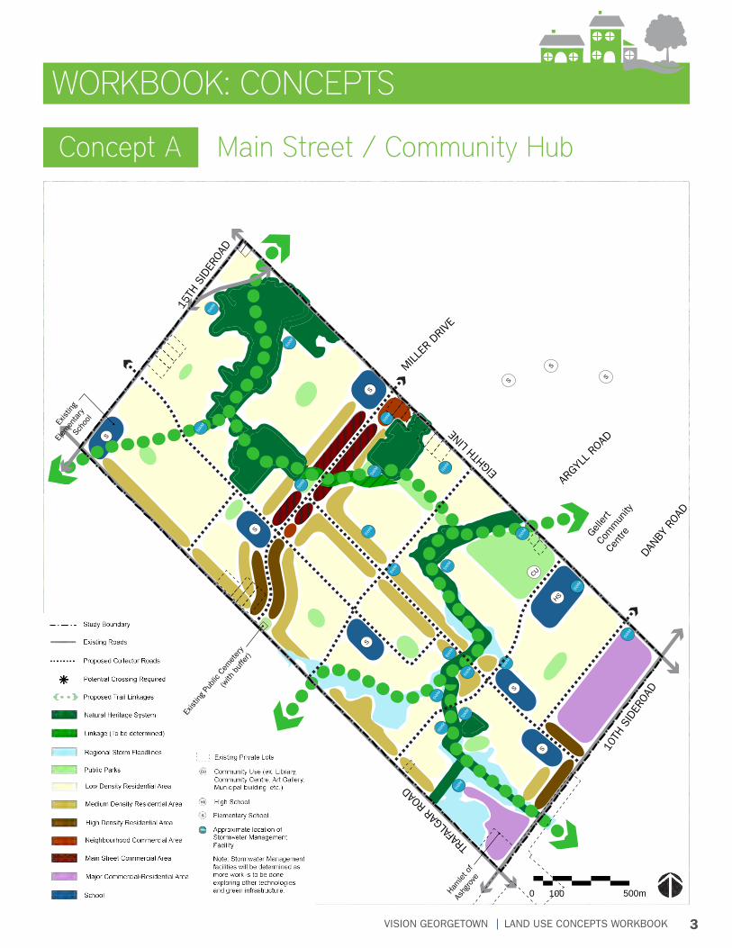
3VISION GEORGETOWN LAND USE CONCEPTS WORKBOOK
Concept A Main Street / Community Hub
SWM
SWM
SWM
SWM
SWM
SWM
SWM
SWM
SWM
SWM
SWM
SWM
SWM
SWM
SWM
SWM
SWM
SWM
SWM
SWM
HS
S
S
S
S
S
S
CU
VISION GEORGETOWN SECONDARY PLANDraft Preliminary Concept: Concept A - Main Street/Community Hub
TRAF
ALGAR
ROAD
10TH
SID
EROA
D
15TH
SID
EROA
D
EIGHTH
LINE
ARGYL
L ROAD
MILLER
DRI
VE
DANB
Y RO
AD
Gelle
rt Co
mm
unity
Cent
re
Ham
let o
f
Ashg
rove
Exist
ing
Public
Cem
eter
y
(with
buf
fer)
Exist
ing
Elem
enta
ry
Scho
ol
S
S
S
Low Density Residential Area
Medium Density Residential Area
High Density Residential Area
Natural Heritage System
Public Parks
Regional Storm Floodlines
April 10, 2014
Neighbourhood Commercial Area
Main Street Area
Major Commercial/Residential Area
Existing Roads
Study Boundary
Proposed Collector Roads
Potential Crossing Required
500m0 100
School
Linkage (To be determined)
Proposed Trail Linkages
Note: Stormwater Management facilities will be determined as more work is to be done exploring other technologies and green infrastructure.
CU Community Use (ex. Library, Community Centre, Art Gallery, Municipal building, etc.)
HS High School
S Elementary School
Approximate location of Stormwater Management Facility
SWM
Existing Private Lots
WORKBOOK: CONCEPTS
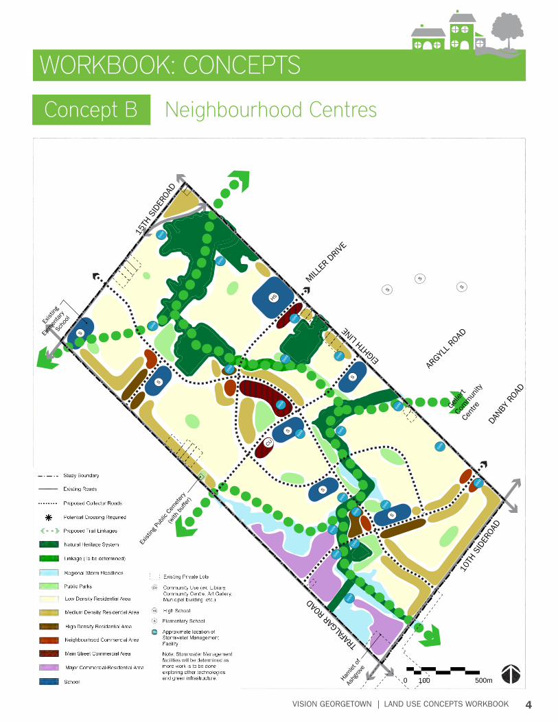
4VISION GEORGETOWN LAND USE CONCEPTS WORKBOOK
SWM
SWM
SWM
SWM
SWM
SWM
SWM
SWM
SWM
SWM
SWM
SWM
SWM
SWM
SWM
SWM
SWM
SWM
SWM
SWM
HS
S
S
S
S
S
S
CU
VISION GEORGETOWN SECONDARY PLANDraft Preliminary Concept: Concept B - Neighbourhood Centres
TRAF
ALGAR
ROAD
10TH
SID
EROA
D
15TH
SID
EROA
D
EIGHTH
LINE
ARGYL
L ROAD
MILLER
DRI
VE
DANB
Y RO
AD
Gelle
rt Co
mm
unity
Cent
re
Ham
let o
f
Ashg
rove
Exist
ing
Public
Cem
eter
y
(with
buf
fer)
Exist
ing
Elem
enta
ry
Scho
ol
S
S
S
Low Density Residential Area
Medium Density Residential Area
High Density Residential Area
Natural Heritage System
Public Parks
Regional Storm Floodlines
April 10, 2014
Neighbourhood Commercial Area
Main Street Area
Major Commercial/Residential Area
Existing Roads
Study Boundary
Proposed Collector Roads
Potential Crossing Required
500m0 100
School
Linkage (To be determined)
Proposed Trail Linkages
Note: Stormwater Management facilities will be determined as more work is to be done exploring other technologies and green infrastructure.
CU Community Use (ex. Library, Community Centre, Art Gallery, Municipal building, etc.)
HS High School
S Elementary School
Approximate location of Stormwater Management Facility
SWM
Existing Private Lots
WORKBOOK: CONCEPTS
Concept B Neighbourhood Centres

5VISION GEORGETOWN LAND USE CONCEPTS WORKBOOK
SWM
SWM
SWM
SWM
SWM
SWM
SWM
SWM
SWM
SWM
SWM
SWM
SWM
SWM
SWM
SWM
SWM
SWM
SWM
SWM
HS
S
S
S
S
S
S
CU
VISION GEORGETOWN SECONDARY PLANDraft Preliminary Concept: Concept C - Main Street/Neighbourhood Centres
TRAF
ALGAR
ROAD
10TH
SID
EROA
D
15TH
SID
EROA
D
EIGHTH
LINE
ARGYL
L ROAD
MILLER
DRI
VE
DANB
Y RO
AD
Gelle
rt Co
mm
unity
Cent
re
Ham
let o
f
Ashg
rove
Exist
ing
Public
Cem
eter
y
(with
buf
fer)
Exist
ing
Elem
enta
ry
Scho
ol
S
S
S
Low Density Residential Area
Medium Density Residential Area
High Density Residential Area
Natural Heritage System
Public Parks
Regional Storm Floodlines
April 10, 2014
Neighbourhood Commercial Area
Main Street Area
Major Commercial/Residential Area
Existing Roads
Study Boundary
Proposed Collector Roads
Potential Crossing Required
500m0 100
School
Linkage (To be determined)
Proposed Trail Linkages
Note: Stormwater Management facilities will be determined as more work is to be done exploring other technologies and green infrastructure.
CU Community Use (ex. Library, Community Centre, Art Gallery, Municipal building, etc.)
HS High School
S Elementary School
Approximate location of Stormwater Management Facility
SWM
Existing Private Lots
Concept C Main Street / Neighbourhood Centres
WORKBOOK: CONCEPTS
6VISION GEORGETOWN LAND USE CONCEPTS WORKBOOK
WORKBOOK
When considering the following questions, think about:• Connections to the existing community• Access to the Natural Heritage System• Draft Guiding Principle #1: To design a community that is connected internally and integrated
with the rest of Georgetown, and other surrounding communities, through a network of roads, paths and trails.
Question 1: In which concept do you prefer the identified collector road network?
Question 3: What would you change, if anything, about the collector roads in your preferred concept to make it better? Feel free to mark up the maps on the table.
Question 2: What do you like about the collector roads in your preferred concept?
Collector Roads1
7VISION GEORGETOWN LAND USE CONCEPTS WORKBOOK
WORKBOOK
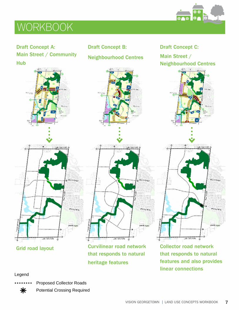
Draft Concept A: Main Street / Community
Hub
Draft Concept B:
Neighbourhood Centres
Draft Concept C:
Main Street / Neighbourhood Centres
Grid road layout Curvilinear road network that responds to natural
heritage features
Collector road network that responds to natural features and also provides linear connections
Proposed Collector Roads
Potential Crossing Required
Legend
8VISION GEORGETOWN LAND USE CONCEPTS WORKBOOK
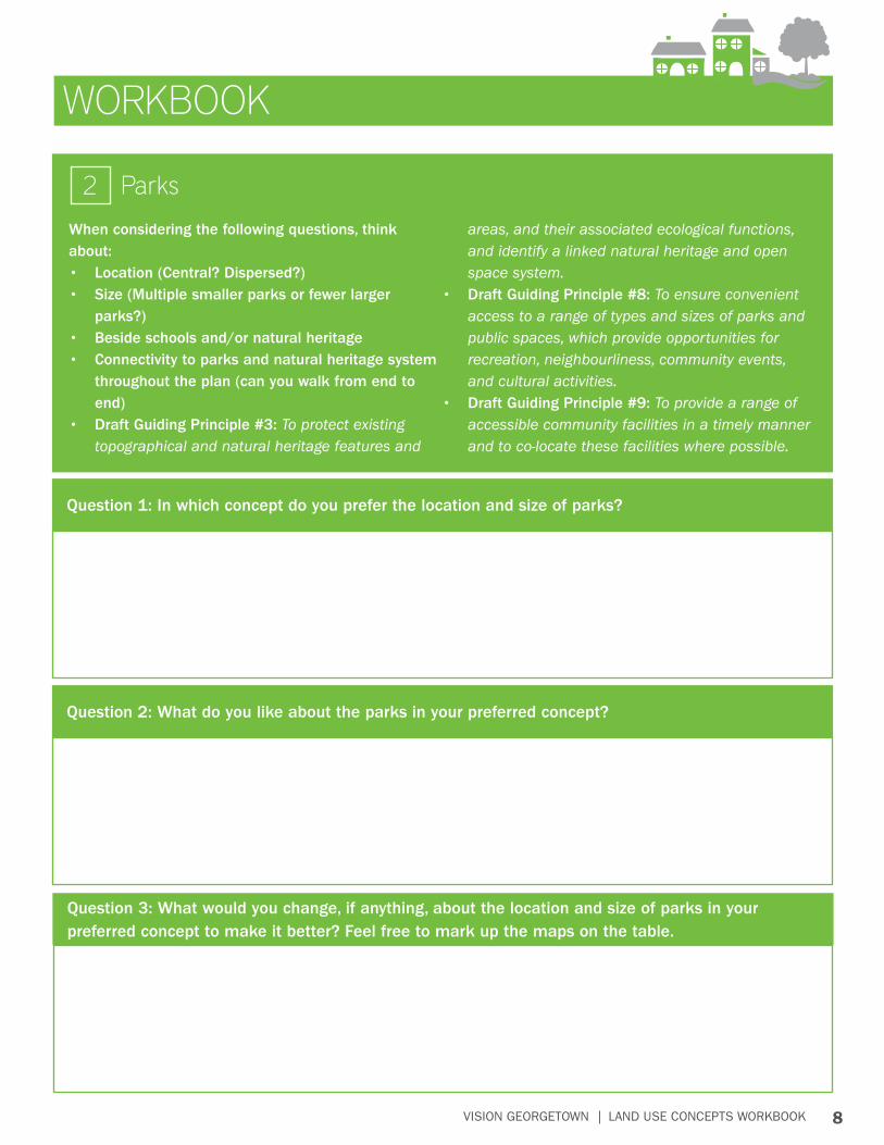
WORKBOOK
When considering the following questions, think about:• Location (Central? Dispersed?)• Size (Multiple smaller parks or fewer larger
parks?)• Beside schools and/or natural heritage• Connectivity to parks and natural heritage system
throughout the plan (can you walk from end to end)
• Draft Guiding Principle #3: To protect existing topographical and natural heritage features and
areas, and their associated ecological functions, and identify a linked natural heritage and open space system.
• Draft Guiding Principle #8: To ensure convenient access to a range of types and sizes of parks and public spaces, which provide opportunities for recreation, neighbourliness, community events, and cultural activities.
• Draft Guiding Principle #9: To provide a range of accessible community facilities in a timely manner and to co-locate these facilities where possible.
Parks2
Question 1: In which concept do you prefer the location and size of parks?
Question 2: What do you like about the parks in your preferred concept?
Question 3: What would you change, if anything, about the location and size of parks in your preferred concept to make it better? Feel free to mark up the maps on the table.
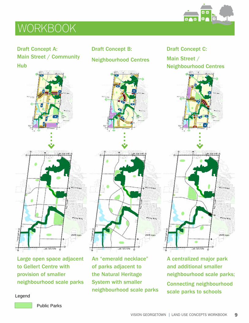
9VISION GEORGETOWN LAND USE CONCEPTS WORKBOOK
WORKBOOK
Large open space adjacent to Gellert Centre with provision of smaller neighbourhood scale parks
An “emerald necklace” of parks adjacent to the Natural Heritage System with smaller neighbourhood scale parks
A centralized major park and additional smaller neighbourhood scale parks;
Connecting neighbourhood scale parks to schools
Draft Concept A: Main Street / Community
Hub
Draft Concept B:
Neighbourhood Centres
Draft Concept C:
Main Street / Neighbourhood Centres
Public Parks
Legend
10VISION GEORGETOWN LAND USE CONCEPTS WORKBOOK
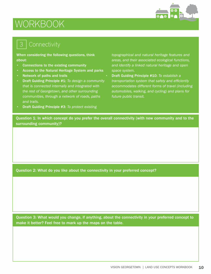
WORKBOOK
When considering the following questions, think about:• Connections to the existing community• Access to the Natural Heritage System and parks• Network of paths and trails• Draft Guiding Principle #1: To design a community
that is connected internally and integrated with the rest of Georgetown, and other surrounding communities, through a network of roads, paths and trails.
• Draft Guiding Principle #3: To protect existing
topographical and natural heritage features and areas, and their associated ecological functions, and identify a linked natural heritage and open space system.
• Draft Guiding Principle #10: To establish a transportation system that safely and efficiently accommodates different forms of travel (including automobiles, walking, and cycling) and plans for future public transit.
Connectivity3
Question 1: In which concept do you prefer the overall connectivity (with new community and to the surrounding community)?
Question 2: What do you like about the connectivity in your preferred concept?
Question 3: What would you change, if anything, about the connectivity in your preferred concept to make it better? Feel free to mark up the maps on the table.
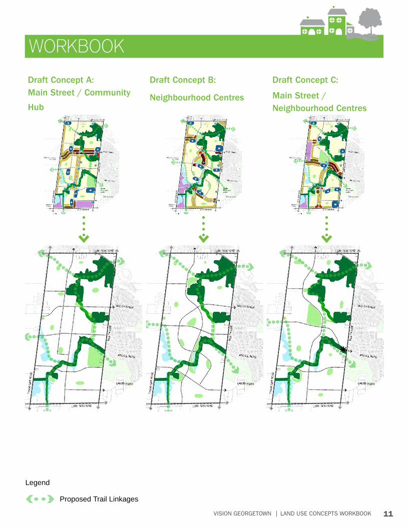
11VISION GEORGETOWN LAND USE CONCEPTS WORKBOOK
WORKBOOK
Draft Concept A: Main Street / Community
Hub
Draft Concept B:
Neighbourhood Centres
Draft Concept C:
Main Street / Neighbourhood Centres
Proposed Trail Linkages
Legend
12VISION GEORGETOWN LAND USE CONCEPTS WORKBOOK
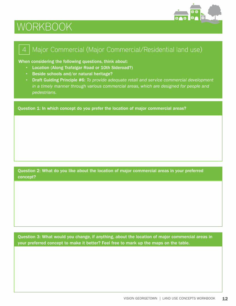
WORKBOOK
When considering the following questions, think about:• Location (Along Trafalgar Road or 10th Sideroad?)• Beside schools and/or natural heritage?• Draft Guiding Principle #6: To provide adequate retail and service commercial development
in a timely manner through various commercial areas, which are designed for people and pedestrians.
Major Commercial (Major Commercial/Residential land use)4
Question 1: In which concept do you prefer the location of major commercial areas?
Question 3: What would you change, if anything, about the location of major commercial areas in your preferred concept to make it better? Feel free to mark up the maps on the table.
Question 2: What do you like about the location of major commercial areas in your preferred concept?
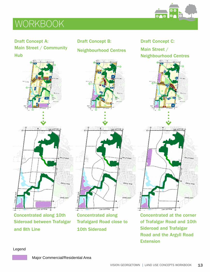
13VISION GEORGETOWN LAND USE CONCEPTS WORKBOOK
WORKBOOK
Concentrated along 10th Sideroad between Trafalgar
and 8th Line
Concentrated along Trafalgard Road close to
10th Sideroad
Concentrated at the corner of Trafalgar Road and 10th Sideroad and Trafalgar Road and the Argyll Road Extension
Draft Concept A: Main Street / Community
Hub
Draft Concept B:
Neighbourhood Centres
Draft Concept C:
Main Street / Neighbourhood Centres
Major Commercial/Residential Area
Legend
14VISION GEORGETOWN LAND USE CONCEPTS WORKBOOK
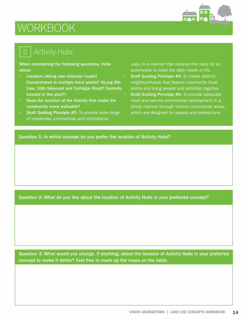
WORKBOOK
When considering the following questions, think about:• Location (Along new collector roads?
Concentrated in multiple focal points? ALong 8th Line, 10th Sideroad and Trafalgar Road? Centrally located in the plan?)
• Does the location of the Activity Hub make the community more walkable?
• Draft Guiding Principle #2: To provide wide range of residential, commercial, and institutional
uses, in a manner that reduces the need for an automobile to meet the daily needs of life.
• Draft Guiding Principle #4: To create distinct neighbourhoods that feature community focal points and bring people and activities together.
• Draft Guiding Principle #6: To provide adequate retail and service commercial development in a timely manner through various commercial areas, which are designed for people and pedestrians.
Activity Hubs5
Question 1: In which concept do you prefer the location of Activity Hubs?
Question 2: What do you like about the location of Activity Hubs in your preferred concept?
Question 3: What would you change, if anything, about the location of Activity Hubs in your preferred concept to make it better? Feel free to mark up the maps on the table.
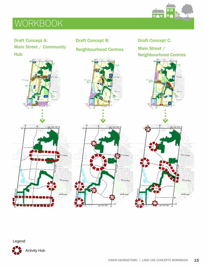
15VISION GEORGETOWN LAND USE CONCEPTS WORKBOOK
WORKBOOK
Draft Concept A: Main Street / Community
Hub
Draft Concept B:
Neighbourhood Centres
Draft Concept C:
Main Street / Neighbourhood Centres
Legend
Activity Hub
16VISION GEORGETOWN LAND USE CONCEPTS WORKBOOK
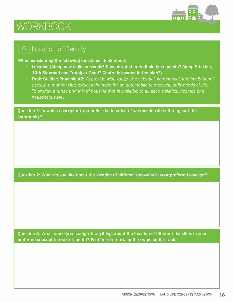
WORKBOOK
When considering the following questions, think about:• Location (Along new collector roads? Concentrated in multiple focal points? Along 8th Line,
10th Sideroad and Trafalgar Road? Centrally located in the plan?)• Draft Guiding Principle #2: To provide wide range of residential, commercial, and institutional
uses, in a manner that reduces the need for an automobile to meet the daily needs of life.- To provide a range and mix of housing that is available to all ages, abilities, incomes and household sizes.
Location of Density6
Question 1: In which concept do you prefer the location of various densities throughout the community?
Question 3: What would you change, if anything, about the location of different densities in your preferred concept to make it better? Feel free to mark up the maps on the table.
Question 2: What do you like about the location of different densities in your preferred concept?
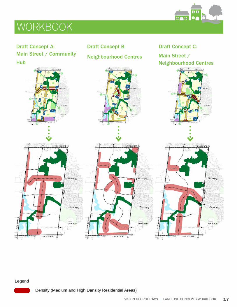
17VISION GEORGETOWN LAND USE CONCEPTS WORKBOOK
WORKBOOK
Draft Concept A: Main Street / Community
Hub
Draft Concept B:
Neighbourhood Centres
Draft Concept C:
Main Street / Neighbourhood Centres
Density (Medium and High Density Residential Areas)
Legend