Embed Size (px)
Citation preview
Virtual Traffic signsVirtual Traffic signs Driver Attention System Driver Attention System
Final PresentationFinal Presentation Students : David Eyal
Handaly Gidi
Semester : Spring 2004
Instructor : Kats IdanCooperation with: Rout Link
Sponsored by : Motorola IL
Technion – Israel Institute Of TechnologyTechnion – Israel Institute Of Technology
Electrical Engineering DepartmentElectrical Engineering Department
15/04/04

Road AccidentsRoad Accidents• The western world faces a severe hazard named
Road Accidents. This hazard damaged nations economy and costs with life of thousands of people every year.
• Big efforts are made to reduce the hazard
such as :
- Velocity limitations ,drivers age restraint.
- Resources are invested in infrastructure.
- Discouraging legislation.

Road AccidentsRoad Accidents• Road accidents caused by two major factors:
- Bad or dangerous infrastructure .
- Human causes.
• Research suggests that twenty five percents
of crashes are distraction-related.
• Social and economic costs for these crashes approach an estimated $40 billion annually
Project definitionProject definition• The purpose of the project is to establish a system,
which helps the driver and bring to his conscious the traffic signs.
• The system will acquire the vehicle positioning and
path information while moving
• The system will compare the vehicle information with required behavior profile in real time.
• The system will alert the driver of dangerous driving and of violating a “sign profile”.

Innovative concept of driving profiles
Alert
Alert
Safe profile
Alert ZoneS0S1
summer
winter
Infrastructure• The system ought to be based on common worldwide infrastructure in terms of :
- distribution - availability- cost
• The GPS is radio based, satellite navigation system that enables users to accurately determine 3-dimensional position, velocity, and time worldwide.
• The GSM is a wireless communication technology via cellular network.

System ArchitectureSystem Architecture
Vehicle Coordinates
Enter Alert Zone ?
Enter Safe Profile ?Sign
Coordinates

System diagramSystem diagram
Base station
G18
SMS
G18
GPSMobile station
Traffic sign location data base
Location & Data

System Configuration – Real Time
Management Application
GUI
Algorithm
Data Base
GPS
CellularAlert
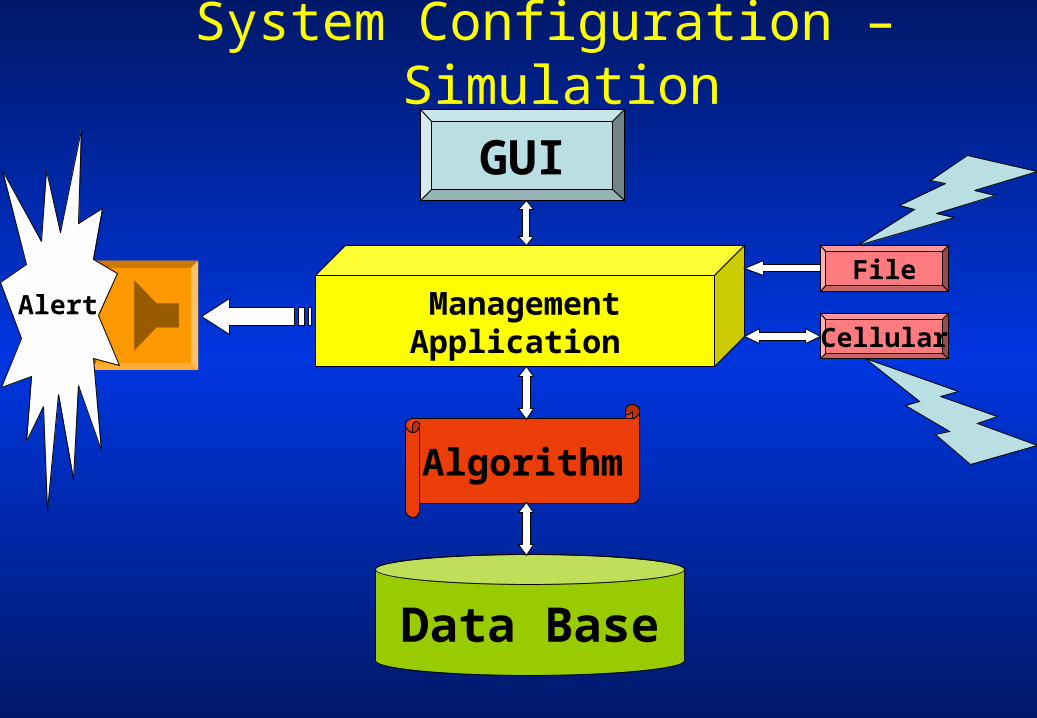
System Configuration – Simulation
Management Application
GUI
Algorithm
Data Base
File
CellularAlert
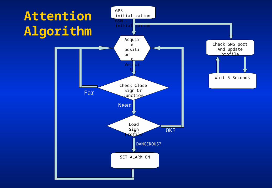
GPS – initializationGSM - initialization
Acquire position
& Velocity
Check Close Sign Or Junction
Load Sign Profile
SET ALARM ON
Check SMS portAnd update profile
Wait 5 Seconds
OK?
Near
Far
DANGEROUS?
AttentionAlgorithm

Innovative concept of driving profiles
Alert
Alert
Safe profile
Alert ZoneS0S1
summer
winterprofiles

GUI – Front PanelGUI – Front Panel
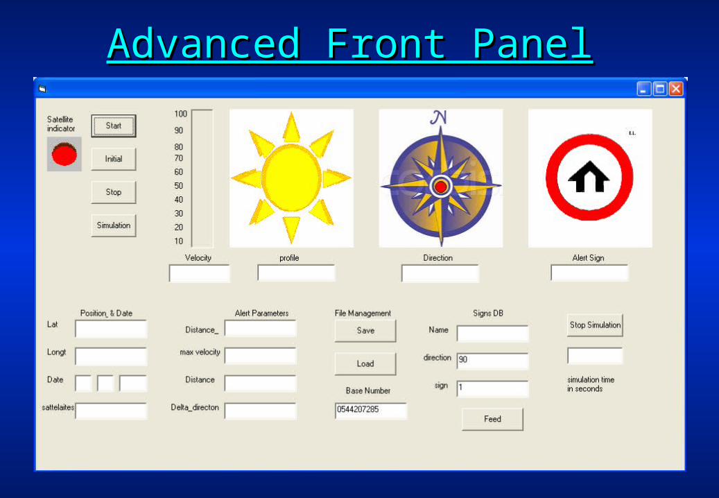
Advanced Front PanelAdvanced Front Panel
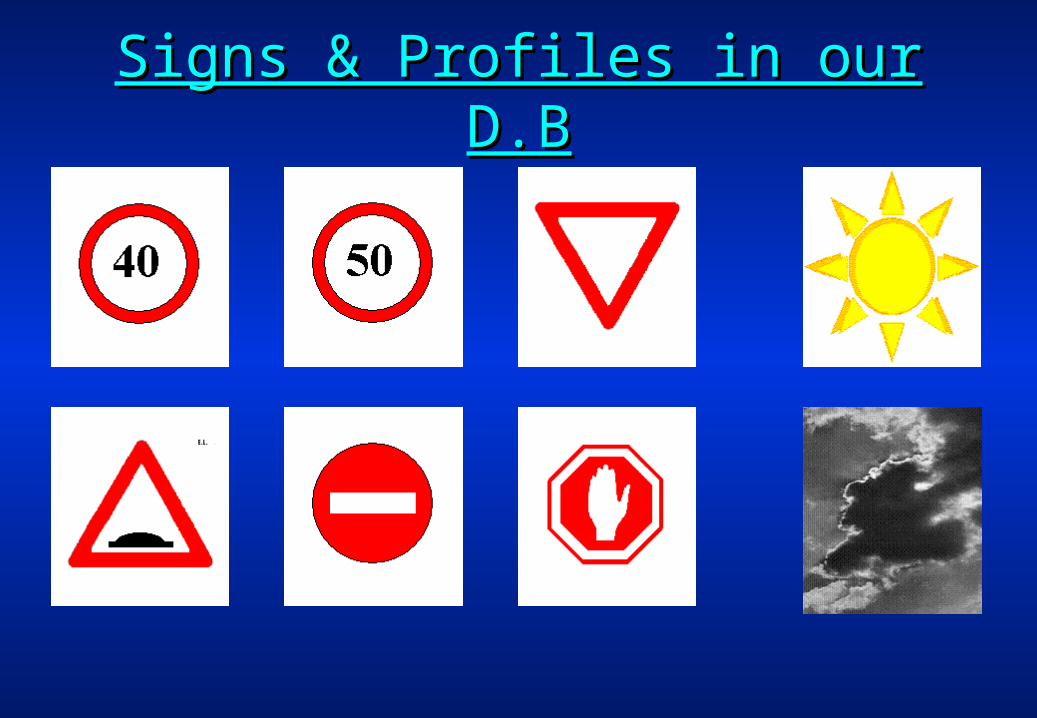
Signs & Profiles in our D.BSigns & Profiles in our D.B
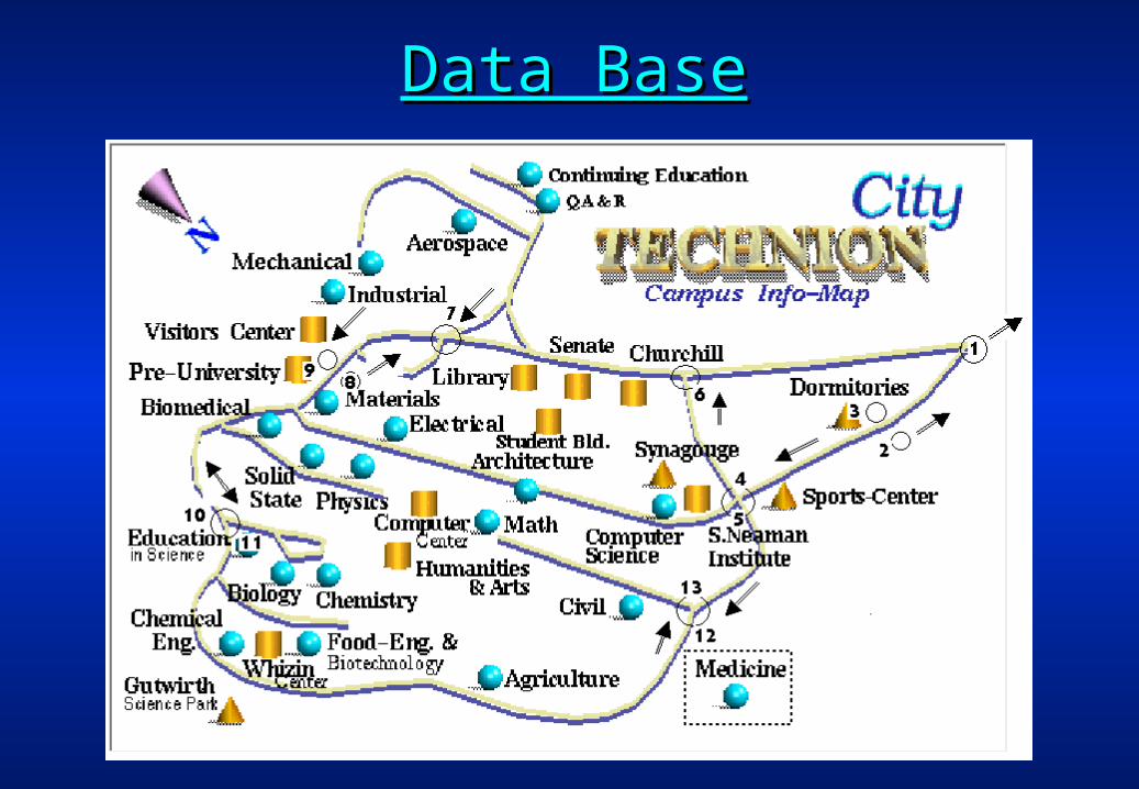
Data BaseData Base
summary and conclusionssummary and conclusions
• System performanceSystem performance
- The system is a Real time system and alert- The system is a Real time system and alert
the driver of violating a “sign profile” .the driver of violating a “sign profile” .
- The system can response to - The system can response to SMSSMS messages. messages.
and report it’s positioning through SMS.and report it’s positioning through SMS.
- The system includes a built in - The system includes a built in SimulatorSimulator
and allows implement tests indoors.and allows implement tests indoors.

Conclusion and problemsConclusion and problems
- The GPS data output rate is 1P/sec.
- The GPS location accuracy is 5-25m
- The searching algorithm in the database is sequential and not the most efficient
(As was defined at this project).
Suggestions for future projectsSuggestions for future projects
- The system will be more efficient using
an enhanced GPS unit.
- More efficiency will be achieved by a
professional database and searching algorithm.
- Use of digital maps will match the positioning of the vehicle to the road it’s traveling.