Embed Size (px)
Citation preview
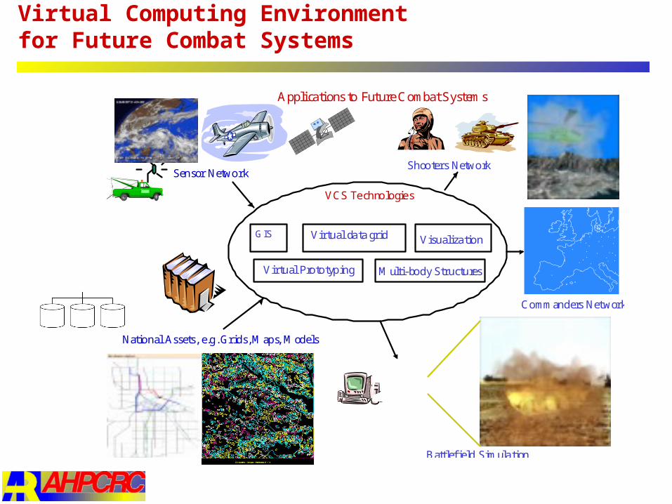
Virtual Computing Environment for Future Combat Systems
Commanders Net work
Battlefield Simula tion
National Assets, e.g. Grids, Maps, Models
Sensor NetworkShooters Network
Virtual da ta grid
Multi-body Structures
GISVisualiza tion
Virtual Prototyping
Applications to Future Combat Systems
VCS Te chnologie s
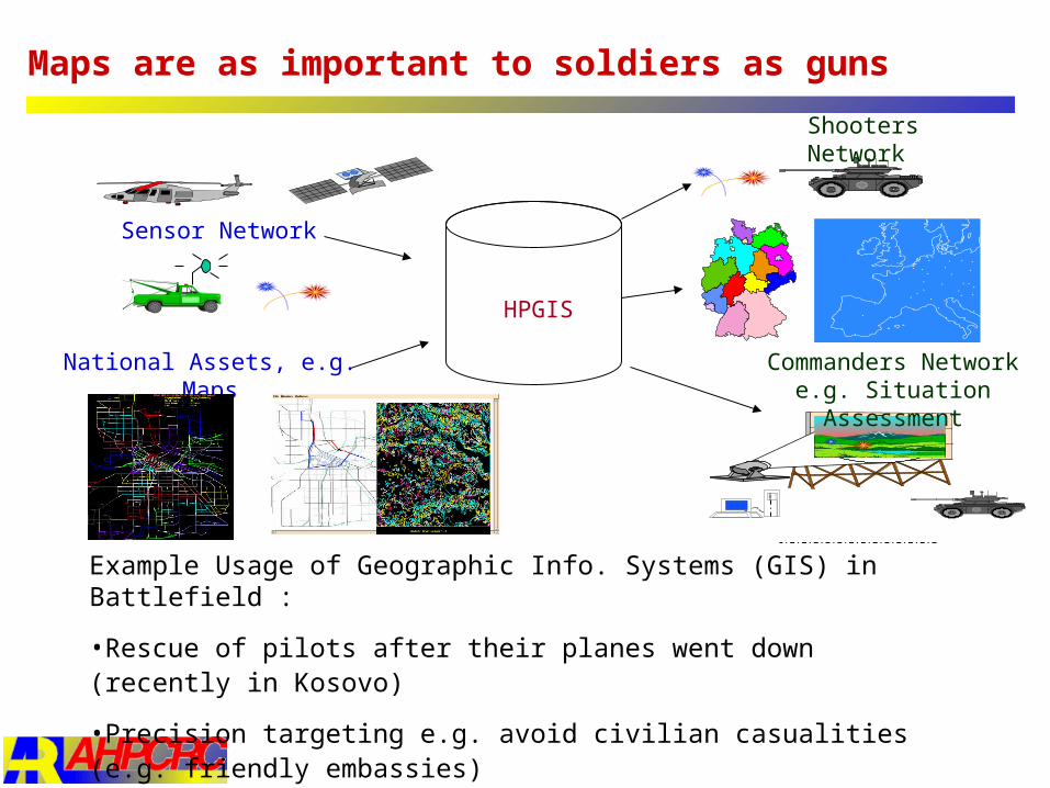
HPGIS
Commanders Network e.g. Situation Assessment
National Assets, e.g. Maps
Sensor Network
Shooters Network
Maps are as important to soldiers as guns
Example Usage of Geographic Info. Systems (GIS) in Battlefield :
•Rescue of pilots after their planes went down (recently in Kosovo)
•Precision targeting e.g. avoid civilian casualities (e.g. friendly embassies)
•Logistics of Troop movements, avoid friendly fires
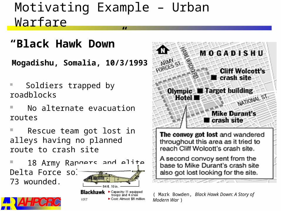
Motivating Example – Urban Warfare
Mogadishu, Somalia, 10/3/1993 Soldiers trapped by roadblocks No alternate evacuation routes Rescue team got lost in alleys having no planned route to crash site 18 Army Rangers and elite Delta Force soldiers killed, 73 wounded.
“Black Hawk Down”
( Mark Bowden, Black Hawk Down: A Story of Modern War )
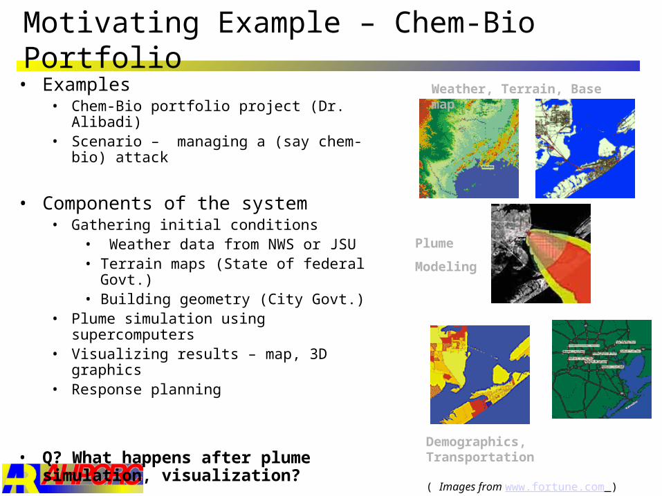
Motivating Example – Chem-Bio Portfolio
Weather, Terrain, Base map
Demographics, Transportation
Plume
Modeling
( Images from www.fortune.com )
• Examples• Chem-Bio portfolio project (Dr. Alibadi)• Scenario – managing a (say chem-bio) attack
• Components of the system• Gathering initial conditions
• Weather data from NWS or JSU • Terrain maps (State of federal Govt.)• Building geometry (City Govt.)
• Plume simulation using supercomputers• Visualizing results – map, 3D graphics• Response planning
• Q? What happens after plume simulation, visualization?
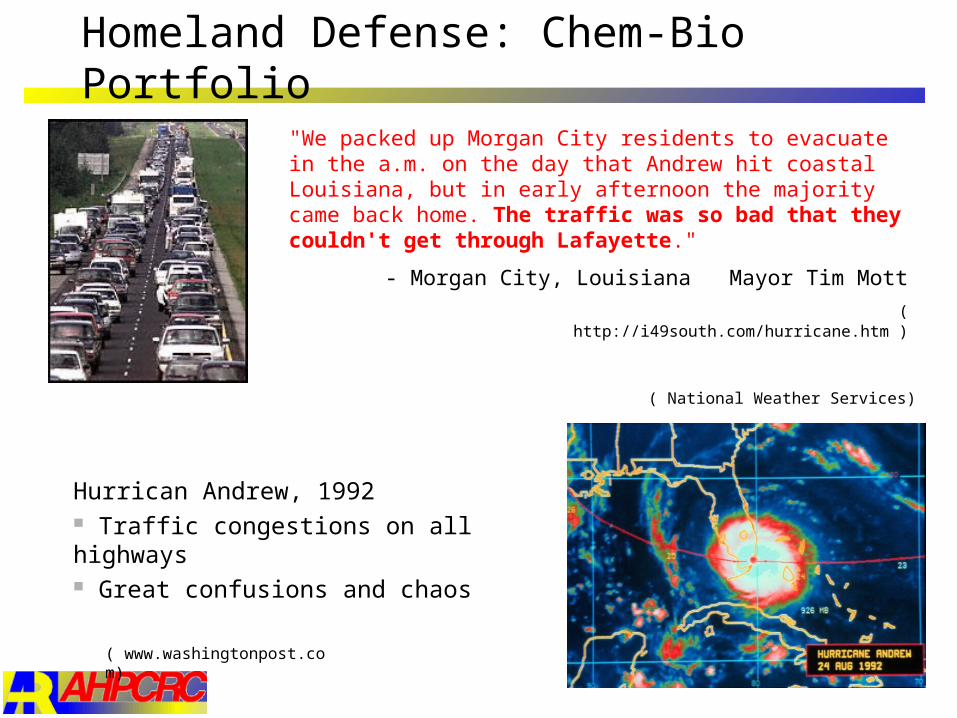
Homeland Defense: Chem-Bio Portfolio
Hurrican Andrew, 1992 Traffic congestions on all highways Great confusions and chaos
"We packed up Morgan City residents to evacuate in the a.m. on the day that Andrew hit coastal Louisiana, but in early afternoon the majority came back home. The traffic was so bad that they couldn't get through Lafayette."
- Morgan City, Louisiana Mayor Tim Mott
( http://i49south.com/hurricane.htm )
( National Weather Services)
( www.washingtonpost.com)
Problem Statement
Given• Transportation network (e.g. building floor map, city roadmap) with
capacity constraints• Initial number of people to be evacuated and their initial location • Evacuation destinations
Output• Scheduling of people to be evacuated and the routes to be taken
Objective• Minimize total time needed for evacuation• Minimize computational overhead
Constraints• Capacity constraints: evacuation plan meets capacity of the network
Route Algorithm - Related Works
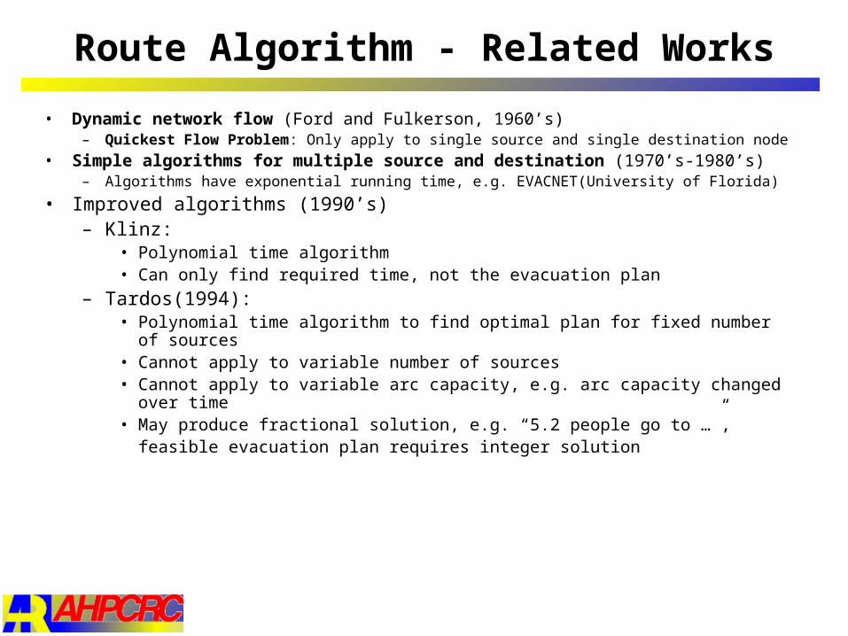
• Dynamic network flow (Ford and Fulkerson, 1960’s)– Quickest Flow Problem: Only apply to single source and single destination node
• Simple algorithms for multiple source and destination (1970’s-1980’s)– Algorithms have exponential running time, e.g. EVACNET(University of Florida)
• Improved algorithms (1990’s)– Klinz:
• Polynomial time algorithm• Can only find required time, not the evacuation plan
– Tardos(1994): • Polynomial time algorithm to find optimal plan for fixed number of sources • Cannot apply to variable number of sources• Cannot apply to variable arc capacity, e.g. arc capacity changed over time• May produce fractional solution, e.g. “5.2 people go to …”,
feasible evacuation plan requires integer solution
Route Algorithm - Our Approach
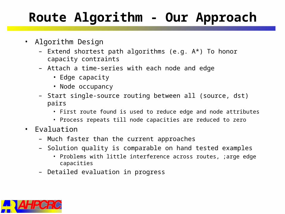
• Algorithm Design– Extend shortest path algorithms (e.g. A*) To honor capacity contraints
– Attach a time-series with each node and edge
• Edge capacity
• Node occupancy
– Start single-source routing between all (source, dst) pairs• First route found is used to reduce edge and node attributes
• Process repeats till node capacities are reduced to zero
• Evaluation– Much faster than the current approaches
– Solution quality is comparable on hand tested examples• Problems with little interference across routes, ;arge edge capacities
– Detailed evaluation in progress
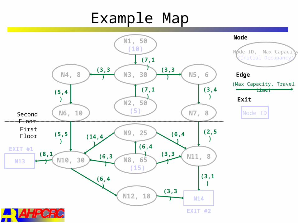
Example Map
N1, 50(10)
N3, 30 N5, 6N4, 8
N2, 50(5)N6, 10 N7, 8
N9, 25
N8, 65 (15)
N12, 18
N11, 8N10, 30
Second Floor
First Floor
(7,1)
(3,3)(3,3)
(7,1) (3,4)(5,4)
(5,5)
(8,1) (6,3)
(6,4)
(6,4)
(6,4) (2,5)
(3,1)
(3,3)
(3,3)
(14,4)
(Max Capacity, Travel time)
Node ID, Max Capacity(Initial Occupancy)
EXIT #2
EXIT #1
N13
N14
Node ID
Exit
Node
Edge
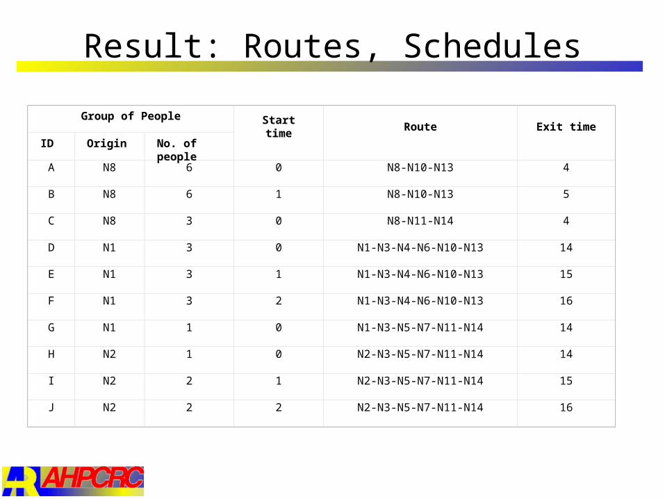
Result: Routes, Schedules
Group of PeopleStart time Route Exit time
ID Origin No. of people
A N8 6 0 N8-N10-N13 4
B N8 6 1 N8-N10-N13 5
C N8 3 0 N8-N11-N14 4
D N1 3 0 N1-N3-N4-N6-N10-N13 14
E N1 3 1 N1-N3-N4-N6-N10-N13 15
F N1 3 2 N1-N3-N4-N6-N10-N13 16
G N1 1 0 N1-N3-N5-N7-N11-N14 14
H N2 1 0 N2-N3-N5-N7-N11-N14 14
I N2 2 1 N2-N3-N5-N7-N11-N14 15
J N2 2 2 N2-N3-N5-N7-N11-N14 16
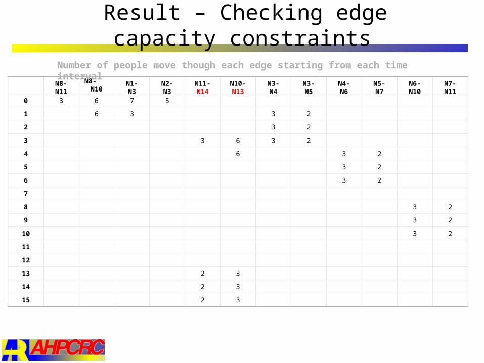
Result – Checking edge capacity constraints
N8-N11
N8- N10
N1-N3 N2-N3 N11-N14
N10-N13
N3-N4 N3-N5 N4-N6 N5-N7 N6-N10
N7-N11
0 3 6 7 5
1 6 3 3 2
2 3 2
3 3 6 3 2
4 6 3 2
5 3 2
6 3 2
7
8 3 2
9 3 2
10 3 2
11
12
13 2 3
14 2 3
15 2 3
Number of people move though each edge starting from each time interval
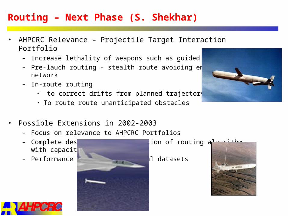
Routing – Next Phase (S. Shekhar)
• AHPCRC Relevance – Projectile Target Interaction Portfolio– Increase lethality of weapons such as guided missiles
– Pre-lauch routing – stealth route avoiding enemy sensor network
– In-route routing • to correct drifts from planned trajectory
• To route route unanticipated obstacles
• Possible Extensions in 2002-2003– Focus on relevance to AHPCRC Portfolios
– Complete design and implementation of routing algorithm with capacity constraints
– Performance evaluation with real datasets
Defer
Assess Attack
ID
Decide Guidance and
ObjectivesDetect
Assess Re-attack
ID
Detect
LocateAssess TST ID
Decide Attack
Detect
LocateAssess ISR
Detect
Locate
ID
Locate
DecideEmploy wpns
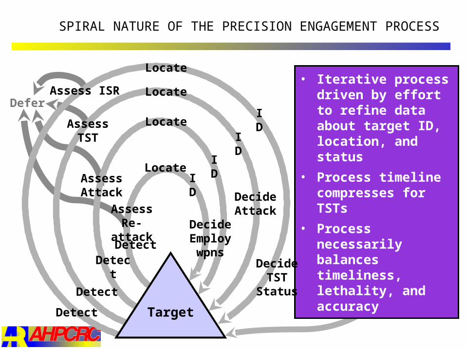
• Iterative process driven by effort to refine data about target ID, location, and status
• Process timeline compresses for TSTs
• Process necessarily balances timeliness, lethality, and accuracy
SPIRAL NATURE OF THE PRECISION ENGAGEMENT PROCESS
Target
Decide TST
Status
Location Prediction and Spatial Data Mining (S. Shekhar)
• Specific Project in 2001-2002– Evaluation of location prediction techniques
– Towards high performance parallel implementation
• AHPCRC Relevance – Projectile Target Interaction Portfolio– Increase lethality of weapons such as guided missiles
– Location prediction for map matching• to check correctness of missile trajectory
• To identify unanticipated obstacle
– Towards possible rerouting
• Army Relevance in general– Predicting global hot spots (FORMID)
– Army land management endangered species vs. training and war games
– Search for local trends in massive simulation data
– Critical infra-structure defense (threat assessment)
– Inferring enemy tactics (e.g. flank attack) from blobology
– Locating enemy (e.g. sniper in a haystack, sensor networks)
– Locating friends to avoid friendly fire

Accomplishments
• Formal Results• SAR - parametric statistics, provides confidence measures in model
• MRF from non-parametric statistics
• SAR : MRF-BC :: linear regression : Bayesian Classifier
• Rewrite SAR as y = (QX) + Q, where Q = (I- W)-1
• SAR has linear class boundaries in transformed space (QX, y)
• MRF-BC can represent non-linear class boundaries
• Experimental results • MRF-BC can provide better classification accuracies than SAR
• But solution procedure is very slow
• Details in Recent paper in IEEE Transactions on Multimedia
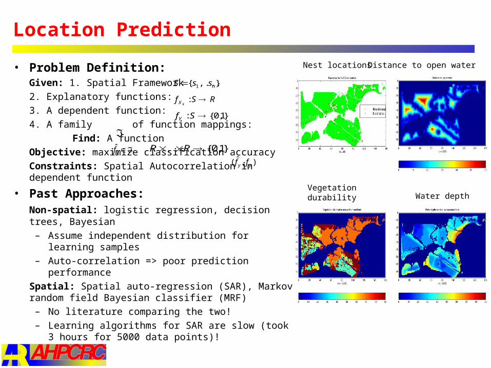
Location Prediction
• Problem Definition: Given: 1. Spatial Framework
2. Explanatory functions:
3. A dependent function:
4. A family of function mappings:
Find: A function
Objective: maximize classification accuracy
Constraints: Spatial Autocorrelation in dependent function
• Past Approaches: Non-spatial: logistic regression, decision trees, Bayesian
– Assume independent distribution for learning samples
– Auto-correlation => poor prediction performance
Spatial: Spatial auto-regression (SAR), Markov random field Bayesian classifier (MRF)
– No literature comparing the two!
– Learning algorithms for SAR are slow (took 3 hours for 5000 data points)!
},...{ 1 nssS
RSfkX
:
}1,0{: SfY
}1,0{... RRyf̂),ˆ( yy ff
Nest locations Distance to open water
Vegetation durability Water depth
Accomplishments
• Formal Results• SAR - parametric statistics, provides confidence measures in model
• MRF from non-parametric statistics
• SAR : MRF-BC :: linear regression : Bayesian Classifier
• Rewrite SAR as y = (QX) + Q, where Q = (I- W)-1
• SAR has linear class boundaries in transformed space (QX, y)
• MRF-BC can represent non-linear class boundaries
• Experimental results • MRF-BC can provide better classification accuracies than SAR
• But solution procedure is very slow
• Details in Recent paper in IEEE Transactions on Multimedia
• Scaleable parallel methods for GIS Querying for Battlefield Visualization
• A spatial data model for directions for querying battlefield information
• Spatial data mining: Predicting Locations Using Maps Similarity (PLUMS)
•An efficient indexing method, CCAM, for spatial graphs, e.g. Road Maps
Past Accomplishments
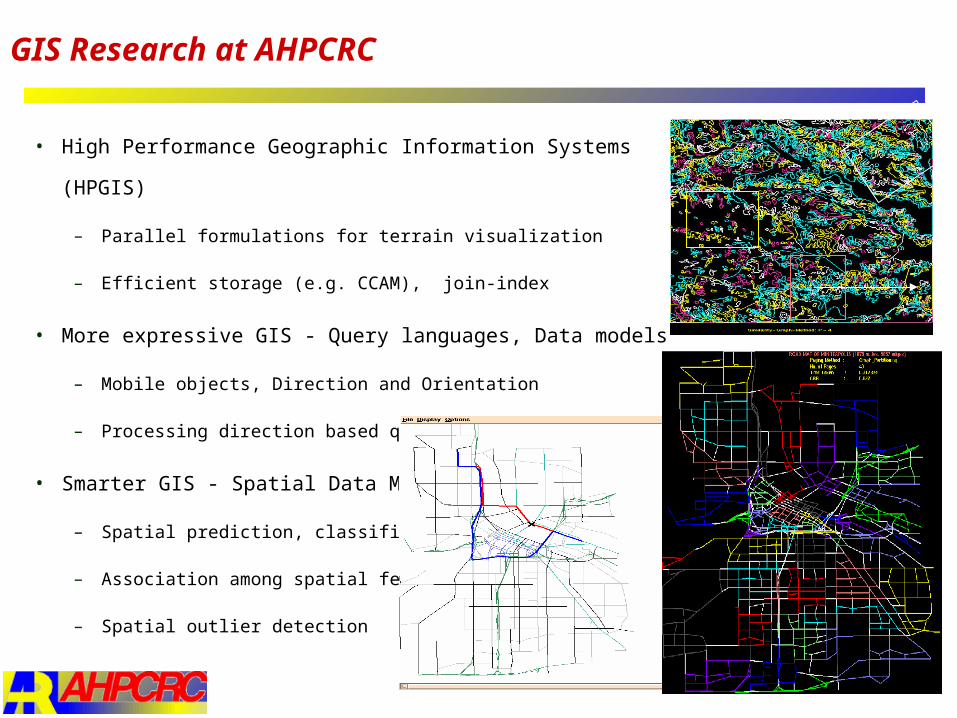
• High Performance Geographic Information Systems (HPGIS)
– Parallel formulations for terrain visualization
– Efficient storage (e.g. CCAM), join-index
• More expressive GIS - Query languages, Data models
– Mobile objects, Direction and Orientation
– Processing direction based queries
• Smarter GIS - Spatial Data Mining
– Spatial prediction, classification
– Association among spatial features
– Spatial outlier detection
GIS Research at AHPCRC