Embed Size (px)
Citation preview

A new report from the Washington, D.C.-based Land Trust Alliance reveals that land trusts in Virginia conserved more land between 2005 and 2010 than in any other state in the Southeast.
The 2010 National Land Trust Census includes statistics from private nonprofit land trusts, as well as the Virginia Outdoors Foundation.
According to the Virginia Department of Conservation and Recreation, which tracks all land conservation activity in the commonwealth, 314,225 acres were conserved by VOF and 78,678 acres were conserved by private land trusts between 2005 and 2010. That works out to about seven acres preserved every hour.
The Land Trust Alliance census reports that the next-closest Southeastern state was North Carolina, where land trusts conserved about 132,000 new acres during the same period.
Altogether, land trusts in the Southeastern states of Alabama, Arkansas, Florida, Georgia, Kentucky, Louisiana, Mississippi, North Carolina, South Carolina, Tennessee, Virginia, and West Virginia have preserved about 2.5 million acres.
Looking at the national picture, the census found 10 million new acres conserved across the United States since 2005, despite a down economy.
“Americans value their land, and they are conserving it at the local level,” said Land Trust Alliance president Rand Wentworth. “While government is shrinking, local land trusts are saving more land than is lost to development. Communities nationwide value clean water, local food, and places to play, and they are investing in those places close to home.”
According to the Land Trust Alliance, a total of 47 million acres—an area over twice the size of all the national parks in the contiguous United States—are now protected by land trusts.
virginiaoutdoorsfoundation.org
Virginia Leads the Southeast in Land Conservation
F A L L 2 0 1 1
By now, you should have received your complimentary 2012 Virginia Outdoors Foundation calendar, which features a dozen easement properties protected by VOF. If you did not receive a calendar and would like one, please call (804) 225-2756.
Please consider making a tax-deductible donation to help VOF continue to preserve landscapes like those featured in the calendar. Your contribution will support our easement program, the long-term stewardship of these easements, and our threatened lands acquisition initiative. Please consider donating one of three ways:
1. Visitvirginiaoutdoorsfoundation.org/donate.
2. Call(804)225-2756tomakeacreditcarddonation.
3. SendacheckmadepayabletotheVirginiaOutdoorsFoundationusingtheenvelopeinthisnewsletter.
ProtectVirginia’sOutdoors:DonateToday
Preserving Virginia’s scenic, natural, historic, recreational, and open-space lands for future generations.
FALL 2011
2 v i r g i n i a o u t d o o r s f o u n d a t i o n . o r g
OFFICE LOCATIONS
BOARD OF TRUSTEESHank M. Hartz, III (Chair)Mark S. AllenHarry F. AthertonA. Benton Chafin, Jr.Suzanne M. LacyCharles H. Seilheimer, Jr.Jeffrey K. Walker
When the General Assembly wants to evaluate the effectiveness of governmental agencies and programs, it often turns to the Joint Legislative Audit and Review Commission, or JLARC. This commission is composed of nine members of the House of Delegates and five members of the Senate. JLARC’s primary objective is to determine whether agencies and programs are making the most efficient and effective use of taxpayer dollars. It regularly publishes reports and recommendations on its website, jlarc.virginia.gov, which are given strong credence by elected and appointed officials serving the Commonwealth of Virginia.
One project undertaken by JLARC staff during 2011 was an evaluation of more than 70 Virginia State Income Tax Credit programs that entail tax credit issuances of amounts greater than $1 million annually. One such program is the Land Preservation Tax Credit Program, which extends transferable state income tax credits for voluntary perpetual land preservation donations that qualify for federal income tax deductions.
Each year, about $100 million of Land Preservation Tax Credits are issued. These credits have been critical to the success of Virginia’s land conservation efforts over the last decade, and have resulted in hundreds of thousands of acres being protected, largely through conservation easements donated to the Virginia Outdoors Foundation.
The Land Preservation Tax Credit program represents the strongest inducement available in any state in the nation for voluntary land conservation on private property. These private lands represent much of the cultural and natural heritage landscapes for which Virginia has long been revered.
Of the programs that JLARC evaluated, only the Land Preservation Tax Credits and Historic Rehabilitation Tax Credits were found to be both efficient and effective.
JLARC’s assessment is an important, independent validation of the success of these programs. It demonstrates that they are worthy of continued public support.
The report also indirectly affirms the efficiency and effectiveness of VOF. After all, of the 518,000 acres that have utilized the credits since 2000, about 490,000 acres—almost 95 percent—resulted from easements donated to VOF.
This success would not have been possible without you, the easement donors. As we finish another year having protected thousands more acres of open space, we thank you for your leadership, your generosity, and your continuing support.
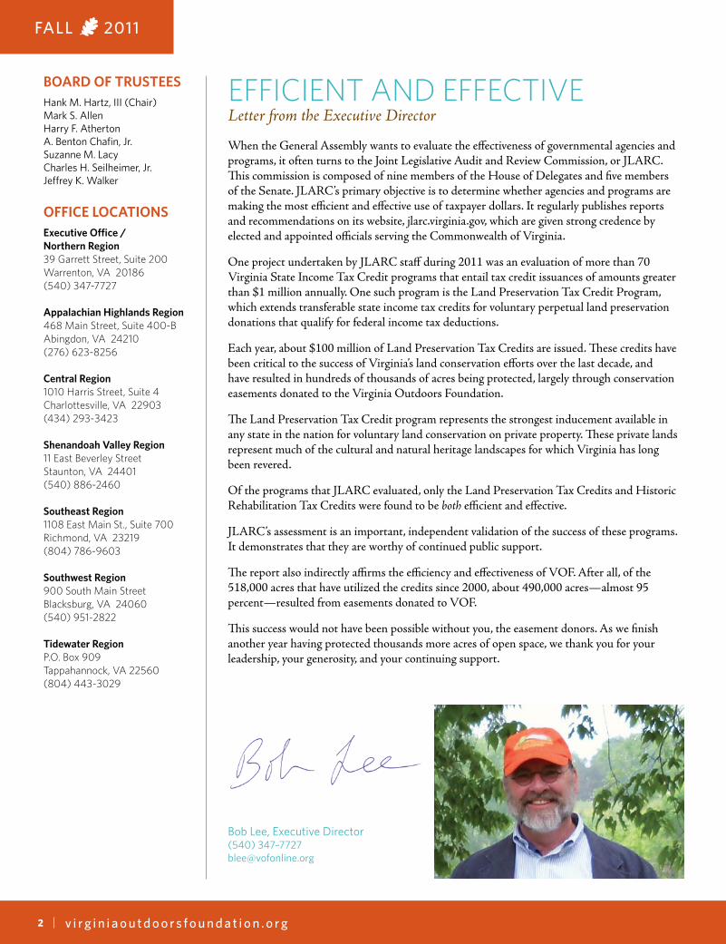
EFFICIENT AND EFFECTIVELetter from the Executive Director
Bob Lee, Executive Director(540) 347–[email protected]
Executive Office /Northern Region39 Garrett Street, Suite 200Warrenton, VA 20186(540) 347-7727
Appalachian Highlands Region468 Main Street, Suite 400-BAbingdon, VA 24210(276) 623-8256
Central Region1010 Harris Street, Suite 4Charlottesville, VA 22903(434) 293-3423
Shenandoah Valley Region11 East Beverley StreetStaunton, VA 24401(540) 886-2460
Southeast Region1108 East Main St., Suite 700Richmond, VA 23219(804) 786-9603
Southwest Region900 South Main StreetBlacksburg, VA 24060(540) 951-2822
Tidewater RegionP.O. Box 909 Tappahannock, VA 22560 (804) 443-3029

FALL 2011
3v i r g i n i a o u t d o o r s f o u n d a t i o n . o r g
Farm Bureau Hosts Easement Panel at ConventionWithout the sale of tax credits from a conservation easement on his 180-acre farm in Augusta County, Wes Kent would never have been able to purchase an adjoining 118-acre farm.
“The conservation easement provided me a valuable tool to expand my farm,” Kent said during a standing-room-only panel discussion on “Conservation Easements: The Right Fit for Your Farm?” at the Virginia Farm Bureau Federation 2011 Annual Convention in Norfolk in November.
Kent, a full-time beef, dairy and poultry farmer, bought his farm in 2004 after leasing it for several years. This year he was able to put that farm under a conservation easement with the Virginia Outdoors Foundation.
With the sale of tax credits from that easement, he had enough collateral to secure financing to purchase his neighbor’s property.
“This easement was a good fit for my farm,” Kent said.
The panel was part of a partnership between VOF, the Virginia Farm Bureau Federation, the Department of Agriculture and Consumer Services, and others to make conservation easements more flexible for working farms. VOF Easement Manager Laura Thurman, who works primarily with farmers in the Shenandoah Valley, was among the panel participants.
For the past year, a working group comprised of these partners developed a variant to VOF’s standard easement template that, among other things, allows for the option of a “farmstead” area within the easement, where building and use restrictions would be less stringent. VOF would be able to control the size and location of the farmstead area overall, and would apply its normal restrictions to the rest of the property. In exchange for this greater flexibility, VOF would seek greater restrictions on division rights and other compensations to protect core public values.
The new Intensive Agriculture Easement Template, as it’s being called, was approved by VOF’s Board of Trustees in October and is available on VOF’s website under Protect Your Land > Easement Documents and Forms.
BY THE NUMBERSHow many approximate acres of USDA-designated prime farmland and soils of statewide importance do VOF easements protect?
A. 75,000B. 175,000C. 275,000
Answer on page 6
HELPKEEPOURRECORDSUPTODATEPlease notify us if you have a new mailing address,email address, or phone number. Send your new info [email protected] or call (804) 225-2756.
FOLLOWUSONLINE
facebook.com/virginiaoutdoorsfoundationtwitter.com/vofonline

FALL 2011
4 v i r g i n i a o u t d o o r s f o u n d a t i o n . o r g
VOF’s Special Project Areas
In recent years, as a way to identify important conservation areas and prioritize our work, the Virginia Outdoors Foundation has accepted nominations for Special Project
Areas—areas that contain such a rich mosaic of natural, historic, scenic, and agricultural resources that there is widespread support for their protection. These nominations generally come from local citizens and groups with support from local government. Each nomination is presented to the VOF Board of Trustees, who evaluate it and, if appropriate, approve its designation.
To date, VOF has designated eight Special Project Areas. To learn more about the nomination process, visit our website at virginiaoutdoorsfoundation.org and navigate to Protect Your Land > Designating Special Project Areas.
BULL RUN MOUNTAINSLocation: Fauquier and Prince William counties
The Bull Run Mountains comprise the largest, relatively intact and unfragmented natural landscape east of the Blue Ridge in Northern Virginia. Because the mountains are isolated amidst relatively heavy development, they serve as an oasis of rare species and ecosystems. VOF owns about 2,500 acres in the
mountains, which it manages for public access and educational activities. VOF also holds easements on hundreds of acres in the immediate area, and tens of thousands of acres within the viewshed of the mountains. In 2002, the Department of Conservation and Recreation dedicated the area as the 34th State Natural Area Preserve. VOF continues to work with landowners to acquire and protect more land surrounding the mountains.
CAT POINT CREEk WATERSHEDLocation: Richmond and Westmoreland counties
The 19-mile, 46,000-acre Cat Point Creek watershed runs the width of the Northern Neck, with the lower tidal portions lying in the boundary of the Rappahannock River Valley National Wildlife Refuge. The watershed connects several important historic resources, including Menokin, Stratford Hall, and George Washington’s birthplace. It includes lush marshes and other habitats for ducks, eagles, peregrine falcons, and it is part of an Important Bird Area designated by the National Audubon Society. The Nature Conservancy has identified Cat Point Creek as one of only a few “last great places” in the Coastal Plain of Virginia.
VOF Special Project Areas
Bull Run Mountains
Cat Point Creek Watershed
Catawba Valley
Eastern Shore
Headwaters of the North Fork Shenandoah River
Middlebrook - Brownsburg Corridor
Scenic 340
Spring Valley
Interstate
Virginia Jurisdictions
Water

FALL 2011
5v i r g i n i a o u t d o o r s f o u n d a t i o n . o r g
CATAWBA VALLEyLocation: Montgomery and Roanoke counties
The Catawba Valley stretches for about 20 miles across northern Roanoke County into northeastern Montgomery County. The valley contains numerous important resources including the North Fork National Rural Historic District, the Route 76 TransAmerica Bicentennial Bikeway, the Appalachian Trail, and the Route 785 State Scenic Byway. It is adjacent to portions of the George Washington and Jefferson National Forests and the Havens State Wildlife Area, and contains headwaters for the North Fork of the Roanoke River and Catawba Creek, both of which are sources of drinking water for the Roanoke metropolitan area. The North Fork of the Roanoke River is also home to the Roanoke logperch, a federally endangered species.
EASTERN SHORELocation: Accomack and Northampton counties
Virginia’s Eastern Shore, part of the Delmarva Peninsula that separates the Chesapeake Bay from the Atlantic Ocean, is prob-ably best known for the beach community of Chincoteague, famous for its wild ponies. It is also a major staging and feeding area for migratory birds. Because of this, the Nature Conser-vancy has protected 14 undeveloped barrier islands along the coast, which form the Virginia Coast Reserve. According to TNC, it’s the longest expanse of coastal wilderness remaining on the eastern seaboard of the United States. These islands shelter more than 250 species of birds, as well as numerous rare and endangered species. To build upon TNC’s work, and to ensure the viability of traditional land uses such as agriculture and recreation, VOF, the Virginia Eastern Shore Land Trust, and others have protected thousands more acres of privately owned open space across the region.
MIDDLEBROOk-BROWNSBURg CORRIDORLocation: Augusta and Rockbridge counties
Home to headwaters for both the James and Shenandoah rivers, the Middlebrook-Brownsburg corridor is one of the more intact agricultural landscapes in Virginia, with many farms still the same size they were when originally plotted. The corridor contains about 100 easements held by the Virginia Outdoors Foundation, protecting more than 17,000 acres and making this one of the most densely conserved regions west of the Blue Ridge Mountains. The region is bordered on the west by the North Mountain Wildlife Management Area and Goshen Pass Natural Area Preserve. A total of 245 standing structures and 11 cemeteries in the area are on record with the Virginia Department of Historic Resources, and 52 properties are listed on the National Register of Historic Places and Virginia Landmarks Register. The Maury River, which flows through the southern portion of the corridor area, has been proposed for Scenic River designation.
HEADWATERS OF THE NORTH FORk SHENANDOAH RIVERLocation: Frederick and Shenandoah counties
The Cedar and Passage Creek watersheds, which comprise the North Fork of the Shenandoah River headwaters in Frederick and Shenandoah counties, are considered among the cleanest and least disturbed streams in the Shenandoah Valley. The Virginia Outdoors Plan identifies both creeks as major recreational streams in the region, and identifies Cedar Creek in its entirety as qualifying for designation as a Virginia Scenic River. The plan also identifies Cedar Creek and portions of Passage Creek as eligible for study for National Wild and Scenic River System designation. A portion of the Cedar Creek watershed has been designated a national historical park within the larger Shenandoah Valley Battlefields National Historic District. Together, the watersheds contain 28 species of plants and animals identified as rare, as well as several unique and rare ecosystems.
SCENIC 340Location: Page and Warren counties
U.S. Route 340, which parallels the South Fork of the Shenandoah River, follows a travel corridor used by Native Americans for millennia. The stretch that runs about 20 miles from Front Royal to Luray is enjoyed by countless travelers on public roadways and users of the South Fork of the Shenandoah, the Appalachian and Tuscarora Trails, George Washington and Jefferson National Forests, Shenandoah National Park, and the Skyline Drive. Rich, diverse wildlife habitat includes numerous Natural Heritage-identified sites and a critical wildlife travel corridor linking the SNP and GWNF. A portion of the South Fork of the Shenandoah River is eligible for Scenic River designation. The area also contains many historic sites and structures from early American settlement and the Revolutionary and Civil wars.
SPRINg VALLEyLocation: Grayson County
Spring Valley is a high valley in northeastern Grayson County bounded by the George Washington and Jefferson National Forests to the north and by Brierpatch Mountain to the south, encompassing an area of roughly 7,500 acres. The area is predominately agricultural land, with beef cattle, timber, and Fraser fir Christmas trees being the major products. Knob Fork, which is a large tributary of Elk Creek, drains the watershed of Spring Valley. Several miles upstream from the town of Fries, Elk Creek flows into the New River, an American Heritage River. The valley was first settled in the 1760s and today is a window into early America. A large percentage of the homes in the valley were built more than 100 years ago. In 2010, the Virginia Department of Historic Resources approved the creation of the Spring Valley Rural Historic District, which comprises approximately 4,220 acres. Soon thereafter, the district was placed on the National Register of Historic Places.

FALL 2011
6 v i r g i n i a o u t d o o r s f o u n d a t i o n . o r g
The land conservation community often talks about what it has “protected.” However, the past tense is misleading. Real protection, especially for permanent conservation
easements, is an ongoing job. It requires regular monitoring of the land and swift action whenever a problem is found.
At the Virginia Outdoors Foundation, this work is performed by stewardship staff. With more than 3,200 easements to monitor on 630,000-plus acres of land across 105 counties and cities, the work is truly never finished.
While VOF’s stewardship responsibilities have been skyrocketing, our funding and staffing levels have not kept pace. As a result, we are constantly exploring new, cost-effective methods for monitoring easements without compromising the trust that easement donors have placed in us. Some of these new methods are being implemented right now with positive results.
One new method is the landowner survey. This involves our stewardship staff calling, mailing, or emailing landowners and asking them questions about their current and future plans for their properties. Landowner surveys allow VOF staff to keep in close contact with landowners without taking up too much of their time.
A second method is remote aerial monitoring. Through geographic satellite imagery available from the National Agriculture Imagery Program and the Virginia Base Mapping Project, VOF staff can view recent aerials from their office computers and note changes to the landscape or building footprints. If no issues are discovered, our staff will not contact the landowner. If an issue is discovered, we will contact the landowner to discuss next steps. This process saves everyone time, reduces the need for staff to burn fuel driving to properties, and can also be extremely helpful in verifying changes in difficult terrain or remote locations.
A third method of monitoring that VOF is developing is the use of highly trained volunteers. We have been reaching out to partner organizations, such as the Rappahannock County Conservation Alliance, Western Virginia Land Trust, Garden Club of Virginia, and others, to find volunteers who are interested in helping VOF fulfill its mission.
When a volunteer applies to help us with monitoring, we provide them with the necessary tools and training to begin work. Some volunteers assist us with courthouse research, while others perform easement monitoring. There are two ways by which volunteers can monitor easements. One way is by viewing the property from a public right-of-way, such as a road that borders the property. When doing this type of visual assessment, the volunteer does not set foot on the property or engage the landowners. The other way is by visiting the property under
the direction of a VOF staff supervisor. In these instances, the volunteers must undergo specialized training to conduct the easement monitoring on the property. They will use the previous monitoring report and other materials to evaluate whether any changes have occurred to the property and then report those changes back to our staff for follow-up.
Volunteers provide an excellent way for VOF to reduce the costs associated with monitoring easements across the state. The volunteer program also allows VOF to better educate and engage the public with regard to our work. We are grateful to have already found many dedicated and talented volunteers, including VOF easement donors themselves. If you are interested in volunteering with VOF, visit virginiaoutdoorsfoundation.org/volunteer to learn more and apply.
Through these new monitoring methods, VOF hopes to keep in close contact with our easement landowners and ensure the long-term protection of these important properties. If you are a VOF easement landowner and have questions about these or other stewardship activities, please contact your local office, which you can find in this newsletter or by visiting our website at virginiaoutdoorsfoundation.org/contact.
New Methods for Easement Monitoring
BY THE NUMBERS ANSWERThe answer is B, 175,000 acres. According to the USDA, “Prime farmland is land that has the best combination of physical and chemical characteristics for producing food, feed, forage, fiber, and oilseed crops and that is available for these uses.”

FALL 2011
7v i r g i n i a o u t d o o r s f o u n d a t i o n . o r g
This year’s harvest season for Snead’s Farm in western Caroline County has yielded more than just produce and Christmas trees. The Conservation Fund, Fort A.P.
Hill and the Virginia Outdoors Foundation recently partnered to place a conservation easement on 290 acres at Emmett Snead III’s pick-your-own style farm. Under the agreement, Snead will continue to maintain its current use as a working farm while forever protecting this acreage from development detrimental to the health of the nearby Rappahannock River.
Located along scenic U.S. Highway 17, Snead’s Farm and roadside stand supports 20 local jobs and offers a variety of seasonal fruits and vegetables, including fresh-picked asparagus, sugar snap peas, grapes, raspberries, blackberries, sweet corn, watermelon, okra, tomatoes, squash, and zucchini. Visitors are encouraged to walk around and explore every-day happenings on the farm from the sunflower field to the chicken coop to the pumpkin patch. In the winter, customers go to Snead’s to cut-their-own Christmas trees.
Emmet Snead has been selling fresh food since he was 6, when he sold eggs from his chickens to Fredericksburg locals from his bicycle. After college, he bought a small farm and began running a roadside stand. His farming business grew to 1,200 acres on seven farms in three counties, mostly growing grains. But in 1980, he bought the property now known as Snead’s Asparagus Farm and focused his efforts on roadside stands and local supermarkets. Today, with the addition of pick-your-own fruits, vegetables, pumpkins, and Christmas trees, the farm is a cherished part of the community.
“Generations from now when there are 14 billion people in the world, we believe the highest and best use for this property will be for farming,” Emmett and his wife, Ellen, said following the recordation of their easement.
With technical assistance from The Conservation Fund and VOF, Fort A.P Hill purchased the conservation easement with funding provided by the Department of Defense Army Compatible Use Buffer (ACUB) program. VOF will hold the easement.
At nearly 76,000 acres, Fort A.P. Hill is one of the largest military installations on the East Coast, bordering Caroline County—the third fastest-growing county in Virginia—and Essex County. The ACUB program allows Fort A.P. Hill to partner with agencies and non-governmental organizations to share the cost of acquiring conservation easements and fee
simple purchases from willing landowners whose properties are located within designated ACUB priority areas. In addition to creating a buffer of open space around Fort A.P. Hill, and thereby safeguarding the installation’s training mission, the ACUB program preserves valuable wildlife habitat and sensitive natural, historic and cultural resources.
Fort A.P. Hill Garrison Commander Lt. Col. John W. Haefner said, “Protecting America’s investment in military readiness by ensuring we can train as we must fight is at the heart of our ACUB effort. We are grateful for neighboring landowners who support our combat training mission and are willing to work with us and our conservation partners to sustain that readiness as well as preserve family farms and open space.”
“VOF is pleased to permanently protect Snead’s Farm, which not only acts as a buffer for Fort A.P. Hill but also provides a farm experience and local produce for the residents of the greater Fredericksburg region,” said Estie Thomas, easement manager in VOF’s Tappahannock office.
“This effort is a great example of modern conservation,” said Reggie Hall, Virginia director for The Conservation Fund. “We are not only protecting wildlife habitat and a popular agritourism business, but we are also helping to ensure that our country’s military warriors will have a place to train as they prepare to defend our nation and fight for freedom. It’s a relationship where everyone wins—the military, the environment and the community.”
Emmett Snead recently placed a VOF easement on his pick-your-own farm in Caroline County through the Fort A.P. Hill’s Army Compatible-Use Buffer Program. Snead has been selling fresh produce to people in the Fredericksburg area since he was a boy.
EASEMENTSPOTLIGHTPick-Your-Own Preservation
Photo by Peter Cihelka, The Free Lance-Star

Executive Office39 Garrett Street, Suite 200Warrenton, VA 20186
in this issue
uVirginia leads the Southeast in
land conservation
u Land Preservation Tax Credit
program gets thumbs-up from JLARC
u Farm Bureau hosts panel on
conservation easements at convention
u Learn about VOF’s eight
Special Project Areas
u VOF adopts new easement
monitoring methods
u Easement Spotlight: Snead’s Farm
The Virginia Outdoors Foundation protects about 140,000 acres of open space along designated federal and state scenic roads.
virginiaoutdoorsfoundation.org
FALL 2011