Embed Size (px)
Citation preview

ORI GIN AL PA PER
Using unclassified continuous remote sensing datato improve distribution models of red-listed plant species
Miia Parviainen • Niklaus E. Zimmermann • Risto K. Heikkinen •
Miska Luoto
Received: 30 November 2012 / Accepted: 6 June 2013 / Published online: 16 June 2013� Springer Science+Business Media Dordrecht 2013
Abstract Remote sensing (RS) data may play an important role in the development of
cost-effective means for modelling, mapping, planning and conserving biodiversity. Spe-
cifically, at the landscape scale, spatial models for the occurrences of species of conser-
vation concern may be improved by the inclusion of RS-based predictors, to help managers
to better meet different conservation challenges. In this study, we examine whether pre-
dicted distributions of 28 red-listed plant species in north-eastern Finland at the resolution
of 25 ha are improved when advanced RS-variables are included as unclassified continuous
predictor variables, in addition to more commonly used climate and topography variables.
Using generalized additive models (GAMs), we studied whether the spatial predictions of
the distribution of red-listed plant species in boreal landscapes are improved by incorpo-
rating advanced RS (normalized difference vegetation index, normalized difference soil
index and Tasseled Cap transformations) information into species-environment models.
Models were fitted using three different sets of explanatory variables: (1) climate-topog-
raphy only; (2) remote sensing only; and (3) combined climate-topography and remote
sensing variables, and evaluated by four-fold cross-validation with the area under the curve
(AUC) statistics. The inclusion of RS variables improved both the explanatory power (on
average 8.1 % improvement) and cross-validation performance (2.5 %) of the models.
Hybrid models produced ecologically more reliable distribution maps than models using
only climate-topography variables, especially for mire and shore species. In conclusion,
M. Parviainen (&)Finnish Forest Research Institute, University of Oulu, P.O. Box 413, 90014 Oulu, Finlande-mail: [email protected]
N. E. ZimmermannSwiss Federal Research Institute WSL, 8903 Birmensdorf, Switzerland
R. K. HeikkinenFinnish Environment Institute, Natural Environment Centre, P.O. Box 140, 00251 Helsinki, Finland
M. LuotoDepartment of Geosciences and Geography, University of Helsinki, P.O. Box 64, 00014 Helsinki,Finland
123
Biodivers Conserv (2013) 22:1731–1754DOI 10.1007/s10531-013-0509-1

Landsat ETM? data integrated with climate and topographical information has the
potential to improve biodiversity and rarity assessments in northern landscapes, especially
in predictive studies covering extensive and remote areas.
Keywords Endangered plant species � GAM � High-latitude landscape � Landsat ETM? �Predictive modelling � Productivity � Remote sensing
Introduction
Growing concern over the loss of biodiversity has increased the need for developing
conservation and management strategies to reduce and prevent further losses (Sala et al.
2000; Young et al. 2005, Redpath et al. 2013). For example, ca. 80 % of all red-listed
(threatened or near-threatened) species recorded in Finland (2,247 species; vertebrates,
invertebrates, plants, fungi) are primarily threatened by habitat changes (Rassi et al. 2010).
Especially in insufficiently known areas, robust and rapidly generated predictions of red-
listed species distributions may play a significant role in present-day conservation (Carroll
and Johnson 2008; Wilson et al. 2010), management planning (Fernandez et al. 2006), and
estimating the biological effects of global change (Thuiller et al. 2008; Elith and Leathwick
2009b).
Species responses to the environmental factors are increasingly assessed using predic-
tive species distribution models (SDMs) (e.g. Franklin 1995; Wu and Smeins 2000; Seoane
et al. 2003; Rushton et al. 2004; Guisan and Thuiller 2005; Araujo and Guisan 2006;
Thuiller et al. 2008; Elith and Leathwick 2009b; Newbold 2010; Zimmermann et al. 2010;
Austin and Van Niel 2011b). SDMs have proven valuable for generating biodiversity
information that can be applied across a broad range of fields, including conservation
biology, ecology, land use planning (Guisan and Thuiller 2005; Pearson 2007; Elith and
Leathwick 2009b), and species responses to climate change (e.g. Thuiller et al. 2005; Elith
and Leathwick 2009a; Elith and Leathwick 2009b; Austin and Van Niel 2011a). As a
special case, SDMs may provide useful predictions for inadequately surveyed areas and
thereby provide guidelines for seeking new populations of rare species (e.g. Guisan et al.
2006; Newbold 2010 and the references therein). However, developing accurate predic-
tions for the occurrences of species at the local or landscape scale is difficult if solely
climatic variables are used (Pearson et al. 2004; de Siqueira et al. 2009).
The interest in applying SDMs has grown alongside with the increasing interest in
developing means for ‘cost-effective’ forecasting of species diversity. Such modelling
approaches, which are based on a few readily measured environmental variables, may be
particularly useful in assessing the impacts of anthropogenic and natural disturbances on
biodiversity under limited resources. Remote sensing (RS hereafter) offers an inexpensive
means to derive spatially complete surrogates and forecasts of biodiversity patterns for
large areas in a consistent and regular manner (Muldavin et al. 2001; Foody and Cutler
2003), and holds the promise to improve the accuracy of local and regional scale SDMs
(Zimmermann et al. 2007). A number of studies have provided support for the usefulness
of RS-information in predicting species distributions (e.g. Levin et al. 2007; Zimmermann
et al. 2007; Buermann et al. 2008; John et al. 2008; Saatchi et al. 2008; Cord and Rodder
2011; Schmidtlein et al. 2012). In particular, recent improvements in spectral and spatial
resolution have enhanced the capacity to more accurately link RS data to ecological studies
1732 Biodivers Conserv (2013) 22:1731–1754
123

(Kerr and Ostrovsky 2003; Gillespie et al. 2008; Wang et al. 2010). However, to optimally
utilise these recent RS products in biodiversity modelling and conservation planning, we
need to critically evaluate best practices for using advanced RS information for describing
and modelling species patterns (Nagendra 2001; Kerr and Ostrovsky 2003; Turner et al.
2003; Seto et al. 2004; Gillespie et al. 2008; Rocchini et al. 2010; Wang et al. 2010). This
challenge needs to be addressed if SDMs aim at improving the assessment of global change
(Zimmermann et al. 2007).
The goal of our study was to assessing the capacity of RS-information to enhance the
performance of SDMs for conservation-targeted species. This is particularly important at
an intermediate spatial scale (meso-scale) employing dimensions of ca. 500 9 500 m to
2 9 2 km (Heikkinen et al. 1998; Gould 2000; Luoto et al. 2002; Parviainen et al. 2008,
2010, since many decisions on the conservation and management of species are made at
meso- to landscape-scale. In order to address this question, we used generalized additive
models (GAMs) to study whether the spatial predictions of the distribution of red-listed
plant species in boreal landscapes are improved by incorporating advanced RS information
into species–environment models, and whether such data have the potentiality to provide
useful complementary information for SDM-based conservation planning. The advanced
RS information tested here included normalized difference vegetation index, normalized
difference soil index and three Tasseled Cap transformations (Crist and Cicone 1984). In
our study setting, models were fitted using three different sets of explanatory variables: (1)
climate-topography only; (2) remote sensing only; and (3) combined climate-topography
and remote sensing variables, and evaluated by four-fold cross-validation with the area
under the curve (AUC) statistics. Recent studies have demonstrated that the performance of
species–distribution models may also depend on the characteristics of the species (e.g.
Luoto et al. 2005; Seoane et al. 2005; Guisan et al. 2007; McPherson and Jetz 2007;
Zimmermann et al. 2007; Poyry et al. 2008). Thus, we will also investigate whether the
importance of remote sensing variables in the models varies between species inhabiting
different habitats.
Materials and methods
Study area
The study area (41,750 km2) is located between 26�–30�450 E and 65.50�–68�N in north-
eastern Finland (Fig. 1). Phytogeographically, the study area lies within the northern boreal
zone (Ahti et al. 1968) where climate is more continental than in most other parts of
northern Europe, but still contains some maritime (humid) influence (Atlas of Finland
1987). Topography varies conspicuously and elevation ranges from 46 to 624 m (Atlas of
Finland 1990). The calcareous soil and the complex topography of the landscape provide
many different biotopes for the plants (Vasari et al. 1996; Parviainen et al. 2008). The
major part of the flora is of Southern origin, i.e. consists of species that have spread from
the south after the last glacial period (11,000 years before present) (Vasari et al. 1996).
Plant species data
We used the occurrence records from the national database of red-listed vascular plant
species (Rassi et al. 2010) (Table 1, Appendix Table 6). Comprehensive field records
originating from both voluntary amateurs and professional botanists constitute the major
Biodivers Conserv (2013) 22:1731–1754 1733
123

data source in this database, but information on species occurrences was also gathered from
the scientific literature and from herbaria (Ryttari and Kettunen 1997; Rassi et al. 2010).
Species data included detailed information on the geographical location of the occurrences
(coordinates in the uniform grid system, Grid 27�E). A total of 28 plant species with ten or
more records among the 1,677 grid squares of 25 ha and covering the whole study area was
used in the analyses (Fig. 1; Table 1). Only observations with an accuracy better than
100 m were selected for this study (see Parviainen et al. 2008 for more details).
As the database of red-listed species does not include records of the absence of species,
the assumption was made that the absence of a record from a sampled grid square
Fig. 1 The location of the study area in boreal landscape, north-eastern Finland, together with the majorvegetation zones and sectors. The black dots indicate known presence points of the modelled threatenedplant species. The vegetation zones are divided into the following sectors according to the variation inclimate. O1 = slightly oceanic, OC = indifferent, C1 = slightly continental (Ahti et al. 1968; Heikkinen2005). Land use-classification is based on Corine 2000 land-cover classification
1734 Biodivers Conserv (2013) 22:1731–1754
123

corresponded to true absence of the species, because a quasi-exhaustive sampling could be
assumed for most squares with presence records (Guisan and Zimmermann 2000). Thus,
for a given target species, pixels with presence of any other of the 28 species that did not
have a presence of the target species observed where considered absence plots of the target
species.
Table 1 The studied 28 nationally red-listed vascular plant species
Species Abbreviation Frequencyntot = 1,677
Prevalence(%)
Mainhabitat
Conservationstatus
Botrychium boreale BOTBOR 65 3.88 Cultural VU
Botrychium lanceolatum BOTLAN 46 2.74 Cultural VU
Asplenium ruta-muraria ASPRUT 44 2.62 Rocky EN
Moehringia lateriflora MOELAT 215 12.82 Rocky NT
Minuartia biflora MINBIF 21 1.25 Rocky NT
Cerastium alpinum(ssp. alpinum)
CERALP 67 4.00 Rocky EN
Lychnis alpina var.serpentinicola
LYCALP 34 2.03 Rocky NT
Silene tatarica SILTAT 101 6.02 Shore VU
Gypsophila fastigiata GYPFAS 34 2.03 Forest EN
Primula stricta PRISTR 46 2.74 Shore EN
Saxifraga hirculus SAXHIR 370 22.06 Mire VU
Epilobium laestaedii EPILAE 25 1.49 Mire EN
Gentianella amarella GENAMA 61 3.64 Cultural EN
Lonicera caerulea LONCAE 12 0.72 Shore EN
Arnica angustifolia ARNANG 31 1.85 Rocky EN
Cypripedium calceolus CYPCAL 282 16.82 Forest NT
Epipogium aphyllum EPIAPH 22 1.31 Forest VU
Dactylorhiza traunsteineri DACTRA 113 6.74 Mire VU
Dactylorhiza lapponica DACLAP 17 1.01 Mire VU
Dactylorhiza incarnatassp. cruenta
DACINC 81 4.83 Mire VU
Calypso bulbosa CALBUL 287 17.11 Forest VU
Schoenus ferrugineus SCHFER 32 1.91 Mire EN
Carex appropinquata CARAPP 60 3.58 Mire VU
Carex heleonastes CARHEL 166 9.89 Mire VU
Carex lepidocarpa ssp.jemtlandica
CARLEPJEM 27 1.61 Mire VU
Carex viridula var. bergrothii CARVIRBER 50 2.98 Mire VU
Carex microlochin CARMIC 21 1.25 Shore EN
Elymus fibrosus ELYFIB 103 6.14 Shore VU
Mean ± std 86.9 ± 91.3 5.18 ± 5.54
For the list of different habitats included in the five main habitat categories see Appendix Table 6
The conservation status is: EN = endangered, VU = vulnerable, NT = near threatened (Rassi et al. 2010)
Biodivers Conserv (2013) 22:1731–1754 1735
123

Environmental predictors
We selected a set of quantitative predictors that cover the main biophysical gradients with
a recognized, physiological influence on plants. The selection of the final predictors was
made so that correlations among variables were \|0.7| in order to minimize the effect of
multicollinearity in the statistical analyses (Zimmermann et al. 2007). In total, 13 envi-
ronmental predictor variables were calculated for all 1,677 of the grid squares at the
resolution of 25 ha and used to explain red-listed plant species distribution: three climate,
four topography and six remote sensing variables (Table 2). The climate and topography
data used here are described in Parviainen et al. (2008) and thus only briefly discussed
here.
The annual temperature sum above 5 �C (i.e. ‘growing degree days’), the mean tem-
perature of the coldest month (TEMPC) and water balance (WAB) were used as climatic
predictor variables, because they reflect the principal limitations to many species’ occur-
rences in high-latitude environments: heat, cold-tolerance and humidity requirements
(Kivinen et al. 2008; Parviainen et al. 2008). Water balance was computed as the monthly
difference between precipitation and potential evapotranspiration (PET) (Skov and Sven-
ning 2004). The climate data with a 10 km resolution (mean values) from the period
1961–1990 (Venalainen and Heikinheimo 2002) were downscaled to 0.5 km (25 ha) grids
by using a linear regression model following the methodology of Vajda and Venalainen
(2003). In the model, the temperature variables and PET were explained by latitude,
longitude and altitude, whereas precipitation was explained by latitude and longitude
(Astorga et al. 2011). Climatic variables thus obtained are fine-tuned to better describe
local-scale variation in climatic conditions.
Topography is a fundamental geophysical observable that contains valuable information
about the climate, hydrology, nutrient levels, and geomorphology of a region (Pausas et al.
2003; Peterson 2003). In total, four topographical parameters were extracted from the
digital elevation model (DEM) at 25 m resolution and aggregated to the 25 ha resolution
using ArcGIS and ArcView software (ESRI 1991): mean elevation (ELE), mean solar
radiation (RAD), mean topographical wetness index (TWI) and the proportion (%) of steep
topography ([15�) (STEEP). Solar radiation is a direct ecological factor affecting the
habitat conditions (Austin and Meyers 1996). Topographic wetness index describes the
local relative differences in moisture conditions (Gessler et al. 2000). High values repre-
sent lower catenary (wet) and small values upper catenary positions (dry).
In total five Landsat 7 ETM images covering the study area were acquired from the
growing seasons of 2000–2002 (Appendix Table 7). All the Landsat images were rectified
according to topographic maps (scale 1:20,000). The geometric correction was successful:
the planimetric root-mean-square error (RMSE) of test ground control points of the images
varied between 12.9 and 18.9 m. The spatial resolution of the rectified Landsat ETM
images was selected to be 25 m, and new values for the pixels were resampled using a
cubic convolution interpolation method (Hjort and Luoto 2006). Topographic variations
may cause variation in reflected radiation, because imaging geometry changes locally.
Thus, the images were topographically corrected using the ‘Ekstrand correction method’
(Ekstrand 1996). Additionally, in order to decrease the effect of atmospheric variation of
the atmosphere between acquisition dates of the five images, the Landsat scenes were
atmospherically corrected based on the SMAC-algorithm, which is a semi-empirical cor-
rection method developed at the Technical Research Centre of Finland (Hjort and Luoto
2006). Satellite scenes were provided by the Finnish Environment Institute (SYKE) and
ortho-rectified by METRIA, Sweden (Harma et al. 2004).
1736 Biodivers Conserv (2013) 22:1731–1754
123

Ta
ble
2L
ist
of
sele
cted
envir
onm
enta
lvar
iable
suse
das
expla
nat
ory
var
iable
sin
the
model
ling
En
vir
on
men
tal
var
iab
les
Ab
bre
via
tio
nU
nit
Mea
n[m
in–
max
]S
ou
rce
Cli
mat
e
Gro
win
gd
egre
ed
ays
([5
�C)
GD
D5
Gd
d7
42
.62
[45
8.8
8–
883
.80
]F
MI
Mea
nte
mp
erat
ure
of
cold
est
mo
nth
TE
MP
C�C
-1
3.3
9[-
15
.06
–1
3.4
7]
FM
I
Wat
erb
alan
ceW
AB
mm
/a1
94
.06
[99
.41–
23
8.7
6]
FM
I
To
pog
rap
hy
Mea
nel
evat
ion
EL
Em
21
3.7
5[7
2.0
0–
58
2.0
0]
DE
M
Mea
nto
po
gra
ph
ical
wet
tnes
sin
dex
TW
I–
8.2
4[0
.00
–1
6.1
6]
DE
M
Mea
nra
dia
tio
nR
AD
j/cm
2/a
0.4
3[0
.12
–0
.87]
DE
M
Ste
epsl
op
e([
15�)
ST
EE
P%
2.6
7[0
.00
–7
4.0
0]
DE
M
Rem
ote
sen
sin
g
Norm
aliz
eddif
fere
nce
veg
etat
ion
index
(mea
n)
ND
VIm
ean
–0
.41
6[-
0.3
76
–0
.72
5]
LA
ND
SA
TE
TM
Norm
aliz
eddif
fere
nce
veg
etat
ion
index
(std
)N
DV
Istd
–0
.16
5[0
.04
6–
0.5
44
]L
AN
DS
AT
ET
M
Norm
aliz
eddif
fere
nce
soil
index
(mea
n)
ND
SIm
ean
–-
0.3
13
[-0
.52
5–
0.0
06
]L
AN
DS
AT
ET
M
Gre
enn
es(m
ean
)G
RE
EN
NE
Sm
ean
–0
.13
5[0
.00
0–
0.2
65
]L
AN
DS
AT
ET
M
Gre
enn
es(s
td)
GR
EE
NN
ES
std
–0
.03
6[0
.00
3–
0.1
36
]L
AN
DS
AT
ET
M
Dat
aso
urc
es:
FM
I=
Fin
nis
hM
eteo
rolo
gic
alIn
stit
ute
,D
EM
=D
igit
alE
lev
atio
nM
od
el,
Lan
dsa
tE
TM
=L
and
sat
ET
Msa
tell
ite
imag
e
Biodivers Conserv (2013) 22:1731–1754 1737
123

In this study, the most commonly used vegetation index, the normalized difference
vegetation index (NDVI) (Rouse et al. 1973), was calculated for each 25 ha grid square
using the formula:
NDVI ¼ ETM4� ETM3ð Þ= ETM4þ ETM3ð ÞNDVI is a sensitive indicator of green biomass; the index increases as the vegetation
becomes more dense or greener (Tucker 1978, 1979). In addition, we used the normalized
difference soil index (NDSI), which to our knowledge has not been used in earlier studies
similar to ours. NDSI was calculated as
NDSI ¼ ETM5� ETM4ð Þ= ETM5þ ETM4ð ÞThe reflectance of band 5 was used, because only bare soil is more reflective in band 5
than in band 4 (Rogers and Kearney 2004). This index can be expected to inform about
local variations in cover density and soil properties.
Additionally, the Tasseled Cap (TC) Transformation (Crist and Cicone 1984), a linear
recombination of Landsat ETM bands 1–5 and 7, was carried out following the procedure
described in Huang et al. (2002). This resulted in three new products, namely the soil
brightness index (‘brightness’), the green vegetation index (‘greenness’) and the moisture
index (‘wetness’). The Tasseled Cap transformation provides a mechanism for data volume
reduction with minimal information loss and its spectral features can be directly associated
with important physical parameters of the land surface (Crist and Cicone 1984).
Statistical analyses
The response variable, i.e. binary presence/absence data of the occurrences of the 28 red-
listed vascular plant species, was related to the predictor variables by means of GAMs
(Hastie and Tibshirani 1990) using the GRASP 3.2 package (Lehmann et al. 2002) for
S-Plus 6.1 (Insightful Corp., Seattle, WA, USA). GAMs have been used extensively in
ecological applications (see Yee and Mitchell 1991; Guisan et al. 2002) because they
permit both parametric and non-parametric additive response shapes, as well as a com-
bination of the two within the same model (Wood and Augustin 2002), and as they have
performed well in many recent model comparison studies (Guisan et al. 2007; Heikkinen
et al. 2012).
GAMs were fitted using three sets of explanatory variables for each of the 28 red-listed
plant species. The first distribution model for each species was built with topography and
climate variables only; hereafter the topo-climatic model. The second model was based on
remotely sensed variables only (RS model; six remote sensing variables). The final model
(hybrid model) included both topo-climatic and remotely sensed variables (three climate,
four topography and six remote sensing variables).
The GAMs were built using a stepwise variable selection procedure to select relevant
explanatory variables, starting with a full model in which all predictors are fitted and
subsequently omitting and re-introducing one predictor variable at each step so that only
variables remain that add significantly to the models based on the Akaike information
criterion (AIC; Akaike 1974). The level of smoothing of the response shapes of the species
to each variable was first fitted with three degrees of freedom and was then dropped to one.
The variable dropping or conversion to linear form was also tested using AIC. A binomial
probability distribution was selected for the response, the link function was set to logit, and
a smoothing spline with three degrees of freedom was applied (Venables and Ripley 2002).
1738 Biodivers Conserv (2013) 22:1731–1754
123
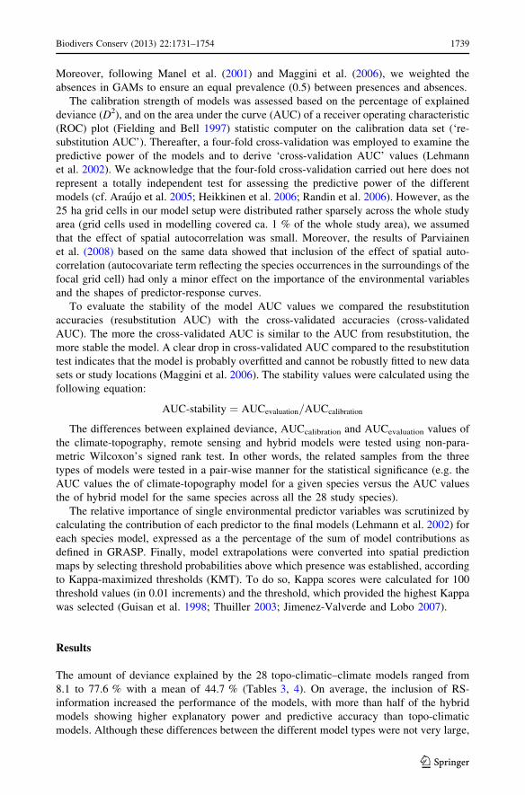
Moreover, following Manel et al. (2001) and Maggini et al. (2006), we weighted the
absences in GAMs to ensure an equal prevalence (0.5) between presences and absences.
The calibration strength of models was assessed based on the percentage of explained
deviance (D2), and on the area under the curve (AUC) of a receiver operating characteristic
(ROC) plot (Fielding and Bell 1997) statistic computer on the calibration data set (‘re-
substitution AUC’). Thereafter, a four-fold cross-validation was employed to examine the
predictive power of the models and to derive ‘cross-validation AUC’ values (Lehmann
et al. 2002). We acknowledge that the four-fold cross-validation carried out here does not
represent a totally independent test for assessing the predictive power of the different
models (cf. Araujo et al. 2005; Heikkinen et al. 2006; Randin et al. 2006). However, as the
25 ha grid cells in our model setup were distributed rather sparsely across the whole study
area (grid cells used in modelling covered ca. 1 % of the whole study area), we assumed
that the effect of spatial autocorrelation was small. Moreover, the results of Parviainen
et al. (2008) based on the same data showed that inclusion of the effect of spatial auto-
correlation (autocovariate term reflecting the species occurrences in the surroundings of the
focal grid cell) had only a minor effect on the importance of the environmental variables
and the shapes of predictor-response curves.
To evaluate the stability of the model AUC values we compared the resubstitution
accuracies (resubstitution AUC) with the cross-validated accuracies (cross-validated
AUC). The more the cross-validated AUC is similar to the AUC from resubstitution, the
more stable the model. A clear drop in cross-validated AUC compared to the resubstitution
test indicates that the model is probably overfitted and cannot be robustly fitted to new data
sets or study locations (Maggini et al. 2006). The stability values were calculated using the
following equation:
AUC-stability ¼ AUCevaluation=AUCcalibration
The differences between explained deviance, AUCcalibration and AUCevaluation values of
the climate-topography, remote sensing and hybrid models were tested using non-para-
metric Wilcoxon’s signed rank test. In other words, the related samples from the three
types of models were tested in a pair-wise manner for the statistical significance (e.g. the
AUC values the of climate-topography model for a given species versus the AUC values
the of hybrid model for the same species across all the 28 study species).
The relative importance of single environmental predictor variables was scrutinized by
calculating the contribution of each predictor to the final models (Lehmann et al. 2002) for
each species model, expressed as a the percentage of the sum of model contributions as
defined in GRASP. Finally, model extrapolations were converted into spatial prediction
maps by selecting threshold probabilities above which presence was established, according
to Kappa-maximized thresholds (KMT). To do so, Kappa scores were calculated for 100
threshold values (in 0.01 increments) and the threshold, which provided the highest Kappa
was selected (Guisan et al. 1998; Thuiller 2003; Jimenez-Valverde and Lobo 2007).
Results
The amount of deviance explained by the 28 topo-climatic–climate models ranged from
8.1 to 77.6 % with a mean of 44.7 % (Tables 3, 4). On average, the inclusion of RS-
information increased the performance of the models, with more than half of the hybrid
models showing higher explanatory power and predictive accuracy than topo-climatic
models. Although these differences between the different model types were not very large,
Biodivers Conserv (2013) 22:1731–1754 1739
123

they were statistically significant; the hybrid models showed significantly higher amount of
explained variation (Wilcoxon signed rank test, p \ 0.001) and predictive power
(AUCevaluation, Wilcoxon signed rank test, p \ 0.001) than topo-climatic and RS models
(Table 4). In general, the cross-validated accuracies (AUCevaluation) of the hybrid models
were rather good, indicating a good discrimination power of the models. In the case of
stability, hybrid models slightly outperformed topo-climatic models (Table 4).
Interestingly, the increase in the model performance resulting from the inclusion of RS-
based variables varied notably among different species, from species where the explained
deviance was ca. doubled (e.g. Saxifraga hirculus and Dactylorhiza traunsteineri) to
species with no difference in explanatory power between the hybrid and topo-climatic
models (e.g. Asplenium ruta-muraria and Epipogium aphyllum (Table 3). With respect to
Table 3 Explained deviance and cross-validated AUC values of the topo-climatic (topography ? climate)and hybrid (topography ? climate ? remote sensing) models for the 28 study species
Species Topo-climate model Hybrid model
Explaineddeviance (%)
Cross-validatedAUC
Explaineddeviance (%)
Cross-validatedAUC
Botrychium boreale 41.54 0.88 44.80 0.88
Botrychium lanceolatum 24.72 0.76 17.93 0.77
Asplenium ruta-muraria 60.01 0.92 60.01 0.93
Moehringia lateriflora 52.51 0.91 57.02 0.93
Minuartia biflora 77.59 0.96 77.59 0.96
Cerastium alpinum (ssp. alpinum) 63.40 0.95 63.40 0.94
Lychnis alpina var. serpentinicola 75.20 0.96 75.20 0.96
Silene tatarica 29.78 0.83 43.89 0.88
Gypsophila fastigiata 65.47 0.94 65.47 0.94
Primula stricta 31.90 0.83 50.13 0.90
Saxifraga hirculus 13.81 0.73 26.59 0.81
Epilobium laestaedii 24.80 0.74 24.80 0.74
Gentianella amarella 49.58 0.88 53.22 0.90
Lonicera caerulea 68.79 0.86 68.79 0.94
Arnica angustifolia 61.48 0.93 61.48 0.93
Cypripedium calceolus 44.86 0.89 45.92 0.89
Epipogium aphyllum 31.13 0.78 31.13 0.79
Dactylorhiza traunsteineri 8.90 0.66 17.20 0.74
Dactylorhiza lapponica 39.37 0.85 39.37 0.86
Dactylorhiza incarnata ssp. cruenta 17.13 0.75 20.87 0.76
Calypso bulbosa 40.98 0.88 45.57 0.89
Schoenus ferrugineus 54.02 0.90 54.60 0.90
Carex appropinquata 17.85 0.72 24.43 0.75
Carex heleonastes 14.54 0.71 20.65 0.76
Carex lepidocarpa ssp. jemtlandica 61.92 0.94 61.92 0.93
Carex viridula var. bergrothii 60.07 0.90 65.74 0.94
Carex microlochin 68.96 0.93 79.56 0.97
Elymus fibrosus 51.94 0.92 56.71 0.93
The models were built using AIC (Akaike’s Information Criterion) model selection algorithm
1740 Biodivers Conserv (2013) 22:1731–1754
123

the species habitat preferences, the increase in the modeling performance was most pro-
nounced in the case of mire and shore species (Fig. 2), where the increase for most species
is in the range of 18.0–29.7 % (explained deviance) and 4.2–4.8 % (AUC). Overall, in the
derived hybrid models, climate variables were generally selected most often in the models
and showed the largest relative contributions (Table 5), followed by remotely sensed
variables. The standard deviation and mean values in NDVI were the most important RS
variables in explaining the distribution of red-listed plant species.
Similarly as in the increase in model performance, the selected variables and their
response shapes varied considerably from species to species (Appendix Table 8). As an
example, the projected spatial distributions from the models that included different sets of
predictors are presented for two red-listed species, Primula stricta and D. traunsteineri
(Fig. 3). For both species, the inclusion of RS variables increased the modelling accuracy
(Table 3) and the level of spatial detail in the predictions despite the rather small increase
in predictive performance when adding the RS variables.
Table 4 Modelling accuracy (mean ± standard deviation) for the 28 red-listed plant species in topo-climatic, RS and hybrid models measured by the amount of explained deviance, calibrated and cross-validated AUC-values and the model stability (i.e. ratio of calibration AUC and four-fold cross-validationAUC)
Explained deviance AUC calibration AUC evaluation Stability
Topo-climatic model 44.72 ± 20.439 0.879 ± 0.082 0.854 ± 0.088 0.971 ± 0.028
RS model 24.02 ± 12.344 0.787 ± 0.083 0.754 ± 0.089 0.956 ± 0.036
Hybrid model 48.36 ± 19.182 0.897 ± 0.069 0.875 ± 0.076 0.975 ± 0.019
P1 \0.001 0.002 \0.001 n.s.
P2 \0.001 \0.001 \0.001 0.010
Ranks1 16/1/11 16/1/11 24/4/0 15/13/0
Ranks2 27/0/1 27/0/1 28/0/0 20/8/0
The Wilcoxon signed-rank test was used to test the difference between topo-climatic versus hybrid (P1) andRS versus hybrid (P2) models. Ranks: positive/negative/tied. Positive rank refers to the number of times ahybrid model was superior to a topo-climatic or RS-model
Fig. 2 Box-Whisker plots illustrating the percentage change (%) of a the amount of explained deviance andb in model accuracy (cross-validated AUC) when incorporating RS variables into AIC-based topo-climaticmodels for the 28 red-listed plant species. The 28 models are assigned into different categories according tothe habitat preferences of the species
Biodivers Conserv (2013) 22:1731–1754 1741
123

Discussion
There is considerable knowledge about the ecophysiological processes that underlie spe-
cies responses to the environment, and such knowledge is important when selecting pre-
dictor variables to describe species distributions (Huntley 1995; Guisan and Zimmermann
2000; Austin 2002, 2007). Generally, the distribution of plant species is closely correlated
with climatic factors at large spatial scales (Currie 1991; Wright et al. 1993; Huntley et al.
1995; H-Acevedo and Currie 2003; Thuiller et al. 2004), whereas topography, geology, soil
nutrient and wetness status, and spatial configuration of suitable habitats types modify
species occupancy patterns at finer spatial scales (Pearson et al. 2004; Thuiller et al. 2004;
Virkkala et al. 2005).
In a previous meso-scale study, land cover information from RS data was found to be an
important predictor for modelling red-listed plant species in high-latitude landscapes
(Parviainen et al. 2008). However, spatially explicit information on land cover is often
unavailable, and therefore rarely used in meso-scale species distribution modelling.
Moreover, the classification of RS images into coarse land cover classes can lead to a
severe loss of information (Palmer et al. 2002; Schwarz and Zimmermann 2005), espe-
cially when dealing with ecological data. In addition, in predictive SDM studies of plant
species carried out especially at higher spatial resolution, the use of vegetation or land
cover classifications is often not meaningful, simply because the inherent danger of
invoking circularity in such modelling settings (Zimmermann et al. 2007). Rather, subtle
differences in the vegetation/soil properties may thus provide more useful information for
discriminating between suitable and unsuitable sites, which have otherwise appropriate
(climatic) conditions for a target species to occur (Guisan et al. 1998; Zimmermann et al.
2007). Such differences may be captured by continuous gradient predictors derived from
Table 5 The relative roles of individual environmental variables in explaining the distribution of 28 red-listed plant species, as derived from the GAMs based on the AIC model selection algorithm based on modelcontributions (in GRASP)
Environmental variables Mean Std Count
GDD5 25.0 27.6 19
TEMPC 11.2 16.4 15
WAB 18.4 25.8 15
ELE 13.7 16.9 15
TWI 5.9 14.4 9
RAD 0.2 1.0 1
STEEP 5.4 17.0 4
NDVImean 3.9 8.0 7
NDVIstd 1.6 3.6 5
NDSImean 1.3 4.1 3
GREENNESmean 3.0 6.0 7
GREENNESstd 10.3 216 11
‘‘Mean’’ = percentage of model contribution provided by GAM analyses; ‘‘Std’’ = standard deviation inthe model contribution provided by GAM analyses; ‘‘Count’’ = number of GAM models in which thevariable was selected. For abbreviations of the environmental variables see Table 2
1742 Biodivers Conserv (2013) 22:1731–1754
123

remotely sensed spectral information that may help to improve the calibration of the SDMs
compared to topographic and bioclimatic predictors alone.
More generally, two important implications can be drawn from our results. First,
continuous RS-information appear to have potentiality to directly contribute to the models
by providing landscape-level details on potential habitat characteristics beyond climatic
and topographic conditions, and also beyond simple land cover classes. We acknowledge
here that strictly speaking remote sensing data are never truly ‘continuous’, not in the same
manner as many ecophysiological parameters measured directly in empirical field studies.
Thus, the ecological meaning of continuous is not applicable to remote sensing data. This
is because RS data are always categorized depending on their radiometric resolution, i.e.
the number of bits used. Nevertheless, our results suggest that there may be a difference in
the degree of usefulness between the unclassified ‘continuous’ RS data and the RS data
which have been converted into a number of broad land cover classes. Thus, we argue that
the introduction of unclassified RS-information may generate a useful improvement in
Fig. 3 Projected distribution of Dactylorhiza traunsteineri and Primula stricta derived from the GAMmodels based on the AIC model selection algorithm: models based on a topo-climatic variables only,b remote sensing variables only, and c combined topo-climatic and remote sensing variables. Black dotsrepresent the known presence points of the species, dark grey shaded areas modelled as suitable and lightgrey areas modelled as non-suitable for the species. The probability level that showed the highest Kappavalue (Kappa-Maximized Threshold, KMT) was used to classify the predicted occurrence probability valuesfor each species in each grid cell. D2 = percentage of explained deviance, AUC = the area under the curvebased on four-fold cross-validation, Pr = the prevalence of the species, Nr = the number of variablesselected in the model, T = threshold based on KMT criterion
Biodivers Conserv (2013) 22:1731–1754 1743
123

environmental characterization by conveying part of habitat information into the models
(Saatchi et al. 2008; Cord and Rodder 2011).
The GAMs containing both topo-climatic and RS variables showed highest amounts of
explained deviance and modelling accuracies. Although the absolute increases in the
amount of explained deviance and cross-validated AUC values were not large, they
showed a clear trend, were statistically significant, and changed the projected spatial
patterns of the species. Interestingly, we found that the inclusion of RS-information
improved especially the spatial projection of species with the poorest modelling perfor-
mance in topo-climate models. Thus continuous RS predictors may significantly improve
modelling success of the species with the most challenging species-habitat relationships,
which is an interesting and important finding (see also Zimmermann et al. 2007). Con-
sequently, for some species the finer scale habitat characteristics are apparently more
important drivers of distributions than the macro-scale climate and topography. Moreover,
hybrid models had approximately similar or slightly higher stabilities compared to climate-
topography and solely RS-based models suggesting that hybrid models may also be more
robust for spatial extrapolation. The models based on RS predictors alone generally per-
formed poorer than the other two model types. Thus, meso-scale species distribution
modelling studies that rely merely on continuous RS-data should be interpreted with care,
not least because in many areas similar phenological characteristics of different habitat
types may result in overprediction of species distributions (Roura-Pascual et al. 2006; Cord
and Rodder 2011).
Second, although for most species the best strategy to build models was to use both
topo-climatic and RS information, we found that species with different physiological and
ecological abilities and/or requirements (e.g. Luoto et al. 2005; Seoane et al. 2005; Guisan
et al. 2007; McPherson and Jetz 2007; Zimmermann et al. 2007; Poyry et al. 2008) may
profit differently from the inclusion of RS predictors. Our results suggested that for species
occupying mire and shore habitats, the addition of RS predictors was most successful. The
first illustrated example species, P. stricta, is a boreal species occurring mainly in prox-
imity of rivers characterized by heterogeneous vegetation cover, consisting mainly on
shrubs and bare soil. In comparison, D. traunsteineri prefers nutrient-rich open wetlands
and only rarely occurs on soils other than peat. For these two species, among others, hybrid
models have the potential to predict spatially more refined distribution patterns compared
to topo-climatic models, resulting in ecologically more reliable predictions of endangered
plant species distributions at the meso- and local scale. When topo-climatic and RS pre-
dictors were combined, the model specificity increased suggesting that the predictors were
disentangling distinct areas of expected absence, and thus operated as complementary
predictors (Parra et al. 2004). This suggests that although climate-topography variables
inherently capture the species responses associated with them, they may fail to capture
certain ecosystem characteristics (Hjort and Luoto 2006; Saatchi et al. 2008; Cord and
Rodder 2011).
Other shore species where the inclusion of RS predictors into the models caused a clear
increase in model accuracy were Silene tatarica, Carex microlochin and Elymus fibrosus,
and mire species S. hirculus, Carex heleonastes and D. traunsteineri. Interestingly, in some
other mire species, e.g. Dactylorhiza lapponica and Schoenus ferrugineus, we did not
observe corresponding increases in model performance. Other species where no notable
increase in model performance was observed following the inclusion of RS data contained
a number of species of rocky outcrops or other rocky terrain habitats, such as Minuartia
biflora and Cerastium alpinum, and some species of (cultural) grasslands, e.g. Botrychium
lanceolatum, but exceptions occurred also in these habitat categories (Table 3). Other
1744 Biodivers Conserv (2013) 22:1731–1754
123

shore species where the inclusion of RS predictors into the models caused a clear increase
in model accuracy were S. tatarica, C. microlochin and E. fibrosus, and mire species S.
hirculus, C. heleonastes and D. traunsteineri. Interestingly, in some other mire species, e.g.
D. lapponica and S. ferrugineus, corresponding increase in model performance was not
observed. Other species where no notable increase in model performance was observed
following the inclusion of RS data included a number of species of rocky outcrops or other
rocky terrain habitats, such as M. biflora and C. alpinum, and some species of (cultural)
grasslands, e.g. B. lanceolatum, but exceptions occurred also in these habitat categories
(Table 3). Thus the only broad conclusion to be derived from our results is that species of
sparsely wooded semi-open or wetland habitats with ‘exceptional’ ecological character-
istics and physiognomy compared to the landscape matrix may benefit of the incorporation
of RS data into SDMs.
Relevance of RS variables
NDVI is one of the most extensively used vegetation index in RS and known to be
sensitive to both photosynthetic activity and biomass (Tucker 1979; Myneni et al. 1995;
Raynolds et al. 2006), net primary productivity (Box et al. 1989; Reed et al. 1994; Cramer
et al. 1999) and heterogeneity (Rocchini et al. 2004). Furthermore, NDVI has been shown
to produce more accurate estimates of productivity in higher latitudes, in seasonal envi-
ronments compared to tropics in low-latitudes (Box et al. 1989; Levin et al. 2007; Par-
viainen et al. 2009, 2010). Interestingly, although Tasseled Cap transformations have been
available as standard tools for almost 30 years, they are less frequently used than NDVI
applications. The Tasseled Cap transformations has been used mainly for vegetation
mapping and monitoring of land cover change (Crist and Cicone 1984; Cohen et al. 1995;
Dymond et al. 2002; Skakun et al. 2003), but to our knowledge only rarely in species
distribution modelling (but see Zimmermann et al. 2007; Bartel and Sexton 2009). The
greenness derived from the Tasseled Cap transformation optimizes the contrast between
near infrared and visible bands, correlating highly with the amount of healthy, green
vegetation (Weiers et al. 2004). It may therefore incorporate highly different kinds of
information of habitat characteristics than band ratios or indices such as NDVI, which
account only for the red and near infrared bands (Crist 1985).
Where mean values of NDVI and greenness can be seen as proxies for productivity, the
standard deviations of these variables may be used as proxies for the variation of pro-
ductivity or variation in habitat diversity, in other words an index reflecting the finer scale
environmental heterogeneity. Overall, productivity and its variability reflect different
important habitat characteristics, and thus both variables may jointly play an important role
in explaining spatial trends in red-listed species distribution patterns. For example, areas of
sharp environmental transition may be especially rich in rare species because they rep-
resent transition zones of different communities and these are often characterised by
unique environmental conditions found in ecotonal environments (see Karka and van
Rensburgb 2006). However, in our study, species distributions responded mainly positively
to the average productivity values and negatively to habitat diversity suggesting that many
of the boreal red-listed plant species particularly prefer sites with rather high resource
abundance. Considering the global variation in productivity, the study area lies in a high-
latitude boreal environment, which poses severe limitations to the distribution and per-
sistence of many vascular plant species (Bonan and Shugart 1989). The sites with high
productivity, e.g. the herb-rich forests, are generally associated with increasing calcium
Biodivers Conserv (2013) 22:1731–1754 1745
123

levels of the soil and bedrock in the study area (Soyrinki and Saari 1980; Parviainen et al.
2008; 2010).
Caveats and strengths
The use of continuous RS-information as a proxy of species distribution has advantages but
also limitations (Zimmermann et al. 2007; Rocchini et al. 2010). The high amount of
unexplained variation was probably due to missing spatial structures and biased species
distribution data. Other important environmental factors—that were not taken into account
in this study and which may operate at different spatial scales—can also modify the
distribution patterns of red-listed plant species. However, at the spatial scale employed in
this study the ecological gradients analysed were not wide, and there were only limited
spatial structures available because of the rather uniform climate, elevational extent and
land cover.
Other potential caveats in our study, as well as other corresponding RS-data based
modelling studies, are that no information is available on the structural variables of the
landscape, e.g. fractal shapes or more general habitat-shape based information. Moreover,
while structural landscape metrics can be evaluated by texture-based methods, continuous
data do not contain such information a priori. It should be also noted that whereas con-
tinuous RS data provides a measure of habitat diversity as such, technically it is a land-
scape summary measure that does not take into account the uniqueness or potential
ecological importance of different habitats (Rocchini et al. 2010).
Although the predictive performance of the models in this study was rather high, care
should be taken when interpreting these results, because such evaluation measures are
based on presence-only data and not on observed absences (Zaniewski et al. 2002; Elith
et al. 2006). In other words, models based on presence-only data do not accurately predict
the probability of species presence because the proportions of presences within the cali-
bration sets do not represent the true prevalence of the species in the landscape (Pearce and
Boyce 2006). However, these models are nevertheless useful in their ability to rank hab-
itats’ suitability on a relative scale (Elith et al. 2006; Newbold 2010). In addition, in rare
species with small geographic ranges and/or narrow habitat specificity, spatially well
segregated occurrence patterns that are strongly correlated with specific habitat charac-
teristics may emerge from combined topo-climatic and RS predictors. Such patterns may
be detected and modeled even from comparably few occurrence records. In such cases,
continuous RS-information may increase the efficiency of mapping schemes under limited
logistical and financial resources, and the modelling may be based on limited amount
records from museum collections and databases (see also Ponder et al. 2001; Loiselle et al.
2003). Moreover, one of the major strengths of using continuous RS data is the fact that
uncertainty information is not lost due to the data processing. This is a particularly
important difference to the classified RS data where some of the broad land cover types can
include sites with larger variation in the ground conditions and the related reflectance
values than other types, but the degree of this within-type variation are generally unknown
to the investigator and may thus give rise to unknown bias in the species distribution
modelling.
Acknowledgments A study of this nature would not have been possible without the hundreds of volun-teers who contributed their data to the red-listed plant species database. M. J. Bailey helped with correctionof the English text. Terhi Ryttari helped in aggregating the species data for this study. Different parts of thisresearch were funded by the Academy of Finland (project grant 116544) and the EC FP6 Integrated Projects
1746 Biodivers Conserv (2013) 22:1731–1754
123

ALARM (GOCE-CT-2003-506675) (Settele et al. 2005), ECOCHANGE (GOCE-2006-036866), and EUFP7 project SCALES (project #226852).
Appendix
See Tables 6, 7, and 8.
Table 6 List of different habitats included in the five main habitat categories delimited for the studyspecies
Cultural Forest Mire Rocky Shore
Rural biotopesand culturalhabitats
Forests Mires Rock outcrops(incl. erraticboulders)
Aquatic habitats
Seminatural drygrasslands
Seminatural mesicgrasslands
Wooded pasturesand pollardmeadows
Seminatural moistgrasslands
Ditches, etc..Arable landParks, yards and
gardensRoadsides,
railwayembankments,etc.
Buildings (andconstructions)
Heath forestsSub-xeric, xeric
and barren heathforests
Mesic and herb-rich heath forests
Herb-rich forestsDry and mesic
herb-rich forestsMoist herb-rich
forestsMountain birch
forests
Rich fensOpen rich fens (incl.
herb-rich sedgefens)
Rich pine fensRich spruce-birch
fensFensOmbro- and
oligotrophic fensMesotrophic fensPine miresOmbro- and
oligotrophic pinemires
Mesotrophic pinemires
Spruce miresOligotrophic spruce
miresEutrophic and
mesotrophicspruce mires
Calcareous rockoutcrops andquarries
Serpentine rockoutcrops
Canyons andgorges
Caves andcrevices
Other rockoutcrops
Lakes and pondsOligotrophic lakes
and pondsEutrophic and
mesotrophic lakesand ponds
Small ponds (also inmires, etc..)
RiversBrooks and streamsRapidsSpring complexes
Table 7 List of five Landsat 7 ETM? images used in the study
Landsat ETM Path Row Date RMSE
Image 1 188 14 26.7.2000 7.9
Image 2 189 12 21.8.2001 18.9
Image 3 189 13 22.8.2001 18.6
Image 4 190 13 30.7.2002 11.6
Image 5 192 12 26.8.2001 17.2
RMSE = root-mean-square error of test ground control points of the image in the georeferencing project
Biodivers Conserv (2013) 22:1731–1754 1747
123

Ta
ble
8S
um
mar
yo
fth
ere
spo
nse
shap
esb
etw
een
the
28
red-l
iste
dv
ascu
lar
pla
nt
spec
ies
and
each
env
iro
nm
enta
lv
aria
ble
inth
eh
yb
rid
GA
Mm
od
els
Sp
ecie
sG
DD
5T
EM
PC
WA
BE
LE
TW
IR
AD
ST
EE
PN
DV
Imea
nN
DV
Istd
ND
SIm
ean
GR
EE
NN
ES
mea
nG
RE
EN
NE
SS
std
BO
TB
OR
-?
?-
\?
BO
TL
AN
?
AS
PR
UT
\-
\M
OE
LA
T-
?-
??
MIN
BIF
-
CE
RA
LP
-U
\-
-
LY
CA
LP
-
SIL
TA
T?
-\
?\
-
GY
PF
AS
\-
-
PR
IST
R-
\?
-
SA
XH
IR?
??
--
-?
-
EP
ILA
E-
?
GE
NA
MA
?-
?-
?
LO
NC
AE
\-
AR
NA
NG
??
CY
PC
AL
?-
\?
-U
-
EP
IAP
HU
-
DA
CT
RA
?\
-
DA
CL
AP
-
DA
CIN
C?
-?
-
CA
LB
UL
?-
?-
??
??
SC
HF
ER
\\
-
CA
RA
PP
?-
-
CA
RH
EL
?U
??
\?
-
CA
RL
EP
JEM
\\
1748 Biodivers Conserv (2013) 22:1731–1754
123

Ta
ble
8co
nti
nued
Sp
ecie
sG
DD
5T
EM
PC
WA
BE
LE
TW
IR
AD
ST
EE
PN
DV
Imea
nN
DV
Istd
ND
SIm
ean
GR
EE
NN
ES
mea
nG
RE
EN
NE
SS
std
CA
RV
1R
BE
R?
-?
?-
-
CA
RM
IC-
--
EL
YF
IB\
--
--
-
Th
em
od
els
wer
eb
uil
tu
sin
gcl
imat
e,to
po
gra
phic
and
RS
var
iab
les,
and
the
AIC
mod
else
lect
ion
alg
ori
thm
.F
or
abb
rev
iati
on
so
fth
esp
ecie
san
den
vir
on
men
tal
var
iab
les
see
Tab
les
1an
d2
Th
ed
irec
tio
no
fth
eef
fect
isin
dic
ated
wit
hsy
mb
ols
(?=
po
siti
ve
lin
ear
corr
elat
e;-
=neg
ativ
eli
nea
rco
rrel
ate;\
=n
on
-lin
ear
corr
elat
ew
ith
ah
um
p-s
hap
edre
spo
nse
curv
e;U
=n
on
linea
rco
rrel
ate
wit
ha
do
wn
war
dh
um
p-s
hap
edre
spo
nse
curv
e)
Biodivers Conserv (2013) 22:1731–1754 1749
123

References
Ahti T, Hamet-Ahti L, Jalas J (1968) Vegetation zones and their sections in northwestern Europe. AnnalesBotanici Fennici 5:169–211
Akaike H (1974) A new look at statistical model identification. IEEE Trans Autom Control AU-19:716–722Araujo MB, Guisan A (2006) Five (or so) challenges for species distribution modelling. J Biogeogr
33:1677–1688Araujo MB, Pearson RG, Thuiller W, Erhard M (2005) Validation of species-climate impact models under
climate change. Glob Change Biol 11:1504–1513Astorga A, Heino J, Luoto M, Muotka T (2011) Freshwater biodiversity at regional extent: determinants of
macroinvertebrate taxonomic richness in headwater streams. Ecography 34:705–713Atlas of Finland (1987) Climate, Folio 131. National Board of Survey & Geographical Society of Finland,
HelsinkiAtlas of Finland (1990) Geology, Folio 123-126. National Board of Survey & Geographical Society of
Finland, HelsinkiAustin MP (2002) Spatial prediction of species distribution: an interface between ecological theory and
statistical modelling. Ecol Model 157:101–118Austin M (2007) Species distribution models and ecological theory: a critical assessment and some possible
new approaches. Ecol Model 200:1–19Austin M, Meyers JA (1996) Current approaches to modelling the environmental niche of eucalypts:
implication for management of forest biodiversity. For Ecol Manage 85:95–106Austin MP, Van Niel KP (2011a) Impact of landscape predictors on climate change modelling of species
distributions: a case study with Eucalyptus fastigata in southern New South Wales, Australia. J Bio-geogr 38:9–19
Austin MP, Van Niel KP (2011b) Improving species distribution models for climate change studies: variableselection and scale. J Biogeogr 38:1–8
Bartel RA, Sexton JO (2009) Monitoring habitat dynamics for rare and endangered species using satelliteimages and niche-based models. Ecography 32:888–896
Bonan GB, Shugart HH (1989) Environmental factors and ecological processes in boreal forests. Annu RevEcol Syst 20:1–28
Box EO, Holben BN, Kalb V (1989) Accuracy of the AVHRR vegetation index as a predictor of biomass,primary productivity and net CO2 flux. Vegetatio 80:71–89
Buermann W, Saatchi S, Smith TB, Zutta BR, Chaves JA, Mila B, Graham CH (2008) Predicting speciesdistributions across the Amazonian and Andean regions using remote sensing data. J Biogeogr35:1160–1176
Carroll C, Johnson DS (2008) The importance of being spatial (and reserved): assessing northern spottedowl habitat relationships with hierarchical Bayesian models. Conserv Biol 22:1026–1036
Cohen WB, Spies TA, Fiorella M (1995) Estimating the age and structure of forests in a multi-ownershiplandscape of western Oregon, USA International. J Remote Sens 16:721–746
Cord A, Rodder D (2011) Inclusion of habitat availability in species distribution models through multi-temporal remote-sensing data? Ecol Appl 21:3285–3298
Cramer W, Kicklighter DW, Bondeau A, Moore B, Churkina C, Nemry B, Ruimy A, Schloss AL (1999)Comparing global models of terrestrial net primary productivity (NPP): overview and key results. GlobChange Biol 5:1–15
Crist EP (1985) A TM tasseled cap equivalent transformation for reflectance factor data. Remote SensEnviron 17:301–306
Crist EP, Cicone RC (1984) A physically-based transformation of thematic mapper data—the TM tasseledcap. IEEE Trans Geosci Remote Sens 22:256–263
Currie DJ (1991) Energy and large-scale patterns of animal- and plant-species richness. Am Nat 137:27–49de Siqueira MF, Durigan G, De Marco P Jr, Peterson AT (2009) Something from nothing: using landscape
similarity and ecological niche modeling to find rare plant species. J Nat Conserv 17:25–32Dymond CC, Mladenoff DJ, Radeloff VC (2002) Phenological differences in tasseled cap indices improve
deciduous forest classification. Remote Sens Environ 80:460–472Ekstrand S (1996) Landsat TM-based forest damage assessment: correction for topographic effects. Pho-
togramm Eng Remote Sens 62:151–161Elith J, Leathwick JR (2009a) Conservation prioritization using species distribution models. In: Moilanen A,
Wilson KA, Possingham HP (eds) Spatial conservation prioritization: quantitative methods andcomputational tools. Oxford University Press, Oxford, pp 70–93
Elith J, Leathwick JR (2009b) Species distribution models: ecological explanation and prediction acrossspace and time. Annu Rev Ecol Evol Syst 40:677–697
1750 Biodivers Conserv (2013) 22:1731–1754
123

Elith J, Graham CH, Anderson RP, Dudık M, Ferrier S, Guisan A, Hijmans RJ, Huettmann F, Leathwick JR,Lehmann A, Li J, Lohmann LG, Loiselle BA, Manion G, Moritz C, Nakamura M, Nakazawa Y,Overton JM, Peterson AT, Phillips SJ, Richardson KS, Scachetti-Pereira R, Schapire RE, Soberon J,Williams S, Wisz MS, Zimmermann NE (2006) Novel methods improve prediction of species’ dis-tributions from occurrence data. Ecography 29:129–151
ESRI (1991) ARC/INFO user’s guide Cell-based modelling with GRID analysis, display and management.California, Environment Systems Research Institute, Inc, Redlands
Fernandez N, Delibes M, Palomares F (2006) Landscape evaluation in conservation: molecular samplingand habitat modeling for the Iberian lynx. Ecol Appl 16:1037–1049
Fielding A, Bell J (1997) A review of methods for the assessment of prediction errors in conservationpresence/absence models. Environ Conserv 24:38–49
Foody GM, Cutler MEJ (2003) Tree biodiversity in protected and logged Bornean tropical rain forests andits measurement by satellite remote sensing. J Biogeogr 30:1053–1066
Franklin J (1995) Predictive vegetation mapping: geographic modelling of biospatial patterns in relation toenvironmental gradients. Prog Phys Geogr 19:474–499
Gessler PE, Chadwick OA, Chamran F, Althouse L, Holmes K (2000) Modeling soil-landscape and eco-system properties using terrain attributes. Soil Sci Soc Am J 64:2046–2056
Gillespie TW, Foody GM, Rocchini D, Giorgi AP, Saatchi S (2008) Measuring and modelling biodiversityfrom space. Prog Phys Geogr 32:203–221
Gould WA (2000) Remote sensing of vegetation, plant species richness, and regional diversity hotspots.Ecol Appl 10:1861–1870
Guisan A, Thuiller W (2005) Predicting species distribution: offering more than simple habitat models. EcolLett 8:993–1009
Guisan A, Zimmermann NE (2000) Predictive habitat distribution models in ecology. Ecol Model135:147–186
Guisan A, Theurillat JP, Kienast F (1998) Predicting the potential distribution of plant species in an alpineenvironment. J Veg Sci 9:65–74
Guisan A, Edwards TCJ, Hastie T (2002) Generalized linear and generalized additive models in studies ofspecies distributions: setting the scene. Ecol Model 157:89–100
Guisan A, Broennimann O, Engler R, Vust M, Yoccoz NG, Lehmann A, Zimmermann NE (2006) Usingniche-based models to improve the sampling of rare species. Conserv Biol 20:501–511
Guisan A, Zimmermann NE, Elith J, Graham CH, Phillips S, Peterson AT (2007) What matters for pre-dicting the occurrences of trees: techniques, data, or species’ characteristics? Ecol Monogr 77:615–630
H-Acevedo D, Currie DJ (2003) Does climate determine broad-scale patterns of species richness? A test ofthe causal link by natural experiment. Glob Ecol Biogeogr 12:461–473
Harma P, Teiniranta R, Torma M, Repo R, Jarvenpaa E, Kallio M (2004) Production of CORINE2000 landcover data using calibrated LANDSAT 7 ETM satellite image mosaics and digital maps in Finland. In:IEEE International Geoscience and Remote Sensing Symposium, 20–24 Sept 2004, Anchorage,Alaska, IEEE
Hastie T, Tibshirani R (1990) Generalized additive models. Chapman and Hall, LondonHeikkinen O (2005) Boreal forests and northern upper timberlines. In: Seppala M (ed) The physical
geography of fennoscandia. Oxford University Press, Oxford, pp 185–200Heikkinen RK, Birks HJB, Kalliola RJ (1998) A numerical analysis of the mesoscale distribution patterns of
vascular plants in the Kevo Nature Reserve, northern Finland. J Biogeogr 25:123–146Heikkinen RK, Luoto M, Araujo MB, Virkkala R, Thuiller W, Sykes MT (2006) Methods and uncertainties
in bioclimatic envelope modelling under climate change. Prog Phys Geogr 30:751–777Heikkinen RK, Marmion M, Luoto M (2012) Does the interpolation accuracy of species distribution models
come at the expense of transferability? Ecography 35:276–288Hjort J, Luoto M (2006) Modelling patterned ground distribution in Finnish Lapland: an integration of
topographical, ground and remote sensing information. Geografiska Annaler 88A:19–29Huang C, Wylie B, Yang L, Homer C, Zylstra G (2002) Derivation of a tasselled cap transformation based
on Landsat 7 at-satellite reflectance. Int J Remote Sens 23:1741–1748Huntley B (1995) Plant species’ response to climate change: implications for the conservation of European
birds. Ibis 137(Supplement 1):127–138Huntley B, Berry PM, Cramer W, McDonald AP (1995) Modelling present and potential future ranges of
some European higher plants using climate response surfaces. J Biogeogr 22:967–1001Jimenez-Valverde A, Lobo JM (2007) Threshold criteria for conversion of probability of species presence to
either-or presence-absence. Acta Oecol 31:361–369
Biodivers Conserv (2013) 22:1731–1754 1751
123

John R, Chen J, Lu N, Guo K, Liang C, Wei Y, Noormets A, Ma K, Han X (2008) Predicting plant diversitybased on remote sensing products in the semi-arid region of Inner Mongolia. Remote Sens Environ112:2018–2032
Karka S, van Rensburgb BJ (2006) Ecotones: marginal or central areas of transition? Israel J Ecol Evol52:29–53
Kerr J, Ostrovsky M (2003) From space to species: ecological applications for remote sensing. Trends EcolEvol 18:299–305
Kivinen S, Luoto M, Heikkinen RK, Saarinen K, Ryttari T (2008) Threat spots and environmental deter-minants of red-listed plant, butterfly and bird species in boreal agricultural environments. BiodiversConserv 17:3289–3305
Lehmann A, Overton J, Leathwick J (2002) GRASP: generalized regression analysis and spatial prediction.Ecol Model 157:189–207
Levin N, Shmida A, Levanoni O, Tamari H, Kark S (2007) Predicting mountain plant richness and rarityfrom space using satellite-derived vegetation indices. Divers Distrib 13:692–703
Loiselle BA, Howell CA, Graham CH, Goerck JM, Brooks T, Smith KG, Williams PH (2003) Avoidingpitfalls of using species distribution models in conservation planning. Conserv Biol 17:1591–1600
Luoto M, Toivonen T, Heikkinen RK (2002) Prediction of total and rare plant species richness in agri-cultural landscapes from satellite images and topographic data. Landsc Ecol 17:195–217
Luoto M, Poyry J, Heikkinen RK, Saarinen K (2005) Uncertainty of bioclimate envelope models based ongeographical distribution of species. Glob Ecol Biogeogr 14:575–584
Maggini R, Lehmann A, Zimmermann NE, Guisan A (2006) Improving generalized regression analysis forthe spatial prediction of forest communities. J Biogeogr 33:1729–1749
Manel S, Williams HC, Ormerod SJ (2001) Evaluating presence-absence models in ecology: the need toaccount for prevalence. J Appl Ecol 38:921–931
McPherson JM, Jetz W (2007) Effect of species’ ecology on the accuracy of distribution models. Ecography30:135–151
Muldavin EH, Neville P, Harper G (2001) Indices of grassland biodiversity in the Chihuahuan desertecoregion derived from remote sensing. Conserv Biol 15:844–855
Myneni RB, Hall FG, Sellers PJ, Marshak AL (1995) The interpretation of spectral vegetation indexes. IEEETrans Geosci Remote Sens 33:481–486
Nagendra H (2001) Using remote sensing to assess biodiversity. Int J Remote Sens 22:2377–2400Newbold T (2010) Applications and limitations of museum data for conservation and ecology, with par-
ticular attention to species distribution models. Prog Phys Geogr 34:3–22Palmer MW, Earls P, Hoagland BW, White PS, Wohlgemuth T (2002) Quantitative tools for perfecting
species lists. Environmetrics 13:121–137Parra JL, Graham CC, Freile JF (2004) Evaluating alternative data sets for ecological niche models of birds
in the Andes. Ecography 27:350–360Parviainen M, Luoto M, Ryttari T, Heikkinen RK (2008) Modelling the occurrence of threatened plant
species in taiga landscapes: methodological and ecological perspectives. J Biogeogr 35:1888–1905Parviainen M, Luoto M, Heikkinen RK (2009) The role of local and landscape level productivity in
modelling of boreal plant species richness. Ecol Model 220:2690–2701Parviainen M, Luoto M, Heikkinen RK (2010) NDVI -based productivity and heterogeneity as indicators of
species richness in boreal landscapes. Boreal Environ Res 15:301–318Pausas JG, Carreras J, Ferre A, Font X (2003) Coarse-scale plant species richness in relation to environ-
mental heterogeneity. J Veg Sci 14:661–668Pearce JL, Boyce MS (2006) Modelling distribution and abundance with presence-only data. J Appl Ecol
43:405–412Pearson RG (2007) Species’ distribution modeling for conservation educators and practitioners. Synthesis.
American Museum of Natural History http://ncepamnhorgPearson RG, Dawson TP, Liu C (2004) Modelling species distributions in Britain: a hierarchical integration
of climate and land-cover data. Ecography 27:285–298Peterson AT (2003) Projected climate change effects on Rocky Mountain and Great Plain birds: generalities
on biodiversity consequences. Glob Change Biol 9:647–655Ponder WF, Carter GA, Flemons P, Chapman RR (2001) Evaluation of museum collection data for use in
biodiversity assessment. Conserv Biol 15:648–657Poyry J, Luoto M, Heikkinen RK, Saarinen K (2008) Species traits are associated with the quality of
bioclimatic models. Glob Ecol Biogeogr 17:403–414Randin CF, Dirnbock T, Dullinger S, Zimmerman NE, Zappa M, Guisan A (2006) Are niche-based species
distribution models transferable in space. J Biogeogr 33:1689–1703
1752 Biodivers Conserv (2013) 22:1731–1754
123

Rassi P, Hyvarinen E, Juslen A, Mannerkoski I (eds) (2010) The 2010 red list of Finnish species. Ministry ofthe Environment & Finnish Environment Institute, Helsinki
Raynolds MK, Walker DA, Maier HA (2006) NDVI patterns and phytomass distribution in the circumpolarArctic. Remote Sens Environ 102:271–281
Redpath SM, Young J, Evely A, Adams WM, Sutherland WJ, Whitehouse A, Amar A, Lambert RA, LinnellJD, Watt A, Gutierrez RJ (2013) Understanding and managing conservation conflicts. Trends EcolEvol 28:100–109
Reed BC, Brown JF, VanderZee D, Loveland TR, Merchant JW, Ohlen DO (1994) Measuring phenologicalvariability from satellite imagery. J Veg Sci 5:703–714
Rocchini D, Chiarucci A, Loiselle SA (2004) Testing the spectral variation hypothesis by using satellitemultispectral images. Acta Oecol 26:117–120
Rocchini D, Balkenhol N, Carter GA, Foody GM, Gillespie TW, He KS, Kark S, Levin N, Lucas K, LuotoM, Nagendra H, Oldeland J, Ricotta C, Southworth J, Neteler M (2010) Remotely sensed spectralheterogeneity as a proxy of species diversity: recent advances and open challenges. Ecol Inform5:318–329
Rogers AS, Kearney MS (2004) Reducing signature variability in unmixing coastal marsh Thematic Mapperscenes using spectral indices. Int J Remote Sens 25:2317–2335
Roura-Pascual N, Suarez AV, McNyset K, Gomez K, Pons P, Touyama Y, Wild A, Gascon F, Peterson AT(2006) Niche differentiation and fine-scale projections for Argentine ants based on remotely senseddata. Ecol Appl 16:1832–1841
Rouse JW Jr, Hass RH, Deering DW, Schell JA, Harlan JC (1973) Monitoring the vernal advancement andretrogression (green wave effect) of natural vegetation NASA/GSFC Type III Final report Geenbelt,Maryland
Rushton SP, Ormerod SJ, Kerby G (2004) New paradigms for modelling species distributions? J Appl Ecol41:193–200
Ryttari T, Kettunen T (1997) Uhanalaiset kasvimme. Tampere, Suomen Ymparistokeskus, Kirjayhtyma OySaatchi S, Buermann W, ter Steege H, Mori S, Smith TB (2008) Modeling distribution of Amazonian tree
species and diversity using remote sensing measurements. Remote Sens Environ 112:2000–2017Sala OE, Chapin FSI, Armesto JJ, Berlow E, Bloomfield J, Dirzo R (2000) Global biodiversity scenarios for
the year 2100. Science 287:1770–1774Schmidtlein S, Feilhauer H, Bruelheide H (2012) Mapping plant strategy types using remote sensing. J Veg
Sci 23:395–405Schwarz M, Zimmermann NE (2005) A new GLM-based method for mapping tree cover continuous fields
using MODIS reflectance data. Remote Sens Environ 95:428–443Seoane J, Vinuela J, Dıaz-Delgado R, Bustamante J (2003) The effects of land use and climate on red kite
distribution in the Iberian peninsula. Biol Conserv 11:401–414Seoane J, Carrascal LM, Alonso CL, Palomino D (2005) Species-specific traits associated to prediction
errors in bird habitat suitability modelling. Ecol Model 185:299–308Seto KC, Fleishman E, Fay JP, Betrus CJ (2004) Linking spatial patterns of bird and butterfly species
richness with Landsat TM derived NDVI. Int J Remote Sens 25:4309–4324Settele J, Hammen V, Hulme P, Karlson U, Klotz S, Kotarac M, Kunin W, Marion G, O’Connor M,
Petanidou T, Peterson K, Potts S, Pritchard H, Pysek P, Rounsevell M, Spangenberg J, Steffan-Dewenter I, Sykes M, Vighi M, Zobel M, Kuhn I (2005) Alarm: assessing Large-scale environmentalRisks for biodiversity with tested Methods GAIA. Ecol Perspect Sci Soc 14:69–72
Skakun RS, Wulder MA, Franklin SE (2003) Sensitivity of the thematic mapper enhanced wetness dif-ference index to detect mountain pine beetle red-attack damage. Remote Sens Environ 86:433–443
Skov F, Svenning J-C (2004) Potential impact of climatic change on the distribution of forest herbs inEurope. Ecography 27:366–380
Soyrinki N, Saari V (1980) Die Flora von Oulanka Nationalpark, Nordfinnland. Acta Botanica Fennica114:1–149
Thuiller W (2003) BIOMOD—optimizing predictions of species distributions and projecting potential futureshifts under global change. Glob Change Biol 9:1353–1362
Thuiller W, Araujo MB, Lavorel S (2004) Do we need land-cover data to predict species distributions inEurope? J Biogeogr 31:353–361
Thuiller W, Lavorel S, Araujo MB (2005) Niche properties and geographical extent as predictors of speciessensitivity to climate change. Glob Ecol Biogeogr 14:347–357
Thuiller W, Albert C, Araujo MB, Berry PM, Cabeza M, Guisan A, Hickler T, Midgley GF, Paterson J,Schurr FM, Sykes MT, Zimmermann NE (2008) Predicting global change impacts on plant species’distributions: future challenges. Perspect Plant Ecol Evol Syst 9:137–152
Biodivers Conserv (2013) 22:1731–1754 1753
123

Tucker CJ (1978) A comparison of satellite sensor bands for vegetation monitoring. Photogramm EngRemote Sens 44:1369–1380
Tucker CJ (1979) Red and photographic infrared linear combinations for monitoring vegetation. RemoteSens Environ 8:127–150
Turner W, Spector S, Gardiner N, Fladeland M, Sterling E, Steininger M (2003) Remote sensing forbiodiversity science and conservation. Trends Ecol Evol 18:306–314
Vajda A, Venalainen A (2003) The influence of natural conditions on the spatial variation of climate inLapland, northern Finland. Int J Climatol 23:1011–1022
Vasari Y, Tonkov S, Vasari A, Nikolova A (1996) The Late-quaternary history of the vegetation and flora innortheastern Finland in the light of a re-investigation of Aapalampi in Salla. Auqilo Ser Botany36:27–41
Venables WN, Ripley BD (2002) Modern applied statistics with S. Springer-Verlag, BerlinVenalainen A, Heikinheimo M (2002) Meteorological data for agricultural applications. Phys Chem Earth
27:1045–1050Virkkala R, Luoto M, Heikkinen RK, Leikola N (2005) Distribution patterns of boreal marshland birds:
modelling the relationships to land cover and climate. J Biogeogr 32:1957–1970Wang K, Franklin SE, Guo X, Cattet M (2010) Remote sensing of ecology, biodiversity and conservation: a
review from the perspective of remote sensing specialists. Sensors 10:9647–9667Weiers S, Bock M, Wissen M, Rossner G (2004) Mapping and indicator approaches for the assessment of
habitats at different scales using remote sensing and GIS methods. Landsc Urban Plan 67:43–65Wilson CD, Roberts D, Reid N (2010) Applying species distribution modelling to identify areas of high
conservation value for endangered species: A case study using Margaritifera margaritifera (L.). BiolConserv 144:821–829
Wood S, Augustin N (2002) GAMs with integrated model selection using penalized regression splines andapplications to environmental modelling. Ecol Model 157:157–177
Wright DH, Currie DJ, Maurer BA (1993) Energy supply and patterns of species richness on local andregional scales. In: Ricklefs RE, Schluter D (eds) Species diversity in ecological communities: his-torical and geographical perspectives. University of Chicago Press, Chicago, pp 66–74
Wu XB, Smeins FE (2000) Multiple-scale habitat modeling approach for rare plant conservation. LandscUrban Plan 51:11–28
Yee TW, Mitchell ND (1991) Generalized additive models in plant ecology. J Veg Sci 2:587–602Young J, Watt A, Nowicki P, Alard D, Clitherow J, Henle K, Johnson R, Laczko E, McCracken D, Matouch
S, Niemela J, Richards C (2005) Towards sustainable land use: identifying and managing conflictsbetween human activities and biodiversity conservation in Europe. Biodivers Conserv 14:1641–1661
Zaniewski AE, Lehmann A, Overton JM (2002) Predicting species spatial distributions using presence-onlydata: a case study of native New Zealand ferns. Ecol Model 157:261–280
Zimmermann NE, Edwards TC, Moisen GG, Frescino TS, Blackard JA (2007) Remote sensing-basedpredictors improve distribution models of rare, early successional and broadleaf tree species in Utah.J Appl Ecol 44:1057–1067
Zimmermann NE, Edwards TC, Graham CH, Pearman PB, Svenning J-C (2010) New trends in speciesdistribution modelling. Ecography 33:985–989
1754 Biodivers Conserv (2013) 22:1731–1754
123