Embed Size (px)
Citation preview

1
Using of Satellite Remote
Sensing in Cultural Heritage
Management.
Islam K. Elbestawi
Assistant Lecturer- Faculty of
Tourism& Hotels- SCU
1

Non-invasive
techniques.
NASA- Space
Archaeology Program
2
Space Archaeology

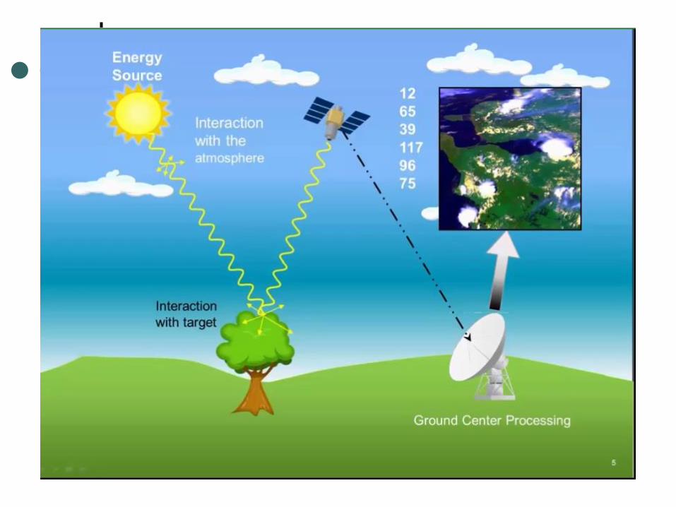
What is Remote sensing ?
Remote sensing (RS), also called earth observation, refers to obtaining
information about objects or areas at the Earth’s surface without being in
direct contact with the object or area. Humans accomplish this task with
aid of eyes or by the sense of smell or hearing; so, remote sensing is day-
today business for people. Reading the newspaper, watching cars driving in
front of you are all remote sensing activities.
3

4
5

6

7
Applications of
SRS in Cultural
Heritage.
7

Discovery of Archaeological Sites
Dr. Parcak’s techniques have helped locate:
17 potential pyramids,
3,100 potential forgotten settlements and
1,000 potential lost tombs in Egypt
8

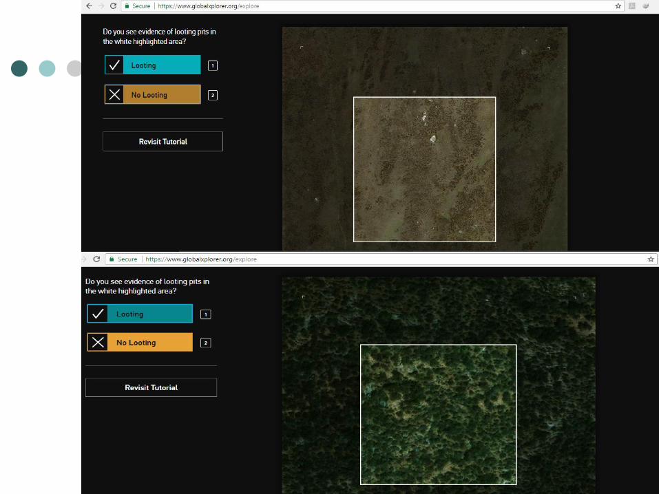
Protecting from Looting
Smuggling of antiquities abroad.
Looters damage and destroy
archaeological heritage.
9

10

Sarah Parcak
Space Archaeologist.
11

North Lisht. 6a is from 2010 (no looting) and the
6b is from 2014 (150+ looting pits, here seen as
darker areas). Imagery courtesy Google Earth.
12

Global Xplorer°
GlobalXplorer° is an online platform that uses the
power of the crowd to analyze the incredible wealth of
satellite images currently available to archaeologists.
Launched by 2016 TED Prize winner and National
Geographic Fellow, Dr. Sarah Parcak.
GlobalXplorer° aims to bring the wonder of
archaeological discovery to all, and to help us better
understand our connection to the past.
13

New Global Alarm
System to protect
our heritage.
14

15
16
Gebel Kamil (meteorite) Carter “
PA
Gebel Kamil is a meteorite that struck Egypt about
5000 years ago leaving a crater surrounded by
thousands of pieces of iron.
It was located in 2008 using Google Earth satellite
imagery by Vincenzo de Michele (former curator of
Milan Natural History Museum in Italy)
17

18