Embed Size (px)
Citation preview

Using high resolution satellite imagery to improve sweet potato crop statistics in Uganda
L. Claessens, P. Zorogastúa, R. Quiroz, M. Potts & S. Namanda

IntroductionStudy area : characteristicsPhysical bases of remote sensingImagery Digital image processingResultsConclusions
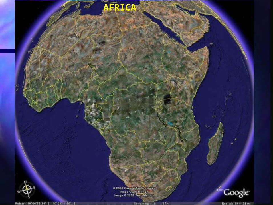
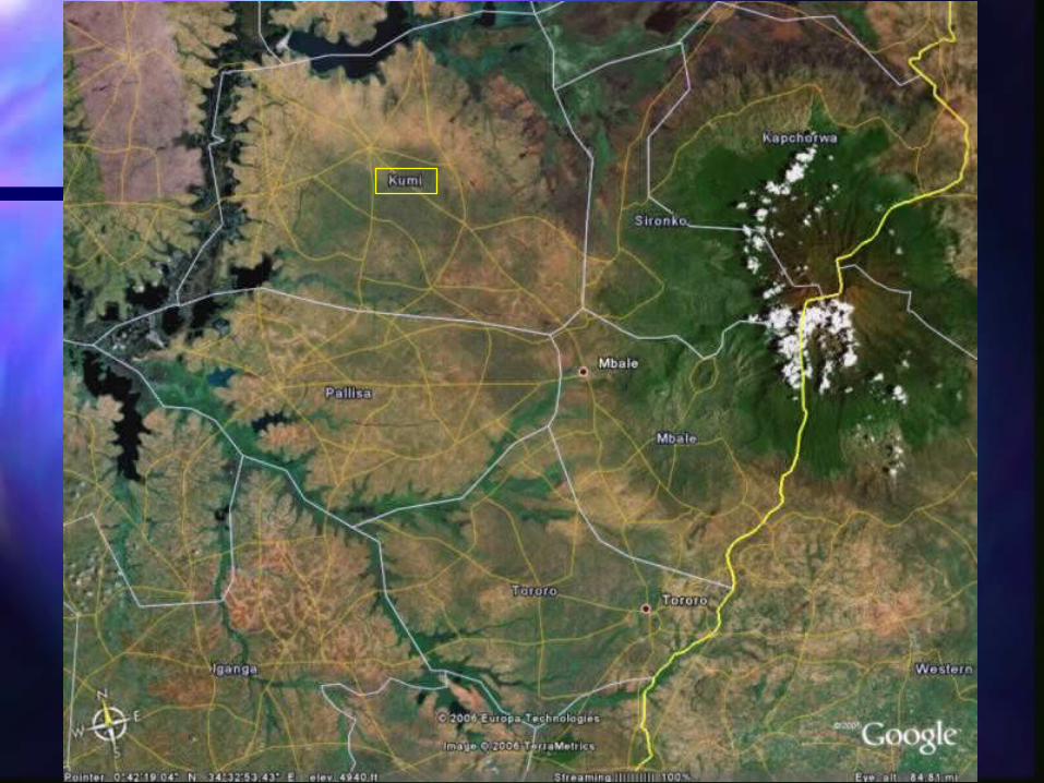
AFRICA

UGANDA

IntroductionStudy area : characteristicsPhysical bases of remote sensingImagery Digital image processingResultsConclusions

Kumi climatic diagram
0
20
40
60
80
100
120
140
160
180
200
Jan Feb Mar May Apr Jun Jul Aug Sep Oct Nov Dic
Months
Pre
cip
itat
ion
/ E
T (
mm
)
0
10
20
30
40
50
60
70
80
90
100
Tem
per
atu
re (
ºC )
Pp ET T max T min


Source: FAO

IntroductionStudy area : characteristicsPhysical bases of remote sensingImagery Digital image processingResultsConclusions


B RG NEAR IR MID INFRARED
500 1000 1500 2000 2500
010
2030
4050
Wavelength in nanometers
% R
efle
ctan
ce
water
Green vegetation
Dry vegetation
Soil
Generic spectral signatures

IntroductionStudy area : characteristicsPhysical bases of remote sensingImagery Digital image processingResultsConclusions

SPOT Satellite
Source: www.spotimage.com

SOURCE: SPOTIMAGE-CNESS
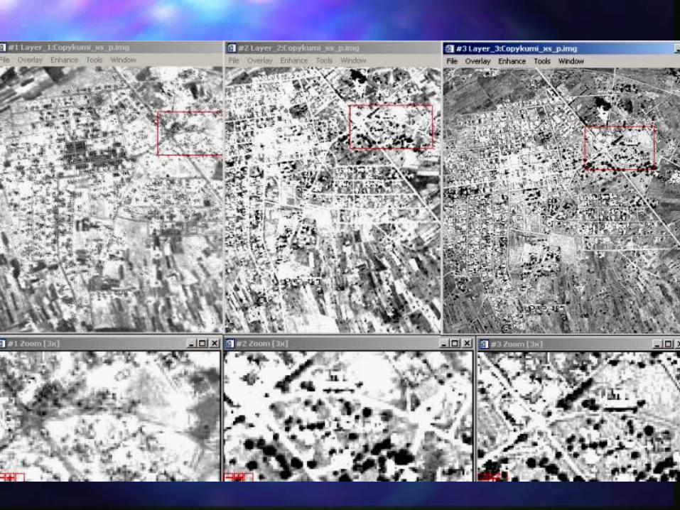
Kumi Spot Image 06-May-06

IntroductionStudy area : characteristicsPhysical bases of remote sensingImagery Digital processingResultsConclusions
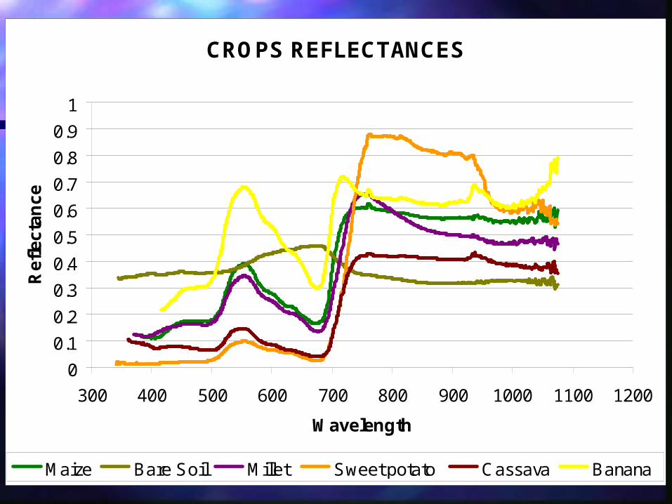
CROPS REFLECTANCES
0
0.1
0.2
0.3
0.4
0.5
0.6
0.7
0.8
0.9
1
300 400 500 600 700 800 900 1000 1100 1200
Wavelength
Re
fle
cta
nc
e
Maize Bare Soil Millet Sweet potato Cassava Banana


IntroductionStudy area : characteristicsPhysical bases of remote sensingImagery Digital image processingResultsConclusions
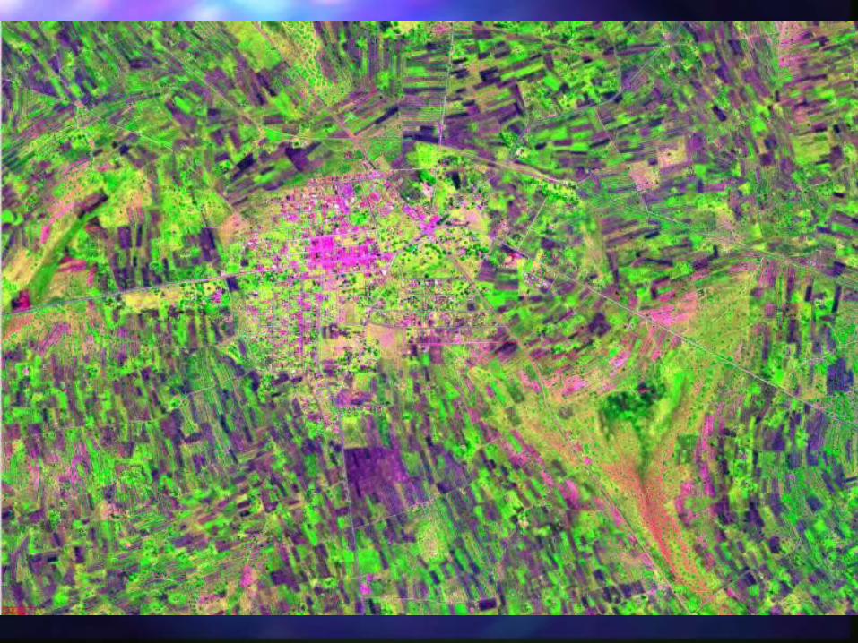


Sweet potato plot
Distribution of Sweet potato fields around Kumi town
IntroductionStudy area : characteristicsPhysical bases of remote sensingImagery Digital image processingResultsConclusions

Kumi Land cover - land use
Category Ha. %Water bodies 14769 5.7Wetland 16886 6.5Grassland/other crops 109564 42.4Sweet potato 28353 11.0Forest/mangoes 30354 11.7Urban-areas_Bare-soil 31390 12.1Fallow land 21310 8.2ND 5822 2.3
258447 100.0
LEGEND

Kumi Land cover - land use
Category Ha. %Water bodies 14769 5.7Wetland 16886 6.5Grassland/other crops 109564 42.4Sweet potato 28353 11.0Forest/mangoes 30354 11.7Urban-areas_Bare-soil 31390 12.1Fallow land 21310 8.2ND 5822 2.3
258447 100.0
LEGEND Area planted by Kumi for Sweet potato
0
5,000
10,000
15,000
20,000
25,000
30,000
1992 1993 1994 1995 1996 1997 1998 1999 2000 2001 2002 2,003
Year
Ha.

THANKSTHANKS