Embed Size (px)
Citation preview

“REMEMBER THE ALAMO”
USING 3-D GIS
Michael A. Garza, GISP
Pape-Dawson Engineers2000 NW Loop 410
San Antonio, TX. 78213


IT’S TIME TO REIMAGINE THE ALAMO.
The Alamo is one of the most important historical sites in
the world. With a story more than 300 years old, it’s no
wonder that more than one million people come to see it
each year. They come to learn about its days as a Spanish
mission or to walk the ground Lt. Col. William Barret Travis
did before he wrote his “victory or death!” letter. These
hallowed grounds have a big story to tell, but after
centuries of urban development, that story is often
misunderstood.
That is about to change.In 2015 the State of Texas General Land Office, the City
of San Antonio, and the private Alamo Endowment are
teaming up to Reimagine the Alamo by developing a new
master plan for the Alamo and surrounding acres.
A draft plan was unveiled late in 2016. https://reimaginethealamo.org/

LIDAR

The Alamo Compound in 1836

3D Representation of the Alamo

1842
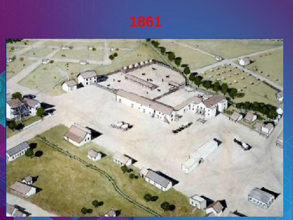
1861

1880
Commercial Development

1890

1910

1912
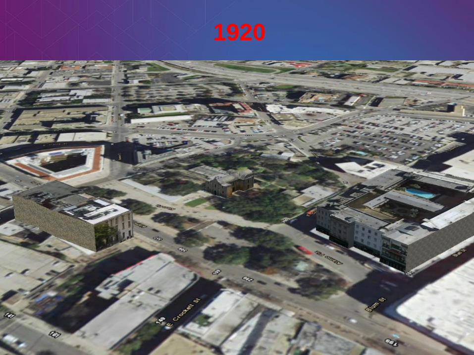
1920

1937

1968

Where the Alamo Compound Would Sit Today

The Front Entrance of the Alamo in 3D

The Museum Shops

The Menger Hotel

The Federal Building & The Emily Morgan Hotel

The Ripley’s Building
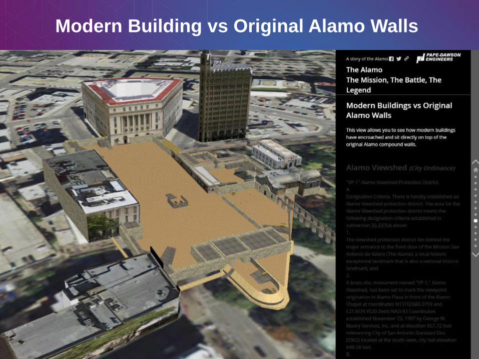
Modern Building vs Original Alamo Walls

The Alamo Viewshed

Protecting the Alamo

Archaeological Findings

Current Ortho Image of the Alamo

Architects Future Layout of the Alamo

Pape-Dawson Engineers
2000 NW Loop 410
San Antonio, TX. 78213
Presenter: Michael A. Garza, GISP
Email: [email protected]
Phone: 210-375-9000 Ext. 426

Model to convert a KML layer to ArcGIS Pro and Publish

1849
First Known Photograph of the Alamo
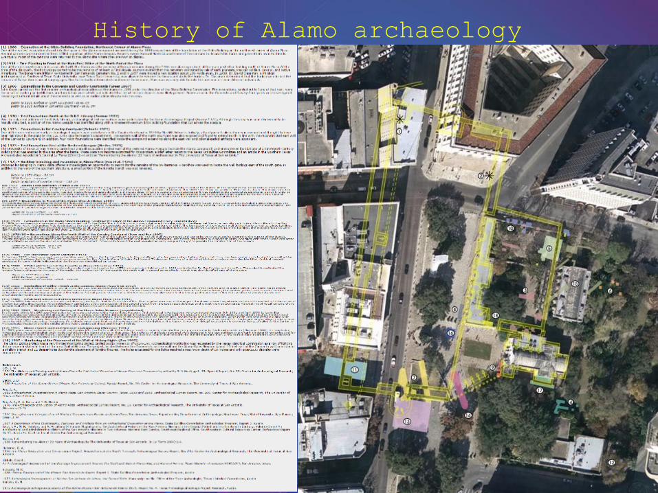
History of Alamo archaeology