Embed Size (px)
Citation preview

Service New Brunswick UGE1998N
Services Nouveau-Brunswick Version 0.8March 6, 2001
User Guideto the
Digital Topographic Data Base 1998 (DTDB98)of New Brunswick
DOCUMENT VERSION 0.8
SERVICE NEW BRUNSWICK
The material in this Guide reflects SNB’s best judgement in light of the information available at the time of its preparation. Any usewhich a third party makes of this Guide, or any reliance on / or decisions to be made based on it, are the responsibility of such thirdparties. SNB accepts no responsibility for damages, if any, suffered by any third party as a result of decisions made or actionsbased on this Guide.

Users’ Guide to the Digital Topographic Data Base (DTDB98) of New Brunswick
Service New Brunswick UGE1998N
Services Nouveau-Brunswick Version 0.8March 6, 2001
2
The material in this Guide reflects SNB’s best judgement in light ofthe information available at the time of its preparation. Any usewhich a third party makes of this Guide, or any reliance on / ordecisions to be made based on it, are the responsibility of such thirdparties. SNB accepts no responsibility for damages, if any, sufferedby any third party as a result of decisions made or actions based onthis Guide.

Users’ Guide to the Digital Topographic Data Base (DTDB98) of New Brunswick
Service New Brunswick UGE1998N
Services Nouveau-Brunswick Version 0.8March 6, 2001
3
Table of Contents
About this Guide ....................................................................................................................................................................8Organization.........................................................................................................................................................................10Document References.........................................................................................................................................................13List of Acronyms..................................................................................................................................................................14Quick Facts ..........................................................................................................................................................................16Major differences between ETB96 and DTDB98 .............................................................................................................18
SECTION 1 INSTALLING THE DIGITAL TOPOGRAPHIC DATA BASE................................................................20
INTRODUCTION .................................................................................................................................................................20PRODUCT NAMING CONVENTIONS.....................................................................................................................................20RECEIVING THE DTDB GRAPHIC AND ATTRIBUTE FILES.....................................................................................................22RECEIVING THE DTDB SUPPORT FILES...............................................................................................................................25GUIDELINES FOR INSTALLING DTDB FILES.........................................................................................................................28GUIDELINES FOR INSTALLING ETB ATTRIBUTE FILES..........................................................................................................30GUIDELINES FOR INSTALLING DTDB SUPPORT FILES..........................................................................................................32NOTES ON INSTALLATION ..................................................................................................................................................34VERIFYING THE INSTALLATION ..........................................................................................................................................35
SECTION 2 CONTENTS OF THE ETB98 FILES ...........................................................................................................36
INTRODUCTION .................................................................................................................................................................36DEFINITIONS......................................................................................................................................................................36DATA SOURCES FOR THE ETB............................................................................................................................................38
Original Source...........................................................................................................................................................38Additional Sources......................................................................................................................................................38
TYPICAL FILE SIZES ...........................................................................................................................................................39ABOUT THE ETB FILES ......................................................................................................................................................39
Accuracy and Scale.....................................................................................................................................................40Currency .....................................................................................................................................................................40Themes........................................................................................................................................................................40Structured and Non Structured Themes .....................................................................................................................41Source Identifier .........................................................................................................................................................45Feature Code..............................................................................................................................................................48Logical Consistency....................................................................................................................................................51Transportation Network (Theme 100)........................................................................................................................54Transportation Associated Features (Theme 110) .....................................................................................................54Roads ..........................................................................................................................................................................54Ramps .........................................................................................................................................................................55Railroads.....................................................................................................................................................................56Transportation Theme Index Keys .............................................................................................................................57
ABOUT THE HYDROGRAPHY THEMES .................................................................................................................................57Hydrography (Theme 300)..........................................................................................................................................57Hydrographic Spines and Connectors (Theme 310)...................................................................................................57Associated Hydrography (Theme 320) .......................................................................................................................58Waterbodies ................................................................................................................................................................58Rivers ..........................................................................................................................................................................59Coastline.....................................................................................................................................................................60Swamps.......................................................................................................................................................................60Spines and Connectors ...............................................................................................................................................61Coastal Features ........................................................................................................................................................62
Feature Code Hierarchy Designation ......................................................................................................................... 63

Users’ Guide to the Digital Topographic Data Base (DTDB98) of New Brunswick
Service New Brunswick UGE1998N
Services Nouveau-Brunswick Version 0.8March 6, 2001
4
Hydrographic Theme Index Keys ...............................................................................................................................65ABOUT THE BUILDINGS THEME................................................................................................................................65KNOWN LIMITATIONS OF THE DTDB.................................................................................................................................66
Non Structured Themes ..............................................................................................................................................66Data Format Differences............................................................................................................................................67Edge Matching............................................................................................................................................................69Road Centreline Positional Accuracy.........................................................................................................................69Road Name Issue ........................................................................................................................................................70Road Centreline Completeness...................................................................................................................................70DNR Roads..................................................................................................................................................................70R98 Files .....................................................................................................................................................................71D98 Files.....................................................................................................................................................................71Elevations ...................................................................................................................................................................71Currency of Mapping..................................................................................................................................................72Maintenance ...............................................................................................................................................................72Coast Line and Spine Features...................................................................................................................................72Line Weights of Features............................................................................................................................................72Additional Road Issues................................................................................................................................................73
SECTION 3 CONTENTS OF THE ETB ATTRIBUTE FILES .......................................................................................74
INTRODUCTION .................................................................................................................................................................74DEFINITIONS......................................................................................................................................................................74DATA SOURCES FOR THE ETB ATTRIBUTE FILES ................................................................................................................74TYPICAL FILE SIZES ...........................................................................................................................................................75
Road Attribute File .....................................................................................................................................................75Hydrographic Attribute File .......................................................................................................................................75
ABOUT THE ETB ATTRIBUTE FILES....................................................................................................................................75Road Attribute File .....................................................................................................................................................75Hydrographic Attribute File .......................................................................................................................................77Links to Topographic Features ..................................................................................................................................77DNRE Resource Roads Attribute................................................................................................................................78
SECTION 4 WORKING WITH THE ETB FILES...........................................................................................................80
INTRODUCTION .................................................................................................................................................................80DISPLAYING ETB FILE DATA .............................................................................................................................................80
By Theme/User Number..............................................................................................................................................80By Feature Code Hierarchy........................................................................................................................................81By Source ID...............................................................................................................................................................82By Attribute Value ......................................................................................................................................................84
SPATIAL ANALYSIS CAPABILITIES ......................................................................................................................................86Transportation Network Theme (100)........................................................................................................................86Hydrographic Network Themes (300 and 310) ..........................................................................................................86Other Spatial Analysis ................................................................................................................................................87
CREATING USER ATTRIBUTE FILES.....................................................................................................................................87Use of Keys.................................................................................................................................................................87What to Do..................................................................................................................................................................88What Not to Do...........................................................................................................................................................89Adding New Topographic Features............................................................................................................................89Use of Separate Themes .............................................................................................................................................89Use of ETB Feature Code Hierarchy .........................................................................................................................90Use of ETB Source ID Standards ...............................................................................................................................91Accuracy Considerations............................................................................................................................................91
USE OF FEATURE INDEX KEYS............................................................................................................................................92

Users’ Guide to the Digital Topographic Data Base (DTDB98) of New Brunswick
Service New Brunswick UGE1998N
Services Nouveau-Brunswick Version 0.8March 6, 2001
5
USING ETB FILES WITH DTM AND OTHER DIGITAL PRODUCTS.......................................................................................92SNB DTM Data Base ..................................................................................................................................................93SNB Digital Property Map Data Base ........................................................................................................................93Other Digital Products ...............................................................................................................................................94
JOINING ETB FILES............................................................................................................................................................95Concepts.....................................................................................................................................................................95Size Considerations.....................................................................................................................................................95Data Filtering .............................................................................................................................................................96Removal of Neat Lines................................................................................................................................................96Map Index Files and Vertical Data Bases ..................................................................................................................97
GUIDELINES FOR MAINTAINING THE ETB...........................................................................................................................97Production Libraries...................................................................................................................................................97CARIS File Size Considerations..................................................................................................................................97Minimizing Customization of ETB Files .....................................................................................................................98
SECTION 5 CONTENTS OF THE DTM FILES .............................................................................................................99
INTRODUCTION .................................................................................................................................................................99ABOUT THE DTM DATA BASE...........................................................................................................................................99DEFINITIONS......................................................................................................................................................................99ABOUT SOURCE IDENTIFIERS ...........................................................................................................................................100ABOUT THEME / USER NUMBERS .....................................................................................................................................100ABOUT FEATURE CODES..................................................................................................................................................100ABOUT THE SPATIAL FRAMEWORK ..................................................................................................................................101ABOUT LOGICAL CONSISTENCY .......................................................................................................................................101
SECTION 6 WORKING WITH THE DTM FILES .......................................................................................................102
INTRODUCTION ...............................................................................................................................................................102CHARACTERISTICS OF DTMS ...........................................................................................................................................102TYPICAL FILE SIZES .........................................................................................................................................................102DATA COLLECTION PRACTICES........................................................................................................................................103ACCURACY......................................................................................................................................................................105WORKING WITH THE SPATIAL FRAMEWORK.....................................................................................................................105WORKING WITH FILE RESOLUTION...................................................................................................................................105GEOMETRIC EFFECTS IN DTM DATA ...............................................................................................................................106
SECTION 7 ORDERING THE DIGITAL TOPOGRAPHIC DATA BASE.................................................................108
INTRODUCTION ...............................................................................................................................................................108PREPARING TO ORDER.....................................................................................................................................................108ORDERING DTDB FILES FROM AN SNB OFFICE...............................................................................................................109ORDERING DTDB FILES THROUGH SNB ONLINE.............................................................................................................110
Downloading ETB Files............................................................................................................................................111
SECTION 8 DATA LICENSING AGREEMENT..........................................................................................................115
INTRODUCTION ...............................................................................................................................................................115
SECTION 9 SNB OFFICES .............................................................................................................................................120
SNB OFFICES AND LOCATIONS........................................................................................................................................121DIGITAL TOPOGRAPHIC DATA BASE (DTDB) .......................................................................................................124ORDER FORM..............................................................................................................................................................124

Users’ Guide to the Digital Topographic Data Base (DTDB98) of New Brunswick
Service New Brunswick UGE1998N
Services Nouveau-Brunswick Version 0.8March 6, 2001
6
Appendices
Appendix A- Frequently Asked Questions................................................................................................................................125Appendix B - ETB Feature Codes...........................................................................................................................................127Appendix C - ETB Feature Codes By File ...............................................................................................................................138Appendix D - Naming Convention for Support Files..................................................................................................................146Appendix E - Dates of Photography ........................................................................................................................................149Appendix F - PDP and VAX Compilation Areas ......................................................................................................................150Appendix G - Sample ETB File CARIS Header .......................................................................................................................151Appendix H - Feature Codes Used to Define Areas Of Exclusion in Digital Terrain Model Files .................................................152Appendix I – Location of 1996 and 1997 Photography ..............................................................................................................155Appendix J - D98 Files with Points within 1m of neatline...........................................................................................................156Appendix K – Updated Coastal Window..................................................................................................................................157Appendix L – DTM’s from Contours.......................................................................................................................................159Appendix M – DOT Extra Issues............................................................................................................................................160Appendix N – DTDB98 Merge Utility Program.......................................................................................................................163
LIST OF TABLES
TABLE 1 - ETB FILE THEMES..................................................................................................................................................41TABLE 2 - DATA SOURCE CODES ............................................................................................................................................46TABLE 3 - METHOD OF DATA CAPTURE .................................................................................................................................46TABLE 4 - EXPECTED ACCURACY............................................................................................................................................47TABLE 5 - EDITING ORGANIZATIONS ......................................................................................................................................47TABLE 6 - DAY OF CAPTURE ..................................................................................................................................................48TABLE 7 - MONTH OF CAPTURE.............................................................................................................................................48TABLE 8 - FEATURE CODE CLASSIFICATIONS AND DESCRIPTIONS............................................................................................49TABLE 9 - PRIMARY FEATURE CODE QUALIFIERS....................................................................................................................50TABLE 10 - SECONDARY FEATURE CODE QUALIFIERS.............................................................................................................50TABLE 11 - ALLOWABLE RELATIONSHIPS ................................................................................................................................54TABLE 12 - ROAD NETWORK CLASSIFICATION........................................................................................................................55TABLE 13 - WATERBODY CLASSIFICATION..............................................................................................................................59TABLE 14 - RIVER CLASSIFICATION.........................................................................................................................................59TABLE 15 - NON STRUCTURED THEMES..................................................................................................................................66TABLE 16 - MAJOR DIFFERENCES BETWEEN PDP AND VAX TOPOGRAPHIC FILES...................................................................67TABLE 17 - FORMER PROCESSING LEVEL DIFFERENCES............................................................................................................68TABLE 18 - VAX FEATURE CODE HIERARCHY.........................................................................................................................69TABLE 19 - ROAD ATTRIBUTE FILE LAYOUT ...........................................................................................................................76TABLE 20 - HYDROGRAPHIC ATTRIBUTE FILE LAYOUT ...........................................................................................................78TABLE 21 – DNRE FIELD DESCRIPTIONS ................................................................................................................................78TABLE 22 - FEATURE CODE CLASSIFICATIONS AND DESCRIPTIONS........................................................................................101TABLE 23 - SELECTING MEDIA FOR DTDB FILES ..................................................................................................................109
Users’ Guide to the Digital Topographic Data Base (DTDB98) of New Brunswick
Service New Brunswick UGE1998N
Services Nouveau-Brunswick Version 0.8March 6, 2001
7
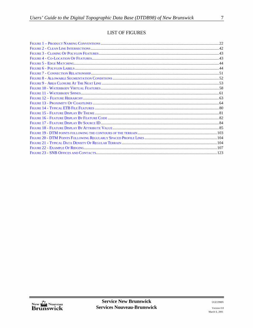
LIST OF FIGURES
FIGURE 1 – PRODUCT NAMING CONVENTIONS .......................................................................................................................22FIGURE 2 - CLEAN LINE INTERSECTIONS .................................................................................................................................42FIGURE 3 - CLOSING OF POLYGON FEATURES.........................................................................................................................43FIGURE 4 - CO-LOCATION OF FEATURES................................................................................................................................43FIGURE 5 - EDGE MATCHING..................................................................................................................................................44FIGURE 6 - POLYGON LABELS .................................................................................................................................................44FIGURE 7 - CONNECTION RELATIONSHIP.................................................................................................................................51FIGURE 8 - ALLOWABLE SEGMENTATION CONDITIONS ...........................................................................................................52FIGURE 9 - AREA CLOSURE AT THE NEAT LINE ......................................................................................................................53FIGURE 10 - WATERBODY VIRTUAL FEATURES.......................................................................................................................58FIGURE 11 - WATERBODY SPINES...........................................................................................................................................61FIGURE 12 – FEATURE HIERARCHY.........................................................................................................................................63FIGURE 13 - PROXIMITY OF COASTLINES ...............................................................................................................................64FIGURE 14 - TYPICAL ETB FILE FEATURES .............................................................................................................................80FIGURE 15 - FEATURE DISPLAY BY THEME .............................................................................................................................81FIGURE 16 - FEATURE DISPLAY BY FEATURE CODE ................................................................................................................82FIGURE 17 - FEATURE DISPLAY BY SOURCE ID.......................................................................................................................84FIGURE 18 - FEATURE DISPLAY BY ATTRIBUTE VALUE ...........................................................................................................85FIGURE 19 - DTM POINTS FOLLOWING THE CONTOURS OF THE TERRAIN................................................................................103FIGURE 20 - DTM POINTS FOLLOWING REGULARLY SPACED PROFILE LINES .........................................................................104FIGURE 21 - TYPICAL DATA DENSITY OF REGULAR TERRAIN ................................................................................................104FIGURE 22 - EXAMPLE OF RIDGING......................................................................................................................................107FIGURE 23 - SNB OFFICES AND CONTACTS..........................................................................................................................123

Users’ Guide to the Digital Topographic Data Base (DTDB98) of New Brunswick
Service New Brunswick UGE1998N
Services Nouveau-Brunswick Version 0.8March 6, 2001
8
About this Guide
Purpose
The purpose of this Guide is to provide an introduction to and a working knowledge of theService New Brunswick (SNB) Digital Topographic Data Base 1998 (DTDB98). TheDTDB98 consists of two data base products: the Digital Topographic Data Base (DTDB98)and the Coastal Topographic Data Base (CTDB98). Each DTDB98 file consists of a suiteof files containing the planimetric data, the Enhanced Topographic Data Base (ETB98) andthe elevation data, Digital Terrain Model Data Base (DTM98).
Scope
This Guide describes the structure and content of the DTDB98 files and provides guidelinesfor transferring data from SNB to users. The Guide does not provide step-by-stepprocedures for using files in Computer Aided Design (CAD), map browser or GeographicInformation Systems (GIS).
Audience
This Guide was prepared to assist those who wish to use digital topographic data within theProvince of New Brunswick.
Pre-requisites
This Guide assumes the user has a basic knowledge of digital geographic data and how thisdata is stored within a CAD system (for example, AutoCad), map browser (for example,MapInfo) or GIS system (for example CARIS) to be used with the DTDB data. A knowledgeof Relational Database Management Systems (RDBMS) and the data base design techniquesused to store data within these systems is also assumed.
Some GIS software systems require special modules to manipulate and / or display DTMfiles. If you are unsure, please consult with your GIS vendor.
Versions of the Digital Topographic Data Base
The Digital Topographic Data Base (DTDB) will be updated over time to reflect changesto features contained within it. Each version of the DTDB will be identified by a two-digitVersion Number. The version means that the files are current to the end of year stated. Forexample, the version number for files current to the end of 1998 is 98.

Users’ Guide to the Digital Topographic Data Base (DTDB98) of New Brunswick
Service New Brunswick UGE1998N
Services Nouveau-Brunswick Version 0.8March 6, 2001
9
The current version of the DTDB will be indicated as follows:
• the version number will be attached as a suffix to the data base product name in formDTDByy (for example, DTDB98);
• the version number will be attached as a suffix to the file name extensions of theindividual DTDB Map Files and DTDB Attribute Files:
- 1yy for ETB Road Theme- 3yy for ETB Hydrographic Theme- gyy for all other ETB map theme- ryy for ETB Road Attribute files- hyy for ETB Hydrographic Attribute files- nyy for ETB DNRE Road Attribute files- dyy for Digital Terrain Model files- rxf for 198 files in DXF format- hxf for 398 files in DXF format- gxf for g98 files in DXF format; and- xyz for Digital Terrain Model data in xyz format
For ETB98 files, the file name extensions for the above files is 198, 398, G98, H98, R98,and N98 respectively.
For DTM98 files, the file name extension is D98.
Each version of the DTDB will also be associated with a Specification Number, whichidentifies the level of the structuring specification used to compile the data.
Current Version and Structuring Specification of the DTDB
Version: 98 (last changes made at the end of 1998)Specification: 0.3
Versions of the DTM Data Base
Structuring of the SNB DTM Data Base was completed in 1995. In 1997 this data base wasconverted to the NAD83(CSRS). The 1998 version was subjected to some minor updates.

Users’ Guide to the Digital Topographic Data Base (DTDB98) of New Brunswick
Service New Brunswick UGE1998N
Services Nouveau-Brunswick Version 0.8March 6, 2001
10
Organization
The Guide is divided into nine sections and thirteen appendices.
Section 1 Installing the Digital Topographic Data Base
This section deals with the transfer of data from the supplied media to your computer. It provides a set of file naming conventions, lists the files you receive from SNB andprovides guidelines for transferring the data. It also provides a "checklist" to ensurethat all data has been properly transferred.
Section 2 Contents of the ETB98 Files
This section deals with the contents and organization of the ETB98 Files. It definesterms needed to understand the contents and structure of the topographic data, anddescribes the various sources from which the files were constructed. The section alsotells how data is organized within the files, and provides more detailed informationon the topologically structured layers. Current limitations of the files are alsodiscussed.
Section 3 Contents of the ETB98 Attribute Files
This section deals with the contents and organization of the ETB98 Attribute Files. Itdefines terms needed to understand the contents and structure of these files, tells howinformation is organized within the files, and provides an overview of how theattribute files are linked to the topographic files.
Section 4 Working with the ETB Files
This section provides explanations and guidelines for working with your digitaltopographic data. It includes guidelines for enhancement of the files, integration of thedigital topographic data base files with other datasets, and ongoing maintenance of thefiles.
Section 5 Contents of the DTM Files
This section deals with the contents and organization of the Digital Terrain Model(DTM) Files. It defines the terms, explains the format of the files which comprise thedata base, and describes the presentation of the data.

Users’ Guide to the Digital Topographic Data Base (DTDB98) of New Brunswick
Service New Brunswick UGE1998N
Services Nouveau-Brunswick Version 0.8March 6, 2001
11
Section 6 Working with the DTM Files
This section provides explanations and guidelines for working with Digital TerrainModel data.
Section 7 Ordering the Digital Topographic Data Base
This section contains information on how to order Digital Topographic Data Base(DTDB) files to suit your applications.
Section 8 Data Licensing Agreement
This section contains a sample of the SNB Data Licensing Agreement.
Section 9 SNB Offices
This section lists the address and telephone number for each of the SNB Offices. Thesection also includes an order form for Digital Topographic Data Base Files.
Appendix A Frequently Asked Questions
This Appendix provides a list of common questions concerning the DigitalTopographic Data Base along with responses to these questions.
Appendix B ETB Feature Codes
This Appendix presents a list of the valid Feature Codes that may be present withinthe ETB98, along with a description and the topological status of each Feature.
Appendix C ETB Feature Codes By File
This Appendix presents a list of valid Feature Codes broken down by each file *.d98,*.198, *.g98, and *.398.
Appendix D Naming Convention of Support Files
This Appendix provides information on the SNB File Naming Convention of supportfiles.
Appendix E Dates of Photography
This Appendix shows the dates of photography used for the original compilation of theDTDB files on a provincial map overlay.

Users’ Guide to the Digital Topographic Data Base (DTDB98) of New Brunswick
Service New Brunswick UGE1998N
Services Nouveau-Brunswick Version 0.8March 6, 2001
12
Appendix F PDP and VAX Compilation Areas
This Appendix shows the areas which were compiled using PDP and VAX methodson a provincial map overlay.
Appendix G Sample ETB File CARIS Header
This Appendix contains the listing for a representative DTDB File CARIS Header.
Appendix H Feature Codes Used to Define Areas of Exclusion in Digital Terrain Model Files
This Appendix supplies a list of feature codes of digital topographic data used to formthe boundaries of areas excluded from the collection of DTM points in the DTM Files.
Appendix I Location of 1996 and 1997 Photograph.
This Appendix shows the 1996 and 1997 photography used to complete coastalfeatures for DTDB98 1:10,000 windows.
Appendix J D98 Files With Points With 1 m of Neatline .
This Appendix lists the D98 files with points within 1 metre of the neatline.
Appendix K Updated Coastal Windows
This Appendix provides a list of windows with coastal features updated from the 1996and 1997 photography.
Appendix L DTM’s from Contours
This appendix provides a list of map windows with some DTM data collected fromcontours.
Appendix M DOT Extra Issues
The appendix provides details of issues identified by NBDOT relating to the 198 andr98 files

Users’ Guide to the Digital Topographic Data Base (DTDB98) of New Brunswick
Service New Brunswick UGE1998N
Services Nouveau-Brunswick Version 0.8March 6, 2001
13
Appendix N DTDB98 Merge Utility Program
The appendix provides details of the DTDB98 map file merge utility. This utility isa tool to aid merging of the individual layers of one or more DTDB98 map files intoa single CARIS Edit file.
Document References
This section contains a list of references which the user may find informative for more specific anddetailed information concerning digital mapping, Geographic Information Systems, other SNB digitalmapping products, and other topics discussed within this guide.
It should be noted that this list is not exhaustive. It rather represents a sample of reference materialswhich provide further insight into these topics.
1. As Built Technical Specifications for the New Brunswick Enhanced Topographic Data Base:Specification 0.3, Service New Brunswick, February 2001.
2. New Brunswick Land and Water Information Standards Manual: 1998 Edition, Service NewBrunswick, July 1998.

Users’ Guide to the Digital Topographic Data Base (DTDB98) of New Brunswick
Service New Brunswick UGE1998N
Services Nouveau-Brunswick Version 0.8March 6, 2001
14
List of Acronyms
The following acronyms are used within this document.
Acronym Long Form
ASCII American Standard Code for Information Exchange.
ATS77 Average Terrestrial System, 1977
CAD Computer Aided Drafting
CARIS GIS software owned and developed by CARIS.
CARIS ASCII A data interchange format used with the CARIS GIS software product.This format is used for ETB Data Base files distributed on CD-ROM.
CARIS NTX A data interchange format used with the CARIS GIS software product.
CD-ROM Compact Disk Read Only Memory
CTDB Coastal Topographic Data Base
DPM Digital Property Maps
DTM Digital Terrain Model
DTDB Digital Topographic Data Base
DXF Digital Exchange Format, a data interchange format used by Map Browser andCAD system like AutoCAD
ETB Enhanced Topographic Base
FMB Forest Management Branch, Department of Natural Resources and Energy
FTP File Transfer Protocol
GIS Geographic Information System
GPS Global Positioning System
LRIS Land Registration Information Service
NAD83(CSRS) North American Datum 1983 Canadian Spatial Reference System

Users’ Guide to the Digital Topographic Data Base (DTDB98) of New Brunswick
Service New Brunswick UGE1998N
Services Nouveau-Brunswick Version 0.8March 6, 2001
15
Acronym Long Form
NBDNR&E New Brunswick Department of Natural Resources and Energy
NBDOT New Brunswick Department of Transportation
NBGIC New Brunswick Geographic Information Corporation
NTDB National Topographic Data Base
NTS National Topographic System
PDP Early series of computers manufactured by Digital Equipment Corporation
RDBMS Relational Data Base Management System
SNB Service New Brunswick
SODB Softcopy Orthophotomap Data Base
SQL Structured Query Language
VAX A series of computers manufactured by Digital Equipment Corporation
ZIP Lossless compression method/engine sold by Pkzip

Users’ Guide to the Digital Topographic Data Base (DTDB98) of New Brunswick
Service New Brunswick UGE1998N
Services Nouveau-Brunswick Version 0.8March 6, 2001
16
Quick Facts
The following is a brief summary of the SNB Digital Topographic Data Base (DTDB) product.
Data BaseComponents
The Digital Topographic Data Base consists of two distinct data bases anda common set of support files:
• the Enhanced Topographic Base (ETB) contains two-dimensional (X,Y)topographic features and associated attributes.
• the Digital Terrain Model (DTM) Data Base contains elevation data.
• the DTDB Support Files contain support files which may be required byCARIS and other GIS users, a Provincial File index to the DTDB, DTDBuser documentation in both English and French, Adobe Acrobat software,and various other support files.
ETB The ETB consists of:
• ETB Graphic Files which contain spatial features.
• ETB Attribute Files which contain descriptive text for spatial datafeatures.
DTM Data Base The Digital Terrain Model Data Base is a digital representation of elevationsthroughout the Province of New Brunswick, organized into individual DTMFiles with the same 1:10 000 windows used for the ETB Data Base. Thereare no attribute files associated with these files.
Coverage The DTDB covers the entire Province of New Brunswick. There are 1894individual 1:10 000 windows encompassing 0.1 degree in longitude (7.5kilometres) by 0.05 degree in latitude (5.5 kilometres). There arecorresponding DTM Files for each of these windows.
Content ETB Files contain topographic features organized into nine generalcategories: Buildings, Designated Areas, Delimiters, Land Cover, LandFeatures, Transportation (Road/Railroad), Structures, Utilities andHydrography. Transportation and Hydrography are each maintained in theirown files, *.198,*.398 respectively. The remaining seven general categoriesare maintained in one *.g98 file.
DTM Files, *.d98, contain elevation mass points, check points, and spotheights.

Users’ Guide to the Digital Topographic Data Base (DTDB98) of New Brunswick
Service New Brunswick UGE1998N
Services Nouveau-Brunswick Version 0.8March 6, 2001
17
Spatial Framework Reference System: NAD83(CSRS)Projection: Stereographic DoubleResolution (XY): 1.0 metreResolution (Z): 0.1 metreNominal Scale: 1:10 000Accuracy: ± 2.5 metres for well defined features
Logical Consistency The Transportation and Hydrography Themes of the ETB have beenstructured to New Brunswick logical consistency standards. All other datais unstructured at this time.
Currency The Transportation Themes of the ETB are current as of late 1998. CoastalFeatures, Coastal Buildings, and Coastal Hydrography themes of the ETB arecurrent as of 1996 or 1997 (See Appendix I). A list of these 1:10 000windows are provided in Appendix K. All other data are current as of thedate of the original photography from which they were derived (SeeAppendix E).
Attributes Index keys are present for Transportation linear features and for Hydrographylinear features, coastal feature polygons, and waterbody polygons within theETB Data Base. SNB feature attribute files are available for these features.
No other features currently have index keys.
CARIS Source Identifier and Feature Code attributes are available for allgraphic features.
Availability Contact your local SNB office (see table 24) or download through the SNBOnline (http://www.gnb.ca/snb/e).
Media Provincial coverage for the Digital Topographic Data Base is distributed onCD-ROM. Users requiring a small number of DTDB files can downloadthese files using the SNB Online service.
Some other media formats may be supplied. Consult your local SNB officefor details.
Data Format DTDB Files are provided in CARIS ASCII and DXF formats. Contact yourlocal SNB office for information on other possible formats.
DTDB Window Each DTDB File covers a geographic area encompassed by a spatial windowextending 0.1 degree in longitude (7.5 kilometres) and 0.05 degree in latitude(5.5 kilometres).

Users’ Guide to the Digital Topographic Data Base (DTDB98) of New Brunswick
Service New Brunswick UGE1998N
Services Nouveau-Brunswick Version 0.8March 6, 2001
18
Major differences between ETB96 and DTDB98
The major differences between ETB96 and DTDB98 relate to the following:
Division of graphic themesNew DNRE Road attribute file N98File namingConversion to NAD83(CSRS) datumNew coastal features and coastlineUpdated coastline in D98Building updates in coastal windowsUpdated roads and coastal featuresElimination of indexed ramp keys
In ETB96 all graphic themes were provided in the *.T96 file. These have been divided into 3 filesin ETB98; *.198 for road themes, *.398 for hydrographic themes, and *.G98 for all other themes.
In ETB98 a new attribute file, containing lineage information to DNRE roads was generated. The N98file contains this lineage information specific for DNRE’s use.
In ETB96 a single DXF version of the graphic themes were provided as *.dxf, while in ETB98, it hasbeen divided in 3 files:
*.rxf for road themes*.hxf for hydrographic themes*.gxf for general themes
ETB96 files and the DTM files were previously maintained on the ATS77 datum. All ETB98 filesand the D98 (DTM) files were translated to NAD83(CSRS).
ETB98 defined and mapped a series of coastline and coastal features. These features were collectedfrom 1996 – 97 aerial photography.
The coastline in the ETB98 has two coastlines. The first line is the landward limit line. It isidentified as the most landward edges of Coastal Marshes, Backshore Beaches, Rock Platforms andDunes. The second line is the ordinary high-water line. It is the most discernible mark on the groundcreated by the medium high tide between the spring and neap tides.
The two coastlines are combined into one line where the two lines merge.
Coastal features consist of Natural Coastal Features and Associated Coastal Features. These featuresoccur in the area between the two coastlines (ordinary highwater and landward limits lines).
Natural Coastal Features are Backshore Beaches, Backshore Rock Platforms, Coastal Marshes, Dunesand Dyked Land.

Users’ Guide to the Digital Topographic Data Base (DTDB98) of New Brunswick
Service New Brunswick UGE1998N
Services Nouveau-Brunswick Version 0.8March 6, 2001
19
Associated Coastal Features are man-made features associated with the Landward Limit of the CoastalFeatures area, the Ordinary High Water Mark or the Natural Coastal Features. Examples of thefeatures include rip-rap, wharves, breakwaters, drydocks, and dykes.
An elevation value ‘z’ was collected for each coastline feature WACFOH*. These features werecopied into the *.D98 file (WACFOH* in the *.398 do not have a ‘z’ value).
All data seaward of these new coastlines were removed from the D98 files.
Buildings are updated from aerial photography in the coastal windows as part of ETB98. Buildingson the 1996 – 97 aerial photography were compared to those in the ETB96. Changes were then madeto delete buildings that no longer exist and to add new ones.
Features on the Transportation Theme have been updated to reflect late 1998 conditions as containedin the NBDOT Road Inventory Data Base, the NBDNR&E Forest Management Branch Data Base. All other features are current as of the date of the aerial photography from which they have beencompiled (coastal features, hydrography and buildings were updated on the coastal windows(CTDB98) of the DTDB with the photography flown in 1996 – 97). The Source Identifier attributecontains information on the currency of individual features. There are 332 windows along the coastline that have been updated. (See Appendix K).
For the purpose of the ETB files, a ramp is defined as a section of road which connects a primaryroute to a secondary route in the vicinity of an at-grade intersection or grade separated interchange. The Feature Code RRRDRAMP is used to classify the ramps. Ramps were given specialconsideration within the ETB96 files; they were assigned special index keys which differed informat from those of other road linear features. These only appear in ETB98 as retired records. In ETB98 ramps were treated and indexed following the same rules used on all road features.

Users’ Guide to the Digital Topographic Data Base (DTDB98) of New Brunswick
Service New Brunswick UGE1998N
Services Nouveau-Brunswick Version 0.8March 6, 2001
20
SECTION 1 INSTALLING THE DIGITAL TOPOGRAPHIC DATABASE
INTRODUCTION
This section deals with the transfer of data from the supplied media to your computer. It provides aset of product naming conventions, lists the files you receive from SNB and provides guidelines fortransferring the data. It also provides a "checklist" to ensure that all data has been properlytransferred.
PRODUCT NAMING CONVENTIONS
In order to avoid confusion when referring to the various data products described within this Guide,the following naming conventions are used to ensure consistency in reference to specific data productsand individual files comprising these products.
SNB Digital Data Refers to the complete collection of digital data products available fromSNB, including the Softcopy Orthophotomap Data Base (SODB), DigitalTopographic Data Base (DTDB) and the Digital Property Map Data Base(DPM Data Base).
SoftcopyOrthophotomapData Base (SODB)
Refers to the digital files associated with the Provincial SoftcopyOrthophotomap Data Base product. It includes the orthophotomap image andits associated files.
Digital TopographicData Base (DTDB)
Refers to the complete collection of SNB digital topographic data baseproducts. It includes the Enhanced Topographic Base (ETB) and DigitalTerrain Models (DTM).
EnhancedTopographic Base(ETB )
Refers to the collection of digital files associated with the ETB product. Itincludes ETB Graphic Files and ETB Attribute Files.
ETB Graphic Files Refers to the digital maps (graphic features) of the ETB. These files areorganized into individual 1:10 000 windows and subdivided within eachwindow by major thematic group.
ETB Attribute Files Refers to the non-graphic attributes which describe individual ETB GraphicFile features. At present there are three ETB Attribute Files:
• Road Attribute Files describe transportation (road / rail) linear features.
• Natural Resource Road Attribute file, describes the origin of DNREroad features.

Users’ Guide to the Digital Topographic Data Base (DTDB98) of New Brunswick
Service New Brunswick UGE1998N
Services Nouveau-Brunswick Version 0.8March 6, 2001
21
• Hydrographic Attribute Files describe hydrographic linear features andwaterbody polygons.
Digital TerrainModels (DTM DataBase)
Refers to the digital files of elevation data which are associated with theDigital Topographic Data Base. There is a corresponding DTM GraphicFile for each ETB Graphic File.
DTDB Support Files Refers to the files which are used by CARIS and AutoCAD to defineindividual DTDB Graphic File features and their display characteristics, aswell as user documentation and other miscellaneous support files.
Digital Property MapData Base (DPM DataBase)
Refers to the digital files associated with the SNB Digital Property MapData Base product. This product includes DPM Graphic Files and DPMAttribute files.
DPM Graphic Files Refers to the digital maps of the DPM Data Base. These files containproperty parcel polygons which are identified by a unique parcel identifier(PID).
DPM Attribute Files Refers to the non-graphic attributes which describe individual DPM parcelsthrough the PID.
At present there are two DPM Attribute Files:
• Parcel Data contains information concerning parcel ownership, sizeand documents registered against it;
• Assessment Data contains information about assessment parcels andthe PIDs associated with each assessment parcel.
NBDOT RoadInventory Data Base
Refers to the collection of digital files maintained by the New BrunswickDepartment of Transportation (NBDOT) as an inventory of provincial roads.
NBDNR&E ForestManagement BranchData Base (FMB DataBase)
Refers to the collection of digital files maintained by the New BrunswickDepartment of Natural Resources and Energy (NBDNR&E) as an inventoryof forest management areas.

Users’ Guide to the Digital Topographic Data Base (DTDB98) of New Brunswick
Service New Brunswick UGE1998N
Services Nouveau-Brunswick Version 0.8March 6, 2001
22
Figure 1 illustrates the hierarchy associated with the above product naming conventions.
SNBDigital Data
Digital TopographicData Base (DTDB)
DTDB SupportFiles
Softcopy Orthophoto MapData Base (SODB)
Digital Property Map DataBase (DPM Data Base)
SODB FilesDigital Terrain Models
(DTM Data Base)
Digital EnhancedTopographic Base (ETB Data Base)
DTM FilesETB Attribute
FilesETB Topographic
Files
DPMGraphic Files
DPM AttributeFiles
Parcel DataAssessment
Data
Department ofTransportation
Department ofNatural Resources
Forest ManagementBranch Data Base(FMD Data Base)
NBDOT Road InventoryData Base
Figure 1 – Product Naming Conventions
RECEIVING THE DTDB GRAPHIC AND ATTRIBUTE FILES
Media If the entire provincial coverage of the DTDB is ordered, SNB will normallyprovide your digital topographic data on CD-ROM. Under certainconditions, data may be provided on other media, such as:
• ZIP diskette• Various tape media• Diskette (3.5", 1.44 Mb)• Files download from the SNB Online• Files attached to an e-mail
For more information on the use of alternative media, refer to Section 7 of theGuide.
Data Format DTDB files distributed on CD-ROM and through the SNB online will beprovided in compressed (.zip) file format. Under certain conditions, andwhen alternate media is requested, files may be provided in alternate dataformats. Refer to Section 7 of the Guide for further information concerningdata format options.
Data provided You will receive on the supplied media a compressed (.zip) file for each1:10 000 window. Each .zip file will contain the following files:
• A CARIS ASCII 1:10 000 ETB window, containing the Road themes withfilename in the form filename.1yy, where yy is the version of the digitalfile.

Users’ Guide to the Digital Topographic Data Base (DTDB98) of New Brunswick
Service New Brunswick UGE1998N
Services Nouveau-Brunswick Version 0.8March 6, 2001
23
• A CARIS ASCII 1:10 000 ETB window containing the Hydrographicthemes with the form filename.3yy.
• A CARIS ASCII 1:10 000 ETB window containing the General themewith the form filename.gyy.
• An AutoCAD DXF 1:10 000 ETB window containing the Road themeswith the filename in the form filename.rxf.
• An AutoCAD DXF 1:10 000 ETB window containing the Hydrographicthemes with the filename in the form filename.hxf.
• An AutoCAD DXF 1:10 000 ETB window containing the General themeswith the filename in the form filename.gxf.
• ETB Attribute Files for the transportation (.ryy) features, hydrographic(.hyy) features and natural resource roads (.nyy) features associated witheach ETB.
• A CARIS ASCII 1:10 000 DTM window corresponding to the ETBwindow, with filename in the format filename.dyy.
• An AutoCAD DXF 1:10 000 DTM window, with filename in theformat filename.xyz.
DTDB File Names The naming convention for DTDB files is based upon the latitude andlongitude (expressed in decimal degrees) of the South East corner of thewindow. These file names are coded as follows:
Where: aaaa
bbbb
aaaabbbb
Is the North latitude of the SE window corner,expressed as a 4-digit integer number in decimaldegrees to the nearest 0.01 degree.
Is the West longitude of the SE window corner,expressed as a 4-digit integer number in decimaldegrees to the nearest 0.01 degree.
Users’ Guide to the Digital Topographic Data Base (DTDB98) of New Brunswick
Service New Brunswick UGE1998N
Services Nouveau-Brunswick Version 0.8March 6, 2001
24
As an example, the DTDB file name for the window having its SE corner atlatitude 46º 00' 00" N (i.e., 46.00º) and longitude 66º 54' 00" W (i.e., 66.90º)is 46006690. The corresponding ETB98 and DTM98 file names wouldtherefore be as follows:
Road Theme - ETB File Name: 46006690.198Hydrographic Theme – ETB File Name: 46006690.398General Theme – ETB File Name: 46006690.g98Road Attributes – ETB File Name: 46006690.r98Hydrographic Attributes – ETB File Name: 46006690.h98DNRE Road Attributes – ETB File Name: 46006690.n98DTM File Name: 46006690.d98
Data Packaging Data supplied on CD-ROM are packaged on two (2) CDs, with each CDcontaining a set of .zip files for a portion of the province:
• CD 1 contains all DTDB 1:10 000 windows south of latitude 46.5
• CD 2 contains all DTDB 1:10 000 windows north of latitude 46.5
The packaging of data supplied on other media may vary according to themedia type and coverage area requested. A packing list will be supplied witheach order indicating which files are contained on each individual media unit.
Note that, regardless of the media requested, the DTDB Support Files mustbe downloaded from the SNB Online site. Refer to Section 7 of this Guidefor further information on how to download files using the SNB Online.

Users’ Guide to the Digital Topographic Data Base (DTDB98) of New Brunswick
Service New Brunswick UGE1998N
Services Nouveau-Brunswick Version 0.8March 6, 2001
25
RECEIVING THE DTDB SUPPORT FILES
Media Irrespective of the media on which the DTDB Graphic and Attribute Files areobtained, the DTDB Support Files must be downloaded using the SNBOnline. Section 7 of this Guide contains specific instructions for accessingand using the Browser.
Data Format DTDB Support Files are downloaded in compressed file (.zip) format. These files are divided into the following categories:
• CARIS Support Files - These files are required by CARIS GIS software.The complete suite of the CARIS support files have been packaged intoa single compressed archive file ETB1998*.zip, where * refers to theversion a - z. There are five (5) CARIS Support Files. They are asfollows:
ETB1998A.col Enhanced Topographic Base 1998 Colour table file(CARIS Format) Version A. This file controls thecolour of features.
ETB1998A.cma Enhanced Topographic Base 1998 Colour map file(CARIS Format) Version A. This file controls thehue, lightness and saturation of colours.
ETB1998A.bin Enhanced Topographic Base 1998 Symbol file(CARIS Binary Format) Version A. This filecontrols the display of symbols.
ETB1998A.dat Enhanced Topographic Base 1998 Symbol file(CARIS ASCII Windows Format) Version A. Thisfile controls the display of symbols.
ETB1998A.txt Enhanced Topographic Base 1998 Master file(CARIS Format) Version A. This file is required toload the SODB files in CARIS.
• AutoCAD Support Files – these files are required to properly symbolizeDTDB graphic features in AutoCAD. The compressed archive fileDXF1998A.zip contains the following two (2) files:
DXF1998A.shxDXF1998A.shp

Users’ Guide to the Digital Topographic Data Base (DTDB98) of New Brunswick
Service New Brunswick UGE1998N
Services Nouveau-Brunswick Version 0.8March 6, 2001
26
• Information Files – these include the Users’ Guide and distributionagreement for the Digital Topographic Data Base in English.
UGE1998A.zip Digital Topographic Data Base 1998 User Guide inthe English language (Adobe Acrobat Format)Version A. The extracted file name isUGE1998A.pdf.
AGR1998A.zip Enhanced Topographic Base 1998 and DigitalTerrain Model distribution agreement (AdobeAcrobat format) Version A. The extracted file nameis AGR1998A.pdf
• Map Index Files – These are Provincial Index files containing the NewBrunswick 1:10 000, 1:50 000 and 1:250 000 windows in CARIS ASCII,DXF and PRN formats Version A. The compressed archive fileNDX1998A.zip contains the following index files:
NDX1998A.asc 1998 index of the province - It shows the1:250 000 windows, the 1:250 000 windownumbers, 1:50 000 windows, the 1:50 000 windownumbers, the 1:10 000 windows, the 1:10 000 filenames, the county boundaries and the outline of theprovince (CARIS format) Version A.
NDX1998A.prn 1998 index of the province - It shows the1:250 000 windows, the 1:250 000 windownumbers, 1:50 000 windows, the 1:50 000 windownumbers, the 1:10 000 windows, the 1:10 000 filenames, the county boundaries and the outline of theprovince (HP DesignJet 750C Plus or compatibleformat) Version A.
NDX1998A.dxf 1998 index window of the province - It shows the1:250 000 windows, the 1:250 000 windownumbers, 1:50 000 windows, the 1:50 000 windownumbers, the 1:10 000 windows, the 1:10 000 filenames, the county boundaries and the outline of theprovince (AutoCad format) Version A.
More information on the Naming Convention of theSupport Files is provided in Appendix D.

Users’ Guide to the Digital Topographic Data Base (DTDB98) of New Brunswick
Service New Brunswick UGE1998N
Services Nouveau-Brunswick Version 0.8March 6, 2001
27
• CARIS utility file is a user friendly software utility that works withCARIS GIS to merge multiple map windows and multiple graphic themes. It consists of the following file:
MRG1998A.zip Contains all software and documentation to installand use the DTDB98 Merge Utility

Users’ Guide to the Digital Topographic Data Base (DTDB98) of New Brunswick
Service New Brunswick UGE1998N
Services Nouveau-Brunswick Version 0.8March 6, 2001
28
GUIDELINES FOR INSTALLING DTDB FILES
Hints If individual windows are requested or the DTDB is ordered on media otherthan CD-ROM or through the SNB Online, perform a directory check of themedia to ensure that all files are present.
Create a temporary directory on your system for the files being transferredfrom the supplied media. Move the files to their permanent directory once thedata transfer is successfully completed.
It is recommended that a tape backup or a CD of the data directory be madeonce the files have been successfully loaded and prepared for use with yourGIS or CAD software.
The time to install the files will vary according to the number of files youhave ordered and the capacity of your computer.
Be familiar with how your GIS software imports geographical data.
If your needs for DTDB files are for occasional project area use, you maywish to load and process these files directly from CD-ROM as they areneeded in order to conserve online disk storage requirements.
Disk StorageRequirements
There are 1894 DTDB 1:10 000 windows which cover the entire Provinceof New Brunswick. The ETB Graphic Files in CARIS ASCII format in totalwill require approximately 1.05 Gb of disk storage. Typical storagerequirements for individual files range from 0.4 Mb to 2.3 Mb.
The DTM Graphic Files in CARIS ASCII format in total requireapproximately 0.45 Gb of disk storage. A typical file size for a DTM File is0.37 Mb.
Support Files In addition to the actual ETB and DTM Files, there are also support fileswhich should be copied to your system. The specific files to be copieddepend on which GIS or CAD system you intend to use. Refer to the sectionGuidelines for Installing DTDB Support Files for instructions on which filesare to be copied for the most common software packages.
For CARIS Users CARIS users should be aware that the CARIS ASCII files loaded must beprocessed by the CARIS utility program REFOASCI before they can be usedfor analysis, and that the full filename (including extension) of each ETB Fileto be processed must be given as the FILE argument to REFOASCI. (Seealso section “Joining ETB files”)
For Other GIS Users Users of other GIS software should be aware that translation from CARISASCII to the data format required by their GIS software must be completed

Users’ Guide to the Digital Topographic Data Base (DTDB98) of New Brunswick
Service New Brunswick UGE1998N
Services Nouveau-Brunswick Version 0.8March 6, 2001
29
before the files can be used for analysis. If no direct translator exists, it maybe advisable to obtain the data in DXF format, or consult with SNB regardingother possible delivery formats which might be provided.
For AutoCAD Users AutoCAD users should request the digital files in DXF format.

Users’ Guide to the Digital Topographic Data Base (DTDB98) of New Brunswick
Service New Brunswick UGE1998N
Services Nouveau-Brunswick Version 0.8March 6, 2001
30
GUIDELINES FOR INSTALLING ETB ATTRIBUTE FILES
This section provides instructions for installing the ETB Attribute Files supplied with the ETB DataBase.
Road Attribute Files There will be one Road Attribute File present for each of the ETB GraphicFiles supplied. These files will have a name in the format filename.ryy,where filename is the name of the individual window.
Example: 46006690.r98
HydrographicAttribute Files
There will be one Hydrographic Attribute File present for each of the ETBGraphic Files supplied. These files will have a name in the formatfilename.hyy.
Example: 46006690.h98
DNRE RoadAttribute Files
There will be one DNRE Road Attribute File for each of the ETB GraphicFiles supplied. These files will have a name in the format filename.nyy.
Example: 46006690.n98
Hints If individual windows are requested or the DTDB is ordered on media otherthan CD-ROM or through the SNB Online, perform a directory check of themedia to ensure that all files are present.
Create a temporary directory on your system for the files being transferredfrom the supplied media. Move the files to their permanent directory once thedata transfer is successfully completed.
The time required to install the files will vary according to the number of filesordered and the capacity of your computer.
It is advisable to make a tape backup or a CD of the data directory once thefiles have been successfully loaded and prepared for use with your systemRDBMS software.
You will need to be familiar with how your data base software imports ASCIItext files in order to prepare this data for GIS use.
If your needs for ETB Attribute Files are for occasional project area use, youmay wish to load and process these files directly from the supplied media asthey are needed in order to conserve online disk storage requirements.
For UNIX Users UNIX users who wish to load the ETB Attribute Files should be aware thatthese files are stored on the supplied media in DOS ASCII format. These files

Users’ Guide to the Digital Topographic Data Base (DTDB98) of New Brunswick
Service New Brunswick UGE1998N
Services Nouveau-Brunswick Version 0.8March 6, 2001
31
will need to be translated to UNIX ASCII format either by using FTP or viaa utility program such as DOS2UNIX.
Disk StorageRequirements
The ETB Attribute Files are stored on CD-ROM in ASCII format. Theapproximate disk space required to load all of these files for the provincialcoverage is approximately 100 Mb.

Users’ Guide to the Digital Topographic Data Base (DTDB98) of New Brunswick
Service New Brunswick UGE1998N
Services Nouveau-Brunswick Version 0.8March 6, 2001
32
GUIDELINES FOR INSTALLING DTDB SUPPORT FILES
Hints The DTDB Support Files must be obtained through the SNB Online regardlessof the media format requested.
Support files should be copied to a specific support directory on your systemand then copied from this directory to the software support directory. Thiswill ensure that a copy of these files is maintained on your system in the eventthat installation of a subsequent release of your GIS software overwrites thesefiles in the GIS support directory.
You should be familiar with how your GIS and/or CAD software expects tointerface with these files.
For all Users All DTDB users should download the following files from the DTDB SupportFiles page of the SNB Online to disk:
• the user guide documentation (UGE1998A.pdf) from the Informationsection.
• the distribution agreement information (AGR1998A.pdf) from theInformation section.
• the Provincial File Index (NDX1998A.zip) from the Map Index section.
Users who do not currently possess a copy of the Adobe Acrobat Readersoftware program should also download this program to disk. It is requiredto read and/or print the DTDB Users’ Guide and any other files with a .pdfextension.
Users who do not currently possess either WINZIP or PKZIP datacompression software should download the PKZIP utility program. It isrequired to uncompress .zip files transferred by the SNB Online.
Users’ Guide to the Digital Topographic Data Base (DTDB98) of New Brunswick
Service New Brunswick UGE1998N
Services Nouveau-Brunswick Version 0.8March 6, 2001
33
For CARIS Users CARIS users should download the following DTDB Support FilesETB1998*.zip from the CARIS Format section to disk. The uncompressedarchive includes:
• ETB1998A.txt, which contains the CARIS Master File associated with thetopographic datasets.
• ETB1998A.dat, which contains the CARIS Symbol File (in ASCII textformat) associated with the topographic datasets.
• ETB1998A.bin, which contains the CARIS Symbol File (in CARIS BinaryFormat) associated with the topographic datasets.
• ETB1998A.col, which contains the CARIS Colour Table File associatedwith the topographic datasets.
• ETB1998A.cma, which contains the CARIS Colour Map File associatedwith the topographic datasets
Note that, the CARIS utility program BUILSYMB may also be run against thefile ETB1998*.dat to create a binary version of the symbol file.
For all Users All users should also download the following file from the Map Index sectionto disk:
NDX1998*.zip - the current file index of the province in CARIS, DXF andPRN formats.
For AutoCAD Users AutoCAD users should download the file DXF1998A.zip to their shape filedirectory from the AutoCAD Format section. This file contains custom shapesfor features within the ETB Graphic Files. The zip file contains both acompiled (DXF1998A.shx) and uncompiled (DXF1998A.shp) shape file.
For Other GIS Users Users who wish to process the Digital Topographic Data Base with GISsoftware other than CARIS should be aware that there are no custom supportfiles provided for other GIS packages. Users in this category may wish todownload the AutoCAD Shape File DXF1998A.zip to disk from the AutoCADFormat section.

Users’ Guide to the Digital Topographic Data Base (DTDB98) of New Brunswick
Service New Brunswick UGE1998N
Services Nouveau-Brunswick Version 0.8March 6, 2001
34
NOTES ON INSTALLATION
Recommendation If you will be reformatting the data you should read about Digital InterchangeFormats, Chapter 8 in the Land and Water Information Standards Manual. It discusses problems which may be encountered when transferring databetween platforms and operating systems. The chapter also provides a list ofresource persons who may be contacted for assistance.
The Land and Water Information Standards Manual may be downloadedfrom the Digital Topographic Data Base section of the SNB Online Services.
CARIS ASCII toDXF Translation
In transferring from CARIS ASCII to DXF, the Source IDs and Theme numberswill be lost. Each CARIS feature code becomes a layer.
CARIS DXF translation generates text as an AutoCAD ALIGNED text type.This can result in improper positioning of polygon display labels.
Linking to AttributeFiles
The ETB Graphic Files contain feature index keys for all Road andHydrography linear network features, and for Hydrography waterbodypolygons. These keys are used to link the Road and Hydrographic AttributeFiles to the graphic. These keys will be present in CARIS files created fromASCII files. They will not be present if the files are received in DXF format.
Use of ConsistentRDBMS FieldNames
ETB Attribute Files are supplied for both the Road and Hydrography layersof the ETB Graphic Files. Within these files, a number of data elements existwhich are common to both (for example, index key, ETB Feature Code, SourceID, etc.). It is recommended that standard field names be used when creatingdata base table definitions for ETB Attribute Files (for example, the nameSOURCE_ID could be used for the ETB Source ID in all tables).

Users’ Guide to the Digital Topographic Data Base (DTDB98) of New Brunswick
Service New Brunswick UGE1998N
Services Nouveau-Brunswick Version 0.8March 6, 2001
35
VERIFYING THE INSTALLATION
Checking DTDBFiles
Display one of the ETB and/or DTM Files using your GIS software. If thegraphics fail to display, check that:
• The format is correct• The translation from one format to another has been done correctly.
Checking DTDBSupport Files
Display one of the ETB and/or DTM Files using your GIS software. Verifythat multiple colours are displayed to represent different feature classes (forexample, water features should be blue). Also, verify that text is correctlydisplayed and that special symbols are present and drawn properly.
Note that these checks are only applicable for CARIS and AutoCAD users.)

Users’ Guide to the Digital Topographic Data Base (DTDB98) of New Brunswick
Service New Brunswick UGE1998N
Services Nouveau-Brunswick Version 0.8March 6, 2001
36
SECTION 2 CONTENTS OF THE ETB98 FILES
INTRODUCTION
This section deals with the contents and organization of the ETB98 Files. It defines terms needed tounderstand the contents and structure of the topographic data, and describes the various sources fromwhich the files were constructed. The section also tells how data is organized within the files, andprovides more detailed information on the topologically structured layers. Current limitations of thefiles are also discussed.
Current Version The current version of the ETB98 has been built according to SpecificationVersion 0.2 (Document #97066C379). These files are often referred to asETB98 files.
Future Versions Future revisions to the ETB are planned. These subsequent versions willreflect changes made to topographic features and may incorporateadditional topological structuring on individual topographic themes. Newversion numbers will be assigned to future versions of the ETB.
DEFINITIONS
There are a number of terms that are used within this section to describe the content of the ETB.Definitions of these terms are given below.
Attributes Data fields or items which are used to describe individual topographicfeatures. Attributes may either be directly associated with topographicfeatures by the GIS software (for example, the Source ID and FeatureCode in CARIS) or linked to topographic features from a data base tableusing an index key.
AutoCAD A Computer Assisted Drafting (CAD) package marketed by Autodesk.
CARIS A GIS software package which is marketed by CARIS of Fredericton, NB. CARIS is the standard GIS software package for SNB and otherProvincial government agencies within the Province of New Brunswick.
Co-location Linear or Polygon features are said to be co-located when two or more ofthese features share a common boundary along some or all of their length,and this common boundary is duplicated within each feature to maintainthe integrity of the feature.

Users’ Guide to the Digital Topographic Data Base (DTDB98) of New Brunswick
Service New Brunswick UGE1998N
Services Nouveau-Brunswick Version 0.8March 6, 2001
37
Digital TopographicMap
A computer generated map file that represents map features in terms ofdigital numeric co-ordinate values (for example, X, Y, and Z co-ordinates). These co-ordinates are used to define points, lines andpolygons, which are the three categories of map features that may bepresent. Map Features may be stored using either two-dimensional (X, Y)or three dimensional (X, Y, Z) coordinates.
Topographic maps contain information about the land and its culturalcharacteristics, including drainage, transportation systems, vegetation,structures and land use. ETB Files are digital topographic maps.
Edge Matching A digital file editing procedure which aligns individual topographicfeatures along the common edges of adjoining windows.
Feature Code A CARIS attribute which is used to describe characteristics of atopographic feature. Feature Codes may be up to 12 characters in length.
Index Key A CARIS attribute which is normally used to cross reference topographicfeatures to associated Relational Data Base Management System attributefiles. Index keys may be up to 12 characters in length.
Logical Consistency The rules which define the relationships among the individual featurespresent within a digital topographic file.
Network Topology Relationships between connected linear and point features, stored in aGIS, which enable the software to represent a real world linear networkentity such as a river system.
Polygon Topology Relationships between connected linear features and associated textuallabels, stored in a GIS, which enable the software to represent a realworld area feature such as a lake.
Source ID A CARIS attribute which is used to describe the data source associatedwith each digital topographic feature. Source ID’s may be up to 12characters in length.
Theme/User Number A CARIS numeric attribute which is used to group similar topographicfeatures within a digital topographic file. A CARIS Theme/User Numberanalogous to a layer within other GIS and CAD packages.

Users’ Guide to the Digital Topographic Data Base (DTDB98) of New Brunswick
Service New Brunswick UGE1998N
Services Nouveau-Brunswick Version 0.8March 6, 2001
38
Topological Structuring The editing process which is used to remove errors and/or inconsistenciespresent within a digital file, group associated features into common themesor layers, code feature attributes, edge match adjoining files, and othersuch operations which are designed to structure topographic dataaccording to a defined standard.
Window The geographic area encompassed by one digital file.
DATA SOURCES FOR THE ETB
There are a number of data sources which have been used to compile the current (1998) EnhancedTopographic Base (ETB). The ETB is one of two digital products associated with the NewBrunswick Digital Topographic Data Base (DTDB). It contains two dimensional (X,Y) planimetricfeatures describing natural and human-made features.
The second DTDB digital product is the Digital Terrain Model (DTM) which contains elevation datacollected for the whole of New Brunswick. The DTM is further described within Sections 5 and 6of this Guide.
Original Source
The original ETB Files were collected from aerial photography using classical photogrammetrictechniques during the period 1982 to 1993. This data collection was carried out as part of theMaritime Provinces Land Registration and Information Services (LRIS) program under the directionof the Council of Maritime Premiers.
Additional Sources
ETB Files contain data from a number of additional sources which are described below.
NBDOT Road network features and associated road text within the TransportationTheme have been updated from the New Brunswick Department ofTransportation (NBDOT) digital Road Inventory Data Base files. These fileswere created from original SNB ETB Files and subsequently updated byNBDOT to reflect changes in roadway alignment and/or classification whichhave occurred on roads under their jurisdiction.
NBDNR&E Resource road features within the Transportation Theme have been updatedfrom data supplied by the New Brunswick Department of Natural Resourcesand Energy (NBDNR&E). This data was compiled from aerial photographyfor use in the Forest Management Branch (FMB) Data Base.
Users’ Guide to the Digital Topographic Data Base (DTDB98) of New Brunswick
Service New Brunswick UGE1998N
Services Nouveau-Brunswick Version 0.8March 6, 2001
39
DPM The Digital Property Map (DPM) Data Base was used during the productionof ETB96 and as such forms part of the source of ETB98. No newinformation was added or collected from DPM data for ETB98.
1996/97 AerialPhotography
In the summers of 1996 and 1997 colour aerial photography was taken at 1:35000, to compile the coastal features in the CTDB. The coastal features, coastline, and coastal buildings were collected through traditionalphotogrammetric techniques. In addition, this data was used to complete theinitial five blocks of the SODB.
TYPICAL FILE SIZES
Typical file sizes for an individual ETB File (one - 1:10 000 window) containing all Features (.198,.398, and .g98) may range from 0.4 Mb to 2.3 Mb. These file sizes are associated with the CARISASCII format. Total size for the 1894 ETB Files covering the Province of New Brunswick isapproximately 1.05 Gb.
CARIS Edit File versions of the ETB Files (as created by the REFOASCI utility) will typically beequivalent in size to the CARIS ASCII files.
Files supplied in AutoCAD DXF format will typically be at least two times larger than thecorresponding CARIS ASCII format file.
ABOUT THE ETB FILES
Map Projection The map projection for the ETB Files is the New Brunswick StereographicDouble Projection.
Reference System The reference system for all data is the 1983 North American Datum,Canadian Spatial Reference System (NAD83(CSRS)).
Coordinate Resolution Coordinates associated with individual features within the ETB Files arerecorded as X,Y values to the nearest 1.0 metre.
Elevations Elevations are not present within the ETB Files.
Technical Reference For more technical information concerning the ETB spatial framework, referto Chapter 4 of the New Brunswick Land and Water Information StandardsManual. A sample CARIS Header File is contained within Appendix G ofthis guide.

Users’ Guide to the Digital Topographic Data Base (DTDB98) of New Brunswick
Service New Brunswick UGE1998N
Services Nouveau-Brunswick Version 0.8March 6, 2001
40
Accuracy and Scale
Accuracy The accuracy statement for the 1:10 000 ETB is that 90 percent of all welldefined features must fall within ± 2.5 metres of their true ground position. Well defined features are those whose positional accuracy is not adverselyaffected by vegetative cover.
Nominal Scale The nominal scale of the ETB Files (the scale at which hardcopy maps areproduced) is 1:10 000.
Currency
Features Features on the Transportation Theme have been updated to reflect late 1998conditions as contained in the NBDOT Road Inventory Data Base, theNBDNR&E Forest Management Branch Data Base. All other features arecurrent as of the date of the aerial photography from which they have beencompiled (Coastal features, hydrography and buildings were updated on thecoastal windows (CTDB98) of the DTDB with the photography flown in 1996– 1997). The Source Identifier attribute contains information on the currencyof individual features. There are 332 windows along the coast line that havebeen updated. (See Appendix K).
Photography Dates Appendix E indicates, on a provincial overview map, the photography datesfor the ETB Files.
Appendix I indicates, on a provincial overview map, the extent of the 1996and 1997 photography used to complete the CTDB98 along the coastal landsof the province.
Themes
Self ContainedThemes
In ETB98, a series of self contained themes, capable of acting as stand aloneproducts with the bounds of each 1:10 000 window were created.
These includeRoad Theme *.198 fileHydrographic Theme *.398 fileGeneral Theme *.g98 file
Thematic Groups Features within ETB Files and the separate self contained themes areorganized into major thematic groups. Table 1 summarizes these Themegroupings.

Users’ Guide to the Digital Topographic Data Base (DTDB98) of New Brunswick
Service New Brunswick UGE1998N
Services Nouveau-Brunswick Version 0.8March 6, 2001
41
FileTHEME
NUMBERTHEME NAME STRUCTURED TOPOLOGY
INDEXKEYS
*.198 100 Road/Rail Network YES Network YES
*.198110
Road/Rail AssociatedFeatures
YES NO
*.g98 200 Map Surround NO NO
*.g98 210 Delimiters NO NO
*.g98 220 Land Cover/Land Form NO NO
*.g98 230 Utilities NO NO
*.g98 240 Buildings NO NO
*.g98 250 Designated Areas NO NO
*.g98 260 Structures NO NO
*.398 300 Hydrography YES Polygon YES
*.398 310 Hydrography Spines YES Network YES
*.398 320 Associated Hydrography YES NO
Table 1 - ETB File Themes
Structured and Non Structured Themes
Structured Themes A thematic group which has been fully processed in order to comply with thelogical consistency standards contained within the New Brunswick Land andWater Information Standards Manual (see Chapter 4 for a detailed descriptionof these standards) is referred to as being a structured Theme.
Characteristics of structured Themes include:
• all line features have clean intersections (i.e., no overshoots orundershoots);
• all polygon features are closed;• where linear and/or polygon features share a common boundary, co-
location of features is normally used to maintain consistency withineach feature class. Note that there are exceptions to this general rule(for example, water bodies are not co-located with swamps). In thislatter case, a single line will represent the boundary of both features.
• features are edge matched to ensure connectivity across windowboundaries;
• area features spanning more than one window are closed at the neat linewith virtual features along the neat line;
• all linear features are assigned index keys; and• all polygon features are indexed using the polygon label as an index

Users’ Guide to the Digital Topographic Data Base (DTDB98) of New Brunswick
Service New Brunswick UGE1998N
Services Nouveau-Brunswick Version 0.8March 6, 2001
42
key.
Figures 2 through 6 illustrate the above concepts. Refer to the section onLogical Consistency for further information on data structuring.
The structured themes within ETB are indicated within Table 1.
The Road/Railroad Network Theme/User Numbers 100 are topologicallyclean (network level) and exist as a free standing layer.
The Hydrography Theme/User Number 300 including coastal features aretopologically clean (network and polygon) and exist as a free standing layer.The Hydrography Theme/User Number 300 and the hydrographic SpinesTheme/User Number 310 when combined are topologically clean (networklevel).
U n s t r u c t u r e d D a t a S t r u c t u r e d D a t a
L i n e O v e r s h o o t
L i n eU n d e r s h o o t
A l l L i n e s M e e t a t I n t e r s e c t i o n
Figure 2 - Clean Line Intersections

Users’ Guide to the Digital Topographic Data Base (DTDB98) of New Brunswick
Service New Brunswick UGE1998N
Services Nouveau-Brunswick Version 0.8March 6, 2001
43
Uns t ruc tu red Da ta St ruc tured Data
Unc losedPolygon Closed
Polygon
Figure 3 - Closing Of Polygon Features
Unstructured Data Structured Data
Land Cover Feature
Road Feature
Land Cover Feature
Road Feature
Land Cover Feature
Road Feature
Land Cover Feature
Road Feature Co-locatedLine Segments
Polygon BoundaryFormed By RoadFeature Segment
Polygon BoundaryClosed By a Co-locatedLand Cover FeatureSegment
NOTE: This featureco-locationcombination is notcurrently present (inETB98 files)
Figure 4 - Co-Location Of Features

Users’ Guide to the Digital Topographic Data Base (DTDB98) of New Brunswick
Service New Brunswick UGE1998N
Services Nouveau-Brunswick Version 0.8March 6, 2001
44
Figure 5 - Edge Matching
Unstructured Data Structured Data
WaterFeature
HM2R00145
Waterbody Polygon HasLabel Index Key
WaterFeature
Figure 6 - Polygon Labels
Non-structuredThemes
Themes which have not been processed to logical consistency standards arereferred to as non-structured themes.

Users’ Guide to the Digital Topographic Data Base (DTDB98) of New Brunswick
Service New Brunswick UGE1998N
Services Nouveau-Brunswick Version 0.8March 6, 2001
45
Source Identifier
Definition The Source Identifier or Source ID is a CARIS software feature attribute. ASource ID is an alphanumeric code up to 12 characters in length, used toindicate the source of data or other information pertinent to the data.
Contents There are established conventions for the coding of Source IDs withinstructured Themes of the ETB Files. By reading the Source ID you will beable to determine:
• the source of the data comprising the feature;• the method of original data capture;• the expected accuracy of the data;• the organization which edited the data; and• the year the data was captured.
Format Source IDs are coded according to the following convention:AABCDEEEFGYY
where:
AA is a code describing the source of the data as defined withinTable 2.
BC is a code describing the method of data capture as definedwith Table 3.
D is a code describing the expected accuracy of the data asdefined within Table 4.
EEE is a code describing the organization which entered the dataas defined within Table 5.
FGYY is the date the data was surveyed, flown or modified.
where:
F is defined within Table 6,G is defined within Table 7 andYY refers to the last two digits in the year.

Users’ Guide to the Digital Topographic Data Base (DTDB98) of New Brunswick
Service New Brunswick UGE1998N
Services Nouveau-Brunswick Version 0.8March 6, 2001
46
CODE DESCRIPTION
AA Contractor (defined in Table 5)
AG NBDARD
D1 NBDOT (everything but theme 2050)
D2 NBDOT (Theme 2050 only)
DN NBDNR&E
GI SNB Digital Property Maps
G2 SNB Colour Orthophotomap
LR LRIS (original ETB data)
MN Municipalities
ZZ Unknown
Table 2 - Data Source Codes
CODE DESCRIPTION
AM Other Methods/Aerial Photography
AS Stereo Compilation /Aerial Photography
CT Coordinate Transfer/Compute Other
HS Hard Copy/Scanning
HV Hard Copy/Vector Digitizing
OR Digitized from Orthophotomap
RS Digital Data/Remote Sensors
SG Field Survey/GPS
SM Field Survey/Other Methods
ST Field Survey/Total Stations
VD Video Terminal/Heads Up Digitizing
ZZ Unknown
Table 3 - Method Of Data Capture

Users’ Guide to the Digital Topographic Data Base (DTDB98) of New Brunswick
Service New Brunswick UGE1998N
Services Nouveau-Brunswick Version 0.8March 6, 2001
47
CODE DESCRIPTION
A less than 1 metre
B 1 - 3 metres
C 3 - 5 metres
D 5 – 10 metres
E 10 - 15 metres
F 15 - 20 metres
G Greater than 20 metres
Z Unknown
Table 4 - Expected Accuracy
CODE DESCRIPTION
ADI ADI Limited
CSL CAD/CAM Systems Limited
DOT NBDOT
DQC DataQC Inc.
EGC The Eastcan Group
GAL Godfrey Associates Limited
GEO Geoplan Consultants Inc.
GIC NBGIC
GNT GeoNet Technologies Inc.
GSL Geomacadie Services Limited
HSL Hughes Surveys & Consultants
KSL Key Surveys Limited
OPX Optex Inc.
SNB Service New Brunswick
TCA Thompson Conn & Associates
ZZZ Unknown
Table 5 - Editing Organizations

Users’ Guide to the Digital Topographic Data Base (DTDB98) of New Brunswick
Service New Brunswick UGE1998N
Services Nouveau-Brunswick Version 0.8March 6, 2001
48
Day F= Day F= Day F= Day F= Day F= Day F= Day F= Day F=1 A 5 E 9 J 13 N 17 S 21 W 25 3 29 72 B 6 F 10 K 14 P 18 T 22 X 26 4 30 83 C 7 G 11 L 15 Q 19 U 23 Y 27 5 31 94 D 8 H 12 M 16 R 20 V 24 2 28 6
Table 6 - Day Of Capture
Month G= Month G= Month G=January A May E September JFebruary B June F October KMarch C July G November LApril D August H December M
Table 7 - Month Of Capture
Anomalies Unknown descriptions in any of the Source ID subfields are coded as Zcharacters.
The year subfield could be coded as 19ZZ or ZZZZ, depending upon thesource of the data.
Feature Code
Definition A Feature Code is a CARIS software feature attribute consisting of analphanumeric code of up to 12 characters used to classify or describe eachfeature within the ETB Files.
Contents There are established conventions for the coding of topographic features. Byreading the Feature Code you will be able to determine
• The classification of the feature• Certain attributes of the feature
Format A Feature Code is in the formXXXXnn,
Where:
XXXX is a variable length text code describing the type of feature

Users’ Guide to the Digital Topographic Data Base (DTDB98) of New Brunswick
Service New Brunswick UGE1998N
Services Nouveau-Brunswick Version 0.8March 6, 2001
49
nn is an optional Feature code qualifier of one or two digits providingfurther attributes of the feature
Feature Types(XXXX)
Table 8 describes the general codes used for feature types. The asteriskfollowing the code indicates that a further break-down may exist. For detailson each Feature Code consult Appendix B.
Code Refers to
BL* Buildings to scale and symbolized buildings
DA*Designated area features such as drive in theatres, quarries, golfcourses, etc.
DL*Delimiters or boundaries such as municipal, county, or interprovincialboundaries. It also includes certain cartographic details such as gridlines, neat lines, etc.
LC*Land cover, both natural and cultivated. It includes forested areas,orchards, reforested areas, etc.
LF* Hypsographic features such as spot heights
RRRR* Railroad features
RRRD* Road features
ST* Structures, such as locks, chimneys, grandstands, etc.
UT* Utilities such as transmission lines, pipelines, etc
WA* Includes all water, coastal and water related features
Table 8 - Feature Code Classifications And Descriptions

Users’ Guide to the Digital Topographic Data Base (DTDB98) of New Brunswick
Service New Brunswick UGE1998N
Services Nouveau-Brunswick Version 0.8March 6, 2001
50
Feature codequalifiers
A Feature Code may optionally have a suffix consisting of either 1 or 2numeric digits. The first number immediately following the text code (forexample DAAP) provides more information about the features. The secondnumber further qualifies the feature. Table 9 lists the first set of qualifiers andTable 10 the second.
Number Means...
0 or blank Regular feature. If blank, no secondary qualifier will be present.
1 Feature is to the left of the line. This is used only for area features.
2 Feature is to the right of the line. This is used only for area features.
3 Text feature
4The feature is displayed using parallel lines. The parallel lines can be viewedwhen the data is symbolized.
5 Hard surface road of more than 2 lanes
6 Hard surface road of two lanes
7 Hard surface road of less than 2 lanes
8 Loose surface road of 2 lanes or more
9 Loose surface road less than 2 lanes
Table 9 - PRIMARY FEATURE CODE QUALIFIERS
Number Means...0 A regular feature
1 Paved feature
2 Unpaved feature
3 Feature under construction
4 Ruin / Inactive / Abandoned feature
5 Indefinite / Approximate feature
6 Underground feature
7 Overhead feature
8 Proposed location9 Road text feature
Table 10 - SECONDARY FEATURE CODE QUALIFIERS

Users’ Guide to the Digital Topographic Data Base (DTDB98) of New Brunswick
Service New Brunswick UGE1998N
Services Nouveau-Brunswick Version 0.8March 6, 2001
51
Examples The following are examples of Feature Codes:
DAQU10 Quarry which is to the left of the DAQU arc
DAPA11 This describes a parking area which is paved and to the leftof the arc.
Logical Consistency
The ETB specification (ETB Level 3.3) dictates that the Transportation and Hydrography Themes bestructured to the logical consistency standards described within the New Brunswick Land and WaterInformation Standards Manual (Chapter 4). The characteristics of structured Themes have beenpreviously summarized. The individual components of the logical consistency standard are describedbelow.
Clean Data All map data is free from any spatial inconsistencies such as line gaps orovershoots and area misclosures.
Connection Lines having a connection relationship will have identical XY end pointcoordinates at the point of intersection. Note that intersections are formed intwo dimensional space, since features do not contain elevations. Thusintersections will occur at overpasses and underpasses on the transportationlayer. Figure 7 illustrates the connection relationship.
Figure 7 - Connection Relationship
1
23
4
L i n e s 1 , 2 , 3 a n d 4 H a v ea C o n n e c t i o n R e l a t i o n s h i p

Users’ Guide to the Digital Topographic Data Base (DTDB98) of New Brunswick
Service New Brunswick UGE1998N
Services Nouveau-Brunswick Version 0.8March 6, 2001
52
Co-location Lines having a co-location relationship will have identical co-ordinates (endpoints and intermediate shape points) in two dimensional co-ordinate space.
Co-location is normally used to ensure that area features may be entirelyrepresented within their own feature class. Figure 4 illustrates the co-location relationship. It should be noted that no co-location of features ispresent within the structured Themes of the current (ETB98) version of theETB.
Segmentation Linear features within ETB File structured themes will normally becontinuous and unbroken. Segmentation of linear features is permitted underthe following conditions:
• where a change in the CARIS attribute (Source ID, Feature Code or IndexKey) occurs;
• where a connection relationship exists at an intersection with anotherlinear feature;
• where a co-location relationship exists at the end points of the co-locatedline segments.
Figure 8 illustrates the allowable segmentation conditions.
Figure 8 - Allowable Segmentation Conditions
Feature 3 :Fea tu re Code RRRDLGS o u r c e I D D 1 S T A D O T 1 9 8 8
Feature 4 :Fea tu re Code RRRDLGS o u r c e I D A A H V C G E O 1 9 9 2
Feature 2 :Fea tu re Code RRRDLO
S o u r c e I D D 1 S T A D O T 1 9 8 8
Feature 1 :Fea tu re Code RRRDLOS o u r c e I D D 1 S T A D O T 1 9 8 8
S e g m e n t a t i o n D u eto In te rsec t ion
S e g m e n t a t i o n D u et o F e a t u r e C o d e
S e g m e n t a t i o n D u eto Source ID

Users’ Guide to the Digital Topographic Data Base (DTDB98) of New Brunswick
Service New Brunswick UGE1998N
Services Nouveau-Brunswick Version 0.8March 6, 2001
53
Closure of AreaFeatures
Each Theme within an ETB File which contains area and/or linear featuresis enclosed by a neat line at the window boundary. Thematic neat lines willbe given a Feature Code of DLNLnnn, where nnn is the Theme Numberinvolved (for example, the neat line for Theme 100 will have a Feature Codeof DLNL100). Within structured Themes, area features will be closed byvirtual lines which represent a segmented portion of the Theme neat line. These virtual lines will have a Feature Code of the area feature to be closed,appended with the characters “__V”. Virtual lines will not be co-locatedwith the neat line. Rather, those portions of the neat line which close areafeatures will have their feature codes changed. Figure 9 illustrates theconcept of area closure at the Thematic neat line within an individual ETBFile.
Figure 9 - Area Closure At The Neat Line

Users’ Guide to the Digital Topographic Data Base (DTDB98) of New Brunswick
Service New Brunswick UGE1998N
Services Nouveau-Brunswick Version 0.8March 6, 2001
54
AllowableRelationships
Table 11 summarizes the allowable connection and co-location relationshipswithin the structured Themes. The transportation structures feature classconsists of bridges, which are represented as symbols (explicit nodes) withinthe ETB.
Feature ClassTrans.Network
Trans.Structures
Hydro.Network
Water bodies
TransportationNetwork
Connection Connection N/A N/A
TransportationStructures
Connection N/A N/A N/A
HydrographicNetwork
N/A N/A Connection Connection
Waterbodies N/A N/A Connection Connection
Table 11 - ALLOWABLE RELATIONSHIPS
About the Transportation Themes
The Transportation theme exists as the *.198 file, which is capable of acting as a stand alone productwithin the bounds of each 1:10 000 ETB window.
Transportation Network (Theme 100)
Content This Theme contains topologically structured road and rail centrelinesaccording to the logical consistency specifications. Bridge symbols (FeatureCode RRBRSY) are included as explicit nodes on this Theme.
Transportation Associated Features (Theme 110)
Content This Theme contains symbology and text associated with transportation.There is no neat line associated with this Theme.
Roads
Representation Roads are represented as linear features on Theme 100.
Indexing Individual road features are assigned unique index keys to permit attributelinkages.
Classification Roads are classified according to functional classification through the use ofFeature Codes. Table 12 summarizes this breakdown.

Users’ Guide to the Digital Topographic Data Base (DTDB98) of New Brunswick
Service New Brunswick UGE1998N
Services Nouveau-Brunswick Version 0.8March 6, 2001
55
Feature Code Classification Description
RRRDA Arterial Numbered Route
RRRDC Collector Numbered Route
RRRDLG Local Named Road, Gravel Surface
RRRDLN Local Numbered Route
RRRDLO Road Local Other
RRRDLP Local Named Road, Paved Surface
RRRDM Municipal Road/Street
RRRDN National Numbered Route (Trans Canada)
RRRDO Road, Other (includes resource roads)
RRRDOAW All weathe roads
RRRDODW Dry Weather Roads
RRRDOTR Trail
RRRDRAMP Ramp
Table 12 - ROAD NETWORK CLASSIFICATION
Ramps
Definition For the purpose of the ETB Files, a ramp is defined as a section of roadwhich connects a primary route to a secondary route in the vicinity of an at-grade intersection or grade separated interchange.
DistinguishingCharacteristics
• The Feature Code RRRDRAMP is used to classify ramps;• Ramps were given special consideration within the ETB96 Files;• Ramps were assigned special index keys which differed in format from
those of other road linear features. These only appear in ETB98 asretired records.

Users’ Guide to the Digital Topographic Data Base (DTDB98) of New Brunswick
Service New Brunswick UGE1998N
Services Nouveau-Brunswick Version 0.8March 6, 2001
56
ETB96 Ramp index keys are coded according to the following format:
Iggggggqn
Where:
I
gggggg
q
n
is the one character ramp identifier used for all ramps inthe province
is a 6 character geocode representing the mid point of theinterchange
is the interchange quadrant within which the ramp islocated
is a sequential ramp number within quadrant q
Indexing
For ETB98 these special ramp index keys were discontinued. Users mayencounter these features, as retired records, in the road attribute files forETB98. For more details the reader is referred to the ETB96 User Guide.
Railroads Representation Railroads are represented as linear features on Theme 100. Only main lines
are included within the rail network on Theme 100. Bridge symbols (FeatureCode RRBRSY) are included as explicit nodes. Sidings and othermiscellaneous rail features are contained on Theme 110.
Indexing Individual rail network features are assigned unique index keys to permitattribute linkage.
Classification There are only two possible Feature Codes used to classify rail networkfeatures within the ETB98:
RRRR indicates an active rail linkRRRR04 indicates an abandoned rail link

Users’ Guide to the Digital Topographic Data Base (DTDB98) of New Brunswick
Service New Brunswick UGE1998N
Services Nouveau-Brunswick Version 0.8March 6, 2001
57
Transportation Theme Index Keys
Index keys are assigned to all linear features on the Transportation NetworkTheme (100). These keys are unique within the Province of New Brunswick,and are coded according to the following format:
Rmmmnnnnn
Where:
Format
R
mmm
nnnnn
is the first character of the index key
is the 3 character geocode corresponding to the window withinwhich the feature is located
is a 5 digit sequential number within the window, zero filledon the left
Example RM2M00015
ABOUT THE HYDROGRAPHY THEMES
Hydrography (Theme 300)
Content The Hydrography Theme contains topologically structured linear and polygonfeatures representing rivers, lakes, islands, coastline and swamps and coastalfeatures. Features are enclosed by a neat line at the window boundary.
Hydrographic Spines and Connectors (Theme 310)
Content This Theme contains topologically structured hydrographic spines, which aresingle lines placed approximately through the centre of waterbodies toprovide continuous hydrographic network connectivity. Each single linestream which is connected to a waterbody will also be connected to thenetwork. In the DTDB98 files, networks can be joined using Connectorsacross land masses where the networks are in close proximity. Features areenclosed by a neat line at the window boundary.

Users’ Guide to the Digital Topographic Data Base (DTDB98) of New Brunswick
Service New Brunswick UGE1998N
Services Nouveau-Brunswick Version 0.8March 6, 2001
58
Associated Hydrography (Theme 320)
Content The Associated Hydrography Theme contains non-topological dataassociated with hydrography, such as text, symbology, dams, breakwaters,dikes, fish ladders, flumes, lobster pounds, rapids, rocks and falls.
Waterbodies
Definition Waterbodies are polygon features which define an area containing water.
Virtual Features Virtual features are used to close waterbody polygons between adjacentwaterbody features (for example, at the intersection of a double line river anda lake). Boundaries between waterbodies will be represented by only oneline. Virtual waterbody features will be given the Feature Code WA_Vunless coastline is involved, in which case the Feature Code will beWACFOHLL_V.
Figure 10 illustrates the concept of waterbody virtual features.
Figure 10 - Waterbody Virtual Features
Classification Waterbodies are classified using the Feature Code attribute. Table 13summarizes these codes.

Users’ Guide to the Digital Topographic Data Base (DTDB98) of New Brunswick
Service New Brunswick UGE1998N
Services Nouveau-Brunswick Version 0.8March 6, 2001
59
FeatureCode
Classification Description
WACA Canal
WACB Cranberry Bog
WALK Lake
WARS Reservoir
WARVDL Double Line River
WARVIS River Island
WARVLK River Lake
WASW Swamp
Table 13 - WATERBODY CLASSIFICATION
Note Waterbody boundaries are indicative of the situation which existed at the datewhen the aerial photography was collected. They may or may not reflectcurrent conditions, which are subject to seasonal and climatic change.
Indexing Waterbody polygons are assigned unique polygon labels as index keys topermit attribute linkage.
Rivers
Classification Rivers are classified using the Feature Code. Table 14 lists these classes:
FeatureCode
Classification Description
WARVDL Double Line River
WARVSL Single Line River
Table 14 - RIVER CLASSIFICATION
Note Double line rivers are considered to be waterbody polygons.
River boundaries are indicative of the situation which existed at the time theaerial photography was collected.

Users’ Guide to the Digital Topographic Data Base (DTDB98) of New Brunswick
Service New Brunswick UGE1998N
Services Nouveau-Brunswick Version 0.8March 6, 2001
60
Indexing Rivers are assigned unique index keys to permit attribute linkage.
Coastline
Definition The coastline in the ETB98 has two coastlines. The first one is the landwardlimit line. It is identified as the most landward edges of Coastal Marshes,Backshore Beaches, Rock Platforms and Dunes. The second one is theordinary high-water line. It is the most discernible mark on the ground createdby the medium high tide between the spring and neap tides.
The two coastlines are combined into one line where the two lines merge.
Classification Coastline features are assigned Feature Codes:
WACFOH Ordinary highwater coastline
WACFLL Landward Limit Coastline
WACFOHLL Combined Ordinary Highwater and LandwardLimit Coastline
WACFOHIS Ordinary Highwater Coastline for an island
WACFOHLLIS Combined Ordinary Highwater and LandwardLimit for an island
Swamps
Classification Swamp features are assigned to the Feature Code WASW. Swamps areconsidered to be waterbody polygons and are enclosed by virtual features atthe neatline and by other waterbody features where they adjoin.

Users’ Guide to the Digital Topographic Data Base (DTDB98) of New Brunswick
Service New Brunswick UGE1998N
Services Nouveau-Brunswick Version 0.8March 6, 2001
61
Note Swamp boundaries were interpreted by the stereo plotter operator fromphotography which reflected the status of wetlands as of that date. Theseboundaries may or may not be indicative of current wetland conditions, whichare subject to seasonal and climatic changes.
Indexing Swamp polygons are assigned unique index keys as polygon labels forattribute linkage.
Spines and Connectors
Definition A spine is a linear feature comprising a segment or group of segments whichprovide hydrographic network connectivity through waterbodies.
Connectors A connector is a linear feature which provides connectivity between twohydrographic networks across a land mass. These connectors are used onlyin the DTDB98 windows.
Collection Spines were compiled by creating line segments representing the approximatecentreline of double line rivers and waterbodies. Figure 11 illustrates themethodology used to create spines.
Figure 11 - Waterbody Spines
Limitation Spines are not present within waterbodies where the total length of thedrainage pattern is less than two (2) kilometres in length. The intent is toavoid hydrographic spines in small isolated drainage patterns.

Users’ Guide to the Digital Topographic Data Base (DTDB98) of New Brunswick
Service New Brunswick UGE1998N
Services Nouveau-Brunswick Version 0.8March 6, 2001
62
Classification Spines are assigned the Feature Code WASP_V through water bodies exceptswamps which receive the Feature code WASQ_V. Connectors are assignedthe Feature code WACN_V.
Indexing Spines are assigned unique index keys to permit attribute linkage.
Coastal Features
Definition Coastal Features consist of Natural Coastal Features and Associated CoastalFeatures. These features occur in the area between the two coastlines(ordinary highwater and landward limits lines).
Natural Coastal Features are Backshore Beaches, Backshore Rock Platforms,Coastal Marshes, Dunes, and Dyked Land.
Associated Coastal Features are man-made features associated with theLandward Limit of the Coastal Features Area, the Ordinary High Water Markor the Natural Coastal Features. Examples of these features include rip-rap,wharves, breakwaters, drydocks and dykes.
Classification Coastal Features are assigned the following Feature codes:
Feature: Dyked LandFeature Code of Boundary: WACFDL*Feature Code of Polygon Label: WACFDLFeature: Backshore Rock PlatformFeature Code of Boundary: WACFRP*Feature Code of Polygon Label: WACFRPFeature: DuneFeature Code of Boundary: WACFDU*Feature Code of Polygon Label: WACFDUFeature: Coastal MarshesFeature Code of Boundary: WACFCM*Feature Code of Polygon Label: WACFCMFeature: Backshore BeachFeature Code of Boundary: WACFBB*Feature Code of Polygon Label: WACFBBFeature: Man Made Coastal FeaturesFeature Code of Boundary WACFMM*Feature Code of Polygon Label WACFMM
Other unidentified polygons may occur between the Landward Limit of theCoastal Features Area (WACFLL*) and the Ordinary High Water Mark(WACFOH) where exclusion area features are present. Polygon Labelsassigned to each of these areas are as follows:

Users’ Guide to the Digital Topographic Data Base (DTDB98) of New Brunswick
Service New Brunswick UGE1998N
Services Nouveau-Brunswick Version 0.8March 6, 2001
63
Feature Exclusion Area FeaturesFeature Code of Polygon Label: WACFEX
Collection New aerial photography was collected during 1996 and 1997 for the CoastalTopographic Data Base (CTDB) and is the source for all Coastal Features.Coastal Features were collected according to a hierarchy.
Adjacent features, each with Feature Code WACF* and Theme/User Number300 will have only one line referencing the two features, according to thehierarchy as depicted in the following table (higher entries take precedence;refer also to Figure 12):
Figure 12 – Feature Hierarchy
Feature Code Hierarchy Designation
WACFOH* 1WACFLL* 1WACFOHL* 1WACFDL* 2WACFRP* 3WACFDU* 4WACFCM* 5WACFBB* 6WACFMM 7
Where WACFOH* and WACFLL* are within three (3) metres of each other,the line will be shown only once, and have Feature Code = WACFOHLL*.Otherwise, both lines will be shown. Refer also to Version 0.3 of the
Coastal Marsh
WACFLL
Beach
WADY (Dyke-Theme 320)
Dykeland
WACFDL
WACFOH
WACFOHLLDune
WACFCM
WACFDU
Beach

Users’ Guide to the Digital Topographic Data Base (DTDB98) of New Brunswick
Service New Brunswick UGE1998N
Services Nouveau-Brunswick Version 0.8March 6, 2001
64
DTDB98 Specifications - Section 6.11 regarding the minimum size criterionfor polygons, and to Figure 13.
Figure 13 - Proximity Of Coastlines
Indexing Coastal Features linework and polygons are assigned unique index keys topermit attribute linkage.
BEFORE
AFTER
WACFOH*
WACFLL*
WACFOH*
WACFLL*
WACFOHLL*•
••
< 3m separation
< 3m separation onboth sides, andresulting polygonwould be < 250m 2
polygon > 250m 2

Users’ Guide to the Digital Topographic Data Base (DTDB98) of New Brunswick
Service New Brunswick UGE1998N
Services Nouveau-Brunswick Version 0.8March 6, 2001
65
Hydrographic Theme Index Keys
Index keys are assigned to all Hydrographic Network linear features andwaterbody polygons within Theme 300 and 310. These keys are uniquewithin the Province of New Brunswick, and are coded according to thefollowing format:
Hmmmnnnnn
Where:
Format
H
mmm
nnnnn
is the first character of the index key
is the 3 character map geocode for the file containing thefeature
is a 5 digit sequential number within the window, zero filledon the left
Example HM2M00015
Note No distinction is made between spines and waterbodies in the assignment ofindex keys.
ABOUT THE BUILDINGS THEME
Buildings are updated from aerial photography in the CTDB98 windows. Buildings on the aerialphotography was compared to those in the ETB96. Changes were then made to delete buildings thatno longer exist and to add new ones.
Classification Buildings were assigned feature codes as referenced in Appendix B andassigned to theme 240.
Indexing Buildings are not assigned index keys.

Users’ Guide to the Digital Topographic Data Base (DTDB98) of New Brunswick
Service New Brunswick UGE1998N
Services Nouveau-Brunswick Version 0.8March 6, 2001
66
KNOWN LIMITATIONS OF THE DTDB
It is important to note that the ETB represents a version of a digital product which has been compiledto meet a specific structuring specification. The structuring specification was developed to achievea certain product standard within the constraints of available resource budgets. As such, the ETBcontains some limitations.
It is expected that revisions and/or enhancements will be made to this specification based uponfeedback from users of the ETB which may result in the removal of some or all of the limitationsdescribed within this subsection.
Non Structured Themes
Limitation There are a number of Themes within the ETB which have not as yet beenprocessed to the logical consistency specifications as described in the NewBrunswick Land and Water Information Standards. Table 15 summarizesthese themes.
ThemeNumber
Description
200 Map Surround
210 Delimiters
220 Land Cover/Land Form
230 Utility
240 Buildings
250 Designated Areas
260 Structures
Table 15 - NON STRUCTURED THEMES

Users’ Guide to the Digital Topographic Data Base (DTDB98) of New Brunswick
Service New Brunswick UGE1998N
Services Nouveau-Brunswick Version 0.8March 6, 2001
67
Data Format Differences
Limitation Individual windows within the ETB were collected to one of two differentcompilation specifications, based primarily on the limitations of the mappingtechnology available at the time of compilation:
• PDP - this was the original compilation method which was used upto 1988; and
• VAX - this was the compilation procedure used to complete ETB filesfor the province after 1988.
Major Differences As a result of this mix of technologies, there are a number of differences inthe manner in which features are represented within individual files. Table16 summarizes these differences.
Category PDP Files VAX Files
Feature CodesNo feature code hierarchy is observedfor area Features.
Feature code hierarchy is observed for closure of areaFeatures.
Area Features
Area features for Hydrography (WA),Land Cover (LC) and DesignatedAreas (DA) are closed within thisfeature class (self contained).
Area centroids are not used.
Only features having elevations are self-contained. Other area features are closed using boundariesdetermined according to Feature Code hierarchy.
Area centroids are present as text strings with FeatureCode of area feature.
Line Duplication
Duplicate lines occur where featuresshare a common boundary.
Duplicate lines are not co-located.
Duplicate lines are not present. Line presentationdetermined by Feature Code hierarchy.
Elevations Elevations are not normally present. Certain features have elevations associated with them.
Sliver Polygons
Sliver polygons may exist alongboundaries of features which shouldbe common (co-location was notdone).
No sliver polygons exist. Common boundary carriesFeature Code of highest feature in hierarchy.
Table 16 - Major Differences Between PDP And VAX Topographic Files
Processing Levels It should also be noted that, in addition to differences in compilationspecifications, original ETB files were processed to one of three possible“levels” HYB, ETX or E15. These processing levels, which are no longerused, may also result in differences in feature representation between files.
A brief description of each of these processing levels is given below:• HYB - these are commonly known as “hybrid” files. They have not
been processed to any logical consistency level;

Users’ Guide to the Digital Topographic Data Base (DTDB98) of New Brunswick
Service New Brunswick UGE1998N
Services Nouveau-Brunswick Version 0.8March 6, 2001
68
• ETX - files in this group have been processed to former logical consistency Level 1.0;
• E15 - files in this group have been processed to former logical consistency Level 1.5.
Table 17 summarizes differences between these levels which are relevant toETB users (i.e., they apply to non-structured Themes). For a more in depthdiscussion of the differences among these obsolete processing levels, referto the New Brunswick Topological Processing Procedures (March 1994).
Category HYB ETX E15
Compilation Type(s) VAX PDP, VAX PDP
Network DataMay contain overshootsand undershoots on non-structured Themes
Overshoots andundershoots on Themes220 and 250
As for ETX
Bridge RepresentationArea Features includedon Theme 110
Area Features may bepresent on Theme 110
Area Features includedon Theme 110
Text No corrections No corrections Corrections added
Table 17 - Former Processing Level Differences
Feature CodeHierarchy
Table 18 summarizes the Feature Code hierarchy used to determine thefeature code associated with common boundaries in the VAX files.
Level
Description
1 Transportation and Hydrographic
2 Features requiring accurate elevations
3 Linear features (fence, tree lines, retaining wall)
4 Tree areas
5 Reforested areas
6 Remaining areas, excluding swamps
7 Swamps
Table 18 - VAX FEATURE CODE HIERARCHY
Significance Unstructured themes may contain data in either format, depending upon whenthe ETB File was originally compiled. The level of processing completedon each file prior to ETB Level 3.3 processing, as well as the compilationmethod (PDP or VAX) are described in the previous ETB96 User Guide(UGE1996*.doc).

Users’ Guide to the Digital Topographic Data Base (DTDB98) of New Brunswick
Service New Brunswick UGE1998N
Services Nouveau-Brunswick Version 0.8March 6, 2001
69
Edge Matching
Limitation Edge matching has not been carried out on non structured Themes (see Table15 for a list of non structured Themes).
Significance Area misclosures may occur across window boundaries. Networkconnectivity may be broken across window boundaries.
Limitation For edge matching between CTDB and DTDB there are cases where lines inDTDB extend beyond the neatline to meet the continuation of the line in theCTDB file. This is required because of the requirement to hold the CTDBfile fixed when matching between the contracts.
Significance Cases of lines undershooting the neatline in the CTDB required this fix.For example: file 46956530 at 2591299, 7553914.
Road Centreline Positional Accuracy
Limitation The positional accuracy of the road centrelines on the TransportationNetwork Theme (100) may vary depending upon the source of the data fromwhich the feature was compiled. In particular, road centrelines captured byheads up digitizing from DPM windows were estimated by using the midpoint between Right of Way property lines.
Significance The road centreline may not accurately represent the situation on the ground.
Data Source The source of the data may be determined from field AA of the Source ID.
Accuracy The estimated accuracy of the feature may be determined from field D of theSource ID.

Users’ Guide to the Digital Topographic Data Base (DTDB98) of New Brunswick
Service New Brunswick UGE1998N
Services Nouveau-Brunswick Version 0.8March 6, 2001
70
Road Name Issue
Situation The Specifications stated that road names in the ETB96 were to be updatedby comparing ETB road names to those used by DOT. Missing or incorrectroad names, as identified in this comparison, were to be included in theETB98 files.
Limitation Production contractors did the following:• For the DTDB a visual inspection process was used to complete the
update – very few files were updated• For the CTDB some of the roads were updated with DOT road
names
Significance DTDB files will have ETB road names, while,CTDB files will have updated some DOT road names.
Road Centreline Completeness
Limitation The user is advised that the structuring process used to update the roadcentrelines within the ETB windows is subject to a number of restrictionsregarding the completeness of the data:
• The data is current as of the date upon which the “snapshots” of thesource files were collected for use in the ETB structuring (late 1998).
• Roads within mobile home parks (which are treated as privateproperty) will not normally be included.
Significance Additional revisions may be required to make the data suitable for use withsome applications.
DNR Roads
Limitation There are cases in the DTDB for DNR roads where there is no F* codegiven in R96 file.
Significance In these cases it may be that the production contractor has given a defaultfeature code of RRRDOTR and a default value of F4ZZ in N98.
Example file 47856810.
Users’ Guide to the Digital Topographic Data Base (DTDB98) of New Brunswick
Service New Brunswick UGE1998N
Services Nouveau-Brunswick Version 0.8March 6, 2001
71
R98 Files
Limitation The production contractor added some retired records to the R98 that weremissing from the R96 source files.
Significance These were for bridges and some roads.
Example, key RP1V0084 in file 45406730.
D98 Files
Limitation A case was found in D98 file where a LFTM point was found outside theneatline.
Significance The points are within 1 metre of the neatline. A list of D98 windows withthis problem areas is provided in Appendix J.
Elevations
Limitation No elevations are present within the ETB windows.
Significance All network intersections occur in two dimensional space. This implies thattopological nodes will occur at grade separated intersections. Transportationplanners using the ETB for routing applications must therefore ensure thatimpossible real world turns (for example, a right turn off a bridge) arecorrectly modelled by coding turn restrictions at these nodes to prevent suchturns.
No checks on drainage patterns (for example, check downhill) are possible.
DTM Files Each ETB window has a corresponding SNB Digital Terrain Model (DTM)window that may be used to interpolate elevations for features within theTopographic File.

Users’ Guide to the Digital Topographic Data Base (DTDB98) of New Brunswick
Service New Brunswick UGE1998N
Services Nouveau-Brunswick Version 0.8March 6, 2001
72
Currency of Mapping
Limitation With the exception of the Transportation Network Theme (100), featureswithin the ETB windows are only current as of the date of the aerialphotography from which the file was compiled (see Appendix E for thesedates). Changes which have occurred subsequent to this date are notreflected in the files.
Significance Features within the files may no longer accurately reflect existing conditions.
Maintenance
Limitation With the exception of the Transportation Network Theme (100), there is noregular maintenance program in place for updating features within the ETBwindows.
Updates to Theme 100 are at present limited to those roads under NBDOT orNBDNR&E jurisdiction.
Significance Features may not reflect current conditions on the ground.
Coast Line and Spine Features
Limitation Some files in the DTDB98 contract contain coast line features that remainas they were in the ETB96 source. These files contained WACO* andWAC_V features, usually along the inland portions of double line rivers. There were no instructions in the DTDB specifications to update thesefeatures.
Significance This creates a situation in the ETB98 files where spines in the riversterminate at two locations, leaving a gap between the DTDB spine and theCTDB spine. In the DTDB file, the spine ends at the WAC_V line. In theCTDB file the spine will end either at the neatline or at the closing lineWACFOHLL_V.
Line Weights of Features
Limitation In CARIS all features have a line weight stored in the graphics file (198, 398,G98). The master file also has a line weight parameter for each feature code. If the line weight stored in the graphics file has a zero value then CARIS usesthe value in the master file for symbolization. Otherwise, if the graphics lineweight is non-zero, it uses the graphics file value.
Also note – in CARED and CARMAN, when you query a feature, only textfeatures show the line weight. For text, they only show the graphics lineweight. If the graphics line weight is zero, then the Line Weight field is

Users’ Guide to the Digital Topographic Data Base (DTDB98) of New Brunswick
Service New Brunswick UGE1998N
Services Nouveau-Brunswick Version 0.8March 6, 2001
73
blank, even though the master file value may be non-zero.
Significance In some files the polygon labels (text) had line weights of 28 when queriedin CARIS (CARED or CARMAN). The master file had line weights of zerofor those feature codes. In these cases, the line weight for the text in thegraphics file is non-zero and cannot be controlled using CARIS from themaster file.
Additional Road Issues
Limitation NBDOT has identified the issues shown in Appendix M relating to the 198and r98 files.
Significance At the time of writing this manual, the impact of these issues had not beendetermined. Additional work must be completed to establish the magnitudeof these problems.

Users’ Guide to the Digital Topographic Data Base (DTDB98) of New Brunswick
Service New Brunswick UGE1998N
Services Nouveau-Brunswick Version 0.8March 6, 2001
74
SECTION 3 CONTENTS OF THE ETB ATTRIBUTE FILES
INTRODUCTION
This section deals with the contents and organization of the ETB Attribute Files. It defines termsneeded to understand the contents and structure of these files, tells how information is organized withinthe files, and provides an overview of how the attribute files are linked to the topographic file.
DEFINITIONS
RDBMS Relational Data Base Management System. A software product whichorganizes data into tables. Rows within these tables represent individualinstances of data (records), and columns represent distinct data entities withineach record. Examples of RDBMS products include INGRES, ORACLE andMicrosoft Access.
Attributes Attributes are textual records which describe a digital topographic feature.Attributes may be attached to features in one of two ways:
• By encoding descriptive text within a field supplied as part of the internalGIS data base structure. In CARIS, attribute fields include the Source ID,Theme/User Number and Feature Code.
• By linking records within a RDBMS table to a specific topographicfeature or group of features through the use of an index key. This methodis employed to link the ETB Attribute files to the ETB Topographic Files.
DATA SOURCES FOR THE ETB ATTRIBUTE FILES
SNB ETB98 Files Some attributes (ETB Source ID, Index Key, Feature Code, Theme/UserNumber, Source ID field descriptive data) were extracted from the currentETB files during structuring.
NBDOT For roads under NBDOT jurisdiction, the original Source ID, Feature Codeand Index Key attributes were obtained from the NBDOT Road InventoryData Base.
SNB ETB96 Files Records were imported from the attribute files of the ETB96 files.
SNB Original ETB The original Source ID and Feature Code attributes were obtained from theoriginal SNB ETB file (i.e., the file which existed prior to ETB Level 3.3processing) for those features not extracted from NBDOT Road InventoryData Base files.

Users’ Guide to the Digital Topographic Data Base (DTDB98) of New Brunswick
Service New Brunswick UGE1998N
Services Nouveau-Brunswick Version 0.8March 6, 2001
75
TYPICAL FILE SIZES
Road Attribute File
Record Length The length of each record within the Road Attribute File is 161 characters(bytes) including the carriage return (CR) character at the end of each record.
Typical File Sizes File sizes may vary from approximately 10 Kb to in excess of 100 Kb,depending upon the number of transportation network features present withinthe file.
Hydrographic Attribute File
Record Length The length of each record within the Hydrographic Attribute File is 149characters (bytes), including the carriage return (CR) character at the end ofeach record.
Typical File Sizes File sizes may vary from approximately 10 Kb to in excess of 100 Kb,depending upon the number of hydrographic features present within the file.
ABOUT THE ETB ATTRIBUTE FILES
Road Attribute File
Description The Road Attribute File contains descriptive information aboutTransportation Network (Theme 100) linear features, including both road andrail features.
Filename Individual Road Attribute Files will have a filename in the formfilename.ryy, where filename is the corresponding ETB file name, and yy isthe version of the ETB from which the file was produced.
Format Road Attribute Files are supplied as DOS ASCII text records. Individualfields within these records are fixed length and are not delimited.
Content Table 19 presents the layout for records within the Road Attribute File.

Users’ Guide to the Digital Topographic Data Base (DTDB98) of New Brunswick
Service New Brunswick UGE1998N
Services Nouveau-Brunswick Version 0.8March 6, 2001
76
Indexing to MapFeatures
Field 1 is used to index Road Attribute File records to corresponding featureswithin the ETB graphic files.
FieldNumber
RecordPosition(Char.)
Field Description
1 1 – 12 Index key from current ETB file
2 13 – 24Index key from previous of version of ETB file ordatabase
3 25 – 36 Feature Code from current ETB file
4 37 – 48 Feature Code from source database
5 49 – 52 Theme/User Number from current ETB file
6 53 – 64 Source ID from current ETB file
7 65 – 94 Descriptive date from field AA of source Id for currentETB
8 95 -124 Descriptive data from field BC of Source ID fromcurrent ETB file
9 125 - 132 Descriptive data from field D of Source ID from currentETB file
10 133– 152 Descriptive data from field EEE of Source ID fromcurrent ETB file
11 153 – 160 Descriptive data from field FGYY of Source ID fromcurrent ETB file; eg July 1, 1999 is 19990701
12 161
“A” - if index key in field 1 is active; “R” – if index key in field 1 is retired’“C” – if index key is duplicated by a consolidation offormer keys
Note: All fields are left justified
Table 19 - ROAD ATTRIBUTE FILE LAYOUT

Users’ Guide to the Digital Topographic Data Base (DTDB98) of New Brunswick
Service New Brunswick UGE1998N
Services Nouveau-Brunswick Version 0.8March 6, 2001
77
Hydrographic Attribute File
Description The Hydrographic Attribute File contains descriptive information abouthydrographic network and water body features on Themes 300 and 310.
Filename Individual Hydrographic Attribute Files will have a filename in the formfilename.hyy, where filename is the corresponding ETB File name, and yy isthe version of the ETB from which the file was produced.
Format Hydrographic Attribute Files are supplied as DOS ASCII text records. Individual fields within these records are fixed length and are not delimited.
Content Table 20 presents the layout for records within the Hydrographic AttributeFile.
Indexing toTopographicFeatures
Field 1 is used to index Hydrographic Attribute File records to correspondingfeatures within the ETB graphic files.
Links to Topographic Features
Feature Index Keys All GIS and some CAD packages permit the assignment of RDBMS attributerecords to digital topographic features through the use of feature index keys. These keys permit the software to access the RDBMS and find an attributerecord in a data table which has the same feature index key within one if itsfields.
Unique Keys All indexed features within ETB windows will be assigned unique keys.

Users’ Guide to the Digital Topographic Data Base (DTDB98) of New Brunswick
Service New Brunswick UGE1998N
Services Nouveau-Brunswick Version 0.8March 6, 2001
78
FieldNumber
RecordPosition(Char.)
Field Description
1 1 – 12 Index key from current ETB file2 13 – 24 Index key from previous version of ETB file or
Source Data Base3 25 – 36 Feature Code from current ETB file4 37 – 40 Theme/User Number from current ETB file5 41 – 52 Source ID from current ETB file6 53 – 82 Descriptive data from field AA of Source ID from
current ETB file7 83 – 112 Descriptive data from field BC of Source ID from
current ETB file8 113 – 120 Descriptive data from field D of Source ID from
current ETB file
9 121 – 140 Descriptive data from field E of Source ID fromcurrent ETB file
10 141 – 148 Descriptive data from field FGYY of Source ID fromcurrent ETB file; e.g. July 1, 1999 is 19990701
11 149 “AA” if Index Key in Field 1 is active; “AR” if Index Key in Field 1 is retired.“AC” if Index Key is duplicated by consolidationof former keys.
Note: All fields are left justified
Table 20 - Hydrographic Attribute File Layout
DNRE Resource Roads Attribute
This is a flat ASCII file (DOS), one file for each 1:10 000 ETB window, containing one record foreach road where the source of the data is DNRE. The format of the file is as follows is shown inTable 21:
FieldNumber
Record Position (Char.) Field Description
1 1 - 12 Index key from current ETB file
2 13 – 24 Feature Code from DNRE (F*)NOTE: All fields are left justified
Table 21 – DNRE Field Descriptions

Users’ Guide to the Digital Topographic Data Base (DTDB98) of New Brunswick
Service New Brunswick UGE1998N
Services Nouveau-Brunswick Version 0.8March 6, 2001
79
File names conform to those referenced in Section 5.1
The file name extension is .n98
The following is a description of the Road Classification Codes for the New BrunswickDepartment of Natural Resources and Energy Forest Resource Inventory System. These codesappear in the ETB98 attribute files, both the R98 (Road Attribute File) and the N98 (NaturalResources Look-up File). The codes have the general format:
Fdyy
Where:
“F” is a constant prefix“d” is the feature description code“yy” is the year the road is dated
The feature description codes are:
“1” - Primary Forest Road (a road passable in all weather conditions)“2” - Secondary Forest Road (a road passable in all weather conditions)“3” - Tertiary Forest Road (a road passable in dry weather conditions)“4” - Poor Road (a track or trail)“5” - Poor Road (a track or trail)“9” - Poor Road (a track or trail)
The year codes are the two right hand digits of the year. For example
“80” - for the year 1980“00” - for the year 2000 (note: for ETB98 there will be no year 2000 dated roads)“zz” - for an unknown year
An example of a road classification code is F280, which is a secondary forest road dated 1980.

Users’ Guide to the Digital Topographic Data Base (DTDB98) of New Brunswick
Service New Brunswick UGE1998N
Services Nouveau-Brunswick Version 0.8March 6, 2001
80
SECTION 4 WORKING WITH THE ETB FILES
INTRODUCTION
This section provides explanations and guidelines for working with your digital topographic data. Itincludes guidelines for enhancement of the files, integration of the digital topographic data base fileswith other datasets, and ongoing maintenance of the files.
DISPLAYING ETB FILE DATA
This subsection provides guidelines for displaying ETB File data. Figure 14 illustrates a typical ETBFile which contains a variety of topographic features. The map display examples contained within thissection are based upon data within this file.
Figure 14 - Typical ETB File Features
By Theme/User Number
Theme Organization CARIS Theme/User Numbers are used to group common ETB features intolayers which can be displayed separately. Table 1 describes the Themegroups within ETB Files.
For CARIS Users CARIS users can execute the Display Parameters (Visibility Parameters inCARIS for Windows) command from within CARED or CARMAN and thenselect the Theme Number option. Enter the number(s) of the Theme(s) youwish to display.

Users’ Guide to the Digital Topographic Data Base (DTDB98) of New Brunswick
Service New Brunswick UGE1998N
Services Nouveau-Brunswick Version 0.8March 6, 2001
81
For Other Users If your software allows you to attach attribute records to indexed mapfeatures, (ie, a feature with an index key assigned) you can use the ETBAttribute Files to select features by Theme/User Number. Note that onlyfeatures on Themes 100, 300 and 310 can be displayed in this manner, asthese are currently the only Themes containing feature index keys.
Example Figure 15 illustrates the display produced by selecting Theme 100 featuresfrom the file shown in Figure 14.
Figure 15 - Feature Display By Theme
By Feature Code Hierarchy
Feature CodeHierarchy
ETB Feature Codes are created in a structured hierarchy, with the two leftmost characters representing the major feature class to which the featuresbelong. Table 6 summarizes these major classification groups. Moredetailed classification information is contained in character positions 3through 12 of the feature code.
The following example is illustrative of the breakdown of feature classeswithin the transportation category:
RR TransportationRRRD Transportation, roadRRRDA Transportation, road arterial
For CARIS Users Execute the Display Parameters (Visibility Parameters in CARIS forWindows) command within CARED or CARMAN and select the FeatureCodes option. Then enter as much of the Feature Code as required to selectthe features you wish to display. Terminate the Feature Code string with awild card character (*) to avoid exact character matching beyond the limits

Users’ Guide to the Digital Topographic Data Base (DTDB98) of New Brunswick
Service New Brunswick UGE1998N
Services Nouveau-Brunswick Version 0.8March 6, 2001
82
of the search string specified.
The following are examples of DP display criteria for Feature Codes:
RR* will display all features beginning with RRRRRD* will display all features beginning with RRRDRRRDA* will display all features beginning with RRRDARRRDA will display only those features which exactly match the string
RRRDA
For Other Users If your software allows you to attach attribute records to indexed mapfeatures, (ie, a feature with an index key assigned) you can use the ETBAttribute Files to select features by Feature Code. Note that only features onThemes 100, 300 and 310 can be displayed in this manner, as these arecurrently the only Themes containing feature index keys.
Example Figure 16 illustrates the display produced by selecting Feature Codes RRRD*from the map shown in Figure 14.
Figure 16 - Feature Display By Feature Code
By Source ID
Format The format of the Source ID CARIS attribute has been previously describedwithin Section 2 of this guide. Tables 2 through 5 describe the variousallowable codes for the subfields comprising this attribute.

Users’ Guide to the Digital Topographic Data Base (DTDB98) of New Brunswick
Service New Brunswick UGE1998N
Services Nouveau-Brunswick Version 0.8March 6, 2001
83
Execute the CARIS Display Parameters (Visibility Parameters in CARIS forWindows) command and select the Source ID option. Then enter as much ofthis Source ID as required to select the features you wish to display. Terminate the string with a wild card character (*) to avoid exact charactermatching beyond the limits of the search string specified.
The following examples of DP display criteria for Source ID:
For CARIS Users
D*
D2*
AAVD*
AAVDCGEO*
will display all features which were obtained fromNBDOT Road Inventory topographic files
will display only those NBDOT features obtained fromTheme 2050 of the Road Inventory topographic files
will display those features captured by heads updigitizing by a SNB contractor
will display those features captured using heads up digitizing with an expected accuracy of 3-5 metres bycontractor Geoplan Consultants Inc.
For Other Users If your software allows you to attach attribute records to indexed mapfeatures, (ie, a feature with an index key assigned) you can use the ETBAttribute Files to select features by Source ID. Note that only features onThemes 100, 300 and 310 can be displayed in this manner, as these arecurrently the only Themes containing feature index keys.
Example Figure 17 illustrates the display produced by selecting features with SourceID AAVD* from the map shown in Figure 14.

Users’ Guide to the Digital Topographic Data Base (DTDB98) of New Brunswick
Service New Brunswick UGE1998N
Services Nouveau-Brunswick Version 0.8March 6, 2001
84
Figure 17 - Feature Display By Source ID
By Attribute Value
Attribute Query GIS software allows the user to select and display features by specifying asearch criteria (filter) to be applied on a specific field (column) in aRDBMS data table. The search is usually specified using a StructuredQuery Language (SQL) statement.
Hints You may need to understand SQL syntax in order to carry out a featureselection by attribute search.
You will need to know how data is stored within the RDBMS table to besearched. Some of the data storage characteristics you will need to knowinclude:
• the name(s) of the data base table(s) within which your data is stored;
• the data base field names associated with each data element withina data base table;
• the data format associated with each data field (for example,character or numeric, upper or lowercase letters, number ofdecimals, etc.).

Users’ Guide to the Digital Topographic Data Base (DTDB98) of New Brunswick
Service New Brunswick UGE1998N
Services Nouveau-Brunswick Version 0.8March 6, 2001
85
For CARIS Users The CARIS Data Manager (CARMAN) may be used to display features byattribute value. The following commands are used:
FESA Feature Select by Attribute SearchHLSL Highlight Selection
OR
MKSL Mark Selection (CARIS requests user to specify a colour)DR Draw
For Non CARISUsers
Commands will vary depending upon the GIS software used.
Example Figure 18 illustrates the display produced by searching the Road AttributeFile for features with NBDOT Index Key values beginning with the string“R0616".
Figure 18 - Feature Display By Attribute Value

Users’ Guide to the Digital Topographic Data Base (DTDB98) of New Brunswick
Service New Brunswick UGE1998N
Services Nouveau-Brunswick Version 0.8March 6, 2001
86
SPATIAL ANALYSIS CAPABILITIES
Themes within the ETB windows that are topologically structured (or capable of being topologicallystructured) can be used for certain analytical operations. Guidelines for spatial analysis are givenbelow by Theme.
Transportation Network Theme (100)
Topology Network topology is present on Theme 100.
Spatial Analysis Connectivity analysis can be performed. Examples of connectivity analysisinclude:• Selection of shortest route between two points• Selection of optimum delivery routes• Determination of service response zones
For Non CARISUsers
Network topology must be constructed using your GIS software prior toperforming spatial analysis operations.
Notes All intersections occur in two dimensional space. This implies that crossroads at grade separated intersections which do not actually connect on theground will be connected (form explicit nodes) within the digital file. Theuser will have to code turn restrictions at these nodes to avoid unrealistic turnmovements (for example, right turns off a bridge onto the road below).
Coding for one way streets, speed limits and other link/node restrictions willhave to be added by the user.
Network connectivity is assured across window boundaries.
Hydrographic Network Themes (300 and 310)
Topology Network topology is present across Themes 300 and 310. Naturalhydrographic linear network features (single line rivers) are present onTheme 300, and water body spines are present on Theme 310. Polygontopology is present on Theme 300.
Spatial Analysis Connectivity analysis can be performed using Themes 300 and 310collectively.
Polygon operations can be performed on Theme 300.
For Non CARISUsers
Network and polygon topology must be constructed on Theme 300 prior toperforming polygon operations.
Users’ Guide to the Digital Topographic Data Base (DTDB98) of New Brunswick
Service New Brunswick UGE1998N
Services Nouveau-Brunswick Version 0.8March 6, 2001
87
Network topology must be constructed across Themes 300 and 310 prior toperforming network connectivity analysis.
Notes No elevations are present in the ETB files. Network analysis istherefore restricted to two dimensions.
Network connectivity is assured across window boundaries.
Polygon closure is assured across window boundaries. Removal ofvirtual neat line features will permit the formation of continuouspolygons across multiple windows.
Other Spatial Analysis
DTM Digital Terrain Model windows are also available for each ETB window.Other analysis operations can be performed once DTMs are constructed. SeeSections 5 and 6 of the Guide for additional information concerning the DTMData Base.
CREATING USER ATTRIBUTE FILES
It is possible to create additional feature attribute files using your RDBMS software which can belinked to ETB features.
Use of Keys
ETB File Keys Index keys exist within ETB Dataset files for the following features:
• Transportation Network linear features on Theme 100
• Hydrographic Network linear features on Themes 300 and 310
• Water body polygons (including islands) on Theme 300
These keys may be used to link additional attributes to ETB features.

Users’ Guide to the Digital Topographic Data Base (DTDB98) of New Brunswick
Service New Brunswick UGE1998N
Services Nouveau-Brunswick Version 0.8March 6, 2001
88
What to Do
Procedure 1. Construct a new data base table using your RDBMS software. Define thefirst field (column) in this table to be of type CHARACTER and assigna length of 12 (characters). This field will be used to contain the indexkey values of features for which attribute records are required.
2. Define additional fields as necessary to store the attribute data desired foreach feature.
3. Identify the index key(s) associated with the topographic feature(s) forwhich you wish to store attribute data.
4. Enter the ETB feature index keys in column 1 of your RDBMS table.
5. Enter the other attributes which describe each topographic feature in theremaining columns next to the applicable Feature index key.
Hints If you are assigning attributes to a large number of features within an ETBFile, use your GIS software to create a plot with the index keys labelledalongside each feature. Keep this plot for future reference.
If you are assigning attributes to a small number of features, you candetermine the index keys by interactively selecting each feature anddisplaying its attributes.
Suggestion If you wish to assign user attributes to ETB features which are not currentlyindexed, consult SNB before developing an indexing specification. It may bepossible to choose an indexing scheme which can be adopted as an ETBstandard and thus avoid future linkage problems when subsequent revisionsof the data base are received.
Warning Future releases of the ETB may contain a different index key for a specificfeature if that feature has been subdivided. If this occurs, the original featureindex key will be “retired”.
Consult SNB for details on accessing historic attribute records for “retired”keys.

Users’ Guide to the Digital Topographic Data Base (DTDB98) of New Brunswick
Service New Brunswick UGE1998N
Services Nouveau-Brunswick Version 0.8March 6, 2001
89
What Not to Do
Appending Fields toETB Attribute Files
It is not good practice to add user attributes by appending new fields toexisting ETB Road or Hydrographic Attribute files. These files could beoverwritten if a subsequent version of the ETB Dataset files are received andthe ETB Attribute Files are reloaded from the new version.
Changing FeatureKeys
Do not change the index keys assigned to ETB File features. Relationshipsto user defined keys may be lost if a subsequent version of the ETB is loaded.
Adding New Topographic Features
Users may wish to add new topographic features to ETB Files in order to create custom map productssuitable for use within their own agencies. An early example of a custom digital product created fromETB Files is the NBDOT Road Inventory Data Base of digital files.
Users may also wish to enhance existing ETB Files by updating features where changes have occurred.
This section contains guidelines on how to update ETB Files in a manner which will both ensure thatsuch updates are not lost when a new version of the ETB Files is obtained, and also maintain theintegrity of the existing structuring specifications.
Use of Separate Themes
Procedure Assign a new Theme/User Number to be used for the storage of customtopographic features, or revisions to existing ETB File features.
Rationale Changes to the ETB File can be isolated easily by Theme Number and savedto a backup file. When a new version of the ETB File is received, the customedits can be restored by simply importing the user Themes to the new ETBversion from the backup file.

Users’ Guide to the Digital Topographic Data Base (DTDB98) of New Brunswick
Service New Brunswick UGE1998N
Services Nouveau-Brunswick Version 0.8March 6, 2001
90
Guidelines Consult with SNB and the New Brunswick Land and Water InformationStandards Manual prior to establishing Theme Number standards for youragency.
Avoid assigning Theme Numbers within the range of numbers currently in useor planned for use with the ETB (i.e., avoid the numbers 0 through 399).
Establish agency digital standards for Theme Numbers to ensure consistencyacross all applications.
Create only enough Theme Numbers to provide a logical separation betweenuser topographic feature classes (for example, topological network featuresversus associated text and symbology). Remember that the Feature Codehierarchy can be used to distinguish between features for display purposesalso.
Leave a gap between Theme Numbers to allow room for subsequentadditions. An increment of 10 between numbers is suggested.
Use of ETB Feature Code Hierarchy
Procedure Use the existing Feature Code structure and hierarchy as a basis for theestablishment of new Feature Codes to be used to represent customtopographic features.
Rationale The existing ETB Feature Code hierarchy is based upon standards developedoriginally at a national level and subsequently adapted for use within theLRIS mapping program. This hierarchy represents the basic featureclassification scheme for topographic data within the Maritime Provinces andis widely known within the region.
Use of this standard will facilitate use of your data by others.
Guidelines Use as much of the existing feature code hierarchy as possible. For example,if you wish to obtain a finer classification of urban streets and determine thatthis must be done through feature coding (it could also be done throughassignment of user attributes to the topographic features), append the refinedclassification scheme to the end of the existing Feature Code for municipalroads (RRRDM). The new codes would therefore be defined as follows:
RRRDMA Municipal Road, Class ARRRDMB Municipal Road, Class B
Do not use the first character positions within the feature code to identify youragency. The Source ID attribute can be used to do this.

Users’ Guide to the Digital Topographic Data Base (DTDB98) of New Brunswick
Service New Brunswick UGE1998N
Services Nouveau-Brunswick Version 0.8March 6, 2001
91
Use attributes wherever possible to avoid the need for new Feature Codes.
Use of ETB Source ID Standards
Procedure Use the existing ETB standard format for the Source ID attribute to identifythe source of your data.
Rationale The existing standard can easily be expanded to accommodate additionalagency requirements.Use of this standard will facilitate use of your data by others.
Guidelines Consult SNB regarding the assignment of new codes where necessary todescribe various components of the Source ID.Avoid the use of the Z (unknown) codes if at all possible.
Accuracy Considerations
Procedure Users collecting topographic data are advised that adding topographicfeatures to the ETB Files which do not meet the minimum accuracyspecification for the product (± 2.5 metres) is not recommended. If suchfeatures are added, ensure that the Source ID accuracy subfield (field D) isproperly coded to reflect this anomaly. An example of where this situationoccurs within the ETB is where road centrelines were added based upon theproperty boundaries in the Digital Property Map Data Base.
Rationale Users expect that all features within an ETB File are collected to the sameaccuracy standard. Incorrect conclusions may result from analysis of datawhich does not conform to this standard.

Users’ Guide to the Digital Topographic Data Base (DTDB98) of New Brunswick
Service New Brunswick UGE1998N
Services Nouveau-Brunswick Version 0.8March 6, 2001
92
Guidelines Data collected using total stations and differentially corrected GPSmeasurements will normally meet the minimum accuracy standards of theETB.
Data collected using GPS measurements which has not been differentiallycorrected will not meet the minimum accuracy standard.
Data captured from hand digitizing or scanning of manuscripts may not meetthe minimum accuracy requirement if the scale of the manuscript is smallerthan 1:10 000 or if the manuscript is of poor quality.
Consult SNB if in doubt regarding the expected accuracy of custom map data.
USE OF FEATURE INDEX KEYS
Procedure Use existing ETB File feature index keys to link user attributes to topographicfeatures.Use an accepted and consistent procedure to assign custom index keys to newtopographic features.
Rationale Use of index keys permits topographic features to be reclassified or morefinely classified without the necessity of modifying existing Feature Codestructures (and hence editing the digital file).
Guidelines Consult SNB before establishing a custom indexing scheme to be used withETB File features.Avoid the use of index keys which exceed 12 characters in length.
USING ETB FILES WITH DTM AND OTHER DIGITAL PRODUCTS
The user may have occasion to merge or overlay ETB Files with DTM and other digital topographicproducts. Care must be taken to ensure that the integrity and quality of the individual files is notcompromised when this is done.
This section provides guidelines for using ETB Files with other digital topographic products.

Users’ Guide to the Digital Topographic Data Base (DTDB98) of New Brunswick
Service New Brunswick UGE1998N
Services Nouveau-Brunswick Version 0.8March 6, 2001
93
SNB DTM Data Base
Content A Digital Terrain Model is a dense collection of points with X, Y, and Zcoordinates captured so as to define a topographic surface shape.
File Name The DTM Data Base files have the same geographic extent and names as theother ETB Files but with the extension .d98.
Collection Density The points are collected approximately every 70 metres, or closer whereterrain characteristics warrant.
Spatial Framework The DTM Data Base files conform to the following specifications:
Reference System NAD83(CSRS)Projection Stereographic DoubleResolution 1.0 metre (horizontal)
0.1 metre (vertical)Nominal Scale 1:10 000
Accuracy The elevations have an absolute accuracy of approximately ± 2.5 metresexcept where the ground is obscured by dense forest.
Combining with ETBFiles
Since the DTM file is part of the ETB File suite, they have the same spatialframework and extent. Merging of the DTM file with the correspondingETB file should present no problems.
Further Information Refer to Sections 5 and 6 of this guide for further information concerning theDTM.
SNB Digital Property Map Data Base
Content Digital Property Map (DPM) Files contain all property lines, includingrivers, lakes, streams and coastline which form property boundaries.
Window Each DPM window represents one Property Management Unit (MU). Management Units are irregular shaped polygons which follow property lineboundaries. There are approximately 2000 parcels in a Management Unit.

Users’ Guide to the Digital Topographic Data Base (DTDB98) of New Brunswick
Service New Brunswick UGE1998N
Services Nouveau-Brunswick Version 0.8March 6, 2001
94
File Name DPM Files have a name of the form NBccnn.NTX
Where:
cc is a two digit County code nn is a two digit MU number within the County
The DPM Files conform to the following specifications:Spatial FrameworkDatumProjectionResolution
Nominal Scale
NAD83(CSRS)Stereographic Double0.05 metre (horizontal)0.001 metre (vertical)1:1 000
Accuracy The accuracy of property lines digitized from manuscripts varies accordingto the accuracy of the original manuscript.
Refer to Appendix 1 of the User Guide to The Digital Property Maps for adiscussion of data sources used to construct the DPM files.
Combining with ETBFiles
DPM Files exist at a finer coordinate resolution than ETB Files. In order toavoid problems, the resolution of ETB Files should be changed tocorrespond to that of the DPM Files.
DPM File windows are based on Management Unit boundaries and do notcorrespond to ETB windows. If DPM Files are clipped at the neat lineboundaries of the ETB Files, care must be taken to ensure that polygonlabels for parcels along the neat line are moved into the clipped polygonresiding within the ETB window boundary.
Combining DPM Files and ETB Files using the above procedures willrequire topology to be reconstructed within the resulting file if spatialanalysis and/or attribute inquiry is to be conducted against the DPM Filepolygons.
Other Digital Products
There are numerous other digital spatial data base products which have the potential for use incombination with the SNB ETB. One of these is listed below. The user is cautioned that this list isnot intended to be complete, nor does it describe the product in detail. For more specific information,contact the agency responsible for maintenance.
FMB Data Base The New Brunswick Department of Natural Resources and Energy maintainsa Forest Management Branch (FMB) Data Base of forest stand boundaries

Users’ Guide to the Digital Topographic Data Base (DTDB98) of New Brunswick
Service New Brunswick UGE1998N
Services Nouveau-Brunswick Version 0.8March 6, 2001
95
within the province. Other features included within these files are resourceroads, hydrography and wild life habitat. The window for individual FMBfiles is identical to that for the ETB Files. Files can be provided in the samespatial framework as the ETB.
For more information concerning the FMB Data Base and its availability,contact Danny Crain, DNR&E at (506) 453-5598.
JOINING ETB FILES
Concepts
Rationale It is often desirable to carry out GIS analysis using an area which exceedsthe size of an individual ETB File window. When this situation occurs,adjacent files may be joined to create a new file with a larger spatial extent.
Continuous Data Base Depending upon the GIS software employed, it may be possible to merelybuild a data base index which associates the adjoining files and maintainsconnectivity among them. This is sometimes referred to as tiling. In CARIS,this association is referred to as a continuous data base.
Single File It may be necessary to merge all data from individual files into one new filewith an expanded coverage area.
Size Considerations
Problem When individual files are merged to create a new file, GIS softwareperformance may degrade due to the increased file size and the number offeatures within it.
Solutions Unnecessary features may be removed from the file to reduce storagerequirements.
The file resolution may be made more coarse. Note that this may causeproblems with topological relationships. This solution should only be usedby experienced GIS users and only under certain conditions.

Users’ Guide to the Digital Topographic Data Base (DTDB98) of New Brunswick
Service New Brunswick UGE1998N
Services Nouveau-Brunswick Version 0.8March 6, 2001
96
Data Filtering
Definition Data filtering is the systematic removal of unnecessary topographic featuresthrough the use of a search criteria based upon topographic feature attributes.
CARIS Users CARIS users can specify a data filter using the Display Parameter (DP)command. Features within the DP filter can be either included or excludedfrom subsequent operations.
Once a DP filter is set, the CARIS REMOFEAT command can be used todelete the unwanted features.
Example If 20 ETB Files need to be combined to perform a transportation networkanalysis, features residing outside the Transportation Network Theme (100)are not required (except for orientation or cartographic output). All featuresresiding on other Themes could be deleted, thus significantly reducing thesize of the combined file.
Removal of Neat Lines
Concept When ETB Files are merged into one new file, internal neat lines are nolonger required on individual Themes in order to close area features.
Procedure Portions of the neat lines required to close area features are coded as virtualfeatures. These virtual features can be removed to obtain continuouspolygons within the merged file.
Exception The virtual feature code WA_V is used to separate different waterbodyfeatures (for example, lakes and double line rivers). These virtual featuresshould not be removed.
DTDB98 Merge Utility
CARIS Users CARIS users can make use of a new user friendly utility program providedby Service New Bruswick to merge multiple map windows and multiplegraphic themes. This utility must be installed and run on a computer withCARIS GIS.
Documentation Procedures to install and use the DTDB98 Merge Utility are provided inAppendix M.

Users’ Guide to the Digital Topographic Data Base (DTDB98) of New Brunswick
Service New Brunswick UGE1998N
Services Nouveau-Brunswick Version 0.8March 6, 2001
97
Map Index Files and Vertical Data Bases
Concept It is possible within some GIS packages to construct a map index fileconsisting only of polygons representing the boundaries of windows labelledwith the file name of the individual ETB (or other) window which coversthe area enclosed by each polygon. Selecting one of these polygons (or itsassociated label) will cause the software to “zoom in” to the individualwindow and display its feature content. This process can be repeatedthrough succeeding levels of detailed mapping, and is analogous to the useof insets on a hardcopy map.
Vertical Data Base The implementation of index mechanisms which permit the user to start withan overview map and then progressively select map files of increasing detailis known as a vertical data base.
Purpose A vertical data base design can avoid the need to store excessive featuredetail at any one map scale (level). The user can work with only thosefeatures which are required to solve the specific problem.
GUIDELINES FOR MAINTAINING THE ETB
Production Libraries
Concept One set of ETB files is maintained in a central location on a map serverwhich is accessible by all users. Files can be downloaded for local use butcannot be updated within the production library.
Rationale All users have access to the same version of the files.
Updating of individual ETB Files can be controlled using a “Check In/CheckOut” procedure.
CARIS File Size Considerations
Concept Maintain production ETB Files in CARIS file format. Create CARIS Editfiles only when needed for analysis.
Rationale CARIS files require significantly less storage than CARIS Edit files(approximately half).
Caution CARIS files do not contain topology. This procedure should only be usedby experienced CARIS users since topology will have to be recreated whenCARIS Edit files are required.

Users’ Guide to the Digital Topographic Data Base (DTDB98) of New Brunswick
Service New Brunswick UGE1998N
Services Nouveau-Brunswick Version 0.8March 6, 2001
98
Minimizing Customization of ETB Files
Concept Avoid customization of ETB Files unless required for your application.
Isolate custom changes on a separate Theme which can be easily reloadedwhen a subsequent update to the ETB File is received.
Rationale This approach minimizes the amount of cartographic editing required tomaintain agency base maps.

Users’ Guide to the Digital Topographic Data Base (DTDB98) of New Brunswick
Service New Brunswick UGE1998N
Services Nouveau-Brunswick Version 0.8March 6, 2001
99
SECTION 5 CONTENTS OF THE DTM FILES
INTRODUCTION
This section deals with the contents and organization of the Digital Terrain Model (DTM) Files. Itdefines the terms, explains the format of the files which comprise the database, and describes thepresentation of the data.
ABOUT THE DTM DATA BASE
The DTM Data Base is one component of the Enhanced Topographic Data Base. Refer to Sections2 through 4 of this guide for further information concerning the DTDB.
The DTM Data Base is composed of 1894, 1:10 000 files that correspond in geographic extent to the1:10 000 files of the ETB.
The DTM Data Base is available from Service New Brunswick. It is provided along with the ETB. Refer to Section 7 of this guide for information on how to order DTM Data Base Files.
The DTM Data Base is a digital representation of elevations throughout the province of NewBrunswick, organized into DTM Files.
DEFINITIONS
Check Points Elevations read throughout the file to provide an independent check of theDTM and / or generated contours.
DTM A Digital Terrain Model is a dense collection of points, with x, y, and zcoordinates that define the earth's surface.
Mass Points Mass points are the individual elevation points of the DTM.
Spot Height A spot height is an elevation read at a location suitable for cartographicpurposes.

Users’ Guide to the Digital Topographic Data Base (DTDB98) of New Brunswick
Service New Brunswick UGE1998N
Services Nouveau-Brunswick Version 0.8March 6, 2001
100
ABOUT SOURCE IDENTIFIERS
Definition Source Identifier or Source ID is a CARIS software feature. A Source ID isan alphanumeric code 12 characters in length, used to indicate the source ofdata or other information pertinent to the data.
The Source ID indicates the photogrammetric model from which the datawas derived in the first 4 characters and the agency responsible for thecreation of the data, in the remaining 8 characters. For example:
4916____LRIS
4324_GEOPLAN
8142GEOMACAD
is model number 4916 created by the LandRegistration Information Service;
is model number 4324 created by Geoplan;
is model number 8142 created by Geomacadie.
Conventions
The Source ID can be changed without affecting the geometricrepresentation.
ABOUT THEME / USER NUMBERS
Definition A Theme / User number is a CARIS software feature which allows featuresto be grouped together and accessed by a number. The Theme / User numberis important in the topological processing of the data.
Theme/User Number50
For the purposes of the DTM files, only Theme / User Number 50 is used.
ABOUT FEATURE CODES
Definition A Feature Code is a alphanumeric code of up to 12 characters used toidentify the attributes of each feature within a GIS database.
Contents There are established conventions for the coding of topographic features. By reading the Feature Code you will be able to determine:• the classification of the feature• certain attributes of the feature
Table 22 indicates the Feature Codes to be found in a DTM file.

Users’ Guide to the Digital Topographic Data Base (DTDB98) of New Brunswick
Service New Brunswick UGE1998N
Services Nouveau-Brunswick Version 0.8March 6, 2001
101
Feature DescriptionLFTM LFTM is short form for Land Feature Terrain Model; a DTM mass point is an
LFTM.LFCK LFCK is short form for Land Feature Check Point; a DTM check point is an LFCK.LFSH LFSH is short form for Land Feature Spot Height; a DTM spot height is an LFSH.LFTMDG LFTMDG is short form for Land Feature Terrain Model Digitized Gap, and are
mass points that have been digitized from orthophoto maps due to poorphotography.
DLNLIN DLNLIN is short form for DeLimiter Neat Line Inner; the Neat Line is a DLNLIN.DLID30 File Number
Table 22 - Feature Code Classifications And Descriptions
ABOUT THE SPATIAL FRAMEWORK
Framework The Digital Terrain Model Data Base data conforms to the followingspecifications:
Reference System NAD83(CSRS)Projection Stereographic DoubleResolution (x,y) 1.0 metreResolution (z) 0.1 metreNominal Scale 1:10 000
ABOUT LOGICAL CONSISTENCY
The DTM Files consist of a number of point type elevation values surrounded by a window neat line. No topological structure applies to this data. The neat line forms a geometrically closed polygoncompletely enclosing the DTM points.

Users’ Guide to the Digital Topographic Data Base (DTDB98) of New Brunswick
Service New Brunswick UGE1998N
Services Nouveau-Brunswick Version 0.8March 6, 2001
102
SECTION 6 WORKING WITH THE DTM FILES
INTRODUCTION
This section provides explanations and guidelines for working with Digital Terrain Model Data.
CHARACTERISTICS OF DTMS
File names for the individual DTM Data Base Files are consistent with thenew naming conventions for the DTDB as of version ETB96. Specifically,DTM file names are coded as follows:
aaaabbbb
Where:
DTM File Names
aaaa
bbbb
is the North latitude of the SE window corner, expressed asa 4-digit integer number in decimal degrees to the nearest0.01 degree.
is the West longitude of the SE window corner, expressed asa 4-digit integer number in decimal degrees to the nearest0.01 degree.
Example: 46006690.d98
Geographic Extent As indicated previously, these files have the same geographic extent as theother ETB Files.
TYPICAL FILE SIZES
File Size 365 000 bytes in a CARIS ASCII format
Number of Points perfile
25 000 (approximately)

Users’ Guide to the Digital Topographic Data Base (DTDB98) of New Brunswick
Service New Brunswick UGE1998N
Services Nouveau-Brunswick Version 0.8March 6, 2001
103
DATA COLLECTION PRACTICES
The DTM data exhibits two forms of stereo-model compilation.
Early Procedure This procedure saw the collection of DTM points following the contours ofthe terrain. This results in irregularly shaped lines of DTM points. Wherethe terrain is flat or gently sloped, gaps appear in the DTM coverage. Wherethe terrain is steep, the coverage may be significantly more dense. There are79 files collected in this manner. (See Figure 19). The location of these filesis shown in Appendix L.
Figure 19 - DTM points following the contours of the terrain
Current Procedure Most DTM data in the province was collected following regularly spacedprofile lines. See Figure 20.

Users’ Guide to the Digital Topographic Data Base (DTDB98) of New Brunswick
Service New Brunswick UGE1998N
Services Nouveau-Brunswick Version 0.8March 6, 2001
104
Figure 20 - DTM Points Following Regularly Spaced Profile Lines
Collection Density The points are collected approximately every 70 metres, or closer whereterrain characteristics warrant. The exceptions are the files collectedfollowing terrain contours as explained above. See Figure 21.
Figure 21 - Typical Data Density Of Regular Terrain

Users’ Guide to the Digital Topographic Data Base (DTDB98) of New Brunswick
Service New Brunswick UGE1998N
Services Nouveau-Brunswick Version 0.8March 6, 2001
105
ACCURACY
In areas of good ground visibility, ninety percent of all discrete spot heights and DTM points (masspoints, etc.) are accurate to within ± 2.5 metres of their true elevation. In areas where there issignificant vegetation, the measurements will be less accurate.
WORKING WITH THE SPATIAL FRAMEWORK
Guideline When merging data from other sources, be sure that the datum, theprojection, and the resolution are the same. Otherwise, the topography willnot be a correct representation.
Combining DTMs withthe correspondingETBs
The DTM Files and ETB Files have the same spatial framework. Useappropriate GIS software to merge the files.
Breakline information was not collected with the DTM Files or the ETBFiles. If you are interested in deriving elevations along hydrographicfeatures, eg rivers, the following procedure could be followed:
• build the Triangular Irregular Network (TIN)• drape the ETB over the TIN• match the ETB location with its corresponding TIN elevation• transfer the TIN elevation to the feature in the ETB File (Your GIS
software may offer you the ability to derive these values)
WORKING WITH FILE RESOLUTION
Guideline The resolution of data in the DTM File is 1.0 metre in X and Y and 0.1 metrein Z. If you bring the data to a coarser resolution the positions of graphicelements in the file may change slightly with respect to each other.

Users’ Guide to the Digital Topographic Data Base (DTDB98) of New Brunswick
Service New Brunswick UGE1998N
Services Nouveau-Brunswick Version 0.8March 6, 2001
106
GEOMETRIC EFFECTS IN DTM DATA
Ridging Effects “Ridging” occurs in a large number of DTM Files. This is thought to be asystematic error caused by the method of data collection in the initial stereo-model compilation. The effect is most pronounced in 3-Dimensionalperspective views where it is manifested as a series of furrows cut throughthe model in the direction of the mass point profiles. The crest and trough ofeach furrow corresponds with adjacent DTM point profile lines. The ridgesare less than 10 metres in height. SeeFigure 22. If ridging is a problem for a particular application, consult yourGIS software vendor.
Data Gaps Gaps in DTM Files are defined here as areas void of elevation values in theDTM coverage that are larger than would be expected by the specified 70metre point spacing. Legitimate gaps occur in the DTM data for two reasons:• DTM points are excluded from areas defined by the exclusion area
feature codes in Appendix B. These are areas such as bodies of water,pits and man made structures.
• DTM points may be absent from areas of flat or evenly sloped terrain. Inthese areas a linear interpolation of the ground elevation from thesurrounding DTM points would produce an elevation within the accuracyspecification.
In some cases, gaps in DTM Files were identified that were a result ofproblems with the original photography. Since these gaps were outside ofspecifications, the gaps were filled in with data digitized from orthophotocontour maps. The digitized points were given the Feature Code ofLFTMDG.

Users’ Guide to the Digital Topographic Data Base (DTDB98) of New Brunswick
Service New Brunswick UGE1998N
Services Nouveau-Brunswick Version 0.8March 6, 2001
107
Points in exclusionareas
Generally, there are no points in exclusion areas. However, there are cases,due to production methods, where the DTM point may be up toone (1) metre inside an area of exclusion.
Figure 22 - Example Of Ridging

Users’ Guide to the Digital Topographic Data Base (DTDB98) of New Brunswick
Service New Brunswick UGE1998N
Services Nouveau-Brunswick Version 0.8March 6, 2001
108
SECTION 7 ORDERING THE DIGITAL TOPOGRAPHIC DATABASE
INTRODUCTION
This section contains information on how to order Digital Topographic Data Base (DTDB)files to suit your applications.
PREPARING TO ORDER
Need-to-Know Prior to ordering DTDB98 files, you must select:
• the media (for example, CD-ROM, SNB Online download, or diskette)• the file name (s)• the SNB office for placing the order (unless files are to be downloaded
from SNB Online)
How to Order There are two basic methods by which DTDB data may be ordered:
• by placing an order through an SNB Office• by directly downloading DTDB files through SNB Online
Each of these methods is further described within the following sections.
SNB Office Orders You should order your DTDB data through an SNB Office if:
• you are ordering more than 10 files• you would like to receive the data on CD-ROM or diskette• you don’t have access to SNB Online service
SNB Online Orders You should order your DTDB data through SNB Online if:
• you are ordering 10 files or less• you have access to the SNB Online service• you need the data quickly

Users’ Guide to the Digital Topographic Data Base (DTDB98) of New Brunswick
Service New Brunswick UGE1998N
Services Nouveau-Brunswick Version 0.8March 6, 2001
109
ORDERING DTDB FILES FROM AN SNB OFFICE
Overview Data for all or any part of the province can be ordered from any SNB Office. Data for the entire province on CD-ROM can be ordered from selectedSNB offices. Addresses and telephone numbers of the SNB offices areprovided in Section 9 of this Guide, along with an order form. Orders maybe placed by telephone, fax, mail or in person.
Licensing Agreement After your order has been processed, the DTDB windows will be sent toyou along with a licensing agreement which must be signed and returned toSNB within ten days.
Price List The cost of acquiring DTDB files shall be in accordance with the Price Listestablished by SNB.
Need-to-Do Read the rest of this section for information about each step for orderingDTDB files. Then complete the order form at the end of Section 9 and mail,fax or deliver it to your local SNB office.
Choosing Media SNB supplies DTDB windows on certain media. If coverage for the entireprovince is requested, the data will normally be provided on CD-ROM. Table 23 lists the most common computer operating systems and suggestswhich media should be chosen when ordering data. Please note that this listis not comprehensive. If you have other software, contact the Director ofSNB Office of your area, to discuss your requirements.
After reading Table 23 select the appropriate media for your hardware andsoftware configuration.
If your computeroperating system is...
And you want filecoverage for...
Then order on...
Province CD-ROMMS-DOS
Other area DOS-DisketteProvince CD-ROMWindows 3.1, Windows
95, 98, 2000 WindowsNT
Other area DOS-Diskette
Province CD-ROMUNIX
Other area DOS-DisketteProvince CD-ROM
VMS (DEC)Other area DOS-Diskette
Table 23 - SELECTING MEDIA FOR DTDB FILES
Note Contact your nearest SNB office (see Section 9) if you wish to check theavailability of other media for file transfer. In some instances it may bepossible to receive data for specific project areas on CD-ROM.

Users’ Guide to the Digital Topographic Data Base (DTDB98) of New Brunswick
Service New Brunswick UGE1998N
Services Nouveau-Brunswick Version 0.8March 6, 2001
110
Supported GISFormats
ETB files are supplied in compressed .zip format by window. Each .zip filecontains all ETB files including the DTM files in CARIS ASCII and DXFformats. Non CARIS users will normally require the DXF format files forprocessing.
Other GIS Formats In some cases, SNB may be able to supply DTDB files in other GIS formats. Contact your nearest SNB office (see Section 9) for further details.
ORDERING DTDB FILES THROUGH SNB ONLINE
Background Service New Brunswick provides an Online service through a World WideWeb (WWW) site. This service was initially established in 1996 to provideconvenient access to Digital Property Map data. It is now possible to usethis service to download DTDB files.
Prerequisites In order to use SNB Online you must:
• have Internet WWW browser software installed on your computer
• have access to an Internet Service Provider (ISP) from your computer,either directly through a modem or through a computer network directconnection
• have an SNB Online account
WWW BrowsersSupported
The following WWW browser packages have been tested and verified tooperate correctly with the SNB Online DTDB File Download function:
• Microsoft Internet Explorer, Versions 3.0 and 4.0
• Netscape Navigator and Netscape Navigator Gold, Version 3.0
Users having earlier releases of the above packages are encouraged toupgrade their software.

Users’ Guide to the Digital Topographic Data Base (DTDB98) of New Brunswick
Service New Brunswick UGE1998N
Services Nouveau-Brunswick Version 0.8March 6, 2001
111
SNB Online Account If you currently have an SNB Online Account for access to the Real PropertyInformation, this account cannot be used to download DTDB files. If you donot currently have an account, you will need to apply for one in order toaccess the DTDB download service. You may obtain the application formand other details concerning this service by:
• calling Customer Support at: (506) 856-3704• sending an E-mail message to: [email protected]
Costs Users downloading DTDB files will incur two categories of costs:
• connect time charges which are assessed by your Internet ServiceProvider
• a flat rate fee per DTDB98 window which is automatically calculatedand assessed by the SNB Online service.
Note It should be noted that there is no volume discount at present if more than 10DTDB files are ordered through the SNB Online service. Users requiringmore than 10 DTDB files may wish to order these files through an SNBoffice in order to receive a volume discount.
Current information regarding the cost structure for ETB files may beobtained from the SNB WWW site:
http://www.gnb.ca/snb/e/
Select Digital Topographic Data Base from the list of products and servicesat the top of this Web page.
Downloading ETB Files
WWW Site DTDB files may be downloaded from the SNB Online www site:
http://www.gnb.ca/snb/e/
User Name andPassword
You will be requested to provide the User Name and Password supplied bySNB Customer Support when you connect to the SNB Online site.
Selecting DTDB FileDownload
From the SNB Online Home Page, select Digital Topographic Data Base.From this page, select Download DTDB
Licence Agreement You will be presented with a Licence Agreement page at this point. Youmay choose to either ACCEPT this agreement to proceed with the filedownload, or CANCEL.

Users’ Guide to the Digital Topographic Data Base (DTDB98) of New Brunswick
Service New Brunswick UGE1998N
Services Nouveau-Brunswick Version 0.8March 6, 2001
112
File Selection Options You may select the individual DTDB windows to be downloaded in oneof two ways:
• Graphic Selection will allow you to select individual windows byclicking on them with the mouse cursor
• Non-Graphic Selection will permit you to enter a list of file names
Graphic Selection You will be presented with a provincial map. To select individual files:
• use the mouse cursor to centre the map on your general area of interest(for example, Fredericton)
• select the Map Scale of the files to be downloaded – this will cause theMap Index windows and file names to be displayed
• ZOOM IN (X 10 recommended initially) to the area of interest, unlessthe 1:250 000 DTDB files are to be downloaded
• use the ZOOM IN, PAN or ZOOM OUT buttons to further refine yourarea of interest
• select individual windows by clicking the mouse cursor within the window desired
• when all desired files have been selected, click on the Proceed with FileDownload button at the bottom left of the page
Non-Graphic Selection This selection mode permits the use to directly enter DTDB files by enteringthe file names to a list. Simply follow the instructions on this page tospecify the required files.
When all desired files have been entered, click on the Cost and Downloadbutton at the bottom left of the page.
Note that users who have selected files using Graphic Selection will bepresented with this page also, with the files previously selected beingdisplayed within the ADD window.
Proceeding withDownload
The cost of downloading the selected files will be displayed, along with thetotal file size. To proceed with the download, click on the Proceed button. Another page will be presented. Click within the [HERE] text to commencedownload of the files.

Users’ Guide to the Digital Topographic Data Base (DTDB98) of New Brunswick
Service New Brunswick UGE1998N
Services Nouveau-Brunswick Version 0.8March 6, 2001
113
At this point, you will be prompted to indicate the directory on yourcomputer where the downloaded files are to be stored.
Status of Download As the files are downloaded, status information will be presented. BothMicrosoft Internet Explorer and Netscape Navigator will display the statusof the download in a file download popup window.
Completion ofDownload
Once the file download has been completed, the user will be notified. Thisnotification will vary depending on the Browser being used:
• Microsoft Internet Explorer will close the File Download popup windowand display the message “Download complete” in an information popupwindow.
• Netscape Navigator will display the message “Document done” in thestatus bar at the bottom of the screen. As well, the file download statuswindow will be closed.
Hints The following points should be kept in mind when planning to downloadDTDB files using SNB Online:
• The compressed .zip files are typically quite large - most are greater than500 kilobytes in size, and some will exceed 1 megabyte. Avoiddownloading too many files at once - a reasonable upper limit would be5 megabytes.
• You must ensure that there is sufficient room on your local hard drive tostore the downloaded files. The software does not check this prior todownload.
• It is probably not practical to download multiple files in one sessionunless your modem speed rating is at least 28.8 kb.
• Each file downloaded is a compressed file which contains six (6)individual files (see Section 1 for a description of these files). You mustensure that you have sufficient space on your computer disk to contain theunpacked files. Typical compression ratios for DTDB.zip files mayrange from 5:1 to 7:1. This means that a downloaded megabyte DTDBfile may require as much as 7 megabytes of additional disk space whenuncompressed.
• The DTDB compressed files were created with the PKZIP utilityprogram. This utility may be downloaded through a link on the SNBOnline DTDB Support Files page:

Users’ Guide to the Digital Topographic Data Base (DTDB98) of New Brunswick
Service New Brunswick UGE1998N
Services Nouveau-Brunswick Version 0.8March 6, 2001
114
http://www.planet.snb.ca:8910/PLANET/docs/topo/dtdb98/support.htm
PKZip is a DOS utility. Windows users can alternatively use the WinZiputility program to uncompress the files. An evaluation version is availablefor downloaded from the WinZip home page (www.winzip.com).
• If for some reason, your download fails, the same files can bedownloaded again provided the download take place before 24:00 thesame day. Note that the system operation is not necessary until 24:00.

Users’ Guide to the Digital Topographic Data Base (DTDB98) of New Brunswick
Service New Brunswick UGE1998N
Services Nouveau-Brunswick Version 0.8March 6, 2001
115
SECTION 8 DATA LICENSING AGREEMENT
INTRODUCTION
This section contains a sample of the SNB Data Licensing Agreement.

Users’ Guide to the Digital Topographic Data Base (DTDB98) of New Brunswick
Service New Brunswick UGE1998N
Services Nouveau-Brunswick Version 0.8March 6, 2001
116
Service New BrunswickDigital Topographic Data Licensing Agreement
This Agreement made in duplicate as of the day of ___________.
BETWEEN:
Service New Brunswick hereinafter called “the Licensor”
AND:
__________________________, hereinafter called “the Licensee.
Whereas the Licensor is the sole owner and distributor of the Digital Topographic Datadescribed in Section 1 of this Agreement; and
Whereas the Licensee wishes to utilize the aforementioned Digital Topographic Data to marketa (specific map product)_______________________________;
In consideration of the premises and of the mutual covenants and agreements hereinafter contained,the parties hereto agree each with the other as follows:
1. Description of the Digital Topographic Data:
1.1 Topographic Data provided under the terms of this Agreement shall consist of X_ topographic files, in 1: ________ scale, used to produce __________________.
1.2 The geographic area for which the Licensor will supply data to the Licensee for thisAgreement will consist of _____________________________________________.
1.3 The Licensor will provide to the Licensee, one copy of each of the aforementioned topographicfiles.
1.4 The Licensor will provide the Digital Topographic Data to the Licensee in electronic format.
2. Use of the Land Ownership Data:
2.1 The Licensee will use the Topographic Data described in Section 1 for the exclusivepurpose of _______________________________________________accordingto the terms set forth in section 2.2 of this Agreement.
2.2 The Licensee shall market (specified products)__________________, which may contain anyof the public information described in section 1.

Users’ Guide to the Digital Topographic Data Base (DTDB98) of New Brunswick
Service New Brunswick UGE1998N
Services Nouveau-Brunswick Version 0.8March 6, 2001
117
3. Payment provisions:
3.1 In consideration for the use of the Topographic Data described in Section 2, the Licensee willpay the Licensor, at the end of (specified period), ______________the accumulated amountof all royalty fees. Royalty fees payable to SNB for each copy of the map product sold willbe $______.
4. Auditing provisions:
4.1 The Licensee will provide to the Licensor a monthly report of sales to include the name ofwholesalers and consignees having purchased/sold the product and the number of copiespurchased/sold.
4.2 The Licensor reserves the right to audit the Licensee’s financial records related to the development, marketing, sale and distribution of the product covered by this Agreement.
5. Restrictive covenants:
5.1 The Licensor will retain sole ownership rights to the data provided to the Licensee under theterms of this Agreement.
5.2 No data originating directly or indirectly from the Licensor will be used in its original form,customized or changed in any way by the Licensee or its agents for any other purpose thanthose specified in section 2 of this Agreement without prior written consent from the Licensor.
5.3 Subject to Section 2 of this Agreement, the Licensee shall have an unlimited, but not exclusive,right to use the data supplied by the Licensor. This right shall not extend to affiliates of theLicensee as defined in the Business Corporations Act, R.S.N.B. 1973, Chapter B-91.
5.4 A contractor or business partner may use this data on behalf of the Licensee but has no rightsto the data or to the use of it, outside of the purposes described in section 2 of this Agreement.
5.5 The Licensee may not give, loan, lease, sell or otherwise make the aforementionedTopographic Data available to other parties other than for purposes specified in Section 2without prior written consent from the Licensor.
5.6 The Licensee may not give, loan, lease, sell or otherwise make available the aforementionedTopographic Data in its original form, customized or changed in any way, as part of a valueadded product, other than for delivering the service specified in Section 2, without priorwritten consent from the Licensor.
6. Warranty
6.1 The Licensor makes no representations or warranties, either express or implied as to the

Users’ Guide to the Digital Topographic Data Base (DTDB98) of New Brunswick
Service New Brunswick UGE1998N
Services Nouveau-Brunswick Version 0.8March 6, 2001
118
accuracy of the Topographic Data. The Licensor shall not be liable for any loss or damage ofany kind arising from the use of the Topographic Data or accompanying written materials orfrom errors, deficiencies or faults therein, whether such damage is caused by negligence orotherwise.
6.2 If the Topographic Data supplied by the Licensor is not usable due to a defective magnetic tapecartridge, the Licensee may return the defective magnetic tape within 30 days of the date ofdelivery and the Licensor shall replace it at no charge.
6.3 While the Topographic Data may not be free from error or omission, care has been taken toensure the best possible quality. A hierarchy of information sources was used to map theproperty boundaries and the positional accuracy of the data varies according to the source.
7. Assignment
7.1 This agreement or any portion thereof shall not be assigned by the Licensee without the priorwritten consent of the Licensor.
7.2 If the Licensee undergoes a change in either ownership or organization, this agreement willbecome null and void.
8. Entire Agreement
This Agreement is the entire agreement between the parties and supersedes all previousagreements, arrangements, or understandings between the Parties hereto whether written ororal, in connection with or incidental to the aforementioned Topographic Data.
9. Law of the Contract
9.1 This Agreement shall be governed by and construed in accordance with the laws of the Province of New Brunswick and the laws of Canada applicable in the Province of New Brunswick.
9.2 The Licensor shall not be liable for any loss, damage of any kind and costs incurred by theLicensee should legislation of the Province of New Brunswick restrict or prohibit thedistribution of all or any products produced as a result of this agreement.
10. Time is of the essence
Time shall be of the essence of this agreement.
11. Termination of Contract
11.1 The Licensee may terminate this Agreement by giving notice in writing to the Licensor thirty days prior to termination date.

Users’ Guide to the Digital Topographic Data Base (DTDB98) of New Brunswick
Service New Brunswick UGE1998N
Services Nouveau-Brunswick Version 0.8March 6, 2001
119
11.2 The Licensor may terminate this Agreement upon written notice if the Licensee breaches thisAgreement and fails to correct the breach to the Licensor’s satisfaction within 30 daysfollowing the written notice specifying the breach.
11.3 Termination of this Agreement shall not relieve the Licensee’s obligation to pay all fees thataccrued prior to termination date.
11.4 Upon termination or expiration of this Agreement, the Licensee shall cease using theTopographic Data and certify to the Licensor that all copies of the Topographic Data, whetherin its original form, modified or merged with other data has been destroyed or returned tothe Licensor within 30 days of termination date.
11.5 This Agreement expires _______.
11.6 This Agreement may be renewed by consent of both parties.
Within 10 business days of receiving this agreement, a signed copy is to be returned and addressedto:
Marketing CoordinatorService New Brunswick527 King Street - P.O. Box 6000Fredericton, N.B. E3B 5H1
The above conditions are agreed to:
On behalf of ____________________
Signature Title Date
On behalf of Service New Brunswick
Signature Title Date

Users’ Guide to the Digital Topographic Data Base (DTDB98) of New Brunswick
Service New Brunswick UGE1998N
Services Nouveau-Brunswick Version 0.8March 6, 2001
120
SECTION 9 SNB OFFICES
This section lists the address and telephone number for each of the SNB Offices. The section alsoincludes an order form for Digital Topographic Data Base Files.
Notes:
The information within Table 6-1 is subject to ongoing change. For the most currentinformation on SNB offices and contacts (including E-mail address if available), consultthe “SNB Locations” page on the SNB web site. The address of this page is as follows:
English: http://www.gnb.ca/snb/e/2000/2001e.htmFrench: http://www.gnb.ca/snb/f/2000/2001f.htm

Users’ Guide to the Digital Topographic Data Base (DTDB98) of New Brunswick
Service New Brunswick UGE1998N
Services Nouveau-Brunswick Version 0.8March 6, 2001
121
SNB OFFICES AND LOCATIONS
Location Address Contact/Location/Phone #
Bathurst
PO Box 5001161 Main StreetBathurst, NB E2A 1A6
Tel: (506) 547-2090Fax: (506) 547-2925
Caroline LandryBathurst
Tel: (506) 547-2611Fax: (506) 547-2778
Campbellton
PO Box 5001157 Water Street,City CentreCampbellton, NB E3N 3H5
Tel: (506) 789-2305Fax: (506) 789-2582
Caroline LandryBathurst
Tel: (506) 547-2611Fax: (506) 547-2778
Fredericton
PO Box 500177 Westmorland Street, 2nd FloorFredericton, NB E3B 5G4
Tel: (506) 453-3390Fax: (506) 444-5030
Richard AlbertEdmundston
Tel (506) 735-2544Fax: (506) 735-2036
Moncton
PO Box 5001633 Main StreetMoncton, NB E1C 8R3
Tel: (506) 856-3303Fax: (506) 856-2609
Darrel ParkerMoncton
Tel: (506) 856-3140Fax: (506) 856-2609
Miramichi
PO Box 5001Castle Square BuildingPleasant Street, 1st FloorMiramichi, NB E1V 3X1
Tel: (506) 627-4028Fax: (506) 627-4448
Caroline LandryBathurst
Tel: (506) 547-2611Fax: (506) 547-2778
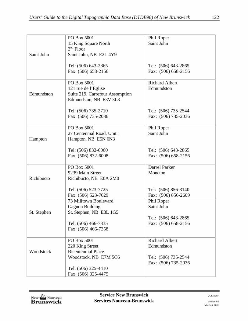
Users’ Guide to the Digital Topographic Data Base (DTDB98) of New Brunswick
Service New Brunswick UGE1998N
Services Nouveau-Brunswick Version 0.8March 6, 2001
122
Saint John
PO Box 500115 King Square North2nd FloorSaint John, NB E2L 4Y9
Tel: (506) 643-2865Fax: (506) 658-2156
Phil RoperSaint John
Tel: (506) 643-2865Fax: (506) 658-2156
Edmundston
PO Box 5001121 rue de l’ÉgliseSuite 219, Carrefour AssomptionEdmundston, NB E3V 3L3
Tel: (506) 735-2710Fax: (506) 735-2036
Richard AlbertEdmundston
Tel: (506) 735-2544Fax: (506) 735-2036
Hampton
PO Box 500127 Centennial Road, Unit 1Hampton, NB E5N 6N3
Tel: (506) 832-6060Fax: (506) 832-6008
Phil RoperSaint John
Tel: (506) 643-2865Fax: (506) 658-2156
Richibucto
PO Box 50019239 Main StreetRichibucto, NB E0A 2M0
Tel: (506) 523-7725Fax: (506) 523-7629
Darrel ParkerMoncton
Tel: (506) 856-3140Fax: (506) 856-2609
St. Stephen
73 Milltown BoulevardGagnon BuildingSt. Stephen, NB E3L 1G5
Tel: (506) 466-7335Fax: (506) 466-7358
Phil RoperSaint John
Tel: (506) 643-2865Fax: (506) 658-2156
Woodstock
PO Box 5001220 King StreetBicentennial PlaceWoodstock, NB E7M 5C6
Tel: (506) 325-4410Fax: (506) 325-4475
Richard AlbertEdmundston
Tel: (506) 735-2544Fax: (506) 735-2036
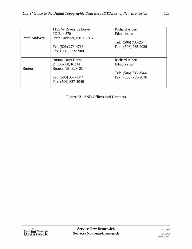
Users’ Guide to the Digital Topographic Data Base (DTDB98) of New Brunswick
Service New Brunswick UGE1998N
Services Nouveau-Brunswick Version 0.8March 6, 2001
123
Perth/Andover
1135 W Riverside DrivePO Box 870Perth Andover, NB E7H 5G5
Tel: (506) 273-4716Fax: (506) 273-5900
Richard AlbertEdmundston
Tel: (506) 735-2544Fax: (506) 735-2036
Burton
Burton Court HousePO Box 80, RR #1Burton, NB E2V 2G4
Tel: (506) 357-4044Fax: (506) 357-4046
Richard AlbertEdmundston
Tel: (506) 735-2544Fax: (506) 735-2036
Figure 23 - SNB Offices and Contacts

Users’ Guide to the Digital Topographic Data Base (DTDB98) of New Brunswick
Service New Brunswick UGE1998N
Services Nouveau-Brunswick Version 0.8March 6, 2001
124
DIGITAL TOPOGRAPHIC DATA BASE (DTDB)ORDER FORM
Client Information Date:
Name of Organization:
Address:
Telephone:
Contact Person:
Digital Topographic Data Base File Information
Media (check appropriate box)
� CD-ROM � DOS-Diskette
� Other (specify - contact SNB office for available options):
DTDB Support Files (check appropriate box)
� I have Internet access and can download these files
� I do not have Internet access. Please provide these files on the media selected above.
Intended use of DTDB File(s)
Description of Area and File Names Required:
� Entire Province (NOTE: Only available on CD-ROM)
� Others (specify):
Send the completed form to the appropriate SNB Office nearest you

Users’ Guide to the Digital Topographic Data Base (DTDB98) of New Brunswick
Service New Brunswick UGE1998N
Services Nouveau-Brunswick Version 0.8March 6, 2001
125
Appendix A- Frequently Asked Questions
This Appendix provides a list of common questions concerning the Digital Topographic Data Basealong with responses to these questions.
Q1. Where can I order the Digital Topographic Data Base?
A1. The Digital Topographic Data Base may be ordered from the nearest SNB office. Refer toSection 9 of the Guide for a list of these offices. DTDB files may also be downloaded throughSNB Online. Refer to Section 7 of the Guide for instructions.
Q2. Can I order files for a specific project area, or do I have to order the complete provincialcoverage?
A2. You can order files for a specific area. The Digital Topographic Data Base (DTDB) OrderForm on page 115 of the Guide contains a section for you to describe the area required. Youmay also specify individual files through SNB Online.
Q3. I am not a CARIS user. Can I order DTDB files in a format compatible with my GIS software?
A3. At this time, SNB supplies DTDB files in CARIS ASCII and DXF (AutoCAD) formats.However, it may be possible to arrange for private sector firms to supply DTDB files in otherGIS formats. Contact your local SNB office to discuss this matter.
Q4. Are the DTDB files “GIS ready”?
A4. No. CARIS ASCII files will need to be processed by the REFOASCI utility prior to GIS use. Files supplied in DXF format will need to have topology built for the Transportation andHydrography Themes within your GIS prior to use.
It is further noted that only the Transportation and Hydrography Themes have been structured. All other data will need structuring prior to use for GIS analysis.
Refer to Section 2 of the Guide for more information on the content of the ETB files, and toSection 6 for more information on the content of the DTM Files.
Q5. Can I order only the data themes I need, or must I order the entire set of features for eachcoverage area?
A5. Data themes are divided into .198, .398, and .g98 files. For a definition of those themes, seeAppendix B. If individual thematic groups are not required, they must be deleted by the user. Similarly, .d98 Files contain all DTM Features.
Q6. Do I need to order both ETB and DTM for a project area?

Users’ Guide to the Digital Topographic Data Base (DTDB98) of New Brunswick
Service New Brunswick UGE1998N
Services Nouveau-Brunswick Version 0.8March 6, 2001
126
A6. Both ETB and DTM files are included within the DTDB compressed files supplied for eachwindow ordered.
Q7. I don’t currently have Internet access on my computer. How can I obtain the DTDB SupportFiles?
A7. Consult your nearest SNB Office to make arrangements to obtain the DTDB Support Files onalternate media.

Users’ Guide to the Digital Topographic Data Base (DTDB98) of New Brunswick
Service New Brunswick UGE1998N
Services Nouveau-Brunswick Version 0.8March 6, 2001
127
Appendix B - ETB Feature Codes
The following table presents a list of the valid Feature Codes which may be present within the ETBData Base, along with a description and the topological status of each Feature.
Feature Code Feature Code Definition Theme/User Number
ARSY Arrow symbol 200
BLAR Arena symbol 240
BLAROL Arena to scale 240
BLBS Building symbol 240
BLCC Community center 240
BLCCOL Community center to scale 240
BLCH Church symbol 240
BLCHOL Church to scale 240
BLCHSY Church identification symbol 240
BLDG Building (outline) 240
BLFA Factory symbol 240
BLFAOL Factory to scale 240
BLFS Fire station symbol 240
BLFSOL Fire station to scale 240
BLFSSY Fire station identification symbol 240
BLFTOL Fort to scale 240
BLGH Greenhouse symbol 240
BLGHOL Factory to scale 240
BLHO Hospital symbol 240
BLHOOL Hospital to scale 240
BLHOSY Hospital identification symbol 240
BLLB Legislative building to scale 240
BLLI Library symbol 240
BLLIOL Library to scale 240
BLMU Museum symbol 240
BLMUOL Museum to scale 240

Users’ Guide to the Digital Topographic Data Base (DTDB98) of New Brunswick
Service New Brunswick UGE1998N
Services Nouveau-Brunswick Version 0.8March 6, 2001
128
Feature Code Feature Code Definition Theme/User Number
BLPO Post office symbol 240
BLPOOL Post office to scale 240
BLPOSY Post office identification symbol 240
BLPS Police station symbol 240
BLPSOL Police station to scale 240
BLPSSY Police station identification symbol 240
BLPU Pumping station symbol 240
BLPUOL Pumping station to scale 240
BLSC Senior citizens home symbol 240
BLSCOL Senior citizens home to scale 240
BLSH School symbol 240
BLSHOL School to scale 240
BLSHSY School identification symbol 240
BLTH Town hall symbol 240
BLTHOL Town hall to scale 240
DAAD Ammunition dump 250
DAAP Airport 250
DAAS Airstrip 250
DAASSY Airstrip identification symbol 250
DABU Built up area 250
DACG Campground 250
DACGSY Campground identification symbol 250
DACM Cemetery 250
DACMSY Cemetery identification symbol 250
DADI Drive-in theatre 250
DADISY Drive in theatre identification symbol 250
DADP Disposal pile 250
DADPSY Disposal pile identification symbol 250
DADR Golf driving range 250

Users’ Guide to the Digital Topographic Data Base (DTDB98) of New Brunswick
Service New Brunswick UGE1998N
Services Nouveau-Brunswick Version 0.8March 6, 2001
129
Feature Code Feature Code Definition Theme/User Number
DADU Dump/Sanitary landfill 250
DADUSY Dump/Sanitary landfill identification symbol 250
DADY Dock yard 250
DAEX Exhibition grounds 250
DAEXSY Exhibition ground identification symbol 250
DAFF Fur farm 250
DAFH Fish hatchery 250
DAFHSY Fish hatchery identification symbol 250
DAFT Ferry terminal 250
DAFTSY Ferry terminal identification symbol 250
DAGC Golf course 250
DAGCSY Golf course identification symbol 250
DAGM Game management (area) 250
DAHP Heliport 250
DAHS Historic site 250
DAHSSY Historic site identification symbol 250
DAIR Indian reserve 250
DALF Landfill site (land reclamation) 250
DALFSY Landfill site (land reclamation) identificationsymbol 250
DALM Lumber mill 250
DALO Lookout scenic 250
DAMN Mine (open pit)/strip 250
DAMNSY Mine (open pit)/strip identification symbol 250
DAMNUG Mine (underground) 250
DAMNUGSY Mine (underground) identification symbol 250
DAMP Mobile home park 250
DAMPSY Mobile home park identification symbol 250
DAMR Military reserve 250
DAPA Parking area 250

Users’ Guide to the Digital Topographic Data Base (DTDB98) of New Brunswick
Service New Brunswick UGE1998N
Services Nouveau-Brunswick Version 0.8March 6, 2001
130
Feature Code Feature Code Definition Theme/User Number
DAPACP Parking area (car pool) 250
DAPASY Parking area (car pool) identification symbol 250
DAPC Peat cutting 250
DAPCSY Peat cutting identification symbol 250
DAPI Pile (industrial) 250
DAPK Park 250
DAPKNA Park, national 250
DAPKPI Park, picnic 250
DAPKPISY Park, picnic identification symbol 250
DAPKPR Park, provincial 250
DAPM Pulp/Paper mill 250
DAPT Pit 250
DAPTSY Pit identification symbol 250
DAQU Quarry 250
DAQUSY Quarry identification symbol 250
DARA Rest area 250
DART Racetrack (track only) 250
DARTSY Racetrack identification symbol 250
DASA Storage area 250
DASASY Storage area identification symbol 250
DASF Sports field 250
DASFSY Sports field identification symbol 250
DASK Ski area 250
DASKSY Ski area identification symbol 250
DASR Shooting range 250
DASRSY Shooting range identification symbol 250
DASV Salvage yard (auto) 250
DASVSY Salvage yard (auto) identification symbol 250
DASW Sewage treatment 250

Users’ Guide to the Digital Topographic Data Base (DTDB98) of New Brunswick
Service New Brunswick UGE1998N
Services Nouveau-Brunswick Version 0.8March 6, 2001
131
Feature Code Feature Code Definition Theme/User Number
DASWSY Sewage treatment identification symbol 250
DAUC Under construction area (general) 250
DAUCSY Under construction area identification symbol 250
DLBNCO Boundary county 210
DLBNIN Boundary international 210
DLBNMU Boundary municipal 210
DLBNPA Boundary parish 210
DLBNPR Boundary provincial 210
DLCM Survey control monument 210
DLGC Graticule 200
DLGCP Ground Control Point (Photo) 210
DLGL Grid line 200
DLGL30 Grid line text 200
DLID30 File Number 200
DLNL100 Map neat line (for road network theme) 100
DLNL210 Map neat line (for delimiters) 210
DLNL220 Map neat line (for land cover and land formtheme) 220
DLNL230 Map neat line (for utility theme) 230
DLNL240 Map neat line (for buildings) 240
DLNL250 Map neat line (for designated area theme) 250
DLNL260 Map neat line (for structure theme) 260
DLNL30 Geographic coordinates 200
DLNL300 Map neat line (for hydrographic theme) 300
DLNLIN Neat line for surround 200
LCCL Cutline 220
LCNU Nursery 220
LCOR Orchard 220
LCORSY Orchard identification symbol 220
LCRF Reforested 220

Users’ Guide to the Digital Topographic Data Base (DTDB98) of New Brunswick
Service New Brunswick UGE1998N
Services Nouveau-Brunswick Version 0.8March 6, 2001
132
Feature Code Feature Code Definition Theme/User Number
LCRFSY Reforestation identification symbol 220
LCTA Tree (area of) 220
LCTR Tree (row of) 220
LCTS Tree (individual) (symbol) 220
LCTX Land cover other text 220
LFCF Cliff 220
LFCK DTM check point 50
LFEM Embankment (around storage tanks only) 220
LFSH DTM spot height 50
LFTM DTM mass point 50
LFTMDG DTM mass point digitized gap 50
RRBR Bridge 110
RRBRSY Bridge identification symbol 100
RRCL Culvert (line) 110
RRCT Cutting (road and railroad) 110
RRCU Culvert 110
RRFB Foot bridge 110
RRFC Ferry landing 110
RRFL Fill (road and railroad) 110
RROP Overpass (road and railroad) 110
RRRD30 Road text (general) 110
RRRDA Road, arterial 100
RRRDATSY Road, arterial shield symbol 110
RRRDAW30 Road, road loose surface all weather, text 110
RRRDC Road, collector 100
RRRDCOSY Road, collector road shield symbol 110
RRRDLG Road, local gravel 100
RRRDLN Road, local numbered 100
RRRDLO Road, local other 100

Users’ Guide to the Digital Topographic Data Base (DTDB98) of New Brunswick
Service New Brunswick UGE1998N
Services Nouveau-Brunswick Version 0.8March 6, 2001
133
Feature Code Feature Code Definition Theme/User Number
RRRDLOSY Road, local other shield symbol 110
RRRDLP Road, local paved 100
RRRDM Road, municipal 100
RRRDN Road, national 100
RRRDO Road, Resource 100
RRRDOAW Road, all weather 100
RRRDODW Road, dry weather 100
RRRDOTR Road, trail 100
RRRDPR30 Road hard surface primary text 110
RRRDRAMP Road, ramp 100
RRRDSC30 Road hard surface secondary text 110
RRRDSL30 Road loose surface seasonal text 110
RRRDTK30 Road, track text 110
RRRDUC Road, under construction 100
RRRDUR30 Road, urban street text 110
RRRR Railroad 100
RRRR04 Railroad, abandoned 100
RRRRTT Railroad turntable (symbol) 110
RRTU Tunnel entrance 110
RRTX Railway other text 110
RRUP Underpass (road and railroad) 110
SRCOTX County text 200
SRDLGL Surround grid lines 200
SRLW6 Surround line weight 6 200
SRLW8 Surround line weight 8 200
SRLW16 Surround line weight 16 200
SRLW30 Surround line weight 30 200
SRTICK Surround tick mark 200
SRNA Map name 200

Users’ Guide to the Digital Topographic Data Base (DTDB98) of New Brunswick
Service New Brunswick UGE1998N
Services Nouveau-Brunswick Version 0.8March 6, 2001
134
Feature Code Feature Code Definition Theme/User Number
STAC Aerial cableway 260
STBP Boom pier (symbol) 260
STCD Communication dome 260
STCH Chimney 260
STCV Conveyor 260
STDD Dry dock 260
STDDSY Dry dock identification symbol 260
STFE Fence 260
STGS Grandstand 260
STGSSY Grandstand identification symbol 260
STGT Gate 260
STIN Burner/Incinerator 260
STKL Kiln (symbol) 260
STLH Lighthouse (symbol) 260
STLK Locks (symbol) 260
STOP Swimming pool (large) 260
STPOSY Swimming pool (large) identification symbol 260
STRI Outdoor rink 260
STRP Ramps 260
STRW Retaining wall 260
STSL Ski lift 260
STSLSY Ski lift identification symbol 260
STSO Silo 260
STSP Slipway 260
STWH Wharf 260
STWL Wall 260
STWM Windmill 260
STWS Weigh scale 260
UTPI Pipeline 230

Users’ Guide to the Digital Topographic Data Base (DTDB98) of New Brunswick
Service New Brunswick UGE1998N
Services Nouveau-Brunswick Version 0.8March 6, 2001
135
Feature Code Feature Code Definition Theme/User Number
UTPO Transmission Line (symbol) 230
UTSP Sewage settling pond (symbol) 230
UTSPOL Sewage settling pond (to scale) 230
UTSS Electrical transformer substation 230
UTSY Electrical transformer substation identificationsymbol
230
UTTK Tank (vertical symbol) 230
UTTKOL Tank (vertical outline) 230
UTTO Tower (except power transmissions) 230
UTTR Electrical transmission line symbolized 230
UTTX Utility, other text 230
WA_V Hydrographic features (virtual line) 300
WABD Dam (beaver) 320
WABW Breakwater 320
WACA Canal (navigable) 300
WACASY Canal (navigable) symbol 320
WACA_VN Canal (virtual line) 300
WACB Bog, Cranberry 300
WACB_VN Cranberry Bog (virtual line) 300
WACFBB Backshore Beach 300
WACFBB_VN Backshore Beach (virtual line) 300
WACFCM Coastal Marsh 300
WACFCM_VN Coastal Marsh (virtual line) 300
WACFDL Dyked Land 300
WACFDL_VN Dyked Land (virtual line) 300
WACFDU Dune 300
WACFDU_VN Dune (virtual line) 300
WACFEX Exclusion Area 300
WACFEX_VN Exclusion Area (virtual line) 300
WACFLL Landward Limit of the Coastal Features 300

Users’ Guide to the Digital Topographic Data Base (DTDB98) of New Brunswick
Service New Brunswick UGE1998N
Services Nouveau-Brunswick Version 0.8March 6, 2001
136
Feature Code Feature Code Definition Theme/User Number
WACFMM Man-made features polygon label 300
WACFMM_VN Man-made features (virtual line) 300
WACFOH Ordinary High Water Mark 300
WACFOH_VN Ordinary High Water Mark (virtual line) 300
WACFOHIS Ordinary High Water Mark on Island 300
WACFOHIS_VNOrdinary High Water Mark on Island (virtualline)
300
WACFOHLL Coincidence between WACFOH and WACFLL300
WACFOHLL_VN Coastal features (virtual line) 300
WACFOHLLIS WACFOHLL on Island 300
WACFRP Backshore Rock Platform 300
WACFRP_VN Backshore Rock Platform (virtual line) 300
WACFT Coastal Features text 300
WACN_V Hydrographic Network Connector 300
WACO ETB96 Coastal Polygon label 300
WACO_VN ETB96 Coastal Polygon (virtual line) 300
WACOIS ETB96 Island polygon label 300
WACOIS_VN ETB96 Island polygon (virtual line) 300
WACT Coast line text 320
WADI Ditch, single line 300
WADM Dam, human made 320
WADMSY Dam (human made) identification symbol 300
WADY Dyke/Levee 320
WAFA Falls 320
WAFASY Fall identification symbol 300
WAFI Fish ladder 320
WAFU Flume 320
WALE Water level carto 320
WALK Lake 300
WALK_VN Lake (virtual line) 300

Users’ Guide to the Digital Topographic Data Base (DTDB98) of New Brunswick
Service New Brunswick UGE1998N
Services Nouveau-Brunswick Version 0.8March 6, 2001
137
Feature Code Feature Code Definition Theme/User Number
WALKIS Lake island polygon label 300
WALKIS_VN Lake island polygon (virtual line) 300
WALP Lobster Pound 320
WALT Lake text 320
WARA Rapids 320
WARESY Reservoirs identification symbol 320
WARK Rock (in water) 320
WARS Reformatory reservoir, (natural, open) 300
WARS_VN Reservoir (virtual line) 300
WART Reservoir text 320
WARV River 320
WARVDL River, double line 300
WARVDL_VN Double line River (virtual line) 300
WARVIS Stream or river island polygon label 300
WARVIS_VN River Island (virtual line) 300
WARVLK River lake 300
WARVLK_VN River Lake (virtual line) 300
WARVLKIS River lake island polygon label 300
WARVLKIS_VN River lake island polygon (virtual line) 300
WARVSL River, single line 300
WARVSP River split, single line 300
WASMSY Swamp symbol 320
WASP_V Spine (virtual line) 310
WASQ_V Virtual Line Through Swamp 310
WAST Swamp text 320
WASW Swamp 300
WASW_VN Swamp (virtual line) 300
WATX Water, other text 320

Users’ Guide to the Digital Topographic Data Base (DTDB98) of New Brunswick
Service New Brunswick UGE1998N
Services Nouveau-Brunswick Version 0.8March 6, 2001
138
Appendix C - ETB Feature Codes By File
The following table presents a list of the valid Feature Codes which may be present within the ETBData Base, along with a description and the topological status of each Feature.The list is broken downby each file, *.d98, *.198, *.g98, and *.398
Feature Code Feature Code DefinitionTheme/User
Number
D98 Features
DLNLIN Map neat line (for DTM theme) 50LFCK DTM check point 50LFSH DTM spot height 50LFTM DTM mass point 50LFTMDG DTM mass point digitized gap 50
198 Features
DLNL100 Map neat line (for road network theme) 100RRBR Bridge 110RRBRSY Bridge identification symbol 100RRCL Culvert (line) 110RRCT Cutting (road and railroad) 110RRCU Culvert 110RRFB Foot bridge 110RRFC Ferry landing 110RRFL Fill (road and railroad) 110RROP Overpass (road and railroad) 110RRRD30 Road text (general) 110RRRDA Road, arterial 100RRRDATSY Road, arterial shield symbol 110RRRDAW30 Road, road loose surface all weather, text 110RRRDC Road, collector 100RRRDCOSY Road, collector road shield symbol 110RRRDLG Road, local gravel 100RRRDLN Road, local numbered 100RRRDLO Road, local other 100RRRDLOSY Road, local other shield symbol 110RRRDLP Road, local paved 100RRRDM Road, municipal 100RRRDN Road, national 100

Users’ Guide to the Digital Topographic Data Base (DTDB98) of New Brunswick
Service New Brunswick UGE1998N
Services Nouveau-Brunswick Version 0.8March 6, 2001
139
Feature Code Feature Code DefinitionTheme/User
NumberRRRDO Road, Resource 100RRRDOAW Road, all weather 100RRRDODW Road, dry weather 100RRRDOTR Road, trail 100RRRDPR30 Road hard surface primary text 110RRRDRAMP Road, ramp 100RRRDSC30 Road hard surface secondary text 110RRRDSL30 Road loose surface seasonal text 110RRRDTK30 Road, track text 110RRRDUC Road, under construction 100RRRDUR30 Road, urban street text 110RRRR Railroad 100RRRR04 Railroad, abandoned 100RRRRTT Railroad turntable (symbol) 110RRTU Tunnel entrance 110RRTX Railway other text 110RRUP Underpass (road and railroad) 110
G98 Features
ARSY Arrow symbol 200BLAR Arena symbol 240BLAROL Arena to scale 240BLBS Building symbol 240BLCC Community center 240BLCCOL Community center to scale 240BLCH Church symbol 240BLCHOL Church to scale 240BLCHSY Church identification symbol 240BLDG Building (outline) 240BLFA Factory symbol 240BLFAOL Factory to scale 240BLFS Fire station symbol 240BLFSOL Fire station to scale 240BLFSSY Fire station identification symbol 240BLFTOL Fort to scale 240BLGH Greenhouse symbol 240BLGHOL Factory to scale 240BLHO Hospital symbol 240BLHOOL Hospital to scale 240BLHOSY Hospital identification symbol 240BLLB Legislative building to scale 240

Users’ Guide to the Digital Topographic Data Base (DTDB98) of New Brunswick
Service New Brunswick UGE1998N
Services Nouveau-Brunswick Version 0.8March 6, 2001
140
Feature Code Feature Code DefinitionTheme/User
NumberBLLI Library symbol 240BLLIOL Library to scale 240BLMU Museum symbol 240BLMUOL Museum to scale 240BLPO Post office symbol 240BLPOOL Post office to scale 240BLPOSY Post office identification symbol 240BLPS Police station symbol 240BLPSOL Police station to scale 240BLPSSY Police station identification symbol 240BLPU Pumping station symbol 240BLPUOL Pumping station to scale 240BLSC Senior citizens home symbol 240BLSCOL Senior citizens home to scale 240BLSH School symbol 240BLSHOL School to scale 240BLSHSY School identification symbol 240BLTH Town hall symbol 240BLTHOL Town hall to scale 240DAAD Ammunition dump 250DAAP Airport 250DAAS Airstrip 250DAASSY Airstrip identification symbol 250DABU Built up area 250DACG Campground 250DACGSY Campground identification symbol 250DACM Cemetery 250DACMSY Cemetery identification symbol 250DADI Drive-in theatre 250DADISY Drive in theatre identification symbol 250DADP Disposal pile 250DADPSY Disposal pile identification symbol 250DADR Golf driving range 250DADU Dump/Sanitary landfill 250DADUSY Dump/Sanitary landfill identification symbol 250DADY Dock yard 250DAEX Exhibition grounds 250DAEXSY Exhibition ground identification symbol 250DAFF Fur farm 250DAFH Fish hatchery 250DAFHSY Fish hatchery identification symbol 250DAFT Ferry terminal 250

Users’ Guide to the Digital Topographic Data Base (DTDB98) of New Brunswick
Service New Brunswick UGE1998N
Services Nouveau-Brunswick Version 0.8March 6, 2001
141
Feature Code Feature Code DefinitionTheme/User
NumberDAFTSY Ferry terminal identification symbol 250DAGC Golf course 250DAGCSY Golf course identification symbol 250DAGM Game management (area) 250DAHP Heliport 250DAHS Historic site 250DAHSSY Historic site identification symbol 250DAIR Indian reserve 250DALF Landfill site (land reclamation) 250DALFSY Landfill site (land reclamation) identification symbol 250DALM Lumber mill 250DALO Lookout scenic 250DAMN Mine (open pit)/strip 250DAMNSY Mine (open pit)/strip identification symbol 250DAMNUG Mine (underground) 250DAMNUGSY Mine (underground) identification symbol 250DAMP Mobile home park 250DAMPSY Mobile home park identification symbol 250DAMR Military reserve 250DAPA Parking area 250DAPACP Parking area (car pool) 250DAPASY Parking area (car pool) identification symbol 250DAPC Peat cutting 250DAPCSY Peat cutting identification symbol 250DAPI Pile (industrial) 250DAPK Park 250DAPKNA Park, national 250DAPKPI Park, picnic 250DAPKPISY Park, picnic identification symbol 250DAPKPR Park, provincial 250DAPM Pulp/Paper mill 250DAPT Pit 250DAPTSY Pit identification symbol 250DAQU Quarry 250DAQUSY Quarry identification symbol 250DARA Rest area 250DART Racetrack (track only) 250DARTSY Racetrack identification symbol 250DASA Storage area 250DASASY Storage area identification symbol 250DASF Sports field 250DASFSY Sports field identification symbol 250

Users’ Guide to the Digital Topographic Data Base (DTDB98) of New Brunswick
Service New Brunswick UGE1998N
Services Nouveau-Brunswick Version 0.8March 6, 2001
142
Feature Code Feature Code DefinitionTheme/User
NumberDASK Ski area 250DASKSY Ski area identification symbol 250DASR Shooting range 250DASRSY Shooting range identification symbol 250DASV Salvage yard (auto) 250DASVSY Salvage yard (auto) identification symbol 250DASW Sewage treatment 250DASWSY Sewage treatment identification symbol 250DAUC Under construction area (general) 250DAUCSY Under construction area identification symbol 250DLBNCO Boundary county 210DLBNIN Boundary international 210DLBNMU Boundary municipal 210DLBNPA Boundary parish 210DLBNPR Boundary provincial 210DLCM Survey control monument 210DLGC Graticule 200DLGCP Ground Control Point (Photo) 210DLGL Grid line 200DLGL30 Grid line text 200DLID30 File Number 200DLNL210 Map neat line (for delimiters) 210DLNL220 Map neat line (for land cover and land form theme) 220DLNL230 Map neat line (for utility theme) 230DLNL240 Map neat line (for buildings) 240DLNL250 Map neat line (for designated area theme) 250DLNL260 Map neat line (for structure theme) 260DLNL30 Geographic coordinates 200DLNLIN Neat line for surround 200LCCL Cutline 220LCNU Nursery 220LCOR Orchard 220LCORSY Orchard identification symbol 220LCRF Reforested 220LCRFSY Reforestation identification symbol 220LCTA Tree (area of) 220LCTR Tree (row of) 220LCTS Tree (individual) (symbol) 220LCTX Land cover other text 220LFCF Cliff 220LFEM Embankment (around storage tanks only) 220SRCOTX County text 200

Users’ Guide to the Digital Topographic Data Base (DTDB98) of New Brunswick
Service New Brunswick UGE1998N
Services Nouveau-Brunswick Version 0.8March 6, 2001
143
Feature Code Feature Code DefinitionTheme/User
NumberSRDLGL Surround grid lines 200SRLW16 Surround line weight 16 200SRLW30 Surround line weight 30 200SRLW6 Surround line weight 6 200SRLW8 Surround line weight 8 200SRNA Map name 200SRTICK Surround tick mark 200STAC Aerial cableway 260STBP Boom pier (symbol) 260STCD Communication dome 260STCH Chimney 260STCV Conveyor 260STDD Dry dock 260STDDSY Dry dock identification symbol 260STFE Fence 260STGS Grandstand 260STGSSY Grandstand identification symbol 260STGT Gate 260STIN Burner/Incinerator 260STKL Kiln (symbol) 260STLH Lighthouse (symbol) 260STLK Locks (symbol) 260STOP Swimming pool (large) 260STPOSY Swimming pool (large) identification symbol 260STRI Outdoor rink 260STRP Ramps 260STRW Retaining wall 260STSL Ski lift 260STSLSY Ski lift identification symbol 260STSO Silo 260STSP Slipway 260STWH Wharf 260STWL Wall 260STWM Windmill 260STWS Weigh scale 260UTPI Pipeline 230UTPO Transmission Line (symbol) 230UTSP Sewage settling pond (symbol) 230UTSPOL Sewage settling pond (to scale) 230UTSS Electrical transformer substation 230UTSY Electrical transformer substation identification symbol 230UTTK Tank (vertical symbol) 230

Users’ Guide to the Digital Topographic Data Base (DTDB98) of New Brunswick
Service New Brunswick UGE1998N
Services Nouveau-Brunswick Version 0.8March 6, 2001
144
Feature Code Feature Code DefinitionTheme/User
NumberUTTKOL Tank (vertical outline) 230UTTO Tower (except power transmissions) 230UTTR Electrical transmission line symbolized 230UTTX Utility, other text 230
398 Features
DLNL300 Map neat line (for hydrographic theme) 300WA_V Hydrographic features (virtual line) 300WABD Dam (beaver) 320WABW Breakwater 320WACA Canal (navigable) 300WACA_VN Canal (virtual line) 300WACASY Canal (navigable) symbol 320WACB Bog, Cranberry 300WACB_VN Cranberry Bog (virtual line) 300WACFBB Backshore Beach 300WACFBB_VN Backshore Beach (virtual line) 300WACFCM Coastal Marsh 300WACFCM_VN Coastal Marsh (virtual line) 300WACFDL Dyked Land 300WACFDL_VN Dyked Land (virtual line) 300WACFDU Dune 300WACFDU_VN Dune (virtual line) 300WACFEX Exclusion Area 300WACFEX_VN Exclusion Area (virtual line) 300WACFLL Landward Limit of the Coastal Features 300WACFMM Man-made features polygon label 300WACFMM_VN Man-made features (virtual line) 300WACFOH Ordinary High Water Mark 300WACFOH_VN Ordinary High Water Mark (virtual line) 300WACFOHIS Ordinary High Water Mark on Island 300WACFOHIS_VN Ordinary High Water Mark on Island (virtual line) 300WACFOHLL Coincidence between WACFOH and WACFLL 300WACFOHLL_VN Coastal features (virtual line) 300WACFOHLLIS WACFOHLL on Island 300WACFRP Backshore Rock Platform 300WACFRP_VN Backshore Rock Platform (virtual line) 300WACFT Coastal Features text 300WACN_V Hydrographic Network Connector 300WACO ETB96 Coastal Polygon label 300WACO_VN ETB96 Coastal Polygon (virtual line) 300

Users’ Guide to the Digital Topographic Data Base (DTDB98) of New Brunswick
Service New Brunswick UGE1998N
Services Nouveau-Brunswick Version 0.8March 6, 2001
145
Feature Code Feature Code DefinitionTheme/User
NumberWACOIS ETB96 Island polygon label 300WACOIS_VN ETB96 Island polygon (virtual line) 300WACT Coast line text 320WADI Ditch, single line 300WADM Dam, human made 320WADMSY Dam (human made) identification symbol 300WADY Dyke/Levee 320WAFA Falls 320WAFASY Fall identification symbol 300WAFI Fish ladder 320WAFU Flume 320WALE Water level carto 320WALK Lake 300WALK_VN Lake (virtual line) 300WALKIS Lake island polygon label 300WALKIS_VN Lake island polygon (virtual line) 300WALP Lobster Pound 320WALT Lake text 320WARA Rapids 320WARESY Reservoirs identification symbol 320WARK Rock (in water) 320WARS Reformatory reservoir, (natural, open) 300WARS_VN Reservoir (virtual line) 300WART Reservoir text 320WARV River 320WARVDL River, double line 300WARVDL_VN Double line River (virtual line) 300WARVIS Stream or river island polygon label 300WARVIS_VN River Island (virtual line) 300WARVLK River lake 300WARVLK_VN River Lake (virtual line) 300WARVLKIS River lake island polygon label 300WARVLKIS_VN River lake island polygon (virtual line) 300WARVSL River, single line 300WARVSP River split, single line 300WASMSY Swamp symbol 320WASP_V Spine (virtual line) 310WASQ_V Virtual Line Through Swamp 310WAST Swamp text 320WASW Swamp 300WASW_VN Swamp (virtual line) 300WATX Water, other text 320

Users’ Guide to the Digital Topographic Data Base (DTDB98) of New Brunswick
Service New Brunswick UGE1998N
Services Nouveau-Brunswick Version 0.8March 6, 2001
146
Appendix D - Naming Convention for Support Files
This Appendix provides information on the SNB File naming convention to support files.
Naming Convention for Support Files
Description Pre 2000 Name Post 2000 NamePre 2000 Namefor Distribution
Post 2000 Name for Distibution
CARIS Colour Table File ETB96TBL.col ETByyyyA.col ETB96TBL.zip ETByyyyA.zip
CARIS Colour Map File ETB96MAP.cma ETByyyyA.cma ETB96MAP.zip included above
CARIS Master File ETB96MAS.txt ETByyyyA.txt ETB96MAS.zip included above
CARIS Symbol File ETB96SYM.dat ETByyyyA.dat ETB96DAT.zip included above
CARIS Symbol File - binary ETB96SYM.bin ETByyyyA.bin ETB96BIN.zip included above
DXF Shape File NBGIC10.shp DXFyyyyA.shp SHAPE.zip DXFyyyyA.zip
DXF shape file (binary) NBGIC10.shx DXFyyyyA.shx included above included above
ETB96 Index Map (ASCII) INDEX96.asc NDX1996A.asc INDEX96.zip NDX1996A.zip
ETB96 Index Map (DXF) INDEX96.dxf NDX1996A.dxf included above included above
ETB96 Index Map (PRN) INDEX96.prn NDX1996A.prn included above included above
ETB98 Index Map (ASCII) NDX1998A.asc Not Applicable NDX1998A.zip
ETB98 Index Map (DXF) NDX1998A.dxf Not Applicable included above
ETB98 Index Map (PRN) NDX1998A.prn Not Applicable included above
SODB User Guide (English) OREyyyyA.doc Not Applicable Not Available
SODB User Guide (French) ORFyyyyA.doc Not Applicable Not Available
SODB User Guide (PDF) English OREyyyyA.pdf Not Applicable ORE1998A.pdf
SODB User Guide (PDF) French ORFyyyyA.pdf Not Applicable ORF1998A.pdf

Users’ Guide to the Digital Topographic Data Base (DTDB98) of New Brunswick
Service New Brunswick UGE1998N
Services Nouveau-Brunswick Version 0.8March 6, 2001
147
SODB Agreement (English)See CTDB/DTDB98Agreement
See CTDB/DTDB98Agreement
SODB Agreement (French)See CTDB/DTDB98Agreement
See CTDB/DTDB98Agreement
SODB Agreement (PDF) EnglishSee CTDB/DTDB98Agreement
See CTDB/DTDB98Agreement
SODB Agreement (PDF) FrenchSee CTDB/DTDB98Agreement
See CTDB/DTDB98Agreement
ETB96 User Guide (English) ETB96UGE.wpd UGE1996A.doc Not Available Not Available
ETB96 User Guide (French) BDA96GUF.wpd GUF1996A.doc Not Available Not Available
ETB96 User Guide (PDF) English ETB96UGE.pdf UGE1996A.pdf ETB96UGE.zip UGE1996A.pdf
ETB96 User Guide (PDF) French BDA96GUF.pdf GUF1996A.pdf BDA96GUF.zip GUF1996A.pdf
ETB96 Agreement (English) ETB96AGR.wpd AGR1996A.doc Not Available Not Available
ETB96 Agreement (French) BDA96ENT.wpd ENT1996A.doc Not Available Not Available
ETB96 Agreement (PDF) English ETB96AGR.pdf AGR1996A.pdf ETB96AGR.zip AGR1996A.pdf
ETB96 Agreement (PDF) French BDA96ENT.pdf ENT1996A.pdf BDA96ENT.zip ENT1996A.pdf
ETB96 Name Cross Reference(ASCII) ETB96XRF.asc XRF1996A.asc ETB96XRF.zip XRF1996A.zip
CTDB/DTDB98 User Guide(English) UGE1998A.doc Not Applicable Not AvailableCTDB/DTDB98 User Guide(French) GUF1998A.doc Not Applicable Not AvailableCTDB/DTDB98 UserGuide (PDF) English UGE1998A.pdf Not Applicable UGE1998A.pdfCTDB/DTDB98 User Guide(PDF) French GUF1998A.pdf Not Applicable GUF1998A.pdf
CTDB/DTDB98 Agreement(English) AGR1998A.doc Not AvailableCTDB/DTDB98 Agreement(French) ENT1998A.doc Not AvailableCTDB/DTDB98Agreement (PDF) English) AGR1998A.pdf AGR1998A.pdfCTDB/DTDB98 Agreement(PDF) French ENT1998A.pdf ENT1998A.pdf
LWIS Manual (English) 1998LWISManual.doc LWIS2000A.doc 1998LWISManual.doc LWIS2000A.docLWIS Manual (French) 1998NITEManual.doc NITE2000A.doc 1998NITEManual.doc NITE2000A.doc

Users’ Guide to the Digital Topographic Data Base (DTDB98) of New Brunswick
Service New Brunswick UGE1998N
Services Nouveau-Brunswick Version 0.8March 6, 2001
148
LWIS Manual (English) - PDF 1998LWISManual.pdf LWIS2000A.pdf 1998LWISManual.pdf LWIS2000A.pdfLWIS Manual (French) - PDF 1998NITEManual.pdf NITE2000A.pdf 1998NITEManual.pdf NITE2000A.pdf
DTDB Merge Utility MGR1998A.zip MGR1998A.ZIP
Notes: 1. Where: yyyy = 4 digit year, and A = version (A - Z) 2. All file names must adhere to the character case convention as follows:
all text to left of "." is to be UPPERCASE
all text to right of "." is to be lowercase

Users’ Guide to the Digital Topographic Data Base (DTDB98) of New Brunswick
Service New Brunswick UGE1998N
Services Nouveau-Brunswick Version 0.8March 6, 2001
149
Appendix E - Dates of Photography
This Appendix shows the dates of photography used for the original compilation of the ETB files ona provincial map overlay.
1983

Users’ Guide to the Digital Topographic Data Base (DTDB98) of New Brunswick
Service New Brunswick UGE1998N
Services Nouveau-Brunswick Version 0.8March 6, 2001
150
Appendix F - PDP and VAX Compilation Areas
This Appendix shows the areas which were compiled using PDP and VAX methods on a provincialmap overlay.

Users’ Guide to the Digital Topographic Data Base (DTDB98) of New Brunswick
Service New Brunswick UGE1998N
Services Nouveau-Brunswick Version 0.8March 6, 2001
151
Appendix G - Sample ETB File CARIS Header
This appendix contains the listing for a representative ETB Map File CARIS header. Note that theinformation contained in Item 20 (Graphic extent) and Item 21 (Neat line corners) will vary dependingupon the specific map window selected. The window for which this information was generated(46006690) is the window used as the basis for the figures within Section 4 of the Guide.
======================= Header=====================
1. Title New Brunswick Coastal Topographic Database, ETB98 [7E03HF] 2. File ID 45706710 3. Horizontal coord system NEMR 4. Header length 198 5. Vertical coord system MR 6. Descriptor length 16 7. Sounding, Spot Ht units MR,M1 8. Coordinate resolutions 9. Coordinate shifts XY 1.0000000000 X .000000000 Y .000000000 Z .1000000000 Z .000000000 10. Projection ST 11. Central meridian 66-30-00.000W 12. Scale 10000.00 13. Scaling Lat 1 46-30-00.000N 14. Scaling factor .999912 15. Scaling Lat 2 N/A 16. Ellipsoid NA83 17. Vertical datum MSL 18. N/A 19. N/A 20. Graphic extent ( *NAD83 value* ) (system) 21. Neatline corners (metres) 21. Neatline corners Lat,Long E=*NAD83 value*N=*NAD83 value* 45-50-15.904N 66-36-51.088W E=*NAD83 value*N=*NAD83 value* 45-50-16.112N 66-28-18.048W E=*NAD83 value*N=*NAD83 value* 45-54-14.336N 66-28-17.936W E=*NAD83 value*N=*NAD83 value* 45-54-14.144N 66-36-51.568W 22. Format ID 5 23. Last edited 15-DEC-1993 18:19 24. False North 7500000.000 25. False East 2500000.000

Users’ Guide to the Digital Topographic Data Base (DTDB98) of New Brunswick
Service New Brunswick UGE1998N
Services Nouveau-Brunswick Version 0.8March 6, 2001
152
Appendix H - Feature Codes Used to Define Areas Of Exclusion inDigital Terrain Model Files
The following is a list of feature codes for digital topographic data which form the boundaries of areasexcluded from the collection of DTM points.
Area Type Water Features
WACA CANALWACA04 CANAL RUIN/INTACT./ABAND.
WACFOH10 COASTLINE WATER LEFTWACFOH20 COASTLINE WATER RIGHT
WACFLL10 LANDWARD LIMIT LEFTWACFLL20 LANDWARD LIMIT RIGHT
WACFOHLL10WACFOHLL20
WACFOHIS10WACFOHIS20
WACFOHLLIS10WACFOHLLIS20
WALK10 LAKE LEFTWALK20 LAKE RIGHT
WARS10 RESERVOIR LEFTWARS20 RESERVOIR RIGHT
WARVDL STREAM DOUBLE LINEWARVDL10 STREAM DOUBLE LINE LEFTWARVDL15 STREAM DOUBLE LINE LEFT INDEFINITEWARVDL20 STREAM DOUBLE LINE RIGHTWARVDL25 STREAM DOUBLE LINE RIGHT INDEFINITE
WARVLK10 RIVER LAKE LEFTWARVLK20 RIVER LAKE RIGHT

Users’ Guide to the Digital Topographic Data Base (DTDB98) of New Brunswick
Service New Brunswick UGE1998N
Services Nouveau-Brunswick Version 0.8March 6, 2001
153
Water Structures
STWH WHARFSTWH03 WHARF UNDER CONSTRUCTIONSTWH04 WHARF RUINSAPO POOL (LARGE)UTSPOL SEWAGE SETTLEMENT PONDWABW BREAKWATERWABW03 BREAKWATER UNDER CONSTRUCTIONWADM DAM (MANMADE)
Land Structures
STRW RETAINING WALL
Land Areas
DADP DISPOSAL PILE CENTROIDDADP10 DISPOSAL PILE LEFTDADP20 DISPOSAL PILE RIGHT
DADU DUMP CENTROIDDADU10 DUMP LEFTDADU20 DUMP RIGHT
DALF LANDFILL SITE CENTROIDDALF10 LANDFILL SITE LEFTDALF20 LANDFILL SITE RIGHT
DAMN MINE/OPEN PIT CENTROIDDAMN10 MINE/OPEN PIT LEFTDAMN20 MINE/OPEN PIT RIGHT
DAPI PILE AREA CENTROIDDAPI10 PILE AREA LEFTDAPI20 PILE AREA RIGHT
DAPT PIT CENTROIDDAPT10 PIT LEFTDAPT20 PIT RIGHT
DAQU QUARRY CENTROIDDAQU10 QUARRY LEFTDAQU20 QUARRY RIGHT

Users’ Guide to the Digital Topographic Data Base (DTDB98) of New Brunswick
Service New Brunswick UGE1998N
Services Nouveau-Brunswick Version 0.8March 6, 2001
154
DAUC CONSTRUCTION AREA CENTROIDDAUC10 CONSTRUCTION AREA LEFTDAUC20 CONSTRUCTION AREA RIGHT
Transportation Structures
RRBR BRIDGERRBR03 BRIDGE UNDER CONSTRUCTIONRRBR04 BRIDGE RUINRROP OVERPASS (ROAD/RAIL ROAD)
NOTE:
In cases where exclusion areas do not form closed polygons, other features mayhave been used to close them. Features which may be used to close polygons inthis manner are:
DLBNIN BOUNDARY INTERNATIONALDLBNPR BOUNDARY PROVINCIALDLNLIN NEAT LINEWARVIS10 STREAM ISLAND LEFTWARVIS15 STREAM ISLAND LEFT INDEFINITEWARVIS20 STREAM ISLAND RIGHTWARVIS25 STREAM ISLAND RIGHT INDEFINITE
All features beginning with
DA DESIGNATED AREASLC LAND COVERRRRD TRANSPORTATION FEATURES

Users’ Guide to the Digital Topographic Data Base (DTDB98) of New Brunswick
Service New Brunswick UGE1998N
Services Nouveau-Brunswick Version 0.8March 6, 2001
155
Appendix I – Location of 1996 and 1997 Photography

Users’ Guide to the Digital Topographic Data Base (DTDB98) of New Brunswick
Service New Brunswick UGE1998N
Services Nouveau-Brunswick Version 0.8March 6, 2001
156
Appendix J - D98 Files with Points within 1m of neatline
45206660 46606670 46906670 4760660045306740 46606690 46906680 4760663045356640 46606760 46906770 4760665045406720 46656580 46956680 4760667045506650 46656690 47006620 4760668045556720 46656730 47006640 4760678045606660 46656740 47006670 4765662045606710 46656750 47006680 4765663045606730 46706590 47056640 4765666045706640 46706640 47056660 4765667045706680 46756560 47056670 4765668045706730 46756580 47106650 4765678045756690 46756620 47106660 4770678045756730 46756630 47106700 4775665045856660 46756690 47156640 4775670045906670 46806550 47156650 4775677045956650 46806570 47156660 4775679045956670 46806590 47156670 4780663045956720 46806610 47206870 4780668046006690 46806650 47306740 4780670046056530 46806670 47356710 4780672046306660 46806730 47356720 4780673046306710 46806740 47356740 4780677046356600 46856610 47356810 4785668046356630 46856620 47406710 4785680046406720 46856640 47406730 4790669046506530 46856650 47456710 4790679046556510 46856660 47506690 4790681046556610 46856750 4755670046556690 46906620 4755677046606620 46906650 47606590

Users’ Guide to the Digital Topographic Data Base (DTDB98) of New Brunswick
Service New Brunswick UGE1998N
Services Nouveau-Brunswick Version 0.8March 6, 2001
157
Appendix K – Updated Coastal Window
This Appendix is a list of 1:10 000 windows with updated coastal features, coastal buildings andcoastal hydrographic themes current to 1996 – 97.
45056670 45256600 45856440 46156380 46556490 4705651045056680 45256610 45856450 46156390 46556500 4705652045056690 45306550 45856460 46156400 46606470 4705653045056700 45306560 45906410 46156410 46606480 4705654045056710 45356540 45906420 46156430 46606490 4710649045106620 45356550 45906430 46156440 46656470 4710650045106630 45406530 45906450 46156450 46656480 4710652045106640 45406540 45906460 46206410 46656490 4710653045106650 45456510 45956400 46206420 46706470 4715650045106660 45456520 45956410 46206430 46706480 4715651045106670 45456530 45956420 46206440 46706490 4715652045106680 45506500 45956430 46206450 46706500 4720649045106690 45506510 45956450 46206460 46756480 4720650045106700 45506520 45956460 46256450 46756490 4720651045106710 45556470 45956470 46256460 46756500 4725649045156580 45556490 46006400 46306450 46806480 4725650045156590 45556500 46006410 46306460 46806490 4730649045156610 45606470 46006430 46306470 46806500 4730650045156620 45606480 46006450 46356450 46856480 4730651045156630 45606490 46006460 46356460 46856490 4735649045156640 45656460 46006470 46356470 46906480 4735650045156650 45656470 46006480 46356480 46906490 4735651045156690 45656480 46006490 46406460 46956480 4740648045156700 45706440 46056370 46406470 46956510 4740649045156710 45706450 46056380 46406480 46956520 4740650045156720 45706460 46056390 46456460 46956550 4745648045206580 45706470 46056400 46456470 47006480 4745649045206590 45756440 46056410 46456480 47006490 4745650045206600 45756450 46056460 46456500 47006500 4750648045206610 45756460 46056470 46456510 47006510 4750649045206620 45756470 46056480 46506460 47006520 4750650045206630 45806420 46106370 46506470 47006530 4755648045206710 45806430 46106380 46506480 47006540 4755649045206720 45806440 46106390 46506490 47006550 4755656045256560 45806450 46106400 46506500 47056470 4760647045256570 45806460 46106410 46506510 47056480 4760648045256580 45856420 46106470 46556470 47056490 4760649045256590 45856430 46106480 46556480 47056500 47606500

Users’ Guide to the Digital Topographic Data Base (DTDB98) of New Brunswick
Service New Brunswick UGE1998N
Services Nouveau-Brunswick Version 0.8March 6, 2001
158
47606550 47706480 47756510 47806570 47956450 4800663047606560 47706490 47756520 47856450 47956610 4800664047656470 47706530 47756530 47856460 47956620 4800665047656480 47706540 47756570 47856570 47956630 4800666047656490 47706560 47806450 47856580 47956660 4800667047656500 47706570 47806460 47906440 47956670 4800668047656540 47756450 47806470 47906450 47956680 4805663047656550 47756460 47806480 47906580 47956690 4805664047656560 47756470 47806490 47906590 4800644047656570 47756480 47806500 47906600 4800645047706460 47756490 47806510 47906610 4800661047706470 47756500 47806520 47956440 48006620

Users’ Guide to the Digital Topographic Data Base (DTDB98) of New Brunswick
Service New Brunswick UGE1998N
Services Nouveau-Brunswick Version 0.8March 6, 2001
159
Appendix L – DTM’s from Contours
The following is a list of windows with some DTM data collected from contours:
46156430 45806500 45706530 45606500
46106520 45806490 45706520 45606490
46106490 45806480 45706510 45606480
46106470 45806470 45706500 45606470
46106460 45806460 45706490 45556540
46006560 45806450 45706480 45556530
45956400 45806430 45706470 45556520
45856530 45806420 45706460 45556510
45856520 45756550 45656540 45556500
45856510 45756540 45656530 45556490
45856500 45756530 45656520 45556470
45856490 45756520 45656510 45506540
45856480 45756510 45656500 45506530
45856470 45756500 45656490 45506520
45856460 45756490 45656480 45506510
45856450 45756480 45656470 45506500
45806540 45756470 45606540 45456540
45806530 45756460 45606530 45456530
45806520 45706550 45606520 45456520
45806510 45706540 45606510

Users’ Guide to the Digital Topographic Data Base (DTDB98) of New Brunswick
Service New Brunswick UGE1998N
Services Nouveau-Brunswick Version 0.8March 6, 2001
160
Appendix M – DOT Extra Issues
Investigation into Issues Raised byNBDOT related to DTDB98 Files
Item I
DOT Comment: File has duplicate arcs on theme 100 without keys.
File(s) identified by NBDOT: File = 45156630
Investigation:
The QC process does a check on the attributes for lines using the output from CARIS command"displine". Using "displine" on theme 100, CARIS reports there are no duplicate features.
Upon detailed investigation, DataQC identified seven lines in the 198 file – feature codeRRRDLP, with user number 100 but the theme is undefined. The output for CARIS "lspt"command showed the features as arcs on user number 100 but the theme was undefined. A displaydescriptor output showed that there were features added by GEONET but did not have a line superdescriptor. If there is no super descriptor, the CARIS command "displine" will not report thepresence of the line and thus the QC processes would not have been aware of the lines.
Item 2
DOT Comment: Different bridge ETB keys between 198 and R98
File(s) identified by NBDOT: File = 45206610
Investigation:
The bridge symbol keys in the 198 graphics file are RQ3503573, RQ3503574, RQ3503575,RQ3503576, RQ3503577and RQ3503578, while the keys in the R98 file range from RQ3503567to RQ3503572.

Users’ Guide to the Digital Topographic Data Base (DTDB98) of New Brunswick
Service New Brunswick UGE1998N
Services Nouveau-Brunswick Version 0.8March 6, 2001
161
Item 3
DOT Comment: Some files have bridge keys starting at R*6000/7000 range.
File(s) identified by NBDOT: File = 47606570
Investigation:
The last key for line features in the file stop at RD4Q03556 while the symbol keys starts atRD4Q06557. It looks like 3000 was added to the last line key, (3556) plus one to give the firstsymbol key.
Item 4
DOT Comment: One file with 19 D2 active arcs in R98 but not in 198 file
File(s) identified by NBDOT: File = 47456730
Investigation:
The QC checks make sure that for every line with a key in the 198 file there is an entry in the R98file. There is not a check which verifies that every active entry in the R98 file has an entity in the198 file.
Item 5
DOT Comment: Some files whose second field in R98 contains ETB98 keys instead of bridgecodes.
File(s) identified by NBDOT: File = 45706550.
Investigation:
The QC processes check to make sure that for every active record in the R98 the previous keyfield contains a valid entry. Initially, a valid entry was defined as a key matching the DTDB98specifications. This becomes unworkable as an extremely large number of keys in the NBDOTsource data were incorrectly formatted (generating error messages) which the contractor was notallowed to change. The QC test had to be reduced to only checking that the entry in field 2 wasnon blank. In addition, if a contractor had to add a bridge symbol then field 2 is blank (flagged asan error during QC) but was accepted by the Inspector as valid.

Users’ Guide to the Digital Topographic Data Base (DTDB98) of New Brunswick
Service New Brunswick UGE1998N
Services Nouveau-Brunswick Version 0.8March 6, 2001
162
Item 6
DOT Comment: One file with arcs changed from rrrdc to rrrdo.
File(s) identified by NBDOT: File = 47456690
Investigation:
We will require the specific feature key to do additional investigation. Without the key wecouldn't verify the specific problems in file, but the following addresses the issue in general.
The production processes check to make sure that the source data has been imported from the fromthe DOT road file, the ETB96 files and where applicable the DNRE road files. A check isperformed to make sure that the feature codes in the final 198 file are in the list of valid featurecodes. (It does not check to see if the final feature code is the same as the source feature code).
Item 7
DOT Comment: One file whose last key in 198 is R*3227, but last record in R98 is R*3226
File(s) identified by NBDOT: File = 46106380.
Investigation:
The additional key in the file 198 is for a bridge symbol.
Item 8
DOT Comment: Some files with bridge nodes on theme 100 without keys.
File(s) identified by NBDOT: File = 47506830
Investigation:
During production, the CARIS "display index" command is used to generate a list of features in the198 file with keys. Only those keys were subjected to the verification process. No QC processidentifies feature without keys in the 198.
It should be noted that the QC process of verifying the key format for only those features with keysin the graphic file is based on the methodology used in ETB96. In ETB96 keys were extractedfrom the T96 files, then formats were verified, while the ETB98 process performs the samefunction on both the 198 and 398 features.

Users’ Guide to the Digital Topographic Data Base (DTDB98) of New Brunswick
Service New Brunswick UGE1998N
Services Nouveau-Brunswick Version 0.8March 6, 2001
163
Appendix N – DTDB98 Merge Utility Program
Introduction
MGR1998A.ZIP contains the install program for the DTDB98 map file merge utility. This utilityis a tool to aid merging of the individual layers of one or more DTDB98 map files into a singleCARIS Edit file. It requires the user have already properly installed and licensed CARIS GISsoftware on the computer. The utility provides a user friendly method to generate a CARIS BatchFile which, once run in CARIS, completes the actual merging of 1:10 000 map windows. Itallows the user to easily select which DTDB98 map components to merge and reads a standardtext file (list) of windows to merge together. The utility provides a default list of features tosuppress during the merge. The user can select no feature suppression or a user defined list offeatures.
The zip file contains the following items:
• The setup program to install the module to the specified directory and update the ini file withthe initial values.
• A redistribution directory which contains copies of the program, the help file, the ini file andan initial set of display filter, which can be used to remove the surround features.
• Pkunzip which is used to extract the map layer files from the map suite zip file.
Installation Instructions
After downloading the MRG1998A.ZIP, place the file in a temporary directory on your computer. Unzip the file. Select and run the setup program (setup.exe). Follow the instruction on theinstallation program.
For detailed instructions use the online help or review the user guide.
Typical Time Requirements to Merge Map Windows
Several test scenarios were completed during the software development stage to document the timeneeded to merge various combinations of DTDB98 files. The test PC’s and results of two separatetests are provided below:
Test ComputerPentium III – 450 MHz128 MB RAM20 GB Hard DriveWindows NT
Test 1Number of files in list: 4 files
Users’ Guide to the Digital Topographic Data Base (DTDB98) of New Brunswick
Service New Brunswick UGE1998N
Services Nouveau-Brunswick Version 0.8March 6, 2001
164
Layers used: 198, 398, G98Time to complete merge: 20 secondsNo suppression
Test 2Number of files in list: 25 filesLayers used: 198, 398, G98Time to complete merge: 9 minutesNo suppression
Test 3Number of files in list: 350 filesLayers used: 198, 398, G98Time to complete merge: 93.5 hoursNo suppression
Test ComputerPentium III – 600 MHz128 MB RAM15 GB Hard driveWindows 98
Test 1Number of files in list: 2 filesLayers used: 198, 398, G98Time to build batch file: 3 secondsTime to complete merge: 22 secondsDefault suppression
Test 2Number of files in list: 112 filesLayers used: 198, 398, G98Time to build batch file: 5 secondsTime to complete merge: 85 minutesDefault suppression
Testing of Merge Utility on 100 Map Windows
The aim was to run a series of three tests to test the speed of the merge operations on larger groupsof files. The tests were run on the following PC:
Pentium III – 600 Mhz.128 MB RAM15 GB Hard driveWindows 98

Users’ Guide to the Digital Topographic Data Base (DTDB98) of New Brunswick
Service New Brunswick UGE1998N
Services Nouveau-Brunswick Version 0.8March 6, 2001
165
The time to build the batch file and the time to run the batch file were recorded. The listed inputand output directories and file names were also documented.
Test 1
To merge together the 1:10 000 files to create four 1:50,000 map blocks. The four blockscreated included: 21G10, 21G09, 21G15 and 21G16. The settings for the test were:
• Read files from CD-ROM• No feature suppression• Include the 198, 398 and G98 layers in the output file• Source files in zip format
Block name Input Text File Output Filename Batch buildTime
Time to run Batch
21G10 .\1_50000\21G10
.\output1\21G10 2 seconds 6 minutes
21G09 .\1_50000\21G09
.\output1\21G09 2 seconds 5 minutes
21G15 .\1_50000\21G15
.\output1\21G15 2 seconds 7 minutes
21G16 .\1_50000\21G16
.\output1\21G16 2 seconds 6 minutes
Test 2
To merge the four files created in the previous test. The CARIS edit files were copied to anew source directory c:\mergefiles\input2 using the CARIS carcopy command and renamedas follows:
• 21G10 copied to 45506650• 21G09 copied to 45506600• 21G15 copied to 45756650• 21G16 copied to 45756600

Users’ Guide to the Digital Topographic Data Base (DTDB98) of New Brunswick
Service New Brunswick UGE1998N
Services Nouveau-Brunswick Version 0.8March 6, 2001
166
The settings for the test were:
• Read files from CARIS edit files: (Source files in CARIS edit format inc:\mergefiles\input2)
• No feature suppression• Include the 198, 398 and G98 layers in the output file
Block name Input Text File Output Filename Batch buildTime
Time torun Batch
fourblocks .\1_100000\4_50000s.txt .\output2\fourblocks 2 seconds 3 minutes
Test 3
To merge the 100 – 1:10 000 map files (those included in: 21G09, 21G10, 21G15, and21G16). The settings for the test were:
• Read files from CD-ROM• No feature suppression• Include the 198, 398 and G98 layers in the out file• Source files in zip format
Block name Input Text File Output Filename Batch buildTime
Time torun Batch
Files100 .\1_100000\1_100000.txt .\output3\Files100 2 seconds 72 minutes
Comparison:
Merging 4 sets of 25 windows and then merging the 4 sets into one file: 27 minutes.Merging 1 set of 100 windows, time: 72 minutes.
DTDB98 Merge Utility HELP:
If you encounter problems running the HELP from the button in the program please ensure that youhave the the latest HTML help module for your operating system, installed on the computer.
The latest version of the help system can be down loaded from :

Users’ Guide to the Digital Topographic Data Base (DTDB98) of New Brunswick
Service New Brunswick UGE1998N
Services Nouveau-Brunswick Version 0.8March 6, 2001
167
"http://msdn.microsoft.com/library/tools/htmlhelp/wkshp/download.h tm".
Example :{HYPERLINK "hhupd.exe"}Download Hhupd.exe 1.32 (716 KB).
Make sure to select the correct upgrade for your operating system.
User Guide
A complete copy of the User Guide is available free on SNB Online. The User Guide is lcated ina compressed suite of files called: “MRG1999*.zip where * is the version (A to Z).