Embed Size (px)
Citation preview
Use of Unmanned Aerial Systems (UAS) to support the predictability of future environmental crisis > 07/09/2010
Slide 1
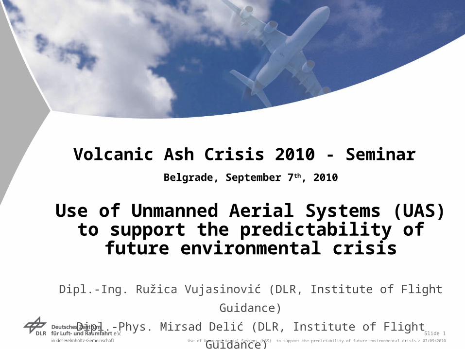
Volcanic Ash Crisis 2010 - Seminar Belgrade, September 7th, 2010
Use of Unmanned Aerial Systems (UAS) to support the predictability of future
environmental crisis
Dipl.-Ing. Ružica Vujasinović (DLR, Institute of Flight Guidance)
Dipl.-Phys. Mirsad Delić (DLR, Institute of Flight Guidance)
Use of Unmanned Aerial Systems (UAS) to support the predictability of future environmental crisis > 07/09/2010
Slide 2
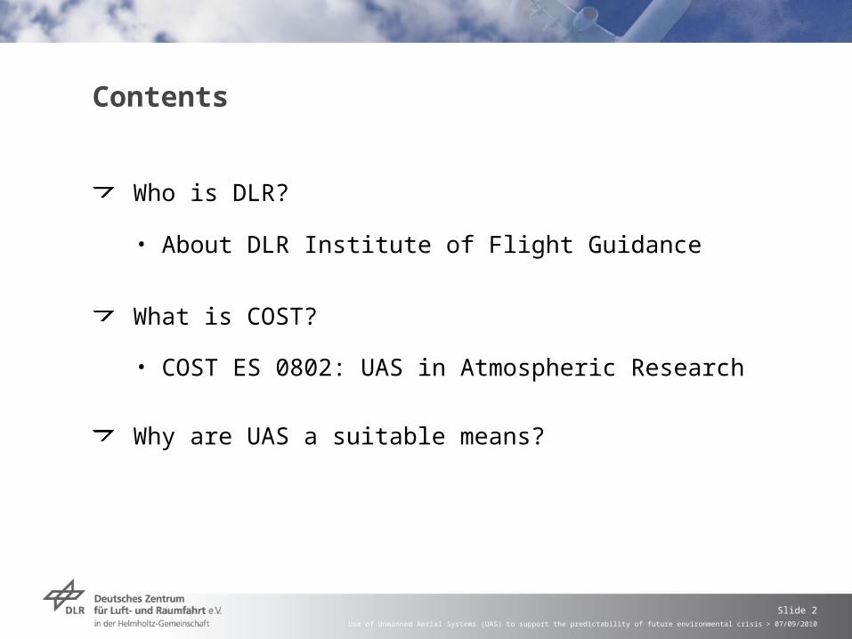
Contents
Who is DLR?
• About DLR Institute of Flight Guidance
What is COST?
• COST ES 0802: UAS in Atmospheric Research
Why are UAS a suitable means?
Use of Unmanned Aerial Systems (UAS) to support the predictability of future environmental crisis > 07/09/2010
Slide 3
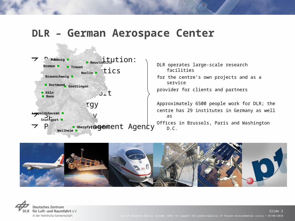
DLR – German Aerospace Center
Research Institution:
• Aeronautics
• Space
• Transport
• Energy
Space Agency
Project Management Agency
DLR operates large-scale research facilities
for the centre’s own projects and as a service
provider for clients and partners
Approximately 6500 people work for DLR; the
centre has 29 institutes in Germany as well as
Offices in Brussels, Paris and Washington D.C.
Köln
Oberpfaffenhofen
Braunschweig
Goettingen
Berlin
Bonn
Neustrelitz
Weilheim
Bremen Trauen
Dortmund
Lampoldshausen
Hamburg
Stuttgart
Use of Unmanned Aerial Systems (UAS) to support the predictability of future environmental crisis > 07/09/2010
Slide 4
Goals and Strategies of the Aeronautics Research Area
Primary goals
Further development of civilian transport systems from the perspectives of efficiency/economy, safety and environmental compatibilityTechnological contributions towards assuring the capability profile of the German armed forces
Focal areas of research at DLR BraunschweigImprovement of the dynamic aircraft behaviour and the operational safety of aircraft and helicoptersIncrease in the performance, safety and reliability of air, road and railway trafficIntelligent assistance systems for human operators of airborne and ground transportation systemsDevelopment of design principles and tools for low-drag and quiet air vehiclesDevelopment and realisation of adaptable, damage-tolerant and cost-efficient high-performance structures for aerospace and ground transportation application
Use of Unmanned Aerial Systems (UAS) to support the predictability of future environmental crisis > 07/09/2010
Slide 5
COST is an intergovernmental framework for European Cooperation in Science and Technology; COST contributes to reducing the fragmentation in European research investments and opening the European Research Area to cooperation worldwide
In total, there are 36 COST Countries:35 member states: Austria, Belgium, Bosnia and Herzegovina, Bulgaria, Croatia, Cyprus, Czech Republic, Denmark, Estonia, Finland, France, Germany, Greece, Hungary, Iceland, Ireland, Italy, Latvia, Lithuania, Luxembourg, Macedonia, Malta, The Netherlands, Norway, Poland, Portugal, Romania, Serbia, Slovakia, Slovenia, Spain, Sweden, Switzerland, Turkey, United KingdomOne cooperating state: Israel
Unmanned systems offer cost-efficient data acquisition options in regions that are hard to reach or too dangerous for manned operation (e.g. polar regions, Off-shore wind parks, active volcanoes, dangerous pollution events)
Use of Unmanned Aerial Systems (UAS) to support the predictability of future environmental crisis > 07/09/2010
Slide 6
COST ES0802
Coordination of ongoing and conception of future research on development and application of UAS to provide cost-efficient, trans-boundary method for the monitoring of the atmospheric boundary layer and the underlying surface of Earth
Creation of a knowledge base of existing UAS and suitable sensors and onboard logging systems to avoid unnecessary multiple inquiry and development
DLR participates in WG4 (UAS Operations) represented by the
Use of Unmanned Aerial Systems (UAS) to support the predictability of future environmental crisis > 07/09/2010
Slide 7
How does the Institute of Flight Guidance fit in?
The Institute of Flight Guidance does not conduct atmospheric research
But, the Institute of Flight Guidance
Conducts applied research in the Air Traffic Management area
Designs concepts, processes, procedures and tools
Develops adequate prototypes and evaluates internal and external products
Airborne: UA-Simulation, Pilot Assistance, Sensor Evaluation
Ground: System Control, UA Guidance, Image Processing, Sensor Simulation
Conception, development, validation and verification of systems needed for operating UAS in non-segregated airspace
Use of Unmanned Aerial Systems (UAS) to support the predictability of future environmental crisis > 07/09/2010
Slide 8
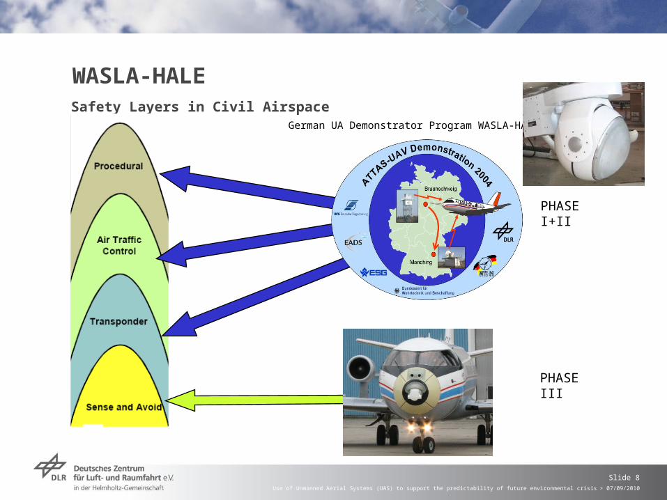
WASLA-HALESafety Layers in Civil Airspace
German UA Demonstrator Program WASLA-HALE
PHASE III
PHASE I+II
Use of Unmanned Aerial Systems (UAS) to support the predictability of future environmental crisis > 07/09/2010
Slide 9
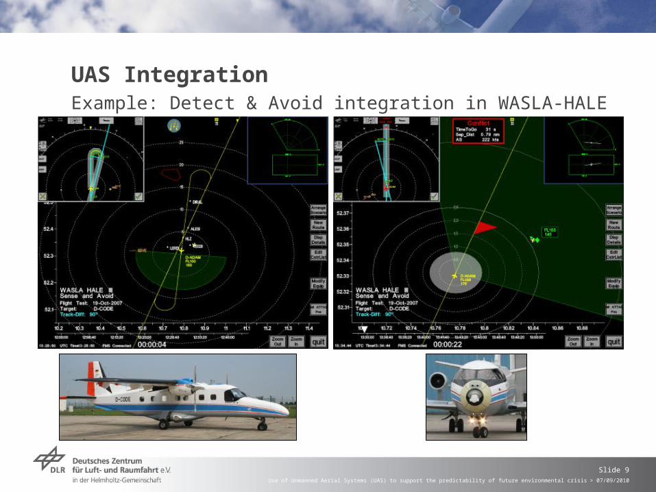
UAS IntegrationExample: Detect & Avoid integration in WASLA-HALE
Use of Unmanned Aerial Systems (UAS) to support the predictability of future environmental crisis > 07/09/2010
Slide 10
Detect & Avoid Programs
WASLA-HALE, German UA Demonstrator Program
Mid-air Collision Avoidance System (MidCAS) - European successor program
Five member states (France, Germany, Italy, Spain and Sweden)
Objective: Demonstrate the technology for a detect and avoid system for UAS to fulfil requirements for traffic separation and collision avoidance in non-segregated airspace
Use of Unmanned Aerial Systems (UAS) to support the predictability of future environmental crisis > 07/09/2010
Slide 11
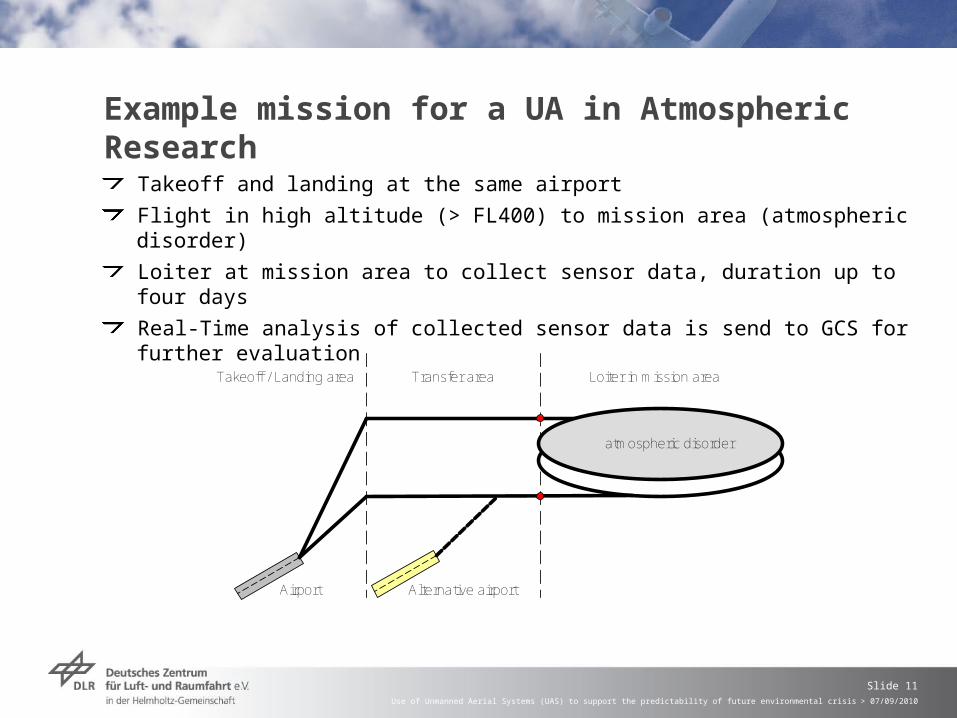
Example mission for a UA in Atmospheric Research
Takeoff and landing at the same airport
Flight in high altitude (> FL400) to mission area (atmospheric disorder)
Loiter at mission area to collect sensor data, duration up to four days
Real-Time analysis of collected sensor data is send to GCS for further evaluation
atmospheric disorder
Airport
Takeoff / Landing area Loiter in mission areaTransfer area
Alternative airport
Use of Unmanned Aerial Systems (UAS) to support the predictability of future environmental crisis > 07/09/2010
Slide 12
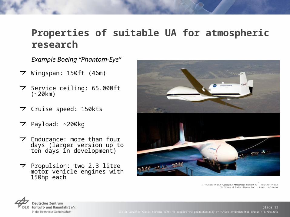
Properties of suitable UA for atmospheric research
Wingspan: 150ft (46m)
Service ceiling: 65.000ft (~20km)
Cruise speed: 150kts
Payload: ~200kg
Endurance: more than four days (larger version up to ten days in development)
Propulsion: two 2.3 litre motor vehicle engines with 150hp each
(1) Picture of NASA “GlobalHawk Atmospheric Research UA” - Property of NASA
(2) Picture of Boeing „Phantom Eye“ - Property of Boeing
Example Boeing “Phantom-Eye”
Use of Unmanned Aerial Systems (UAS) to support the predictability of future environmental crisis > 07/09/2010
Slide 13
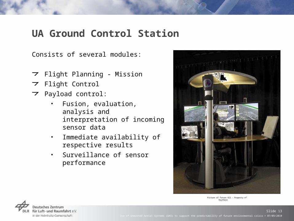
UA Ground Control Station
Consists of several modules:
Flight Planning - Mission
Flight Control
Payload control:
• Fusion, evaluation, analysis and interpretation of incoming sensor data
• Immediate availability of respective results
• Surveillance of sensor performance
Picture of future GCS - Property of Raytheon
Use of Unmanned Aerial Systems (UAS) to support the predictability of future environmental crisis > 07/09/2010
Slide 14
Thank you. Any questions?