Embed Size (px)
Citation preview
1
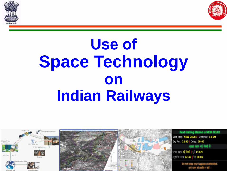
Use of
Space Technology on
Indian Railways
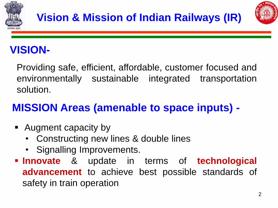
Vision & Mission of Indian Railways (IR)
Providing safe, efficient, affordable, customer focused and
environmentally sustainable integrated transportation
solution.
VISION-
MISSION Areas (amenable to space inputs) -
Augment capacity by
• Constructing new lines & double lines
• Signalling Improvements.
Innovate & update in terms of technological
advancement to achieve best possible standards of
safety in train operation 2
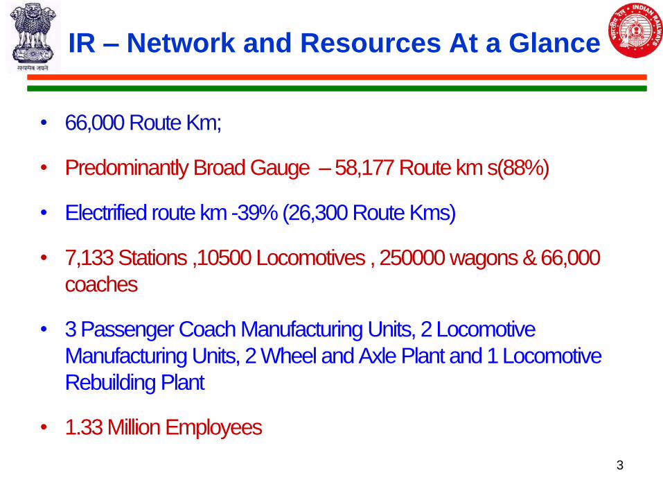
IR – Network and Resources At a Glance
• 66,000 Route Km;
• Predominantly Broad Gauge – 58,177 Route km s(88%)
• Electrified route km -39% (26,300 Route Kms)
• 7,133 Stations ,10500 Locomotives , 250000 wagons & 66,000
coaches
• 3 Passenger Coach Manufacturing Units, 2 Locomotive
Manufacturing Units, 2 Wheel and Axle Plant and 1 Locomotive
Rebuilding Plant
• 1.33 Million Employees
3
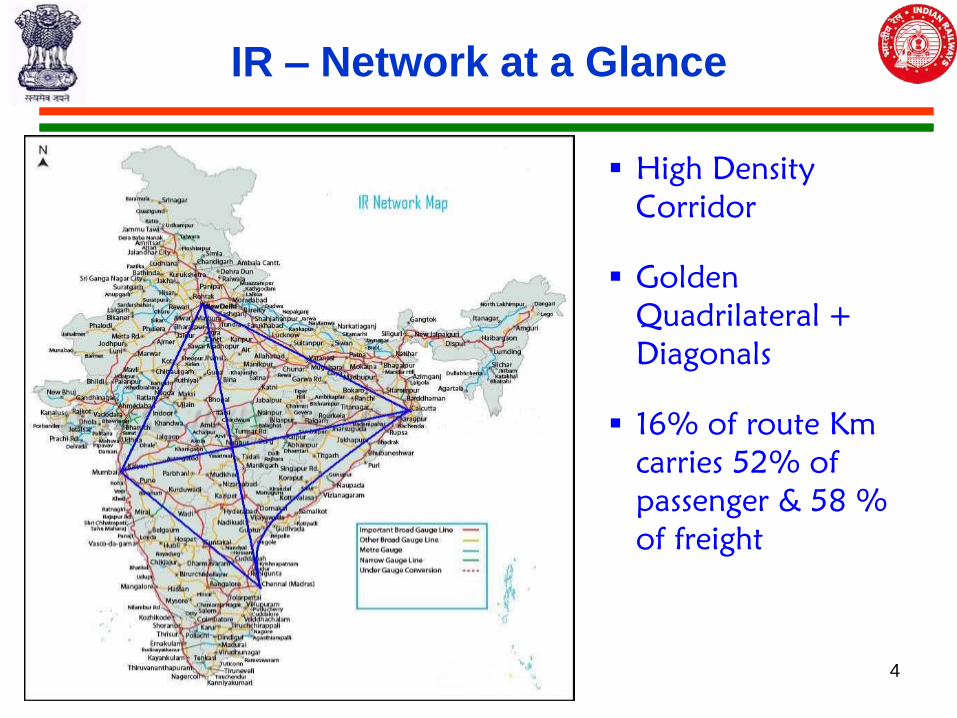
IR – Network at a Glance
High Density
Corridor
Golden
Quadrilateral +
Diagonals
16% of route Km
carries 52% of
passenger & 58 %
of freight
4
Transportation Statistics
Freight Operations
• 1052 million Ton
• 666 billion Net Ton KM
• Major commodities – coal, iron ore, steel, cement, fertilizer, POL, container
• 7000 + freight trains per day
Passenger Operations
• 8450 million Originating Passengers;
• 53% suburban, 47% non suburban
• 1098 billion Passenger KM; 14% suburban, 86% non suburban
• 12,000+ passenger trains per day (23m pass /day)
5
The Next 5 years …
Eastern and Western Dedicated Freight Corridors (3300 km)
New Lines – 4000 km
Doubling – 7500 km
Gauge Conversion – 5500 km
Electrification – 10,000 Route kms
Develop High speed Corridors
New terminals and terminal development
6
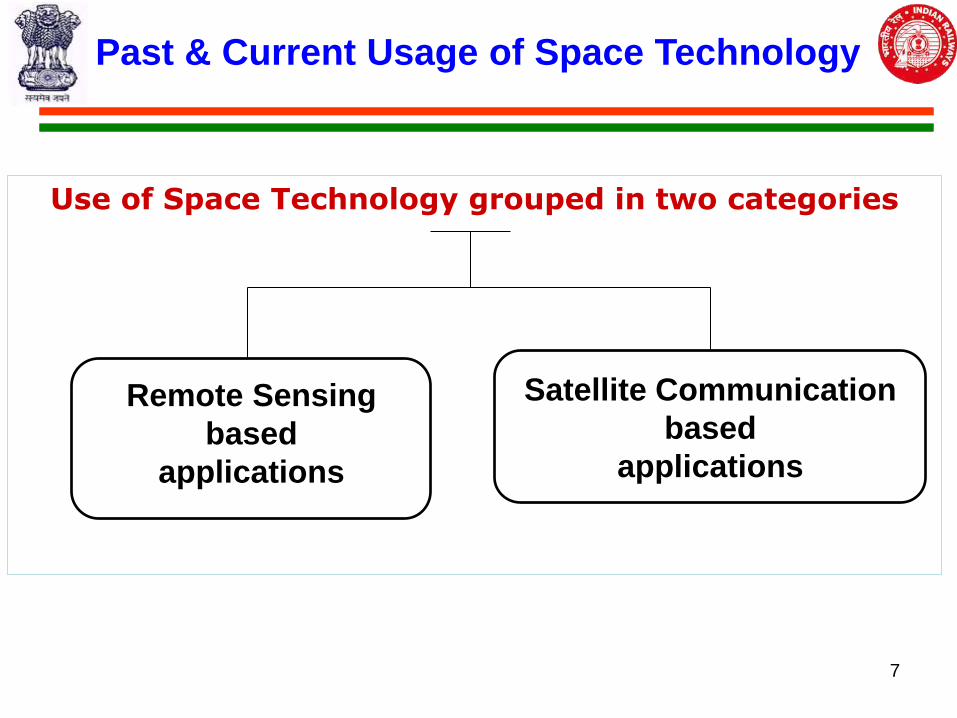
Past & Current Usage of Space Technology
Use of Space Technology grouped in two categories
Remote Sensing
based
applications
Satellite Communication
based
applications
7
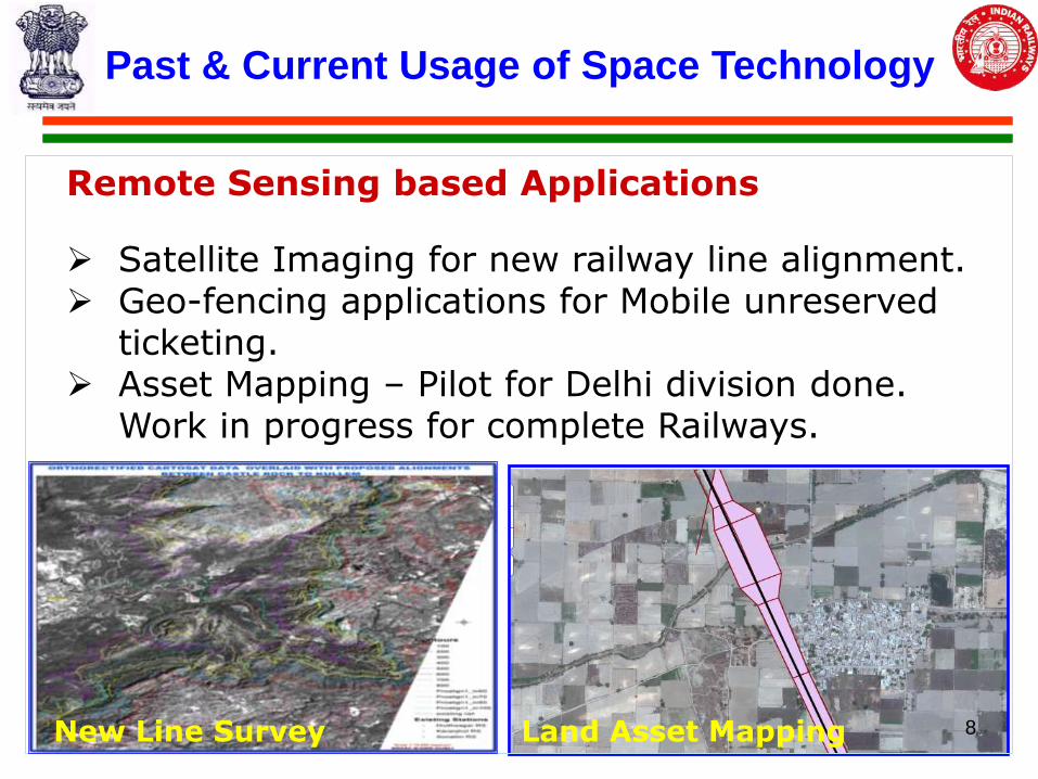
Past & Current Usage of Space Technology
Remote Sensing based Applications
Satellite Imaging for new railway line alignment. Geo-fencing applications for Mobile unreserved
ticketing. Asset Mapping – Pilot for Delhi division done.
Work in progress for complete Railways.
New Line Survey Land Asset Mapping 8
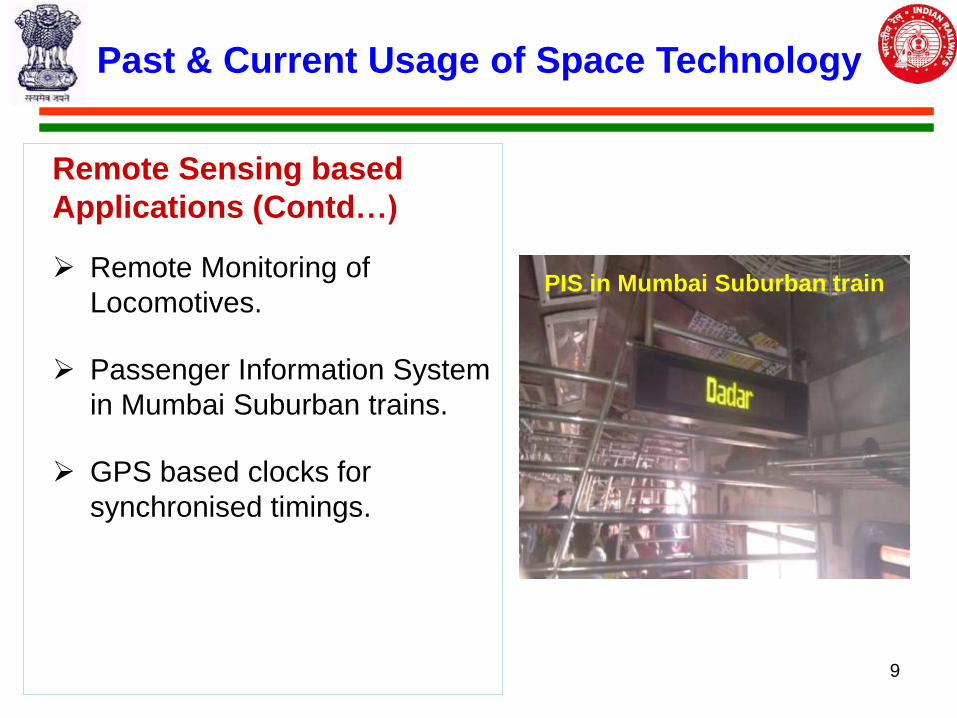
Remote Sensing based
Applications (Contd…)
Remote Monitoring of
Locomotives.
Passenger Information System
in Mumbai Suburban trains.
GPS based clocks for
synchronised timings.
Past & Current Usage of Space Technology
PIS in Mumbai Suburban train
9
Past & Current Usage of Space Technology
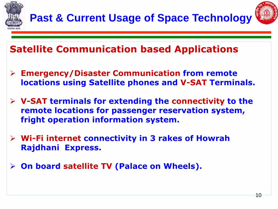
Satellite Communication based Applications
Emergency/Disaster Communication from remote locations using Satellite phones and V-SAT Terminals.
V-SAT terminals for extending the connectivity to the remote locations for passenger reservation system, fright operation information system.
Wi-Fi internet connectivity in 3 rakes of Howrah Rajdhani Express.
On board satellite TV (Palace on Wheels).
10
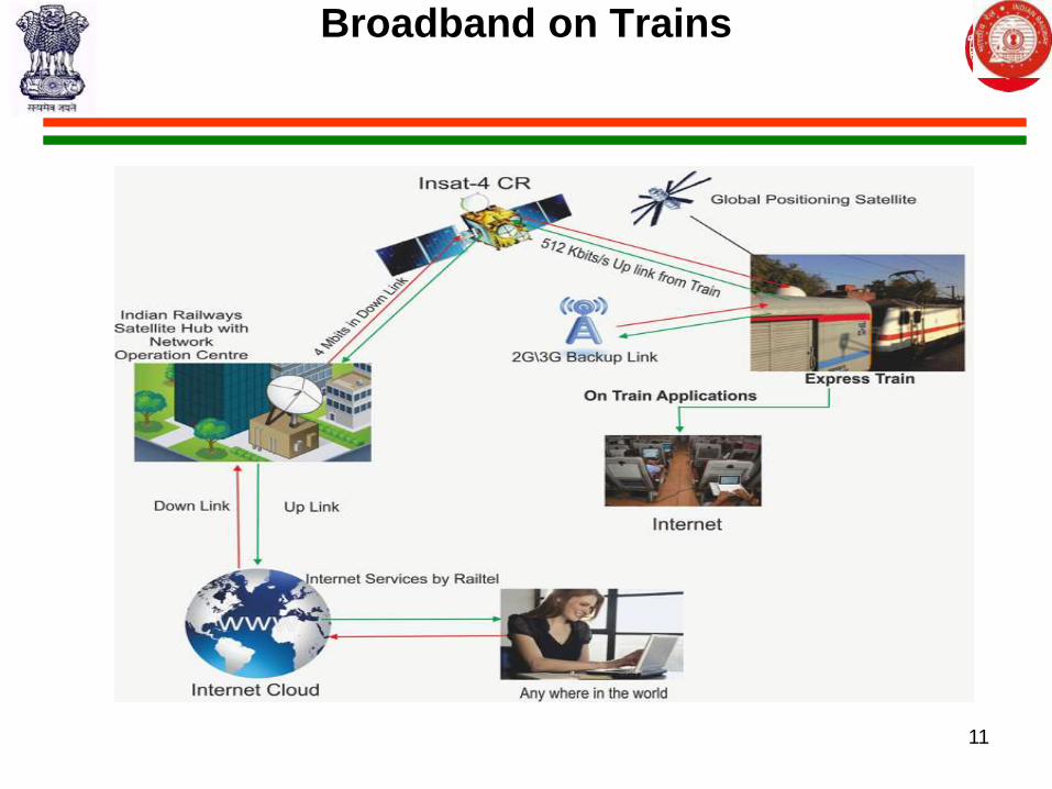
Broadband on Trains
11
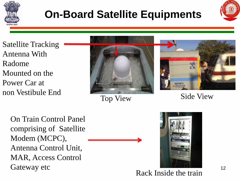
On-Board Satellite Equipments
Satellite Tracking
Antenna With
Radome
Mounted on the
Power Car at
non Vestibule End
On Train Control Panel
comprising of Satellite
Modem (MCPC),
Antenna Control Unit,
MAR, Access Control
Gateway etc 12
Rack Inside the train
Top View Side View
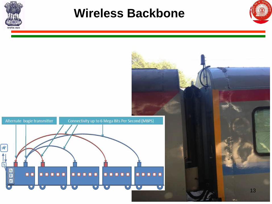
Wireless Backbone
13
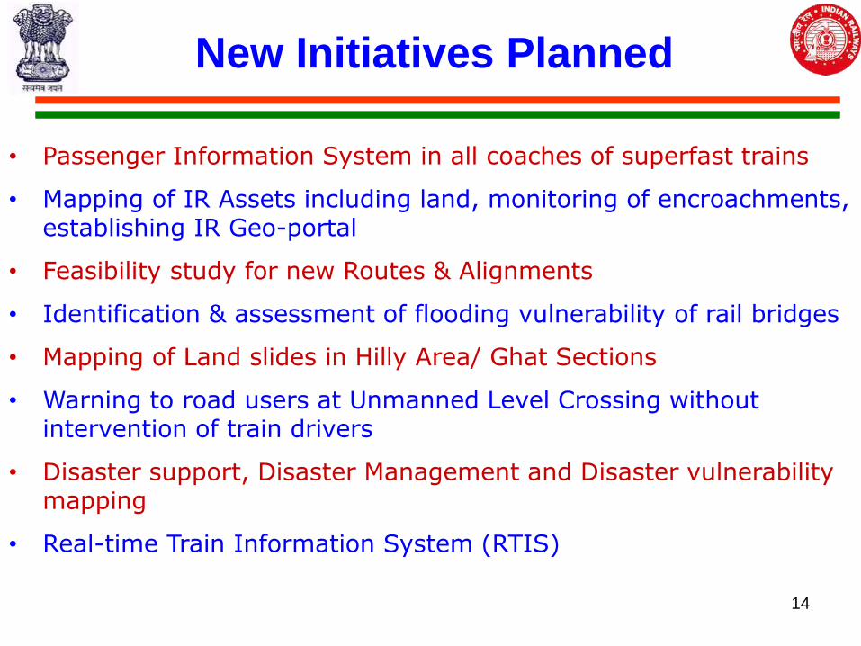
New Initiatives Planned
• Passenger Information System in all coaches of superfast trains
• Mapping of IR Assets including land, monitoring of encroachments, establishing IR Geo-portal
• Feasibility study for new Routes & Alignments
• Identification & assessment of flooding vulnerability of rail bridges
• Mapping of Land slides in Hilly Area/ Ghat Sections
• Warning to road users at Unmanned Level Crossing without intervention of train drivers
• Disaster support, Disaster Management and Disaster vulnerability mapping
• Real-time Train Information System (RTIS)
14
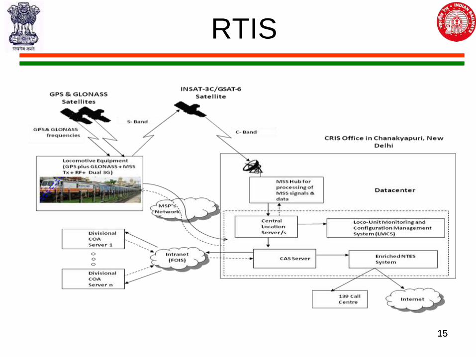
RTIS
15 15
Expected Benefits from New Initiatives
• Enhancing safety in Train operations.
• Dissemination of information to Passengers on Real time
basis.
• Effective utilization of Railways assets.
• Effective Asset/Land utilisation & Encroachment
monitoring and prevention
• Significant cost and time reduction in Project
implementation
• Identification of vulnerable stretches with respect to
floods, landslides etc,
• Effective and efficient management of Railways 16
Institutionalization & Capacity Building
• MoU between Railways and ISRO.
• Establishing BHUVAN node in Railways Data Centre for
departmental applications and citizen centric services
• Capacity Building –
• Training of Trainers for Centralized Training Institutes of
Indian Railways.
• Customized courses on Geospatial Technology Tools for
Railway Officials.
• Technical guidance for various geospatial applications
17
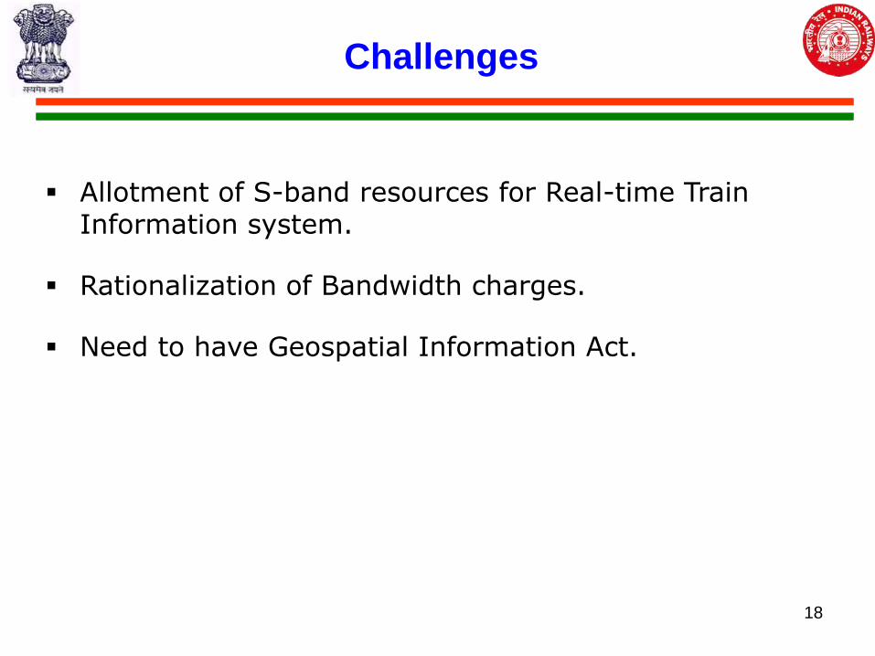
Challenges
Allotment of S-band resources for Real-time Train Information system.
Rationalization of Bandwidth charges.
Need to have Geospatial Information Act.
18
19