Embed Size (px)
Citation preview
Use of remote sensing on Use of remote sensing on turfgrassturfgrass
Soil 4213 course presentationSoil 4213 course presentation
Xi XiongXi Xiong
April 18, 2003April 18, 2003
Why is it necessary to use sensor Why is it necessary to use sensor on turfgrass management?on turfgrass management?
Stress lead to reduced turfgrass Stress lead to reduced turfgrass quality.quality.
Traditional turfgrass management is Traditional turfgrass management is based on visible observation. based on visible observation.
The use of remote sensing may allow The use of remote sensing may allow the turf manager to see stress before the turf manager to see stress before it becomes visible as damage to the it becomes visible as damage to the turf.turf.
BackgroundBackground
Stress causes an increase in reflectance Stress causes an increase in reflectance in the red and blue portions of the in the red and blue portions of the spectrum and decreased reflectance in the spectrum and decreased reflectance in the near infrared (NIR) region. near infrared (NIR) region.
methods of assessing plant reflectance methods of assessing plant reflectance properties include infrared thermography, properties include infrared thermography, multispectral radiometry, and near infrared multispectral radiometry, and near infrared spectroscopy.spectroscopy.
BackgroundBackground (continued)(continued)
Indices such as the Leaf Area Index (LAI) (IR Indices such as the Leaf Area Index (LAI) (IR reflectance/Red reflectance) and Normalized reflectance/Red reflectance) and Normalized Difference Vegetative Index (NDVI) Difference Vegetative Index (NDVI) [(IR-R)/(IR+R)] have been correlated with the [(IR-R)/(IR+R)] have been correlated with the presence of green biomass and provide a presence of green biomass and provide a quantitative estimate of general stress on a quantitative estimate of general stress on a plant. plant.
All of these technologies and knowledge make it All of these technologies and knowledge make it possible of detecting turf quality by remote possible of detecting turf quality by remote sensing. sensing.
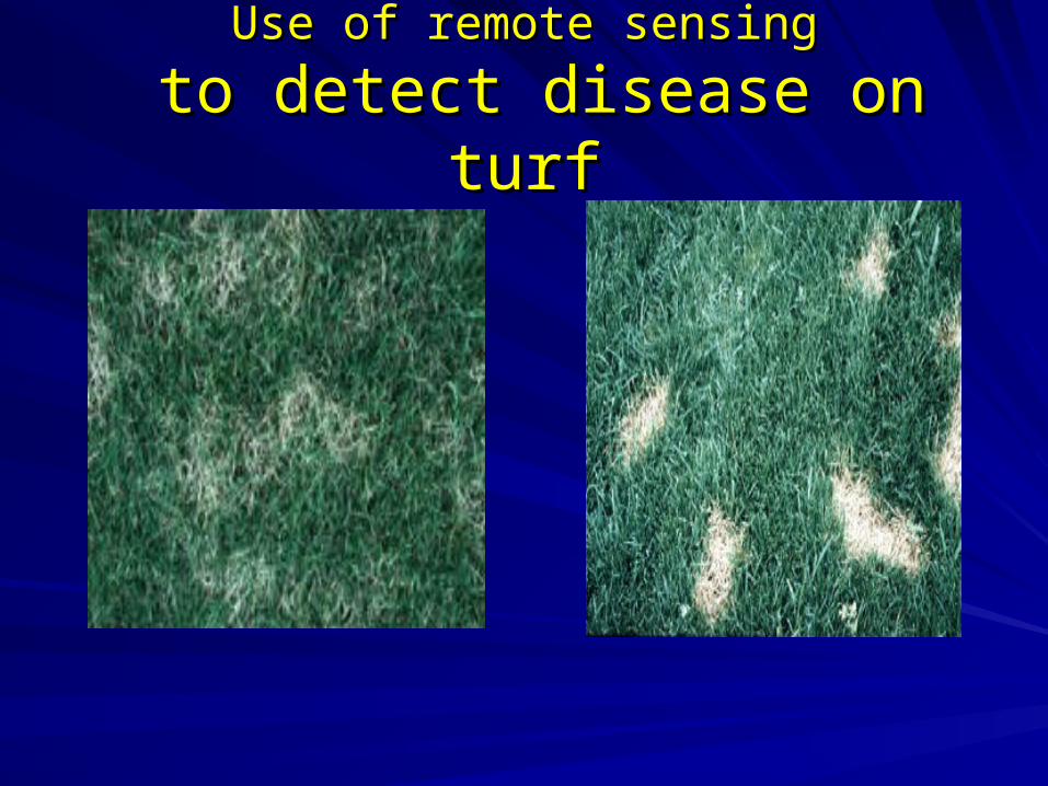
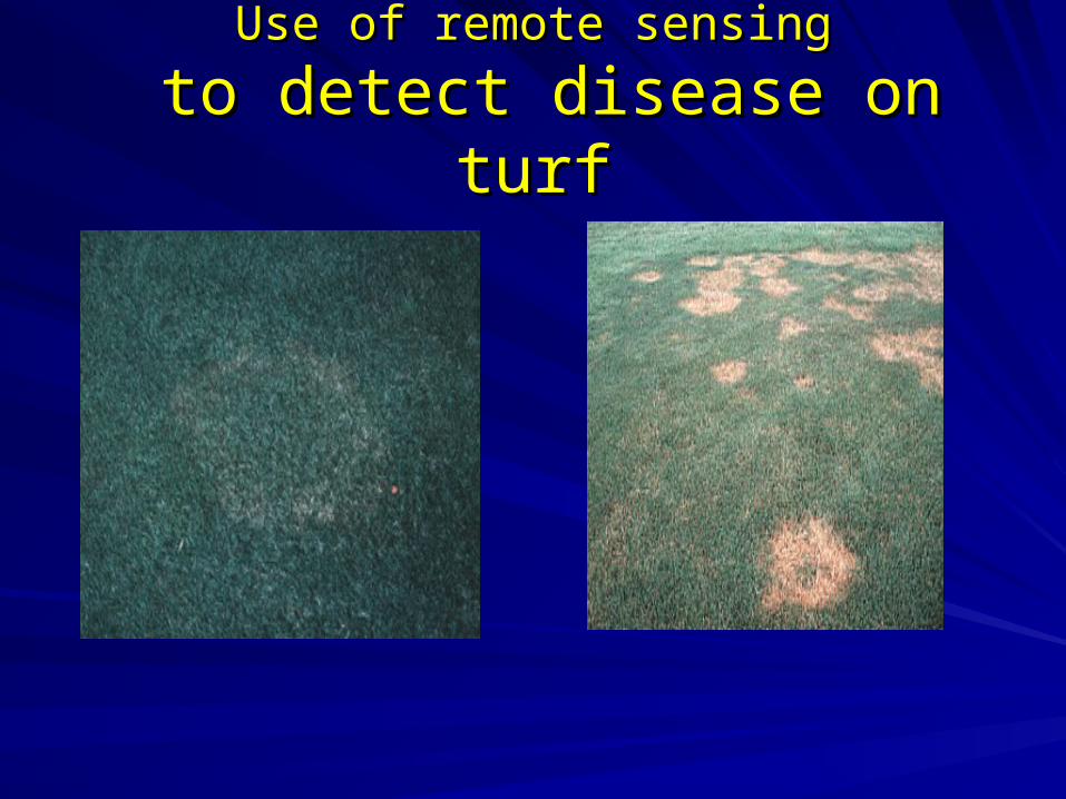
Use of remote sensingUse of remote sensing
to detect disease on turfto detect disease on turf
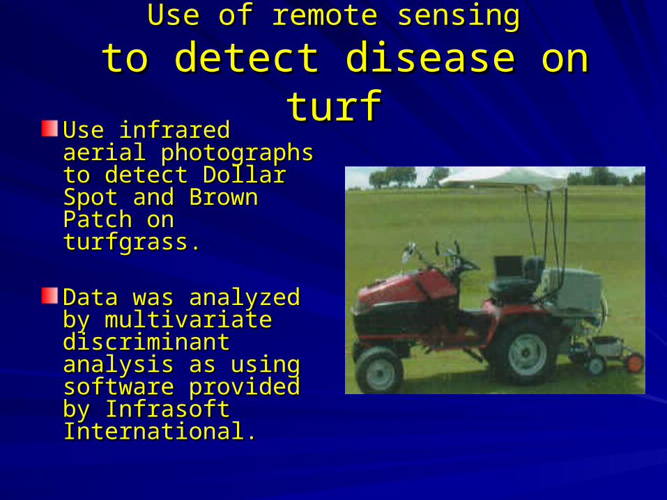
Use of remote sensingUse of remote sensing
to detect disease on turfto detect disease on turf
Use of remote sensingUse of remote sensing
to detect disease on turfto detect disease on turfUse infrared aerial Use infrared aerial photographs to detect photographs to detect Dollar Spot and Dollar Spot and Brown Patch on Brown Patch on turfgrass.turfgrass.
Data was analyzed by Data was analyzed by multivariate multivariate discriminant analysis discriminant analysis as using software as using software provided by Infrasoft provided by Infrasoft International.International.
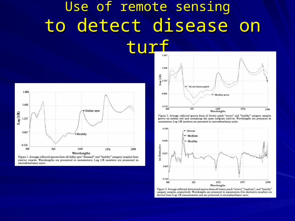
Use of remote sensingUse of remote sensing
to detect disease on turfto detect disease on turf
Use of remote sensingUse of remote sensing
to detect disease on turfto detect disease on turfFrom the Dollar Spot experiment, 20 out of 193 From the Dollar Spot experiment, 20 out of 193 samples (10.3%) were classified incorrectly. samples (10.3%) were classified incorrectly. The data from Brown Patch study showed 29 out The data from Brown Patch study showed 29 out of 337 samples (8.6%) were classified of 337 samples (8.6%) were classified incorrectly.incorrectly.These results indicate that VIS-NIRS is a viable These results indicate that VIS-NIRS is a viable method for assessing brown patch and dollar method for assessing brown patch and dollar spot severity. However, enough data should be spot severity. However, enough data should be collected before to build the threshold levels of collected before to build the threshold levels of disease which is need to determine the proper disease which is need to determine the proper fungicide treatment. fungicide treatment.
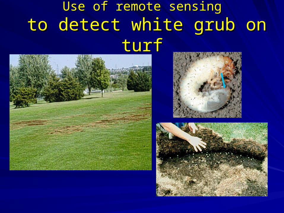
Use of remote sensingUse of remote sensing
to detect white grub on turfto detect white grub on turf
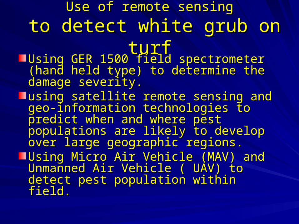
Use of remote sensingUse of remote sensing
to detect white grub on turfto detect white grub on turfUsing GER 1500 field spectrometer (hand Using GER 1500 field spectrometer (hand held type) to determine the damage held type) to determine the damage severity. severity. using satellite remote sensing and geo-using satellite remote sensing and geo-information technologies to predict when information technologies to predict when and where pest populations are likely to and where pest populations are likely to develop over large geographic regions.develop over large geographic regions.Using Micro Air Vehicle (MAV) and Using Micro Air Vehicle (MAV) and Unmanned Air Vehicle ( UAV) to detect Unmanned Air Vehicle ( UAV) to detect pest population within field.pest population within field.
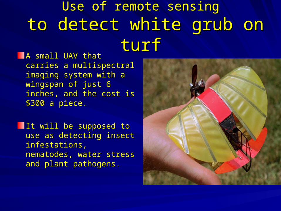
Use of remote sensingUse of remote sensing
to detect white grub on turfto detect white grub on turfA small UAV that carries A small UAV that carries a multispectral imaging a multispectral imaging system with a wingspan system with a wingspan of just 6 inches, and the of just 6 inches, and the cost is $300 a piece.cost is $300 a piece.
It will be supposed to use It will be supposed to use as detecting insect as detecting insect infestations, nematodes, infestations, nematodes, water stress and plant water stress and plant pathogens. pathogens.
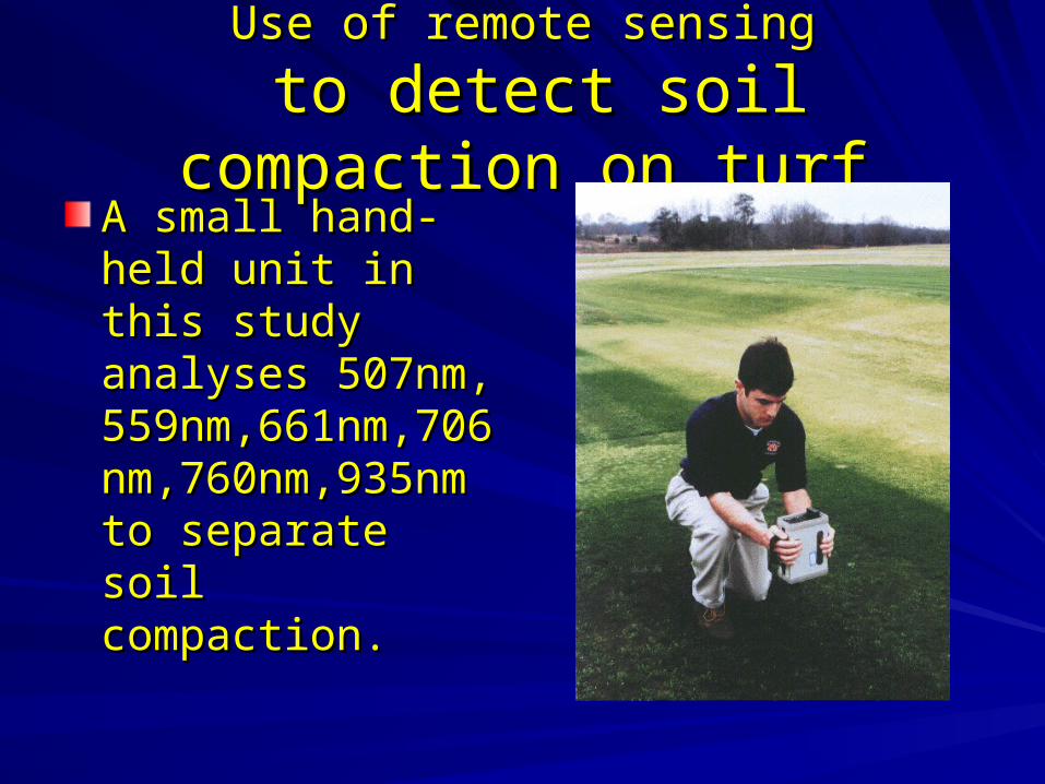
Use of remote sensingUse of remote sensing
to detect soil compaction on turfto detect soil compaction on turfA small hand-held A small hand-held unit in this study unit in this study analyses 507nm, analyses 507nm, 559nm,661nm,706n559nm,661nm,706nm,760nm,935nm to m,760nm,935nm to separate soil separate soil compaction. compaction.
Use of remote sensingUse of remote sensing
to detect soil compaction on turfto detect soil compaction on turfThe result showed that the VIR (visible The result showed that the VIR (visible range) had significant positive correlations range) had significant positive correlations to soil penetrometer readings, while to soil penetrometer readings, while readings in most of the NIR (near infrared) readings in most of the NIR (near infrared) portion of the spectrum did not correlate portion of the spectrum did not correlate with soil strength.with soil strength.One issue needed to concerned is when One issue needed to concerned is when the turf was overseeded with other the turf was overseeded with other turfgrass species, the strong relationship turfgrass species, the strong relationship will decreasewill decrease. .
Use of remote sensingUse of remote sensing
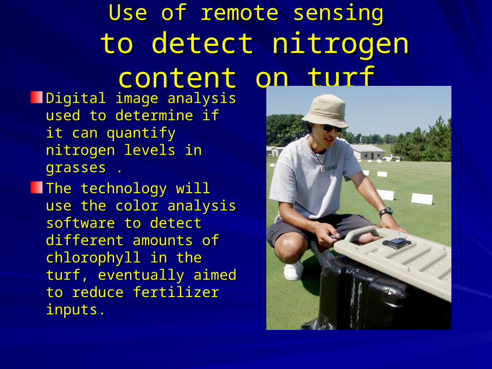
to detect nitrogen content on turfto detect nitrogen content on turfDigital image analysis Digital image analysis used to determine if it can used to determine if it can quantify nitrogen levels in quantify nitrogen levels in grasses .grasses .
The technology will use The technology will use the color analysis the color analysis software to detect software to detect different amounts of different amounts of chlorophyll in the turf, chlorophyll in the turf, eventually aimed to eventually aimed to reduce fertilizer inputs. reduce fertilizer inputs.
Use of remote sensingUse of remote sensing
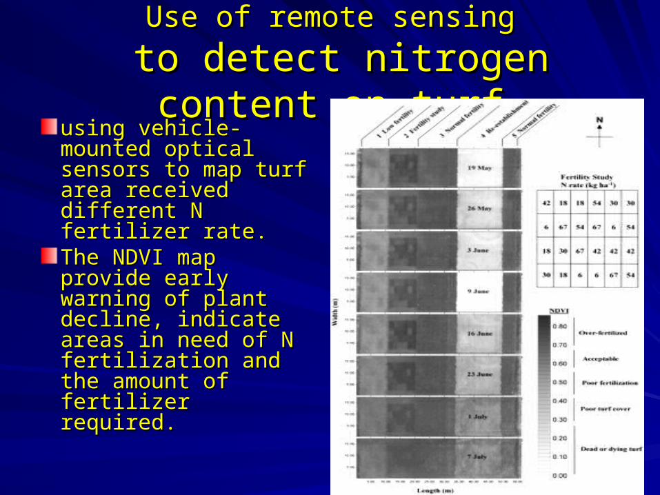
to detect nitrogen content on turfto detect nitrogen content on turfusing vehicle-using vehicle-mounted optical mounted optical sensors to map turf sensors to map turf area received area received different N fertilizer different N fertilizer rate. rate. The NDVI map The NDVI map provide early warning provide early warning of plant decline, of plant decline, indicate areas in need indicate areas in need of N fertilization and of N fertilization and the amount of the amount of fertilizer required.fertilizer required.
Use of remote sensingUse of remote sensing
to detect drainage patterns on Golf courseto detect drainage patterns on Golf course
A project under development in Clemson A project under development in Clemson University is trying to build a three-University is trying to build a three-dimensional digital elevation model (DEM) dimensional digital elevation model (DEM) to identify drainage patterns and possible to identify drainage patterns and possible areas of runoff problems.areas of runoff problems.The project will use GIS to help locating The project will use GIS to help locating aerial maps, and eventually optimize aerial maps, and eventually optimize chemical application rates and irrigation chemical application rates and irrigation rates in golf courses. rates in golf courses.
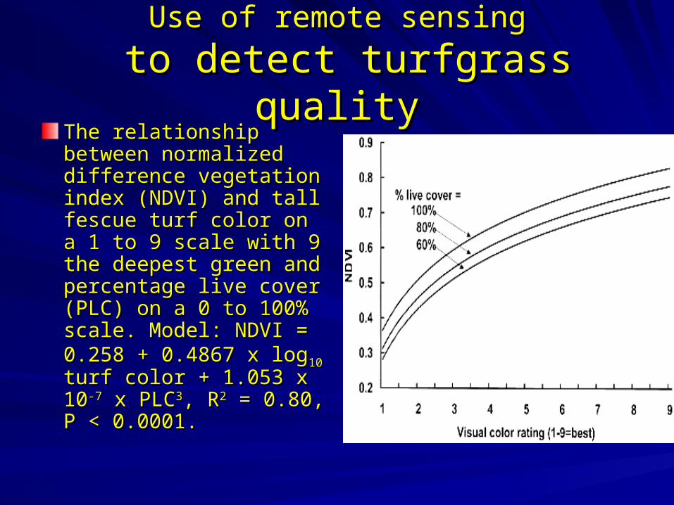
Use of remote sensingUse of remote sensing
to detect turfgrass qualityto detect turfgrass qualityThe relationship between The relationship between normalized difference normalized difference vegetation index (NDVI) vegetation index (NDVI) and tall fescue turf color and tall fescue turf color on a 1 to 9 scale with 9 on a 1 to 9 scale with 9 the deepest green and the deepest green and percentage live cover percentage live cover (PLC) on a 0 to 100% (PLC) on a 0 to 100% scale. Model: NDVI = scale. Model: NDVI = 0.258 + 0.4867 x log0.258 + 0.4867 x log1010 turf turf color + 1.053 x 10color + 1.053 x 10⁻⁷-7 x x PLCPLC33, R, R22 = 0.80, P < = 0.80, P < 0.0001. 0.0001.
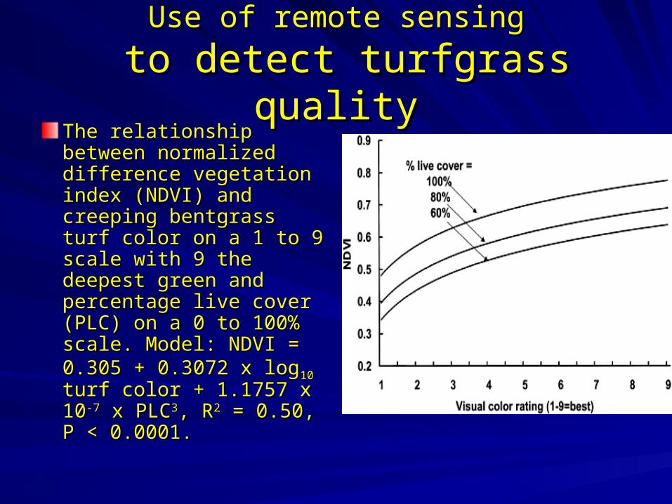
Use of remote sensingUse of remote sensing
to detect turfgrass qualityto detect turfgrass qualityThe relationship between The relationship between normalized difference normalized difference vegetation index (NDVI) vegetation index (NDVI) and creeping bentgrass and creeping bentgrass turf color on a 1 to 9 scale turf color on a 1 to 9 scale with 9 the deepest green with 9 the deepest green and percentage live cover and percentage live cover (PLC) on a 0 to 100% (PLC) on a 0 to 100% scale. Model: NDVI = scale. Model: NDVI = 0.305 + 0.3072 x log0.305 + 0.3072 x log10 10 turf turf color + 1.1757 x 10color + 1.1757 x 10⁻⁷-7 x x PLCPLC33, R, R22 = 0.50, P < = 0.50, P < 0.0001. 0.0001.
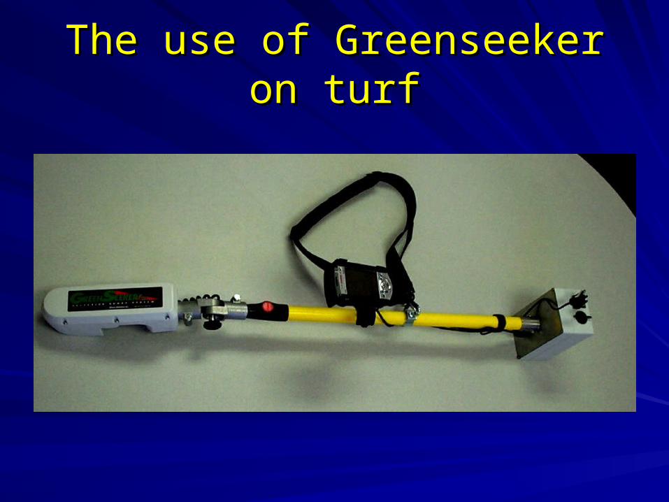
The use of Greenseeker on turfThe use of Greenseeker on turf
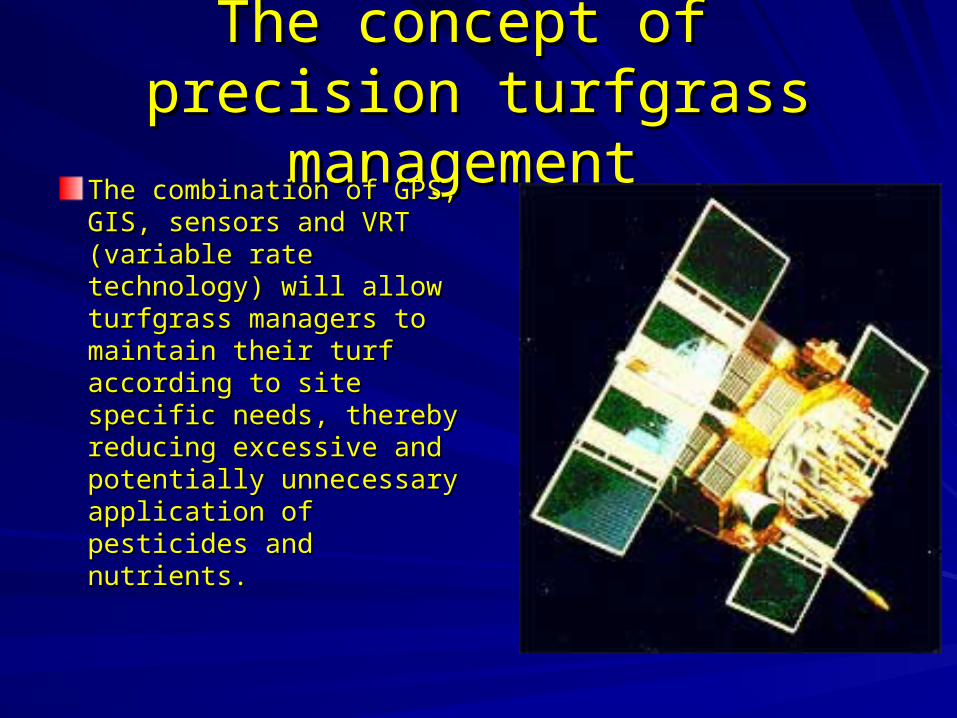
The concept of The concept of precision turfgrass managementprecision turfgrass management
The combination of GPS, The combination of GPS, GIS, sensors and VRT GIS, sensors and VRT (variable rate technology) (variable rate technology) will allow turfgrass will allow turfgrass managers to maintain managers to maintain their turf according to site their turf according to site specific needs, thereby specific needs, thereby reducing excessive and reducing excessive and potentially unnecessary potentially unnecessary application of pesticides application of pesticides and nutrients.and nutrients.
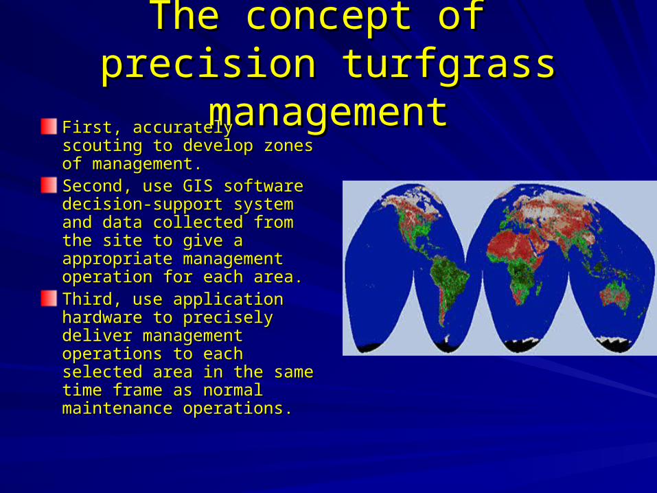
The concept of The concept of precision turfgrass managementprecision turfgrass management
First, accurately scouting to First, accurately scouting to develop zones of develop zones of management.management.Second, use GIS software Second, use GIS software decision-support system and decision-support system and data collected from the site to data collected from the site to give a appropriate give a appropriate management operation for management operation for each area.each area.Third, use application Third, use application hardware to precisely deliver hardware to precisely deliver management operations to management operations to each selected area in the each selected area in the same time frame as normal same time frame as normal maintenance operations. maintenance operations.
Questions?
Thank you!