Embed Size (px)
Citation preview
Use of Remote Sensing Use of Remote Sensing in Forestry Applicationsin Forestry Applications
Murat TunçMurat Tunç
110020209110020209
Use of Remote Sensing Use of Remote Sensing in Forestry Applications in Forestry Applications
There are many forestry applications There are many forestry applications that remote sensing can be used for. that remote sensing can be used for. Some of these applications include Some of these applications include
terrain analysis, forest management, terrain analysis, forest management, recultivation, updating of existing recultivation, updating of existing
forest inventories, forest cover type forest inventories, forest cover type discrimination, the delineation of discrimination, the delineation of
burned areas, and mapping of cleared burned areas, and mapping of cleared areas.areas.
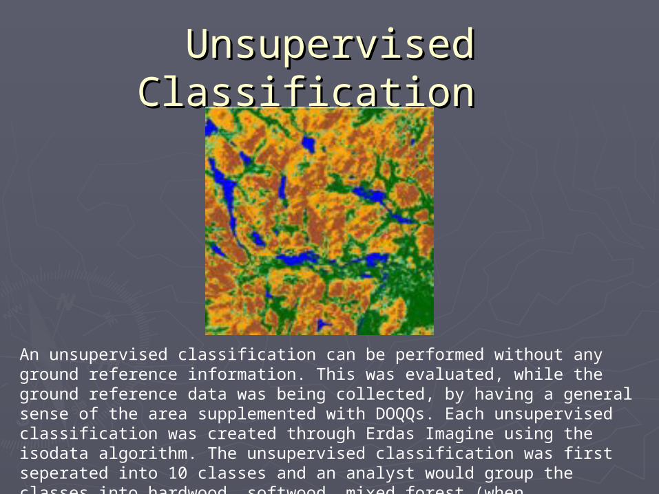
Unsupervised Classification Unsupervised Classification
An unsupervised classification can be performed without any ground reference information. This was evaluated, while the ground reference data was being collected, by having a general sense of the area supplemented with DOQQs. Each unsupervised classification was created through Erdas Imagine using the isodata algorithm. The unsupervised classification was first seperated into 10 classes and an analyst would group the classes into hardwood, softwood, mixed forest (when applicable), open field and water.
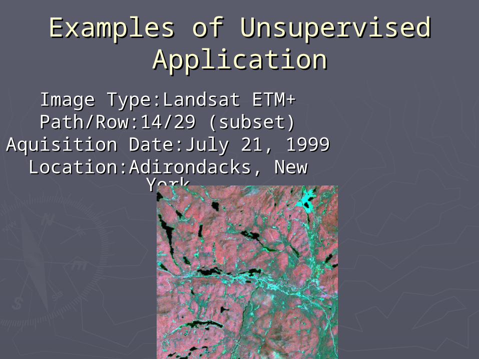
Examples of Unsupervised Examples of Unsupervised ApplicationApplication
Image Type:Landsat ETM+Image Type:Landsat ETM+Path/Row:14/29 (subset)Path/Row:14/29 (subset)
Aquisition Date:July 21, 1999Aquisition Date:July 21, 1999Location:Adirondacks, New YorkLocation:Adirondacks, New York
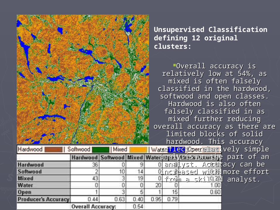
Unsupervised Classification defining 12 original clusters:
Overall accuracy is relatively low at 54%, Overall accuracy is relatively low at 54%, as mixed is often falsely classified in the as mixed is often falsely classified in the hardwood, softwood and open classes. hardwood, softwood and open classes.
Hardwood is also often falsely classified in Hardwood is also often falsely classified in as mixed further reducing overall accuracy as mixed further reducing overall accuracy
as there are limited blocks of solid as there are limited blocks of solid hardwood. This accuracy reflects relatively hardwood. This accuracy reflects relatively
simple analysis on the part of an analyst. simple analysis on the part of an analyst. Accuracy can be increased with more effort Accuracy can be increased with more effort
from a skilled analyst.from a skilled analyst.
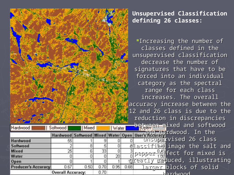
Unsupervised Classification defining 26 classes:
Increasing the number of classes defined Increasing the number of classes defined in the unsupervised classification decrease in the unsupervised classification decrease the number of signatures that have to be the number of signatures that have to be forced into an individual category as the forced into an individual category as the
spectral range for each class increases. The spectral range for each class increases. The overall accuracy increase between the 12 overall accuracy increase between the 12
and 26 class is due to the reduction in and 26 class is due to the reduction in discrepancies between mixed and softwood discrepancies between mixed and softwood and hardwood. In the unsupervised 26 class and hardwood. In the unsupervised 26 class classified image the salt and pepper effect classified image the salt and pepper effect for mixed is greatly reduced, illustrating for mixed is greatly reduced, illustrating
larger blocks of solid hardwood.larger blocks of solid hardwood.
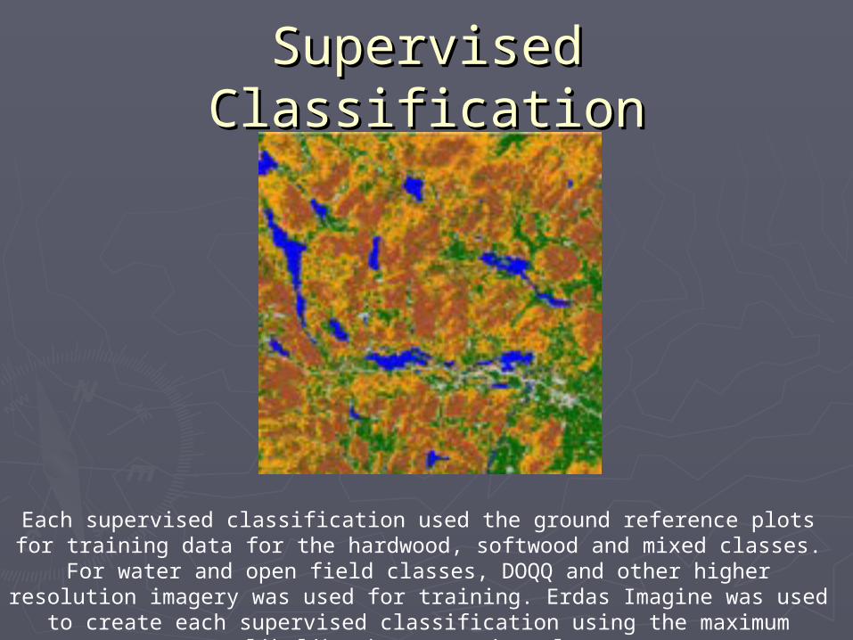
Supervised ClassificationSupervised Classification
Each supervised classification used the ground reference plots for training data for the hardwood, softwood and mixed classes. For water and open field classes, DOQQ and other
higher resolution imagery was used for training. Erdas Imagine was used to create each supervised classification using the maximum likelihood parametric rule.
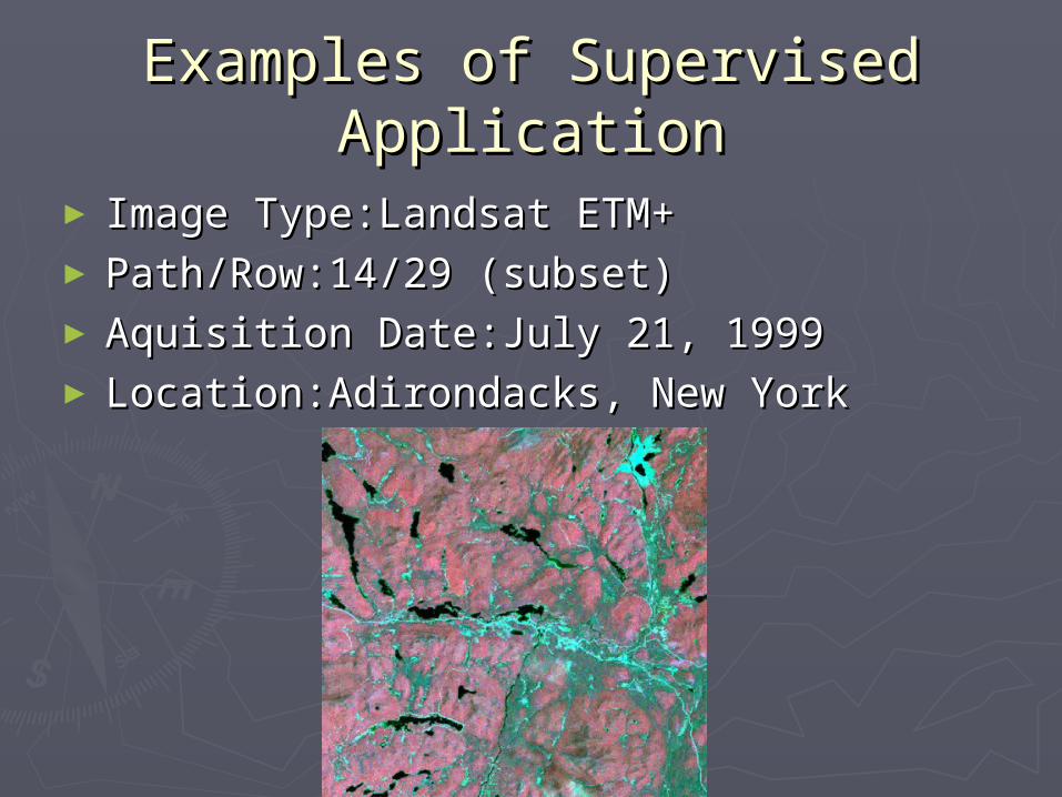
Examples of Supervised Examples of Supervised ApplicationApplication
► Image Type:Landsat ETM+Image Type:Landsat ETM+► Path/Row:14/29 (subset)Path/Row:14/29 (subset)► Aquisition Date:July 21, 1999Aquisition Date:July 21, 1999► Location:Adirondacks, New YorkLocation:Adirondacks, New York
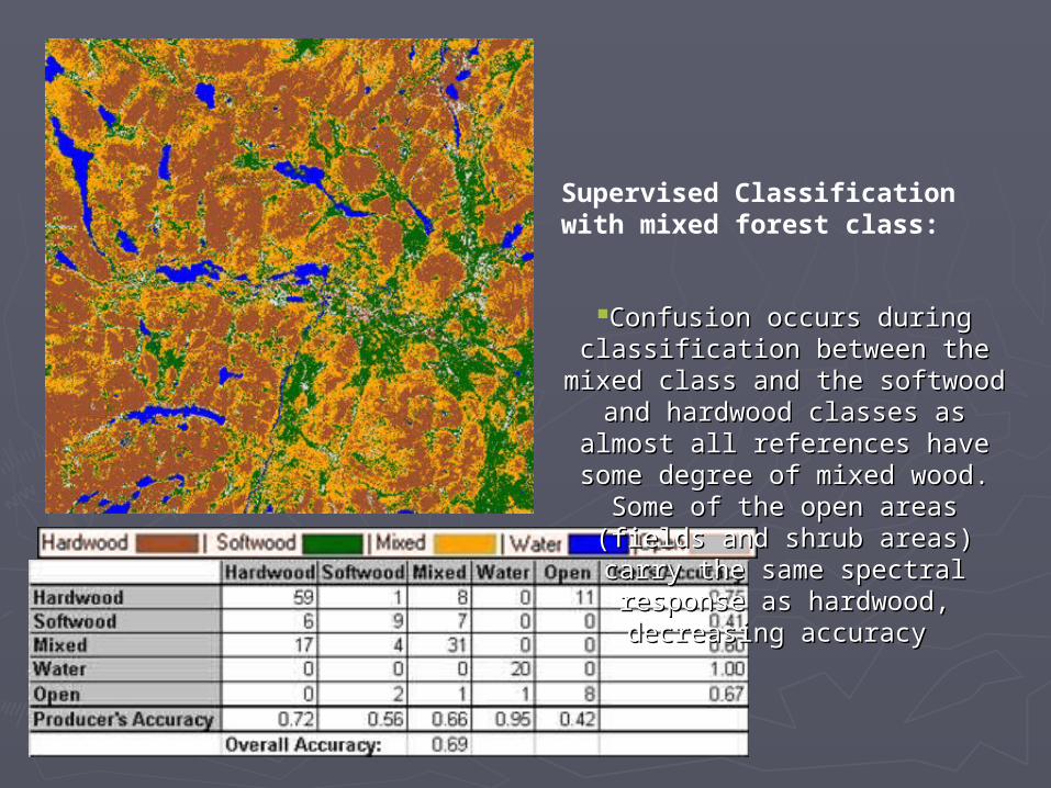
Supervised Classification with mixed forest class:
Confusion occurs during classification Confusion occurs during classification between the mixed class and the softwood between the mixed class and the softwood
and hardwood classes as almost all and hardwood classes as almost all references have some degree of mixed references have some degree of mixed
wood. Some of the open areas (fields and wood. Some of the open areas (fields and shrub areas) carry the same spectral shrub areas) carry the same spectral
response as hardwood, decreasing accuracyresponse as hardwood, decreasing accuracy
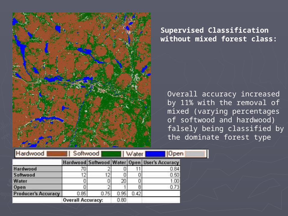
Supervised Classification without mixed forest class:
Overall accuracy increased by 11% with the removal of mixed (varying percentages of softwood and hardwood) falsely being classified by the dominate forest type
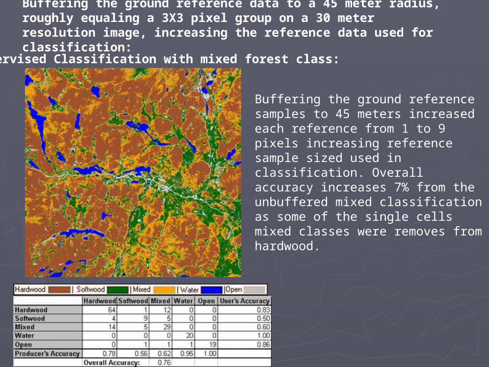
Buffering the ground reference data to a 45 meter radius, roughly equaling a 3X3 pixel group on a 30 meter resolution image, increasing the reference data used for classification:
Supervised Classification with mixed forest class:
Buffering the ground reference samples to 45 meters increased each reference from 1 to 9 pixels increasing reference sample sized used in classification. Overall accuracy increases 7% from the unbuffered mixed classification as some of the single cells mixed classes were removes from hardwood.
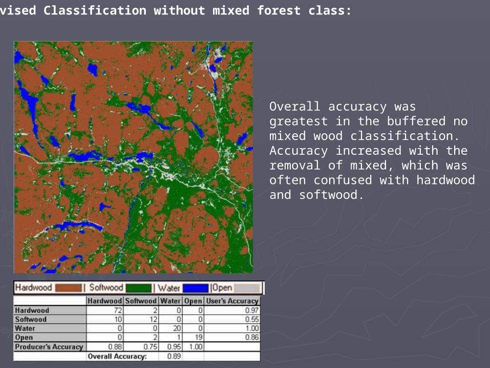
Supervised Classification without mixed forest class:
Overall accuracy was greatest in the buffered no mixed wood classification. Accuracy increased with the removal of mixed, which was often confused with hardwood and softwood.
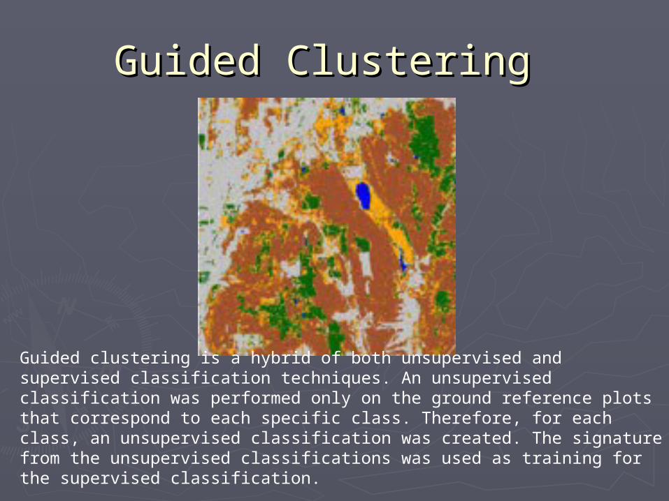
Guided Clustering Guided Clustering
Guided clustering is a hybrid of both unsupervised and supervised classification techniques. An unsupervised classification was performed only on the ground reference plots that correspond to each specific class. Therefore, for each class, an unsupervised classification was created. The signature from the unsupervised classifications was used as training for the supervised classification.
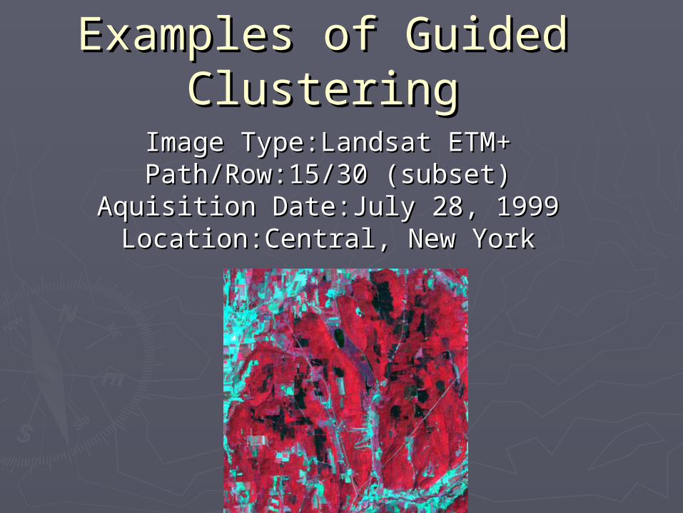
Examples of Guided Examples of Guided ClusteringClustering
Image Type:Landsat ETM+Image Type:Landsat ETM+Path/Row:15/30 (subset)Path/Row:15/30 (subset)
Aquisition Date:July 28, 1999Aquisition Date:July 28, 1999Location:Central, New YorkLocation:Central, New York

Guided Clustering Classification with mixed forest class:
Some of the open class signatures used in classification were similar to those of the different forest classes, lowering the user's accuracy for the open class. The mixed forest type is spread throughout the hard and softwood categories in a salt and pepper effect, reducing the ability of the classifier to delineate hard and softwood classes. This is represented in the error matrix as the fact that mixed is often misclassified in both the hard and softwood categories.
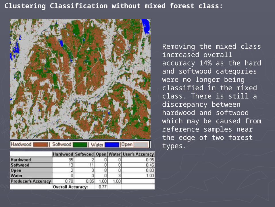
Guided Clustering Classification without mixed forest class:
Removing the mixed class increased overall accuracy 14% as the hard and softwood categories were no longer being classified in the mixed class. There is still a discrepancy between hardwood and softwood which may be caused from reference samples near the edge of two forest types.
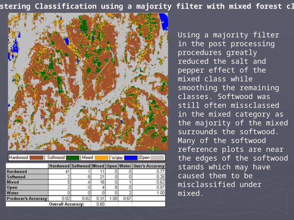
Guided Clustering Classification using a majority filter with mixed forest class:
Using a majority filter in the post processing procedures greatly reduced the salt and pepper effect of the mixed class while smoothing the remaining classes. Softwood was still often missclassed in the mixed category as the majority of the mixed surrounds the softwood. Many of the softwood reference plots are near the edges of the softwood stands which may have caused them to be misclassified under mixed.
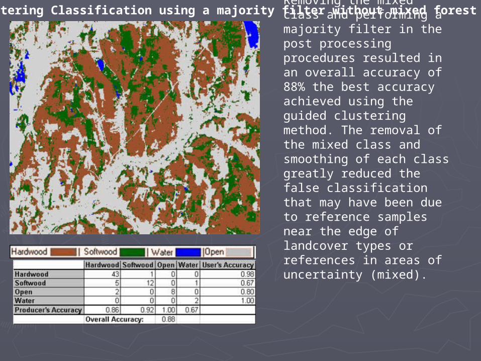
Guided Clustering Classification using a majority filter without mixed forest class:
Removing the mixed class and performing a majority filter in the post processing procedures resulted in an overall accuracy of 88% the best accuracy achieved using the guided clustering method. The removal of the mixed class and smoothing of each class greatly reduced the false classification that may have been due to reference samples near the edge of landcover types or references in areas of uncertainty (mixed).
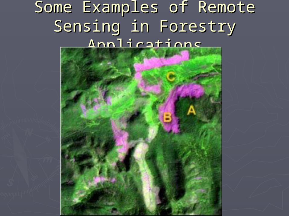
Some Examples of Remote Some Examples of Remote Sensing in Forestry ApplicationsSensing in Forestry Applications
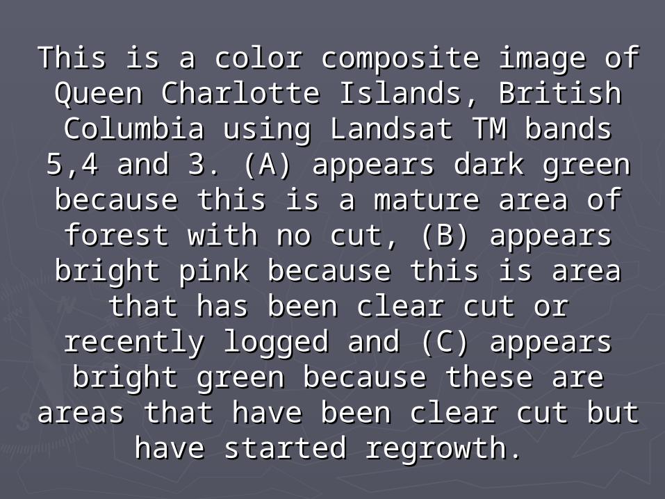
This is a color composite image of Queen This is a color composite image of Queen Charlotte Islands, British Columbia using Charlotte Islands, British Columbia using Landsat TM bands 5,4 and 3. (A) appears Landsat TM bands 5,4 and 3. (A) appears dark green because this is a mature area dark green because this is a mature area of forest with no cut, (B) appears bright of forest with no cut, (B) appears bright pink because this is area that has been pink because this is area that has been
clear cut or recently logged and (C) clear cut or recently logged and (C) appears bright green because these are appears bright green because these are areas that have been clear cut but have areas that have been clear cut but have
started regrowth. started regrowth.
Applications of Remote Sensing Applications of Remote Sensing for Forest Fires in Polandfor Forest Fires in Poland
► For several years the number of fires in European forests has increased. In the For several years the number of fires in European forests has increased. In the case of Polish forests, a new category of forest fire risk has appeared in some case of Polish forests, a new category of forest fire risk has appeared in some regions. Forest fires are a result of the simultaneous existence of at least regions. Forest fires are a result of the simultaneous existence of at least three unfavourable phenomena: long- term drought, the effect of air pollution three unfavourable phenomena: long- term drought, the effect of air pollution (decline and decay of trees, the formation of loose canopy and lush growth of (decline and decay of trees, the formation of loose canopy and lush growth of grasses - all resulting in large amounts of inflammable material) and high grasses - all resulting in large amounts of inflammable material) and high tourist presence in forests. Because of this situation, the Polish Forest Service tourist presence in forests. Because of this situation, the Polish Forest Service has started to apply new techniques and technologies for forest protection: has started to apply new techniques and technologies for forest protection: satellite data and Geographic Information Systems (GIS). satellite data and Geographic Information Systems (GIS).
► High resolution satellite data such as Landsat Thematic Mapper, SPOT and High resolution satellite data such as Landsat Thematic Mapper, SPOT and ERS-SAR combined with low resolution satellite images such as NOAA-AVHRR ERS-SAR combined with low resolution satellite images such as NOAA-AVHRR offer new possibilities to monitor forest fires. They have a number of offer new possibilities to monitor forest fires. They have a number of advantages over conventional means of observation: Using satellite images, it advantages over conventional means of observation: Using satellite images, it is possible to view vast expanses of land (thousands to tens of thousands of is possible to view vast expanses of land (thousands to tens of thousands of km2 on one image). This can be performed regularly for the same area and km2 on one image). This can be performed regularly for the same area and recorded in different wavelengths, thus providing information on the state of recorded in different wavelengths, thus providing information on the state of forest resources. Satellite data can be acquired without encountering forest resources. Satellite data can be acquired without encountering administrative restrictions administrative restrictions
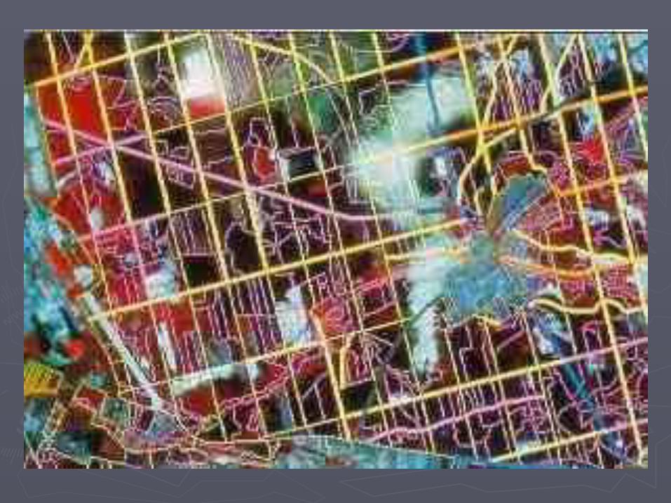
► GIS may be useful in immediately finding the most direct access to GIS may be useful in immediately finding the most direct access to endangered areas and in locating water sourcesendangered areas and in locating water sources
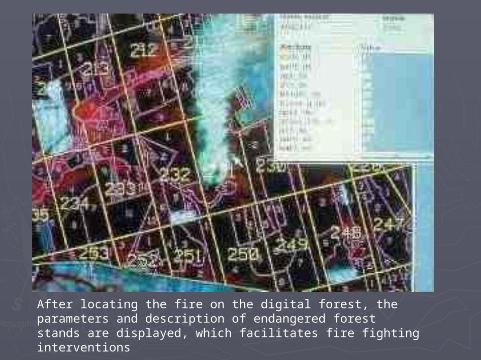
After locating the fire on the digital forest, the parameters and description of endangered forest stands are displayed, which facilitates fire fighting interventions
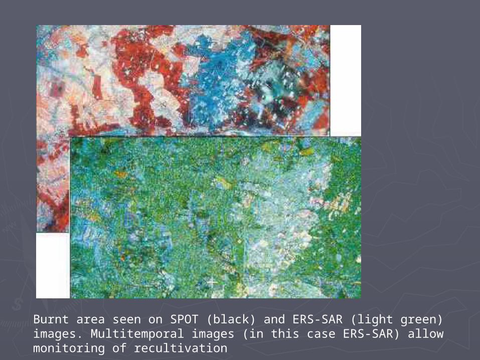
Burnt area seen on SPOT (black) and ERS-SAR (light green) images. Multitemporal images (in this case ERS-SAR) allow monitoring of recultivation
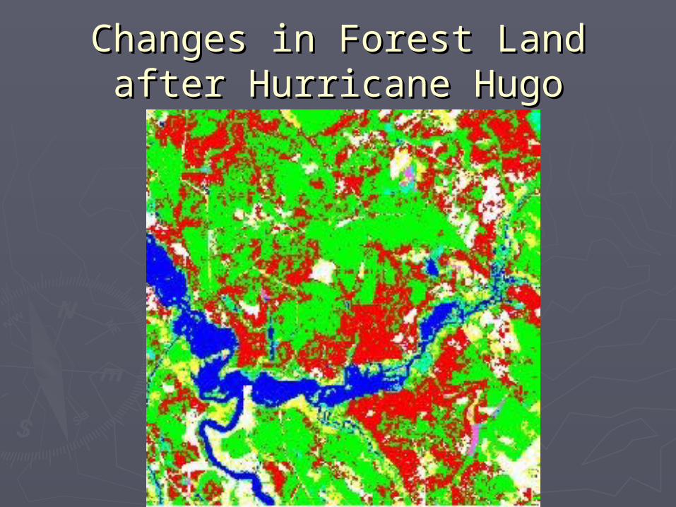
Changes in Forest Land after Changes in Forest Land after Hurricane HugoHurricane Hugo
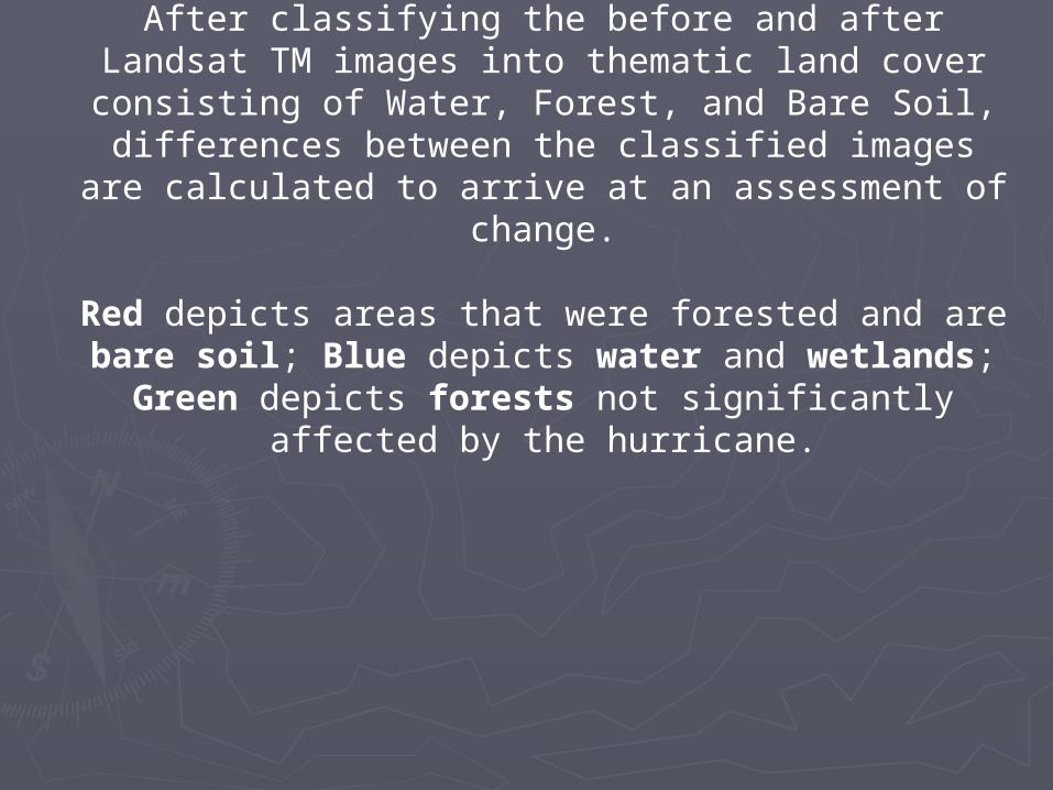
After classifying the before and after Landsat TM images into thematic land cover consisting of Water, Forest, and Bare Soil,
differences between the classified images are calculated to arrive at an assessment of change.
Red depicts areas that were forested and are bare soil; Blue depicts water and wetlands; Green depicts forests not
significantly affected by the hurricane.
Conclusion:Conclusion:
► We can see that remote sensing in forestry is very We can see that remote sensing in forestry is very important. Because we can see the places that are important. Because we can see the places that are damaged by people, or the places that are cut from damaged by people, or the places that are cut from the space; and you can get these images when the the space; and you can get these images when the satellite is passing above your region. satellite is passing above your region.
► You can understand where there is a fire, how big You can understand where there is a fire, how big the fire is or where the fire is going to without going the fire is or where the fire is going to without going to that place, and you can take precautions to that place, and you can take precautions immediately.immediately.
► For example after a hurricane or disasters, the For example after a hurricane or disasters, the damages on forests can be understood in a very damages on forests can be understood in a very short time, and the places where regrowth must be short time, and the places where regrowth must be made can be seen from above.made can be seen from above.
References:References:
► http://www.fao.org/sd/EIdirect/EIre0074.htmhttp://www.fao.org/sd/EIdirect/EIre0074.htm► http://www.geog.ucl.ac.uk/%7Esmerino/http://www.geog.ucl.ac.uk/%7Esmerino/► http://forest.esf.edu/technicalAnalysis.htmlhttp://forest.esf.edu/technicalAnalysis.html► http://www.emporia.edu/earthsci/student/talk2/forestry1text.hhttp://www.emporia.edu/earthsci/student/talk2/forestry1text.h
tmtm

![CASE OF MUSTAFA TUNÇ AND FECİRE TUNÇ v. TURKEY · such (see, for example, Dalban v. Romania [GC], no. 28114/95, ECHR 1999-VI). 3. The applicants were represented on behalf of the](https://img.pdfslide.us/doc/110x75/5e27849db6b9ce03dc64bbd5/case-of-mustafa-tun-and-fecre-tun-v-turkey-such-see-for-example-dalban.jpg)