Embed Size (px)
Citation preview

USE GROUP 16D – SELF- SERVICE STORAGE FACILITIES N 174025(A) ZRY
Matter underlined is new, to be added; Matter struck out is to be deleted; Matter within # # is defined in Section 12-10; * * * indicates where unchanged text appears in the Zoning Resolution. ARTICLE I GENERAL PROVISIONS Chapter 2 Construction of Language and Definitions
* * * 12-10 DEFINITIONS
* * * Industrial floor space “Industrial floor space” is #floor area# or #cellar# space, excluding mechanical space and common space such as hallways, lobbies or stairways, with a minimum clear height from floor to ceiling of 15 feet, and allocated to one or more of the #manufacturing#, semi-industrial or industrial #uses# listed in Use Groups 9A (limited to art studios), 10A (limited to photographic or motion picture production studios and radio or television studios), 11A, 16A, 16B, 16D (other than a #self-service storage facility#), 17 or 18.
* * * Self-service storage facility A “self-service storage facility” is a moving or storage office, or a warehouse establishment, as listed in Use Group 16D, for the purpose of storing personal property, where:
(a) such facility is partitioned into individual, securely subdivided space for lease; or
(b) such facility consists of enclosed or unenclosed floor space which is subdivided by secured bins, boxes, containers, pods or other mobile or stationary storage devices; and
(c) such floor space or storage devices less than 300 square feet in area are to be leased or rented to persons or businesses to access, store or remove property on a self-service basis.

* * *
ARTICLE III COMMERCIAL DISTRICT REGULATIONS Chapter 2 Use Regulations
* * * 32-10 USES PERMITTED AS-OF-RIGHT
* * * 32-25 Use Group 16 C8 Use Group 16 consists of automotive and other necessary semi-industrial #uses# which: (1) are required widely throughout the city; and (2) involve offensive noise, vibration, smoke, dust, or other particulate matter, odorous matter,
heat, humidity, glare, or other objectionable influences, making such #uses# incompatible with #residential uses# and other #commercial uses#.
* * *
D. Heavy Service, Wholesale, or Storage Establishments
Carpet cleaning establishments [PRC-F]
Dry cleaning or cleaning and dyeing establishments, with no limitation on type of operation, solvents, #floor area# or capacity per establishment [PRC-F]
Laundries, with no limitation on type of operation [PRC-F]
Linen, towel or diaper supply establishments [PRC-F]

Moving or storage offices, with no limitation as to storage or #floor area# per establishment [PRC-G]*
Packing or crating establishments [PRC-G]
Photographic developing or printing with no limitation on #floor area# per establishment [PRC-C] Trucking terminals or motor freight stations, limited to 20,000 square feet of #lot area# per establishment [PRC-G]
Warehouses [PRC-G]*
Wholesale establishments, with no limitation on #accessory# storage [PRC-C]
E. #Accessory Uses# * In designated areas within #Manufacturing Districts#, as shown on the maps in APPENDIX J (Designated
Areas Within Manufacturing Districts) of this Resolution, a #self-service storage facility# is subject to the provisions of Section 42-121 (Use Group 16D self-service storage facilities).
* * *
ARTICLE IV MANUFACTURING DISTRICT REGULATIONS Chapter 2 Use Regulations
* * * 42-10 USES PERMITTED AS-OF-RIGHT
* * *
42-12 Use Groups 3A, 6A, 6B, 6D, 6F, 7B, 7C, 7D, 7E, 8, 9B, 9C, 10A, 10B, 10C, 11, 12A, 12C, 12D, 12E, 13, 14 and 16
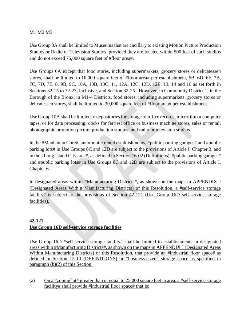
M1 M2 M3 Use Group 3A shall be limited to Museums that are ancillary to existing Motion Picture Production Studios or Radio or Television Studios, provided they are located within 500 feet of such studios and do not exceed 75,000 square feet of #floor area#. Use Groups 6A except that food stores, including supermarkets, grocery stores or delicatessen stores, shall be limited to 10,000 square feet of #floor area# per establishment, 6B, 6D, 6F, 7B, 7C, 7D, 7E, 8, 9B, 9C, 10A, 10B, 10C, 11, 12A, 12C, 12D, 12E, 13, 14 and 16 as set forth in Sections 32-15 to 32-23, inclusive, and Section 32-25.. However, in Community District 1, in the Borough of the Bronx, in M1-4 Districts, food stores, including supermarkets, grocery stores or delicatessen stores, shall be limited to 30,000 square feet of #floor area# per establishment. Use Group 10A shall be limited to depositories for storage of office records, microfilm or computer tapes, or for data processing; docks for ferries; office or business machine stores, sales or rental; photographic or motion picture production studios; and radio or television studios. In the #Manhattan Core#, automobile rental establishments, #public parking garages# and #public parking lots# in Use Groups 8C and 12D are subject to the provisions of Article I, Chapter 3, and in the #Long Island City area#, as defined in Section 16-02 (Definitions), #public parking garages# and #public parking lots# in Use Groups 8C and 12D are subject to the provisions of Article I, Chapter 6. In designated areas within #Manufacturing Districts#, as shown on the maps in APPENDIX J (Designated Areas Within Manufacturing Districts) of this Resolution, a #self-service storage facility# is subject to the provisions of Section 42-121 (Use Group 16D self-service storage facilities). 42-121 Use Group 16D self-service storage facilities
Use Group 16D #self-service storage facility# shall be limited to establishments in designated areas within #Manufacturing Districts#, as shown on the maps in APPENDIX J (Designated Areas Within Manufacturing Districts) of this Resolution, that provide an #industrial floor space# as defined in Section 12-10 (DEFINITIONS) or “business-sized” storage space as specified in paragraph (b)(2) of this Section.
(a) On a #zoning lot# greater than or equal to 25,000 square feet in area, a #self-service storage facility# shall provide #industrial floor space# that is:

(1) equal in #floor area# or #cellar# space to 50 percent of the #lot area#;
(2) located below the level of the third #story#, with at least 50 percent of such#industrial floor space# located on the ground floor where such ground floor#story# is located within five feet of #curb level#, or #base plane#, as applicableand the remaining #industrial floor space# located on a level that is immediatelyabove or below such #story#; and
(3) provided with access to freight elevators and the #accessory# off-street loadingberth required for such #industrial floor space# in accordance with the provisionsof Section 44-586 (Regulations for permitted or required loading berths for zoninglots containing self-service storage facilities in designated areas).
(b) On a #zoning lot# that on [date of adoption] is less than 25,000 square feet in area, a#self-service storage facility# shall provide:
(1) #industrial floor space# as specified in paragraph (a) of this Section; or
(2) #floor area# or #cellar space# containing securely subdivided spaces for leasewithin such #self-service storage facility#, where each subdivided space is notless than 100 square feet in area. Such spaces shall be categorized as “business-sized” for the purposes of this Section. The total area of such business-sizedstorage space shall be equal in #floor area# or #cellar# space to 50 percent of the#lot area#.
The Board of Standards and Appeals may permit a #self-storage service facility# that does not meet the requirements of paragraphs (a) and (b) of this Section pursuant to Section 73-37 (Self-service Storage Facilities in Designated Areas Within Manufacturing Districts ).
Any #self-service storage facility# existing on [date of adoption] located in a designated area within #Manufacturing Districts#, as shown on the maps in APPENDIX J, shall be considered a conforming #use#, provided that the owner of such #self-service storage facility# has filed documentation satisfactory to the Department of Buildings that it existed on [date of adoption] and would have met the definition of #self-service storage facility# set forth in Section 12-10 (DEFINITIONS). The Department of Buildings shall establish a deadline by which time such documentation must be submitted. Any #enlargement# or #extension# to such existing conforming facility need not provide #industrial floor space# or business-sized storage, as applicable, provided there is no increase in #lot area#. In the event that a #building# for which satisfactory documentation has been filed with the Department of Buildings is damaged or destroyed by any means, such #building# may be reconstructed on the same #zoning lot# and continue as a #self-service storage facility# without providing #industrial floor space# or

business-sized storage, as applicable, provided that the #floor area# of such reconstructed #self-service storage facility# does not exceed the #floor area# permitted pursuant to the provisions of Section 43-10 (FLOOR AREA REGULATIONS), inclusive.
Any #self-service storage facility# existing on [date of adoption] that does not file such documentation satisfactory to the Department of Buildings pursuant to the provisions of this Section shall be considered #non-conforming# and subject to the provisions of Article V (NON-CONFORMING USES AND NON-COMPLYING BUILDINGS) of this Resolution.
* * *42-30USES PERMITTED BY SPECIAL PERMIT
* * *42-31By the Board of Standards and Appeals
In the districts indicated, the following #uses# are permitted by special permit of the Board of Standards and Appeals, in accordance with standards set forth in Article VII, Chapter 3.
* * *M1 M2 M3 Sand, gravel or clay pits
M1 M2 M3 #Self-service storage facilities# in designated areas within #Manufacturing Districts#, as shown on the maps in APPENDIX J (Designated Areas Within Manufacturing Districts) of this Resolution, that do not meet the requirements of paragraphs (a) and (b) of Section 42-121 (Use Group 16D self-service storage facilities)
M1 #Schools#, provided they have no living or sleeping accommodations
* * *
Chapter 3 Bulk Regulations
* * *

43-10FLOOR AREA REGULATIONS
* * *
43-123
Floor area increase for an industrial space within a self-service storage facility
In M1-1 Districts in designated areas, as shown on the maps in APPENDIX J (Designated Areas Within Manufacturing Districts) of this Resolution, for any #zoning lot# containing a #self-service storage facility# that meets the requirements of paragraphs (a) or (b)(1) of Section 42-121 (Use Group 16D self-service storage facilities), the maximum permitted #floor area# for #commercial# or #manufacturing uses#, referenced by paragraphs (a) or (b)(1) of Section 42-121, on the #zoning lot#, pursuant to the provisions of Section 43-12 (Maximum floor area ratio), inclusive, may be increased by a maximum of 50 percent of the #lot area# or up to 20,000 square feet, whichever is less.
* * *
Chapter 4 Accessory Off-street Parking and Loading Regulations
* * *44-20REQUIRED ACCESSORY OFF-STREET PARKING SPACES FORMANUFACTURING, COMMERCIAL OR COMMUNITY FACILITY USES
* * *44-28Parking Regulations for Residential Uses in M1-1D Through M1-5D Districts
* * *44-29
Parking Regulations for Zoning Lots Containing Self-Service Storage Facilities in Designated Areas
M1-1 M1-2 M1-3 M2-1 M2-2 M3-1
In the Districts indicated, in designated areas within #Manufacturing Districts#, as shown on the maps in APPENDIX J (Designated Areas Within Manufacturing Districts) of this Resolution, the provisions of Section 44-21 (General Provisions) are modified as set forth in this Section for all #uses# within the #industrial floor space#.
For any #zoning lot# containing a #self-service storage facility# that meets the requirements of paragraphs (a) or (b) (1) of Section 42-121 (Use Group 16D self-service storage facilities), #accessory# off-street parking spaces, open or enclosed, shall not be required for all #uses# within #industrial floor space#, where all such #uses# occupy less than 10,000 square feet of #floor area# or have fewer than 15 employees. For #industrial floor space# on such #zoning lots# where all such #uses#, in total, occupy at least 10,000 square feet of #floor area# or have 15 or more employees, #accessory# off-street parking spaces, open or enclosed, shall be required for all #uses# within the #industrial floor space# at the rate of one space per 2,000 square feet of #floor area#, or one space per three employees, whichever will require a lesser number of spaces.
* * *44-50GENERAL PURPOSES
* * *
44-58Additional Regulations for Permitted or Required Berths
* * *44-586Regulations for permitted or required loading berths for zoning lots containing self-service storage facilities in designated areas
M1-1 M1-2 M1-3 M2-1 M2-2 M3-1
In the Districts indicated, in designated areas within #Manufacturing Districts#, as shown on the maps in APPENDIX J (Designated Areas Within Manufacturing Districts) of this Resolution, the provisions of Sections 44-52 (Required Accessory Off-street Loading Berths) and 44-581 (Size of required loading berths) are modified as set forth in this Section.
For any #zoning lot# containing a #self-service storage facility# that meets the requirements of paragraphs (a) or (b)(1) of Section 42-121 (Use Group 16D self-service storage facilities), all required #accessory# off-street loading berths for a #self-service storage facility# shall have a

minimum length of 37 feet. The dimensions of off-street loading berths shall not include driveways, or entrances to or exits from such off-street loading berths.
The number of #accessory# off-street loading berths required for all #uses# occupying #industrial floor space# shall be as set forth in the following table:
#Floor Area# (in square feet) Required Loading Berths
First 15,000 None
Next 25,000 1
Next 40,000 1
Each additional 80,000 or fraction thereof 1
Additional loading berths shall not be required for a change of #use# within an existing #building# from Use Group 16D to a #self-service storage facility#.
* * *ARTICLE VII ADMINISTRATION
Chapter 3 Special Permits by the Board of Standards and Appeals
* * *73-00SPECIAL PERMIT USES AND MODIFICATIONS
* * *73-11General ProvisionsSubject to the general findings required by Section 73-03 and in accordance with the provisionscontained in Sections 73-12 to 72-36 73-37, inclusive, the Board of Standards and Appeals shallhave the power to permit special permit #uses#, and shall have the power to impose appropriateconditions and safeguards thereon.
* * *73-36Physical Culture or Health Establishments

* * *73-37Self-service Storage Facilities in Designated Areas Within Manufacturing Districts
On #zoning lots# in designated areas within #Manufacturing Districts# as shown on the maps in APPENDIX J (Designated Areas Within Manufacturing Districts) of this Resolution, the Board of Standards and Appeals may modify the requirements of paragraphs (a) or (b) of Section 42-121 (Use Group 16D self-service storage facilities), permitting #self-service storage facilities# provided the Board finds that:
(a) such requirements create practical difficulties, with no reasonable possibility that a#development#, #enlargement#, or #conversion# on the #zoning lot# in strict compliancewith the provisions of Section 42-121 (Use Group 16D self-service storage facilities) willbring a reasonable return, and that a reduction or modification of these requirements istherefore necessary to enable the owner to realize a reasonable return from such #zoninglot#; and
(b) the reduction or modification of such requirements is the minimum necessary to affordrelief.
The Board may prescribe additional appropriate conditions and safeguards to minimize adverse effects on the character of the surrounding area.
* * *

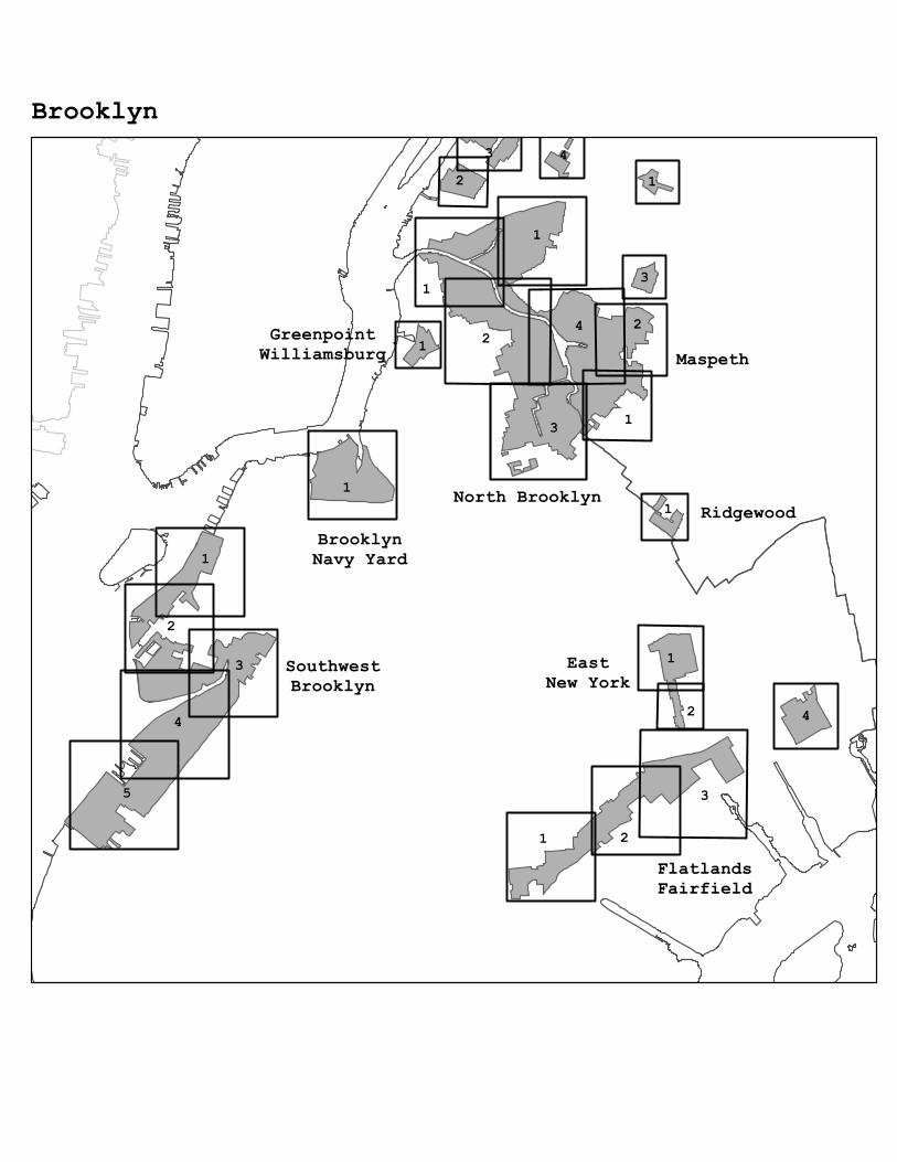
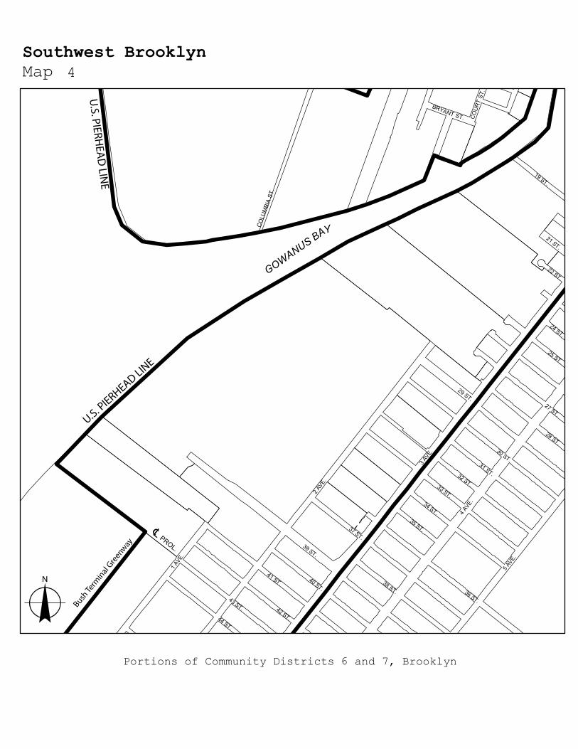
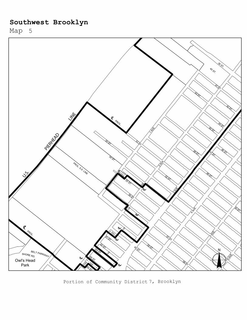
APPENDIX J – Designated Areas Within Manufacturing Districts
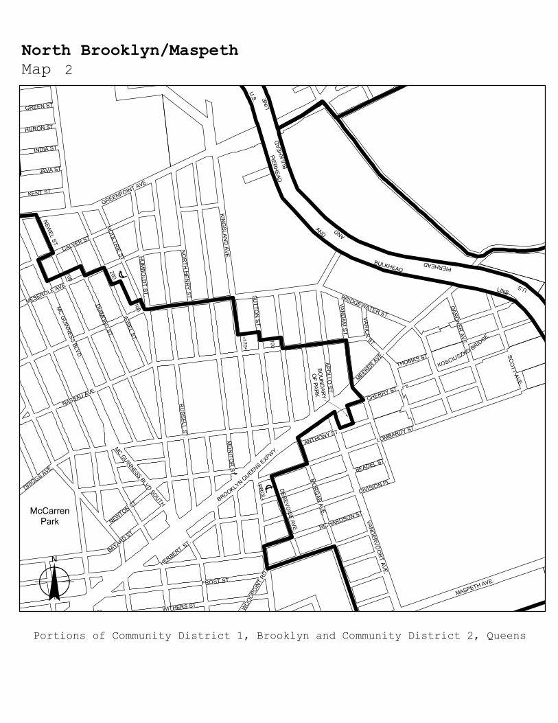
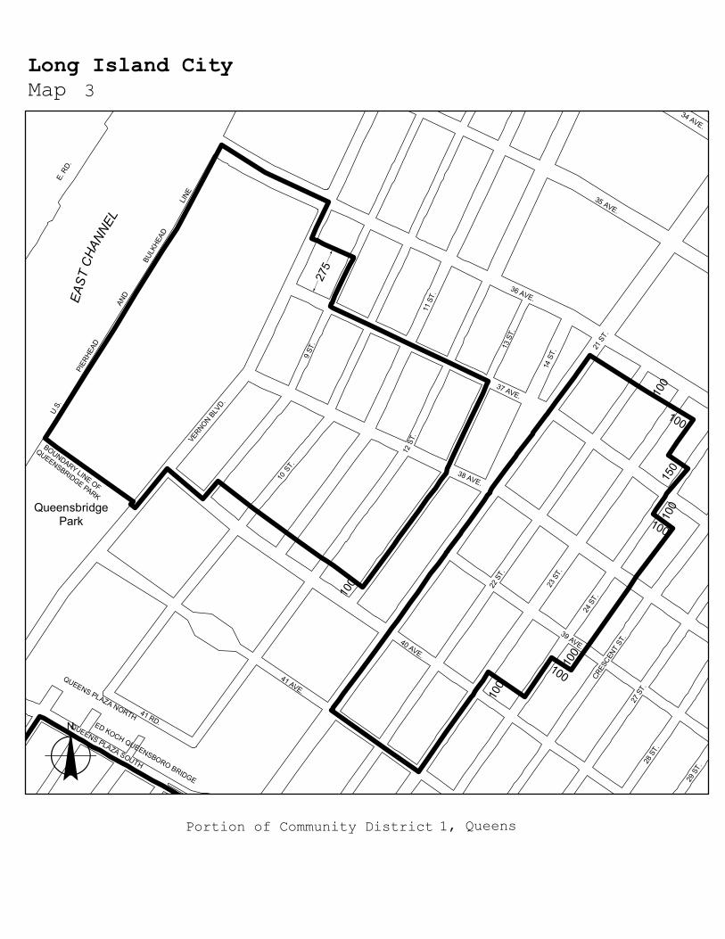
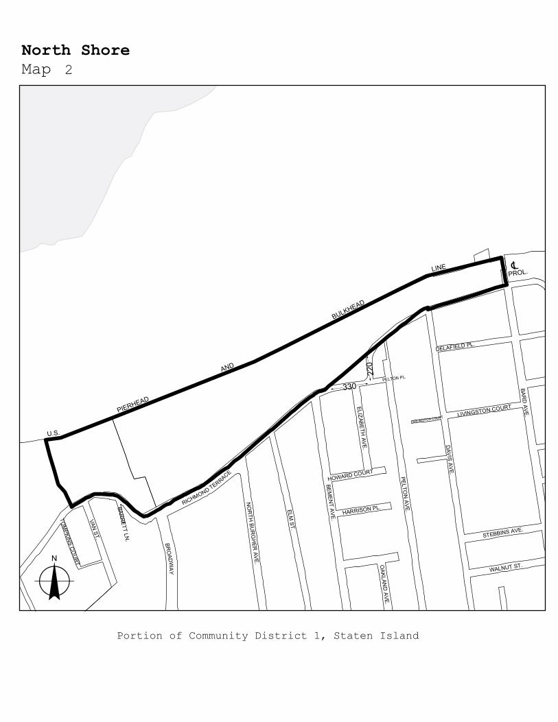
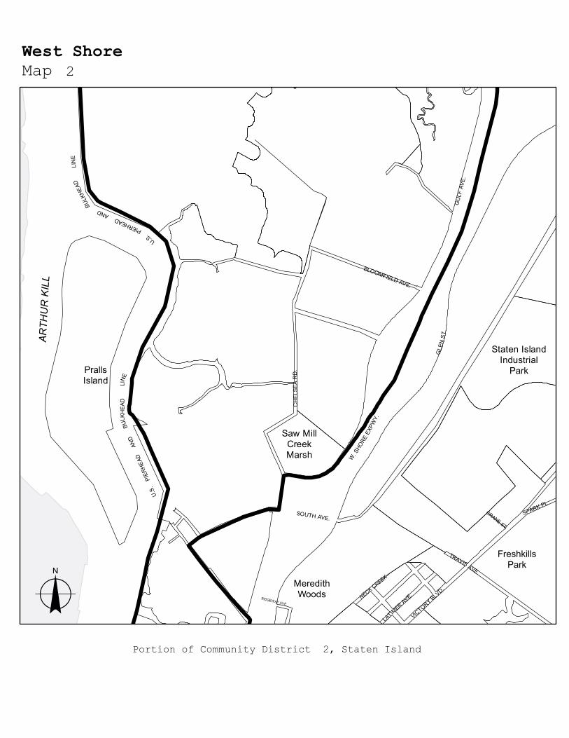
The boundaries of certain designated areas within #Manufacturing Districts# are shown on the maps in this APPENDIX, and include areas in the following Community Districts:
Borough Community Districts
Name of Designated Area in M District
Map_No
The Bronx 1, 2 Port Morris Maps 1-3 The Bronx 2 Hunts Point Maps 1-3 The Bronx 9, 10 Zerega Maps 1, 2 The Bronx 3, 4, 6 Bathgate Map 1 The Bronx 10, 12 Eastchester Map 1 Brooklyn 2 Brooklyn Navy Yard Map 1 Brooklyn 6, 7 Southwest Brooklyn Maps 1-5 Brooklyn 5, 16, 17, 18 Flatlands/Fairfield Maps 1-4 Brooklyn 5, 16 East New York Maps 1, 2 Brooklyn/Queens BK 4/QN 5 Ridgewood Map 1 Brooklyn 1 Williamsburg/Greenpoint Map 1 Brooklyn/Queens BK 1, 4/QN 2 North Brooklyn/Long Island City/
Maspeth Maps 1-3
Queens/Brooklyn QN 2, 5/BK 1 Maspeth/North Brooklyn Maps 1-4 Queens 1, 2 Long Island City Maps 1-4 Queens 2 Woodside Map 1 Queens 1 Steinway Maps 1, 2 Queens 9, 12 Jamaica Maps 1-4 Queens 10, 12, 13 JFK Maps 1-3 Staten Island 1 North Shore Maps 1-5 Staten Island 1, 2 West Shore Maps 1-3 Staten Island 3 Rossville Map 1

1
3
1
2
1
3
12
1
2
1
The Bronx
PortMorris
HuntsPoint
Zerega
Bathgate
Eastchester
1
1
224
1
3 1
1
2
3
4
2
3
1
3
143
2
1
1
4
1
2
5
Brooklyn
SouthwestBrooklyn
GreenpointWilliamsburg
FlatlandsFairfield
EastNew York
RidgewoodBrooklynNavy Yard
North Brooklyn
Maspeth

32
2
1
2
1
1
224
31
23
1
3
143
2
1
2
21
4
1
2 1
3 4
3
Queens
Ridgewood
LIC
JFK
Jamaica
Steinway
Maspeth
Woodside

51 4
3
3
21
2
1
Staten Island
Rossville
WestShore
North Shore

275
300
100
100
100
75
75
150
150 M
ORR
IS A
VE.
E. 138 ST.
GRA
NDC
ON
CO
UR
SE
3 AVE.
ALEX
ANDE
R AV
E.
PARK
AVE
.
E. 144 ST.
LINC
OLN
AVE
.
E. 139 ST.
RIDE
R AV
E.
CAN
AL P
L.
E. 140 ST.
E. 141 ST.
GER
ARD
AV
E.
E. 135 ST.
E. 143 ST.
E. 142 ST.
E. 137 ST.
WAL
TON
AVE
.
CANAL ST. W
.
EXTE
RIO
R S
T.M
AJO
RD
EEG
ANEX
PWY
.
PARK AVE
E. 135 ST.
3 AVE.
PIERHEA
D LIN
E
o
Port Morris 1Map
Portion of Community District 1, Bronx

210
370
Randall'sIsland Park
CYPR
ESS
AVE.
E. 136 ST.
E. 137 ST.AL
EXAN
DER
AVE.
MAJOR DEEGAN EXPWY.
BRUCKNER BLVD.
WIL
LIS
AVE.
HA
RLEM
RIV
ERD
R.
E. 132 ST.
1 AV
E.
WILLIS AVE. BRIDGE
E. 120 ST.
E. 135 ST.
E. 127 ST.
ST A
NNS
AVE
.
ROBE
RTF
KENN
EDY
BRID
GE
2AV
E.
E. 125 ST.
E. 140 ST.
F DR
DR.
E. 116 ST.
BRUCKNER EXPWY.
E. 138 ST.
E. 118 ST.
E. 139 ST.
BRO
WN
PL.
E. 134 ST.
E. 124 ST.
E. 119 ST.
E. 126 ST.
PALADIN
O AVE.
LINC
OLN
AV
E.
E. 132 ST.
E. 132 ST.
E. 133 ST.
E. 134 ST.
EASTR
IVE
R
HARLEM RIVER
BULKHEAD LINEU.S. PIERH
EAD
U.S. PIERHEAD
AND
LINE
o
Port Morris 2Map
Portion of Community District 1, Bronx

100
100
SouthBrotherIsland
St.Mary'sPark
NorthBrotherIsland
E. 140 ST.
E. 138 ST.
E. 141 ST.
SOU
THER
N B
LVD
.
E. 145 ST.
BRUCKNER EXPWY.
E. 132 ST.
ST MARYS ST.
E. 133 ST.
LOCUST
AVE
.
E. 144 ST.
AUSTIN PL.
TIN
TON
AVE
.
WAL
ES A
VE.
WIL
LOW
AVE
.
CYP
RES
S AV
E.
CON
CO
RD
AVE.
E. 134 ST.
WAL
NUT AV
E.
E. 142 ST.
E. 137 ST.
POW
ERS
AVE.
E. 147 ST.
E. 139 ST.
E. 135 ST.
E. 136 ST.
DU
PON
T ST.
BARR
Y ST.
TIMPSON PL.
EAST
RIV
ER
JACK
SON
AVE
.
E. 149 ST.
cL
o
Port Morris/Hunts Point 3Map
U.S. PIERHEAD LINE
Portions of Community Districts 1 and 2, Bronx

? PROL.
175
120
260100
95
BECK
ST.
LEGGETT AVE.
LAFAYETTE AVE.
BARR
ETTO ST.
CASAN
OVA ST.
MAN
IDA ST.
SPOFFORD AVE.
RANDALL AVE.
BRYAN
T AVE.
CO
STER ST.
FOX
ST.
HALLEC
K ST.
WO
RTH
EN ST.
BRUCKNEREX
PWY.
HUNTS POINT AVE.
FAILE ST.
KELL
Y ST
.
BRUCKNERBL
VD.
BARR
Y ST
.
E. BAY AVE.
SOUTH
ERN B
LVD.
BURNETT PL.
TRUX
TON
ST.
OAK POINT AVE.
E. 156 ST.
GARRI
SON
AVE.
VIELE AVE.
RYAWA AVE.
GRINNELL PL.
WH
ITTIER ST.
DRAKE PARK SOUTH
CR
AVEN ST.
DU
PON
T ST.
TIFFANY ST.
DR
AKE ST.
LON
GFELLO
W AVE.
EAST RIVER
U.S. PIERHEAD LINE
100
BarrettoPointPark
o
Hunts Point 1Map
cL
Portion of Community District 2, Bronx

PROL. OF FORMER EAST BAY AVE.
SoundviewPark
RANDALL AVE.
DR
AKE
ST.
RYAWA AVE.
FAILE ST.
CO
STER ST.
HUNTS POINT AVE.BRYAN
T AVE.
LON
GFELLO
W AVE.
WH
ITTIER ST.
FOO
D CENTER DR.
EASTR
IVE
R
BRON
XRIVER
cL
100U.S. PIERHEAD LINE
o
Hunts Point 2Map
Portion of Community District 2, Bronx

150
100
SoundviewPark
BronxRiver
Parkway
BRUCKNER BLVD.
BRUCKNER EXPWY.
BR
ON
XR
IVER
PAR
KWAY
SPOFFORD AVE.
CO
STER ST.
WATSON AVE.
BRYAN
T AVE.
SH
ERID
ANE
XP
WY
.
BRO
NX R
IVER AVE.
STORY AVE.
HUNTSPOINT
AVE.
GARRISON AVE.
WH
ITLO
CK
AVE.
E. 165 ST.
EASTERN BLVD BRIDGE
LAFAYETTE AVE.
CLO
SE AVE.
SENECA AVE.
FAILE ST.
LON
GFELLO
W AVE.
WH
ITTIER ST.
CO
LGA
TEA
VE.
BOYN
TON
AVE.
DR
AKE ST.
ED
GEW
ATER
RD
.
STRATFO
RD
AVE.
MAN
OR
AVE.
WAR
D AVE.
MO
RR
ISON
AVE.
ELDER
AVE.
WH
EELER AVE.
EVERG
REEN
AVE.
HALLEC
K ST.
BRUCKNER EXPWY.
PED.
ST
.
LON
GFELLO
W AVE.
cLBRONX
RIVER
U.S. PIERHEAD
AND
BULKHEAD LINE
o
Hunts Point 3Map
Portion of Community District 2, Bronx

290150
150
100
100
500
300
300
PROL.PROL.
200
PROL.
FerryPointPark
ZEREG
A AVE.
CASTLE H
ILL AVE.
CROSS BRONX EXPWY.
BRUCKNER EXPWY.
RANDALL AVE.
BRUSH
AVE.
HAVEM
EYER AVE.
OLM
STEAD AVE.
SEWARD AVE.
HU
TCH
INSO
N R
IVE
R P
AR
KW
AY
BRUCKNER BLVD.
LACOMBE AVE.
NORTON AVE.
QUIMBY AVE.
CINCINNATUS AVE.
TOR
RY AVE.
HO
WE AVE.
TUR
NEU
R AVE.
ROHR PL.
STORY AVE.
HERMANY AVE.
TURNBULL AVE.
LAFAYETTE AVE.
EFFING
HAM
AVE.
VIRGIL PL.
HOMER AVE.
WENNER PL.
SENGER PL.
JAY PL.
HU
TCH
INSO
N R
IVER
PAR
KWAY
SER
VIC
E R
D. O
F
SE
RV
ICE
RD
. OF
H.R
.P.
cL
U.S.
PIE
RHEA
D A
ND
WESTC
HESTER
cL
SCHLEY AVE.
cL
cL
BULKHEAD
LINE
CREEKU.S. PIERH
EAD AN
DBU
LKHEA
D LIN
E
cL
Portion of Community District 9, Bronx
o
Zerega 1Map

200
200
200
100
100
100
100
100
250
250
250
150
100
100 PROL.E.S.L.
FORMER D
OCK ST.
N.S.L. FO
RM
ER
DO
CK ST.
140
FORMER
KIR
K ST.
100
100
100
150
150
300PR
OL.
cL
cL
cLFORMER BLACK
ROCK AVE.
NEWBOLD AVE.
CASTLE H
ILL AVE.
BRUCKNER EXPWY.
HU
TCH
I NS
ON
RIV
ER
PAR
KW
AY
GLEBE AVE.
CROSS BRONX EXPWY.
BRUCKNER BLVD.
DUDLEY AVE.
PARKER ST.
BENSON ST.E. TREMONT AVE.
WESTC
HESTER A
VE.
HAVEM
EYER AVE.
BUTLER PL.
ELLIS AVE.
SEABUR
Y AVE.
HAVILAND AVE.
GLEASON AVE.
HERSCHELL ST.
ERIC
SON
PL.
EDWARDS AVE.
MAITLAND AVE.
COMMERCE
AVE
.
ELLISON AVE.
MACLAY A
VE.
WILL
IAMPL.
STRAY
MONDAVE.
FRIS
BY AVE.
POWELL AVE.
LYON A
VE.
OVERING ST.
SEDDON ST.
WATSON AVE.
DORSEY ST.
DORIS ST.
FERRIS PL.
TRATM
AN AVE.
ROWLAND ST.
BALCOM
AVE.
WATERBURY AVE.
BLACKROCK AVE.
HALSEY ST.
VREELAND AVE.
ROWE ST.
LN. A
VE.
WESTC
HE
STE
RC
RE
EK
U.S. P
IERHEAD
AN
D
BU
LKH
EAD
L
INE
o
Zerega 2Map
Portions of Community Districts 9 and 10, Bronx

90
550
325
210
100
100
90°
100
cL
cL
180
220
cL
200
CrotonaPark
TremontPark
ClaremontPark
CAR
TER
AVE.
CROSS BRONX EXPWY.
BATH
GAT
E AV
E.
WE
EK
S A
VE
.
3 AV
E.MO
NR
OE
AVE.
WAS
HING
TON
AVE.
CLA
Y A
VE
.
PARK
AVE
.
WEB
STER
AVE
.
E. TREMONT AVE.
CROTONA PARK NORTH
E. MT EDEN AVE.
E. 175 ST.
E. 176 ST.
ANTH
ON
Y AV
E.
CRO
TONA
AVE
.
ITTNER PL.
E. 172 ST.
PROSPECT PL.
E. 174 ST.
E. 173 ST.
TOPP
ING
AVE
.
FULT
ON
AVE.
BRO
OK
AVE.
CLAREMONT PKWY.
E. 174 ST.
CART
ER A
VE.
BELMONT ST.
o
Bathgate 1Map
Portion of Community Districts 3, 4, and 6, Bronx

225
50 100
100
100
100
350100
PelhamBay Park
PublicPlace
BIVON
AST.
E. 233 ST.
BOSTON RD.
ROPES AVE.
NEW ENGLAND THRUWAY
HOLLERS AVE.
PR
ATT
AVE.
LIGHT ST.
BAYCHESTE
RAVE.
DYR
E A
VE
.
HUNTER AVE.
GIVAN AVE.
CONNERST.
NEW
ENGLAND
THRUWAY SERVICE RD.
STEENWICK
AVE.
BOLLER AVE.
WRIG
HT AVE.
RO
MBO
UTS
AVE
.
DARK ST.
DE LAVALL AVE.
BELL AVE.
HUGUENOT AVE.
GARRETT PL.
MER
RIT
TAV
E.
MC OWEN AVE.
MU
LVEY
AVE
.
HUTCHINSONAVE.
HEATHCOTE AVE.
NOELL AVE.
HU
TCH
INSO
N R
IVER
PAR
KWAY
HAR
PER
AV
E.
PEAR
TREE
AVE
.
TILLOTSON AVE.
CO-OP CITY BLVD.
PRO
VOS
TA
VE.
REEDS MILL LN.
SEC
OR
AVE
.
VAR
I AN
AVE
.
CONNER ST.
CONNER ST.
W.R
.O.W
. NYC
T.A.
W.R
.O.W
. NYC
T.A
. BOUNDARY LINE OF THE CITY OF NEW YORK
BOUNDARY LINE OF THE CITY OF NEW YORK
EASTCH
ESTER
BA
Y
U.S
.
PIER
HEA
D
AN
D
cLPROL.
U.S. PIERHEAD
AND
BULKHEAD LINE
LIN
E
BULKHEAD
and 12, Bronx 10 Portions of Community Districts
o
Eastchester 1Map

400
400
N.S.L.
PROL.
PROL.
DIVISION AVE.
ROSS ST.
WYTHE PL.
CLIN
TON
AVE.
NA
VY
ST.
TAYLOR ST.
NO
RTH
POR
TLAND
AVE.
CU
MBER
LAND
ST.
WAVER
LY AVE.
CAR
LTON
AVE.
WASH
ING
TON
AVE.
ADELPH
I ST.
HALL ST.
PARK AVE.
WILSON ST.
CLYMER ST.
DR
IGG
S AV
E.
SOUTH 8 ST.
HEWES ST.
SOUTH 11 ST.
RODNEY ST.
STEUBEN
ST.
MORTON ST.
HOOPER ST.KEAP ST.
GR
AND
AVE.
NO
RTH
ELLIO
TT PL.
NO
RTH
OXFO
RD
ST.
WYTHE AVE.
BED
FOR
D A
VE.
BER
RY
ST.
EMER
SON
PL.
KE
NT AV
E.
FLUSHING AVE.
FLUSHING AVE.
WIL
LIAM
SBU
RG
ST.
W.
EVANSST.
PLYMOUTHST.
NAV
YYAR
DBASIN
EAST RIVER
o
Brooklyn Navy Yard 1Map
U.S. PIERHEAD
ANDBULKHEAD
LINE
U.S.
AN
D B
ULK
HEA
D L
INE
PIER
HEAD
Portion of Community District 2, Brooklyn

100 PROL.
80
50
STATE ST.
CONGRESS ST.
UNION ST.
KANE ST.
HAM
ILTON
AVE.
ATLANTIC AVE.
HEN
RY
ST.
HIC
KS S
T.
GO
WAN
US
EXP W
Y.
FUR
MAN
ST.
DE GRAW ST.
IMLA
Y ST.
2 PL.
1 PL.
CO
LUM
BIA
ST.
3 PL.
SUMMIT ST.
VERONA ST.
PACIFIC ST.
BOWNE ST.
4 PL.
BALTIC ST.
WARREN ST.
COMMERCE ST.
RAPELYE ST.KING ST.
PRESIDENT ST.
LUQUER ST.
DELAVAN ST.
CARROLL ST.
AMITY ST.
WIL
LOW
PL.
VERANDAH PL.
GAR
DEN
PL.
TOM
PKIN
S PL
.
STR
ON
G P
L.
CH
EEVE
R P
L.
TIFF
ANY
PL.
WOODHULL ST.
CO
LUM
BIA
PL.
BRO
OKL
YN Q
UEE
NS
EXPW
Y.
SEABRING ST.
PIONEER ST.CONOVER ST.
HAMILTO
N AVE.
100
, Brooklyn 6Portion of Community District
o
Southwest Brooklyn 1Map
U.S. PIERHEAD LIN
E
EAST RIVER
VAN B
RUNT ST.
COMMERCIAL W
HARF

100
100
75
PROL. OF FORMERHALLECK ST
100
100
60
COMMERCIAL W
HARF
100
cL200
300
100
cL
100 75
400
cL
cLPROL.
Red HookRecreation
Area
CO
LUM
BIA
ST.
HAMILTO
NAVE.
MILL ST.
LORRAINE ST.
W. 9 ST.
VAN DYKE ST.
DWIGHT
ST.
RICHARDS S
T.
HIC
KSST
.
WOLCOTT ST.O
TSEG
O S
T.
IMLA
Y ST.
BRO
OKL
YN Q
UEE
NS
EXPW
Y.
CLINTON
WHARF
LUQUER ST.
DELAVAN ST.
SUMMIT ST.
BOWNE ST.
BEARD ST.
VERONA ST.
DIKEMAN ST.
PIONEER ST.
COMMERCE ST.
HUNTINGTON ST.
HEN
RY
ST.
FERRIS
ST.
CLI
NTO
N S
T.
IKEA
BUS TERMINAL DRWY .
COFFEY ST.
CARROLL ST.
PRESIDENT ST.
BAY ST.
REED ST.
SULLIVAN ST.
KING ST.
VISITATION PL.
BARNELL ST.
GO
WAN
US
EXPWY.
WOODHULL ST.
CREAMER ST.
CONOVER ST.
VAN B
RUNT ST
.
BUTT
ERMILK CHANNEL
o
Southwest Brooklyn 2Map
U.S. PIERHEAD LINE
U.S. PIERH
EAD
LINE
Portion of Community District 6, Brooklyn

PROL.
10060
100
100
520400
100
100
400
100
100
220
220
100
Red HookRecreation
Area
18 ST. 5 AV
E.
CENTRE ST.
4AV
E.
HAM
ILTON
AVE.
11 ST.
8 ST.
9 ST.
10 ST.
12 ST.
16 ST.
13 ST.
14 ST.
MILL ST.
6 AVE.
19 ST.
20 ST.
21 ST.
22 ST.
W. 9 ST.
PROSPECT AVE.
SMIT
H S
T.
17 ST.
PROSPECT EXPWY.
CO
UR
T ST
. BUSH ST.
LORRAINE ST.
2 AV
E.
NELSON ST.
3 AV
E.
BOND
ST.
BAY ST.CREAMER ST.
CLI
NTO
N S
T.
HIC
KS S
T.
HEN
RY
ST.
HAMIL
TON
PL.
BRYANT ST.
4 ST.3 ST.
6 ST.
5 ST.
7 ST.
GO
WANUS EXPW
Y.
15 ST.
HALLECK ST.
HAMILTO
N AVE.
GARNET ST.
HUNTINGTON ST. SMIT
H S
T.
U.S. PIERHEAD LINE
U.S. PIERHEAD
GO
WAN
US
CANA
L
cLcL
cL
cL
cL
AND BULKHEAD
LIN
E
and 7, Brooklyn 6Portions of Community Districts
o
Southwest Brooklyn 3Map
22 ST.
3 AVE
.
34 ST.
31 ST.
37 ST.
36 ST.
30 ST.
35 ST.
33 ST.
39 ST.
32 ST.
38 ST.
40 ST.
29 ST.
42 ST.
41 ST.
28 ST.
24 ST.
5 AVE
.
25 ST.
27 ST.
2 AVE
.
4 AVE
.
1 AVE
.
43 ST.
CO
UR
T ST
.
19 ST.
BRYANT ST.
44 ST.
21 ST.
CO
LUM
BIA
ST.
GOWANUS BAY
U.S. PIERHEAD LIN
E
U.S. PIERH
EAD
LINE
PROL.
cL
Bush Te
rmin
al Gre
enway
o
Southwest Brooklyn 4Map
and 7, Brooklyn 6Portions of Community Districts
PROL. S.S. LINE
100
100
200PROL.
100
350
100
100 430
PROL.
PROL.
cL
cL
cLcL
cL
cL
cL
cL
U.S.
P
IERHEA
D
LINE
Owl's HeadPark
60 ST.
3 AVE
.
SHORE RD.
55 ST.
56 ST.
53 ST.
45 ST.
50 ST.
57 ST.
52 ST.
49 ST.
47 ST.
51 ST.
48 ST.
58 ST.
46 ST.
59 ST.
42 ST.
43 ST.
44 ST.
54 ST.
BELT PARKWAY
2 AVE
.
4 AVE
.
5 AVE
.
6 AVE
.
1 AVE
.
39 ST.40 ST.
41 ST.
62 ST.
61 ST.
63 ST.64 ST.
65 ST.
, Brooklyn 7Portion of Community District
o
Southwest Brooklyn 5Map
cL

330
C.L. OF FORMER
DITMAS AVE.
100
200
100
cL
200
100 120
cL100
cL
100
100
220
RALPH
AVE.
E. 59 ST.
E. 56 ST.
E. 80 ST.
E. 54 ST.
E. 55 ST.
SCH
ENEC
TADY AVE.
E. 53 ST.
AVE. H
ALBANY AVE.
AVE. D
FOSTER AVE.
CLARENDON RD.
KINGS
HIGH
WAY
FARRAGUT RD.
GLENWOOD RD.
UTIC
A AVE.
E. 40 ST.
E. 43 ST.
PRESTON COURT
CANARSIE LN.
E. 83ST.
E. 46 ST.
E. 45 ST.
TRO
Y AVE.
E. 48 ST.
E. 42 ST.
CORTELYOU RD.
E. 51 ST.
E. 49 ST.
JODIE COURT
E. 58 ST.
E. 57 ST.
E. 52 ST.
WHITTY LN.
RR. R.O.W
.
Brooklyn 17 and 18,Portions of Community Districts
o
Flatlands/Fairfield 1Map

100
370
180
90°
100
100
140
200
200
200
100
E. 81 ST.
FARRAGUT RD.
DITMAS AVE.
E. 83 ST.
E. 88 ST.
E. 87 ST.
E. 80 ST.
E. 82 ST.
E. 89 ST.
AVE. B
REMSEN AVE.
AVE. D
E. 92 ST.
E. 86 ST.
GLENWOOD RD.
E. 85 ST.
E. 84 ST.
FLATLANDS AVE.
E. 93 ST.
E. 91 ST.
AVE. J
CONKLIN AVE.
E. 95 ST.
RO
CKA
WAY
AVE.
FOSTER AVE.
AVE. A
E. 100 ST.
ROCKAWAY PARKW
AY
E. 94 ST.
E. 98 ST.
E. 96 ST.
E. 99 ST.
NORTH MARKET ST.
CENTER MARKET ST.
SOUTH MARKET ST.
DORSET ST.
BAY VIEW PL.
E. 105 ST.
VARKEN
SH
OO
KRD.
PRESTON COURT
E. 101 ST.
AMES LN.
KRIER PL.
cL
o
Flatlands/Fairfield 2Map
Portions of Community Districts 17 and 18, Brooklyn

180
R.R. R
. OF W
AY
R.R.
R. O
F W
AY
PROL.
100
100
BreukelenBallfields
Fresh CreekNature
Preserve
WATKIN
S ST.
NEWPORT ST.
LOUISIANAAVE.
E. 107 ST.
E. 104 ST.
RO
CKAW
AY AVE.
E. 106 ST.E. 108 ST.
E. 105 ST.
HIN
SDALE ST.
GLENWOOD RD.
LINDEN BLVD.
E. 94 ST.
ALABAMA AVE.
GEO
RGIA AVE.
COZINE AVE.
VERMO
NT ST.
WILLIAM
S AVE.
VANDALIAAVE.
FOSTER AVE.
MALTA ST.
E. 93 ST.
E. 103 ST.
AVE. L
OSBO
RN
ST.
LOTT AVE.
HEGEMAN AVE.
THATFO
RD
AVE.
AVE. J
DITMAS AVE.
E. 101 ST.E. 102 ST.
JUN
IUS
ST.
FLATLANDS 3 ST.
FLATLANDS 4 ST.
AVE. K
CH
RISTO
PHER
AVE.
ROCKAWAY PARKW
AYPO
WELL ST.
E. 95 ST.
E. 98 ST.
E. 96 ST.
E. 99 ST.
VAN SIN
DER
EN AVE.
SACKM
AN ST.
E. 100 ST.
BANK ST.
CH
ESTER ST.
NEW JERSEY AVE.
SHEFFIELD AVE.
BRISTO
L ST.
FLATLANDS 5 ST.
FLATLANDS 2 ST.
FLATLANDS 1 ST.
PENNSYLVANIA AVE.
AVE. D
AMES LN.
STANLEY
AVE.
NEW JERSEY AVE.
FRES
H
CREEK BASIN
cL
cL
Brooklyn 5Portions of Community Districts
o
Flatlands/Fairfield 3Map
16, and 18,,

100
115
SpringCreekPark
LINDEN BLVD.
STANLEY AVE.
ELTON ST.
ATKINS AVE.
FOUNTAIN
AVE.
MO
NTAUK AVE.
ERSKINE ST.
ESSEX ST.
BERRIMAN ST.
LINWO
OD ST.
HEGEMAN AVE.
SHEPHERD AVE.
AUTU
MN
AVE.
FLATLANDS AVE.
LORING AVE.
COZINE AVE.
VANDALIA AVE.
ASHFORD ST.
CLEVELAND ST.
EGAN ST.
WARW
ICK ST.
CR
ESC
EN
TST.
PINE ST.
HEM
LOC
K ST.
JEROM
E ST.
EUC
LID AVE.
LOG
AN ST.
MILFO
RD ST.
DRWY.
HO
LLY ST.
o
Flatlands/Fairfield 4Map
180
180
400
PRO
L.cL
Portion of Community District 5, Brooklyn

PRO
L.
150
PRO
L.
100
150
cLcL
EAS
TER
NP
AR
KW
AY
DEAN ST.
SUTTER AVE.
MO
THER
GASTO
N BLVD
.
SHEFFIELD
AVE.
ATLANTIC AVE.
BLAKE AVE.
WILLIAM
S AVE.
E. NEW YORK AVE.
PITKIN AVE.
WATKIN
S ST.
PACIFIC ST.
PENN
SYLVANIA AVE.
POW
ELL ST.
CH
RISTO
PHER
AVE.
GLENMORE AVE.
FULTON ST.
LIBERTY AVE.
SACKM
AN ST.
HERKIMER ST.
DRWY.
JUN
IUS ST.
OSBO
RN
ST.
BELMONT AVE.
NEW
JERSEY AVE.
VAN SIN
DER
EN AVE.
BROADWAY
SNED
IKER AVE.
BERGEN ST.
HIN
SDALE ST.
MO
NAC
O P
L.
SHER
LOC
K PL
.
ALABAMA AVE.
GEO
RG
IA AVE.
o
East New York 1Map
Portion of Community District 5, Brooklyn

WILLIAM
S AVE.BLAKE AVE.
POW
ELL ST.
DUMONT AVE.
GEO
RG
IA AVE.
SHEFFIELD
AVE.
CH
RISTO
PHER
AVE.
ALABAMA AVE.
SACKM
AN ST.
NEW LOTS AVE.
RIVERDALE AVE.
HIN
SDALE ST.
JUN
IUS ST.
LIVONIA AVE.
NEWPORT ST.
SNED
IKER AVE.
VAN SIN
DER
EN AVE.
MO
THER
GASTO
N BLVD
.
100
100
185
240
cLcL
cLcL
cLcL
o
East New York 2Map
Portions of Community Districts 5 and 16, Brooklyn

150
100
100
200
170
100
cL
cL
cL
DECAT
UR ST.
COOPER AVE.
SENECA AVE.
WYCKOFF AVE.
SCHAE
FER S
T.
KNICKERBOCKER AVE.
CODY AVE.
STEP
HEN S
T.
HANCOCK
ST.
CORNELIA
ST.
WEI
RFIEL
D ST.
NORMAN
ST.
PUTN
AM A
VE.
MOFFAT
ST.
HALSE
Y ST
.
ST F
ELIX
AVE
.
CENTR
E ST
.
COVERT
ST.
79 AVE.
COOPER S
T.
SUM
MER
FIEL
D ST.
GEORGE
ST.
ELDER
T ST
.
JEFF
ERSO
N AVE
.
WEI
RFIEL
D ST.
IRVING AVE.
CYPRESS AVE.
PARK
BO
UNDA
RY L
INE
Portions of Community District 4, Brooklyn and Community District 5, Queens
320
o
Ridgewood 1Map

400
250
?
100
100
100
120
200
100
McCarrenPark
W.S
T.
OAK ST.
GUERNSEY ST.
NORTH 11 ST.
CALYER ST.
NORTH 15 ST.
NORTH 8 ST.
NORTH 14 ST.
KENT
AVE.
NORMAN AVE.
BERRY S
T.
MESEROLE AVE.
NORTH 7 ST.
NORTH 10 ST.
MANH
ATTAN AVE.
BANKER ST.
LORIM
ER ST.
QUAY ST.
NORTH 12 ST.
NORTH 13 ST.
GEM
ST. DOBBIN ST.
BUSHWICK INLET
cL
Brooklyn1, Portion of Community District
o
Williamsburg/Greenpoint 1Map

250
250
PROL.
370
86
100
100
100
KENT ST.
JACKSON AVE.
VER
NO
N B
LVD
.
47 RD.
ASH ST.
48 AVE.
BORDEN AVE.53 AVE.
BOX ST.
CLAY ST.
PAIDGE AVE.
27 S
T.
23 S
T.
QUEENS MIDTOWN TUNNEL
HURON ST.
JAVA ST.
GREENPOINT AVE.
GREEN ST.
INDIA ST.
47 AVE.
PRO
VOST ST.
5 ST
.
49 AVE.
REVIEW AVE.
LONG ISLAND EXPWY.
21 S
T.
54 AVE.
11 S
T.
50 AVE.
29 ST.
51 AVE.
HU
MBO
LDT ST.
PEARSON PL.
RU
SSELL ST.
MO
NITO
R ST.
11 P
L.
COMMERCIAL ST.
KINGSLAND AVE.
28 S
T.
AUSTELL PL.
EAGLE ST.
DUPONT ST.
MAN
HATTAN
AVE.
NO
RTH
HEN
RY ST.
MC
GU
INN
ESS
BLVD
.
DAVIS COURT
NEWTOWN CREEK
Portions of Community District 1, Brooklyn and Community District 2, Queens
o
North Brooklyn/Long Island City 1Map
cL
U.S.
U.S.
PIERHEAD
PIER
HEAD
ANDAND
BULKHEAD
BULKHEAD
LINE
LINE
100
200
100
170
100
100
McCarrenPark
BAYARD ST.
BROOKLYNQUEENS EXPWY.
NEWTON ST.
KING
SLAND
AVE.
DRIGGS AVE.
VAND
ERVO
OR
T AVE.
MO
RG
AN AVE.
DEBEVO
ISE AVE.
MESEROLE AVE.
CALVER ST.
NASSAU AVE.
GAR
DN
ER AVE.
KOSCIUSZKO BRIDGE
FROST ST.
NO
RTH
HEN
RY ST.
HERBERT ST.
MEEKER AVE.
WO
ODP
OIN
T RD
.
MO
NITO
R ST.
CHERRY ST.
MC GUINNESS BLVD SOUTH
GREENPOINT AVE.
SUTTO
N ST.
SCO
TTAVE.
BEADEL ST.
VAR
ICK
ST.
WITHERS ST.
LOMBARDY ST.
MC
GUIN
NESS BLVD.
BRIDGEWATER ST.
DIVISION PL.
MO
ULTRIE ST.
RICHARDSON ST.
JEWEL ST.
RU
SSELL ST.
NEWEL ST.
DIAMO
ND ST.
GREEN ST.
ANTHONY ST.
THOMAS ST.
HURON ST.
INDIA ST.
JAVA ST.
KENT ST.
VAND
AM ST.
MASPETH AVE.
HU
MBO
LDT ST.
APOLLO
ST.
BOU
ND
ARY
OF PAR
K
cLPRO
L.
cL
Portions of Community District 1, Brooklyn and Community District 2, Queens
North Brooklyn/Maspeth 2Map
o
U.S.
PIERH
EAD
PIERHEAD
AND AND
BULKHEAD
BULK
HEA
D
LINE
LIN
E
U.S.

c L
Portions of Community District 1, Brooklyn and Community District 4, Queens
o
North Brooklyn 3Map
ENG
LISH KILLS
100
125
200
350100
400
160
100
100
250
250
PIERHEAD
LIN
E
HU
MBO
LDT ST.
MO
RG
AN AVE.
HART
ST.
GAR
DN
ER AVE.
FLUSHING AVE.
BOERUM ST.
STAR
R ST.
MC KIBBIN ST.
POWERS ST.
GEORGE
ST.
CENTRAL AVE.
ORIENT AVE.
DEVOE ST.
STEWAR
TAVE.
IRVING AVE.
WYCKOFF AVE.
SCHOLES ST.
VARIC
K AVE.
VAND
ERVO
OR
T AVE.BO
GAR
T ST.
POR
TER AVE.
GRAND ST.
SCO
TT AVE.
TROUTM
AN S
T.ST NICHOLAS AVE.
WILSON AVE.
JEFF
ERSO
N ST.
WILL
OUGHBYAVE
.
THAMES ST.
SKILLMAN AVE.
SEIGEL ST.
SUYD
AM S
T.
NOLL S
T.
MASPETH AVE.
MESEROLE ST.
47 ST.
IVY HILL R
D.
METROPOLITAN AVE.
MONTROSE AVE.
INGRAHAM ST.
MEADOW ST.
GRATTAN ST.
INGRAHAM ST.
100
JOHNSON AVE.
JUD
GE ST.
DEKAL
B AV
E.
RANDOLPH ST.
TEN EYCK ST.MAUJER ST.
WATER
BURY ST.
BUSHW
ICK PL.
STAGG ST.
VARET ST.
MOORE ST.
MELROSE
ST.
SHARON ST.
U.S
.
U.S
.
PIERHEAD
PIERHEAD
BOR
OU
GH
OF Q
UEEN
S
ONDERDONK AVE
BOR
OU
GH
OF BR
OO
KLYN
ANDAND
LINE
LIN
EBU
LKH
EAD
BULK
HEA
D

100
200
100
100
100
250
C.L. FORMER 59TH AVE.
100
.
200
RUST ST.
59 DR.
59 ST.
MENAH
AN S
T.
60 ST.
METROPOLITAN AVE.
HIMROD S
T.
ARNOLD
AVE
.
62 AVE.
57ST.
CYPRESS AVE.
GREENE
AVE.
54 PL.
STOCKH
OLM S
T.
59 RD.
59 AVE.
BLEE
CKER S
T.
PAG
E PL
.
WOODWARD AVE.
FLUSHING AVE.
ANDREW
S AV
E.
FAIRVIEW AVE.
GRAND AVE.
TONSOR ST.
60 AVE.
STAR
R ST.
SUYD
AM S
T.HAR
T ST
.
HARMAN
ST.
NURGE AV
E.
58 DR.
SENECA AVE.
59 PL.
AMORY
CO
UR
T
DE KA
LB A
VE.
58 ST.
RIC
ARD
ST.
STAN
HOPE S
T.
WILL
OUGHBY A
VE.
RENE
COURT
54 ST.
53 ST.
49 PL.
TROUTM
AN S
T.
55 ST.
56 ST.
o
Maspeth 1Map
Portion of Community District 5, Queens

380
200
140
140
150
100
160
C.L. FORMER 59TH AVE.
MAURICE AVE.
59 AVE.
58 RD.
54 AVE.
FLUSHING AVE.
56 TERRACE
GRAND AVE.
56 DR.
LONG ISLAND EXPWY.
56 S
T.
57 DR.
RUSTST.
58 DR.
LIE EB ENTRANCE MAURICE AVE55 DR.
63 S
T.
BORDEN AVE.
MASPETH AVE.
58 AVE.
55 AVE.
58 PL.
60 PL.
60 S
T.
60 LN.
56 AVE.
56 RD.
50 S
T.
59 PL.
49 L
N.
57 ST.
62 S
T.
LIE WB ENTRANCE MAURICE AVE
57 RD.
58 RD.
57 P
L.
MELVIN
A PL.
PAG
E PL
.
55 RD.
58 S
T.
61 ST.
59 ST.
100
12075
100
100
100
150 110
260
120
70
40
NEW CALVARY CEMETERY
BOUNDARY LINE
OF CEMETERY
Queens 2 and 5,Portions of Community Districts
o
Maspeth 2Map

90°
TYLER AVE.
51 AVE.
58 S
T.
50 AVE.
BROOKLYN QUEENS EXPWY.
60 S
T.LAUREL HILL BLVD.
59 S
T.
59 P
L.
58 L
N.
58 P
L.
52 AVE.
52 RD.
48 AVE.
53 AVE.
61 S
T.
59 P
L.
MT.
ZION CEMETERY
BOUNDARY LINE
OF CEMETERY
o
Maspeth 3Map
Portion of Community District 2, Queens

140
54 AVE.
56 RD.
GAR
DN
ER AVE.
CHERRY ST.
48 S
T.
GRAND AVE.
LONG ISLAND EXPWY.
KOSCIUSZKO BRIDGE
44 S
T.
43 S
T.
56 TERRACE
49 S
T.
56 DR.
56 S
T.
RUST ST.
58 RD.
54 DR.
57 ST.
50 S
T.
TOWNSEND ST.
LOMBARDY ST.
SCO
TTAVE.
49 L
N.
57 RD.
54 RD.
PAG
E PL
.
49 P
L.
55 AVE.
MASPETH AVE.
ANTHONY ST.
GALASSO PL.
54 ST.
55 ST.
57 AVE.
55 DR.
47 ST.
58S
T.
Portions of Community Districts 2 and 5, Queens and Community District 1, Brooklyn
o
Maspeth/North Brooklyn 4Map
200
160
200
445
500
LAUREL HILL
BLVD
U.S.
U.S
.
PIERHEAD
PIERHEAD
PIER
HEA
D
AND
AND
AND
BULKHEAD
BULKH
EADBU
LKHEAD
BULK
HEA
D LINE
LINE
LIN
E

cL
cL
cL
cL
, Queens 2Portion of Community District
Long Island City 1Map
200
100
40
?
?
?
125
105
75
150
?
100
48 AVE.
45 S
T.
LONG ISLAND EXPWY.
31 S
T.
30 P
L.
30 S
T.
BROOKLYN QUEENS EXPWY.
31 P
L.
43 S
T.
40 S
T.
REVIEW
AVE.
STARR AVE.
GREENPOINT AVE.
QUEENS BLVD.
41 S
T.
32 P
L.
44 S
T.
39 P
L.
42 S
T.
33 S
T.
39 S
T.
34 S
T. 38 S
T.
37 S
T.
36 S
T.
35 S
T.
BORDEN AVE.
BRADLEY AVE.
LAUREL HILL BLVD.
THOMSON AVE.
HUNTERS POINT AVE.
51 AVE.
50 AVE.
SKILLMAN AVE.
GALE AVE.
43 AVE.
28 S
T.
CELT
IC A
VE.
29 S
T.
o
150

75
100
100
100
QueensbridgePark
21 S
T.
46 AVE.
23 S
T.
24ST
.
45 RD.
VER
NO
N B
LVD
.
45 AVE.
9 ST
.
22 S
T.
44 DR.
11 S
T.
12 S
T.
10 S
T.41 RD.
QUEENS PLAZA SOUTH
43 AVE.
ED KOCH QUEENSBORO BRIDGE
42 RD.
44 RD.
JACKSON AVE.
44 AVE.
13ST
.
41 AVE.
CRES
CENT
ST.
HUNTER ST.
43 RD.
QUEENS PLAZA NORTH
, Queens 2Portion of Community District
o
Long Island City 2Map
100
100
100
100
100
150
100
100
100
275
QueensbridgePark
9 ST
.
37 AVE.
35 AVE.
CRES
CENT
ST.
36 AVE.
41 AVE.
21 S
T.
VERNON B
LVD.
41 RD.
12ST
.
QUEENS PLAZA SOUTH
10 S
T.
E. R
D.
ED KOCH QUEENSBORO BRIDGE
38 AVE.
23 S
T.
27 S
T.39 AVE.
34 AVE.
11 S
T.
40 AVE.
QUEENS PLAZA NORTH
29 S
T.
28 S
T.
22 S
T.
24 S
T.
13 S
T.
14 S
T.
EAS
TC
HANN
EL
BOUNDARY LINE OF
QUEENSBRIDGE PARK
U.S.
PIER
HEAD
AND
BULK
HEAD
L
INE
, Queens 1Portion of Community District
o
Long Island City 3Map

cL
, Queens 1Portion of Community District
Long Island City 4Map
370
425
36 AVE.
30 S
T.
38 AVE.
33 S
T.35
ST.
34 S
T.
NORTHERN BLVD.
N. R.R. R.O.W.
37 AVE.
35 AVE.
34 AVE.
32 S
T.
41 S
T.
29 S
T.
31 S
T.
36 S
T.
42 S
T.
38 S
T.
STEI
NWAY
ST.
37 S
T.
PROL
. 36
ST.
o 39 S
T.

100
100
100
100
200
?
cL
365
61 S
T.
51 S
T.
BROADWAY
54 S
T.
39 AVE.
NORTHERN BLVD.
34 AVE.
60 S
T.
62 S
T.
53 PL.
63 S
T.
60 PL.
59 S
T.
38 AVE.
38 AVE.
37 RD.58
ST.
WO
OD
SID
E AV
E.
56 S
T.
57 S
T.
55 S
T.
cL
R.R. R.O.W.
o
Woodside 1Map
Portion of Community District 2, Queens

300
PARK
Randall'sIsland Park
29 ST.
21 AVE.
DITMARS BLVD.
20 RD.
26 ST.
20 AVE.
31 ST.
21 ST.
35 ST.
23 ST.
24 ST.
43 ST.
19 AVE.
28 ST.
27 ST.
CRESCENT ST.
BERRIANBLVD.
36 ST.
38 ST.
33 ST. 42
ST.
21 RD.
37 ST.
BOUNDARY
OF PARK
STEINWAY S
T.41
ST.
18 S
T.
32 ST.
19 ST.
20 ST.
STEINWAY P
L.
o
Steinway 1Map
Portion of Community District 1, Queens
US
US
US
PIERHEAD
PIERHEAD
PIERHEAD
AND
AND
AND
BULKHEAD
BULKHEAD
BULKHEAD
LINE
LINE
LINE

45 ST.
20 RD.
19 RD.
47 ST.
21 AVE.
20 AVE.
DITMARS BLVD.
33 ST.
STEINWAY S
T.
19 AVE.
78 ST.
36 ST.
35 ST.
42 ST.
46 ST.
19 DR.
77 ST.
RIKE
RS IS
LAND
BRI
DGE
38 ST.
BERRIAN BLVD.
41 ST.
79 ST.
37 ST.
43 ST.
49 ST.
HAZEN ST.
76 ST.
81 ST.
48 ST.
US. PIERHEAD LINE
STEINWAY P
L.
80S
T.
EAST RIVER
PROL.cL
BOUNDARY
OF PARK
o
Steinway 2Map
300
PARK
100
Portion of Community District 1, Queens

100100
300 110
100
325
75
300
N. R.O.W.OF R.R.
R.R. R.O.W. 100
380
130
435
225
100
160
100
100
100
127 ST.
ATLANTIC AVE.
134 ST.
132 ST.
133 ST.
130 ST.
131 ST.
HILLSIDE AVE.
129 ST.
JAMAICA AVE.
116 ST.
VANW
YCK
EXPWY.
LEFFERTS BLVD
.
124
PL.
118 ST.
AUSTIN ST.
121 ST.
84 AVE.
89 AVE.
ARCHER AVE.
120 ST.
101 AVE.
85 AVE.
139 ST.
94 AVE.
115 ST.
KEWGARDENS
RD.
123 ST.
METROPOLITAN AVE.
143 ST.
90 AVE.
117 ST.
138 PL.
87 AVE.
91 AVE.125 ST.
133 ST.136 ST.
86 RD.
87 RD.
87 DR.
95 AVE.
97 AVE.
89 RD.
138 ST.
102 AVE.
88 RD.124 ST.122 ST.
1 26S
T.
88 AVE.
92 AVE.
135 ST.
QUEENS BLVD.
89 AVE.
ATLANTIC AVE.
cL
cL
o
Jamaica 1Map
Portion of Community District 9, Queens

150
100
200
150
125
cL
Portion of Community District 12, Queens
R.R. R.O.W.
R.R. R.O.W.
106 A
VE.
LIVERPOOL ST.
105 A
VE.
159 ST.
160 ST.
158 ST.
108 AVE.
150 ST.
WALTHAM ST.
LIBERTY
AVE.
BEAV
ERR
D.
146 ST.
94 AVE.
157 ST.
SUTPHIN BLVD.
SHORE AVE.
TUSKEGEE AIRMEN WAY
107 AVE.
EVANS RD.
97 AVE.
101 AVE.
95 AVE.
151 ST.
155 ST.
154 ST.
156 PL.
148 ST.
TUC
KERTO
N ST.
147 PL.
GUINZBURG RD.
YATES RD.
153 ST.
149 ST.
STYL
ER R
D.
156 ST.
o
Jamaica 2Map

107 AVE.
176 ST.
93 AVE.
105 AVE.
MERRICK
BLVD.
165 ST.
170 ST.
168 ST.
DOUGLAS AVE.
LIBERTY AVE.
TUSKEGEE
AIRM
ENW
AYJAMAICA AVE.
171PL.171 ST.
ARCHER AVE.
172 ST.
175 ST.
108 AVE.
164 ST.
173ST.
166ST.
SOUTHRD.
104 RD.
104 AVE.
169 ST.
168 PL.
CLAYTON RD.
GUY R BREW
ER BLVD.
106 AVE.
164 PL.
103 RD.
92 RD.
290
107 AVE.
Portion of Community District 12, Queens
o
Jamaica 3Map
100
R.R.R.O.W. LINE
cL

100
100
100
170
500
cL
cL
100
100
184 ST.
184 PL.
187 PL.
179 ST.178 PL.
178 ST.
179 PL.
181 ST.
177ST.
FIRWOOD PL.
182 PL.
102 AVE.
RYE PL.
183S
T.
WOODHULL AVE.
HANNIBAL ST.
93 AVE.
191 ST.
LIBERTY AVE.
FOND
A AV
E.
JAMAICA AVE.
HENDERSON AVE.
SAYR
ESAV
E.
180 ST.
108 AVE.
MAN
GIN
AVE
.
106 AVE.
172 ST.
RUSCOE ST.
FARM
ERS BLVD
.
104 AVE.
190 ST.
90 AVE.
DUN
KIRK
ST.
175 ST.
GALW
AY A
VE.
110 AVE.
JORD
AN A
VE.
107 AVE.
99 AVE.
108 DR.
WATSON PL.
WOOD ST.
FERN PL.173 ST. PO
LHEM
ASAV
E.
171 PL.
91 AVE.
HILB
URN
AVE.
LUDLUM AVE.
ILIO
N AV
E.
187 ST.
189 ST.
176 ST.
185 ST.
91 RD.
BRINKERHOFF AVE.
174 ST.
188 ST.
WREN PL.
ARCADE AVE.
DUNLOP AVE.
183 PL.
ELMIRA AVE.
105 AVE.
103 RD.
BABYLON AVE.
106 RD.
CAMDEN AVE.
186 ST.HOLLIS AVE.
R.R. R.O.W
.
107 AVE.
178 ST.
Portion of Community District 12, Queens
o
Jamaica 4Map
R.R. R.O.W. LINE

BeltParkway
125
ST.
130
ST.
LEFF
ERTS
BLV
D. 135 AVE.
SUTTER AVE.
NORTH CONDUIT AVE.
133 AVE.
121
ST.
126
ST.
116
ST.
127
ST.
SOUTH CONDUIT AVE.
118
ST.
BELT PARKWAY
NASSAU
EXPWY.
NASSAU EXPWY.
131
ST .
117
ST.
OLD SOUTH RD.
150 AVE.
152 AVE.
155 AVE.
134
ST.
SOUTH CONDUIT AVE.
149 AVE.
123
ST.
120
ST.
128
ST.
131 AVE.
129
ST.
132
ST.
122
PL.
135 RD.
122
ST.
HAW
TREE
CRE
EK R
D.
124
ST.
BELT PARKWAY WB ENTRANCE 134 ST
133
ST.
BERGEN BASIN
Portion of Community District 10, Queens
o
JFK 1Map

N.S.L. PROL.
135TH AVE.
E.S.L. PROL.
151ST PL.
BaisleyPond Park
BeltParkway
130 AVE.
150
ST.
NASSAU EXPWY.
BELT PARKWAY EB ENTRANCE 150 ST
ROCKAWAY BLVD.
15 3C
OU
RT
135 AVE.
134 AVE.
133 AVE.
147
ST.
140 AVE.
155 ST.
BELT PARKWAYNORTH CONDUIT AVE.
SOUTH CONDUIT AVE.
BAIS
LEY
BLVD
.
CRANSTON ST.
GRANNATT PL.
137 AVE.
132 AVE.
SUTTER AVE.
144 AVE.
154 ST.
146 AVE.
133 AVE.
158 ST.166 ST.
145 DR.
BELT PARKWAY ENTRANCE WESTBOUND
144 RD.
151 PL.
145 AVE.
145 RD.
156 ST.
153 ST.
148
ST.
157 ST.14
9 ST
.
159
ST.15
8 ST
.157
ST.
136 AVE.
153 PL. 153 LN. 25
0
100
100
100
100
Portion of Community District 12, Queens
o
JFK 2Map

SpringfieldPark
IdlewildPark
145 RD.
182
ST.
147 AVE.
227
ST.
ROCKAWAY BLVD.
SPR
ING
FIEL
DLN
.
146 AVE.
FARM
ERS
BLVD
.
229
ST.
GU
Y R BR
EWER
BLVD.
150 RD.
ARTH
UR S
T.
SPRI
NGFI
ELD
BLVD
.
230
ST.
145 AVE.
183
ST.
177 PL.
178
PL.
228
ST.
146 TERRACE
146 DR.
181
ST.
146 RD.
225
ST.
145 DR.
168 ST.
167 ST.
148 AVE.
184
ST.
180
ST.
179
ST.
150 AVE.
149 AVE.
224
ST.
222
ST.
223
ST.
221
ST.
220
ST.
PORTER RD.
148 RD.
BOUNDARY LINEOF PARK
Portion of Community District 13, Queens
o
JFK 3Map
100
100
150
cL

230
? cL
RICHMOND TERRACE
E. BUCHANAN ST.
LAFAYETTE AVE.
JERSEY ST.
CASSIDY PL.
FRAN
KLIN AVE.C
LINTO
N AVE.
MIN
ERV
A PL.
EADIE PL.
YORK AVE.
VAN BUREN ST.
BANK ST.
FILLMORE ST.
HARVARDAVE.
KIRBY C
OU
RT
YOR
K TERR
ACE
NORTH SHORE ESPLANADE
W. BUCHANAN ST.
HIG
HVIEW
AVE.
PEND
LETO
N PL.
U.S.
PROL.
PIERHEADAND
BULKHEAD
LINE
, Staten Island 1Portion of Community District
o
North Shore 1Map
NO
RTH
BUR
GH
ER AVE.
BRO
ADW
AY
RICHMOND TERRACE
BARD
AVE.
DAVIS AVE.
TOM
PKINS C
OU
RT
BEMEN
T AVE.
HOWARD COURT
PELTON PL.
VAN ST.
DELAFIELD PL.
ARLINGTON COURT
WALNUT ST.
PELTON
AVE.BARR
ETT LN.
OAKLAN
D AVE.
HARRISON PL.ELM ST.
LIVINGSTON COURT
STEBBINS AVE.
ELIZABETH AVE.
PROL.cL
U.S.
PIERHEAD
AND
BULKHEAD
LINE
Portion of Community District 1, Staten Island
o
North Shore 2Map
220
330

100
NEW ST.
HEBE
RTO
N AV
E.C
OTT
AGE
PL.
PARK
AVE.
CHURCH ST.
JEW
ETT
AV E
.
TRINITY PL.
PORT
RICH
MO
NDAV
E.
ANN ST.
TAYLOR
ST.
VREELAND ST.
BENNETT ST.
AVE.
B
WYGANT PL.
REC
TOR
ST. BO
DIN
E ST.
CLO
VE RD
.
DO
NG
AN ST.
150
PRO
L.
U.S. PIERHEAD
ANDBULKHEAD
LINE
RICHMO
ND TERRACE
RICHMOND TERRACE
Portion of Community District 1, Staten Island
o
North Shore 3Map

200
CASTLETON AVE.
CHARLES AVE.
WALKER ST.
TRAN
TOR
PL.
LAK
EA
VE.
HOOKER PL.
BLACKFORD AVE.
MO
RN
ING
STAR
RD
.
MAP
LEAV
E.
SIM
ON
SON
AVE
.
LARKIN ST.
WR
IGH
T AV
E.
NIC
HO
LAS
AVE.
HARRISON AVE.
EAT
ON
PL.
HEBERTO
N AVE.
PULA
SKI A
VE.
BURDEN AVE.
DAVID PL.
JOH
N S
T.
CATHERINE ST.
CRIT
TEN
DE N
PL.
HEUSDEN ST.
LAFO
RG
EPL
.
GR
ANIT
E AV
E.
GROVE AVE.
KALVER PL.
HATFIELD PL.
GR
OVE
PL.
NEW
ARK
AVE.
WIN
ANT
ST.
PALMER AVE.CLINTON PL.
SLAIGHT ST.
ST J
OSE
PHS
AVE.
LA FORGE AVE.RAINBOW AVE.
HOMESTEAD AVE.
BAY ONNE BRIDGE ENTRANCE
DR
ML
KIN
GJR
EX
PW
Y.
FABE
R S
T.
HO
USM
AN A
VE.
BOUNDARY LINE
OF PARK
U.S.
PIERHEAD
AND
BULKHEAD
LINEFABER
PARK
RICHMOND TERRACE
Portion of Community District 1, Staten Island
o
North Shore 4Map

165
MarinersMarsh Park
ShootersIsland
WALLOON ST.
BRABANT ST.
LINDEN AVE.
ROXBURY ST.
SYLVAN PL.
SOU
TH A
VE
.
BUS
H A
VE
.
DE
HAR
T A
VE.
ORINOCO PL.
RICHMOND TERRACE
GR
A ND
V IE
WA
VE
.
ARLINGTON PL.
DAVIDSON ST.
ME
RS
ER
EA
U A
VE.
VAN
PEL
T AV
E.
BENJAMIN PL.
HO
LLA
ND
AV
E.
FED
ERAL
PL.
HEUSDEN ST.
MA
PLE
PAR
KW
AY
BAILEY PL.
MARTINEAU ST.
WALKER ST.
POS
TLN
.
LOC
KM
AN
AV
E.
JOURNEAY ST.
ARLI
NG
TON
AV
E.
LEYDEN AVE.
ERA
STI
NA
PL.
MACORMAC PL.
HAR
BOR
RD
.
UN
ION
AV
E.
1, Staten Island Portion of Community District
o
North Shore 5Map
c LPR
OL.
U.S.
PIERHEAD
AND
BULKHEAD
LINE

N.Y.C. ROW. (S.I.R.R.)
4,38
0H
OLL
AN
D A
VE
.
MarinersMarsh Park
RICHMOND TERRACE
WES
TERN
AVE.
MEEKER AVE.FOREST AVE.
GOETHALS RD. NORTH
STATENISLAND EXPWY.
MORROW ST.
GULF AVE.
, Staten Island 1Portion of Community District
o
West Shore 1Map
U.S
.PI
ERH
EAD
AND
BULK
HEAD
LINE
FreshkillsPark
MeredithWoods
PrallsIsland
Saw MillCreekMarsh
Staten IslandIndustrial
Park
W. S
HORE
EXPW
Y.
CH
ELS
EA
RD
.
GLE
NS
T.
GU
LF A
VE.
TRAVIS AVE.
SOUTH AVE.
VICTORY BLV
D.RIDGEW AY AVE.
LATIM
ER AVE.
CRANE ST.
SPARK PL.
BLOOMFIELD AVE.
NECK CREEK
AR
THU
RK
I LL
o
West Shore 2Map
U.S.
P
IER
HEAD
A
ND
BULK
HE
AD
LIN
E
U.S. PIERHEAD A
ND BUL
KHEA
D
L
INE
Portion of Community District 2, Staten Island

FORMER
PARKSTRIP
FORMER
PARKSTRIP
MeredithWoods
GreenbeltNative
Plant Center
FreshkillsPark
Isle OfMeadows
MEREDITHAVE.
VICTORY BLVD.
W. SH
OR
EE
XPW
Y.
MELVINAVE.
ALBERTA AVE.
RICHE AVE.
PEARSON ST.
DEAN A
VE.MIL
DRED
AVE.
LEROY ST.
GLE
N S
T.
RAWSON PL.
BURKE AVE.
PARISH AVE.
PRICES LN.
WIL
DAV
E.
DSNY TRANSFER STATION DRWY.
NE
CK
CR
E EK
o
West Shore 3Map
Portion of Community District 2, Staten Island
U.S
. P
IER
HEA
D
AN
D
B
ULK
HE
AD
LIN
E
U.S.
PIE
RHEAD
AND
BULK
HEAD
LIN
E

FORMER W
EST
SERVICE R
D.
FORMER WEST
SIDE OF WEST
SHORE EXPWY. FORMER C.L.
SIDE OF WEST
SHORE EXPWY.
FORMER C.L.
SIDE OF WEST
SHORE EXPWY.
FORMER C.L.
SIDE OF WEST
SHORE EXPWY.
FOR
MER
WES
TSI
DE
OF
WES
TSH
OR
E EX
PWY.
S.S.L. PROL. OFNIELSEN AVE.
Bloomingdale Park
BLOOMINGDALE RD.
SHARROTTS RD.
BARRY ST.
BA LSAM PL.
GRA FE
ST.
WOODROW RD.CRABTREE AVE.
CANDON AVE.
CORRELL AVE.
WINANT PL.
M
AR
VIN
RD
.
CHARLESTON AV E.
WIRT AVE.
CAR
LIN
ST.
CLAY PIT RD.
BOM
BAY ST.
VETE
RANSRD. W
.
JOHNSON ST.
WINANT LN.
VETE
RANSRD. E
.KRAMER AVE.
LUCILLE AVE.
POPLAR AVE.
DR
WY.
JADE COURT
ANDROVETTE ST.
STORER AVE.
ZARELLI COURT
MAN
LEY
ST.
MALVINE AVE.
RADIGAN AVE.
SHIEL AVE.
MC BAINE AVE.MASON BLVD.
ELLIS RD.
CH
EMIC
AL LN.
ARTHUR
KILL CORRECTION
ALFAC
DY
HAM
PTON
PL.
W. S
HORE
EXPW
Y.
MARISA
CIRCLE
Portion of Community District 3, Staten Island
o
Rossville 1Map
U.S.
PIE
RHEAD
AND B
ULKHEAD
LINE
U.S. PIERHEAD AND BULKHEAD LINE AR
THUR
KIL
L RD
.


![Temporary Storage Facilities - [Temporary Storage Facilities] · Tax and Duty Manual Temporary Storage Facilities 6 available (this method can be applied where there is an uniform](https://img.pdfslide.us/doc/110x75/608ed3bc2072614b515ee8e0/temporary-storage-facilities-temporary-storage-facilities-tax-and-duty-manual.jpg)