Embed Size (px)
Citation preview
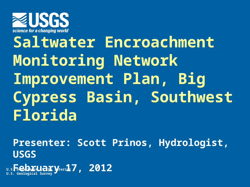
U.S. Department of the InteriorU.S. Geological Survey
Saltwater Encroachment Monitoring Network Improvement Plan, Big Cypress Basin, Southwest Florida
Presenter: Scott Prinos, Hydrologist, USGS
February 17, 2012
Project Background
Initial unpublished assessment of southwest Florida salinity network conducted in 2008.
Saltwater encroachment network improvement plan for Big Cypress Basin (BCB) developed in 2011.
Publication of final plan by September 2012.
Salinity Monitoring Within the BCB
Combined Collier County, Florida DEP, SFWMD, and USGS monitoring networks provide dense 2D coverage.
Existing 3D coverage is insufficient to fully assess the extent of the coastal seawater. encroachment in the lower Tamiami aquifer.
Same deficiencies in 3D coverage described 32 years ago in Collier County (Klein, 1980) still exist.
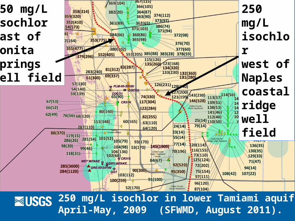
250 mg/L isochlor in lower Tamiami aquifer, April-May, 2009 (SFWMD, August 2011).
250 mg/Lisochlor east of Bonita Springswell field
250 mg/Lisochlor west of Naples coastal ridgewell field
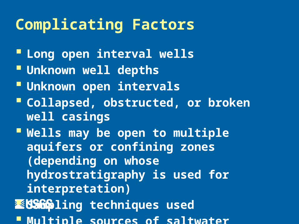
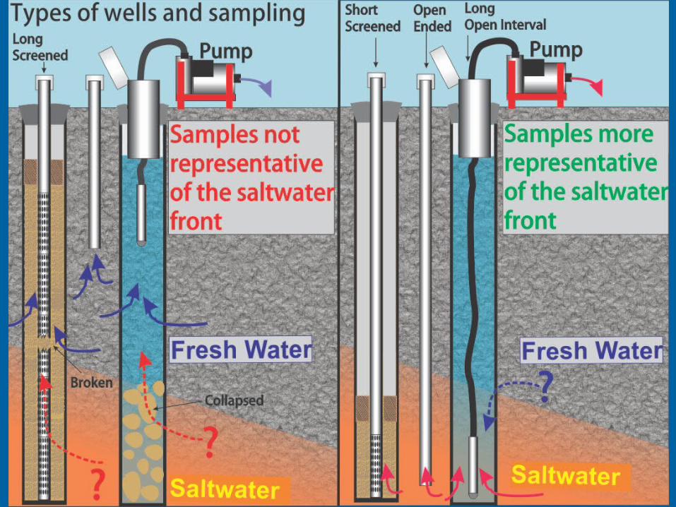
Complicating Factors
Long open interval wells Unknown well depths Unknown open intervals Collapsed, obstructed, or broken well casings Wells may be open to multiple aquifers or
confining zones (depending on whose hydrostratigraphy is used for interpretation)
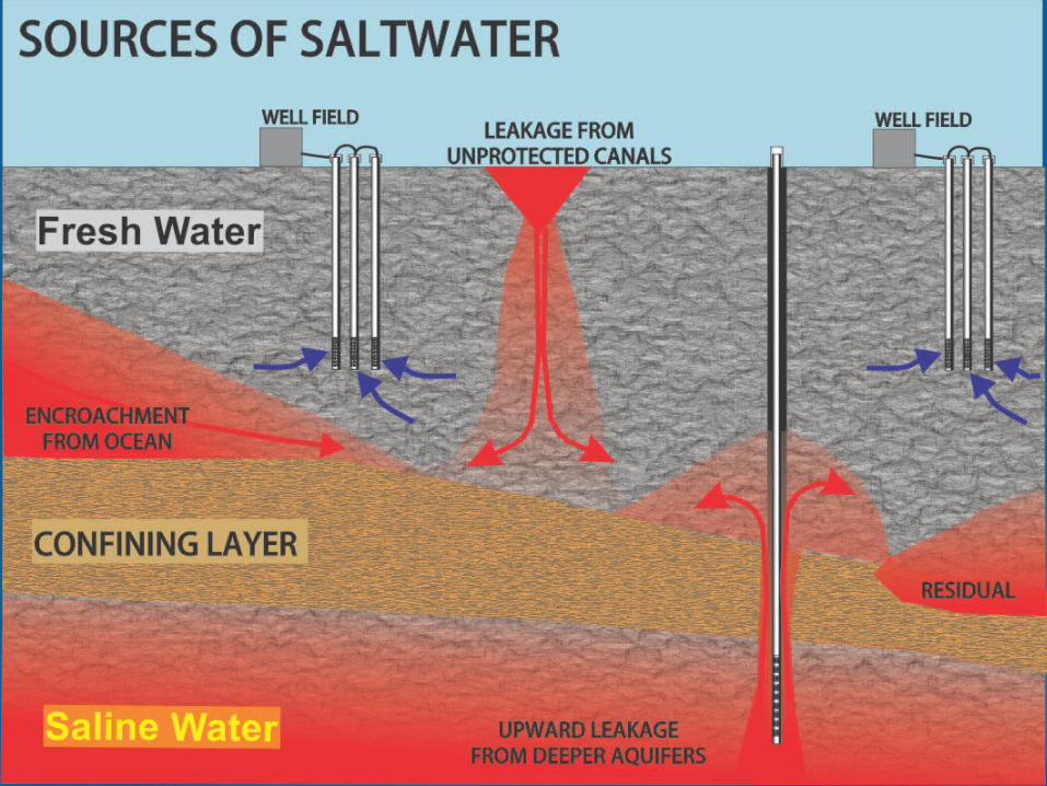
Sampling techniques used Multiple sources of saltwater
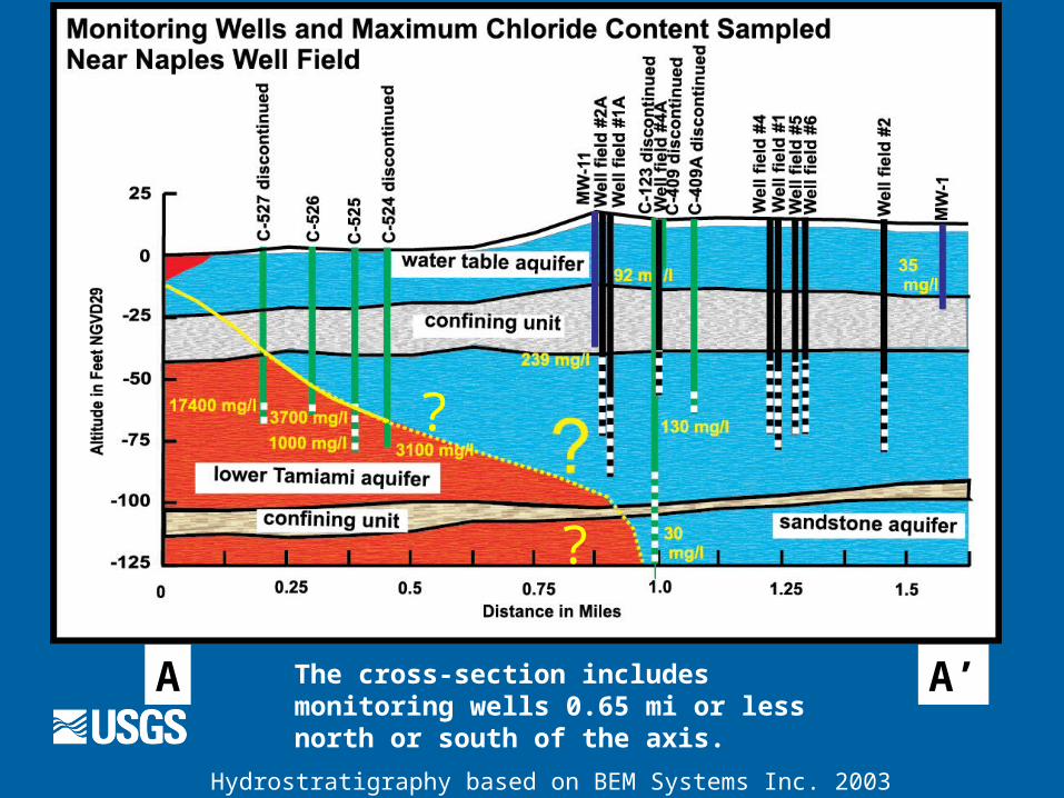
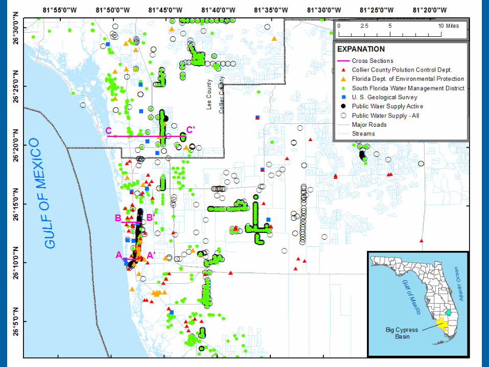
A A’The cross-section includes monitoring wells 0.65 mi or less north or south of the axis.
Hydrostratigraphy based on BEM Systems Inc. 2003
?
?
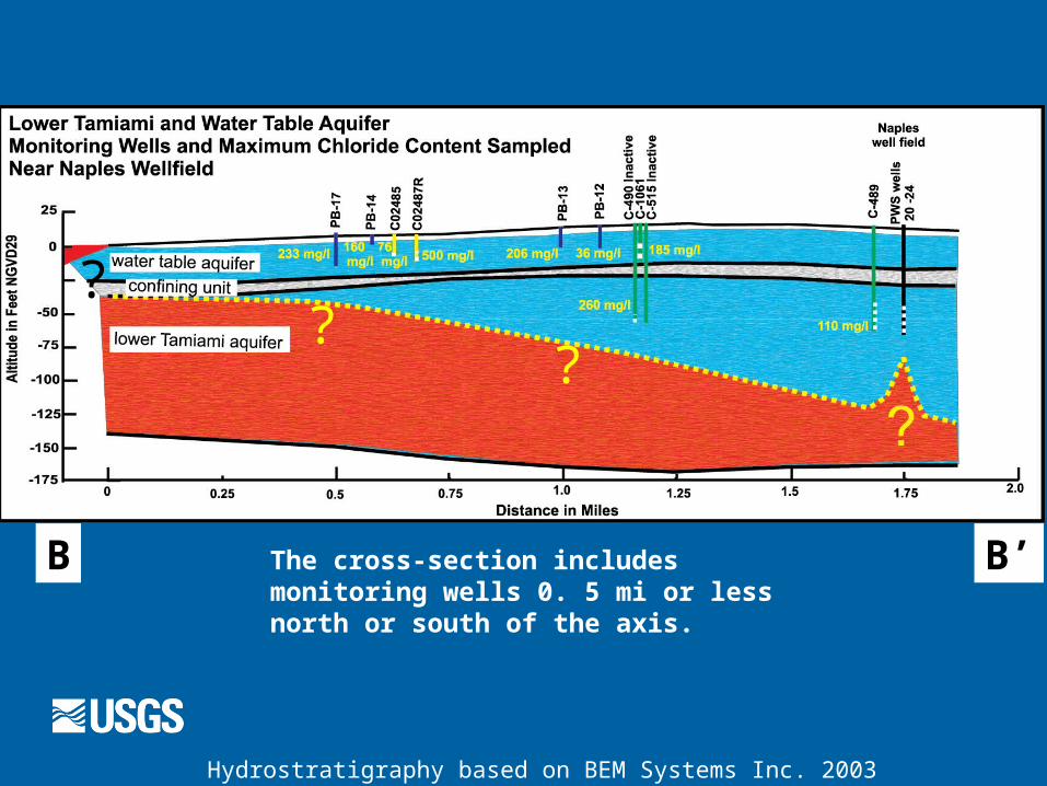
B B’The cross-section includes monitoring wells 0. 5 mi or less north or south of the axis.
Hydrostratigraphy based on BEM Systems Inc. 2003
??
?
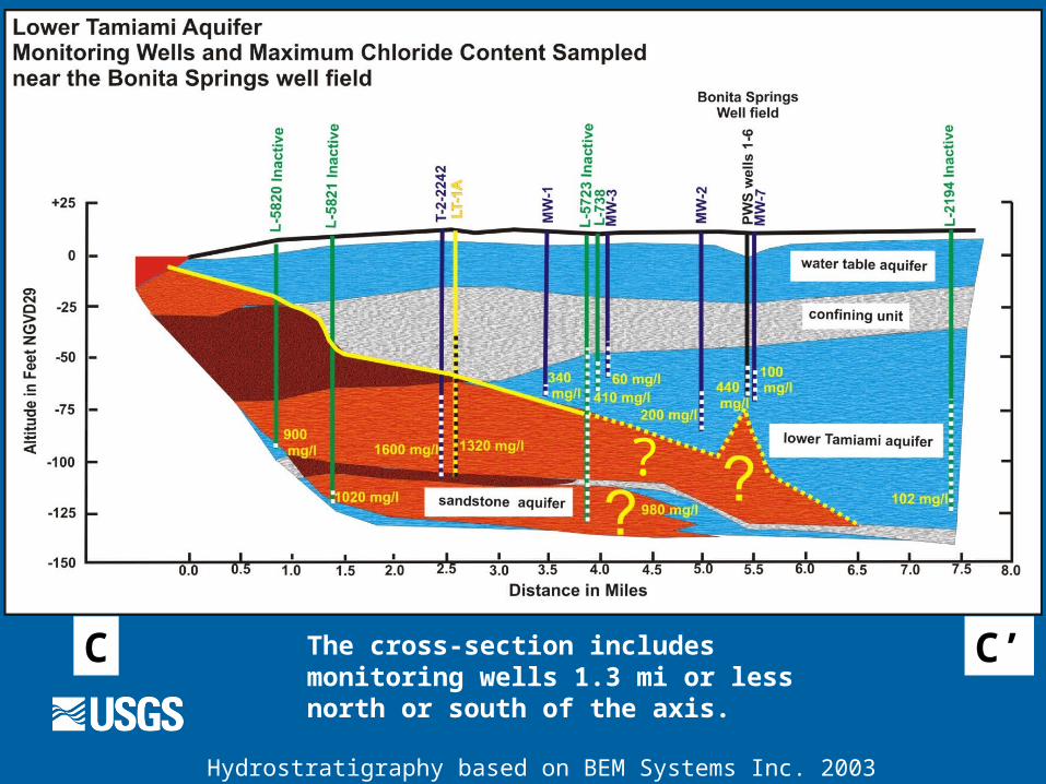
C C’The cross-section includes monitoring wells 1.3 mi or less north or south of the axis.
Hydrostratigraphy based on BEM Systems Inc. 2003
?
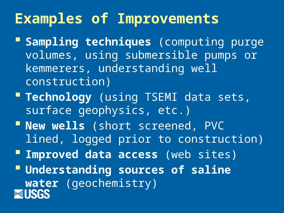
Examples of Improvements
Sampling techniques (computing purge volumes, using submersible pumps or kemmerers, understanding well construction)
Technology (using TSEMI data sets, surface geophysics, etc.)
New wells (short screened, PVC lined, logged prior to construction)
Improved data access (web sites) Understanding sources of saline water
(geochemistry)
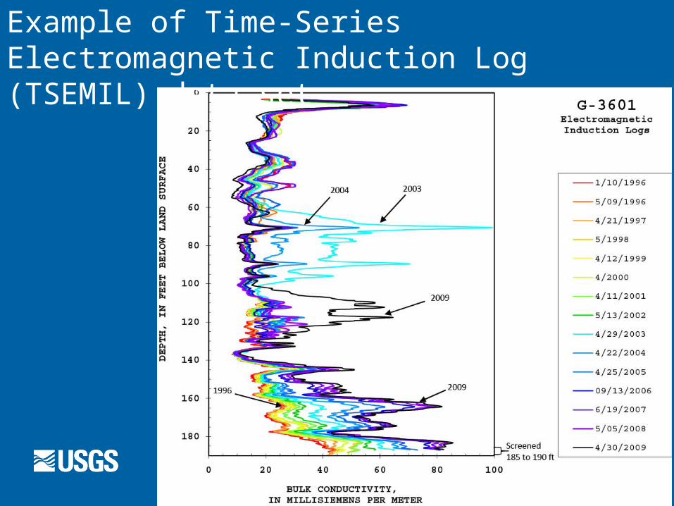
Example of Time-Series Electromagnetic Induction Log (TSEMIL) data set
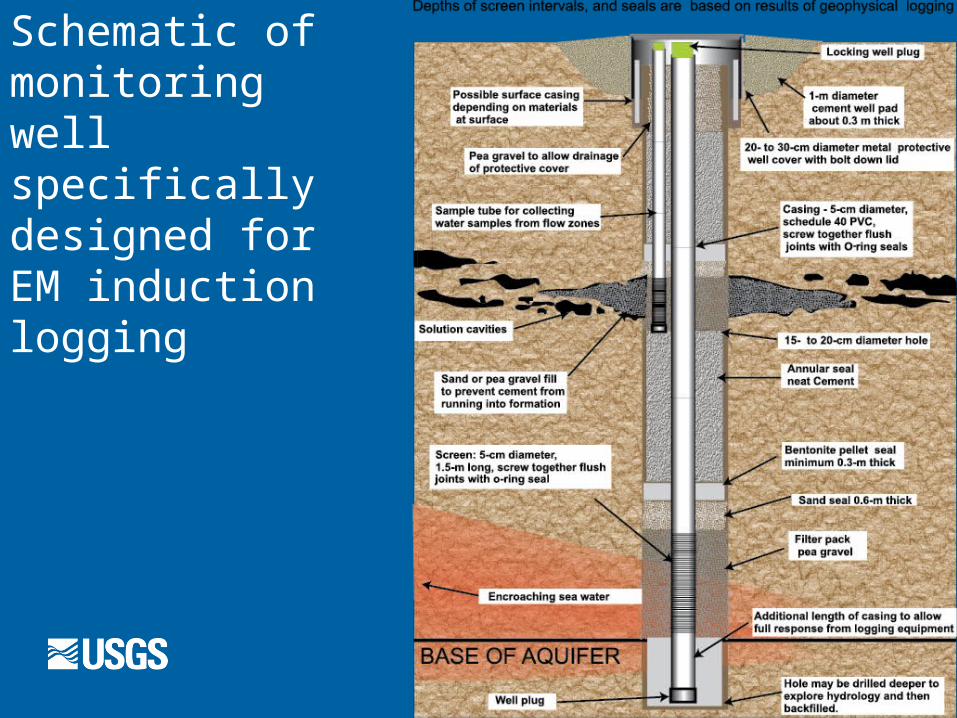
Schematic of monitoring well specifically designed for EM induction logging
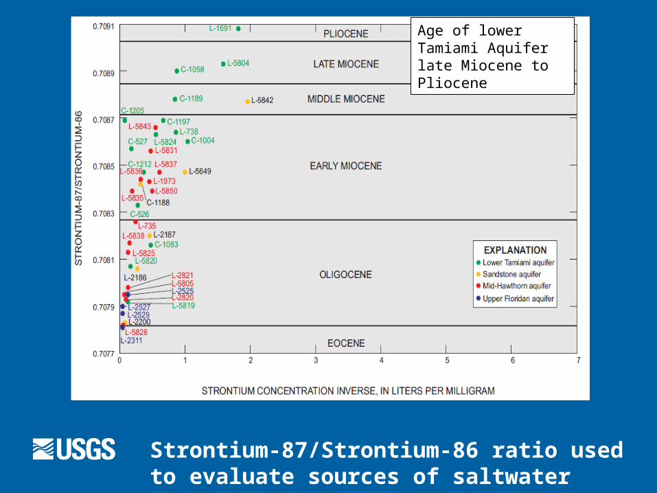
Strontium-87/Strontium-86 ratio used to evaluate sources of saltwater (Schmerge, 2001)
Age of lower Tamiami Aquifer late Miocene to Pliocene
Selected References
BEM Systems Inc. Environmental Engineers and Scientists, 2003, Hydrostratigraphy Review Report, Report to the Lower West Coast Regional Service Center, South Florida Water Management District, 40 p, included electronic files.
Klein, Howard, 1980, Water-resources investigations, Collier County, Florida, U.S. Geological Survey, Open File Report 80-1270, 29 p.
Schmerge, D. L., 2001, Distribution and origin of salinity in the surficial and intermediate aquifer systems, southwestern Florida, U.S. Geological Survey Water-Resources Investigation Report 2001-4159.
South Florida Water Management District, 2011, Lee and Collier Counties; estimated position of the saltwater interface, lower Tamiami aquifer, April / May 2009, South Florida Water Management, Palm Beach Florida, 1 sheet.