Embed Size (px)
Citation preview
Surveying Basics
US Army Corps of Engineers
Detroit District
Great Lakes Hydraulics and Hydrology Office
US Army Corps of Engineers
Detroit District
Surveying Basics
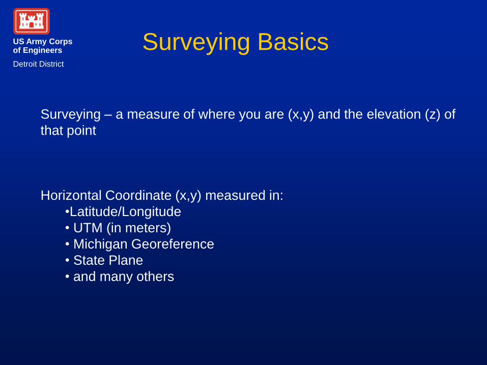
Surveying – a measure of where you are (x,y) and the elevation (z) of
that point
Horizontal Coordinate (x,y) measured in:
•Latitude/Longitude
• UTM (in meters)
• Michigan Georeference
• State Plane
• and many others
US Army Corps of Engineers
Detroit District
Surveying Basics
Vertical Coordinate (z) usually measured as the number of feet above
some measure of sea level. Sea level is your starting point or zero
point.
• IGLD
• NGVD
• and many others
Our elevation here at Holiday Inn is ~550 ft above sea level
(Lake Ontario is ~240 ft)
US Army Corps of Engineers
Detroit District
Surveying Basics Benchmarks
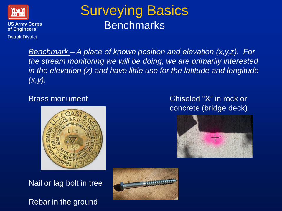
Benchmark – A place of known position and elevation (x,y,z). For
the stream monitoring we will be doing, we are primarily interested
in the elevation (z) and have little use for the latitude and longitude
(x,y).
Brass monument Chiseled “X” in rock or
concrete (bridge deck)
Nail or lag bolt in tree
Rebar in the ground
US Army Corps of Engineers
Detroit District
Surveying Basics Benchmarks
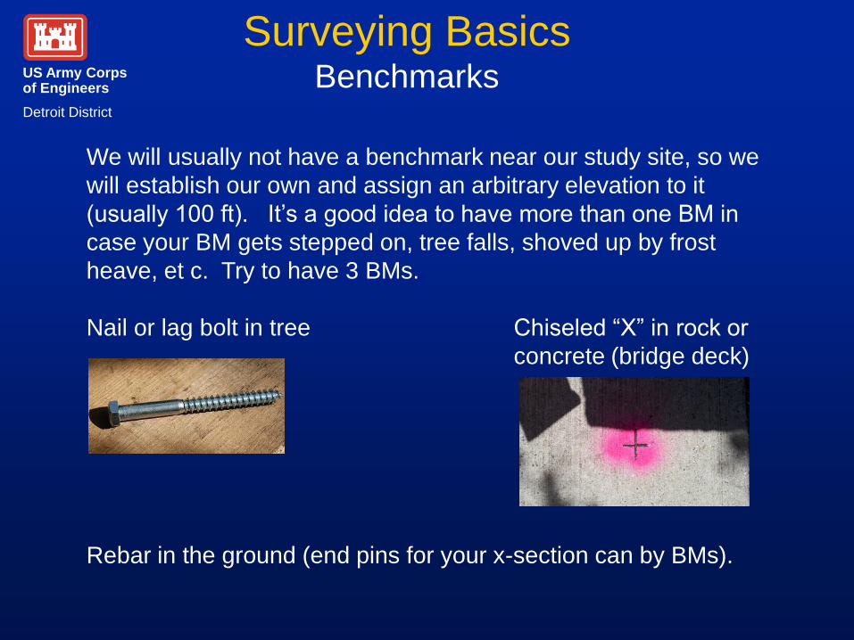
We will usually not have a benchmark near our study site, so we
will establish our own and assign an arbitrary elevation to it
(usually 100 ft). It’s a good idea to have more than one BM in
case your BM gets stepped on, tree falls, shoved up by frost
heave, et c. Try to have 3 BMs.
Nail or lag bolt in tree Chiseled “X” in rock or
concrete (bridge deck)
Rebar in the ground (end pins for your x-section can by BMs).
US Army Corps of Engineers
Detroit District
Surveying Basics Benchmarks
To locate benchmarks near your study area, you can search for them at:
www.ngs.noaa.gov
Or talk to local government agencies:
- Road Commission
- Department of Public Works
If there is infrastructure near by, there is likely a benchmark
US Army Corps of Engineers
Detroit District
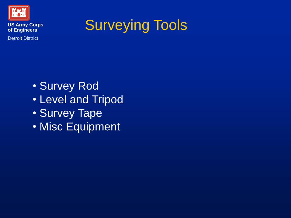
Surveying Tools
• Survey Rod
• Level and Tripod
• Survey Tape
• Misc Equipment
US Army Corps of Engineers
Detroit District
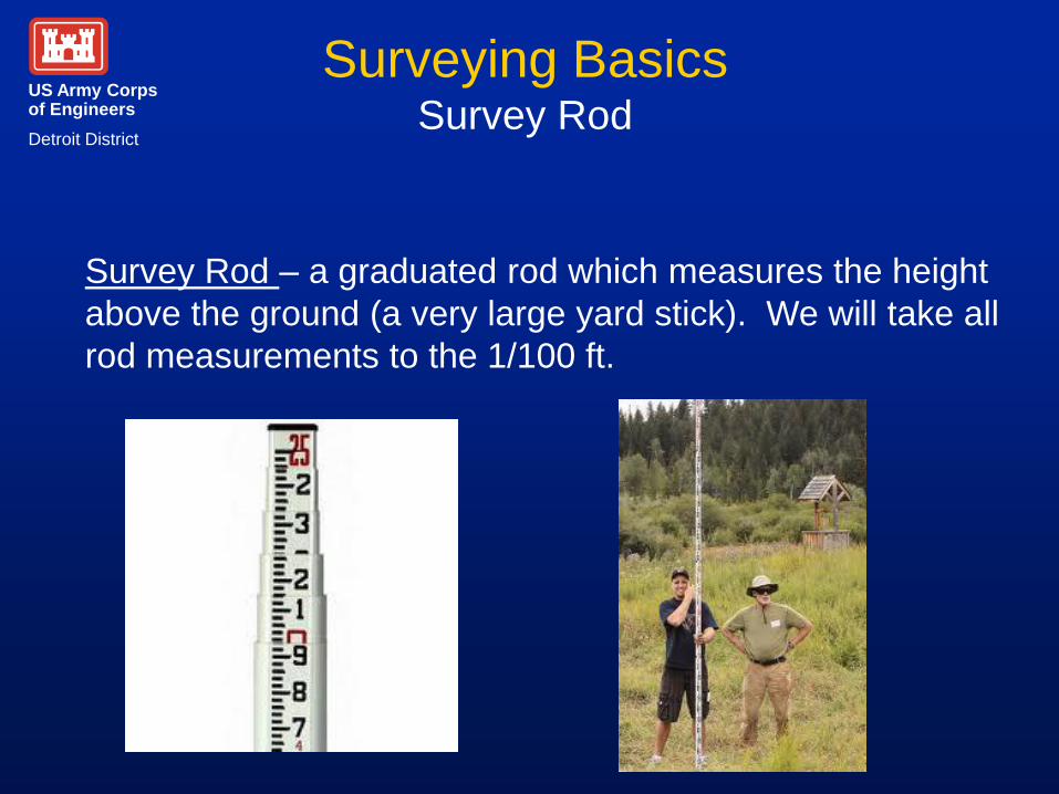
Surveying Basics Survey Rod
Survey Rod – a graduated rod which measures the height
above the ground (a very large yard stick). We will take all
rod measurements to the 1/100 ft.
US Army Corps of Engineers
Detroit District
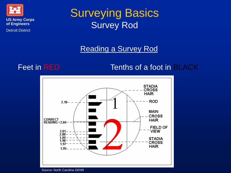
Surveying Basics Survey Rod
Reading a Survey Rod
Feet in RED Tenths of a foot in BLACK
Source: North Carolina DENR
US Army Corps of Engineers
Detroit District
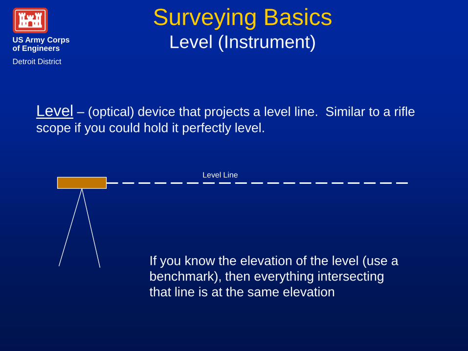
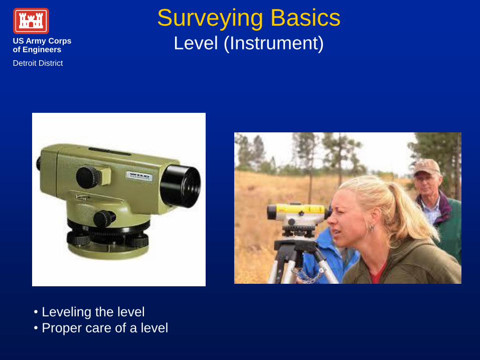
Surveying Basics Level (Instrument)
Level – (optical) device that projects a level line. Similar to a rifle
scope if you could hold it perfectly level.
Level Line
If you know the elevation of the level (use a
benchmark), then everything intersecting
that line is at the same elevation
US Army Corps of Engineers
Detroit District
Surveying Basics Level (Instrument)
• Leveling the level
• Proper care of a level
US Army Corps of Engineers
Detroit District
Surveying Basics Level (Instrument)
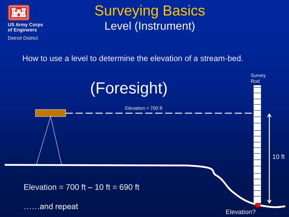
How to use a level to determine the elevation of a stream-bed.
Elevation = 700 ft
Survey
Rod
Elevation?
10 ft
Elevation = 700 ft – 10 ft = 690 ft
……and repeat
(Foresight)
US Army Corps of Engineers
Detroit District
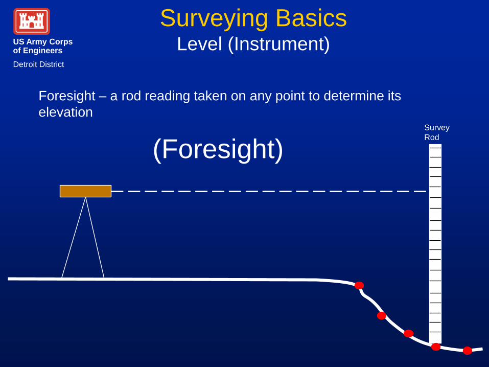
Surveying Basics Level (Instrument)
Survey
Rod
(Foresight)
Foresight – a rod reading taken on any point to determine its
elevation
US Army Corps of Engineers
Detroit District
Surveying Basics Level (Instrument)
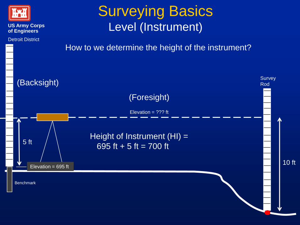
How to we determine the height of the instrument?
Elevation = ??? ft
Survey
Rod
10 ft
Height of Instrument (HI) =
695 ft + 5 ft = 700 ft
(Foresight)
(Backsight)
5 ft
Benchmark
Elevation = 695 ft
US Army Corps of Engineers
Detroit District
Surveying Basics
Backsight – A rod reading taken on a point of known
elevation. There is only ONE backsight for each setup
of the instrument.
US Army Corps of Engineers
Detroit District
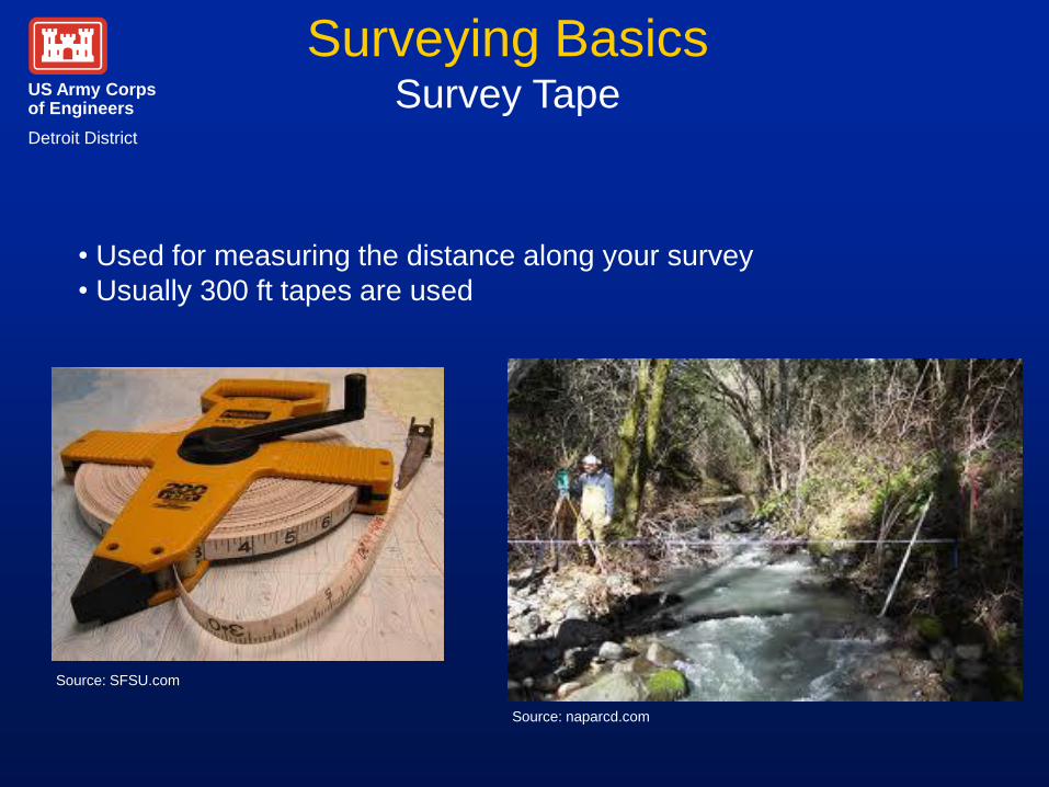
Surveying Basics Survey Tape
• Used for measuring the distance along your survey
• Usually 300 ft tapes are used
Source: SFSU.com
Source: naparcd.com
US Army Corps of Engineers
Detroit District
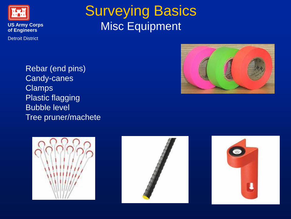
Surveying Basics Misc Equipment
Rebar (end pins)
Candy-canes
Clamps
Plastic flagging
Bubble level
Tree pruner/machete
US Army Corps of Engineers
Detroit District
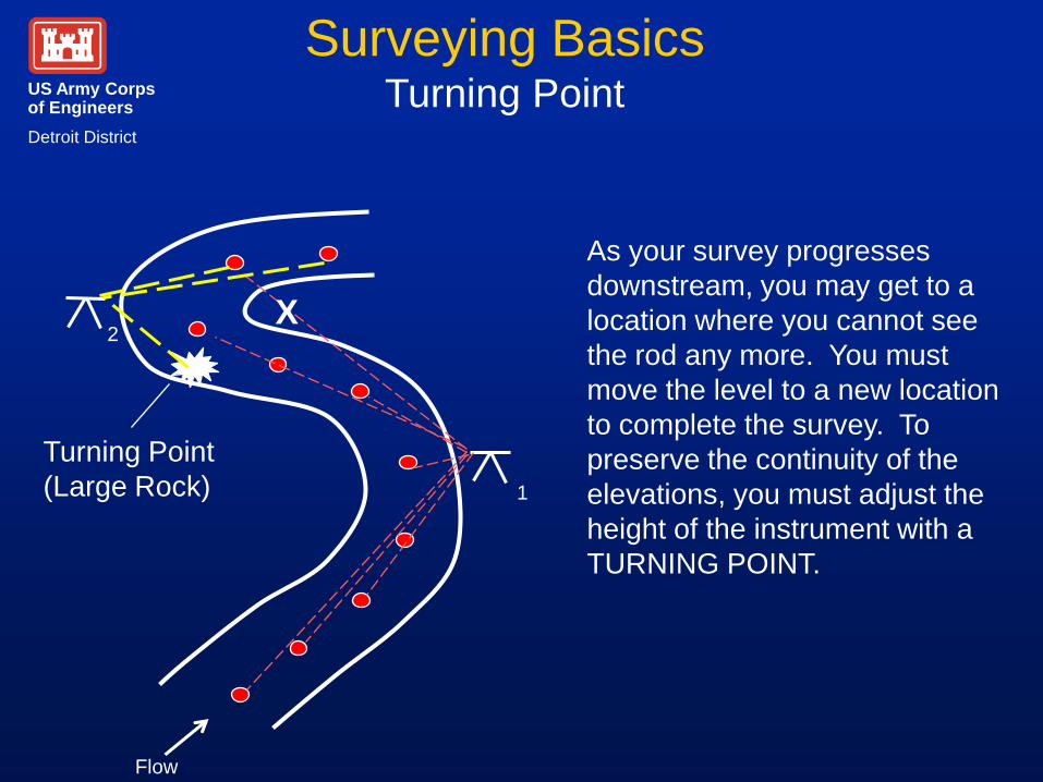
Surveying Basics Turning Point
X
1
2
Turning Point
(Large Rock)
As your survey progresses
downstream, you may get to a
location where you cannot see
the rod any more. You must
move the level to a new location
to complete the survey. To
preserve the continuity of the
elevations, you must adjust the
height of the instrument with a
TURNING POINT.
Flow

US Army Corps of Engineers
Detroit District
Surveying Basics Turning Point
Turning Point (TP) – A stable point (large rock, stump, et c.)
upon which a foresight is taken to establish an elevation.
The level is then moved and a new backsight is made to
determine the new height of instrument and to continue the
line of levels. You need to create TPs when you can no
longer see the survey rod, such as when going around a
bend in a river or around a building.
US Army Corps of Engineers
Detroit District
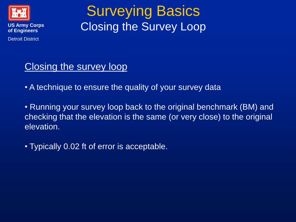
Surveying Basics Closing the Survey Loop
Closing the survey loop
• A technique to ensure the quality of your survey data
• Running your survey loop back to the original benchmark (BM) and
checking that the elevation is the same (or very close) to the original
elevation.
• Typically 0.02 ft of error is acceptable.
US Army Corps of Engineers
Detroit District
Surveying Basics Closing the Survey Loop
X
1
2
Turning Point
(Large Rock)
Flow
Benchmark
US Army Corps of Engineers
Detroit District
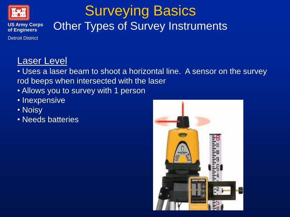
Surveying Basics Other Types of Survey Instruments
Laser Level • Uses a laser beam to shoot a horizontal line. A sensor on the survey
rod beeps when intersected with the laser
• Allows you to survey with 1 person
• Inexpensive
• Noisy
• Needs batteries
US Army Corps of Engineers
Detroit District
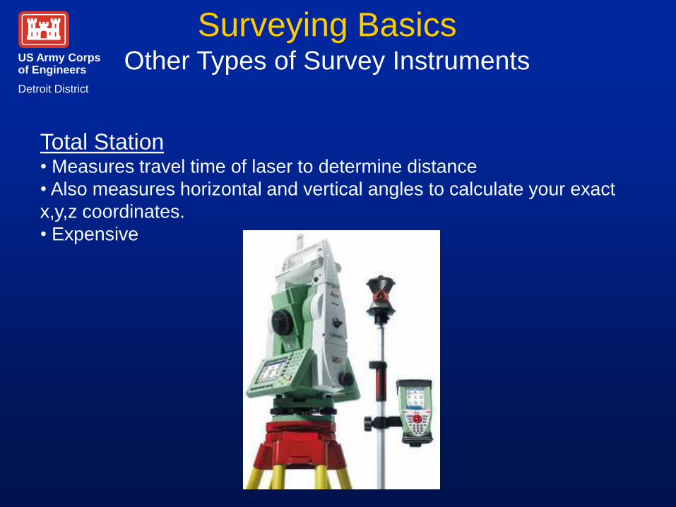
Surveying Basics Other Types of Survey Instruments
Total Station • Measures travel time of laser to determine distance
• Also measures horizontal and vertical angles to calculate your exact
x,y,z coordinates.
• Expensive
US Army Corps of Engineers
Detroit District
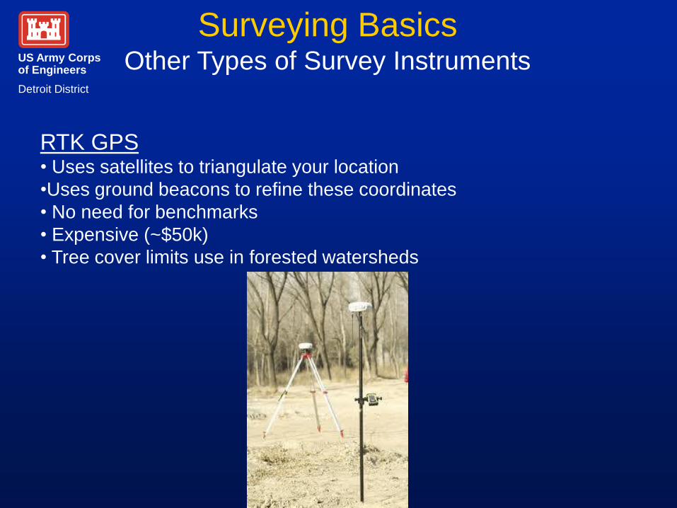
Surveying Basics Other Types of Survey Instruments
RTK GPS • Uses satellites to triangulate your location
•Uses ground beacons to refine these coordinates
• No need for benchmarks
• Expensive (~$50k)
• Tree cover limits use in forested watersheds
US Army Corps of Engineers
Detroit District
Questions
Contact:
Dr. Jim Selegean, P.E., P.H.
U.S. Army Corps of Engineers, Detroit District
Great Lakes Hydraulics and Hydrology Office
477 Michigan Ave
Detroit, MI 48226
313.226.679

![[PPT]Chapter #1: Basics of Surveying - Faculty Personal ...faculty.kfupm.edu.sa/CE/kaluwfi/Surveying/CE260 CH 1.ppt · Web viewChapter #1: Basics of Surveying 1.1 Surveying Defined](https://img.pdfslide.us/doc/110x75/5abdf95a7f8b9aa3088c4dc9/pptchapter-1-basics-of-surveying-faculty-personal-ch-1pptweb-viewchapter.jpg)