Embed Size (px)
Citation preview
PINETREE BAR
BUD'S LANDING BAR
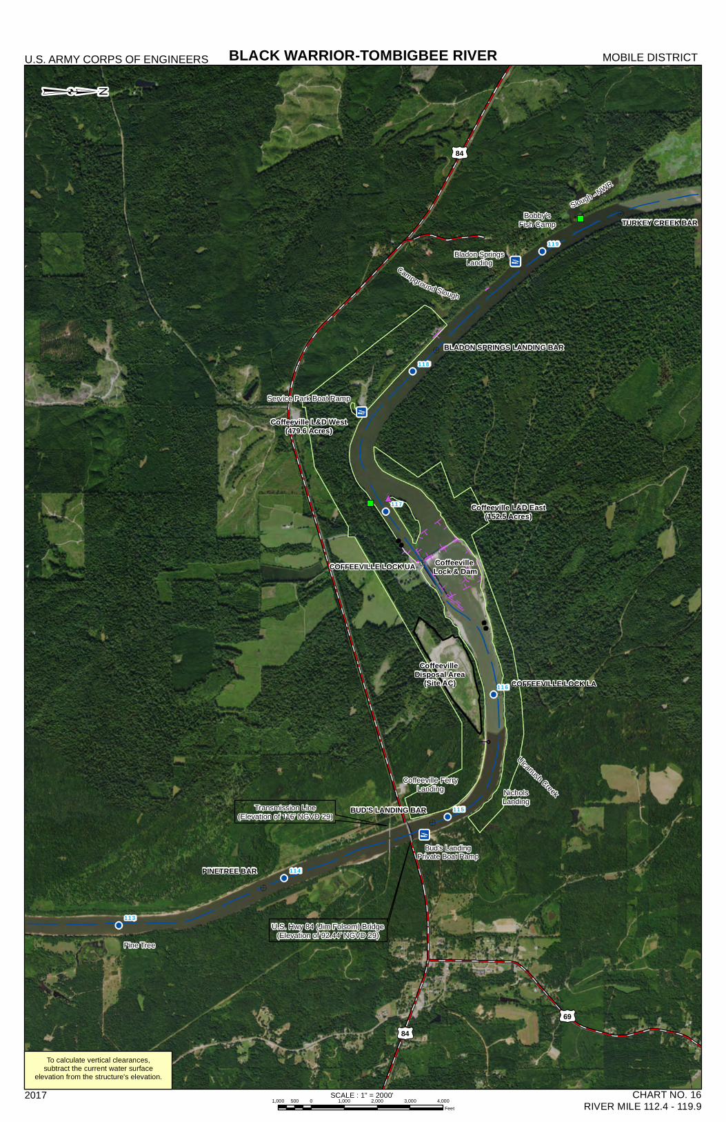
COFFEEVILLE LOCK UA
COFFEEVILLE LOCK LA
TURKEY CREEK BAR
BLADON SPRINGS LANDING BAR
119
118
117
116
115
114
113
Source: Esri, DigitalGlobe, GeoEye, Earthstar Geographics, CNES/Airbus DS, USDA, USGS,AeroGRID, IGN, and the GIS User Community
BLACK WARRIOR-TOMBIGBEE RIVERU.S. ARMY CORPS OF ENGINEERS MOBILE DISTRICT
2017 CHART NO. 16RIVER MILE 112.4 - 119.9
Transmission Line(Elevation of 116' NGVD 29)
Coffeeville FerryLanding
Coffeeville L&D East(152.5 Acres)
U.S. Hwy 84 (Jim Folsom) Bridge(Elevation of 92.44' NGVD 29)
NicholsLanding
Coffeeville L&D West(479.6 Acres)
Ulcanush Creek
Bladon SpringsLanding
Bobby'sFish Camp
Coffeeville Lock & Dam
To calculate vertical clearances,subtract the current water surface
elevation from the structure's elevation.
Bud's LandingPrivate Boat Ramp
Service Park Boat Ramp
84
84
Pine Tree
Coffeeville Disposal Area
(Site AC)
Campground Slough
Slough - NWR
69
SCALE : 1" = 2000'1,000 0 1,000 2,000 3,000 4,000500
Feet
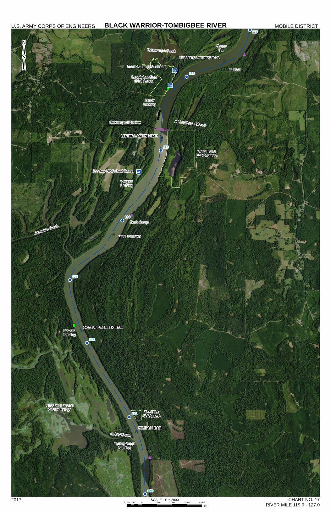
MILE 124 BAR
MILE 121 BAR
LENOIR LANDING BAR
OKATUPPA CREEK BAR
SELLERS LANDING BAR
127
126
125
124
123
122
121
120
BLACK WARRIOR-TOMBIGBEE RIVERU.S. ARMY CORPS OF ENGINEERS MOBILE DISTRICT
2017 CHART NO. 17RIVER MILE 119.9 - 127.0
Turkey CreekLanding
Turkey Creek
The Dike(7.4 Acres)
Choctaw NationalWildlife Refuge
PowersLanding
Okatuppa Creek
West Bend(139.9 Acres)
Lenoir Landing(58.1 Acres)
Cox's Camp
Wright'sLanding
LenoirLanding
Tallawampa CreekOsage
Bar
IP DockLenoir Landing Boat Ramp
Submerged Pipeline Adrian House Slough
SCALE : 1" = 2000'1,000 0 1,000 2,000 3,000 4,000500
Feet
Choctaw NWR Boat Ramp
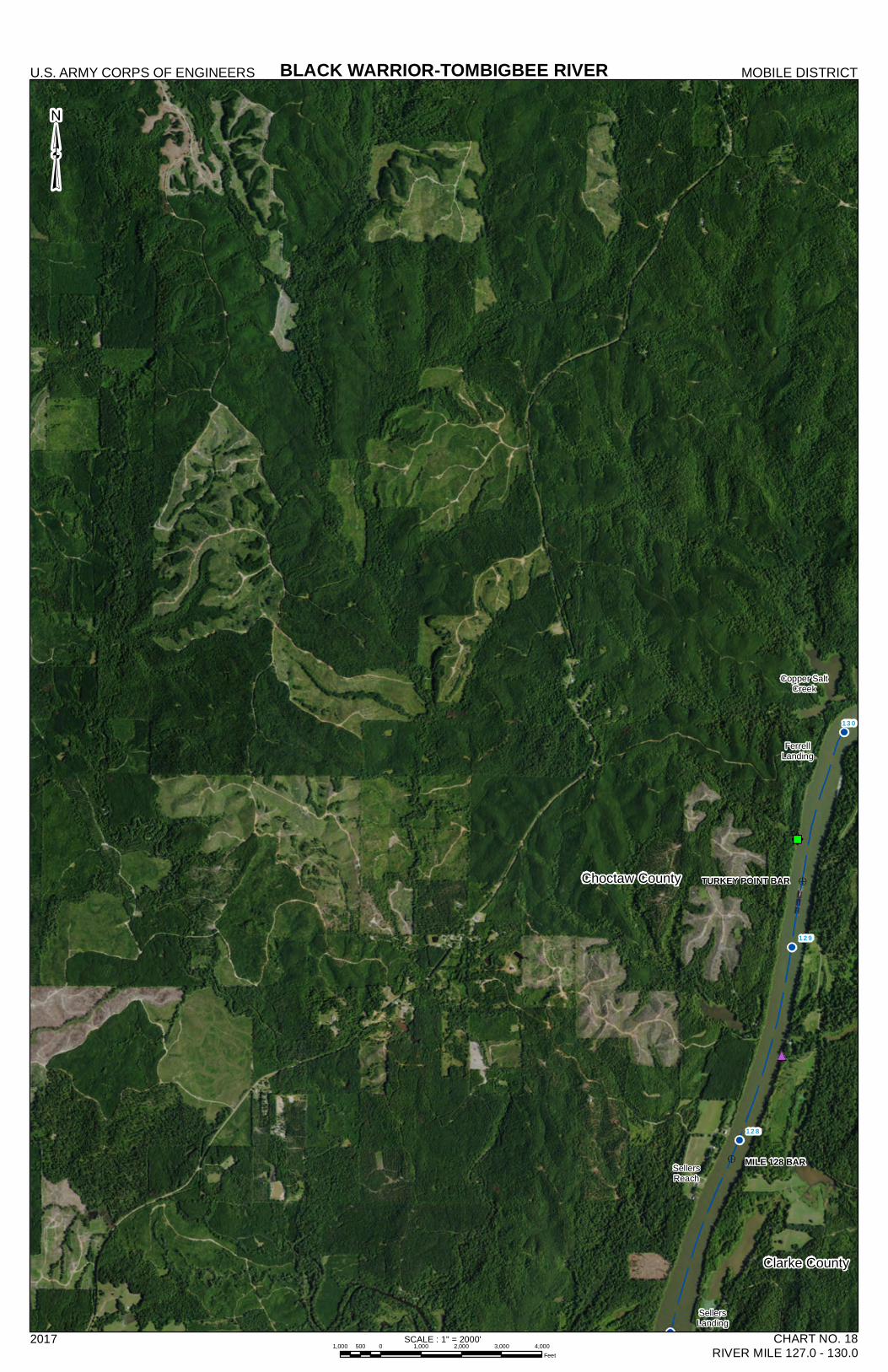
Choctaw County
Clarke County
MILE 128 BAR
TURKEY POINT BAR
130
129
128
BLACK WARRIOR-TOMBIGBEE RIVERU.S. ARMY CORPS OF ENGINEERS MOBILE DISTRICT
2017 CHART NO. 18RIVER MILE 127.0 - 130.0
³
SellersReach
SellersLanding
FerrellLanding
Copper SaltCreek
SCALE : 1" = 2000'1,000 0 1,000 2,000 3,000 4,000500
Feet
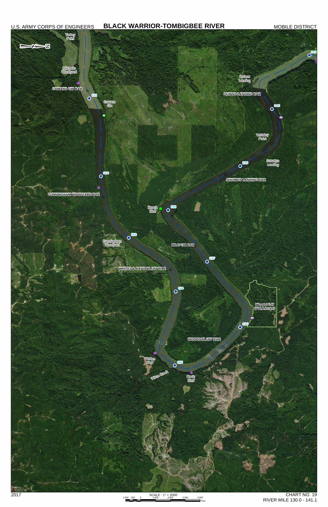
MILE 138 BAR
COWANS GIN BAR
WOODS BLUFF BAR
QUINNS LANDING BAR
SHULTYS LANDING BAR
CUNNINGHAM WOODYARD BAR
WHITES & DAVIS BLUFF BAR
141
140
139
138
137
136
135
134
133
132
131
BLACK WARRIOR-TOMBIGBEE RIVERU.S. ARMY CORPS OF ENGINEERS MOBILE DISTRICT
2017 CHART NO. 19RIVER MILE 130.0 - 141.1
³ TurkeyPoint
CowansGin
MitchellsWoodyard
CunninghamWoodyard
WhitesBluff
Witch CreekDavisBluff
BeachBluff
Woodsbluff(116.8 Acres)
Eddie
SchultysLanding
QuinnsLanding
WhiskeyPoint
Eddie
SCALE : 1" = 2000'1,000 0 1,000 2,000 3,000 4,000500
Feet
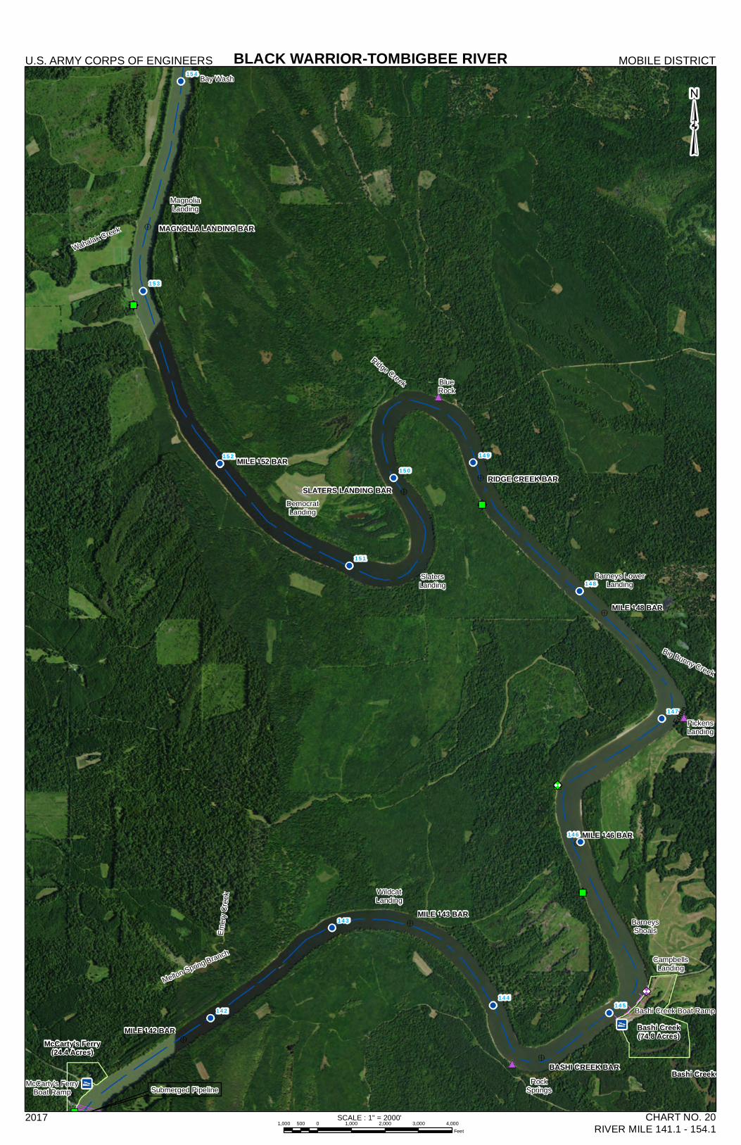
MILE 152 BAR
MILE 148 BAR
MILE 146 BAR
MILE 143 BAR
MILE 142 BAR
BASHI CREEK BAR
SLATERS LANDING BAR
MAGNOLIA LANDING BAR
154
153
152
151
150
149
148
147
146
145144
143
142
BLACK WARRIOR-TOMBIGBEE RIVERU.S. ARMY CORPS OF ENGINEERS MOBILE DISTRICT
2017 CHART NO. 20RIVER MILE 141.1 - 154.1
³
McCarty's Ferry(24.4 Acres)
Submerged Pipeline
Melton Spring Branch
WildcatLanding
RockSprings
Bashi Creek(74.8 Acres)
CampbellsLanding
BarneysShoals
PickensLanding
Eddie
Big Bunny Creek
Barneys LowerLanding
SlatersLanding
RIDGE CREEK BAR
BlueRock
Ridge Creek
DemocratLanding
Wahalak Creek
MagnoliaLanding
Bay Wash
Bashi Creek Boat Ramp
McCarty's FerryBoat Ramp
Emery
Cree
k
Bashi Creek
SCALE : 1" = 2000'1,000 0 1,000 2,000 3,000 4,000500
Feet
§̈¦65
£¤43
£¤43
£¤117
£¤69
£¤
69
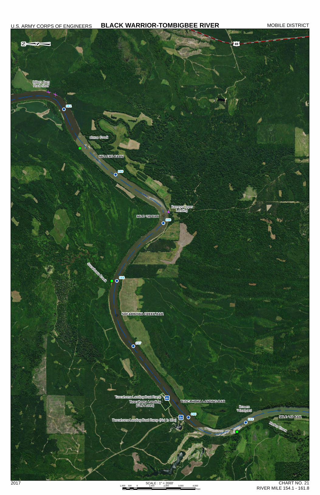
MILLERS BARN
MILE 159 BAR
MILE 155 BAR
SUCARBOWA CREEK BAR
TUSCAHOMA LANDING BAR
161
160
159
158
157
156155
BLACK WARRIOR-TOMBIGBEE RIVERU.S. ARMY CORPS OF ENGINEERS MOBILE DISTRICT
2017 CHART NO. 21RIVER MILE 154.1 - 161.8
³
BrownsWoodyard
Mellen Creek
Tuscahoma Landing(13.6 Acres)
Sucarbowa Creek
Barneys UpperLanding
Horse Creek
Millers BarnRock Shelf
Tuscahoma Landing Boat Ramp
£¤69
Tuscahoma Landing Boat Ramp (Not in Use)
SCALE : 1" = 2000'1,000 0 1,000 2,000 3,000 4,000500
Feet
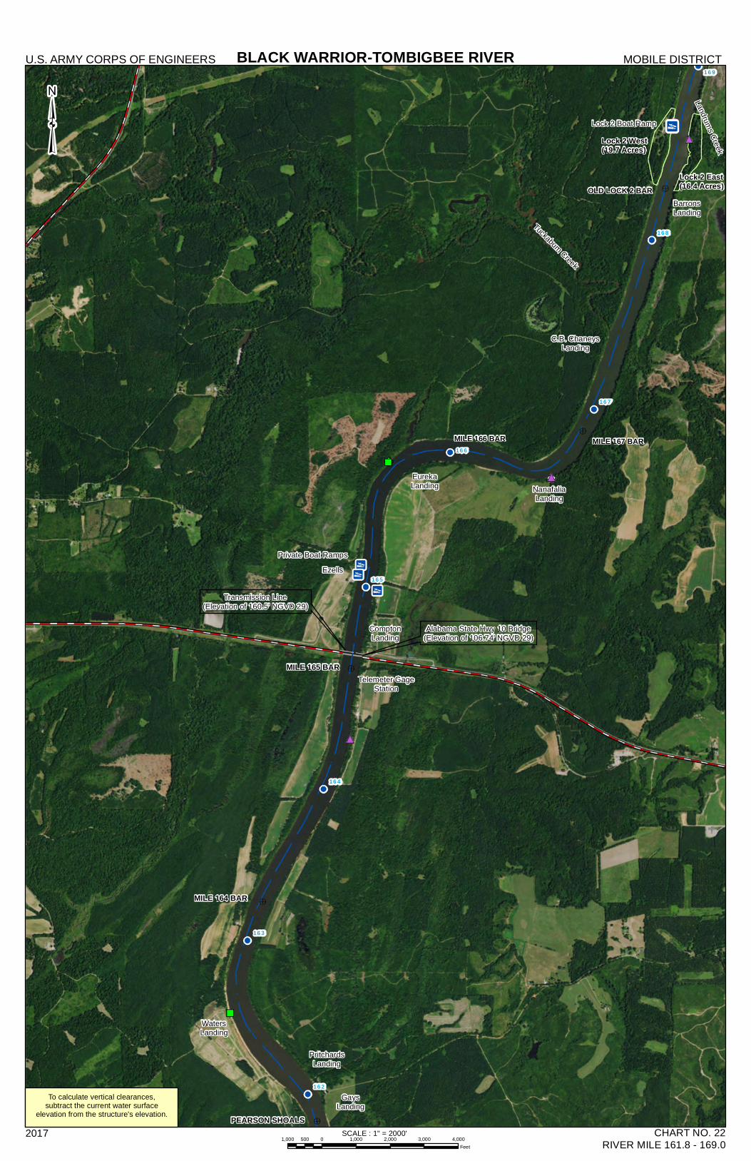
MILE 167 BARMILE 166 BAR
OLD LOCK 2 BAR
p
169
168
167
166
165
164
163
162
BLACK WARRIOR-TOMBIGBEE RIVERU.S. ARMY CORPS OF ENGINEERS MOBILE DISTRICT
2017 CHART NO. 22RIVER MILE 161.8 - 169.0
³
Transmission Line(Elevation of 160.5' NGVD 29)
PEARSON SHOALS
GaysLanding
PritchardsLanding
WatersLanding
MILE 164 BAR
MILE 165 BAR
Alabama State Hwy 10 Bridge(Elevation of 106.74' NGVD 29)
Telemeter GageStation
ComptonLanding
EurekaLanding
Ezells
NanafaliaLanding
C.B. ChaneysLanding
Lock 2 West(19.7 Acres)
Lock 2 East(16.4 Acres)
BarronsLanding
Tuckabum Creek
Landrums Creek
To calculate vertical clearances,subtract the current water surface
elevation from the structure's elevation.
Lock 2 Boat Ramp
Private Boat Ramps
SCALE : 1" = 2000'1,000 0 1,000 2,000 3,000 4,000500
Feet
Choctaw County
Marengo County
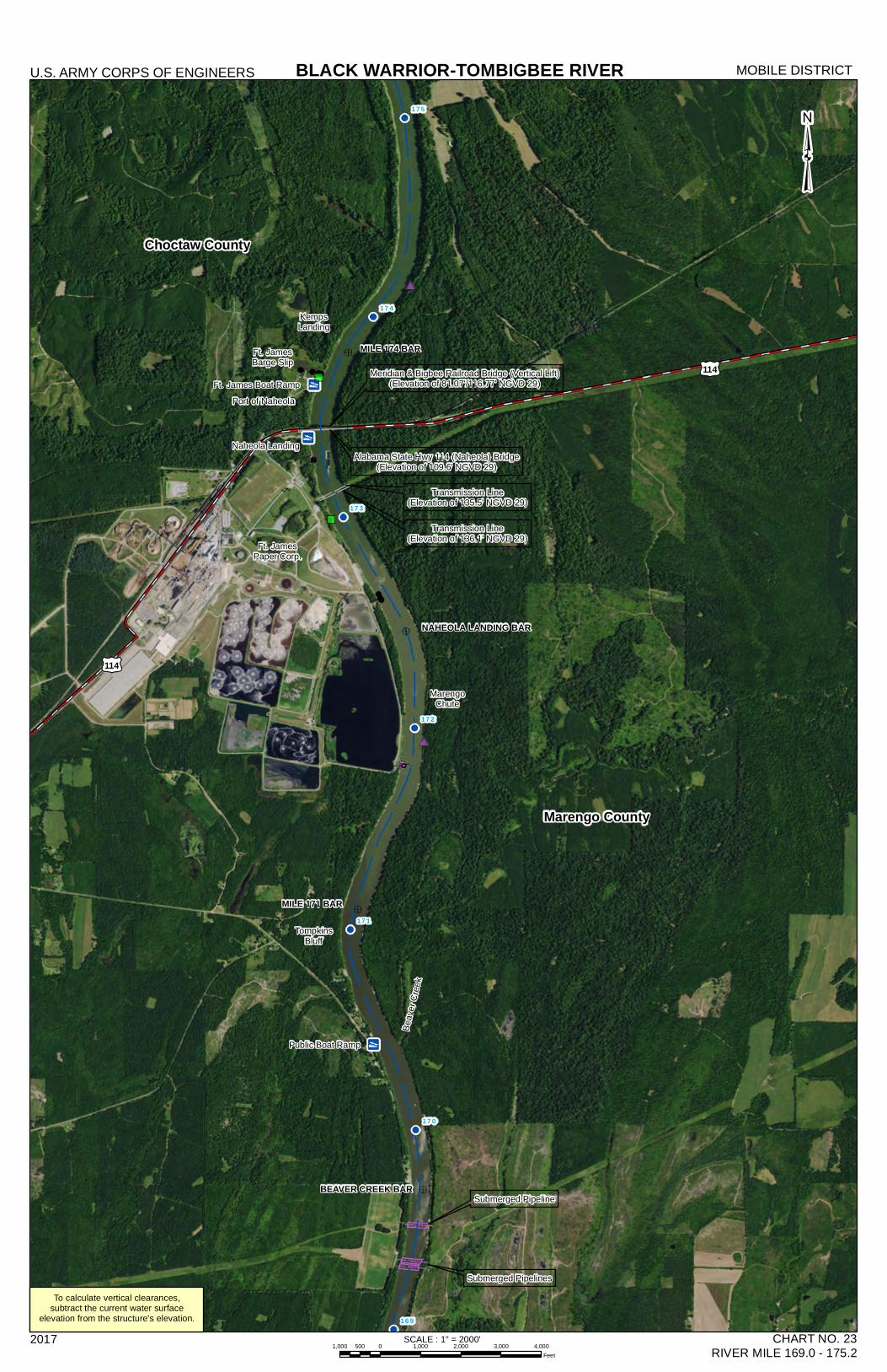
MILE 171 BAR
MILE 174 BAR
BEAVER CREEK BAR
NAHEOLA LANDING BAR
175
174
173
172
171
170
169
BLACK WARRIOR-TOMBIGBEE RIVERU.S. ARMY CORPS OF ENGINEERS MOBILE DISTRICT
2017 CHART NO. 23RIVER MILE 169.0 - 175.2
³
Transmission Line(Elevation of 136.1' NGVD 29)
Submerged Pipelines
Submerged Pipeline
Beav
erCr
eek
TompkinsBluff
Transmission Line(Elevation of 135.5' NGVD 29)
Ft. JamesPaper Corp.
MarengoChute
Ft. JamesBarge Slip
Port of Naheola
KempsLanding
Meridian & Bigbee Railroad Bridge (Vertical Lift)(Elevation of 81.07'/116.77' NGVD 29)
Naheola LandingAlabama State Hwy 114 (Naheola) Bridge
(Elevation of 109.6' NGVD 29)
Public Boat Ramp
Ft. James Boat Ramp
To calculate vertical clearances,subtract the current water surface
elevation from the structure's elevation.
£¤114
£¤114
SCALE : 1" = 2000'1,000 0 1,000 2,000 3,000 4,000500
Feet
Choctaw County
Marengo County
Sumter County
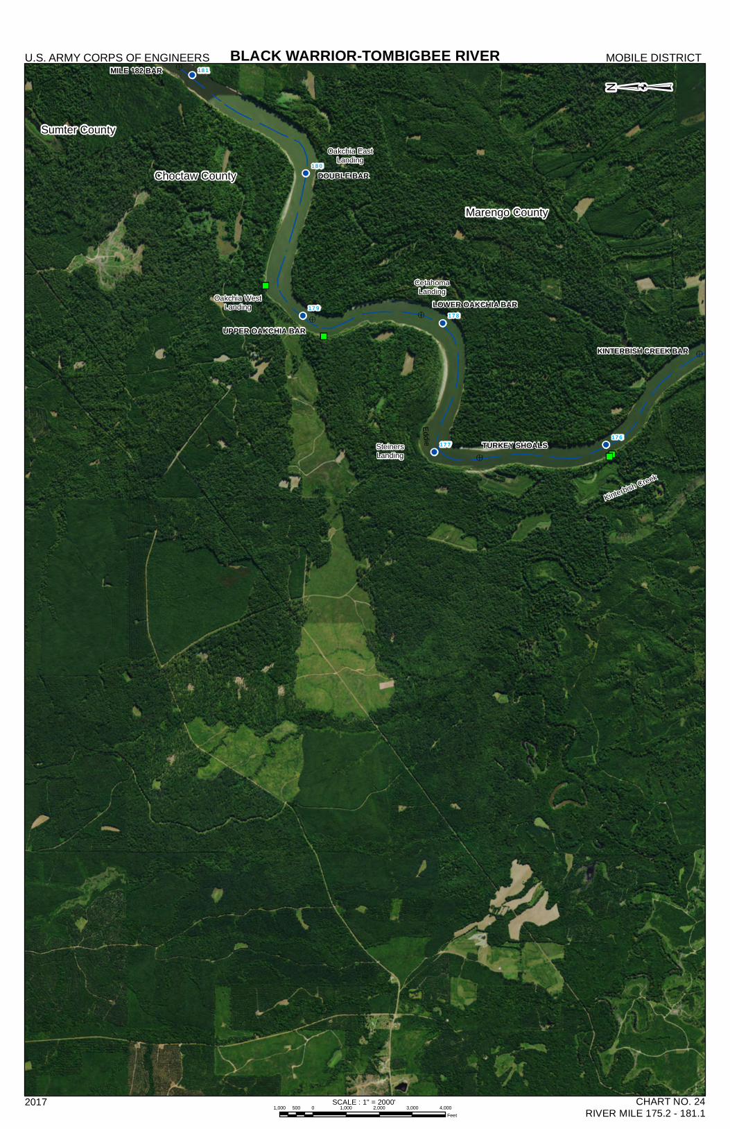
KINTERBISH CREEK BAR
181
180
179178
177176
Source: Esri, DigitalGlobe, GeoEye, Earthstar Geographics, CNES/Airbus DS, USDA, USGS,AeroGRID, IGN, and the GIS User Community
BLACK WARRIOR-TOMBIGBEE RIVERU.S. ARMY CORPS OF ENGINEERS MOBILE DISTRICT
2017 CHART NO. 24RIVER MILE 175.2 - 181.1
³
UPPER OAKCHIA BAR
DOUBLE BAR
MILE 182 BAR
SteinersLanding
CetahomaLandingOakchia West
Landing
Oakchia EastLanding
Kinterbish Creek
LOWER OAKCHIA BAR
TURKEY SHOALS
Eddie
SCALE : 1" = 2000'1,000 0 1,000 2,000 3,000 4,000500
Feet
Marengo County
Sumter County
Choctaw County
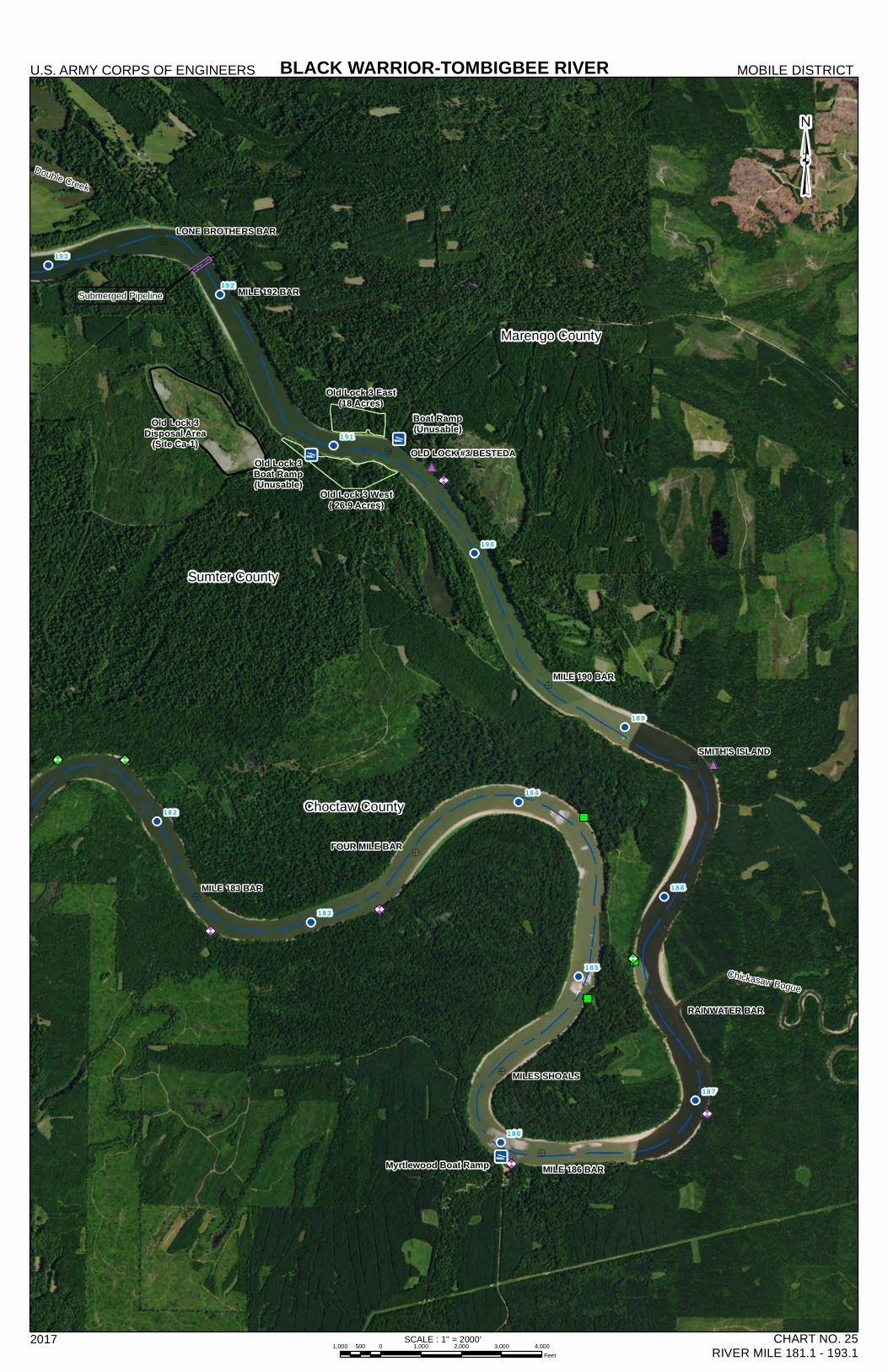
MILE 192 BAR
MILE 183 BAR
MILE 190 BAR
MILES SHOALS
RAINWATER BAR
FOUR MILE BAR
SMITH'S ISLAND
LONE BROTHERS BAR
OLD LOCK #3/BESTEDA
MILE 186 BAR
193
192
191
190
189
188
187
186
185
184
183
182
BLACK WARRIOR-TOMBIGBEE RIVERU.S. ARMY CORPS OF ENGINEERS MOBILE DISTRICT
2017 CHART NO. 25RIVER MILE 181.1 - 193.1
Chickasaw Bogue
Double Creek
Submerged Pipeline
SCALE : 1" = 2000'1,000 0 1,000 2,000 3,000 4,000500
Feet
Old Lock 3Disposal Area
(Site Ca-1)Old Lock 3Boat Ramp(Unusable)
Boat Ramp(Unusable)
Myrtlewood Boat Ramp
Old Lock 3 West( 26.9 Acres)
Old Lock 3 East(18 Acres)
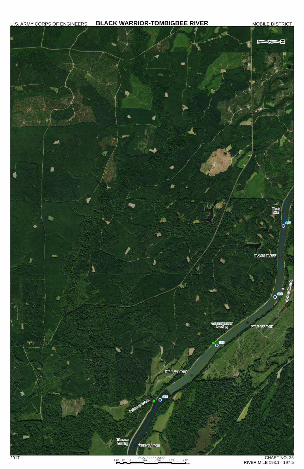
197
196
195
194
Source: Esri, DigitalGlobe, GeoEye, Earthstar Geographics, CNES/Airbus DS, USDA, USGS,AeroGRID, IGN, and the GIS User Community
BLACK WARRIOR-TOMBIGBEE RIVERU.S. ARMY CORPS OF ENGINEERS MOBILE DISTRICT
2017 CHART NO. 26RIVER MILE 193.1 - 197.5
³
MILE 195 BAR
MILE 194 BARGilmoresLanding
Cotohaga Creek
Crooms LowerLanding MILE 196 BAR
BLACK BLUFF
Cypre
ssBr
anch
BlackBluff
SCALE : 1" = 2000'1,000 0 1,000 2,000 3,000 4,000500
Feet
Sumter County Marengo County
!
!
!
!!
!
!!
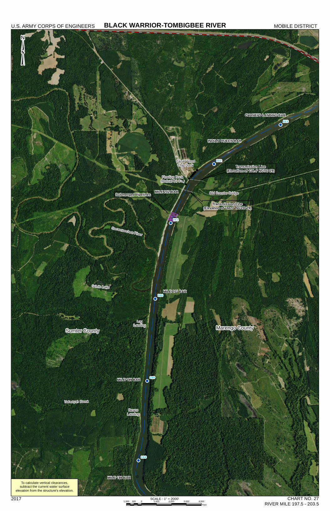
CHANEYS LANDING BAR203
202
201
200
199
198
BLACK WARRIOR-TOMBIGBEE RIVERU.S. ARMY CORPS OF ENGINEERS MOBILE DISTRICT
2017 CHART NO. 27RIVER MILE 197.5 - 203.5
³
Submerged Pipelines
MILE 198 BAR
MILE 199 BAR
DeansLanding
MILE 201 BAR
LogLanding
Sucarnoochee River
MILE 202 BAR
Transmission Line(Elevation of 166.7' NGVD 29)
Transmission Line(Elevation of 118.4' NGVD 29)
Old Rooster Bridge
Floating Dock(Mutual Oil Co.)
Canal WoodChip Dock
INDIAN QUEEN BAR
To calculate vertical clearances,subtract the current water surface
elevation from the structure's elevation.
Tallawyah Creek
Grinlin Lake
SCALE : 1" = 2000'1,000 0 1,000 2,000 3,000 4,000500
Feet
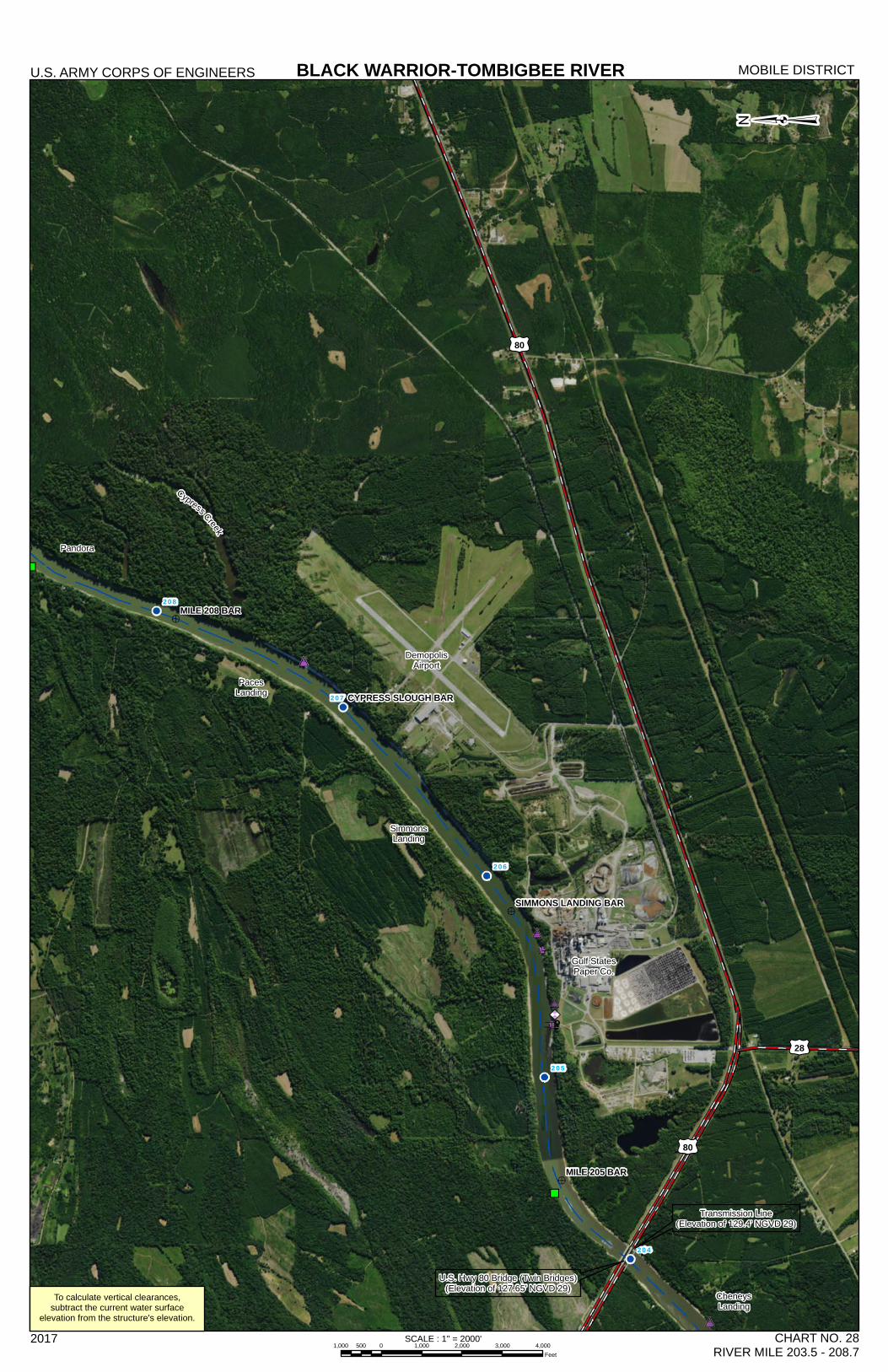
MILE 208 BAR
MILE 205 BAR
CYPRESS SLOUGH BAR
SIMMONS LANDING BAR
"
208
207
206
205
204
BLACK WARRIOR-TOMBIGBEE RIVERU.S. ARMY CORPS OF ENGINEERS MOBILE DISTRICT
2017 CHART NO. 28RIVER MILE 203.5 - 208.7
Transmission Line(Elevation of 129.4' NGVD 29)
U.S. Hwy 80 Bridge (Twin Bridges)(Elevation of 127.65' NGVD 29) Cheneys
Landing
Gulf StatesPaper Co.
SimmonsLanding
PacesLanding
DemopolisAirport
Cypress Creek
Pandora
To calculate vertical clearances,subtract the current water surface
elevation from the structure's elevation.
£¤80
£¤80
£¤28
³
SCALE : 1" = 2000'1,000 0 1,000 2,000 3,000 4,000500
Feet
65
43
43
117
69
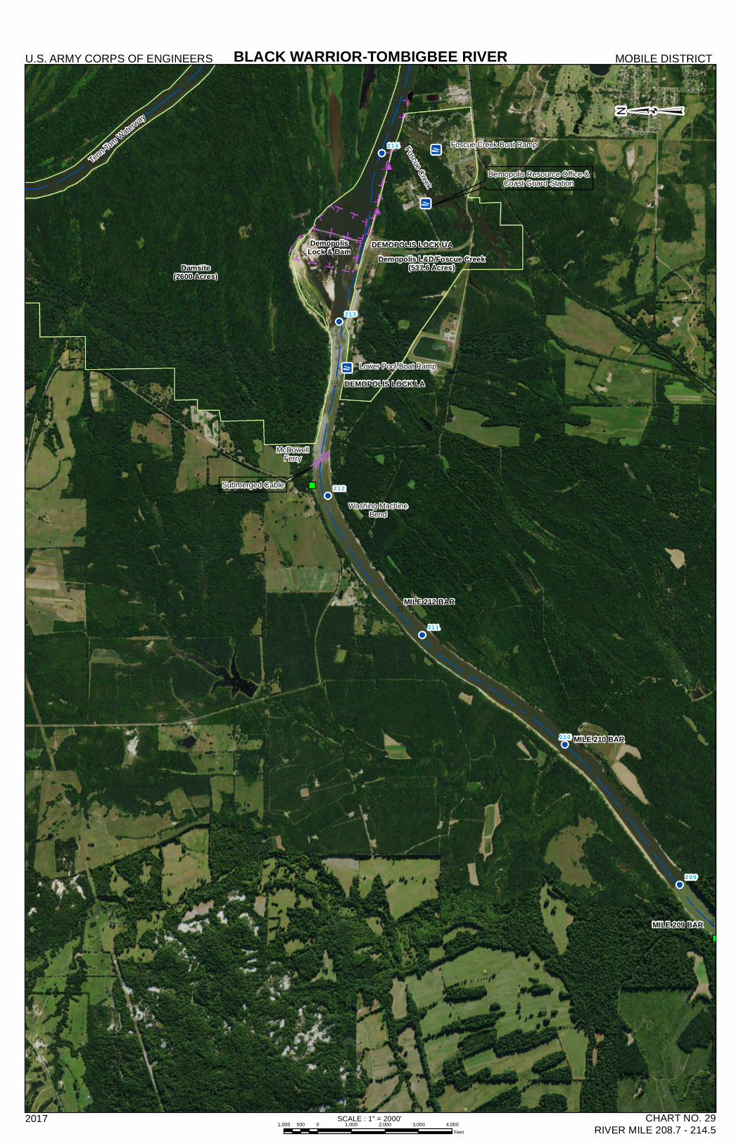
MILE 212 BAR
MILE 210 BAR
MILE 209 BAR
DEMOPOLIS LOCK UA
DEMOPOLIS LOCK LA
214
213
212
211
210
209
Source: Esri, DigitalGlobe, GeoEye, Earthstar Geographics, CNES/Airbus DS, USDA, USGS,AeroGRID, IGN, and the GIS User Community
BLACK WARRIOR-TOMBIGBEE RIVERU.S. ARMY CORPS OF ENGINEERS MOBILE DISTRICT
2017 CHART NO. 29RIVER MILE 208.7 - 214.5
Submerged Cable
Demopolis Resource Office &Coast Guard Station
Tenn-Tom Waterway
Washing MachineBend
McDowellFerry
Damsite(2600 Acres)
Demopolis L&D/Foscue Creek(537.6 Acres)
DemopolisLock & Dam
Foscue Creek
SCALE : 1" = 2000'1,000 0 1,000 2,000 3,000 4,000500
Feet
Lower Pool Boat Ramp
Foscue Creek Boat Ramp