Embed Size (px)
Citation preview
UrbanizationGeog100
Genevieve Depelteau
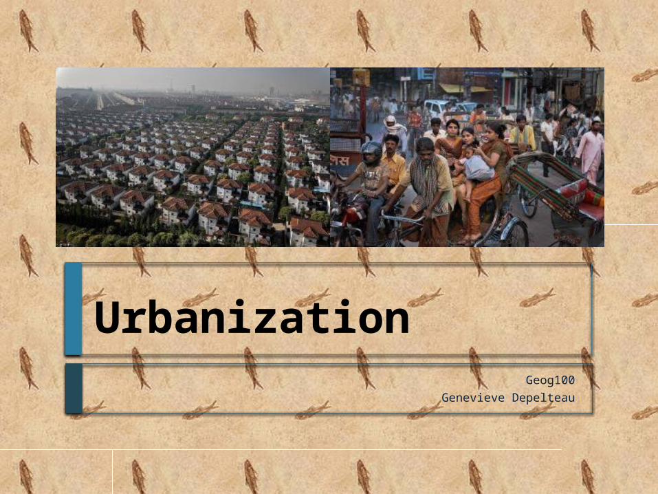
Urbanization is IRREVERSIBLE!!
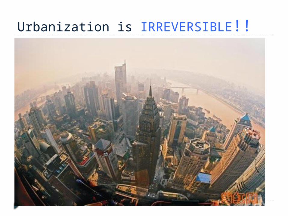
Urbanization facts In 1800, only 2 percent of the
world’s population was urban
By 2030, it is expected that 60% of the world population will live in urban areas.
70 million people a year
Almost 180,000 people are added to the urban population each day. Every week, addition of a city of more than 1 million residents every week!
It is estimated that there are almost a billion poor people in the world, of this over 750 million live in urban areas without adequate shelter and basic services.
Core/peripheries Core 65-95%
urbanized
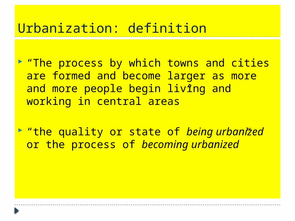
Urbanization: definition
“The process by which towns and cities are formed and become larger as more and more people begin living and working in central areas”
“the quality or state of being urbanized or the process of becoming urbanized”
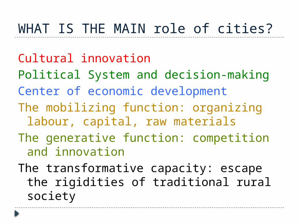
WHAT IS THE MAIN role of cities?
Cultural innovationPolitical System and decision-making Center of economic developmentThe mobilizing function: organizing labour,
capital, raw materials The generative function: competition and
innovationThe transformative capacity: escape the
rigidities of traditional rural society
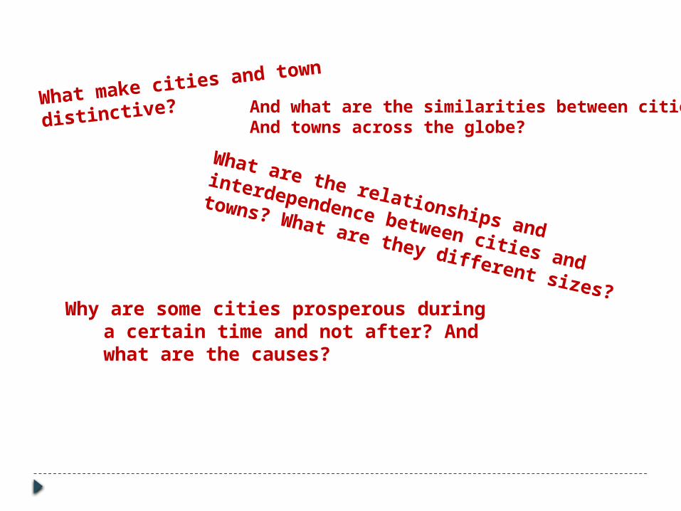
What make cities and town distinctive?
What are the relationships and interdependence
between cities and towns? What are they
different sizes?
Why are some cities prosperous during a certain time and not after? And what are the causes?
And what are the similarities between cities And towns across the globe?
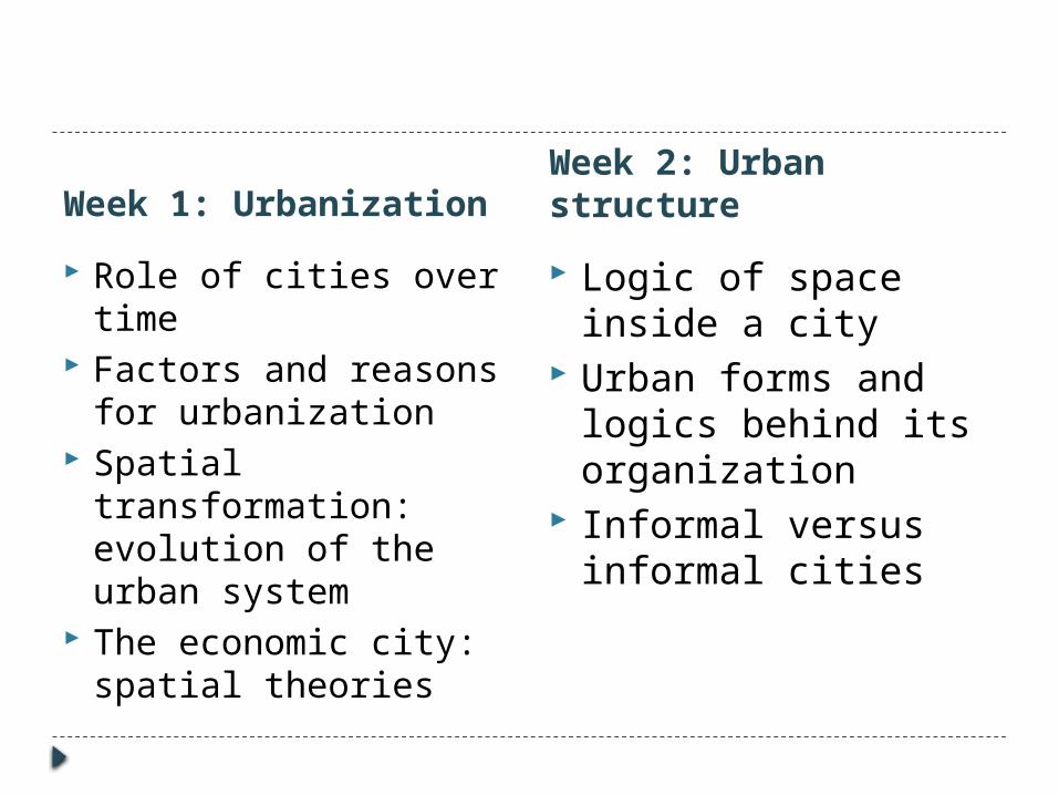
Week 1: UrbanizationWeek 2: Urban structure
Role of cities over time
Factors and reasons for urbanization
Spatial transformation: evolution of the urban system
The economic city: spatial theories
Logic of space inside a city
Urban forms and logics behind its organization
Informal versus informal cities
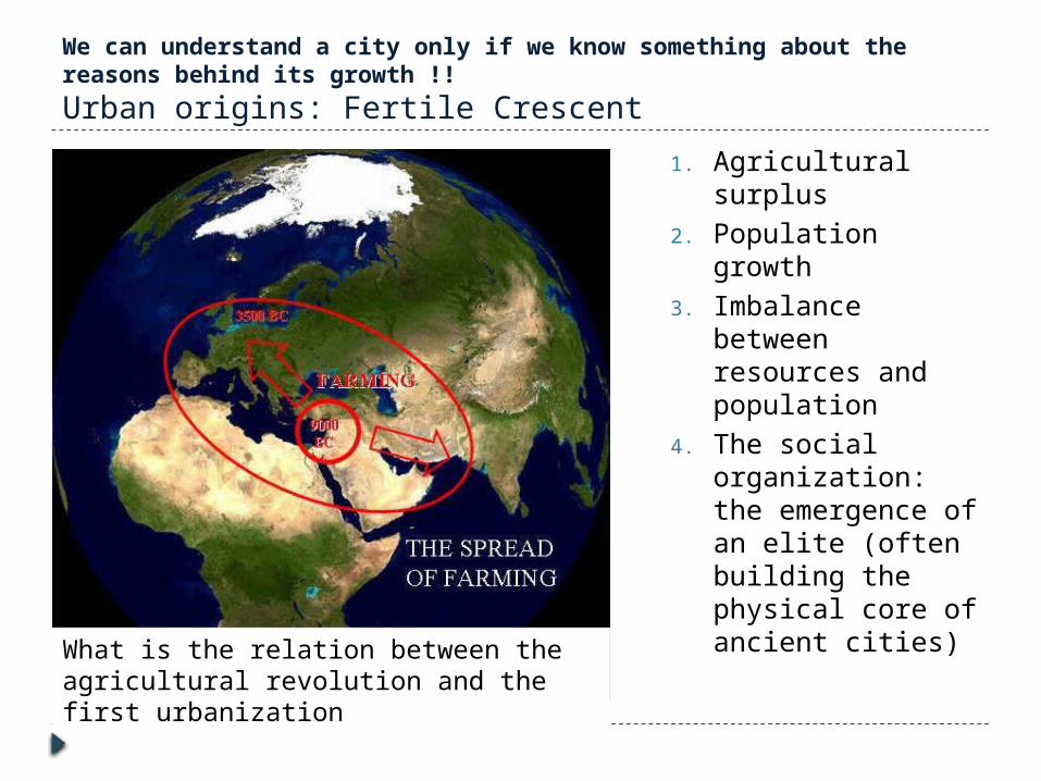
We can understand a city only if we know something about the reasons behind its growth !!
Urban origins: Fertile Crescent
1. Agricultural surplus
2. Population growth
3. Imbalance between resources and population
4. The social organization: the emergence of an elite (often building the physical core of ancient cities)
What is the relation between the agricultural revolution and the first urbanization
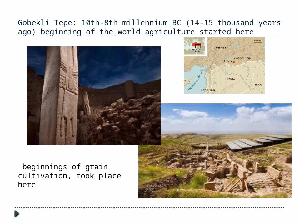
Gobekli Tepe: 10th-8th millennium BC (14-15 thousand years ago) beginning of the world agriculture started here
beginnings of grain cultivation, took place here
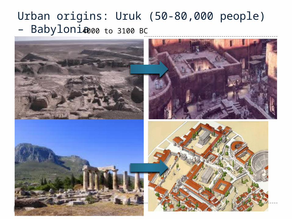
Urban origins: Uruk (50-80,000 people) – Babylonia 4000 to 3100 BC
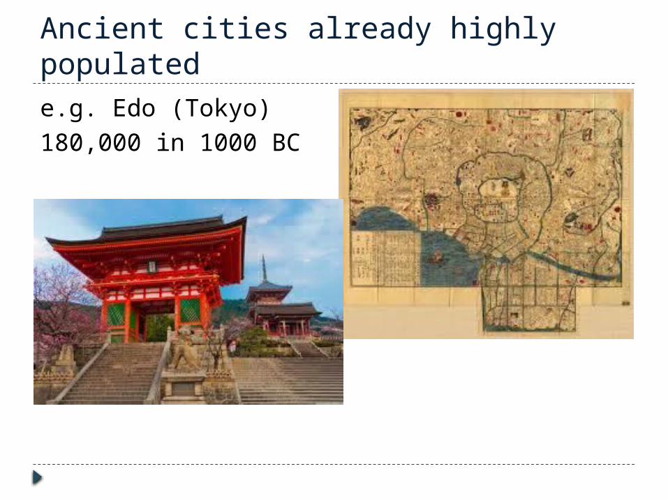
Ancient cities already highly populatede.g. Edo (Tokyo) 180,000 in 1000 BC
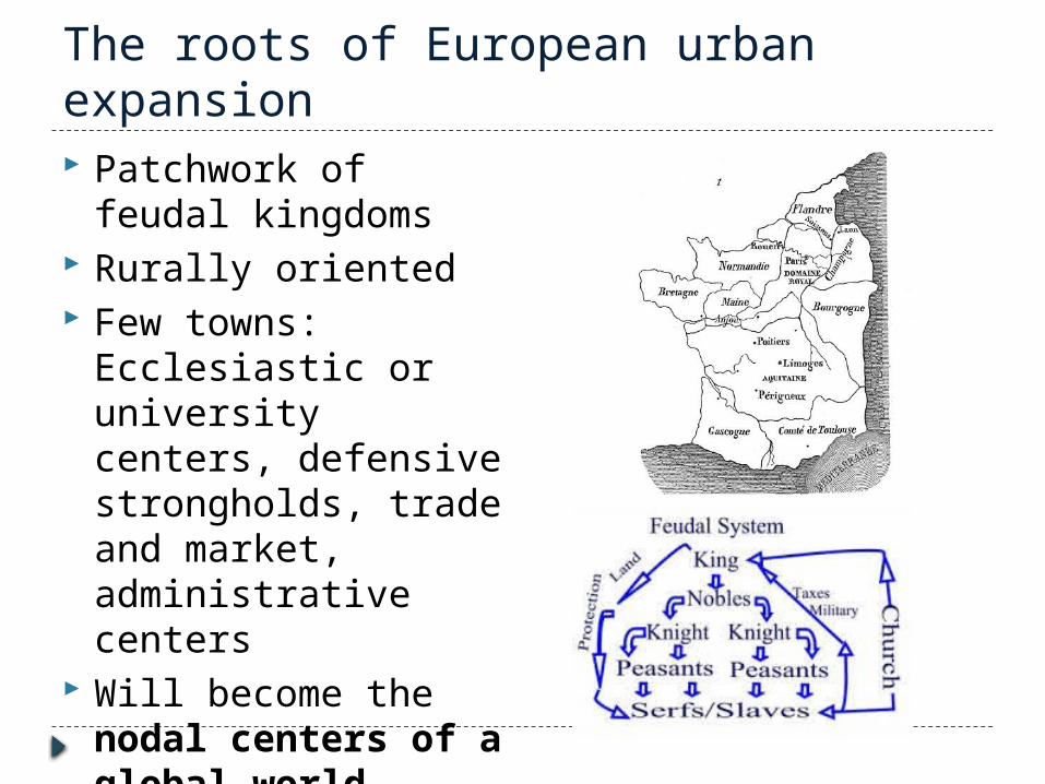
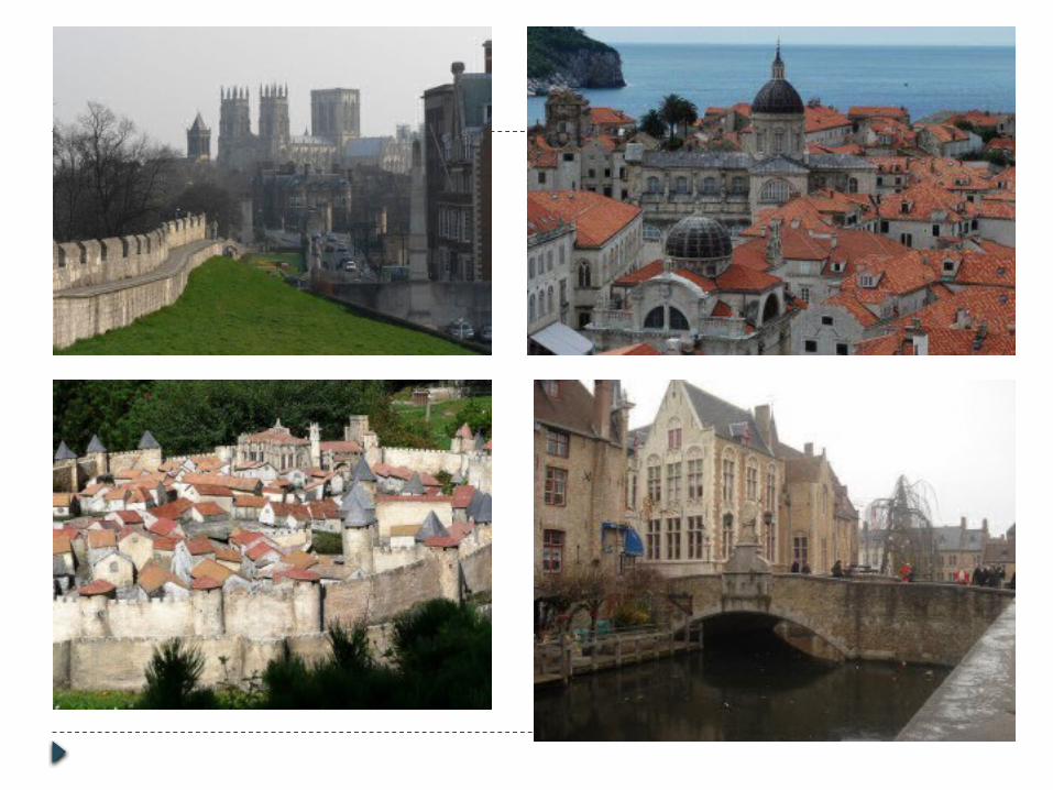
The roots of European urban expansion Patchwork of feudal
kingdoms Rurally oriented Few towns:
Ecclesiastic or university centers, defensive strongholds, trade and market, administrative centers
Will become the nodal centers of a global world-system
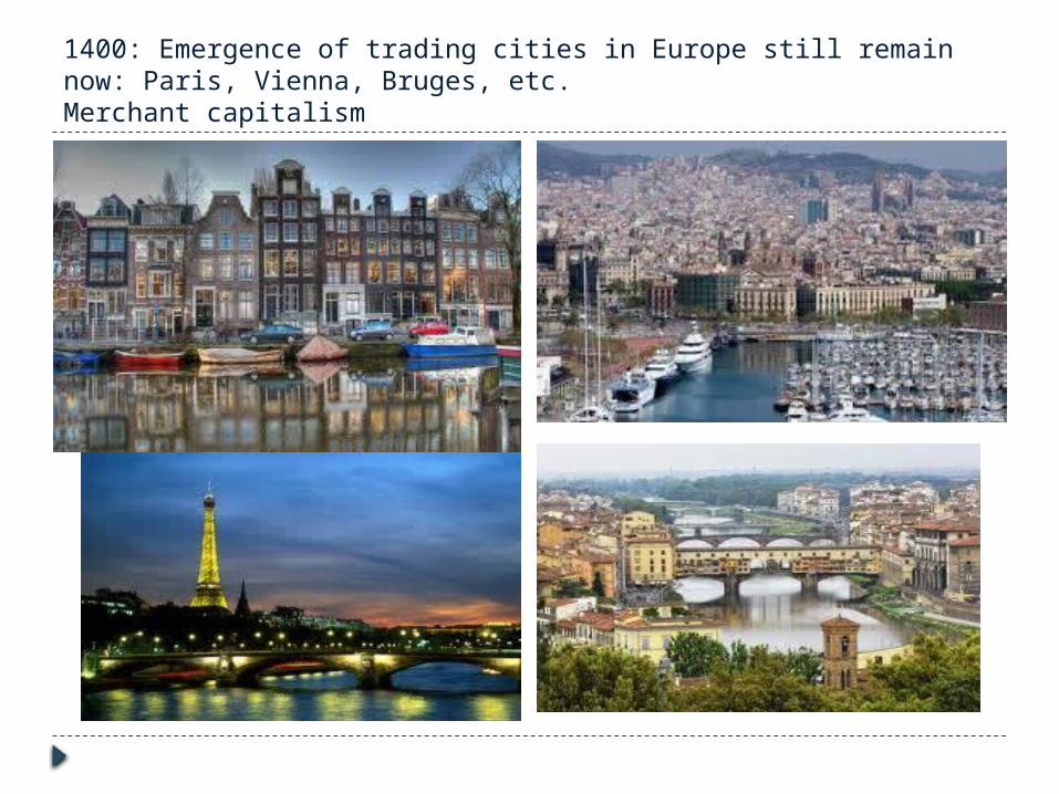
1400: Emergence of trading cities in Europe still remain now: Paris, Vienna, Bruges, etc.Merchant capitalism
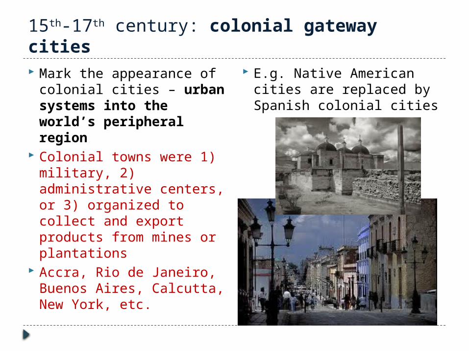
15th-17th century: colonial gateway cities Mark the appearance of
colonial cities – urban systems into the world’s peripheral region
Colonial towns were 1) military, 2) administrative centers, or 3) organized to collect and export products from mines or plantations
Accra, Rio de Janeiro, Buenos Aires, Calcutta, New York, etc.
E.g. Native American cities are replaced by Spanish colonial cities
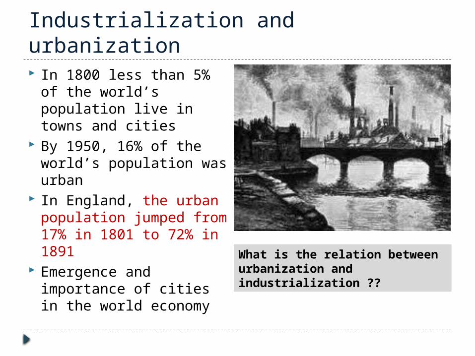
Industrialization and urbanization In 1800 less than 5% of
the world’s population live in towns and cities
By 1950, 16% of the world’s population was urban
In England, the urban population jumped from 17% in 1801 to 72% in 1891
Emergence and importance of cities in the world economy
What is the relation between urbanization and industrialization ??
Urbanization during the Industrial Revolution
Factors contributing Factors facilitating
Higher agricultural productivity
Industrialization: warehouse, factories
Growing trade around the world: cereals could be imported from America
Consumer market Development of land
transportation: e.g. public transport
Decrease death rate
Police Sanitation Fire department Public transport
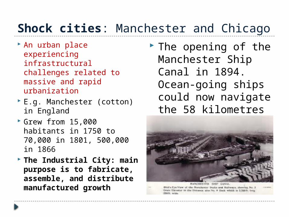
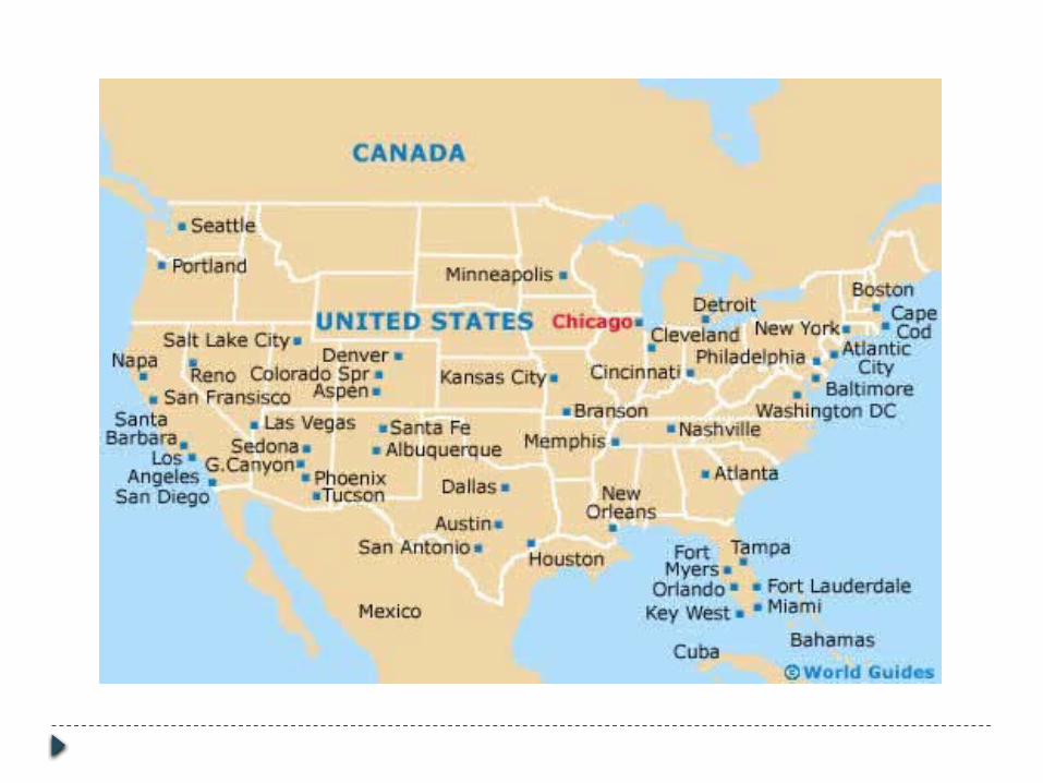
Shock cities: Manchester and Chicago An urban place
experiencing infrastructural challenges related to massive and rapid urbanization
E.g. Manchester (cotton) in England
Grew from 15,000 habitants in 1750 to 70,000 in 1801, 500,000 in 1866
The Industrial City: main purpose is to fabricate, assemble, and distribute manufactured growth
The opening of the Manchester Ship Canal in 1894. Ocean-going ships could now navigate the 58 kilometres to the newly opened Port of Manchester
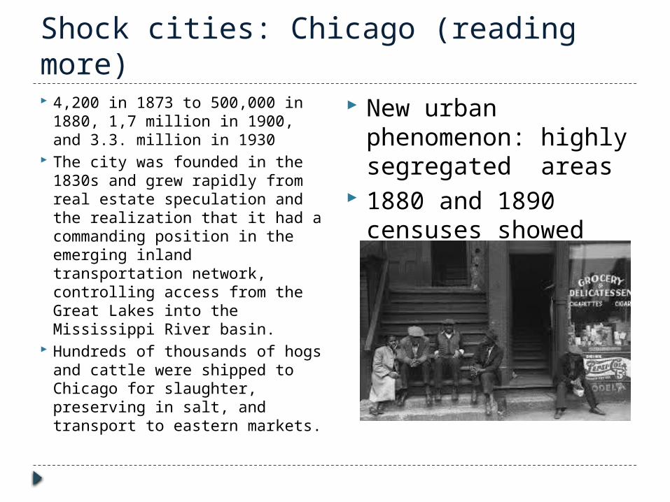
Shock cities: Chicago (reading more) 4,200 in 1873 to 500,000 in
1880, 1,7 million in 1900, and 3.3. million in 1930
The city was founded in the 1830s and grew rapidly from real estate speculation and the realization that it had a commanding position in the emerging inland transportation network, controlling access from the Great Lakes into the Mississippi River basin.
Hundreds of thousands of hogs and cattle were shipped to Chicago for slaughter, preserving in salt, and transport to eastern markets.
New urban phenomenon: highly segregated areas
1880 and 1890 censuses showed that more than three-quarters of Chicago’s population was foreign-born immigrants
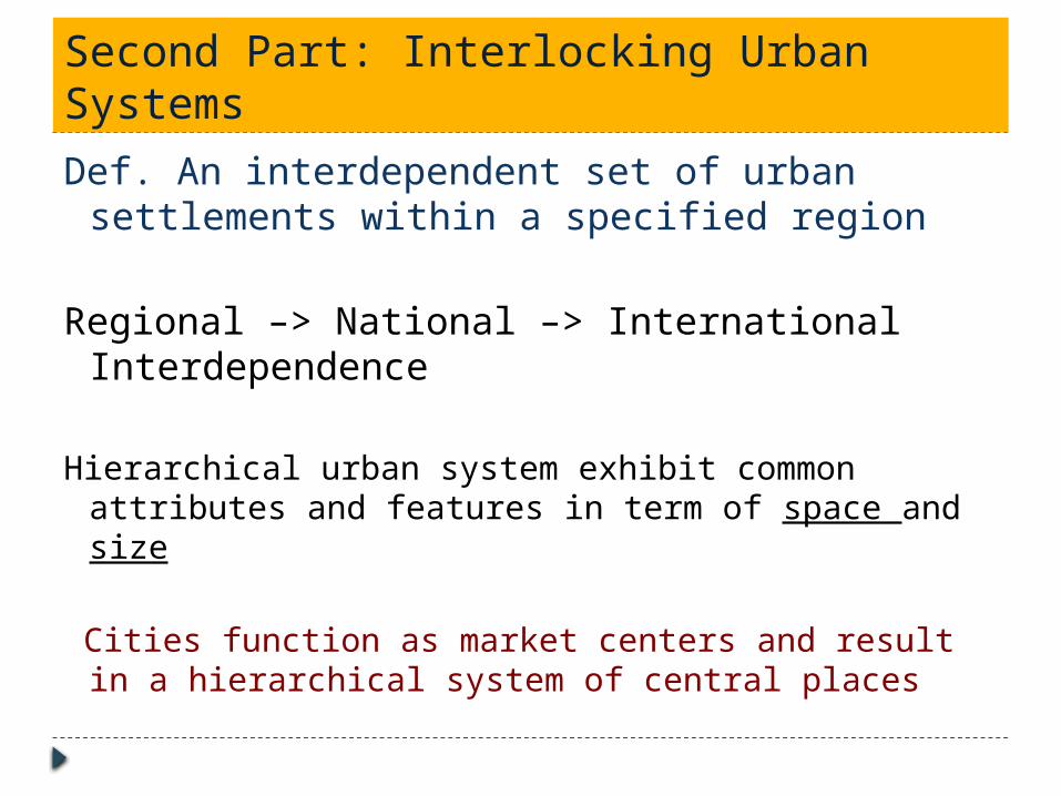
Second Part: Interlocking Urban Systems
Def. An interdependent set of urban settlements within a specified region
Regional –> National –> International Interdependence
Hierarchical urban system exhibit common attributes and features in term of space and size
Cities function as market centers and result in a hierarchical system of central places
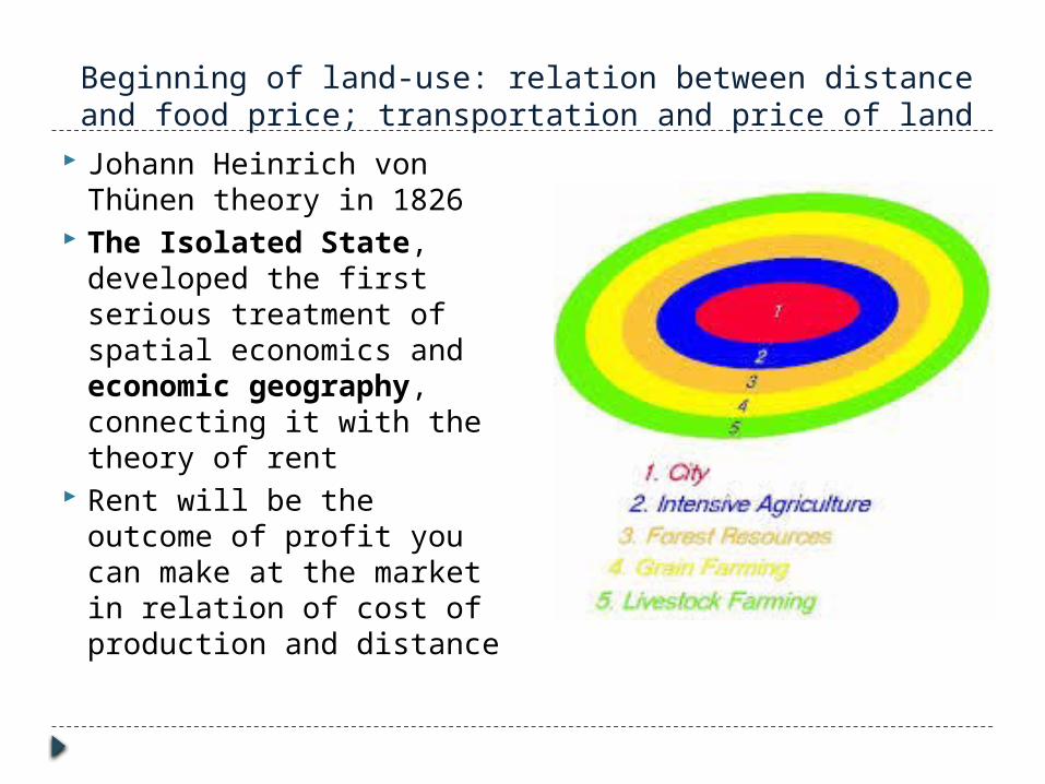
Beginning of land-use: relation between distance and food price; transportation and price of land
Johann Heinrich von Thünen theory in 1826
The Isolated State, developed the first serious treatment of spatial economics and economic geography, connecting it with the theory of rent
Rent will be the outcome of profit you can make at the market in relation of cost of production and distance
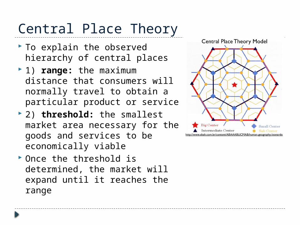
Central Place Theory To explain the observed
hierarchy of central places 1) range: the maximum
distance that consumers will normally travel to obtain a particular product or service
2) threshold: the smallest market area necessary for the goods and services to be economically viable
Once the threshold is determined, the market will expand until it reaches the range
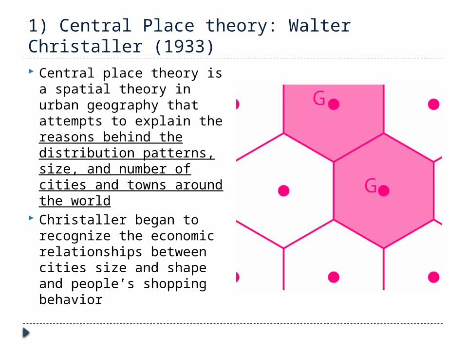
1) Central Place theory: Walter Christaller (1933) Central place theory is a
spatial theory in urban geography that attempts to explain the reasons behind the distribution patterns, size, and number of cities and towns around the world
Christaller began to recognize the economic relationships between cities size and shape and people’s shopping behavior
Central place theory
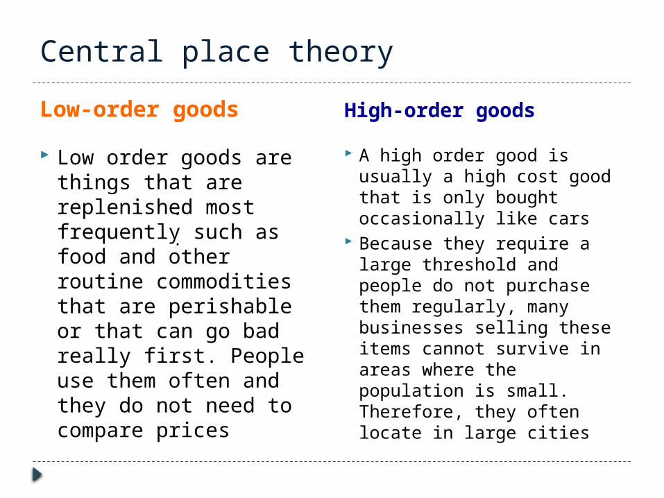
Low-order goods High-order goods
Low order goods are things that are replenished most frequently such as food and other routine commodities that are perishable or that can go bad really first. People use them often and they do not need to compare prices
A high order good is usually a high cost good that is only bought occasionally like cars
Because they require a large threshold and people do not purchase them regularly, many businesses selling these items cannot survive in areas where the population is small. Therefore, they often locate in large cities
.
.
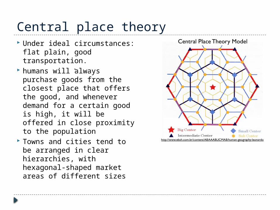
Central place theory Under ideal circumstances:
flat plain, good transportation.
humans will always purchase goods from the closest place that offers the good, and whenever demand for a certain good is high, it will be offered in close proximity to the population
Towns and cities tend to be arranged in clear hierarchies, with hexagonal-shaped market areas of different sizes
.

Central place theory: results The larger the
settlements are in size, the fewer in number they will be, i.e. there are many small villages, but few large cities.
The larger the settlements grow in size, the greater the distance between them, i.e. villages are usually found close together, while cities are spaced much further apart.
As a settlement increases in size, the range and number of its functions will increase .
As a settlement increases in size, the number of higher-order services will also increase, i.e. a greater degree of specialization occurs in the services
There is a distinctive relationship between the population size of cities and their rank with the overall hierarchy (rank-size rule)
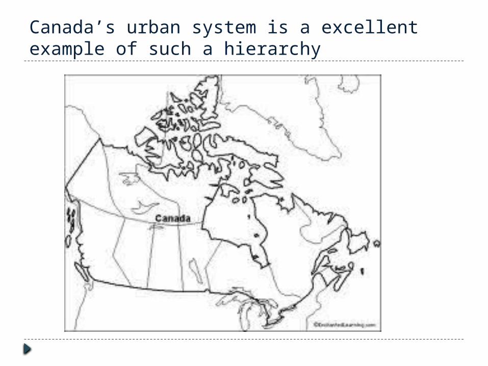
Canada’s urban system is a excellent example of such a hierarchy
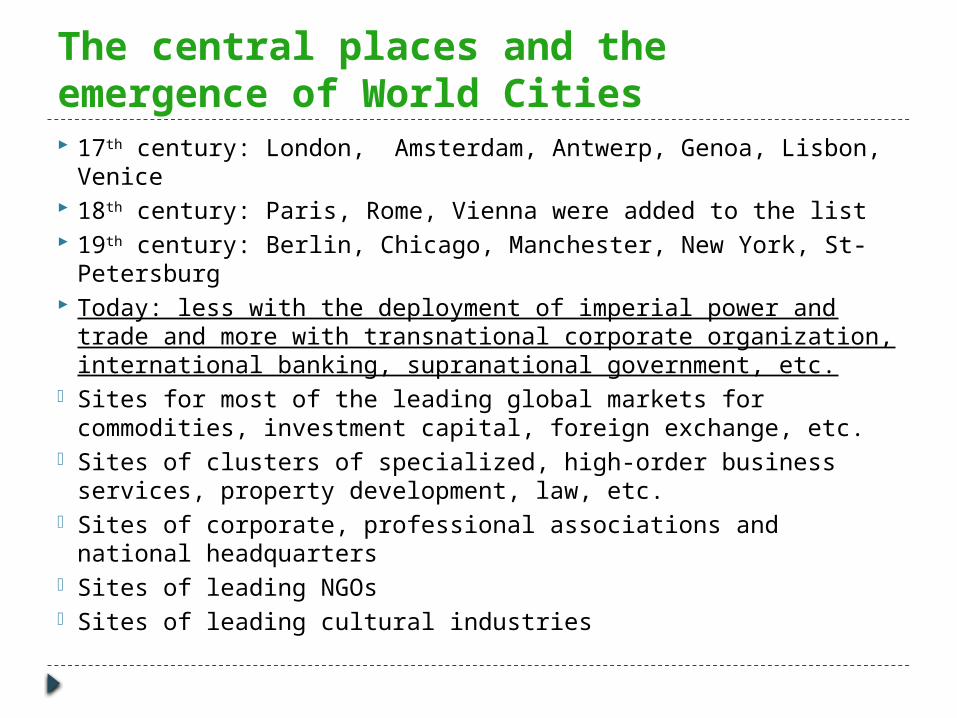
The central places and the emergence of World Cities 17th century: London, Amsterdam, Antwerp, Genoa, Lisbon,
Venice 18th century: Paris, Rome, Vienna were added to the list 19th century: Berlin, Chicago, Manchester, New York, St-
Petersburg Today: less with the deployment of imperial power and trade
and more with transnational corporate organization, international banking, supranational government, etc.
- Sites for most of the leading global markets for commodities, investment capital, foreign exchange, etc.
- Sites of clusters of specialized, high-order business services, property development, law, etc.
- Sites of corporate, professional associations and national headquarters
- Sites of leading NGOs- Sites of leading cultural industries
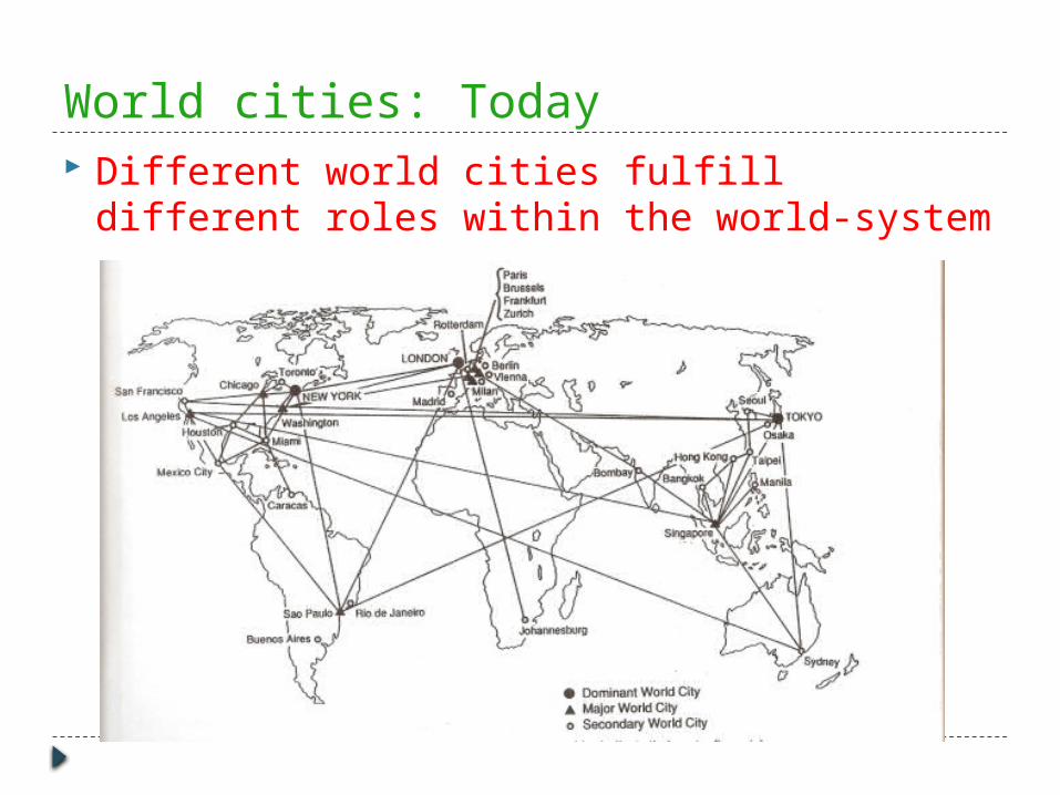
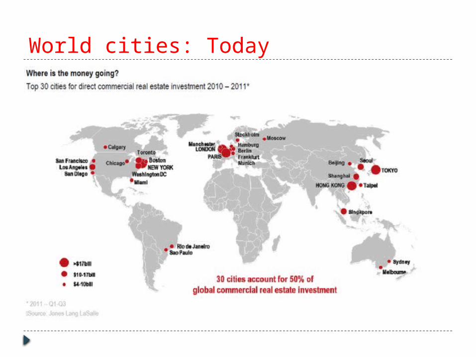
World cities: Today Different world cities fulfill different roles
within the world-system
World cities: Today
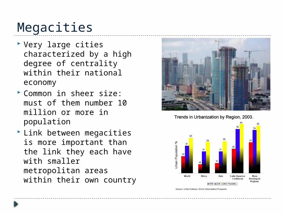
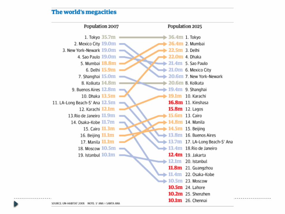
Megacities Very large cities
characterized by a high degree of centrality within their national economy
Common in sheer size: must of them number 10 million or more in population
Link between megacities is more important than the link they each have with smaller metropolitan areas within their own country
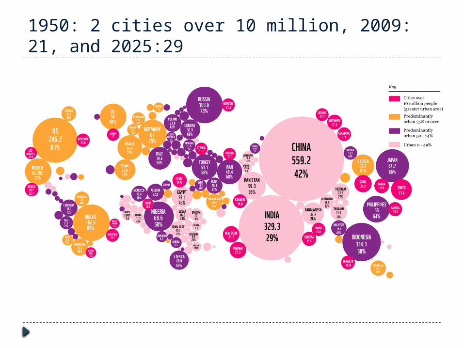
1950: 2 cities over 10 million, 2009: 21, and 2025:29
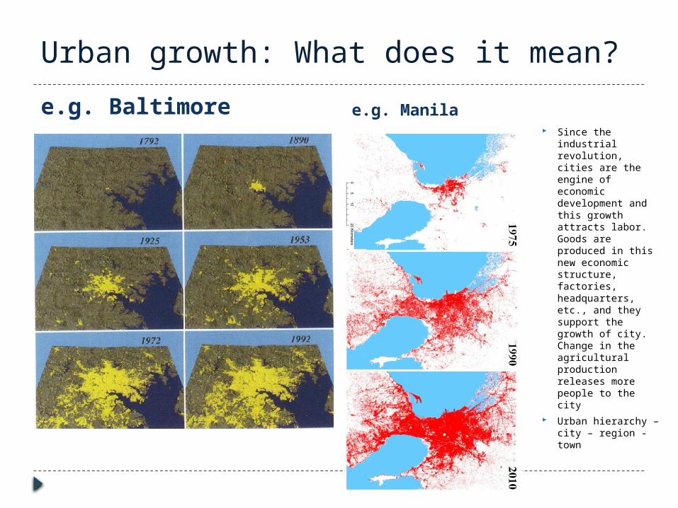
Urban growth: What does it mean?
e.g. Baltimore e.g. Manila Since the
industrial revolution, cities are the engine of economic development and this growth attracts labor. Goods are produced in this new economic structure, factories, headquarters, etc., and they support the growth of city. Change in the agricultural production releases more people to the city
Urban hierarchy – city – region - town

Urban Growth Process: Chicken/egg principle Principles of commercial and industrial LOCATION1. Accessibility to material inputs (raw materials and energy)2. Availability of labor with skills3. Processing costs4. The pull of the market5. The influence of cultural and institutional factors that
channel activities away (e.g. government policies- tax breaks)
6. The influence of behavioral considerations affecting individual decision
7. Other personal reasons8. Initial advantage: critical importance of an early start in
economic developmentALL TOGETHER IT CAN BE EXPLAINED BY A FUNCTIONAL
INTERDEPENDENCE
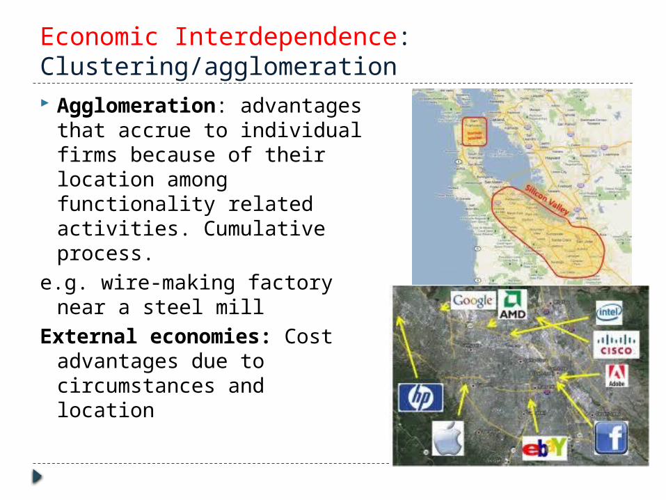
Economic Interdependence: Clustering/agglomeration Agglomeration:
advantages that accrue to individual firms because of their location among functionality related activities. Cumulative process.
e.g. wire-making factory near a steel mill
External economies: Cost advantages due to circumstances and location
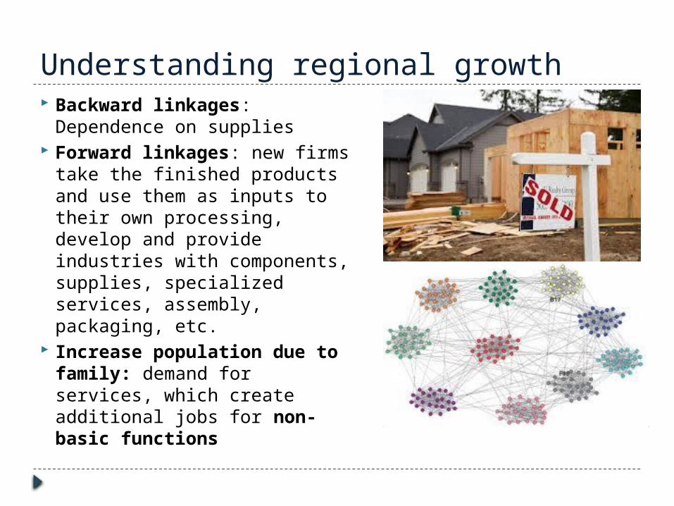
Understanding regional growth Backward linkages:
Dependence on supplies Forward linkages: new
firms take the finished products and use them as inputs to their own processing, develop and provide industries with components, supplies, specialized services, assembly, packaging, etc.
Increase population due to family: demand for services, which create additional jobs for non-basic functions
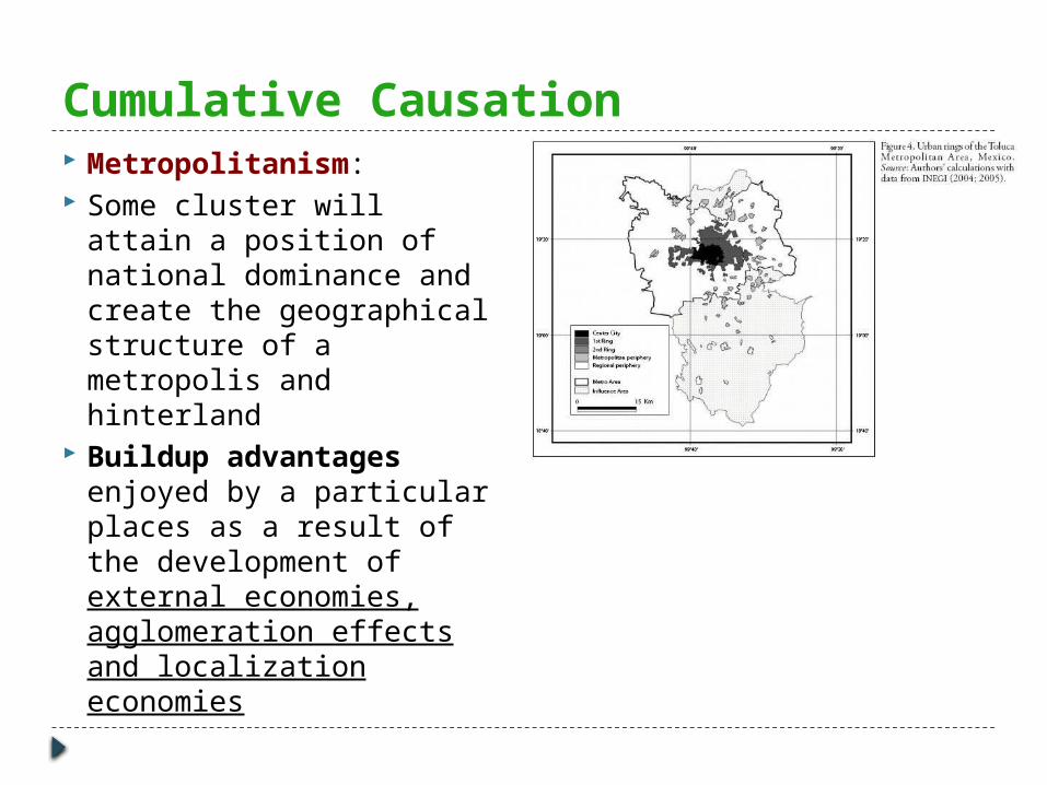
Cumulative Causation Metropolitanism: Some cluster will attain a
position of national dominance and create the geographical structure of a metropolis and hinterland
Buildup advantages enjoyed by a particular places as a result of the development of external economies, agglomeration effects and localization economies
Danger: agglomeration diseconomies
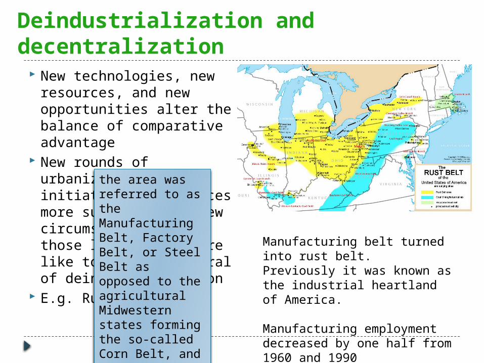
Deindustrialization and decentralization
New technologies, new resources, and new opportunities alter the balance of comparative advantage
New rounds of urbanization are initiated in the places more suited to the new circumstances, when those least suited are like to suffer a spiral of deindustrialization
E.g. Rust Belt
Manufacturing belt turned into rust belt. Previously it was known as the industrial heartland of America.
Manufacturing employment decreased by one half from 1960 and 1990
the area was referred to as the Manufacturing Belt, Factory Belt, or Steel Belt as opposed to the agricultural Midwestern states forming the so-called Corn Belt, and Great Plains states
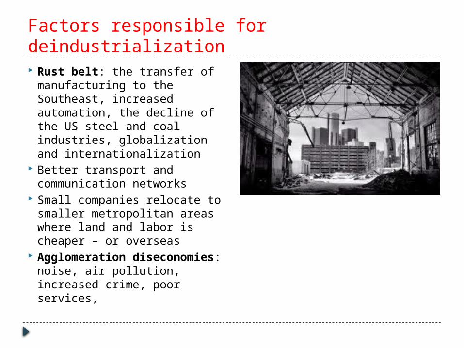
Factors responsible for deindustrialization Rust belt: the transfer of
manufacturing to the Southeast, increased automation, the decline of the US steel and coal industries, globalization and internationalization
Better transport and communication networks
Small companies relocate to smaller metropolitan areas where land and labor is cheaper – or overseas
Agglomeration diseconomies: noise, air pollution, increased crime, poor services,
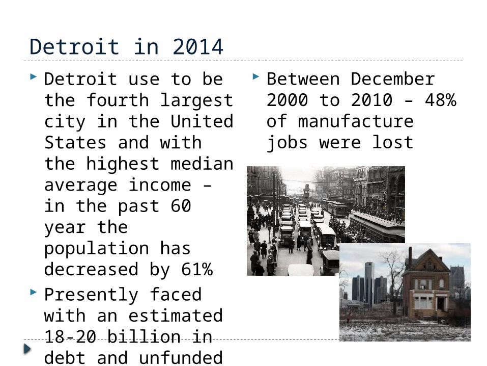
Detroit in 2014 Detroit use to be the
fourth largest city in the United States and with the highest median average income – in the past 60 year the population has decreased by 61%
Presently faced with an estimated 18-20 billion in debt and unfunded liability
Filed bankruptcy in 2012
Between December 2000 to 2010 – 48% of manufacture jobs were lost
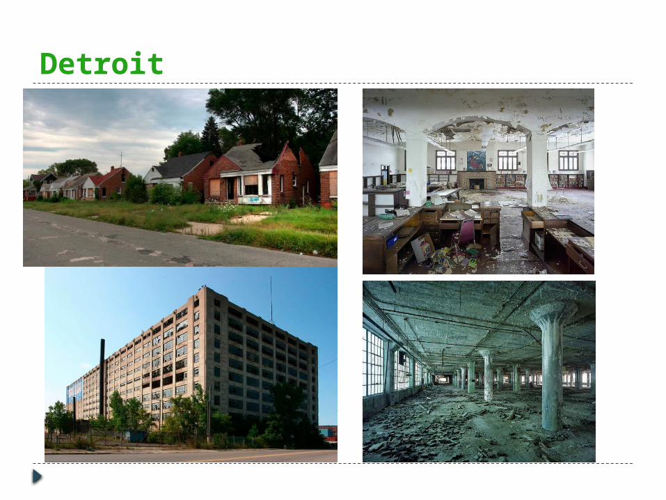
Detroit