Embed Size (px)
Citation preview

Colorado
Urban Land Institute – ULI ColoradoMorrison RoadTechnical Advisory Panel
Supported by BuCu West Development Association and the Denver Regional Council of Governments.
A Report from a Technical Advisory Panel (TAP)of ULI ColoradoNovember 15-16, 2018
Colorado
Overview........................................................3
Findings............................................................5
Recommendations..................................................7Conclusion..........................................................20ULI Volunteer Panelists.............................................21Interviewed Stakeholders.........................................23
Contents
Morrison Road Technical Advisory Panel
Colorado
A Report from a Technical Advisory Panel (TAP) of ULI Colorado
ULI Colorado’s Technical Advisory Panels (TAPs) offer the same expertise at the local level. Each panel is composed of qualified and unbiased professionals who volunteer their time. Panel chairs are respected ULI members with previous panel experience. Since 2003, ULI Colorado has completed more than 60 TAPs leading to positive policy changes and built projects.
Technical Advisory Panels (TAPs)
Supported by:Supported by BuCu West Development Association and the Denver Regional Council of Governments.
Writer: Marianne Eppig, Manager, ULI Colorado
Since 1947, the national ULI Advisory Services program has assembled 400+ ULI-member teams to help sponsors find solutions for issues including downtown redevelopment, community revitalization, and affordable housing, among other matters. In Colorado, ULI Advisory Services have provided solutions for such key sites as the Colorado Convention Center, Coors Field, Fitzsimons, and the Denver Justice Center.
Overview of ULI Advisory Services

Colorado
page 3
On November 15-16, 2018, ULI Colorado convened a Technical Advisory Panel (TAP) toprovide guidance for enhancing the Morrison Road corridor in Denver’s Westwood
neighborhood.
This TAP follows the successful national ULI panel that convened in 2013 to advise Westwood on ways to improve the built environment to benefit community health. Building on the progress of the past five years, this panel provided recommendations that can be used to transform the 1.5-mile diagonal corridor into a street that knits together the neighborhood, as opposed to dividing it. Its recommendations focused on:
• Ways to activate the public realm along the Morrison Road corridor
• Street designation and design opportunities
• Zoning and overlays that could be used to implement the vision of a linear mercado
• Incentives that could be used to encourage developers to create the kinds ofdevelopment desired by the community
• An action plan for how to phase the transformation of the corridor
For this two-day TAP, ULI Colorado assembled seven land use experts (see panelist bios on page 21) who volunteered to offer objective, third-party advice. The panel reviewed a detailed advance packet of prior studies, toured the site, and interviewed local stakeholders, including city staff, elected officials, longtime property and business owners, and local residents and artists (for a list of stakeholders interviewed, see page 23).
BuCu West gave the panelists the following problem statement and questions to address during the TAP.
Overview
TAP panelists discuss findings and recommendations for the Morrison Road corridor.
To see the 2013 national ULI Advisory Services Panel Report on the Westwood neighborhood, visit: http://uli.org/wp-content/uploads/ULI-Documents/WestwoodPanelReport_finallo.pdf
This panel provided recommendations that can be used to transform the 1.5-mile diagonal corridor into a street that knits together the neighborhood, as opposed to dividing it.

Colorado
page 4
The Problem Statement:The Scope of Work for the ULI Technical Advisory Panel focuses on studying the existing zoning regulations along Morrison Road and recommending changes to help us achieve the “Linear Mercado” vision outlined in the Westwood Neighborhood Plan (2016) and Morrison Road Streetscape Implementation Plan (2017).
Our goal is to leverage the funds allocated from Denver’s 2017 General Obligation (GO) Bond to implement the Morrison Road Streetscape Plan and use it as a catalyst for economic opportunity and cultural expression. Morrison Road provides a unique challenge given the irregular parcels created by the diagonal main street that cuts across Westwood’s orthogonal street grid. The need for a zoning overlay and was highlighted in the Neighborhood plan with a goal to redevelop and create adaptive reuse of underutilized commercial and private property along Morrison Road.
BuCu West is asking for support from the ULI TAP to get to the next level of assessment and move from planning to implementation. Adopting zoning guidelines designed specifically to address Morrison Road will leverage opportunities engendered from public investment and guide redevelopment in a way that is consistent with the communities culturally driven vision for the neighborhood. The outcome will build on existing efforts and maximize benefits to community residents.
Questions for the Panelists:1. How do we activate public/private spaces and underutilized areas?
2. What are the appropriate zoning regulations to create the right conditions for activating the corridor?
3. What opportunities can be offered to developers to encourage investment?
4. How to activate public/private spaces and underutilized areas?
Started in 1987 as the Morrison Road Business Association, the organization donned the name BuCu West in 2010. Since the name change, it’s been a community development corporation. That means it can ask for larger, sometimes federal, grants and be involved in commercial real estate and business operations. BuCu West works to connect businesses, and those looking to start businesses, with resources that can get them off the ground. Before the change, the organization depended mostly on business owners’ contributions and volunteer efforts, but the community needed more resources than that.
As a community development corporation, it involves residents that bring a wide variety of skills to the table. Rather than only assisting businesses, BuCu West can search for resources to help the area in other ways.
About BuCu West Development Association
Jose Esparza, Executive Director of BuCu West, explains details about the corridor to the TAP panelists during the tour.
Morrison Road used to be a cut-through for traffic, but our vision is for it to become a main street for the neighborhood. Since we don’t have a lot of space, we’ll have to get creative on how to use weird triangular parcels.
– Councilman Paul Lopez
“
”

Colorado
page 5
Westwood is a strong and culturally vibrant community that has been making greatstrides. In addition to attracting GO Bond funding for the corridor and a recreation
center to the neighborhood, it has gained state certification as a creative district, and local entrepreneurs and artists are transforming the auto-oriented corridor, all while the area has been addressing issues with housing, traffic, gentrification, and safety.
Through the review of the city’s previous plans and studies, as well as interviews with local stakeholders, the panelists noted the following challenges and opportunities for continuing to transform the corridor.
Challenges:
Findings
View of the Morrison Road corridor from its intersection with S. Raleigh Street.
Traffic is uncontrollable here. Trying to cross the street is ridiculous.
– Erick Garcia,Kitchen Network
“”• The Westwood Neighborhood Plan,
adopted by Denver City Council in 2016, proposes zoning for the Morrison Road corridor that doesn’t currently exist (UE-MX-5) and that is likely not right for the entire corridor based on what the community wants (more information available on page 14)
• “It’s hard to be healthy here”• Fear of change that will lead to
gentrification• Crime and perceived lack of safety• High traffic speeds• Lack of safe pedestrian paths and
crossings
• Lack of lighting• Lack of alleys and secondary access• Too many curb cuts• Lack of trees and green space• Lack of youth activities along the
corridor• Too many auto body shops• Developers focused on rental and not
for-sale residential housing• Rental units require expensive deposits• Influx of outsiders who don’t engage in
the local community• Many irregular and small parcels along
Morrison Road
The goal here is to increase pedestrian safety and bike crossings.
– Heather Noyes, StudioCPG and co-creator of the
Morrison Road Streetscape Implementation Plan
“”

Colorado
page 6
We need a place that creates ‘gravity’ - something that draws people here, like food and arts venues.
– Aaron Elinoff, BuCu Westboard member
“
”
Most parcels here are irregular and because of the way buildings are oriented to the street, each has its own little gathering area/plaza.
– Charles Woolley,St. Charles Town Co.
“
”
There is an Opportunity Zone in the northeast corner of Westwood.
Opportunity Zones were enacted as part of the 2017 tax reform package (Tax Cuts and Jobs Act) to address uneven economic recovery and persistent lack of growth that have left many communities across the country behind. The new program provides a federal tax incentive for investors to invest in low-income urban and rural communities through favorable treatment of reinvested capital gains and forgiveness of tax on new capital gains.
This economic and community development tax incentive program provides a new impetus for private investors to support distressed communities through private equity investments in businesses and real estate ventures. The incentive is deferral, reduction and potential elimination of certain federal capital gains taxes.
These funds can go toward investments in affordable housing, new infrastructure, startup businesses and various capital improvement projects in any of the selected 126 communities. The incentives expire in 2026.
For more information, visit choosecolorado.com/opportunity-zones.
Opportunity Zones
• Rich cultural identity• Arts and cultural district has been
formed and designated• Desire to be a destination• Resources for desired outcomes are
available (like the GO Bond, Parks andRecreation initiative for Via Verde, andother partnerships & funding)
• Well-considered neighborhood andstreetscape plans in place
• Local and political will to implementlocal plans
• Density of neighborhood organizationswilling to be part of the solution
• Entrepreneurial spirit• Community energy• Food and music scene is growing• 3 designated areas of character and
brand• Recreation center in the works that
could also be a cultural center• Views of downtown Denver and the
mountains• Variety of parcels available• Custom auto shops can be embraced
as part of the character and culture• Opportunity Zone at northeast end of
Morrison Road and Westwood
Opportunities:
Map of future land uses and street classifications along Morrison Road showing the irregular parcel shapes. Courtesy Blueprint Denver.
Map of the Opportunity Zone (in yellow) in Westwood courtesy choosecolorado.com/opportunity-zones.

Colorado
page 7
Morrison Road has the potential to become both a local and a regional destination,highlighting Mexican and Latin culture and knitting together the Westwood
neighborhood.
Currently, $12.24 million of the 2017 General Obligation Bond (GO Bond) funding is earmarked for Morrison Road improvements, which will include updates to the Entertainment District (Sheridan Boulevard to Kentucky Avenue), the Arts District (Perry Street to Alameda Avenue), two plazas (Newton Street and Osceola Street), and five key intersections (Nevada Plaza, Patton Court, Ohio Avenue, Wolff Street, and Yates Street).
Recommendations
Rendering of how Morrison Road could look in the future. Courtesy the Morrison Road Streetscape Implementation Plan from 2017.
Streetscape Implementation Plan Areas designated by BuCu West in 2017.

Colorado
page 8
BuCu West and the surrounding Westwood community is at a critical juncture, with the opportunity to get ahead of these changes, leveraging the funding to implement the community’s vision and plan, while preventing displacement.
This investment offers the unique opportunity to fundamentally change Morrison Road so that it begins to prioritize people over cars.
There is an urgency to act now to minimize the displacement of existing residents and businesses that may otherwise come with the incoming resources and development.
1. How do we activate public and private spaces and underutilized areas along the corridor?
• Support and attract creatives.
• Build on efforts of the Westwood Creative District and leverage its creativedistrict designation for additional grants and support.
• Apply for funding for affordable housing from Denver’s Affordable Housing Fund.
• Encourage and support the creation of live/work/exhibit space (i.e. through downpayment support, Colorado Creative Industries grants, and recruitment of artspace developers and co-ops).
• Encourage local ownership for preservation of the district.
Inclusion of Public ArtFrom the 2017 Morrison Road Streetscape Implementation Plan:
“City and County of Denver Arts and Venues should be engaged in the next phase of the design process to ensure local involvement and to coordinate public art opportunities with street reconstruction so that the streetscape design and public art are integrated. Phase I of Morrison Road will be designed and constructed as a GO BOND project, which will require the project to include a '1% for Public Art' element or elements. This component should not be initiated at the conclusion of the project, but rather in tandem with design refinement to more fully engage the artist in the overall streetscape design process, and to ensure that any lighting and/or irrigation necessary to support the art installation are fully integrated with street reconstruction.”
“The Hole” on Douglas Ave in Downtown Wichita transformed into a temporary Pop-Up Urban Park. The park was activated with food truck vendors during the week and provided a space for community engagement. Image courtesy ictpopuppark.com.
The panelists recommended that the BuCu West Development Association lead efforts to manage the public realm along Morrison Road, promoting and supporting the creative arts district and partnering with other local organizations to develop and manage plazas along the corridor.
BuCu West is well-positioned to provide this leadership, focusing on the economic, environmental, and cultural health of the corridor as a whole. To activate both public and private spaces along Morrison Road, BuCu West could continue to:
For more information about Denver’s Affordable Housing Fund, visit: www.denvergov.org/content/denvergov/en/denver-office-of-economic-development/housing-neighborhoods/DenversPermanentFundforHousing.html

Colorado
page 9page 9
Specific recommendations related to the activation of publicly accessible spaces along the corridor include:
• Make the identity of the neighborhood clear to people coming through the corridor. Encourage artists, local residents, and small businesses to get involved so that they have a say in the appearance of their neighborhood.
• Test ideas through pop-up tactical urbanism. Work with property owners to create pop-up plazas and public spaces that include art and retail, like market stalls. These spaces can be activated with seating and games. Painting creative pedestrian crosswalks, decorating the sidewalk, and adding planters along the street are creative ways to test ideas and see what works.
• Improve user comfort along the corridor. The corridor today is not comfortable or inviting for pedestrians. More trees, green space, and shade will add comfort and green infrastructure will also help with stormwater runoff. Seating, shelter, and lighting (such as string lighting in the creative district) will also help improve the pedestrian experience along the corridor.
• Foster the arts and support the creation of artist co-ops. Art highlights the cultures of the neighborhood and attracts people from around the region, supporting local businesses. The Westwood Creative District can build on its efforts to support and attract creatives by applying for funding for art space and creation and supporting artist ownership within the district. If artists own live/work/exhibit space, they won’t be as easily priced out of the area by increasing rents and can lower expenses by combining these needed uses into a single space. To support this kind of ownership, the district can allow a mix of live/work/exhibit uses in the overlay zoning (more on page 14). It can also financially support the creation of artist co-ops that share the expenses of developing live/work/exhibit space and living and working in the district. By staying in the creative district, artists can continue to add art and activation on Morrison Road and in its publicly accessible spaces.
Tactical urbanism like painting the pavement can test strategies for traffic calming and pedestrian safety. Photo by J.T. Wampler, courtesy Northwest Arkansas Democrat Gazette.
We wanted to create an art studio/community center/teaching facility, but we couldn’t afford the down payment. If we were able to own the building, we could stay here and establish connections to community.
– Tony Diego, local artist
“
”
Live/Work Space for ArtistsArtspace is a nonprofit developer and owner of live-work spaces for artists nationwide. To vet prospective artist-tenants, Artspace forms a local artist-selection committee to approve potential tenants based on three criteria: the applicant’s sustained commitment to their craft; their excitement about participating in the building’s community and neighborhood; and their willingness to live in a potentially lively, social environment. Artspace is currently working on projects in Loveland and 40 West Art District.
For more information, visit: www.artspace.org.

Colorado
page 10
• Consider evolving the BuCu West maintenance district into a different type of special district. As a maintenance district, BuCu West can use local assessments on streetscape improvements. BuCu West could evolve into a different type of special district, such as a Business Improvement District (BID) or a General Improvement District (GID), to best financially support the needs of the local community and to add amenities to the corridor.
• BuCu West could serve as nonprofit developer early in the transition of the corridor. Panelists recommended acquiring property in the near term before GO Bond improvements and development interest ramps up along the corridor. That property could be used for public plazas, community gathering space, or artist co-op space.
• Create great public plazas. Over time, pop-up plazas can transition into more permanent public plazas. Private plazas, like the Del Corazon plaza at Ohio and Morrison, can be made publicly accessible to enhance their activation. For users to feel that plazas are safe and activated in a positive way, they should have active edges (such as with retail or community uses on the ground floor instead of blank walls) and “eyes on the plaza” (people are able to see into the plaza). Buffers from street traffic, which could include vegetation, seating, lighting, active uses and programming (like with festivals, events, exercise classes, etc) all contribute to great plazas. The overlay zoning (more on this on pages 14-16) can help to reinforce activation.
• Support a variety of inter-generational public spaces. Public spaces along the corridor could have a variety of uses that serve different groups of people. Playgrounds, sports fields and activities for all ages could be located close to a public plaza with movable seating anda coffee stand, allowing parents and older generations to spectate. Designing for flexibility (such as movable chairs and tables and programmable space) and integrating local public art will make these spaces inviting for the community.
• Add to the mix of neighborhood amenities. Westwood is slated for a $37 million recreation center, funded by the GO Bond. Before this is designed and built, neighborhood residents could advocate for inclusion of cultural, educational, artist, and community amenities. Some recreation centers allow local artists to exhibit their art with prices along hallways. Cultural education, language classes, and healthy cooking classes could also be added to the facilities. Panelists also suggested working with the Mi Casa Resource Center to add business training for artists or a small business incubator.
• Registered Neighborhood Organizations (RNOs) can work with local police to enhance safety in the area. Westwood Unidosand Westwood Residents Association are two local RNOs whose boundaries include all of Westwood, including the Morrison Road corridor.
A public plaza in Mexico City uses paint, planters, movable seating, and umbrellas to enhance comfort. Photo courtesy ecpamericas.org.
Plazas could offer great spaces for arts and cultural activities. Photo courtesy BuCu West.
Temporarily closing and painting a section of the street allowed for the creation of this pilot plaza before making it permanent. Photo courtesy NYC DOT.
Colorado
page 11
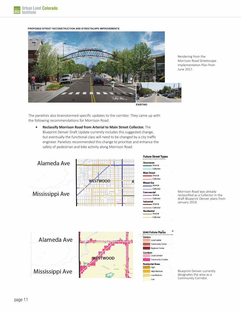
The panelists also brainstormed specific updates to the corridor. They came up with the following recommendations for Morrison Road:
• Reclassify Morrison Road from Arterial to Main Street Collector. TheBlueprint Denver Draft Update currently includes this suggested change,but eventually the functional class will need to be changed by a city trafficengineer. Panelists recommended this change to prioritize and enhance thesafety of pedestrian and bike activity along Morrison Road.
Morrison Road was already reclassified as a Collector in the draft Blueprint Denver plans from January 2019.
Rendering from the Morrison Road Streetscape Implementation Plan from June 2017.
Blueprint Denver currently designates the area as a Community Corridor.

Colorado
page 12
• Change the place designation of Morrison Road fromCommunity Corridor to Local Corridor in Blueprint Denver.The Blueprint Denver Draft currently designates Morrisonas a Community Corridor, based on traffic driving throughthe corridor from and to surrounding areas. By changing thedesignation to a Local Corridor, local foot and bike traffic willbe prioritized over regional traffic counts. Even if MorrisonRoad retains the Community Corridor designation, it wouldbe on the lower end of the designation in terms of density,intensity of uses, and building stories compared to otherplaces in Denver.
• Slow traffic on Morrison Road with improved streetdesign. While the speed limit along Morrison Road is 30mph, traffic frequently goes faster. Street design elementslike narrower lanes and textured pedestrian crosswalks willhelp to calm traffic, making the street safer for pedestriansand bicyclists.
• Enhance the pedestrian experience. Transforming MorrisonRoad from “a place to get through” to “a place to arrive”involves prioritizing pedestrians. Widening sidewalks,planting trees, creating pedestrian plazas, and addingcomfortable transit shelters will all help to enhance thepedestrian experience along the corridor.
• Create safe places to cross Morrison. Currently, thereare few pedestrian crosswalks on Morrison Road. Addingcrosswalk paint, signs, and signals every few blockscould greatly enhance the safety of pedestrian crossings.Narrowing the crossing distance with wider sidewalks, bulbouts, or medians could also increase the safety of crossingsthroughout the corridor.
• Reconfigure the Morrison/Alameda intersection to createa safer gateway into the corridor. Panelists suggestedremoving one of the turn lanes from Alameda onto Morrisonto reduce oncoming traffic into the corridor.
• District branding and wayfinding at key intersectionsand crossings. BuCu West has done a commendable job ofadding banners, murals, and public art along a section ofMorrison Road. Panelists suggested adding to the districtbranding and wayfinding along the corridor to let peopleknow when they’ve entered the art district and where topark.
• Get creative with parking on side streets. Currently, thereis more than enough street parking available throughoutthe corridor. In the future, when there is greater demandfor parking, the panelists suggested that creative parkingoptions, like diagonal street parking, could be added to sidestreets.
Existing and proposed Morrison Road cross-sections from the 2017 Streetscape Implementation Plan.
Bus stops can integrate public art, becoming enhanced shelters. Photo by Kara Pearson Gwinn, courtesy Confluence Denver.
SECTIONS
CURB
& G
UTTE
R GAS
SANITARY GASSANITARY
WATER
MAINLINE
CURB
& G
UTTE
RBA
CK O
F CU
RB
BACK
OF
CURB
R.O.
W.
R.O.
W.
5’CONCRETE
5’CONCRETE
8’PARKING LANE
8’PARKING LANE
5’BIKELANE
5’BIKELANE
12’TRAVEL LANE
12’TRAVEL LANE
GAS
SANITARY GASSANITARY
WATER
MAINLINE
GUTT
ER
GUTT
ER
CURB
BUILD
BUILD
CURB
BACK
OF
CURB
EXI
STIN
G
BACK
OF
CURB
EXI
STIN
G
R.O.
W.
R.O.
W.
5’CONCRETE
5’CONCRETE
5’AMENITY
ZONE
5’AMENITY
ZONE
8’PARKING LANE
8’PARKING LANE
+ +
11’SHARROW
TRAVEL LANE
11’SHARROW
TRAVEL LANE
BACK
OF
CURB
(PRO
POSE
D)
BACK
OF
CURB
(PRO
POSE
D) MMMMMMMMMMMMMMMMMMMOOOOOOOOOOOOOOOORRRRRRRRRRRRRRRRRRRRRRRRRRRRIISSON ROOOOOOOOOOOOOOADDD
EXISTING TYPICAL SECTION
PROPOSED TYPICAL SECTION
AMENITY ZONE�������������LIGHTS��������MATERIAL��������������������������������������PLANTERS��GATEWAY/ARCHES��BENCHES��������������������������������RECEPTACLES�
Pedestrian crosswalks with medians enhance safety by decreasing the crossing distance. Photo courtesy picswe.com.

Colorado
page 13
Removing one of the turn lanes from Alameda Avenue onto Morrison Road and adding a bulb out and median will calm traffic coming into the corridor. Image by Meredith Wenskoski.
Diagonal parking spaces were added to E. 7th Avenue and Logan Street in Denver, allowing for additional street parking. Image courtesy Google Maps.
Rendering of a proposed plaza along Morrison Road. Image courtesy BuCu West.

Colorado
page 14
Current zoning of the corridor is UE-MX-3 (Urban Edge, Mixed-Use, 3 Stories). The Westwood Neighborhood Plan recommends UE-MX-5 (Urban Edge, Mixed-Use, 5 Stories) for the corridor. Map courtesy the City and County of Denver.
2. What are the appropriate zoning regulations to createthe right conditions for activating the corridor?
Current Zoning Issues:The Westwood Neighborhood Plan recommends the currently unavailable zone district of UE-MX-5 (Urban Edge, Mixed-Use, 5 stories). The closest zone district that is available is UE-MX-3 (Urban Edge, Mixed-Use, 3 stories), which is the current zoning of the entire corridor.
If the corridor implements the plan’s recommended zoning of UE-MX-5, it would encourage parcel assembly, allowing bigger and taller developments all along the corridor. This will likely result in the demolition of older existing structures.
Zoning in Denver was designed primarily for rectangular blocks on a street grid, but Morrison Road’s diagonal creates unique parcel shapes and sizes that don’t fit well with the existing code. Additionally, Morrison Road has small parcels to the north and larger lot sizes to the south, with different physical conditions throughout the corridor. A single zone district along the corridor doesn’t typically allow for unique and creative development solutions.
The panelists recommended adding Overlay Zoning to highlight the unique sizes and shapes of the existing sites and to encourage the ongoing use of existing buildings along the northern end of the corridor to keep rents affordable, since new construction is expensive.
Overlay Zoning:
Overlay zoning along the Morrison Road corridor can be used to support the community’s goals for a linear mercado and to incentivize the type of development that benefits the community.
Overlay zoning should be used to guide development toward the community’s objectives, such as activating public spaces, improving safety, enhancing the pedestrian experience, sustaining local businesses, and showcasing culture.
BuCu West and the City can work with existing property owners to identify options for the overlay, which will be written into the zoning code. Creating a Morrison Road Advisory Committee could help to provide input, buy-in, and guidance on the vision, objectives, and guidelines for the Overlay and continuity for its implementation over time.
Variations to be Addressed in the Overlay Zoning:
• Flexibility in Form Standards: Allow variety in how buildingsaddress the street (build-to requirements), promoting streetactivation. Address flexible form standards for siting, setbacks,and additions.
• Siting: Expand public space with the goal of more public art,gathering space, green space, and plazas.
• Access: Allow customized access for unique parcel shapes andshared access to reduce quantity of curb cuts.
• Parking: Allow creative parking solutions for sites, suchas shared parking and on-street parking. Reduce parkingrequirements for small parcels when curb cuts are closed onMorrison Road.
We need to do a more focused zoning district here that helps to realize the vision of the neighborhood plan.
– Steven Chester, planner whoworked on the Westwood
Neighborhood Plan
“
”
Overlay Zoning
An overlay zone is a zoning district which is applied over one or more previously established zoning districts, establishing additional or stricter standards and criteria for covered properties in addition to those of the underlying zoning district. Overlay zones can be used to promote specific development projects, such as mixed-used developments, art districts, and affordable housing.
For more information, visit: www.planning.org/divisions/planningandlaw/propertytopics. htm#Overlay.

Colorado
page 15
Pop-up Retail in Denver
Pop-up retail in Denver currently requires a Temporary Zoning Use Permit, which can be approved or denied on a case-by-case basis.
Morrison Road has smaller parcels north of Perry Street and larger parcels south of Perry Street. Overlay zoning can treat these areas differently.
• Massing & Setbacks: Attention to height and shading of adjacent properties. Supportdiverse housing types (mixed-use, townhomes, duplexes, row homes) throughout thecorridor. Scale amenities (i.e. setbacks, open space) to lot and building size.
• Public Space Activation: Ensure options for pop-up and cluster vending in publicspaces.
• Live/Work/Exhibit Space: Allow live/work/exhibit space for artists in the mixed-usezoning.
• Public Art: Create options for interactive and installation public art (special uses).
Since Morrison Road has smaller parcels and uses north of Perry Street and larger parcels and uses south of Perry Street, overlay zoning can treat these areas differently:
Sub-Area 1 (Perry Street to Alameda Avenue):
• This area includes the “Westwood Creative District” and the “Gateway” into thecorridor from Alameda Avenue. It is also within the Opportunity Zone.
• Parcel sizes along the northern end of the corridor tend to be smaller and buildingstend to be older, which can be preserved with Overlay specifications in this sub-area.
• The Overlay Zoning in this sub-area can address flexible form standards for siting,setbacks, and additions to preserve the unique attributes of parcels and supportexisting organizations that are located there.
• When property owners close curb cuts into their small parcels along Morrison Road,reduce their parking requirements.
• Promote small-scale development, rehab, and reuse of old buildings in this sub-area,which will support small local organizations, creative rehab, and new construction onthe larger sites (as opposed to parcel assembly and demolition on the smaller sites).
• Consider tax incentives and support for legacy businesses in this area, such as relieffrom property and/or sales taxes.

Colorado
page 16
Retail along Morrison Road north of Perry Street.
• In this sub-area, change the place designation from“Community Corridor” to “Local Corridor” in BlueprintDenver.
Sub-Area 2 (Perry Street to Sheridan Boulevard):
• This area includes the “Community Core” and “Entertainment District” areas designated by BuCu West.
• Parcel sizes along the southern end of the corridor tend to be larger in this sub-area.
• The Overlay Zoning could allow for larger scale development and mixed-use in this sub-area.
• The Overlay should account for appropriate transitions between the larger scale development and surrounding residential areas, such as with setbacks.
• Development incentives could be used in this sub-area to encourage the addition of community benefits (more details below).
• This sub-area could retain the “Community Corridor” place designation in Blueprint Denver.
3. What opportunities can be offered to developers toencourage investment?
With the high costs of new construction and development in metro Denver, it can be difficult to make projects “pencil” without charging high rents upon project completion. To avoid the gentrification and displacement that typically follow increasing prices, a different strategy is needed to encourage reinvestment along this corridor.
Developers can apply for Low Income Housing Tax Credits (LIHTC) to provide affordable housing in the area, but that does not guarantee that the developers will incorporate the amenities—such as community gathering spaces, public art, and affordable commercial space—that the community desires.
Other communities in the Denver metro area, as well as in other parts of the country, have used Overlay Zoning to incentivize developers to provide the community benefits desired. Denver’s RiNo neighborhood now has a design overlay and an incentive overlay, allowing increased building height in exchange for affordable housing. City of Boulder staff and City Council are currently investigating what community benefits should qualify for height and density zoning variances.
A community benefits program is a tool to ensure that new growth and development contribute positively to the community’s quality of life. Currently, Site Development Plan Review by the City and County of Denver is done on a case-by-case basis, which may result in vastly different outcomes, leading to uncertainty on the part of both developers and the community. Typically, staff will review sites based on adherence to current zoning and the neighborhood plan, which may not incorporate the community’s desires for the corridor.
By adding an Incentives Overlay to the corridor, the community can standardize what incentives (like building height, floor area, and
A large vacant lot south of Perry Street on Morrison Road.
River North Design Overlay and 38th & Blake Incentive Overlay
In 2018, Denver City Council voted to adopt Denver Zoning Code text and map amendments to establish an incentive height overlay for the 38th and Blake Station Area and a design overlay for the station area and surrounding River North (RiNo) Art District.
• The design overlay establishes new high-qualitydesign standards.
• The incentive overlay requires projects that usethe height incentives to provide affordable housingunits in the station area, or significantly greatercontributions to Denver’s Affordable Housing Fundthan are required elsewhere in the city.
The intention of the overlays is to help direct growth into areas of the city that are best equipped to handle change, while also ensuring that those areas become great places. The overlays promote high quality design and capture a portion of the increased property values that result from significant public investments, such as the train station, and use them to ensure that new development benefits the community.
For more information, visit: www.denvergov.org/content/denvergov/en/community-planning-and-development/zoning/text-amendments/38th_and_Blake_Plan_Implementation.html.
Colorado
page 17
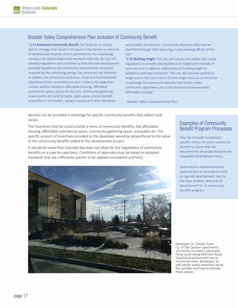
Developer St. Charles Town Co. of Del Corazon apartments voluntarily included a plaza and futsal court along Morrison Road. Panelists brainstormed how to incentivize other developers to add similar public amenities along the corridor and how to activate these spaces.
density) can be provided in exchange for specific community benefits that reflect local values.
The Incentives Overlay could provide a menu of community benefits, like affordable housing, affordable commercial space, community gathering space, and public art. The specific amount of incentives provided to the developer would be proportional to the value of the community benefits added to the development project.
It should be noted that Colorado law does not allow for the negotiation of community benefits on a case-by-case basis. Conditions of approvals must be based on adopted standards that are sufficiently specific to be applied consistently and fairly.
Boulder Valley Comprehensive Plan Inclusion of Community Benefit“1.11 Enhanced Community Benefit: For land use or zoning district changes that result in increases in the density or intensity of development beyond what is permitted by the underlying zoning or for added height that increases intensity, the city will develop regulations and incentives so that the new development provides benefits to the community beyond those otherwise required by the underlying zoning. Any incentives are intended to address the community economic, social and environmental objectives of the comprehensive plan. Community objectives include without limitation affordable housing, affordable commercial space, spaces for the arts, community gathering space, public art, land for parks, open space, environmental protection or restoration, outdoor spaces and other identified
social needs and services. Community objectives also may be identified through other planning or policymaking efforts of the city.”“2.35 Building Height: The city will review and update site review regulations to provide clear guidance on height and intensity of land uses and to address relationship of building height to aesthetics and view protection. The city will consider additional height (up to the City Charter 55-foot height limit) as an incentive in exchange for community benefits that further other community objectives such as the provision of permanently affordable housing.”
- Boulder Valley Comprehensive Plan
Examples of Community Benefit Program Processes
The City of Austin established specific metrics for each community benefit to ensure that the requirements are proportional to the requested development bonus.
Santa Monica established three approval tiers or procedural tracks to regulate development, tied to the type, location, and level of development for its community benefits program.

Colorado
page 18
Panelists recommended the creation of an Incentives Overlay for the Morrison Road corridor, especially in sub-area 2, that allows an increase in height from 3 stories to 5 stories for development projects that incorporate specific community benefits identified by the community, such as:
• Affordable Housing
• Affordable Commercial Space
• Community Gathering Space
• Green Space
• Public Art
• Live, Work & Exhibit Space for Artists
Other incentives and resources that could increasingly benefit this area include:
• The Opportunity Zone north of Perry Street allows for the deferral,reduction, and potential elimination of certain federal capital gains taxes oninvestments in affordable housing, new infrastructure, startup businesses,and various capital improvement projects. The incentives are set to expirein 2026.
• Denver’s Office of Economic Development (OED) has many programs andfinancial resources for: 1) fostering a thriving business environment, 2)developing a skilled workforce, 3) expanding affordable housing options,and 4) creating sustainable neighborhoods. The OED runs Denver’sAffordable Housing Fund, as an example. Many of these programs andtheir resources can be leveraged to bring investment to the Morrison Roadcorridor and to support existing businesses, organizations, artists, andentrepreneurs in the area.
• The Mi Casa Resource Center, located three blocks east of MorrisonRoad, provides resources and assistance for business development, careerdevelopment, and youth development. In addition to business training, itoperates a loan program for business owners. They offer microloans forstart-up businesses ranging from $500 to $4000 and lines of credit forexisting businesses ranging from $1000 to $7500.
• The Colorado Department of Local Affairs (DOLA) has many financialassistance programs, such as Community Development Block Grants(CDBG), for which this corridor would likely be eligible.
• The Colorado Housing and Finance Authority (CHFA) allocates Low IncomeHousing Tax Credits, provides long-term financing, and fills financing gapsto support affordable multifamily housing in Colorado.
• Colorado Creative Industries provides programs and grants to designatedcreative districts in Colorado, and the Westwood Creative District is eligible.The Westwood Creative District could continue to use its state certificationto pursue grants.
Murals by local artists fill the corridor with a sense of history and culture. Photo courtesy BuCu West.

Colorado
page 19
4. How do we phase this transformation?Many recommendations throughout this report can be pursued concurrently and as opportunities arise with funding and other resources. The following phasing could assist as a plan of action and/or checklist for the community.
• Advocate for street and place designation changes in the draftDenveright plans. Panelists recommended the street designation changefrom Arterial to Main Street Collector and the place designation changefrom Community Corridor to Local Corridor on pages 11-12.
• Connect with city planning staff around requirements for developingOverlay Zoning. Express interest in creating a Design Overlay and anIncentives Overlay, similar to what RiNo has implemented. Furtherrecommendations for Overlay Zoning are on pages 14-16.
• Let city staff know what amenities are desired in the recreation center.More details about neighborhood amenities and the recreation centerare on pages 9-13.
• Use tactical urbanism to test ideas along the corridor. Temporary plazasand public spaces, pop-up markets, planters, string lighting, seating,painted crosswalks, and public art could all be used to test concepts andrefine implementation over time. More details are on page 9.
• Reach out to successful artist co-ops and live/work/exhibit spacedevelopers. Learn best practices on how to promote artist ownership inthe creative district. Apply for grants to support art space developmentand artist ownership in the district. More details on artist ownership areon page 9.
• Evolve the maintenance district into a different kind of special district.This will allow BuCu West to leverage local funding for uses beyondstreetscape improvements, such as for the creation of public plazas.More details are on page 10.
• Apply for funding and develop partnerships to create public plazas.More details about plaza creation are on page 10.
• Work with CDOT on streetscape improvements. Advocatefor CDOT to add safe pedestrian crosswalks and streetscapeimprovements coming into and along the corridor. More details aboutstreetscape recommendations are on pages 11-12.
• Work with Denver Arts and Venues, Public Works, and local artists ondistrict branding, wayfinding, and public art. As a GO Bond project, 1%of the money must go towards a public art element(s). Artists can beengaged in this process through a design competition, in which localartists submit ideas for inclusion of art along the corridor and/or a districtgateway. More details about district branding, wayfinding, and public artare on page 12.
• Work with Public Works on creative parking solutions in the district.More details about parking recommendations are on page 12.
Local artist and business owner Santiago Jaramillo paints a mural along the corridor. Photo courtesy Denverite.
Local artist and business owner Santiago Jaramillo paints a mural along the corridor. Photo courtesy BuCu West.
Colorado
page 20
Development is coming to Morrison Road. The question is whether the community isready to meet that development with standards for how development should benefit the
community.
One scenario is similar to how development has progressed in much of metro Denver: gentrification and ultimate displacement.
An alternative is to enforce community values and to protect the people and places that are already there through regulatory tools. Overlay zoning and incentives are prime regulatory tools for leveraging development and investment interest for the benefit of the community.
Currently, the City and County of Denver is working on finalizing its Comprehensive Plan, which impacts the designations of the corridor. Developers are submitting site plans for this area. To get out in front of these efforts, BuCu West and other community supporters must act quickly.
ULI Colorado and its volunteer panelists saw how energized this community is around creating a great place. The TAP panelists believe that BuCu West and the Westwood community can attract the resources necessary to jumpstart the work ahead and make their vision for Morrison Road a reality.
Conclusion
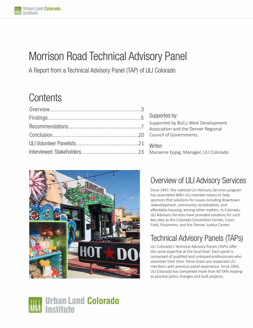
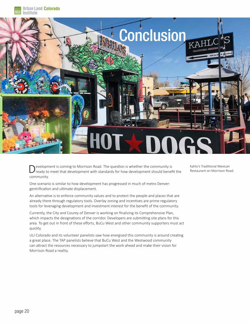
Kahlo’s Traditional Mexican Restaurant on Morrison Road.
Colorado
page 21
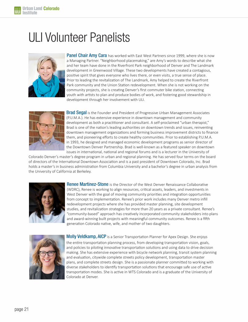
ULI Volunteer PanelistsPanel Chair Amy Cara has worked with East West Partners since 1999, where she is now a Managing Partner. “Neighborhood placemaking,” are Amy’s words to describe what she and her team have done in the Riverfront Park neighborhood of Denver and The Landmark development in Greenwood Village. These two developments have created a contagious, positive spirit that gives everyone who lives there, or even visits, a true sense of place. Prior to leading the revitalization of The Landmark, Amy helped to create the Riverfront Park community and the Union Station redevelopment. When she is not working on the community projects, she is creating Denver’s first commuter bike station, connecting youth with artists to plan and produce bodies of work, and fostering good stewardship in development through her involvement with ULI.
Brad Segal is the Founder and President of Progressive Urban Management Associates (P.U.M.A.). He has extensive experience in downtown management and community development as both a practitioner and consultant. A self-proclaimed “urban therapist,” Brad is one of the nation’s leading authorities on downtown trends and issues, reinventing downtown management organizations and forming business improvement districts to finance them, and pioneering efforts to create healthy communities. Prior to establishing P.U.M.A. in 1993, he designed and managed economic development programs as senior director of the Downtown Denver Partnership. Brad is well-known as a featured speaker on downtown issues in international, national and regional forums and is a lecturer in the University of
Colorado Denver’s master’s degree program in urban and regional planning. He has served four terms on the board of directors of the International Downtown Association and is a past president of Downtown Colorado, Inc. Brad holds a master’s in business administration from Columbia University and a bachelor’s degree in urban analysis from the University of California at Berkeley.
Renee Martinez-Stone is the Director of the West Denver Renaissance Collaborative (WDRC), Renee is working to align resources, critical assets, leaders, and investments in West Denver with the goal of moving community priorities and integration opportunities from concept to implementation. Renee’s prior work includes many Denver metro infill redevelopment projects where she has provided master planning, site development studies, and revitalization strategies for more than 20 years as a private consultant. Renee’s “community-based” approach has creatively incorporated community stakeholders into plans and award-winning built projects with meaningful community outcomes. Renee is a fifth generation Colorado native, wife, and mother of two daughters.
Molly Veldkamp, AICP is a Senior Transportation Planner for Apex Design. She enjoys
the entire transportation planning process, from developing transportation vision, goals, and policies to piloting innovative transportation solutions and using data to drive decision making. She has extensive experience with bicycle network planning, transit system planning and evaluation, citywide complete streets policy development, transportation master plans, and complete streets design. She is a passionate planner committed to working with diverse stakeholders to identify transportation solutions that encourage safe use of active transportation modes. She is active in WTS Colorado and is a graduate of the University of Colorado at Denver.

Colorado
page 22
Meredith Wenskoski is the President and Owner of Livable Cities Studio. She has over 13 years of expertise in urban redevelopment, parks and public space design. She is distinguished for her leadership, design and project management of large-scale complex efforts. She has worked on public parks, streetscapes and urban design projects focusing on developing responsible and innovative designs that respond to the needs of the place and community. Meredith’s projects emphasize the role of public space as a way to stimulate redevelopment and create socially active spaces that provide long-term benefits for cities. Meredith is known for her interdisciplinary team leadership, her responsiveness to clients
and her excellent communication skills. A firm believer in the benefits of collaboration, she forms strong long-term working relationships with design teams and clients. Meredith is recognized for her rigor and follow-through and for instilling discipline and accountability into design processes.
Tyler Gibbs, AIA brings over 39 years of public and private sector experience in architecture, planning, zoning, entitlements, design standards and placemaking as a part of an urban design perspective that assists in gaining community support for development proposals in sensitive contexts. He previously served as the Director of Planning and Community Development for the City of Steamboat Springs, as well as a Plan Implementation Manager and Urban Design Director for the City and County of Denver.
Jack Pappalardo is an attorney who previously served as the President of Denver’s Art District on Santa Fe from 2004-2008 and 2011-2015. He is a proven legal professional in the areas of commercial leasing, real estate development and franchise law and a leader in the arts and community redevelopment. During his term as president of Denver’s Art District on Santa Fe, the number of creative businesses and nonprofits grew from 12 members to over 100 and gained national attention in the areas of culture and community revitalization. The Art District is studied nationally and recognized as one of the top “organic” art districts in the US. In 2012, the Art District on Santa Fe became one of two districts in Colorado to be designated as a “Certified Creative District” and was the winner of the Mayor’s Award for Excellence in Arts and Culture.

Colorado
page 23
Local Elected Officials
• Paul Lopez, City Council, District 3
• Adriana Lara, Office of Councilman Lopez
City Staff • Steven Chester, Senior City Planner, City and
County of Denver (planner of the Westwood Neighborhood Plan)
• Michael Koslow, Public Works (Morrison Road Improvements)
• Gaby Arismendi, Public Works
• Ashley Grace, City Planning (Via Verde)
• Andrew Webb, Senior City Planner, City and County of Denver
• Elvis Rubio, Office of Economic Development
Local Organizations• Mark Marshall, Urban Land Conservancy
• Emily Patterson, Trust for Public Land
• Christina Contreras, BuCu West Board
Local Artists • Santiago Jaramillo, BuCu West board
• Tony Diego
• Thadeaous Mighell
• Julio Mendoza
• Crystal O’Brien
• Aaron Nuanez
• Victor Escobedo
Local Residents• LaLa Jaramillo, young artist and resident
• Ceci Sandival, Westwood resident
• Lupe, mobile home resident
• David De Santiago, Re:Vision property manager
• Yurida Santana, Westwood Food Co-op Board
• Maricendi Jaimes, Westwood Unidos Community Connector
Local Business Owners• Nestor Castillo, Alamo Restaurant Owner and
BuCu West Board
• Marco Martinez, MGM Bar Owner and BuCu West Board
• Noe Bermudez, Tarascos and Kahlos Restaurant Owner
• Aaron Elinoff, Property owner, attorney and BuCu West Board
• Alberto Tejada, Los 3 Potrillos
• Erick Garcia, Kitchen Network
Local Real Estate Professionals• Chris Coble, Black Label Real Estate
• Charles Wooley, St. Charles Town Company
• Felipe Bedon, First Bank Commercial Lender
• Dan Strammiello, Westbrook Development Partners
• Lydia Prado, University of Denver
Prior Consultants• Heather Noyes, Studio CPG (lead designer of the
Morrison Road Streetscape Plan)
• Tom Hanna, THK Associates
Interviewed Stakeholders

Colorado
(p) 303.893.1760(e) [email protected]://colorado.uli.org
1536 Wynkoop StreetSuite 211Denver, Colorado 80202
ULI Colorado Leadership in Responsible Land Use
ULI Colorado is the 1,300-member District Council of the global Urban Land Institute. ULI Colorado consists of a four-person staff, 25-member executive committee, and 15 committees with more than 250 volunteers. More than 40 programs a year include advisory panels, leadership and mentoring programs, panels, project tours, publications, and community service. ULI is a non-lobbying educational and research institute supported by its members, sponsors, and foundations. Key issues include affordable housing, healthy communities, transit-oriented development, and sustainable design and planning.
Executive Director: Michael LecceseDirector: Sarah FranklinManager: Marianne EppigSenior Associate: Jack TieboutReport Design: Kelly Annis, Branch Communications
Chair: Tracy Huggins, Executive Director, Denver Urban Renewal Authority
Vice Chair: Mike Zoellner, Managing Partner, ZF Capital
Treasurer: Mark Tompkins, Principal, Strae Advisory Services
Chair of Mission Advancement: Marilee Utter, President, Citiventure Associates
Governance Chair: Bruce O’Donnell, Principal, Starboard Realty
Chairs emeriti: Amy Cara, Kirk Monroe, Chris Achenbach, Bill Mosher, V. Michael Komppa, Marilee Utter, Julie Underdahl, James DeFrancia, Buz Koelbel, Byron Koste