Embed Size (px)
Citation preview
Updating Virginia’s Statewide Functional Classification System
Briefing to MPOs, PDCs, and Local Governments
October 15 & 19, 2012

Functional Class 101
Shelton’s FC Game
Research Phase
Today’s Review New FHWA Guidelines
Our Update Process
S l PDC N th Sample PDC – Northern Shenandoah Valley PDC
Next Steps
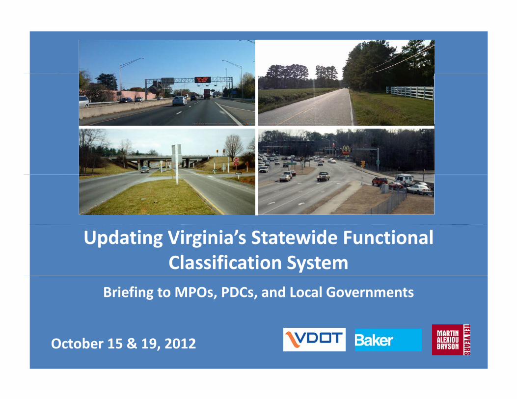
What is Functional Classification Process by which streets and highways are grouped into classes, or
systems, according to the part that any particular road or street plays in serving the flow of trips through a highway network.
A roadway’s functional usage is based on Mobility & AccessibilityMobility ‐ is measured in respect to ability of traffic to pass through a d fi d i bl t f tidefined area in a reasonable amount of time
Accessibility ‐ is measured in terms of the road system’s capability to provide access to and between land use activities within a defined area
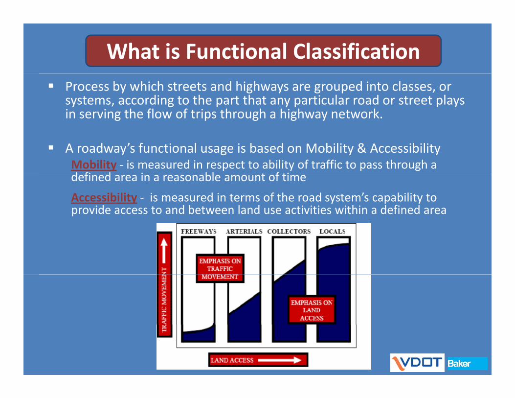
Functional Classification Criteria
For each class, FHWA provides criteria. Examples include:
f b Type of trips being served Travel speeds Trip distance
Population center thresholds Population center thresholds and/or traffic generators/destinations being served
d l Expected volume Network characteristics Interval spacing Mileage extents Mileage extents
www.fhwa.cot.gov/planning/fctoc.htm

How does VDOT use Functional ClassificationFunctional Classification
Used to determine:Used to determine:
Federal‐aid highway program funding eligibility
Applicable geometric design standards of the VDOT Road and pp g gBridge Design Manual
Maintenance payment amounts that a locality will receive if the locality has responsibility for road maintenancethe locality has responsibility for road maintenance
Access management features (spacing‐frequency and/or type of access such as interchanges, intersections, and roadside g , ,entrance, exit and/or driveway points)
Highway Performance Monitoring System federal reporting
Secondary Street Acceptance Requirements
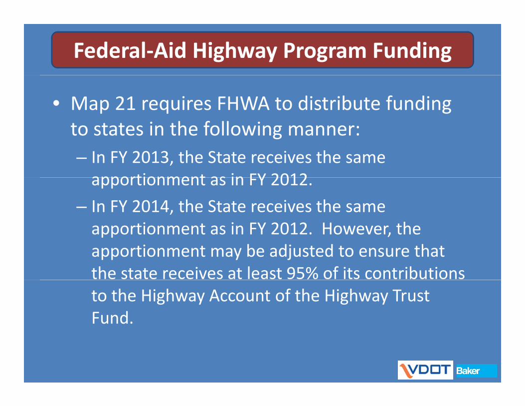
Federal‐Aid Highway Program Funding
• Map 21 requires FHWA to distribute funding to states in the following manner:to states in the following manner:– In FY 2013, the State receives the same apportionment as in FY 2012apportionment as in FY 2012.
– In FY 2014, the State receives the same apportionment as in FY 2012 However theapportionment as in FY 2012. However, the apportionment may be adjusted to ensure that the state receives at least 95% of its contributions to the Highway Account of the Highway Trust Fund.
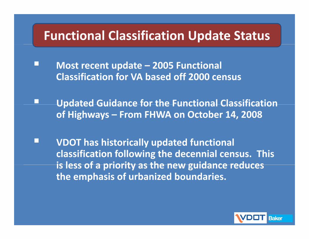
Functional Classification Update Status
Most recent update – 2005 Functional Cl ifi ti f VA b d ff 2000Classification for VA based off 2000 census
Updated Guidance for the Functional ClassificationUpdated Guidance for the Functional Classification of Highways – From FHWA on October 14, 2008
VDOT has historically updated functional classification following the decennial census. This is less of a priority as the new guidance reducesis less of a priority as the new guidance reduces the emphasis of urbanized boundaries.

Sh lt ’Shelton’s Functional The functional
Classification Game
classification of many state roads is not what
ld fi !Game you would first guess!
The Game that puts h “FUN” ithe “FUN” in
functional Class!
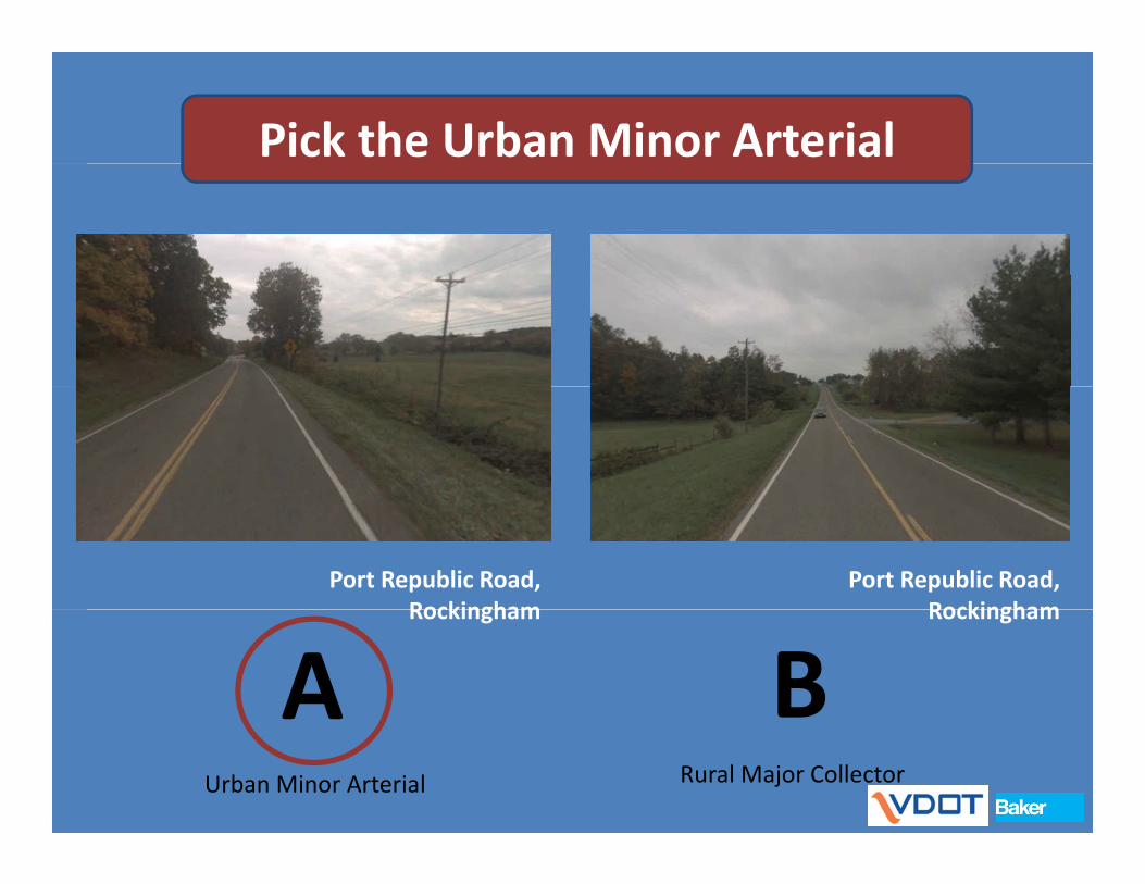
Pick the Urban Minor Arterial
Port Republic Road, Rockingham
Port Republic Road, Rockingham RockinghamRockingham
A BRural Major CollectorUrban Minor Arterial

Pick the Urban CollectorPick the Urban Collector
Garrisonville Rd, Stafford
Rt. 608, Spotsylvania
A BUrban CollectorUrban Collector
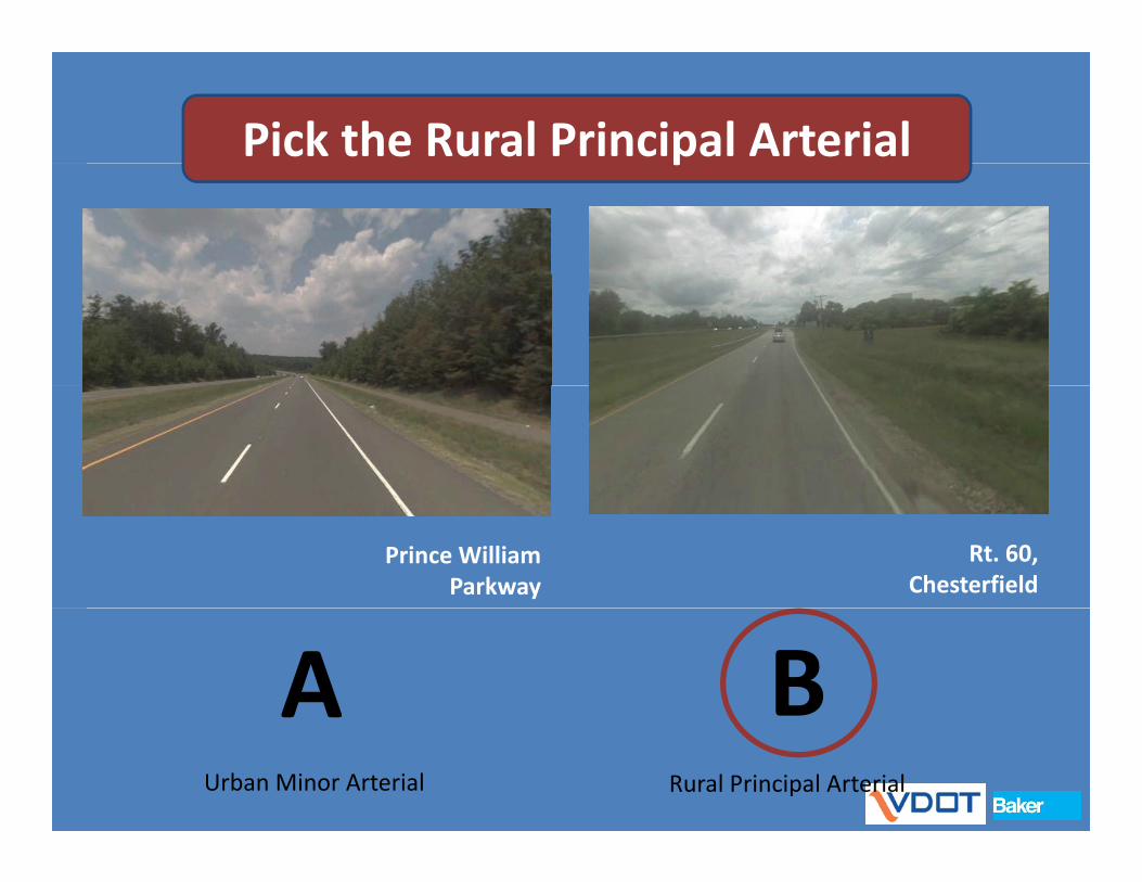
Pick the Rural Principal Arterialp
Prince William Parkway
Rt. 60, Chesterfield
BARural Principal ArterialUrban Minor Arterial

Best Practice Research
Research & Document Functional
Classification Update Research & Document Phase
pProcess
l Ad‐Hoc Functional Classification GuidelinesGuidelines

Best Practice Research
Departments of Transportation Interviewed:Interviewed:
• Alaska• Kentucky• Maryland• Minnesota• New Jersey• North Carolina• Ohio• Tennessee• Texas• Texas• Washington• Washington D.C.• West VirginiaWest Virginia• Wisconsin
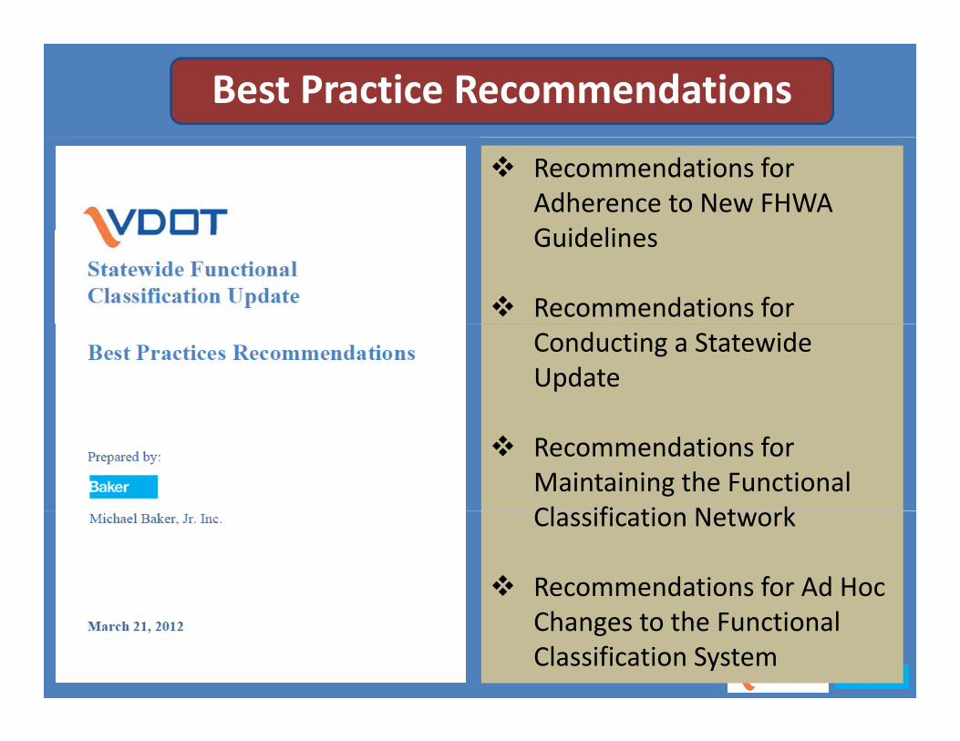
Best Practice Recommendations
Recommendations for Adherence to New FHWA G id liGuidelines
Recommendations for Conducting a Statewide Update
Recommendations for Maintaining the Functional Cl ifi ti N t kClassification Network
Recommendations for Ad Hoc Changes to the Functional Classification System
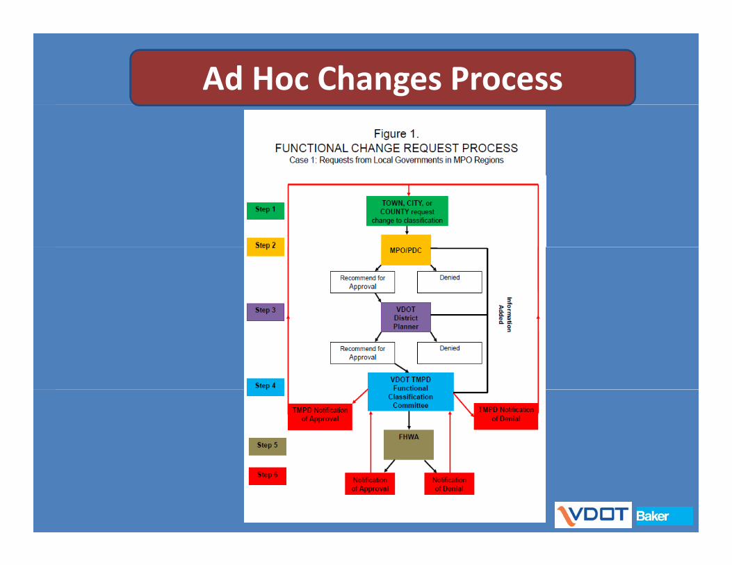
Ad Hoc Changes Process
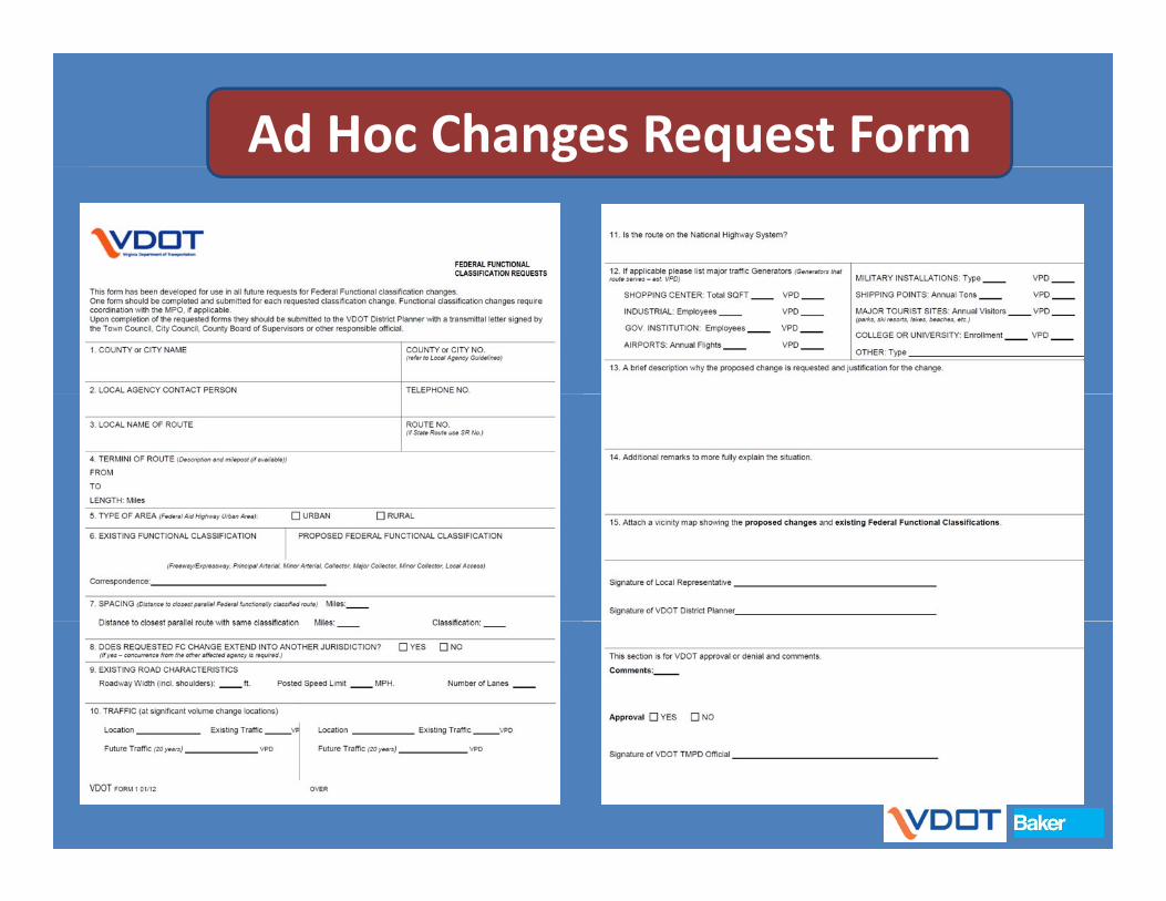
Ad Hoc Changes Request Form
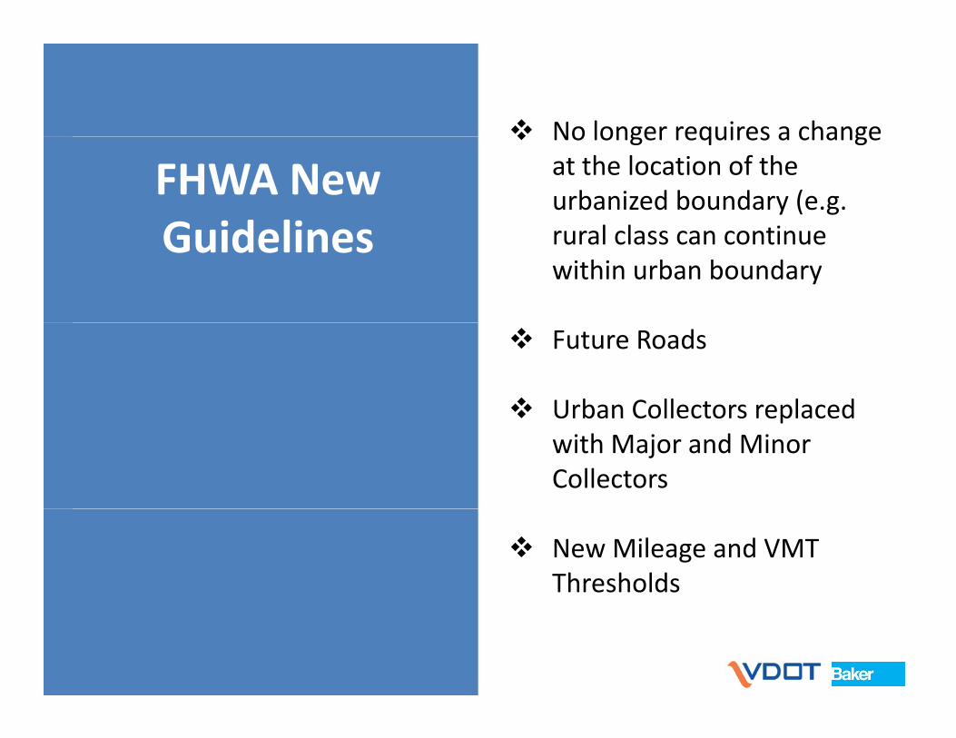
No longer requires a change
FHWA New Guidelines
No longer requires a change at the location of the urbanized boundary (e.g.
l l tiGuidelines rural class can continue within urban boundary
Future Roads
Urban Collectors replaced Urban Collectors replaced with Major and Minor Collectors
New Mileage and VMT Thresholds

New Mileage Thresholds
Old Percentages
Range (%)Rural System VMT MilesPrincipal Arterial 30 ‐ 55 2 ‐ 4Principal Arterial PlusMinor Arterial 45 ‐ 55 6 ‐ 12*
Range (%)Urban System VMT MilesPrincipal Arterial 40 ‐ 65 5 ‐ 10Principal Arterial PlusMinor Arterial 45 55 6 12
Collector 20 ‐ 35 20 ‐ 25Local 5 ‐ 20 65 ‐ 75*With most states falling in the 7‐10 percent range.
Minor Arterial 65 ‐ 80 15 ‐ 25Collector 5 ‐ 10 5 ‐ 10Local 10 ‐ 30 65 ‐ 80
Functional Classification Group Percentage of Percentage of
New Percentages
Miles VMTRural Principal Arterial (for NHS apportionment) 4% max 30‐55%
Urban Principal Arterial (for NHS apportionment) 10% max 40‐65%
All arterials and Collectors (for STP and HSIP 35% max 70 80%All arterials and Collectors (for STP and HSIP apportionment)
35% max 70‐80%
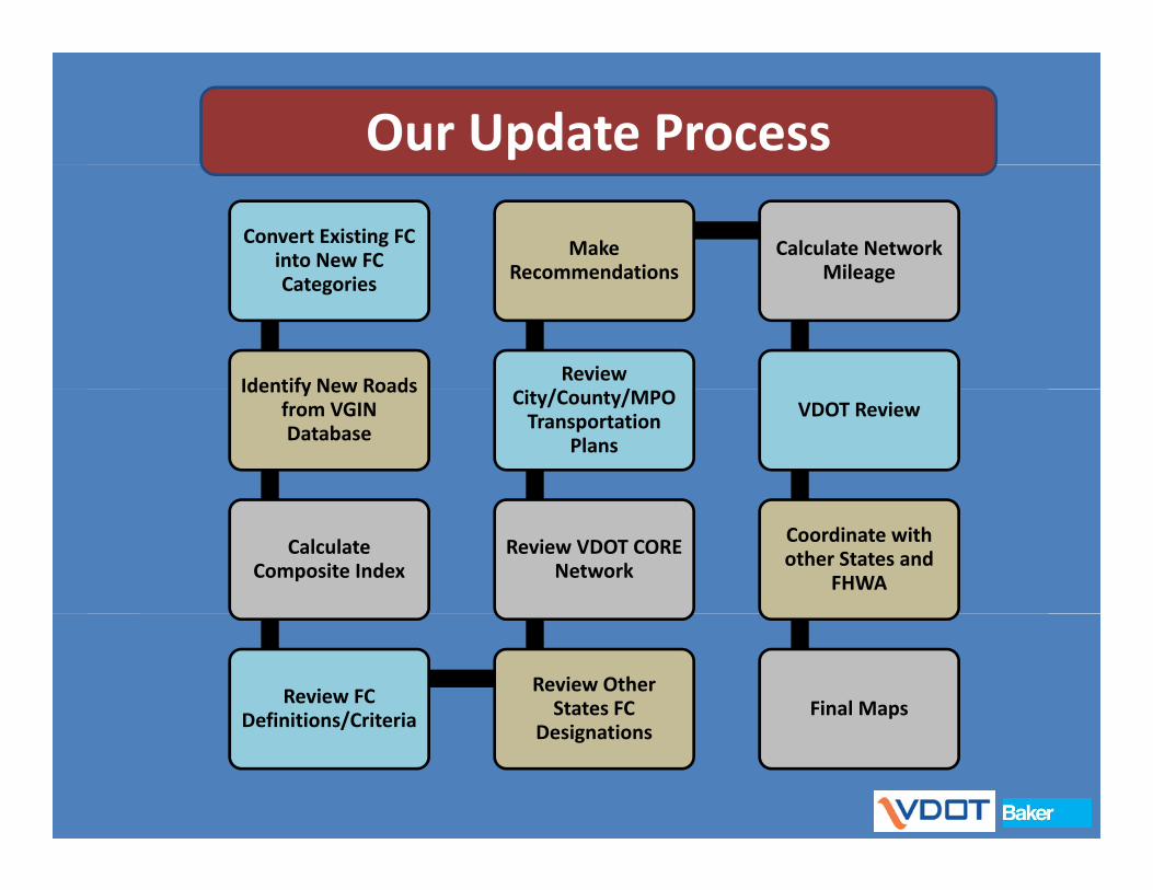
Our Update Process
Convert Existing FC into New FC C i
Make Recommendations
Calculate Network MileageCategories
Identify New Roads Review / /
Recommendations Mileage
Identify New Roads from VGIN Database
City/County/MPO Transportation
Plans
VDOT Review
Calculate Composite Index
Review VDOT CORE Network
Coordinate with other States and
FHWA
Review FC Definitions/Criteria
Review Other States FC
D i iFinal MapsDefinitions/Criteria Designations
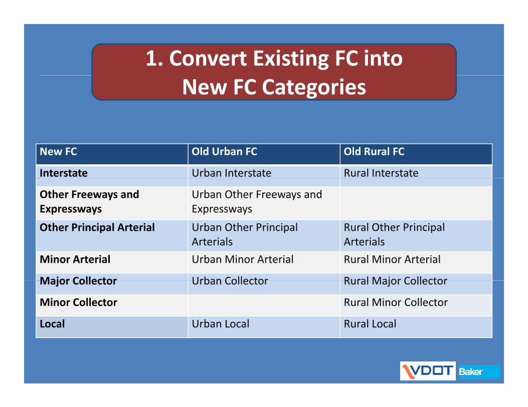
1. Convert Existing FC into New FC Categories
New FC Old Urban FC Old Rural FC
Interstate Urban Interstate Rural Interstate
Other Freeways and Expressways
Urban Other Freeways and Expressways
Other Principal Arterial Urban Other Principal Rural Other PrincipalOther Principal Arterial Urban Other Principal Arterials
Rural Other Principal Arterials
Minor Arterial Urban Minor Arterial Rural Minor Arterial
Major Collector Urban Collector Rural Major CollectorMajor Collector Urban Collector Rural Major Collector
Minor Collector Rural Minor Collector
Local Urban Local Rural Local
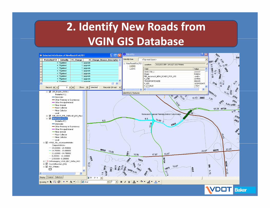
2. Identify New Roads from VGIN GIS D t bVGIN GIS Database

3a. Calculate Composite Index
Composite Index based on:
• Volume Percentile
• Speed Limit
• Primary Route or not
• Number of lanes
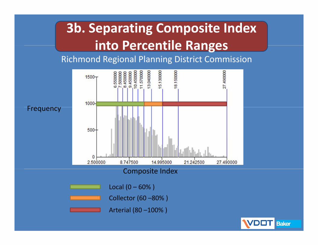
3b. Separating Composite Index into Percentile Rangesinto Percentile Ranges
Richmond Regional Planning District Commission
FrequencyFrequency
C it I dComposite Index
Local (0 – 60% )
Collector (60 –80% )Collector (60 80% )
Arterial (80 –100% )
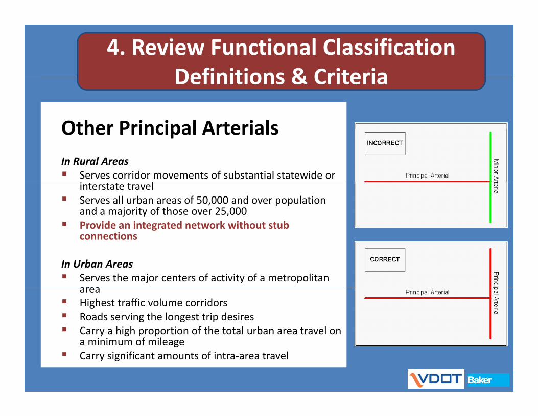
4. Review Functional Classification Definitions & CriteriaDefinitions & Criteria
Other Principal ArterialsOther Principal ArterialsIn Rural Areas Serves corridor movements of substantial statewide or
interstate travel Serves all urban areas of 50,000 and over population
and a majority of those over 25,000 Provide an integrated network without stub
connectionsconnections
In Urban Areas Serves the major centers of activity of a metropolitan
area Highest traffic volume corridors Roads serving the longest trip desires Carry a high proportion of the total urban area travel on
i i f ila minimum of mileage Carry significant amounts of intra‐area travel
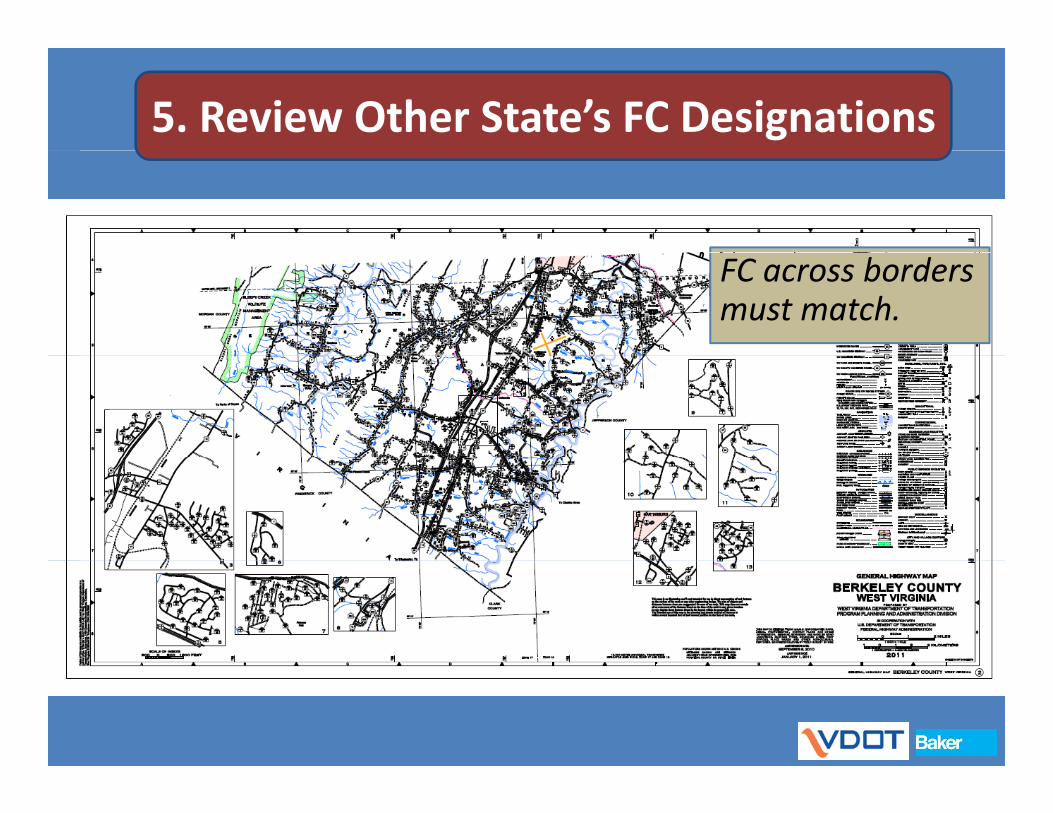
5. Review Other State’s FC Designations
FC across borders must match.
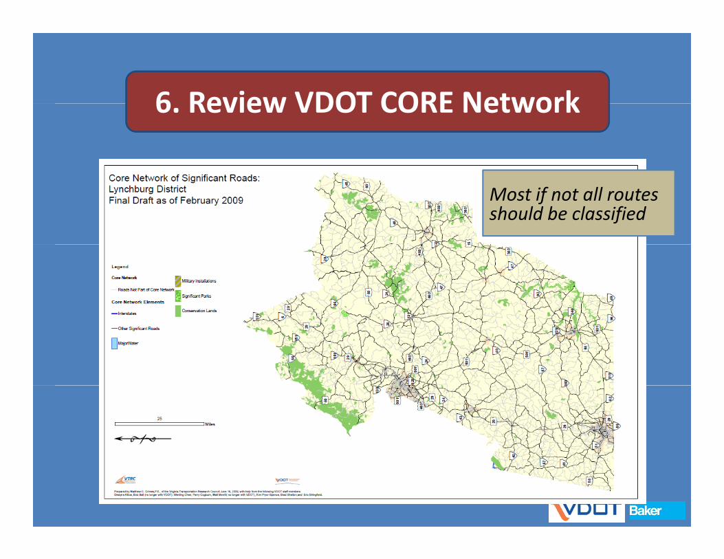
6 Review VDOT CORE Network6. Review VDOT CORE Network
Most if not all routes should be classified

7. Review City/County/MPO Plans
Provides initial inputProvides initial input from local jurisdiction
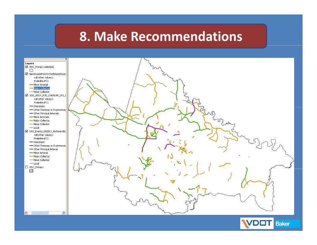
8. Make Recommendations
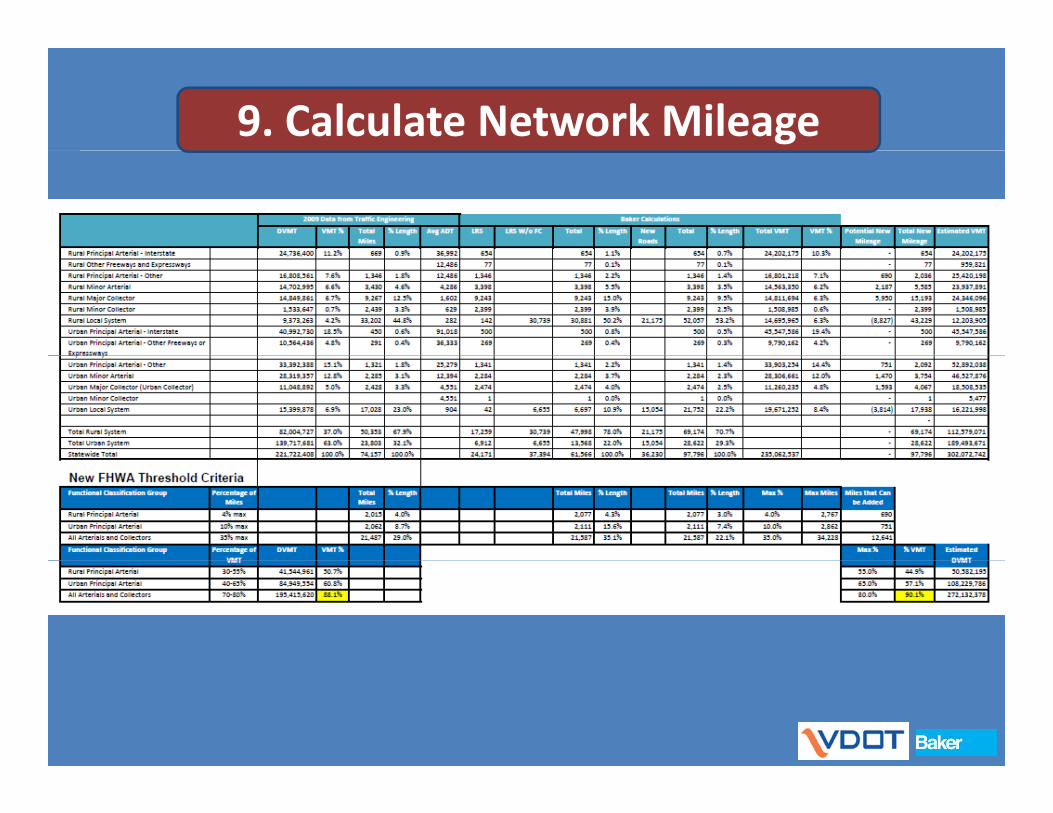
9. Calculate Network Mileage

10. VDOT/MPO/PDC Review
By Central Office, District Planners & District Staff &District Staff & MPOs/PDCs

10. VDOT/MPO/PDC Review
http://gis3.rbf.com/vdot/
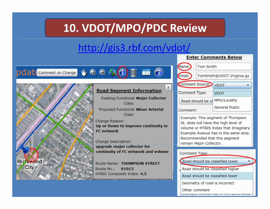
10. VDOT/MPO/PDC Review
http://gis3.rbf.com/vdot/

11. Coordinate with Other States and FHWAand FHWA
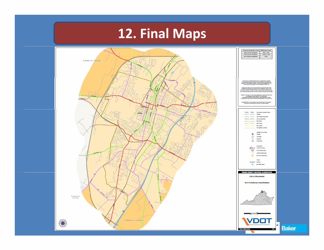
12. Final Maps

Next Steps Review recommended changes with
localities and MPO and finalize:Next Steps localities and MPO and finalize: Ongoing
Finalize Functional Classification Update Process Documentation:Summer 2013
Finalize Ad Hoc Changes Guidelines Finalize Ad‐Hoc Changes GuidelinesSummer 2013
Final Mapping and Website pp gUpdates: Summer 2013