Embed Size (px)
Citation preview

Up Next
5 Things Land Trusts Need to Know about GIS

5 Things Land Trusts Need to Know About GIS CCLT Conference 2017
Davis, CA March 8th
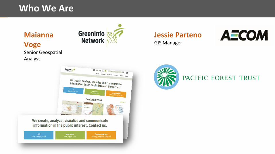
Who We Are
Maianna VogeSenior Geospatial Analyst
Jessie PartenoGIS Manager

Road map
1. What is GIS?
2. What do land trusts do with GIS?
3. How do you get there? (data, software) •Must-have data
•Software on a budget
•Case study: ArcGIS Online for field collection
4.Contributing to public datasets
5.Storytelling (you did it! now what)

Announcing . . .
www.landtrustgis.org

Who’s here?

Land Trusts – Size, Capacity for GIS
150+ land trusts
20+Staff: 50-1 10
100
500
1,000
Acres conserved
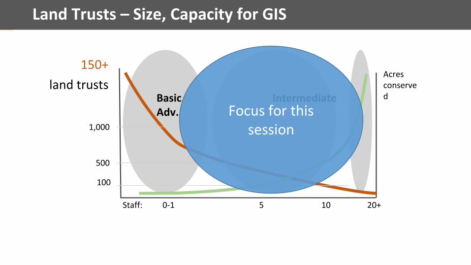
Land Trusts – Size, Capacity for GIS
20+Staff: 50-1 10
100
500
1,000
Acres conservedBasic Intermediate
Adv. Focus for this session
150+ land trusts

1. “What’s GIS again?”
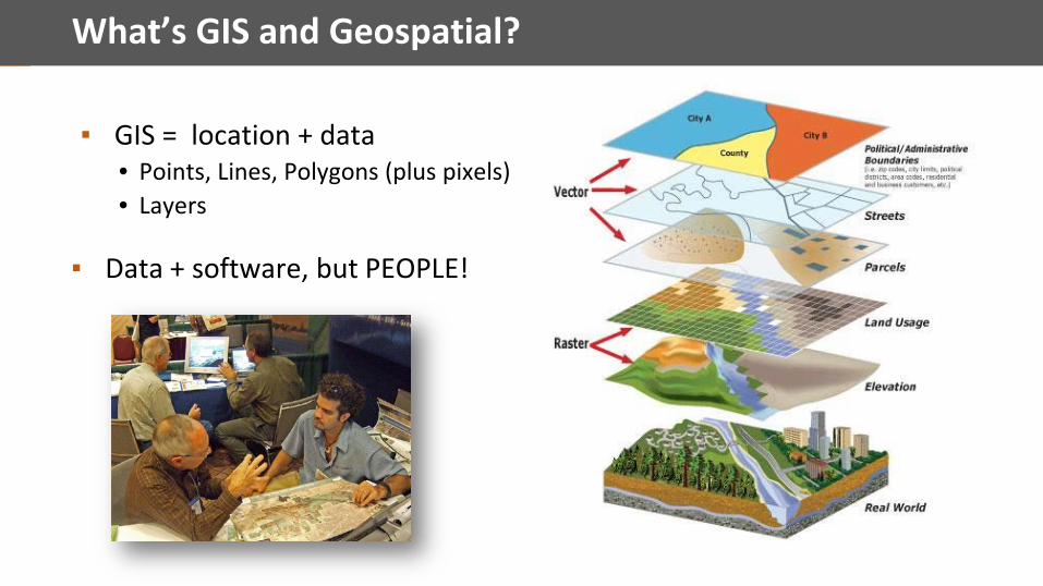
What’s GIS and Geospatial?
▪ GIS = location + data• Points, Lines, Polygons (plus pixels)• Layers
▪ Data + software, but PEOPLE!

GIS Software – Esri
▪ ArcGIS: ArcMap, ArcGIS Pro; ArcGIS Cloud/applications (Earth)

QGIS
▪ Open source GIS▪ www.qgis.org

GIS Online
▪ ArcGIS Online & ArcGIS Server
▪ Phones and mobile

GIS is becoming “geospatial”
But GIS on its own still matters . . .
>

GIS: Vision for land trusts
How does GIS all fit together?
Capacity & Strategy
Outreach
Data and system
Maps & Analyses
Training & support
Strategic Conservation
Mobile/field
Monitoring
Web Apps*

2. What land trusts DO with GIS

GIS and Land Trusts
•Conservation planning – prioritization/support
• Project development – fundraising, baseline documents
• Property holding – stewardship, monitoring
• Organizational support – shared vision, fundraising
• Education – hikes, tours, interpretatio
• Engagement – events, targeting
• Impact analysis – Climate change, flooding, drought
What you can DO with GIS:

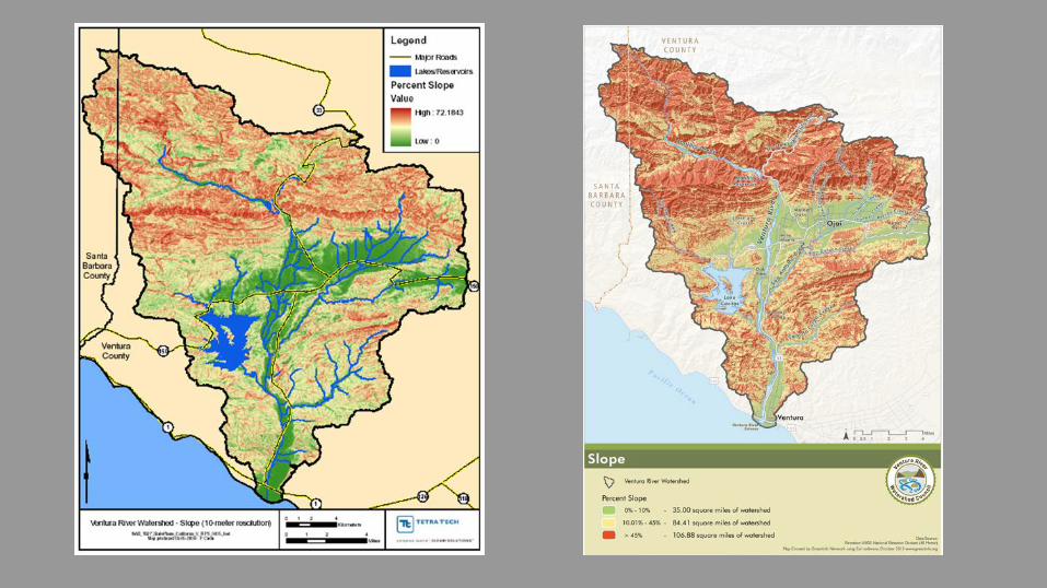
Land trust maps

Map Examples

Map Examples
GIS and Land Trusts
So how do you get there?

3. GIS for Land Trusts

GIS – Selected Best Practices
1.Evaluate your capacity (staff, budget, org culture, consults)
2. Organize – efficient and long term
3. Get software – Esri grants program
4. Essential data needs
5.Communicate visually

Best Practices – Structure Your Capacity
1. Desires, needs, budget, capacity
2. Volunteers – expert, not, enthusiasm
3. Staff – part-time, full-time
4. Consultants
5. Other – universities, etc.

Best Practices – Organize Your GIS System
Shape files (shp) Geodatabase (gdb)
GDB best for large, organized data systems
File GDB better than Personal GDB

Best Practices – Organize Your GIS System
Esri Data Ecosystem

Best Practices – Organize Your GIS System
Data
-Ve
ctor
/Ras
ter
Cont
ent C
ateg
orie
s

Best Practices – Organize Your GIS System
PRO
JECT
S
Stan
dard
Proj
ect F
olde
rs

Best Practices – Be Systematic About GIS Program
▪ People come and go . . .
▪ Data/project files . . .
▪ Documentation – data and projects
• External spreadsheet• Metadata in file• Online – use Gdocs
▪ Map templates

Best Practices – Grants and Resources
1. ESRI Conservation Program • www.esri.com/esri-conservation-program• www.conservationgis.org• New online application! Yahoo!• Maintenance…
2. Nonprofit GIS Program - www.esri.com/nonprofit
3. Personal use of ArcGIS - $100 (includes everything)
4. Training, SCGIS.org

How to develop a GIS
• GIS data• GIS software•Workflow/Data storage•Data collection/Mobile solutions
• Case Study: Pacific Forest Trust Conservation Easement Monitoring
What do you need?
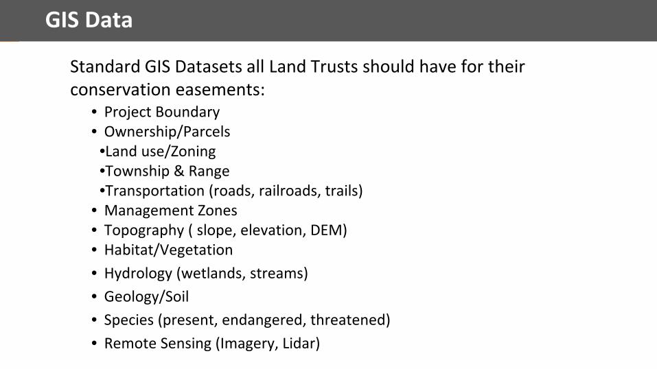
GIS Data
• Project Boundary• Ownership/Parcels•Land use/Zoning•Township & Range•Transportation (roads, railroads, trails)
• Management Zones• Topography ( slope, elevation, DEM)• Habitat/Vegetation• Hydrology (wetlands, streams)• Geology/Soil• Species (present, endangered, threatened)• Remote Sensing (Imagery, Lidar)
Standard GIS Datasets all Land Trusts should have for their conservation easements:

GIS Data
• Project Boundary - Landowner\County• Ownership/Parcels - County•Land use/Zoning - County•Township & Range - County\State•Transportation (roads, railroads, trails) - County\State
• Management Zones - Landowner, on the ground field surveys• Topography ( slope, elevation, DEM) - Landfire, USGS• Habitat/Vegetation - Landfire, CWHR• Hydrology (wetlands, streams) - NHD, NWI• Geology/Soil - NRCS Soil, Landfire• Species (present, endangered, threatened) - CNDDB• Remote Sensing (Imagery, Lidar) - Landfire, USGS, Landsat, NAIP
Standard GIS Datasets all Land Trusts should have for their conservation easements:

GIS Software
• Esri• Wide range of products• Advanced spatial analysis• Non-profit
• QGIS• Free, but no support
• Google Earth• Free or at a cost, but with limited functionality
• Mapbox• Software as a service
Wide range of options including:

GIS Software – Esri
▪ ArcGIS: ArcMap, ArcGIS Pro, ArcGIS Server, ArcGIS Online

GIS Software - QGIS
▪ Open source GIS▪ www.qgis.org

GIS Software - Google Earth

GIS Software - Mapbox.com

GIS – Data Storage
Esri Data Ecosystem

GIS – Data Storage
Shape files (shp) Geodatabase (gdb)
GDB best for large, organized data systems
File GDB better than Personal GDB

GIS - Mobile Solutions
▪ Hardware•Garmins•Trimbles•Cell Phone/Tablet

How to develop a GIS
• Identify the goals of the project/land trust• Get a budget range for the GIS system
• Initial and continuing costs•Evaluation the skills sets in your organization
• Contract GIS• In-house GIS
• Evaluation the cost and available support of the software• Out-of-the-box low cost software vs. free software with more setup time
•Workflow/Data storage• Shapefile, Database, Server
•Data collection/Mobile solutions• Expensive with high accuracy vs. lower cost with less accuracy
How to decide with so many options?

Case Study - Developing a GIS System for PFT
▪ Stewardship Manager at Pacific Forest Trust (PFT)▪ Established in 1993▪ PFT pioneered the use of “working forest conservation easements”▪ 28 conservation easements over 98,420 acres
•Redwoods, Mt. Shasta, Sierra, Oregon
•Families, commercial enterprises, investors
▪ Own and/or manage 12,000 acres (OR + CA)

Case Study - Developing a GIS System for PFT
▪ Evaluate the situation•Goals: Manage the existing conservation easements and developed new projects. Develop a system that improves data collection and sharing within the organization. Manage numerous datasets and base data for two states.
•Budget: Limited non-profit budget•Expertise: One GIS specialist in the office with Esri experience, multiple staff with interest in access GIS.
Case Study - Developing a GIS System for PFT
▪ Solution•Software: Esri Products (ArcGIS Desktop, ArcGIS Pro & ArcGIS Online)
•Nonprofit GIS Program - www.esri.com/nonprofit•Data Storage: File Geodatabases
• 1 FGDB per Conservation Easement• Multiple FGDBs for basedata
• County level data (one FGDB)• State level data (California, Oregon)• County level data (one per county)
•Mobile Solution: ArcGIS Collector App•Mobile Hardware: Cell Phone•Data Management\Workflow: ArcMap > ArcGIS Pro> ArcGIS Online > ArcGIS Collector
Case Study - Developing a GIS System for PFT
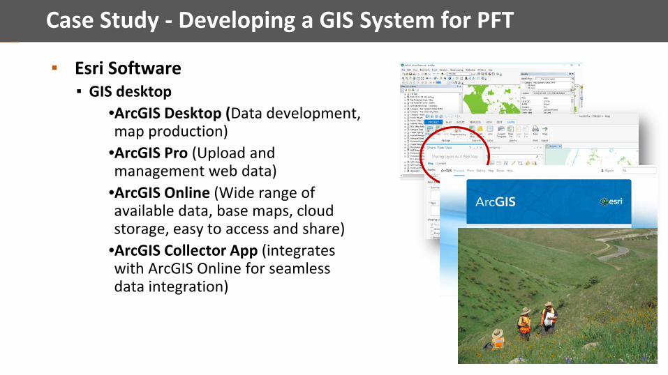
▪ Esri Software▪ GIS desktop
•ArcGIS Desktop (Data development, map production)
•ArcGIS Pro (Upload and management web data)
•ArcGIS Online (Wide range of available data, base maps, cloud storage, easy to access and share)
•ArcGIS Collector App (integrates with ArcGIS Online for seamless data integration)

Case Study - Developing a GIS System for PFT

Case Study - Developing a GIS System for PFT
▪ ArcGIS Collector•Works offline: No data server required, download the data before you get out in the field.
•Standardize data collection: can require specific attributes
•Take photos and attach them to data points: Georeferenced photos
•Usage: Easy to use and share, anyone in your organization can easily collect useful data
.

3. Share your Datathis could be you!

What is the California Protected Areas Database?

What is the California Protected Areas Database?
● GIS data
● 49+ million acres
● 14,000 parks
● v. 2016b (Dec. 2016)
● www.calands.org

Why a Good Inventory Matters
CPAD
Google Bing
Structure
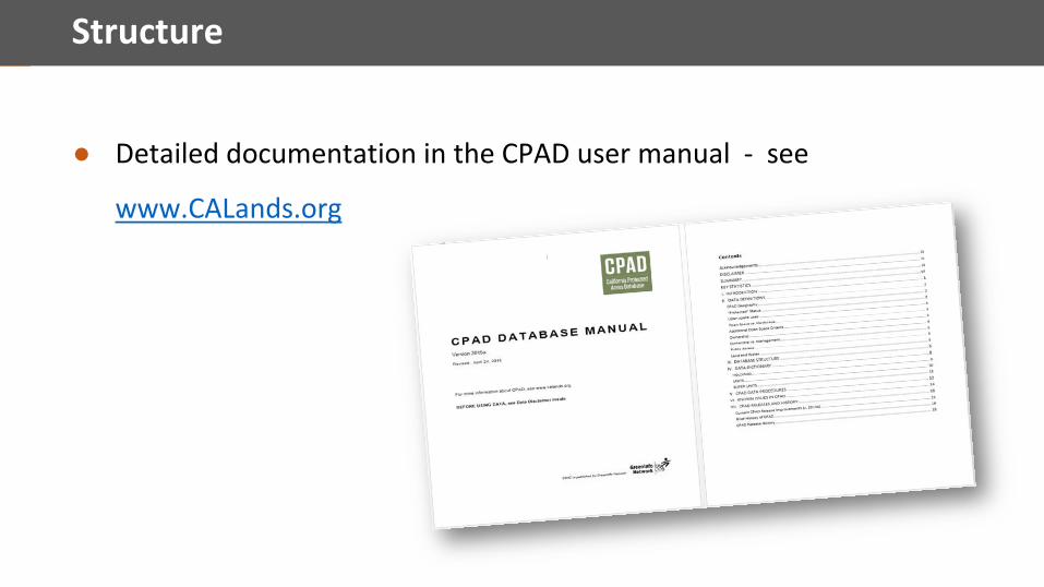
● Detailed documentation in the CPAD user manual - see
www.CALands.org
Structure
● Relational GIS database ○ Holdings (parcel)○ Units (analysis)○ Super Units (“park”)
● Core attributes○ Full name*○ Manager*○ Access*○ Owner○ Bonus - acquisition/establishment date

How CPAD is Used
● Best use: multi-jurisdictional plans/programs/analyses
● Typical uses:○ Recreation access○ County general plans○ Land conservation planning○ Utilities – siting, routing, etc. ○ Environmental impact reports○ Transportation facility siting, advance mitigation○ Emergency planning and response○ Climate adaptation

How CPAD is Used

How CPAD is Used

How CPAD is Used

From California to National Scale - PAD-US
● New PAD-US in May 2016 – v 1.4● New Protectedlands.net web site● Plan for major improvement over next
3 years● CPAD represents California in PAD-US

5. Tell Your Story
Communicate Visually
1. Maps are stories
2. Design for the viewer who is interested but pressed for time
3. Unfold them in layers of meaning

How your brain perceives
<1 second
PRE-ATTENTION
1-3 seconds
ATTENTION
3-20 seconds +
COGNITION

First glimpse is critical for engagement
<1 second 1-2 seconds 3+ seconds

>
to storyFrom raw data


Branding
Simple look & feel
Color
Logo
(fonts)

Best Practices – Communicate Visually!
Easy wins:
▪ Branding – use consistently
▪ Reduce, reduce, reduce map content
▪ Limit lined boxes
▪ Go beyond default fonts (serif, sans)
▪ Test maps on viewers, get design support
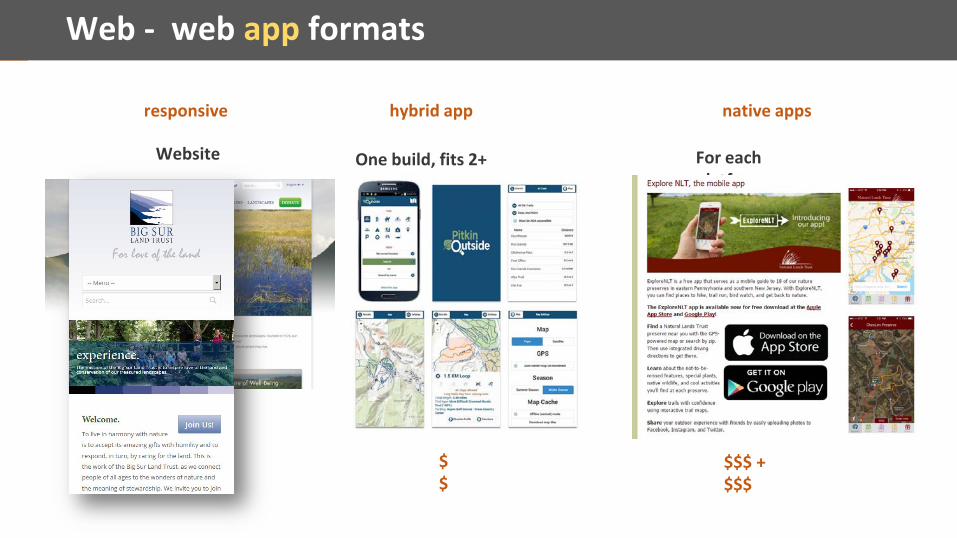
Web - web app formats
Website One build, fits 2+ platforms
responsive hybrid app native apps
For each platform
$$$ + $$$
$$

Web Technologies for Mapping
▪ Static maps
▪ (ArcGIS Online covered before)
▪ Google Maps, MyMaps (but there’s life beyond Google!)
▪ Mapbox, Carto
▪ Open source tools
▪ Story maps

Web – Google MyMaps, Earth, api

Web – Google MyMaps, Earth, api

Web – (Extending My Maps applications…)

Web – Beyond a Street Map and Pushpins
▪ Simple: Google’s styling wizard to brand your map. • Free• Minimal coding and excellent documentation• Control look of data, but no custom data, no searches/selects
▪ Better: Use a Mapbox custom basemap. • Use their style or use their interface to style your own • Add custom data so your lands show accurately and well• Free up to 50K views/month

Web – Open Source Property Finder

Web – Open Source data explorer, customizations
▪ Layer selection▪ Transparency adjustment▪ (Tool tips for more info)▪ Popup (modal)▪ Base maps▪ Link sharing
PLUS:▪ Search for location▪ Select elements to display▪ Birds eye/street views
PLUS+: ▪ Add data (point, line, area, image)▪ Place notes
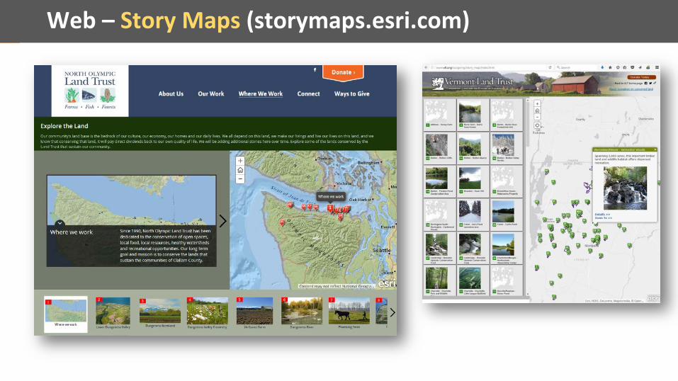
Web – Story Maps (storymaps.esri.com)

Esri Green Infrastructure project
▪ www.esri.com/about-esri/greeninfrastructure
http://arcg.is/21282GO

Esri Green Infrastructure project
▪ https://green-infrastructure.esri.com/AssetFinder/index.html
http://arcg.is/21282GO

TNC Resilient Landscapes
▪ ConservationGateway.org▪ Rally presentation
http://arcg.is/2cEy8Qf

GreenInfo Instagram for map lovers
www.instagram.com/greeninfonetwork/

6. Q&A
Contact
▪ Maianna Voge - [email protected]
www.greeninfo.org www.landtrustgis.org
▪ Jessie Parteno - [email protected]/ www.aecom.com