Embed Size (px)
Citation preview
FHR-a-300 (11-78)
United States Department of the Interior Heritage Conservation and Recreation Service
National Register of Historic Places Inventory Nomination FormSee instructions in How to Complete National Register FormsType ail entries complete applicable sections_______________
Historic Resources of Marshallville and Vicinity historic $ Partial Inventory: Historic and Architectural Properties)
and/or common_____________________
2. Location
city, town Marshallville -*&- vicinity of
state Georeia code 013 county
congressional district
a) Macon b) Peach
Third- Jack Brinkleva) 193
code b) 225
3. ClassificationCategory Ownership Status
district public x occupiedbuilding($) private unoccupiedstructure x both work in progresssite Public Acquisition Accessibleobject in process yes: restricted
v Mnl t-i nip being considered _x_ yes: unrestrictedA Jt~ 4.1*1*4* ! pt-^S J-t' v
Resource no
Present UseX agriculture x commercial x educational
entertainmentx governmentx industrial
military
museurnpark
x private residencex religious
scientificx transportation
other:
4. Owner of Property
name Multiple ownership (property-owner list attached)
street & number
city, town vicinity of state
5. Location off Legal Descriptioncourthouse, registry of deeds, etc. Clerk of the Superior Court
a) Macon County Courthouse street & number b) Peach County Courthouse
a) Oglethorpe city, town ^ Fptr1, state Georgia
6. Representation in Existing Surveys__________title Historic American Building Survey has this property been determined elegible? __ yes %_ no
date 1941________________________________-JL. federal __state county __local
depository'for survey records Library of Congress
city, town WashjngtQn, D,C. state
7. Description
Condition Check onex excellent deteriorated x unalteredx good ruins ~x alteredx fair unexposed
Check onex original site
moved date
Describe the present and .original (if known) physical appearance
Located in the northeast corner of Maeon County, Marshallville is a small, rural community of approximately 1,300 people. The land ranges from nearly level to a five-percent slope in most instances and is well-suited for agricultural use, which proved to be the attraction for early settlers in the area. Adjacent to the townsite are the headwaters of several drainage basins, and the Flint River lies three miles west of the city limits. The area surrounding Marshallville is primarily covered with timber or used for agricultural purposes as cultivated fields or orchards. Within the corporate limits there is a central commercial core composed mainly of late-nineteenth century brick buildings and bisected by the railroad line. Twentieth-century industrial property is adjacent to this area on both ,,the, north and south sides, while the major residential areas lie to the east, west, and southwest of the central business district (CBD) with buildings from the antebellum, Victorian, turn-of-the-century and modern periods. New hous ing developments are located to the north and south of the industrial areas. Land left vacant or used for agricultural purposes surrounds the core of the community.
Plantations are the major historical resources in the countryside while the town contains both residential and commercial buildings from the antebellum, Vic torian and early-twentieth-century periods. The irregularly-shaped boundary for the multiple-resource area (MRA) [see Map A for precise location] lies approxi mately three miles west (and two miles south, east, and north of the corporate limits of the town.
The initial settlement in the Marshallville area occurred in the late-1820s and early-1830s. Forests, which covered the land, were cleared and cotton was planted. Plantation plain-style houses and associated outbuildings were erected on these farms, which began to encircle the area that became Marshallville. The town itself grew around a north-south, east-west crossroads in the late-1830s, beginning with a blacksmith's shop, post office, store and a few frame and brick houses.
It was during the two decades prior to the War/ Between the States that Mar shallville developed as a town. The Southwestern Railroad Company of Macon laid its tracks to the east of the crossroads in 1851, and around them were placed a public well, store buildings and the depot. On the western edge of the community were two large Greek Revival-style plantation houses, one of frame construction and the other made of brick. In 1853, the Methodists constructed a frame build ing fifty feet east of their present structure. Several frame Greek Revivals-style residences were located on both the eastern and western fringes of the community, and plantations, surrounded by cotton fields, were continually forming in the outlying area during this period.
The War Between the States and the years of Reconstruction brought signifi cant changes to the landscape of Marshallville, although actual warfare never
[continued]
FHR-8-300 (11-78)
United States Department off the Interior Heritage Conservation and Recreation Service
National Register of Historic Places Inventory Nomination Form
Continuation sheet Description_______ ___ Item number 7 Page 2
occurred near the community. Extensive cotton production, especially after 1865, continued on the plantations, yet a number of new residences were built in town. Two large, Greek Revival-style frame buildings were built on the western edge of the community, while smaller residences, usually built of wood, began to fill in the vacant lots along Main Street on both sides of the railroad tracks. The Baptist church, a wooden structure, was completed in 1861 on the site of the. pres ent-day building.
It was during the period between 1870 and World War I that Marshallville began to take the basic form it retains to the present day. East and West Main Streets and McCaskill Street were lined with additional buildings, usually sim ple Victorian, Neo-classical and vernacular residences, but in a few instances, large, ornate Neo-classical townhouses. Small, double-pen and shotgun-style houses constructed of wood were built to the south of West Main Street on small lots. The Central Business District experienced its greatest growth with the construction of brick stores, a Victorian-style depot, a fruit exchange, a hotel for fruit buyers, and a bank. This activity was concentrated in a two-block area along Main' Street at the intersection of the railroad line, and consisted of one- and two-story late-nineteenth^century7 commercial-s'tyle^ structures. In 1913, a municipal water*-and-eleetrical plantwas constructed north of the CBD. The Gothic- style Methodist church was built from 1910-1912 along West Main Street while the Baptist church, which also features extensive use of Gothic detailing, was con structed at its present site along East Main Street from 1914-1920. Agricultural production changed from cotton to fruit orchards, which were generally located one to three miles from town. It was also during this period of growth that the last of the significant plantations were built, usually centered around simple Victorian residences.
The 1920s and 1930s produced little growth in the Marshallville vicinity. Road improvements were made in the 1920s, but other areas, especially the CBD, declined in importance and began a period of decay. The entrances to Marshall ville along Georgia Highway 49 were greatly enhanced in 1932 with the planting of five miles of crepe myrtles and camellias, and a large camellia garden was established north of Marshallville in 1936. Generally, however, there was little physical growth in the community until the 1960s and 1970s, when modern residences were built within the residential sections.
Throughout the Marshallville Multiple Resource Area there exists a wide var iety of architectural styles and types of both frame and brick construction, in cluding Plantation Plain farmhouses, Greek Revival plantation houses, Victorian cottages, double-pen and shotgun-type workers 1 houses, late-nineteenth-century commercial structures, and large Neo-classical townhouses. While a majority of the buildings are modest in scale and design quality, there are a substantial
[continued]
FHR-8-300 (11-78)
United States Department off the Interior Heritage Conservation and Recreation Service
National Register of Historic Places Inventory Nomination FormContinuation sheet Description____ Item number 7 Page 3
number of both small and large structures which exhibit a high quality of design and workmanship.
The core of Marshallville is the two-block business district, which consists of one- and two-story brick buildings fronting Main Street and a railroad depot between Railroad and Market Streets that is set apart from the commercial struc tures. This depot, and the railroad tracks, are the major breaks in the CBD. Structural density lessens in the adjoining residential districts to the east and west as the one- and two-story detached homes are often sited on large lots, sev eral of which are extremely deep. These houses are often surrounded by iron or stone fences, and many have formal gardens in the side or rear yards. Trees, camellias, and crepe myrtles were planted in the yards and along the streets of Harshaliville, making East and West Main streets and McCaskill Street tree-lined. Adjacent to the CBD on the north and south is the industrial area, with large metal, wood, and concrete warehouses and storage bins. Residential areas on the north and south sides of town are generally very dense, with older double-pen and shotgun-type houses interspersed with concrete-block homes, trailers and public housing on small lots. The streets are narrow and often unpaved. While the com munity grew around a north-south, east-west crossroads, the side streets have no regular pattern. The land which surrounds the community within the corporate limits is generally vacant and is used for agricultural purposes, mainly as or chards. Major landscape features include the crepe myrtles along Highway 49 and the Camellia Gardens one and one-half miles north of town. Many smaller gardens, however, can be found around the residences within town, and the city cemetery be hind the Methodist church is an open public green space. The outlying land sur rounding Marshallville is sparsely populated and is either cultivated, orchards, or timberland. Clusters of structures, however, are often found on the planta tions, as the outbuildings were placed near the main house.
In 1974, 21.2 percent of the 2,009.6 acres in Marshallville was developed. Land use within that developed portion was as follows: single-family residential, 56.2 percent; multi-family residential, 1.9 percent; mobile homes, 1.3 percent; industrial, 7.6 percent; transportation, 23.7 percent; and public and semi-public buildings, 8 percent. For the surrounding area, 1979 land-use figures for Macon County can be used with a certain degree of accuracy. The two major uses are agriculture, at 53.1 percent of the total area, and forest and vacant land at 43.8 percent of that area.
The survey of the Multiple Resource Area was conducted during July, August, September, and October of 1979 under the direction of David Brown, historic preser vation planner with the Middle Flint Area Planning and Development Commission. Sur veyors included Mr. Brown and the following local residents: Mayor Rachel Bickley, Mrs. Jane Bickley, Mrs. Gladys Walker, Mrs. Irene Kirkland, Ms. Ruth Grice, and Ms. Elia Grice. The survey was coordinated closely with Richard Cloues, architec tural historian with the Historic Preservation Section in Atlanta (SHPO Office).
FHR-8-300 (11-78)
United States Department off the Interior Heritage Conservation and Recreation Service
National Register of Historic Places Inventory Nomination Form
Continuation sheet Description___________Item number 7______ Page 4
Every structure in the Multiple Resource Area was visited by Mr. Brown and a local surveyor, and information on those properties being nominated individually and on properties of primary significance to the districts was recorded on inven tory forms developed specifically for the Marshallville nomination by Mr. Brown and Mr. Gloues, Buildings within the districts were surveyed and rated accord ing to their architectural significance, historical significance, age, and inte grity of both, the building and site.. They were grouped in the following categor ies: primary significance, contributing, non-detracting, and intrusions [see Maps Br-D) f Those categorized as being of primary significance are by no means the only important structures within the districts; they are simply the easily identifiable "cornerstones" of the community. Contributing structures were those buildings, generally over fifty years of age, that by their architectural design or historical association contributed to the significance of the MRA. Non-detract ing structures, while not fifty years of age or of any special architectural or historical significance, nonetheless do not detract from the character and appear ance of the MRA as their plan, heights, scale, and texture are generally compati ble with the contributing structures. Intrusions were those buildings and struc tures that detracted from the MRA environment because of their design, plan, scale, texture, siting or some related feature. Literature searches of both primary and secondary sources were undertaken by Mr. Brown and the surveyors. No archaeologi cal survey or testing was undertaken. Within the Multiple Resource Area there are approximately 567 structures, of which approximately 235 contribute to the histor ical character of the area.
8. Significance
Periodprehistoric1400-14991500-15991600-1699
- 1700-1799JL_ 1800-1 899 _JXL_1900-
Areas of Significance Check and justify belowarcheology-prehistoric community planning _2archeology-historic conservation
^x agriculture ^ architecture
artx commerce
communications
economics _2as education
engineeringx exploration/settlement
industryx invention
L_ landscape architectun law
c_ literature militarymusicphilosophypolitics/government
e x religionsciencesculpture
x social/humanitarian theater
X transportation other (specify)
Specific dates Builder/Architect
Statement of Significance (in one paragraph)
Marshallville, Georgia, through itp historic, cultural and architectural re^ sources, provides a well-preserved, comprehensive record of the lifestyle of a rural farming community in *the .Deep South. The plantation system, the railroad, the Civil War, a shift in agricultural emphasis, the Southern literary renaissance, and the Depression, all were, and in many instances remain, a part of life in Marsh'allvilte-. Yet, because of the life and work of several of its residents,, which has often had statewide and regional ramifications, Harshallville f s heritage is richer than that of most small farming communities.
The northern part of present-day Macon County was a portion of the land con trolled by the Creek Indians prior to 1821, Benjamin Hawkins 1 Indian Agency was located a short distance to the north, of the Multiple Resource Area (MRA) while Timothy Bernard 1 ^ crossing and farm were located south of the MRA, Ties between the Creeks of this region and the white settlements along the coast were close. Traders and settlers used trails close to the MR^^C such as Bernard T s Trail and the Slosheye Trail, to move into the Marshallville vicinity. Settlement pressures be came so great, in fact, that in 1821 the Creeks ceded a large portion of their lands, including the MRA, to the whites.
In the mid-182Qs, settlement began in earnest in the Marshallville vicinity when North Carolina natives moved into the area. The plantation system of cotton production began immediately after the 1827 land lottery', Needham Massee built Massee Plantation in 1827, while Billy Felton built the Billy Place'In 1830. Both men had extensive land holdings connected with their farms and immediately began planting cotton, Their homes were vernacular in style and were surrounded by the outbuildings necessary for the operation of a plantation. These first settlers were joined in the 1830s by a group of planters from the Orangeburg District of South Carolina. Lewis Rumph, who established two plantations in the area (one an HABS surveyed property that has since been destroyed), Daniel H. Frederick, and Daniel Wade all brought their families to the Marshallville vicinity. By 1840, the large Southern plantation system was firmly established in the area.
The 1840s and 1850s brought the initial growth of the town of Marshallville, which provided services to the plantations that continued to develop and grow. An increasing number of residences and commercial structures located near this coun try crossroads 9 especially after the laying of the railroad in 1851 by the South western Railroad Company. The right-of-way to the north was donated by Needham Massee (with a stop at Massee Lane), that through town was donated by Daniel Fre derick, and south of Marshallville, Billy Felton donated the necessary land (with
[continued]
FHR-8-300 (11-78)
United States Department off the Interior Heritage Conservation and Recreation Service
National Register of Historic Places Inventory Nomination FormContinuation sheet significance Item number Q Page 2
a stop at Winchester). This rail location solidified Marshallville f s position in the region, and the town was incorporated in 1854. By this time, both the Metho dists and Baptists had moved into the community from their earlier outlying loca tions .
During these two decades, many planters turned from vernacular architectural styles to variations of the Greek Revival style. Daniel Frederick (Frederick-Wade House, 1840) and Murdock McCaskill (McCaskill-Rumph House, ca. 1855) built two of the largest and finest, but there were numerous smaller Greek Revival buildings built in Marshallville.
The 1860s saw little change in the countryside but significant development within the community. Although not directly affected by the fighting, Marshall ville was radically changed by the Civil War and its outcome. Many planters, fear ing a Negro insurrection moved into town. The Slappey House and the William Hamilton Felton House were both large residences built in the 1860s near the com munity, but there were several smaller residences also constructed during that per iod, such as the Donald Barton Frederick House. Cotton remained the major money crop in the region throughout the decade.
Marshallville experienced its greatest period of prosperity between 1870 and World War I, due in large measure to the development of the commercial fruit indus try. The one person most responsible for this was Samuel Henry Rumph, who, about 1870, began experimenting with a new type of peach. Named the Elberta, after his wife, it differed from the traditional varieties in that it was a larger, firmer, freestone peach. After ten years of testing and budding at his Willow Lake farm, the Elberta was placed on the market and met with great success. Rumph also developed an insulated shipping crate, called a "one-third" crate, during the 1870s, and was the first to ship peaches to the northeastern markets where they netted a remarkable $15 per bushel. His activity was not limited to peaches, how ever, as apple, pear, plum and berry, as well as peach trees from his nursery were shipped all over the United States.
In addition, other Marshallville residents were involved in the fast-growing commercial fruit industry. Lewis A. Rumph developed the Georgia Belle peach at about the same time that his nephew was experimenting with the Elberta variety, and in 1886, Roland Hiley developed a strain he named the Hiley Belle peach. Apple and peach orchards soon replaced cotton in the fields in and surrounding the community. A fruit exchange was built near the depot, the Elberta Hotel was constructed to accommodate buyers from the North, and a local bank was formed. Thus, the CBD grew to match the town's prosperity. Dry-goods stores, grocery stores, and general-merchandise stores sprang up alongside those establishments related to the fruit industry. Most of the buildings still standing were built between 1880 and 1910 and are typical of Victorian commercial architecture with their brick cornices, arched windows, vents, and other period details.
[continued]
FHR-8-300 (11-78)
United States Department off the Interior Heritage Conservation and Recreation Service
National Register of Historic Places Inventory Nomination Form
Continuation sheet Significance Item number Q Page 3
Residential architecture and accompanying landscaping efforts also flourished during this era, often the result of one or two good peach crops. Samuel Rumph's in-town residence, built in 1904, was a colossal (by Marshallville f s standards) Neo-classical building which became a major focal point of the community. In ad dition, the last of the major plantations, such as the Alma Fruit Farm, were con structed between 1870 and World War I. Earlier frame Victorian structures and smaller turn-of-the-century residences filled in the vacant lots on Main and Mc- Caskill streets while the workers in the fruit industry lived in small frame structures southwest of the crossroads. Most of these workers were low-income blacks, living without the advantages of their white neighbors. A school was formed, however, to help fill their educational needs.
Founded in 1887 by Anna Wade, a former slave in Marshallville, and Kate Lamson, a YWCA counselor in Boston, the Lamson School was operated as a grade school for Marshallville f s black population through the support of the Congrega tional denomination's American Missionary Association. Three buildings were erected with funds from northern philanthropists, and Anna Wade served as princi pal until 1914. At that time, her husband, Edward S. Richardson, became principal of the school which was renamed the Lamson-Richardson School. Funds from the Tremont Temple Baptist Church in Boston made possible the erection of a new build ing in 1915. The school continued under the guidance of Richardson and his daugh ter, Blanche M. Richardson, until 1946, In 1957, the Lamson-Richardson School was consolidated with the elementary levels and became a public-supported insti tution.
The other major focal point of the black community was St. James Methodist Church. Founded in the nineteenth century, this church has remained as the strong est and most constant black congregation in Marshallville. Their present building was built in 1905, and the church has counted many of Marshallville ? s black lead ers among its members. Marshallville f s black cemetery is located directly behind the church building. Recent alterations, however, have resulted in this property being omitted from the nomination.
The 1920s saw the emergence of another major Marshallville figure, Dr. John Donald Wade. A graduate of the University of Georgia (B.A.), Harvard University (M.A.), and Columbia University (Ph.D.), Wade was awarded one of the first Guggen- heim Fellowships. His research in London led to his 1930 biography of John Wesley, which followed a 1924 biography of Augustus Baldwin Longstreet. In 1928, he accepted a position in the English Department at Vanderbilt University in Nash ville, Tennessee, where he first achieved regional prominence. Wade returned as a professor to the University of Georgia in 1934, remaining there until his retire ment in 1951. He died in 1963.
While at Vanderbilt, Wade became acquainted with several other Southerners who felt, as he did, that the South was moving toward the total embrace of modern industrialism at the expense of its heritage. Among this group, known collectively as the Agrarians, were Robert Penn Warren, Alien Tate, John Crowe Ransom, Donald
icontinued]
FHR-&-300 (11-78)
United States Department of the Interior Heritage Conservation and Recreation Service
National Register of Historic Places Inventory Nomination Form
Continuation sheet signifir.aTire Item number 8 Page 4
Davidson, Andrew Lytle, and Frank Owsley. In 1930, they published a symposium entitled, I'11 Take My Stand: The South and the Agrarian Tradition (the title was suggested by Wade), in which they decried the rush toward industrialism. It immediately attracted national attention and, in many instances, brought fierce critical attacks. Since its publication, I'll Take My Stand has come to be recognized as an important regional work, and many of the Agrarians are counted among the leaders of the Southern literary renaissance of the twentieth century. Wade f s contribution was a short story entitled, "The Life and Death of Cousin Lucius," loosely based upon the life of Wade's uncle, Jacob Walter Freder ick.
The importance of John Donald Wade to Marshallville, however, comes not so much from his writing as it does from the fact that he personally exemplified his Agrarian beliefs. While he knew (perhaps being more practical than the other Agrarians) that industrialism could not be stopped, he did believe that the South ern tradition could act as a barrier for the human mind and soul against the im personal surge of progress.
Wade suggested four ways of propagating the Southern heritage: by practicing Southern integrity; by establishing Southern literary pursuits (as seen in his founding of the Georgia Review); by living in the South (he never moved from Mar shallville) ; and by cultivating the physical beauty of the South. This last tenet most affected his hometown. In 1932, Wade and a group of Marshallville residents planted approximately five miles of crepe myrtles and camellias along Georgia High way 49 leading into the community. While many of the expensive camellias were stolen, the watermelon-red crepe myrtles remain and make for an impressive entrance- way. Wade also built an arboretum behind his home (Frederick-Wade House) with shrubs and flowers from all over the world. The outlines and sculpture of this garden still remain. In addition, Wade was very much involved with both the national camellia shows held in Marshallville and the development of Dave Strother's Camellia Gardens (now headquarters of the American Camellia Society).
After this activity in the 1930s, very little growth occurred in Marshallville. A few industries located adjacent to the CBD, but they were generally small in scale. In the 1960s and 1970s, some new residential building took place within the community. However, the town has generally remained stable in both size and economic growth.
Three districts, nine individual properties and an object are included in this nomination. They represent the growth of Marshallville from its early plantation days through its period of importance in the fruit industry to its present state as a small Southern community.
[continued]
FHR-8-300 (11-78)
United States Department of the Interior Heritage Conservation and Recreation Service
National Register of Historic Places Inventory Nomination FormContinuation sheet significance ltem number 3 Page 5
In most instances, the individual properties are the plantations surrounding the community. The earliest, such as Thronateeska and Massee Lane, are important as early settlements in the region. All are important agriculturally, either for their owner ! s involvement in cotton production or the commercial fruit industry. Architecturally, these plantations are significant not only as single buildings worthy of note but as collections of buildings that represent the total operation of a Southern farm. Willow Lake is also important as the site of Samuel Rumph's development of the Elberta Peach, his invention of a refrigerated shipping crate (the nominated object is a model of this crate), and the subsequent development of the commercial fruit industry in Georgia.
Two of the individual properties are not plantations. The Lamson-Richardson School is important as an early, privately owned, educational center for the town f s black citizens. Located north of Marshallville, Strother's Farm (the camellia garden) is representative of the community f s interest in landscape archi tecture, which dates back to the 1850s but was largely fueled in the 1930s by the writings and practices of John Donald Wade.
Both of the residential districts contain resources from the town r s various periods of growth. Architecturally, there are fine local variations of the Plan tation Plain, Greek Revival, Victorian and Neo-classical styles. The homes of the white citizens are usually sited on spacious lots and often feature formal gardens and wrought-iron fences. Many are a direct result of the prosperity of the fruit industry. The homes of the town f s black population are also a result of this in dustry, as these were the workers* in the orchards and packing sheds. Their homes were frame structures crowded onto small lots facing narrow streets. However, be cause of the large number of intrusions in the black neighborhoods, and because of extensive structural alterations, any site integrity which once existed no longer remains. For this reason, only a few buildings from this area can be included in the nomination.
The commercial district relates to one period of growth, from 1870 to World War I, and is a direct result of the prosperity from the fruit industry. Build ings here are typical of late-nineteenth-century commercial structures with their brick construction and details such as arched windows, corbelling, and vents.
In the past, preservation activity has been fueled by both private property owners and, to some extent, by the Marshallville Foundation, founded by Wade. Within the past decade, many of the residents of Marshallville have renovated or rehabilitated their homes. Much of the work has been sympathetic to the architec tural character of the resources, but there have also been several drastic remodel ing efforts.
[continued]
FHR-8-300 (11-78)
United States Department of the Interior Heritage Conservation and Recreation Service
National Register of Historic Places Inventory Nomination Form
Continuation sheet Significance________ Item number 8 Page 6
Since April of 1978, the Middle Flint Area Planning and Development Commission has included a historic preservation planner on its staff. By working closely with Marshallville T s mayor, the planner has encouraged the community to undertake this multiple resource nomination. In addition, the newly formed Macon County His torical Society is presently studying the situation in Marshallville to determine what types of preservation efforts might be appropriate.
Because the multiple resource nomination was coordinated out of the office of the regional planning commission, the information gathered will be integrated into its future planning work. The 1975 Community Development Concept Plan for Marshall ville does not discuss historic resources, but the 1979 Growth Management Plan for Macon County, and the 1974 Andersonville Trail Master Development Plan, the 1978 Plains Country Tourism Master Plan, and the Area Development Plan, FY80-FY84 (ADP) all briefly discuss the range of resources in Marshallville. Future Area Develop ment Plans and comprehensive plans for the community generated by the APDC office will most assuredly address the need for the preservation of cultural resources in Marshallville.
See continuation sheet.*
Acreage of nominated property See District and Individual Property Forms.
Quadrangle name Garden Valley., Marshallville, Perry West Quadrangle scale 1;24,OOPUMT References
I_I I I LJZone Easting
ci , I I I , LEl , I I I , |
Gl , I II , |
Northing
! I 1 1 I 1 I 1 I 1 1
I I 1 1 . 1 , | . I |
.,11 I III III
Zone Easting
D| I II 1 , L
F| , I 1 1 , |
Hi ,1 1 1 , 1
Northing
1 1 | 1 1 1 1 ||
i i 1 1 I 1 i | |
I i 1 1 I 1 i ii
Verbal boundary description and justification
See continuation sheet.
List all states and counties for properties overlapping state or county boundaries
state Georgia______________code 013 county Ma CQn_____ code 193
state Georgia code 225
name/titlea) David J, Brown, Historic 'Preservation Planner ^\ g^cfrarfl cioues. Architectural Historian ___
Organizationa) Middle Flint Area Planning and Development Commission'
^ street & numbera) P.,0, Box 6
, Ra. T>m?date 19
a) (912) 937-2561 telephone ^ (404) 656-2840
state
12. State Historic Preservation Officer CertificationThe evaluated significance of this property within the state is:
__ national y state __ local
As the designated State Historic Preservation Officer for the National Historic Preservation Act of 1966 (Public Law 89- 665), I hereby nominate this property for inclusion in the National Register and certify that it has been evaluated according to the criteria and procedures set forth by the Heritage Conservation and Recreation Service.
State Historic Preservation Officer signature
GPO 938 835
FHR-8-300 (11-78)
United States Department of the Interior Heritage Conservation and Recreation Service
National Register of Historic Places Inventory Nomination Form
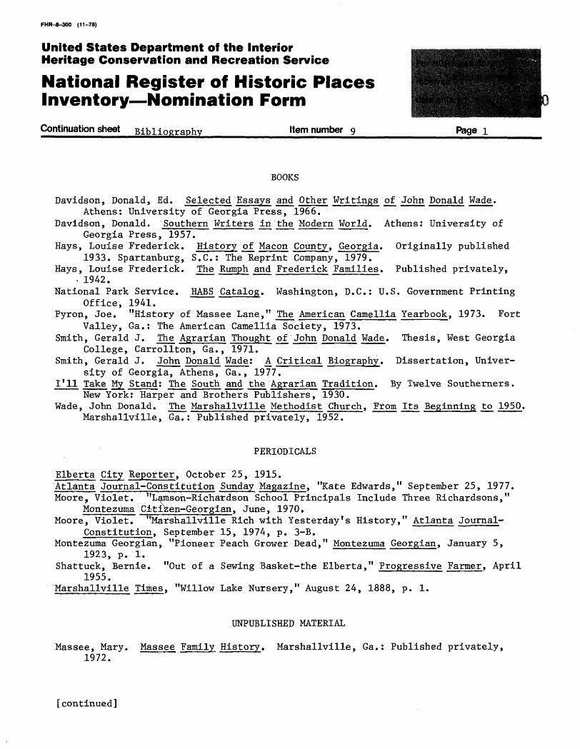
Continuation sheet Bibliography Item number 9 Page
BOOKS
Davidson, Donald, Ed. Selected Essays and Other Writings of John Donald Wade.Athens: University of Georgia Press, 1966.
Davidson, Donald. Southern Writers in the Modern World. Athens: University ofGeorgia Press, 1957.
Hays, Louise Frederick. History of Macon County, Georgia. Originally published1933. Spartanburg, S.C.: The Reprint Company, 1979.
Hays, Louise Frederick. The Rumph and Frederick Families. Published privately,. 1942.
National Park Service. HABS Catalog. Washington, D.C.: U.S. Government PrintingOffice, 1941.
Pyron, Joe. "History of Massee Lane," The American Camellia Yearbook, 1973. FortValley, Ga.: The American Camellia Society, 1973.
Smith, Gerald J. The Agrarian Thought of John Donald Wade. Thesis, West GeorgiaCollege, Carrollton, Ga., 1971.
Smith, Gerald J. John Donald Wade: A Critical Biography. Dissertation, Univer sity of Georgia, Athens, Ga., 1977.
1*11 Take My Stand: The South and the Agrarian Tradition. By Twelve Southerners.New York: Harper and Brothers Publishers, 1930.
Wade, John Donald. The Marshallville Methodist Church, From Its Beginning to 1950.Marshallville, Ga.: Published privately, 1952.
PERIODICALS
Elberta City Reporter, October 25, 1915.AtlantaJournal-Constitution Sunday Magazine, "Kate Edwards," September 25, 1977.Moore, Violet. * 'Lams on-Richards on School Principals Include Three Richardsons,"
Montezuma Citizen-Georgian, June, 1970.Moore, Violet. "Marshallville Rich with Yesterday f s History," Atlanta Journal-
Constitution, September 15, 1974, p. 3-B.Montezuma Georgian, "Pioneer Peach Grower Dead," Montezuma Georgian, January 5,
1923, p. 1.Shattuck, Bernie. "Out of a Sewing Basket-the Elberta," Progressive Farmer, April
1955.Marshallville Times, "Willow Lake Nursery," August 24, 1888, p. 1.
UNPUBLISHED MATERIAL
Massee, Mary. Massee Family History. Marshallville, Ga.: Published privately, 1972.
[continued]
FHR-8-300 (11-78)
United States Department of the Interior Heritage Conservation and Recreation Service
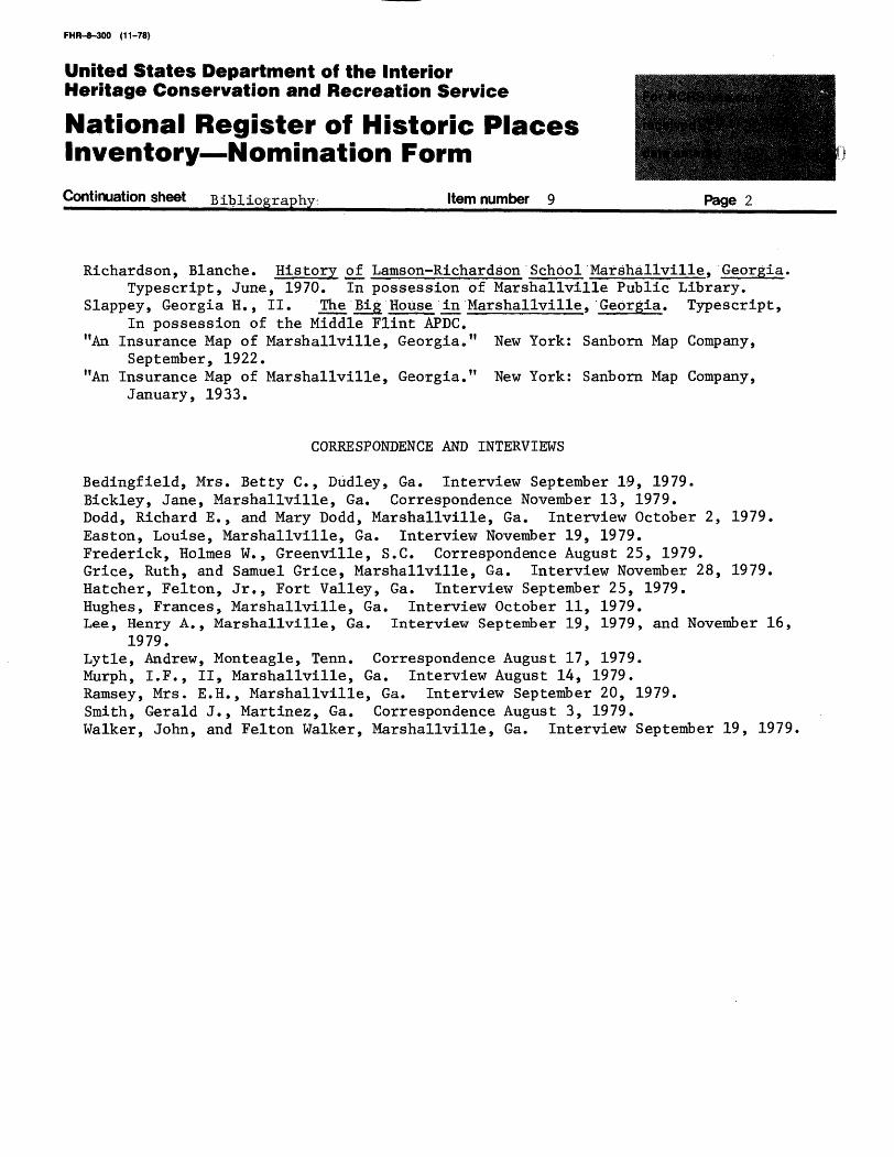
National Register of Historic Places Inventory Nomination FormContinuation sheet Bibliography Item number 9 Page 2
Richardson, Blanche. History of Lamson-Richardson School Marshallville, Georgia,Typescript, June, 1970. In possession of Marshallville Public Library.
Slappey, Georgian., II. The Big House in Marshallville, Georgia. Typescript,In possession of the Middle Flint APDC,
"An Insurance Map of Marshallville, Georgia." New York: Sanborn Map Company,September, 1922.
"An Insurance Map of Marshallville, Georgia." New York: Sanborn Map Company,January, 1933.
CORRESPONDENCE AND INTERVIEWS
Bedingfield, Mrs. Betty C., Dudley, Ga. Interview September 19, 1979.Bickley, Jane, Marshallville, Ga. Correspondence November 13, 1979.Dodd, Richard E., and Mary Dodd, Marshallville, Ga. Interview October 2, 1979.Easton, Louise, Marshallville, Ga. Interview November 19, 1979.Frederick, Holmes W., Greenville, S.C. Correspondence August 25, 1979.Grice, Ruth, and Samuel Grice, Marshallville, Ga. Interview November 28, 1979.Hatcher, Felton, Jr., Fort Valley, Ga. Interview September 25, 1979.Hughes, Frances, Marshallville, Ga. Interview October 11, 1979.Lee, Henry A., Marshallville, Ga. Interview September 19, 1979, and November 16,
1979.Lytle, Andrew, Monteagle, Tenn. Correspondence August 17, 1979. Murph, I.F., II, Marshallville, Ga. Interview August 14, 1979. Ramsey, Mrs. E.H., Marshallville, Ga. Interview September 20, 1979. Smith, Gerald J., Martinez, Ga. Correspondence August 3, 1979. Walker, John, and Felton Walker, Marshallville, Ga. Interview September 19, 1979,
FHR-8-300 (11-78)
United States Department of the Interior Heritage Conservation and Recreation Service
National Register of Historic Places Inventory Nomination Form
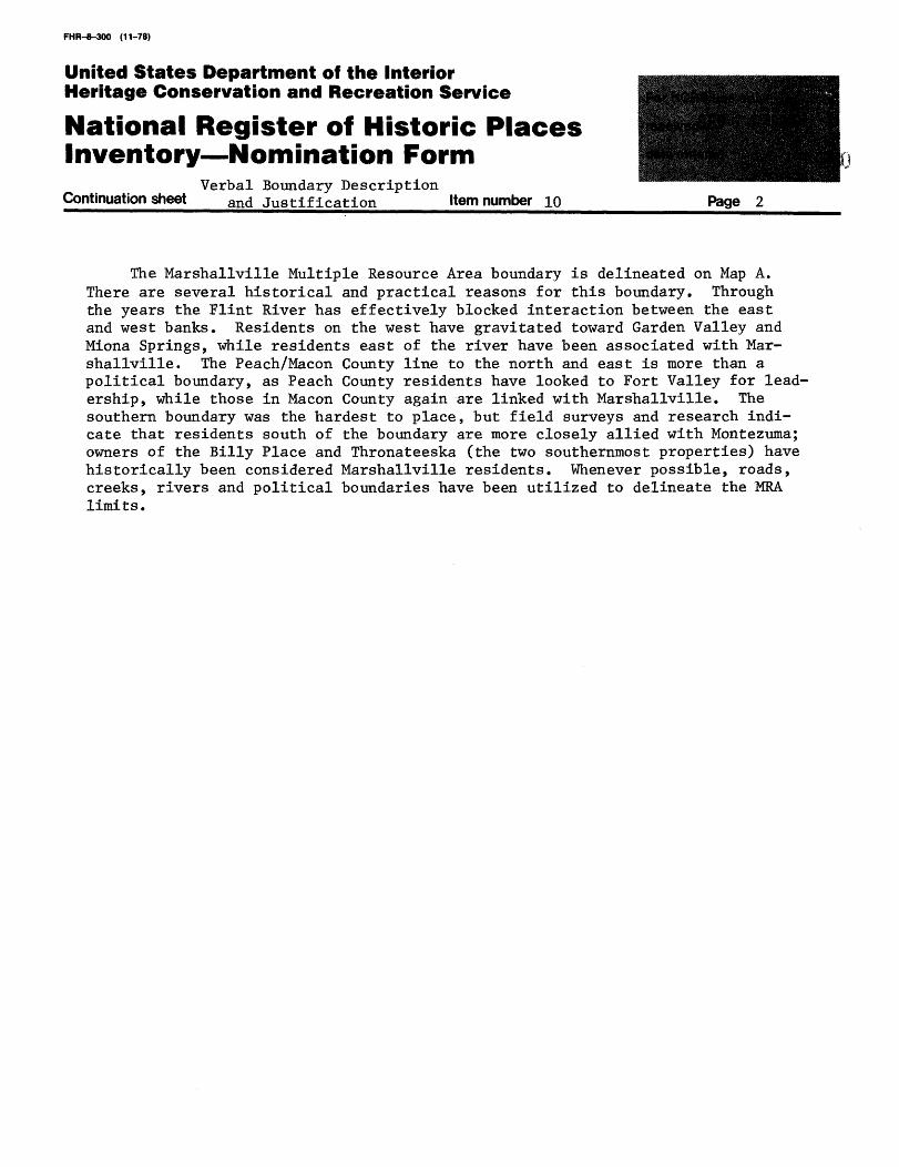
Verbal Boundary Description Continuation sheet and justification Item number 10 Page 2
The Marshallville Multiple Resource Area boundary is delineated on Map A. There are several historical and practical reasons for this boundary. Through the years the Flint River has effectively blocked interaction between the east and west banks. Residents on the west have gravitated toward Garden Valley and Miona Springs, while residents east of the river have been associated with Mar shallville. The Peach/Macon County line to the north and east is more than a political boundary, as Peach County residents have looked to Fort Valley for lead ership, while those in Macon County again are linked with Marshallville. The southern boundary was the hardest to place, but field surveys and research indi cate that residents south of the boundary are more closely allied with Montezuma; owners of the Billy Place and Thronateeska (the two southernmost properties) have historically been considered Marshallville residents. Whenever possible, roads, creeks, rivers and political boundaries have been utilized to delineate the MRA limits.