Embed Size (px)
Citation preview

NPS Form 10-900 OMB No. 1024-0018 United States Department of the Interior National Park Service RECEIVED 2280 1-' 1
N t . I R . t f H" t . PI R . t t" F SEP 1 8 2015 a 1ona eg1s er o 1s or1c aces eg1s ra 10n orm . PI
Mat .• e ister of Histone aces This form is for use in nominating or requesting determinations for individual properties and districts. See ins!rucfto · ~~~Avllelin . How to Complete the National Register of Historic Places Registration Form. If any Item does not apply to the propert um@h~<t;J'i!h~\'-''1<1/A" for "not applicable." For functions, architectural classification, materials, and areas of significance, enter only categories and subcategories from the instructions. Place additional certification comments, entries, and narrative Items on continuation sheets if needed (NPS Form 10-900a).
1. Name of Property
Historic name Green, Philip and Louisa, Home
Other names/site number 4171 West Belle Place ------~~~----~-----------------------------------------------------
Name of related Multiple Property Listing .;;_N.:;;.;/A'-'---------------------------
2. Location
Street & number 4171 West Belle Place N/A not for publication
City or town Saint Louis N/A vicinity ~~~~~--------------------------------------------------~~~~
State Missouri Code MO County St. Louis Independent City Code 510 Zip code 63108
3. State/Federal Agency Certification
As the designated authority under the National Historic Preservation Act, as amended,
I hereby certify that this L.. nomination _ request for determination of eligibility meets the documentation standards for registering properties in the National Register of Historic Places and meets the procedural and professional requirements set forth in 36 CFR Part 60.
In my opinion, the property .K.__ meets __ does not meet the National Register Criteria. I recommend that this property be considered significant at the following level(s) of significance:
national statewide _K__Iocal
Applicable National Register Criteria: A B _L C 0
q Deputy SHPO
Missouri Department of Natural Resources State or Federal agency/bureau or Tribal Government
In my opinion, the property __ meets_ does not meet the National Register criteria.
Signature of commenting official Date
Title State or Federal agency/bureau or Tribal Government
ark Service Certification
entered in the National Register __ determined eligible for the National Register
____ determined not eligible for the National Register ____ removed from the National Register
~..,.:_~~~~~Lt._~~~V-~...,.---- I t 2 II . itte of Action
1

United States Department of the Interior National Park Service / National Register of Historic Places Registration Form NPS Form 10-900 OMB No. 1024-0018
Green, Philip and Louisa, Home St. Louis (Independent City) Missouri Name of Property County and State
2
5. Classification
Ownership of Property (Check as many boxes as apply.)
Category of Property (Check only one box.)
Number of Resources within Property (Do not include previously listed resources in the count.)
Contributing Noncontributing
x private x building(s) 1 0 buildings
public - Local district sites
public - State site structures
public - Federal structure objects object 1 0 Total
Number of contributing resources previously
listed in the National Register
N/A 6. Function or Use
Historic Functions
(Enter categories from instructions.) Current Functions
(Enter categories from instructions.)
DOMESTIC/single dwelling/ residence VACANT
7. Description
Architectural Classification (Enter categories from instructions.)
Materials (Enter categories from instructions.)
Late Victorian/Italianate foundation: Limestone
walls: Brick
roof: Unknown
other:
x
NARRATIVE DESCRIPTION ON CONTINUTATION PAGES

United States Department of the Interior National Park Service / National Register of Historic Places Registration Form NPS Form 10-900 OMB No. 1024-0018
Green, Philip and Louisa, Home St. Louis (Independent City) Missouri Name of Property County and State
8. Statement of Significance
Applicable National Register Criteria (Mark "x" in one or more boxes for the criteria qualifying the property for National Register listing.)
A Property is associated with events that have made a
significant contribution to the broad patterns of our history.
B Property is associated with the lives of persons significant in our past.
x C Property embodies the distinctive characteristics of a type, period, or method of construction or represents the work of a master, or possesses high artistic values, or represents a significant and distinguishable entity whose components lack individual distinction.
D Property has yielded, or is likely to yield, information important in prehistory or history.
Criteria Considerations (Mark "x" in all the boxes that apply.)
Property is:
A
Owned by a religious institution or used for religious purposes.
B removed from its original location.
C a birthplace or grave.
D a cemetery.
E a reconstructed building, object, or structure.
F a commemorative property.
G less than 50 years old or achieving significance
within the past 50 years.
x STATEMENT OF SIGNIFICANCE ON CONTINUTATION PAGES
Areas of Significance
ARCHITECTURE
Period of Significance
1882
Significant Dates
1882
Significant Person
(Complete only if Criterion B is marked above.)
N/A
Cultural Affiliation
N/A
Architect/Builder
Unknown
9. Major Bibliographical References
Bibliography (Cite the books, articles, and other sources used in preparing this form.) Previous documentation on file (NPS): Primary location of additional data:
preliminary determination of individual listing (36 CFR 67 has been x State Historic Preservation Office requested) Other State agency previously listed in the National Register Federal agency previously determined eligible by the National Register Local government designated a National Historic Landmark University recorded by Historic American Buildings Survey #____________ Other
recorded by Historic American Engineering Record # __________ Name of repository: recorded by Historic American Landscape Survey # ___________
Historic Resources Survey Number (if assigned): _N/A____________________________________________________________________

United States Department of the Interior National Park Service / National Register of Historic Places Registration Form NPS Form 10-900 OMB No. 1024-0018
Green, Philip and Louisa, Home St. Louis [Independent City] MO Name of Property County and State
10. Geographical Data Acreage of Property Less than one acre
Latitude/Longitude Coordinates Datum if other than WGS84:__________ (enter coordinates to 6 decimal places) 1 38.648705 -90.242981 3 Latitude: Longitude: Latitude:
Longitude:
2 4 Latitude: Longitude:
Latitude: Longitude:
UTM References (Place additional UTM references on a continuation sheet.) NAD 1927 or NAD 1983 1 3 Zone
Easting
Northing Zone
Easting
Northing
2 4 Zone
Easting
Northing
Zone
Easting
Northing
Verbal Boundary Description (On continuation sheet)
Boundary Justification (On continuation sheet) 11. Form Prepared By
name/title Andrew B. Weil with assistance from Karen Bode Baxter and Sheila Findall
organization Landmarks Association of St. Louis date 5/1/15
street & number 911 Washington Avenue, Suite 170 telephone 314-421-6474
city or town St. Louis State MO zip code 63101
e-mail [email protected]
Additional Documentation
Submit the following items with the completed form:
Maps: o A USGS map (7.5 or 15 minute series) indicating the property's location. o A Sketch map for historic districts and properties having large acreage or numerous resources. Key all
photographs to this map. Continuation Sheets
Photographs Owner Name and Contact Information Additional items: (Check with the SHPO or FPO for any additional items.)
Paperwork Reduction Act Statement: This information is being collected for applications to the National Register of Historic Places to nominate properties for listing or determine eligibility for listing, to list properties, and to amend existing listings. Response to this request is required to obtain a benefit in accordance with the National Historic Preservation Act, as amended (16 U.S.C.460 et seq.). Estimated Burden Statement: Public reporting burden for this form is estimated to average 18 hours per response including time for reviewing instructions, gathering and maintaining data, and completing and reviewing the form. Direct comments regarding this burden estimate or any aspect of this form to the Office of Planning and Performance Management. U.S. Dept. of the Interior, 1849 C. Street, NW, Washington, DC.

United States Department of the Interior National Park Service / National Register of Historic Places Registration Form NPS Form 10-900 OMB No. 1024-0018
Green, Philip and Louisa, Home St. Louis [Independent City] MO Name of Property County and State
Photographs Submit clear and descriptive photographs. The size of each image must be 1600x1200 pixels (minimum), 3000x2000 preferred, at 300 ppi (pixels per inch) or larger. Key all photographs to the sketch map. Each photograph must be numbered and that number must correspond to the photograph number on the photo log. For simplicity, the name of the photographer, photo date, etc. may be listed once on the photograph log and doesn’t need to be labeled on every photograph.
Photo Log:
Name of Property: Green, Philip and Louisa, Home
City or Vicinity: Saint Louis
County: Saint Louis (Independent City) State:
Missouri
Photographer:
Andrew B. Weil
Date Photographed: Multiple Dates
Description of Photograph(s) and number, include description of view indicating direction of camera:
Photo #1: 4171 W. Belle Place, St. Louis, MO Sheila Findall, photographer, August 2014 Digital Files with Karen Bode Baxter, 5811 Delor St., St. Louis, MO 63109 Exterior, looking NW at S façade and E elevation Photo #2: 4171 W. Belle Place, St. Louis, MO Sheila Findall, photographer, August 2014 Digital Files with Karen Bode Baxter, 5811 Delor St., St. Louis, MO 63109 Exterior, looking NE at W elevation Photo #3: 4171 W. Belle Place, St. Louis, MO Sheila Findall, photographer, August 2014 Digital Files with Karen Bode Baxter, 5811 Delor St., St. Louis, MO 63109 Exterior, looking NW at S façade 1st fl windows Photo #4: 4171 W. Belle Place, St. Louis, MO Sheila Findall, photographer, August 2014 Digital Files with Karen Bode Baxter, 5811 Delor St., St. Louis, MO 63109 Exterior, looking NW at E elevation N end

United States Department of the Interior National Park Service / National Register of Historic Places Registration Form NPS Form 10-900 OMB No. 1024-0018
Green, Philip and Louisa, Home St. Louis [Independent City] MO Name of Property County and State
Photo #5: 4171 W. Belle Place, St. Louis, MO Sheila Findall, photographer, August 2014 Digital Files with Karen Bode Baxter, 5811 Delor St., St. Louis, MO 63109 1
st fl, SW room, from mid E wall looking NW
Photo #6: 4171 W. Belle Place, St. Louis, MO Sheila Findall, photographer, August 2014 Digital Files with Karen Bode Baxter, 5811 Delor St., St. Louis, MO 63109 1
st fl, SW room, from mid E wall looking SW
Photo #7: 4171 W. Belle Place, St. Louis, MO Sheila Findall, photographer, August 2014 Digital Files with Karen Bode Baxter, 5811 Delor St., St. Louis, MO 63109 1st fl, Mid E room, from SW corner looking NE Photo #8: 4171 W. Belle Place, St. Louis, MO Andrew Weil, photographer, September 2014 Digital Files with Karen Bode Baxter, 5811 Delor St., St. Louis, MO 63109 Exterior, looking E at W elevation N end Photo #9: 4171 W. Belle Place, St. Louis, MO Andrew Weil, photographer, September 2014 Digital Files with Karen Bode Baxter, 5811 Delor St., St. Louis, MO 63109 Exterior, looking SE at N elevation Photo #10: 4171 W. Belle Place, St. Louis, MO Andrew Weil, photographer, September 2014 Digital Files with Karen Bode Baxter, 5811 Delor St., St. Louis, MO 63109 Looking across West Belle Place at buildings SE Photo #11: 4171 W. Belle Place, St. Louis, MO Andrew Weil, photographer, September 2014 Digital Files with Karen Bode Baxter, 5811 Delor St., St. Louis, MO 63109 Looking across West Belle Place at buildings SW

United States Department of the Interior National Park Service / National Register of Historic Places Registration Form NPS Form 10-900 OMB No. 1024-0018
Green, Philip and Louisa, Home St. Louis [Independent City] MO Name of Property County and State
Figure Log: Figure 1: Tower Grove House, Grounds of Missouri Botanical Gardens Figure 2: Superintendant’s House, Grounds of Tower Grove Park Figure 3: Lemp Mansion, 3322 DeMenil Place Figure 4: William O. Shands House, 2223 Salisbury Avenue Figure 5: Andrew and Laura Scott Einstmann House, 4612 Virginia Avenue Figure 6: Lafayette Square
Figure 7: Photo Location Map Figure 8: 1883 Hopkins Map showing 4171 West Belle Place Figure 9: William Cuthbert Jones Home, 3724 Olive Street Figure 10: Aerial of St. Louis showing locations of referenced Italianate homes Figure 11: St. Louis Neighborhood Map

NPS Form 10-900 OMB No. 1024-001 United States Department of the Interior National Park Service
National Register of Historic Places Continuation Sheet Section number 7 Page 1
Green, Philip and Louisa, Home Name of Property Saint Louis [Independent City] MO County and State N/A Name of multiple listing (if applicable)
Summary The Philip and Louisa Green Home, 4171 West Belle Place, St. Louis City, Missouri, is an ornate Italianate house that was constructed on the western fringe of St. Louis’ developed neighborhoods in 1882. The stately home features prominent design elements such as stone quoins, an elaborate wooden cornice, and projecting octagonal bays. While many such homes associated with country estates were once common in the countryside surrounding the city’s central core, rapid urban growth in the late 19
th and
early 20th
centuries destroyed most examples. The Philip and Louisa Green Home is a rare surviving example of a high style Italianate home that was originally constructed in a rural context and then managed to survive the boom and bust cycle of St. Louis’ urban growth from the late 19
th through the
late 20th
century.
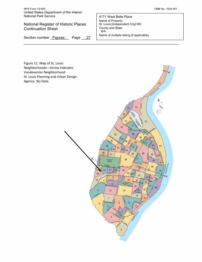
Setting The Italianate styled dwelling at 4171 West Belle Place is located in north, central St. Louis [Independent City] Missouri in what is today classified as the Vandeventer Neighborhood (Figure 11). The home stands on lot 31 of the Bequette’s Tract subdivision. The surrounding neighborhood was primarily developed between 1890 and the 1920s and contains a mixture of large single family homes as well as multifamily flats. While some blocks are largely intact, others have suffered from substantial amounts of demolition. West Belle Place is a street that unfortunately has lost many residences. Vacant lots are abundant and vacant homes are common. The most common architectural resources in the surrounding area are large, revival style single family homes dating primarily to the last decade of the 19th century and the first decade of the 20th, as well as Craftsman influenced two- and four- family flats from the early 20
th century. Brick bearing wall masonry is the dominant construction technique. There are also
occasional examples of mid-20th century infill housing that are not compatible architecturally with the historic building stock. This is the case with the building located next door to the east of 4171 at 4167 West Belle Place, which is a one-story brick multifamily unit constructed in 1962. Immediately to the west of 4171 West Belle Place is a vacant lot followed by two large historic homes constructed c. 1900. Immediately to the north of 4171 West Belle Place across an alley is another vacant lot. These vacant lots were caused by demolition of historic buildings in the 20th century. The block across the street to the south of the home is reasonably intact with five historic residences and a one-story church (Bethlehem Baptist) that was constructed c. 1930 on the site of an earlier residence (Photos 10-11). Overall integrity of streetscapes in the area is insufficient to justify historic district status. The area was assessed for historic district potential by Landmarks Association on behalf of the St. Louis Community Development Administration in 2003 and found at that time to be ineligible at that time due to a lack of integrity. Notably, that survey did single out 4171 West Belle Place as individually eligible for NR listing calling it an “…incredibly rare and unique Italianate…” design. 1 South (Primary) Elevation The Philip and Louisa Green Home at 4171 West Belle Place, St. Louis City, Missouri, is a two story, brick, Italianate single family home built c. 1882 that was converted into “flats” (two apartments) before the publication of the 1951 Sanborn map (Photo 1). It has a mostly flat roof although there is a pitched section that slopes down from the false gable on the primary façade. An elaborate wooden
1 Landmarks Association of St. Louis. Architectural Survey: Delmar-Sarah-Page-Taylor. 2003. On file City of St. Louis Community
Development Administration. Np. City Block 4566.
NPS Form 10-900 OMB No. 1024-001 United States Department of the Interior National Park Service
National Register of Historic Places Continuation Sheet Section number 7 Page 2
Green, Philip and Louisa, Home Name of Property Saint Louis [Independent City] MO County and State N/A Name of multiple listing (if applicable)
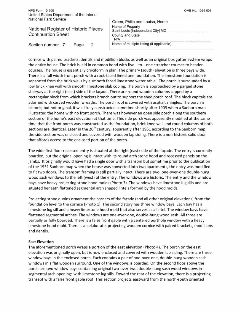
cornice with paired brackets, dentils and modillion blocks as well as an original box gutter system wraps the entire house. The brick is laid in common bond with five—to—one stretcher courses to header courses. The house is essentially cruciform in plan. The primary (south) elevation is three bays wide. There is a full width front porch with a rock-faced limestone foundation. The limestone foundation is separated from the brick walls by a smooth faced limestone water table. The porch is surrounded by a low brick knee wall with smooth limestone slab coping. The porch is approached by a parged stone stairway at the right (east) side of the façade. There are round wooden columns capped by a rectangular block from which brackets branch out to support the shed porch roof. The block capitals are adorned with carved wooden wreaths. The porch roof is covered with asphalt shingles. The porch is historic, but not original. It was likely constructed sometime shortly after 1909 when a Sanborn map illustrated the home with no front porch. There was however an open side porch along the southern section of the home’s east elevation at that time. This side porch was apparently modified at the same time that the front porch was constructed as the foundation, brick knee wall and round columns of both sections are identical. Later in the 20th century, apparently after 1951 according to the Sanborn map, the side section was enclosed and covered with wooden lap siding. There is a non-historic solid door that affords access to the enclosed portion of the porch. The wide first floor recessed entry is situated at the right (east) side of the façade. The entry is currently boarded, but the original opening is intact with its round arch stone hood and recessed panels on the jambs. It originally would have had a single door with a transom but sometime prior to the publication of the 1951 Sanborn map when the house was converted into two apartments, the entry was modified to fit two doors. The transom framing is still partially intact. There are two, one-over-one double-hung wood sash windows to the left (west) of the entry. The windows are historic. The entry and the window bays have heavy projecting stone hood molds (Photo 3). The windows have limestone lug sills and are situated beneath flattened segmental arch shaped lintels formed by the hood molds. Projecting stone quoins ornament the corners of the façade (and all other original elevations) from the foundation level to the cornice (Photo 1). The second story has three window bays. Each bay has a limestone lug sill and a heavy limestone hood mold that also serves as a lintel. The window bays have flattened segmental arches. The windows are one-over-one, double-hung wood sash. All three are partially or fully boarded. There is a false front gable with a centered porthole window with a heavy limestone hood mold. There is an elaborate, projecting wooden cornice with paired brackets, modillions and dentils. East Elevation The aforementioned porch wraps a portion of the east elevation (Photo 4). The porch on the east elevation was originally open, but is now enclosed and covered with wooden lap siding. There are three window bays in the enclosed porch. Each contains a pair of one-over-one, double-hung wooden sash windows in a flat wooden surround. One of the windows is boarded. On the second floor above the porch are two window bays containing original two-over-two, double-hung sash wood windows in segmental arch openings with limestone lug sills. Toward the rear of the elevation, there is a projecting transept with a false front gable roof. This section projects eastward from the north-south oriented

NPS Form 10-900 OMB No. 1024-001 United States Department of the Interior National Park Service
National Register of Historic Places Continuation Sheet Section number 7 Page 3
Green, Philip and Louisa, Home Name of Property Saint Louis [Independent City] MO County and State N/A Name of multiple listing (if applicable)
primary wall plane. The elaborate wooden cornice described on the primary elevation continues along the length of the east façade. The transept has one narrow window bay that faces south on the second floor. The bay contains an original one-over-one, double-hung wood sash window with a segmental arch lintel and a limestone lug sill. The transept has two window bays on the second floor that face east. Both bays have segmental arches and limestone lug sills and contain original two-over-two double-hung wood sash windows. The corners of the transept have limestone quoins. The first floor of the transept has a projecting octagonal bay containing three original one-over-one, double-hung wood sash windows in narrow round arch openings with limestone lug sills. The bay has a slightly sloped flat roof and a projecting wooden cornice. (The cornice is unadorned and may not be original as its counterpart on the west elevation is elaborately ornamented with dentils and modillions). There are three window openings at the basement level that are boarded. The northern third of the east façade (toward the rear of the house) is a non original, brick addition with a formed concrete foundation. The 1909 Sanborn shows a wooden porch in this location. By 1951, the Sanborn map update still shows this as a porch indicating that the addition was probably built shortly after that date. In contrast, the masonry, especially at the window openings (segmental brick arched openings and crown cap, back band trim on the interior), exhibits techniques more commonly associated with early 20th century construction in St. Louis City and not those used in the mid-20th century. It is possible that the 1951 Sanborn inspectors failed to record the actual condition of the rear addition and that the porch was constructed at an earlier date. The two story addition has a flat roof and has both east- and north-facing elevations. Each elevation contains a window bay on the first and second floor. The bays have segmental arches and brick lug sills and contain one-over-one, double-hung wood sash windows. There is a flat brick parapet. The addition only has a crawl space, and a poured concrete foundation. The northern end of the east elevation has a projecting second floor sun room supported by heavy square brick piers. The brick piers are likely historic replacements for original wooden supports. The sun room primarily faces north, but its eastern side forms the northern terminus of the east elevation. The portion visible from the east has a low brick knee wall and a brick pier supporting a shed roof, but otherwise has a frame wall. There is a pair of rectangular window openings (boarded) with flat wooden surrounds and a continuous brick soldier course lug sill formed by the knee wall. North Elevation The northern elevation consists of a second floor sun room supported by three heavy square brick piers (Photo 9). The second floor room has a brick knee wall on its east, west and north sides with a frame wall facing north. It has a shed roof. The frame wall has three boarded rectangular window bays with flat wooden surrounds and a brick soldier course lug sill formed by the knee wall. The sun room attaches to the original rear ell of the house. Between the brick support piers on the first floor is a recent frame enclosure with an aluminum panel door and a shed roof. On the western side (right) side

NPS Form 10-900 OMB No. 1024-001 United States Department of the Interior National Park Service
National Register of Historic Places Continuation Sheet Section number 7 Page 4
Green, Philip and Louisa, Home Name of Property Saint Louis [Independent City] MO County and State N/A Name of multiple listing (if applicable)
of the rear elevation beneath the second floor porch is an entry that contains a non-original door with a boarded window. The door is approached by non-original concrete steps. Visible on the west (right) side of the north elevation is a one-story brick addition (bathroom) with a formed concrete foundation that projects from the west elevation. The addition sits in the angle formed by the juncture of the rear ell and the main wall of the house. It has a flat roof and a single, one-over-one, double-hung wood sash window in a segmental arch opening with a brick lug sill. It is not shown on the 1909 or 1951 Sanborn maps, but its construction technique indicates that it dates to the early 20
th
century, possibly again indicating the Sanborn map was simply not updated correctly for the home’s rear additions. West Elevation The west elevation of the second floor sun room addition has a pair of window openings (boarded) with flat wooden surrounds and a continuous brick soldier course lug sill formed by a brick knee wall (Photo 9). The original rear ell portion of the western elevation contains three window openings with segmental arches and brick lug sills. One window is located on the first floor and two are on the second floor. Two of the windows have original two-over-two, double-hung wood sash windows. The third window opening is boarded. The angle formed by the junction of the rear ell and the wall plain of the main house is obscured by the unbroken brick wall of the aforementioned one-story bathroom addition. The addition has a formed concrete foundation and was “toothed” into the wall of the main house destroying the stone quoins up to the level of the second floor (Photo 8). The transept portion of the western elevation projects westward from the primary wall plane. It is edged by limestone quoins and capped with an original elaborate projecting wooden cornice. The second floor contains a window bay whose arch has failed, though a pair of original two-over-two, double hung wood sash windows remains situated in the failing bay facing west. A single window bay with a segmental arch opening and a bracketed limestone lug sill is situated on the second floor of the south-facing portion of the transept and a single window bay with a round arch opening and a bracketed limestone lug sill is situated on the first floor. Both contain what appear to be original, one-over-one, double hung wood sash windows. The first floor of the transept has a projecting octagonal bay with three, round-arch window openings containing what appear to be original, one-over-one, single-hung wood sash windows. The flat roof of the octagonal bay has an elaborate projecting wooden cornice with modillion blocks (Photo 8). There are three rectangular window openings in the raised basement level of the octagonal bay. The western elevation in general has a rock-faced limestone foundation and smooth limestone water table. Beyond the transept to the south (right) side of the western elevation is the wall plane of the main body of the house (Photo 2). There is one window bay on the first floor and one window bay on the second

NPS Form 10-900 OMB No. 1024-001 United States Department of the Interior National Park Service
National Register of Historic Places Continuation Sheet Section number 7 Page 5
Green, Philip and Louisa, Home Name of Property Saint Louis [Independent City] MO County and State N/A Name of multiple listing (if applicable)
floor. The first floor window bay has a round arch and the second floor window bay has a segmental arch. Both have limestone lug sills and contain original two-over-two, double-hung wood sash windows. The western elevation is spanned by a continuation of the home’s elaborate projecting wooden cornice. The southern (right) corner of the western elevation is accented with limestone quoins. The western wall of the porch forms the southern terminus of the western elevation and consists of a limestone foundation and water table that matches those of the main house, and a brick knee wall with smooth limestone coping. Interior There are two entrances on the primary facade. One provides access to the enclosed front porch and the other (the original entrance) to the home’s stair hall. The stairs were originally open, but were enclosed sometime in the early 20th century (prior to 1951) when the home was converted to a rooming house. The historic plan consists of five main rooms and is intact on the first floor although additional partitions were added upstairs (Figure 7). A rectangular front parlor (Photos 5-6) is situated to the left (west) of the entry hall and contains a fireplace with historic glazed tile surround. Window bays have original center bead wooden trim (which dominates throughout) and original paneled bulkheads. Original wooden wall base moldings are intact throughout. There is a non-original drop ceiling that is barely intact and peeling, non-original wall paper. The wooden floor is largely rotten and in poor shape. Moving northward from the front parlor on the west side of the house is a T-shaped entrance to what was probably a formal dining room. The “T” is faced with original wood paneling and flanked by built-in wooden cabinets (Photo 5). This room has an octagonal projecting bay with three original narrow window bays with round heads. The original wooden window trim and paneled bulkheads are intact as are wooden wall base moldings. An historic four-paneled wooden door with wooden trim surround provides access to a restroom to the north. The original wooden trim surround for a set of pocket doors separates this room from another room to the east. The doorway itself has been framed in. The wooden floors are largely rotten and in some places the plaster has failed exposing wooden lathe. The room at the northwest corner of the house was the kitchen. It has no ceiling and second floor joists are exposed. There is an original window with wooden surround and non-original yellow tile wainscoting on some of the walls. There is a non-original door in an original opening with painted wooden trim and an original two-light transom. At the right (east) side of the room is an original four-panel door leading to a non-historic stair and a connection to the room at the corner of the building. The entry to the northeast room has original (painted) wooden trim and a two-light transom. The room at the northeast corner of the house is situated in the non-original addition. It contains a wooden cabinet and has failing plaster over brick walls and a failing plaster lathe ceiling. There are two window bays with painted wooden trim. The room at the center of the east side of the house has an octagonal bay with original narrow windows with round heads (Photo 7). The original wooden window trim and paneled bulkheads are intact. Some

NPS Form 10-900 OMB No. 1024-001 United States Department of the Interior National Park Service
National Register of Historic Places Continuation Sheet Section number 7 Page 6
Green, Philip and Louisa, Home Name of Property Saint Louis [Independent City] MO County and State N/A Name of multiple listing (if applicable)
built in wooden shelving is intact. Original wall base trim, four—panel doors, door trim and a lunette transom are all intact. The plaster—on—lathe ceiling is failing and the wooden floors are very rotten. The original trim of the pocket door that once separated this room from the central room on the west side of the house is intact. There is original wooden wall base trim intact in the stair hall. The sun room in the enclosed porch at the southeast corner of the house has no defining characteristics other than the round wooden porch supports and a beadboard ceiling that is also intact in the exterior section of the porch. The first floor plan remains essentially intact and many original features such as abundant wood trim, doors, transoms, windows, tile fireplace surround and paneled bulkheads remain. Floors, plasterwork and ceilings are generally in a severe state of decay. It is not clear whether the walled—in stairway encloses the original staircase railing. Most of the second floor could not be accessed due to safety reasons, but we are informed that similar conditions are present. The home retains integrity of design, materials, setting and craftsmanship despite some areas of significant deterioration. Original trim, millwork, windows, and bulkhead panels remain variably intact throughout and can be replicated as part of a renovation. Many original windows are still intact as are the patterns of fenestration, roofline, and ornamental details such as hood molds, quoins, and cornices.

NPS Form 10-900 OMB No. 1024-001 United States Department of the Interior National Park Service
National Register of Historic Places Continuation Sheet Section number 8 Page 7
Green, Philip and Louisa, Home Name of Property St. Louis [Independent City] MO County and State N/A Name of multiple listing (if applicable)
Introduction The Philip and Louisa Green Home at 4171 West Belle Place, St. Louis City, Missouri, is eligible for listing in the National Register of Historic Places under Criterion C for Architecture for local significance as an example of an Italianate country home. The home was constructed by real estate developer Philip P. Green for his family c. 1882 in what was then a quasi-rural area on the western fringe of residential development in St. Louis City. It is likely that Green chose the Italianate style for the home because it was in keeping with its picturesque, bucolic setting as did many wealthy landowners who built country estates on the outskirts of St. Louis earlier in the 19
th century. While elaborate Italianate homes were
once common in the countryside surrounding St. Louis, today very few survive. Interestingly, by the 1880s, the “country home” settlement pattern was disappearing as the city’s population growth necessitated the subdivision of estates for dense tracts of urban housing. In addition if St. Louis’ surviving building stock gives an accurate impression, by the 1880s, the popularity of the Italianate style appears to have been in decline in the city. It is unclear why the Greens chose what today might be termed a “retro” or “throwback” style for their home, although the quality of the design indicates that its architect was intimately familiar with the Italianate vocabulary. It may simply be that the Greens had an affinity for the style, or purposefully emulated a disappearing romantic ideal. The home also could have been intended to set the tone for a future neighborhood the Greens may have already been planning to develop on surrounding blocks. Indeed, beginning in the 1890s, Philip Green speculated extensively with nearby real estate holdings and eventually constructed twelve homes on West Belle Place by 1894. The Green home is a very rare example of a large, high-style Italianate home of a type that would typically have been constructed as a country estate by the elite of St. Louis in the mid-19th century. The robust stone hood molds above the window bays, projecting stone quoins, elaborate wooden cornice and projecting stone portal window surrounds together constitute a stately and romantic Italianate composition. The home’s appearance stands in stark contrast with the dominant architectural character of its once dense turn-of-the-century neighborhood and ranks it among the most significant examples of surviving Italianate homes that were originally constructed in rural contexts in St. Louis. Elaboration Based on field investigations of the surrounding Vandeventer neighborhood conducted as a component of this nomination, and also after reviewing an architectural survey of the neighborhood conducted by Landmarks Association for the City of St. Louis in 2003, the home appears to be the only surviving Italianate design in this portion of west central St. Louis. 2 The surrounding neighborhoods were primarily developed around the turn of the century and are dominated by late 19th and early 20th century revival and Craftsman style homes. This finding is not surprising considering that most formerly rural estates dating to the middle of the 19th century, when the Italianate style was most popular, were destroyed as rural lands were subdivided into dense city neighborhoods at the turn of the 20th century. The relatively late date (for the style in St. Louis) at which 4171 West Belle Place was constructed, its relatively modest scale, and its association with a real estate developer who played a significant role in constructing the surrounding neighborhood likely all contributed to the building’s survival. While many large homes associated with country estates, such as those of Chalmers Blossom (1.8 miles to the west, 2 Landmarks Association, 2003

NPS Form 10-900 OMB No. 1024-001 United States Department of the Interior National Park Service
National Register of Historic Places Continuation Sheet Section number 8 Page 8
Green, Philip and Louisa, Home Name of Property St. Louis [Independent City] MO County and State N/A Name of multiple listing (if applicable)
demolished) or of James S. Thomas (2.2 miles to the southeast, demolished) came to be considered obsolete impediments to development as urban neighborhoods expanded in the 20
th century, 4171
West Belle Place survived. Rather than being destroyed by the growth of its surrounding neighborhood, the Green home was incorporated into it. The land where the home at 4171 West Belle Place stands today was originally granted to Jean Baptiste Bequette (aka Becquet) in the late 18
th century. Bequette was born in Kaskaskia, Illinois in 1721 and
came to St. Louis in the year the settlement was founded, 1764.3 He worked as a blacksmith and
married Marie Francoise Dodier with whom he had three children; Margaret, Marie and Gabriel. 4
Sometime prior to his death in 1797, Bequette acquired land approximately four tenths of a mile south of the southern boundary of the Grand Prairie Common Field (today’s MLK Avenue), which had been designated for the use of the citizens of St. Louis for agricultural purposes in 1766.5
Located far from the city limits at the time, Bequette’s tract remained in the ownership of his estate until the growth of the city prompted an initial subdivision of the property in 1859.6 Many lots remained in the possession of Bequette’s descendants following subdivision including lot 31 where 4171 West Belle Place now stands. This lot is shown as belonging to Bequette’s son-in-law Louis Barada (husband of Marie Bequette), on the original subdivision plat. 7 By 1875, Bell Avenue (a portion of which would become West Belle Place) had been laid out between Vandeventer Avenue on the east and Taylor Avenue on the west, but the land (including lot 31) remained almost completely undeveloped.8 Only two large homes are depicted along the length of Bell Avenue in the vicinity of lot 31 at the time: the home of James M. Loring and P. G. Gerhart.9 Neither of these early homes survive today. Immediately east of what would become West Belle Place, the earliest homes of Vandeventer Place were visible. The city’s most prestigious residential district of the time, Vandeventer Place was just beginning to develop with Bell Avenue serving as its northern boundary. The disposition of the area on high ground, far from the smoke and congestion of the inner city was attractive to wealthy residents who in coming decades would flock to the neighborhood to build palatial homes. Today, they are all gone. Banking on the future development prospects of the area, real estate developer Philip P. Green began purchasing land along Bell Avenue by 1880, when he purchased lot 31 (consisting of three parcels) from George W. Sale for $200.10 In 1881, the lot was transferred to Green’s wife Louisa, in whose name it remained until her death in 1902.11 Of the Green family’s holdings along West Belle, this parcel was the
3 John Thomas Scharf, History of St. Louis City and County, vol 1.
(Philadelphia: Louis H. Everts & Co., 1883), 170. 4 Ibid.
5 James Neal Primm, Lion of the Valley, St. Louis, Missouri, 1764-1980. (St. Louis: Missouri Historical Society Press, 1981),16.
6 St. Louis, MO., Recorder of Deeds, Book C, Bequette Tract, (1977) p. 51.
7 St. Louis, MO., Recorder of Deeds, Book 244, Bequette Tract (1859) pp. 92-93.
8 Richard J. Compton and Camille N. Dry, Pictorial St. Louis, the Great Metropolis of the Mississippi Valley. (St. Louis: Compton &
Company, 1876), plate 85. 9 Ibid.
10 St. Louis, MO., St. Louis City Hall, Recorder of Deeds, Book 58 (1880) p. 3 and 48.
11 Ibid.

NPS Form 10-900 OMB No. 1024-001 United States Department of the Interior National Park Service
National Register of Historic Places Continuation Sheet Section number 8 Page 9
Green, Philip and Louisa, Home Name of Property St. Louis [Independent City] MO County and State N/A Name of multiple listing (if applicable)
only one that was not in Philip’s name and it was also the first land that the family owned on Bell Avenue (later West Belle Place) to have a home constructed on it. The Atlas of The City of St. Louis published in 1883 by C.M. Hopkins clearly shows the home situated on Lot 31, but the price that the Greens paid to purchase the land in 1880 indicates that no home was present on site at the time (Figure 8).
12 This indicates that the home was constructed by Philip and
Louisa Green between the time they acquired the land and the time the Hopkins Atlas was published in 1883. This information forms the basis of the assignation of a construction date of c. 1882 to the building. At the time, the atlas indicates that the area remained largely rural. There were a smattering of modest brick and frame homes located several thousand feet to the west, no homes for blocks to the south, and virtually nothing but Charles Elleard’s plant nursery to the north and several blocks to the east a public school. A real estate man by trade, Green must have had his eye on the area as a development opportunity.13 Located close to the value-anchor of Vandeventer Place, the lots he purchased were located less than a block to the north of the West End Narrow Gauge Commuter Rail Road which since 1878 had connected the estates and towns of north St. Louis County to the city. In 1884, the railway’s terminal was relocated to the corner of Vandeventer Place and Enright Avenue (three blocks from the Green home) so that it could link up with the western terminus of the cable car line that ran to the city’s central business district.14 As with so many other St. Louis neighborhoods, connection to public transit was a catalyst to- rather than a result of- growth. Throughout the 1880s Green acquired additional lands in the area and by the end of the decade further development was imminent. On August 14, 1890, Louisa took out a building permit for a two story brick house to cost $7,000 on the north side of what was then Bell Avenue between Sarah and Whittier Streets.15 Considering that Louisa owned lot 31 (rather than her husband Philip), this permit likely refers to one of the two other homes that were constructed adjacent to the Green’s original house at either 4175 or 4161 West Belle Avenue on parcels that were carved from the original large lot. One year later, Ernest P. Bell (another large landholder in the area), petitioned the City to have the name Bell Avenue changed to West Belle Place between Vandeventer and Taylor Avenues (a distance of five blocks) and development accelerated.16 While West Belle Place does not appear to have been organized formally as a private neighborhood the way many other upscale developments of the time were, the fact that it was called a “place” indicates that Bell may have been referencing (or perhaps intending to imitate) the development pattern of exclusive neighborhoods nearby such as Vandeventer Place (1870), Westmoreland and Portland Places (1888), and Lewis Place (1890).
12
G.M. Hopkins, Atlas of St. Louis City, Missouri. (Philadelphia: G.M. Hopkins & Company, 1883), plate 28. 13
“Philip P. Green the Real Estate Man,” St. Louis Republic, 9 July 1902. 14
Norbury Wayman, History of St. Louis Neighborhoods, Grand Prairie. (St. Louis: St. Louis Community Development Agency, 1978) 11. 15
St. Louis, MO., City Building Permits. City Block 4566. 16
St. Louis, MO., Ordinance 16001,Municipal Code (1891).
NPS Form 10-900 OMB No. 1024-001 United States Department of the Interior National Park Service
National Register of Historic Places Continuation Sheet Section number 8 Page 10
Green, Philip and Louisa, Home Name of Property St. Louis [Independent City] MO County and State N/A Name of multiple listing (if applicable)
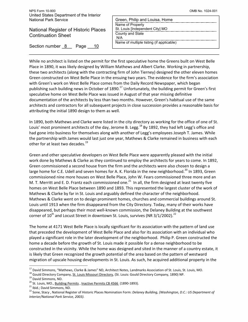
While no architect is listed on the permit for the first speculative home the Greens built on West Belle Place in 1890, it was likely designed by William Mathews and Albert Clarke. Working in partnership, these two architects (along with the contracting firm of John Tierney) designed the other eleven homes Green constructed on West Belle Place in the ensuing two years. The evidence for the firm’s association with Green’s work on West Belle Place comes from the Daily Record Newspaper, which began publishing such building news in October of 1890.17
Unfortunately, the building permit for Green’s first speculative home on West Belle Place was issued in August of that year missing definitive documentation of the architects by less than two months. However, Green’s habitual use of the same architects and contractors for all subsequent projects in close succession provides a reasonable basis for attributing the initial 1890 design to them as well. In 1890, both Mathews and Clarke were listed in the city directory as working for the office of one of St. Louis’ most prominent architects of the day, Jerome B. Legg.
18 By 1892, they had left Legg’s office and
had gone into business for themselves along with another of Legg’s employees Joseph T. James. While the partnership with James would last just one year, Mathews & Clarke remained in business with each other for at least two decades.19 Green and other speculative developers on West Belle Place were apparently pleased with the initial work done by Mathews & Clarke as they continued to employ the architects for years to come. In 1892, Green commissioned a second house from the firm and the architects were also chosen to design a large home for C.E. Udell and seven homes for A. K. Florida in the new neighborhood.20 In 1893, Green commissioned nine more houses on West Belle Place, John W. Fears commissioned three more and an M. T. Merritt and E. D. Frantz each commissioned one.21 In all, the firm designed at least twenty five homes on West Belle Place between 1890 and 1893. This represented the largest cluster of the work of Mathews & Clarke by far in St. Louis and arguably defined the character of the neighborhood. Mathews & Clarke went on to design prominent homes, churches and commercial buildings around St. Louis until 1913 when the firm disappeared from the City Directory. Today, many of their works have disappeared, but perhaps their most well-known commission, the Delaney Building at the southwest corner of 10th and Locust Street in downtown St. Louis, survives (NR 3/1/2002).22 The home at 4171 West Belle Place is locally significant for its association with the pattern of land use that preceded the development of West Belle Place and also for its association with an individual who played a significant role in the later development of the neighborhood. Philip P. Green constructed the home a decade before the growth of St. Louis made it possible for a dense neighborhood to be constructed in the vicinity. While the home was designed and sited in the manner of a country estate, it is likely that Green recognized the growth potential of the area based on the pattern of westward migration of upscale housing developments in St. Louis. As such, he acquired additional property in the 17
David Simmons, “Mathews, Clarke & James” ND, Architect Notes, Landmarks Association of St. Louis, St. Louis, MO. 18
Gould Directory Company, St. Louis Missouri Directory, (St. Louis: Gould Directory Company, 1890) NP. 19
David Simmons, ND. 20
St. Louis, MO., Building Permits , Inactive Permits CB 4566 (1890-1893). 21
Ibid.; David Simmons, ND. 22
Sone, Stacy , National Register of Historic Places Nomination Form: Delaney Building, (Washington, D.C.: US Department of Interior/National Park Service, 2003).

NPS Form 10-900 OMB No. 1024-001 United States Department of the Interior National Park Service
National Register of Historic Places Continuation Sheet Section number 8 Page 11
Green, Philip and Louisa, Home Name of Property St. Louis [Independent City] MO County and State N/A Name of multiple listing (if applicable)
vicinity of his home and eventually constructed twelve speculative homes on the land. Finally, it was likely the Green family who first employed architects Mathews & Clarke to design a home on West Belle in 1890 and certainly employed them for at least eleven other commissions. Other developers would take their cue from the Green’s choice of architects resulting in at least twenty five commissions for the firm along West Belle Place between 1890 and 1893.23
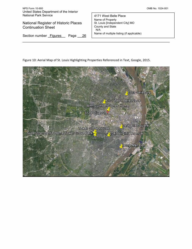
Architecture The Green home is an unusual Italianate survival in St. Louis. While high-style Italianate country homes had been in vogue in the 1850s and 1860s on the fringes of the City, and the Italianate influence could certainly be seen in prestigious townhouse districts as well, by the 1880s, Italianate had lost ground in fashionable neighborhoods to other styles. Decades of intensive architectural survey work conducted by Landmarks Association in St. Louis’ historic neighborhoods indicate that very few clear-cut, high-style Italianate homes survive anywhere in the City although notable examples exist in both country house and townhouse form. In all of St. Louis, there are probably fewer than ten surviving examples of how the Italianate style was employed for upscale houses in rural or semi-rural contexts (Figure 10). Five examples of such homes (Figures 1-5) provide a cross section of these rare property types and illustrate the company 4171 West Belle Place keeps. Moving from the upper end of the economic and design spectrum toward the lower end, one can begin with two houses constructed at the behest of philanthropist Henry Shaw in south St. Louis. Shaw’s Tower Grove House (1849, George I. Barnett) as well as the home that he commissioned for the keeper of Tower Grove Park (1869, Francis Tunica[attributed to Francis Tunica]) are unequivocal invocations of Italianate ideals and together implement many of its stylistic tropes including narrow hooded windows, a row of attic lights under projecting eaves, angled bay windows and balustrades on components of rooflines (Figures 1-2). Sparing no expense, Shaw even opted to equip these homes with towers featuring both round arch and portal windows. While an unmistakable hallmark of the Italianate style, it should be noted that towers are only present on an estimated 15 percent of Italianate homes in the United States.24 The home that is today known as the Lemp Mansion after the famous St. Louis Brewing Family is another surviving example of how the Italianate style was interpreted in a somewhat more common form (tower-less), although also for wealthy residents in a semi-rural context (Figure 3). Constructed in 1868 for Jacob Feickert, the building became the home of Feickert’s daughter Julia and her husband the brewing magnate William J. Lemp in the 1870s.25 The home features rectangular attic lights between its corbelled cornice and projecting eaves, projecting octagonal bay windows, a low hipped roof and a symmetrical façade.
23
David Simmons, ND. 24
Virginia and Lee McAlester, A Field Guide to North American Houses. (New York: Alfred A. Knopf & Co, 1984) 211. 25
Mary M. Stiritz, National Register of Historic Places Nomination Form: Benton Park Historic District, (Washington, D.C.: US Department of Interior/National Park Service, 1985), Section 8, P.3.

NPS Form 10-900 OMB No. 1024-001 United States Department of the Interior National Park Service
National Register of Historic Places Continuation Sheet Section number 8 Page 12
Green, Philip and Louisa, Home Name of Property St. Louis [Independent City] MO County and State N/A Name of multiple listing (if applicable)
A more modest example of surviving Italianate architecture can be found on the north side of St. Louis at 2223 Salisbury Street (Figure 4). Purchased by William O. Shands in 1851 and modified into its current form in 1857, the home has a deep setback on its lot which, in St. Louis, is frequently indicative of a home that predates the growth of the later, more urban neighborhood.26
Indeed, these deep setbacks frequently contributed to the perceived obsolescence of the early country homes as they were difficult to assimilate into the regular, rigid lot grids of later subdivisions. Essentially an Italianate brick “I-house” this property is reminiscent of homes that can be found across the state as the centerpieces of prosperous, mid 19
th century farms. The center hall building features ornate cast iron pedimented
window hoods, a pedimented entry porch that forms a second floor balcony, corbelled cornice and has a low hipped roof capped by a central “widow’s walk.” Perhaps the most modest example of a surviving Italianate influenced country home in St. Louis can be found at 2347 Virginia Avenue in the city’s Tower Grove East Historic District (NR 3/27/2013), which was constructed as a rural summer retreat by Andrew and Laura Scott Einstmann c. 1869 (Figure 5).27 Einstmann was a commission merchant and a member of the city’s upper middle class. The home that he and his wife Laura constructed amidst the farms and estates on Compton Hill speaks to their aspirations to join the ranks of St. Louis’ wealthy elite, although the scale and sophistication of the design indicate that the Einstmann’s were somewhat constrained by their means. The home features a cross-gable plan with a simple corbelled cornice that wraps the entire roofline. An octagonal bay projects from the transept gable and window openings are a mix of round and segmental arches. While these buildings (when constructed) represented the Italianate ideal of the picturesque home in a country setting, all had been absorbed into dense urban landscapes by the early 20th century, and many others like them had been destroyed as development pressure rose across the city. While intended to be a style for country houses, St. Louisans also adapted the Italianate style for more urban environments. For example, Lucas Place (laid out c.1850 between 13th Street and 16th Street along today’s Locust Street) was a wealthy enclave that contained many grand Italianate or Italianate-influenced homes in a neighborhood setting. Unfortunately, by the 1920s, St. Louis’ bustling central business district had expanded into the neighborhood and by 1937 only one home remained (The Robert G. Campbell House, 1508 Locust St. (NR 4/21/1977).28 One surviving neighborhood containing a number of ornate Italianate townhomes is Lafayette Square on the city’s south side.29 While the dominant character of the neighborhood is arguably Second Empire mansard, a handful of homes dating to the decades surrounding the Civil War reflect Italianate ideals. Constructed on deep, narrow lots in what was at the time a neighborhood that was intentionally
26
Norbury Wayman, History of St. Louis Neighborhoods: Hyde Park. (St. Louis: St. Louis Community Development Agency, 1978) np. 27
Andrew Weil, National Register of Historic Places Nomination Form: Tower Grove East Historic District, (Washington, D.C.: US Department of Interior/National Park Service, 2013). 28
Nancy B. Breme, National Register of Historic Places Nomination Form: Robert and Virginia Campbell House, (Washington, D.C.:US Department of the Interior/National Park Service, 1977). 29
Norbury Wayman, History of St. Louis Neighborhoods, Lafayette Square .(St. Louis: St. Louis Community Development Agency, 1978) 6.

NPS Form 10-900 OMB No. 1024-001 United States Department of the Interior National Park Service
National Register of Historic Places Continuation Sheet Section number 8 Page 13
Green, Philip and Louisa, Home Name of Property St. Louis [Independent City] MO County and State N/A Name of multiple listing (if applicable)
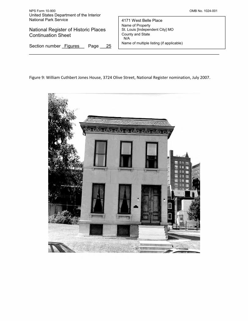
placed far from the city’s center, Lafayette Square represents the city’s best surviving collection of Italianate buildings that were constructed in a neighborhood, rather than a rural context. These homes tend to be narrow and vertical, because of the dimensions of city lots, and also may be attached in rows (Figure 6). Italianate influence in St. Louis also occasionally survives in the form of more modest, middle class townhomes. Usually designed as attached rows, or for narrow city lots with close neighbors, these homes demonstrate an application of Italianate ornament to forms that were built for dense city living. A good example survives at 1227 Sullivan in Old North St. Louis, which features a wide projecting bracketed cornice and projecting cast iron hood molds above the windows. Another surviving townhouse example is the William Cuthbert Jones House (1887, Jerome Bibb Legg) (NR 02/07/2007), which somehow managed to weather the storm of neighborhood clearance that swept the surrounding Midtown neighborhoods in the second half of the 20th century (Figure 8).
30 Interestingly, this home was
constructed several years after 4171 West Belle Place, indicating that the Greens were not alone in their enduring affinity for an aging style. Despite these examples, high-style Italianate architecture in St. Louis City is rare, and examples of rural expressions of the style are even rarer. In part this can be attributed to immense development pressure that consumed formerly rural lands as the city boomed in the late 19th and early 20th centuries. Another force that contributed to the elimination of Italianate influenced buildings in St. Louis were the urban renewal plans of the mid 20th century that demolished wide swathes of the city’s middle and upper-class housing stock that dated to the period when the style was most popular. Neighborhoods like Mill Creek, French Town and the Chestnut Valley which were constructed by middle and upper-middle class residents in the decades surrounding the Civil War contained high concentrations of Italianate-influenced homes, but were destroyed by “slum clearance” initiatives in the 1950s. When compared with other examples of Italianate buildings in St. Louis, the home is unique. It is far less formal than the designs executed for Henry Shaw (Figures 1-2)or the Lemp Mansion (Figure 3), and much more elaborate than other rural examples like Einstmann House (Figure 5), or extant urban townhouses such as the William Cuthbert Jones House (Figure 9). The home’s elaborate cornice and use of heavy projecting hood molds and quoins, its multiple projecting octagonal bays and alternating use of both segmental and round arch window openings set the Philip and Louisa Green home apart as a high quality and unusual expression of the Italianate style in St. Louis. The Philip and Louisa Green Home at 4171 West Belle Place is an exceptionally rare example of an Italianate country home in St. Louis. Constructed c. 1882 in a largely rural environment at the fringe of the City the home was eventually incorporated into a dense urban neighborhood as development pressure pushed westward. While the Green home managed to survive, the rapid growth of the city’s neighborhoods resulted in the destruction of many other early examples of the rural settlement pattern that once dominated the landscape at the edge of the urban core.
30
Michael Allen, National Register of Historic Places Nomination Form: William Cuthbert Jones house (Washington, D.C.:US Department of the Interior/National Park Service, 2007).

NPS Form 10-900 OMB No. 1024-001 United States Department of the Interior National Park Service
National Register of Historic Places Continuation Sheet Section number 9 Page 14
4171 West Belle Place Name of Property St. Louis [Independent City] MO County and State N/A Name of multiple listing (if applicable)
Bibliography Allen, Michael R. National Register of Historic Places Nomination Form: William Cuthbert Jones House. Washington, D.C.: US Department of Interior/National Park Service, 2007.
Breme, Betsy B. National Register of Historic Places Nomination Form: Robert and Virginia Campbell House. Washington, D.C.: US Department of Interior/National Park Service, 1977. Compton, Richard J. and Camille N. Dry. Pictorial St. Louis, the Great Metropolis of the Mississippi Valley. St. Louis: Compton & Company, 1876. Gould Directory Company, St. Louis Missouri Directory. St. Louis: Gould Directory Company, 1890. Hopkins, G.M. Atlas of St. Louis City, Missouri. Philadelphia: G.M. Hopkins & Company, 1883. Landmarks Association of St. Louis. Architectural Survey: Delmar-Sarah-Page-Taylor. On file City of St. Louis Community Development Administration, 2003. np. City Block 4566. McAlester, Virginia and Lee. A Field Guide to North American Houses. New York: Alfred A. Knopf & Co, 1984. “Philip P. Green the Real Estate Man,” St. Louis Republic, 9 July 1902. Primm, James Neal. Lion of the Valley, St. Louis, Missouri, 1764-1980. St. Louis: Missouri Historical Society Press, 1981. Scharf, John Thomas. History of St. Louis City and County, vol 1. Philadelphia: Louis H. Everts & Co., 1883. Sone, Stacy. National Register of Historic Places Nomination Form: Delaney Building, (Washington, D.C.: US Department of Interior/National Park Service, 2003). Stiritz, Mary M. National Register of Historic Places Nomination Form: Benton Park Historic District, (Washington, D.C.: US Department of Interior/National Park Service, 1985), Section 8, P.3. St. Louis, MO., Building Permits , Inactive Permits CB 4566 (1890-1893). St. Louis, MO. Landmarks Association of St. Louis. Architect Files. David Simmons, “Mathews, Clarke & James” ND. St. Louis, MO., Ordinance 16001,Municipal Code (1891).

NPS Form 10-900 OMB No. 1024-001 United States Department of the Interior National Park Service
National Register of Historic Places Continuation Sheet Section number 9 Page 15
4171 West Belle Place Name of Property St. Louis [Independent City] MO County and State N/A Name of multiple listing (if applicable)
St. Louis, MO., St. Louis City Hall, Recorder of Deeds, Book 58 (1880). St. Louis, MO., St. Louis City Hall, Recorder of Deeds, Book C. Bequette Tract (1977). St. Louis, MO., St. Louis City Hall, Recorder of Deeds, Book 244. Bequette Tract (1859). Wayman, Norbury. History of St. Louis Neighborhoods, Lafayette Square .St. Louis: St. Louis Community Development Agency, 1978. Wayman, Norbury. History of St. Louis Neighborhoods, Grand Prairie. St. Louis: St. Louis Community Development Agency, 1978. Wayman, Norbury. History of St. Louis Neighborhoods, Hyde Park. St. Louis: St. Louis Community Development Agency, 1978).
Weil, Andrew B. National Register of Historic Places Nomination Form: Tower Grove East Historic District. Washington, D.C.: US Department of Interior/National Park Service, 2013.

NPS Form 10-900 OMB No. 1024-001 United States Department of the Interior National Park Service
National Register of Historic Places Continuation Sheet Section number 10 Page 16
4171 West Belle Place Name of Property St. Louis [Independent City], MO County and State N/A Name of multiple listing (if applicable)
Verbal Boundary Description: The boundary of the nominated resource is the same as that of Lot Part 31 of Bequette’s Addition measuring 56x147 feet, 6 inches in city block 4566. The address of this parcel is 4171 West Belle Place, St. Louis (Independent City) Missouri, 63113. Boundary Justification: The boundary of the nominated resource is its property line, which represents the remaining portion of the Green family’s real estate holdings on what is today West Belle Place that can be directly associated with their home.
Nominated Parcel Boundary

NPS Form 10-900 OMB No. 1024-001 United States Department of the Interior National Park Service
National Register of Historic Places Continuation Sheet Section number Figures Page 17
4171 West Belle Place Name of Property St. Louis [Independent City] MO County and State N/A Name of multiple listing (if applicable)
Figure 1: Tower Grove House, Grounds of Missouri Botanical Garden, St. Louis City File Photo (No Date).

NPS Form 10-900 OMB No. 1024-001 United States Department of the Interior National Park Service
National Register of Historic Places Continuation Sheet Section number Figures Page 18
4171 West Belle Place Name of Property St. Louis [Independent City] MO County and State N/A Name of multiple listing (if applicable)
Figure 2: Superintendant’s Home, Tower Grove Park (Park Grounds). Photo courtesy of Chris Naffziger, 2015.

NPS Form 10-900 OMB No. 1024-001 United States Department of the Interior National Park Service
National Register of Historic Places Continuation Sheet Section number Figures Page 19
4171 West Belle Place Name of Property St. Louis [Independent City] MO County and State N/A Name of multiple listing (if applicable)
Figure 3: Lemp Mansion, 3322 DeMenil Place, Landmarks Files, 1985.

NPS Form 10-900 OMB No. 1024-001 United States Department of the Interior National Park Service
National Register of Historic Places Continuation Sheet Section number Figures Page 20
4171 West Belle Place Name of Property St. Louis [Independent City] MO County and State N/A Name of multiple listing (if applicable)
Figure 4: William O. Shands Home, 2223 Salisbury Avenue, Landmarks Files (No Date).

NPS Form 10-900 OMB No. 1024-001 United States Department of the Interior National Park Service
National Register of Historic Places Continuation Sheet Section number Figures Page 21
4171 West Belle Place Name of Property St. Louis [Independent City] MO County and State N/A Name of multiple listing (if applicable)
Figure 5: Andrew and Laura Einstmann Home, 4612 Virginia Avenue, Landmarks’ Files, November 2007.

NPS Form 10-900 OMB No. 1024-001 United States Department of the Interior National Park Service
National Register of Historic Places Continuation Sheet Section number Figures Page 22
4171 West Belle Place Name of Property St. Louis [Independent City] MO County and State N/A Name of multiple listing (if applicable)
Figure 6: Lafayette Square Italianate Townhome, Landmarks’ files (No Date).

NPS Form 10-900 OMB No. 1024-001 United States Department of the Interior National Park Service
National Register of Historic Places Continuation Sheet Section number Figures Page 23
4171 West Belle Place Name of Property St. Louis [Independent City] MO County and State N/A Name of multiple listing (if applicable)
Figure 7: Photo Location Map.

NPS Form 10-900 OMB No. 1024-001 United States Department of the Interior National Park Service
National Register of Historic Places Continuation Sheet Section number Figures Page 24
4171 West Belle Place Name of Property St. Louis [Independent City] MO County and State N/A Name of multiple listing (if applicable)
Figure 8: Hopkins Atlas, 1883. Arrow points to Philip and Louisa Green Home.
NPS Form 10-900 OMB No. 1024-001 United States Department of the Interior National Park Service
National Register of Historic Places Continuation Sheet Section number Figures Page 25
4171 West Belle Place Name of Property St. Louis [Independent City] MO County and State N/A Name of multiple listing (if applicable)
Figure 9: William Cuthbert Jones House, 3724 Olive Street, National Register nomination, July 2007.
NPS Form 10-900 OMB No. 1024-001 United States Department of the Interior National Park Service
National Register of Historic Places Continuation Sheet Section number Figures Page 26
4171 West Belle Place Name of Property St. Louis [Independent City] MO County and State N/A Name of multiple listing (if applicable)
Figure 10: Aerial Map of St. Louis Highlighting Properties Referenced in Text, Google, 2015.
NPS Form 10-900 OMB No. 1024-001 United States Department of the Interior National Park Service
National Register of Historic Places Continuation Sheet Section number Figures Page 27
4171 West Belle Place Name of Property St. Louis [Independent City] MO County and State N/A Name of multiple listing (if applicable)
Figure 11: Map of St. Louis Neighborhoods—Arrow Indicates Vandeventer Neighborhood St. Louis Planning and Urban Design Agency. No Date.