Embed Size (px)
Citation preview

UNIT 1 :: MAPS :: OVERVIEW8
UNIT 1 MAPS
INTRODUCTION TO THE UNIT
This unit introduces Owney using the themes of geography and map skills. His well-documented journeys and resources provide a foundation for different
projects in which students learn about maps. This interdisciplinary unit supports second grade teaching
and encompasses the areas of language arts, science and social studies, with opportunities for artistic and technological enrichment. Students will be assessed during and at the end of the unit
through worksheets, modeling, and art project.
MAPS :: LESSONS1 students will use Owney’s map to learn the basic parts
of a map and understand the importance of maps.
2 students will interact directly with Owney’s interactive map and understand how maps are tools to learn
about the United States.
3 students will recreate a model of a land or water form for an area that Owney visited. Students will extend this
lesson by writing about how the topography of the area affects travel and life in the area.
UNIT 1 :: MAPS
HERE, THERE, AND EVERYWHERE Mapping Lessons through Owney the Postal Dog

UNIT 1 :: MAPS :: OVERVIEW 9
ESSENTIAL QUESTIONS1. What do we use maps for and what are the parts of a
map?
2. How do maps help us learn about the world around us?
3. What are similarities and differences between parts of the United States?
4. What are some important landmarks in different parts of the United States?
Supporting Standards of Learning are available at: http://www.postalmuseum.si.edu/owneycurriculum/Owney_SOLs.pdf
DID YOU KNOW!
Newspaper articles often praised Owney as
an independent traveler, but he was often
accompanied by a clerk who picked his
destinations.
TEACHER RESOURCES• Mapping Penny’s World
by Loreen Leedy
• Tales from the Rails e-Book by Jerry Rees and Stephen Michael Schwartz
• Owney’s Interactive Map found at http://www.postalmuseum.si.edu/owney/#map
4 students will create a collage of a U.S. location that Owney visited. Students must research this place to find
important landmarks to include in their collage.
5 students will compare and contrast two places in the U.S. based on information gathered and presented by
classmates.

LESSON DURATION
UNIT 1 :: MAPS
LESSON 1 :: READING A MAPLesson Duration: 45 minutes
ObjectiveStudents will be able to identify key parts of a map, in-cluding compass rose, map key, scale, and symbols.
Key points• Maps have key parts that help us understand what
we are looking at
• Definitions and uses for the compass rose, map key, map scale, and symbols
Assessment• Students will complete a worksheet defining key
parts of a map.
• Students will mark up a map identifying key parts.
UNIT 1 :: MAPS :: LESSON 110
•

Closing •Tell students that they will begin a unit exploring maps of the United States by studying the route taken by Owney the postal dog. Use a SmartBoard or com-puter to introduce Owney’s interactive map.
Materials• Mapping Penny’s
World by Leedy
• Chart paper
• markers
• “Map Parts“ worksheet http://www.postalmu-seum.si.edu/owneyc-urriculum/worksheets.html
• local map (hard copy and/or online)
• electronic whiteboard or computers with internet access
• KWL chart http://www.postalmu-seum.si.edu/owneyc-urriculum/worksheets.html
Guided Practice •• KWL chart: How do we use maps? Who do you know
who uses maps? What maps do they use?
• Explain how we use maps to help us find places, show us directions to go somewhere, show us what is around us, or help us learn more about a place. Have students pair/share about map uses.
• Show a local map. Have students locate important places on it. Demonstrate how to find these places using key parts of the map. Show how to use the map scale to find out how far these places are from each other. Show how the compass rose shows which direction to travel to find these places.
• Show the same place on an online satellite map for comparison.
• Create symbols on the map for the locations chosen above. Add symbols to a “map key” for city map.
Independent Practice •Have students work independently or with partners to com-plete worksheet defining and identifying map parts. Students must label a map of the classroom (compass rose, map scale, map key, symbols).
Differentiation: The “Map Parts” worksheet can be modi-fied to support different learners by adding a word bank. Another modification could be to provide the definitions and map features and ask the student to match the definition to the map feature.
Opening •Read Aloud: Mapping Penny’s World. Ask comprehen-sion questions relating to key points.
UNIT 1 :: MAPS :: LESSON 1 11

LESSON DURATION
UNIT 1 :: MAPS
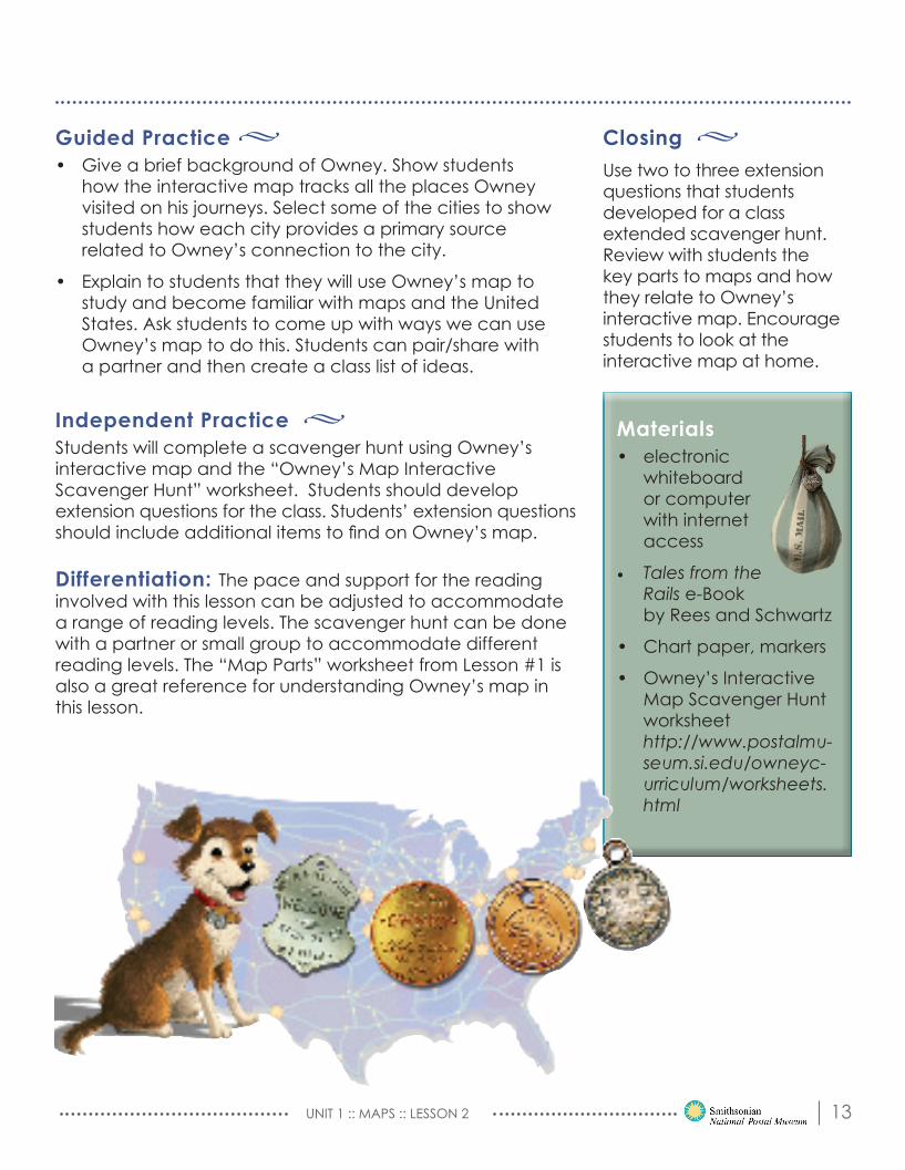
LESSON 2 :: THE SINGING MAPLesson Duration: 45 minutes
ObjectiveStudents will be able to list five different things they can find on Owney’s interactive map. Students will demonstrate mastery of using maps by using map tools and finding locations from Owney’s journeys. Key points• The map shows the locations Owney visited across
the United States.
• Each location can be selected and a primary source from that location will show more information.
• We can learn about a place from primary sources.
AssessmentStudents will complete a scavenger hunt of Owney’s interactive map.
Opening •Show students Owney’s interactive map. Play song from the end of Owney’s e-Book. Show students how each location mentioned in the song is located on the map of Owney’s travel. Have students interact with the electronic whiteboard to find all the locations mentioned in the song.
UNIT 1 :: MAPS :: LESSON 212
•
Closing •Use two to three extension questions that students developed for a class extended scavenger hunt. Review with students the key parts to maps and how they relate to Owney’s interactive map. Encourage students to look at the interactive map at home.
Materials• electronic
whiteboard or computer with internet access
• Tales from the Rails e-Book by Rees and Schwartz
• Chart paper, markers
• Owney’s Interactive Map Scavenger Hunt worksheet http://www.postalmu-seum.si.edu/owneyc-urriculum/worksheets.html
Guided Practice •• Give a brief background of Owney. Show students
how the interactive map tracks all the places Owney visited on his journeys. Select some of the cities to show students how each city provides a primary source related to Owney’s connection to the city.
• Explain to students that they will use Owney’s map to study and become familiar with maps and the United States. Ask students to come up with ways we can use Owney’s map to do this. Students can pair/share with a partner and then create a class list of ideas.
Independent Practice •Students will complete a scavenger hunt using Owney’s interactive map and the “Owney’s Map Interactive Scavenger Hunt” worksheet. Students should develop extension questions for the class. Students’ extension questions should include additional items to find on Owney’s map.
Differentiation: The pace and support for the reading involved with this lesson can be adjusted to accommodate a range of reading levels. The scavenger hunt can be done with a partner or small group to accommodate different reading levels. The “Map Parts” worksheet from Lesson #1 is also a great reference for understanding Owney’s map in this lesson.
UNIT 1 :: MAPS :: LESSON 2 13

LESSON DURATION
UNIT 1 :: MAPS
LESSON 3 :: WHERE WATER MEETS THE LANDLesson Duration: Three 25 minute lessons to introduce and give time for model creation
ObjectiveStudents will be able to create a model of a particular kind of land/water form for a U.S. city/area that Owney has visited. Students can extend this lesson by writing about how the topography of the area affects travel and life in the area. Key points• There are different land and water forms we can find
in the U.S.
• Different land and water forms affect travel and life in an area.
AssessmentStudent will create a model showing topography of one U.S. location meeting requirements of the rubric.
Opening •Show students videos or pictures of regional topography.
UNIT 1 :: MAPS :: LESSON 314
•

Closing •Students present completed models to their classmates, explaining the area they selected and the topogra-phy in that area. This project can be framed as what Owney saw out the train window while going through that part of the country.
Materials• Computer
with internet access
• Pictures of various land and water forms (found in the U.S.)
• T-chart http://www.postalmuseum.si.edu/owneycurriculum/worksheets.html
• US Topography Model Rubric http://www.postalmuseum.si.edu/owneycurriculum/Owney_Lessons_Ru-bric.pdf
Guided Practice •• Explain that there are different land and water forms.
Use pictures to show students what various land and water forms look like.
• Have students complete a T-chart with characteristics of land and water forms.
Independent Practice •Have students create a model of one area of the U.S. high-lighting at least one landform and one water form found in that area. Models can be made using any classroom resources (such as clay, popsicle sticks, cotton balls, paper, etc.)
Differentiation: Provide support to students when they are completing the chart. This can be accomplished by giving the students a chart that has some of the information already provided. Give the students a checklist or the model rubric in grade appropriate language to guide them in the construc-tion and ensure they include all the required elements.
UNIT 1 :: MAPS :: LESSON 3 15

LESSON DURATION
UNIT 1 :: MAPS
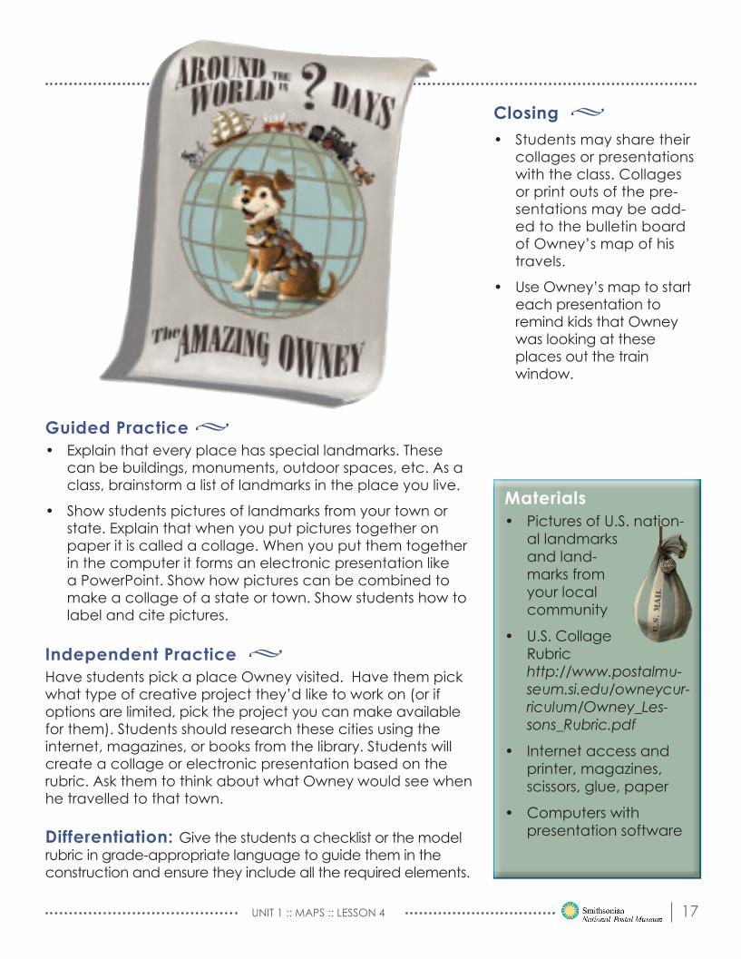
LESSON 4 :: OWNEY’S VIEWLesson Duration: Three 30 minutes lessons to introduce and give times for collage creation. Please note, this project aligns closely with Jobs, Lesson 4 (p. 28)
ObjectiveStudents will create a project to illustrate a U.S. state or city that Owney has visited. Students must research this place to find important landmarks to include in their final project. Suggested projects can be a paper collage or electronic presentation. Key pointsNationally-important landmarks are important places in a state or city.
AssessmentStudents will complete a project illustrating a state or city meeting requirements of the rubric.
Opening •Show students pictures of U.S. landmarks. Help students identify landmarks by name and location. If necessary, explain that a landmark is a building, artwork, or other structure that is important due to its historical signifi-cance or how it looks. Some landmarks are officially listed as landmarks while others are simply recognizable by many people.
UNIT 1 :: MAPS :: LESSON 416
•
Closing •• Students may share their
collages or presentations with the class. Collages or print outs of the pre-sentations may be add-ed to the bulletin board of Owney’s map of his travels.
• Use Owney’s map to start each presentation to remind kids that Owney was looking at these places out the train window.
Materials• Pictures of U.S. nation-
al landmarks and land-marks from your local community
• U.S. Collage Rubric http://www.postalmu-seum.si.edu/owneycur-riculum/Owney_Les-sons_Rubric.pdf
• Internet access and printer, magazines, scissors, glue, paper
• Computers with presentation software
Guided Practice •• Explain that every place has special landmarks. These
can be buildings, monuments, outdoor spaces, etc. As a class, brainstorm a list of landmarks in the place you live.
• Show students pictures of landmarks from your town or state. Explain that when you put pictures together on paper it is called a collage. When you put them together in the computer it forms an electronic presentation like a PowerPoint. Show how pictures can be combined to make a collage of a state or town. Show students how to label and cite pictures.
Independent Practice •Have students pick a place Owney visited. Have them pick what type of creative project they’d like to work on (or if options are limited, pick the project you can make available for them). Students should research these cities using the internet, magazines, or books from the library. Students will create a collage or electronic presentation based on the rubric. Ask them to think about what Owney would see when he travelled to that town.
Differentiation: Give the students a checklist or the model rubric in grade-appropriate language to guide them in the construction and ensure they include all the required elements.
UNIT 1 :: MAPS :: LESSON 4 17
LESSON DURATION
UNIT 1 :: MAPS
LESSON 5 :: SOUNDS OF THE CITY/ SOUNDS OF THE COUNTRYLesson Duration: 30 minutes
ObjectiveStudents will be able to compare and contrast two U.S. places based on information gathered by classmates.
Key points• Places in the United States have similarities and
differences.
• We compare places to help us learn more about the world we live in.
AssessmentStudents will complete a Venn Diagram comparing two U.S. places that Owney has visited.
Opening •Play sounds of a place (city or rural) and have students identify what is making the sound. Have students provide suggestions as to when, where, and why you might hear that sound in a certain place. Many web-sites (try “Partners in Rhyme”) offer free sound effects.
UNIT 1 :: MAPS :: LESSON 518
•

Closing •Have students share their Venn Diagrams with a class-mate. Find similarities and differences with their peers.
Materials• Computer with inter-
net access
• Free sound effects can be found at www.part-nersinrhyme.com
• Venn Dia-gram worksheet http://www.postalmu-seum.si.edu/owneyc-urriculum/worksheets.html
• Online Owney Map http://www.post-almuseum.si.edu/owney/#map
Guided Practice •• Explain to students that we hear different sounds in
different places because of things we may find there. Compare some of the sounds (loud vs quiet, outside vs inside).
• Review how to use a Venn Diagram to compare two things.
• Choose two places that Owney has visited (Suggested: a town from the state you live in and Albany, New York, the town Owney is from). Model for students how to complete a Venn Diagram comparing two places.
Independent Practice •• Students will choose two places to compare and contrast
on a Venn Diagram.
• Encourage students to include sounds that might be heard in the two places.
Differentiation: Modify the Venn diagram by labeling the sections. Help thestudents pick a city to compare with their city based on the available information at their reading level.
UNIT 1 :: MAPS :: LESSON 5 19