Embed Size (px)
Citation preview
UNCLASSIFIED
MDP Software UpdateMDP Software UpdateH4.2 Improvements and
Added CapabilitiesH4.2 Improvements and
Added Capabilities
UNCLASSIFIED
OverviewOverview
• Addition of color display support (MFCD)• But TW-1 is not getting color until ~FY16
• CALT Option• HUD Changes/Additions• Steering Options• HSI, Waypoint, and Sequence Changes/Additions• Command Heading Marker• Advisories
2
UNCLASSIFIED
ADIADI
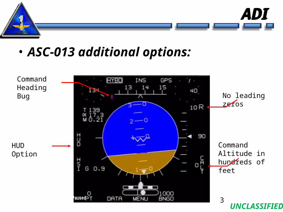
• ASC-013 additional options:
3
Command Heading Bug
HUD Option Command Altitude in hundreds of feet
No leading zeros

UNCLASSIFIED
CALT OptionCALT Option
• Commanded Altitude• Allows aircrew to enter an altitude via the
DEP in increments of 100 feet from 0 to 40,000 feet
• No connections to other systems / simply allows crew to display altitude assigned
• Displayed next to CALT option• Used like we use the HDG Bug right now for
altitudes4
UNCLASSIFIED
HUD ChangesHUD Changes
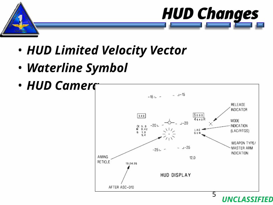
• HUD Limited Velocity Vector• Waterline Symbol• HUD Camera
5
UNCLASSIFIED
HUD WaterlineHUD Waterline
6
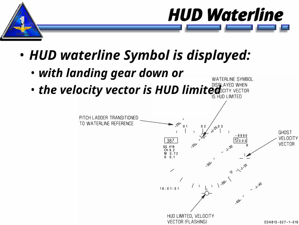
• HUD waterline Symbol is displayed:• with landing gear down or • the velocity vector is HUD limited
UNCLASSIFIED
HUD Limited VVHUD Limited VV
• Velocity Vector and Ghost Vector flash when HUD limited
• Pitch ladder is displayed relative to waterline • Velocity Vector becomes HUD Limited or• INS velocities are invalid • No flight path data is provided
• Pitch ladder slides from/to Velocity Vector to/from Waterline• Sliding transition takes 2 seconds• Waterline symbol is displayed with gear down or
HUD limited VV 7
UNCLASSIFIED
HUD RepeaterHUD Repeater
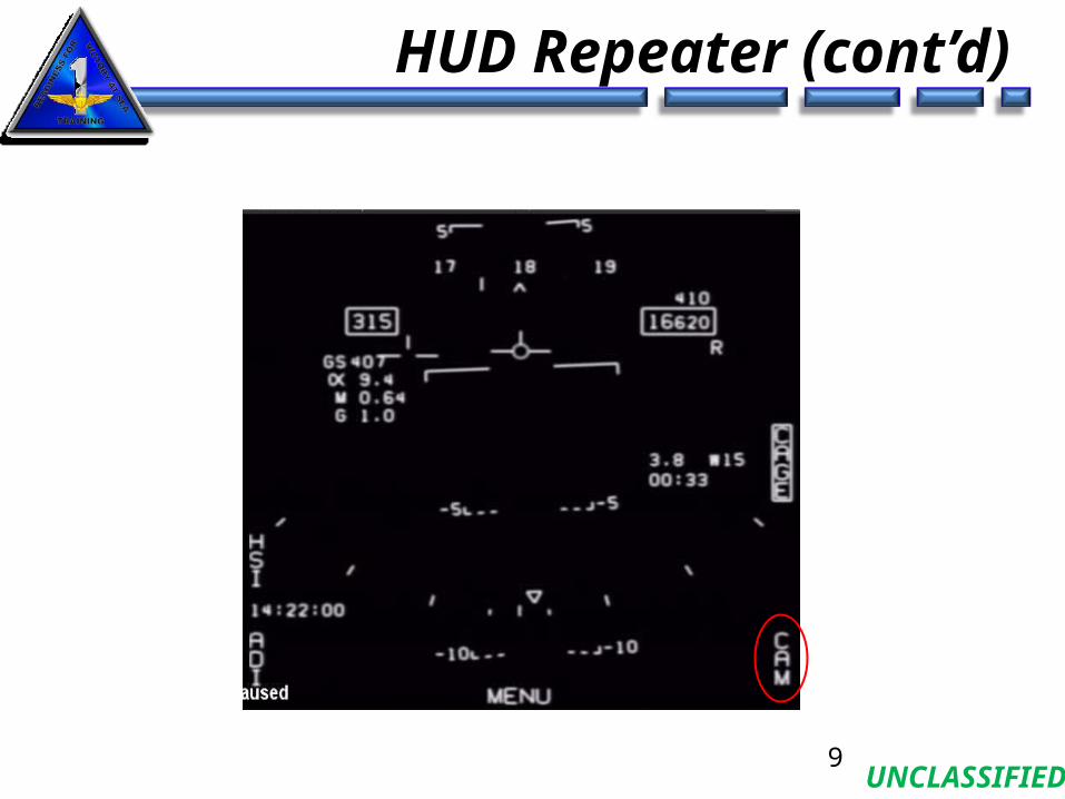
• “HUD” Option on ADI allows viewing raw HUD data directly on an MFD by selecting “HUD” on the ADI
• HUD video camera input on MFD can be “turned off” in order to view only HUD symbology and data by deselecting “CAM”
8
UNCLASSIFIED
HUD Repeater (cont’d)
9
UNCLASSIFIED
HSI ChangesHSI Changes
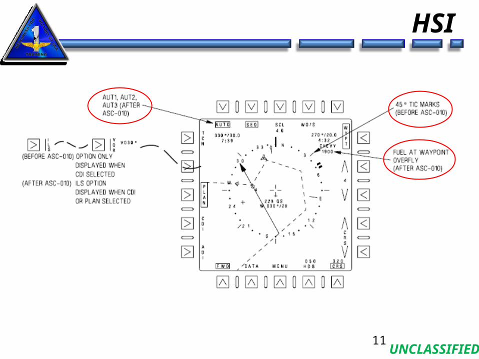
• HSI Symbology• 45 deg tics Removed, Mark Points, GREF
• Increased Waypoints (from 11 to 61)• Additional Lat/Long formats• Waypoint Offset PLAN/CDI Steering• Support for up to 3 Flight Plans / SEQs
• Sequential Waypoint Programming• AUT1, AUT2, AUT3 available
• Additional scale options on HSI• Fuel remaining at waypoint overfly• Command Heading Marker
10
UNCLASSIFIED
HSI
11
UNCLASSIFIED
HSI
12
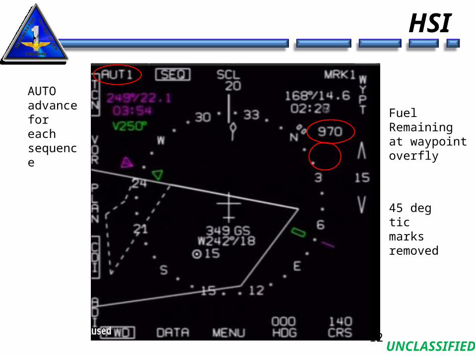
AUTO advance for each sequence
Fuel Remaining at waypoint overfly
45 deg tic marks removed
UNCLASSIFIED
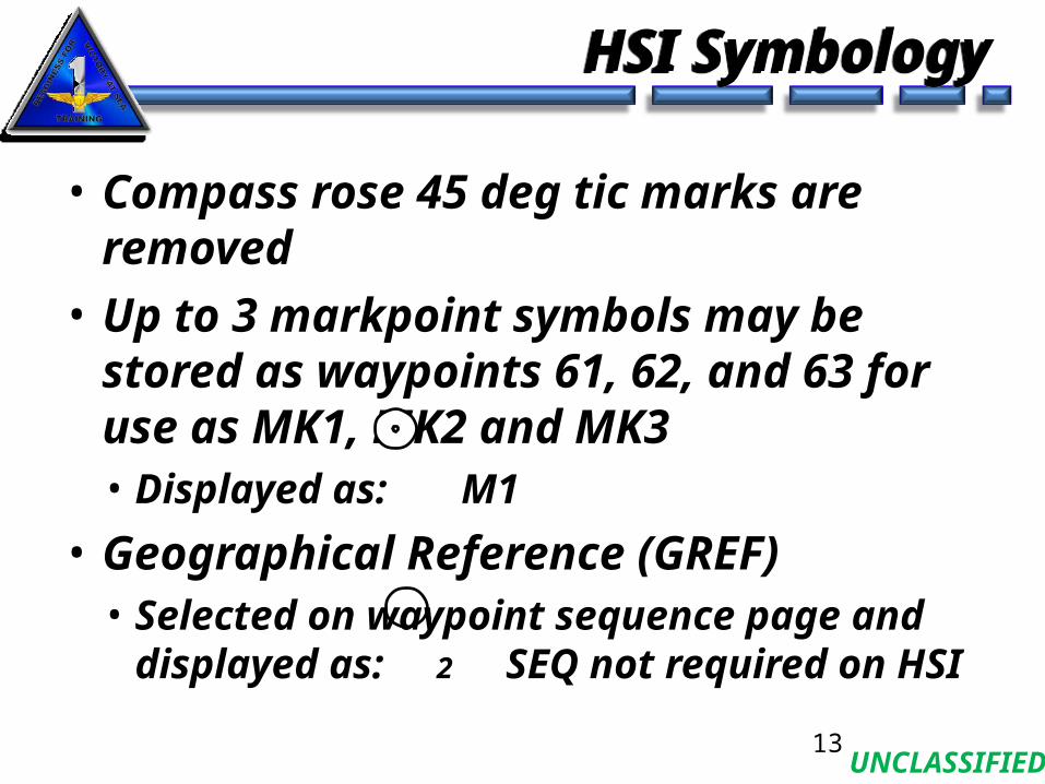
• Compass rose 45 deg tic marks are removed• Up to 3 markpoint symbols may be stored as
waypoints 61, 62, and 63 for use as MK1, MK2 and MK3• Displayed as: M1
• Geographical Reference (GREF)• Selected on waypoint sequence page and
displayed as: 2 SEQ not required on HSI
HSI SymbologyHSI Symbology
13

UNCLASSIFIED
Increased WaypointsIncreased Waypoints
• 61 Waypoints available (0-60)• Also, 3 Markpoints (as previously stated)
14
UNCLASSIFIED
Additional LAT/LONG FormatsAdditional LAT/LONG Formats
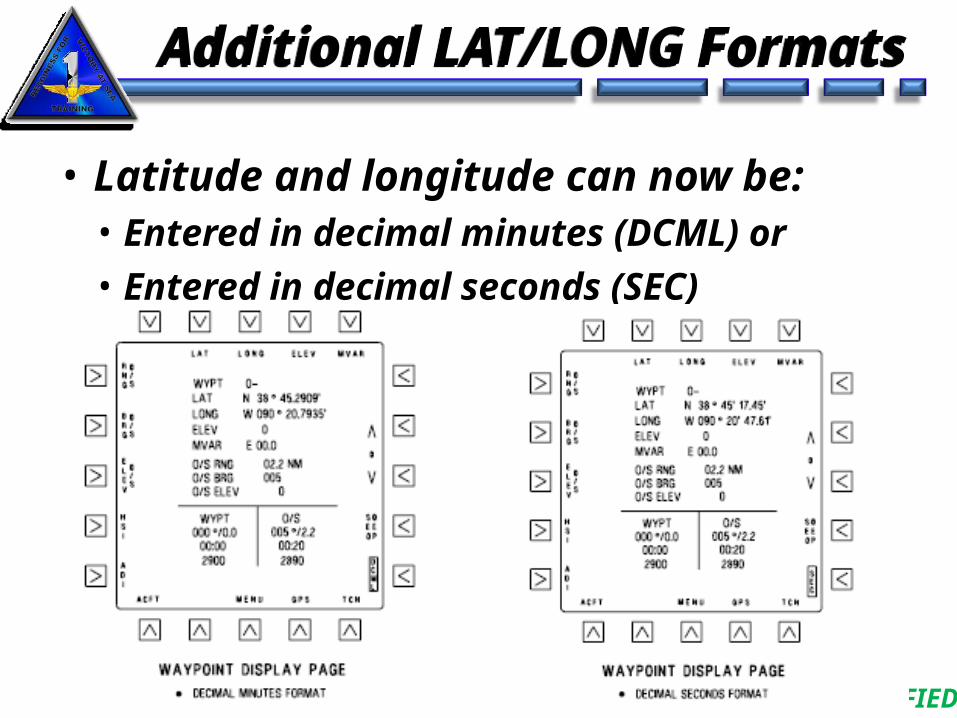
• Latitude and longitude can now be:• Entered in decimal minutes (DCML) or• Entered in decimal seconds (SEC)
15
UNCLASSIFIED
Waypoint Offset PLAN /CDI SteeringWaypoint Offset PLAN /CDI Steering
• Entered by selecting PLAN then WO/S• Course is entered using CRS option
• Command steering marker is displayed on the ADI and HUD
16
UNCLASSIFIED
TACAN Offset SteeringTACAN Offset Steering
• Similar to waypoint offset, but now to a TACAN station• Provides TACAN offset steering in either the PLAN or CDI
modes and displayed as a cross symbol on HSI• Select TACAN display page to enter offset information
• Select TCN option from waypoint, aircraft or GPS display pages
• Offset information includes:• TACAN station elevation• Offset range (RNG)• Offset bearing (BRG)• Elevation for offset location (ELEV)
• Offset information is retained and applied (when TO/S selected) for any TACAN station selected until offset information is changed
17
UNCLASSIFIED
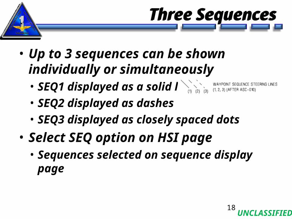
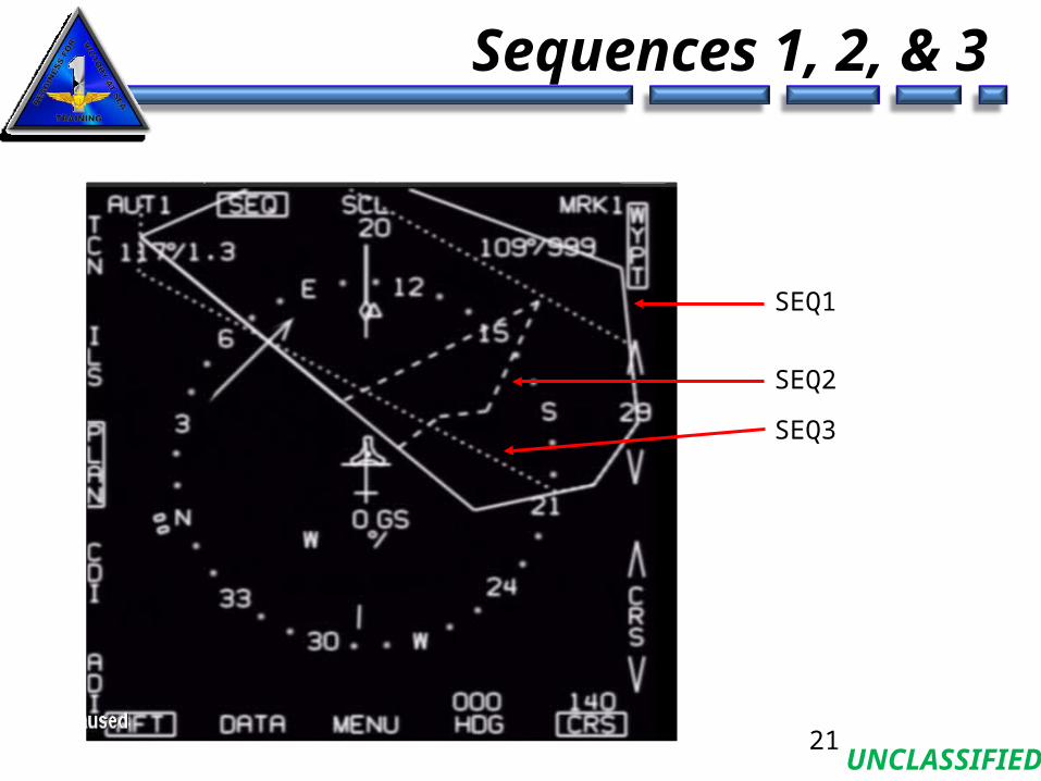
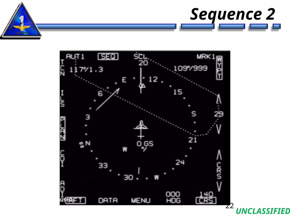
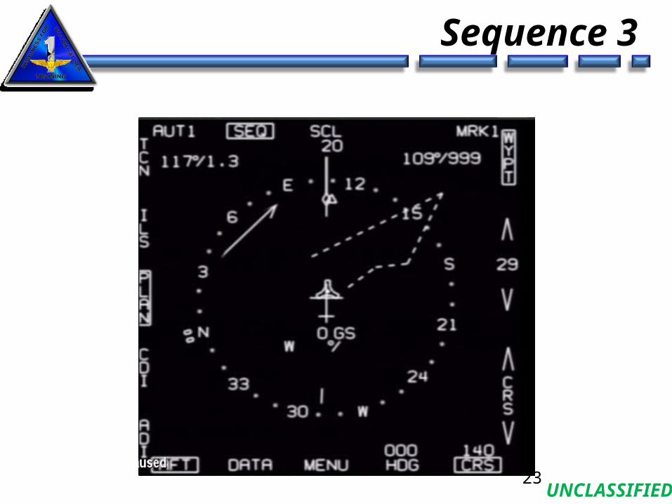
Three SequencesThree Sequences
• Up to 3 sequences can be shown individually or simultaneously• SEQ1 displayed as a solid line• SEQ2 displayed as dashes• SEQ3 displayed as closely spaced dots
• Select SEQ option on HSI page• Sequences selected on sequence display page
18
UNCLASSIFIED
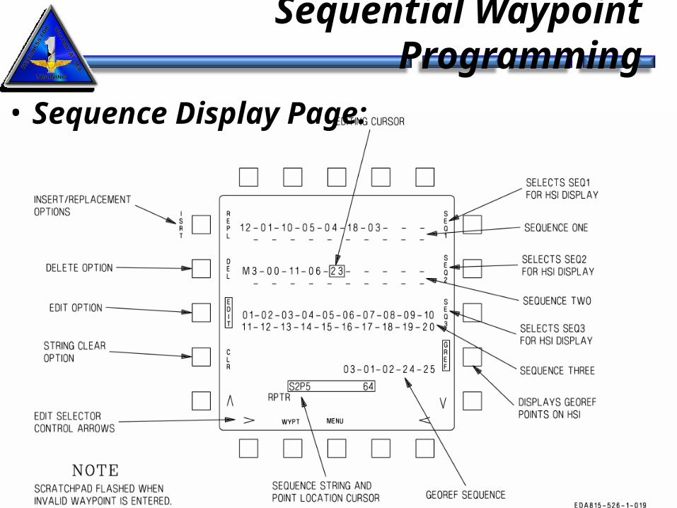
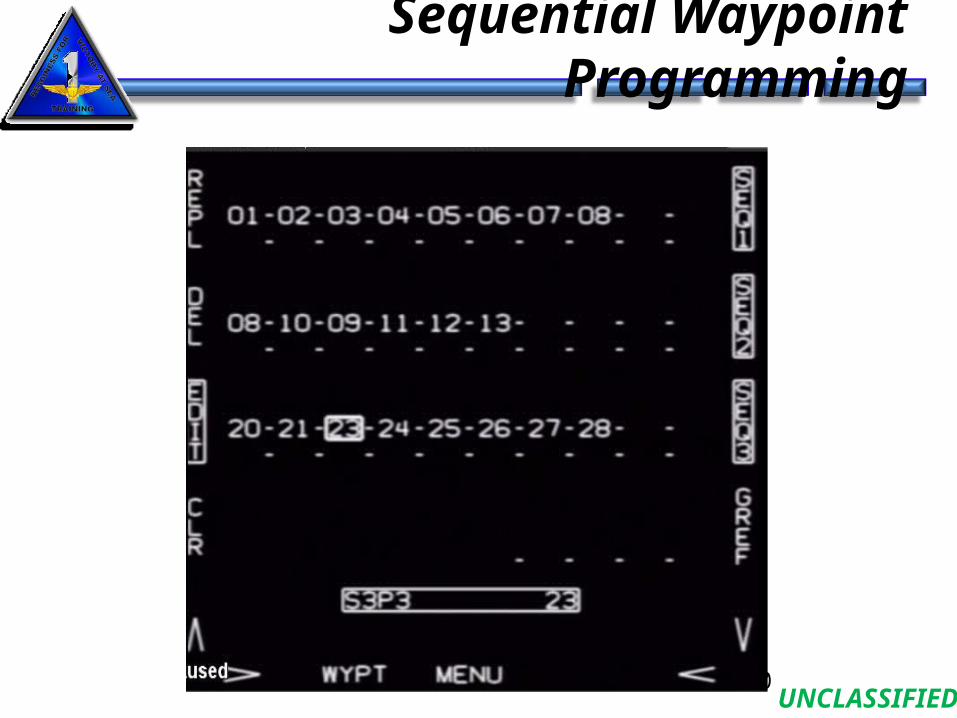
Sequential Waypoint Programming
19
• Sequence Display Page:
UNCLASSIFIED
Sequential Waypoint Programming
20
UNCLASSIFIED
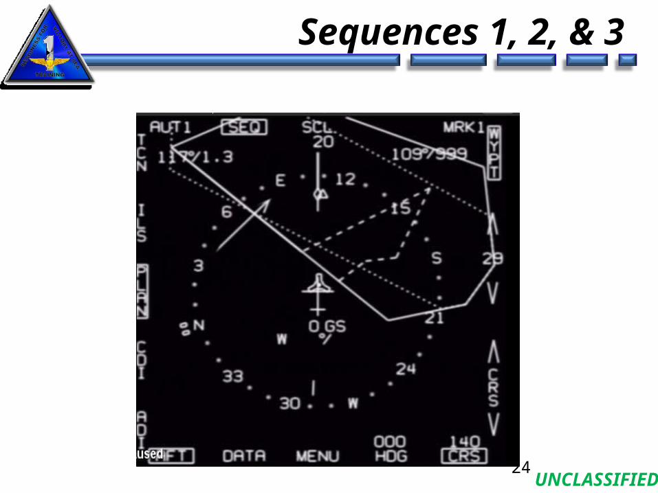
Sequences 1, 2, & 3
21
SEQ1
SEQ2
SEQ3
UNCLASSIFIED
Sequence 2
22
UNCLASSIFIED
Sequence 3
23
UNCLASSIFIED
Sequences 1, 2, & 3
24
UNCLASSIFIED
Sequential Waypoint ProgrammingSequential Waypoint Programming
• Selected by pressing SEQ option on waypoint display page
• Up to 20 waypoints in each sequence• Up to 5 waypoints in GREF sequence• Waypoints can be inserted (ISRT), replaced (REPL) or
deleted (DEL) by selecting EDIT option• Use edit selector control arrows to box desired waypoint
number in sequence for above actions• Box SEQ1, SEQ2, and/or SEQ3 in order to display on
HSI page when SEQ is selected on HSI page• Can select AUT1, AUT2, AUT3 corresponding to
SEQ1, SEQ2, SEQ3 respectively
25
UNCLASSIFIED
HSI Scale OptionsHSI Scale Options
• Range scales now available:• 5, 10, 20, 40, 80, 160, and 320• 5 and 320 were added
26
UNCLASSIFIED
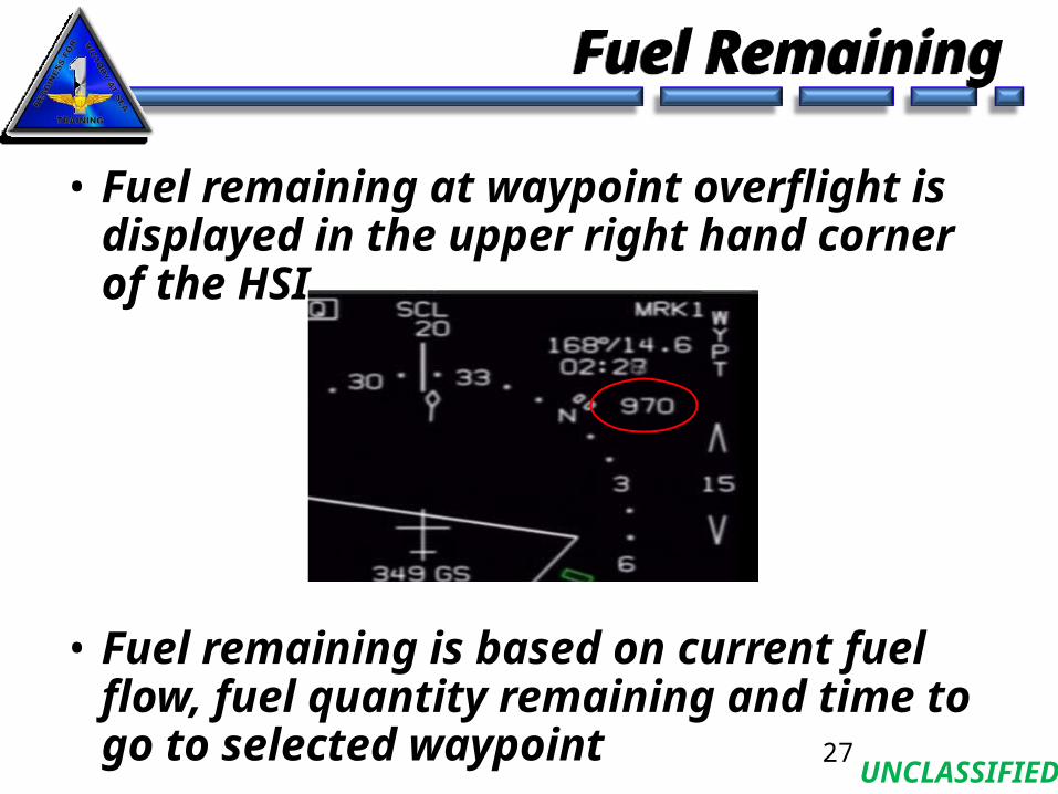
Fuel RemainingFuel Remaining
• Fuel remaining at waypoint overflight is displayed in the upper right hand corner of the HSI
• Fuel remaining is based on current fuel flow, fuel quantity remaining and time to go to selected waypoint
27
UNCLASSIFIED
Command Heading MarkerCommand Heading Marker
• ILS or no steering selected:• Marker indicates selected heading• Marker is NOT wind corrected in ADI and HUD
• Steering selected• Marker is wind corrected on ADI and HUD• VOR: location is based on VOR bearing• TACAN, TACAN offset, waypoint or waypoint offset: great
circle steering to the NAVAID position
• Displayed anytime the steering arrow is displayed
28
UNCLASSIFIED
Miscompare AdvisoryMiscompare Advisory
• Advisory cue when INS and GPS outputs do not agree within threshold• Approx 6.5 ft/sec and 2,000 ft for about 25 sec
• MISCOMPARE now displayed on ADI• Removed when REJ option is selected• GINA will indicate DEGD on BIT page until INS and
GPS velocities are within threshold
29
UNCLASSIFIED
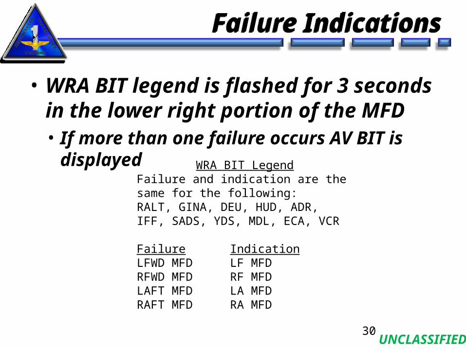
Failure IndicationsFailure Indications
• WRA BIT legend is flashed for 3 seconds in the lower right portion of the MFD• If more than one failure occurs AV BIT is displayed
30
WRA BIT LegendFailure and indication are the same for the following:RALT, GINA, DEU, HUD, ADR, IFF, SADS, YDS, MDL, ECA, VCR
Failure IndicationLFWD MFD LF MFDRFWD MFD RF MFDLAFT MFD LA MFDRAFT MFD RA MFD
UNCLASSIFIED
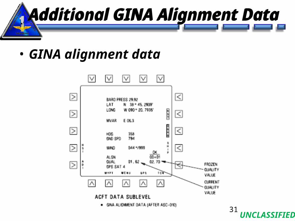
Additional GINA Alignment DataAdditional GINA Alignment Data
• GINA alignment data
31
UNCLASSIFIED
GINA SHIP OptionGINA SHIP Option
• Boxing SHIP option now begins ship alignment and boxes RST (restart)• No need to manually restart GINA• Must have:
• weight-on-wheels• Incomplete alignment or• DGRO (directional gyro) option selected w/ weight-on-
wheels and true heading invalid
32

UNCLASSIFIED
Questions?Questions?
33