Embed Size (px)
Citation preview
UAV (AKA DRONE)
TECHNOLOGY
IN TRANSPORTATION
PROJECTS
Washington State Transportation Commission Meeting March 15th, 2016
CO-PRESENTER’S:
WALT OLSEN, P.E. DEPUTY DIRECTOR
JIM AYRES P.E., DESIGN SYSTEMS ENGINEER
WASHINGTON STATE COUNTY ROAD ADMINISTRATION (CRAB)
Washington State Transportation Commission Meeting March 15th, 2016
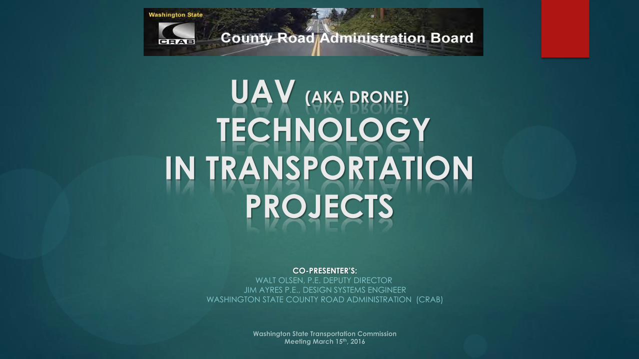
Purpose of presentation is to: Provide a fundamental understanding of UAV’s and how they
can operate Safely and Effectively in Transportation Projects.
Contents: 1. UAV Applications in the Public Arena.
2. History and types of Drones & UAV’s.
3. Why should we use UAV’s for Transportation Projects? 4. Examples of Fixed Winged UAV’s & Rotary UAV’s.
5. How to utilize the UAV data for Transportation purposes.
6. Current FAA authorization requirements to fly an UAV.
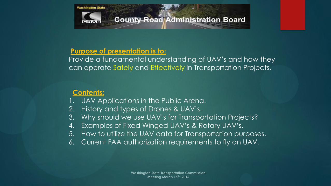
UAV Applications in the Public Works
Arena
Information Technology is one of CRAB’s Core Missions.
Investigate and research innovative, cost effective, technical
strategies for counties for possible implementation.
Drone or UAV’s (Unmanned Aerial Vehicles) technology has grown
rapidly over the last decade and the future growth is almost
assured.
Data obtained from UAV’s is 1% to 10% of the cost of conventional
aircraft.
Owner controlled data with better quality, clarity, and safer.
Data gathered and processed for usage more quickly.

UAV Applications in the Public
Works Arena
Inspections Existing Bridge Structures (routine, damage, replacement)
Quarry and pit site operations and depletion surveys
Waste site operations and cell development surveys
Construction project progress and conflict resolution surveys
Mapping and Surveying Aerial Photography
LIDAR data for 3D modeling of surfaces
Environmental assessments and evaluations
UAV Applications in the Public
Works Arena
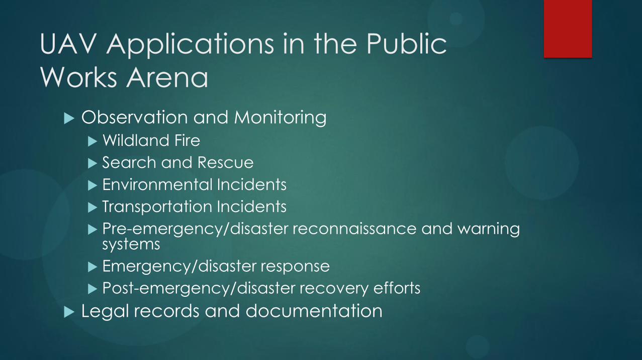
Observation and Monitoring
Wildland Fire
Search and Rescue
Environmental Incidents
Transportation Incidents
Pre-emergency/disaster reconnaissance and warning systems
Emergency/disaster response
Post-emergency/disaster recovery efforts
Legal records and documentation
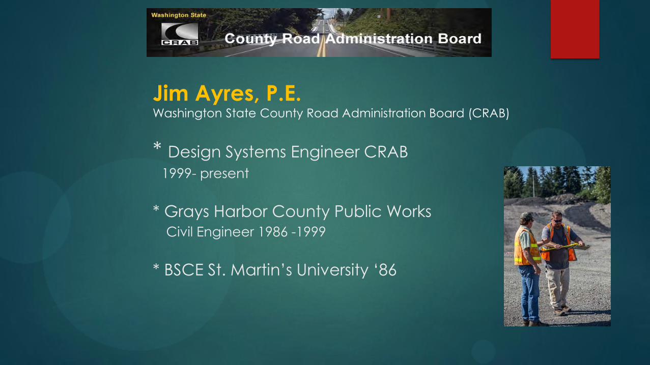
Jim Ayres, P.E. Washington State County Road Administration Board (CRAB)
* Design Systems Engineer CRAB
1999- present
* Grays Harbor County Public Works
Civil Engineer 1986 -1999
* BSCE St. Martin’s University ‘86
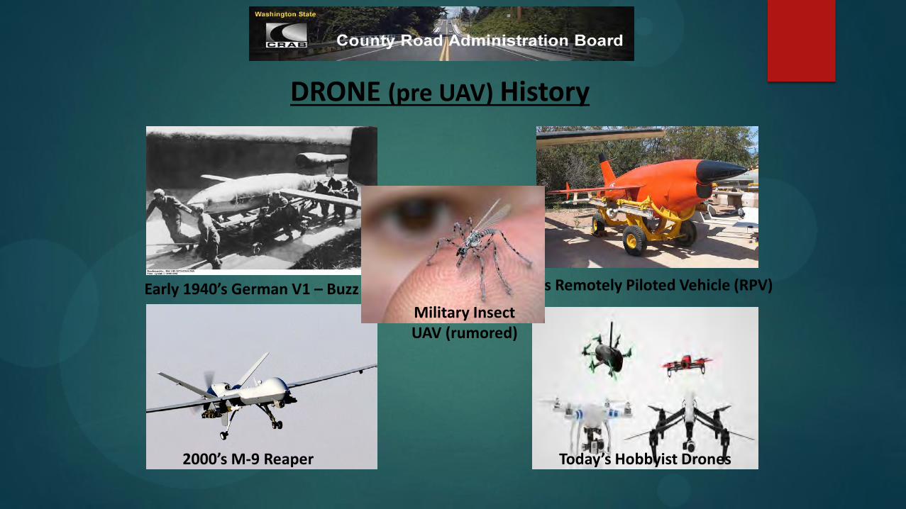
DRONE (pre UAV) History
Early 1940’s German V1 – Buzz Bomb 1950’s Remotely Piloted Vehicle (RPV)
2000’s M-9 Reaper Today’s Hobbyist Drones
Military Insect UAV (rumored)
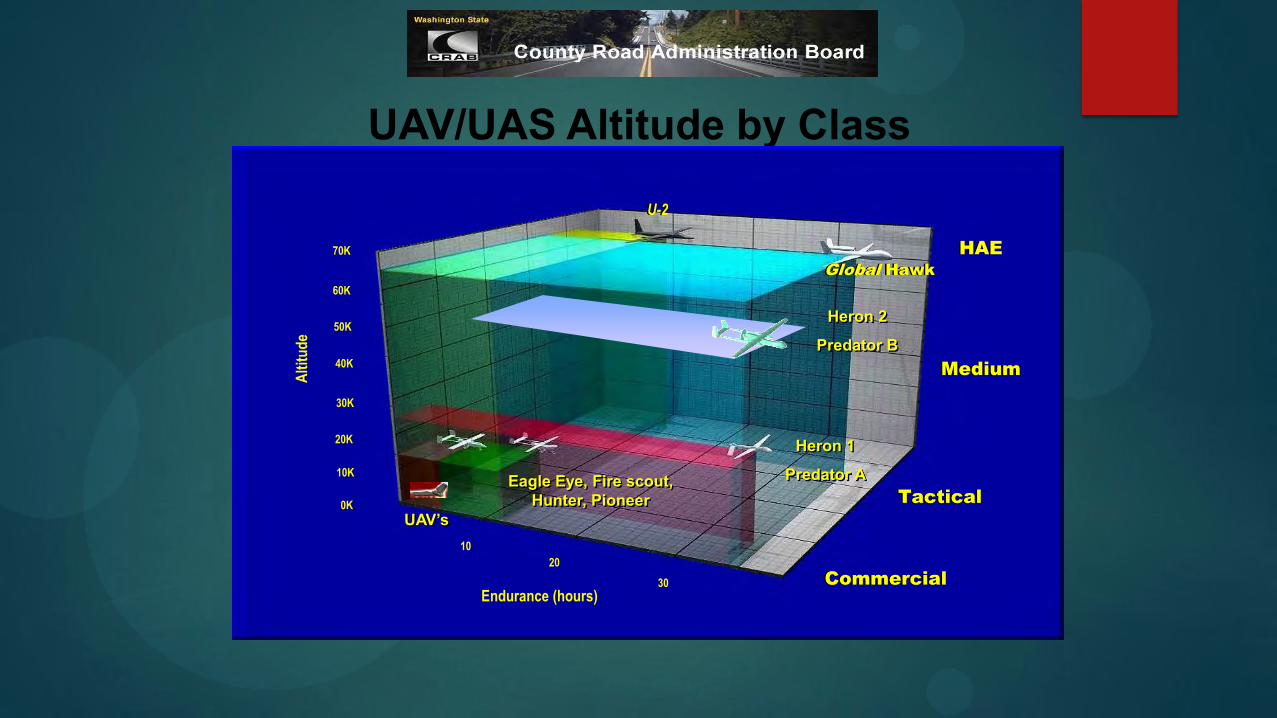
UAV/UAS Altitude by Class
Global Hawk
HAE
Medium
Tactical
10
20
30
Endurance (hours)
70K
60K
50K
40K
30K
20K
10K
Alt
itu
de
U-2
Heron 2
Predator B
Heron 1
Predator A Eagle Eye, Fire scout, Hunter, Pioneer 0K
UAV’s
Commercial
Washington State Transportation Commission Meeting March 15th, 2016
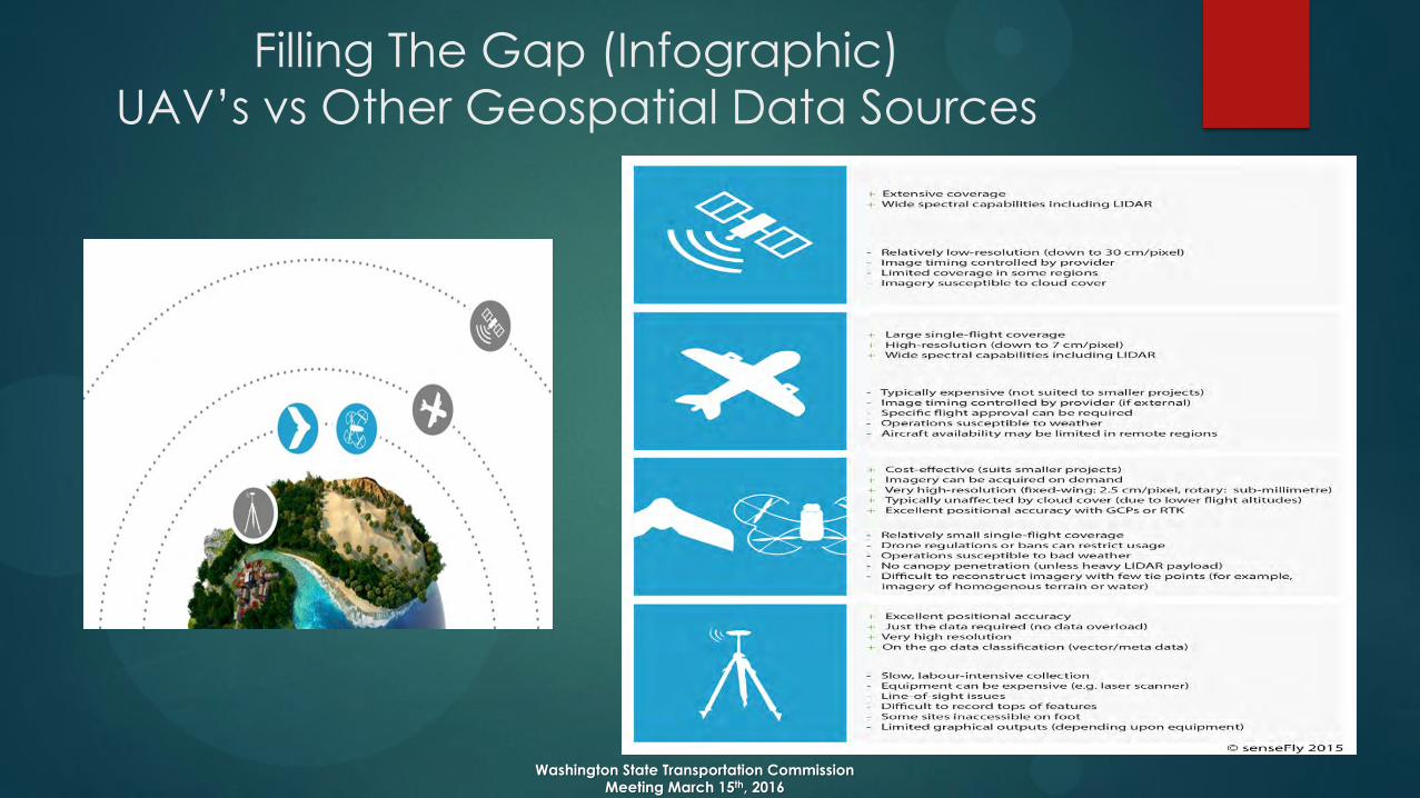
Filling The Gap (Infographic)
UAV’s vs Other Geospatial Data Sources

Why use UAV’s for Transportation Projects?
1. High Precision UAV mapping accuracy is similar to GPS
2. Worker Safety & Labor spent mapping using a UAV is considerably lower than GPS Surveying
3. Photographic Data – Quality Assured
Washington State Transportation Commission Meeting March 15th, 2016

County Demonstration Project Scope
• Utilize UAV technology in case studies at various locations through
Washington State.
• Investigate & Evaluate the UAV’s capabilities and effectiveness in improving Mapping and Reducing Mapping/Inspection costs.
• UAV technologies were investigated to evaluate their capabilities as
they relate to county road and bridge projects.
Washington State Transportation Commission Meeting March 15th, 2016
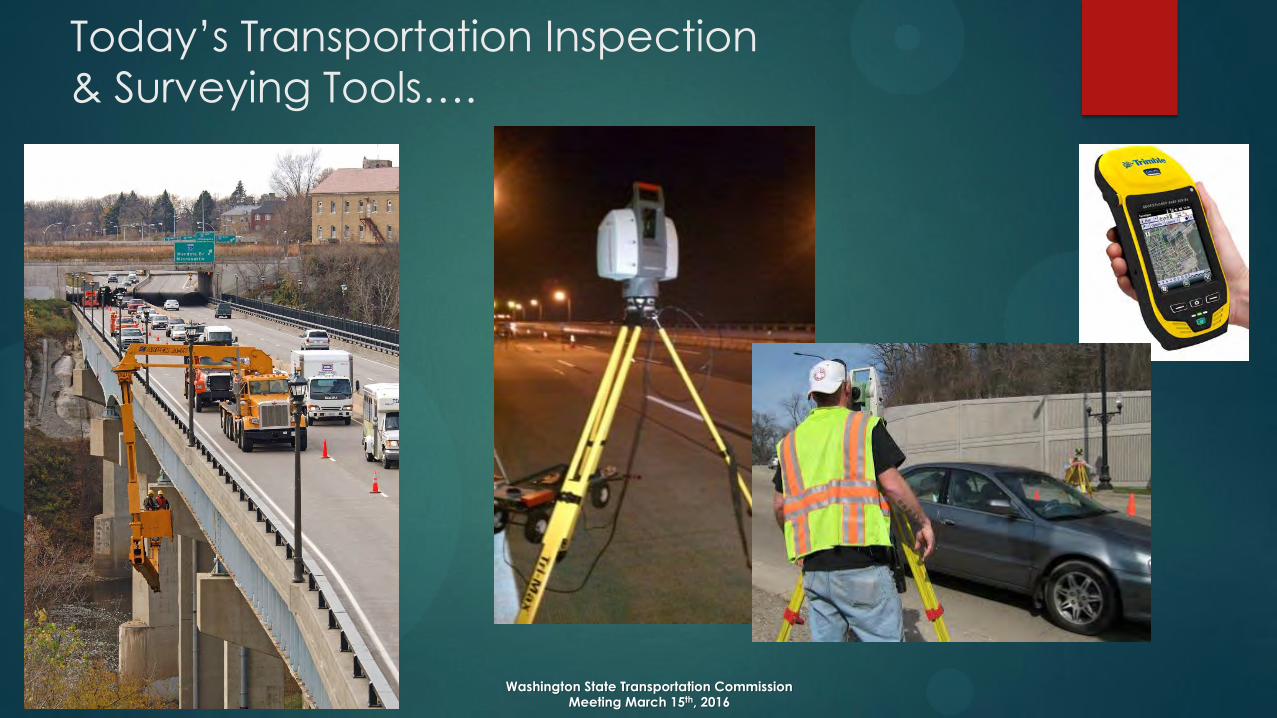
Today’s Transportation Inspection
& Surveying Tools….
Washington State Transportation Commission Meeting March 15th, 2016

coverage large areas small areas
takeoff & landing linear spot
object resolution Inch/pixel mm/pixel
oblique imagery 0° to -50° +90° to -90°
3D mapping of infrastructure difficult much easier
Close-up inspection not adapted well adapted
Two Types of UAV’:
Fixed-wing vs rotorcraft
Washington State Transportation Commission Meeting March 15th, 2016
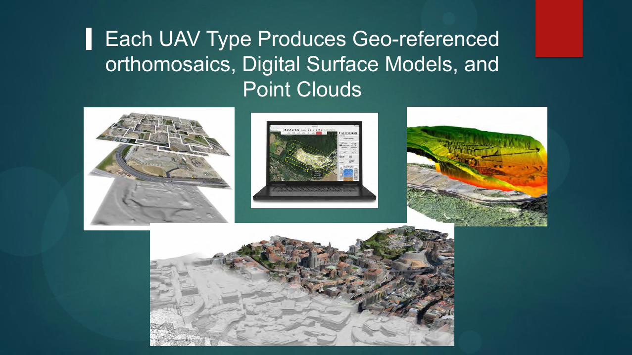
Each UAV Type Produces Geo-referenced orthomosaics, Digital Surface Models, and
Point Clouds

Example of Fixed
Winged UAV’s
Click on image to begin video
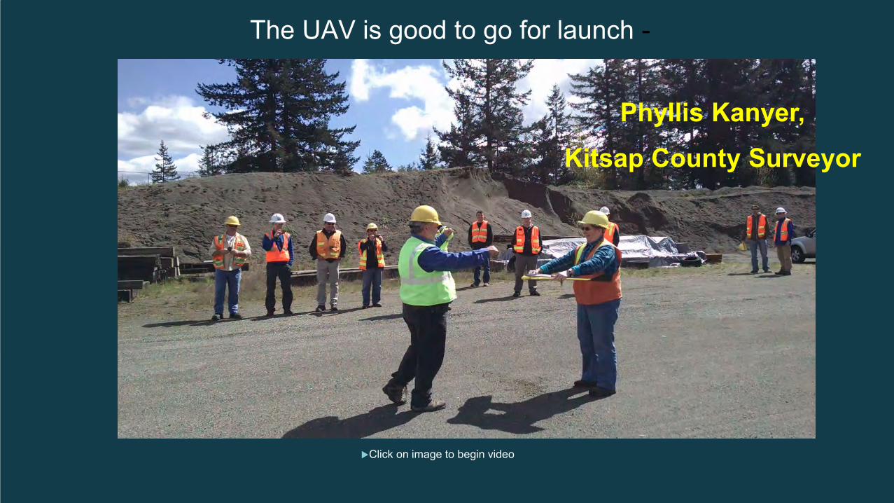
The UAV is good to go for launch -
Phyllis Kanyer, Kitsap County Surveyor
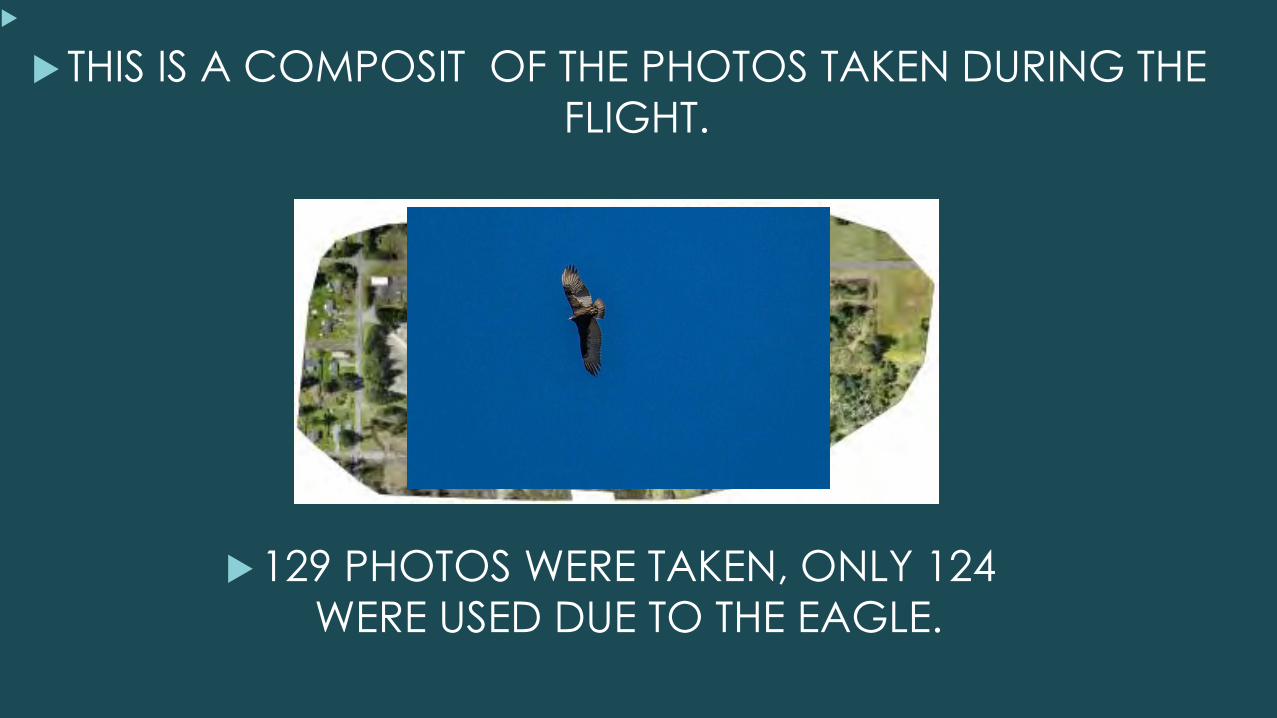
THIS IS A COMPOSIT OF THE PHOTOS TAKEN DURING THE
FLIGHT.
129 PHOTOS WERE TAKEN, ONLY 124
WERE USED DUE TO THE EAGLE.
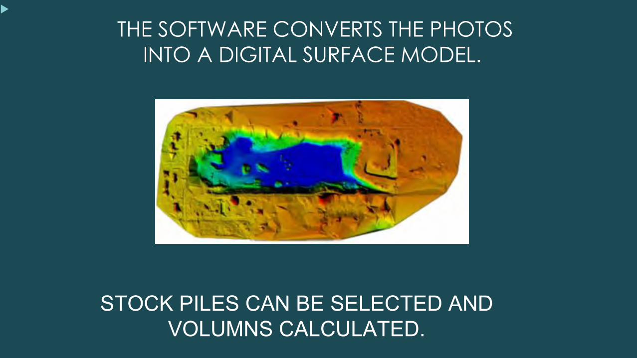
THE SOFTWARE CONVERTS THE PHOTOS
INTO A DIGITAL SURFACE MODEL.
STOCK PILES CAN BE SELECTED AND VOLUMNS CALCULATED.
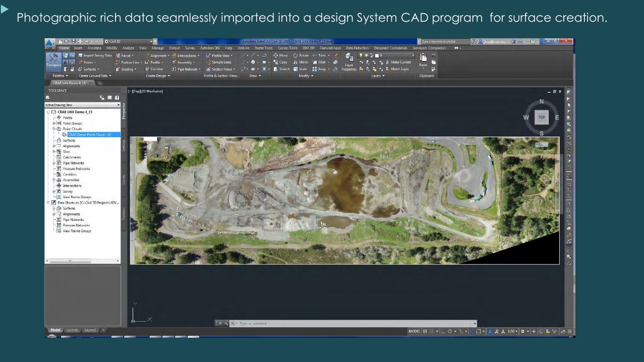
Photographic rich data seamlessly imported into a design System CAD program for surface creation.
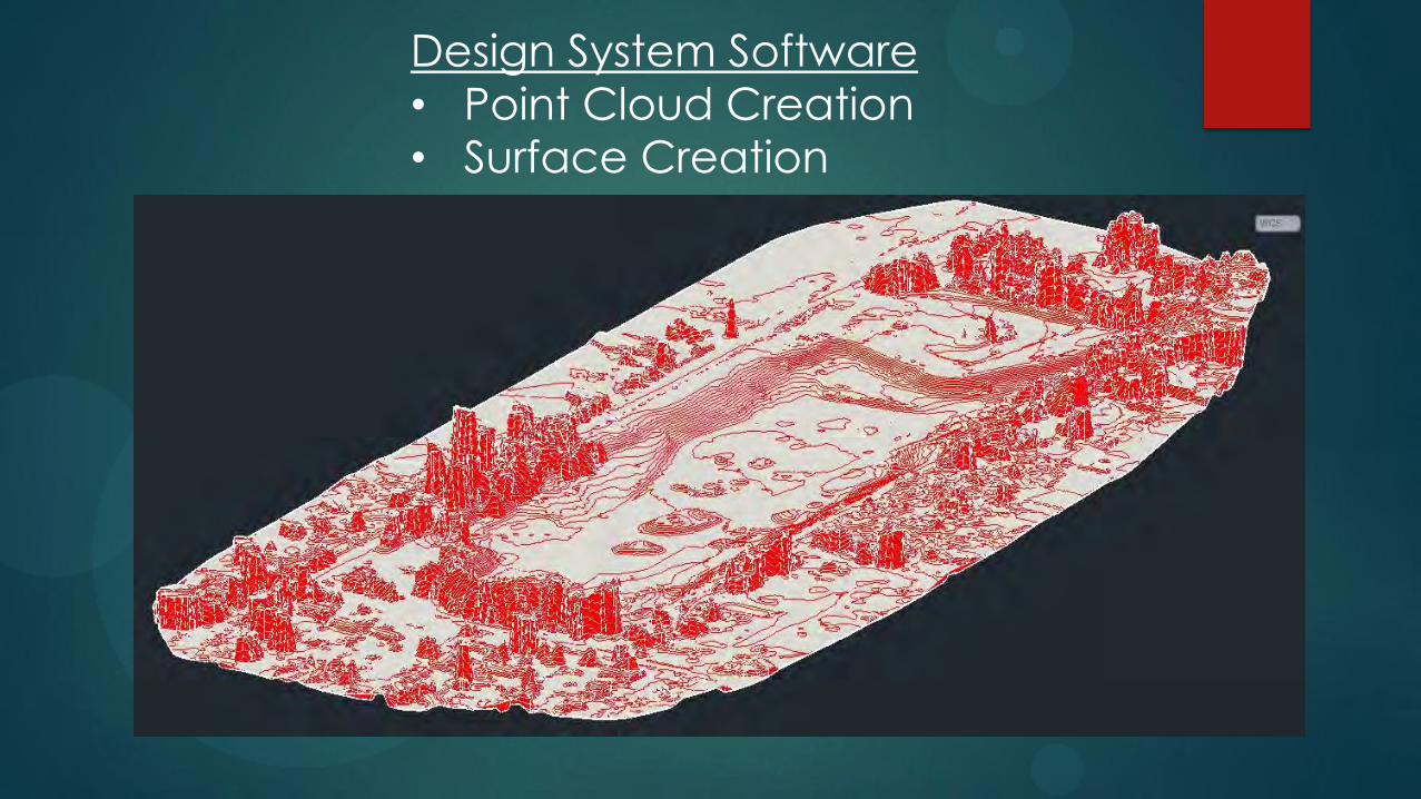
Design System Software
• Point Cloud Creation • Surface Creation
RDC 2015 LAKE CHELAN CHELAN COUNTY
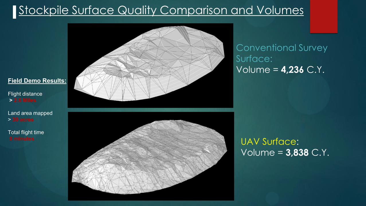
Stockpile Surface Quality Comparison and Volumes
Conventional Survey
Surface: Volume = 4,236 C.Y.
UAV Surface: Volume = 3,838 C.Y.
Field Demo Results: Flight distance > 2.6 Miles Land area mapped > 30 acres Total flight time 9 minutes
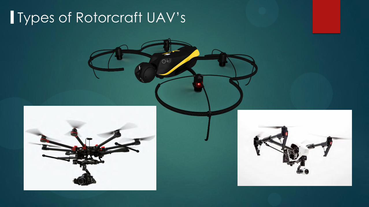
Types of Rotorcraft UAV’s

3 typical applications
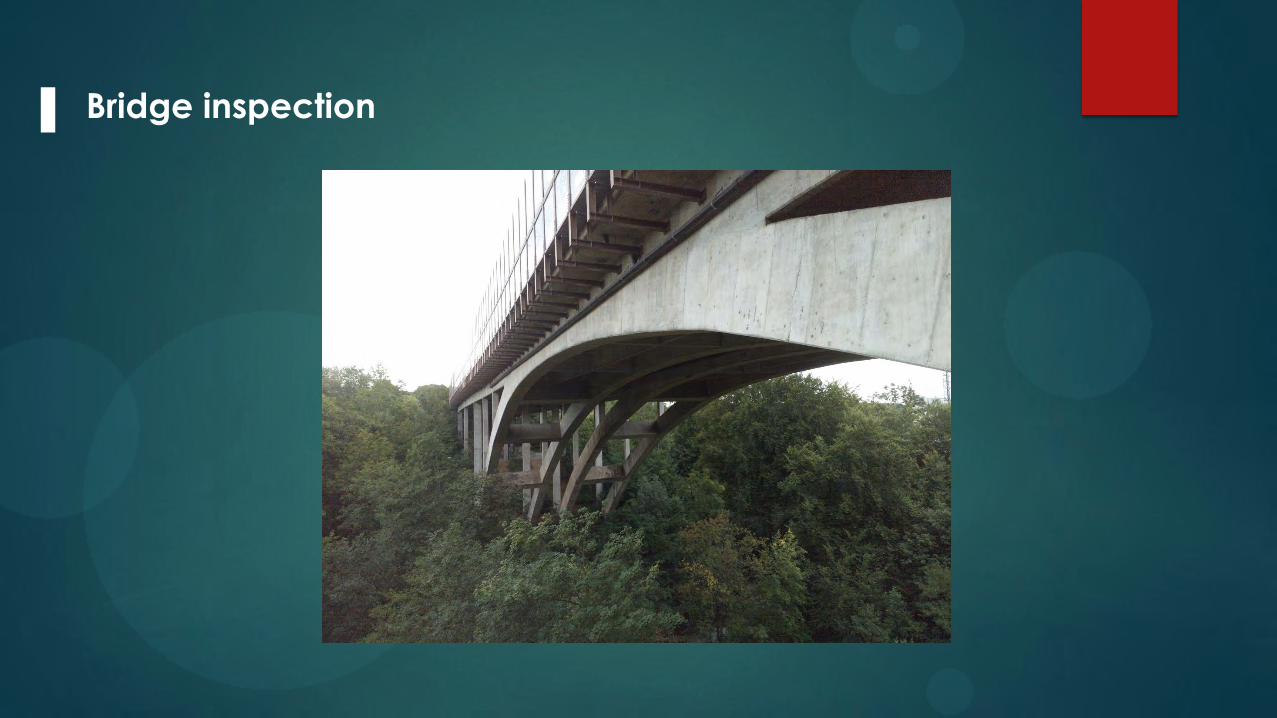
Bridge inspection
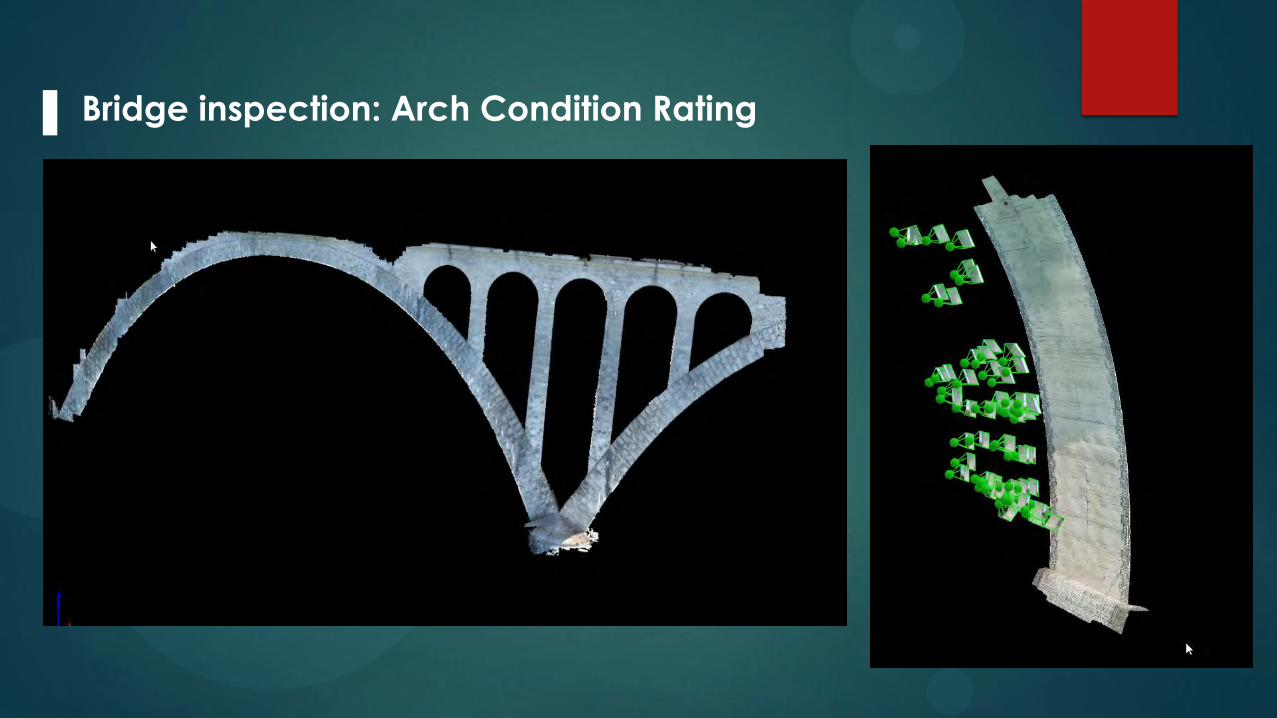
Bridge inspection: Arch Condition Rating
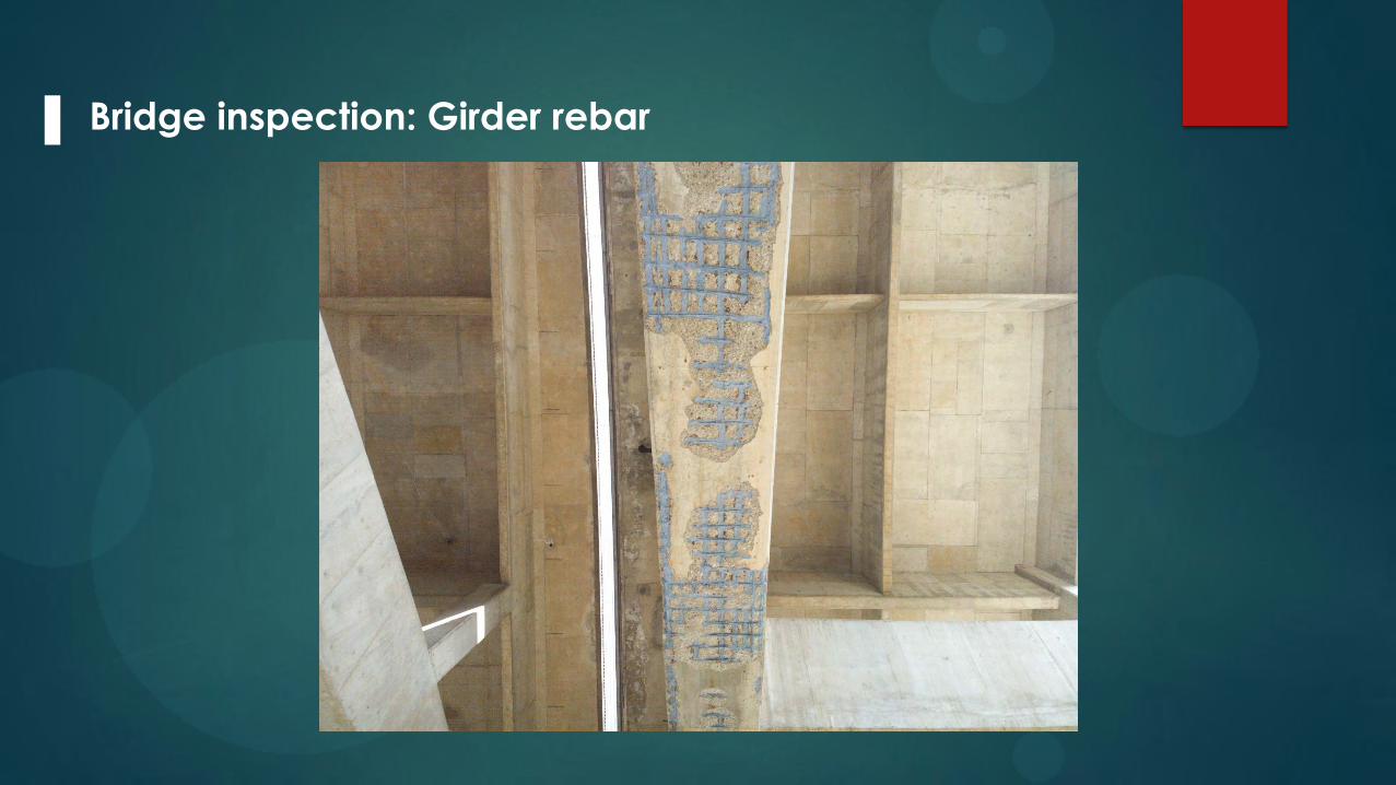
Bridge inspection: Girder rebar

Bridge inspection: piers

Bridge Pier – Mapping Cracks
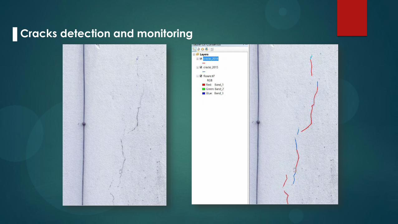
Cracks detection and monitoring
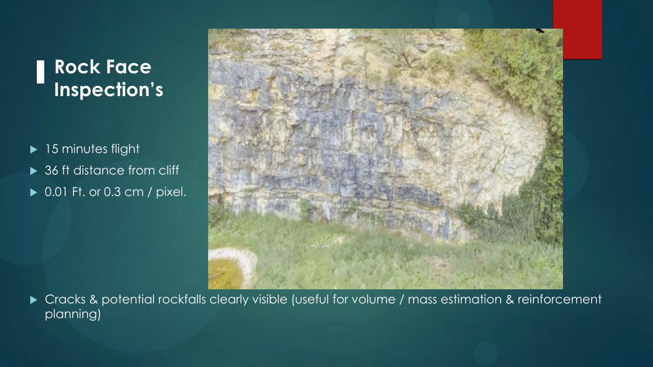
15 minutes flight
36 ft distance from cliff
0.01 Ft. or 0.3 cm / pixel.
Cracks & potential rockfalls clearly visible (useful for volume / mass estimation & reinforcement
planning)
Rock Face
Inspection’s
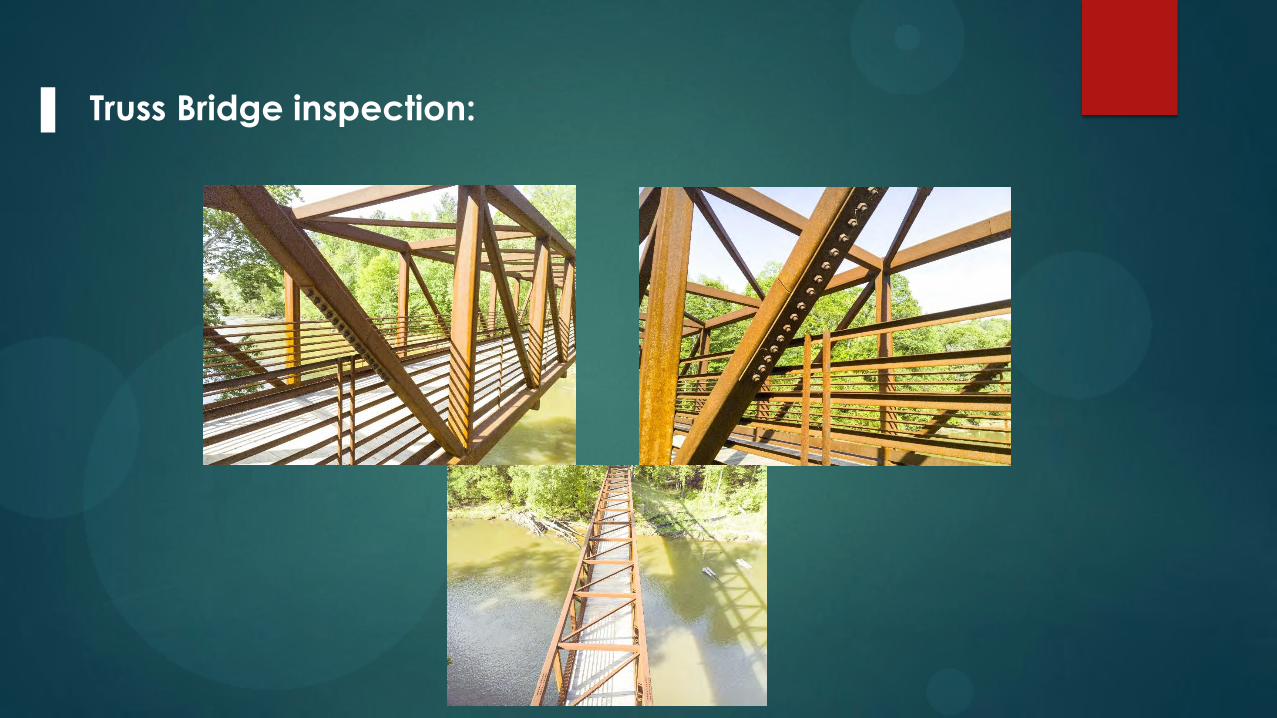
Truss Bridge inspection:

Bridge inspection: Substructure difficult to Access.

Bridge inspection: Use of InfraRed Payload
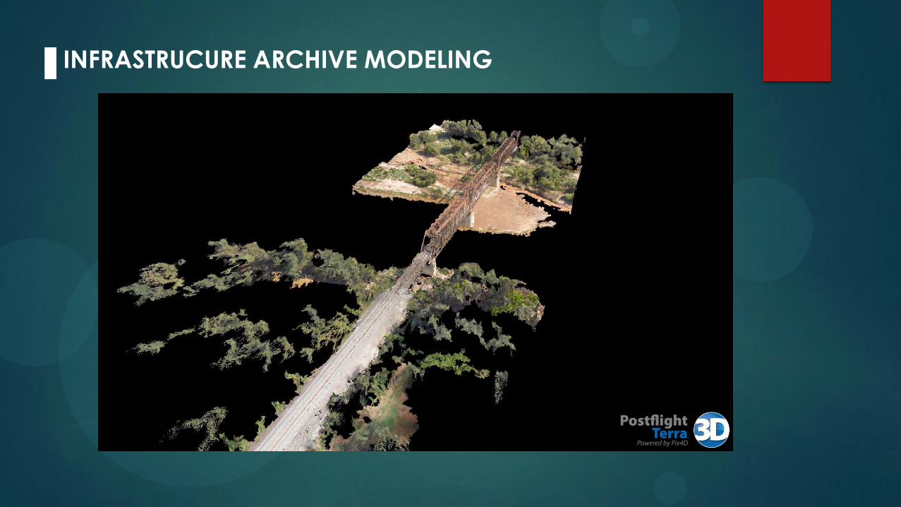
INFRASTRUCURE ARCHIVE MODELING

Congress Tells FAA to Get Busy
License Timeline • February 3, 2012 – Incorporate UAS ops safely into the NAS system
without being a huge burden on the owners/operators, which they are obligated by congress to do so, in the Airspace Modernization Act of 2012.
• March 7, 2012 – Issued notice it was looking for 6 test sites • May 14, 2012 – Public Safety can fly up to 25 lbs. UAV’s without license:
• UAS must be flown within the LOS (line of sight) of the operator, • less than 400 feet above the ground, • during daylight conditions, and • inside Class G (uncontrolled) airspace and more than five miles
from any airport or other location with aviation activities. Current FAA regulation 333 Exemption is the only current system for commercial UAS compliance….
Until FAA Part 107 rules proposed for 2016...

No need for previously licensed FAA pilot as operator.
What’s different about Part 107 from Section 333?
An extra VO (Visual Observer) is not required for flights.
No need for Air Traffic Control clearance in class G airspace.
This is a big deal!
In conclusion, UAV Technology
In transportation projects;
1. When compared to conventional aircraft, because a UAV is easier, safer, and more efficient.
2. High Precision UAV mapping accuracy is comparable to GPS accuracy.
3. Photographic rich data, quality assured, owner managed, imports seamlessly into Design Systems for Digital Surface Modeling