Embed Size (px)
Citation preview
Scale3 How (small) unmanned aerial vehicles
can provide data at appropriate spatial,
temporal, and spectral scales to
monitor fine-scale ecological patterns
and processes.
Benjamin W. Heumann, Ph.D
Center for Geographic Information Science, Central Michigan University
(989) 954-2114
2014 UAS Workshop Argonne National Labs
1
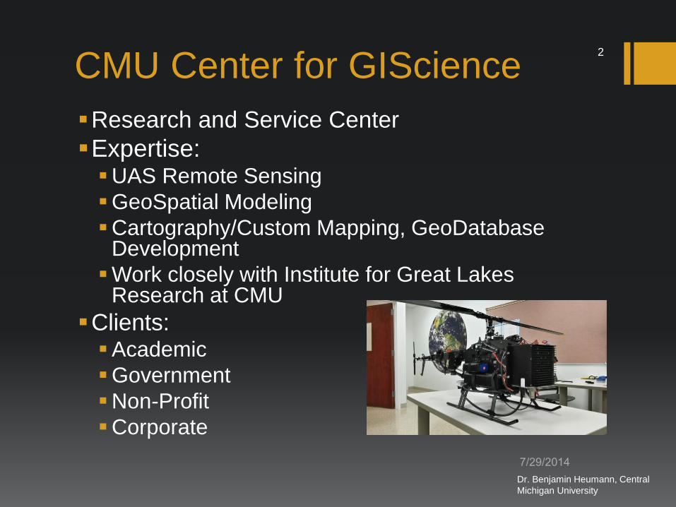
CMU Center for GIScience
Research and Service Center
Expertise: UAS Remote Sensing
GeoSpatial Modeling
Cartography/Custom Mapping, GeoDatabase Development
Work closely with Institute for Great Lakes Research at CMU
Clients: Academic
Government
Non-Profit
Corporate
Dr. Benjamin Heumann, Central
Michigan University
2

Outline
Why sUAS? A Personal Perspective
The Three Scales in Remote Sensing
Temporal
Spatial
Spectral
UAS Remote Sensing Opportunities
Conclusions
Dr. Benjamin Heumann, Central
Michigan University
3

Scale(s) in Remote Sensing
“ Explain the impact of scale in
remote sensing”
– a doctoral comprehensive
exam question
Dr. Benjamin Heumann, Central
Michigan University
4

Space
1cm
10cm 1m
10m
100m
1km
Dr. Benjamin Heumann,
Central Michigan University
5

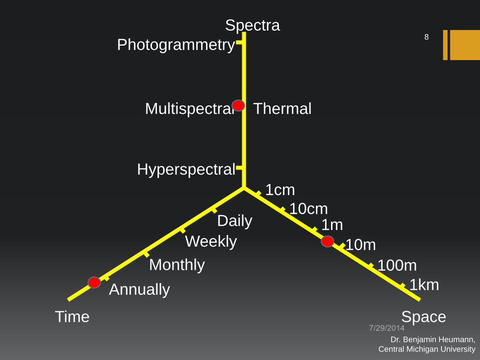
Time Space
Spectra
Photogrammetry
Multispectral
Hyperspectral
Daily
Weekly
Monthly
Annually
1cm
10cm 1m
10m
100m
1km
Thermal, Lidar, SAR
Dr. Benjamin Heumann,
Central Michigan University
6
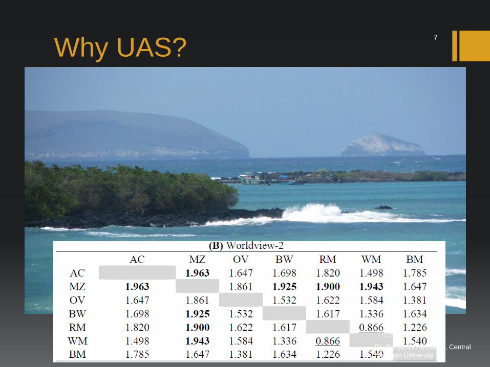
Why UAS?
Dr. Benjamin Heumann, Central
Michigan University
7
Time Space
Spectra
Photogrammetry
Multispectral
Hyperspectral
Daily
Weekly
Monthly
Annually
1cm
10cm 1m
10m
100m
1km
Thermal
Dr. Benjamin Heumann,
Central Michigan University
8

Time Space
Spectra
Photogrammetry
Multispectral
Hyperspectral
Daily
Weekly
Monthly
Annually
1cm
10cm 1m
10m
100m
1km
Thermal
Dr. Benjamin Heumann,
Central Michigan University
9
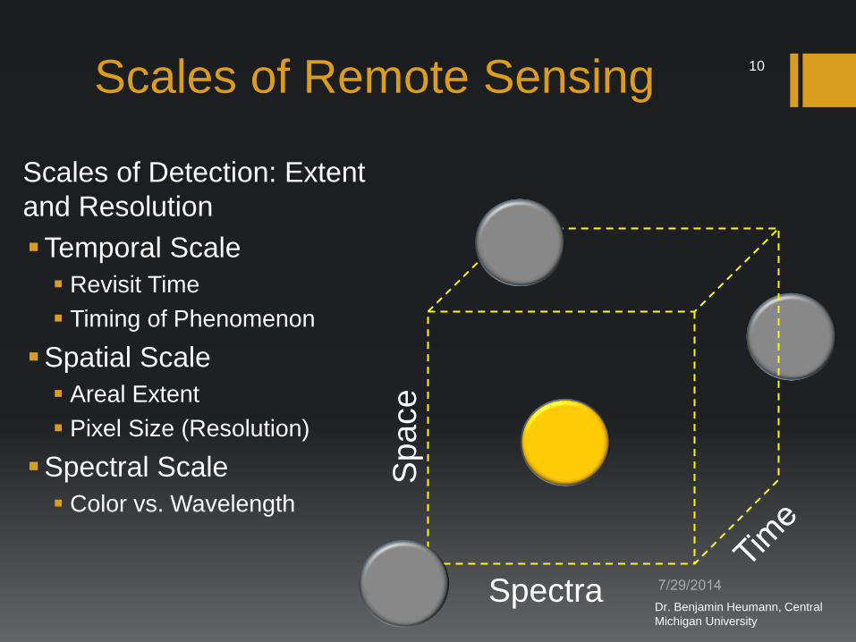
Scales of Remote Sensing
Scales of Detection: Extent
and Resolution
Temporal Scale
Revisit Time
Timing of Phenomenon
Spatial Scale
Areal Extent
Pixel Size (Resolution)
Spectral Scale
Color vs. Wavelength
Space
Spectra Dr. Benjamin Heumann, Central
Michigan University
10
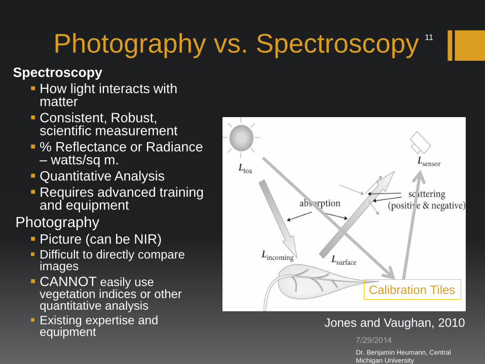
Photography vs. Spectroscopy
Jones and Vaughan, 2010
Calibration Tiles
Spectroscopy
How light interacts with matter
Consistent, Robust, scientific measurement
% Reflectance or Radiance – watts/sq m.
Quantitative Analysis
Requires advanced training and equipment
Photography Picture (can be NIR) Difficult to directly compare
images
CANNOT easily use vegetation indices or other quantitative analysis
Existing expertise and equipment
Dr. Benjamin Heumann, Central
Michigan University
11

Phenology
Can
op
y N
utr
ien
ts*
Structure /
Biomass
Species*
Fir
e
Sca
les o
f R
em
ote
Se
nsin
g
MODIS
Landsat / HYPERION*
After Chambers et al. 2007 Day Month Year Decade Century
10cm
2m
30m
250m
1km
1km
50km
200km
500km
2000km
Spatial R
esolu
tion
Spatial E
xte
nt
Temporal Resolution
Quickbird / Worldview-2
Airborne*
Small Unmanned* Dr. Benjamin Heumann,
Central Michigan
University
12
Non-Imaging remote sensing
sUAS can be a tool to collect samples in difficult terrain
Example: Hyperspectral measurements of plants in wetlands using handheld spectroradiometer On the ground Sensitivity of equipment
Travel Time
Navigation Issues
Disturbance of field site
In the air Predetermined sampling
Equipment is safe
Sampling is quick
Non-imaging sensors often less
than 1/10th cost of imaging
sensors
Dr. Benjamin Heumann, Central
Michigan University
13

Opportunities for UAS Remote Sensing:
Spatial
• Object of interest < pixel size
• Satellite & Manned Aircraft:
Forests, Agriculture,
Shrublands
• What about herbaceous
vegetation?
• Tundra / Alpine
• Grasslands
• Wetlands
• Peatlands
• Marshes
Photo credit: Smith, R.W.
Dr. Benjamin Heumann, Central
Michigan University
14
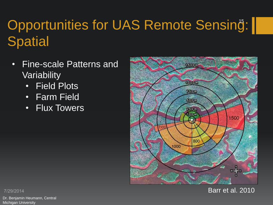
Opportunities for UAS Remote Sensing:
Spatial
• Fine-scale Patterns and
Variability
• Field Plots
• Farm Field
• Flux Towers
Barr et al. 2010 Dr. Benjamin Heumann, Central
Michigan University
15

Opportunities for UAS Remote Sensing:
Temporal
• Phenology
• Leaf burst
• Leaf senescence
• Flowering
• Fruiting
• Insect Hatch
• Flexible and Rapid
Deployment
• Plant Pathogens
• Invasive Species
• Drought, Floods, Extreme
Events
gardenamateur.blogspot.com
Fine Spatial Scale Phenology:
• Detection of individual
flowers, leaves, fruits
Dr. Benjamin Heumann, Central
Michigan University
16

Opportunities for UAS Remote Sensing:
Precision Agriculture
Bratney and Whelan, 2001
Zarco-Tejada et al. 2008
Dr. Benjamin Heumann, Central
Michigan University
17
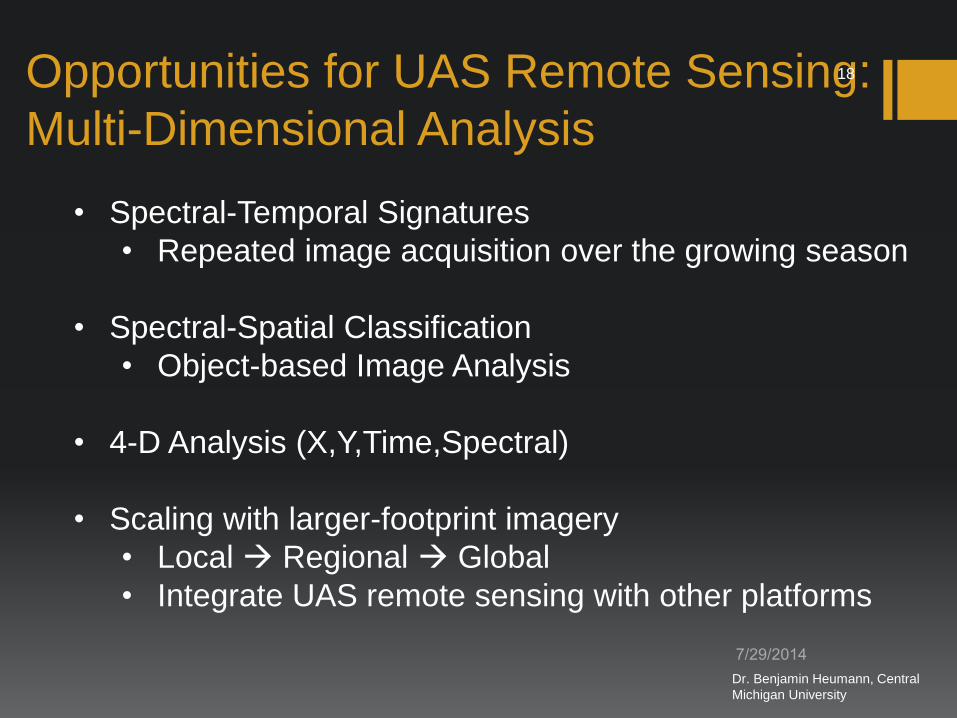
Opportunities for UAS Remote Sensing:
Multi-Dimensional Analysis
• Spectral-Temporal Signatures
• Repeated image acquisition over the growing season
• Spectral-Spatial Classification
• Object-based Image Analysis
• 4-D Analysis (X,Y,Time,Spectral)
• Scaling with larger-footprint imagery
• Local Regional Global
• Integrate UAS remote sensing with other platforms
Dr. Benjamin Heumann, Central
Michigan University
18
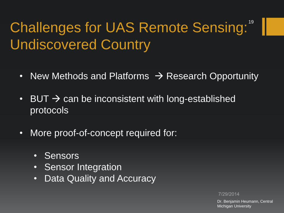
Challenges for UAS Remote Sensing:
Undiscovered Country
• New Methods and Platforms Research Opportunity
• BUT can be inconsistent with long-established
protocols
• More proof-of-concept required for:
• Sensors
• Sensor Integration
• Data Quality and Accuracy
Dr. Benjamin Heumann, Central
Michigan University
19

Challenges for UAS Remote Sensing:
Sensor Integration
Source: Leptron Industrial Robotic Helicopters Source: Headwall Phonics
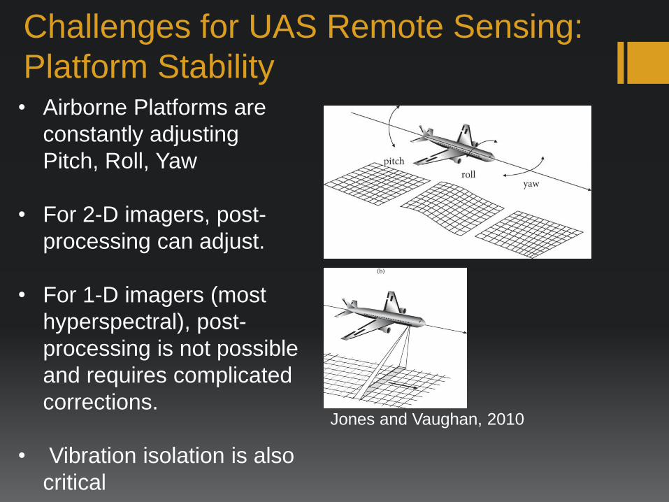
Challenges for UAS Remote Sensing:
Platform Stability
• Airborne Platforms are
constantly adjusting
Pitch, Roll, Yaw
• For 2-D imagers, post-
processing can adjust.
• For 1-D imagers (most
hyperspectral), post-
processing is not possible
and requires complicated
corrections.
• Vibration isolation is also
critical
Jones and Vaughan, 2010

Challenges for UAS Remote Sensing:
Sensor Calibration and Processing
Jones and Vaughan, 2010
Calibration Tiles
Accurate Reflectance
Measurements
Require:
• In-Situ Calibration
with multiple
Calibration Tiles
• AND/OR
• Continuous
Readings of
Incoming Radiation
(variable light
conditions)

Current UAS Research Projects at CMU
Smith, R.W.
Mapping Wetland
Biodiversity Location: Washtenaw County, MI
Mapping Pitcher’s Thistle Location: Wilderness State Park, MI
Collaborators: Chicago Botanic Gardens,
East Carolina University, Charleston
College
Funded in-part by USFWS Dr. Benjamin Heumann, Central
Michigan University
23
Conclusions
• Remote sensing requires careful consideration of
spatial, temporal, and spectral scales.
• UAS as a new platform provides new
opportunities for flexible deployment (temporal
scale) and low altitude image collection (fine-
spatial scale).
• Type of spectral data has considerable tradeoffs
between potential benefits and costs/efforts to
achieve results.
Dr. Benjamin Heumann, Central
Michigan University
24
Thank You – Questions?
Benjamin W. Heumann, Ph.D
Center for Geographic Information Science, Central Michigan University
Dr. Benjamin Heumann, Central
Michigan University
25