Embed Size (px)
Citation preview
October 29, 2003
Provincial Highways Management
Ministry of Transportation
1
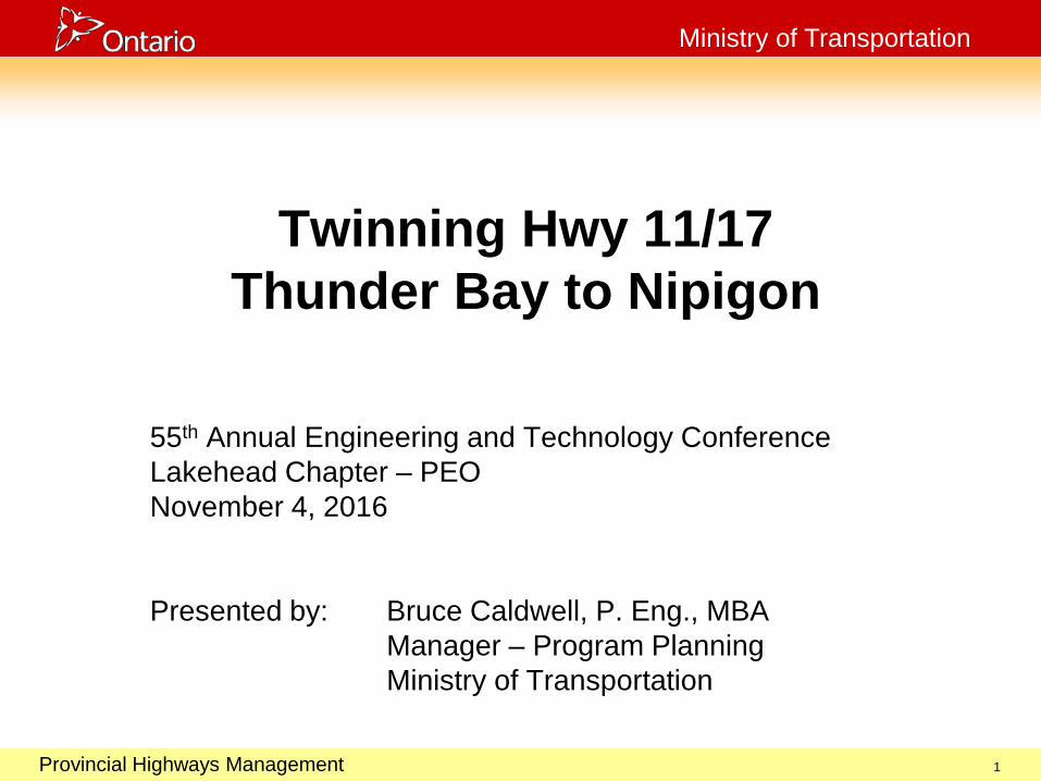
Twinning Hwy 11/17 Thunder Bay to Nipigon
55th Annual Engineering and Technology Conference Lakehead Chapter – PEO November 4, 2016 Presented by: Bruce Caldwell, P. Eng., MBA Manager – Program Planning Ministry of Transportation
October 29, 2003
Provincial Highways Management
Ministry of Transportation
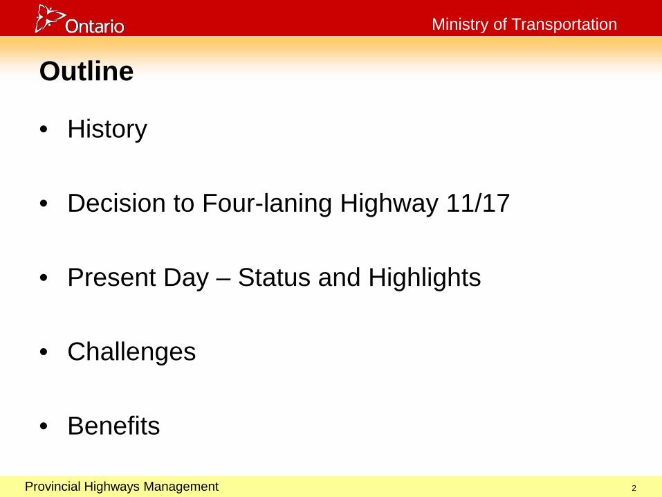
Outline
• History
• Decision to Four-laning Highway 11/17
• Present Day – Status and Highlights
• Challenges
• Benefits
2
October 29, 2003
Provincial Highways Management
Ministry of Transportation
History of Highway 11/17
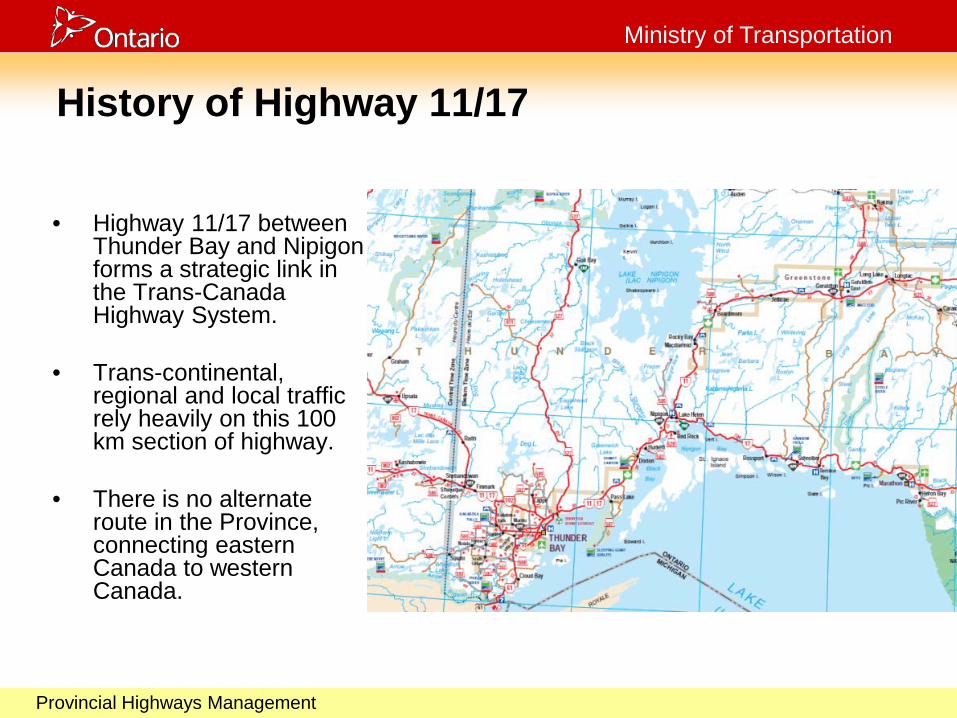
• Highway 11/17 between Thunder Bay and Nipigon forms a strategic link in the Trans-Canada Highway System.
• Trans-continental, regional and local traffic rely heavily on this 100 km section of highway.
• There is no alternate
route in the Province, connecting eastern Canada to western Canada.

October 29, 2003
Provincial Highways Management
Ministry of Transportation
History of Highway 11/17
• Road between Nipigon and Port Arthur/Fort William was completed in 1920.
• Nipigon River Bridge on Highway 17 was officially opened on Sept. 24, 1937.
• Highway 11 between Nipigon and Geraldton was officially opened on Sept. 7, 1940.
• Highway 17 linked to Sault
Ste. Marie in 1961.
October 29, 2003
Provincial Highways Management
Ministry of Transportation
History of Highway 11/17
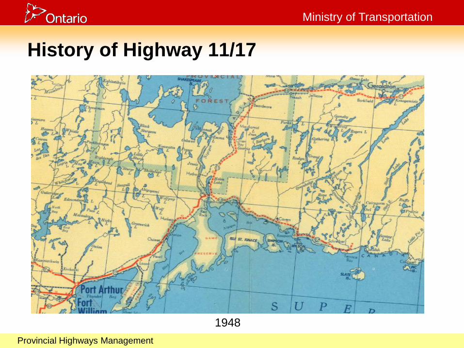
1948
October 29, 2003
Provincial Highways Management
Ministry of Transportation
Four-laning Highway 11/17
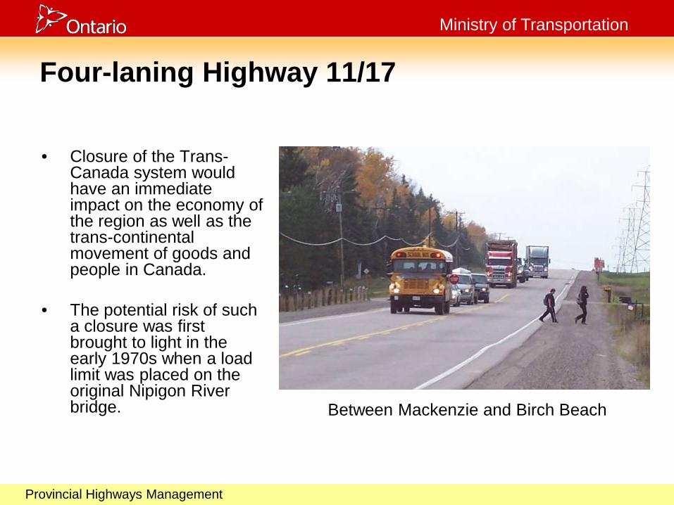
• Closure of the Trans-Canada system would have an immediate impact on the economy of the region as well as the trans-continental movement of goods and people in Canada.
• The potential risk of such
a closure was first brought to light in the early 1970s when a load limit was placed on the original Nipigon River bridge. Between Mackenzie and Birch Beach

October 29, 2003
Provincial Highways Management
Ministry of Transportation
Four-laning Highway 11/17
• Since then, MTO has identified
the potential risk of closure at a number of bridge sites along this section of Highway 11/17.
• During the 1970s & 1980s, the
public expressed the need to four-lane Highway 11/17 between Nipigon & Shabaqua, due to the absence of an alternate route when weather, collisions and construction caused closure of the route.
Crystal Beach
October 29, 2003
Provincial Highways Management
Ministry of Transportation
Four-laning Highway 11/17
• In late 1989, the government announced an accelerated program for highway improvements in northern Ontario. This included the four-laning of Highway 11/17 between Thunder Bay and Nipigon.
• With this announcement, commitments were made to
identify a four-lane corridor and five separate studies were undertaken between: • Balsam Street and Highway 527 • Highway 527 and Mackenzie Station Road • Mackenzie Station Road and Welch Creek • Welch Creek and the Township of Red Rock west boundary • The Township of Red Rock west boundary and the junction of
Highways 11 and 17 (Nipigon)

October 29, 2003
Provincial Highways Management
Ministry of Transportation
Four-laning Highway 11/17
• These studies were carried out in accordance with the Provincial Highways Class Environmental Assessment. • Extensive public consultation was under taken • As many as four Public Information Centres were held for each
project
• In 1993 construction of four-lanes between Balsam St. and Hodder Ave. began.
October 29, 2003
Provincial Highways Management
Ministry of Transportation
Four-laning Highway 11/17 • In 1994, four-laning was deemed premature, following a
reassessment of costs and priorities. • In 1996 planning studies were completed to the point of being able
to designate and protect the right-of-way for future four-laning. Designation occurred in 2003.
• Over the years the MTO continued to make improvements to the existing highway including adding turning lanes and building passing and truck climbing lanes.
• Interest in four-laning was renewed in early 2000’s, and in May 2009 the Ontario Government committed to the construction of two projects, commencing in 2010.
October 29, 2003
Provincial Highways Management
Ministry of Transportation
October 29, 2003
Provincial Highways Management
Ministry of Transportation
TIME PASSES…
12

October 29, 2003
Provincial Highways Management
Ministry of Transportation
PRESENT DAY TIME PASSES…
13
October 29, 2003
Provincial Highways Management
Ministry of Transportation
14
October 29, 2003
Provincial Highways Management
Ministry of Transportation
What’s Finished?
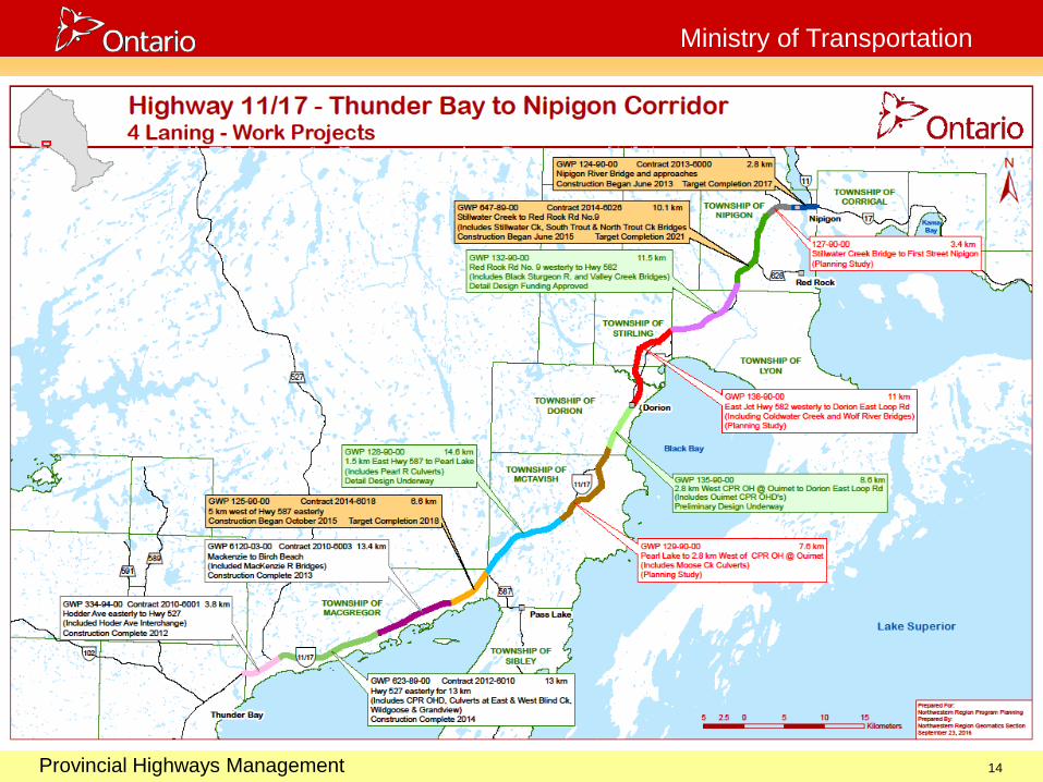
• Completed (30.2 km):
• Hodder Avenue easterly to Highway 527 (3.8 km), including a full interchange at Hodder and realignment to the Terry Fox Rest Area. This project was completed in fall 2012. [334-94-00]
• Mackenzie Station Road to Birch Beach Road (13.4 km-new alignment), including new bridges over the Mackenzie River. This project opened to traffic in summer 2013. [6120-03-00]
• Highway 527 to Mackenzie Station Road (13km). This project opened to traffic in the fall 2014. [623-89-00]
15

October 29, 2003
Provincial Highways Management
Ministry of Transportation
Mackenzie River Bridges
Mackenzie River Fall 2010
October 29, 2003
Provincial Highways Management
Ministry of Transportation
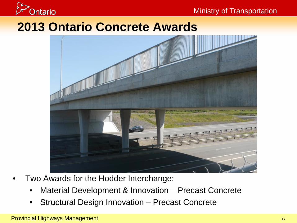
2013 Ontario Concrete Awards
• Two Awards for the Hodder Interchange: • Material Development & Innovation – Precast Concrete • Structural Design Innovation – Precast Concrete
17

October 29, 2003
Provincial Highways Management
Ministry of Transportation
18
October 29, 2003
Provincial Highways Management
Ministry of Transportation
What’s Under Construction?
• Construction Underway (19.5 km):
• Nipigon River Bridge and approaches from First Street to Highway 11/Highway 17 intersection (2.8 km) (Construction started in summer 2013). [124-90-00]
• Red Rock Road No. 9 to Stillwater Creek Bridge (10.1 km) (Utility Relocations started in 2013, construction started in 2015). [647-89-00]
• Birch Beach Road to Highway 587 at Pass Lake (6.6 km) Design-Build (Construction started in 2015). [125-90-00]
19
October 29, 2003
Provincial Highways Management
Ministry of Transportation
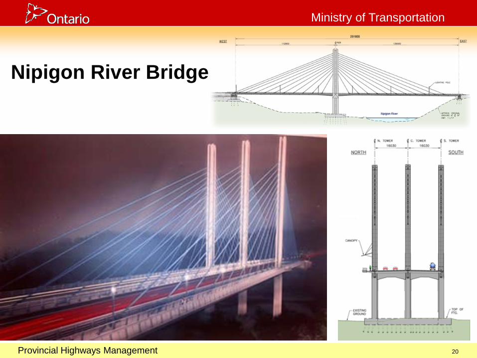
Nipigon River Bridge
20
October 29, 2003
Provincial Highways Management
Ministry of Transportation
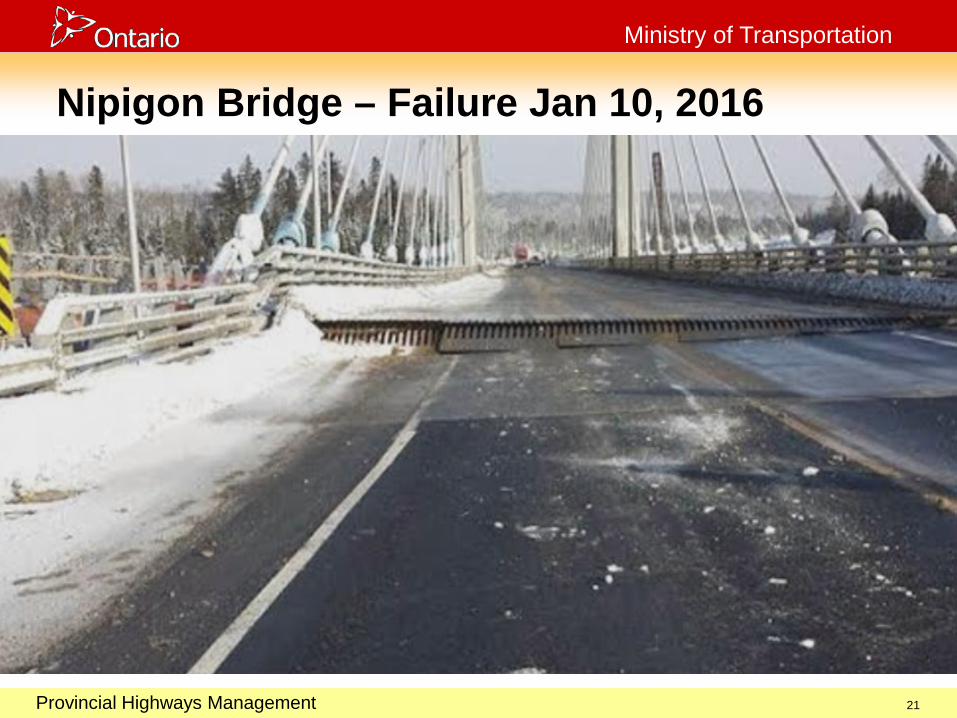
Nipigon Bridge – Failure Jan 10, 2016
21
October 29, 2003
Provincial Highways Management
Ministry of Transportation
Nipigon Bridge Failure
• Full information about the Nipigon River Bridge
failure and the subsequent investigation reports can be found at: http://www.mto.gov.on.ca/english/highway-bridges/nipigon-bridge/
22
October 29, 2003
Provincial Highways Management
Ministry of Transportation
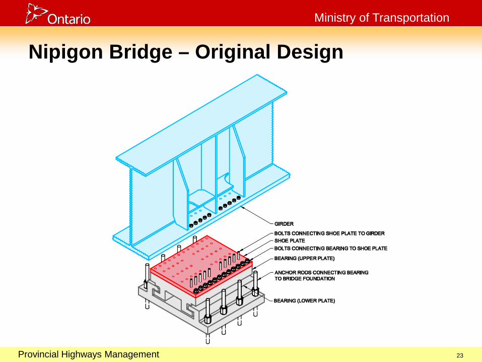
Nipigon Bridge – Original Design
23
October 29, 2003
Provincial Highways Management
Ministry of Transportation
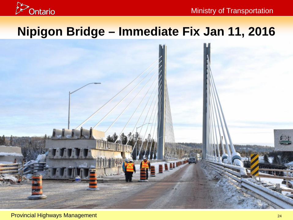
Nipigon Bridge – Immediate Fix Jan 11, 2016
24

October 29, 2003
Provincial Highways Management
Ministry of Transportation
Nipigon Bridge – Temporary Repair Feb 19
25

October 29, 2003
Provincial Highways Management
Ministry of Transportation
Nipigon Bridge – Permanent Retrofit
26

October 29, 2003
Provincial Highways Management
Ministry of Transportation
Nipigon Bridge – Looking Downstream
27
October 29, 2003
Provincial Highways Management
Ministry of Transportation
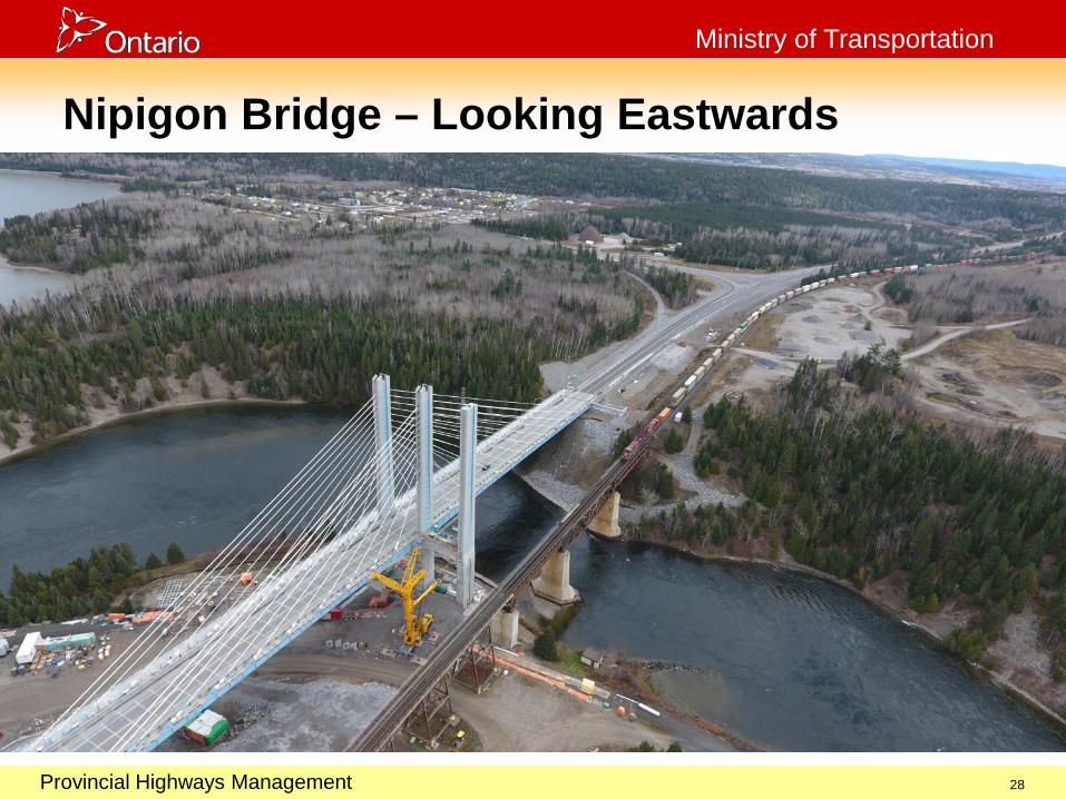
Nipigon Bridge – Looking Eastwards
28
October 29, 2003
Provincial Highways Management
Ministry of Transportation
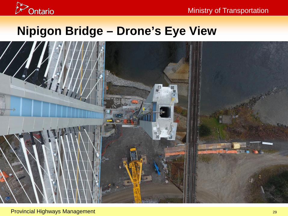
Nipigon Bridge – Drone’s Eye View
29

October 29, 2003
Provincial Highways Management
Ministry of Transportation
30
October 29, 2003
Provincial Highways Management
Ministry of Transportation
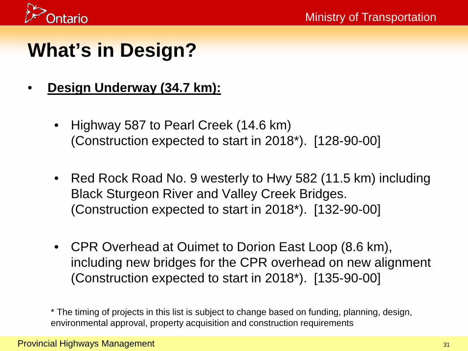
What’s in Design?
• Design Underway (34.7 km):
• Highway 587 to Pearl Creek (14.6 km) (Construction expected to start in 2018*). [128-90-00]
• Red Rock Road No. 9 westerly to Hwy 582 (11.5 km) including Black Sturgeon River and Valley Creek Bridges. (Construction expected to start in 2018*). [132-90-00]
• CPR Overhead at Ouimet to Dorion East Loop (8.6 km), including new bridges for the CPR overhead on new alignment (Construction expected to start in 2018*). [135-90-00]
* The timing of projects in this list is subject to change based on funding, planning, design, environmental approval, property acquisition and construction requirements
31
October 29, 2003
Provincial Highways Management
Ministry of Transportation
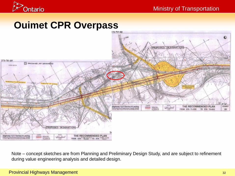
Ouimet CPR Overpass
32
Note – concept sketches are from Planning and Preliminary Design Study, and are subject to refinement during value engineering analysis and detailed design.

October 29, 2003
Provincial Highways Management
Ministry of Transportation
33
October 29, 2003
Provincial Highways Management
Ministry of Transportation
What’s Left?
• Planning Study (22 km):
• Pearl to Ouimet (7.6 km) (Construction expected to start in 2020*). [129-90-00]
• Dorion to Hwy 582 (11 km) (Construction expected to start in 2020*). [138-90-00]
• Stillwater Creek Bridge to First Street Nipigon (3.4 km) (Construction expected to start in 2020*). [127-90-00]
* The timing of projects in this list is subject to change based on funding, planning, design, environmental approval, property acquisition and construction requirements
34
October 29, 2003
Provincial Highways Management
Ministry of Transportation
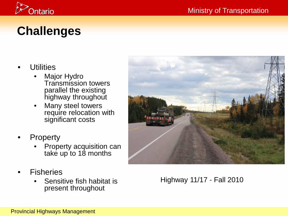
Challenges
• Utilities • Major Hydro
Transmission towers parallel the existing highway throughout
• Many steel towers require relocation with significant costs
• Property
• Property acquisition can take up to 18 months
• Fisheries
• Sensitive fish habitat is present throughout
Highway 11/17 - Fall 2010
October 29, 2003
Provincial Highways Management
Ministry of Transportation
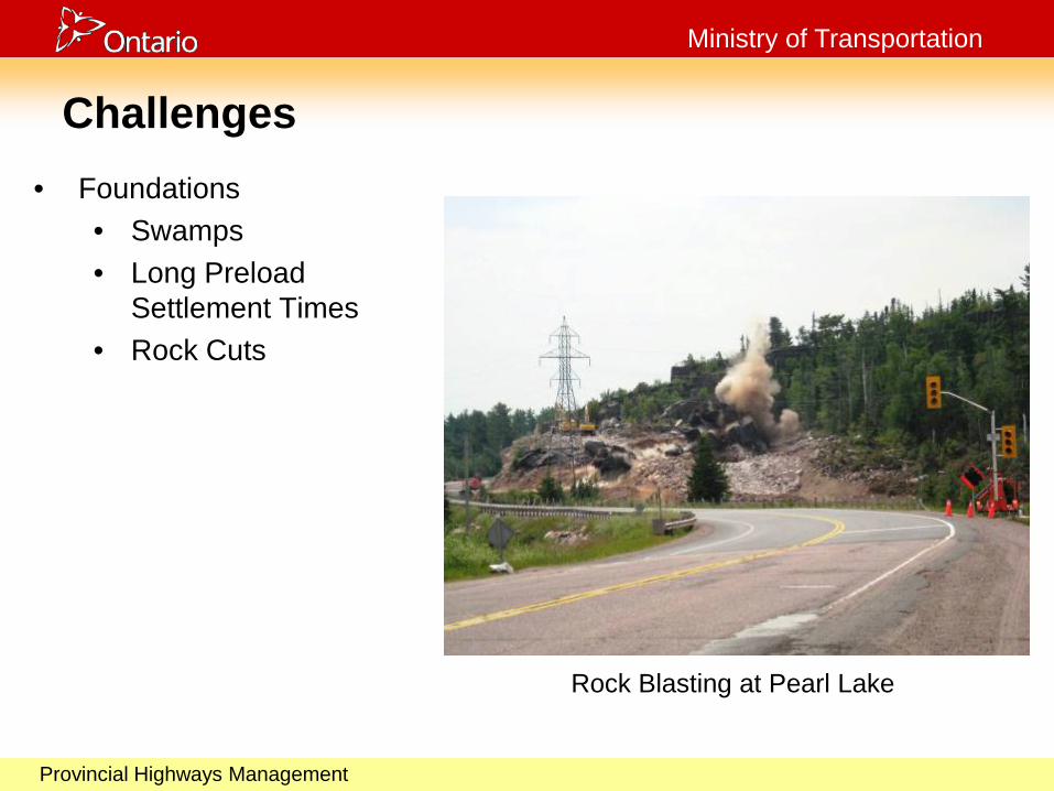
Challenges
• Foundations • Swamps • Long Preload
Settlement Times • Rock Cuts
Rock Blasting at Pearl Lake

October 29, 2003
Provincial Highways Management
Ministry of Transportation
Challenges
• Archaeology • Significant Paleo
Indian site was discovered near the banks of the Mackenzie River.
• This site is considered rare and complex.
October 29, 2003
Provincial Highways Management
Ministry of Transportation
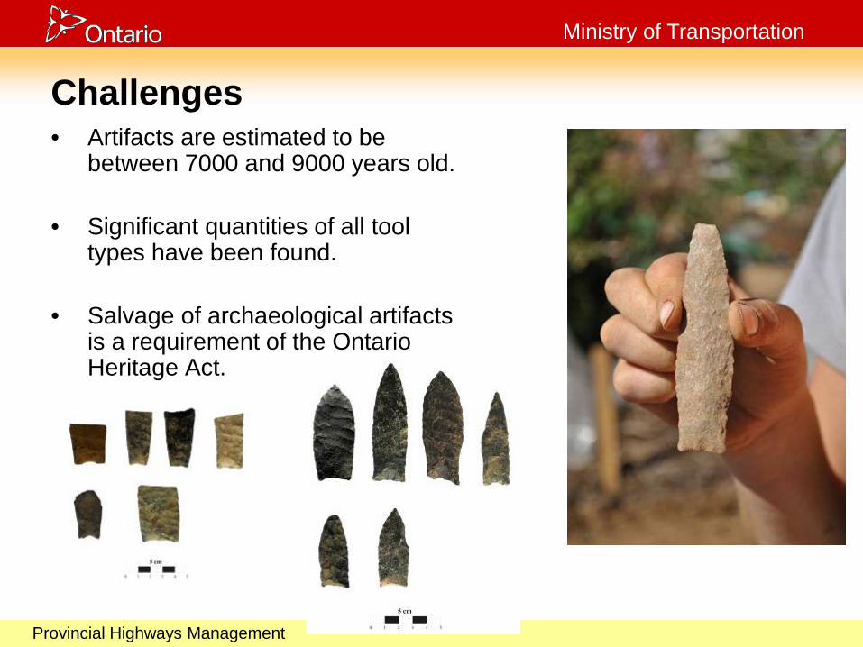
Challenges • Artifacts are estimated to be
between 7000 and 9000 years old.
• Significant quantities of all tool types have been found.
• Salvage of archaeological artifacts is a requirement of the Ontario Heritage Act.

October 29, 2003
Provincial Highways Management
Ministry of Transportation
Benefits
• Four-laning continues to: • Improve driver comfort and safety • Eliminate head-on collisions • Provide a parallel road that will serve as an
emergency alternate route in the event of a natural disaster or structural loss
• Generate construction jobs • Support economic growth in Northern Ontario
October 29, 2003
Provincial Highways Management
Ministry of Transportation
Questions?