Embed Size (px)
Citation preview

8/14/2019 Turistic Routes of El Salvador.pdf
http://slidepdf.com/reader/full/turistic-routes-of-el-salvadorpdf 1/14
ROUTE OF FLOWERS
Pleasant route from Sonsonate to Abroad and includes five destinations full of cultural tradition,
history, archaeological sites, natural attractions, fine dining, pleasant climate and beautiful
scenery:
Nahuizalco: A 70 kms. From San Salvador.
Your name Nahuatl means "four Izalcos", as it
was founded by four families of Izalco.
People of Indian tradition and whose main
attractions are the night market and shops
and craft workshops.
Salcoatitán: "The city of Quetzalcoatl" is a small
coffee town, whose main attraction is the colonial
church, located opposite the picturesque Central
Park in which is held a food festival where you can
taste typical local dishes.
Juayúa: Attractive city whose name in Nahuatl
means "river of purple orchids" has a pleasant
climate, diversity of stories and legends, unique
natural sites, and a famous food festival that takes
place every weekend in front of his impressive
church, which honors the Black Christ.
8/14/2019 Turistic Routes of El Salvador.pdf
http://slidepdf.com/reader/full/turistic-routes-of-el-salvadorpdf 2/14
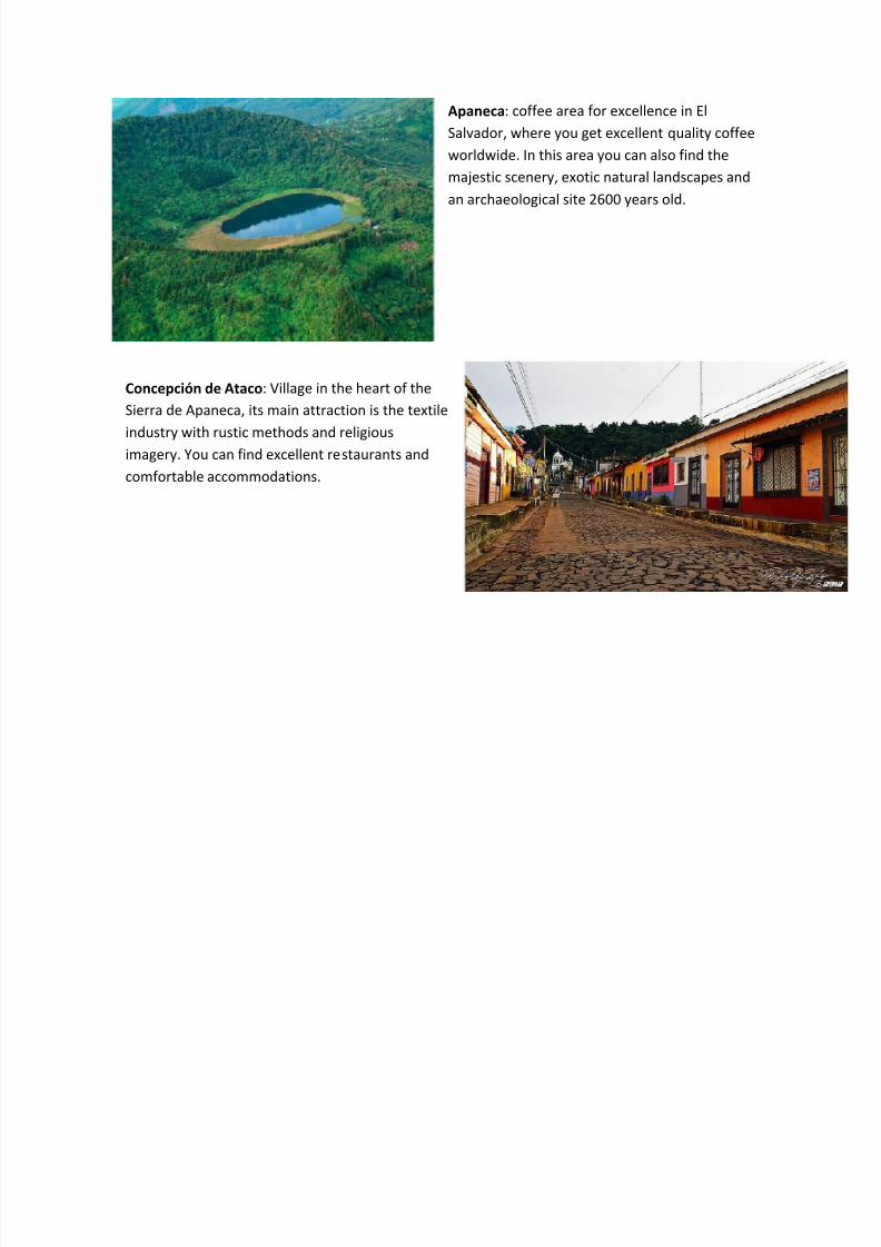
Apaneca: coffee area for excellence in El
Salvador, where you get excellent quality coffee
worldwide. In this area you can also find the
majestic scenery, exotic natural landscapes and
an archaeological site 2600 years old.
Concepción de Ataco: Village in the heart of the
Sierra de Apaneca, its main attraction is the textile
industry with rustic methods and religiousimagery. You can find excellent restaurants and
comfortable accommodations.

8/14/2019 Turistic Routes of El Salvador.pdf
http://slidepdf.com/reader/full/turistic-routes-of-el-salvadorpdf 3/14
PARADISE ROAD CRAFT
Approximately 100 kms. From the city of San Salvador to the country's highest point 2730 meters
above the sea level, (m). One of the most scenic areas of the country, with cooler weather and a
series of natural and handmade.
Cihuatán: Archaeological site whose name means "Place of
Women", and has one of the largest ball games found in the
country was occupied by different groups of people with the
last post-classical period, the most important and mostly
investigated after conquest.
La Palma: Picturesque village cool climate where
the most representative made country crafts, wood
and painted with colorful landscapes, whose style
was created by artist Fernando Llort.
San Ignacio: People of craftsmen very quiet
and safe, with beautiful landscapes of cypress
and pine.
8/14/2019 Turistic Routes of El Salvador.pdf
http://slidepdf.com/reader/full/turistic-routes-of-el-salvadorpdf 4/14
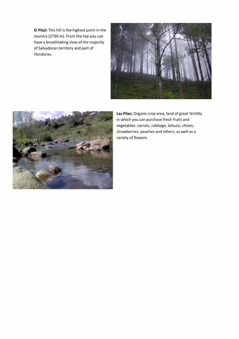
El Pital: This hill is the highest point in the
country (2730 m). From the top you can
have a breathtaking view of the majority
of Salvadoran territory and part of
Honduras.
Las Pilas: Organic crop area, land of great fertility
in which you can purchase fresh fruits and
vegetables: carrots, cabbage, lettuce, chives,
strawberries, peaches and others, as well as a
variety of flowers.
8/14/2019 Turistic Routes of El Salvador.pdf
http://slidepdf.com/reader/full/turistic-routes-of-el-salvadorpdf 5/14
VOLCANO COMPLEX
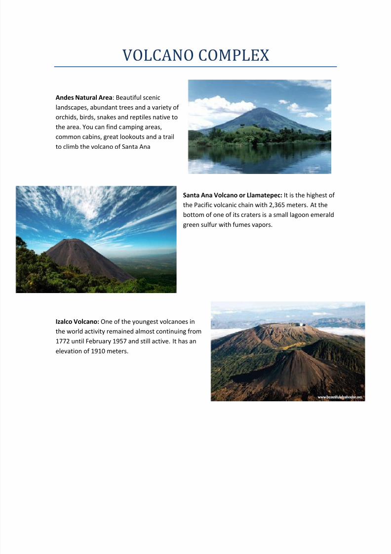
Andes Natural Area: Beautiful scenic
landscapes, abundant trees and a variety of
orchids, birds, snakes and reptiles native to
the area. You can find camping areas,
common cabins, great lookouts and a trail
to climb the volcano of Santa Ana
Santa Ana Volcano or Llamatepec: It is the highest of
the Pacific volcanic chain with 2,365 meters. At the
bottom of one of its craters is a small lagoon emerald
green sulfur with fumes vapors.
Izalco Volcano: One of the youngest volcanoes in
the world activity remained almost continuing from
1772 until February 1957 and still active. It has an
elevation of 1910 meters.
8/14/2019 Turistic Routes of El Salvador.pdf
http://slidepdf.com/reader/full/turistic-routes-of-el-salvadorpdf 6/14
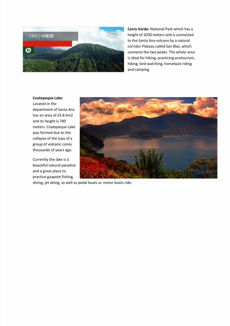
Cerro Verde: National Park which has a
height of 2030 meters and is connected
to the Santa Ana volcano by a natural
corridor Plateau called San Blas, which
connects the two peaks. The whole area
is ideal for hiking, practicing ecotourism,
hiking, bird watching, horseback riding
and camping.
Coatepeque Lake:
Located in the
department of Santa Ana
has an area of 24.8 km2
and its height is 740
meters. Coatepeque Lake
was formed due to the
collapse of the tops of a
group of volcanic cones
thousands of years ago.
Currently the lake is a
beautiful natural paradise
and a great place topractice guapote fishing,
diving, jet skiing, as well as pedal boats or motor boats ride.
8/14/2019 Turistic Routes of El Salvador.pdf
http://slidepdf.com/reader/full/turistic-routes-of-el-salvadorpdf 7/14

8/14/2019 Turistic Routes of El Salvador.pdf
http://slidepdf.com/reader/full/turistic-routes-of-el-salvadorpdf 8/14
ARCHAEOLOGICAL ROUTE
This route will lead you through the major archaeological sites of El Salvador that are part of the Mayan World and remnants of the colonial era.
Joya de Ceren: Declared a World Heritage Site by
UNESCO. The only place in the Mayan world
showing the daily life of Mayan Indians.
San Andrés: Site that was an important ceremonial
center, where they also found the first obraje of Indigo
from the colonial era.
Santa Ana: The second largest city in the
country. Its main attraction is its unique
historical center, an architectural treasure.

8/14/2019 Turistic Routes of El Salvador.pdf
http://slidepdf.com/reader/full/turistic-routes-of-el-salvadorpdf 9/14
Chalchuapa: Constitute the largest archaeologicalsite in the country.
Tazumal: This is a must for lovers of archeology, jade and reproductions of ancient vases.
Casablanca: Archaeological site of the
fifteenth century. It has an indigo dyeing
workshop.
St. James Church: Its construction
eighteenth century, contains labeled
boxes in the colonial era, imagery,
paintings and silverware.
8/14/2019 Turistic Routes of El Salvador.pdf
http://slidepdf.com/reader/full/turistic-routes-of-el-salvadorpdf 10/14
ROUTE OF PEACE
Natural paradise here you have a unique experience to know the history and culture of our
ancestors, indigenous traditions, living nature, fresh air and crystal springs flowing rivers,
waterfalls and streams, make this place an enchanting ready to be discovered in an unforgettable
adventure.
Perquín: A village green surrounded by coffee
plantations and pine forests with a pleasant
climate, from the mountains. Perquín has food
services, accommodation options, craft shops
and ground transportation.
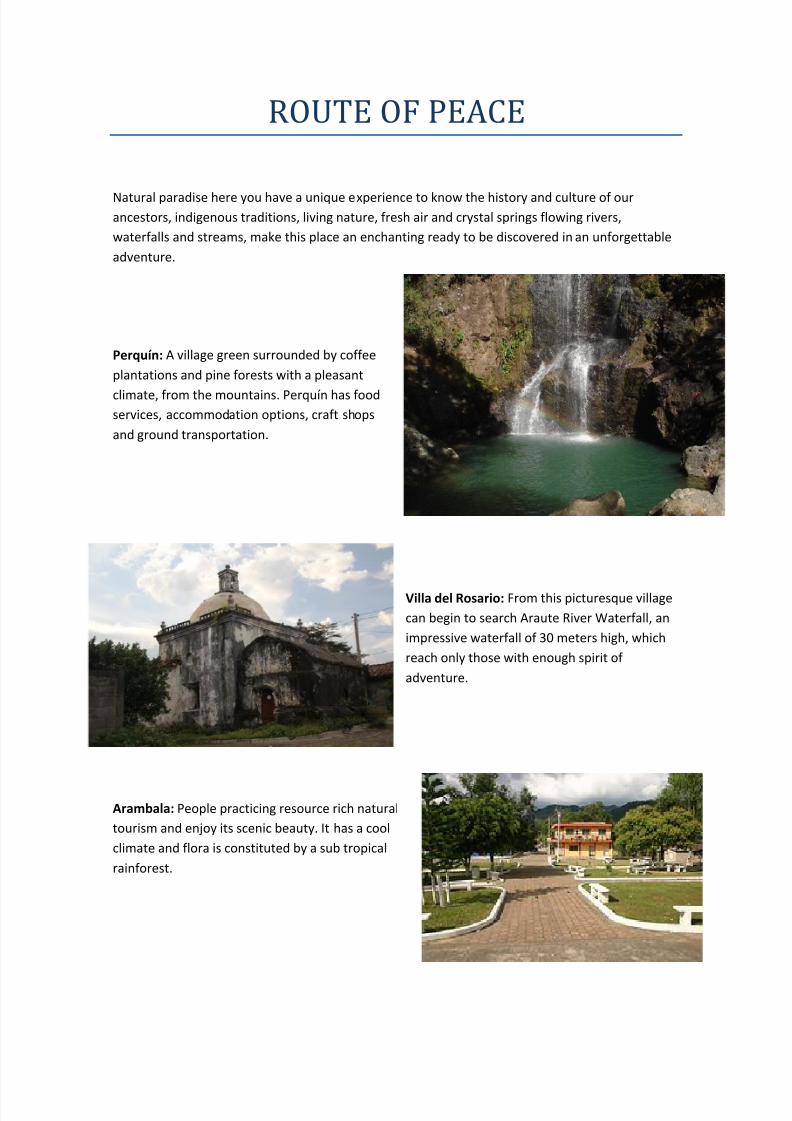
Villa del Rosario: From this picturesque village
can begin to search Araute River Waterfall, an
impressive waterfall of 30 meters high, which
reach only those with enough spirit of
adventure.
Arambala: People practicing resource rich natural
tourism and enjoy its scenic beauty. It has a cool
climate and flora is constituted by a sub tropical
rainforest.
8/14/2019 Turistic Routes of El Salvador.pdf
http://slidepdf.com/reader/full/turistic-routes-of-el-salvadorpdf 11/14
Cacaopera: In the main square is the colonial
church built in the year 16660. In its
construction, its walls surprised almost 5 meters
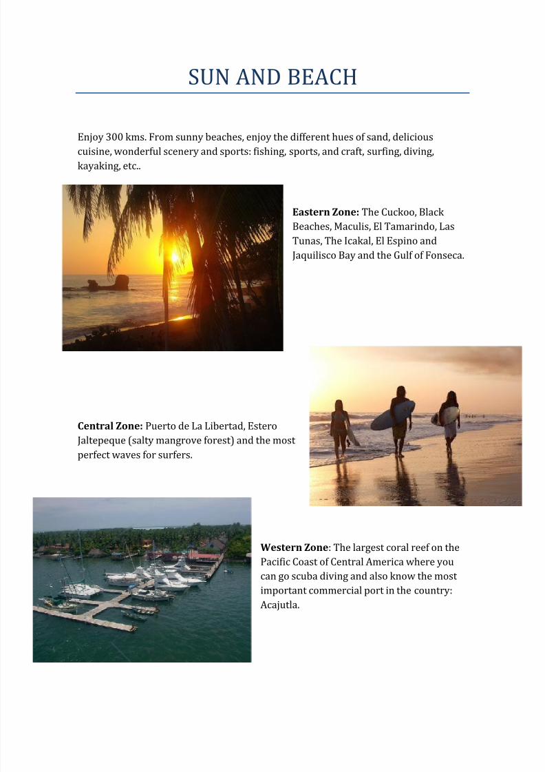
wide. Very near the church is a bell tower
holding 3 large bronze bells dating from 1721.
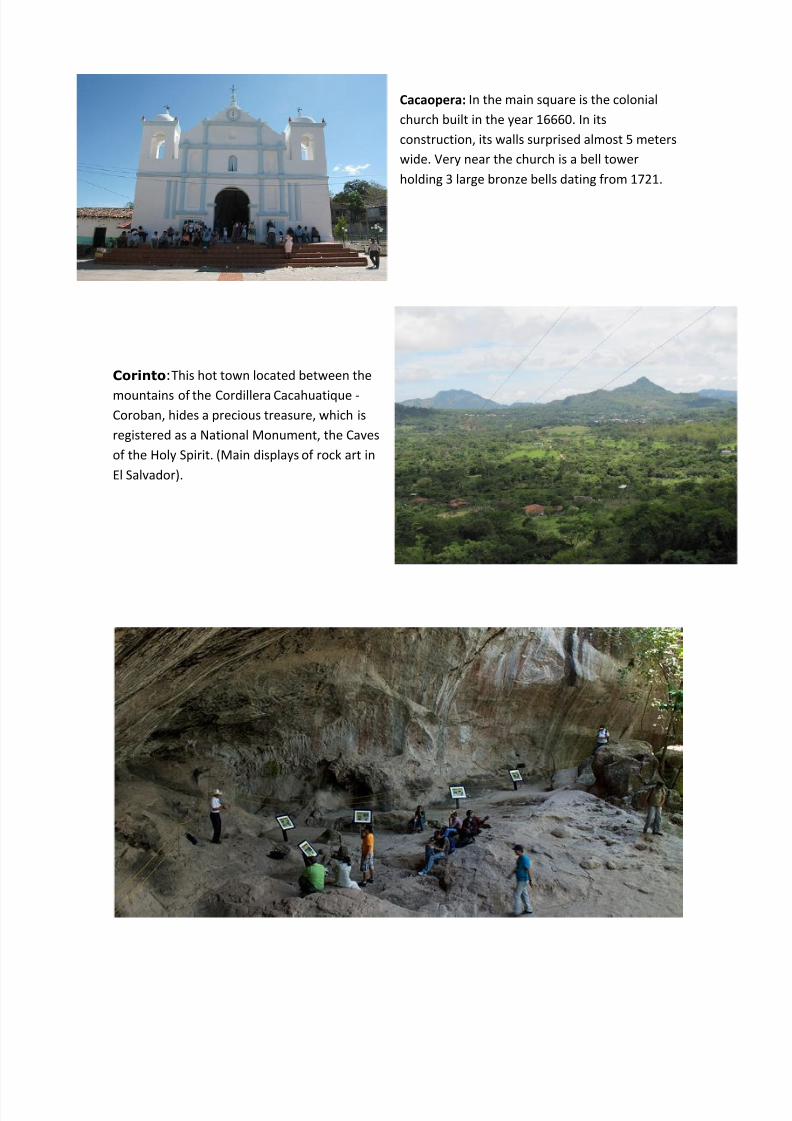
Corinto:This hot town located between the
mountains of the Cordillera Cacahuatique -
Coroban, hides a precious treasure, which is
registered as a National Monument, the Caves
of the Holy Spirit. (Main displays of rock art in
El Salvador).
8/14/2019 Turistic Routes of El Salvador.pdf
http://slidepdf.com/reader/full/turistic-routes-of-el-salvadorpdf 12/14
ARTISAN ROUTE
Enjoy the unique works of art that are born from the hands of Salvadoran artisans and colonial
heritage embodied in the people of Suchitoto and Ilobasco.
Lake Ilopango: The country's largest lake inside a
volcanic crater.
Ilobasco: The main attraction of this town is
making crafts in clay. Visit the workshops and a
variety of shops where you will find the most vivid
expressions of the imagination of the artisans.
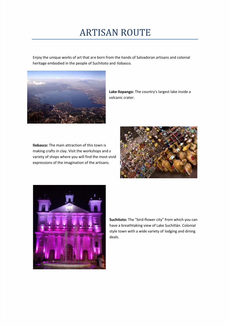
Suchitoto: The "bird-flower city" from which you can
have a breathtaking view of Lake Suchitlán. Colonial
style town with a wide variety of lodging and dining
deals.

8/14/2019 Turistic Routes of El Salvador.pdf
http://slidepdf.com/reader/full/turistic-routes-of-el-salvadorpdf 13/14
OF THE SUMMITS ROUTE
Discover diversity of landscapes and natural attractions that make this original route nestled in the
mountains Tecapa-Chinameca in Usulutan.
Jocotal Lake: Wildlife Refuge, unique in the
country declared a Ramsar site.
Chaguantique: It is the perfect place to admire the beautiful
butterfly Big Blue and a large colony of Spider Monkeys.
Jiquilisco Bay: One of the most beautiful natural
sites in salt water, lush vegetation compound,salty forests, coconut trees, large islands, desert
and paradise beaches.

8/14/2019 Turistic Routes of El Salvador.pdf
http://slidepdf.com/reader/full/turistic-routes-of-el-salvadorpdf 14/14
Berlin: City cool climate and beautiful
scenery.
Santiago de Maria: Beautiful city surrounded
by mountains and forests. It houses the largest
coffee producer in the country.
Alegría: Small villa with an attractive surprising
crater lagoon of Alegria.