Embed Size (px)
Citation preview
Trimble Geospatial Division –
Integrated Solutions for
Geomatics professions
Volker Zirn
Regional Sales Representative
11
Agenda
Trimble GeoSpatial Division
Airborne System Solutions
Trimble Inpho Software
Mobile Spatial Imaging
eCognition Image Analysis Software
2
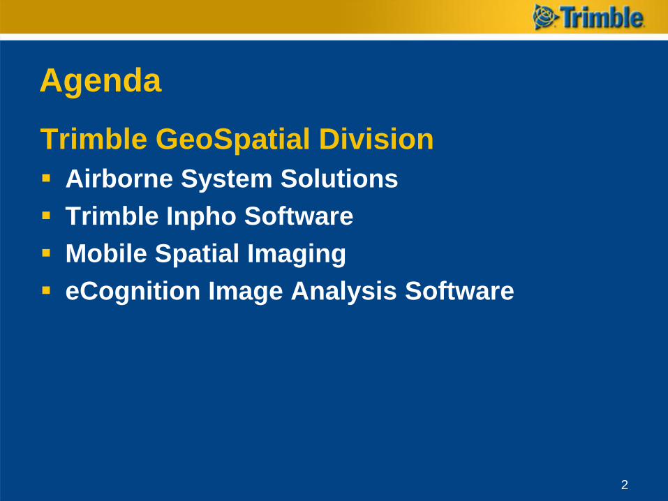
GeoSpatial DivisionResult of Acquisition of 5 Companies:
Inpho (Photogrammetry)
Rollei Metric (Aerial Camera Systems)
Toposys (Aerial LiDAR integrated platform)
Geo-3D (Land based Mobile Mapping)
eCognition Business Area (geo-information extraction)
Main Division Office in Westminster, Colorado
Satellite offices in Montreal, Madrid, Stuttgart, Munich and throughout Germany.
3
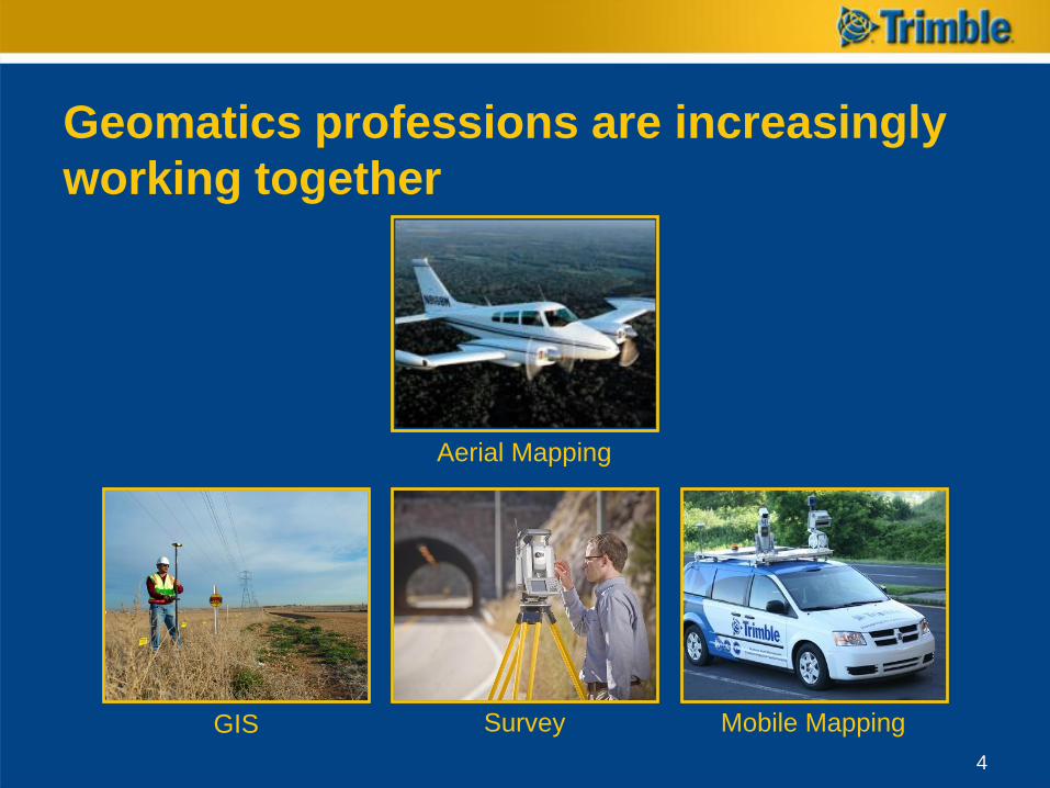
Geomatics professions are increasingly
working together
4
Aerial Mapping
GIS Mobile MappingSurvey
4
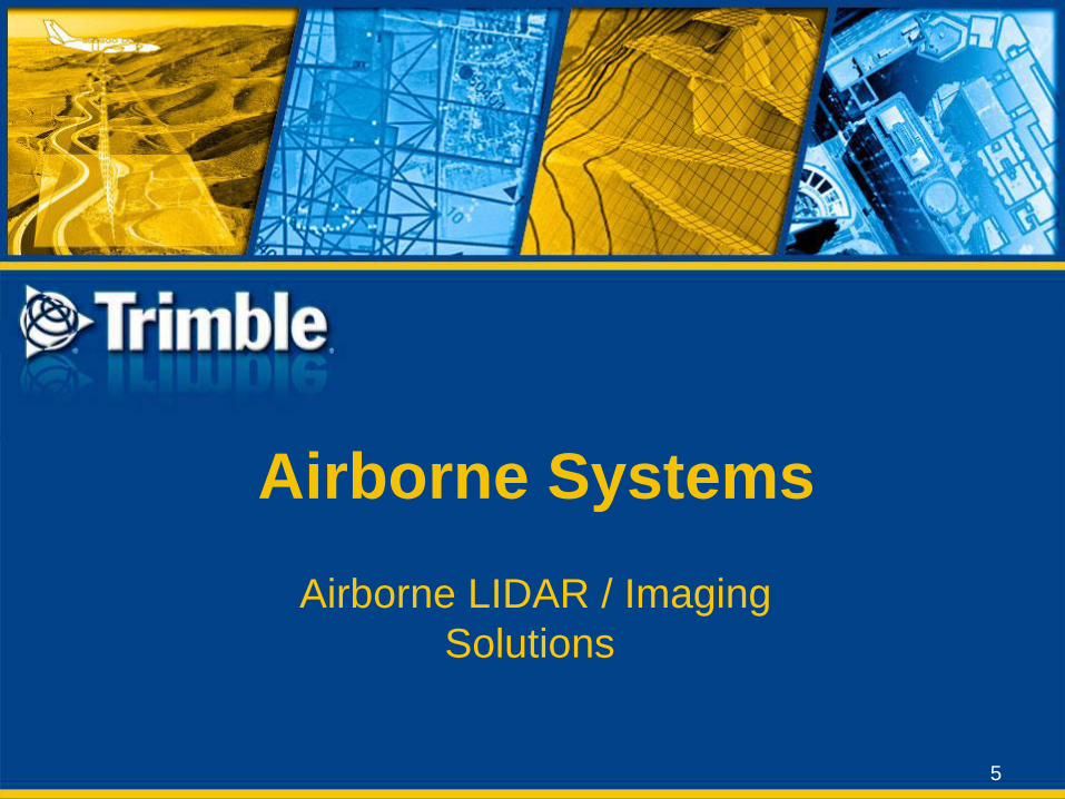
Airborne Systems
5
Airborne LIDAR / Imaging
Solutions
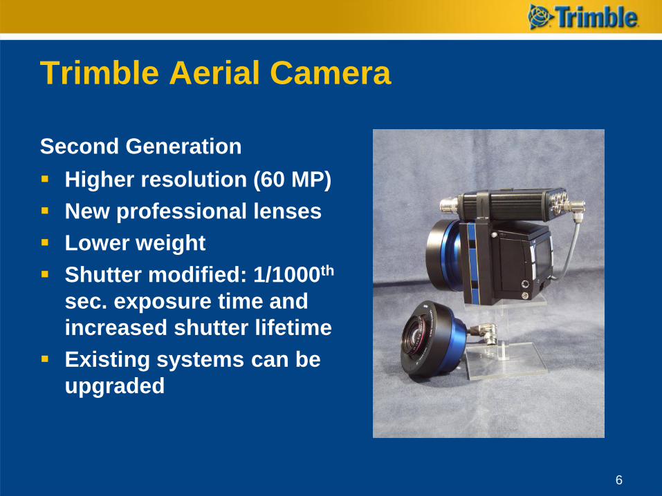
Trimble Aerial Camera
Second Generation
Higher resolution (60 MP)
New professional lenses
Lower weight
Shutter modified: 1/1000th
sec. exposure time and
increased shutter lifetime
Existing systems can be
upgraded
6
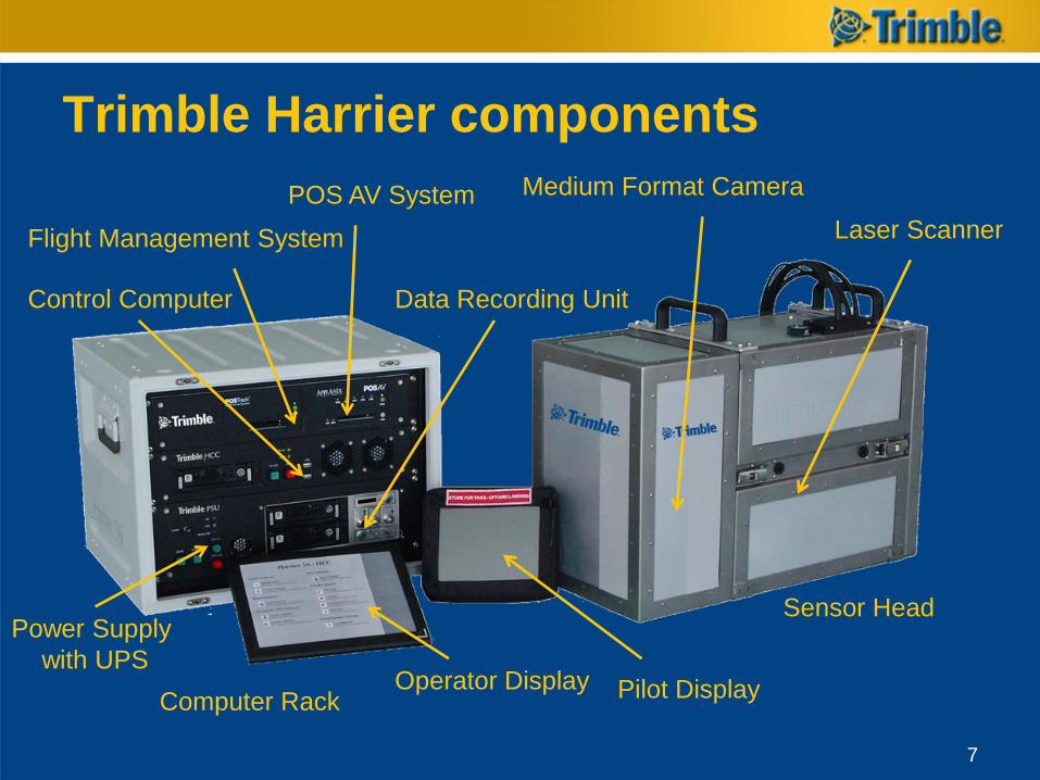
Trimble Harrier components
7
Laser Scanner
Medium Format CameraPOS AV System
Flight Management System
Control Computer
Power Supply
with UPS
Data Recording Unit
Operator Display Pilot Display
Sensor Head
Computer Rack
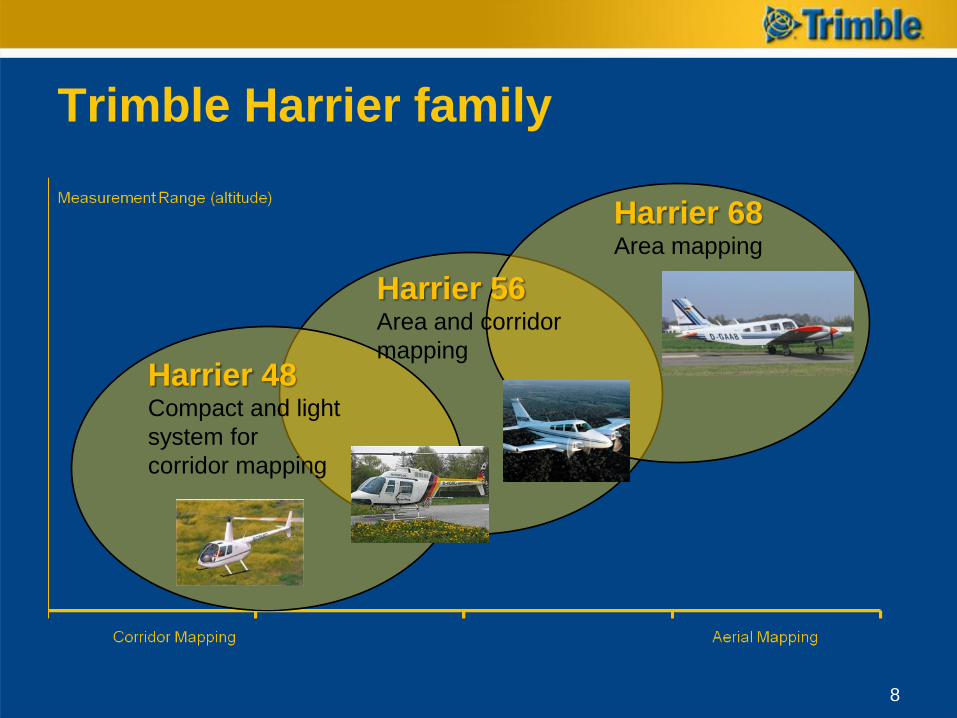
Trimble Harrier family
8
Harrier 48Compact and light
system for
corridor mapping
Harrier 56Area and corridor
mapping
Harrier 68Area mapping
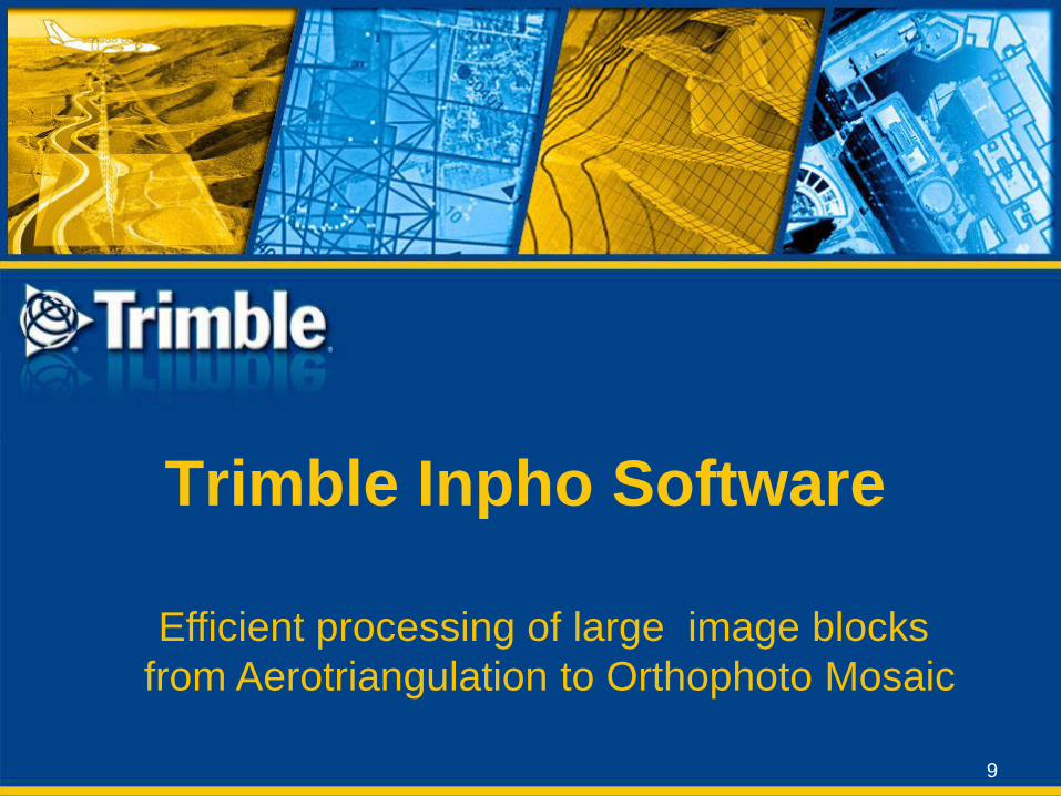
Trimble Inpho Software
9
Efficient processing of large image blocks
from Aerotriangulation to Orthophoto Mosaic
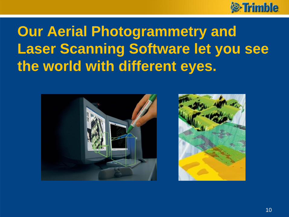
Our Aerial Photogrammetry and
Laser Scanning Software let you see
the world with different eyes.
10
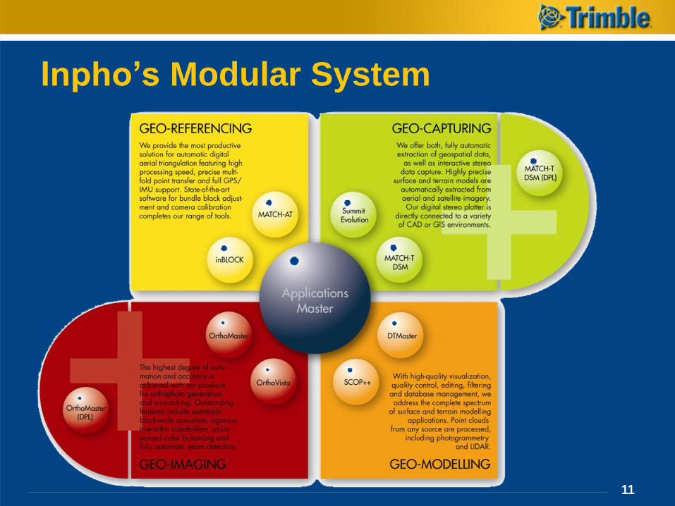
Inpho’s Modular System
111111
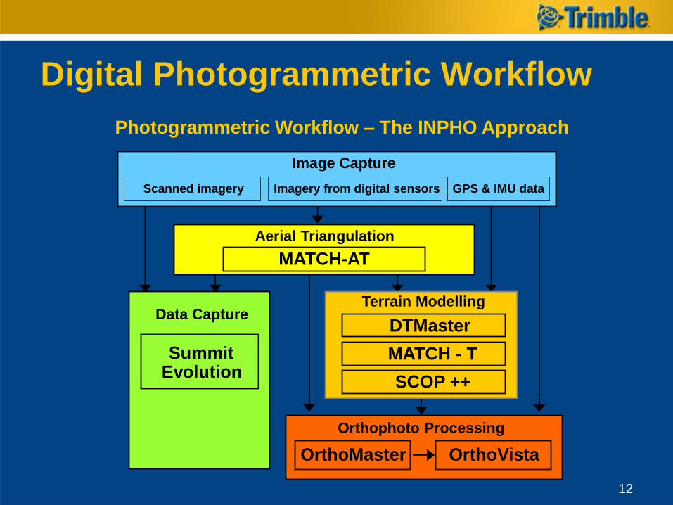
Digital Photogrammetric Workflow
Photogrammetric Workflow – The INPHO Approach
Aerial Triangulation
MATCH-AT
Data Capture
SummitEvolution
Image Capture
Scanned imagery Imagery from digital sensors GPS & IMU data
Orthophoto Processing
OrthoMaster OrthoVista
Terrain Modelling
DTMaster
SCOP ++
MATCH - T
12
13
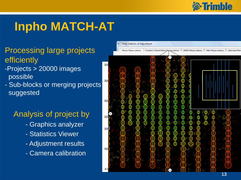
Inpho MATCH-AT
Processing large projects
efficiently-Projects > 20000 images
possible
- Sub-blocks or merging projects
suggested
Analysis of project by
- Graphics analyzer
- Statistics Viewer
- Adjustment results
- Camera calibration
13
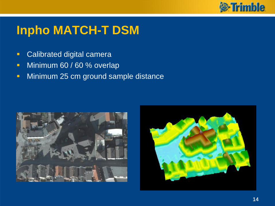
Inpho MATCH-T DSM
Calibrated digital camera
Minimum 60 / 60 % overlap
Minimum 25 cm ground sample distance
1414
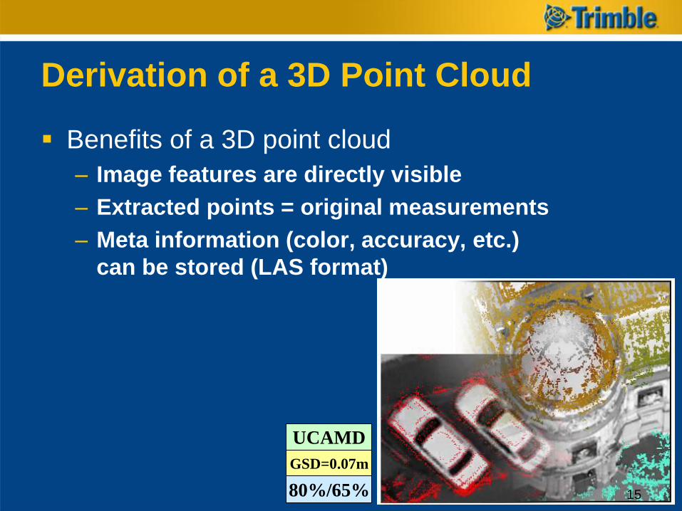
Benefits of a 3D point cloud
– Image features are directly visible
– Extracted points = original measurements
– Meta information (color, accuracy, etc.)
can be stored (LAS format)
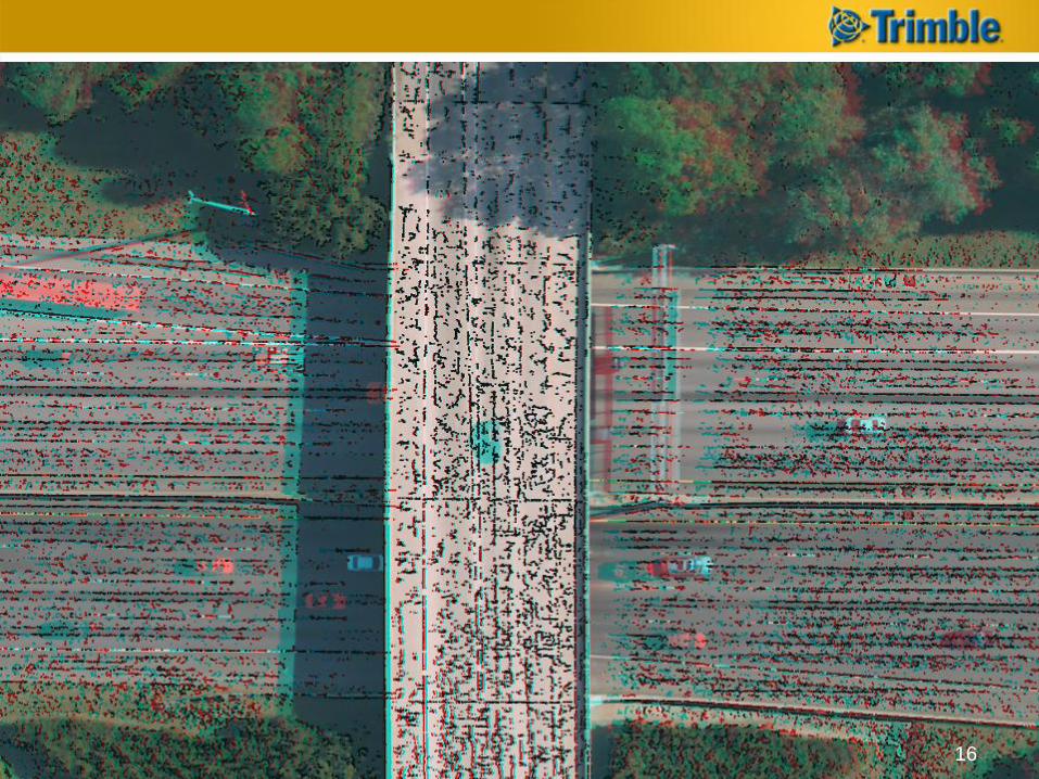
Derivation of a 3D Point Cloud
UCAMD
GSD=0.07m
80%/65% 15
16
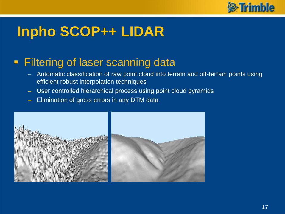
Inpho SCOP++ LIDAR
Filtering of laser scanning data– Automatic classification of raw point cloud into terrain and off-terrain points using
efficient robust interpolation techniques
– User controlled hierarchical process using point cloud pyramids
– Elimination of gross errors in any DTM data
17
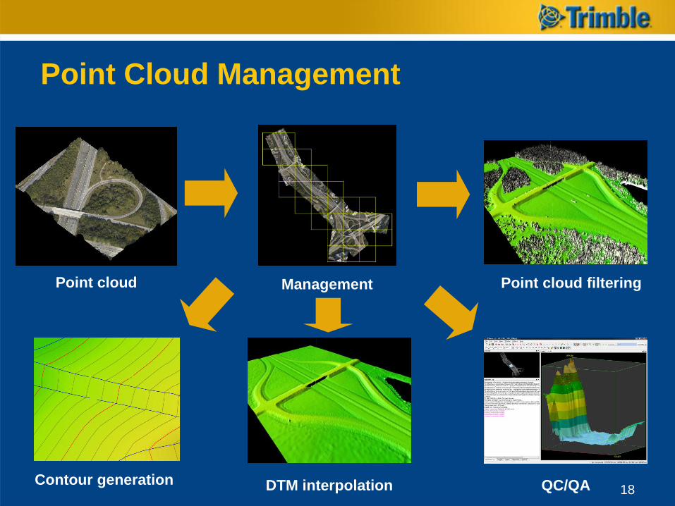
Point Cloud Management
ManagementPoint cloud Point cloud filtering
QC/QADTM interpolationContour generation18
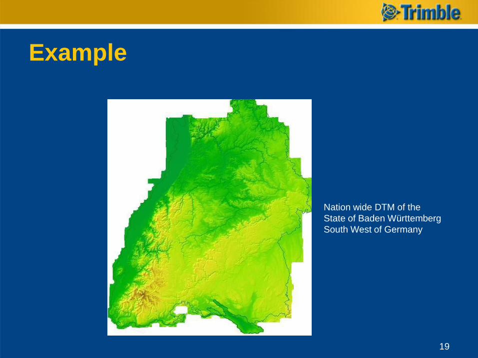
Example
Nation wide DTM of the
State of Baden Württemberg
South West of Germany
19
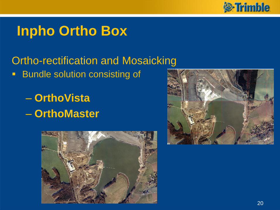
Inpho Ortho Box
Ortho-rectification and Mosaicking
Bundle solution consisting of
– OrthoVista
– OrthoMaster
20
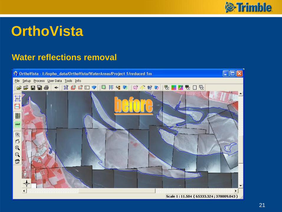
OrthoVista
Water reflections removal
21
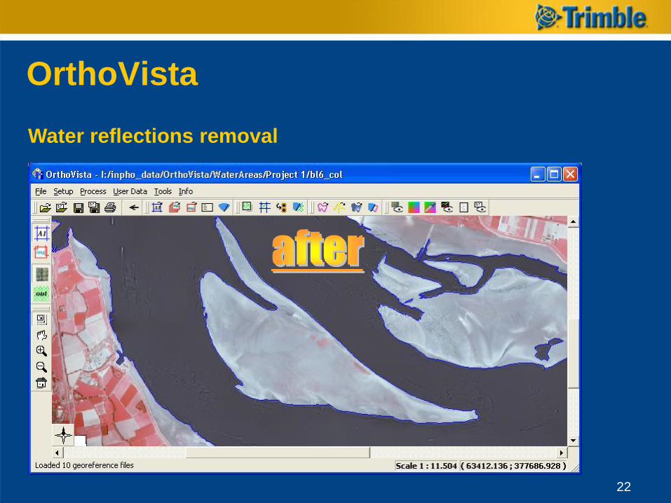
OrthoVista
Water reflections removal
22
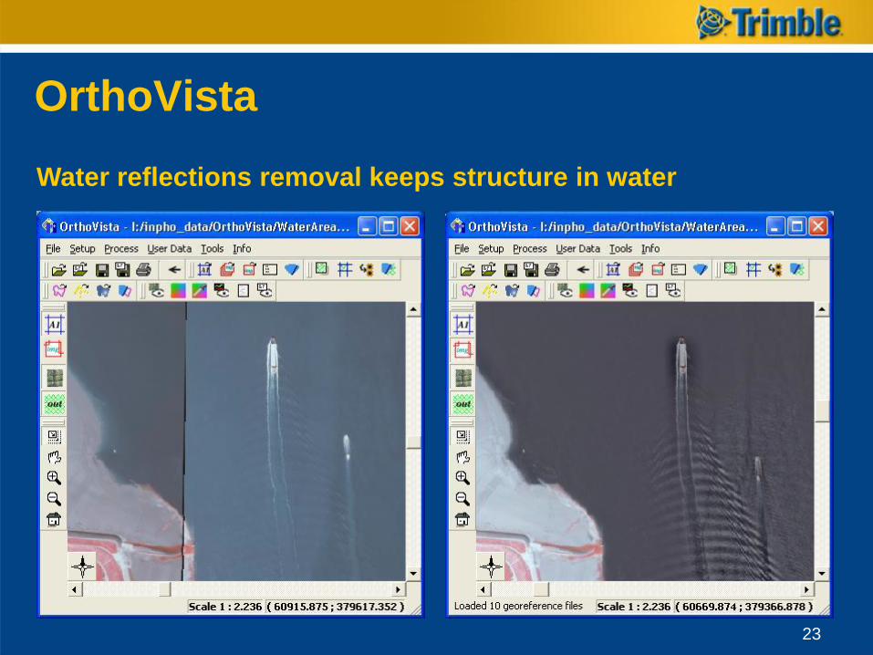
OrthoVista
Water reflections removal keeps structure in water
23
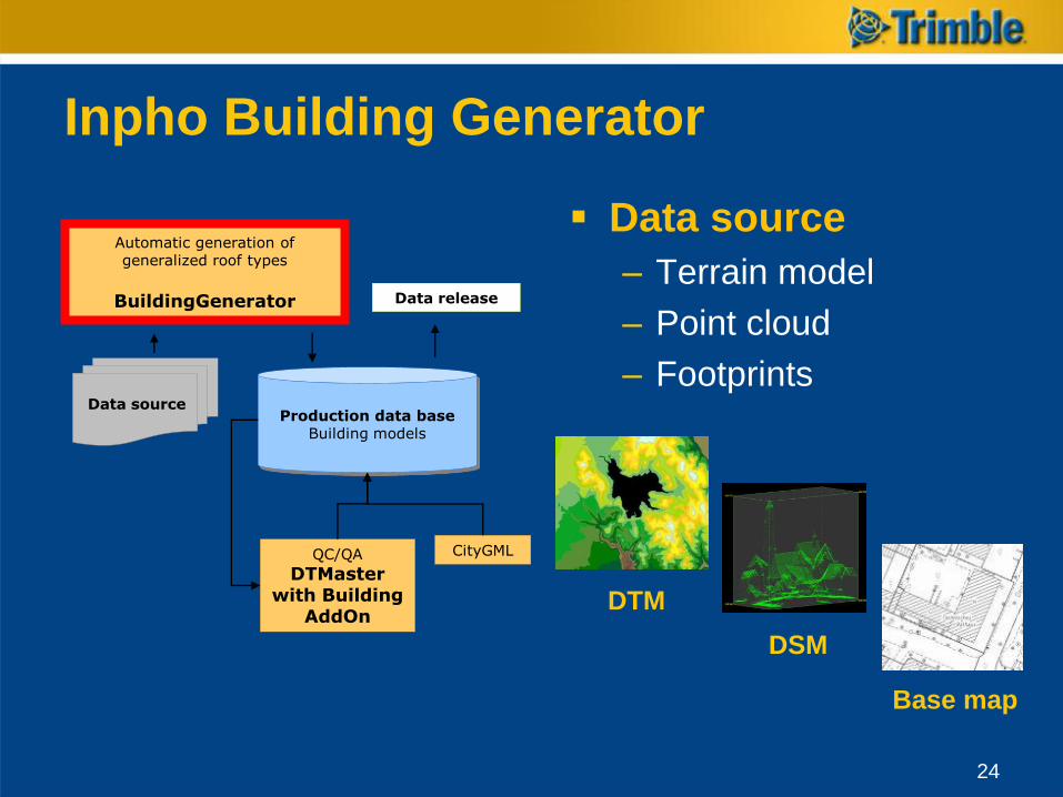
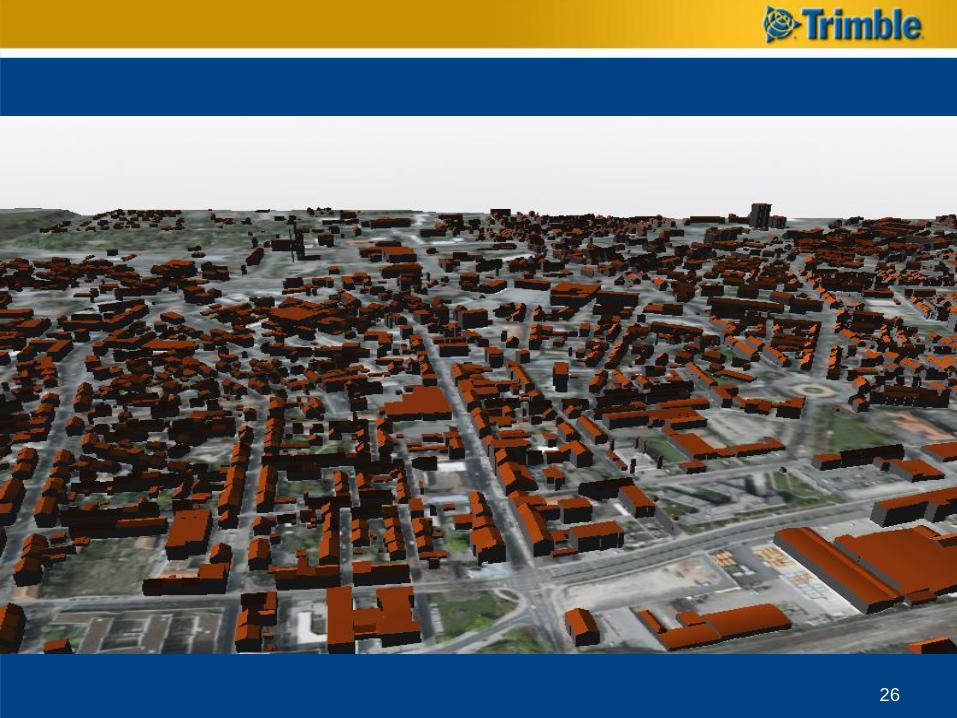
Inpho Building Generator
Data source
– Terrain model
– Point cloud
– Footprints
Base map
Data source
DTM
DSM
Production data baseBuilding models
QC/QA
DTMaster with Building
AddOn
Automatic generation of generalized roof types
BuildingGenerator
CityGML
Data release
24
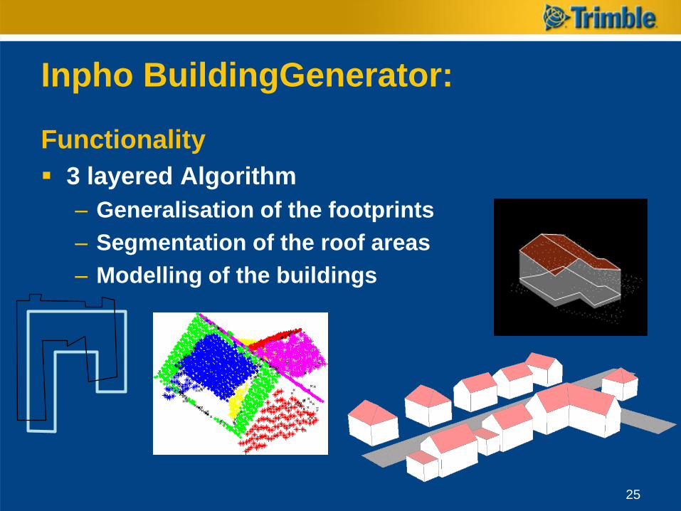
Functionality
3 layered Algorithm
– Generalisation of the footprints
– Segmentation of the roof areas
– Modelling of the buildings
Inpho BuildingGenerator:
25
26
Mobile Spatial Imaging
Mobile Data Capture Systems
27
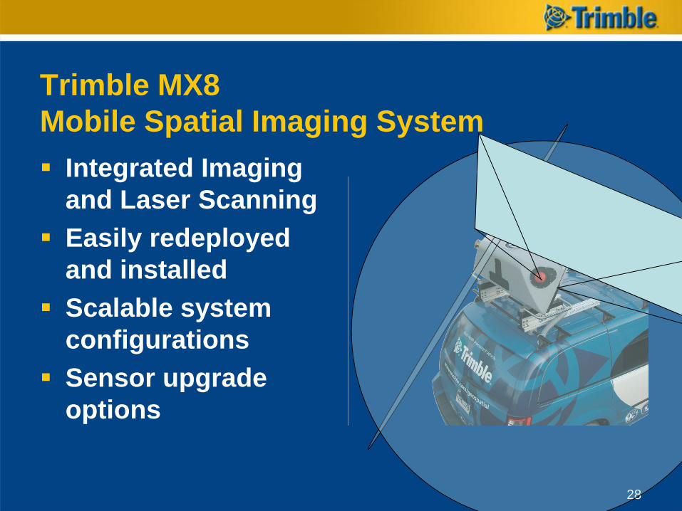
Trimble MX8
Mobile Spatial Imaging System
Integrated Imaging
and Laser Scanning
Easily redeployed
and installed
Scalable system
configurations
Sensor upgrade
options
28
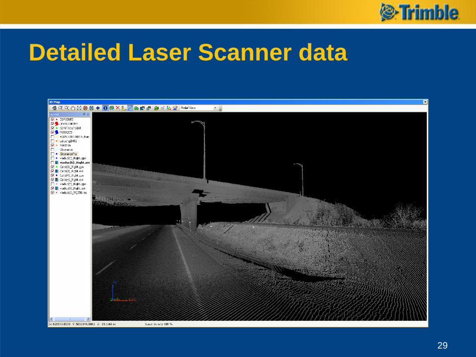
Detailed Laser Scanner data
29
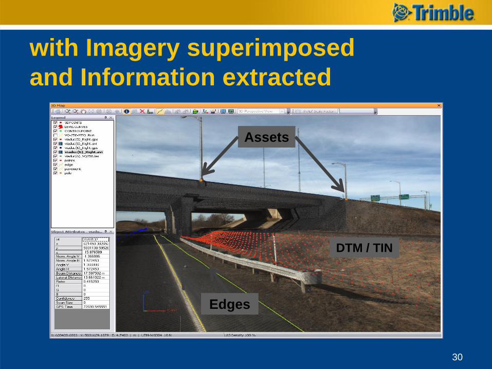
with Imagery superimposed
and Information extracted
30
DTM / TIN
Assets
Edges
eCognition
31
The most advanced image analysis software
available for geospatial applications
For more information
www.trimble.com/geospatial
Thank you for your attention !