Embed Size (px)
Citation preview
Tree Height Estimation Methodology With X-band and P-band InSAR Data
Lijun Lu Guoman Huang Qiwei Li CASM
Outline
CASMSAR dataset and test area
Height Estimation with RVoG method Height Estimation with dual-band InSAR method
Results validation and analysis
Conclusions
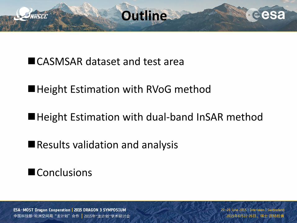
CASMSAR System
CASMSAR • Cessna Citation aircraft • X-band dual-antenna SAR • P-band repeat pass SAR
Airborne PolInSAR System Band X-band P-band Interferometry Dual-antenna single pass single-antenna repeat-pass Baseline Length 2.2m -- Mode Biastics Mode、Ping-Pong Mode Monostatic Polarization HH、HV、VH、VV HH、HV、VH、VV Resolution(m) 0.3-2.5 1-5 Incident Angle(°) 30-60 30-60 Bandwidth(MHz) 800 200 Flight Altitude 3000-12000m Velocity 450km/h Endurance 3.5hours
Airborne Platform CASM-SAR System Parameters
Test area
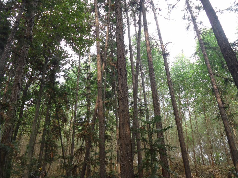
• Sichuan Danling • Forest (Eucalyptus,Broadleaf)
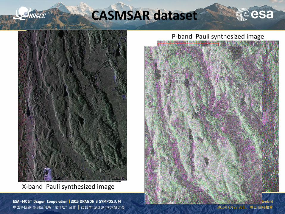
CASMSAR dataset
X-band Pauli synthesized image
P-band Pauli synthesized image
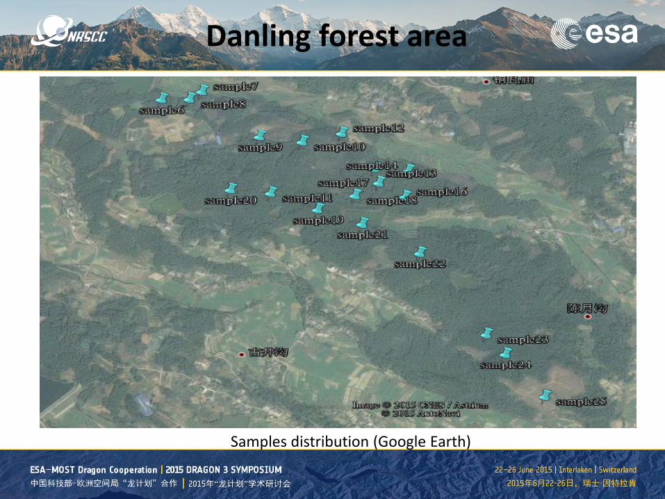
Danling forest area
Samples distribution (Google Earth)
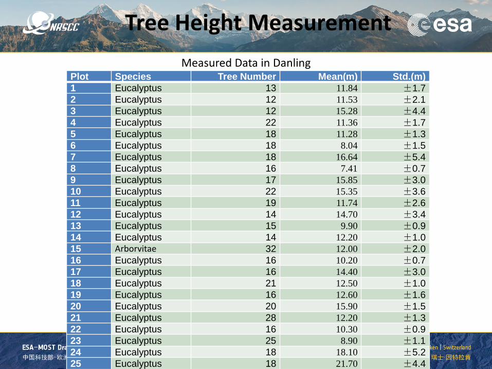
Tree Height Measurement
Plot Species Tree Number Mean(m) Std.(m) 1 Eucalyptus 13 11.84 ±1.7 2 Eucalyptus 12 11.53 ±2.1 3 Eucalyptus 12 15.28 ±4.4 4 Eucalyptus 22 11.36 ±1.7 5 Eucalyptus 18 11.28 ±1.3 6 Eucalyptus 18 8.04 ±1.5 7 Eucalyptus 18 16.64 ±5.4 8 Eucalyptus 16 7.41 ±0.7 9 Eucalyptus 17 15.85 ±3.0 10 Eucalyptus 22 15.35 ±3.6 11 Eucalyptus 19 11.74 ±2.6 12 Eucalyptus 14 14.70 ±3.4 13 Eucalyptus 15 9.90 ±0.9 14 Eucalyptus 14 12.20 ±1.0 15 Arborvitae 32 12.00 ±2.0 16 Eucalyptus 16 10.20 ±0.7 17 Eucalyptus 16 14.40 ±3.0 18 Eucalyptus 21 12.50 ±1.0 19 Eucalyptus 16 12.60 ±1.6 20 Eucalyptus 20 15.90 ±1.5 21 Eucalyptus 28 12.20 ±1.3 22 Eucalyptus 16 10.30 ±0.9 23 Eucalyptus 25 8.90 ±1.1 24 Eucalyptus 18 18.10 ±5.2 25 Eucalyptus 18 21.70 ±4.4
Measured Data in Danling
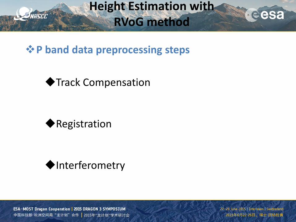
P band data preprocessing steps Track Compensation
Registration
Interferometry
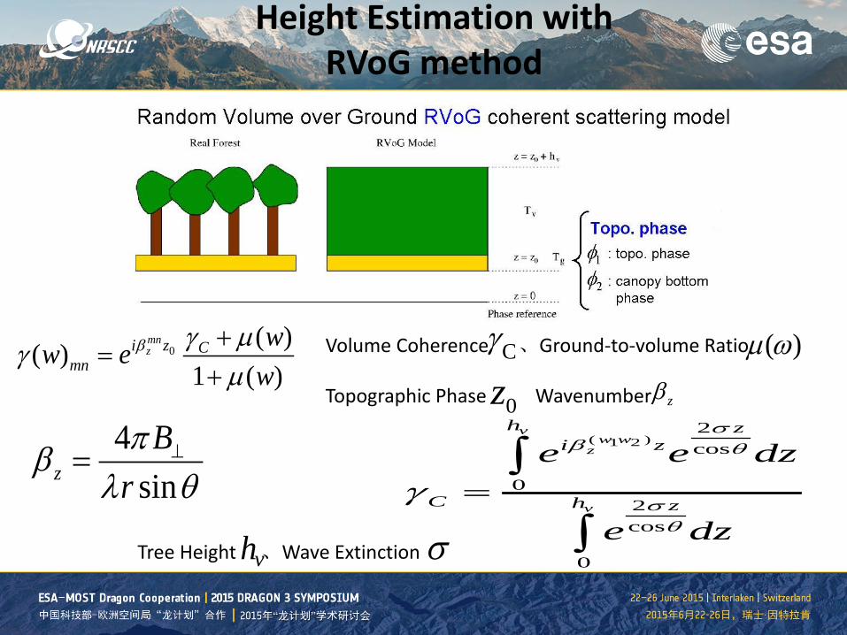
Height Estimation with RVoG method
0( )( )
1 ( )mnzi z C
mnww e
wβ γ µγ
µ+
=+
Tree Height 、Wave Extinction
( )1 22cos
02cos
0
vw w
z
v
h zi z
C h z
e e dz
e dz
σβ θ
σθ
γ =∫
∫vh σ
Volume Coherence 、Ground-to-volume Ratio Topographic Phase Wavenumber 0z
( )µ ωCγ
4sinzB
rπβ
λ θ⊥=
zβ
Height Estimation with RVoG method
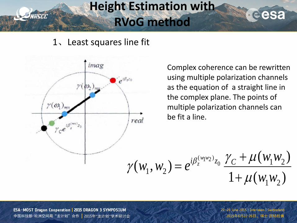
1、Least squares line fit
Complex coherence can be rewritten using multiple polarization channels as the equation of a straight line in the complex plane. The points of multiple polarization channels can be fit a line.
( )1 20 1 2
1 21 2
( )( , )1 ( )
w wzi z C w ww w e
w wβ γ µ
γµ+
=+
Height Estimation with RVoG method
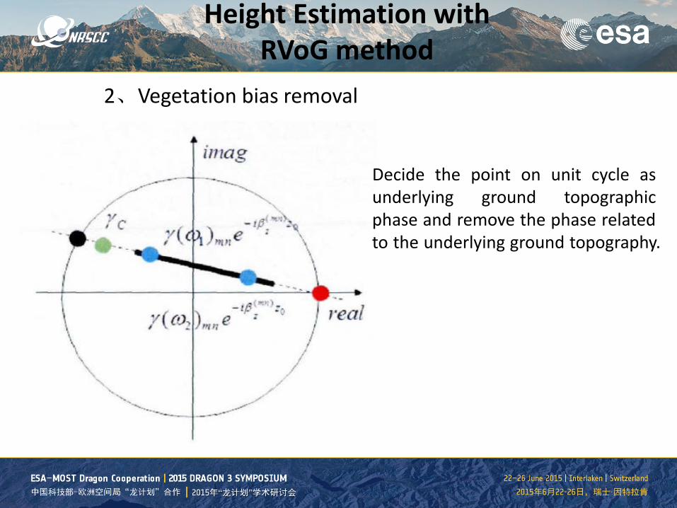
2、Vegetation bias removal
Decide the point on unit cycle as underlying ground topographic phase and remove the phase related to the underlying ground topography.
Height Estimation with RVoG method
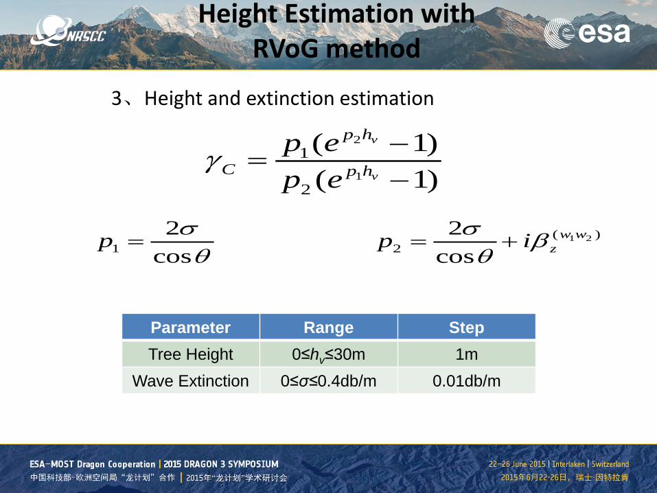
3、Height and extinction estimation
2
1
1
2
( 1)( 1)
v
v
p h
C p hp ep e
γ −=
−
12
cosp σ
θ= 1 2( )
22
cosw w
zp iσ βθ
= +
Parameter Range Step Tree Height 0≤hv≤30m 1m
Wave Extinction 0≤σ≤0.4db/m 0.01db/m
Height Estimation with RVoG method
SVD1 SVD2 SVD3
NR1 NR2 NR3
HH HV VV
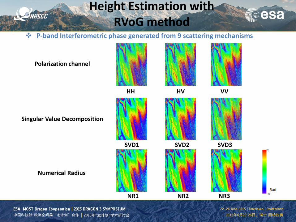
P-band Interferometric phase generated from 9 scattering mechanisms
Singular Value Decomposition
Numerical Radius
Polarization channel
Height Estimation with RVoG method
Height Estimation with RVoG method
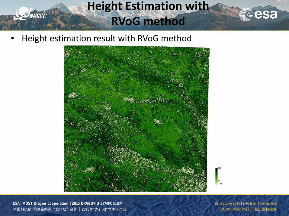
• Height estimation result with RVoG method
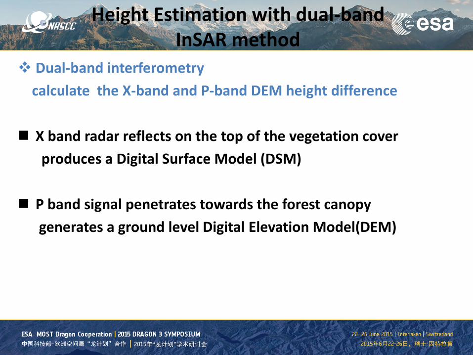
Dual-band interferometry calculate the X-band and P-band DEM height difference X band radar reflects on the top of the vegetation cover
produces a Digital Surface Model (DSM) P band signal penetrates towards the forest canopy generates a ground level Digital Elevation Model(DEM)
Height Estimation with dual-band InSAR method
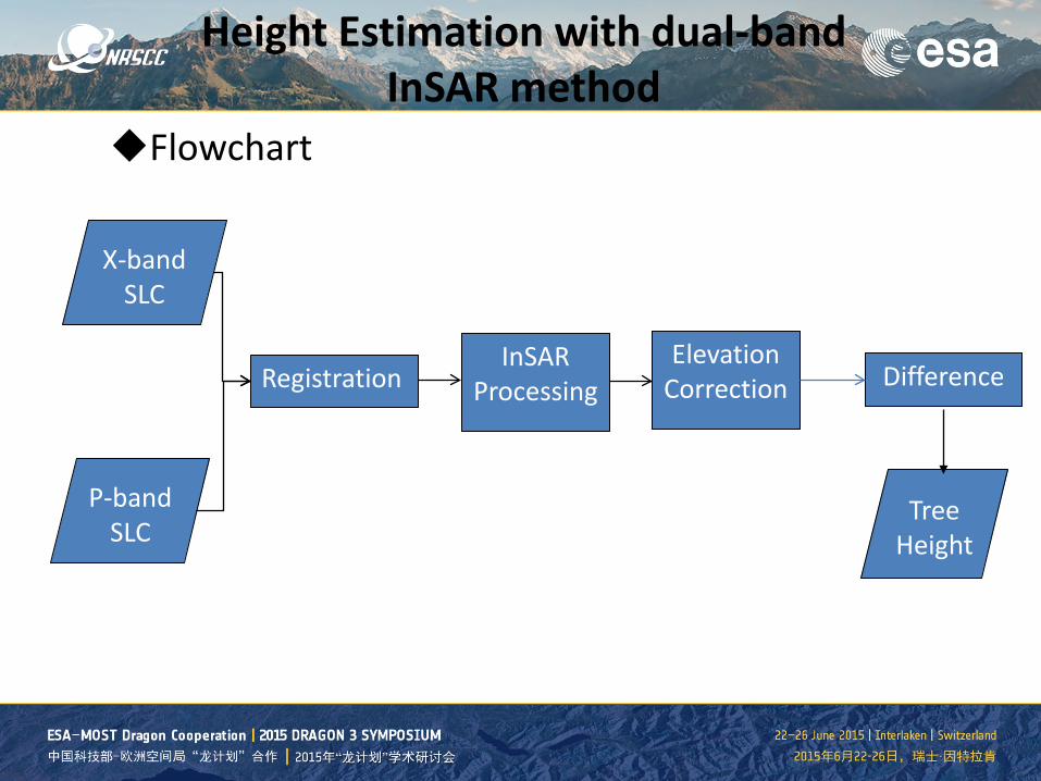
Flowchart
Height Estimation with dual-band InSAR method
X-band SLC
P-band SLC
Registration Elevation
Correction Difference
Tree Height
InSAR Processing
SVD1 SVD2 SVD3
NR1 NR2 NR3
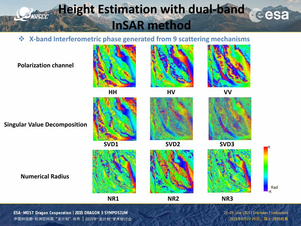
HH HV VV
X-band Interferometric phase generated from 9 scattering mechanisms
Singular Value Decomposition
Numerical Radius
Polarization channel
Height Estimation with dual-band InSAR method
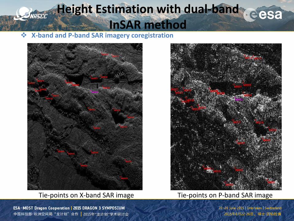
Tie-points on X-band SAR image Tie-points on P-band SAR image
X-band and P-band SAR imagery coregistration
Height Estimation with dual-band InSAR method
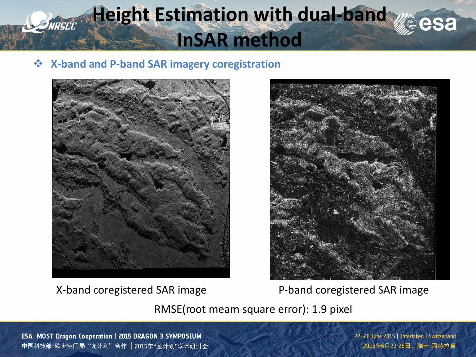
X-band coregistered SAR image P-band coregistered SAR image
X-band and P-band SAR imagery coregistration
RMSE(root meam square error): 1.9 pixel
Height Estimation with dual-band InSAR method
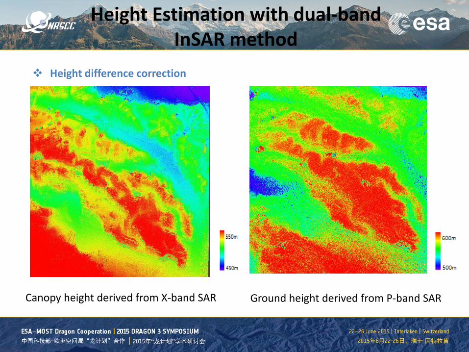
Canopy height derived from X-band SAR Ground height derived from P-band SAR
Height difference correction
Height Estimation with dual-band InSAR method
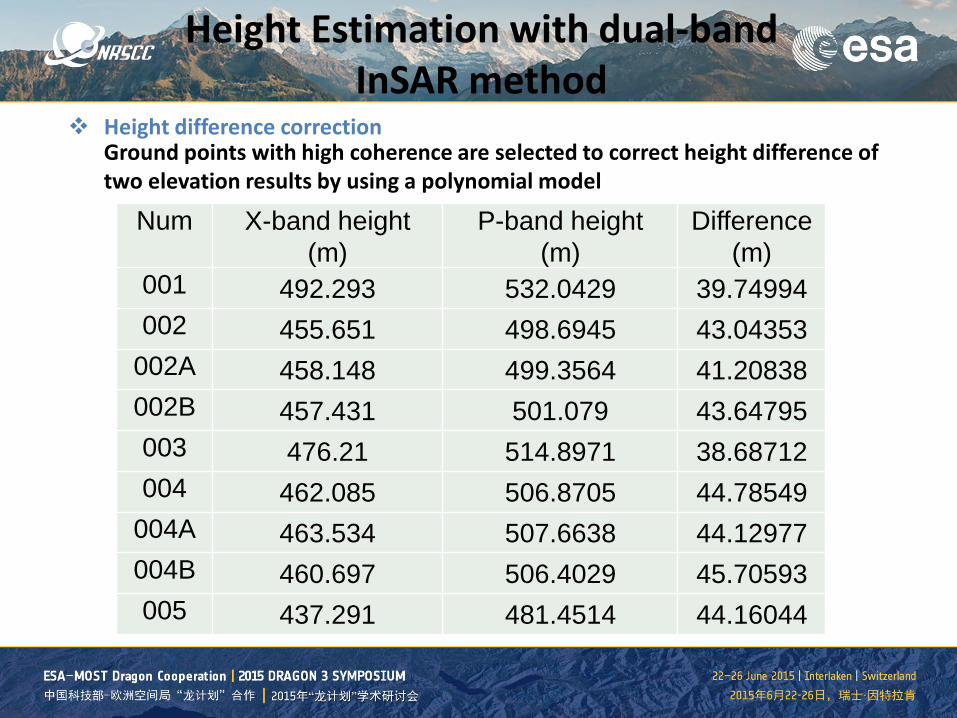
Num X-band height (m)
P-band height (m)
Difference (m)
001 492.293 532.0429 39.74994 002 455.651 498.6945 43.04353
002A 458.148 499.3564 41.20838 002B 457.431 501.079 43.64795 003 476.21 514.8971 38.68712 004 462.085 506.8705 44.78549
004A 463.534 507.6638 44.12977 004B 460.697 506.4029 45.70593 005 437.291 481.4514 44.16044
Height difference correction
Ground points with high coherence are selected to correct height difference of two elevation results by using a polynomial model
Height Estimation with dual-band InSAR method
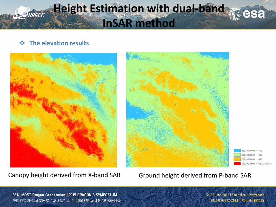
Canopy height derived from X-band SAR Ground height derived from P-band SAR
The elevation results
Height Estimation with dual-band InSAR method
Height Estimation with dual-band InSAR method
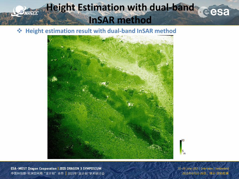
Height estimation result with dual-band InSAR method
Results validation and analysis
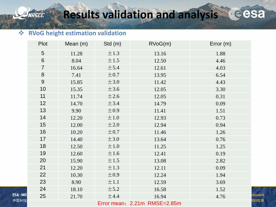
Plot Mean (m) Std (m) RVoG(m) Error (m)
5 11.28 ±1.3 13.16 1.88 6 8.04 ±1.5 12.50 4.46 7 16.64 ±5.4 12.61 4.03 8 7.41 ±0.7 13.95 6.54 9 15.85 ±3.0 11.42 4.43 10 15.35 ±3.6 12.05 3.30 11 11.74 ±2.6 12.05 0.31 12 14.70 ±3.4 14.79 0.09 13 9.90 ±0.9 11.41 1.51 14 12.20 ±1.0 12.93 0.73 15 12.00 ±2.0 12.94 0.94 16 10.20 ±0.7 11.46 1.26 17 14.40 ±3.0 13.64 0.76 18 12.50 ±1.0 11.25 1.25 19 12.60 ±1.6 12.41 0.19 20 15.90 ±1.5 13.08 2.82 21 12.20 ±1.3 12.11 0.09 22 10.30 ±0.9 12.24 1.94 23 8.90 ±1.1 12.59 3.69 24 18.10 ±5.2 16.58 1.52 25 21.70 ±4.4 16.94 4.76
Error mean:2.21m RMSE=2.85m
RVoG height estimation validation
Results validation and analysis
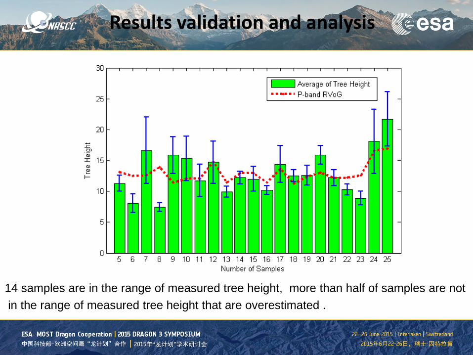
14 samples are in the range of measured tree height, more than half of samples are not in the range of measured tree height that are overestimated .
Results validation and analysis
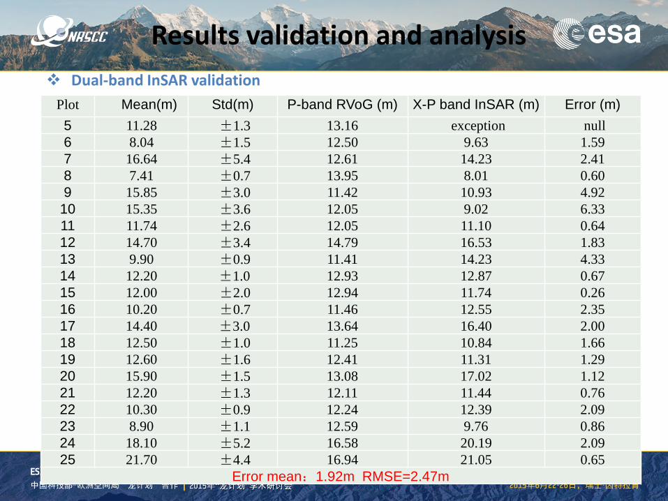
Plot Mean(m) Std(m) P-band RVoG (m) X-P band InSAR (m) Error (m) 5 11.28 ±1.3 13.16 exception null 6 8.04 ±1.5 12.50 9.63 1.59 7 16.64 ±5.4 12.61 14.23 2.41 8 7.41 ±0.7 13.95 8.01 0.60 9 15.85 ±3.0 11.42 10.93 4.92
10 15.35 ±3.6 12.05 9.02 6.33 11 11.74 ±2.6 12.05 11.10 0.64 12 14.70 ±3.4 14.79 16.53 1.83 13 9.90 ±0.9 11.41 14.23 4.33 14 12.20 ±1.0 12.93 12.87 0.67 15 12.00 ±2.0 12.94 11.74 0.26 16 10.20 ±0.7 11.46 12.55 2.35 17 14.40 ±3.0 13.64 16.40 2.00 18 12.50 ±1.0 11.25 10.84 1.66 19 12.60 ±1.6 12.41 11.31 1.29 20 15.90 ±1.5 13.08 17.02 1.12 21 12.20 ±1.3 12.11 11.44 0.76 22 10.30 ±0.9 12.24 12.39 2.09 23 8.90 ±1.1 12.59 9.76 0.86 24 18.10 ±5.2 16.58 20.19 2.09 25 21.70 ±4.4 16.94 21.05 0.65
Error mean:1.92m RMSE=2.47m
Dual-band InSAR validation
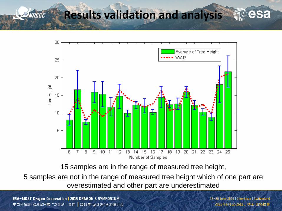
15 samples are in the range of measured tree height, 5 samples are not in the range of measured tree height which of one part are
overestimated and other part are underestimated
Results validation and analysis
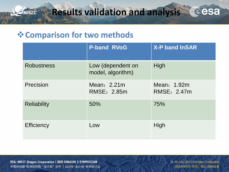
P-band RVoG X-P band InSAR
Robustness Low (dependent on model, algorithm)
High
Precision Mean:2.21m RMSE:2.85m
Mean:1.92m RMSE:2.47m
Reliability 50% 75%
Efficiency Low High
Results validation and analysis
Comparison for two methods
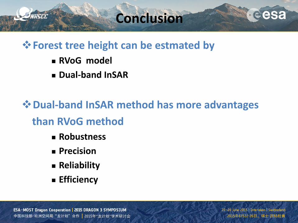
Conclusion
Forest tree height can be estmated by RVoG model Dual-band InSAR
Dual-band InSAR method has more advantages than RVoG method
Robustness Precision Reliability Efficiency