Embed Size (px)
Citation preview
Laskar Muqsudur Rahman
Forest Department, BANGLADESH E-mail: [email protected]
Transboundary Conservation of the mangrove ecosystem of Sundarbans
BANGLADESH
Third Workshop on Water and Adaptation to Climate Change in transboundary basins
Geneva. Switzerland 25-26 April 2012
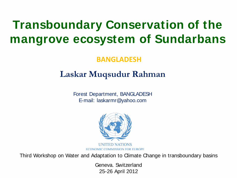
The country is bordered on the west, north, and east
by a 4,095-km land frontier with India and,
in the southeast, by a short land and water frontier of 193 km with Myanmar. Bangladesh has a tropical monsoon climate -
• Maximum summer temperatures 38 - 41°C • Winter day temperature 16–20 °C & at night around 10 °C
• Annual rainfall ranges between 1,600 mm and 4,780 mm
• Natural calamities - floods, tropical cyclones & tidal surges —ravage the country, particularly the coastal zone, almost every year.
Bangladesh - Location & Climate
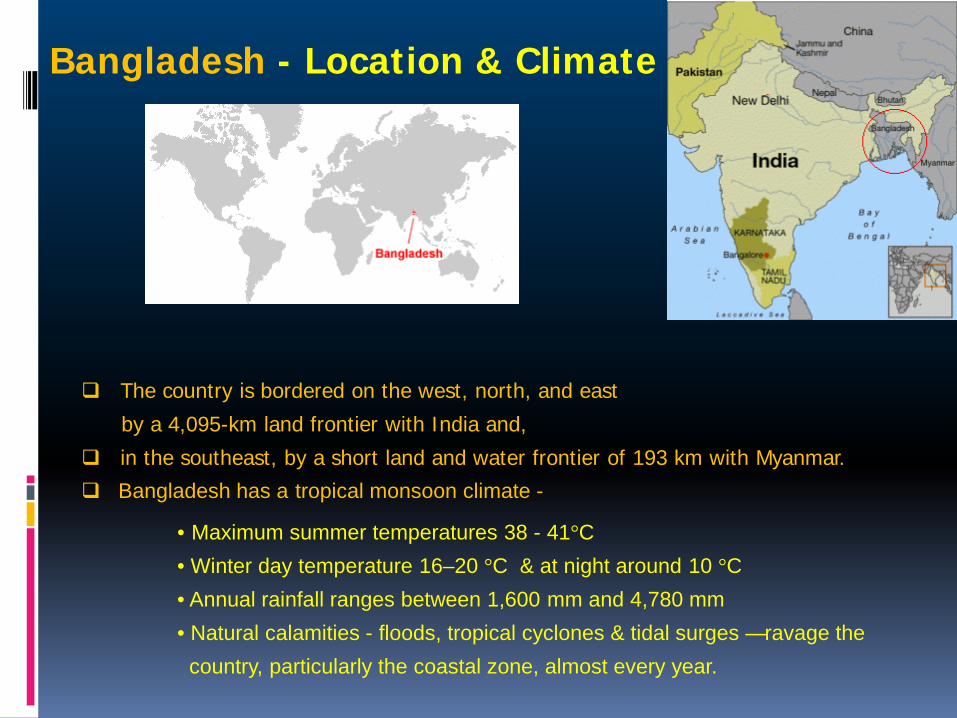
Ecosystem in Bangladesh
The 4 broad types of ecosystems :
Terrestrial forest ecosystems, Inland freshwater ecosystems (Rivers, wetlands) Man-made ecosystems (Homegardens), and Coastal and marine ecosystems (Mangroves)
Forests
Homegardens
Wetlands
Mangroves
River
Coastal
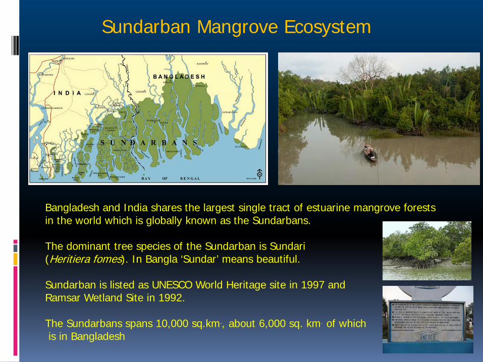
Bangladesh and India shares the largest single tract of estuarine mangrove forests in the world which is globally known as the Sundarbans. The dominant tree species of the Sundarban is Sundari (Heritiera fomes). In Bangla ‘Sundar’ means beautiful. Sundarban is listed as UNESCO World Heritage site in 1997 and Ramsar Wetland Site in 1992. The Sundarbans spans 10,000 sq.km., about 6,000 sq. km. of which is in Bangladesh
Sundarban Mangrove Ecosystem
Sundarban Mangrove Ecosystem
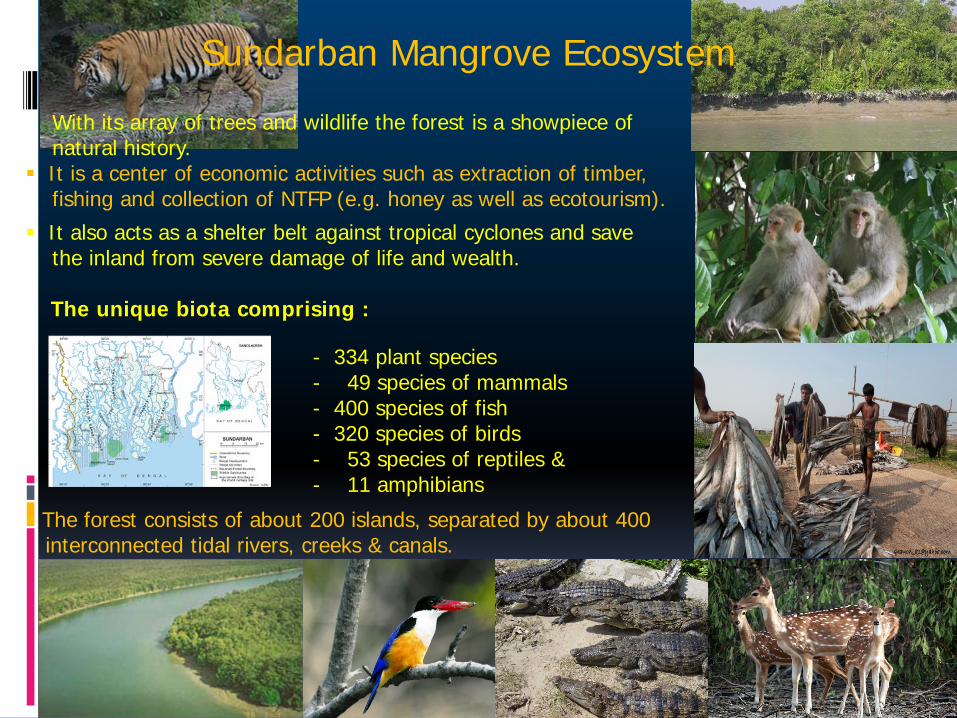
With its array of trees and wildlife the forest is a showpiece of natural history. It is a center of economic activities such as extraction of timber, fishing and collection of NTFP (e.g. honey as well as ecotourism).
It also acts as a shelter belt against tropical cyclones and save the inland from severe damage of life and wealth.
The unique biota comprising :
- 334 plant species - 49 species of mammals - 400 species of fish - 320 species of birds - 53 species of reptiles & - 11 amphibians
The forest consists of about 200 islands, separated by about 400 interconnected tidal rivers, creeks & canals.
BANGLADESH Transboundary Rivers
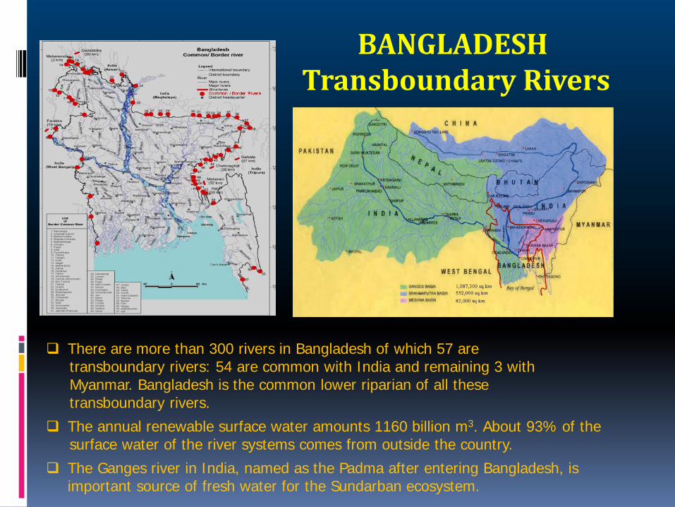
There are more than 300 rivers in Bangladesh of which 57 are transboundary rivers: 54 are common with India and remaining 3 with Myanmar. Bangladesh is the common lower riparian of all these transboundary rivers.
The annual renewable surface water amounts 1160 billion m3. About 93% of the surface water of the river systems comes from outside the country.
The Ganges river in India, named as the Padma after entering Bangladesh, is important source of fresh water for the Sundarban ecosystem.
Gorai River and the Sundarban
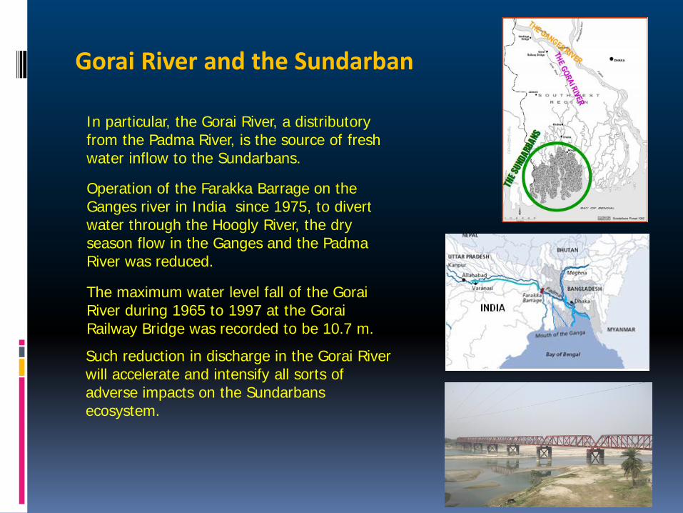
In particular, the Gorai River, a distributory from the Padma River, is the source of fresh water inflow to the Sundarbans.
Operation of the Farakka Barrage on the Ganges river in India since 1975, to divert water through the Hoogly River, the dry season flow in the Ganges and the Padma River was reduced.
The maximum water level fall of the Gorai River during 1965 to 1997 at the Gorai Railway Bridge was recorded to be 10.7 m.
Such reduction in discharge in the Gorai River will accelerate and intensify all sorts of adverse impacts on the Sundarbans ecosystem.
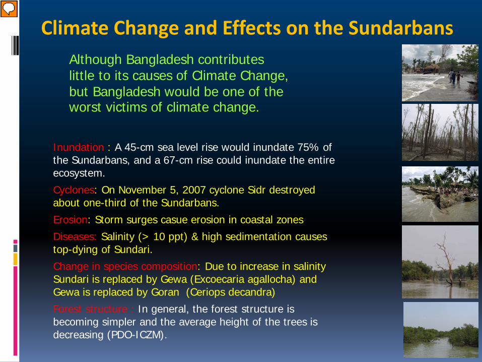
Inundation : A 45-cm sea level rise would inundate 75% of the Sundarbans, and a 67-cm rise could inundate the entire ecosystem.
Cyclones: On November 5, 2007 cyclone Sidr destroyed about one-third of the Sundarbans.
Erosion: Storm surges casue erosion in coastal zones
Diseases: Salinity (> 10 ppt) & high sedimentation causes top-dying of Sundari.
Change in species composition: Due to increase in salinity Sundari is replaced by Gewa (Excoecaria agallocha) and Gewa is replaced by Goran (Ceriops decandra)
Forest structure : In general, the forest structure is becoming simpler and the average height of the trees is decreasing (PDO-ICZM).
Climate Change and Effects on the Sundarbans Although Bangladesh contributes little to its causes of Climate Change, but Bangladesh would be one of the worst victims of climate change.
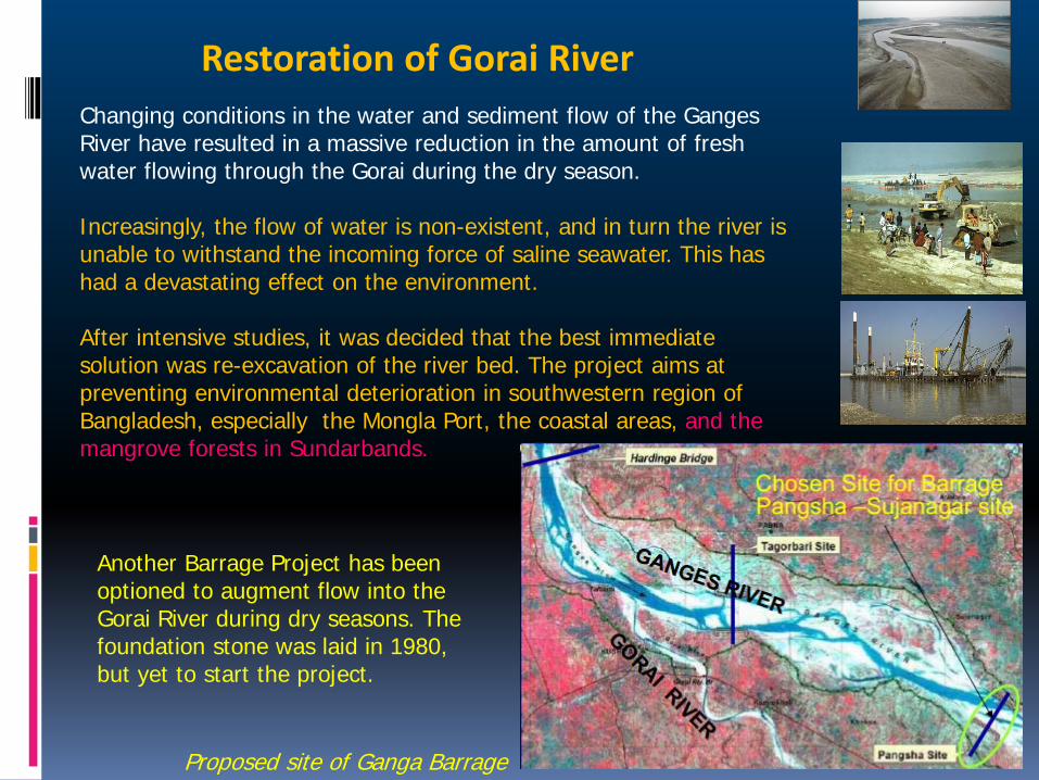
Restoration of Gorai River
Proposed site of Ganga Barrage
Another Barrage Project has been optioned to augment flow into the Gorai River during dry seasons. The foundation stone was laid in 1980, but yet to start the project.
Changing conditions in the water and sediment flow of the Ganges River have resulted in a massive reduction in the amount of fresh water flowing through the Gorai during the dry season. Increasingly, the flow of water is non-existent, and in turn the river is unable to withstand the incoming force of saline seawater. This has had a devastating effect on the environment. After intensive studies, it was decided that the best immediate solution was re-excavation of the river bed. The project aims at preventing environmental deterioration in southwestern region of Bangladesh, especially the Mongla Port, the coastal areas, and the mangrove forests in Sundarbands.
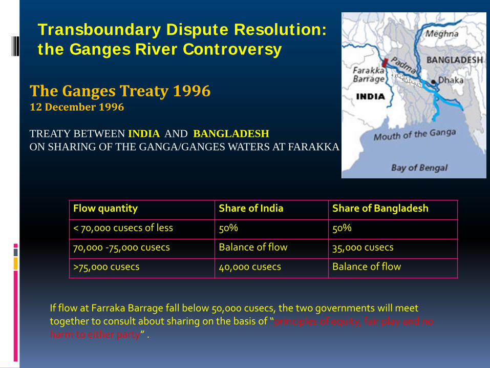
The Ganges Treaty 1996 12 December 1996
TREATY BETWEEN INDIA AND BANGLADESH ON SHARING OF THE GANGA/GANGES WATERS AT FARAKKA
Flow quantity Share of India Share of Bangladesh
< 70,000 cusecs of less 50% 50%
70,000 -75,000 cusecs Balance of flow 35,000 cusecs
>75,000 cusecs 40,000 cusecs Balance of flow
If flow at Farraka Barrage fall below 50,000 cusecs, the two governments will meet together to consult about sharing on the basis of “principles of equity, fair play and no harm to either party” .
Transboundary Dispute Resolution: the Ganges River Controversy
Memorandum of Understanding
6 September 2011 Between
Bangladesh and India for
conservation of Sundarban
Carry out research to develop a understanding of the impacts of climate change along with adaptation strategies.
information exchange programmes and joint research programmes and ensure effective patrolling in respective border and promote capacity building.
Exploit the potential of the Sundarban for development and alleviation of poverty.
Initiate development and conservation programmes for habitat improvement.
Surveying human settlements on respective sides (human-ecology relation)
Identify and catalogue the diversity of flora and fauna
To ensure implementation of any on going projects, even after the expiry of the MOU
MOU for 5 years
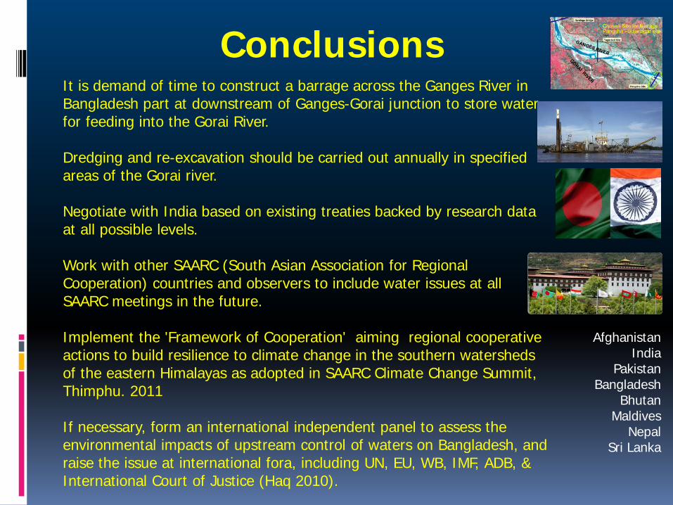
It is demand of time to construct a barrage across the Ganges River in Bangladesh part at downstream of Ganges-Gorai junction to store water for feeding into the Gorai River. Dredging and re-excavation should be carried out annually in specified areas of the Gorai river. Negotiate with India based on existing treaties backed by research data at all possible levels. Work with other SAARC (South Asian Association for Regional Cooperation) countries and observers to include water issues at all SAARC meetings in the future. Implement the 'Framework of Cooperation' aiming regional cooperative actions to build resilience to climate change in the southern watersheds of the eastern Himalayas as adopted in SAARC Climate Change Summit, Thimphu. 2011 If necessary, form an international independent panel to assess the environmental impacts of upstream control of waters on Bangladesh, and raise the issue at international fora, including UN, EU, WB, IMF, ADB, & International Court of Justice (Haq 2010).
Conclusions
Afghanistan India
Pakistan Bangladesh
Bhutan Maldives
Nepal Sri Lanka