Embed Size (px)
Citation preview

Traffic Impact Assessment Proposed Residential Development
Black Lion Field, Llanrhystud, Ceredigion
Dyddiad/Date: 18th January 2017
CPF 5655 – Revision 1

CPF5655 - Traffic Impact Assessment Proposed Residential Development
Black Lion Field, Llanrhystud, Ceredigion
2
Document Control Sheet
Document Title: Traffic Impact Assessment - Proposed Residential, Black Lion Field,
Llanrhystud, Ceredigion
Document Author: Andrew Evans
Project Manager: Dylan Parry
Project Title: Traffic Impact Assessment - Proposed Residential, Black Lion Field,
Llanrhystud, Ceredigion
Revision History
Date Version No. Summary of Changes
22/12/16 0.01 Client comments as per e-mail dated 5th December 2016
18/01/17 0.02 Client comments as per e-mail dated 16th January 2017
Approvals
Approved by Signature Date Version
Dylan Parry
18/01/17 0.02
Distribution
Name Title Date Version
Dr Ali Wright Client 18/01/17 0.02
© 2017 Gwynedd Council / Gwynedd Consultancy. All Rights Reserved.
Copyright in any or all of this documentation belongs to Gwynedd Council / Gwynedd Consultancy of Council Offices,
Shirehall Street, Caernarfon, Gwynedd, LL55 1SH (the 'Owner') and may not be used, sold, transferred, copied or
reproduced in whole or in part, in any manner of form or on any media to any person other than in accordance with the terms of the Owner's agreement or otherwise without the prior written consent of the Owner.
Green Dragon Certified
Ardystiad Y Ddraig Werdd ISO9001:2000
FS526386
CPF5655 - Traffic Impact Assessment Proposed Residential Development
Black Lion Field, Llanrhystud, Ceredigion
3
Contents
1. INTRODUCTION 4
2. EXISTING SITE CONTEXT 6
3. DEVELOPMENT PROPOSALS 7
4. ACCESSIBILTY REVIEW 8
5. TRAFFIC AND COLLISIONS 10
6. SUMMARY AND CONCLUSIONS 11
APPENDICES
APPENDIX 1- SITE ACCESS AND VISIBILITY SPLAYS 13
APPENDIX 2- SITE PHOTOGRAPHS 15
APPENDIX 3- TRAFFIC FIGURES 18
APPENDIX 4- BUS TIMETABLES 20
CPF5655 - Traffic Impact Assessment Proposed Residential Development
Black Lion Field, Llanrhystud, Ceredigion
4
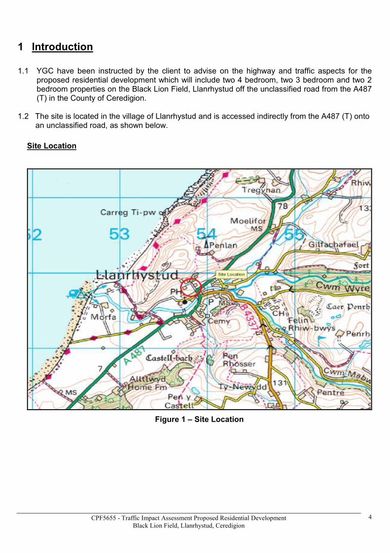
1 Introduction
1.1 YGC have been instructed by the client to advise on the highway and traffic aspects for the proposed residential development which will include two 4 bedroom, two 3 bedroom and two 2 bedroom properties on the Black Lion Field, Llanrhystud off the unclassified road from the A487 (T) in the County of Ceredigion.
1.2 The site is located in the village of Llanrhystud and is accessed indirectly from the A487 (T) onto
an unclassified road, as shown below.
Site Location
Figure 1 – Site Location

CPF5655 - Traffic Impact Assessment Proposed Residential Development
Black Lion Field, Llanrhystud, Ceredigion
5
1.3 The proposed development will compromise of two 4 bedroom, two 3 bedroom and two 2 bedroom properties.
1.4 This report considers the traffic and transportation aspects of the proposed development; it is
sub-divided into the following sections:
• Section 2 sets out the existing context of the site;
• Section 3 provides details of the proposed development;
• Section 4 reviews the accessibility of the site;
• Section 5 reviews Traffic and Collision data;
• Section 6 provides summary and conclusions.

CPF5655 - Traffic Impact Assessment Proposed Residential Development
Black Lion Field, Llanrhystud, Ceredigion
6
2 Existing Site Context
The site is situated on the outskirts of Llanrhystud, Ceredigion. This section sets out the context of the site in relation to these surroundings.
Local Highway Network
2.1 The site is located on an unclassified road accessed indirectly from the A487 (T) in the village of Llanrhystud, 9.3 miles south of Aberystwyth and 6.9 miles north of Aberaeron.
2.2 The A487 (T) is a single carriageway trunk road linking Bangor, Gwynedd to Fishguard, Ceredigion and runs from Aberystwyth in a southerly direction towards Llanrhystud and then south towards Aberaeron.
Pedestrian Access
2.3 The road network surrounding the site consists of an unclassified road accessed indirectly from the A487 (T) which has footways on the northbound approach which stops at the junction of the unclassified road leading to the development site. There will be a pedestrian link between the development and the existing footways in the village of Llanrhystud.
Cycle Access
2.4 There is no direct access to a designated cycle route within the village of Llanrhystud, the nearest cycle route being Route 81 which runs from Aberystwyth to Shrewsbury as part of the National Cycle Network (NCN).
Public Transport – Bus Access
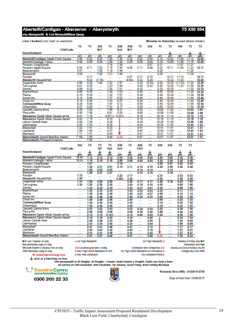
2.5 There are five bus routes which can be accessed from bus stops at the Black Lion Hotel on the northbound and southbound side of the A487 (T) to the south of the development site providing direct access by public transport to Aberystwyth, Aberaeron, Lampeter and Carmarthen to the north and south (See Appendix 3) The Black Lion bus stops are 320 metres from the proposed development site, pedestrian access from the bus stops to the site will be provided by a footway link to the proposed development site.
Public Transport – Rail Access
2.6 The nearest main line railway station is Aberystwyth to the north; this provides direct access by rail to Shrewsbury, Chester, Birmingham and London.

CPF5655 - Traffic Impact Assessment Proposed Residential Development
Black Lion Field, Llanrhystud, Ceredigion
7
3 DEVELOPMENT PROPOSALS
3.1 The proposed development will include two 4 bedroom, two 3 bedroom and two 2 bedroom properties, the site road layout is illustrated on a plan in Appendix 1.
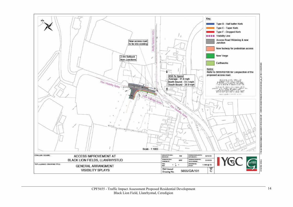
3.2 The proposed access road to the development will be served by an upgraded unclassified road accessed directly from the A487 (T), the upgraded road will be to current highway standards, and this will serve the proposed development site.
3.3 The existing unclassified road will be upgraded to provide sufficient visibility splays in both directions (See Appendix 1) at its junction with the A487 (T).
3.4 Based on the guidance as set out in DRMB Volume 6 TD 42/95 Chapter 7.8 “Vehicular Access to All Purpose Trunk Roads”. The visibility splays for the access on the unclassified road will be 70 metres on both sides using a setback distance of 2.4 metres due to it being lightly trafficked, the current visibility splays for the unclassified road with the A487 (T) junction are 120 metres northbound and 70 metres southbound due to road geometry using a setback distance of 2.4 metres due to it being lightly trafficked and difficult circumstances.
Northbound Visibility Southbound Visibility

CPF5655 - Traffic Impact Assessment Proposed Residential Development
Black Lion Field, Llanrhystud, Ceredigion
8
4. ACCESSIBILITY REVIEW
4.1 This section reviews the accessibility of the site by a range of travel modes, comprising walking and cycling.
Pedestrian Access
4.2 The Walking and Cycling Strategy for Wales states that ”Around 8% of car journeys in Wales are less than 1 mile, 26% are under 2 miles and 58% are under 5 miles. For these distances walking and cycling can offer viable and attractive alternatives.”
4.3 As the plan below shows, a distance of 1 mile allows access to the village of Llanrhystud from the proposed residential development site. The area accessible by foot includes Llanrhystud village with access to the primary school, post office and convenience store, and fuel service station.
Walk Accessibility
Figure 2 – Walking Accessibility
Atgy nhy rchi r y map hw n o Ddeunydd y r Ordnance Survey
gy da chan ia tâd yr Ordnance Surveyar ran Rheo lwr Llyfrfa Ei Maw rhy di.
© Hawl fra in t y Goron .Mae atgynhyrc hu heb gan iatâd y n to rri
hawlfra int y Goron a gall hyn a rwain at erlyn iad neu ac hos sifil .
Cyngor G wy nedd - 100023387 - 2007
This map is reproduced from O rdnance S urvey mater ialwith the perm i ss ion of Ordnanc e Survey
on beha lf of the Contro lle r of Her Ma jes ty’s Sta tionery Off ice© Crown c opy ri gh t.
Unauthori sed reproduc tion in fringes Crown copyrigh tand may l ead to p rosecu ti on or c ivi l p roceed ings.
Cyngor G wy nedd - 100023387 - 2007

CPF5655 - Traffic Impact Assessment Proposed Residential Development
Black Lion Field, Llanrhystud, Ceredigion
9
4.4 Overall, the existing site has very good levels of accessibility by foot to and from the village of Llanrhystud which has footways on both sides off the A487 (T) and this will be improved by the pedestrian link from the proposed development.
Cycle Access
4.5 Paragraph 5.1.2 of the Walking and Cycling Strategy states that “In 1999 / 2001 around 20% of journeys under 1 mile and 54% of journeys under 5 miles were being made by car. Yet these distances are generally recognised as practical for walking and cycling.”
The plan below shows, a cycle distance of 5 miles, to the north, east, west and south of the proposed development site. There is no direct access to a cycle route within the village of Llanrhystud, the nearest cycle route being Route 81 which runs from Aberystwyth to Shrewsbury as part of the National Cycle Network (NCN).
4.6
Cycle Accessibility
Figure 3 – Cycle Accessibility
4.7 There is accessibility for short trips to be made by cycle to and from the development site into the village of Llanrhystud.
Overall
4.8 Overall, access by foot is good into the village of Llanrhystud and there is access by cycle from the development site. This shows that the site is located for travel by sustainable modes within the village of Llanrhystud.
Atgy nhy rchi r y map hw n o Ddeunydd y r Ordnance Survey
gy da chan ia tâd yr Ordnance Surveyar ran Rheo lwr Llyfrfa Ei Maw rhy di.
© Hawl fra in t y Goron .Mae atgynhyrc hu heb gan iatâd y n to rri
hawlfra int y Goron a gall hyn a rwain at erlyn iad neu ac hos sifil .
Cyngor G wy nedd - 100023387 - 2007
This map is reproduced from O rdnance S urvey mater ialwith the perm i ss ion of Ordnanc e Survey
on beha lf of the Contro lle r of Her Ma jes ty’s Sta tionery Off ice© Crown c opy ri gh t.
Unauthori sed reproduc tion in fringes Crown copyrigh tand may l ead to p rosecu ti on or c ivi l p roceed ings.
Cyngor G wy nedd - 100023387 - 2007
CPF5655 - Traffic Impact Assessment Proposed Residential Development
Black Lion Field, Llanrhystud, Ceredigion
10
5 TRAFFIC AND COLLISIONS
Traffic
5.1 Automatic traffic counters were installed in October 2016 on A487 (T) to the south of the unclassified road and on the unclassified road leading to the proposed site access for a period of seven days to monitor traffic flows and speeds.
On the A487 (T) there were 8,662 vehicles per day or 361 vehicles per hour with a combined traffic speed of 28.6mph (85th %) and a mean traffic speed of 23.1mph. On the unclassified road there were 87 vehicles per day or 3 vehicles per hour with a combined traffic speed of 17.9 mph (85th%) and a mean traffic speed of 14.6mph (Details of the traffic survey are provided in Appendix 3.)
Collisions
5.2 There have been no recorded personal injury collisions in the last five years on the unclassified road or the A487 (T).
Trip Generation
5.3 There is no historical traffic flows along the unclassified road which was previously used as an access road to the former Lewis bus depot which had 30 vehicles equating to an estimated 120 trips per day therefore the current traffic flow will have reduced by this amount since the closure of the bus depot. Traffic flow from the proposed development will be minimal in comparison and will have reduced the amount of traffic accessing the unclassified road in comparison to previous traffic flows.

CPF5655 - Traffic Impact Assessment Proposed Residential Development
Black Lion Field, Llanrhystud, Ceredigion
11
6 SUMMARY AND CONCLUSIONS
6.1 Gwynedd Consultancy have assessed the local area in terms of its transport sustainability and found that the development is within easy reach of village of Llanrhystud. Additionally, potential traffic generated from the development can be accommodated onto the highway network without any issues.
The proposed residential development will include two 4 bedroom, two 3 bedroom and two 2 bedroom properties. The proposed access has been designed to current standards and will serve the development site and achieves visibility splays of 2 x 70m (See Appendix 1) for the unclassified road and achieves visibility splays of 1x120m northbound and 1x70m southbound for the A487 (T) junction although no changes are being made to the existing junction layout.
6.2 The site is accessible via a range of travel modes, including sustainable modes such as walking, cycling due to the proposed link from the proposed development. Public transport services are very good with direct access to bus stops which serve the local area.
6.3 For the reasons set out above, there are no new highways or traffic related issues caused as a result of this proposed development.

CPF5655 - Traffic Impact Assessment Proposed Residential Development
Black Lion Field, Llanrhystud, Ceredigion
12
APPENDICES

CPF5655 - Traffic Impact Assessment Proposed Residential Development
Black Lion Field, Llanrhystud, Ceredigion
13
APPENDIX 1
SITE ACCESS AND VISIBILITY SPLAYS
CPF5655 - Traffic Impact Assessment Proposed Residential Development
Black Lion Field, Llanrhystud, Ceredigion
14

CPF5655 - Traffic Impact Assessment Proposed Residential Development
Black Lion Field, Llanrhystud, Ceredigion
15
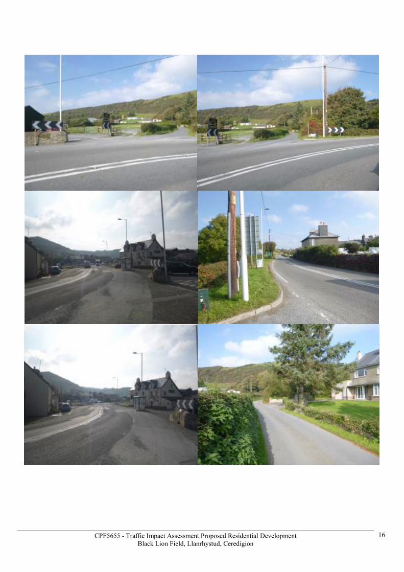
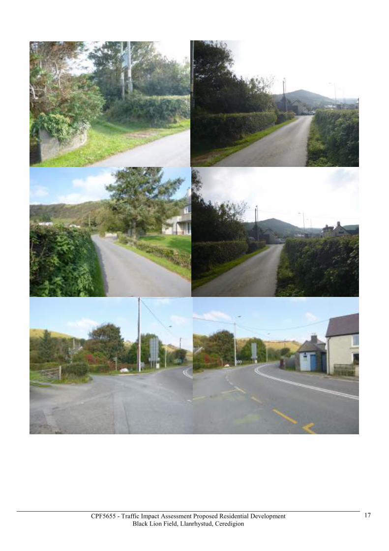
APPENDIX 2
PHOTOGRAPHS OF EXISTING CONDITIONS
CPF5655 - Traffic Impact Assessment Proposed Residential Development
Black Lion Field, Llanrhystud, Ceredigion
16
CPF5655 - Traffic Impact Assessment Proposed Residential Development
Black Lion Field, Llanrhystud, Ceredigion
17

CPF5655 - Traffic Impact Assessment Proposed Residential Development
Black Lion Field, Llanrhystud, Ceredigion
18
APPENDIX 3
TRAFFIC FIGURES

CPF5655 - Traffic Impact Assessment Proposed Residential Development
Black Lion Field, Llanrhystud, Ceredigion
19

CPF5655 - Traffic Impact Assessment Proposed Residential Development
Black Lion Field, Llanrhystud, Ceredigion
20
APPENDIX 4
BUS TIME TABLE

CPF5655 - Traffic Impact Assessment Proposed Residential Development
Black Lion Field, Llanrhystud, Ceredigion
21

CPF5655 - Traffic Impact Assessment Proposed Residential Development
Black Lion Field, Llanrhystud, Ceredigion
22

CPF5655 - Traffic Impact Assessment Proposed Residential Development
Black Lion Field, Llanrhystud, Ceredigion
23
CPF5655 - Traffic Impact Assessment Proposed Residential Development
Black Lion Field, Llanrhystud, Ceredigion
24

CPF5655 - Traffic Impact Assessment Proposed Residential Development
Black Lion Field, Llanrhystud, Ceredigion
25