Embed Size (px)
Citation preview
TRAFFIC FLOW MANAGEMENT SYSTEM
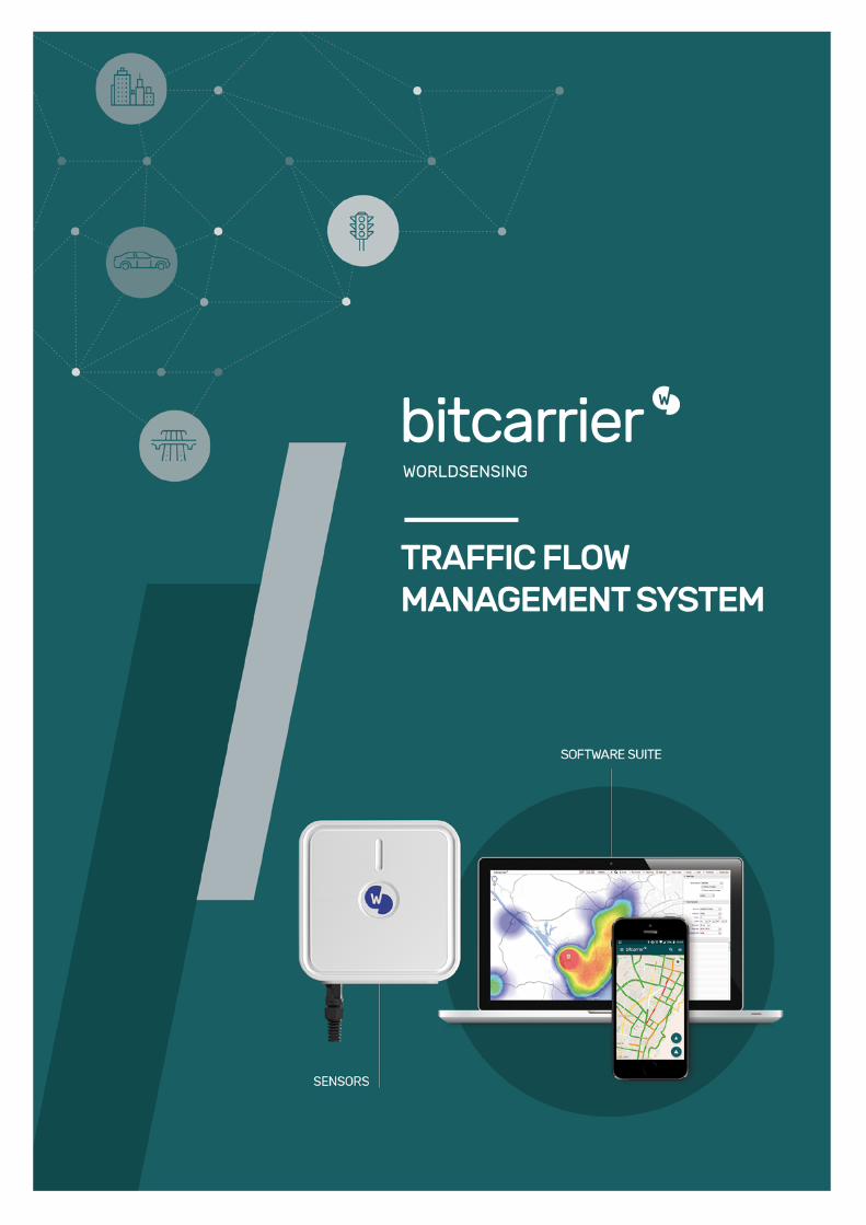
THE REAL-TIME TRAFFIC FLOW MANAGEMENT SYSTEMTRACKING THE WAY THE WORLD MOVES
Bitcarrier is a system for real-time traffic and road monitoring. Vehicle movements are captured with a network of smart sensors, which are placed at strategic locations in city streets, on roads and on highways.
City and road operators wirelessly collect traffic information and can visualize and analyze results to better manage traffic flow.
While drivers obtain instant updates about journey times and incidents, road operators receive all the data they need to develop agile mobility policies.
Cloud-based or on-premise software suite
Data analytics tools
Real-time traffic maps
Key traffic metrics: Traffic intensity, vehicle speed, congestion level & travel times
Mobility profiling: origin and destination matrices
Incident alert system: accidents, roadblocks, among others
Historical and real-time traffic data statistics
Third Party Data Input APIs
Flexible integration with third party data feeds
FEATURES BENEFITS Improve mobility strategy
Manage and optimize traffic in real time
Make faster decisions based on 24/7 information
Easily add sensors to extend measurement range
Save resources through fast implementation
Decrease costs through easy maintenance
Integrate with TMCs and information dissemination
Manage congestion and reduce pollution
Provide citizens and drivers with valuable updates
Leverage system without privacy issues
Improve your mobility strategy
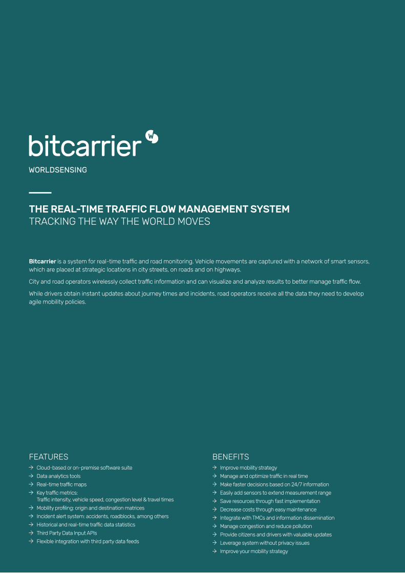
BITCARRIER TECHNOLOGY
Operational Intelligence for Cities and Transport Operators
Worldsensing is not only among the leading providers for wireless data capturing, we also know how to extract intelligence from collected data to transform traffic management operations.
The wireless, intelligent Bitcarrier traffic flow management system is a combination of Worldsensing proprietary hardware and software. The Bitcarrier Software Suite enables cities and transport operators to collect real-time traffic information. The software suite includes two individual tools for analyzing and archiving data in real time: the Bitcarrier Configuration and Visualization Tool.
Bitcarrier can complement other existing traffic information systems enabling operators to use multiple sources of information and allows to integrate data quickly and easily.
COMPLETE SOFTWARE SUITE
Bitcarrier works in three steps: data collection, information processing and data visualization. It uses a 2.4GHz frequency band and scans Bluetooth and Wi-Fi signals emitted by mobile devices such as cell phones, GPS navigators, and hands-free kits. The system uses anonymous data from captured signals in order to provide information related to traffic flow in various environments, thus allowing to analyze and manage traffic more efficiently.
ADVANCED SENSOR
HOW IT WORKS
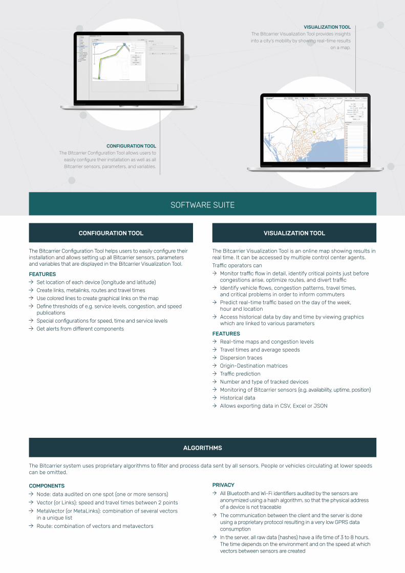
CONFIGURATION TOOL The Bitcarrier Configuration Tool allows users to
easily configure their installation as well as all
Bitcarrier sensors, parameters, and variables.
VISUALIZATION TOOLThe Bitcarrier Visualization Tool provides insights
into a city’s mobility by showing real-time results
on a map.
VISUALIZATION TOOL
ALGORITHMS
CONFIGURATION TOOL
SOFTWARE SUITE
The Bitcarrier Configuration Tool helps users to easily configure their installation and allows setting up all Bitcarrier sensors, parameters and variables that are displayed in the Bitcarrier Visualization Tool.
FEATURES
Set location of each device (longitude and latitude)
Create links, metalinks, routes and travel times
Use colored lines to create graphical links on the map
Define thresholds of e.g. service levels, congestion, and speed publications
Special configurations for speed, time and service levels
Get alerts from different components
The Bitcarrier Visualization Tool is an online map showing results in real time. It can be accessed by multiple control center agents.
Traffic operators can
Monitor traffic flow in detail, identify critical points just before congestions arise, optimize routes, and divert traffic
Identify vehicle flows, congestion patterns, travel times, and critical problems in order to inform commuters
Predict real-time traffic based on the day of the week, hour and location
Access historical data by day and time by viewing graphics which are linked to various parameters
FEATURES
Real-time maps and congestion levels
Travel times and average speeds
Dispersion traces
Origin-Destination matrices
Traffic prediction
Number and type of tracked devices
Monitoring of Bitcarrier sensors (e.g. availability, uptime, position)
Historical data
Allows exporting data in CSV, Excel or JSON
COMPONENTS
Node: data audited on one spot (one or more sensors)
Vector (or Links): speed and travel times between 2 points
MetaVector (or MetaLinks): combination of several vectors in a unique list
Route: combination of vectors and metavectors
PRIVACY
All Bluetooth and Wi-Fi identifiers audited by the sensors are anonymized using a hash algorithm, so that the physical address of a device is not traceable
The communication between the client and the server is done using a proprietary protocol resulting in a very low GPRS data consumption
In the server, all raw data (hashes) have a life time of 3 to 8 hours. The time depends on the environment and on the speed at which vectors between sensors are created
The Bitcarrier system uses proprietary algorithms to filter and process data sent by all sensors. People or vehicles circulating at lower speeds can be omitted.

TRAVEL TIMESAnalyze travel times and average speeds to identify
critical points just before congestions arise.
HEAT MAPSVisualize traffic flows in real time to optimize
routes or divert traffic to secondary routes.
SOFTWARE SUITE
TECHNICAL SPECIFICATIONS HISTORICAL DATA
Bitcarrier runs on a hybrid database that combines the advantages of relational databases and the flexibility and speed of NoSQL storage systems.
Bitcarrier runs on a cluster of 2 servers to ensure performance and resilience. Depending on the size of the deployment the servers can be increased to 6.
The Bitcarrier system offers secure web-based REST API services to connect to 3rd party software solutions and provides a connection to a raw database where all detections are aggregated and stored.
FEATURES
JVM module (Java Virtual Machine) for data gathering
JVM Software for origin destination matrix calculation
JVM Software for data aggregation and for statistical analysis
NOSQL3 database based on CASSANDRA
SQL database based on MYSQL
Secure REST API in JSON format or standard XML formats
The platform allows integrating and displaying geolocation data using external Keyhole Markup Language (KMLs)
FEATURES
The tool allows to:
Access historical data per day or time
Predict real-time traffic based on the day of the week, hour or location
Secure REST API
Bitcarrier can be integrated into Mobility, the City Operational Intelligence solution for city control centers.
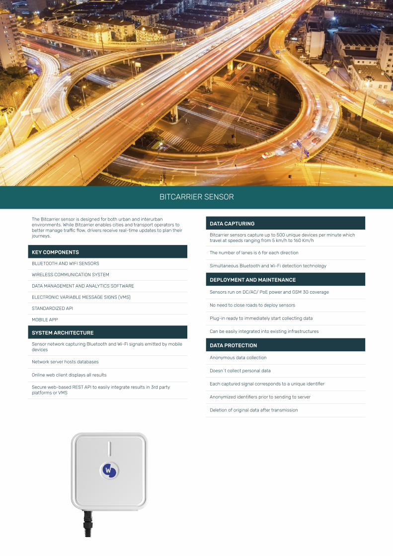
BITCARRIER SENSOR
The Bitcarrier sensor is designed for both urban and interurban environments. While Bitcarrier enables cities and transport operators to better manage traffic flow, drivers receive real-time updates to plan their journeys.
KEY COMPONENTS
BLUETOOTH AND WIFI SENSORS
WIRELESS COMMUNICATION SYSTEM
DATA MANAGEMENT AND ANALYTICS SOFTWARE
ELECTRONIC VARIABLE MESSAGE SIGNS (VMS)
STANDARDIZED API
MOBILE APP
SYSTEM ARCHITECTURE
Sensor network capturing Bluetooth and Wi-Fi signals emitted by mobile devices
Network server hosts databases
Online web client displays all results
Secure web-based REST API to easily integrate results in 3rd party platforms or VMS
DATA CAPTURING
Bitcarrier sensors capture up to 500 unique devices per minute which travel at speeds ranging from 5 km/h to 160 Km/h
The number of lanes is 6 for each direction
Simultaneous Bluetooth and Wi-Fi detection technology
DEPLOYMENT AND MAINTENANCE
Sensors run on DC/AC/ PoE power and GSM 3G coverage
No need to close roads to deploy sensors
Plug-in ready to immediately start collecting data
Can be easily integrated into existing infrastructures
DATA PROTECTION
Anonymous data collection
Doesn´t collect personal data
Each captured signal corresponds to a unique identifier
Anonymized identifiers prior to sending to server
Deletion of original data after transmission
BITCARRIER SENSOR
BITCARRIER SENSOR
MAIN SPECIFICATIONS
PROCESSOR
Ultra low-power processor specifically designed for outdoor installations. Because of its ultra low TDP no fan is needed. This also minimizes the risk of failure due to moving parts
COMMUNICATION
Ethernet:
Passive POE (Power over Ethernet) sends both data and power to the device with the same cable. When Ethernet is available, power and connectivity are provided using the same cable. If a traffic light has an Ethernet socket, a POE connector can be installed to connect the device with the Ethernet cable
Modem GSM:
Modem with 4 bands able to transmit GPRS, EDGE and HSDPA data
LOCATION
GPS receiver able to process GPS and WAAS satellite signals
STORAGE
●Non-volatile memory data storage
● Storage is activated only when the sensor is offline. When connectivity is recovered, all data in storage are submitted
DETECTION SCANNING
Bluetooth:
●BT 2.1 EDR (2.4 Ghz) All versions are detected if Bluetooth is switched on (visible mode)
●Gain: 15.5 dBi (directional)
●Maximum range: 150m
Wi-Fi
●2.4 Ghz
●Gain: 1 dBi
●Maximum range: 50 m
POWER
●Two input options: VDC/ Passive PoE
●Power consumption: 4 W
REMOTE MANAGEMENT
●Remote checking and maintenance of the nodes
●Remote detection of connectivity, coverage and system
●Remote updating
MECHANICAL
ANTENNA
Box with adjustable clamp for pole installation
SIZE
276 x 272 x 96.5 mm (HxLxW)
WEIGHT
2 kg
CASING MATERIAL
ABS (UV RESISTANT)
OPERATING TEMPERATURE
-35°C to +80°C 1
STORAGE TEMPERATURE
-35°C to +80°C 1
HUMIDITY
10 to 95%
IP67
Compliant – Resistant to all weather conditions
MTBF
10 years or 90000 hours
STANDARDS COMPLIANCE
RoHs compliant
REGIONS
CE, FCC, IC and NEMA compliant
BENEFITS
SOFTWARE SUITE
Monitor and manage traffic 24/7 in real-time with intuitive software. Instantly obtain information on speed and travel times.
AFFORDABILITY
The cost of the Bitcarrier solution is significantly lower than other competing traffic information technologies.
THIRD PARTY INTEGRATION
Complement other traffic information systems such as cameras to provide your traffic control center with multiple sources of information.
WIRELESS SENSOR SYSTEM
Deploy wireless sensors quickly and easily and save money on cabling and costly installation. Once installed, they are easy to maintain.
24/7
Bitcarrier offers round-the-clock remote monitoring with real-time data and alerts.
1 Depending on configuration
BARCELONA
Viriat 47, Edificio Numancia 1, 10th floor,
08014 Barcelona, Spain
(+34) 93 418 05 85
LONDON
9-10 Carlos Place, Mayfair
London W1K 3AT, UK
(+44) 203 807 2495
LOS ANGELES
1900 Avenue of the Stars, Suite 2430
90067 Los Angeles, CA, USA
(+1) 323 395 5120
www.worldsensing.com
HOW IT WORKS
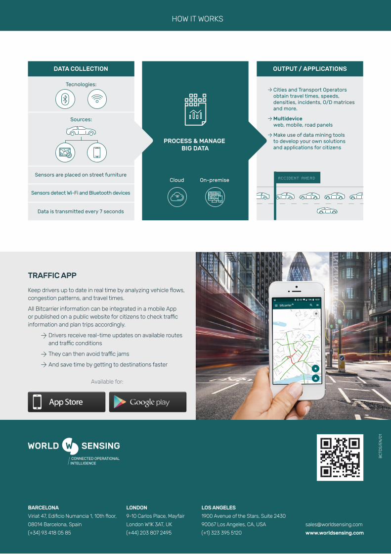
Keep drivers up to date in real time by analyzing vehicle flows, congestion patterns, and travel times.
All Bitcarrier information can be integrated in a mobile App or published on a public website for citizens to check traffic information and plan trips accordingly.
Drivers receive real-time updates on available routes and traffic conditions
They can then avoid traffic jams
And save time by getting to destinations faster
Available for:
TRAFFIC APP
BC
TDS
/EN
/01