Embed Size (px)
Citation preview
TOWN OF MALTA
COMPLETE STREETS WORKSHOP
September 9, 2016
CDTA
i | P a g e
TABLE OF CONTENTS
INTRODUCTION ...................................................................................................................................... 1
WORKSHOP DEVELOPMENT PROCESS ........................................................................................... 1
WORKSHOP AGENDA ............................................................................................................................ 1
WORKSHOP NOTES ............................................................................................................................... 4
COMPLETE STREETS RESOURCES & REFERENCES: ................................................................. 8
IDENTIFIED WORKSHOP OUTCOMES ............................................................................................. 9
SIGN-IN SHEETS .................................................................................................................................. 10
NYSAMPO COMPLETE STREETS FACT SHEETS ......................................................................... 10
1 | P a g e
INTRODUCTION CDTC is the federally-designated Metropolitan Planning Organization (MPO) for Albany, Rensselaer, Saratoga, and Schenectady counties, and 78 municipalities including the cities of Albany, Schenectady, Troy and Saratoga Springs. In 2015, the CDTC released an RFP (Request for Proposals) seeking consultant assistance to develop and implement a Complete Streets educational and technical assistance workshop series to assist local jurisdictions in developing and implementing Complete Streets policies.
On behalf of local member jurisdictions, the CDTC workshop series offered to administer the consultant contract and serve as project manager for workshop development and implementation. The CDTC developed a competitive selection process whereby they partnered with the Town of Malta, county officials, CDTA, NYSDOT, and nonprofit organizations, business and community groups and interested residents to ensure that all those with a stake in the outcome are actively involved in the Complete Streets workshop & implementation.
The workshop and partnership between CDTC, the Town of Malta and other stakeholders was developed to help transportation planning practitioners and decision makers identify and overcome barriers to implementation. Assisting the Town and CDTC were the consulting firms of Planning4Places, a Niskayuna-based land use and transportation planning firm and Sam Schwartz Engineering – a leading traffic and transportation planning and engineering firm based in New York City.
WORKSHOP DEVELOPMENT PROCESS The workshops were the result of a collaborative development process that included CDTC staff, Town of Malta staff, and the Consultant Team. Based on the application for the workshop that was submitted to CDTC and conference calls prior to the workshop, the Consultant Team developed a draft agenda and set of questions and data requests that would help to develop the workshop and frame the conversation.
Prior to the workshop, CDTC staff, Malta staff, and the Consultant Team held a conference call to discuss and decide
upon the final agenda and remaining meeting logistics. Participating in this discussion were Chris Bauer, Anne Benware, and Chris O’Neill from CDTC, Anthony Tozzi, Shelley Norton and Floria Huizinga from the Town of Malta, Jim Levy and Katherine Ember from Planning4Places, and Mike Flynn from Sam Schwartz.
WORKSHOP AGENDA The workshop agenda follows on the next two pages.
TOWN OF MALTA COMPLETE STREETS WORKSHOP
SEPTEMBER 9, 2016 MALTA COMMUNITY CENTER
ONE BAYBERRY DRIVE, MALTA NY
Workshop objectives:
• Understand the benefits of Complete Streets and how they can benefit Malta • Become familiar with the status of Complete Streets implementation in Malta • Identify how to refine the Complete Streets Process • Facilitate a discussion among participants to identify implementable action items
Agenda
9:00 Introductions
a. Instructors b. Participants
i. Ice breaker exercise: “A Complete Street is ______”
9:30 Module 1: Complete Streets overview
a. What are Complete Streets? b. Why are they important? (benefits of Complete Streets)
i. Mobility for all ii. Safety
iii. Health iv. Economic development v. Social equity & opportunity
c. The many faces of Complete Streets i. Photos of Complete Streets in different contexts (urban, suburban, commercial,
residential, etc.)
10:20 Break
10:30 Module 2: Design Considerations
a. Designing for context - how to make it fit b. Rural Complete Streets considerations
12:00 Lunch
TOWN OF MALTA COMPLETE STREETS WORKSHOP
SEPTEMBER 9, 2016 MALTA COMMUNITY CENTER
ONE BAYBERRY DRIVE, MALTA NY
12:30 Intro to Malta Form-Based Code & Complete Streets/What’s been done to date
a. Discussion led by Town Representative
12:45 Module 3: Project Development Process
a. Overview/steps b. How to integrate & implement Complete Streets c. Examples from other communities d. Existing process (Section 6.1.A & 6.3)
3:00 Adjourn
4 | P a g e
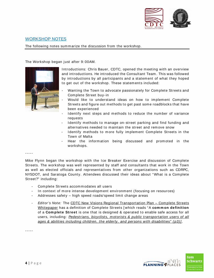
WORKSHOP NOTES The following notes summarize the discussion from the workshop.
The Workshop began just after 9:00AM.
Introductions: Chris Bauer, CDTC, opened the meeting with an overview and introductions. He introduced the Consultant Team. This was followed by introductions by all participants and a statement of what they hoped to get out of the workshop. These statements included:
- Wanting the Town to advocate passionately for Complete Streets and Complete Street buy-in
- Would like to understand ideas on how to implement Complete Streets and figure out methods to get past some roadblocks that have been experienced
- Identify next steps and methods to reduce the number of variance requests
- Identify methods to manage on-street parking and find funding and alternatives needed to maintain the street and remove snow
- Identify methods to more fully implement Complete Streets in the Town of Malta
- Hear the information being discussed and promoted in the workshops.
-----
Mike Flynn began the workshop with the Ice Breaker Exercise and discussion of Complete Streets. The workshop was well represented by staff and consultants that work in the Town as well as elected officials and representatives from other organizations such as CDRPC, NYSDOT, and Saratoga County. Attendees discussed their ideas about “What is a Complete Street?” including:
- Complete Streets accommodates all users - In context of more intense development environment (focusing on resources) - Addresses safety – high speed roads/speed limit change areas
- Editor’s Note: The CDTC New Visions Regional Transportation Plan – Complete Streets Whitepaper has a definition of Complete Streets [which reads “A common definition of a Complete Street is one that is designed & operated to enable safe access for all users, including: Pedestrians, bicyclists, motorists & public transportation users of all ages & abilities including children, the elderly, and persons with disabilities” (p3)].
-----
5 | P a g e
(All Modules identified below included a PPT slide presentation)
Module 1: Complete Streets Overview
M. Flynn discussed the components of Complete Streets and why they are important. Attendee ideas on what Complete Streets are and some issues in the Town of Malta included the following:
o Crossing Rt 9 is a concern o 2-lane roundabout challenges especially related to pedestrian crossings
A future option could be to install pedestrian signals to cross once regulations are adopted
o Rt 67 and Raymond Rd – going east remains a concern o Exit 12 & new senior apartments – requires crossing multiple roundabouts to
walk over the Northway and there are no support services there yet – hard to get to Dunkin Donuts and Panera by walking
o Need funding for maintenance and snow removal
-----
Module 2: Design Considerations
M. Flynn opened Module 2 with the slide presentation. Attendees provided input based on the discussion including the following topics:
- Zim Smith Trail crossing near the Route 67/Eastline Road intersection: o Left arrow turn is a problem o Painted crosswalk – opportunity to add a beacon o Option green arrow to blinking yellow and other traffic is held o To prove signal is necessary provide information beyond warrant information –
use, users, walking draw, and area growth potential to make the case for a signal
- Ideas mentioned for consideration included the following: o Green fold-out signs for pedestrian crossings o Speed monitoring signs o Lower speed limits o Change the culture – more focus on bike & pedestrians o Sharrows would be helpful to show location and direction of where people
should ride o Paths to connect residential areas to destinations would help walkability o Highway standards need updating to match the FBC o Will also need to look at the Subdivision Code o One option would be to adopt a Town Highway Tax for maintenance and snow
removal like Halfmoon did o Alternatively, a Downtown Improvement District or bed tax for hotels to pay
for maintenance expenses could be enacted o Complete Streets could apply to other areas – not just the downtown but also
the rural areas
6 | P a g e
-----
Introduction to Malta Form-Based Code & Complete Streets/What’s Been Done to Date
T. Tozzi provided a slide presentation on the adoption of the Malta Form-Based Code, the status of development that has been built in the Malta Town Center or is in progress, and some information about the current Route 9 design standards Linkage Study. The presentation noted that there no detailed engineering drawings to implement the Complete Streets cross-section in the Form-Based Code. As such the Town will look into consolidating the current standards (including the Town Highway Code) into a more concise set of standards.
-----
Module 3: Project Development Process
M. Flynn opened the module with the slide presentation. Attendees provided input based on the discussion including the following topics:
- Route 9 image – pedestrians walking with traffic because there is no safe place to cross. Pedestrians are walking on the same side of the street because of their destination. The direction of walking is only an issue when sidewalks are missing.
- CDTC LRTP has a Complete Streets element to encourage communities to buy-in and look at Federal Aid projects including Complete Streets in those projects. Communities can still fund potential improvements with little additional spending on paving and bridge projects and may be the only shot at an improvement for 30-40 years.
- There is currently no Complete Streets Advisory Committee in Malta. - There are three road specifications in Malta – in the Subdivision Ordinance, Highway
Design, and in the Form-Based Code. Most of the Town-only owned roads are rural roads.
- Saratoga Regional Traffic Study – residents have expressed concerns about increased pass-through traffic.
- Route 9 is a 45 mph road. On-street parking is not conducive on a high-speed road. Ellsworth is struggling – many feel it is because of a lack of on-street parking. Sense of place doesn’t happen at 45 mph.
- Cross connection between developments, particularly Route 9 are a concern especially left turns – need island breaks or selective U-turns?
- Updates on Route 9 could be done in phases or in one piece, not site by site. - GEIS – The fee structure will be changing to gravity-based model. Any development
is required to pay traffic mitigation. Could expand the GEIS to allow spending on Complete Streets improvements.
- There is parking on-street in some locations – have the precedent and that needs to be encouraged.
- Improvements are only being done on a developer’s property and the Town has waived some requirements of the Form-Based Code for Complete Streets/roads so a precedent has been set there.
- The FAST Act says Town can adopt a manual for standards for Town. - Off the shelf engineering detail - can borrow from others such as Saratoga Springs and
Clifton Park and then use the GEIS to pay for analysis and finalize engineering details

7 | P a g e
-----
The workshop concluded with a discussion of next steps and final thoughts.
- The Town of Malta could tackle these five things to improve Complete Streets infrastructure:
o Implementation of Downtown Streets o Update Highway Code and coordinate all regulations o Address highway maintenance o Form a Complete Streets Advisory Committee o Conduct a snow removal demonstration and identify snow storage locations
-----
- The meeting adjourned at 3:30 PM.
8 | P a g e
COMPLETE STREETS RESOURCES & REFERENCES: Thought not necessarily all directly requested in the workshop, all 2016 Complete Streets Workshops have included discussions of identifying Complete Streets Implementation resources/guides, low-cost options and green streets implementation assistance. In addition to resources and technical assistance available to the Town from CDTC, CDRPC, Saratoga County and CDTA, the Consultant Team has identified some of the resources that can be consulted for Complete Streets implementation:
Capital District Transportation Committee (CDTC)
New Visions 2040 Plan
http://www.cdtcmpo.org/rtp2040/2040.htm
Complete Streets Advisory Committee
http://www.cdtcmpo.org/compst/compst.htm
Bicycle and Pedestrian Committee
http://www.cdtcmpo.org/bkpedtf.htm
New York State Department of Transportation Complete Streets:
https://www.dot.ny.gov/programs/completestreets
National Complete Streets Coalition
http://www.smartgrowthamerica.org/complete-streets
City of Philadelphia Green Streets Program
http://www.phillywatersheds.org/what_were_doing/green_infrastructure/programs/ green_streets
American Association of Retired Persons (AARP) – Planning Complete Streets For an Aging America
American Association of Highway Traffic Officials (AASHTO) – Green Book, Guide for the Planning, Design, and Operation of Pedestrian Facilities, Guide for the Development of Bicycle Facilities, Roadside Design Guide
American Planning Association (APA) – Complete Streets: Best Policy and Implementation Practices
Federal Highway Administration (FHWA) – Manual on Uniform Traffic Control Devices (MUTCD)
Institute of Transportation Engineers (ITE) – Designing Walkable Urban Thoroughfares
National Association of City Transportation Officials (NACTO) – Urban Street Design Guide, Urban Bikeway Design Guide
Transportation Research Board (TRB) – Highway Capacity Manual
9 | P a g e
Rural Complete Streets Implementation – Smart Growth America:
https://www.smartgrowthamerica.org/app/legacy/documents/ cs/factsheets/cs-rural.pdf
IDENTIFIED WORKSHOP OUTCOMES Near Term Priorities/Next Steps
- Form a Complete Streets Advisory Committee - Address highway maintenance concerns/considerations
o Conduct a snow removal demonstration project and identify snow storage locations
- Update Highway Code Standards and coordinate all regulations - Work to develop a framework to ensure consistent implementation of Downtown
Streets improvements
Key Stakeholders and Officials to keep engaged and updated on progress and activities
- All Town Departments - Local Business Association/Chamber of Commerce - NYSDOT - Saratoga County Planning Department - CDTA - CDTC - CDRPC
Summary of Identified Opportunities/Needs/Potential Solutions:
- Form a Complete Streets Advisory Committee - Address highway maintenance concerns/considerations
o Conduct a snow removal demonstration and identify snow storage locations - Update Highway Code Standards and coordinate all regulations
o Highway standards need updating to match the FBC o Will also need to look at the Subdivision Code
- Work to develop a framework to ensure consistent implementation of Downtown Streets improvements
- Location specific issues for consideration: o Crossing Rt 9 is a concern o 2-lane roundabout challenges especially related to pedestrian crossings
A potential future option could be to install pedestrian signals once regulations are adopted
o Rt 67 and Raymond Rd – going east remains a concern o Exit 12 & new senior apartments – requires crossing multiple roundabouts to
walk over the Northway and there are no support services there yet – hard to get to Dunkin Donuts and Panera by walking
10 | P a g e
- Zim Smith Trail crossing near the Route 67/Eastline Road intersection: o Left arrow turn is a problem o Painted crosswalk – opportunity to add a beacon o Option green arrow to blinking yellow and other traffic is held o To prove signal is necessary provide information beyond warrant information –
use, users, walking draw, and area growth potential to make the case for a signal
- Green fold-out signs for pedestrian crossings - Speed monitoring signs - Lower speed limits - Change the culture – more focus on bike & pedestrians - Sharrows would be helpful to show location and direction of where people should ride - Paths to connect residential areas to destinations would help walkability - Need funding for maintenance and snow removal
o One option would be to adopt a Town Highway Tax for maintenance and snow removal like Halfmoon did
o Alternatively, a Downtown Improvement District or bed tax for hotels to pay for maintenance expenses could be enacted
- Complete Streets should apply to other areas – not just the downtown but also the rural areas
- Look at the potential to expand the GEIS to allow spending on Complete Streets improvements.
SIGN-IN SHEETS Scans of the sign-in sheets for the workshop follow below.
NYSAMPO COMPLETE STREETS FACT SHEETS Copies of the NYSAMPO Complete Streets Fact Sheets follow below.
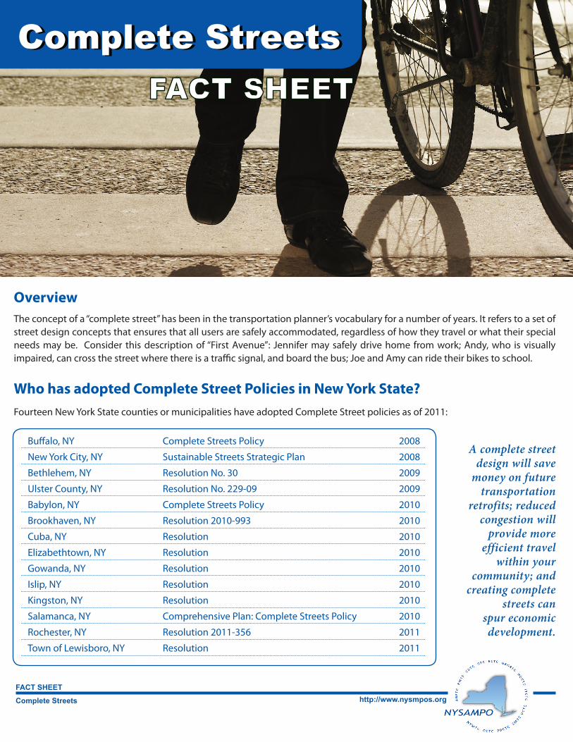
Complete Streets
FACT SHEEThttp://www.nysmpos.org
FACT SHEETComplete StreetsComplete Streets
OverviewThe concept of a “complete street” has been in the transportation planner’s vocabulary for a number of years. It refers to a set of street design concepts that ensures that all users are safely accommodated, regardless of how they travel or what their special needs may be. Consider this description of “First Avenue”: Jennifer may safely drive home from work; Andy, who is visually impaired, can cross the street where there is a traffic signal, and board the bus; Joe and Amy can ride their bikes to school.
Who has adopted Complete Street Policies in New York State?Fourteen New York State counties or municipalities have adopted Complete Street policies as of 2011:
A complete street design will save
money on future transportation
retrofits; reduced congestion will
provide more efficient travel
within your community; and
creating complete streets can
spur economic development.
Buffalo, NY Complete Streets Policy 2008
New York City, NY Sustainable Streets Strategic Plan 2008
Bethlehem, NY Resolution No. 30 2009
Ulster County, NY Resolution No. 229-09 2009
Babylon, NY Complete Streets Policy 2010
Brookhaven, NY Resolution 2010-993 2010
Cuba, NY Resolution 2010
Elizabethtown, NY Resolution 2010
Gowanda, NY Resolution 2010
Islip, NY Resolution 2010
Kingston, NY Resolution 2010
Salamanca, NY Comprehensive Plan: Complete Streets Policy 2010
Rochester, NY Resolution 2011-356 2011
Town of Lewisboro, NY Resolution 2011
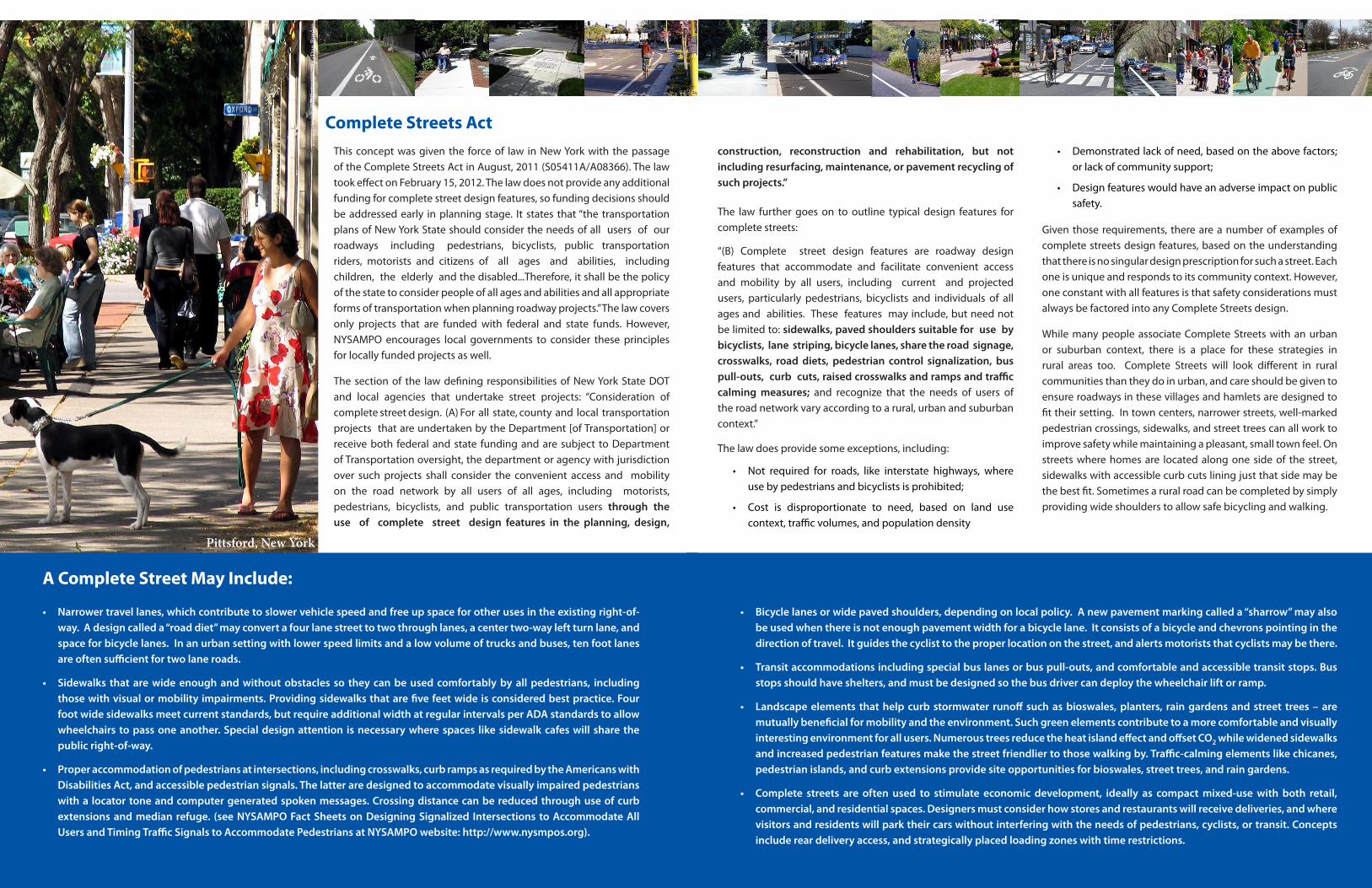
Complete Streets ActThis concept was given the force of law in New York with the passage of the Complete Streets Act in August, 2011 (S05411A/A08366). The law took effect on February 15, 2012. The law does not provide any additional funding for complete street design features, so funding decisions should be addressed early in planning stage. It states that “the transportation plans of New York State should consider the needs of all users of our roadways including pedestrians, bicyclists, public transportation riders, motorists and citizens of all ages and abilities, including children, the elderly and the disabled...Therefore, it shall be the policy of the state to consider people of all ages and abilities and all appropriate forms of transportation when planning roadway projects.” The law covers only projects that are funded with federal and state funds. However, NYSAMPO encourages local governments to consider these principles for locally funded projects as well.
The section of the law defining responsibilities of New York State DOT and local agencies that undertake street projects: “Consideration of complete street design. (A) For all state, county and local transportation projects that are undertaken by the Department [of Transportation] or receive both federal and state funding and are subject to Department of Transportation oversight, the department or agency with jurisdiction over such projects shall consider the convenient access and mobility on the road network by all users of all ages, including motorists, pedestrians, bicyclists, and public transportation users through the use of complete street design features in the planning, design,
A Complete Street May Include:
• Narrower travel lanes, which contribute to slower vehicle speed and free up space for other uses in the existing right-of-way. A design called a “road diet” may convert a four lane street to two through lanes, a center two-way left turn lane, and space for bicycle lanes. In an urban setting with lower speed limits and a low volume of trucks and buses, ten foot lanes are often sufficient for two lane roads.
• Sidewalks that are wide enough and without obstacles so they can be used comfortably by all pedestrians, including those with visual or mobility impairments. Providing sidewalks that are five feet wide is considered best practice. Four foot wide sidewalks meet current standards, but require additional width at regular intervals per ADA standards to allow wheelchairs to pass one another. Special design attention is necessary where spaces like sidewalk cafes will share the public right-of-way.
• Proper accommodation of pedestrians at intersections, including crosswalks, curb ramps as required by the Americans with Disabilities Act, and accessible pedestrian signals. The latter are designed to accommodate visually impaired pedestrians with a locator tone and computer generated spoken messages. Crossing distance can be reduced through use of curb extensions and median refuge. (see NYSAMPO Fact Sheets on Designing Signalized Intersections to Accommodate All Users and Timing Traffic Signals to Accommodate Pedestrians at NYSAMPO website: http://www.nysmpos.org).
• Bicycle lanes or wide paved shoulders, depending on local policy. A new pavement marking called a “sharrow” may also be used when there is not enough pavement width for a bicycle lane. It consists of a bicycle and chevrons pointing in the direction of travel. It guides the cyclist to the proper location on the street, and alerts motorists that cyclists may be there.
• Transit accommodations including special bus lanes or bus pull-outs, and comfortable and accessible transit stops. Bus stops should have shelters, and must be designed so the bus driver can deploy the wheelchair lift or ramp.
• Landscape elements that help curb stormwater runoff such as bioswales, planters, rain gardens and street trees – are mutually beneficial for mobility and the environment. Such green elements contribute to a more comfortable and visually interesting environment for all users. Numerous trees reduce the heat island effect and offset CO2 while widened sidewalks and increased pedestrian features make the street friendlier to those walking by. Traffic-calming elements like chicanes, pedestrian islands, and curb extensions provide site opportunities for bioswales, street trees, and rain gardens.
• Complete streets are often used to stimulate economic development, ideally as compact mixed-use with both retail, commercial, and residential spaces. Designers must consider how stores and restaurants will receive deliveries, and where visitors and residents will park their cars without interfering with the needs of pedestrians, cyclists, or transit. Concepts include rear delivery access, and strategically placed loading zones with time restrictions.
Pittsford, New York
sour
ce: w
ww.
pedb
ikei
mag
es.o
rg /D
an B
urde
n
construction, reconstruction and rehabilitation, but not including resurfacing, maintenance, or pavement recycling of such projects.”
The law further goes on to outline typical design features for complete streets:
“(B) Complete street design features are roadway design features that accommodate and facilitate convenient access and mobility by all users, including current and projected users, particularly pedestrians, bicyclists and individuals of all ages and abilities. These features may include, but need not be limited to: sidewalks, paved shoulders suitable for use by bicyclists, lane striping, bicycle lanes, share the road signage, crosswalks, road diets, pedestrian control signalization, bus pull-outs, curb cuts, raised crosswalks and ramps and traffic calming measures; and recognize that the needs of users of the road network vary according to a rural, urban and suburban context.”
The law does provide some exceptions, including:
• Not required for roads, like interstate highways, where use by pedestrians and bicyclists is prohibited;
• Cost is disproportionate to need, based on land use context, traffic volumes, and population density
• Demonstrated lack of need, based on the above factors; or lack of community support;
• Design features would have an adverse impact on public safety.
Given those requirements, there are a number of examples of complete streets design features, based on the understanding that there is no singular design prescription for such a street. Each one is unique and responds to its community context. However, one constant with all features is that safety considerations must always be factored into any Complete Streets design.
While many people associate Complete Streets with an urban or suburban context, there is a place for these strategies in rural areas too. Complete Streets will look different in rural communities than they do in urban, and care should be given to ensure roadways in these villages and hamlets are designed to fit their setting. In town centers, narrower streets, well-marked pedestrian crossings, sidewalks, and street trees can all work to improve safety while maintaining a pleasant, small town feel. On streets where homes are located along one side of the street, sidewalks with accessible curb cuts lining just that side may be the best fit. Sometimes a rural road can be completed by simply providing wide shoulders to allow safe bicycling and walking.
New York State Association of
Metropolitan Planning Organizations
http://www.nysmpos.org/
The National Complete Streets Coalition is an excellent source of information on the design and benefits of Complete Streets.
http://www.completestreets.org/complete-streets-fundamentals/factsheets/
sour
ce: w
ww.
pedb
ikei
mag
es.o
rg /J
enni
fer C
ampo
s
sour
ce: w
ww.
pedb
ikei
mag
es.o
rg /D
an B
urde
n
sour
ce: w
ww.
pedb
ikei
mag
es.o
rg /L
aura
San
dt
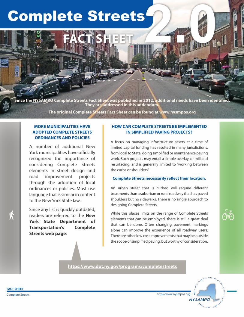
Since the NYSAMPO Complete Streets Fact Sheet was published in 2012, additional needs have been identified. They are addressed in this addendum.
The original Complete Streets Fact Sheet can be found at www.nysmpos.org
FACT SHEET
MORE MUNICIPALITIES HAVE ADOPTED COMPLETE STREETS
ORDINANCES AND POLICIES
A number of additional New York municipalities have officially recognized the importance of considering Complete Streets elements in street design and road improvement projects through the adoption of local ordinances or policies. Most use language that is similar in content to the New York State law.
Since any list is quickly outdated, readers are referred to the New York State Department of Transportation’s Complete Streets web page:
Complete Streets
FACT SHEET
http://www.nysmpos.org
https://www.dot.ny.gov/programs/completestreets
2.0HOW CAN COMPLETE STREETS BE IMPLEMENTED
IN SIMPLIFIED PAVING PROJECTS?
A focus on managing infrastructure assets at a time of limited capital funding has resulted in many jurisdictions, from local to State, doing simplified or maintenance paving work. Such projects may entail a simple overlay, or mill and resurfacing, and is generally limited to “working between the curbs or shoulders”.
Complete Streets necessarily reflect their location.
An urban street that is curbed will require different treatments than a suburban or rural roadway that has paved shoulders but no sidewalks. There is no single approach to designing Complete Streets.
While this places limits on the range of Complete Streets elements that can be employed, there is still a great deal that can be done. Often changing pavement markings alone can improve the experience of all roadway users. There are other low cost improvements that may be outside the scope of simplified paving, but worthy of consideration.
Complete Streets
HOW CAN COMPLETE STREETS ACCOMMODATE GOODS MOVEMENT?
component of Complete Streets, especially when one of the objectives of the new streetscape is to encourage economic de-velopment, which often occurs in the form
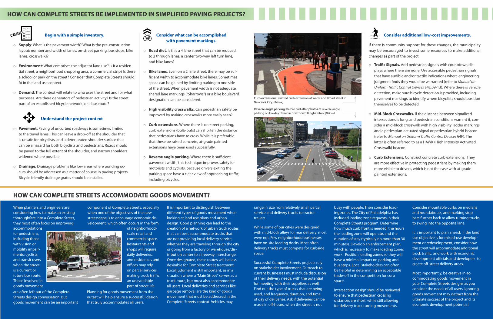
Begin with a simple inventory.
o Supply: What is the pavement width? What is the pre-construction layout: number and width of lanes, on-street parking, bus stops, bike lanes, crosswalks?
o Environment: What comprises the adjacent land use? Is it a residen-tial street, a neighborhood shopping area, a commercial strip? Is there a school or park on the street? Consider that Complete Streets should fit in the land use context.
o Demand: The context will relate to who uses the street and for what purposes. Are there generators of pedestrian activity? Is the street part of an established bicycle network, or a bus route?
Consider additional low-cost improvements.
If there is community support for these changes, the municipality may be encouraged to invest some resources to make additional changes as part of the project.
o Traffic Signals. Add pedestrian signals with countdown dis-plays where there are none. Use accessible pedestrian signals that have audible and/or tactile indications where engineering judgment finds they would be warranted (refer to Manual on Uniform Traffic Control Devices §4E.09-13). Where there is vehicle detection, make sure bicycle detection is provided, including pavement markings to identify where bicyclists should position themselves to be detected.
o Mid-Block Crosswalks. If the distance between signalized intersections is long, and pedestrian conditions warrant it, con-sider a mid-block crosswalk with high visibility ladder markings and a pedestrian-actuated signal or pedestrian hybrid beacon (refer to Manual on Uniform Traffic Control Devices §4F). The latter is often referred to as a HAWK (High Intensity Activated Crosswalk) beacon.
o Curb Extensions. Construct concrete curb extensions. They are more effective in protecting pedestrians by making them more visible to drivers, which is not the case with at-grade painted extensions.
range in size from relatively small parcel service and delivery trucks to tractor-trailers.
While some of our cities were designed with mid-block alleys for rear delivery, most were not. Few neighborhood businesses have on-site loading docks. Most often delivery trucks must compete for curbside space.
Successful Complete Streets projects rely on stakeholder involvement. Outreach to current businesses must include discussion of their delivery needs, with the potential for meeting with their suppliers as well. Find out the type of trucks that are being used, and frequency, duration, and time of day of deliveries. Ask if deliveries can be made in off-hours, when the street is not
busy with people. Then consider load-ing zones. The City of Philadelphia has included loading zone requests in their Complete Streets program. Determine how much curb front is needed, the hours the loading zone will operate, and the duration of stay (typically no more than 30 minutes). Develop an enforcement plan, which is necessary to make loading zones work. Position loading zones so they will have a minimal impact on parking and bus stops. Local stakeholders can often be helpful in determining an acceptable trade-off in the competition for curb space.
Intersection design should be reviewed to ensure that pedestrian crossing distances are short, while still allowing for delivery truck turning movements.
Consider what can be accomplished with pavement markings.
o Road diet. Is this a 4 lane street that can be reduced to 2 through lanes, a center two-way left turn lane, and bike lanes?
o Bike lanes. Even on a 2 lane street, there may be suf-ficient width to accommodate bike lanes. Sometimes space can be gained by limiting parking to one side of the street. When pavement width is not adequate, shared lane markings (“Sharrows”) or a bike boulevard designation can be considered.
o High visibility crosswalks. Can pedestrian safety be improved by making crosswalks more easily seen?
o Curb extensions. Where there is on-street parking, curb extensions (bulb-outs) can shorten the distance that pedestrians have to cross. While it is preferable that these be raised concrete, at-grade painted extensions have been used successfully.
o Reverse angle parking. Where there is sufficient pavement width, this technique improves safety for motorists and cyclists, because drivers exiting the parking space have a clear view of approaching traffic, including bicycles.
Understand the project context
o Pavement. Paving of uncurbed roadways is sometimes limited to the travel lanes. This can leave a drop-off at the shoulder that is unsafe for bicyclists, and a deteriorated shoulder surface that can be a hazard for both bicyclists and pedestrians. Roads should be paved to the full extent of the shoulder, and narrow shoulders widened where possible.
o Drainage. Drainage problems like low areas where ponding oc-curs should be addressed as a matter of course in paving projects. Bicycle friendly drainage grates should be installed.
When planners and engineers are considering how to make an existing thoroughfare into a Complete Street, they most often focus on improving
HOW CAN COMPLETE STREETS BE IMPLEMENTED IN SIMPLIFIED PAVING PROJECTS?
It is important to distinguish between different types of goods movement when looking at land use plans and urban design. Good planning can lead to the creation of a network of urban truck routes that can best accommodate trucks that are not providing local delivery service, whether they are traveling through the city or going from a factory or warehouse/dis-tribution center to a freeway interchange. Once designated, these routes will be less desirable for Complete Street treatment. Local judgment is still important, as in a situation where a “Main Street” serves as a truck route, but must also accommodate all users. Local deliveries and services like garbage removal are the kind of goods movement that must be addressed in the Complete Streets context. Vehicles may
Consider mountable curbs on medians and roundabouts, and marking stop bars further back to allow turning trucks to swing into the opposite lane.
It is important to plan ahead. If the land use objective is for mixed-use develop-ment or redevelopment, consider how the street will accommodate additional truck traffic, and work with economic development officials and developers to create off-street delivery areas.
Most importantly, be creative in ac-commodating goods movement in your Complete Streets designs as you consider the needs of all users. Ignoring goods movement may detract from the ultimate success of the project and its economic development potential.
Planning for goods movement from the outset will help ensure a successful design that truly accommodates all users.
accommodations for pedestrians, including those with vision or mobility impair-ments; cyclists; and transit users when the street is a current or future bus route. Those involved in goods movement are often left out of the Complete Streets design conversation. But goods movement can be an important
of neighborhood-scale retail and commercial space. Restaurants and shops will require daily deliveries, and residences and offices may rely on parcel services, making truck traffic an unavoidable part of street life.
Curb extensions: Painted curb extension at Water and Broad street in New York City. (Above)
Reverse angle parking: Before and after photos of reverse angle parking on Hawley Street in downtown Binghamton. (Below)
Before
After
IMPLEMENTING COMPLETE STREETS
New York State Association of Metropolitan Planning Organizations
http://www.nysmpos.org
The National Complete Streets Coalition is an excellent source of information on the design and benefits of Complete Streets.
http://www.completestreets.org/complete-streets-fundamentals/Factsheets
Implementing Complete Streets projects can be a challenge. The existence of a state law or local ordinance that requires consideration of the needs of all users in project design does not guarantee the creation of a Complete Street. It is the responsibility of transportation and urban planners to work with residents
and businesses on a street that is slated for construction to educate them about Complete Streets and encourage their input on design elements that will meet their needs. The street owner must be engaged early in the project development process as well, to understand the range of options they may be willing to consider. They will know about limitations of the
built infrastructure that are not otherwise apparent. Finding a champion can also be key in garnering support. Decision makers may be more willing to dedicate resources when they see that a Complete Street project is responding to the needs their constituents have identified, and are not perceived simply as a required response to a law.
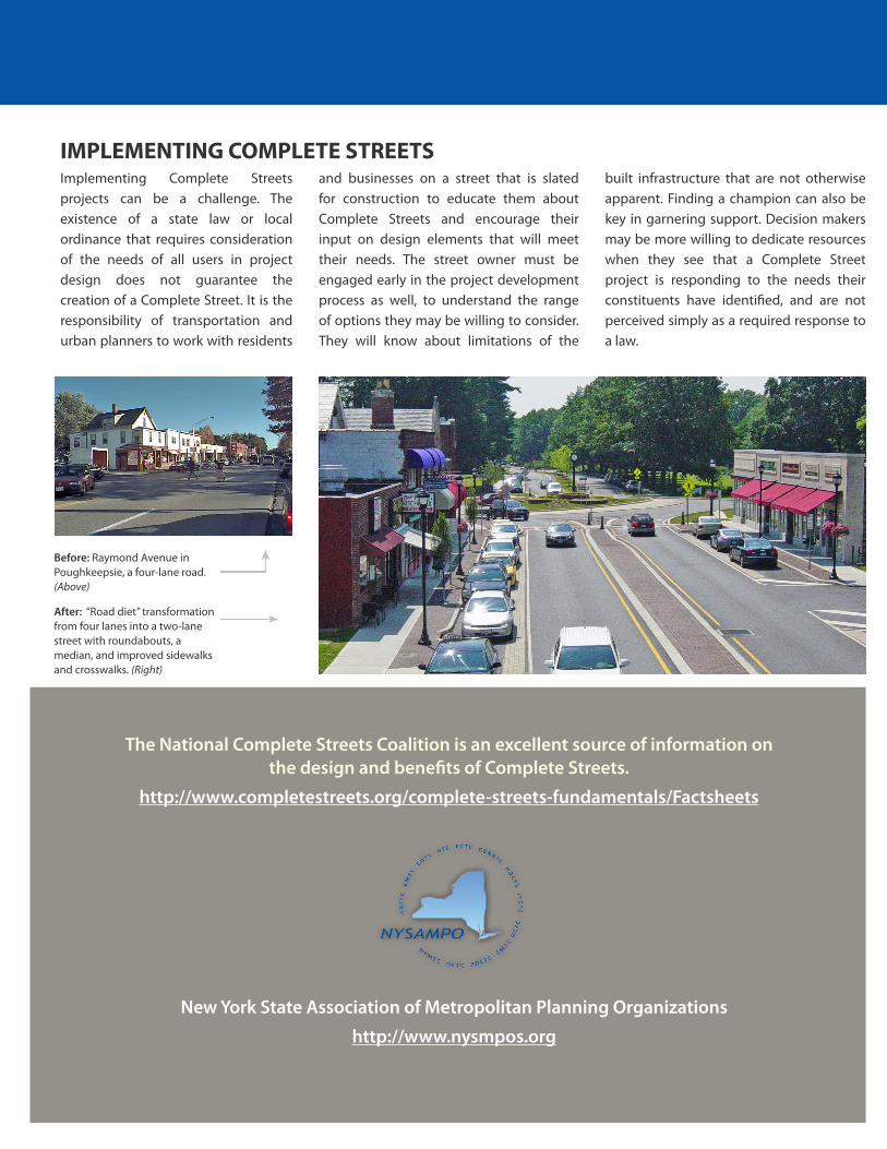
Before: Raymond Avenue in Poughkeepsie, a four-lane road. (Above)
After: “Road diet” transformation from four lanes into a two-lane street with roundabouts, a median, and improved sidewalks and crosswalks. (Right)