Embed Size (px)
Citation preview
Towards understanding the impact of mapathons –
Reflecting on YouthMappers experiencesPresented by Serena Coetzee
Centre for Geoinformation Science, University of Pretoria, South Africa
Co-authors: Marco Minghini, Politecnico di Milano, ItalyPatricia Solis, Texas Tech University, USA
Victoria Rautenbach and Cameron Green, University of Pretoria, South Africa
FOSS4G 2018, Dar es Salaam, 29 August 2018

Openly licensed geospatial database created and edited daily by volunteers
worldwide
2

OpenStreetMap contributions
1. field mapping2. remote mapping
3. bulk import
3

4
OpenStreetMap contributions
1. field mapping2. remote mapping
3. bulk import

mapathon ~ map marathon
collaborative effort
by groups of people who meet together (e.g. at a university or a company)
for collecting specific map data where OpenStreetMap data is scarce or non-existent
(typically for humanitarian purposes)
through remote mapping
5

What is the impact of mapathons?
• Do mapathons improve the map data?– Can newcomers contribute quality data?– If unfamiliar with the area, can one contribute quality
data?– Is the data validated properly?
• Do mapathons increase the number of contributors?– Do newcomers contribute again?– Why do some continue to contribute?– If not, what do they take with them from the mapathon?
6

What is the impact of mapathons?
• What others have found…– How mapathon is conducted is important
• Be careful not to attract floods of newcomers who cannot be coordinated (Dittus et al. 2016)
– Mapathons can positively affect school children’s engagement, enthusiasm and attitude towards geography (Ebrahim et al. 2016)
7

What is the impact of mapathons?
• What others have found…– Experienced users uploaded most of the
data after FOSS4G 2015 Europe mapping party in London (Mooney et al. 2015)
– Difficult to convert newcomers into long-term contributors, but long-term contributors just carry on… (Juhász and Hochmair 2018)
8
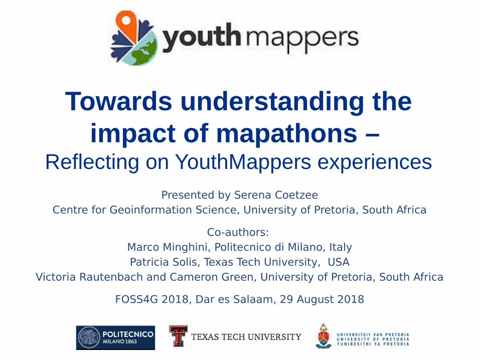
YouthMappers
• 113 chapters in 35 countries• > 5,000 students• Mapped in OpenStreetMap since
2016:2,776,167 buildings422,344 roads>20,000 other features2,000,000 map changes per month
(Statistics: April 2018)
9
What is the impact of YouthMappers mapathons?
Reflections from three universities…
10

Politecnico di Milano (Italy)
• PoliMappers (since 2016)– Community of mappers based on
OpenStreetMap, open data and open source
– Empower students to work with OpenStreetMap and geospatial data!
– Mapping activities every 2 months• Field mapping and remote mapping• Wide variety of technologies used, e.g. Field
Papers, Mapillary, maps.me, Geopaparazzi, …
11
Politecnico di Milano (Italy)
• mapathons by PoliMappers–announced in lectures–email invitations to students and
previous participants–open to all students
12

Politecnico di Milano (Italy)
13
After lectures, late afternoon, starting 16:00 or 17:0030–70 voluntary participants per mapathonParticipants bring their own laptopsLast for a few hours
After lectures, late afternoon, starting 16:00 or 17:0030–70 voluntary participants per mapathonParticipants bring their own laptopsLast for a few hours

Politecnico di Milano (Italy)
• If there are many newcomers– Introductory presentation – Hands-on tutorial in iD editor, stress
importance of quality of data
• Mix of novice and experienced mappers– Long-term members guide newcomers
• Validation– Changesets are marked with #polimappers
and event tag (e.g. #polimappers03)– Long-term members validate contributions
14
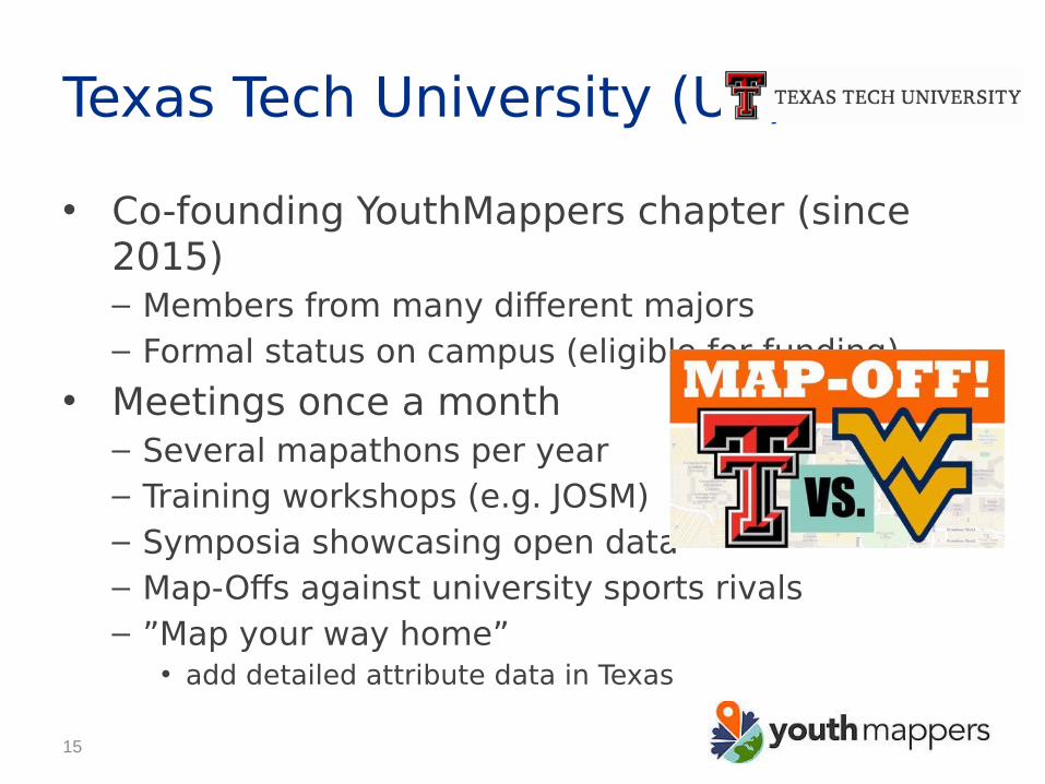
Texas Tech University (US)
• Co-founding YouthMappers chapter (since 2015)– Members from many different majors– Formal status on campus (eligible for funding)
• Meetings once a month– Several mapathons per year– Training workshops (e.g. JOSM)– Symposia showcasing open data– Map-Offs against university sports rivals – ”Map your way home”
• add detailed attribute data in Texas
15

Texas Tech University (US)
16
Pizzas in map roomMusic/videos from mapped areaSometimes ad hoc extra credits offered

Texas Tech University (US)
17
Typically 3 hours70-75 participants per mapathonStart with orientation presentationQuick start instructions at each deskChapter members point out mistakes earlyDifferent assistance depending on experience
Typically 3 hours70-75 participants per mapathonStart with orientation presentationQuick start instructions at each deskChapter members point out mistakes earlyDifferent assistance depending on experience

Texas Tech University (US)
• mapathons in service-learning course– Learning objective
• How to plan and execute a mapping project
– Map data and research humanitarian or development issue at hand
• Work with students from around the world • Quality of first 500 edits reviewed, feedback
provided• Focus on US AID request themes• Class hosts public mapathon
18
Some students enjoyed it so much, they retook course, even though they had passed with high marks!
Some students enjoyed it so much, they retook course, even though they had passed with high marks!

University of Pretoria (South Africa)• Inaugural YouthMappers chapter (since
2016)– Activities focus on students and local schools– Monthly open data events for students– Final year geoinformatics students bulk upload
their project data into OpenStreetMap– Regular events with groups of school children
• mapathons integrated into the curriculum as practical lab sessions for digitizing
19
University of Pretoria (South Africa)
20
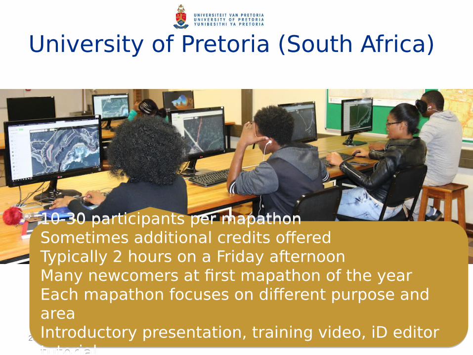
10-30 participants per mapathonSometimes additional credits offeredTypically 2 hours on a Friday afternoonMany newcomers at first mapathon of the yearEach mapathon focuses on different purpose and areaIntroductory presentation, training video, iD editor tutorial
10-30 participants per mapathonSometimes additional credits offeredTypically 2 hours on a Friday afternoonMany newcomers at first mapathon of the yearEach mapathon focuses on different purpose and areaIntroductory presentation, training video, iD editor tutorial

University of Pretoria (South Africa)
21
Challenges:• Bad imagery or cloud cover (16%)• Difficult to identity roads or footpaths
(26%)• Difficult to identify road surface (22%)
Challenges:• Bad imagery or cloud cover (16%)• Difficult to identity roads or footpaths
(26%)• Difficult to identify road surface (22%)
University of Pretoria (South Africa)
22
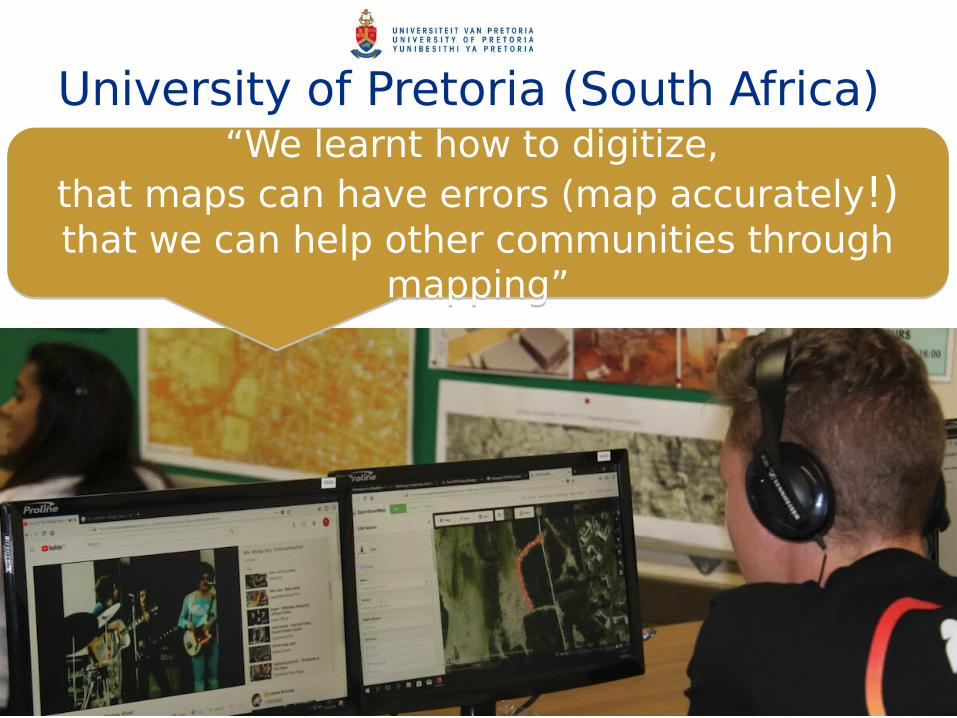
“We learnt how to digitize, that maps can have errors (map accurately!)that we can help other communities through
mapping”
“We learnt how to digitize, that maps can have errors (map accurately!)that we can help other communities through
mapping”

University of Pretoria (South Africa)
23
I will use OpenStreetMap again (75%)
I will use OpenStreetMap again (75%)
University of Pretoria (South Africa)
24
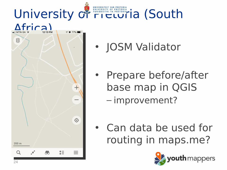
• JOSM Validator
• Prepare before/after base map in QGIS– improvement?
• Can data be used for routing in maps.me?

What is the impact of mapathons?
1.map data2.mapathon participants3.hosting institutions
25
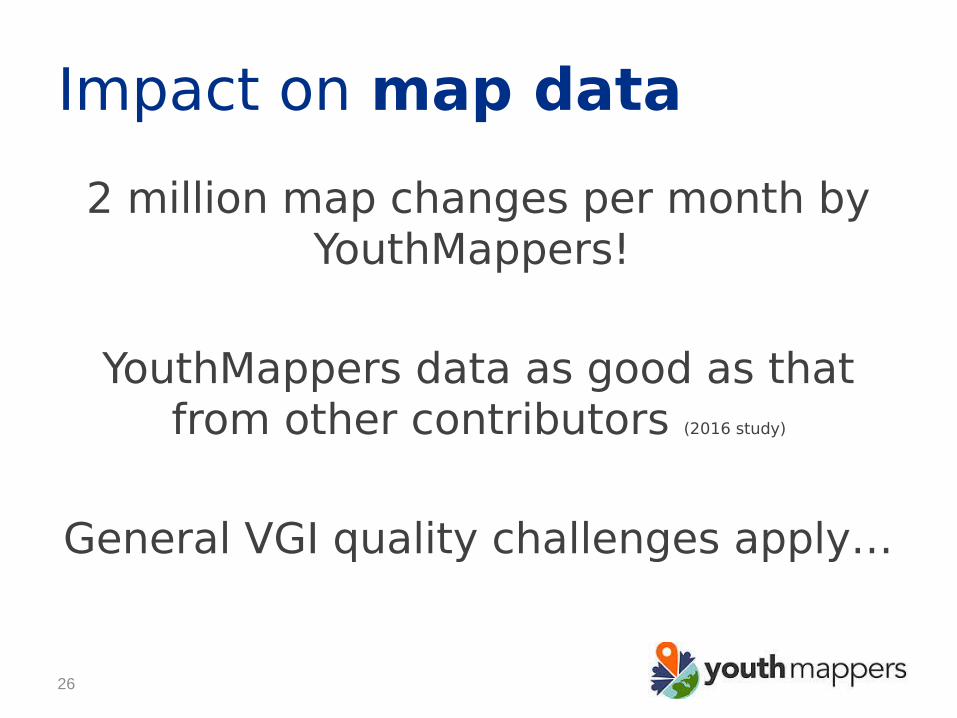
Impact on map data
2 million map changes per month by YouthMappers!
YouthMappers data as good as that from other contributors (2016 study)
General VGI quality challenges apply…
26

Impact on map data
• Ways to address quality challenges…– Set up a data collection protocol– Match remote mapping with field
mapping trip (if possible)– Senior students validate data
contributed by juniors– Check whether contributed data can be
used in OpenStreetMap applications
27

Impact on mapathon participants
• Opportunity to network with peers (globally)– Sense of belonging, have fun, find friends
• Practical learning experience– Do not accept quality of map at face value!
• Supports learning in many domains– Technical, as well as humanitarian and
developmental issues
28

Impact on mapathon participants
• Empowers students by including them on the map
• May prompt them to realize what a good citizen is
• Raises awareness of geospatial careers
29

Impact on hosting institutions• ‘open’ into teaching
– Course at Texas Tech University– Practical lab sessions at University of Pretoria– mapathons recognized as innovative teaching
method at Politecnico di Milano
• ‘open’ into research– Research in OpenStreetMap, open data and
open source– By postgraduate students and staff …
30

Conclusions
Decide what the objective with your mapathon is,
shape it accordingly
Aim for acceptable balance between productivity and quality
31

Acknowledgements
Thanks to our mapathon participants!
YouthMappers network www.youthmappers.org
US AID supports the YouthMappers program through a grant from
the USAID GeoCenter (Award #AID-OAA-G-15-00007)Views expressed in this article do not necessarily reflect the
policies and viewpoints of the agency or its employees
32