Embed Size (px)
Citation preview
Towards practical Guidance for Sustainable Sediment Management using the Sava River
as a showcase
Damir Bekić, Ph.D., M.Sc., Dipl.Ing., Civ.Eng. University of Zagreb, Faculty of Civil Engineering, Croatia
UNIVERSITY OF ZAGREB FACULTY OF CIVIL ENGINEERING
WATER RESEARCH DEPARTMENT
8th International SedNet Conference 6-9 November 2013 Lisbon, Portugal Innovative Sediment Management: How to do more with less
Contents
1. Introduction 2. Project – Towards practical Guidance for SSM 3. Project results 4. Future steps
2
1. INTRODUCTION
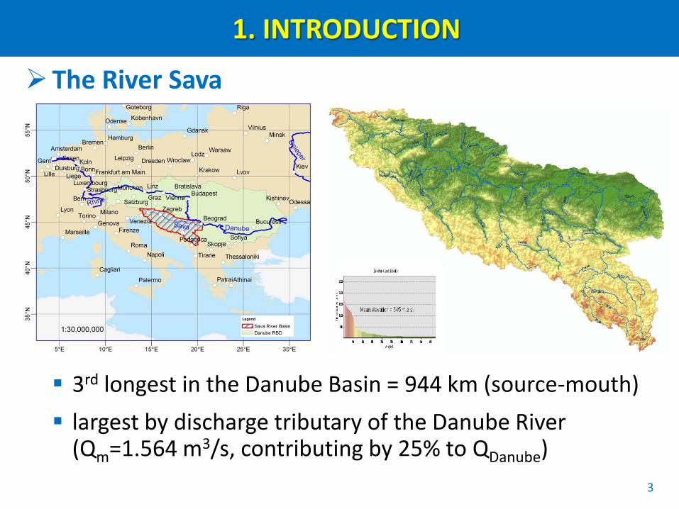
The River Sava
3rd longest in the Danube Basin = 944 km (source-mouth) largest by discharge tributary of the Danube River
(Qm=1.564 m3/s, contributing by 25% to QDanube)
3
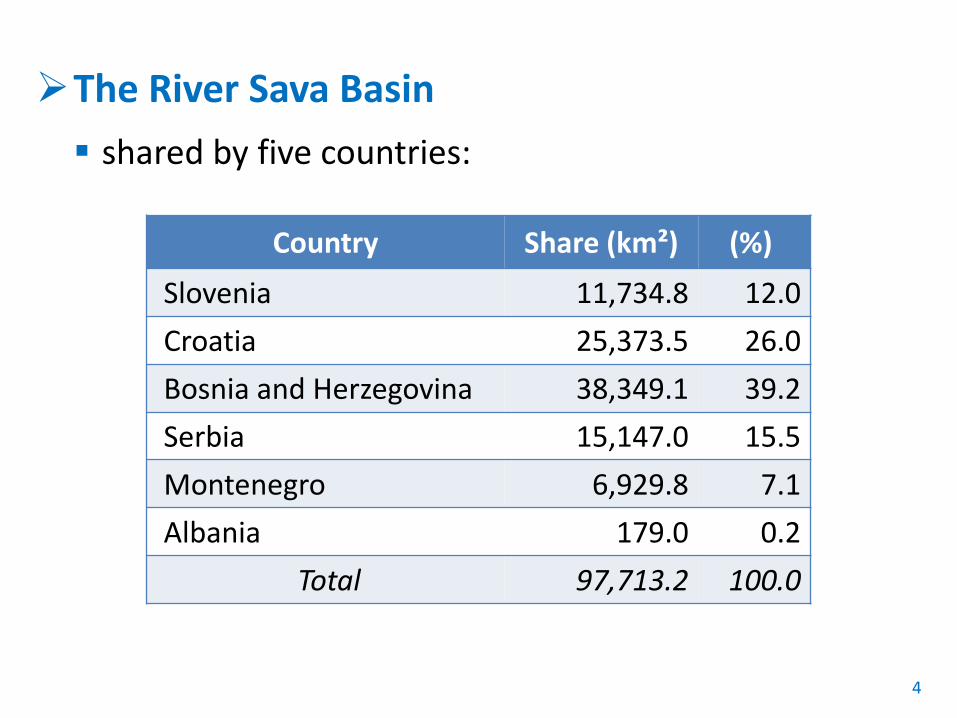
The River Sava Basin shared by five countries:
4
Country Share (km²) (%) Slovenia 11,734.8 12.0 Croatia 25,373.5 26.0 Bosnia and Herzegovina 38,349.1 39.2 Serbia 15,147.0 15.5 Montenegro 6,929.8 7.1 Albania 179.0 0.2
Total 97,713.2 100.0
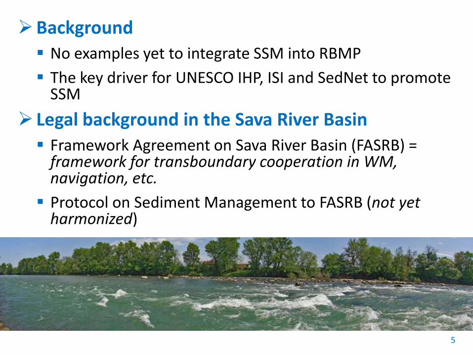
Background No examples yet to integrate SSM into RBMP The key driver for UNESCO IHP, ISI and SedNet to promote
SSM Legal background in the Sava River Basin Framework Agreement on Sava River Basin (FASRB) =
framework for transboundary cooperation in WM, navigation, etc. Protocol on Sediment Management to FASRB (not yet
harmonized)
5
2. PROJECT: Towards practical Guidance for SSM
General facts Main objective = to develop and validate practical
guidance to achieve SSM plan on the river basin scale
Project partners = experts appointed by UNESCO, ISI, SedNet and ISRBC
Estimated duration = 26 months
6
Project schedule
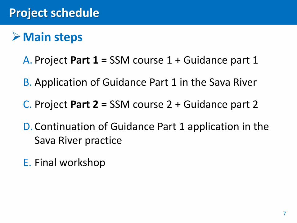
Main steps
A. Project Part 1 = SSM course 1 + Guidance part 1
B. Application of Guidance Part 1 in the Sava River
C. Project Part 2 = SSM course 2 + Guidance part 2
D. Continuation of Guidance Part 1 application in the Sava River practice
E. Final workshop
7

3. PROJECT RESULTS: Guidance on SSM
Guidance purpose To serve as a policy-level (strategic)
document as an input in national/entity-level strategic planning on sustainable sediment management; To provide expert contribution to
unified approach to sustainable sediment management in the Sava River Basin; To outline the scope of work for the
preparation of Sediment Management Plan for the Sava Basin.
8
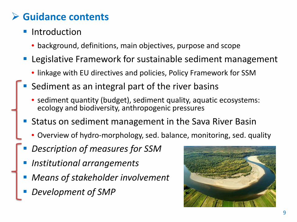
Guidance contents Introduction
• background, definitions, main objectives, purpose and scope
Legislative Framework for sustainable sediment management • linkage with EU directives and policies, Policy Framework for SSM
Sediment as an integral part of the river basins • sediment quantity (budget), sediment quality, aquatic ecosystems:
ecology and biodiversity, anthropogenic pressures
Status on sediment management in the Sava River Basin • Overview of hydro-morphology, sed. balance, monitoring, sed. quality
Description of measures for SSM Institutional arrangements Means of stakeholder involvement Development of SMP
9
3. PROJECT RESULTS: Guidance Part 1
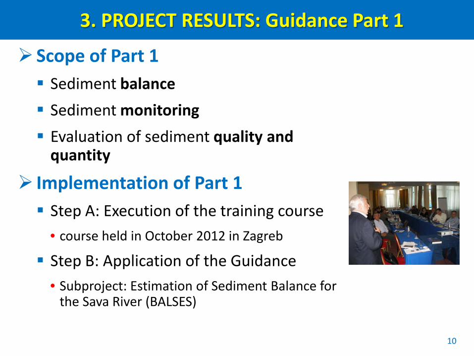
Scope of Part 1 Sediment balance Sediment monitoring Evaluation of sediment quality and
quantity
Implementation of Part 1 Step A: Execution of the training course
• course held in October 2012 in Zagreb
Step B: Application of the Guidance • Subproject: Estimation of Sediment Balance for
the Sava River (BALSES)
10
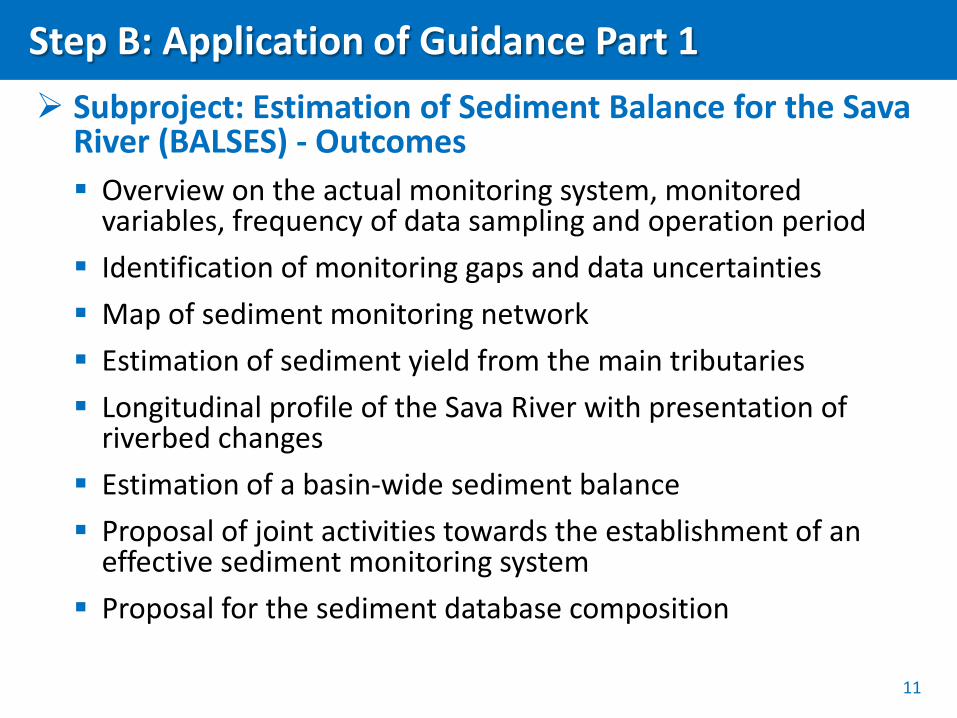
Step B: Application of Guidance Part 1 Subproject: Estimation of Sediment Balance for the Sava
River (BALSES) - Outcomes Overview on the actual monitoring system, monitored
variables, frequency of data sampling and operation period Identification of monitoring gaps and data uncertainties Map of sediment monitoring network Estimation of sediment yield from the main tributaries Longitudinal profile of the Sava River with presentation of
riverbed changes Estimation of a basin-wide sediment balance Proposal of joint activities towards the establishment of an
effective sediment monitoring system Proposal for the sediment database composition
11
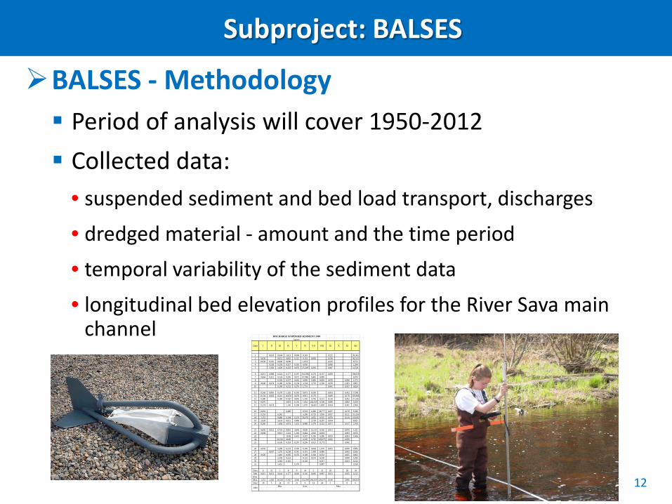
Subproject: BALSES
BALSES - Methodology Period of analysis will cover 1950-2012 Collected data:
• suspended sediment and bed load transport, discharges
• dredged material - amount and the time period • temporal variability of the sediment data
• longitudinal bed elevation profiles for the River Sava main channel
12
DISCHARGE SUSPENDED SEDIMENT 2008kg/sec
Date I II III IV V VI VII VIII IX X XI XII
1 0,053 0,044 1,013 0,084 0,145 0,121 90,3652 0,030 0,051 0,816 0,115 0,133 0,083 0,190 90,3133 0,030 0,391 0,048 0,606 1,033 0,105 8,5724 0,538 0,259 0,327 0,102 6,930 0,066 2,2845 2,382 1,028 0,222 0,076 25,318 0,283 0,047 12,521
6 0,015 0,988 0,322 0,177 0,107 152,598 0,170 0,157 0,059 106,0197 0,064 0,312 0,124 0,285 0,072 87,988 0,445 0,089 8,0708 0,103 0,557 0,046 9,089 1,885 0,829 0,078 6,096 1,5739 0,040 0,074 0,188 0,259 0,134 3,334 3,770 2,190 0,078 1,433 0,602
10 0,169 0,232 0,276 1,701 0,041 0,507 0,824
11 0,543 0,065 0,178 1,326 0,103 0,875 0,196 0,053 0,302 17,09112 0,134 0,062 0,241 16,876 0,078 0,921 0,170 0,049 0,170 105,96613 0,180 0,169 57,927 0,095 1,350 5,795 0,131 0,118 0,292 27,32614 0,476 5,819 0,130 1,062 264,359 0,108 0,089 0,892 5,81915 0,174 0,074 1,136 0,198 1,070 18,410 1,609 0,014 0,361 2,856
16 0,091 0,490 0,519 1,666 38,777 0,027 0,170 9,38017 0,253 6,362 5,308 0,729 3,950 0,037 0,121 55,32418 1,351 9,468 0,194 0,133 56,276 2,852 0,535 0,070 0,110 19,81619 1,020 5,633 0,921 0,460 2,739 0,297 0,034 8,62120 0,260 1,894 0,974 1,632 0,988 2,379 0,222 0,011 0,167 2,918
21 0,095 0,031 0,722 0,816 3,646 0,699 12,119 0,166 0,011 0,070 1,23122 0,088 0,911 3,224 1,218 0,464 2,902 0,094 0,093 0,67623 3,038 0,443 0,337 1,106 4,286 0,053 0,064 0,46624 26,518 0,849 0,330 0,705 129,075 0,062 0,05925 6,526 0,353 0,207 0,236 0,521 11,773 0,042
26 0,041 2,208 0,233 0,196 0,196 0,664 1,670 0,023 0,058 0,58527 0,047 1,276 0,238 0,181 0,161 1,969 0,446 0,043 0,56628 0,020 1,410 0,285 0,176 0,148 1,028 0,332 0,025 0,60229 2,559 0,222 0,152 0,534 0,230 0,040 0,39030 3,362 0,181 0,126 0,217 0,813 0,21231 1,451 0,170 0,087 0,550
Date 6 21 1 6 8 30 2 31 20 28 30Min 0,015 0,031 0,044 0,177 0,046 0,126 0,083 0,087 0,011 0,025 0,212
Aver.Max. 1,351 2,382 26,518 57,927 3,646 152,598 264,359 129,075 0,190 6,096 106,019Date 18 5 24 13 21 6 14 24 2 8 6
Min. Aver. Max.2008
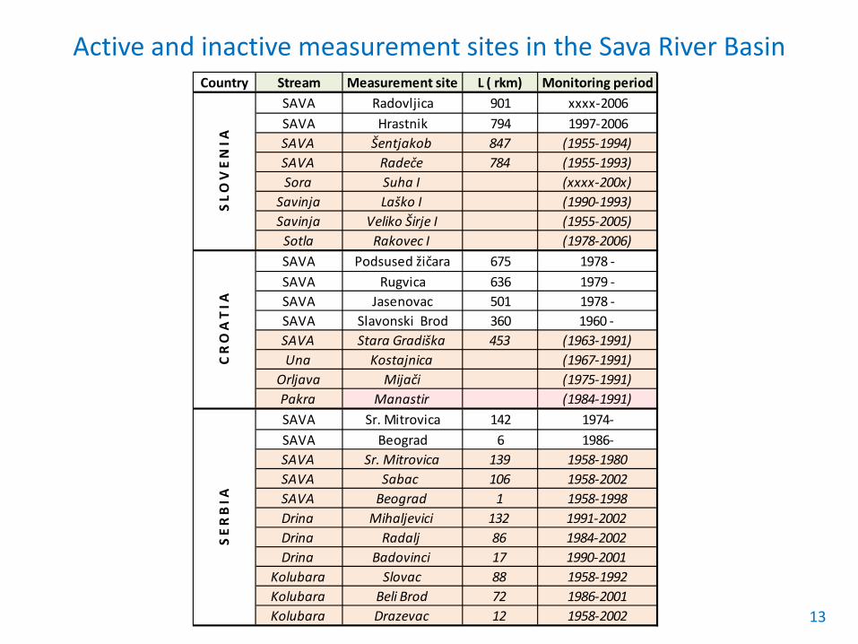
Active and inactive measurement sites in the Sava River Basin
13
Country Stream Measurement site L ( rkm) Monitoring periodSAVA Radovljica 901 xxxx-2006SAVA Hrastnik 794 1997-2006SAVA Šentjakob 847 (1955-1994)SAVA Radeče 784 (1955-1993)Sora Suha I (xxxx-200x)
Savinja Laško I (1990-1993)Savinja Veliko Širje I (1955-2005)
Sotla Rakovec I (1978-2006)SAVA Podsused žičara 675 1978 -SAVA Rugvica 636 1979 -SAVA Jasenovac 501 1978 -SAVA Slavonski Brod 360 1960 - SAVA Stara Gradiška 453 (1963-1991)Una Kostajnica (1967-1991)
Orljava Mijači (1975-1991)Pakra Manastir (1984-1991)SAVA Sr. Mitrovica 142 1974-SAVA Beograd 6 1986-SAVA Sr. Mitrovica 139 1958-1980SAVA Sabac 106 1958-2002SAVA Beograd 1 1958-1998Drina Mihaljevici 132 1991-2002Drina Radalj 86 1984-2002Drina Badovinci 17 1990-2001
Kolubara Slovac 88 1958-1992Kolubara Beli Brod 72 1986-2001Kolubara Drazevac 12 1958-2002
S L O
V E
N I
AC
R O
A T
I A
S E
R B
I A
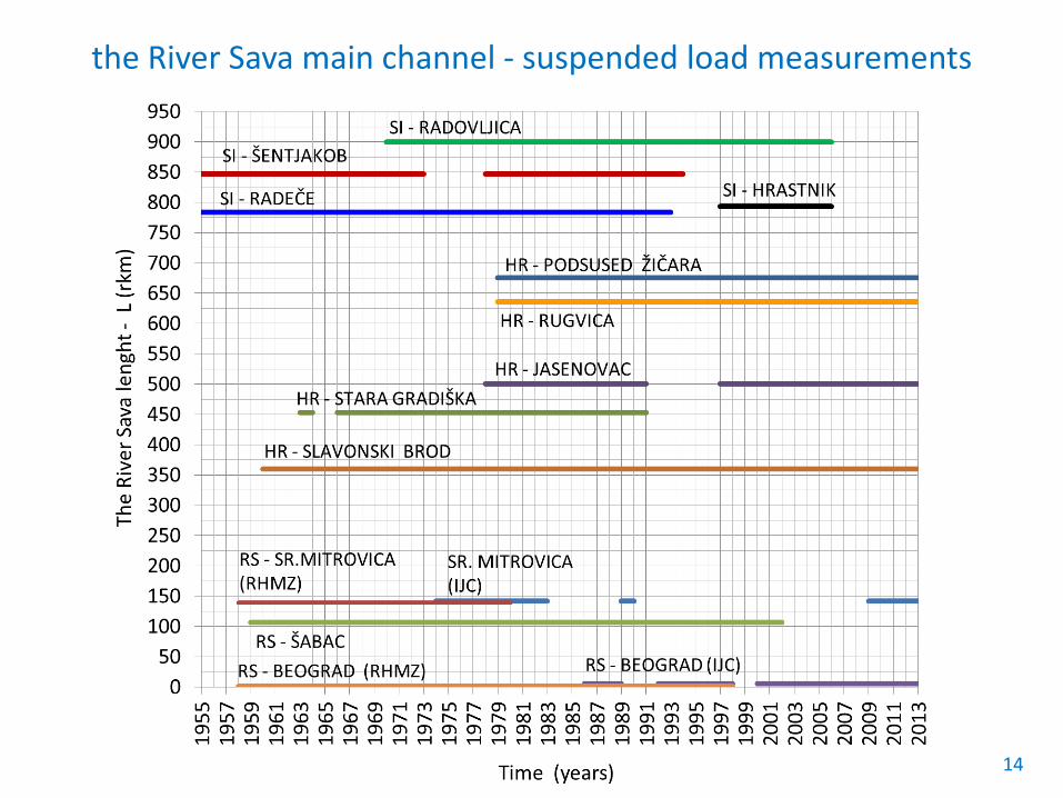
the River Sava main channel - suspended load measurements
14

Longitudinal profiles of the River Sava and main tributaries
15
S0=3.5×10⁻⁵
> S0=1.5×10⁻³
16
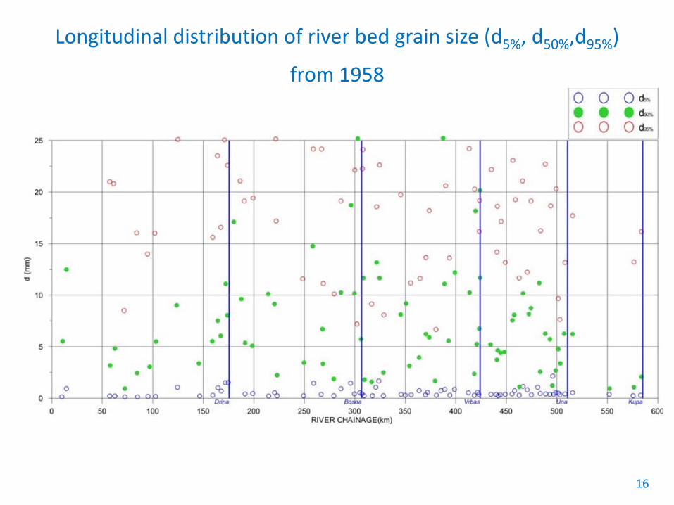
Longitudinal distribution of river bed grain size (d5%, d50%,d95%)
from 1958
17
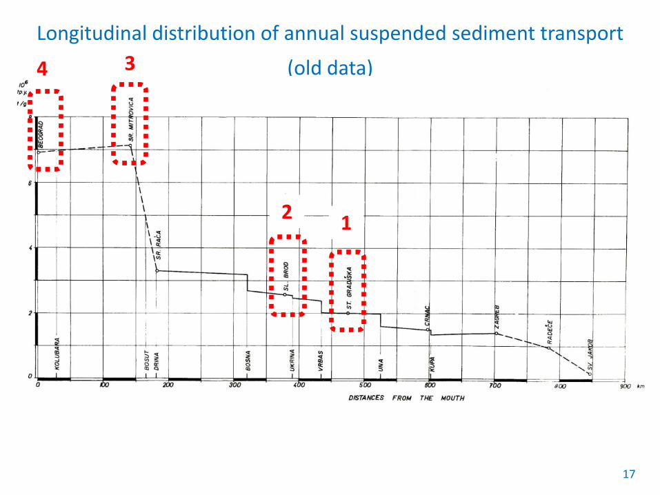
Longitudinal distribution of annual suspended sediment transport
(old data)
1 2
3 4
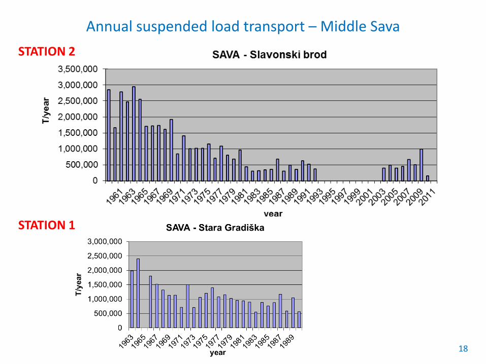
Annual suspended load transport – Middle Sava
18
STATION 2
STATION 1
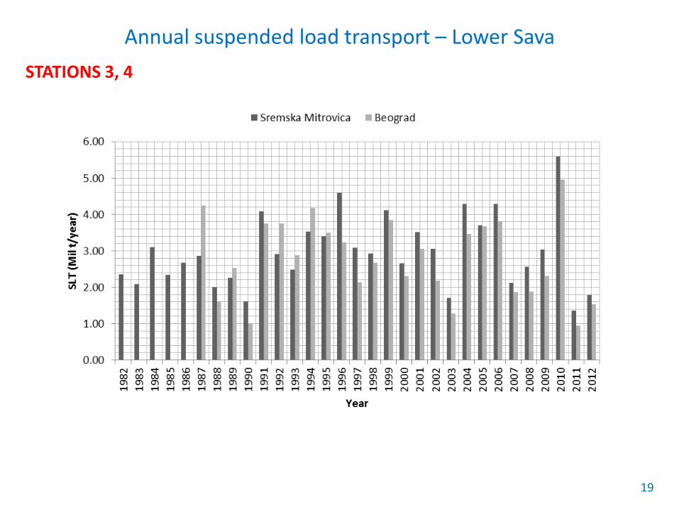
Annual suspended load transport – Lower Sava
19
STATIONS 3, 4

4. FUTURE STEPS Step C: Project Part 2 Scope:
• Description of measures for SSM • Sediment dredging, disposal, treatment and use • Institutional arrangements • Stakeholder involvement
Training course + Guidance (part 2) Step D: Continuation of the
application of the Guidance (part 1) Step E: Final workshop Presentation and discussion of the results Finalization of the Guidance document
20
Thank you for your attention
21
Marina Babić-Mladenović (Serbia) Samo Grošelj (Sava Commission)
Tarik Kupusović (Bosnia and Herzegovina) Matijaž Mikoš (slovenia) Dijana Oskoruš (Croatia)