Embed Size (px)
Citation preview
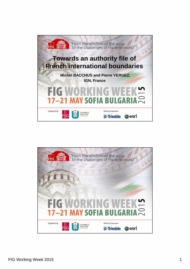
FIG Working Week 2015 1
Towards an authority file of French international boundaries
Michel BACCHUS and Pierre VERGEZ, IGN, France

FIG Working Week 2015 2
Towards an authority file of French
international boundaries
Michel BACCHUS and Pierre VERGEZ,
IGN, France
Involvement of IGN
• As French National Mapping Agency, IGN has plotted administrative boundaries
on national maps. It keeps them up to date in its databases (RGE, BDCARTO).
The national borders of France has been carefully identified by surveyors, and
the marks recognized in the field and plotted on the base-map (if not too close!)
• In charge of the geodetic network, IGN (SGA before 1940) was involved in many
demarcations (Djibouti 1946, Italy 1947, Guyana-Brazil from 1955 to 1962 ...) by
the Boundary Commissions. Today: providing cartographic support and advice
in joint committees in charge of maintenance del demarcation; this cooperation
is particularly useful to make interoperable different national geographic
databases with each other and with those of neighboring countries -
• Mapping of foreign countries: "IGN plots on the topographic base of its maps the
boundaries between states as described in texts known to him."

FIG Working Week 2015 3
Towards an authority file of French international boundaries
• We will describe how the IGN seeks to improve the digital files of international
borders of France
• It’s necessary to meet the requirements of the Directive INSPIRE (art. 10.2).
• This work is carried in collaboration with neighboring countries
- either within the framework of EuroGeographics
- or that of the joint demarcation committees.
Boundaries on (paper) Maps

FIG Working Week 2015 4
7/23
Boundary Marks: Borne, L.b. Bne Front. Bne front. Crx front.
Mars 2010+ janv 2015
IGN / XX
Fronti ère Franco-mon égasqueLongueur 4 km
Fronti ère franco-espagnoleLongueur 623 km700 bornes : de 1 à 602 + enclave de LliviaTraité des Pyrénées (1659)délimitation de 1856 à 1868 (Traité de Bayonne).Dernière rectification en 1982 à’Arette (27 ares)
Fronti ère franco-andorraneLongueur 57 kmUne rectification et 29 points fixés en 2000, mais pas de bornes. Traité de délimitation signé en 2012.
Fronti ère franco-italienneLongueur 515 kmTraité d’Utrecht (1713,démarcation 1825), Traité de Turin (1860, démarcation 1861-62),Traité de Paris (1947, démarcation 1947-1948, 1962-1963, 1975, 1989).Une rectification en 1967à Clavières.Toutes les bornes ont depuis 2008 des coordonnées déterminées en commun.
Fronti ère franco-luxembourgeoiseLongueur 73 kmEnviron 400 bornes Traité des Limites Courtrai (1820).Dernière rectification : en 2007, échange de 9 hectares
Fronti ère franco-allemandeLongueur 448 km900 bornes avec la Rhénanie-Palatinat,900 avec la Sarre.En application du traité de Versailles (1919),délimitations : 1925 et 1937,Rectification en 2000 (Rhin).
Fronti ère franco-suisseLongueur 573 kmPlusieurs traités (1780, 1816, 1824, 1826, 1891) et échanges de territoires (1862, 1953, 1959, 1963, 1977, 1984, 1996, 2002).ont 2900 bornes et points, déterminés par Les géomètres cantonaux, archivées par Swistopo
Fronti ère franco-belgeLongueur 620 kmTraité d’Utrecht (1713)Traité de Paris (1815)Traité de Courtrai (1820)Réglé entre cadastres
Fronti ère avec les Antilles n éérlandaises(Saint-Martin)Longueur 13 km
Fronti ère franco-surinamienne (Guyane)Longueur 520 kmAccord de 1915 sur un quart de la longueur du fleuve Maroni.
Fronti ère franco-br ésilienne (Guyane)Longueur 730 kmAccord de délimitation signé
en 1980, publié en 1982.10 points observés en 1937 (1), 1954 (1), 1955 (5) et 1991 (3).10 bornes implantées en 1937 (1), 1961 (3), 1962 (3) et 1991 (3).
IGN/Cadastre
2913 km de fronti èresmétropolitaines1263 km de fronti ères outremer
SHOM
3424 km de côtes2000 km outremer
LA CARTE DES FRONTIÈRES

FIG Working Week 2015 5
TRADITIONAL RESPONSABILITIES
Reponsable in coordination and maintenance of the border work, he manages funds
Positions defended by France vis-à-vis neighboring countries
International Treaties and Agreements with France attribute boundary maintenance to heads of district departments and institute bilateral meetings: the commissions..
Cartographic expertise or geodetic
Local expertise
When the best expertise to make is that of the cadastre
Représentations
Textes et entretien
INSPIRE DIRECTIVE 2007, ARTICLE 10.2
” In order to ensure that spatial data
relating to a geographical feature,
the location of which spans the frontier
between two or more Member States,
are coherent, Member States shall,
where appropriate, decide by mutual
consent on the depiction and position
of such common features.
IGN /DPC/ MISSION APPUI CNIG INSPIRE
situado a
ambos
lados de la
frontera
situato in una
località che
attraversa la
frontiera
un élément
géographique
qui englobe
la frontière
que
transpõe a
fronteira

FIG Working Week 2015 6
EDGE-MATCHING
IGN /DPC/ MISSION APPUI CNIG INSPIRE
: same borderline
: disagreement
: vectors nodes to be connected
: red country borderline
: blu country borderline
: same axis
Difference in
localisation
Consistency between spatial objets spanning, extending, situated on
both sides or, situated in an area crossed by the borderline.
Difference in
borderlines
State Boundaries of Europe (SBE) Data archived by swisstopo in october 2014

FIG Working Week 2015 7
Which authority file ?
• A systematic comparison of the boundary lines in the large-scale national datasets
(topographic and parcel layers of RGE) was undertaken, referring to the Treaty of
delimitation and demarcation minutes (if available).
• As existing files (IGN and DGFiP) are references to users, the main errors are
corrected, but that will change to a much better authorized file with the neighboring
country
• in most cases, the French cadastral line will be the basis for the discussion with
neighboring countries
Photogrammetric and geodetic works
• In mountain areas (Alps and Pyrenees) where the cadastral map is of uneven
quality, IGN has made, in 2006-2007 ando 2014, a photogrammetric plotting of the
topographic features (ridge lines, roads and rivers) on which relies the boundary line
• French IGN and Italian Military Survey (IGM) completed (1989-2008) the GPS survey
of boundary marks for the maintenance border commission; ongoing (2010-2015):
comparison of their photogrammetric lines between the marks, in the office and in
the field (with Helicopter in the mountains).
• The border demarcation commission with Andorra (2001-2011) has agreed on a
Treaty, signed 2012-03-06. Comparison of photogrammetric plots began (2006)
• The GPS survey of the Franco-Spanish border marks began in 2011, by Spanish IGN
and Army geographical center, within the maintenance border commission.

FIG Working Week 2015 8
IGN /DPC/ MISSION APPUI CNIG INSPIRE 15/10/2013
PRESENT SBE VERSION
BDUNI administrative line
Source : specific restitution
Markers
CountryL / CountryR :OK
Accuracy : 5 or 30 m
Pol stat : non agreed
Tec stat : national
Last M, moving B : [not filled]
INSPIRID : OK
Attributes :
16/23Mars 2010
Bondary between France and Andorra:proposed marks in disputed zona
• histoire
• géographie
• l’échange
• la commission
• photogrammétrie
• l’Ariège
• l’étang

FIG Working Week 2015 9
17/23Mars 2012
the border agreement between France and Andorra was signed on March 6, 2012. It will enter into force after its approval by
the Parliaments
• histoire
• géographie
• l’échange
• la commission
• photogrammétrie
• l’Ariège
• la suite
18/23Mars 2010

FIG Working Week 2015 10
19/23Mars 2010
20/23Mars 2010
FIG Working Week 2015 11
21/23Mars 2010
22/23Mars 2010

FIG Working Week 2015 12
23/23Mars 2010
24/23Déc. 2014

FIG Working Week 2015 13
International Boundary (IB) layer
for European Location Frame (ELF) Project
• in most cases, the French cadastral line will be the basis for the discussion with
neighboring countries
• The ELF project is preparing the implementation of the INSPIRE Directive; it needs
lines shared between the neighboring countries. IGN provided in 2013 a first line
(Master Level SBE). The IGN’s objective is to provide metric-precision lines on all
French borders before the end of 2015. This work is underway
• the European line will be chosen according to the following criteria:
• - A temporary consensus and technical validation
• - In cases of shared accuracy to more than 10 m, an intermediate line will be adopted
• - In these irreconcilable, 2 lines will be proposed
THE IMPLEMENTING PROCESS OF VALIDATION
IGN /DPC/ MISSION APPUI CNIG INSPIRE
Office work :
Ridgeline stereo restitution
Field works :
Measurement
of markers
Visits to points
of disagreement
Commission :
Validation of the
numerics objects
Expertise :
Comparison
of the lines
Commission :
Proposition, financial aspects
Bilateral Commission
Technical job
2014 : All ridge lines needed are
already restituated by IGN.
Italy : on track
2005=>2014 : 25% validated
Spain : just started in 2014
(first line proposed)
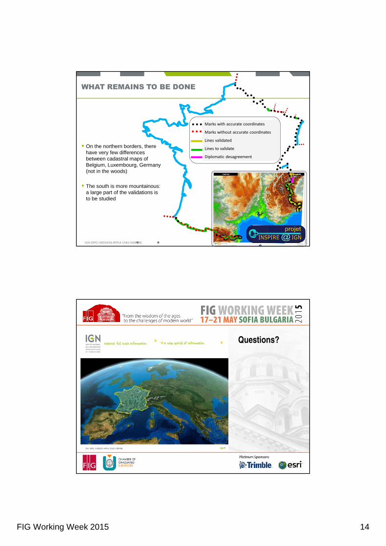
FIG Working Week 2015 14
WHAT REMAINS TO BE DONE
� On the northern borders, there have very few differencesbetween cadastral maps of Belgium, Luxembourg, Germany (not in the woods)
� The south is more mountainous: a large part of the validations is to be studied
IGN /DPC/ MISSION APPUI CNIG INSPIRE
Marks with accurate coordinates
Marks without accurate coordinates
Lines validated
Lines to validate
Diplomatic desagreement
Questions?