Embed Size (px)
Citation preview


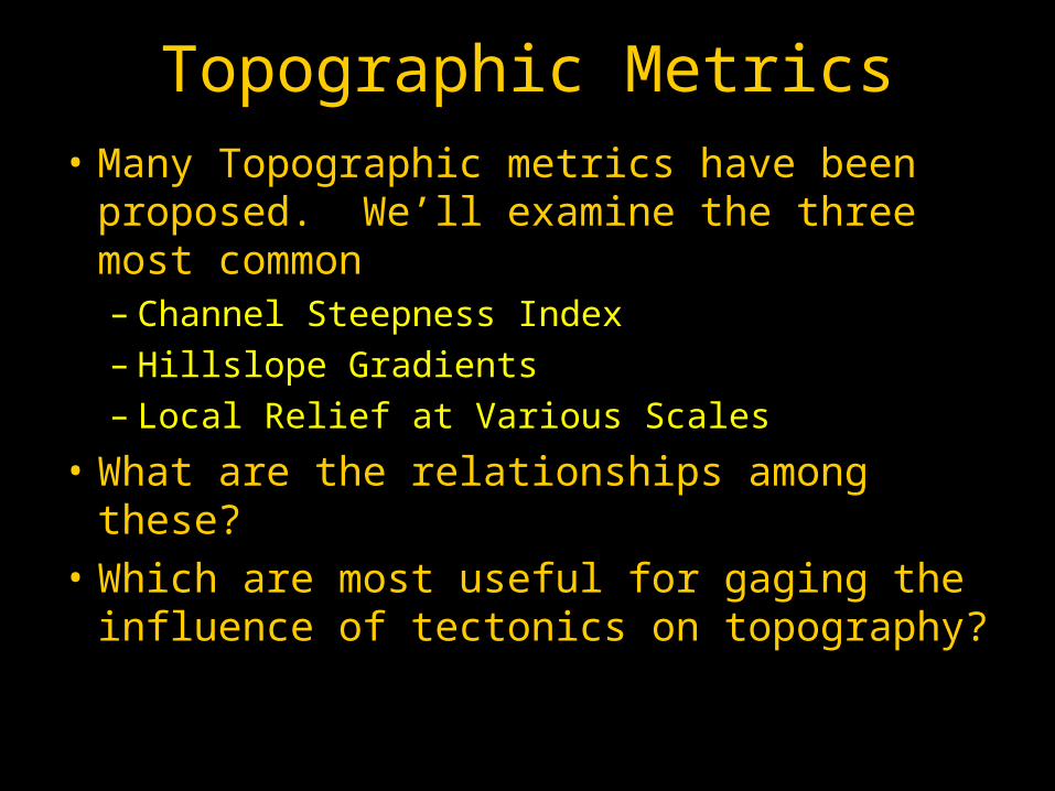
Topographic Metrics• Many Topographic metrics have been
proposed. We’ll examine the three most common– Channel Steepness Index– Hillslope Gradients– Local Relief at Various Scales
• What are the relationships among these?
• Which are most useful for gaging the influence of tectonics on topography?

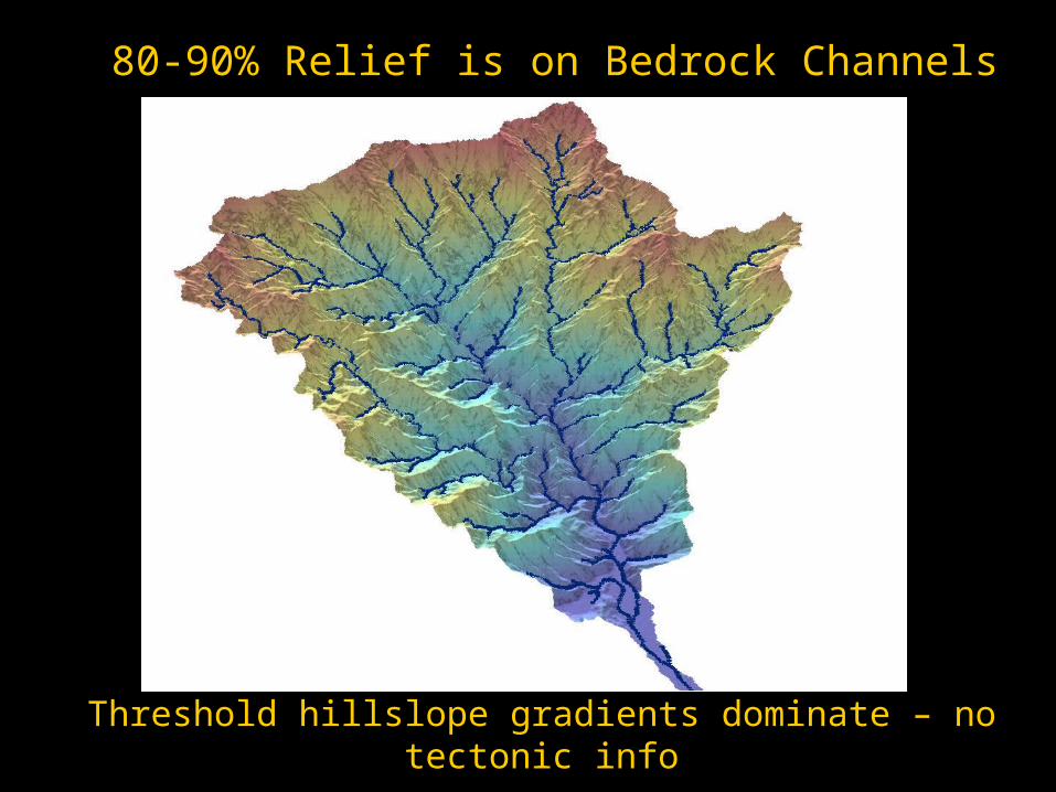
80-90% Relief is on Bedrock Channels
Blue lines: drainage area > 1km2
80-90% Relief is on Bedrock Channels
Threshold hillslope gradients dominate – no tectonic info

Now in 3D
The Same Drainage Basin in Taiwan

Beware: Many authors use “hillslope relief” and “local relief” (measured over up to 5km radius) as
interchangeable

• Empirical data for well-adjusted fluvial systems around the globe yield the following scaling:
S = ksA-
Fluvial Scaling – Empirical Data
• Linear relationship between log(S) and log(A)
• ks is the channel steepness; is the concavity
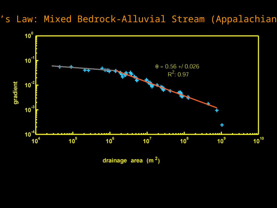
Flint’s Law: Mixed Bedrock-Alluvial Stream (Appalachians, VA)
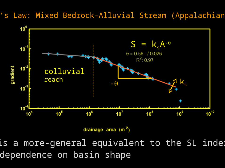
Flint’s Law: Mixed Bedrock-Alluvial Stream (Appalachians, VA)
S = ksA-
ks is a more-general equivalent to the SL index:No dependence on basin shape
colluvialreach ks-

Duvall, Kirby, and Burbank, 2004, JGR-ES
ks
S = ksA-
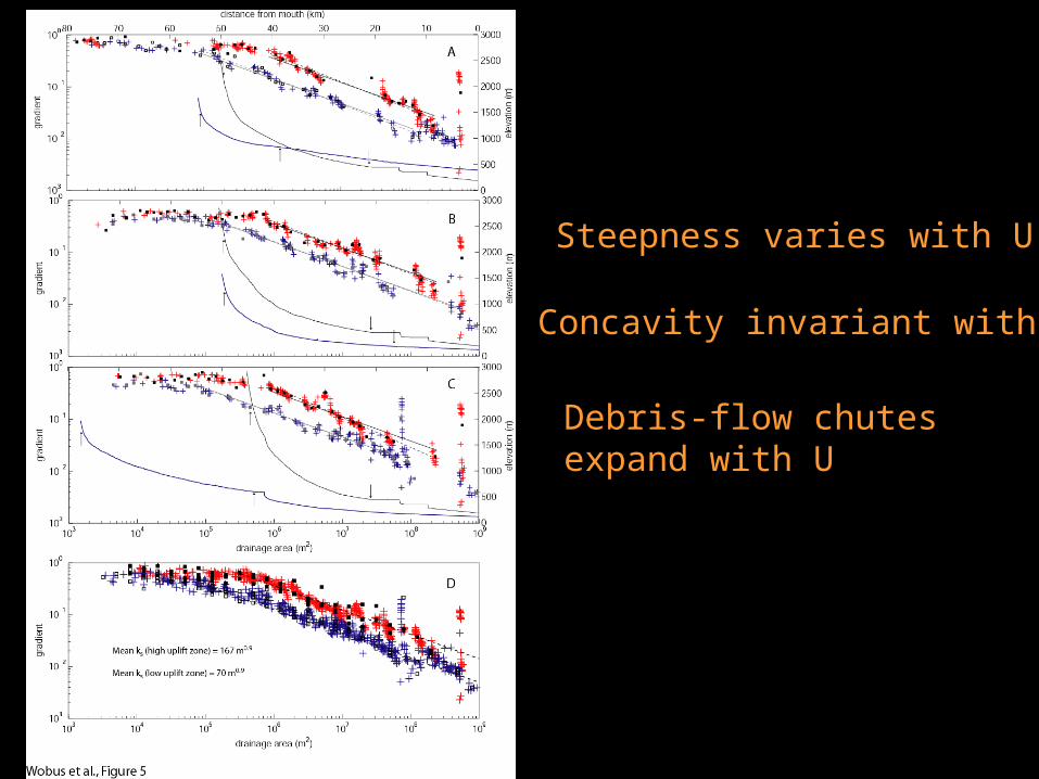
Concavity invariant with U
Steepness varies with U
Debris-flow chutesexpand with U

Question: What Sets Erosion Rate?
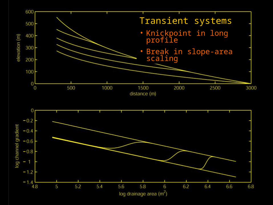
E = KAmSnTransient systems• Knickpoint in long profile
• Break in slope-area scaling