Embed Size (px)
Citation preview

Topographic Maps

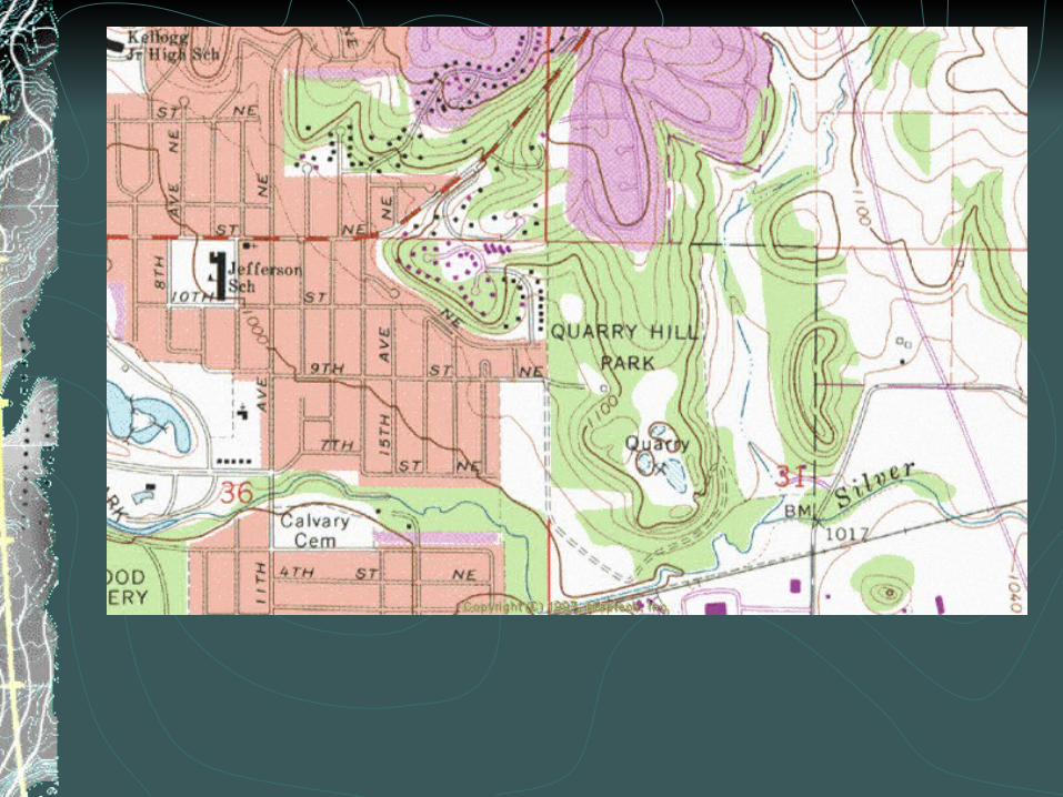
Contour linesA line which connects points of equal elevation.Index Contours: Thick contour lines which have the elevation written on them.


Contour line properties:Contour lines never cross.The closer the lines the steeper the hill.At valleys, contour lines form “V”s which always point up hill.
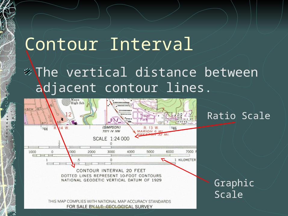
Contour IntervalThe vertical distance between adjacent contour lines.
Ratio Scale
Graphic Scale
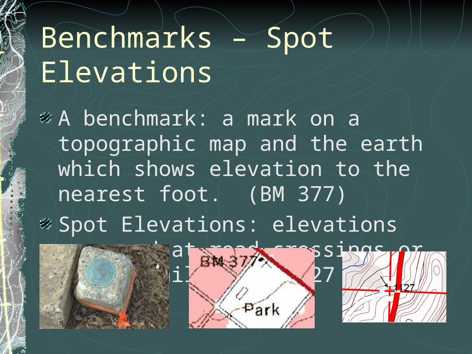
Benchmarks – Spot ElevationsA benchmark: a mark on a topographic map and the earth which shows elevation to the nearest foot. (BM 377)Spot Elevations: elevations measured at road crossings or tops of hills. (.1127 or X1127)

Latitude and LongitudeLatitude and Longitude are measured in degrees. °1 degree = 60 minutes. 60’1 minute = 60 seconds. 60”Example 44° 30’ 15” N , 92° 15’ 54” W Found in the corners of topo. maps and along the edges.
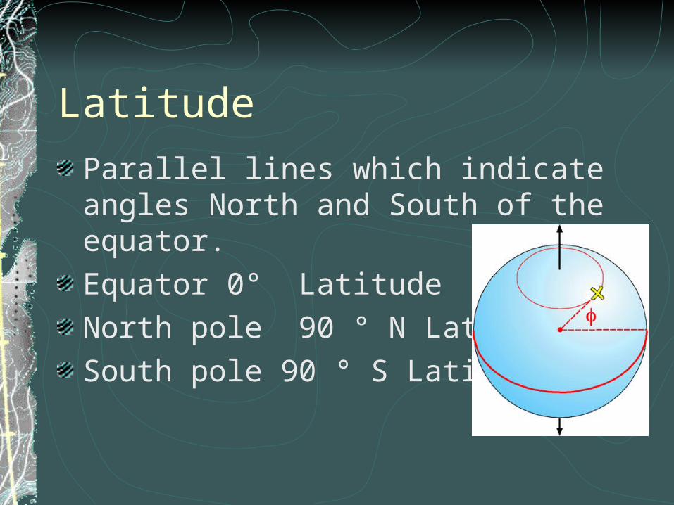
LatitudeParallel lines which indicate angles North and South of the equator.Equator 0° LatitudeNorth pole 90 ° N LatitudeSouth pole 90 ° S Latitude

LongitudeMeridians measuring angles East or West of the Prime meridian.Prime meridian 0 ° long.International Dateline 180 ° long.

L a ti tud e / Lo ng itu de
6 0 S e con dsT h ere a re 60 S e co n ds in ev ery m inu teT h ere a re 36 0 0 secon ds in o ne d e gree
6 0 M inu tesT h ere a re 60 m in u te s in o ne de gree
O n e D eg ree