Embed Size (px)
Citation preview
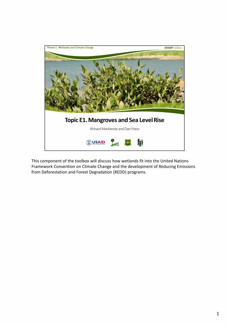
This component of the toolbox will discuss how wetlands fit into the United Nations Framework Convention on Climate Change and the development of Reducing Emissions from Deforestation and Forest Degradation (REDD) programs.
1
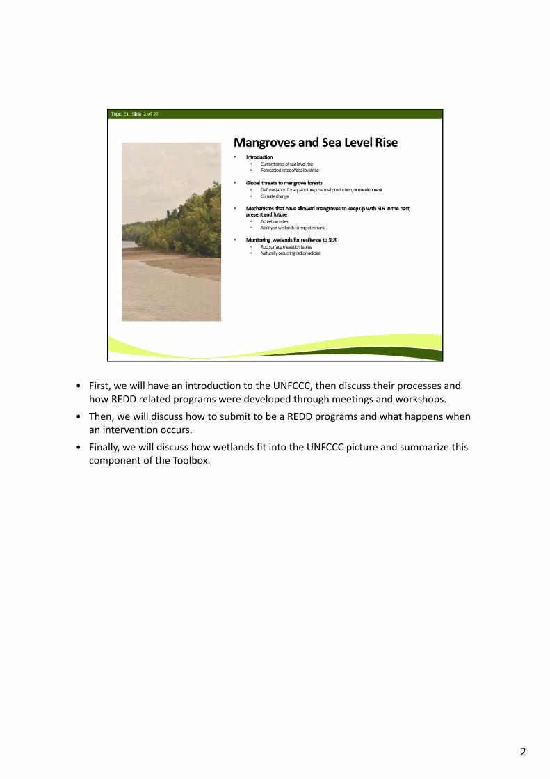
• First, we will have an introduction to the UNFCCC, then discuss their processes and how REDD related programs were developed through meetings and workshops.
• Then, we will discuss how to submit to be a REDD programs and what happens when an intervention occurs.
• Finally, we will discuss how wetlands fit into the UNFCCC picture and summarize this component of the Toolbox.
2
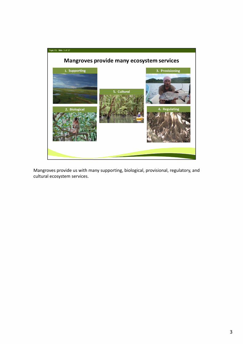
Mangroves provide us with many supporting, biological, provisional, regulatory, and cultural ecosystem services.
3
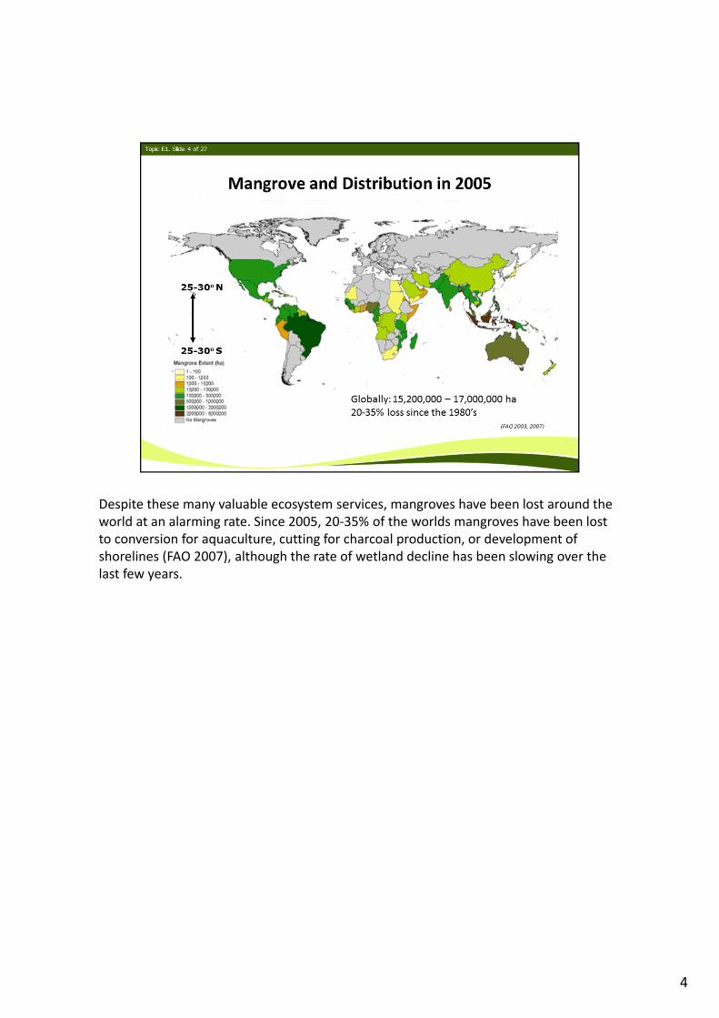
Despite these many valuable ecosystem services, mangroves have been lost around the world at an alarming rate. Since 2005, 20‐35% of the worlds mangroves have been lost to conversion for aquaculture, cutting for charcoal production, or development of shorelines (FAO 2007), although the rate of wetland decline has been slowing over the last few years.
4
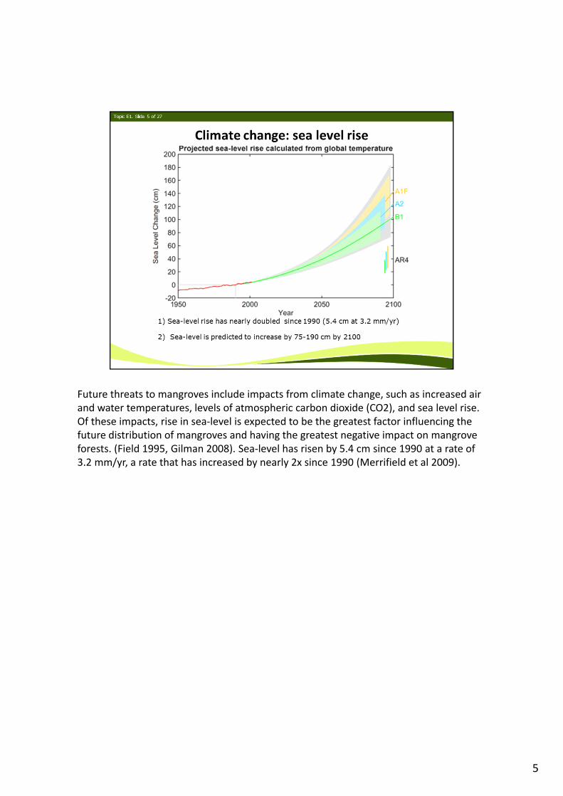
Future threats to mangroves include impacts from climate change, such as increased air and water temperatures, levels of atmospheric carbon dioxide (CO2), and sea level rise. Of these impacts, rise in sea‐level is expected to be the greatest factor influencing the future distribution of mangroves and having the greatest negative impact on mangrove forests. (Field 1995, Gilman 2008). Sea‐level has risen by 5.4 cm since 1990 at a rate of 3.2 mm/yr, a rate that has increased by nearly 2x since 1990 (Merrifield et al 2009).
5
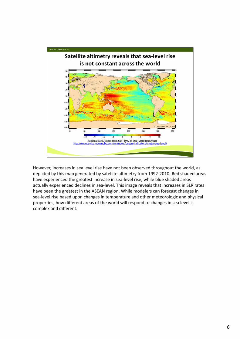
However, increases in sea level rise have not been observed throughout the world, as depicted by this map generated by satellite altimetry from 1992‐2010. Red shaded areas have experienced the greatest increase in sea‐level rise, while blue shaded areas actually experienced declines in sea‐level. This image reveals that increases in SLR rates have been the greatest in the ASEAN region. While modelers can forecast changes in sea‐level rise based upon changes in temperature and other meteorologic and physical properties, how different areas of the world will respond to changes in sea level is complex and different.
6
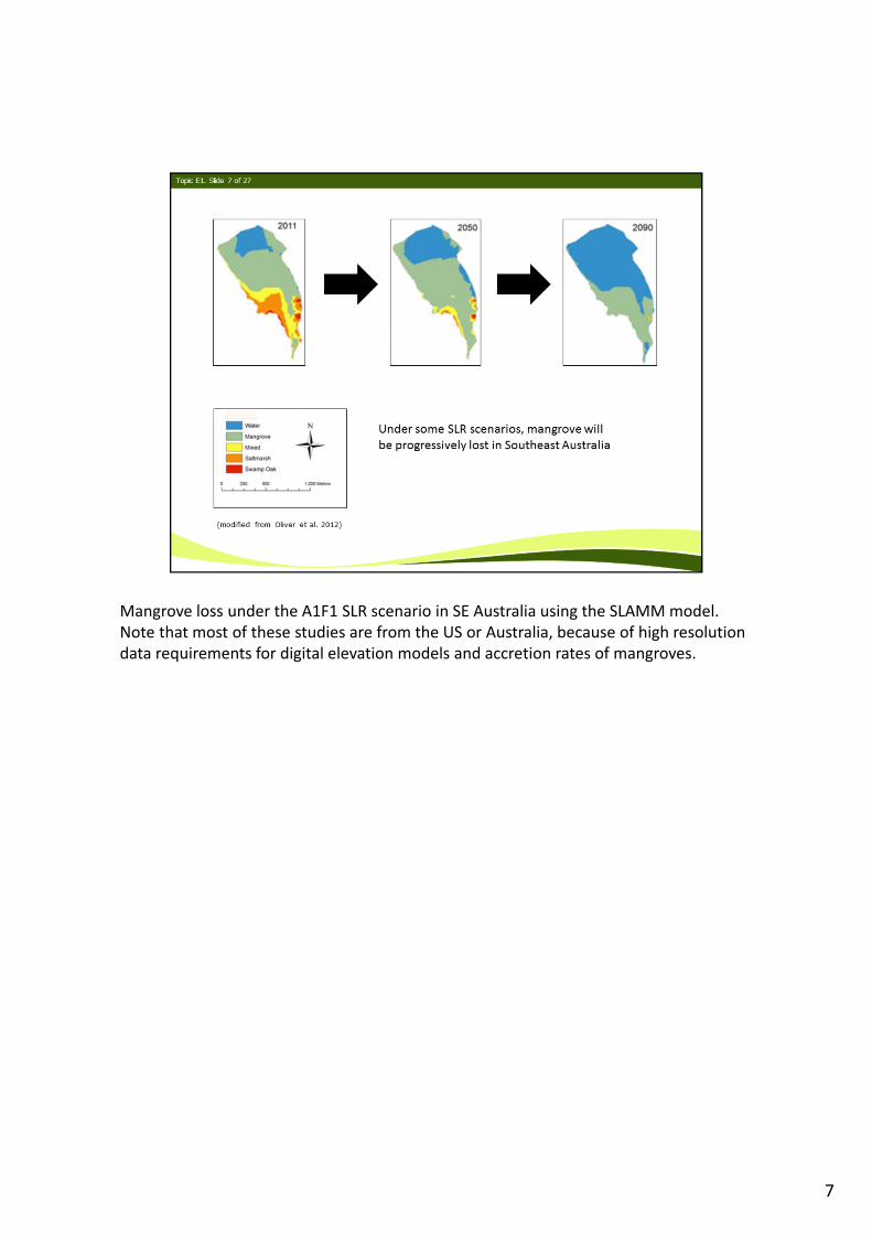
Mangrove loss under the A1F1 SLR scenario in SE Australia using the SLAMM model. Note that most of these studies are from the US or Australia, because of high resolution data requirements for digital elevation models and accretion rates of mangroves.
7
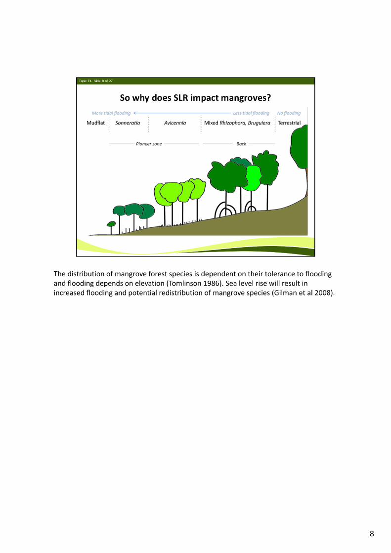
The distribution of mangrove forest species is dependent on their tolerance to flooding and flooding depends on elevation (Tomlinson 1986). Sea level rise will result in increased flooding and potential redistribution of mangrove species (Gilman et al 2008).
8
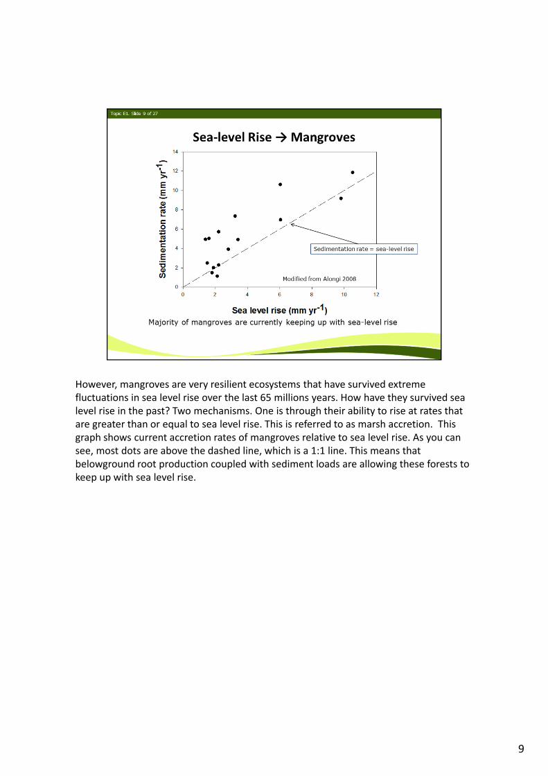
However, mangroves are very resilient ecosystems that have survived extreme fluctuations in sea level rise over the last 65 millions years. How have they survived sea level rise in the past? Two mechanisms. One is through their ability to rise at rates that are greater than or equal to sea level rise. This is referred to as marsh accretion. This graph shows current accretion rates of mangroves relative to sea level rise. As you can see, most dots are above the dashed line, which is a 1:1 line. This means that belowground root production coupled with sediment loads are allowing these forests to keep up with sea level rise.
9
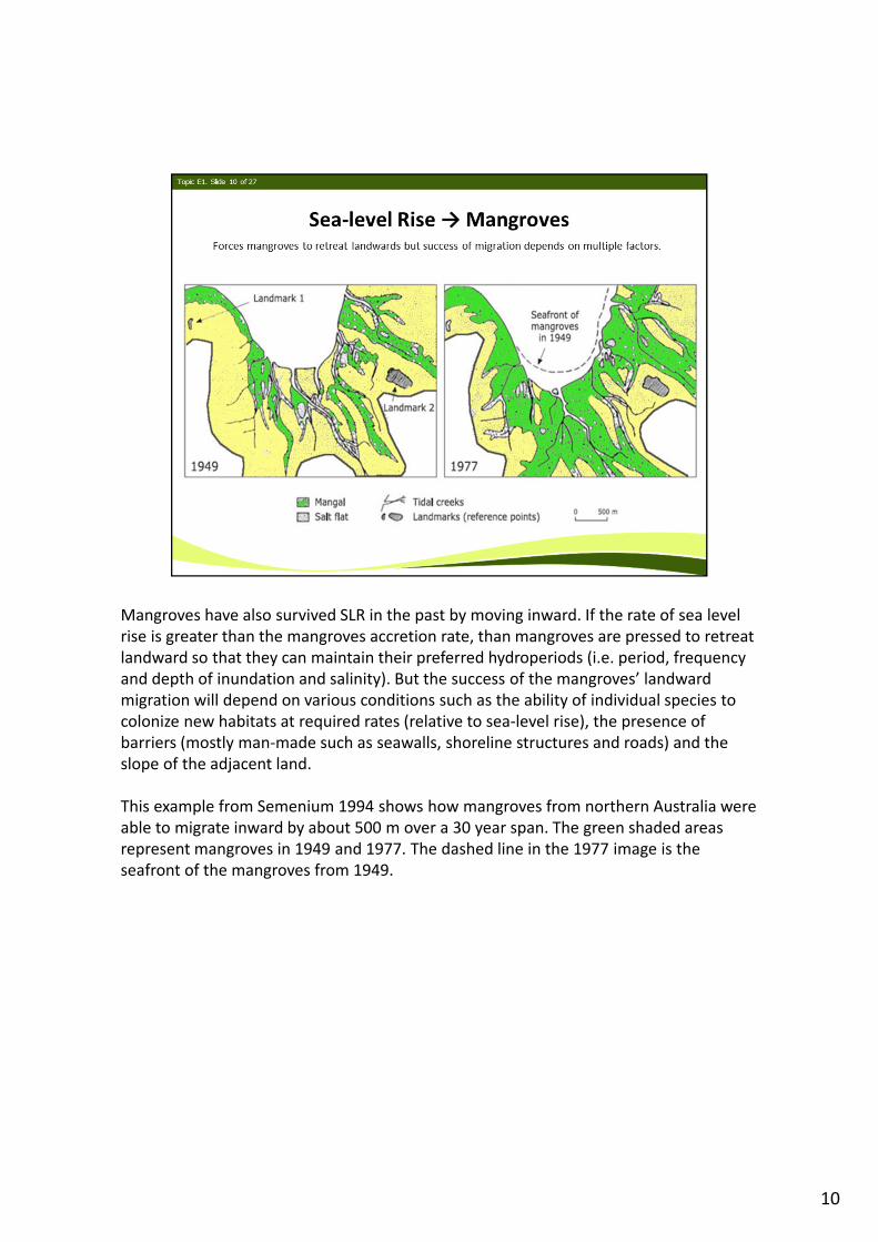
Mangroves have also survived SLR in the past by moving inward. If the rate of sea level rise is greater than the mangroves accretion rate, than mangroves are pressed to retreat landward so that they can maintain their preferred hydroperiods (i.e. period, frequency and depth of inundation and salinity). But the success of the mangroves’ landward migration will depend on various conditions such as the ability of individual species to colonize new habitats at required rates (relative to sea‐level rise), the presence of barriers (mostly man‐made such as seawalls, shoreline structures and roads) and the slope of the adjacent land.
This example from Semenium 1994 shows how mangroves from northern Australia were able to migrate inward by about 500 m over a 30 year span. The green shaded areas represent mangroves in 1949 and 1977. The dashed line in the 1977 image is the seafront of the mangroves from 1949.
10
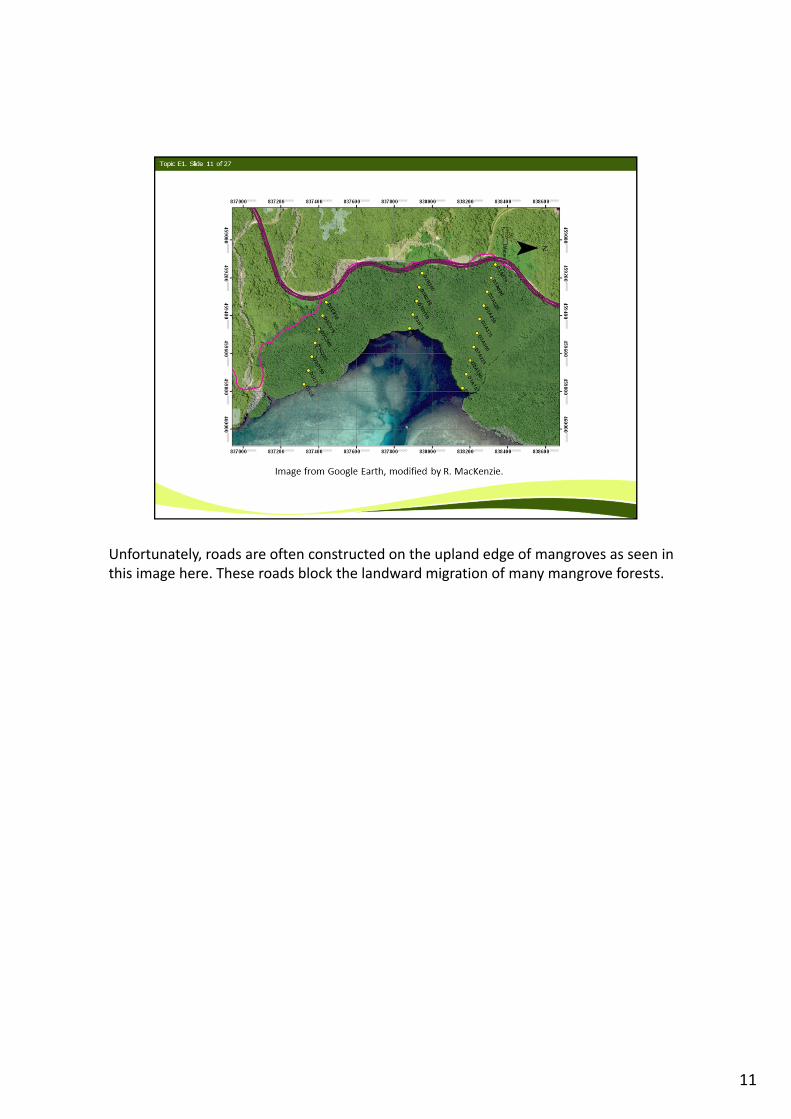
Unfortunately, roads are often constructed on the upland edge of mangroves as seen in this image here. These roads block the landward migration of many mangrove forests.
11
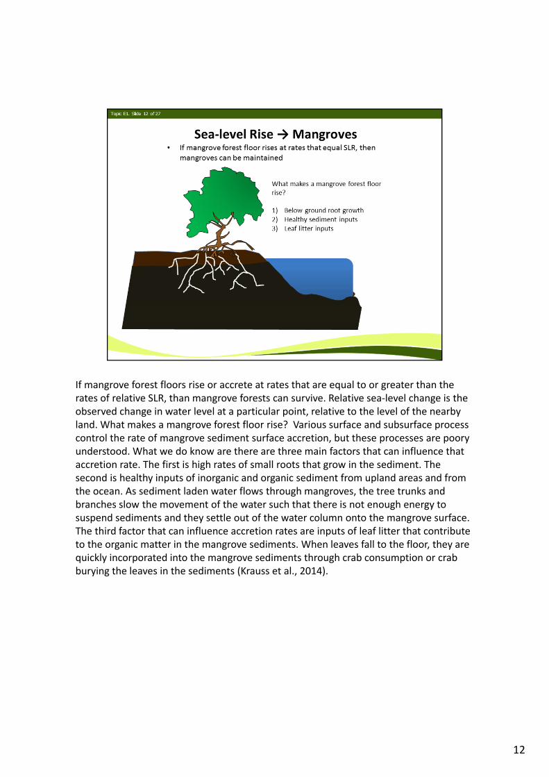
If mangrove forest floors rise or accrete at rates that are equal to or greater than the rates of relative SLR, than mangrove forests can survive. Relative sea‐level change is the observed change in water level at a particular point, relative to the level of the nearby land. What makes a mangrove forest floor rise? Various surface and subsurface process control the rate of mangrove sediment surface accretion, but these processes are poory understood. What we do know are there are three main factors that can influence that accretion rate. The first is high rates of small roots that grow in the sediment. The second is healthy inputs of inorganic and organic sediment from upland areas and from the ocean. As sediment laden water flows through mangroves, the tree trunks and branches slow the movement of the water such that there is not enough energy to suspend sediments and they settle out of the water column onto the mangrove surface. The third factor that can influence accretion rates are inputs of leaf litter that contribute to the organic matter in the mangrove sediments. When leaves fall to the floor, they are quickly incorporated into the mangrove sediments through crab consumption or crab burying the leaves in the sediments (Krauss et al., 2014).
12
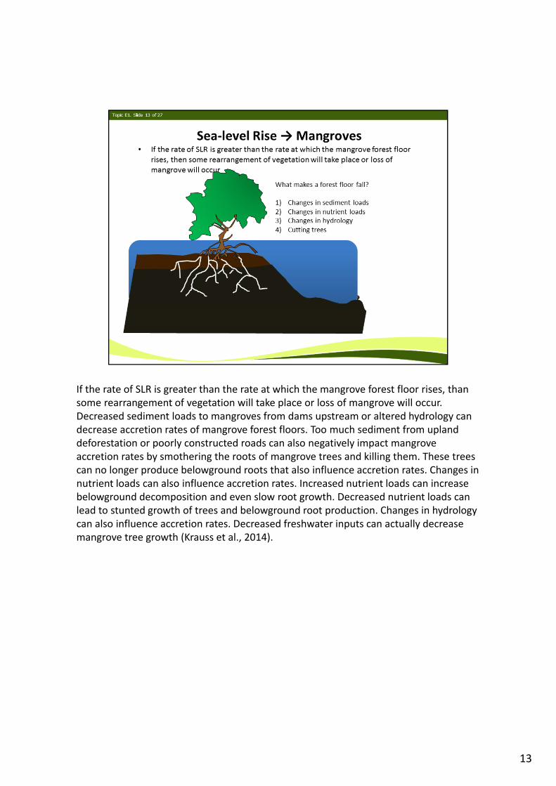
If the rate of SLR is greater than the rate at which the mangrove forest floor rises, than some rearrangement of vegetation will take place or loss of mangrove will occur. Decreased sediment loads to mangroves from dams upstream or altered hydrology can decrease accretion rates of mangrove forest floors. Too much sediment from upland deforestation or poorly constructed roads can also negatively impact mangrove accretion rates by smothering the roots of mangrove trees and killing them. These trees can no longer produce belowground roots that also influence accretion rates. Changes in nutrient loads can also influence accretion rates. Increased nutrient loads can increase belowground decomposition and even slow root growth. Decreased nutrient loads can lead to stunted growth of trees and belowground root production. Changes in hydrology can also influence accretion rates. Decreased freshwater inputs can actually decrease mangrove tree growth (Krauss et al., 2014).
13
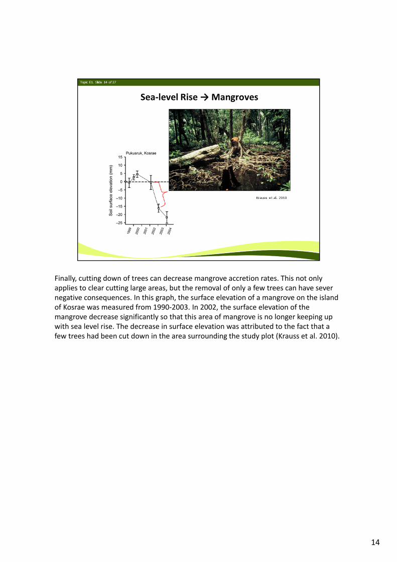
Finally, cutting down of trees can decrease mangrove accretion rates. This not only applies to clear cutting large areas, but the removal of only a few trees can have sever negative consequences. In this graph, the surface elevation of a mangrove on the island of Kosrae was measured from 1990‐2003. In 2002, the surface elevation of the mangrove decrease significantly so that this area of mangrove is no longer keeping up with sea level rise. The decrease in surface elevation was attributed to the fact that a few trees had been cut down in the area surrounding the study plot (Krauss et al. 2010).
14
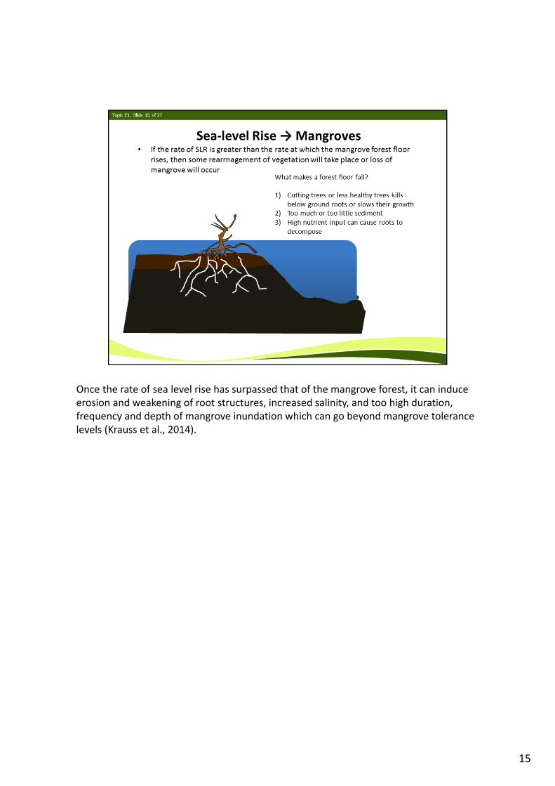
Once the rate of sea level rise has surpassed that of the mangrove forest, it can induce erosion and weakening of root structures, increased salinity, and too high duration, frequency and depth of mangrove inundation which can go beyond mangrove tolerance levels (Krauss et al., 2014).
15
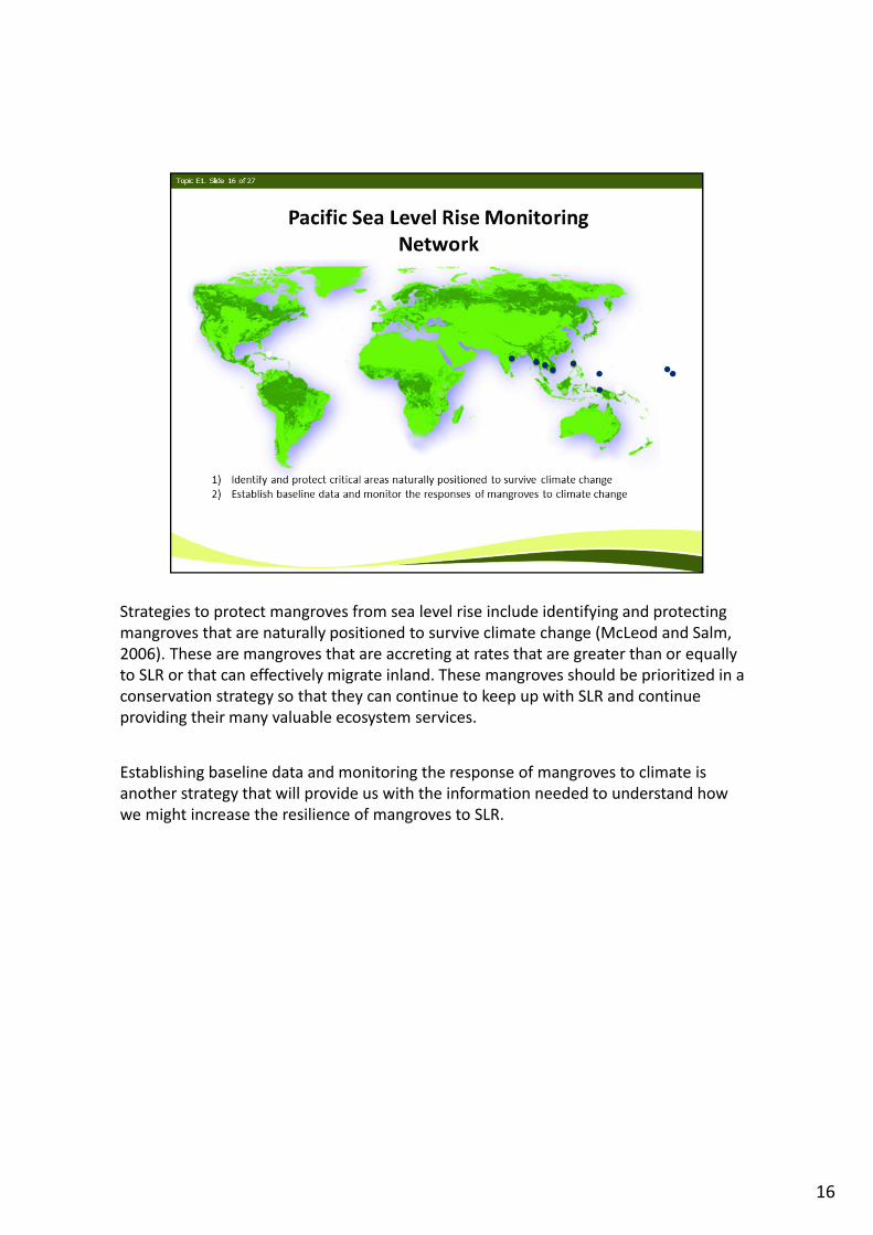
Strategies to protect mangroves from sea level rise include identifying and protecting mangroves that are naturally positioned to survive climate change (McLeod and Salm, 2006). These are mangroves that are accreting at rates that are greater than or equally to SLR or that can effectively migrate inland. These mangroves should be prioritized in a conservation strategy so that they can continue to keep up with SLR and continue providing their many valuable ecosystem services.
Establishing baseline data and monitoring the response of mangroves to climate is another strategy that will provide us with the information needed to understand how we might increase the resilience of mangroves to SLR.
16
Strategies to protect mangroves from sea level rise include identifying and protecting mangroves that are naturally positioned to survive climate change (McLeod and Salm, 2006). These are mangroves that are accreting at rates that are greater than or equally to SLR or that can effectively migrate inland. These mangroves should be prioritized in a conservation strategy so that they can continue to keep up with SLR and continue providing their many valuable ecosystem services.
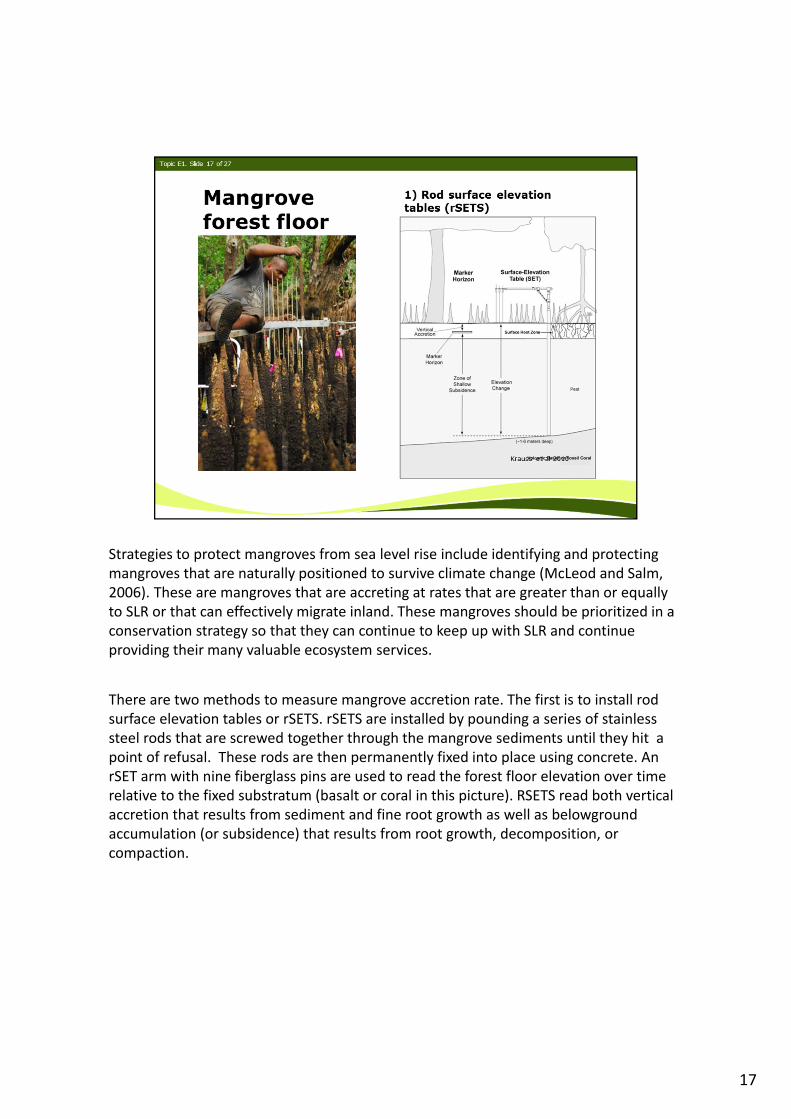
There are two methods to measure mangrove accretion rate. The first is to install rod surface elevation tables or rSETS. rSETS are installed by pounding a series of stainless steel rods that are screwed together through the mangrove sediments until they hit a point of refusal. These rods are then permanently fixed into place using concrete. An rSET arm with nine fiberglass pins are used to read the forest floor elevation over time relative to the fixed substratum (basalt or coral in this picture). RSETS read both vertical accretion that results from sediment and fine root growth as well as belowground accumulation (or subsidence) that results from root growth, decomposition, or compaction.
17
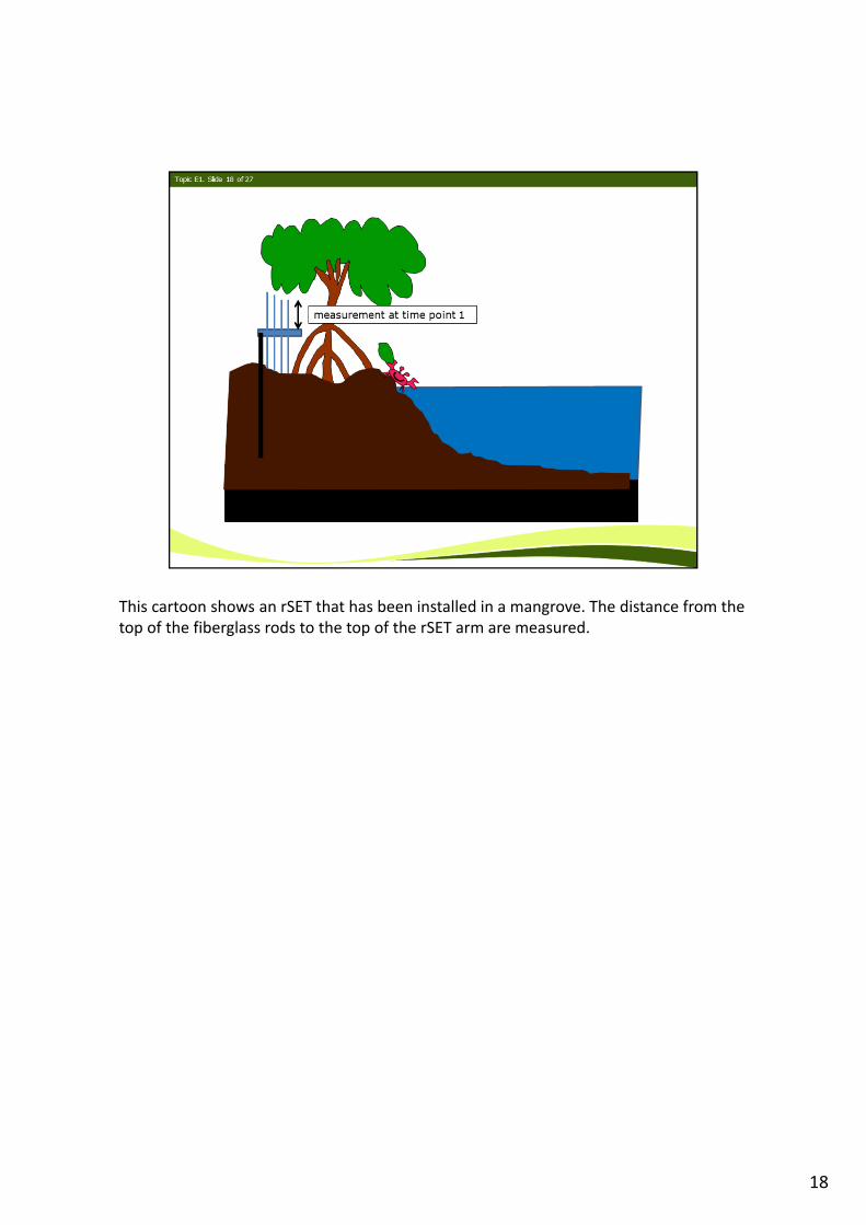
This cartoon shows an rSET that has been installed in a mangrove. The distance from the top of the fiberglass rods to the top of the rSET arm are measured.
18
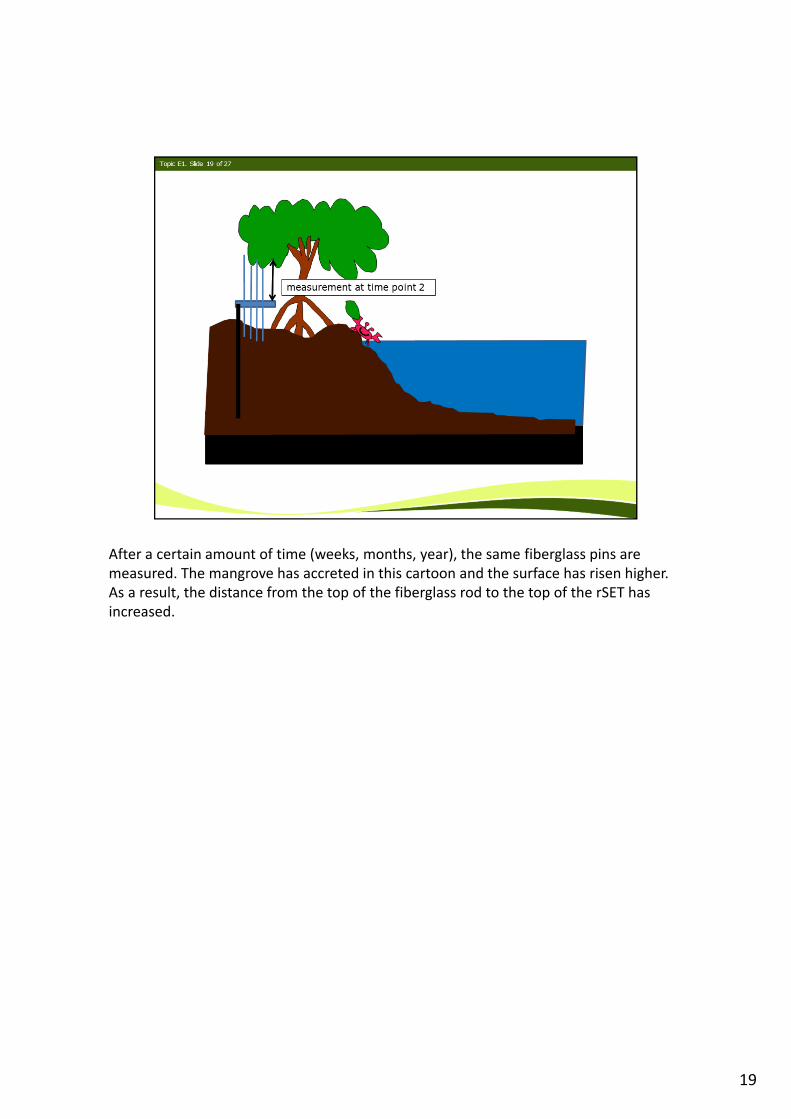
After a certain amount of time (weeks, months, year), the same fiberglass pins are measured. The mangrove has accreted in this cartoon and the surface has risen higher. As a result, the distance from the top of the fiberglass rod to the top of the rSET has increased.
19
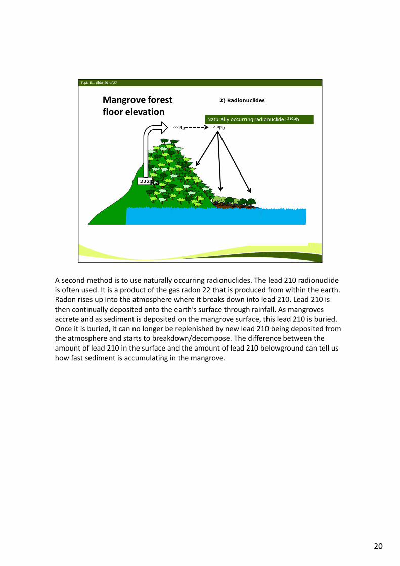
A second method is to use naturally occurring radionuclides. The lead 210 radionuclide is often used. It is a product of the gas radon 22 that is produced from within the earth. Radon rises up into the atmosphere where it breaks down into lead 210. Lead 210 is then continually deposited onto the earth’s surface through rainfall. As mangroves accrete and as sediment is deposited on the mangrove surface, this lead 210 is buried. Once it is buried, it can no longer be replenished by new lead 210 being deposited from the atmosphere and starts to breakdown/decompose. The difference between the amount of lead 210 in the surface and the amount of lead 210 belowground can tell us how fast sediment is accumulating in the mangrove.
20
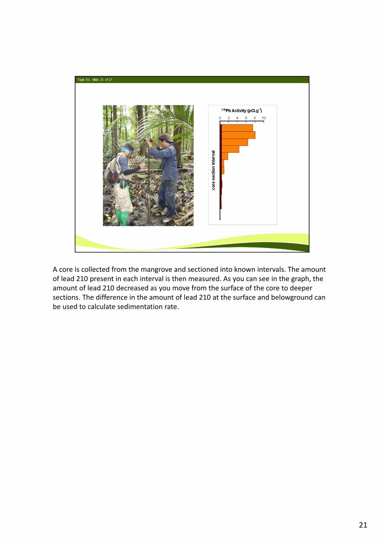
A core is collected from the mangrove and sectioned into known intervals. The amount of lead 210 present in each interval is then measured. As you can see in the graph, the amount of lead 210 decreased as you move from the surface of the core to deeper sections. The difference in the amount of lead 210 at the surface and belowground can be used to calculate sedimentation rate.
21
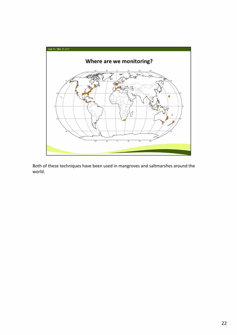
Both of these techniques have been used in mangroves and saltmarshes around the world.
22
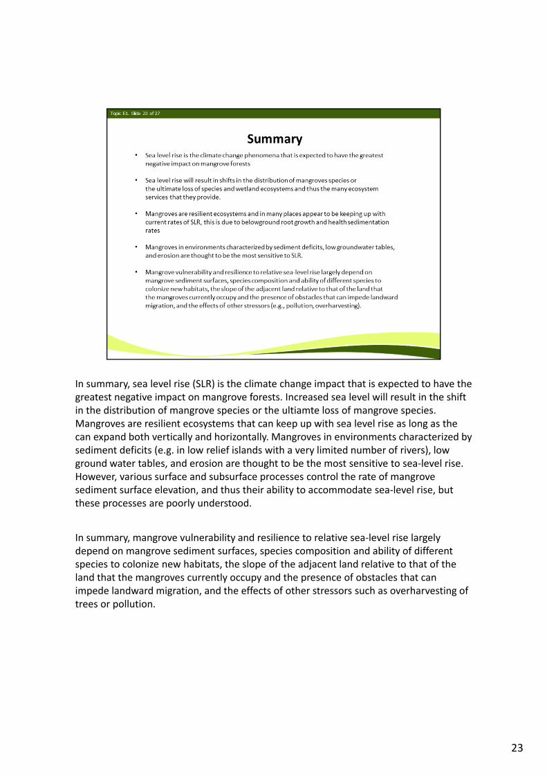
In summary, sea level rise (SLR) is the climate change impact that is expected to have the greatest negative impact on mangrove forests. Increased sea level will result in the shift in the distribution of mangrove species or the ultiamte loss of mangrove species. Mangroves are resilient ecosystems that can keep up with sea level rise as long as the can expand both vertically and horizontally. Mangroves in environments characterized by sediment deficits (e.g. in low relief islands with a very limited number of rivers), low ground water tables, and erosion are thought to be the most sensitive to sea‐level rise. However, various surface and subsurface processes control the rate of mangrove sediment surface elevation, and thus their ability to accommodate sea‐level rise, but these processes are poorly understood.
In summary, mangrove vulnerability and resilience to relative sea‐level rise largely depend on mangrove sediment surfaces, species composition and ability of different species to colonize new habitats, the slope of the adjacent land relative to that of the land that the mangroves currently occupy and the presence of obstacles that can impede landward migration, and the effects of other stressors such as overharvesting of trees or pollution.
23
24
25
26
27