Embed Size (px)
Citation preview

TOD Policy Status Report

Inside front cover

2014
TOD Policy Status Report
prepared for
by

TOD Policy Status Report II
Table of ContentsI. Introduction – 1
Purpose of the Report – 1II. TOD Policy Background – 2
Why Transit-Oriented Development? – 2Evolution of TOD Initiatives – 3
III. Outcomes of the TOD Policy – 9
Evaluations – 9Summary of Successes and Challenges – 11
IV. Performance-Based Metrics – 14
Lessons Learned – 14Existing Performance-Based Planning Tools – 14Portland Metro Case Study: The Southwest Corridor – 16
V. Recommendations – 18
Key Recommendations – 18Issues for Consideration – 18
End Notes – 20
Appendix A – 21
Proposed methodology for evaluating compliance – 21Appendix B – 23
Metropolitan Transportation Commission Resolution 3434 – 23
Figures & TablesFigure 1: Share of workers commuting by transit and walking – 2
Figure 2: TOD Policy Corridor Housing Thresholds – 3
Figure 3: Timeline of MTC’s TOD Initiatives – 4
Figure 4: South San Francisco Ferry Terminal Station Area – 6
Figure 5: Status of Resolution 3434 Transit Expansion Projects – 8
Figure 6: Summary of Completed Plans in Resolution 3434 Corridors – 11
Figure 7: Results of Transit Project Performance Assessment – 15

Executive Summary1
I. IntroductionThe Metropolitan Transportation Commission (MTC) adopted the Transit-
Oriented Development Policy (the TOD Policy) in 2005 to achieve multiple
objectives, including improving the cost-effectiveness of new transit investments,
encouraging new housing development near transit, and fostering cooperation
between cities, transit operators, regional agencies, and developers. The TOD
Policy applies only to the transit expansion projects known as Resolution 3434
corridors – which include rail, bus rapid transit, and ferry extensions. Under the
TOD Policy, the allocation of MTC’s regional discretionary transportation funds
for these projects is conditional on transit-supportive land uses (either existing or
planned) along the corridor to enable TOD. More recently, MTC and ABAG ad-
opted Plan Bay Area, a long term transportation and land use plan for the region
that strongly emphasizes transit investments and transit-oriented development.
Plan Bay Area allocates 86 percent of the region’s transportation dollars to transit
operations, maintenance, and expansion, as well as repairing and replacing exist-
ing roadways and bridges. Furthermore, Plan Bay Area focuses 78 percent of new
housing and 63 percent of new jobs in the region’s existing and new transit areas.1
This report brings together the results of various tasks, including 1) updated
analysis of Resolution 3434 corridors and review of MTC-funded station area
plans, 2) a survey of TOD Policy stakeholders, 3) an updated estimate of future
demand for transit-oriented development in the Bay Area region, 4) case studies
of transit investment policies in other regions, and 5) working sessions and dis-
cussions with staff and stakeholders. As part of this project, the consultant team
and MTC-ABAG staff convened a Technical Advisory Committee (TAC) com-
posed of representatives from transit agencies, cities, and congestion management
agencies. The Consultant Team and MTC staff met with the TAC three times to
gather input.
Purpose of the Report
The objective of this report is to provide a review of the implementation of the
Resolution 3434 TOD Policy, assessing its effectiveness to date, and identifying
areas of strength and weakness. The report concludes with recommendations and
next steps for the TOD Policy, to ensure that MTC can continue to maximize the
impact of regional transit investments in the future.
Metropolitan Transportation CommissionA construction worker working on the BART extension to Berryessa.

II. TOD Policy Background 2
II. TOD Policy BackgroundWhy Transit-Oriented Development?
The Center for Transit-Oriented Development estimates that by 2040, between
780,000 and 1.3 million Bay Area households will prefer to live in transit-
accessible locations. This growing demand is driven in large part by demographic
changes in the region, including strong growth in the types of households that
favor living in higher-density, mixed-use, transit-accessible neighborhoods, pri-
marily consisting of working-age adults (Generations X and Y) and aging Baby
Boomers. In addition to accommodating changing lifestyle preferences, aligning
transit investments with land use policy can create many important benefits at the
regional level. Some of these benefits include:
Increasing transit ridership – Encouraging denser development around tran-
sit stations and along transit corridors helps to boost transit ridership and pro-
ductivity. Concentrating households and workers in transit areas supports rider-
ship, making transit systems more sustainable in the long term. While there is no
universal rule about
how much density is
required to achieve
increased ridership,
many regions adhere
to the guidelines es-
tablished in the 1977
study by Pushkarev
and Zupan, which
posits that station
areas should have a
minimum residential
density of 9 to 15 dwelling units per acre to support transit.2 This range is gener-
ally consistent with a more recent study by Newman and Kenworthy establishing
a density of 14 to 16 people per acre as the threshold for transit ridership, or a
sum of 10,000 residents and workers within the station area.3 Data from Califor-
nia shows that the likelihood that a resident will use transit decreases as the dis-
tance from the station increases.4 This is especially the case for employees, who are
much less likely to take transit to work if their job is located more than a quarter
mile from a transit stop.5
Reducing auto dependency and greenhouse gas emissions – Numerous
studies have empirically demonstrated that residents and workers in compact,
walkable transit neighborhoods are less likely to rely on their cars for daily trips.
In the Bay Area, residents that live in transit areas are more than twice as likely
as the average resident to take transit or walk to work (see Figure 1). Compact
neighborhoods also result in lower rates of driving – the average vehicle miles
traveled (VMT) per household is lower in dense, transit-oriented neighborhoods.6
Fostering economic development – Locating housing near transit can reduce
the time and cost of the work commute, a significant benefit to the region’s
workforce and overall economy. Further, transit-oriented development can also
facilitate the agglomeration of “knowledge-based industries,” allowing them to
be more innovative and productive.6 Transit’s economic benefits are often capital-
ized into higher property values, which can range depending on several factors,
including: transit quality; demographics; and station area characteristics. A report
studying the property value impacts of the BART stations found that single-fam-
ily homes increased in value by $2.00 for every meter closer to BART in Alameda
and Contra Costa Counties.8 Systems that provide frequent, reliable, fast, and
regional service (like BART), have been shown to generate higher property value Bay Area regional average Bay Area residents
living near transit
40%
35%
30%
25%
20%
15%
10%
5%
0%
Figure 1: Share of workers commuting by transit and walking

II. TOD Policy Background3
premiums than systems that provide more limited service and serve a smaller
market area.9
Evolution of TOD Initiatives
The MTC TOD Policy grew out of a series of previous smart growth initiatives
(see Figure 3) in the region. Since its adoption, the programs related to the TOD
Policy have expanded and evolved along with other initiatives to promote transit-
oriented development in the Bay Area.
Early Smart Growth Initiatives
The first regional smart growth initiative was the Transportation for Livable Com-
munities (TLC) program, launched in 1997. TLC provided planning and capital
grants for local transportation projects in downtowns, corridors, transit areas, and
other activity centers. The TLC program rewarded communities with these types
of transportation improvements when they planned for higher density housing
projects and mixed-use developments in transit locations. Beginning in 2000,
ABAG, MTC and other regional agencies began a two-year visioning effort to de-
velop the regional Bay Area Smart Growth Strategy to inform the region’s future
transportation and land use plans.
Resolution 3434 TOD Policy
In 2001, MTC adopted the Resolution 3434 Transit Expansion Policy, providing
nearly $12 billion in regional funding to a set of high-priority transit projects (see
Figure 4). To ensure that the region was maximizing the benefits of the Reso-
lution 3434 transit corridors, the Commission then implemented the Transit-
Oriented Development Policy in 2005, encouraging the development of compact,
pedestrian-friendly, mixed-use neighborhoods in the new station areas. The TOD
Policy has three key elements:
1. The Policy sets corridor-level thresholds to quantify appropriate mini-
mum levels of residential development around transit stations along new
corridors. Specifically, the areas within a half-mile of stations along new
corridors are required to meet corridor-level thresholds for existing and
new housing, which vary according to the type of transit (see Figure 2).
In general, the thresholds for higher-capacity and more costly modes of
transit require greater amounts of development in order to justify the
expenditure of regional transit funds. The thresholds include a 50% bonus
for new affordable housing units that meet specified affordability levels.
The corridor-level thresholds were set based on a combination of existing
housing units and the potential for new development, which are explained
further below.
2. The Policy funds local station area plans that address future land-use
changes, station access needs, circulation improvements, pedestrian-friend-
ly design, TOD-supportive parking standards, zoning codes, implementa-
tion strategies, and other key features in a transit-oriented development.
Funding for these plans was provided through MTC’s Station Area Plan-
ning Program, prioritizing the corridors that do not meet the thresholds
through existing development.
3. The Policy establishes corridor working groups that bring together County
Congestion Management Agencies (CMAs), city and county planning
Figure 2: TOD Policy Corridor Housing Thresholds
Project Type BART Light Rail BRT Commuter Rail Ferry
Housing Threshold (Number of Units)
3,850 3,300 2,750 2,200 750
Source: MTC TOD Policy, adopted July 2005. See Appendix.

II. TOD Policy Background 4
Figure 3: Timeline of MTC’s TOD Initiatives
1997-1998
2001 2005
Transportation for Livable Communities (TLC)The TLC program is estab-lished by MTC to provide planning and capital grants for community-based transportation projects that bring vibrancy to downtown areas, commer-cial cores, neighborhoods, and transit corridors. The capital grants program was established the follow-ing year with over $250 million granted during the life of the program.
Smart Growth StrategyBay Area Alliance and the Bay Area’s five regional agencies engaged in a two-year effort to develop a smart growth land use vision for the Bay Area, and develop policy-based projections based on that vision.
Resolution 3434 Transit Expansion PolicyMTC adopts the $11.8 billion Transit Expansion Policy Program, a multi-year program identifying specific bus, rail, and ferry projects as priority for transit expansion.
TOD Policy MTC adopts the Transit-Oriented Development (TOD) Policy for Resolu-tion 3434 transit expan-sion projects that condi-tions the allocation of regional discretionary funds on supportive local land use plans and policies.
Station Area Planning ProgramAs part of the TOD Policy, MTC also launches the Station Area Planning Program to assist cit-ies in planning around future transit stations to meet TOD Policy goals. The plans are intended to address the range of transit-supportive features necessary to support high levels of transit ridership. Nearly $15 million has been awarded through this program.
FOCUS ProgramABAG, MTC and other regional agencies estab-lish FOCUS, a regional program that promotes linkages between land use and transportation by encouraging future devel-opment in key locations –priority development areas (PDAs) – while conserving the region’s open spaces. PDAs are locally-identified areas near transit that provide opportunities for future growth. Under the FOCUS program, regional agencies and the state direct funds to PDAs for planning grants, capital improvements, techni-cal assistance, and other resources to support local governments and encour-age transit-oriented devel-opment.
2000-2002
2007-2008

II. TOD Policy Background5
2008 2009 2011 2013
Plan Bay AreaMTC and ABAG release the Draft Plan Bay Area, an inte-grated long-range transportation and land-use strategy. The plan builds on previous land use and transportation plans at the regional level, and responds to the California Sustainable Com-munities and Climate Protection Act of 2008 (SB 375), re-quiring regions to re-duce greenhouse gas emissions from cars and light trucks. The draft Plan Bay Area focuses 78 percent of new housing and 62 percent of new jobs in PDAs. It also devotes 86 percent of transportation funds to operate and maintain existing transportation net-works.
Transit-Oriented Affordable Hous-ing Fund (TOAH)MTC approves a $10 million commit-ment through the Transportation for Livable Communities program to establish a new $50 million revolving loan fund to assist developers with the financing of affordable housing developments near transit in PDAs.
Resolution 3434 Strategic PlanMTC completes the strategic plan for Resolution 3434 corridors, identifying $222 million to speed project delivery and close funding gaps.
Parking ToolboxMTC produces a toolbox/ handbook to provide guidance to cities on parking policies to support smart growth.
2035 PlanMTC adopts Trans-portation 2035, the regional transporta-tion plan specificying how $218 billion in anticipated trans-portation funds will be spent through the year 2035. The plan prioritizies the maintenance and operations of existing transporta-tion networks, and allocates two-thirds of future revenues to public transit opera-tions, maintenance and expansion. Many Resolution 3434 projects are included in the 2035 Plan.
Realignment of TLC to PDAsMTC revises the TLC program to direct planning and techni-cal assistance grants to PDAs, allowing cities to focus on larger-scale planning (through the Station Area Planning Pro-gram) and specific TOD-related chal-lenges through a new Technical Assistance program. The TLC Capital program is also strengthened to support the FOCUS Program, with an expansion of eligible types of projects.

II. TOD Policy Background 6
staff, transit agencies, and other key stakeholders. Corridor-level thresh-
olds were established so no single jurisdiction would be saddled with a
specific housing requirement. The corridor working groups were intended
to facilitate coordination of jurisdictions to meet their collective housing
thresholds.
The housing thresholds set by the TOD Policy were determined through a study
of existing and potential levels of development in the corridors covered under the
TOD Policy. When the TOD Policy was adopted, five of the extensions did not
meet the required housing thresholds based on existing development. These cor-
ridors included:
• BART to eastern Contra Costa County (eBART),
• BART from Fremont to San Jose/Santa Clara (Silicon Valley Rapid Transit),
• Sonoma-Marin Area Rail Transit (SMART),
• Dumbarton Rail corridor, and
• Ferry service expansion by the Water Emergency Transit Authority.
In collaboration with local jurisdictions and the regional agencies, a consultant
team worked with MTC and ABAG staff to estimate the development capacity
of the station areas in these five corridors based on existing General Plans, under
a range of build-out scenarios. These scenarios involved different assumptions
regarding the extent to which existing uses would be redeveloped at the higher
densities or alternative uses permitted by General Plans. The study found that
several corridors, including SMART and Dumbarton, could meet the thresholds
at the very upper end of their estimated General Plan capacity.
As an additional point of comparison, the team made a corridor-level assessment
of the future demand for transit-oriented housing and employment, assessed the
supply of vacant and underutilized land in station areas, and created a “TOD sce-
nario” that assessed the supply- and demand-constrained potential for TOD along
the corridors. The TOD scenario found that the thresholds could be met along
the rail and bus corridors if local land use regulations were modified to allow the
market for TOD to be realized on vacant and underutilized sites in the station
areas.
Ferry station areas proved to be more challenged in meeting the housing thresh-
olds, due to a few key constraints. The most obvious challenge is that much of
the half-mile radius of ferry stations is made up of either water or undevelopable
land. For example, the South San Francisco Ferry terminal, while it serves a major
employment concentration at Oyster Point, is located more than a half mile away
from many of those jobs (see Figure 4). Finally, many ferry terminal areas lack
the infrastructure, such as sewer and roadways, needed to accommodate higher
intensity development.
Figure 4: South San Francisco Ferry Terminal Station Area
II. TOD Policy Background7
Beginning in 2005, MTC funded station area plans within the five rail and bus
corridors to assess the potential for TOD, and Corridor Working Groups were
established. MTC and ABAG have since awarded four subsequent cycles of sta-
tion area land use planning grants, and many of the station area plans have been
completed. Currently, many of the transit corridors subject to the TOD Policy are
fully funded, and have commenced construction, at least for the initial phases of
the projects (see Figure 5 – Status of Resolution 3434 Transit Expansion Projects).
PDA Focus Program and Plan Bay Area
The success of the Station Area Planning Program led jurisdictions and ABAG/
MTC to expand it beyond the Resolution 3434 corridors. The new Priority De-
velopment Area (PDA) planning program has refined many of the elements of the
Station Area Planning Program, but rather than being contained to the Resolu-
tion 3434 corridors, it includes all Priority Development Areas (PDAs), as the
principal geographies for accommodating new development and making strategic
investments in infrastructure to enable TOD.
The PDA framework is at the center of the region’s long term transportation and
land use plan. Plan Bay Area, adopted in July 2013, projects that the nine-county
San Francisco Bay Area region will increase by 660,000 households and 1.1
million jobs from 2010 to 2040. The regional plan allocates approximately 78
percent of the future household growth (509,000 units) and 63 percent of new
jobs (690,000 jobs) in PDAs. These figures are relatively conservative compared
to potential demand; a recent CTOD analysis estimated future housing demand
near transit to be in the range of 780,000 to 1.3 million units by 2040.
Given the significant amount of housing and employment growth anticipated
near transit, the TOD Policy is a key component in the region’s overall efforts to
accommodate new households and jobs in transit locations, by ensuring that cit-
ies are well-positioned to plan and implement TOD. Pelli Clarke Pelli Architects, courtesy of the Transbay Joint Powers AuthorityRendering of the future Transbay Transit Center, San Francisco

II. TOD Policy Background 8
Corridor Description Status
BART East Contra Costa Extension (eBART) 10-mile commuter rail extension from Pittsburg-BayPoint BART to Antioch
Currently under construction; Scheduled to open in 2017.
BART Extension from Fremont to San Jose/Santa Clara (Silicon Valley Rapid Transit or SVRT)
Phase I: BART extension to Warm Springs
Phase II: BART extension from Warm Springs to San Jose/ Santa Clara
Phase I is currently under construction; Scheduled to open in 2015. Phase II to Santa Clara is in design.
AC Transit Berkeley/Oakland/San Leandro Bus Rapid Transit Phase I
Phase I of the bus rapid transit connects Oakland to San Leandro
Received environmental clearance in 2012. Sched-uled to open in 2015
Caltrain Downtown Extension/ Transbay Terminal Caltrain 1.3 mile extension from Fourth and King streets to the new Transbay Terminal facility at First and Mission streets, with accommodations for future high-speed rail
The terminal building is currently under construction. The Caltrain/High Speed Rail extension is pending additional funding.
MUNI Central Subway 1.7 mile extension of the MUNI T Third Line from the 4th Street Caltrain Station to Chinatown
Currently under construction; Scheduled to open in 2019
Sonoma-Marin Rail (SMART) Phase I: commuter rail from Downtown San Rafael to Santa Rosa.
Phase II: planned extension to Cloverdale and con-nection to Larkspur ferry terminal
Currently under construction; Scheduled to open in 2016
Dumbarton Rail 20.5 mile commuter rail service between Redwood City and Union City by reconstructing rail bridge next to Dumbarton Bridge (SR-84)
Unlikely to proceed
Expanded Ferry Service Phase I New ferry terminals and service expansion in Berke-ley, Richmond, and Treasure Island
In planning stages
Expanded Ferry Service Phase II New ferry terminals and service expansion in An-tioch, Hercules, Martinez, Redwood City
In planning stages
Figure 5: Status of Resolution 3434 Transit Expansion Projects

III. Outcomes of the TOD Policy9
III. Outcomes of the TOD PolicyAllocating transit funding based on land use policies was an unprecedented action
for MTC to take, and it is the first policy of its kind by a metropolitan planning
organization. Since its adoption in 2005, MTC has conducted two evaluations to
monitor the effectiveness and outcomes of the TOD Policy. This section sum-
marizes the successes and challenges of the TOD Policy based on past evaluations;
results of an online survey of stakeholders; and input from the Technical Advisory
Committee (TAC).
Evaluations
The first TOD Policy evaluations were conducted in 2006 and 2007 by a team of
consultants. These evaluations found that early results from the TOD Policy were
encouraging, and that thresholds were achievable on most corridors either with
existing development or with new land use planning efforts in station areas. The
evaluation found that cities did not need to impose major changes to achieve the
TOD Policy thresholds; rather, the housing thresholds could be met with mod-
erate increases in density, and allowed for employment-oriented station areas to
accommodate only a small number of new housing units. Because these evalu-
ations were conducted so soon after adoption, it was too early to determine the
effectiveness of the station area plans, corridor working groups, or the affordable
housing bonus.
The evaluations identified several issues requiring continued attention or addi-
tional refinement, including the following:
• Refining methodologies for compliance – Clearer methodologies for de-
termining compliance with the TOD Policy were needed, particularly related
to counting housing units and the affordable housing bonus.
• Addressing uncertainty of transit service and timing for develop-
ment – The report raised the issue of cities’ potential reluctance to move
forward with station area plans when the timing of future transit expansions
remained uncertain.
• Expanding station area planning issues – The study suggested that
future station area planning should consider an area beyond the traditional
half-mile radius in certain cases, recognizing that the necessary access im-
provements could be better addressed. In addition, the evaluation identified
other additional topics to be addressed in station area plans, including level-
of-service (LOS) standards, permitting/ design review processes, and looking
at tradeoffs between parking, new development, and access improvements.
• Addressing ferry system expansions – The ferry system expansions were
found not to be a good fit with the original corridor threshold concept, and
the evaluation called for a different approach to accommodate the uncertainty
still surrounding the choice of new terminal sites.
From 2009 to 2012, the SMART, SVRT, and eBART corridors were evaluated
again for compliance with the TOD Policy, in order to take into account planned
or potential changes in station location, local planning and policy documents,
and transit project phasing. These evaluations in turn allowed MTC to release
funding for the initial phases of the projects. The following summarizes the find-
ings of compliance for each corridor:
• SVRT: The TOD Policy establishes a threshold of 3,850 existing and
planned housing units per station along the SVRT corridor. In 2012, the
consulting firm CD+A reviewed and updated the previous 2005 compliance
evaluation by Arup, incorporating all pipeline development projects, changes
III. Outcomes of the TOD Policy 10
in existing residential counts, and policy changes. The 2012 assessment found
that the Berryessa extension of SVRT (the corridor segment between Down-
town Fremont and the Berryessa station in San Jose) can attain the MTC
TOD Policy threshold if the available vacant and underutilized parcels are
developed to the maximum allowable capacity.
• SMART: In 2009, CD+A led an assessment of station area development
capacity in the SMART corridor and found that while the TOD Policy
thresholds could not be achieved under current plans and policies, there was
capacity to reach the thresholds by increasing planned development intensi-
ties at the station areas. In 2012, in response to changes in the project, CD+A
evaluated the corridor’s designated Initial Operating Segment (IOS) from
Santa Rosa to San Rafael and the relocation of the Rohnert Park station to a
more central location. The 2012 assessment confirmed that the TOD Policy
thresholds could still be met with enhanced densities in station areas. The
additional existing housing around the relocated Rohnert Park station site
allowed SMART to restore the Atherton station in Novato while still meeting
the TOD Policy requirements for the corridor. Based on MTC’s TOD Policy
thresholds, the corridor required an average of 2,200 housing units (exist-ing
and zoned) per station (15,400 total) to receive funding. With the new IOS,
the corridor total fell short, with 14,951 existing and planned units.
However, because the gap was relatively small (three percent), the Commis-
sion determined that the project was in compliance with the TOD Policy and
approved funding for SMART.
• eBART: In 2009, BART adopted an EIR for a Phase I eBART extension
from the existing Pittsburg/Bay Point station to a terminus near Hillcrest Av-
enue in Antioch. To facilitate station site selection and TOD Policy compli-
ance, Nelson\Nygaard conducted an independent planning-level analysis of
existing and planned land uses within one-half mile of each of two alternative
station sites in Antioch and the planned station at Railroad Avenue in Pitts-
burg. The analysis found that under then-current plans, the corridor fell just
slightly short of the threshold of 6,600 total (2,200 per station), with a total
of 6,300 existing and planned units. The Consultant Team found it highly
likely that the corridor would meet its housing targets. Subsequently, Pitts-
burg adopted a new station area plan for Pittsburg-Bay Point in 2011, which
added 1,200 units. MTC staff estimated that the total number of units pro-
jected for the three e-BART stations was roughly 6,570, just 30 units short of
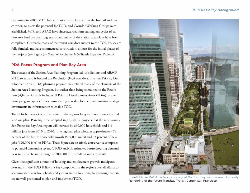
Greenbelt Alliance Photo A new infill development near one of Santa Rosa’s future SMART stations.

III. Outcomes of the TOD Policy11
the threshold of 6,600. Because the difference was less than 0.5 percent, the
corridor was deemed to be compliant with the TOD Policy.
Summary of Successes and Challenges
The Consultant Team conducted meetings with a Technical Advisory Committee
and MTC/ABAG staff, administered a web-based survey10 targeted to Corridor
Working Group participants, city staff, and stakeholders, and reviewed station
area plans to identify the major successes and challenges of the TOD Policy.
Successes of the TOD Policy
The TOD Policy has resulted in many positive outcomes, including the successful
completion of numerous station area plans that establish policies to foster transit-
oriented development along the Resolution 3434 corridors. Notably, the TOD
Policy has been instrumental in achieving the following outcomes:
Allocation of significant regional housing growth to transit corri-
dors – Based on the data collected from completed station area plans along the
Resolution 3434 corridors, the TOD Policy has contributed to local jurisdictions
planning for 26,000 new housing units in transit locations (see Figure 6).
Planning for jobs in station areas – In addition to accommodating housing
growth, local jurisdictions have also planned for considerable amounts of employ-
ment uses in the Resolution 3434 corridors. Planning for jobs has occurred in
many places, even without specific thresholds for those uses. This reflects the fact
that for many cities, there are fiscal and economic incentives to provide ample
capacity for job growth.
Gaining community support for TOD – Especially for the SVRT and
SMART corridors, respondents considered the TOD Policy highly effective in
influencing planning for TOD in different communities.
Providing funding for station area planning – MTC’s Station Area Plan-
ning and PDA Planning Programs have been an important source of funding for
local jurisdictions on the corridors to address land use planning, station access,
Figure 6: Summary of Completed Plans in Resolution 3434 Corridors
Source: Metropolitan Transportation Commission, 2013.
Jurisdiction CorridorPlanned housing (units)
Planned commercial (sq. ft.)
Estimated jobs planned*
Santa Rosa SMART 3,409 493,500 1,316
San Leandro BRT 3,430 839,000 2,662
Pittsburg eBART 1,845 988,449 2,774
Cloverdale SMART 761 340,000 1,000
Santa Clara SVRT 2,250 4,200,000 11,800
Newark Dumbarton Rail 2,500 230,000 550
Milpitas SVRT 7,109 1,300,000 730 to 2,670
Cotati SMART 331 237,050 632
Antioch eBART 2,500 2,500,000 5,600
East Palo Alto Dumbarton Rail 835 1,500,000 3,801
Pittsburg-Bay Point
BART/eBART 1,168 146,362 1,300
TOTAL 26,138 12,774,361 32,165 to 34,105
* For plans where the number of jobs is not specified, the number of jobswere calculated as follows: For retail space, the ratio is 1 job per 450 sq. ft;for office, the ratio is 1 job per 300 sq. ft.; and for R&D the ratio is 1 job per1000 sq. ft. For plans that did not estimate the employment space by type,the employment numbers were estimated based on an average ratio of 1 jobper 375 sq. ft.

III. Outcomes of the TOD Policy 12
circulation, design, and parking policies to foster transit-oriented development.
Challenges of the TOD Policy
Though the TOD Policy has resulted in the completion of many station area
plans, there are a number of implementation challenges, some of which are out-
lined below.
Corridor phasing issues – As described above, many of the corridors in Reso-
lution 3434 achieved compliance with the TOD Policy at early phases of projects.
However, many of the projects are being funded and built out in phases, and
initial operating segments often change over time, adding, dropping, or moving
stations, which impacts the evaluation of compliance. This uncertainty poses an
ongoing challenge for the application of the existing TOD Policy to projects that
are implemented in phases.
Role of corridor working groups (CWG) – The role of the CWG was
designed to be focused on a single task – planning for compliance with the TOD
Policy thresholds. There have been some challenges with that role, since the
CWG is usually composed of ad-hoc staff from cities and CMAs, with limited
abilities to make binding agreements about station area land uses and densities.
Furthermore, there is a lack of clarity about the role of this group, if any, once the
corridor is funded and under construction.
Market and feasibility factors – The higher-density residential and com-
mercial building types planned for in many of the Resolution 3434 station areas
may not be feasible for many locations given current real estate market condi-
tions. The 2008 housing market downturn, combined with the demise of rede-
velopment, has made new development particularly challenging to implement
in many of the station areas. Survey responses varied on the question of whether
the planned densities in station areas would be feasible with the recovery of the
housing market; however, it was clear that respondents from the SMART and
SVRT corridors were more confident about the densities being feasible than those
in other corridors. While the survey did not ask whether the scope of work for the
station area plans included market analysis, understanding the market demand
for higher-density housing and employment is recommended in MTC’s Station
Area Planning Manual and is commonly included in station area plans, unless
recent market analyses are already available. It is noteworthy that almost all of
the station areas where residential developments had been built, the development
projects were aligned with planned densities and building types.
Infrastructure needs – According to the PDA Readiness Assessment complet-
ed in March 2013, many of the region’s PDAs require significant investments in
public infrastructure (including roads, water/wastewater, and parks) to enable the
type and intensity of development envisioned.11
Affordable housing – The TOD Policy encourages the development of af-
fordable housing in station areas by including a 50% bonus for new affordable
housing units towards meeting the thresholds. However, the survey respondents
did not feel that the Policy was effective in encouraging the inclusion of affordable
housing opportunities within station areas. Most jurisdictions relied on their city-Greenbelt Alliance Photo
Taking a corridor scale look at planning opportunities.

III. Outcomes of the TOD Policy13
wide affordable housing policies rather than making a specific effort to provide
affordable housing within the station area plans. Although it is appropriate for
the TOD Policy to provide a bonus for affordable housing – given that affordable
housing residents are more likely to use transit than other households, and the
pressing need for transit-accessible affordable housing – the bonus does not ap-
pear to have made an impact on the approval of affordable units in the planning
areas, nor resulted in the construction of more affordable housing in station areas.
Ferries – As described above, the previous evaluations of the TOD Policy have
shown that the ferry terminal areas have not been able to meet the housing
thresholds. The standard 1/2 mile radius to estimate the TOD potential reveals
the challenges of creating high-ridership ferry lines without intense land uses to
support them.
Greenbelt Alliance PhotoAn affordable housing project near transit in Pittsburg.

IV. Performance-Based Metrics 14
IV. Performance-Based MetricsThis section summarizes the use of performance-based metrics by other Metro-
politan Planning Organization (MPOs) – including the Delaware Valley Regional
Planning Council, Portland Metro, and London – for transit expansion projects
and transit-oriented development. The case studies provide useful lessons for
MTC’s decision-making on future transit expansion as well as supporting TOD
along the Resolution 3434 corridors.
Lessons Learned
Increasingly, MPOs are turning to performance-based metrics to evaluate and
fund new transit projects. The development and application of the performance
metrics for long range planning and funding decisions offers several key benefits
to communities, including:
• Framework for regional decision-making around transit invest-
ments – The use of transit performance metrics provides regional agencies,
local jurisdictions, and stakeholders with an information-based framework to
enable and support transit investment decisions.
• Transparent and accessible evaluation process – Because performance
metrics are typically based on quantitative or well-defined qualitative infor-
mation, they can provide local jurisdictions and stakeholders with a clear and
accessible framework to understand the transit evaluation process.
• Cost effective investment of transit funding – Applying a performance
evaluation which includes measures of cost effectiveness can assist regional
agencies in identifying the transit lines which are most likely to contribute to
the financial sustainability of a transit system.
• Catalyst for discussion of prioritization of projects and integration
of land use planning. Transit evaluation metrics can help illuminate the
relationship between transit and land use to local agencies and stakeholders,
by demonstrating that higher intensity land uses in station areas can support
ridership goals and create a more productive transit system.
• Outcome based comparison of projects – The use of transit perfor-
mance metrics shifts decision-makers’ focus from transportation technologies
to transportation effectiveness, permitting an apples-to-apples, outcome-
based comparison of alternative transit technologies and land use alternatives.
Programs and policies can also be assessed based on key criteria and outcomes
that matter to the region, such as cost effectiveness or emission reduction.
Existing Performance-Based Planning Tools
MTC has developed tools and metrics to develop long-range regional transporta-
tion plans. More recently, these tools have been modified to evaluate the competi-
tiveness of transit corridors in the region, and inform future investments.
Project Performance Assessment
MTC applied a performance-based planning approach to evaluate the transporta-
tion investments in Plan Bay Area. The process began with setting performance
targets with close collaboration from the public and key stakeholders, and includ-
ed both traditional performance targets (mobility and air quality) and additional
sustainability targets related to land use, economic vitality, and public health.
MTC then scored individual transportation projects based on 1) their contribu-
tion to meeting the region’s performance targets, and 2) their cost-effectiveness,
measured as a benefit-cost ratio. The performance assessment of these projects

IV. Performance-Based Metrics15
Figure 7: Results of Transit Project Performance Assessment
Source: Metropolitan Transportation Commission, “Plan Bay Area Draft Performance Assessment Report,” 2013.
IV. Performance-Based Metrics 16
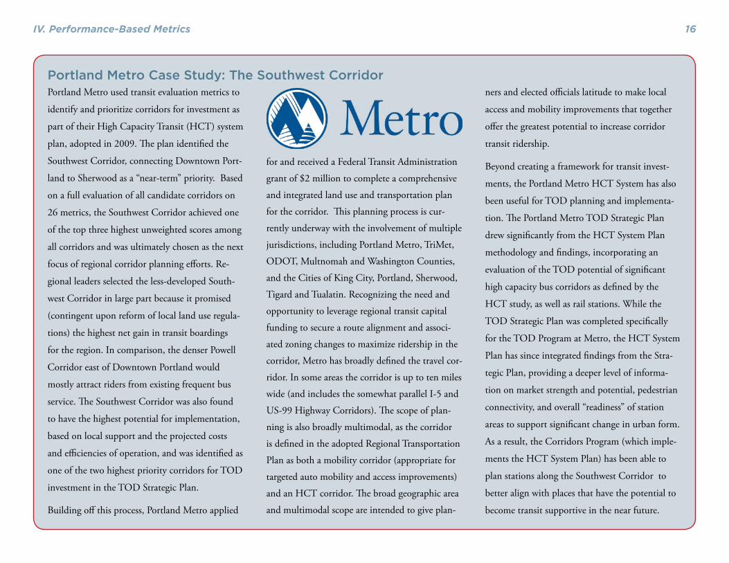
Portland Metro used transit evaluation metrics to
identify and prioritize corridors for investment as
part of their High Capacity Transit (HCT) system
plan, adopted in 2009. The plan identified the
Southwest Corridor, connecting Downtown Port-
land to Sherwood as a “near-term” priority. Based
on a full evaluation of all candidate corridors on
26 metrics, the Southwest Corridor achieved one
of the top three highest unweighted scores among
all corridors and was ultimately chosen as the next
focus of regional corridor planning efforts. Re-
gional leaders selected the less-developed South-
west Corridor in large part because it promised
(contingent upon reform of local land use regula-
tions) the highest net gain in transit boardings
for the region. In comparison, the denser Powell
Corridor east of Downtown Portland would
mostly attract riders from existing frequent bus
service. The Southwest Corridor was also found
to have the highest potential for implementation,
based on local support and the projected costs
and efficiencies of operation, and was identified as
one of the two highest priority corridors for TOD
investment in the TOD Strategic Plan.
Building off this process, Portland Metro applied
for and received a Federal Transit Administration
grant of $2 million to complete a comprehensive
and integrated land use and transportation plan
for the corridor. This planning process is cur-
rently underway with the involvement of multiple
jurisdictions, including Portland Metro, TriMet,
ODOT, Multnomah and Washington Counties,
and the Cities of King City, Portland, Sherwood,
Tigard and Tualatin. Recognizing the need and
opportunity to leverage regional transit capital
funding to secure a route alignment and associ-
ated zoning changes to maximize ridership in the
corridor, Metro has broadly defined the travel cor-
ridor. In some areas the corridor is up to ten miles
wide (and includes the somewhat parallel I-5 and
US-99 Highway Corridors). The scope of plan-
ning is also broadly multimodal, as the corridor
is defined in the adopted Regional Transportation
Plan as both a mobility corridor (appropriate for
targeted auto mobility and access improvements)
and an HCT corridor. The broad geographic area
and multimodal scope are intended to give plan-
ners and elected officials latitude to make local
access and mobility improvements that together
offer the greatest potential to increase corridor
transit ridership.
Beyond creating a framework for transit invest-
ments, the Portland Metro HCT System has also
been useful for TOD planning and implementa-
tion. The Portland Metro TOD Strategic Plan
drew significantly from the HCT System Plan
methodology and findings, incorporating an
evaluation of the TOD potential of significant
high capacity bus corridors as defined by the
HCT study, as well as rail stations. While the
TOD Strategic Plan was completed specifically
for the TOD Program at Metro, the HCT System
Plan has since integrated findings from the Stra-
tegic Plan, providing a deeper level of informa-
tion on market strength and potential, pedestrian
connectivity, and overall “readiness” of station
areas to support significant change in urban form.
As a result, the Corridors Program (which imple-
ments the HCT System Plan) has been able to
plan stations along the Southwest Corridor to
better align with places that have the potential to
become transit supportive in the near future.
Portland Metro Case Study: The Southwest Corridor

IV. Performance-Based Metrics17
then led to the prioritization of projects to be included for regional funding in
Plan Bay Area. Figure 7 graphically illustrates the results of the performance as-
sessment for transit projects. As shown, many of the region’s highest performing
projects were those that increased the efficiency of existing transit systems (BART,
Metro) and those that provided transit expansions to high-density employment
centers (such as BART to San Jose).
The Transit Sustainability Project and the Transit Com-petitiveness Index
In 2010, MTC launched the Transit Sustainability Project (TSP) to address the
major challenges facing transit and identify a path toward an affordable, effi-
cient and well-funded transit system that will attract more riders. As part of this
project, MTC developed the transit-competitiveness index (TCI) tool to identify
locations within the region where transit could be a competitive alternative to
auto travel. TCI allows for regional agencies, congestion management agencies,
and local stakeholders to analyze the travel markets that could be best suited for
transit service, incorporating factors such as parking pricing, congestion, land
uses, densities, and pedestrian environment. This tool could potentially be modi-
fied in the future, potentially employing Plan Bay Area land use assumptions, to
scan which transit corridors may be viable in the future. MTC could build on
the TCI and other tools with project sponsors to develop the most cost-effective,
highest performing projects in the region.
Metropolitan Transportation CommissionAboveground view of path of San Francisco Central Subway.

V. Recommendations 18
V. Recommendations The TOD Policy is an important tool for ensuring that the land uses near future
corridors helps to support transit ridership and meet regional performance targets.
The following summarizes the Consultant Team’s recommendations for future
implementation of the TOD Policy.
Key Recommendations
Continue applying housing thresholds to transit corridors.
The outcomes from the Resolution 3434 corridor plans show that the housing
thresholds have been an effective mechanism to encourage local jurisdictions to
enable higher density housing development in station areas. MTC should contin-
ue to engage a broad range of stakeholders, including cities, congestion manage-
ment agencies, transit agencies, and other concerned stakeholders to evolve the
TOD Policy in the future.
Continue to exclude jobs from transit corridor thresholds.
According to the Resolution 3434 corridor station area plans, local jurisdictions
are accommodating more than 12 million square feet of commercial development
in the station areas. This shows that there are already significant incentives for
local jurisdictions to include employment in PDA and station area plans. Fur-
thermore, the market demand for office and retail space varies considerably more
than for housing by corridor; a numerical threshold would not be appropriate for
commercial uses.
Continue to apply performance metrics to evaluate future
transit investments.
The use of transit performance metrics allows for a better understanding of the
effectiveness of regional transportation investments, and can lead to better buy-in
from all stakeholders as projects advance. In addition, having an objective basis
for selecting future transit corridors can also help pave the way for more effective
TOD planning and implementation.
Adopt a consistent methodology for evaluating compliance.
Past evaluations have cited the need to standardize the methodology for evaluat-
ing TOD Policy compliance to ensure a consistent application over time and
across corridors and station areas. The Consultant Team recommends that MTC
adopt a standardized methodology for assessing compliance with the TOD Policy
thresholds, as shown in Appendix A of the report.
Issues for Consideration
In addition to the recommendations described above, the Consultant Team has
also identified some areas of weakness in the TOD Policy that require further con-
sideration from MTC staff and stakeholders.
Address corridor phasing.
When adopted, the TOD Policy was intended to apply to the entirety of each
Resolution 3434 corridor. As projects have been scaled back due to funding con-
straints, initial phases of projects such as SVRT and SMART have been required
to meet the TOD Policy thresholds. Requiring phases of each project to meet the
TOD Policy threshold individually has the potential to undercut the corridor-
level approach to the TOD Policy thresholds and jeopardize funding for certain
stations or segments that make sense from a corridor ridership perspective (e.g.
stations serving concentrations of employment or a park and ride market). As
funding is released for future phases, the Consultant Team suggests that the TOD
Policy evaluation be assessed over the entirety of the corridor in order to remain
V. Recommendations19
in line with the original intent of the TOD Policy.
Promote affordable housing in station areas.
The existing TOD Policy’s bonus on affordable units appears to have had little
or no effect on affordable housing development. Rather, local jurisdiction poli-
cies have been the impetus for any affordable housing built in station areas. Some
jurisdictions feel that their citywide inclusionary ordinances are already near the
tipping point of making housing development infeasible and imposing higher
requirements for affordable housing in station areas would make transit-oriented
housing infeasible. The City of San Jose actually exempted downtown areas from
its citywide inclusionary housing ordinance, which had the effect of stimulating
market-rate housing production around transit stations.
The Consultant Team recommends creating a stronger link to the funding sources
like the TOAH Fund, established after the TOD Policy was first put into place, as
one way of supporting the development of more affordable housing. This link-
age could be in the form of granting bonus eligibility for those projects in station
areas that have affordable housing in their plans. Other detailed strategies could
be developed through a series of convenings with affordable housing developers,
advocates, and financial institutions.
Reinforce parking management strategies.
While the TOD Policy’s corridor-level thresholds offer specific, quantitative stan-
dards for residential density, no such standards existing for parking management.
Parking has also not typically been a focus of work by the corridor-level working
groups created under the TOD Policy. However, while it lacks specific parking
standards, the TOD Policy has indirectly influenced parking policy in a number
of cases by funding station area planning grants. Grantees have discretion in the
content of station area plans, but they have typically addressed parking policy
alongside other topics, including urban design, land use planning, and multimod-
al circulation. While some of these plans have called for little change from status
quo, others have put in place much more transit-supportive parking policies. The
Consultant Team recommends that MTC’s PDA Planning Program take a more
consistent approach to managing parking, recognizing it as one of the most im-
portant steps that local jurisdictions can take to promote successful TOD. MTC
should continue to emphasize the development of its existing parking resources,
along with additional technical assistance to cities wishing to adjust parking
policy for station areas. Future station area planning grants may also include more
specific requirements regarding the types of analysis required before setting park-
ing standards, and the areas of parking policy that plans should address.
Assess composition or role of corridor working groups.
There have been challenges with the composition of the CWG, which is typically
made up of staff from cities and CMAs, who have limited ability to make bind-
ing local land use decisions. Furthermore, there are capacity constraints, given
the overlap between CWG participants and other forums facilitated by MTC
and ABAG. It may be more effective to streamline the process by integrating the
CWG with other TOD and sub-regional planning initiatives. It is recommended
that MTC explore other options for gaining corridor-level collaboration.
Enhance station area planning in ferry terminal areas.
Ferry terminal areas have been challenged in meeting the TOD Policy thresholds.
Greater emphasis on site planning, station access, and infrastructure investments,
along with land use intensification, is needed in the terminal areas in order to
maximize the ridership potential.

20
End Notes1 Plan Bay Area http://www.mtc.ca.gov/planning/plan_bay_area/
2 Pushkarev, Boris and Jeffrey M. Zupan. “Public transportation and land use
policy,” Indiana University Press, 1977.
3 Newman, Peter and Jeff Kenworthy. “Urban Design to Reduce Automobile
Dependence,” Opolis, v. 2 no 1, 2006.
4 Kolko, Jed. “Making the Most of Transit Density, Employment Growth, and
Ridership around New Stations,” PPIC, February 2011.
5 Ibid.
6 CTOD. “Performance-Based Transit-Oriented Development Typology Guide-
book,” December 2010.
7 CTOD. “Transit and Regional Economic Development,” May 2011.
8 Cervero and Landis, “BART at 20”; Landis, Guhathakurta, and Zhang. “Capi-
talization of Transit Investments into Single-Family Home Prices: A Compara-
tive Analysis of Five California Rail Transit Systems.”
9 Landis et al. “Rail Transit Investments, Real Estate Values, and Land Use
Change: A Comparative Analysis of Five California Rail Transit Systems.”
10 The consultant team sent a survey invitation to 78 Corridor Working Group
members, non-for-profit stakeholders and local jurisdictions on the corridors.
A total of 31 responses were received, for a response rate of 40%. The corridors
most represented were eBART (8 responses) and SMART (7 responses). There
were 4 respondents each associated with Dumbarton Rail and Silicon Val-
ley Rapid Transit (SVRT), 2 with AC Transit BRT and one with ferry service.
There was one respondent each from BART and the city of San Francisco
Transbay/Central Subway, and three respondents who did not identify their
association with any of the corridors.
11 PDA readiness assessment. http://onebayarea.org/pdf/Draft_Plan_Bay_Area/
Draft_PBA_PDA_Development_Feasibility_and_Readiness.pdf

21
Proposed methodology for evaluating compliance
The Consultant Team recommends that MTC adopt a standardized methodology
for assessing compliance with the TOD Policy thresholds, as follows:
1. Assemble Data Sources
Assemble a GIS database including:
• potential transit station locations• parcels• existing land use• General Plan designations• zoning designations
Contact jurisdiction(s) to verify the GIS data as well as collect additional informa-
tion on planned or pipeline projects that could potentially fall within a half-mile
of the station.
2. Identify the Half-Mile Geographical Area (“Station Area”)
In GIS, create a point that best represents either:
• the entrance of the potential (or existing) station building or • the center of the potential (or existing) platform.
Create a one-half mile buffer around this point.
Using the half-mile buffer geography, select parcels either completely within, or
with a majority of their area within the half mile geography. These parcels consti-
tute the “station area” for TOD Policy evaluation purposes.
Overlay the existing uses, General Plan and zoning designation data on the
selected half-mile parcels in order to determine exiting and potential housing
capacity, as discussed below.
3. Calculate Existing Households within the Half-mile Buffer
Associate the county assessor’s data to the parcels within the station area.
Identify single family units from the assessor’s data and count the number of
single-family parcels. Assume one unit per single-family parcel.
Identify multi-family parcel from assessor data. If assessor data does not indicate
number of units, verify with local jurisdiction. Include 100% of units on parcels
that have a majority of their area within the half-mile geography
Contact all the jurisdictions within the half-mile geography to collect data on
new housing units that are planned or in the approval process within the station
area. Determine whether these projects also include qualifying below-market rate
housing units per the TOD Policy requirements (i.e., affordable to 60% of area
median income for rental units and 100% of area median income for owner-
occupied units). Tally the number of market rate and qualifying affordable units
separately.
Calculate the total number of units on the parcels selected within the half-mile
geography under existing conditions by adding the following:
• Existing single family units; • Existing multi-family units; • Planned and pipeline market rate units, and; • 150% of the number of qualifying planned or pipeline below-market units
4. Calculate the Household Potential for Station Areas in the
Short-term Future
From existing land use data, identify vacant and highly underutilized parcels (sur-
face parking lots, open air storage, etc) with an underlying zoning and General
Plan designation that allows for new housing to be developed on those properties.
Appendix A

22
Exclude parcels with planned or pipeline projects counted in the existing condi-
tions.
Based upon the lowest density allowable in the zoning code, calculate the number
of potential new units that could be developed within the station area’s half-mile
geography.
Calculate the number of those future units required to be below-market units
based upon the jurisdiction’s affordable housing policy.
Calculate the number of total potential future units by adding the potential new
market rate units to 150% of the number of below-market units.
5. Summary Total and Evaluation for the Short-term Future
Add the total number of potential new units to the number of existing units, pro-
ducing the total number of potential units that could fall within the station area’s
half-mile geography. Sum station area totals by corridor and evaluate corridor
compliance with the TOD Policy thresholds.
6. Calculating the Household Potential for Station Area in the Long-term Future
In addition to analyzing the existing and short-term future housing capacity with-
in the half-mile station area, it is possible to estimate long-term potential housing
capacity in the station area under potential land use policy changes (for example,
Specific Plans or station area plans that have not yet been adopted but are in the
approvals process). The long-term capacity analysis should include parcels that are
currently in active use for non-residential uses but which have underlying zoning
and General Plan designations that would allow for new housing units to be built
should the property redevelop due to a significant shift in market demand in the
future.
Assess the potential capacity on portions of those parcels where redevelopment
would likely take place, and estimate the number of market and below-market
units (along with the 50% bonus) similar to the method applied in the short-term
housing capacity analysis.
Summarize the total housing capacity for each station area by adding up the re-
sults from the existing, short-term and long-term household capacity analysis.

1. PURPOSEThe San Francisco Bay Area — widely recognized for its beautyand innovation — is projected to grow by almost two millionpeople and one and a half million jobs by 2030. This presents adaunting challenge to the sustainability and the quality of life inthe region. Where and how we accommodate this future growth,in particular where people live and work, will help determinehow effectively the transportation system can handle this growth.
The more people who live, work and study in close proximity topublic transit stations and corridors, the more likely they are touse the transit systems, and more transit riders means fewer vehi-cles competing for valuable road space. The policy also provides
support for a growing market demand for more vibrant, walkableand transit convenient lifestyles by stimulating the constructionof at least 42,000 new housing units along the region’s major newtransit corridors and will help to contribute to a forecasted 59%increase in transit ridership by the year 2030.
This TOD policy addresses multiple goals: improving the cost-effectiveness of regional investments in new transit expansions,easing the Bay Area’s chronic housing shortage, creating vibrantnew communities, and helping preserve regional open space. Thepolicy ensures that transportation agencies, local jurisdictions,members of the public and the private sector work together tocreate development patterns that are more supportive of transit.
ME T RO P O L I TA N TR A N S P O RTAT I O N CO M M I S S I O N
MTC RESOLUTION 3434 TRANSIT-ORIENTED DEVELOPMENT (TOD) POLICY FOR REGIONAL TRANSIT EXPANSION PROJECTS
Adopted July 27, 2005
TABLE 1: Resolution 3434 Transit Extension Projects Subject to Corridor Thresholds
PROJECT SPONSOR TYPETHRESHOLD IS MET WITHCURRENT DEVELOPMENT?
BART East Contra Costa Rail Extension BART/CCTA Commuter Rail No
BART — Downtown Fremont to San Jose/Santa Clara(a) Fremont to Warm Springs
(b) Warm Springs to San Jose/Santa Clara
(a) BART
(b) VTA
BART extension No
AC Transit Berkeley/Oakland/San Leandro Bus Rapid Transit: Phase 1
AC Transit Bus Rapid Transit Yes
Caltrain Downtown Extension/RebuiltTransbay Terminal
TJPA Commuter Rail Yes
MUNI Third Street Light Rail TransitProject Phase 2 — New Central Subway
MUNI Light Rail Yes
Sonoma-Marin Rail SMART Commuter Rail No
Dumbarton RailSMTA, ACCMA, VTA,ACTIA, Capitol
Corridor Commuter Rail
No
Expanded Ferry Service Phase 1:Berkeley, Alameda/Oakland/Harbor Bay,and South San Francisco to SanFrancisco (Note 1)
WTA Ferry No
Expanded Ferry Service Phase 2:Alameda to South San Francisco, andHercules, Antioch, Treasure Island,Redwood City and Richmond to SanFrancisco (Note 1)
WTA Ferry No
Note 1: The WTA Ferry Expansion “Corridor” for the purposes of the TOD policy consists of all new terminals planned in Phase 1 and Phase 2.
At a minimum, Station Area Plans will define both the land useplan for the area as well as the policies—zoning, design stan-dards, parking policies, etc.—for implementation. The plansshall at a minimum include the following elements:
• Current and proposed land use by type of use and densitywithin the half-mile radius, with a clear identification of thenumber of existing and planned housing units and jobs;
• Station access and circulation plans for motorized, non-motorized and transit access. The station area plan shouldclearly identify any barriers for pedestrian, bicycle andwheelchair access to the station from surrounding neigh-borhoods (e.g., freeways, railroad tracks, arterials with inad-equate pedestrian crossings), and should propose strategiesthat will remove these barriers and maximize the number ofresidents and employees that can access the station by thesemeans. The station area and transit village public spacesshall be made accessible to persons with disabilities.
• Estimates of transit riders walking from the half mile stationarea to the transit station to use transit;
• Transit village design policies and standards, includingmixed use developments and pedestrian-scaled block size,to promote the livability and walkability of the station area;
• TOD-oriented parking demand and parking requirementsfor station area land uses, including consideration of pricingand provisions for shared parking;
• Implementation plan for the station area plan, includinglocal policies required for development per the plan, marketdemand for the proposed development, potential phasing ofdevelopment and demand analysis for proposed develop-ment.
The Station Area Plans shall be conducted using existing TODdesign guidelines that have already been developed by ABAG,local jurisdictions, transit agencies, the CMAs and others. MTCwill work with ABAG to provide more specific guidance on theissues listed above that must be addressed in the station areaplans and references and information to support this effort. MTCis conducting an analysis of parking policies that will be madeavailable when complete, and shall be considered in developinglocal parking policies for TODs.
6. CORRIDOR WORKING GROUPSThe goal of the Corridor Working Groups is to create a morecoordinated approach to planning for transit-oriented develop-ment along Resolution 3434 transit corridors. Each of the transitextensions subject to the corridor threshold process, as identifiedin Table 1, will need a Corridor Working Group, unless the cur-rent level of development already meets the corridor threshold.Many of the corridors already have a transit project workinggroup that may be adjusted to take on this role. The CorridorWorking Group shall be coordinated by the relevant CMAs, andwill include the sponsoring transit agency, the local jurisdictionsin the corridor, and representatives from ABAG, MTC, and otherparties as appropriate.
The Corridor Working Group will assess whether the plannedlevel of development satisfies the corridor threshold as definedfor the mode, and assist in addressing any deficit in meeting thethreshold by working to identify opportunities and strategies atthe local level. This will include the key task of distributing therequired housing units to each of the affected station sites withinthe defined corridor. The Corridor Working Group will continuewith corridor evaluation, station area planning, and any neces-sary refinements to station locations until the corridor thresholdis met and supporting Station Area Plans are adopted by the localjurisdictions.
MTC will confirm that each corridor meets the housing thresh-old prior to the release of regional discretionary funds for con-struction of the transit project.
7. REVIEW OF THE TOD POLICYMTC staff will conduct a review of the TOD policy and its appli-cation to each of the affected Resolution 3434 corridors, andpresent findings to the Commission, within 12 months of theadoption of the TOD policy.
FOR MORE INFORMATIONJames Corless • [email protected] • 510.817.5709
Valerie Knepper • [email protected] • 510.817.5824
METROPOLITANTRANSPORTATION
COMMISSIONJoseph P. Bort MetroCenter
101 Eighth StreetOakland, CA 94607-4700
Tel: 510.817.5700TDD/TTY: 510.817.5769
Fax: 510.817.5848e-mail: [email protected]
Web site: www.mtc.ca.gov

There are three key elements of the regional TOD policy:
(a) Corridor-level thresholds to quantify appropriate mini-mum levels of development around transit stations alongnew corridors;
(b) Local station area plans that address future land usechanges, station access needs, circulation improvements,pedestrian-friendly design, and other key features in a tran-sit-oriented development; and
(c) Corridor working groups that bring together CMAs, cityand county planning staff, transit agencies, and other keystakeholders to define expectations, timelines, roles andresponsibilities for key stages of the transit project develop-ment process.
2. TOD POLICY APPLICATIONThe TOD policy only applies to physical transit extensions fund-ed in Resolution 3434 (see Table 1). The policy applies to anyphysical transit extension project with regional discretionaryfunds, regardless of level of funding. Resolution 3434 invest-ments that only entail level of service improvements or otherenhancements without physically extending the system are notsubject to the TOD policy requirements. Single station exten-sions to international airports are not subject to the TOD policydue to the infeasiblity of housing development.
3. DEFINITIONS AND CONDITIONS OF FUNDINGFor purposes of this policy “regional discretionary funding” con-sists of the following sources identified in the Resolution 3434funding plan:
• FTA Section 5309- New Starts
• FTA Section 5309- Bus and Bus Facilities Discretionary
• FTA Section 5309- Rail Modernization
• Regional Measure 1- Rail (bridge tolls)
• Regional Measure 2 (bridge tolls)
• Interregional Transportation Improvement Program
• Interregional Transportation Improvement Program-Intercity rail
• Federal Ferryboat Discretionary
• AB 1171 (bridge tolls)
• CARB-Carl Moyer/AB434 (Bay Area Air QualityManagement District)*
These regional funds may be programmed and allocated for envi-ronmental and design related work, in preparation for addressingthe requirements of the TOD policy. Regional funds may be pro-grammed and allocated for right-of-way acquisition in advanceof meeting all requirements in the policy, if land preservation forTOD or project delivery purposes is essential. No regional fundswill be programmed and allocated for construction until therequirements of this policy have been satisfied. See Table 2 for amore detailed overview of the planning process.
4. CORRIDOR-LEVEL THRESHOLDSEach transit extension project funded in Resolution 3434 mustplan for a minimum number of housing units along the corridor.These corridor-level thresholds vary by mode of transit, withmore capital-intensive modes requiring higher numbers of hous-ing units (see Table 3). The corridor thresholds have been devel-oped based on potential for increased transit ridership, exemplaryexisting station sites in the Bay Area, local general plan data, pre-dicted market demand for TOD-oriented housing in each county,and an independent analysis of feasible development potential ineach transit corridor.
• Meeting the corridor level thresholds requires that within ahalf mile of all stations, a combination of existing land usesand planned land uses meets or exceeds the overall corridorthreshold for housing (listed in Table 3);
• Physical transit extension projects that do not currentlymeet the corridor thresholds with development that isalready built will receive the highest priority for the awardof MTC’s Station Area Planning Grants.
• To be counted toward the threshold, planned land uses mustbe adopted through general plans, and the appropriateimplementation processes must be put in place, such aszoning codes. General plan language alone without sup-portive implementation policies, such as zoning, is not suf-ficient for the purposes of this policy. Ideally, planned landuses will be formally adopted through a specific plan (orequivalent), zoning codes and general plan amendmentsalong with an accompanying programmatic EnvironmentalImpact Report (EIR) as part of the overall station area plan-ning process. Minimum densities will be used in the calcu-lations to assess achievement of the thresholds.
• An existing end station is included as part of the transit cor-ridor for the purposes of calculating the corridor thresh-olds; optional stations will not be included in calculatingthe corridor thresholds.
• New below-market housing units will receive a 50 percentbonus toward meeting the corridor threshold (i.e. oneplanned below-market housing unit counts for 1.5 housingunits for the purposes of meeting the corridor threshold.Below market for the purposes of the Resolution 3434 TODpolicy is affordable to 60% of area median income for rentalunits and 100% of area median income for owner-occupiedunits);
• The local jurisdictions in each corridor will determine joband housing placement, type, density, and design.
• The Corridor Working Groups are encouraged to plan for alevel of housing that will significantly exceed the housingunit thresholds stated here during the planning process.This will ensure that the Housing Unit Threshold is exceed-ed corridor-wide and that the ridership potential from TODis maximized.
5. STATION AREA PLANSEach proposed physical transit extension project seeking fundingthrough Resolution 3434 must demonstrate that the thresholdsfor the corridor are met through existing development andadopted station area plans that commit local jurisdictions to alevel of housing that meets the threshold. This requirement maybe met by existing station area plans accompanied by appropriatezoning and implementation mechanisms. If new station areaplans are needed to meet the corridor threshold, MTC will assistin funding the plans. The Station Area Plans shall be conductedby local governments in coordination with transit agencies,Association of Bay Area Governments (ABAG), MTC and theCongestion Management Agencies (CMAs).
Station Area Plans are opportunities to define vibrant mixed use,accessible transit villages and quality transit-oriented develop-ment – places where people will want to live, work, shop andspend time. These plans should incorporate mixed-use develop-ments, including new housing, neighborhood serving retail,employment, schools, day care centers, parks and other amenitiesto serve the local community.
* The Carl Moyer funds and AB 434 funds are controlled directly by the California Air Resources Board and Bay Area Air Management District. Res. 3434 identifiesthese funds for the Caltrain electrification project, which is not subject to the TOD policy.
TABLE 2: Regional TOD Policy Implementation Process for Transit Extension Projects
TRANSIT AGENCY ACTION CITY ACTION MTC/CMA/ABAG ACTION
All parties in corridors that do not currently meet thresholds (see Table 1) establish Corridor Working Group toaddress corridor threshold. Conduct initial corridor performance evaluation, initiate station area planning.
Environmental Review/Preliminary Engineering/
Right-of-WayConduct Station Area Plans
Coordination of corridor workinggroup, funding of station area plans
Step 1 Threshold Check: the combination of new Station Area Plans and existing development patterns exceeds corridor housing thresholds .
Final DesignAdopt Station Area Plans.
Revise general plan policies and zon-ing, environmental reviews
Regional and county agencies assistlocal jurisdictions in implementing
station area plans
Step 2 Threshold Check: (a) local policies adopted for station areas; (b) implementation mechanisms in place per adopted Station Area Plan by the time Final Design is completed.
ConstructionImplementation (financing, MOUs)
Solicit developmentTLC planning and capital funding,
HIP funding
Project Type BART Light Rail Bus Rapid Transit Commuter Rail Ferry
HousingThreshold
3,850 3,300 2,750 2,200 750
Each corridor is evaluated for the Housing Threshold. For example, a four station commuter rail extension (including the existing end-of-the-line station) would be required to meet a corridor-level threshold of 8,800 housing units.
Threshold figures above are an average per station area based on both existing land uses and planned development within a halfmile of all stations. New below market rate housing is provided a 50% bonus towards meeting housing unit threshold.
TABLE 3: Corridor Thresholds Housing Units — Average per Station Area

1. PURPOSEThe San Francisco Bay Area — widely recognized for its beautyand innovation — is projected to grow by almost two millionpeople and one and a half million jobs by 2030. This presents adaunting challenge to the sustainability and the quality of life inthe region. Where and how we accommodate this future growth,in particular where people live and work, will help determinehow effectively the transportation system can handle this growth.
The more people who live, work and study in close proximity topublic transit stations and corridors, the more likely they are touse the transit systems, and more transit riders means fewer vehi-cles competing for valuable road space. The policy also provides
support for a growing market demand for more vibrant, walkableand transit convenient lifestyles by stimulating the constructionof at least 42,000 new housing units along the region’s major newtransit corridors and will help to contribute to a forecasted 59%increase in transit ridership by the year 2030.
This TOD policy addresses multiple goals: improving the cost-effectiveness of regional investments in new transit expansions,easing the Bay Area’s chronic housing shortage, creating vibrantnew communities, and helping preserve regional open space. Thepolicy ensures that transportation agencies, local jurisdictions,members of the public and the private sector work together tocreate development patterns that are more supportive of transit.
ME T RO P O L I TA N TR A N S P O RTAT I O N CO M M I S S I O N
MTC RESOLUTION 3434 TRANSIT-ORIENTED DEVELOPMENT (TOD) POLICY FOR REGIONAL TRANSIT EXPANSION PROJECTS
Adopted July 27, 2005
TABLE 1: Resolution 3434 Transit Extension Projects Subject to Corridor Thresholds
PROJECT SPONSOR TYPETHRESHOLD IS MET WITHCURRENT DEVELOPMENT?
BART East Contra Costa Rail Extension BART/CCTA Commuter Rail No
BART — Downtown Fremont to San Jose/Santa Clara(a) Fremont to Warm Springs
(b) Warm Springs to San Jose/Santa Clara
(a) BART
(b) VTA
BART extension No
AC Transit Berkeley/Oakland/San Leandro Bus Rapid Transit: Phase 1
AC Transit Bus Rapid Transit Yes
Caltrain Downtown Extension/RebuiltTransbay Terminal
TJPA Commuter Rail Yes
MUNI Third Street Light Rail TransitProject Phase 2 — New Central Subway
MUNI Light Rail Yes
Sonoma-Marin Rail SMART Commuter Rail No
Dumbarton RailSMTA, ACCMA, VTA,ACTIA, Capitol
Corridor Commuter Rail
No
Expanded Ferry Service Phase 1:Berkeley, Alameda/Oakland/Harbor Bay,and South San Francisco to SanFrancisco (Note 1)
WTA Ferry No
Expanded Ferry Service Phase 2:Alameda to South San Francisco, andHercules, Antioch, Treasure Island,Redwood City and Richmond to SanFrancisco (Note 1)
WTA Ferry No
Note 1: The WTA Ferry Expansion “Corridor” for the purposes of the TOD policy consists of all new terminals planned in Phase 1 and Phase 2.
At a minimum, Station Area Plans will define both the land useplan for the area as well as the policies—zoning, design stan-dards, parking policies, etc.—for implementation. The plansshall at a minimum include the following elements:
• Current and proposed land use by type of use and densitywithin the half-mile radius, with a clear identification of thenumber of existing and planned housing units and jobs;
• Station access and circulation plans for motorized, non-motorized and transit access. The station area plan shouldclearly identify any barriers for pedestrian, bicycle andwheelchair access to the station from surrounding neigh-borhoods (e.g., freeways, railroad tracks, arterials with inad-equate pedestrian crossings), and should propose strategiesthat will remove these barriers and maximize the number ofresidents and employees that can access the station by thesemeans. The station area and transit village public spacesshall be made accessible to persons with disabilities.
• Estimates of transit riders walking from the half mile stationarea to the transit station to use transit;
• Transit village design policies and standards, includingmixed use developments and pedestrian-scaled block size,to promote the livability and walkability of the station area;
• TOD-oriented parking demand and parking requirementsfor station area land uses, including consideration of pricingand provisions for shared parking;
• Implementation plan for the station area plan, includinglocal policies required for development per the plan, marketdemand for the proposed development, potential phasing ofdevelopment and demand analysis for proposed develop-ment.
The Station Area Plans shall be conducted using existing TODdesign guidelines that have already been developed by ABAG,local jurisdictions, transit agencies, the CMAs and others. MTCwill work with ABAG to provide more specific guidance on theissues listed above that must be addressed in the station areaplans and references and information to support this effort. MTCis conducting an analysis of parking policies that will be madeavailable when complete, and shall be considered in developinglocal parking policies for TODs.
6. CORRIDOR WORKING GROUPSThe goal of the Corridor Working Groups is to create a morecoordinated approach to planning for transit-oriented develop-ment along Resolution 3434 transit corridors. Each of the transitextensions subject to the corridor threshold process, as identifiedin Table 1, will need a Corridor Working Group, unless the cur-rent level of development already meets the corridor threshold.Many of the corridors already have a transit project workinggroup that may be adjusted to take on this role. The CorridorWorking Group shall be coordinated by the relevant CMAs, andwill include the sponsoring transit agency, the local jurisdictionsin the corridor, and representatives from ABAG, MTC, and otherparties as appropriate.
The Corridor Working Group will assess whether the plannedlevel of development satisfies the corridor threshold as definedfor the mode, and assist in addressing any deficit in meeting thethreshold by working to identify opportunities and strategies atthe local level. This will include the key task of distributing therequired housing units to each of the affected station sites withinthe defined corridor. The Corridor Working Group will continuewith corridor evaluation, station area planning, and any neces-sary refinements to station locations until the corridor thresholdis met and supporting Station Area Plans are adopted by the localjurisdictions.
MTC will confirm that each corridor meets the housing thresh-old prior to the release of regional discretionary funds for con-struction of the transit project.
7. REVIEW OF THE TOD POLICYMTC staff will conduct a review of the TOD policy and its appli-cation to each of the affected Resolution 3434 corridors, andpresent findings to the Commission, within 12 months of theadoption of the TOD policy.
FOR MORE INFORMATIONJames Corless • [email protected] • 510.817.5709
Valerie Knepper • [email protected] • 510.817.5824
METROPOLITANTRANSPORTATION
COMMISSIONJoseph P. Bort MetroCenter
101 Eighth StreetOakland, CA 94607-4700
Tel: 510.817.5700TDD/TTY: 510.817.5769
Fax: 510.817.5848e-mail: [email protected]
Web site: www.mtc.ca.gov