Embed Size (px)
Citation preview
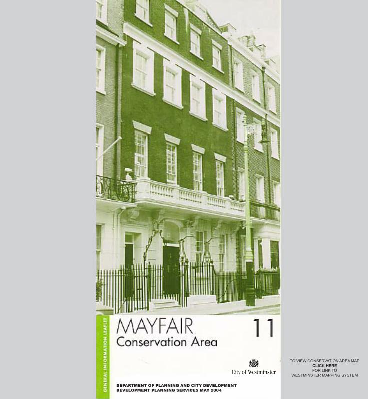
DEPARTMENT OF PLANNING AND CITY DEVELOPMENT
DEVELOPMENT PLANNING SERVICES MAY 2004
TO VIEW CONSERVATION AREA MAPCLICK HEREFOR LINK TO
WESTMINSTER MAPPING SYSTEM

Designation: First designated in 1969, extended in 1974 to include areas to thesouth and east of Berkeley Square and east of Savile Row, extended againin1979 to include the area from the north end of South Molton Street to NorthAudley Street and small extensions on Park Lane, and extended in 1990 toinclude small areas on Park Lane and Oxford Street.
Historical Background: Mayfair derives its name from a fair held in May infields around the site of today’s Shepherd Market. In the1660s three largemansions, including Burlington House (now the Royal Academy) were erectedon the north side of Piccadilly. These were followed by smaller scale highquality, speculative residential development. Early development was slow andpiecemeal, but the pace and scale quickened from the second decade of the18th century. Clifford Street, New Bond Street and Conduit Street weredeveloped from 1717 and the first houses in Hanover Square were completedin the same year.
An Act was passed in 1710 permitting leases for building on the GrosvenorEstate and the development of Grosvenor Square was well underway by 1725.Berkeley Square and its surrounding streets were in different ownership andhad been laid out in 1675. However, development in this area did not getproperly underway until the mid 1730s. By the time that Rocque’s map waspublished in 1745 most of the Grosvenor Estate had been built over, but a largearea of land remained vacant to the west of Berkeley Square. There was alsoan open ground for the market in Shepherd Market and Devonshire House(now demolished) retained its pleasure ground running back to BerkeleySquare.
By the 1780s, however, with the exception of the grounds of Devonshire House,Mayfair was almost completely built up. Some houses survive from this firstphase of development, but many were redeveloped as their original 99 yearleases expired.
On the Grosvenor Estate redevelopment took place early in three phases. In themid-19th century houses were reclad or redeveloped in the stuccoed Italianatestyle. From the 1870s the Queen Anne and later Renaissance and Arts andCrafts styles took over. Finally, in the years after the First World War,neo-Georgian became the dominant style. This general pattern of developmentis mirrored throughout the Mayfair Conservation Area. A limited amount ofredevelopment in the Modern style took place after the Second World War (eg.the Time and Life Building on New Bond Street), but it is notable that theneo-Georgian facades of Grosvenor Square were not completed until the1960s.
Listed Buildings: There are almost 700 listed buildings in the MayfairConservation Area. Of these, 44 are listed Grade II* and 14 are listedGrade I.
Key Features: The detailed street plan of Mayfair is dictated largely by thepattern of land ownership. There are three distinct areas of typical 18th centurygrid-iron layout: the first based on and around Grosvenor Square and HanoverSquare, the second based on Berkeley Square and the third based on the lineof the east end of Piccadilly. Overlaid on this are the roads based on the Tyburnand Conduit Mead rivers (South Molton Street, Avery Row, Conduit Street,Bruton Lane, Curzon Street and White Horse Street). The informality of thesestreets and the haphazard junctions between the three major grid-irons,generate a great deal of interest in the townscape.
Imposed upon this street plan is a rich cocktail of high quality buildings.The area is dominated by fashionable town-houses (and their mews)reflecting the history of English domestic architecture from the early 18th to theearly 20th century. In some terraces houses from the 1880s jostle with thosefrom the 1780s. Other terraces date almost entirely from the period of the firstbuild or from late 19th century redevelopment. These high quality terracescreate the essential background character of the area.
Against this background, the character of Mayfair changes from street to street.Mount Street, South Audley Street and Shepherd Market are important localand specialist shopping areas. Bond Street and Oxford Street are internationalshopping streets, Cork Street is dominated by galleries and Savile Row isfamous for its tailors. On a larger scale, the area east of Bond Street isgenerally more commercial than the area to the west and the borders of Mayfairare more commercial than its heart.
Despite this predominantly, commercial use, the domestic scale of the area haslargely survived. Large blocks of flats, hotels and offices have largely beenconfined to Park Lane, Piccadilly, Berkeley Square and Hanover Square. Someof these date from the late 19th and early 20th century and are of a high quality.Others could beneficially, be redeveloped.
Adjacent Conservation Areas: Mayfair is bounded to the west and south bythe Royal Parks and St James’s Conservation Areas, to the north by thePortman Estate, Stratford Place and Harley Street Conservation Areas and tothe east by the Regent Street Conservation Area.
Strategic Views: Not affected.
Areas of Special Archaeological Priority: The Tyburn Settlement area ofspecial archaeological priority extends 100m south of Oxford Street from BinneyStreet to Woodstock Street.
Regulation 7 Directions: The whole area is affected by therequirement that any advertisement for the sale or letting of land(including estate agents’ boards, advertising, shops, houses, flats or Offices)must be given consent by the City Council as local planning authority.Displaying an advertisement without having first obtained consent is a criminaloffence.
Planning Briefs and Design Guidelines: ‘Bond Street. A Guide to Shopfrontsand Advertisements’ (1992).
Spaces protected by the London Squares Act 1931: None
Registered Historic Parks and Gardens: Grosvenor Square and BerkeleySquare.
Contacts
Built Environment Westminster City CouncilCity Hall, 64 Victoria Street, London, SWIE 6QPTel: (020) 7641 2513