Embed Size (px)
DESCRIPTION
Tides, King Tides, and Tidal Datums plus some NOS Resources. Marti Ikehara , Geodetic Advisor NOAA’s NGS, Sacramento [email protected]. CLSA Sonoma County chapter meeting, Feb 2013. King Tide, Humboldt Bay, Dec ‘12 event. 12. Photo by Steve Coppin, Humboldt Baykeeper. - PowerPoint PPT Presentation
Citation preview
Tides, King Tides, and Tidal Datums plus some NOS Resources
Marti Ikehara, Geodetic Advisor
NOAA’s NGS, Sacramento
CLSA Sonoma County chapter meeting, Feb 2013
1
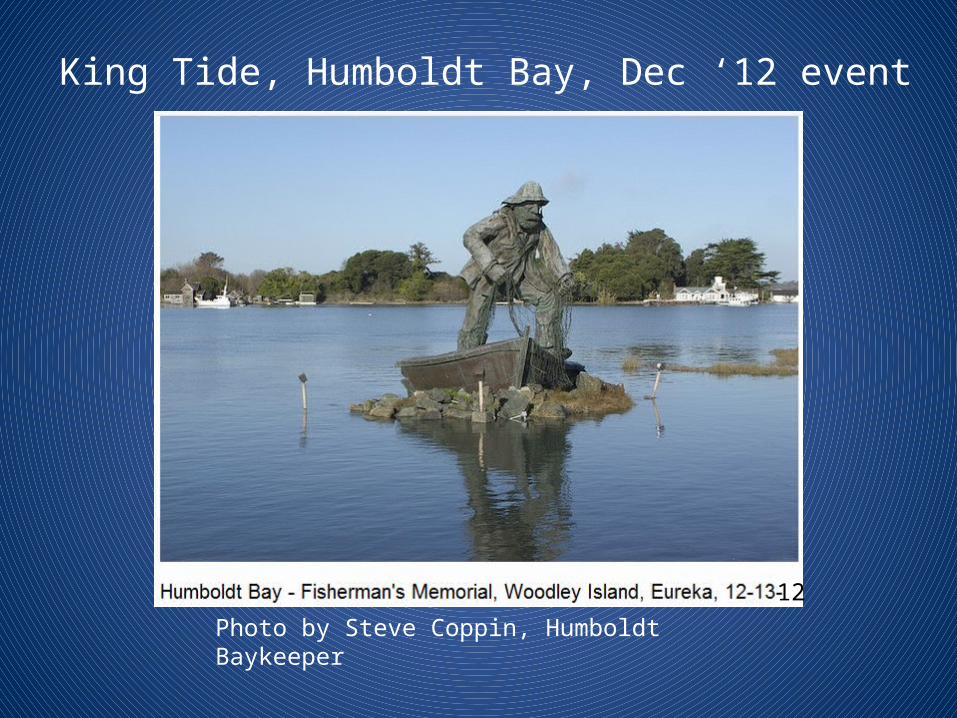
12
King Tide, Humboldt Bay, Dec ‘12 event
Photo by Steve Coppin, Humboldt Baykeeper
3
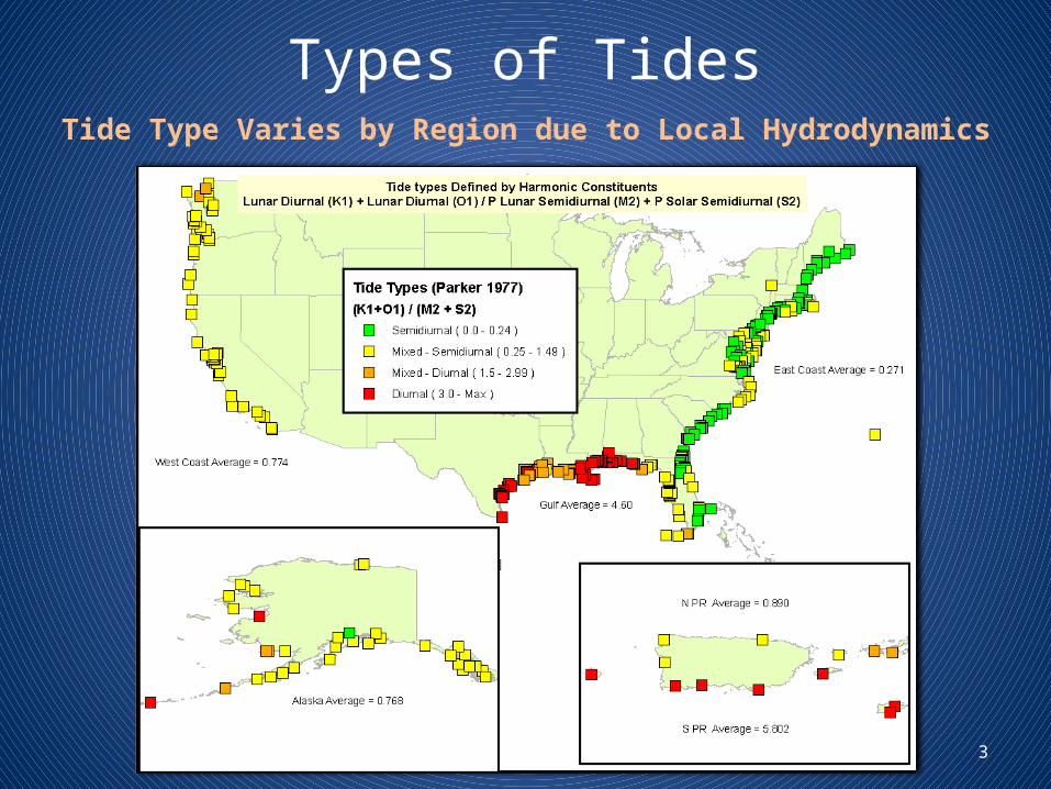
Types of TidesTide Type Varies by Region due to Local Hydrodynamics
4
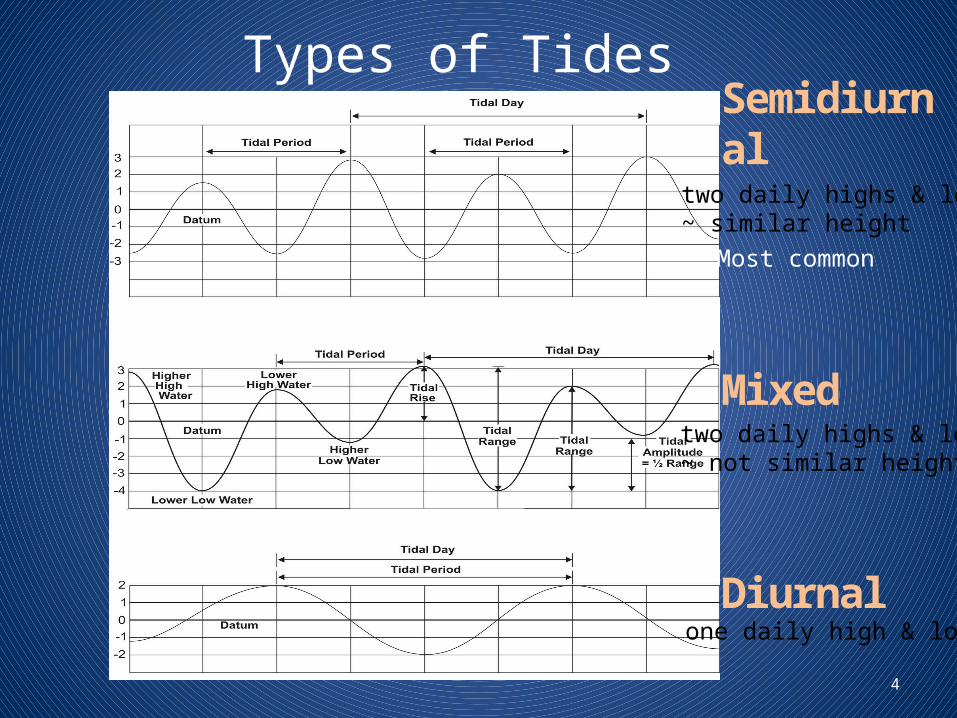
Types of Tides
Semidiurnal
Mixed
Diurnal
two daily highs & lows~ similar height Most common
two daily highs & lows~ not similar height
one daily high & low
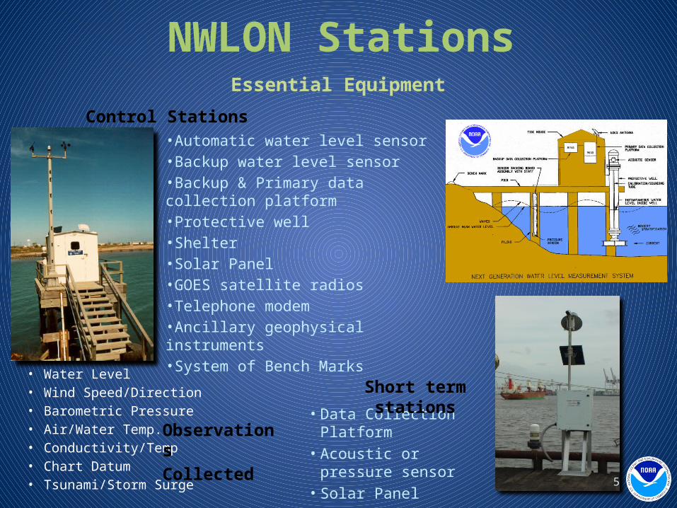
NWLON StationsEssential Equipment
•Automatic water level sensor•Backup water level sensor•Backup & Primary data collection platform•Protective well•Shelter•Solar Panel•GOES satellite radios•Telephone modem•Ancillary geophysical instruments•System of Bench Marks
• Data Collection Platform• Acoustic or pressure sensor• Solar Panel• GOES Transmitter
Short term stations
Control Stations
• Water Level• Wind Speed/Direction• Barometric Pressure• Air/Water Temp.• Conductivity/Temp• Chart Datum• Tsunami/Storm Surge
Observations Collected
5
6
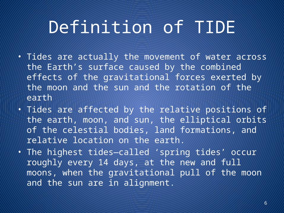
Definition of TIDE
• Tides are actually the movement of water across the Earth’s surface caused by the combined effects of the gravitational forces exerted by the moon and the sun and the rotation of the earth
• Tides are affected by the relative positions of the earth, moon, and sun, the elliptical orbits of the celestial bodies, land formations, and relative location on the earth.
• The highest tides—called ‘spring tides’ occur roughly every 14 days, at the new and full moons, when the gravitational pull of the moon and the sun are in alignment.
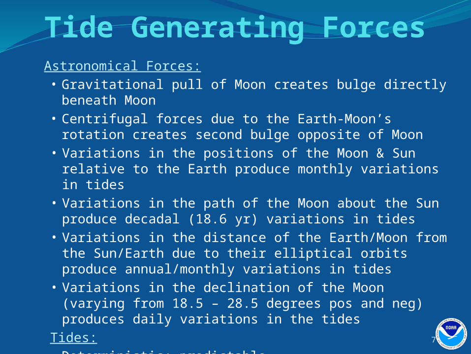
Astronomical Forces:• Gravitational pull of Moon creates bulge directly beneath Moon• Centrifugal forces due to the Earth-Moon’s rotation creates second bulge
opposite of Moon• Variations in the positions of the Moon & Sun relative to the Earth
produce monthly variations in tides• Variations in the path of the Moon about the Sun produce decadal (18.6
yr) variations in tides • Variations in the distance of the Earth/Moon from the Sun/Earth due to
their elliptical orbits produce annual/monthly variations in tides• Variations in the declination of the Moon (varying from 18.5 – 28.5
degrees pos and neg) produces daily variations in the tidesTides:• Deterministic; predictable• With enough water level data, the tides can be predicted indefinitely for
that location until/when there are changes to the geometry—bathymetrically or along the coastline
Tide Generating Forces
7
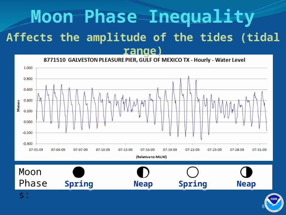
Moon Phase InequalityAffects the amplitude of the tides (tidal range)
Moon Phases: NeapNeapSpring Spring
8
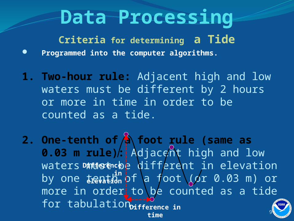
Data Processing Programmed into the computer algorithms.
1. Two-hour rule: Adjacent high and low waters must be different by 2 hours or more in time in order to be counted as a tide.
2. One-tenth of a foot rule (same as 0.03 m rule): Adjacent high and low waters must be different in elevation by one tenth of a foot (or 0.03 m) or more in order to be counted as a tide for tabulation.
Criteria for determining a Tide
Difference in elevation
Difference in time9
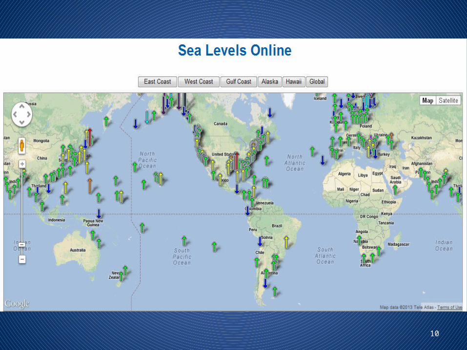
10
11
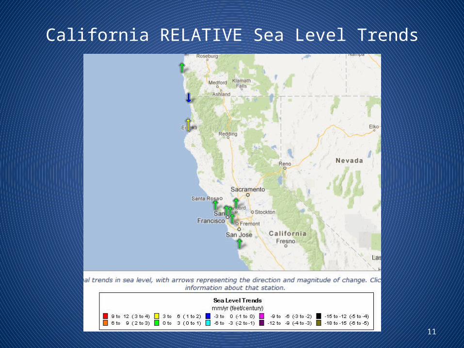
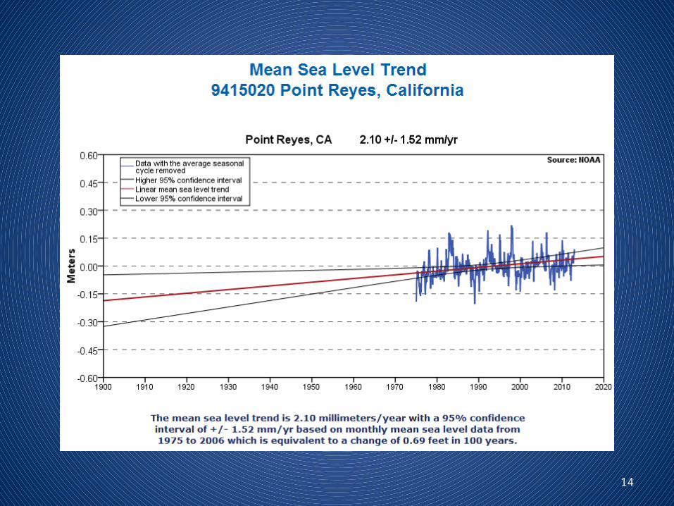
California RELATIVE Sea Level Trends
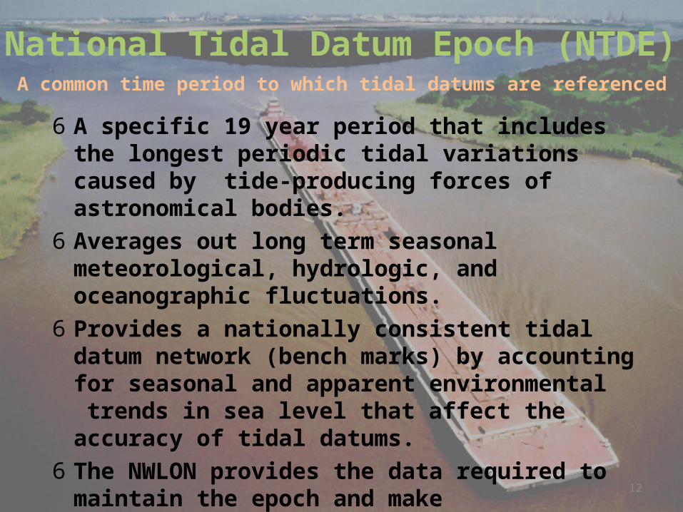
6 A specific 19 year period that includes the longest periodic tidal variations caused by tide-producing forces of astronomical bodies.
6 Averages out long term seasonal meteorological, hydrologic, and oceanographic fluctuations.
6 Provides a nationally consistent tidal datum network (bench marks) by accounting for seasonal and apparent environmental trends in sea level that affect the accuracy of tidal datums.
6 The NWLON provides the data required to maintain the epoch and make determinations of tidal datums at primary and secondary tide (water level for the Great Lakes) gages.
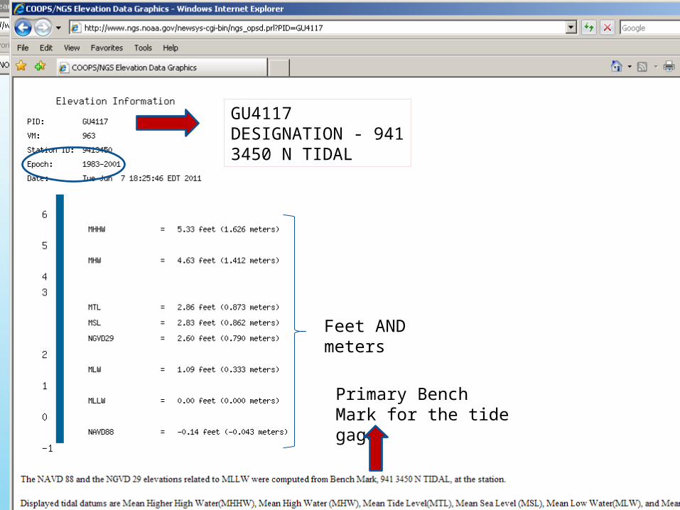
6 Current epoch is 1983-2001; previous was 1960-78.
National Tidal Datum Epoch (NTDE)A common time period to which tidal datums are referenced
12
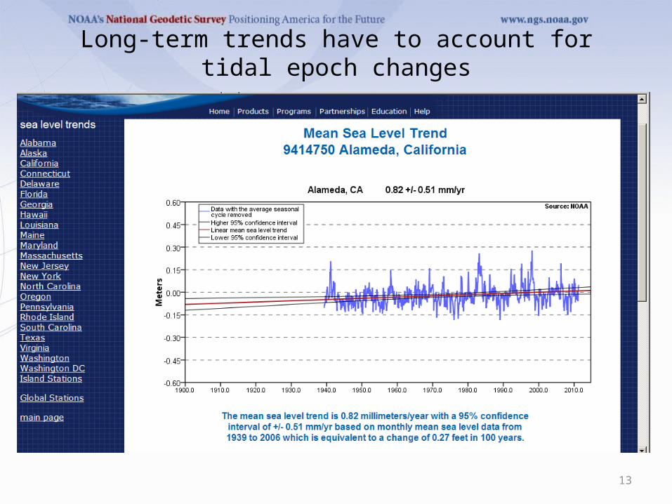
Long-term trends have to account for tidal epoch changes
13
14
15
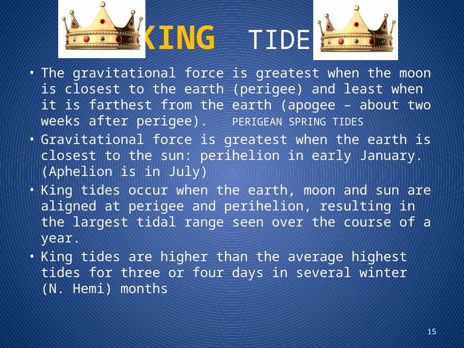
KING TIDES• The gravitational force is greatest when the moon is
closest to the earth (perigee) and least when it is farthest from the earth (apogee – about two weeks after perigee). PERIGEAN SPRING TIDES
• Gravitational force is greatest when the earth is closest to the sun: perihelion in early January. (Aphelion is in July)
• King tides occur when the earth, moon and sun are aligned at perigee and perihelion, resulting in the largest tidal range seen over the course of a year.
• King tides are higher than the average highest tides for three or four days in several winter (N. Hemi) months
16
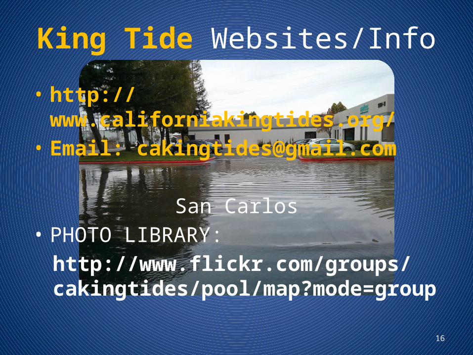
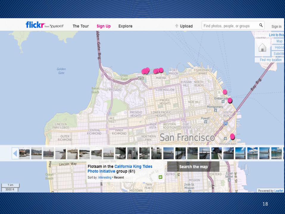
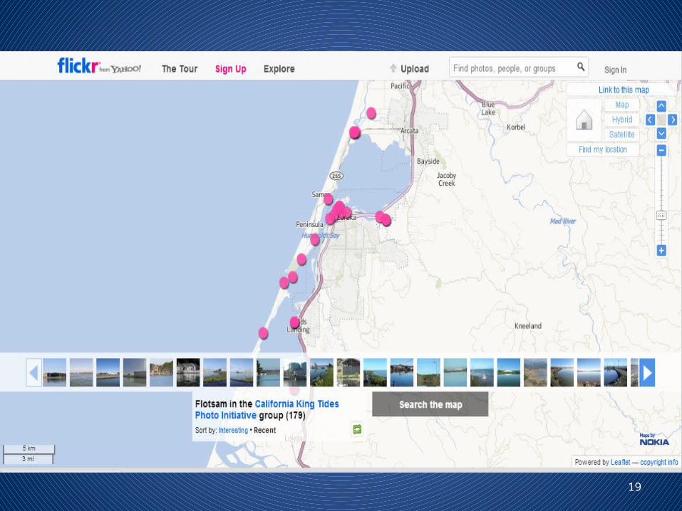
King Tide Websites/Info
• http://www.californiakingtides.org/• Email: [email protected]
San Carlos• PHOTO LIBRARY:
http://www.flickr.com/groups/cakingtides/pool/map?mode=group
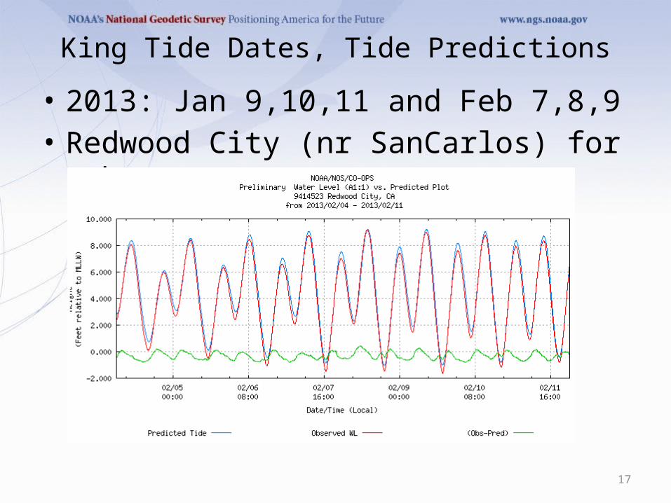
King Tide Dates, Tide Predictions• 2013: Jan 9,10,11 and Feb 7,8,9• Redwood City (nr SanCarlos) for Feb 4-11
17
18
19
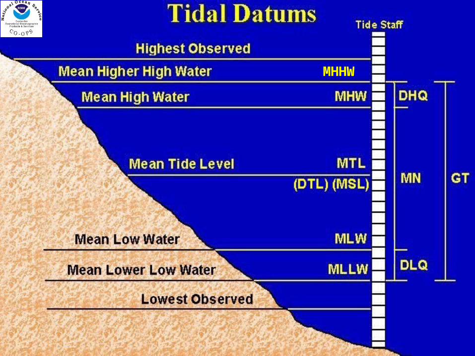
MHHW
Tidal DatumsStation Datum: Unique to each water level
station - Established at a lower elevation than the water is ever expected to reach. - Referenced to the primary bench mark at the station- Held constant regardless of changes to the water level gauge or tide staffMHHW: Mean Higher High Water The average height of the higher high water of
each tidal day observed over the NTDE MHW: Mean High Water
The average of all the high water heights observed over the NTDE
MTL: Mean Tide Level The arithmetic mean of mean high water and mean
low waterMSL: Mean Sea Level or LMSL: Local Mean Sea
LevelThe arithmetic mean of HOURLY heights observed
over the NTDEMLW: Mean Low Water The average of all the low water heights observed
over the NTDE MLLW: Mean Lower Low Water The average of the lower low water height of each
tidal day observed over the NTDEGT: Great Diurnal Range The difference in height between mean higher high
water and mean lower low water
21
04/19/2023 22
04/19/2023 23
Primary Bench Mark for the tide gage
GU4117 DESIGNATION - 941 3450 N TIDAL
Feet AND meters
24
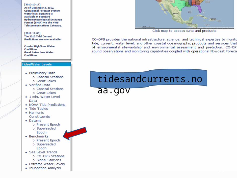
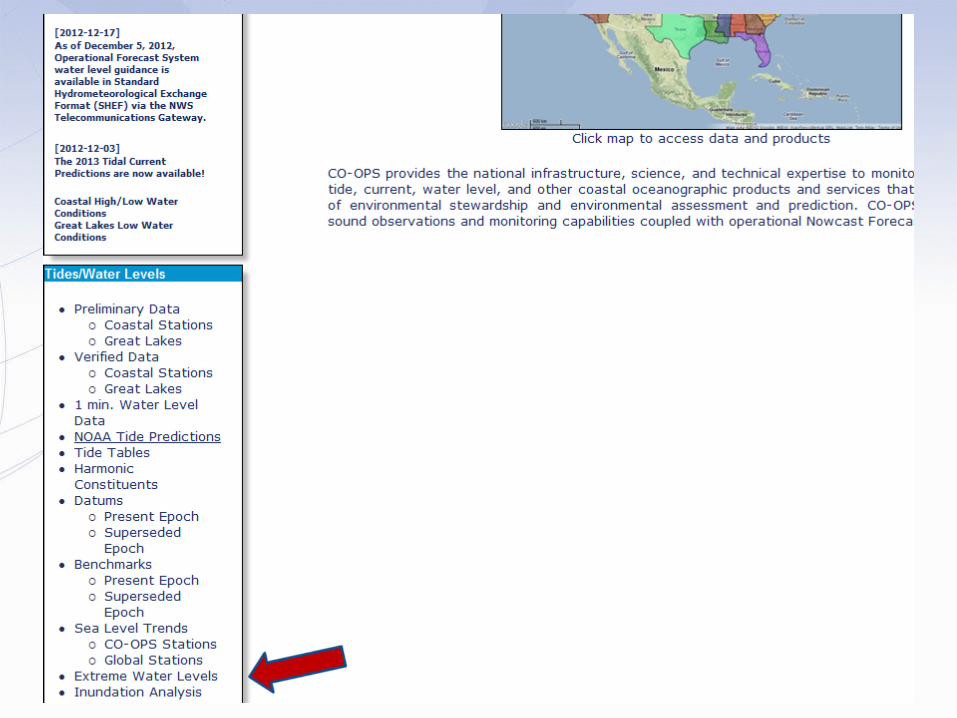
tidesandcurrents.noaa.gov
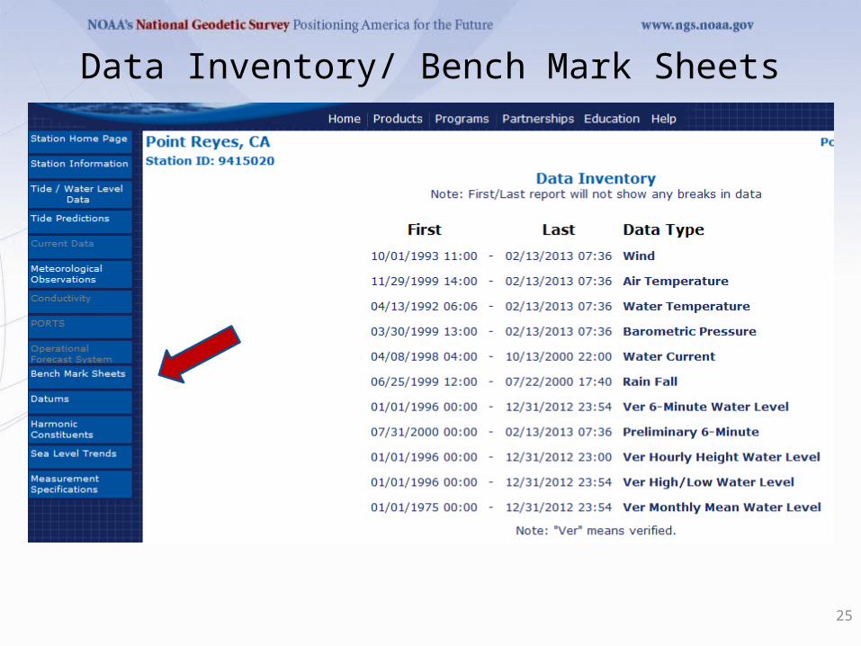
Data Inventory/ Bench Mark Sheets
25
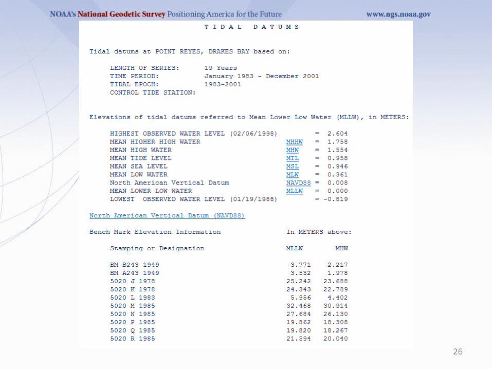
26
27
28
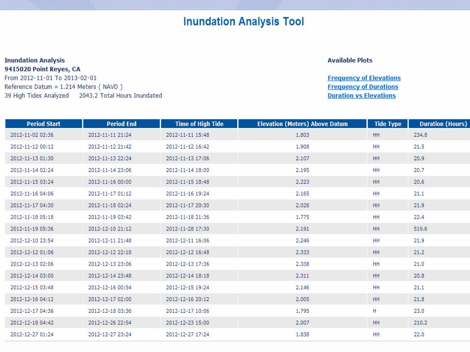
29
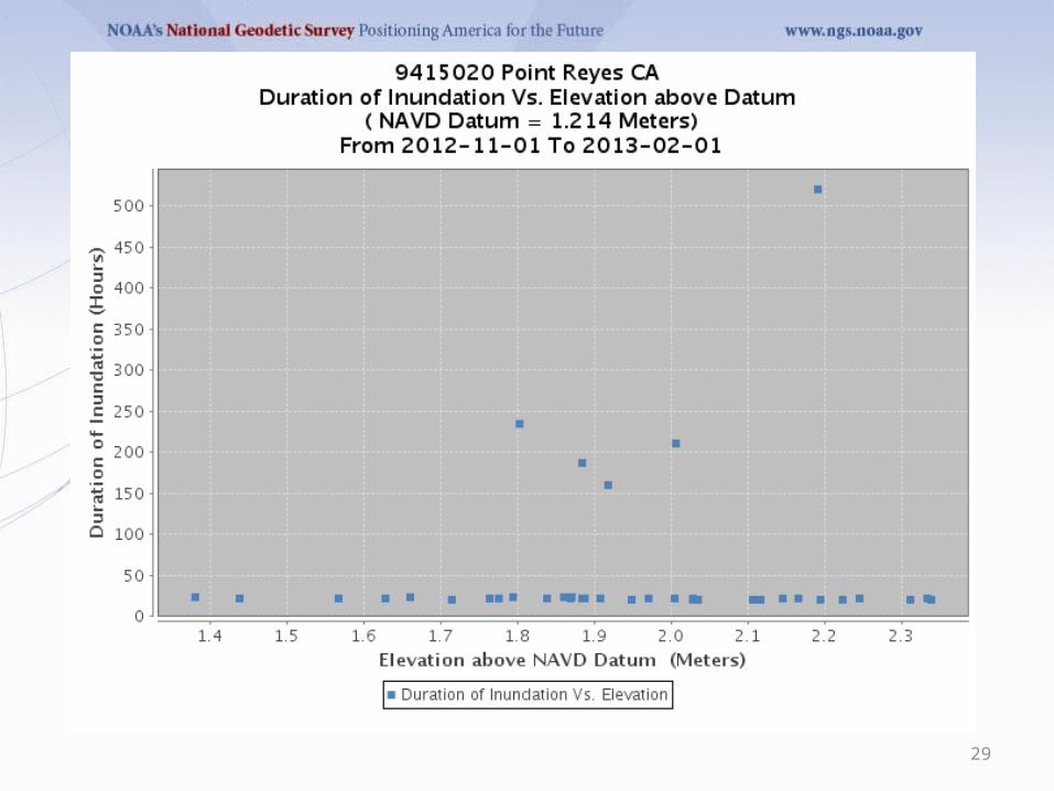
30
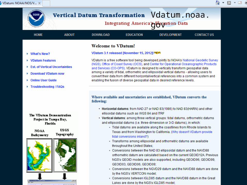
Vdatum.noaa.gov
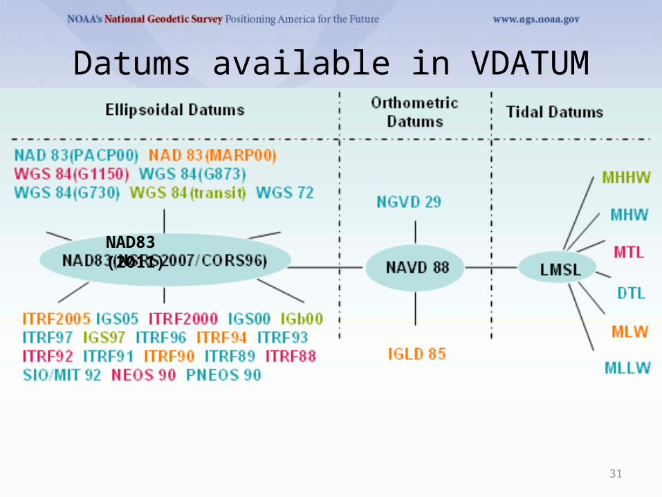
Datums available in VDATUM
31
NAD83 (2011)
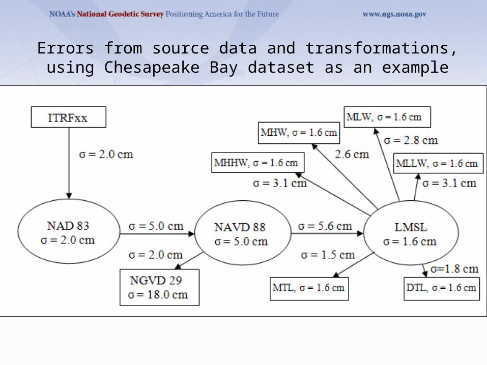
Errors from source data and transformations, using Chesapeake Bay dataset as an example
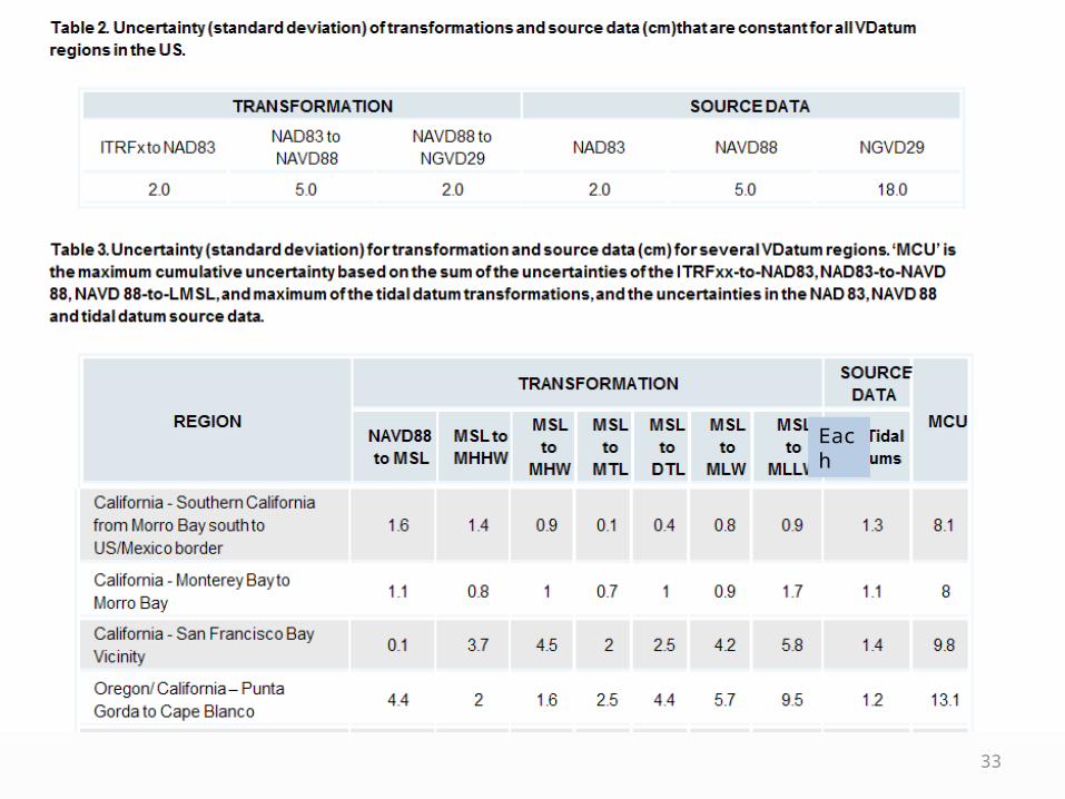
33
Each
34
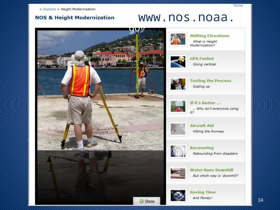
www.nos.noaa.govwww.nos.noaa.gov
35
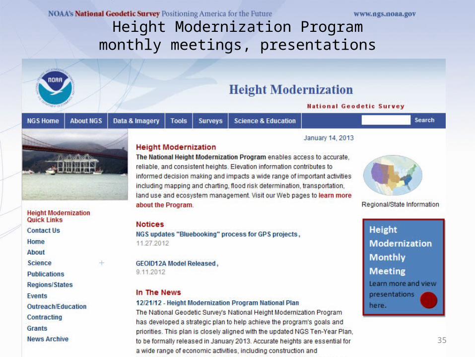
Height Modernization Programmonthly meetings, presentations
36
37
38
The Changing Face of the Geodetic Advisor Program
Provide equal service to non-coop statesREGIONALIZATION15 advisors total for 50 states, PR, Pacific islandsRegions being discussed in NGS Advisory [email protected] is Chair (SAB Chief)Proposal includes “State Coordinator” as POCTransition in next 4 years, with attrition due to
retirements

39