Embed Size (px)
Citation preview

USGIF.ORG TRAJECTORY 1
2018 ISSUE 2
> The YPG Story > NGA’s Sue Kalweit on Workforce Innovation > Army GEOINT
THE OFFICIAL MAGAZINE OF THE UNITED STATES GEOSPATIAL INTELLIGENCE FOUNDATION
Though DNI Dan Coats and PDDNI Sue Gordon come
from different backgrounds (and rival college basketball
states), they have teamed up to lead the IC with a shared
strategy for the future
Full CourtPress
We’re four companies at the intersection of what’s
new and what’s possible. We do what no other single
company can by delivering integrated solutions to solve
our customers’ most complex challenges. Together, we’re
accelerating innovation in the new space economy.
MAXAR.COM
OUR MISSIONS REVOLVE AROUND HUMANITY

2018 ISSUE 2
FEATURES
12 SEEING THE BIG PICTUREDNI Dan Coats and PDDNI Sue Gordon discuss their plans for the future of the IC, including cybersecurity, intelligence integration, AI, and sensemakingb y K r i s t i n Q u i n n
02 | VANTAGE POINTThere is an unprecedented level of intensity surrounding geospatial intelligence
04 | INTSIDERArmy GEOINT: a team sport; USGIF Organizational Members provide resources for college students; support for EdGEOcation
TRJ-
054
contents20 THE YPG STORYHow GEOINT’s next generation built a robust community of young professionals that has fostered countless careers and lifelong connectionsb y M e l a n i e D . G . K a p l a n
26 | MEMBERSHIP PULSEIBM, OpenText, USGIF Individual Member Charlie Devine
30 | HORIZONSReading List, Peer Intel, USGIF Events Calendar
32 | PERSPECTIVEA discussion of workforce innovation with NGA’s Sue Kalweit
TRAJECTORYMAGAZINE.COM
SMALL SATELLITESRead an extensive recap of USGIF’s March Small Satellite Workshop at NGA.
BONUS Q&ARead more from NGA’s Sue Kalweit on promoting a culture of risk-taking.
32
06
Cover photo of DNI Dan Coats and PDDNI Sue Gordon taken by Brian Murphy, ODNI Public Affairs.
Carmen Medina, founder of MedinAnalytics, a 32-year veteran of the CIA, and a USGIF board member, mentors young professionals in the YPG lounge at the USGIF booth during GEOINT 2017.
2 TRAJECTORYMAGAZINE.COM 2018 ISSUE 2
KEITH J. MASBACK | CEO, USGIF@geointer
A Thriving Community
vantagepoint
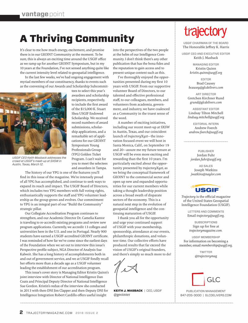
It’s clear to me how much energy, excitement, and promise there is in our GEOINT Community at the moment. To be sure, this is always an exciting time around the USGIF office as we ramp up for another GEOINT Symposium, but in my 10 years at the Foundation, I’ve not sensed anything quite like the current intensity level related to geospatial intelligence.
In the last few weeks, we’ve had ongoing engagement with myriad members of our constituency, thanks to events such as the convening of our Awards and Scholarship Subcommit-
tees to select this year’s awardees and scholarship recipients, respectively, to include the first award of the $15,000 K. Stuart Shea USGIF Endowed Scholarship. We received record numbers of award submissions, scholar-ship applications, and a remarkable set of appli-cations for our GEOINT Symposium Young Professionals Group (YPG) Golden Ticket Program. I can’t wait for you to meet the selectees and awardees in Tampa.
The history of our YPG is one of the features you’ll find in this issue of the magazine. We’re intensely proud of all YPG has accomplished, and continue to seek ways to expand its reach and impact. The USGIF Board of Directors, which includes two YPG members with full voting rights, enthusiastically supports the staff and YPG volunteer lead-ership as the group grows and evolves. Our commitment to YPG is an integral part of our “Build the Community” strategic pillar.
Our Collegiate Accreditation Program continues to strengthen, and our Academic Director Dr. Camelia Kantor is traveling to re-accredit existing programs and review new program applications. Currently, we accredit 13 colleges and universities here in the U.S. and one in Portugal. Nearly 900 students have earned a USGIF-accredited GEOINT certificate. I was reminded of how far we’ve come since the earliest days of the Foundation when we set out to interview this issue’s Perspective profile subject, NGA Director of Analysis Sue Kalweit. She has a long history of accomplishments both in and out of government service, and we at USGIF fondly recall her efforts more than a decade ago as a USGIF volunteer leading the establishment of our accreditation program.
This issue’s cover story is Managing Editor Kristin Quinn’s joint interview with Director of National Intelligence Dan Coats and Principal Deputy Director of National Intelligence Sue Gordon. Kristin’s redux of the interview she conducted in 2013 with then-DNI Jim Clapper and then-Deputy DNI for Intelligence Integration Robert Cardillo offers useful insight
USGIF CHAIRMAN OF THE BOARDThe Honorable Jeffrey K. Harris
USGIF CEO AND EXECUTIVE EDITORKeith J. Masback
MANAGING EDITORKristin Quinn
EDITORBrad Causey
ART DIRECTORGretchen Kirchner Rund
ASSISTANT EDITORLindsay Tilton Mitchell
EDITORIAL INTERNAndrew Foerch
PUBLISHERJordan Fuhr
AD SALES Joseph Watkins
Trajectory is the official magazine of the United States Geospatial
Intelligence Foundation (USGIF).
LETTERS AND COMMENTSEmail [email protected].
SUBSCRIPTIONSSign up for free at
trajectorymagazine.com.
USGIF MEMBERSHIPFor information on becoming a
member, email [email protected].
TWITTER@trajectorymag
PUBLICATION MANAGEMENT847-205-3000 | GLCDELIVERS.COM
into the perspectives of the two people at the helm of our Intelligence Com-munity. I don’t think there’s any other publication that has the bona fides and the reputation to gain access and to present unique content such as this.
I’ve thoroughly enjoyed the oppor-tunities presented during my first 10 years with USGIF. From our supportive volunteer Board of Directors, to our talented and effective professional staff, to our colleagues, members, and volunteers from academia, govern-ment, and industry, we have coalesced as a Community in the truest sense of the word.
A number of exciting initiatives, including our recent meet-up at SXSW in Austin, Texas, and our coincident launch of trajectoryXyzt—the inno-vation focused event we will host in Santa Monica, Calif., on September 19 and 20—assure me my future tenure at USGIF will be even more exciting and rewarding than the first 10 years. I’m particularly excited about the oppor-tunity presented by trajectoryXyzt, as we bring the conceptual framework of GEOINT to the commercial sector and open up new and expanded opportu-nities for our current members while taking a thought leadership position across a broad swath of disparate sectors of the economy. This is a natural next step in the evolution of geospatial intelligence and the con-tinuing maturation of USGIF.
I thank you all for the opportunity and urge your continued support of USGIF with your membership, sponsorship, attendance at our events, philanthropic donations, and volun-teer time. Our collective efforts have produced results that far exceed the vision of USGIF’s original founders, and there’s simply so much more to do!
USGIF CEO Keith Masback addresses the crowd at USGIF’s meet-up at SXSW in Austin, Texas, March 12.
C
M
Y
CM
MY
CY
CMY
K
tst_fullpage.pdf 1 3/12/18 8:39 AM

4 TRAJECTORYMAGAZINE.COM 2018 ISSUE 2
A variety of organizations provide geospatial intelligence to the U.S. Army, and attendees at USGIF’s GEOINTeraction Tuesday event Jan. 9 heard from the leaders of four of these offices and components.
In a presentation titled “Army GEOINT: A Team Sport”—held in Tysons, Va., and sponsored by Altamira—attendees learned about the different roles and interconnectedness of organizations within the Army GEOINT enterprise.
Speakers included Collin Agee, senior army operations advisor to the National Geospatial-Intelligence Agency (NGA) for the Army GEOINT Office; Col. Loren Traugutt, chief of the Army NGA Support Team; Lt. Col. Jacquelyn Barcomb, commander of the Army GEOINT Battalion (AGB); and Dr. Joseph Fontanella, director of the Army Geospatial Center (AGC).
Agee, who was initially invited to speak, said he realized it wouldn’t be possible to talk about Army GEOINT alone, and thus invited the others to join
Army GEOINT: A Team Sport
C O M M U N IT Y N EW S , E V E NTS , A N D E D U C ATI O N
USGIF NEWS GEOINT COMMUNITY NEWS EDUCATION APPLICATIONS
him. He described the Army’s “sobering” task to recently turn its attention more toward North Korea after about 16 years of a strong counterinsurgency mission.
“We read in the papers just about every day that [North Korea is] a growing nuclear threat. But they also have a very large standing army, which is dominated by artillery,” he said. Agee went on to mention the difficult mountainous terrain, the nearby massive urban areas south of the DMZ, locations of potential military targets, and various GEOINT products that could be used to monitor the North, maintain situational awareness, and respond if necessary.
Traugutt said his priorities for the year ahead are to continue to support the warfighter within Army Forces Command and all divisions as they deploy to Iraq, Afghanistan, and elsewhere in the world.
“I’m also looking at starting to expand to other Army units that aren’t just in CONUS,” Traugutt said, citing Hawaii, Korea, and Europe as areas of interest.
The Army is the only service that has an operational command located within NGA, and that’s AGB, according to Barcomb.
“GEOINT is underrepresented in the Army, and part of that is an educational process,” she said. “Most of the time, when you talk about GEOINT to command-ers and other Army folks, they think, ‘Okay, GEOINT, that means you can make me a map or you can get me a picture, right?’ [We educate] that we don’t want them asking their GEOINT folks to give them products, we want them to use their GEOINT folks to solve problems.”
The Army geospatial enterprise and the need for a common understanding of the battle space is AGC’s coordinating principle, according to Fontanella.
“We bring all this capability—people, technology, processes, governance—and deliver what we call a standard and shareable geospatial foundation,” he said. “That means we’re all operating off of the same data. The same elevation data, imagery, topographic feature data—everybody, in every place.”
^ Army GEOINT leaders gather for a photo with leaders from GEOINTeraction Tuesday host Altamira in January.
GEOINTeraction

YPG is 2,250 strong, representing 700 employers, with two young professionals serving as voting members of USGIF’s Board of Directors. — THE YPG STORY, PAGE 20
SOFTWARE
Organizational Members Provide Resources for College Students
Two USGIF Organizational Members recently approached USGIF and created memorandums of understanding (MOUs) to offer software licenses and support for the 14 colleges and universities accredited by the Foundation. These partnerships with industry are designed to benefit students, professors, and scientists alike.
Hexagon Geospatial will provide students and faculty at each of USGIF’s 14 accredited programs with three-year licenses for its desktop and cloud-based Smart M.App soft-ware. Smart M.apps are interactive map applications that combine content, analytics, workflow, and presentation to solve a specific business problem.
A recent agreement with the DigitalGlobe Foundation allows students and faculty at USGIF-accredited schools to gain access to DigitalGlobe’s imagery archive and platforms to include DigitalGlobe Cloud Services.
USGIF’s Collegiate Accreditation Program verifies colleges and universities are teaching students the necessary knowledge and skills to enter the professional GEOINT workforce. Students receive an academic GEOINT certificate to complement their degree upon completion of the program requirements.
USGIF NEWS GEOINT COMMUNITY NEWS EDUCATION APPLICATIONS
OUTREACH
USGIF Receives Loudoun County Partners in Education AwardLoudoun County Public Schools in Virginia selected USGIF as a “Partners in Education” award recipient for the Foundation’s work with students at Moorefield Station Elementary School in Ashburn.
USGIF partnered with Moorefield Station in 2016 through the Loudoun School Business Partnership. Under the program, USGIF promotes GEOINT among students using activities that encourage skills in geography, spatial thinking, and critical thinking, while integrating the skills into the school’s curriculum. USGIF has led a variety of educational and interactive initiatives that have reached approximately 450 students at Moorefield Station, teaching them about GEOINT and its applications in the world.
“USGIF is thrilled to receive this recognition for our K-12 outreach,” said Lindsay Mitchell, USGIF’s lead educational manager. “Moorefield was the first school we worked with to offer quarterly GEOINT activities, and it’s been incredibly rewarding to see the students get excited about GEOINT and the different career opportunities the field offers.”
USGIF NEWS
USGIF Partners with T-REXEarlier this year, USGIF signed an MOU with T-REX, a St. Louis-based coworking space and technology incubator. As part of the agreement, both organizations will co-develop opportunities to support the growth of the geospatial community in the St. Louis region. One of these goals is to further support USGIF’s St. Louis Area Working Group, which was founded in 2017 to help build and grow a geospa-tial pipeline in the St. Louis area to fill future jobs in government, industry, and academia. In addition, T-REX is now a USGIF Organi-zational Member, and USGIF has the ability to use meeting and event space at the T-REX location.
USGIF hosted a Technology Cluster Forum at T-REX in October as part of the Foundation’s two-day Tech Showcase West event. USGIF and T-REX recently expanded their partnership through an MOU.

6 TRAJECTORYMAGAZINE.COM 2018 ISSUE 2
MUSEUMS
USGIF Teams with International Spy MuseumUSGIF and the International Spy Museum in Washing-ton, D.C., recently signed an MOU to work more closely together on events and membership. The two organiza-tions have collaborated previously through the museum’s annual Spy Fest in January. Spy Fest is a family event at which attendees learn about espionage through spy- related activities. At the annual event, USGIF provides a
build-your-own-satellite station, where children create their own satellite proto-types using common household products. USGIF Young Professionals Group (YPG) volunteers also teach families imagery analysis, showing before and after satellite imagery from natural disasters.
In March, the Spy Museum hosted a workshop titled “When Space, Time, and Location Are Critical: A GEOINT Mission,” presented by USGIF CEO Keith Masback. This workshop was targeted toward adults interested in GEOINT. Participants learned basic techniques such as extracting infor-mation from satellite images and using real-world problems and data to complete a national security mission.
Above: Children learned about satellites and built their own models when visiting USGIF at the International Spy Museum’s annual Spy Fest event in January. Below: Participants learned how to extract information from images during an interactive presentation USGIF gave at the International Spy Museum in March.
Satellite ARAGI’s Satellite AR app uses augmented reality to show users the satellites orbiting thousands of miles overhead. Point your smartphone camera toward the sky and the app searches its catalog for nearby satellites, using yellow icons to mark their locations relative to your surroundings. Click an icon to receive data and tracking information about that spacecraft. Users can apply filters to limit the types of satellites that appear on the display in order to pinpoint specific constellations.play.google.com/store/apps/details?id=com.agi.android.augmentedreality
Flyover CountryThis data discovery app funded by the National Science Foundation is a must-have for travelers. The app compiles geologic maps, offline base maps, geo-referenced Wikipe-dia articles, and fossil records for users wanting to learn more about the landscape fea-tures of a flight path, road trip, or hike. Set the parameters of your journey beforehand
and save the associated data on your device for offline use.fc.umn.edu
Relay Relay simplifies custom map creation. Users drop colored and numbered pins on one central map to signify differ-ent locations of interest; red could be a new restaurant, green a museum of science. The app is particularly useful for travelers, who can create new layers for cities they’ve visited or want to visit in the future. Relay also offers direc-tions in a similar format as traditional transit apps.relaymaps.com
PROCRASTINATION TOOLS

ANALYTICS
TURN DATA INTO ADECISIVE ADVANTAGE.
@Raytheon
Raytheon
Raytheon.com/analytics
DECISIVE ADVANTAGE.
@Raytheon
Raytheon.com/analytics
Activity-Based Intelligence. Persistent Analytics. Object-Based Production. More than capabilities, together these represent
a critical advantage – to spot patterns in data, extract insights, enhance the value of global Multi-INT, and power decisive action.
© 2018 Raytheon Company. All rights reserved.
18IIS687_Raytheon_DataAnlytcs.indd 1 2/28/18 3:44 PM

8 TRAJECTORYMAGAZINE.COM 2018 ISSUE 2
FUNDRAISING
Support for EdGEOcationUSGIF raised more than $8,100 during a sea-sonal giving campaign for its EdGEOcation Giving Fund. The campaign ran from October to January, and all funds raised go toward the Foundation’s K-12 educational program-ming and outreach.
Throughout the campaign, USGIF attended six CFC charity fairs at government agencies including the Defense Information Systems Agency, the Defense Intelligence Agency, the Department of Commerce, NGA, the National Guard Bureau, and the U.S. Navy.
In 2017, USGIF raised $15,774 in dona-tions for its EdGEOCation Giving Fund. USGIF would like to thank its individual members, organizational members, and the community for contributing to GEOINT education for K-12 students.
USGIF staff members Lindsay Mitchell (left) and Shameka Jordan attended CFC charity fairs during the 2017 giving season to promote USGIF’s educational initiatives.
ACCREDITATION
JMU and Air Force Academy Renew Academic Accreditation
USGIF’s Dr. Camelia Kantor presents the U.S. Air Force Academy’s certificate of re-accreditation to Dean of Faculty Brig. Gen. Andrew P. Armacost.
USGIF’s Director of Academic Programs Dr. Camelia Kantor (center) visited James Madison University to award its certificate of re-accreditation.
In February, USGIF renewed academic accreditation for the U.S. Air Force Academy (USAFA) and James Madison University (JMU).
The schools are among the 14 academic insti-tutions accredited under USGIF’s Collegiate Accreditation Program. Through this program, the Foundation awards colleges and universities the
ability to offer students GEOINT certificates accompanying a college degree.
JMU earned accreditation in 2016 and offers the USGIF GEOINT certificate to on-campus undergraduate students in the school’s department of integrated science and technology. USAFA became USGIF-accredited in 2010 and offers the certificate to cadets majoring in geospatial science.

©2018 Hexagon US Federal, Inc. All rights reserved.
Transforming Data to DriveIntelligent DecisionsHexagon provides powerful solutions for solving complex geospatial problems. As the world's largest geospatial company, we design, build, and operate space-based, airborne, and terrestrial remote sensing instruments for collecting data. We provide a complete range of solutions for transforming your data to meet all of your geospatial workflow needs.
Stop by Hexagon booth #937 at GEOINT 2018 to better understand how intelligence from accurate, real time data will help overcome your defense and intelligence challenges.
Don't forget to play the Global Espionage Challenge and compete to win the 2018 Hexagon Epic Spy Catcher award!
Hexagon Q2 Ad.indd 1 2/26/2018 9:28:36 AM

UN
IVERSAL GEOIN
T
CE
RTIFICATION PROG
RA
M
Three exams and three certifications tailored to your career needs.
• GIS and Analysis Tools (CGP-G)
• Remote Sensing and Imagery Analysis (CGP-R)
• Geospatial Data Management (CGP-D)
Earn all three certifications and become eligible to be a Universal GEOINT Professional (UGP).
The Universal GEOINT Certification Program is accredited by the National Commission for Certifying Agencies (NCCA), under the Institute for Credentialing Excellence (ICE).
Take Your GEOINT Career a Step Further With the Universal GEOINT Certification Program
usgif.org
• USGIF will offer instructor-led training courses and self-study guides to prepare you for success with each of the exams.
• Updates to the GEOINT Essential Body of Knowledge (EBK) will provide more detail on each of the four competency areas.
BE
ON
TH
EL
OO
KO
UT

South Lakes High School students present their science projects to USGIF staff.
STEM
USGIF K-12 Educational ActivitiesIn January, USGIF collaborated with Moorefield Station Elementary School in Ashburn, Va., to offer an introduction to GPS for third grade classes. USGIF presented an overview of GPS, and students then completed an outdoor scavenger hunt using GPS units.
In February, USGIF staff and volunteers presented at nine geospatial science classes at high schools in Loudoun County. Students viewed USGIF’s “Intro to GEOINT” presentation and learned about career opportunities using geospatial skills. More than 180 11th- and 12th-grade students attended.
In March, USGIF and its Young Professionals Group (YPG) provided judges for the South Lakes High School Science Fair as well as Fairfax County and Loudoun County’s Regional Science and Engineering Fairs. USGIF presented a total of $1,100 in prizes to winning students.
USGIF also visited fourth grade classes at Seldens Landing Elementary School to speak about maps in preparation for a project the class is conducting with the Loudoun Freedom Center to locate and map unmarked slave graves near construction zones in Leesburg, Va.
SCHOLARSHIPS
USGIF Offers New $10,000 Scholarship in Partnership with RGi Reinventing Geospatial Inc. (RGi) has pledged $10,000 for each of the next three years to support the USGIF Scholarship Program. The new $10,000 RGi Scholarship for Geospatial and Engineering will be awarded to an undergraduate student who demonstrates financial need and is interested in or study-ing both the engineering and geospatial disciplines. The first recipient of this scholarship will be announced later this year. Scholarship program applications were due at the end of February, and recipients will be announced in the summer prior to the begin-ning of the school year.
12 TRAJECTORYMAGAZINE.COM 2018 ISSUE 2
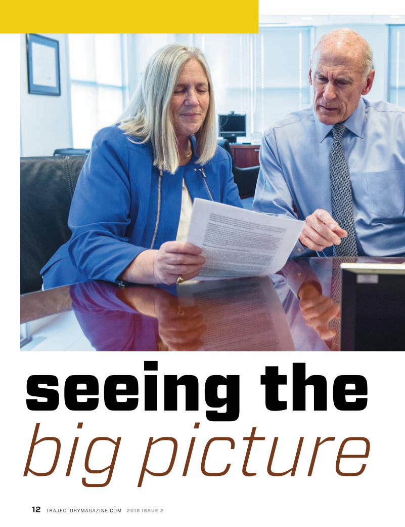
seeing thebig picture

Though DNI Dan Coats and PDDNI Sue Gordon come from different backgrounds
(and rival college basketball states), they have teamed up to lead the IC with a
shared strategy for the future
BY KRISTIN QUINN
USGIF.ORG TRAJECTORY 13
IN MARCH 2017, Dan Coats was sworn in as the fifth Director of National Intelligence (DNI), and Sue Gordon
followed in August 2017 as the principal deputy DNI (PDDNI). A self-described Intelligence Community (IC) outsider, Coats brings a varied background in military service, law, Congressional leadership, and diplomacy to the office. From 1981 to 1999, Coats served in the House of Representatives and then in the U.S. Senate. During his time in Congress, he served on the Senate Armed Services Committee and House Permanent Select Committee on Intelligence. In 2001, Coats was named Ambassador to Germany, arriving in the country just three days before 9/11. He returned to the Senate in 2011 and served on the Senate Select Committee on Intelligence before retiring from the Senate in 2017. >>
PHO
TO B
Y B
RIA
N M
UR
PHY,
OD
NI P
UB
LIC
AFF
AIR
S
DNI Dan Coats and PDDNI Sue Gordon review documents in the DNI’s office at Liberty Crossing in McLean, Va., March 7.

Gordon, a career intelligence pro-fessional, spent 27 years with the CIA, rising to senior executive positions in each of the agency’s four director-ates. While at the CIA, she also drove the formation of In-Q-Tel, a private, nonprofit organization with the pri-mary purpose of delivering innovative technology for the IC. Gordon served as the deputy director of the National Geospatial-Intelligence Agency (NGA) from 2015 to 2017. In this role, she championed agile governance, recruitment and retention of a diverse workforce, and expansion of GEOINT services to the open marketplace.
In February, Coats and Gordon participated in a joint interview with trajectory, sharing their thoughts on the IC’s pressing challenges, achievements in intelligence integration, the value of GEOINT, and more.
Q How would you describe your shared vision for the future of the IC?Coats: Sue and I both love sports. She comes from a basketball crazy state, North Carolina. I come from a bas-ketball crazy state, Indiana. We hate each other’s teams, but we have that in common. That love for the game and friendly competition makes for a dynamic duo. As you know, I come from outside—from political channels, not from intelligence channels. She
knows the inner-workings of our 16 intelligence agencies plus the ODNI. She brings a wealth of talent as well as the inside knowledge and skills needed to run a functioning organization.
I bring the ability to work with Congress given all my years there with both the House and the Senate, and in the executive branch as a former ambassador. Those years give me a perspective complementary to Sue’s. We have high regard for this community, what it does, and all it can do. We also have a true understanding of the threats of the future as well as current threats, and the vision to prepare the IC to be the best in the world, providing our policymak-ers with the very best integrated intelligence from all of our agencies and partners.
Gordon: As the director just mentioned, the most known and immediate responsibility we have is continu-ing to advance intelligence integration. We work in three domains: to execute against our current mission; to ensure we are replacing capabilities that are lost (either to time or adversaries); and to anticipate how to address emerging threats or how to take advantage of what’s being developed technologically. As you look to the future, the role of tech-nology pervades every aspect of our craft. One of the things the director and I both focus on is how we’re going to ensure technology can be rapidly introduced into our community to change how we provide advantage. To sum up our shared vision: It’s one of an enterprise community, increasing agil-ity, and it demands we maintain the trust of both the IC and the American people.
Q What are some of the IC’s most pressing challenges?Coats: We are facing the most diverse set of threats world-wide that we’ve seen in a long time, maybe ever. The kind of conflicts taking place around the world and the threats to our interests are multiple. We have to be on top of our game.
The threat of North Korea and weapons of mass destruction around the world pose a significant risk to the American people. There are other conflicts and efforts directed toward Americans either living abroad or here in the homeland from various terrorists groups. We also see a lot of unsettled issues in different parts of the world where the U.S. is being looked to as an honest broker. And, as I go forward detailing the annual Worldwide Threat Assessment to Congress and the American public next week, right near the top—if not at the top—of the list is cyber.
Gordon: It is hard to imagine a more pressing threat than cyber because every aspect of our adversaries’ national intent is going to go through this digital domain, and it allows reach, access, scale, and interaction in ways we are just learning to understand. For me, as someone who has been in the cyber game a long time, what is most obvious is the rate of advance of our adversaries’ capabilities.
It feels like just a minute ago that when we talked about our adversaries in this
DNI Dan Coats delivers the Intelligence Community’s annual Worldwide Threat Assessment to the Senate Armed Services Committee in Washington, D.C., March 6.
14 TRAJECTORYMAGAZINE.COM 2018 ISSUE 2
PHO
TO B
Y B
RIA
N M
UR
PHY,
OD
NI P
UB
LIC
AFF
AIR
S

space, we were talking primarily about Russia, China, and maybe Iran, and that they were doing somewhat com-plex things but mostly denial of service activities. Now, you see a whole range of cyber actors doing much more in-depth activity, not only denial but theft and manipulation of data. The other thing about cyber is it doesn’t just go govern-ment to government. Our private sector is affected by these actions, and they are a part of national security.
We have other pressing challenges in addition to cyber. No. 1 is acquiring the right talent to meet these future needs, particularly those in technology and data. Also, really focus-ing on speed to innovation. We are innovative people, but getting that innovation to scale and the way we do things is a challenge, and we aren’t alone in that. Another is augmenting intelligence through the use of machines. Everyone is talking about artificial intelligence (AI). I like to focus on the outcome we need to achieve, which is how we augment traditional intelligence through the use of these emerging capabilities.
Q With regard to cyber, what are your thoughts on the “cyber-location nexus”—or the intersection of the virtual and physical worlds? Gordon: I love that term. One of the lessons I learned at NGA is that everything is somewhere. For too long we thought of cyber as something that exists out there in the ether that didn’t actually resolve to a location. Location is a really good contextual framework to understand what is happening,
particularly when we get to the point where we can see large sets of activity. Location also turns out to be important when you want to respond to cyber threats. When we want to evolve our understanding of both the larger interactions, but also the association of an activity to an actor, location is absolutely crucial to being able to make those moves.
Q You mentioned integration as a pressing responsibility of the ODNI. How would you describe the IC’s progress toward achieving intelligence integration? Coats: Integration is absolutely the essential task of ODNI. What we’ve learned the hard way is that if it’s not shared among us, we don’t see the
TRUSTED SOLUTIONS FOR THE GEOINT COMMUNITY
Riverside Research has 50 years of experience providing
research and development, technical and scienti� c expertise,
and management oversight to achieve trusted, mission-focused
solutions. Our open innovation R&D model encourages internal
and external collaboration, advancing science and innovation
in: arti� cial intelligence/machine learning, radar, hyperspectral,
plasma physics, and modeling & simulation.
VISIT US AT GEOINT BOOTH #1138
“ We have a true understanding of the threats of the future as well as current threats, and the vision to prepare the IC to be the best in the world, providing our policymakers with the very best integrated intelligence from all of our agencies and partners.” —DAN COATS, DIRECTOR OF NATIONAL INTELLIGENCE

16 TRAJECTORYMAGAZINE.COM 2018 ISSUE 2
full picture and we may have some gaps that could’ve prevented some wrongdoings. We’ve made light years of progress since 9/11 and the forma-tion of ODNI for that specific purpose. What we see now is our agencies welcome the value of integration and how it is necessary to fully understand threats and give the information to policymakers to address how we respond to those threats. It’s constantly evolving as technology changes. We just have to stay ahead of the game.
Gordon: I’ll pick up on integration through the lens of the Intelligence Community Information Technol-ogy Enterprise (IC ITE). It seems like yesterday, but it was about seven years ago when the community really came to this notion that if we weren’t able to connect on an infrastructure basis we would not be able to achieve the data reach, the human integration, or quite frankly, the security needed in order to be able to integrate at speed and at volume. Seven years later, the ideals of IC ITE are no less relevant than they were on the day we started. What’s exciting about it is we’re coming to the point where we don’t have to talk about IC ITE as a thing as much as it is a foun-dation that allows us to do things.
There are many things we can do now that are evidence of the achievement of the IC ITE vision and are underpinned by technological advances. We are much better positioned now for future threats than we have ever been. We can do things in terms of cyber notifications that we never could before. When we see threats we can immediately push information out to people who need to act on it. We are able to push insightful, timely, accurate infor-mation all the way down range to the field, and we are able to quickly harness big data because we can bring online the computa-tional power that is in the cloud.
We are better able to work across agency lines. We have large, secure multi-INT data sets that we can act on simultaneously. We can stand up communities of interest that allow for data to be worked on together, and we can do that in hours, not days. We can deliver speed to mission that we never could before. The ability to grant anyone across the 17 agencies who has need-to-know access to data—we can do that in hours as opposed to the one to seven days it used to take us. We have a better intelli-gence picture than we’ve ever had before, and that is mostly represented by what we are able to allow our Defense Department
colleagues to access down range by compiling information from disparate sources.
Particularly in the last year, we also are making moves to take the solid foundation that we built technically and now take advantage of some of the new advances in technology. In those seven years the private sector was doing some wonderful things, and we’re working to make sure we have an architecture that can constantly introduce those new capabilities. So if the vision was intelligence integration, and an element was IC ITE because you needed an infrastructure to allow that, I can happily say we aren’t still simply building an infrastructure—we’re now using it in order to actually achieve the intent. It doesn’t mean we don’t have places to go still.
Q This question is for DNI Coats: How has your varied background shaped your outlook as Director of National Intelligence?Coats: It has given me the opportunity to learn good lessons. The years of experience I’ve had in these different cultures helped me see how we as a government need to work together to deal with security threats. It involves all three branches of government, and I’ve had some experience in each branch that helps me see a fuller picture of how we need to integrate our three branches so we are on the same page and working together to achieve our goals. I’m grateful for those opportunities and the lessons I’ve learned through experience, and hopefully I can bring that to ODNI.
Gordon: Director Coats’ ability to see the field—in keeping with sports analogies—surpasses mine and most of the IC’s because we’re players; we’ve got our nose down in the trenches, so confident of our intent, so dedicated to
Sue Gordon, then deputy director of NGA, hosted an acquisition report card session on the Government Pavilion Stage in the GEOINT 2016 exhibit hall.

MASTER OF SCIENCE IN
GEOSPATIALINTELLIGENCEThe JHU program leading to the Master of Science in Geospatial Intelligence provides the concepts, models, experience, and learning to enable its graduates to lead and shape this emerging discipline.
1717 MASSACHUSETTS AVE. NW, SUITE 101WASHINGTON, DC 20036 1.800.847.3330 | 202.452.1940
LEARN MORE AND APPLY AT:ADVANCED.JHU.EDU/GEOSPATIALINTELLIGENCE
our mission that sometimes we think in just relaying that mission the value will be apparent to everyone else.
What I’ve seen in the short time the director has been in this job, through some pretty specific challenges we’ve faced, are three benefits. No. 1, he is clear-eyed about how things work and how you get things done. And boy, when there is something important to be relayed to the policymaker, to be effected through Congress, or to be communicated to the whole community, every bit of the experience he referred to comes into play in tangible ways. The second is sometimes you have to act differently to get the outcome you want instead of just beating people over the head with the story of what you’ve done. That experience, particularly on the Hill, allows him to under-stand their value proposition in a manner that allows us to be most effective. The third thing is we already have tons of intelligence pros. The director doesn’t have to be the subject matter expert, but understanding where we need to go and communicating that clearly so we move together is a remarkable skill set. We are a good team, but don’t be con-fused about his ability to see the field and to quarterback.
Q PDDNI Gordon, this question is for you: What did you learn during your experience at NGA that you are carrying forward in your IC career? Gordon: My time at NGA was just such a gift. I had a varied career at the CIA, but there are many things I will carry with me from NGA in terms of how we innovate. What geospatial infor-mation brings to the table is not just the content it has but also the context—how do you put issues in great, obvious relief?
Also, combat support is a very particular type of intelligence that is slightly different from national strategic intelligence and a lot more tactile. Making sure the whole intelli-gence apparatus has that sense to it is something I learned at NGA. You have to get data all the way to the edge and make sure the users in the field can do something with the intelligence.
The other thing I learned at NGA is just how urgent our need is to be able to handle data with machines because we’re just being overwhelmed by it.
“ We are much better positioned now for future threats than we have ever been. We can do things in terms of cyber notifications that we never could before.” —SUE GORDON, PRINCIPAL DEPUTY DIRECTOR OF NATIONAL INTELLIGENCE

NGA and Director Cardillo were on the forefront of thinking about that future. Agile acquisition is just about how we get faster, and the biggest step we made there was having a clear view of what needed to be done and that’s something I drive here at ODNI. And also various mechanisms of how we engage the private sector, from challenge questions to how you set up secure enclaves so you can work
quickly, are all pieces NGA had a head start on.
The other things I’ll carry forward from NGA are the notion of public- private partnerships. Geospatial data is so universally useful that NGA really pushed the envelope of making those data sets publicly available, and I expect that is something we will try and both help NGA further and look at the whole notion of how the govern-ment helps the private sector for the purpose of societal gain.
The last piece from NGA is how to effectively communicate your mission to a broad set of stakeholders so they can know how to use what you have. The relatively new intel.gov—a pretty revolutionary website which is a manner for us to communicate to the American people—is a furtherance of the same ideals started at NGA.
Everything I do from this point forward will be affected by what I learned there. Combat support data to the edge, making available publicly what is publicly useful, and being quicker about how we introduce new technical capabilities so we can deal with massive amounts of data are all initia-tives I will advance from this position.
Q What are your perspectives on the significance of emerging intelligent technology? Coats: It is clear given the collection capabilities we have now, including social media and all the data available for examination, that analysis is becoming overwhelming. We simply don’t have the human capacity to analyze all that col-lection in an efficient and agile way. Machine learning and AI are going to play a critical role in our ability to put the bigger picture together more quickly. That does not mean machines are going to replace humans. Human judgment will always be essential to determine what we do with that information. What AI does provide is a better look at what we’re facing, and an ability to discard the nonessential in an efficient way and sort out the essential that needs to be looked at from a human perspective. AI shouldn’t be oversold as something that is going to replace the role of the individual who can evaluate information and judge it on the basis of not only what the machine tells you but their years of personal experience.
Gordon: There is a lot of work going on in machine learning and the beginnings of AI that is available in the private sector. We need to get that into the IC as fast as we can. It tends to be single domain, which is, “How can I look at numbers or images fast so I don’t have to have humans looking at them?” For example, looking at license plates as you’re driving through tollbooths—those sorts of things are available to us.
What’s different about the intelligence domain is we don’t need to just process language, speech, or images. We actually need to be able to work across those domains, and that isn’t something the commercial sector is working on right now even though they have the piece parts.
The IC will also need sensemaking in terms of how we take something that is undifferentiated—large data sets from disparate sources—and put it together. That’s a place we would love to get to and probably an area where the government could do some investment and research. There are phases we need to address, but you can imagine a future where if our job is to use information so we can know the truth, see beyond the horizon, and help our partners be able to act before events dictate, we’re going to need not only serious information processing but sensemaking to help us do so.
Q What would you like to share with the GEOINT Community, specifically? Gordon: The history of data we have both in foundational GEOINT and on the imagery side will be exceptionally important not only to be able to share today, but as the groundwork for some of these more automated processes. As we talk about intelligence integration, we almost never go into a meeting without a GEOINT product. GEOINT or geospatial information has a role to play in every priority we have and every technology we need to pursue. It is founda-tional to what we as a community need to pursue.
18 TRAJECTORYMAGAZINE.COM 2018 ISSUE 2
“ So if the vision was intelligence integration, and an element was IC ITE because you needed an infrastructure to allow that, I can happily say we aren’t still simply building an infrastructure—we’re now using it...”—SUE GORDON, PRINCIPAL DEPUTY DIRECTOR OF NATIONAL INTELLIGENCE
PHO
TO B
Y B
RIA
N M
UR
PHY,
OD
NI P
UB
LIC
AFF
AIR
S

RVcloud is the latest generation in our trusted line of geospatial analytic software. Designed with our substantial industry experience and developed using an agile model, users are able to interact with full-resolution, geo-referenced imagery within an easy-to-use web application. To see Textron Systems’ software in action, visit us at GEOINT 2018 booth #637.
REMOTEVIEWTM THROUGH THICK AND THINRVcloudTM
Textron Systems Geospatial Solutions is an operating unit of Textron Systems, a Textron Inc. (NYSE: TXT) company. © 2018 Overwatch Systems, Ltd. RVcloud and RemoteView are trademarks of Overwatch Systems, Ltd.
Geospatial Solutions21660 Ridgetop Circle Suite 110, Sterling, VA 20166 | 800.937.6881 | [email protected]

IN 2008, at a dinner following a USGIF Board of Directors meeting, then
GeoEye CEO Matt O’Connell asked everyone to share his or her first memory of the internet. Carrie Drake, who was attending the dinner, recalls how O’Connell started off by sharing a memory of a Sony meeting at which the “World Wide Web” was first discussed as a way to access this new phenomenon called the internet.
storythe ypg
20 TRAJECTORYMAGAZINE.COM 2018 ISSUE 2
BY MELANIE D.G. KAPLAN

USGIF.ORG TRAJECTORY 21
How GEOINT’s next generation built a robust community of
young professionals that has fostered countless careers and
lifelong connections
Robert Cardillo and Golden Ticket winners at the GEOINT 2017 Symposium
22 TRAJECTORYMAGAZINE.COM 2018 ISSUE 2
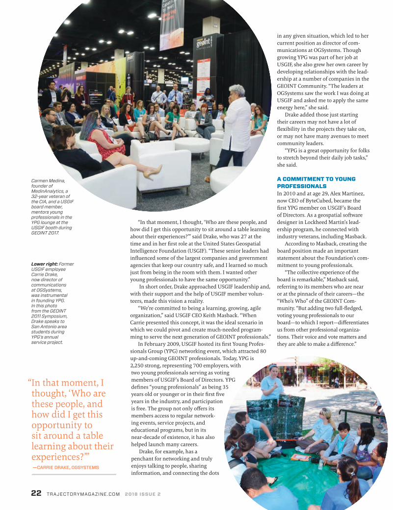
Carmen Medina, founder of MedinAnalytics, a 32-year veteran of the CIA, and a USGIF board member, mentors young professionals in the YPG lounge at the USGIF booth during GEOINT 2017.
Lower right: Former USGIF employee Carrie Drake, now director of communications at OGSystems, was instrumental in founding YPG. In this photo from the GEOINT 2011 Symposium, Drake speaks to San Antonio area students during YPG’s annual service project.
“ In that moment, I thought, ‘Who are these people, and how did I get this opportunity to sit around a table learning about their experiences?’” —CARRIE DRAKE, OGSYSTEMS
in any given situation, which led to her current position as director of com-munications at OGSystems. Though growing YPG was part of her job at USGIF, she also grew her own career by developing relationships with the lead-ership at a number of companies in the GEOINT Community. “The leaders at OGSystems saw the work I was doing at USGIF and asked me to apply the same energy here,” she said.
Drake added those just starting their careers may not have a lot of flexibility in the projects they take on, or may not have many avenues to meet community leaders.
“YPG is a great opportunity for folks to stretch beyond their daily job tasks,” she said.
A COMMITMENT TO YOUNG PROFESSIONALSIn 2010 and at age 29, Alex Martinez, now CEO of ByteCubed, became the first YPG member on USGIF’s Board of Directors. As a geospatial software designer in Lockheed Martin’s lead-ership program, he connected with industry veterans, including Masback.
According to Masback, creating the board position made an important statement about the Foundation’s com-mitment to young professionals.
“The collective experience of the board is remarkable,” Masback said, referring to its members who are near or at the pinnacle of their careers—the “Who’s Who” of the GEOINT Com-munity. “But adding two full-fledged, voting young professionals to our board—to which I report—differentiates us from other professional organiza-tions. Their voice and vote matters and they are able to make a difference.”
“In that moment, I thought, ‘Who are these people, and how did I get this opportunity to sit around a table learning about their experiences?’” said Drake, who was 27 at the time and in her first role at the United States Geospatial Intelligence Foundation (USGIF). “These senior leaders had influenced some of the largest companies and government agencies that keep our country safe, and I learned so much just from being in the room with them. I wanted other young professionals to have the same opportunity.”
In short order, Drake approached USGIF leadership and, with their support and the help of USGIF member volun-teers, made this vision a reality.
“We’re committed to being a learning, growing, agile organization,” said USGIF CEO Keith Masback. “When Carrie presented this concept, it was the ideal scenario in which we could pivot and create much-needed program-ming to serve the next generation of GEOINT professionals.”
In February 2009, USGIF hosted its first Young Profes-sionals Group (YPG) networking event, which attracted 80 up-and-coming GEOINT professionals. Today, YPG is 2,250 strong, representing 700 employers, with two young professionals serving as voting members of USGIF’s Board of Directors. YPG defines “young professionals” as being 35 years old or younger or in their first five years in the industry, and participation is free. The group not only offers its members access to regular network-ing events, service projects, and educational programs, but in its near-decade of existence, it has also helped launch many careers.
Drake, for example, has a penchant for networking and truly enjoys talking to people, sharing information, and connecting the dots

Gain relevant, career-boosting skills through Penn State World Campus. We have nearly 20 years of experience delivering respected online education to the geospatial industry and offer seven degree and certificate programs.
Join more than 6,000 geospatial professionals who have chosen Penn State for their education. Military and federal employees are eligible for tuition reductions.
Visit us at GEOINT 2018 booth 1712
worldcampus.psu.edu/geoint2018
18-WC-09
32/lm
f/sss
A world of possibilities. Online.
Become a trusted analyst by earning a Penn State geospatial degree online
Martinez dove into the position, lining up events that focused on education, career development, and service, from a speed dating-style mentoring program to a speaker series on emerging trends. Martinez also aimed to offer events that appealed to the entire community, not just his younger peers.
“We wanted the young profes-sionals contributing back to the community with their ideas,” Martinez said. In 2011, during the early days of mobile application development, he and Drake created “What’s in an App?”
Martinez moderated the panel, and discussion topics ranged from the defi-nition of an app to the promises and challenges of apps in the Intelligence Community. Among the panelists was Ahmad Ishaq, who had created a MySpace-like platform at the Defense Intelligence Agency. Martinez kept in touch with Ishaq, who later co-founded ByteCubed and asked Martinez to lead the team.
Now, at age 37, thanks in part to YPG, Martinez leads a company of about 150.
“Being part of [YPG] was an accel-erator in meeting great people and
building lasting friendships in the community,” Martinez said. “The relationships I built through USGIF and YPG have given me the opportunities to grow and make an impact in senior roles.”
BUILDING TRUST YPG represents the diversity of the GEOINT industry: Its members are cartogra-phers, analysts, systems engineers, mechanical engineers, data scientists, and emergency responders, to name a few. Yet for all their varied experiences, these early-career professionals form tight networks and friend-ships. Masback attributes this partly to the dynamics of working in defense and intelligence.
“Given the sacred responsibility and high stakes asso-ciated with national security, the trust has to be in place if you’re going to work with someone, and it has to be organ-ically grown,” Masback said. Such trust is cultivated over time, and a group like YPG sets the stage for that to occur.
Elizabeth Lyon, a former young professional govern-ment advisor to the USGIF Board, works at the National Geospatial-Intelligence Agency (NGA) and has spent her entire career as a federal employee. During her time with
“ Having a trusted relationship with my peers is huge. I can go to them with questions rather than struggling on my own.” —ELIZABETH LYON, NGA
Elizabeth Lyon, a former young professional government
advisor to the USGIF board and an NGA employee,
participated in a young professionals panel
during the GEOINT 2012 general session.

24 TRAJECTORYMAGAZINE.COM 2018 ISSUE 2
YPG, she developed an invaluable network of peers and seniors in the industry.
“Having a trusted relationship with my peers is huge,” Lyon said. “I can go to them with questions rather than strug-gling on my own.” She has sought advice from her peer network and her “tribe of mentors” on the timing of a job tran-sition, team dynamics, and leadership skills. She began her career as a research geographer at the U.S. Army Corps of Engineers, and prior to her current posi-tion as NGA’s senior GEOINT authority on geography and cartography, she was the special assistant to then NGA Deputy Director Sue Gordon.
Jennifer Stansall, who manages U.S. government partnerships at Planet, served on the USGIF Board during her time with YPG and counts some of its members as her closest friends. Stansall said she learned a lot during her involve-ment with YPG, even simple things such as speaking up—not always an easy task when you’re sitting in a board room full of senior industry leaders.
Drake said it has been rewarding to witness how far her YPG peers have gone in their careers. She remembers in 2014 when she saw YPG member Shay Har-Noy, founder of TomNod, on NBC’s TODAY talking about using the company’s crowdsourced intelligence to gather information about the disap-pearance of Malaysian Airlines Flight 370. Today, Har-Noy is vice president and general manager of platform for DigitalGlobe.
GROWING THE YPGUSGIF’s Young Professionals Working Group, which guides the YPG and plans activities, offers events that parallel the Foundation’s mission of advancing the GEOINT tradecraft. The group is co-chaired by Bill Pilotte and Isaac Zaworski, who also currently hold the two young professional positions on USGIF’s Board. YPG holds monthly meetings at USGIF headquarters, monthly networking events, and quar-terly educational workshops. Among the group’s annual events is the Golden Ticket program, which brings industry juniors to the GEOINT Symposium for free, and Spy Fest at the International Spy Museum, where YPG members talk to hundreds of children and their families about satellite imagery.
USGIF and YPG leaders contin-uously strive to expand the group’s reach. Justin Franz, USGIF’s community
WINNING A GOLDEN TICKETIn 2010, Bill Pilotte was fresh out of college, working as a geospatial analyst at what is today Wiser Imagery Services in Murfreesboro, Tenn. At age 23, when USGIF invited him to take part in its new Young
Professionals Golden Ticket pro-gram, which included free
access to the GEOINT Symposium, he packed
his bags and took a road trip to New Orleans.
At the Sym-posium, Pilotte networked like
crazy—especially with senior man-
agement within his company. He and oth-
ers in the Golden Ticket program also volunteered to map neighborhoods for ongoing rebuilding efforts following the devastation from Hurricane Katrina.
“That was the big kickoff to my career,” said Pilotte, who now represents young professionals on USGIF’s Board of Directors and co-chairs USGIF’s Young Professionals Working Group. “It changed the course of my work.”
Before long, Pilotte’s YPG connections led him to Washington, D.C., and his current position as direc-tor of business strategy for ISPA Technology.
ROUTE TO WINNINGEvery year, USGIF offers young professionals the opportunity to apply for complimentary regis-tration to its GEOINT Symposium. Golden Ticket participants also attend special events including a welcome breakfast, a private tour of the exhibit hall, networking and mentoring sessions, luncheons with government seniors, admission to the USGIF Chairman’s Reception—to which only about 150 of the approximately 4,000 Symposium attendees are invited—and more.
Golden Ticket winners began attending the USGIF Chairman’s Reception at the request of current USGIF Chairman The Honorable Jeffrey K. Harris.
“USGIF has as its principal tenet the imperative to grow the tradecraft,” Harris said. “As managers, we recognize investment in human capital must be a priority. As technologists, we are excited to embrace both the process disruption and the excitement of mission-enabling capabilities. Inviting Golden Ticket winners to the reception pro-vides an essential catalyst to empower the future of GEOINT.”
In 2017, 26 young professionals attended the Symposium in San Antonio and hosted a service project that involved leading local Boy Scouts in
a geocaching activity. Golden Ticket alumni not only network with each other during the Sym-posium, they also enjoy a special camaraderie with winners from other years, calling upon one another for job openings and hiring recommendations.
Jennifer Stansall, who manages U.S. government partnerships for Planet, was a Golden Ticket recipient in 2011. She had attended the Sympo-sium previously, working in the exhibit hall for her then employer DigitalGlobe, but hadn’t attended any general session program-ming until she participated in the event with YPG.
“It was an incredible opportu-nity for me to network and meet other young professionals in the industry,” she said. “I didn’t have that opportunity in Colorado, where I was living.” She recalled standing with a small group of young professionals at the USGIF Chairman’s Reception and talking to former Director of National Intelligence James Clapper. “I don’t think there were many words that came out of my mouth because I was in such awe.”
Carlos Jimenez, a contractor with Darkhorse Geospatial work-ing as an analyst the National Geospatial-Intelligence Agency (NGA) in St. Louis, was a Golden Ticket winner in 2016. He had been at a crossroads in his career, trying to determine whether to accept a U.S. Air Force promotion.
“Being able to rub elbows with heads of industry at [the Sympo-sium] changed my perspective,” Jimenez said. He talked to Sue Gordon, then deputy director of NGA, and heard how she and others took risks in their careers. Jimenez accumulated a two-inch stack of business cards, and put his networking skills to use after he left the military.
“I had multiple offers state-side and overseas,” he said. “My phone didn’t stop ringing for a month straight until I decided where I wanted to work.”
Participants in the GEOINT 2017 Young Professionals Golden Ticket Program network with program alumni.
AUTOMATE GEOINT WITH ANSIBLESystems, programs, networks, and clouds can be more efficient with automation. Learn how in “The automated enterprise” e-book.
Visit our Red Hat booth (#800) at GEOINT 2018 to LEARN MORE.
and educational manager, focuses heavily on recruiting new members, sometimes traveling to academic fairs, universities, and conferences.
“There’s some magic happening with YPG,” Masback said. “But I can’t explain why it hasn’t taken off in a way that’s representative of the breadth of USGIF engagement. My generation knows this type of networking is at the heart of professional relationships and success. It’s these ties that as you get more senior create business opportuni-ties and trust in a community in which trust is paramount. For these reasons we are steadily working to expand the reach of YPG.”
Zaworski, vice president of Vricon, said he feels “inherent ageism” in the industry. “People who are the most influential in the community are in a generation significantly older than I am,” he said. “I notice that the young professionals—or the YPG events—are thought of in a distinct way. They’re seen as the new kids in town.”
Zaworski encourages those who haven’t attended a YPG event to consider the content rather than the young professionals label.
“The events we’re organizing and promoting will provide opportunities
for both young professionals and senior members of the community to grow their networks,” he said. He added that events such as a machine learning panel the group hosted in 2016 are intended for professionals of all ages to learn and share ideas about some of the most exciting and cutting-edge issues facing the community.
According to Zaworski, the GEOINT Community isn’t benefited more by the older gen-eration or by those new to the industry. “[We need] both,” he said. “With the challenges that face the national security community today, we need this talent—and this collaboration—more than ever.”
Get Involved! To learn more about USGIF’s Young Professionals Group (YPG) visit usgif.org/community/YPG. To be added to the YPG distribution list and be the first to know about upcoming events and programming, email [email protected].
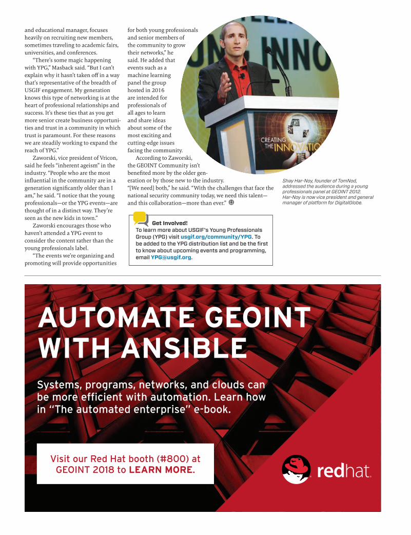
Shay Har-Noy, founder of TomNod, addressed the audience during a young professionals panel at GEOINT 2012. Har-Noy is now vice president and general manager of platform for DigitalGlobe.

26 TRAJECTORYMAGAZINE.COM 2018 ISSUE 2
Q What products and services does IBM U.S. Federal offer?
To quote the National Geospatial- Intelligence Agency (NGA) motto: “Know the Earth, Show the Way, Understand the World.” Our technology solutions and services are designed spe-cifically to help provide those insights. The geospatial world is a mash-up of structured and unstructured infor-mation. With video, human language, Internet of Things (IoT) sensors, cyberspace, and additional intelligence all trying to make sense of the space
around us, their interpretation of the data we receive influences
our interactions with everyday objects and people. IBM has a plethora of solutions, tools, and services that help us make
those interpretations, pre-dict with a high degree
of certainty what will happen next, and help model the vast unstruc-tured world.
IBM: Turning Unstructured into UnderstandingQ&A with Gabe Chang, federal CTO architect, IBM U.S. Federal and Industries
W H O W E A R Emembershippulse
Q What advice do you have for working effectively with
government customers?Know your client. Each promising technology in and of itself isn’t a pan-acea. Rather, we must understand the client’s mission, objectives, challenges, contributing factors, and definition of success before recommending a technological approach. It is important to remember that clients’ missions evolve and our recommendations and approaches should as well.
Q How has IBM evolved to keep pace with the explosion of
geospatial data throughout the last decade?We understand the nuances of big data. There are four Vs, the last of which is increasingly important: volume, variety, velocity, and veracity. You need to be certain your intelli-gence comes from a reliable source and the fidelity of the information at every part of your supply chain
is uncompromised. One technology, blockchain, fosters a new generation of transactional applications that estab-lishes this trust.
Also, the speed to decision-making is critical. The ability to process these vast data lakes is bogged down by the actual ingestion of data—the challenge is the myriad and unending number of sensors. Today, we have specific solutions to help with metadata cleansing, annotation, and curation before entering the system, and also to triage, classify, and create semantic understanding out of the unstructured information.
Q What emerging GEOINT trends are IBM most
excited about?Speed is king, and of great benefit whether you’re reacting to an event, obtaining situational awareness, or determining the next course of action. How do you decide which asset to task? Or which processing models will yield
Gabe Chang
Inside the first IBM Q computation center, December 2017. Dilution refrigerators with microwave electronics operate IBM Q Network clients’ cloud access to the 20 qubit processor.
PHO
TO B
Y C
ON
NIE
ZH
OU
Q How would you describe your company culture?
Gamble: The culture is engineering- focused. We embrace the understand-ing that data is the currency of the digital economy and that analytics is the way to untangle and provide visual evidence of the information. OpenText has grown from its focus on document management and informa-tion governance into a broad-based enterprise information management solution provider. We’re enabling the digital flow of information across all business applications, with analytics as the binding agent.
Alioto: Our roots are in the Toronto area—the “Silicon Valley of Canada.” Over the last five years, the OpenText culture has merged with the West Coast-based technology firms. Our U.S. headquarters is now in Silicon Valley. You can hear echoes of this in our approach to develop what makes sense, gain complementary strategic capabilities through acquisitions, integrate everything into our overall ecosystem of enterprise information management, then provide innova-tive customer solutions utilizing our unique toolbox.
Q What differen-tiates OpenText
from other information management companies?Gamble: It’s our focus on enabling the intelligent, connected enterprise powered by data, content, and machine learning. That crux of innovation has propelled us past other players in this space.
Alioto: We realize it’s not practical to require customers to store all data and digital content within the OpenText solution stack. That’s something we see with a number of our competi-tors, and we do away with that inflexible approach. We don’t force enterprises to store all information in one place to capital-ize on it. Instead, we provide a wide variety of connectors, driven by standards-based
the best stability? Or which systems and datasets to exploit? We’d like to speed up each part of the process. Until now, many methods were not available to support the rapid increase in performance.
We are excited about using AI to improve decision-making as well as about utilizing parallel paradigms such as streaming computation and high-performance computing, and, of course, graphics processing units. We are excited to incorporate data science into all of our mission solutions and to achieve revolutionary speed in every part of the system—including vast improvements of the performance of networked data stores, the imple-mentation of parallel operational data flows, uncovering process efficiencies, disseminating intelligence to the user, and prosecuting the target.
OpenText: An Information EnterpriseQ&A with Mark Gamble, senior director, product marketing, analytics, and Bob Alioto, principal enterprise architect
Q Who are OpenText’s core customers?
Gamble: OpenText Analytics and our Magellan AI platform are so broadly applied we have customers all over the place—state and local governments, DoD/IC, law enforcement. Being able to merge geospatial data with corre-sponding information is where we provide additional insight, context, and value.
One emerging player is big agricul-ture. Having an awareness of things like soil conditions and weather allows big ag companies to produce precise recommendations on planting locations—where and when to plant crops based on historic trends and machine learning tools that anticipate likely outcomes.
We have law enforcement cus-tomers using our products for things like historic crime statistics to help inform, predict, and track areas likely to experience high crime rates. We don’t just report where things are on a map. We take that data and combine it with complementary information for contextual awareness.
metadata schemas to enable consis-tent interoperability, governance, and security across the information infrastructure.
Q What advice do you have for companies seeking to trans-
form their information security?Alioto: Information security is often seen as locking everything down. We see it as the ability to share infor-mation with confidence, enabling better-informed decisions in support-ing mission objectives.
Gamble: It’s more about awareness of data use—where, when, and how do people see information? Then you can provide an appropriate breach detec-tion response without bottlenecking the digital flow of information. Compa-nies looking to transform their digital business approach should consider the enterprise flow of information at all its junctions and decision points, and try to achieve an analytic aware-ness of their data. If you start to see patterns, you can locate potential high-risk areas upon which to focus your attention.
Mark Gamble

28 TRAJECTORYMAGAZINE.COM 2018 ISSUE 228 TRAJECTORYMAGAZINE.COM 2018 ISSUE 2
Q What are some GEOINT trends you see emerging?
Alioto: My excitement is around the pervasive nature of the solutions we’re providing. We acquired Actuate (analytics) and Guidance Software (cybersecurity), and I think we’re approaching a comprehensive set of capabilities that can flexibly mix and match to meet the most challenging customer needs.
Gamble: The application of AI to geospatial information—more specif-ically, the ability to combine various sources of data to infer possible behav-ior and outcomes for future situations. We acquired Guidance Software to help us provide security as well as breach detection and response. We have AI-powered analytics to under-stand the flow of information going from endpoint to endpoint and to detect anomalies and risks. There’s an increasing expectation from people in the market who are looking for the AI button that will help fix their problems, and we’re ready to meet that expectation.
Individual Member Spotlight: Dynamic InteractionsCharlie Devine, University of Arizona graduate student
Charlie Devine has been involved with the GEOINT Community since 2009, when he joined the GIS department for land use management and conser-vation at Philmont Scout Ranch, a Boy Scout camp in New Mexico. Shortly thereafter, he received his undergradu-
ate degree in environmental science and GIS from the University of Mary Washington. Devine would go on to work with Leidos, FEMA, NASA, and most recently Vricon before returning to academia
full-time to earn his master’s degree in hydrometeorology at
the University of Arizona. Devine has been a
USGIF individual member since 2015.
Q What is the focus of your graduate research?
The hydrometeorology program is kind of a hybrid between atmospheric science and surface hydrology, so focusing on interactions between Earth’s land surface and the lower atmosphere, and how land and air affect the planet’s mass, heat, and energy balance. It’s relevant for weather forecasting and climate analysis, and it helps us better understand how we may impact our atmosphere by changing the physical characteristics of the land and vice versa.
My research looks at global snow coverage using satellite-based passive microwave remote sensing. I’m using that microwave data to retrieve “snow-water-equivalent, or SWE”—which refers to the equivalent depth of water that would be produced out of melted snow pack. Microwave data records the signal of the long-wave radiation emitted by the Earth through the snow pack, so you can determine the depth and density of snow based on the attenuation of the signal through a spectral gradient, or, in other words, the difference in how snow scatters the signal at different frequencies.
Many regions throughout the world rely on snowmelt as their primary source of water, so reduction in SWE can put stress on those populations. Additionally, having an accurate measurement of SWE enables better prediction of the timing and mag-nitude of flooding. I’m comparing different algorithms and retrieval methods used for various terrain and land cover types to develop a retrieval algorithm that will provide the best measurement of SWE on a global scale.
Q What are your plans following the completion of
your master’s degree?I’d like to work as a research scientist within a federal agency or national laboratory. I hope to build on this research and experience, and to look at dynamic interactions between humans and the environment, specifically water, and how changes to regional
and global water resources may affect national security.
Q What is your advice for aspiring GEOINT
professionals?Get involved with a professional society or organization like USGIF. Participate in regional events and grow your network. Get actively involved in organizations too, don’t just become a member. Meet other community mem-bers, talk to them, volunteer alongside them. Also, try to continue your edu-cation for as long as possible. Whether that means taking grad classes at night, going back to school full-time, or tak-ing online coding classes.
Q How do you think geospatial education could be improved?
The courses I benefitted from the most required deep critical thinking and creative problem-solving as opposed to following cut-and-dry laboratory assignments. They were difficult, but they required me to get out of my com-fort zone and to approach geospatial problems differently. These courses often incorporated open-source packages, which provided me with much greater “under the hood” under-standing of geospatial software. More educational programs should incorpo-rate these. Also, geospatial programs could benefit from incorporating more foundational curriculum in coding and software development.
Q How has USGIF membership contributed to your profes-
sional growth?I’ve been participating in events such as USGIF’s GEOINTeraction Tuesdays and the Foundation’s Young Profes-sionals Group since 2011, but I wasn’t officially a USGIF member until I applied to the GEOINT Symposium Golden Ticket program. As a Young Professional Golden Ticket recipient, I was able to attend GEOINT 2016 for free and participate in special program-ming. USGIF membership has given me the opportunity as an early-career professional to interact with so many different people and to learn from their experiences.
Charlie Devine

United States Geospatial Intelligence Foundation
2018 STATE AND FUTURE OF GEOINT REPORT
DOWNLOAD THE REPORT USGIF.ORG

30 TRAJECTORYMAGAZINE.COM 2018 ISSUE 2
Driverless: Intelligent Cars and the Road AheadBy Hod Lipson and Melba Kurman Self-driving vehicles, once a forward-looking fantasy, are finally emerging as the next major evolution in personal transportation. While the tech world is well prepared for this driverless revolution, automotive companies, policymak-ers, and consumers might not be. This book details the good and bad ways autonomous cars will reshape industries, business models, and cities throughout the next decade as artificially intelligent systems grow safer and smarter.
The Island of Lost Maps: A True Story of Cartographic CrimeBy Miles HarveyThis is the story of Gilbert Bland, one of his-tory’s most infamous map thieves. In 1995, Bland fled the Johns Hopkins University rare book room with an armful of cartographic treasures including one 232-year-old map, which he later carved up. Stolen maps played a considerable role in shaping the borders that define today’s globe, and Bland’s crime particularly shocked the map-making and dealing communities. Harvey investigates Bland’s motives and tracks his infamy in this dramatic tale.
If I Understood You, Would I Have This Look on My Face? My Adventures in the Art and Science of Relating and CommunicatingBy Alan AldaNeed help describing your latest app, widget, or algorithm in a way that is both compelling and easy to understand? New York Times bestselling author and actor Alan Alda tells the story of how he learned that empathy is the key ingredient in effec-tive communication. Through interviews with countless scientists and engineers, Alda shares how nonverbal cues, storytelling, and word choice can improve complex communication. His techniques are drawn from applied science and classical acting practices and are delivered with a lively dose of wit and humor.
APRIL 22-25
GEOINT 2018
Tampa, Fla.
R E A D I N G LI ST
U S G I F E V E NTS C A LE N D A R
MAY 8
GEOINTeraction
Tuesday
hosted by Tesla
Government
McLean, Va.
JULY 10
GEOINTeraction
Tuesday
San Diego, Calif.
SEPTEMBER 11
GEOINTeraction
Tuesday
hosted by Vricon
McLean, Va.
SEPTEMBER 19-20
trajectoryXyzt
Santa Monica, Calif.
NOVEMBER 10-16
GEOINT Community
Week
Northern Virginia

PE
ER
IN
TE
L Peraton hired former DHS and DoD official REGGIE BROTHERS as executive vice president and chief technology officer. Brothers was most recently a principal at The Chertoff Group, and will oversee tech solutions, business development, and mergers and acquisitions.
Peraton named THE HONORABLE JEFFREY K. HARRIS, chairman of USGIF’s Board of Directors and former director of the National Reconnaissance Office (NRO), to the company’s advisory board. Harris served as the Assistant Secretary of the Air Force for Space and Director of the NRO from 1994-1996.
In January, Peraton hired USGIF Board member and former Noblis executive ROGER MASON as president of its space, intelligence, and cyber sector.
The company also appointed DAVID MYERS as president of its communications sector.
OGSystems announced a new executive leadership team. Co-founder OMAR BALKISSOON will transition from CEO to chairman of the board—he’ll soon focus on growing the firm’s GeoSpark Analytics spin out. OGSystems’ president and co-founder GARRETT PAGON will step into the role of CEO. STEVE MARTIN was recently promoted to chief operating officer and DAN EHRMANTRAUT to chief financial officer.
ISPA Technology announced a series of executive promotions. Former consultant and tech executive STEVE DAVISON was appointed vice president of special programs. Davison will lead capture and management of major business opportunities across the firm. ISPA also appointed MICHAEL GROCHOL, the former director of ISPA’s combatant command/intelligence community division, to a newly created chief strategy officer role.
PETER HIGHNAM, formerly NGA’s director of research, was named deputy director of DARPA. He succeeds STEFANIE TOMPKINS and will support the agency’s future research projects in areas such as machine learning and AI, biomechanics, and data management and analytics.
NGA announced DR. ANTHONY VINCI would fill the new role of CTO at the agency. The CTO will focus on increasing the agency’s ability to instill next-generation technology, tradecraft, and innovative approaches to the GEOINT Community, enterprise, and mission. NGA’s CTO role will be concerned with how to combine analyst experience and expertise with the power of data and AI. JENNIFER SCHNARRE will replace Vinci as associate director for capabilities.

32 TRAJECTORYMAGAZINE.COM 2018 ISSUE 2
FOSTERING WORKFORCE INNOVATION
NGA’s Sue Kalweit on promoting a culture of risk-taking among the agency’s analysts
Sue Kalweit, director of analysis for the National Geospatial- Intelligence Agency (NGA), is responsible for leading the agency’s GEOINT analytic capabilities as well as modern-izing its analytic efforts. Prior to this role, Kalweit spent 12 years with Booz Allen Hamilton as a senior business manager. She was also previously a volunteer member of USGIF’s Academic Advisory Committee, through which she helped lead the establishment of GEOINT accreditation and certificate programs at the collegiate level.
Q How does an innovative approach to analysis benefit the future of geospatial intelligence?
I can point to many examples of innovative approaches to GEOINT analysis. One that my teammates regularly remind me of is the integrated work group concept. In that approach, we create multidisciplinary teams of analysts and technologists to focus on specific mission sets. Our approach to structured observation management grew out of these groups. What our past examples of innovative approaches have in common is they tend to be individual experiments and not how we work as an organization. The result is these new approaches are not scaled or made opera-tional across the enterprise.
A more important question is, “How does a culture of innovation benefit the GEOINT mission?” I define culture as “a way of thinking, behaving, or working that exists in a place or organization.” Innovation then is not a thing, but rather a way of working. A culture of innovation across all of NGA is critical to our mission. I see it resulting in behaviors of continuously exploring, realizing, and scaling new and untapped potential in our talent, technology, and approach to the mission. This is in contrast to “innovative approaches,” which are one-off experiments. A culture of innovation elevates our mission. Innovative approaches lead only to good idea demonstrations.
Q How do you foster a culture of innovation among your workforce?
By creating space and time to experiment, providing skills and tools to innovators, and ensuring resource and leader-ship commitment.
Space and time to experiment is making it clear that giving space to innovate includes risk-taking. A first step was convincing my teammates I mean it when I say, “fail fast, fail forward, or you’re not testing the limits of what’s possible.” To encourage risk- taking, I created “get out of jail free” risk-taker cards.
Time is the other critical ingredient to enabling innova-tion. In industry, I thought about time as direct revenue or indirect costs. In my current role, I think about time as “mission now” services or “mission next” costs. Balanc-ing that time across the entire workforce is a challenge. The breadth of our customers and their missions, combined with the variety and velocity of data, could keep us solely focused on “mission now.” How-ever, innovation for “mission next” is imperative. We must and are creating time for it. At the same time, we must balance the cost. To help determine what the right balance is, we have begun collecting metrics of how ana-lysts and leaders spend time each day.
To provide skills and tools to our innovators, NGA’s Office of Ventures and Innovation has been tremen-dously valuable. They assisted by offering a “kick start” box for every-one who was planning to submit a proposal for the Analysis Innovation Experience we hosted last year, and lean startup training to those down- selected in final rounds. All five final-ists pivoted with their final solution after attending a weeklong lean startup training.
On ensuring resource and lead-ership commitment, NGA senior leadership is 100 percent behind innovation. At the analyst level, resource and leadership commitment is tied to providing space and time for innovation. Constant communication is central to ensuring our analysis leaders not only support but encour-age innovation.
Q Having spent time in both industry and government,
what have you learned about how innovation is both different and the same on each side?
There is not a week—nor sometimes even a day—that goes by when I am not drawing on experiences from 12 years in industry. My quest to establish a culture of innovation within our analysis team and across all of NGA is no different. Balancing time between “mission now” and “mission next” is like balancing time between direct and indirect hours. Whether in industry or government, people want to be recog-nized for their contributions, and they want to see their good ideas be given a chance.
Q How has your engagement with USGIF shaped your
outlook on the GEOINT Community?The future of our industry and our ability to protect our nation’s secu-rity depends on a strong pipeline of GEOINT professionals. I value the work USGIF does with academia, K-12 schools, academic scholarships, and its Young Professionals Group. These all contribute significantly to growing and developing our future workforce. I’m proud to say I contributed to USGIF’s work in developing our future workforce through my efforts in initi-ating the collegiate accreditation and GEOINT certificate program.
Visit trajectorymagazine.com/perspective to read bonus questions with Sue Kalweit on data science, machine learning, and more.

APRIL 22-25TAMPA, FL
Driving Data to
GEOINT2018.com
Decisions and Action
• Engage with young professionals in the YPG lounge
• Talk directly with representatives from USGIF’s Accredited GEOINT Certificate Programs
• Find out about individual and organizational membership
• Attend an info session on USGIF’s Universal GEOINT Certification Program
Hear from senior defense and intelligence leaders
Justin PooleDeputy Director, NGA
Robert CardilloDirector, NGA
Dr. David AlexanderChief, Geospatial Scientist, First Responders Group, Science & Technology, DHS
Mina ChangCEO Linking the World, International Security Fellow at New America
Dr. Joseph F. FontanellaDirector, U.S. Army Geospatial Center
Gen. Raymond A. Thomas IIICommander, USSOCOM
Scott HartleyCapitalist and Best-selling Author of The Fuzzy and the Techie
The Honorable Joseph D. KernanUnder Secretary of Defense for Intelligence
Maj. Gen. Linda R. Urrutia-VarhallAssociate Director for Operations, NGA
Ellen ArdreyAssociate Director for Support, NGA
Dustin Gard-WeissAssociate Director for Enterprise, NGA
Dawn MeyerriecksDeputy Director, Science and Technology Directorate, CIA
The Honorable Susan M. GordonPrincipal Deputy Director of National Intelligence
BE SURE TO VISIT USGIF BOOTH #1147