Embed Size (px)
Citation preview

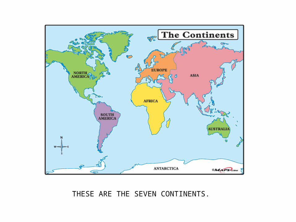
THESE ARE THE SEVEN CONTINENTS.
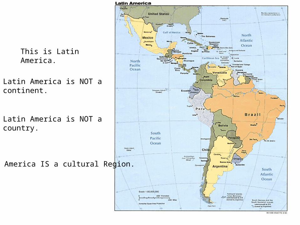
This is Latin America.
Latin America is NOT a continent.
Latin America is NOT a country.
Latin America IS a cultural Region.
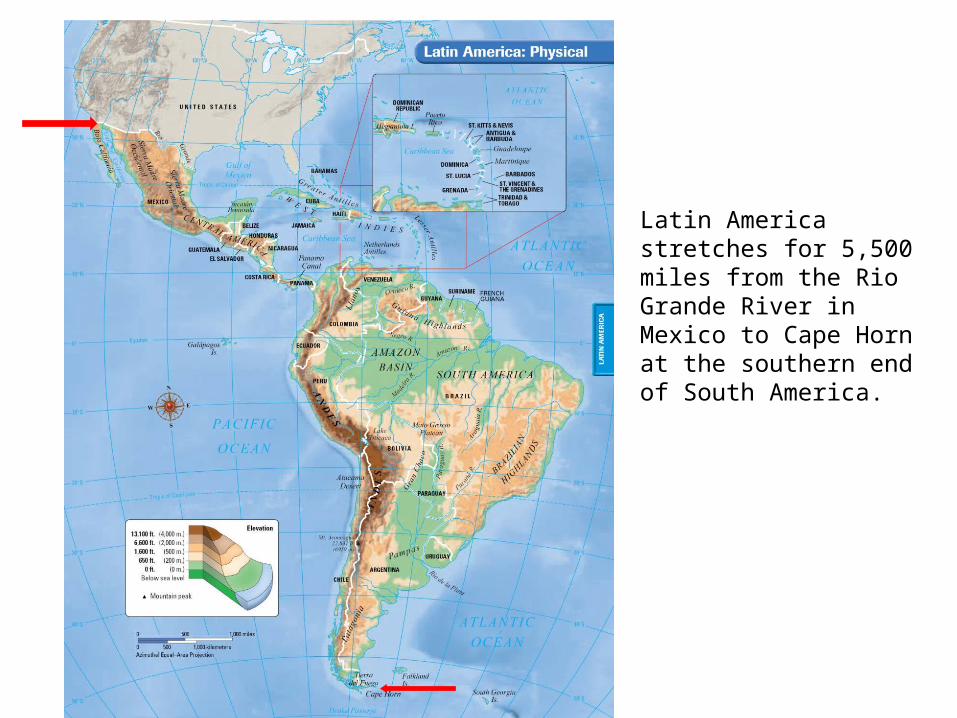
Latin America stretches for 5,500 miles from the Rio Grande River in Mexico to Cape Horn at the southern end of South America.
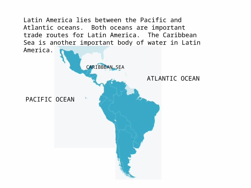
Latin America lies between the Pacific and Atlantic oceans. Both oceans are important trade routes for Latin America. The Caribbean Sea is another important body of water in Latin America.
ATLANTIC OCEAN
PACIFIC OCEAN
CARIBBEAN SEA
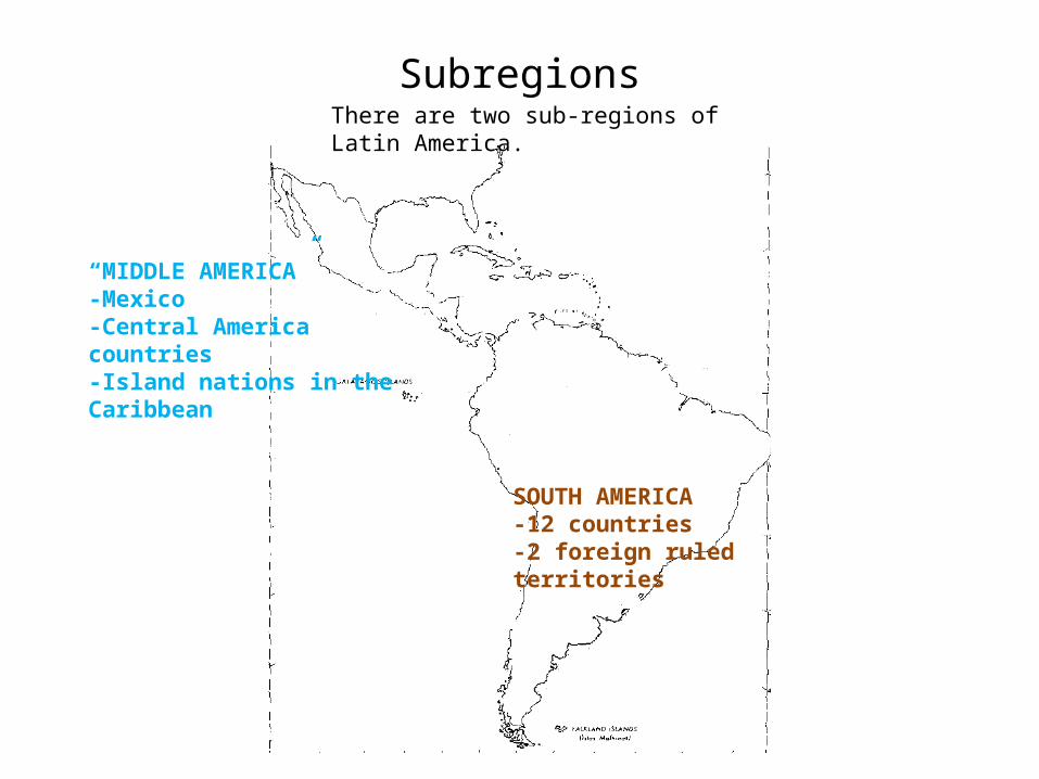
Subregions
“MIDDLE AMERICA”-Mexico-Central America countries-Island nations in the Caribbean
SOUTH AMERICA-12 countries-2 foreign ruled territories
There are two sub-regions of Latin America.
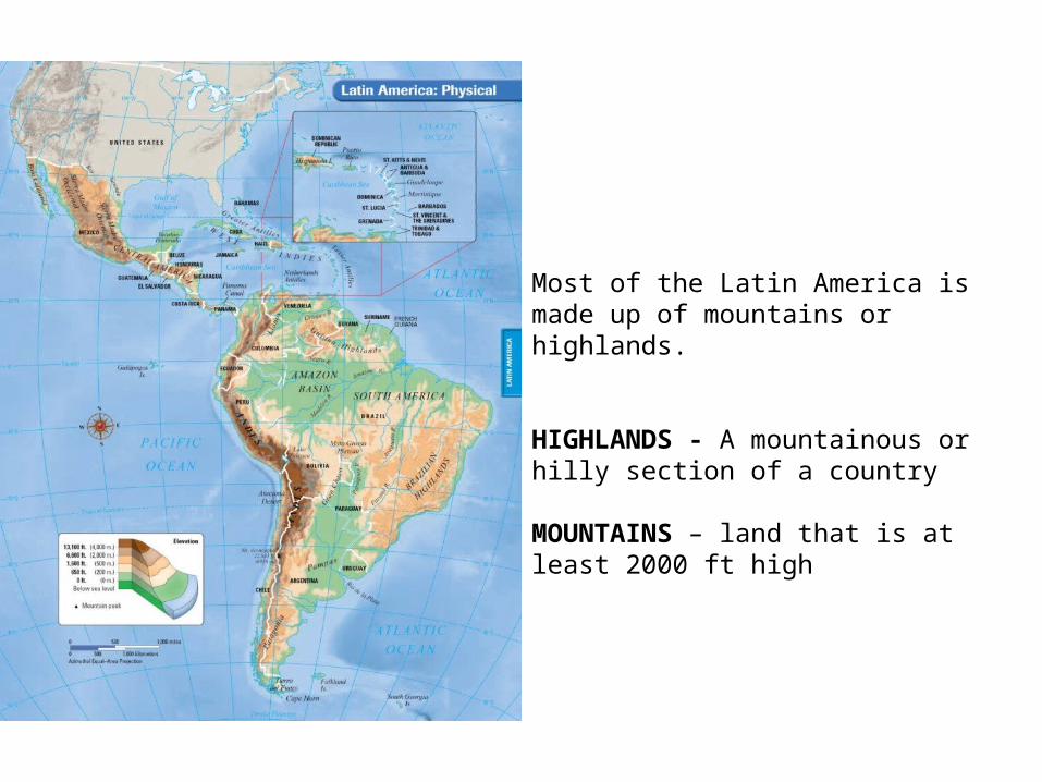
Most of the Latin America is made up of mountains or highlands.
HIGHLANDS - A mountainous or hilly section of a country
MOUNTAINS – land that is at least 2000 ft high
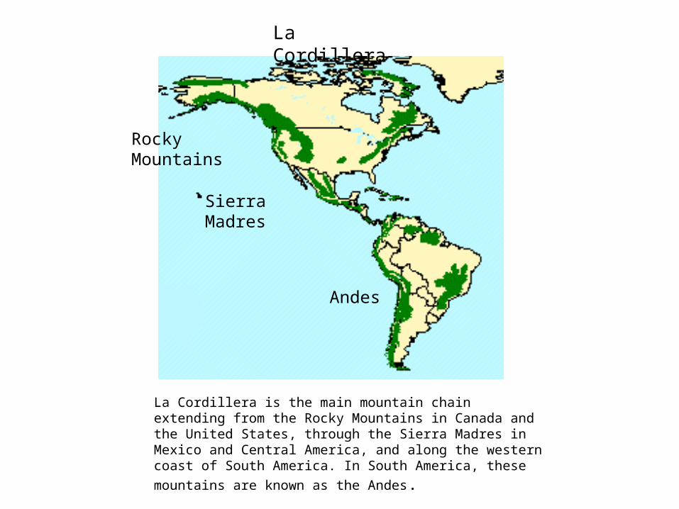
La Cordillera
La Cordillera is the main mountain chain extending from the Rocky Mountains in Canada and the United States, through the Sierra Madres in Mexico and Central America, and along the western coast of South America. In South America, these mountains are known as the Andes.
Rocky Mountains
Sierra Madres
Andes

SIERRA MADRES
SIERRA MADRES EAST
SIERRA MADRES WEST
In Mexico the Sierra Madres mountains split into the Sierra Madre West and Sierra Madre East.
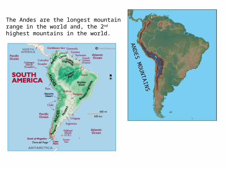
ANDES M
OUN
TAINS
The Andes are the longest mountain range in the world and, the 2nd highest mountains in the world.
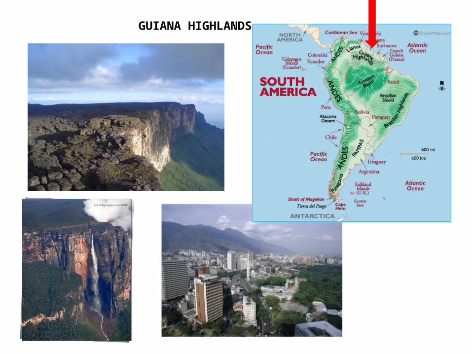
GUIANA HIGHLANDS
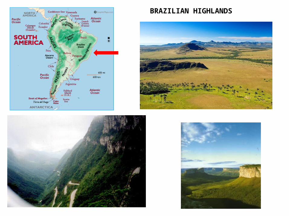
BRAZILIAN HIGHLANDS
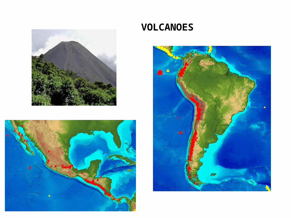
VOLCANOES
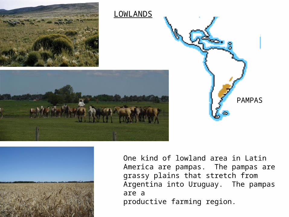
LOWLANDS
PAMPAS
One kind of lowland area in Latin America are pampas. The pampas are grassy plains that stretch from Argentina into Uruguay. The pampas are a productive farming region.
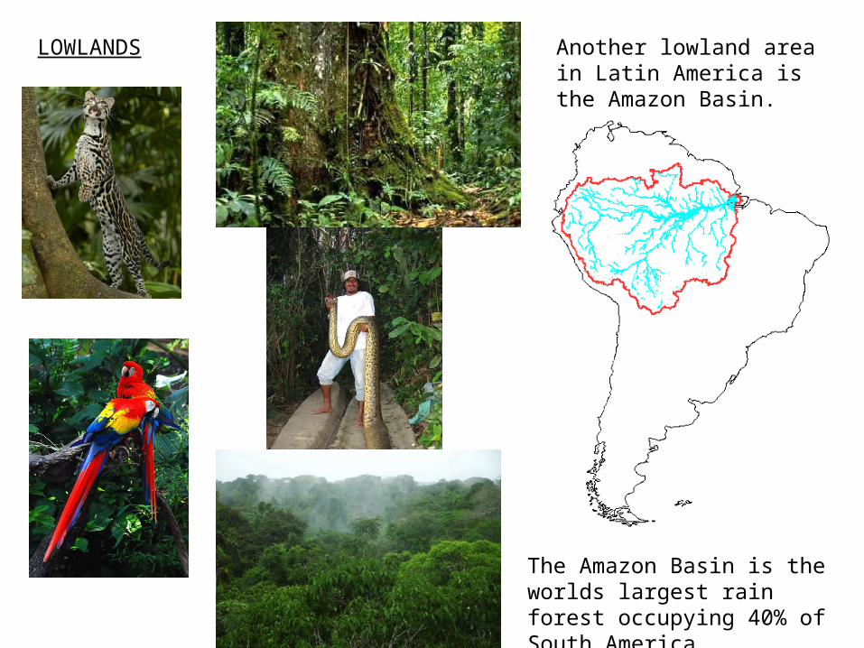
Another lowland area in Latin America is the Amazon Basin.
LOWLANDS
The Amazon Basin is the worlds largest rain forest occupying 40% of South America.
South America has three major river systems that provide important transportation routes: the Amazon river, Orinoco river and, the Rio de la Plata. All these rivers are important transportation routes for people and goods.
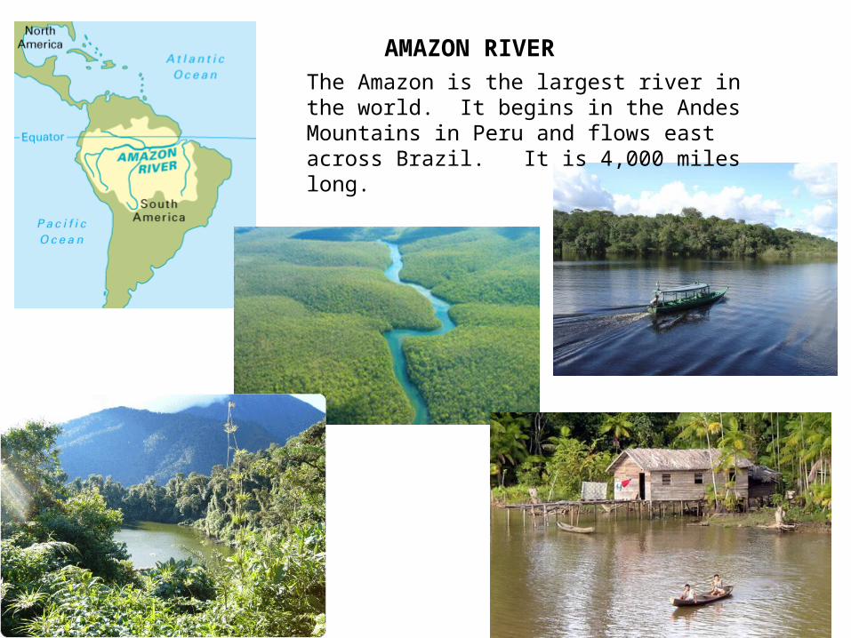
AMAZON RIVERThe Amazon is the largest river in the world. It begins in the Andes Mountains in Peru and flows east across Brazil. It is 4,000 miles long.
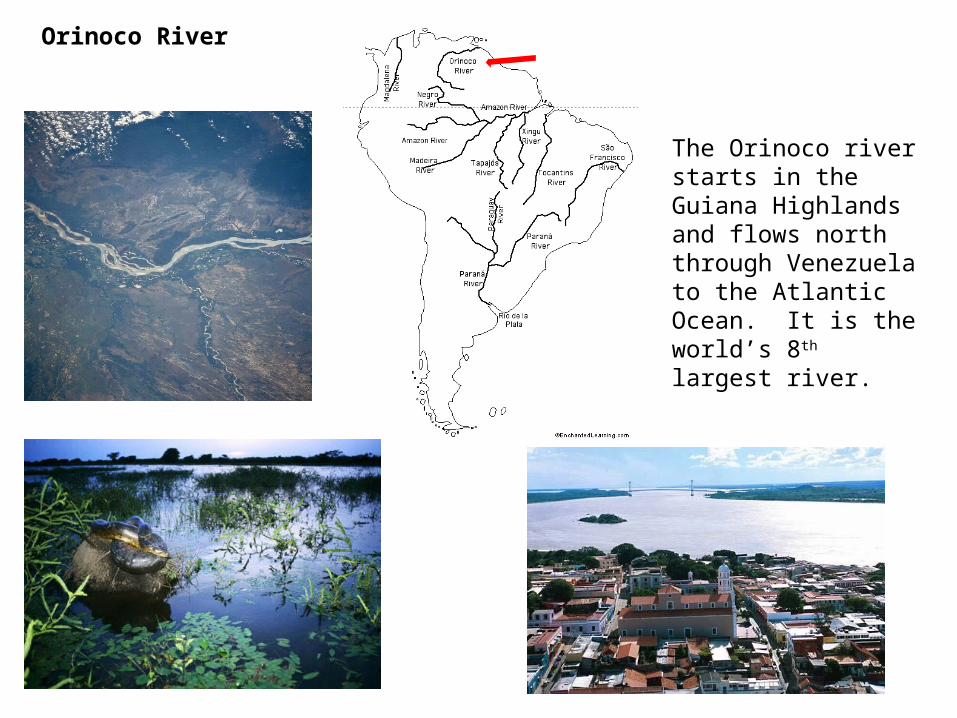
Orinoco River
The Orinoco river starts in the Guiana Highlands and flows north through Venezuela to the Atlantic Ocean. It is the world’s 8th largest river.
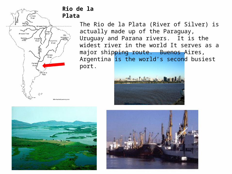
Rio de la Plata
The Rio de la Plata (River of Silver) is actually made up of the Paraguay, Uruguay and Parana rivers. It is the widest river in the world It serves as a major shipping route. Buenos Aires, Argentina is the world’s second busiest port.
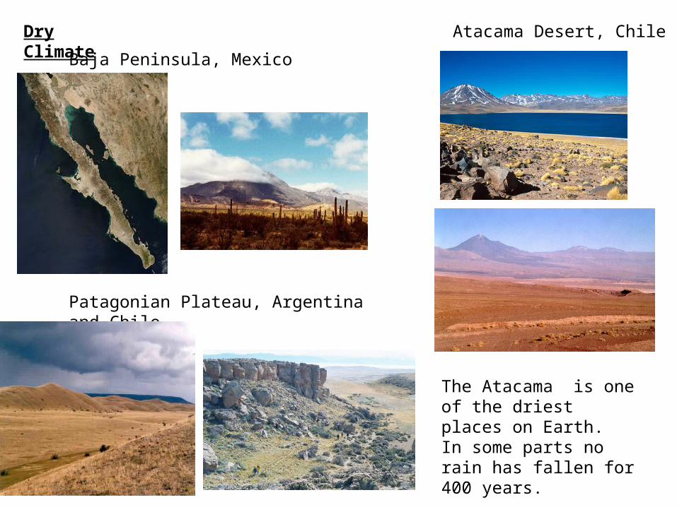
Dry Climate
Baja Peninsula, Mexico
Patagonian Plateau, Argentina and Chile
Atacama Desert, Chile
The Atacama is one of the driest places on Earth. In some parts no rain has fallen for 400 years.
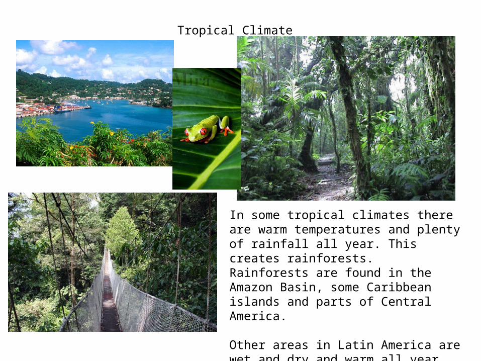
Tropical Climate
In some tropical climates there are warm temperatures and plenty of rainfall all year. This creates rainforests. Rainforests are found in the Amazon Basin, some Caribbean islands and parts of Central America.
Other areas in Latin America are wet and dry and warm all year. For example, lowlands of Mexico, western Central America and southern Brazil.

Temperate climate
In temperate climates, warm seasons alternate with cool seasons. Temperate climates are good area for grazing for livestock and farming. Some areas where there are temperate climates are in Paraguay, Uruguay and northern Argentina.
In Latin America the chief influence on climate is elevation above sea level. Climate can vary greatly depending on if your are in the lowlands or highlands. Latin Americans have their own terms for the changes in climate: tierra caliente, tierra templada and, tierra fria.
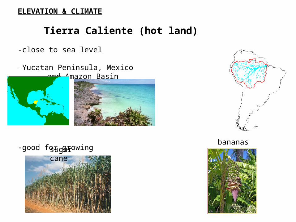
ELEVATION & CLIMATE
Tierra Caliente (hot land)
-close to sea level
-Yucatan Peninsula, Mexico and Amazon Basin
-good for growingsugar cane
bananas

ELEVATION & CLIMATE
Tierra Templada (temperate land)
–areas that lie above 3,000 ft. above sea level-days are hot, nights are cool-Mexican central plateau and valleys in the Andes Mountains-good for growing
COFFEE TOBACCO

ELEVATION & CLIMATE
Tierra Fria (cold Land)
-highlands that are at least 6,000 ft above sea level-nighttime and winter temperatures are cold-Mexico City, Mexico and Bogota, Columbia are in the tierra fria.-good for growing
WHEAT BARLEY POTATOES