Embed Size (px)
Citation preview

Themata 5 E-learning Archaeology, the Heritage Handbook
AAC-Themata 5DEF-v.a.12 verloop.indd 1 12-03-13 15:29

ProgrammeLifelong Learning Programme 2010-2012, Leonardo da Vinci
EditorsMarjolijn Kok, Heleen van Londen and Arkadiusz Marciniak
DesignSusan de Loor, kantoordeloor, Haarlem
PrintKoopmans’ drukkerij, Hoorn
isbn 978 90 78863 76 2
© University of Amsterdam, Amsterdam 2012
All rights reserved. No part of this book may be reprinted or reproduced or utilized in any form or by any electronic, mechanical, or other means, now known or hereafter invented, including photocopying and recording, or in any information storage or retrieval system, without permission in writing from the editors.
AAC-Themata 5DEF-v.a.12 verloop.indd 2 12-03-13 15:29

E-learning Archaeology
Marjolijn Kok Heleen van LondenArkadiusz Marciniak (eds.)
the Heritage Handbook
themata 5university of amsterdam • 2012
AAC-Themata 5DEF-v.a.12 verloop.indd 3 12-03-13 15:29

part 1 E-learning resources in the vocational training system in archaeological heritage by Arkadiusz Marciniak
Organizing effective distance training using e-learning content and the content repository by Jacek Marciniak
Short user guide for the book by Marjolijn Kok
part 2 course content01 Theorizing cultural heritage by Anders Gustafsson & Håkan Karlsson
02 Mentalities and perspectives in archaeological heritage management by Marjolijn Kok & Heleen van Londen
03 Concepts of understanding spatial valorization of archaeological heritage resources by Włodzimierz Raczkowski
04 Aerial survey in archaeology protection and manage- ment system by Włodzimierz Raczkowski
05 Geographic Information System as a method of management of spatial data by Christopher Sevara
06 Geophysical prospection in archaeological protection and management by Robert Hook with cooperation of Arkadiusz Marciniak & Włodzimierz Raczkowski
07 Images of the past by Anders Gustafsson & Håkan Karlsson
08 Cultural biography of landscape by Marjolijn Kok & Heleen van Londen
09 International convention and legal frameworks by Arkadiusz Marciniak
10 Sustainable development in archaeological heritage sector by Marjolijn Kok & Heleen van Londen
11 Management cycle and information system in archaeological heritage sector by Andris Šne
12 Commercial archaeology by Marjolijn Kok & Heleen van Londen
13 A single voice? Archaeological heritage, information boards and the public dialogue by Anders Gustafsson & Håkan Karlsson
14 Digital public outreach by Francois Bertemes & Peter F. Biehl
15 Methods and engagement, publicity and media relationships by Francois Bertemes & Peter F. Biehl
16 Introduction to archaeology for construction engineers by Kenneth Aitchison
17 Introduction to construction engineering for archaeologists by Kenneth Aitchison
18 Archaeology and politics by Heleen van Londen
19 Public archaeology by Monique van den Dries
20 Urban archaeology by Andrzej Gołembnik
21 Perspectives on looting, illicit antiquities trade, art and heritage by Staffan Lundén
22 Problematic heritage by Anders Gustafsson & Håkan Karlsson
23 Maritime archaeology by Andrzej Pydyn
case studies See dvd in the back sleeve of the book
Table of Contents
67
16
24
2526
38
50
58
70
82
94
106
116
125
132
142
149
158
167
175
190
204
208
218
236
250
260
AAC-Themata 5DEF-v.a.12 verloop.indd 4 12-03-13 15:29

Kenneth AitchisonExecutive Director, Landward Research Ltd, United Kingdom
Tony AxelssonLecturer of Archaeology, Department of Historical Studies, University of Göteborg, Sweden
Monique H. van den DriesAssistant professor of Archaeology, University of Leiden, The Netherlands
Mikel ErrazkinAranzadi Society of Sciences, Spain
Ekihne GarcíaExpert in geophysical prospection, sot Prospecció Arqueòlogic, Spain
Marcos GarcíaProfessor of the Department of Geography, Prehistory and Archaeology, University of the Basque Country, Spain
Andrzej GołembnikExecutive Director, Zespół Archeologiczno Konserwatorski, Warsaw, Poland
Anders GustafssonAssociate professor of Archaeology, Department of Historical Studies, University of Göteborg, Sweden
Lourdes HerrastiResearcher, Aranzadi Society of Sciences, Spain
Manuel IzaguirreArchaeologist, Center for Underwater Investigations insub, Spain
Håkan KarssonProfessors of Archaeology, Department of Historical Studies, University of Göteborg, Sweden
Arkadiusz KlimowiczDoctoral student, Adam Mickiewicz University, Poznan, Poland
Marjolijn KokGuest researcher, Amsterdams Archeologisch Centrum, University of Amsterdam, The Netherlands; Director of Bureau Archeologie en Toekomst, The Netherlands
Jose Antonio Lasheras Director, Altamira Museum, Spain
Heleen van LondenAssistant professor of Archaeology, Amsterdams Archeologisch Centrum, University of Amsterdam, The Netherlands
Staffan LundénLecturer, School of Global Studies, University of Göteborg, Sweden
Arkadiuz MarciniakProfessor of Archaeology, University Adam Mickiewicza, Poznan, Poland
Jacek MarciniakAssistant professor, Faculty of Mathematics and Computer Science, Adam Mickiewicz University in Poznan
Rosa MartínezEducational manager, Aranzadi Society of Sciences, Spain
Marc PluciennikDirector of Distance Learning, School of Archaeology & Ancient History, Leicester, United Kingdom
Juan Gregorio RejasResearcher, National Institute of Aerospace Technologies, Spain
Andrzej PydynInstitute of Archaeology. Nicolas Copernicus University, Torun, Poland
Włodzimierz RaczkowskiAssociate Professor, Adam Mickiewicz University, Poznan, Poland
Andris ŠneAssistant professor, Faculty of History and Philosophy of the University of Latvia, Riga, Latvia
List of Contributors
AAC-Themata 5DEF-v.a.12 verloop.indd 5 12-03-13 15:29

part 1
6
E-learning resources in the vocational training system in archaeological heritage by Arkadiusz Marciniak
Organizing effective distance training using e-learning content and the content repository by Jacek Marciniak
Short user guide for the book by Marjolijn Kok
7
16
24
AAC-Themata 5DEF-v.a.12 verloop.indd 6 12-03-13 15:29

7
E-learning resources in the vocational training system in archaeological heritage by Arkadiusz Marciniak
IntroductionArchaeological heritage constitutes finite and non-renewable cultural resources of humanity and is hence an important element of holistically understood cultural heritage. Its significance is ever increasing in many domains far beyond activities undertaken by professionals working in heritage offices and formally responsible for its protection and man-agement. Over recent years archaeological heritage has become an intrinsic element of sustainable development and spatial planning projects undertaken by local administrations of different kinds. It also plays a vital role in the tourism industry sector and is supported by local, regional and national bodies. Archaeological resources are also an important element in practical activities such as those of the construction engineer-ing sector, including building railways, roads, water systems and the like. A significant number of professionals from these sectors need access to the dynamically expanding body of knowledge about different aspects of archaeological heritage. Hence, there is a growing need and demand to develop and upgrade the vocational skills of these various groups. Moreover, recent decades brought about dynamic changes in the field of archaeological heritage in Europe, which addi-tionally increased the demand for properly trained profession-als, including heritage officers, decision-makers and experts at different levels. In these circumstances, the development of a professional vocational system is required to equip those of limited access to the newest knowledge, whose qualifications need updating, as well as to young people who have no qualifications whatsoever. This will secure the preservation of precious and finite heritage and integrate it with the life of local groups by valorising its significance in sustainable development. A thorough understanding of archaeological heritage requires a set of efficient and flexible training tools in a form that is accessible to various social sectors. Hence, vocational training is of key importance in order to meet the needs enumerated above. Databases of e-learning resources and efficient training solutions are the perfect tools to support this didactic process.
The vocational training system in archaeological heritage was developed over recent years. It was largely possible thanks to two large international projects under the Leonardo da Vinci scheme. The first project E-learning as a tool of knowledge transfer in the field of protection and management of archaeo-logical heritage took place in the years 2007-2009. This was a starting point in making the exchange of the best practices and innovative solutions in this field possible and formulating training curricula in the domain of archaeological heritage that could cover most of the relevant issues of today’s Europe. The ultimate goal was to provide the newest knowledge to those whose qualifications need updating, in addition to students who have no qualifications. The curricula should be as universal as possible to consolidate the European co-operation in education and training in the sector. In particular, its major purpose was to design, develop, test, assess and implement innovative solutions in developing and upgrading vocational skills in these groups at the European level. In order for the innovative and complex training curricula to be successful and far reaching, a set of new educational tools had to be available in an easily accessible form to various categories of users. E-learning solutions were chosen as the most efficient tool supporting the didactic process (see also Collison et al. 2000; Horton & Horton 2003; Politis 2008). The basic advantage of this mode of content delivery is that training can take place at any time and in any place. This will meet expectations of various dispersed groups with limited time and logistic constraints. As no e-learning training in the domain of archaeological heritage has ever been completed yet, it was necessary to develop and implement a new method-ology of transferring knowledge from the conventional to the e-learning format, as well as a training methodology. The project eventually resulted in the creation of a multimedia e-learning course composed of fifteen interrelated modules, which were then used for the training process in the project partners’ countries. The first Leonardo da Vinci project laid down solid foun-dations for the construction of a flexible vocational training system in archaeological heritage. Building the system itself was necessary for it to be flexible, efficient, and easy to use. It should have the form of a complex, easily adaptable, reus-able, interoperable and user-friendly database of e-learning resources (content repository). This was the main objective of the second Leonardo da Vinci project: Vocational training system in archaeological heritage based upon e-learning resources, which was completed in the years 2010-2012. The project eventually also included entering all of the available e-learning data in the domain of archaeological heritage into the data-base, the elaboration of a coherent methodology of course-
AAC-Themata 5DEF-v.a.12 verloop.indd 7 12-03-13 15:29

8 part 1
appealing issues in the domain of protection and manage-ment of archaeological heritage across Europe. This will considerably enrich their qualifications in the job market. The didactic materials available in this form are particularly suitable for graduate and extramural students. This is espe-cially important as archaeological heritage is becoming the backbone of contemporary archaeology and the broadly understood heritage sector creates the majority of archaeo-logical jobs today. During the construction of system solutions designed to handle the training needs of users with different levels of competence and expectations, it is necessary to select models capable of providing greater flexibility in running training courses with similar themes. In a situation where target groups are spatially dispersed and have significant time constraints, training should be run in a remote mode through the Internet, using e-learning solutions. This approach gives the opportunity to offer training for groups of homogeneous training needs but geographically dispersed. This kind of model also facilitates time management in the implementa-tion of training. Remote training can be organised through a range of different modes. For the training to be effective, it is necessary to take into account the different needs of target groups and to guarantee a high quality of teaching. It is also important for the training to be implemented using electronic teaching materials, which will be adapted to online learning.
The structure of didactic materials – content repository The database of e-learning resources (content repository) in the field of protection and management of archaeological heritage produced in the second Leonardo da Vinci project is available at www.e-archaeology.org/contentrepository. Its major functionality is a capacity to create e-learning tailored content based on the owned content to meet needs of different trainees. Moreover, it enables content authoring by individuals without it competence overcoming the previously existing constraints. In the past, for the training program to be modi-fied, because for example the need to remove specific batch of material or broaden the discussed issues, the assistance of e-learning authoring experts was needed. Flexible content authoring is possible thanks to Web Content Repository software that enables the storage and processing of e-learning content in a scorm standard. Its availability in this format shall facilitate: (1) adaptability – the ability to tailor instruction to individual and organizational needs, (2) accessibility – the ability to access training components in many locations, (3) durability – the ability to withstand technological developments and changes without costly redesign, reconfiguration or recoding,
making using this database, the expansion of new training curricula to address diverse target groups and the production of e-learning modules out of the database resources, conduct-ing trial training among different groups, and the evaluation of usefulness and efficiency of various e-learning courses among them. The major advantage of the system is that the materials are available in a range of different languages. As of today, the materials are available in English, Spanish, Polish, Latvian, and partly in German. The system also provides an easy and flexible option of translating the didactic content into all kinds of other languages.
The users of the vocational training system in archaeological heritage As archaeological heritage is getting increasingly important and relevant in many domains of contemporary life, the need for receiving updated knowledge in this field goes far beyond that of heritage professionals. The presence and significance of archaeological heritage in contemporary societies is ever increasing in many domains far beyond activities undertaken by those working in heritage offices and formally responsible for their protection and management. Hence, a deep under-standing of archaeological heritage by professional groups that have to deal with its various aspects in their work is crucial. Accordingly, this requires a set of efficient and flexible training tools to be created in a form that is accessible to them, and which addresses their diverse needs. The vocational training system is designed in a way that will meet expecta-tions and requirements of different potential users from a range of sectors as well as graduate and extramural students interested in this field of expertise. These include museum staff, school teachers, administrative staff, planners, architects, civil engineers, forest rangers, among others. The training vocational system can also serve professionals in the sector of archaeological heritage protection and man-agement. For heritage professionals, the knowledge acquaint-ed during the training could be later efficiently implemented into their own professional practice. They are usually em-ployed in local branches of the heritage sector located in provincial capitals, while their branches are placed in smaller cities. Understandably, the group is largely dispersed and is characterised by varied access to the newest knowledge in the field. At the same time, this group is very active professionally and hence, the methods of vocational training need to combine efficiency of the learning process with their obvious time constraints. Thanks to the training vocational system, students gain access to a body of knowledge produced by leading experts in the field in Europe, making it possible to recognise the most
AAC-Themata 5DEF-v.a.12 verloop.indd 8 12-03-13 15:29

9
TheLearningObject (lo) is the smallest didactic element. It refers to a coherent piece of knowledge or relevant case study. The availability of e-learning content in the form of los is a very flexible solution making possible to (1) sort out existing resources, (2) describe them in a systematic manner, and (3) open up a possibility of constructing an infinite number of e-learning training curricula out of existing resources. In particular, it facilitates a simple and easy re-usability of the didactic content and its adaptability to the reformulated training goals for diverse target groups by collating a coherent set of los to complete the task. Altogether, there are approximately 800 los in English (c. 4000 in all languages – Latvian, Polish, Spanish, and partly in German, Norse and Turkish) in the current content repository.
AUnit is defined as the smallest didactic component. It contains a well-defined and coherent body of knowledge and provides means of its verification. The didactic content presents in the form of unit cannot be further divided into smaller elements as this jeopardizes its didactic coherence and relevance (albeit it may still convey important piece of infor-mation). From the technical viewpoint, the unit is composed of a range of learning objects under one heading. As of today, there are ca. 175 learning units in the content repository.
AModule is defined as a coherent set of didactic materials covering complex but coherent issues. It is composed of a number of learning units that are internally integrated and present different aspects of the issue in question. Altogether, there are approximately 68 modules in the current content repository. However, the availability of modules in a scorm system provides a technical means for their re-use to serve a range of different didactic needs.
ACurriculum is a set of well-designed didactic materials tailored for the need of different trainee groups. From the technical viewpoints, a curriculum is composed of a number of modules. The content of these curricula is constructed in such way as to meet needs and expectation of each such group as well as their competencies and different training intensity. The system makes possible to construct curricula of different duration spanning from 2-3 days to 6 months. Altogether, there are 15 curricula in the current content repository. They are directed to different users including professionals in the field of archaeological heritage, museum staff, local administration staff, school teachers, engineering sector, etc. The current content repository provides advanced search-ing engine of the available didactic materials. All content in
(4) interoperability – the ability to take training components developed in one location with one set of tools or platform and use them in another location with a different set of tools or platform, and (5) reusability – the flexibility to incorporate training components in multiple applications and contexts. From the educational viewpoint, a particularly important is the availability of mechanisms enabling the authoring of teaching materials through the compilation of the available didactic materials. This solution allows the construction of a training curriculum to fully correspond to the training needs of any group of trainees. Then, in order to support the training needs of the group, e.g. by expanding the training program or focusing on the chosen issues, such flexible authoring mecha-nisms make it possible to construct teaching materials of the available didactic content. The didactic materials prepared to meet individual needs of any target group can then be used in the training process. In particular, the system is able to conduct remote training via the Internet. It is carried out through the assisted e-learning model, i.e. in the model in which training is performed asynchronously, the source of knowledge is the e-learning content, not the teacher, and the role of teachers is to support and monitor learning. The training is carried out using e-learning content in the form of multimedia and interactive solutions (see J. Marciniak 2009, 2012). Didactic materials in the domain of archaeological heritage (see details below) available in e-learning format are uploaded into the system and then made available for use in the form of smaller entities relevant to teaching according to the nomenclature of the Universal Curricular Taxonomy System (ucts). E-learning content is stored in a content repository in the form of learning objects and the logical grouping of larger units of material is substantially consistent. The vocational training system in archaeological heritage constructed in the project has a hierarchical structure com-posed of a range of categories of the so-called Processable Units (pus) of increasing degree of inclusiveness. These include unit, module, and curriculum. The smallest compo-nents of e-learning content, i.e. the learning objects are not recognized as a pu but comprise an important element of the system. Hence, the content repository is to be understood as a database and a single authoring tool that helps find the necessary learning content and to construct new content via a drag and drop mechanism. These components of the scorm compatible content can be further processed, i.e. integrated in the form of training curriculum. Such ready to use packages can be downloaded from the system and then uploaded to any lms compatible platform to run the training.
E-learning resources in the vocational training system | A. Marciniak
AAC-Themata 5DEF-v.a.12 verloop.indd 9 12-03-13 15:29

10
Memory use and misuse of Franco’s dictatorship by Mikel Errazkin. The module Mentalities and perspectives in archaeological heritage management by Marjolijn Kok and Heleen van Londen aims to discuss different perspectives in practice of heritage management in relation to landscape and planning. It stresses the increasing significance of public constituencies whose needs and expectations ought to be identified, addressed and met in the practice of heritage offices. In particular, the module advocates a need of explicit identification of the general public as an important agent in archaeological heritage policies and introduces the concept of a stakeholder. The plurality of the perspectives needs to be in place within archaeological heritage management to address the diverse concerns of numerous public constituencies. The issues discussed in the module are illustrated by two cases studies: (a) Altamira: management and preservation of Palaeolithic cave art (Marcos García & José Antonio Lasheras) and (b) Heathrow terminal 5 (Kenneth Aitchison). The next module Concepts of understanding – spatial valorization of archaeological heritage resources by Włodzimierz Raczkowski provides an overview of the impact of different archaeological paradigms on the recognition and valorisation of archaeological resources as well as strategies of protection and management of archaeological heritage. Changes in the way archaeology was practiced in the past determined the development of methods applied to protect and manage archaeological heritage resources. Hence, it is widely assumed that the development of academic archaeology has signifi-cantly influenced our views on archaeological heritage and the methods applied in this field. Understanding of archaeological heritage and means of its protection evolved not only by changes in research paradigms but was also influenced by the political, ideological and social contexts in which archaeology was practiced. The module is illustrated by three informative case studies: (a) Stonehenge as a site and a place in the landscape (Kenneth Aitchison); (b) Las Medulas: Archaeological heritage manage-ment based on the spatial valorization (Rosa Martínez); and (c) Landscape archaeology in Midden-Delfland (Heleen van Londen). The next three modules presents methods of recognizing and recording archaeological resources as well as managing and analysing spatial data for the needs of archaeological heritage protection and management. The module Aerial survey in archaeological protection and management systems by Włodzimierz Raczkowski presents a systematic overview of aerial prospection in the practice of heritage management. It comprises also a presentation of major categories of soil
the form of processable units and learning objects were tagged based on the wordnet-based ontology in addition to the standard scorm metadata. A semantic search using tags make searching repository significantly easier and much more efficient. The database of e-learning resources, along with a coherent methodology of building up potentially endless e-learning modules and curricula out of it, may serve as an ultimate resource for the production of wide range e-learning courses targeting different audiences. More importantly, the construction of database and its availability in a scorm format will facilitate its further expansion and enlargement.
The content of didactic materialsAs mentioned above, the major objective of the e-learning trainings conducted within the Leonardo da Vinci project was to get a group of trainees acquainted with the most appealing issues in archaeological protection and management across Europe and provide them with practical solutions in their implementation. For heritage professionals, this knowledge is meant to be efficiently implemented into their own profes-sional practice. Students get access to a body of knowledge produced by leading experts in the field in Europe making it possible to recognise the most appealing issues in the domain of protection and management of archaeological heritage across Europe. Museum staff, local administration, teachers and other groups get to know the significance of archaeologi-cal heritage for city planning, landscape policies, sustainable development, construction of regional identities, and the like. The didactic materials available in the form of the content repository cover a broad range of the most pertaining issues of archaeological heritage in contemporary Europe. They are thoroughly presented in the book in the form of 23 modules with accompanying case studies (see also A. Marciniak 2009; A. Marciniak & J. Marciniak 2011). The module Theorizing cultural heritage written by Håkan Karlsson and Anders Gustafsson reflects and critically assesses the concept of cultural heritage, both its material and tangible form as well as non-material and intangible representations. In presenting its numerous facets it addresses its dynamic character and stresses intertwined conditions of its develop-ment in changing historical, social, and political circumstanc-es. In particular, the module discusses relation between collective memory and cultural heritage, its constructive and fluid character as well as its political use and abuse. It further addresses different relevant issues of contemporary cultural heritage including relations with the public its role in sustain-able development, relationship of cultural heritage with the recent and contemporary past, authenticity as well as tourism and entertainment. The module is illustrated by the case on
part 1
AAC-Themata 5DEF-v.a.12 verloop.indd 10 12-03-13 15:29

11
example of the Archaeological Record of Poland (azp) _ 2 program in Great Poland (Arkadiusz Klimowicz). The module Images of the past by Håkan Karlsson and Anders Gustafsson aims to discuss how images of the past are created and valorised by using elements of archaeological heritage. It presents the role of these images in creating and maintaining local and regional identities. Accordingly, archae-ological heritage is presented as being a real fact and inven-tion at the same time. This is illustrated by a critical and ethnographical comparison of how the World Heritage listed rock carvings in Tanum, Sweden and Val Camonica, Italy are managed and made accessible to the public. Both cases show how these contemporarily embedded and constructed narra-tives lead to specific ways of managing, organizing, presenting these places to the public. The next module Cultural biography of landscape written by Marjolijn Kok & Heleen van Londen discusses the metaphor of the cultural biography of landscape and its use as a tool for sustainable development. A biography of landscape, as an invented image of the past, proved to be a useful tool to serve the value of sustainable development. The module discusses how this metaphor refers to the life history of landscape and its personification as well as stressing its narrative quality. It concludes by presenting Historic Landscape Characterisation as a good alternative approach. The module is exemplified by two case studies: (a) How Historic Landscape Characterisation is used in the uk (Kenneth Aitchison) and (b) Igartza: Cultural biography of historical urban landscape (Rosa Martínez). The module International conventions and legal frameworks by Arkadiusz Marciniak is a systematic overview of interna-tional conventions and charters in the domain of conservation and preservation of cultural heritage prepared by the world (e.g. unesco or icomos) and European (mainly Council of Europe) bodies over the past fifty years. They provided guiding principles towards defining an appropriate response to the pertaining issues of their time. The module discusses their impact upon education and practical solutions in the domain of protection and management of culture heritage as well as their role in shaping the national policies in this domain and forcing governments to recognise their responsibility for the conservation of cultural property. The module is supplement-ed by a presentation of the Lausanne Charter by Arkadiusz Klimowicz. The module Sustainable development in archaeological heritage sector prepared by Marjolijn Kok and Heleen van Londen discusses how the concept of sustainability has recently been translated into the cultural field. In particular, the module presents how, under the pressures of globalisation
marks making possible to recognize archaeological features, major methods of aerial prospection, and methods of trans-ferring photo images onto maps. The module stresses that the effectiveness of aerial photos depends on their integration with other non-invasive methods, especially geophysical survey. The module on aerial prospection is further illustrated by two case studies: (a) Aerial photography and heritage manage-ment in West-Friesland (Marjolijn Kok), and (b) Segeda Archaeo-logical Area in Spain ( Juan Gregorio Rejas Ayuga). The module Geophysical prospection in archaeological protection and management systems by Robert Hood (in coop-eration by Arkadiusz Marciniak and Włodzimierz Raczkowski) aims to provide an overview of the techniques of geophysical survey, presents major instruments and their use. These make possible to determine the nature of the detectable archaeo-logical resource within a specified area. The major part of the module is devoted to the presentation of a potential of various geophysical methods for heritage protection. It provides necessary hints on how to choose survey method(s) depending upon the site conditions, logistics and time constraints. The module further discusses a need to integrate geophysical survey within the planning process. Issues discussed in the module are illustrated by three cases studies: (a) Using Geographic Information Systems in the creation of spatial databases for the preservation and management of archaeological heritage (Arkadiusz Klimowicz), (b) Republican Aerodromes of the Spanish Civil War (Ekhine García), and (c) Geophysical monitoring in heritage management; case study of Broekpolder (Marjolijn Kok). A separate module Geographic Information System as a method of management of spatial data by Christopher Sevara is aimed at providing a brief discussion of gis in the context of its use in heritage management practice, as well as to present a background and solid introduction to the applications and types of information for which a gis is well suited. It stresses that the role of gis in any given project must be well defined to become its useful component, and issues such as accuracy and resolution of a data set must be taken into account when performing analyses and interpreting results. The module presents an overview of gis applications, especially its role in culture heritage management. It then presents core com-ponents of gis, data types and their input, as well as their processing and management. The gis module is illustrated by three case studies: (a) Visibility and topography in Neolithic Falbygden, southwest Sweden (Tony Axelsson); (b) gis for heritage management by public authorities: Barcelona and Region of Murcia (Rosa Martínez), and (c) Integration of non-invasive methods – the
E-learning resources in the vocational training system | A. Marciniak
AAC-Themata 5DEF-v.a.12 verloop.indd 11 12-03-13 15:29

12
at different facets of commercial archaeology, which may be relevant for archaeological heritage management. The module is exemplified by three case studies. These comprise (a) Commercial archaeology in Spain (Rosa Martínez), (b) Irish commercial archaeology and road building development (Kenneth Aitchison), and (c) Canal Seine-Nord Europe (Kenneth Aitchison). The module A single voice? Archaeological heritage, informa-tion boards and the public dialogue by Håkan Karlsson and Anders Gustafsson discusses a range of issues related to the presentation of archaeological heritage and communication with the general public. This is exemplified by the role of information-boards at monuments and sites as a dominant method of communication with the general public in Sweden. In particular, the module presents history and socio-political context of using sign-posts/information-boards, epistemologi-cal and socio-political considerations behind the method, its contribution to the communicative and unequal relationship between the heritage management and the public as well as future possibilities of a new communicative relationship anchored in an open and living dialogue. The module is supplemented by a case study Open for works (Rosa Martínez). In the module Producing and communicating archaeological knowledge: public outreach in the digital age by Francois Bertemes and Peter F. Biehl, the authors explore importance of multimedia technologies and the internet for the way archaeology is communicated to the public as well as means of engaging the specialist community and the public in the knowledge production and knowledge transfer. The module then presents a case of ‘multimedia excavation’ serving as a training ground for young heritage professionals and archae-ology students. These issues are further exemplified by presenting multimedia applications at the Neolithic settle-ment at Çatalhöyük in Turkey and the Cambridge ‘Blobgects’ Project. The module is illustrated by two case studies: (a) Oxford archaeology database (Kenneth Aitchison) and (b) Archaeo-tainment (Marjolijn Kok). The module Methods and engagement, publicity and media relationships by Francois Bertemes and Peter F. Biehl discusses the importance of communication with the public, methods of engagement, publicity and media relationships. In particular, it presents an overview of strategies and methods of achieving these goals by a range different media. Knowledge production is ranging from digital field archaeology, visual representation, knowledge management, and the sociology of knowledge. The module is exemplified by a case study Uses of web 2.0 for archaeology and archaeological heritage management by Rosa Martínez.
and general economics, cultural diversity was recognised as being under threat. Hence, in order to maintain cultural diversity it is necessary to actively engage with the manage-ment of the landscape in a sustainable manner. This module delves into the concept of sustainability and the way in which it applies to cultural resources as well as presents how this new framework affects the practice of heritage bodies. The module starts by presenting the general idea of sustainability and goes on to the specificities associated with cultural sustainability. It also discusses the role of archaeologists as providers of information and the context of decision making within the democratic framework of policy-makers and executors. It then discusses their role in the planning process and the development of landscape. The module is illustrated by a range of case studies. These include: (a) The concept of sustainable development as an archaeological heritage management strategy (Arkadiusz Klimowicz), (b) Environmental assessment (eia) and wind power in Sweden (Håkan Karlsson and Anders Gustafsson), (c) Sustain-able research programs (Rosa Martínez), (d) Drentse Aa (Heleen van Londen), and (e) Environmental assessment in uk archaeology (Kenneth Aitchison). The module Management cycle and information systems in archaeological heritage sector by Andris Šne discusses a range of practical issues directly connected with management of archaeological heritage. It provides a thorough overview of the entire management cycle including documentation and registration, archiving, evaluation, protection/conservation, interpretation/synthesis, and communication (presentation and maintenance). It further discusses how these subsequent stages are related to a range of legislative issues and public concerns. The module focuses more on the management of particular sites than on landscapes. The theoretical context of management policies is provided by reference to the Netherlands and Sweden while a range of practical issues refer to the situation in Latvia. The module is illustrated by two case studies presenting practical managerial solutions. These comprise (a) The Rose Theatre (Kenneth Aitchison) and (b) Praileaitz (Rosa Martínez). The module Commercial archaeology by Marjolijn Kok and Heleen van Londen discusses the relationship between commercial archaeology and archaeological heritage manage-ment. It presents the origin of commercialisation of archaeo-logical practice in Europe as well as numerous facets and pitfalls of commercial archaeology in different European countries. These include quality and standard of work, profes-sionalism, and ethics. It further presents an overview of introducing market principles in archaeology, in particular in relation to the planning process. It concludes by looking
part 1
AAC-Themata 5DEF-v.a.12 verloop.indd 12 12-03-13 15:29

13
ded in the political discourses of the time. It discusses the relationship between archaeology and politics, in particular how archaeology has been used to serve political purposes in different historical periods. The module discusses also how images of the past served as justifications, social binds, social outcastings, cultural domination or land claims. The important role of archaeology in constructing national identity and impact of great archaeological expeditions in strengthening nationalism in different countries is also discussed. The role of archaeology in the development of national socialism in Germany, where creating a unique combination of heritage, land and ethnicity was particularly important. Archaeology also played an important role in the quest for human origins. Following the Second World War, archaeology became used as a means for creating international understanding, coopera-tion, and integration. This was mainly due to numerous legal initiatives undertaken by the United Nations and the Council of Europe. The issues discussed in the module are further elaborated in three case studies: (a) Archaeology and human rights (Rosa Martínez), (b) Archaeology contributions to Basque and Catalo-nian nationalisms (Rosa Martínez), and (c) Ayodhya (Kenneth Aitchison). The module Public archaeology by Monique van den Dries provides an overview of the developments that triggered the engagement with the public in various parts of the world. It discusses the emergence of public archaeology within the academic sector, traces the trajectories of its development in the United States and Europe and evaluates an impact of international regulations such as the Faro Convention and the Ename Charter. In particular, it presents different definitions of public archaeology, levels of engagement with the public, and means of engaging different constituencies. The module then presents major facets of community-based archaeology, in particular projects run by the communities themselves or in collaboration with professionals. Different issues presented in the module are further expanded in three cases studies comprising (a) Involving community groups in uk archaeology (Kenneth Aitchison), (b) Amaiur: heritage and local identity (Mikel Errazkin), and (c) Vikings – archaeological resources? Local people involved in heritage (Håkan Karlsson & Anders Gustafsson). The module Urban archaeology by Andrzej Gołembnik presents interdisciplinary character of archaeology and management of historic towns with complicated stratigraphi-cally. It explores the legal and organisational framework of urban archaeology and provides an outline of its history. In particular, the module discusses various facets of urban archaeology, starting from the stratigraphy of urban sites.
The module Introduction to archaeology for construction engineers was prepared within the Leonardo da Vinci project Archaeology and Construction Engineering Skills. It provides an overview of archaeology and archaeological practice for con-structional engineers. The module systematically presents major elements of the archaeological process. Its first part refers to on overall context of conducting an archaeological project and covers legal regulations and administrative practices, licensing and standards of archaeological works, basic foundations of management of archaeological resources, and cooperation between major stakeholders of archaeological heritage. The second part of the module aims at discussing elements of archaeological heritage, including types of sites, evidence for archaeological remains, different categories of portable objects as well as classification of archaeological sites. The module also discusses possible damages and threats to archaeological heritage. It then deals with the presentation of techniques used in archaeological works, in particular a range of non-invasive and invasive methods. The module presents also different activities performed by archaeologists after completing field works. These comprise the analysis of different categories of data, publications, and engagement with the general public. The final part of the module deals with the management of archaeological projects in the context of the spatial planning process. These include timescale and risk management, the role of archaeological remains in feasibility studies, application stage, as well as enabling and construction works. The module is additionally illustrated by case study on Engineering Amsterdam Subway by Heleen van Londen. The module Introduction to construction engineering for archaeologists was also prepared within the Leonardo da Vinci project Archaeology and Construction Engineering Skills. It provides an introduction to the engineering projects, their major components and the basic principles of the project management and control. The module also addresses public clients’ responsibility for engineering projects as well as a range of contractual and financial issues. The major part of the module is devoted to the presentation of the subsequent steps of the infrastructure process. These include the categorization of engineering soil in addition to in-ground structures and their classification in both rural and urban areas. The following section presents an overview of the stages present in the building process, including timescales. These comprise of the initial stage, followed by a design phase, construction phase and the guarantee period. The module Archaeology and politics by Heleen van Londen provides an overview on how archaeology has been practiced and how it was strictly tied to the political context and embed-
E-learning resources in the vocational training system | A. Marciniak
AAC-Themata 5DEF-v.a.12 verloop.indd 13 12-03-13 15:29

14
regional or national history such as concentration-camps and other genocide sites, slave-trade stations, cold-war installa-tions, battlefields, mental asylums, political prisons, etc. Such neglected heritage not only includes fearsome heritage, but most commonly is not considered worthwhile to rememberin the future by the cultural heritage management. The module is illustrated by two representative case studies including (a) Queer archaeology (Marjolijn Kok) and (b) Memo-ry’s graves. Exhumations of common mass graves from Spanish Civil War (Lourdes Herrasti). The final module Maritime archaeology by Andrzej Pydyn provides an overview of maritime archaeology. This sub-discipline of archaeology deals with the complex relationship between man and the sea, as well as the seaside environment. It spans from the Pleistocene exploitation of the marine environment to the study of World War ii ship-wrecks. The module discusses types of maritime culture heritage including historic ships, submerged archaeological sites in the continen-tal shelf, ports and harbour-cities, and objects deliberately placed under water (‘treasures’). It then presents major archae-ological maritime techniques, in particular different methods of invasive and non-invasive research. Regarding the latter, these comprise mainly acoustic methods and magnetometers. It further discusses methods of underwater excavations. A significant part of the module deals with the presentation of monitoring, protecting and managing maritime heritage. The maritime heritage management mainly focuses on research, archiving, monitoring, protection, conservatory work, as well as on the dissemination of maritime heritage on regional and national levels. The module also presents the legal framework for the protection and management of maritime heritage, including regulations concerning saving and excavating properties from the sea, and the ways of proceeding with wrecks at both national, and international levels.The module is illustrated by four diverse case studies. These comprise: (a) Vasa – a Swedish warship from 1628 (Håkan Karlsson & Anders Gustafsson), (b) IJsselmeerpolders (Heleen van Londen), (c) Maritime archaeology (Kenneth Aitchison), and (d) Urbieta’s shipwreck: Recuperating a 15th century ship in the Basque Country (Manuel Izagirre).
Final remarksThe dynamic changes in Europe over the last two decades have radically transformed archaeology and means of protec-tion and management of archaeological heritage. Heritage professionals need to be aware of these transformations in order to react accordingly to these emerging challengesin an adequate and professional manner. Designing, develop-
It focuses on subsequent elements of the research process from desk analysis, through non-invasive prospection, excava-tion, post-excavation analyses, and conservation methods. An important part of the module comprises the presentation of recording methods, archiving and publication. The module is illustrated by two case studies: (a) Museum of London archaeology (Kenneth Aitchison) and (b) Merida: managing Emerita Augusta (Rosa Martínez). The module Perspectives on looting, illicit antiquities trade, art and heritage by Staffan Lundén provides an overview of issues related to looting and illicit trade of antiques and art objects. It presents the nature of destruction of archaeological sites as generated by market demand, a broader societal context of local and global power relations in which looting take place, in particular the nature of relations between the looter and the collector as well as role and responsibility of the cultural heritage professionals’ in relation to the ongoing trade. It also provides examples of how museums and scholars have been involved in activities which served to legitimise the trade in unprovenanced archaeological objects and more generally how cultural heritage professionals may support the trade through their participation in the social construction of such concepts as ‘art’ and ‘heritage’. The module is illustrated by three case studies. These are as follows: (a) Metal detectors in southern Spain (Rosa Martínez), (b) Metal detectors in Sweden. A new legal framework? (Anders Gustafsson & Håkan Karlsson), and (c) Baghdad Museum (Kenneth Aitchison). The module Problematic heritage by Håkan Karlsson and Anders Gustafsson tries to address the constructive nature of cultural heritage. In particular, it discusses what constitutes a part of the cultural heritage and which parts are constricted and forgotten. It further discusses the process of materializa-tion and construction of collective memory. It presents fearsome and neglected cultural heritage. More precisely, it tackles material and immaterial remains and memories of the past that, for various reasons, have been either hard to handle since they remind us of fearful, painful and/or shameful episodes of our history, or have been neglected and forgotten since they are not considered worthwhile to remember in the future. While addressing these issues, the module presents the problems of collective memory and cultural heritage, as well as the relationship between politics and cultural heritage. Cultural heritage and the construction of collective memory are always connected to various, but concrete, political agen-das. The major part of the module comprises the discussion of fearsome and neglected cultural heritage. As regards to the former, there exists a number of sites and memories that represent fearful, painful and/or shameful episodes in local,
part 1
AAC-Themata 5DEF-v.a.12 verloop.indd 14 12-03-13 15:29

15
References• Collison G., Elbaum, B., Haavind S., Tinker, R., 2000. Facilitating Online Learning, Effective Strategies for Moderators, Atwood Publishing• Horton W., Horton K., 2003. E-learning Tools and Technologies, Wiley Publishing• Marciniak A., 2009. E-learning in archaeological heritage. An example of ‘Archaeological heritage in contemporary Europe’ a distance learning course. In H. van Londen, M.S.M. Kok and A. Marciniak (eds.), E-learning Archaeology, Theory and Practice, 41-55. Themata 3, University of Amsterdam: Amsterdam• Marciniak, A., Marciniak, J., 2011. Technology & methodology in distance learning in archaeology. A case of e-learning course ‘Archaeo-logical heritage in contemporary Europe. In W. Börner (ed.) Proceedings of the 14th International Congress ‘Cultural Heritage and New Technologies’ held in Vienna, Austria November 2009, 382-390. Museen der Stadt Wien: Wien• Marciniak, J., 2009. Methodology and e-learning solutions in ‘Archaeo-logical heritage in contemporary Europe’ distance learning course. In H. van Londen, M.S.M. Kok and A. Marciniak (eds.), E-learning Archaeology, Theory and Practice, 56-89. Themata 3, University of Amster-dam: Amsterdam• Marciniak, J., 2012. Metody organizacji materiałów dydaktycznych w postaci elektronicznej zapisywanych w standardzie scorm. Edukacja. Magazyn edukacji elektronicznej 1(3): 79-92• Politis, D. (ed.), 2008. E-Learning Methodologies and Computer Applica-tions in Archaeology. igi Global: Hershey, pa
ing, testing, assessing and disseminating innovative solutions in developing and upgrading vocational skills in the protection and management sector of archaeological heritage at the European level is crucial. At the same time, recent develop-ments led archaeology to become an element of sustainable development at the regional and national context, in particular closely integrated in the planning and landscape policies. These conditions require expanding vocational training of archaeological heritage beyond the professional sector.The educational system in the form of flexible and user friendly content depository can easily handle the training needs of different audiences. The proposed solutions can be used in diverse educational contexts and on different e-learn-ing platforms, according to the resources available in institu-tions conducting the training. The vocational training system can significantly contribute to consolidation of European co-operation in education and training in the archaeology sector by meeting emerging challenges and demands in the field across Europe.
E-learning resources in the vocational training system | A. Marciniak
AAC-Themata 5DEF-v.a.12 verloop.indd 15 12-03-13 15:29

16 part 1
In order to efficiently use the resources stored in the content repository, one needs to understand the technical architecture of e-learning courses and the logical organisation of the content, as seen from a didactic standpoint.
scorm – the technical architectureE-learning course (or the ‘electronic book’) refers to the way of organizing the content in an electronic format that is tailored to the needs of the educational process in the Internet envi-ronment. It has the following characteristics (J. Marciniak, 2009):> it contains multimedia and interactive elements which make the delivered content attractive and facilitates the efficiency of the training,> it has a hierarchical structure adapted to the internet education needs and is composed of independent units of knowledge known as Learning Objects, > it can be easily uploaded in the learning management sys- tem due to its availability in the form of a popular standard of the didactic content representation, such as scorm.
Multimedia and interactive elements increase the effectiveness of online learning. They should always be designed to comple-ment and expand the didactic content (Driscoll, 1998), (Horton, 2006). In particular, they are aimed at visualising dynamic processes or illustrating the relationships between phenom-ena discussed in the text. A division of the content into learning objects directly serves the purpose of teaching on the internet. Trainees are rarely in a position to master all the content of the e-learning course in one session (one attempt). The learning process is inevitably interrupted by different logistical constraints (professional duties, everyday life, time limitations, etc.). If the learning object provides didactic material that can be mastered in 3-10 minutes, then the work with the entire material will be more effective. A hierarchical structure of learning objects aims to organise the content in a transparent way. The content is usually hierarchically structured on different levels facilitating straightforward navigation through them. This forces the trainees to complete all parts of the material in the order suggested by the author. The scorm standard makes it possible to launch e-learn-ing courses on multiple platforms for distance education (Blackboard, Edumatic, Moodle, Olat, etc.). It is supported by all major learning management systems. Implementinga course in scorm guarantees its convenient maintenance, modifications and extensions. In particular, it makes it possi-ble to use the content in a number of different ways.
Organizing effective distance training, using e-learning content and the content reposi-tory by Janek Marciniak
IntroductionThe didactic content in the field of protection and manage-ment of archaeological heritage presented in the book is available in the form of e-learning modules, which are avail-able in the content repository at www.e-archaeology.org/contentrepository. This content is designed and arranged in a way suitable for the distance education via the Internet. The repository is made of multimedia and interactive electronic books, which are available in the form of the e-learning courses. These courses can be easily downloaded from the content repository and uploaded into any lms/lcms system (Learning Management System/Learning Content Manage-ment System), and made available to different groups of trainees. The didactic materials provided in the E-archaeology content repository have been developed by experts in the field of protection and management of archaeological heritage. These works were carried out within the framework of two Leonardo da Vinci projects (see A. Marciniak this volume). The content repository is a tool that makes it possible to store the existing e-learning courses as well as build new courses from smaller learning components. These functionali-ties are available due to the technical structure of e-learning courses (i.e. based on sco derived from scorm) and the possibility of collating these components in form of didacti-cally feasible blocks, such as curricula, modules, and units (ucts categories).
The form of didactic materials in the E-archaeology content repositoryEducational content in the content repository is available in the form of e-learning courses. The major characteristics of the repository are that the courses uploaded to the repository and then downloaded from it are not necessarily the same, as they can be easily modified, expanded, and transformed. The system also makes it possible to extract individual components from the existing e-learning courses.
AAC-Themata 5DEF-v.a.12 verloop.indd 16 12-03-13 15:29

17
in the E-archaeology content repository. ucts is a universal tool for interpreting all segments of material, which are consistent and didactically useful (J. Marciniak, 2012). The following components of ucts can be used in the interpreta-tion of didactic materials:> Learning unit (or Unit) – a smallest element of didactically useful material,> Learning module (or Module) – a set of Units,> Curriculum – a set of Modules.
A Learning unit is the smallest element of educational materi-als. It usually conveys a coherent message or provides testing materials. It intuitively refers to the smallest piece of didacti-cally useful material available in the form of any medium (e.g. book, script, PowerPoint presentation, etc.). Thus, learning units are made of a set of learning objects covering a specific topic. These refer not only to the didactic content per se but also to exercises and references. The entire content available in the E-archaeology content repository has been divided into these categories. The authors of its subsequent parts ascribed explicitly selected segments of material into learning units and learning modules. This decision automatically defined which parts of the material can be potentially reused. Hence, the curricula were built to meet the requirements of different target groups.
Processable Units – managing the contentA Processable unit (pu) is an entity in the content repository serving content management. pu can be defined as a didacti-cally useful segment of knowledge. In particular, one can perform the following operations with pu:> Assign educational interpretation to any scorm compo- nent – asic pu creation,> Create an empty pu – System pu creation,
The didactic content in scorm is composed of the following components (Dodds, 2006):> Course package – a collection of files (text, layout, images, etc.) that can be launched on lms; from the technical standpoint, it is a zip file to be downloaded from the content repository and then uploaded to a lms,> Activity – a set (block) of learning resources (sco or Asset) or sub-activities,> sco (Sharable Content Object) – a collection of one or more Assets representing a single learning resource launchable in a lms; sco is a basic scorm component,> Asset – a basic block of the learning resource, an electronic representation of media (text, - images, sound, etc).
ucts – didactic interpretationThe didactic content available in the E-archaeology content repository has been developed in compliance with these requirements (J. Marciniak, 2009). Hence, the courses contain multimedia and interactive elements. They are designed for the non-linear knowledge presentation directed to the trainees and self-test constructions. The content has been divided into small and coherent pieces of didactic material. These have then been saved in an electronic form. E-learning courses have been implemented in scorm 1.2. Each segment of didac-tic material has then been saved as a sco. Each sco contains the material that can be mastered in 3-10 minutes. scos stored in the E-archaeology content repository are organised hierarchically. Any e-learning course downloaded from the content repository is given the title of the hierarchically highest block used in the course. The model makes it possible to arrange the didactic con-tent in the form of learning objects. However, this leaves us with a range of relevant questions. In particular, it is unclear which blocks of the material have didactic value on their own. Equally uncertain is which of them can operate independently, i.e. are available in the substantively consistent and didactically useful format. If the system allows incorporation of any ele-ment of the stored content into any course, then the question emerges to what extent is the new course coherent and didac-tically useful. In practical terms, this refers to the decision whether it is possible to use any single sco or set of scos in the educational process. In order to avoid technically arbitrary criteria in this process, it is necessary to develop a method aimed at interpreting the didactically useful material by using consistent terminology. This is a particularly relevant issue as scorm leaves an assessment of the educational value of the didactic content in hands of the content author. The Universal Curricular Taxonomy System (ucts) has been used to unambiguously interpret the didactic content available
Curricula > Archaeological heritage in contemporary Europe > Teaching of the past – archaeological heritage for teachers
Modules > Theorizing Cultural Heritage > Geographic Information System as a method of management of spatial data > International conventions and legal frameworks
Units > Cultural Heritage – concepts and problems > Cultural Heritage – management through time > gis applications and history > gis in archaeology > un and unesco conventions > European conventions
Table 1 Examples of e-learning content components interpreted using ucts categories
AAC-Themata 5DEF-v.a.12 verloop.indd 17 12-03-13 15:29

18
The construction of a new course is only possible from elements that have been ascribed didactic interpretations, such as unit, module or curriculum. This solution makes it possible for a new author to get appropriate segments of dedi-cated didactic materials with accompanying exercises for self-testing and references.
Using the content repositoryThe content repository has a number of functionalities:> Browsing and filtering,> Multi-criteria searching,> Exploring pu and scorm structures,> Downloading content as scorm packages,> Creating new training curricula from the stored content,> Supplying the repository with new content.
The E-archaeology content repository is available at www.e-archaeology.org/contentrepository. Each internet user can freely browse, filter and search the repository resources. Logged-in users are allowed to download content, construct new training curricula, and upload new content.
Browsing and filtering the repositoryFigure 1 shows the browsing window in the E-archaeology content repository
> Place any existing pu in System pu,> Download pu as scorm package.
Processable Units may be created in the system by assigning the didactic interpretation to any scorm component. These pus are referred to as Basic pus. The ucts categories are available in the E-archaeology content repository to ascribe didactic interpretation to the available content. Any user who has been granted access to the repository can therefore ascribe an ucts didactic interpretation (unit, module, curriculum) to any scorm component (sco, activity, course). The possibility of building up a new blank pu (System pu) and embed in it any other pu from the repository is an essen-tial tool for constructing new didactic content in the content repository. The system allows the user to incorporate one pu into another pu, if required for the construction of valuable didactic curricula. The ability to download pu in the form of a scorm package facilitates the use of all available didactic resources while secu-ring the content consistency and the copyright. However, the tool does not allow new authors to download the content in formats different than specified by the author of this very seg-ment of didactic material. Hence, it is impossible to download a single lo out of pu of which it is a part. Similarly, it is impossible to place such lo in another structure.
Figure 1 Browsing the content repository
part 1
AAC-Themata 5DEF-v.a.12 verloop.indd 18 12-03-13 15:29

19
> Age range,> Interacti vity level,> Copyright information.
These descriptions are set to help the user to choose appro-priate materials available in the content repository. A simple search engine makes it possible to select a range of useful information including the element title, scorm type of element (sco, block, etc.), or didactic interpretation (curricu-lum, module, unit).
FilteringThe filtering mode is set to determine the availability of the content to the user. Basic filters are displayed in the form of the tab Filter. The user can choose the following parameters:> Content interpretation categories available in the reposi- tory (i.e. Curriculum, Module, Unit),> scorm types (course, block, sco, asset, resource, file).
These filters allow the specification of data to be displayed, e.g. at the highest level of complexity (curricula), or the lowest one (units). They also facilitate more complex queries, such as presentation of all Units available in the form of scorm packages and not scos.
The system lists of all resources stored in the content repository. The user defines conditions for displaying the search results. He or she can also automatically apply different filters.
Presentation of resourcesThe content repository is set to store the information on the content component attributes in accord with the scorm standard. While browsing, the user decides which content attributes to be viewed. The display function is available by selecting the Columns option. This facilitates displaying two types of data:> Repository properties,> Metadata descriptions.Repository properties refer to basic information about the content, such as:> Element title,> Owner of the element,> Available didactic categories (e.g. ucts),> scorm type,> Rights to the displayed element (i.e. downloading rights).
Metadata descriptions refer to metadata defined in the scorm standard. These are used to describe the content, such as:> General description,> Educational difficulty,
Figure 2 Multi-criteria search mode
Organizing effective distance training | J. Marciniak
AAC-Themata 5DEF-v.a.12 verloop.indd 19 12-03-13 15:29

20
describe it (Figure 3). Tags are defined as words from the domain of archaeological heritage protection and manage-ment. They have been used to describe all units, modules and curricula in the E-archaeology content repository. All tags used in the content repository originate from the ontology con-structed as a wordnet-based ontology (J. Marciniak 2011). The existing ontology consists of approximately 1500 words ascribed to c. 100 categories. The use of wordnet-based ontology made it possible to ascribe a semantic field to any given word in the E-archaeology content repository. This solution makes it possible to run a more accurate search.
Metadata tabThe metadata tab is used to search scorm metadata. They refer to c. 100 metadata attributes used to describe the e-learning content. The system allows searching of all scorm metadata attributes as well as of all additional attributes ascribed to the content.
Exploring pu and scorm structuresThe system makes it also possible to view the structure of the searched element. This is available in the form of a tree representing the selected item (Figure 4).
Tree tab (Element details tab)This view is set to analyse the structure of pu or any other
Multi-criteria searchFigure 2 presents a multi-criteria (advanced) search mode.Advanced search mode allows the application of the following searching methods:> Simple search,> Tag search,> Metadata search.
Simple search tabSimple search is a method of searching the content repository resources for a specific word. The word is searched for in the reasonable content attributes i.e. described in natural language. These include, among others: > Title – the name of the content element, as given by the author,> File name – the name of the technical file representing the content element,> Description, Educational description – scorm metadata summing up the content element,> Keyword – scorm metadata semantically describing the content element,> Author – scorm metadata containing the author name.
Tags tabTags tab are set to search the content using tags applied to
Figure 3 Categories and tags used for searching the repository
part 1
AAC-Themata 5DEF-v.a.12 verloop.indd 20 12-03-13 15:29

21
the training is to be run. It is necessary to control the sizeof the package as it may cause some technical and logistic problems. Packages of excessively large size are difficult to process. For example, it is still difficult to download and manage a package exceeding 100Mb. A range of logistic factors (e.g. training schedule) may require splitting up the didactic content into smaller packages when the entire content is made available to the trainees at the same time.
Building up new training curriculaThe content repository allows the construction of new training curricula from the resources available in the repository. This process can be compared with editorial works. Accordingly, a range of new curricula was prepared in the second Leonardo da Vinci project based upon the content of the ‘Archaeological heritage in contemporary Europe’ materials. These were to meet the needs of different training groups. The construction of new training curricula involves the following steps:> Creation of a void System pu,> Modification of the System pu structure.
Creation of the void System puThis functionality allows the creation of the void System pu, used to store different pus available in the system.
content element, which is not a pu. It provides information about all components of the selected element (pus and other scorm components).
Quick info tabThe quick info tab is set to provide access to the following information: > Repository properties – content repository attributes describing the content,> scorm metadata – metadata used to describe the chosen element.
Downloading contentThe logged-in user of the E-archaeology content repository can download stored content in the form of scorm packages (i.e. as e-learning courses). He or she can download all pus, assuming access to them has been granted. The system makes it possible to download different categories of material, such as curricula, modules and units, except for single learning objects. Downloading from the repository is available under the Browsing Repository button (Figure 5). The system makes it possible to specify the structure of packages to be downloaded. It is therefore possible to down-load a scorm package with the complete content of any given pu or numerous packages composed of individual elements of different pus. This functionality of the system is very practical. The downloaded content is then placed in the lms where
Figure 4 Tree representation of the content element
Organizing effective distance training | J. Marciniak
AAC-Themata 5DEF-v.a.12 verloop.indd 21 12-03-13 15:29

22
Integrating e-learning courses with educational processE-learning courses downloaded from the E-archaeology content repository can be integrated with teaching conducted at a distance, as proposed by J. Marciniak (2009):> To constitute basic training materials – an assisted web based training model,> To complement educational process designed in a different way – asynchronous learning (e.g. video conferences), traditional teaching.
In the case of the assisted web based training model, e-learn-ing materials have to be delivered to the trainees according to an explicitly defined timetable. Study of the materials needs to be supplemented by a range of collaborative activities, such as discussion forums, wikis, chat, etc. If materials from the content repository are designed to supplement a traditional teaching model, their role may vary depending on the specific training needs.
Modification of the System pu structureThis functionality allows the addition of any pu available in the system into the existing System pu (Figure 6). The user can add any pu retrieved from the repository into the existing System pu. He or she has been granted unlimited access to his own didactic materials as well as to any other materials made available by other authors. The transfer of any selected pu into a new System pu is made by drag-and-drop operation.
Supplementing the content repository with new contentUsers with appropriate access rights can upload new content recorded in the scorm standard (version 1.2 and 2004) into the repository. This functionality is intended for users who have produced e-learning courses themselves, and want to share them with others. Following the uploading of an e-learning course into the system, all course components have to be interpreted in pedagogical terms (Figure 7). As a result, a basic pu is produced. It is also possible to describe the data using metadata, tags, and to specify access rights. The E-archaeology content repository has been uploaded with all e-learning courses produced during two Leonardo da Vinci projects. Any new courses in the domain of protection and management of archaeological heritage produced in the future can easily be uploaded into the system. It is also possible to expand the E-archaeology content repository by adding the content from other domains.
Figure 5 Window with technical specifications of downloaded data
part 1
AAC-Themata 5DEF-v.a.12 verloop.indd 22 12-03-13 15:29

23
• Marciniak J. 2011 Enhancing tagging systems by wordnet based ontologies. Zygmunt Vetulani (ed.) Proceedings of 5th Language and Technology Conference, November 25-27• Marciniak J. 2012 Metody organizacji materiałów dydaktycznych w postaci elektronicznej zapisywanych w standardzie scorm. Eduakcja. Magazyn edukacji elektronicznej, nr 1(3)/2012, 79-92
References• Dodds, P. 2006 scorm 2004, 3rd Edition, Overview, Advanced Distributed Learning• Driscoll M. 1998 Web-Based Training, Jossey-Bass/Pfeiffer• Horton W. 2006 E-learning by design, Pfeiffer• Marciniak J. 2009 Methodology and e-learning solutions in ‘Archaeo-logical heritage in contemporary Europe’ distance learning course, van Londen H., Kok M. S.M., Marciniak A. (eds.) E-learning Archaeology, Theory and Practice, University of Amsterdam, 56-89
Figure 6 Structuring the System pu Figure 7 Interpreting e-learning course components
Organizing effective distance training | J. Marciniak
AAC-Themata 5DEF-v.a.12 verloop.indd 23 12-03-13 15:29

24 part 1
All sections starting with sco or msco are the smallest unit of learning and cover one (interactive) page in the e-learning system. They can not be selected separately. If there is an animation within a (m)sco this is indicated with the small heading ‘animation’. In book form only the text of the anima-tion can be represented, otherwise the book would grow to an unmanageable size. To manage the size of the book, all exercises have only been indicated by their heading. In this way the teacher or trainer knows when there is a test. Most exercises are inter-active and have a game element. They are meant as self-tests for the students, so they can evaluate if they understood the teaching material presented. Any other tests used for scoring purposes, such as essays, exams or other assignments mustbe developed by the trainer. This book is meant to show the textual content of the e-learning repository. The actual learning material has many more pictures (in colour) and has many interactive elements. Therefore, although this book is meant to help educators develop a course, it is certainly worthwhile opening some e-learning units and browsing around to get an impression of the actual teaching material.
Short user guide to the book by Marjolijn Kok
This short user guide will help you use the book efficiently. The book is intended for course developers to help them go through the course material rapidly. The book is divided into two parts: the introduction with a general description of the project and its background; and the e-learning modules.The modules all have a similar structure and headings in order for course developers to have an overview of the different elements. Selection in the e-learning repository can take place at the level of curriculum, module and learning unit. This book only deals with modules and learning units, for the specific curricu-lum the repository has to be consulted. The titles of chapters and sections correspond with module and learning unit names in the e-learning repository. Module titles start with a number and learning units start with the letters lu. They can be retrieved from the repository using their name without the number or lu. If you use language other than English translate some core terms or use tags to find the material in the e-learning repository. In principle, all learning units can be selected separately. Some of the modules were, however, written before this selection was possible. This means that learning units can be selected from these modules, but that certain basic elements are always included. In the book these compulsory elements start their section title with msco.
AAC-Themata 5DEF-v.a.12 verloop.indd 24 12-03-13 15:29

part 2 Course content
25
01 Theorizing cultural heritage by Anders Gustafsson & Håkan Karlsson
02 Mentalities and perspectives in archaeological heritage management by Marjolijn Kok & Heleen van Londen
03 Concepts of understanding spatial valorization of archaeological heritage resources by Włodzimierz Raczkowski
04 Aerial survey in archaeology protection and manage- ment system by Włodzimierz Raczkowski
05 Geographic Information System as a method of management of spatial data by Christopher Sevara
06 Geophysical prospection in archaeological protection and management by Robert Hook with cooperation of Arkadiusz Marciniak & Włodzimierz Raczkowski
07 Images of the past by Anders Gustafsson & Håkan Karlsson
08 Cultural biography of landscape by Marjolijn Kok & Heleen van Londen
09 International convention and legal frameworks by Arkadiusz Marciniak
10 Sustainable development in archaeological heritage sector by Marjolijn Kok & Heleen van Londen
11 Management cycle and information system in archaeological heritage sector by Andris Šne
12 Commercial archaeology by Marjolijn Kok & Heleen van Londen
13 A single voice? Archaeological heritage, information boards and the public dialogue by Anders Gustafsson & Håkan Karlsson
14 Digital public outreach by Francois Bertemes & Peter F. Biehl
15 Methods and engagement, publicity and media relationships by Francois Bertemes & Peter F. Biehl
16 Introduction to archaeology for construction engineers by Kenneth Aitchison
17 Introduction to construction engineering for archaeologists by Kenneth Aitchison
18 Archaeology and politics by Heleen van Londen
19 Public archaeology by Monique van den Dries
20 Urban archaeology by Andrzej Gołembnik
21 Perspectives on looting, illicit antiquities trade, art and heritage by Staffan Lundén
22 Problematic heritage by Anders Gustafsson & Håkan Karlsson
23 Maritime archaeology by Andrzej Pydyn
26
38
50
58
70
82
94
106
116
125
132
142
149
158
167
175
190
204
208
218
236
250
260
AAC-Themata 5DEF-v.a.12 verloop.indd 25 12-03-13 15:29

26 part 2
01Theorizing cultural heritage by Anders Gustafsson
& Håkan Karlsson
msco IntroductionIn this module we present a number of themes and discus-sions connected to various dimensions of the cultural heritage under a number of different headings. According to the nature of the cultural heritage, the wide field of themes and dimen-sions connected to the concept, and the present discussions of cultural heritage and cultural heritage management we raise no claims whatsoever of covering all aspects. Rather the presentation shall be seen as a sort of ‘clearing-house’ that presents some themes, issues and dimensions under a number of interconnected headings that can help the reader to find more information as well as to reflect critically around his/her own situation as heritage manager irrespective of which European country he/she is active in. However, the themes presented below are not valid for the current situation in all national heritage management context since the point of departure for our reasonings are taken in a Swedish context an in our own research concerning the issues at stake.
The concept of cultural heritage (ch)Despite these facts we do believe that the module can act as a catalyst for reflexions and critical discussions in most Euro-pean heritage management contexts. In the text below the concept of cultural heritage refers to material as well as non-material and intangible representations. This means that the concept theoretically contains an endless number of represen-tations. In this context it shall be noticed that the concept of archaeological heritage is more restricted than the term cultural heritage since it normally focuses on material remains.
Regional differencesThere are also regional differences in the view of, and in the practical work with, the content of these concepts in various contexts in Europe. However, in this module we do use the broader definition i.e. cultural heritage, since we believe it is important to grasp the concept of cultural heritage in all its
ambiguity. The concept of cultural heritage management refers to museums, different kinds of regional administrative units as well as national authorities.
TrainingIt takes circa 2 hours to work through the module and its examination consist of a reflection around one’s own situation towards some of the themes presented in the module.
––––––––––Y lu ch Concepts and Problems by Anders Gustafsson & Håkan Karlsson
sco ch and individual and collective memories> Animation starting with quiz and then following text
Initially it can be concluded that every single individual has individual memories and that all societies has collective memories.Our individual memories are stretched backwards in time and are aided in their construction by material things such as: photo-albums, souvenirs, furniture etc., but also by immaterial things such as: family-traditions, anecdotes, narratives etc. These things and phenomena are ordered within the framework of our cognitive memory and our cognitive construction in accordance with how we want to be remembered in the future. Thus, these things and phenomena – but also the meaning created by the order-ing – can be said to constitute our individual cultural heritage.On the societal level these individual methods of ordering the memories are moved to higher levels in the form of collective memories – collective memories that in its materialised forms are highlighted at museums, stored in archives or that can be found as monuments, buildings, landscapes etc. at various places in the society. Thus, these collective memories can be in the material form of arte-facts as well as large areas of landscape, but they can also have the immaterial form of narrations, myths etc. On a general level these things and phenomena – but also the meaning created by the ordering – can be said to consti-tute the society’s common cultural heritage.
sco ch and authors of memoriesLook at the pyramid below presenting the mechanism of creating memories that may become cultural heritage. It is thus interesting to underline that the individual memories (and the individual forgetfulness) are organised and constructed by ourselves within the framework of a continuous process.
AAC-Themata 5DEF-v.a.12 verloop.indd 26 12-03-13 15:29

27
sco ch and the content of the concept: Two approaches to ch – traditional vs. flexibleNot surprisingly, there is a number of ways to answer these questions since there are various – and sometimes contrast-ing – meanings concerning the content of the concept of ‘cultural heritage’, meanings that differ both according to the temporal/historical, geographical and social context of the interpreter. Analyse the scheme below and place the photos in proper columns.> Animation Flexible approach
Meaning inherent in the concept of ‘cultural heritage’ is always ambiguous, flexible and contextual dependent and there is no single interpretation of the content of the concept that can be pinned down once and for ever. From this it follows that cultural heritage can consist of material remains from prehistory as well as material and immaterial remains from the contemporary past.
Traditional approachThere still exists heritage management milieus where the content of the concept is viewed as quite unproblematic. This is since the cultural heritage is viewed as a number of cannoned – and pinned down – objects, monuments, buildings, landscapes etc. that in a simple way can be identified towards older traditions and a number of current juridical documents.
From the positions presented above follows – needless to say – different views of the present societal and political role of the cultural heritage. Let us also state that with the concepts of heritage management, and heritage management sector we do refer to museums, county-boards, county antiquarians, national heritage boards etc. that are responsible for the handling of the cultural heritage and that are financed by the taxpayers.
sco References• Anderson, B., 1989. Imagined communities. Reflections on the origin and spread of nationalism. London, Verso• Anshelm, J. (red.), 1993. Modernisering och kulturarv. Essäer och uppsatser. Stockholm, B. Östlings bokförl. Symposion• Atkinson, J. A., Banks, I. & O’Sullivan, J. (eds.), 1996. Nationalism and archaeology. Glasgow, Cruithne Press• Boric, D. ed., 2010. Archaeology and memory. Oxford, Oxbow Books.Burström, M., 2001. Cultural heritage and Antiquarian Attitude. Current Swedish Archaeology, Vol. 9, 39-44• Butler, T. (ed.), 1989. Memory. History, culture and the mind. Oxford, Basil Blackwell
This, at the same time as this process when it takes place on a societal level – that influence how the society want to be remembered by the future – is creating some problematic dimensions. This is not least, since the society’s memories and the writing of its history are intimately connected and inter-twined with present political and ideological decisions and dimensions. This means, amongst others, that the past are creating and neglecting identities and that cultural heritage can be viewed as a society’s common collective (material and immaterial) identity-creating memory.
ch and the content of the concept: Filling the concept of ch with contentWe have just concluded that cultural heritage constitutes common collective memory. Now, try to fill it with content. What in your opinion should constitute an object of cultural heritage? Place photos of buildings, artefacts and/or sites in the rectangle below.
> Animation exercise
ch and the content of the concept: difficult questions about ch> Animation
In the previous exercise while deciding which building, monument or artefact should constitute cultural heritage you must have been confronted with a number of ques-tions and doubts for instance:What kind of common culture constitutes a heritage, a heritage that is worthwhile to remember in the future?Which parts of our common past shall be constricted and forgotten about?Is cultural heritage something that is fixed once and for all – a cannoned agenda of things, monuments and narrations that we shall take care of and deliver untouched to the generations to come - or is cultural heritage never fixed, and instead something that is connected to complex, open, dynamic, and always continuing cultural processes – processes wherein the collective memory is materialised and constructed, and which therefore affects the whole of society?Are present and continuous processes – wherein the contents and meanings of cultural heritage are constantly renewed and reconstructed since their meanings, values, opinions and claims are directed – from different horizons – towards material and immaterial phenomena relevant?
AAC-Themata 5DEF-v.a.12 verloop.indd 27 12-03-13 15:29

28 part 2
• Smith, L. 2004. Archaeological theory and the politics of cultural heritage. London, Routledge• Smith, L. & E. Waterton, 2009. Heritage, communities and archaeology.
London, Duckworth
––––––––––––Y lu ch Management through time by Anders Gustafsson & Håkan Karlsson
sco ch and the traditional position of heritage managementToday the conditions and the missions of ch are changing in many European countries. This leads to a situation where the differences between the ch contexts in many ways are wid-ened.> Animation
The irony inherent in the traditional heritage management position mentioned above is that what now is considered to be natural and undisputable parts of the cultural heritage in the present is something that that have been negotiated and constructed by previous generations of antiquarians.These were antiquarians that in their present – primarily during the 20th century – decided what should constitute the society’s cultural heritage and what should be protected and preserved. In this context one ought to remember that in many cases these decisions were taken towards both the background of various forms of nationalistic and chauvin-istic ideas and arguments, as well as the desperate striving to protect the ancient remains that still existed from the societal changes and the tides of industrialisation. This was at the same time as the decisions were also taken towards different legalisations – in various parts of Europe – con-cerning the stately or private ownership of ancient remains.While nationalism as an idea today – in most places – has been substituted by ideas where the cultural diversity is brought into focus it is not surprising that (traditional) heritage management milieus – where the cultural heritage is viewed as a number of cannoned – and pinned down – objects, monuments, buildings, and landscapes etc. – have some problems. This means their hands are tied by, and they carry a rucksack full of, the content that previous generations of antiquarians gave as the concept of cultural heritage.However, today most heritage managers – around the world – are aware of the constructivist dimensions of the cultural heritage, i.e. that the cultural heritage is connected to complex, open, dynamic, and always continuing cultural processes – wherein contents and meanings of cultural
• Carman, J., 2002. Archaeology and Heritage. London, Continuum• Carman, J & Sörensen, M.L., (eds), 2009. Heritage Studies: Methods and Approaches. Routledge, New York• Díaz-Andreu, M. & Champion, T. (eds.), 1996. Nationalism and archaeo-logy in Europe. London. ucl Press• Fentress, J. & Wickham, C., 1992. Social memory. Cambridge, Mass., Blackwell• Gellner, E., 1983. Nations and nationalism. Oxford, Blackwell• Graves-Brown, P., Jones, S. & Gamble, C. (eds.), 1996. Cultural identity and archaeology. The construction of European communities. London, Routledge• Grundberg, J., 2000. Kulturarvsförvaltningens samhällsuppdrag. En introduktion till kulturarvsförvaltningens teori och praktik. Göteborgs universitet. Institutionen för arkeologi och antikens kultur. Göteborg, Institutionen för arkeologi, Göteborgs universitet• Grundberg, J., 2001. Kulturmiljövard och turism i Danmark, Skottland och Sverige. En jämförelse. Östersund, European Tourism Research Institute (etour)• Grundberg, J., 2004. Historiebruk, globalisering och kulturarvsförvaltning. Utveckling eller konflikt? Göteborgs universitet. Institutionen för arkeologi och antikens kultur. Göteborg, Institutionen för arkeologi, Göteborgs universitet• Halbwachs, M., 1992. On collective memory. Chicago, University of Chicago Press• Jones. A., 2007. Memory and material culture. Cambridge, Cambridge University Press• Kohl, P.L., Kozelsky, M. & Ben-Yehuda, N. eds., 2007. Selective remem-brances. Archaeology in the construction, commemoration, and consecration of national pasts. Chicago, University of Chicago Press• Kwint, M., Breward, C. & Aynsley, J. (eds.), 1999. Material memories. Design and evocation. Oxford, Berg• Layton, P. & Ucko, P. (eds.), 1999. The archaeology and anthropology of landscape. Shaping your landscape. London, Routledge• Lowenthal, D., 1985. The Past is a Foreign Country. Cambridge, Cambridge University Press• Lowenthal, D., 1998. The Heritage Crusade and the Spoils of History. London, Viking. 15, 15-42• Middleton, D. & Edwards, D. (eds.) 1990. Collective remembering. London, Sage• Shore, B., 1996. Culture in mind. Cognition, culture, and the problem of meaning. New York, Oxford Univ. Press• Smith, L., 2006. Uses of heritage. New York, Routledge
––––––––––Y lu ch Concepts and Problems – Further reading by Anders Gustafsson & Håkan Karlsson
• Holtorf, C. 2005. From Stonehenge to Las Vegas. Archaeology as popular
culture. Lanham, Altamira • Larsen, K. (ed.) 1995. Nara Conference on Authenticity. Trondheim, Tapir• Nuttall, S. & Coetzee, C. (eds.) 1998. Negotiating the past. The making of memory in South Africa. Cape Town, Oxford Univ. Press• Smith, L. & Waterton, E. 2009. Heritage, communities and archaeology. London, Duckworth
AAC-Themata 5DEF-v.a.12 verloop.indd 28 12-03-13 15:29

2901 Theorizing cultural heritage | Gustafsson & Karlsson
There is a number of clear-cut examples of this abuse, for instance, the Nazi-German claim of Polish territory towards an interpretation of the relationship and connection between ethnicity and material remains. In most European countries antiquarian activities have taken place since, at least the 17-18th centuries and, in most, if not all, cases these early activities did fulfill themselves and were a direct consequence of nationalistic demands in con-nection with identification-processes in the rising national states. In accordance with this, the activities were often – even if the pictures are not homogenous across Europe – followed by, and anchored in, stately juridical documents protecting various forms of ancient monuments etc., the construction of some form of antiquarian department responsible for surveying, document and protect the monuments, educational departments, and museums where the sum parts of the common material cultural heritage could be showed to, and explained for, the public. Thus, there is an intimate connection between, cultural heritage, antiquarian activities/heritage management, and various forms of nationalistic ideas that have existed right from the start until today. On a general level the heritage management activities that have been carried out during the 20th century also have had a clear-cut connection to the strengthening of the national state (or a block of states). This is not at least, since the activities carried out are still intimately connected, as well as limited to, the geographical territory that the founding states control. Society’s memories and writings of its history were always – in the 17th-18th centuries, as well as today – intimately connected and intertwined with political and ideological decisions and dimensions. This means that the past is used for the creation and the neglecting of identities and that cultural heritage can be viewed as a society’s common collective (material and immaterial) identity-creating memory. Indeed, since the cultural heritage and the heritage management are always connected to politics, it is perhaps not so much a question of trying to avoid this connection but rather a question of which kind of politics should be central.
ch and the professionalization of the heritage management sector> Animation
Read the beginning of the text concerning the profession-alisation of the heritage management sector and try to reconstruct the rest.Even if antiquarian activities have taken place in most European countries since, at least the 17-18th centuries these activities have constantly developed to become more
heritage are constantly renewed and constructed, this at the same time as there often exists a set of hard-to-kill traditional practices in the everyday work – practices that lead to difficulties when handling the cultural heritage as part of contemporary cultural processes, wherein the material and immaterial cultural objects that are defined as cultural heritage receive their meaning.Nor is it surprising that there are sincere practical prob-lems in these milieus when approaching and handle remains from the recent past or from the contemporary society as a relevant part of the cultural heritage. In the second case one has to make important decisions concern-ing the handling, preservation and use of contemporary phenomena at the same time as the rest of the cultural heritage are still to be approached. The question is in such (traditional) milieus if the recourses and their strengths are enough to let the previous years of constructivist-directed redefinitions of the cultural heritage, its content and meaning be put into practice.It ought to be mentioned that these kind of redefinitions – within the framework of considerations of the cultural heritage as a cultural process – are common within coun-tries influenced by dramatic political changes both in Europe and in other parts of the world. For instance, the discussions by the cultural heritage managers of South-Africa if whether the prison-buildings at Robben Island, used until de fall of the Apartheid regime, should be preserved or not? Should the buildings function as an open wound or as an important reminder? Other examples, can for instance, be found in the eastern parts of Europe and discussions concerning the handling of monuments (for instance statues of Lenin) etc. from the communist era. Is this historical time something to be remembered and why?
sco ch and its political use and abuse In some examples below it is obvious that the archaeology is use for nationalistic purposes. But is there always such a dimension? The passages above mentioning Robben Island and Lenin statues highlight the political dimensions inherent in the creation of a collective memory and in the material forms of cultural heritage constituting a part of it. Needless to say, the very contemporary material remains mentioned above are just some brief examples picked from the huge archive dealing with how the cultural heritage always bears an inherent political dimension and how this dimension throughout history has been used – and in some cases abused – for different political purposes in various parts of the world.
AAC-Themata 5DEF-v.a.12 verloop.indd 29 12-03-13 15:29

30 part 2
countries in Europe also paid attention to their own cultural heritages in the farm of their pre history, sagas of varying origins and the like. These nationalistic currents existed in Sweden as early as the 15th century. The fore-most of the early antiquarians was ohannes Bureus (1568-1652). He devoted his main attention to rune stones, but also played an important role as tutor to King Gustav ii Adolf. In 1630 the king appointed Bureus and two of his colleagues to be ‘National Antiquarians’, with the task of surveying monuments in accordance with a royal memo-randum.Sweden passed its first Law on Ancient Monuments in 1666. The protection included all ancient monuments on Crown land and taxable land, while the nobility were presumed to look after them on their land. The definition of ancient monuments was very broad and there were in reality few possibilities of actively applying the law.In 1667 an antiquarian institute was created at Uppsala for research in antiquities.The Romantic movement in the beginning of 1800 led to an increasing interest in antiquities, and a circular letter was issued in 1805, pointing out the needs to preserve ancient monuments during the big land reforms that was conducted in Sweden at the time.A new ordinance on ancient monuments was issued in 1828, which proved, however, to be far too vague and toothless. It reappeared in a new form in 1867 with the order that ‘all permanent ancient monuments preserving the memory of the inhabitants of the fatherland in prehis-toric times’ were to be protected.The Ancient Monuments Ordinance of 1867 soon proved to be inadequate. After several commissions a new law was passed in 1942 which was one of the most radical of its kind: all ancient monuments were to be ‘placed under the protection of the law’. Every permanent monument had a right to a protective area. Anyone who wanted to ‘disturb, alter or move’ an ancient monument had first to obtain permission and then pay for the following scientific investi-gation. This law was complemented in 1988, when all the regulations concerning the protection antiquarian remains, was gathered into the Culture Heritage Act, which still is the core in the cultural heritage management.
References• Selinge, K-G (ed.), 1994: ‘Cultural Heritage and Preservation’, National Atlas of Sweden, vol 11• Damell, D. et al., 1994. ‘The Cultural Heritage in Society’, National Atlas of Sweden, vol 11, 154-175
and more professional and specialised. At least the western part of Europe has, during the period stretching from wwii until today witnessed dramatic changes in the growth of the heritage management sector and its activities, changes where the activities of the sector have changed from small-scale craftsmanship to large-scale industry at the same time as the number of private actors on the heritage-scene steadily has increased.This is the case of the higher amount of rescue-excavations that have followed infrastructural development of the societies. As a consequence of this, heritage management activities are also drifting towards a higher degree of specialisation and a growing split between its various parts.Needless to say, this development has strengthened the position of archaeology/heritage management in society, but there is also a reverse to this coin. The negative dimen-sions inherent in this development has been pointed out by a number of authors that – with varying emphasis – argues that the separation of the activities of archaeology/heritage management into different and isolated fields of activities is to be viewed as a serious structural crisis. The professionalization of the heritage management sector after wwii has also been accompanied by a higher degree of scientific claims and ideals that at least partly have replaced the nationalistic ideals underlying most antiquar-ian activities and heritage management until wwii. In some contexts these scientific ideals have further strengthen the professional claims of the heritage man-agement sector and led to a situation were the sector has become isolated from the public and where the dialogue and the dialectics of knowledge between heritage manag-ers and the public have collapsed.There is also a situation were the content of the education at the university departments do not meet the demands of a changing cultural heritage sector its new structures and functions. However, in many parts of the world the herit-age management sector are putting a new political agenda to practice – an agenda were protection is complemented by usage and where the public’s interpretations and direct participation in the construction of the cultural heritage and their use of it is focused on.
sco An extremely short history of cultural heritage management – Swedish exampleIn the Swedish context the heritage is stately owned. How does the situation look in other European countries?> Animation
In Renaissance Europe classical culture was the focus of attention for the scholarly world. But the more remote
AAC-Themata 5DEF-v.a.12 verloop.indd 30 12-03-13 15:29

31
that it has been hard for the heritage management sector to handle, integrate and focus on various forms of cultural heritage from the recent or the contemporary past within the framework of the activities. Since it is often exactly this cultural heritage that interests the public a natural integra-tion of this cultural heritage can be made as a consequence of the dialogue between heritage managers and the public.
Despite these positive changes and developments, the situa-tion is far from unproblematic when implementing these ideas in practice within different parts of the heritage manage-ment sector. Since traditional values and ways of working (for instance in milieus with a traditional view on cultural heritage) are challenged by new ideas and demands and this process of change is not a simple one. And this is not least since the changes also in some cases lead to new roles for heritage managers where they are supposed to act in a dialogic manner together with the public and not in a solitary monologue.
ch and the publicThe developments described above can be viewed as being new concerning the role of the cultural heritage since they no longer is supposed to play a part in the construction of national identities, but instead contributes to democratic processes and a social sustainable development in the socie-ties. However, heritage management’s role where the selec-tion and construction of the cultural heritage that should be carried out together and in a dialogue with the public – is not as new as it can seem at a first glance. Instead it can be stated that an intimate relationship has existed between the public and antiquarians/heritage manag-ers – in most European contexts – since the start of the antiquarian activities in the 17th-18th centuries and until the end of the 19th century. The early antiquarians were totally dependent upon the public’s knowledge, for instance, when they surveyed the landscape for ancient remains and monu-ments there was a dialogue and a dialectics of knowledge between the two groups. However, during the 19th century, and more accentuated during its later parts, antiquarians/heritage managers devel-oped into ‘professional experts’ moving towards the back-ground of an arsenal of their own (scientific) methods and reference points, and with regard to their success in disciplin-ing both regarding the landscape and ancient monuments within a specific modern and scientific framework. In parallel this information previously gathered within a dialogue with the public was viewed as irrelevant. During the 20th century and especially under the period since wwii the continued professionalisation of the heritage management
ch and its changed roleIt can be said that at the moment cultural heritage and cultural heritage managers are taking on new roles in a number of European contexts since the heritage management sector – against the background of righteous political claims and political policy documents – are vitalised in a number of ways. Click on each of the three boxes below to learn about the changed role of ch.> Animation The state
Neither the heritage management sector nor the cultural heritage is, as before, expected to fulfill their duty within the limited framework of a process of nationalistic identifi-cation where the protection of a cannoned and pinned down cultural heritage is the only central task.
The public and sustainable developmentOne consequence of the ongoing changes are a number of projects and investigations that point out movemement towards completely new approaches towards the cultural heritage, its use and its relationship to the public, as well as a new dialogue-directed attitude towards the surrounding society (Riksantikvarieämbetet 2004 a-b). In short these changes focus the fact that the cultural heritage shall not solely be protected and preserved, but rather that it shall also be used by the public in such a way that the public participates in this process and that cultural heritage thus contributes to democratic processes and a social sustain-able development.The public’s commitment and engagement in and for the cultural heritage are essential to both the conservation and the use of it (Riksantikvarieämbetet 2004a-b). These changed attitudes tend to solve at least two – earlier – central problems. Firstly, until now the public have been excluded from the selection and creation of their own cultural heritage and thus also from the selection and creation of the society’s collective memories. The processes of selection and creation have solely been in the hands of the expertise of heritage management. Within the frame-work of the new orientations a situation is created where the activities are carried out together and in dialogue with the public. At least in the Swedish context this means also that a harmony is created between juridical statutes and policy documents that highlight the central role of the public concerning the selection and creation of the cultural heritage.
Remains from the recent and contemporary pastAnother problem solved by this new orientation is the fact
01 Theorizing cultural heritage | Gustafsson & Karlsson
AAC-Themata 5DEF-v.a.12 verloop.indd 31 12-03-13 15:29

32 part 2
work, it becomes easier for people to develop their own attitudes and relationship with the cultural heritage. This participation does also mean that the public are given the opportunity to exert influence and take responsibility for social development, thus participating in the cultural heritage work can be a positive and inclusive process that counteracts the more negative processes of exclusion and marginalisation (Riksantikvarieämbetet 2005). This means that the cultural heritage and the public’s participation in, and use of it, are to be considered to be an important resource for the sustainable development of the society. The public’s increased influence on and responsibility for the creation of the cultural heritage means that more people will be involved in the democratic processes of the societal development, both concerning processes connected to the cultural heritage as well as in those processes of a more general societal nature. At its core, this is a question of democracy. In this context, and when trying to get the public to participate in cultural heritage work, an interesting question is what kind of cultural heritage is interesting to the public? Well, above it has been stated that it is the cultural heritage from the recent or the contemporary past, that often is the cultural heritage which interests the public the most.
ch and remains from the recent and contemporary pastIt has been stressed above that the content of cultural heritage never is fixed once and for all and that it is not a cannoned agenda of things, monuments and narratives. On the contrary, it has been argued that cultural heritage is something that is connected to complex, open, dynamic, and always continuing cultural processes, present and continuous processes wherein the contents and meanings of cultural heritage are constantly renewed and reconstructed since meanings, values, opinions and claims are directed – from different horizons – towards material and immaterial phenomena. From this it follows that there are no chronological restraints on what can be consid-ered to constitute parts of cultural heritage and that also phenomena from the recent or contemporary past can consti-tute parts of it. It has also been argued above these kinds of material and immaterial remains are often the kinds of phenomena that interest the public and that constitute parts of their cultural heritage. It is often phenomena from the recent or contempo-rary past that people perceive as important for their under-standing and experience of their lives. This is not surprising since the temporality of these phenomena is easier to grasp and to connect to one’s life and experiences. There are a number of recent and contemporary remains that that are the products of societally – and in many
sector has also been accompanied by a higher degree of scientific claims and ideals than before. In some contexts the scientific claims have nearly, if not totally, replaced the nation-alistic ideals underlying most of the antiquarian activities and heritage management until Second World War. One consequence of this lack of dialogue is, for instance, that historical environments and remains that people have perceived as important for their understanding and experience of the landscape have not been identified as relevant by the heritage management. Since the ancient remains have been primarily approached by the heritage managers with a scien-tific screen in front of their eyes this has excluded other motives for protecting the remains. Such is the case for in-stance concerning remains from the recent past or from the contemporary society. However, within the framework of the new orientations of the heritage management sector, a situation is created where some heritage management activities, not least the selection and creation of the society’s collective memories, are (once again) carried out together and in a dialogue with the public and where the public’s commitment and engagement are essential to both the conservation and the use of the cultural heritage.
ch and sustainable developmentThe questions concerning why cultural heritage and cultural heritage managers are taking on new roles in a number of European contexts, and why their role in nationalistic identifi-cation processes were abandoned in favour of democratic processes and a socially sustainable development, are interest-ing ones. One of the factors underlying this change can probably be found in the European Union and the wish to create a more common cultural heritage for the continent as well as in the fact that today most European countries are multicultural in their nature. In such a context the old nation-alistic approaches to cultural heritage are clearly outdated. Another factor is the wish to use cultural heritage, and the participation of the public within the creation of it, as an asset in striving for democratic and sustainable development in the societies where the cultural heritage sector is going through these changes. Once again there is – as usual – a political use of cultural heritage, but as pointed out above this dimension is unavoidable and it is rather a question of which kind of poli-tics it is that should be central. Thus, there are political agendas of various forms that drive the changes forward (Riksantikvarieämbetet 2007). The thoughts, and arguments, underlying these agendas are at a general level the same, namely the thought that if opportuni-ties are created for the public to participate in cultural heritage
AAC-Themata 5DEF-v.a.12 verloop.indd 32 12-03-13 15:29

33
archaeology investigation, including metal detector surveys and interviews with people who, in one or another way, had experienced the crash. The project group consisted of people from Södertörn University College, Gothenburg University and the Bäckebo Folklore Society. The mere excess of information about the recent past is, however, in itself obscuring. The low-voiced history is at risk of drowning in the noise of other more dominant and loud-voiced sources. An important archaeological contribution is therefore to give voice to some of those histories that other-wise are not heard. These low-voiced histories can give a human perspective on large-scale happenings and courses of events that we otherwise only hear about on a general level. A central aspect of the archaeology of the contemporary past is that it brings histories to the fore. This means that an excavation is not just a search for new information; it is also a happening that attracts people’s attention and brings the recent past of that particular site in focus. The most important information is not always that which is found in the ground; it can very well be that which is told by local people or found in archives. But the archaeological effort is, nonetheless, what brings that history to the fore and triggers a remembering process. The project clearly showed that a combination of the ‘classical’ archaeology’s way of dealing with material culture in combination with other sources can create a deeper and broader understanding of historical events, or, in short, make history come alive.
Learn more• http://www.v2rocket.com/start/others/aud_vid.html• Burström, M., Gustafsson, A. & H. Karlsson, 2006. The Air Torpedo of Bäckebo. Local Incident and World History. Current Swedish Archaeology Vol 14, 7-24• Burström, M., Gustafsson, A. & H. Karlsson, 2007. Bäckebobomben. Minnen av Hitlers raket. Bäckebo: Arén kulturkonsult
ch and authenticity As mentioned above, questions concerning the constitution of the modern cultural heritage can contribute to reflexive research concerning the cultural heritage and its role in society in general. It was also stressed that one such reflexive theme was the question of the authenticity of the cultural heritage. The concept of authenticity is central for most heritage management activities since the authenticity of the cultural heritage, for instance in the form of monuments and sites, is often seen as one of the cornerstones for its handling and preservation etc. Despite this, the concept of authenticity is problematic and it can be – and has been – interpreted in
cases publicly – anchored cultural processes, activities and happenings. For instance, material and immaterial remains from: sport, industry, the military, small cottages etc. However, with the new orientation of heritage manage-ment, as presented above, where the activities are carried out together and in a dialogue with the public, a situation can be created where the recent and contemporary cultural heritage can become an accepted part of common cultural heritage and the common memory. Despite the fact that heritage management often have had difficulties in handling, integrating and focussing on this kind of cultural heritage, it is obvious that it can function as a gate-way for people to approach various cultural heritage issues and their participation in the construction of the cultural heritage. It can also be the starting point for the problemising of the cultural heritage in general and questions concerning societal remembering and forgetting. Our society has devel-oped a view of previous epochs through the creation of museums and the preservation of monuments and the land-scape etc where selected objects act as reference points to earlier societies. The question is: whose history is emphasised in this selection? And here the modern cultural heritage can act as a focus for these questions. Thus, the modern cultural heritage can contribute to a critical research concerning cultural heritage and its role in society in general. One such theme is for instance the question concerning the authenticity of the cultural heritage.
– – – – – – – –sco ch Case study and remains from the recent and contemporary past – Swedish example
Is this archaeology? Why? Why not?The air-torpedo of Bäckebo. An example of contemporary archaeology. In June 1944 a German V2-rocket, which had been launched from the German research centre at Peene-münde, exploded and crashed in Bäckebo in the province of Smaland in southern Sweden. More than sixty years after the crash in Bäckebo, the incident has itself become history. But with the passage of time the incident has been overshadowed by countless other happenings and courses of events. As a result, the story of the air torpedo of Bäckebo is largely forgotten or is unknown to most people in Sweden. But what traces had the incident left locally? What kinds of memories still exist in the form of material remains and stories? Were there still parts of the rocket left in the ground? Could an archaeological survey for them trigger a process of remembering? With these questions in mind, a project group was formed to make a contemporary
01 Theorizing cultural heritage | Gustafsson & Karlsson
AAC-Themata 5DEF-v.a.12 verloop.indd 33 12-03-13 15:29

34 part 2
problematic since the authenticity of phenomena seems to be regarded solely as inherent in the phenomena themselves (i.e. authenticity defined narrowly as genuineness). At the same time as the managers seems to neglect any notions that this authenticity is partly a consequence of present meanings, manipulations and negotiations of various kinds.
ch and tourism and entertainmentThe theme of authenticity touched upon above is of interest not least since today some parts of the cultural heritage, such as monuments, sites, landscapes, museums etc are being more and more integrated into the exploding economy of tourism and entertainment. In this case cultural tourism can be defined as a journey to experience the arts or history of a location or to travel to immerse oneself in the language, society, or culture of a region. On a general level tourism today is one of the fastest growing market sectors in the world (eu 2006) and it can be stressed that cultural heritage has been one of the central motives for tourism since antiquity. The Romans did, for instance, pilgrimage to Greece or Egypt to view ancient remains and the educational Grand-Tour travels of the 18th century bourgeoisie had classical cultural heritage as one of its main foci (Horne 1984; Grundberg 2001). It has been stressed that within the framework of a more sophisticated and service-orientated economy, an experience-related economy and an industry of experiences are develop-ing. It is not just a question of offering products and services to consumers, rather it is a question about offering and providing experiences to various types of customers (O’Dell 1999). In this type of economy, culture and cultural heritage is a fitting and important component of the cultural and recrea-tional industry. In general, cultural tourism can be defined as a form of tourism that focuses upon local and regional culture and cultural heritage. This means that it includes a wide range of phenomena on different levels such as, for instance, cultural traditions, historical environments, prehistoric monuments, industrial environments, cultural landscapes, museums, festivals etc (Ashworth & Tunbridge 1996; Aronsson 1999). Even if cultural heritage can be the main focus of tourism, it seems to function more as a complement to other attractions and activities such as, for instance, beach-holidays, nature-tourism, visits to towns, shopping etc. In this context it is important to note that cultural heritage often functions as an asset when it comes to creating an attractive image of a place or an area, and that this kind of tourism does not necessarily have to be grounded in the existing cultural heritage since it can also lead to the creation of products such as theme parks, heritage villages etc. (Prentice 1993).
a number of ways in different contexts (cf. Lowenthal 1985, 1997; Shanks 1998; Holtorf & Schadla-Hall 1999; Holtorf 2005). In a narrow definition of the term, authenticity refers solely to the genuineness of, for example, a rock carving. That this definition is simplified, generalising and an-chored in Western traditions has, amongst other matters, led to two unesco-sponsored conferences where the search for an appropriate definition of the term (that could be used worldwide) was focused on (Larsen ed. 1995). The results of these conferences are presented in the ‘Nara Document on Authenticity’ and in this it is, for example, stated that authen-ticity can mean different things in different cultural contexts (ibid.). After its construction in 1994, the Nara document has influenced such discussions. Even if not explicitly using the concept of authenticity the Burra Charter – produced by the Australian National icomos Committee in 1999 – does also present interesting themes concerning the issue of authentic-ity. For instance, this is the case when discussing in-depth the relationship and differences between the maintenance, repair and reconstruction of a place and its fabric, and when focus-ing on the existing use of places, its present cultural signifi-cance, the dialogue with people for whom the places is culturally significant, and the co-existence of cultural values and interpretations (www.nsw.nationaltrust.org.au/burracharter.html). Also, in this case it is obvious that authenticity – in line with the Nara document – is something that can be interpreted in different ways. Thus, there is still an epistemological problem if one interprets the content of the concept of authenticity in the sense of genuineness. According to unesco, which has handled and managed the world heritage convention since 1972, there are a number of criteria that must be fulfilled if a phenomenon is to be classified as World Heritage. The criterion of authenticity (in some cases obviously interpreted plainly as the genuineness of the phenomenon) is among the central ones. This explains why unesco has been interested in finding an appropriate definition of the term. If a phenom-enon is classified, the host country has an obligation and a responsibility to preserve, protect and take care of the phe-nomenon in such a way that it remains unchanged (i.e. genuine) for forthcoming generations (http://whc.unesco.org/en/conventiontext). In unesco’s convention, the epistemological problem of considering authenticity solely as genuineness is therefore obvious. How does one protect, manipulate, tend and take care of something that receives its value from being unpro-tected, un-manipulated, untended and uncared for? However, for heritage managers, handling, for instance monuments and sites, this dichotomy seems not to be
AAC-Themata 5DEF-v.a.12 verloop.indd 34 12-03-13 15:29

35
education and professional competence of, and concern-ing, the cultural heritage and the cultural heritage management sector.
KnowledgeThe future production of knowledgeKnowledge production and research are carried out by a number of actors and departments both within the field of cultural heritage and cultural heritage management as well as by other bodies such as universities. It is to be stressed that as research activities intensify, it is becoming more and important to collect and systematically exchange expe-riences and results. In the future the production of knowl-edge may need to be structured around a number of questions in accordance with the direct needs of the cultural heritage sector.
PublicCultural heritage and its importance for the development of the societyCultural heritage can contribute to social sustainable devel-opment of society and solidarity between people. This means that cultural heritage is of considerable significance for numerous social domains. If the public understands and feels and need to participate in and take responsibility for cultural heritage, possibilities increase that cultural heritage and its values are preserved, used and developed. These values are resources for the public's knowledge, experiences, quality of life and feeling of social solidarity. Thus, the knowledge of cultural heritage as well as the work with it is crucial for the development of sustainable society and all its dimensions, such as economic, social and environmental.
SocietySocietal trends that influence research within the field of cultural heritageThere are a number of general trends within European societies that are influencing cultural heritage and cultural heritage sector as well as research within this field. Some of these are as follows: significance of regions in develop-ing, a continuous trend of people moving from rural to urban areas, international contacts are (not at least within the eu) increasing and deepening, increasing number of privatisations and new actors on a market with fewer frontiers, the experience-related economy is continuing its development, it becomes more and more integrated into everyday life, populations are becoming more and more
Europe receives the major part of global tourism and the continent is the main destination for cultural-tourism (Urry 1995). This reflects how the nations of Europe and their cultural heritage – in one sense – is ‘the museum of the world’ and it does illustrate the important role that cultural tourism within the broader framework of tourism (Horne 1984). Cultural tourism – which has developed more and more since the 1980s towards being an independent business sector – is sometimes mentioned under the term of a ‘cultural heritage industry’. Within this industry the experience-related economy creates a situation where it is possible to advertise and sell the cultural heritage in a market for cultural experi-ences. However, at the same time as it creates possibilities it also leads to conflicts between various ways of viewing and handling this development. The major role of cultural heritage management in Europe is critical to this development and one of the main arguments is whether one should consider cultural heritage or the cultural heritage management, is part of an entertainment and recreational market.
ch and the futureThe development of the tourist industry discussed above, as well as the previous passages and themes in this text, raises important questions concerning the future of cultural heritage and the cultural heritage management sector. There are some themes that can be of extra importance to discuss in relation-ship to the future, and below we bring forward some of these themes as presented within the policy documents of the Swedish National Heritage Board (2008). Despite this nation-alistic approach, we believe that a discussion of the themes below is of value irrespective of the geographical location of the heritage management context.> Animation Research
Strategic development of knowledge and research within the field of cultural heritage.The humanistic and historical perspective of the heritage management sector can significantly contribute to sustain-able development of society as cultural heritage is crucial for both societal and individual's memory, identity and solidarity. It is also an important resource for education, research, quality of life, and feeling of social solidarity, experiences and development. Currently, European societies, together with cultural heritage along with conditions for heritage management work are undergoing profound changes. This development implies the need for renewed and more assertive cultural heritage work that is grounded in developed and strengthened research,
01 Theorizing cultural heritage | Gustafsson & Karlsson
AAC-Themata 5DEF-v.a.12 verloop.indd 35 12-03-13 15:29

36 part 2
• eu. 2006. The Europeans, Culture and Cultural Values. Qualitative study in 27 European countries. Summary Report. European Commission. Directorate-General for Education and Culture. Juni 2006• Fentress, J. & C. Wickham, 1992. Social memory. Cambridge, Mass., Blackwell• Gellner, E., 1983. Nations and nationalism. Oxford, Blackwell• Gustafsson A. & H. Karlsson, 2004. Plats på scen. Kring beskrivning och förmedling av Bohusläns fasta fornlämningar genom tiderna. Bohusläns museum, Uddevalla• Gustafsson, A. & H. Karlsson, 2006. Among Totem Poles and Clan Power in Tanum, Sweden. An Ethnographic Perspective on Communica-tive Artifacts of Heritage Management. In: Edgeworth, M. (ed), Ethno-graphies of Archaeological Practice. Cultural Encounters, Material Transfor-mations. Altamira Press, Lanham. sid. 137-147• Gustafsson, A. & H. Karlsson, 2008. Places of power. Control, public access and authenticity at rock carvings in Tanum, Sweden and Val Camonica, Italy. Public Archaeology. sid. 174-198• Graves-Brown, P., S. Jones & C. Gamble, (eds.), 1996. Cultural identity and archaeology. The construction of European communities. London, Routledge.• Grundberg, J., 2000. Kulturarvsförvaltningens samhällsuppdrag. En introduktion till kulturarvsförvaltningens teori och praktik. Göteborgs universitet. Institutionen för arkeologi och antikens kultur. Göteborg, Institutionen för arkeologi, Göteborgs universitet• Grundberg, J., 2001. Kulturmiljövard och turism i Danmark, Skottland och Sverige. En jämförelse. Östersund, European Tourism Research Institute (etour)• Grundberg, J., 2004. Historiebruk, globalisering och kulturarvsförvaltning. Utveckling eller konflikt? Göteborgs universitet. Institutionen för arkeologi och antikens kultur. Göteborg, Institutionen för arkeologi, Göteborgs universitet• Halbwachs, M. 1992. On collective memory. Chicago, University of Chicago Press• Hanley, K. & J.K. Walton, 2010. Constructing cultural tourism. John Ruskin and the tourist gaze. Bristol, Channel View Publications• Holtorf, C., 2005. From Stonehenge to Las Vegas. Archaeology as popular culture. Lanham, Altamira Press• Holtorf, C. & T. Schadla-Hall, 1999. Age as Artefact. On Archaeological Authenticity. European Journal of Archaeology 2, 229-247• Holtorf, C. & A. Piccini, eds., 2009. Contemporary archaeologies. Excavating now. Frankfurt am Main, Peter Lang• Horne, A., 1984. The French army and politics, 1870-1970. London, Macmillan• Härke, H., ed., 2002. Archaeology, ideology and society. The German experience. Frankfurt am Main, Lang• Jameson, J.H., eds., 1997. Presenting Archaeology to the Public. Digging For Truths. Walnut Creek, Altamira Press• Jones. A., 2007. Memory and material culture. Cambridge, Cambridge University Press.• Jones, S., 2006. They made it a living thing didn’t they. The growth of things and the fossilisation of heritage. I: Layton, R., S. Shennan & P.G. Stone, (red.). A future for archaeology: the past in the present. Walnut Creek, Left Coast Press
heterogeneous, values, engagements and priorities are changing faster and faster, the interest in environmental issues is increasing, conditions are changing for societies’ public sectors.
DevelopmentForms for an increased cooperation and developmentThere is a need for close cooperation between different sectors and actors in the society such as various actors within the heritage management sector, the heritage management sector and universities as well as various organisations that have the cultural heritage on their agenda, such as local folklore societies
sco References• Anderson, B., 1989. Imagined communities. Reflections on the origin and spread of nationalism. London, Verso• Anshelm, J. (red.), 1993. Modernisering och kulturarv. Essäer och uppsat-ser. Stockholm, B. Östlings bokförl. Symposion• Arnold, B., 1990. The past as propaganda. Totalitarian archaeology in Nazi Germany. Antiquity 64, 464-78• Ashworth, G. J. & Tunbridge, J. E. 1996. Dissonant heritage. The manage-ment of the past as a resource in conflict. Chichester, Wiley• Atkinson, J. A., Banks, I. & O’Sullivan, J. (eds.), 1996. Nationalism and archaeology. Glasgow, Cruithne Press• Boric, D. ed., 2010. Archaeology and memory. Oxford, Oxbow Books• Buchli, V. and G. Lucas, (eds.), 2001. Archaeologies of the Contemporary Past. London: Routledge• Burström, M., 2001. Cultural heritage and Antiquarian Attitude. Current Swedish Archaeology, Vol. 9, 39-44• Burström, M., 2009. ‘Looking into the Recent Past. Extending and Exploring the Field of Archaeology’, Current Swedish Archaeology 15-16, 21-36• Burström, M., T. Acosta, E. Gonzáles, A. Gustafsson, I. Hernández, H. Karlsson, J. Pajón, M. & R. Robaina, 2009. Memories of a World Crisis. The archaeology of a former Soviet nuclear missile site in Cuba. Journal of Social Archaeology, 95-318• Butler, T. (ed.), 1989. Memory. History, culture and the mind. Oxford, Basil Blackwell• Carman, J., 2002. Archaeology and Heritage. London, Continuum• Carman, J & M-L Sörensen, (eds), 2009. Heritage Studies: Methods and Approaches. Routledge, New York• Deacon, H.J., 1998. Remembering Tragedy, Constructing Modernity. Robben Island as a national monument. In: Coetzee, C. & S. Nuttall, (eds.), Negotiating the Past. The Making of Memory in South Africa. Oxford, Oxford University Press• Díaz-Andreu, M. & T. Champion, (eds.), 1996. Nationalism and archaeol-ogy in Europe. London. ucl Press• English Heritage 2002. Military Aircraft Crash Sites: Archaeological Guidance on their Significance and Future Management. London: English Heritage
AAC-Themata 5DEF-v.a.12 verloop.indd 36 12-03-13 15:29
37
• Schofield, J., W.G. Johnson & C.M. Beck, eds., 2002. Matériel Culture: The Archaeology of Twentieth Century Conflict. London, Routledge• Shanks, M., 1998. ‘The life of an Artefact in an Interpretive Archaeology.’ Fennoscandia Archaeologica 15, 15-42• Shore, B., 1996. Culture in mind. Cognition, culture, and the problem of meaning. New York, Oxford Univ. Press• Skeates, R., 2000. Debating the Archaeological Heritage. London, Duckworth• Smith, L., 2004. Archaeological theory and the politics of cultural heritage. London, Routledge• Smith, L., 2006. Uses of heritage. New York, Routledge• Smith, L. & N. Akagawa, eds., 2009. Intangible heritage. London, Routledge• Smith, L. & E. Waterton, 2009. Heritage, communities and archaeology. London, Duckworth• Toshiyuki, K., 2009. Intangible cultural heritage and intellectual property Communities, cultural diversity and sustainable development. Antwerpen, Intersentia• Trigger, B., 1989. A history of archaeological thought. Cambridge, Cambridge Univ. Press• Urry, J., 1995. Consuming Places. London, Routledge• Van Dyke, R.M. & S.E. Alcock, eds., 2003. Archaeologies of Memory. Oxford, Blackwell
Websites• www.nsw.nationaltrust.org.au/burracharter.html (2008-11-18)• http://whc.unesco.org/en/conventiontext (2008-11-18)• http://icip.icomos.org/eng/about_missionstatement.html (2008-11-18)• www.international.icomos.org/charters/tourism_e.htm (2008-11-18)
• Jones, S., 2005. That stone was born here and that’s where it belongs. Hilton of Cadboll and the negotiation of identity, ownership and belonging, I: Foster, Sally M. & Morag Cross, (red.). Able minds and practised hands: Scotland’s early medieval sculpture in the 21st century. Leeds, Maney• Karlsson, H. 2000. Swedish Archaeology into the 21st century. The necessity of (self ) criticism. Current Swedish Archaeology. Vol 8, 143-155• Kristiansen, K., 1996. Old boundaries and new frontiers. Reflections on the identity of archaeology. Current Swedish Archaeology. Vol 4,103-122• Kohl, P.L., M. Kozelsky & N. Ben-Yehuda, eds., 2007. Selective remem-brances. Archaeology in the construction, commemoration, and consecration of national pasts. Chicago, University of Chicago Press• Kwint, M., C. Breward & J. Aynsley, (eds.), 1999. Material memories. Design and evocation. Oxford, Berg• Larsen, K. (ed.), 1995. Nara Conference on Authenticity. Trondheim, Tapir• Layton, P. & P. Ucko, (eds.), 1999. The archaeology and anthropology of landscape. Shaping your landscape. London, Routledge• Lowenthal, D., 1985. The Past is a Foreign Country. Cambridge, Cam-bridge University Press• Lowenthal, D., 1997. The Heritage Crusade and the Spoils of History. London, Viking• Marshall, Y., 2002. What is community archaeology? World Archaeology, 34(2), 211-219• Merriman, N., 2004. Public Archaeology. London: Routledge• Middleton, D. & D. Edwards, (eds.), 1990. Collective remembering. London, Sage.• Nuttall, S. & C. Coetzee, (eds.), 1998. Negotiating the past. The making of memory in South Africa. Cape Town, Oxford Univ. Press• McKercher, B. & H. Du Cros, 2002. Cultural tourism. The partnership between tourism and cultural heritage management. New York, Haworth Hospitality Press• O’Dell, T., 1999. Nonstop!. Turist i upplevelseindustrialismen. Lund, Historiska media• Olivier, L., 2001. ‘Duration, Memory and the Nature of the Archaeol-ogical Record’, in H. Karlsson (ed.) It’s about Time. The Concept of Time in Archaeology, 60-71. Göteborg: Bricoleur Press• Prentice, R., 1993. Tourism and heritage attractions. London, Routledge.• Richards, G., ed., 2007. Cultural tourism. Global and local perspectives. Binghamton, The Haworth Hospitality Press• Riksantikvarieämbetet. 2004a. Agenda kulturarv. Slutrapport, Stockholm• Riksantikvarieämbetet. 2004b. Människan i centrum. Agenda kulturarvs programförklaring. Stockholm• Riksantikvarieämbetet. 2005• http://www.raa.se/cms/showdocument/documents/extern_webbplats/2006/februari/ research_development_programme_2006_2010.pdf• Riksantikvarieämbetet. 2007• http://www.raa.se/cms/showdocument/documents/ extern_webbplats/2007/december/9789172094765.pdf• Schofield, J., 2005. Combat Archaeology. Material Culture and Modern Conflict. London, Duckworth
01 Theorizing cultural heritage | Gustafsson & Karlsson
AAC-Themata 5DEF-v.a.12 verloop.indd 37 12-03-13 15:29

38 part 2
––––––––––Y lu Characteristics of the proces by Marjolijn Kok & Heleen van Londen
sco Characteristics of the process: plurality of participantsRecent years show a rapid growth of people that work within ahm and landscape planning. The growth can be explained by the political awareness of the immense damage that is done through ongoing development as is stated in the Valletta treaty. Other driving forces are the need for the creation of cultural identities (see module 1) and the development of tourism. One may say that archaeology and the management of our shared archaeological heritage have become firmly integrated into society throughout Europe, which means of course that people from different backgrounds participate in this field.The European treaties and national legislations state that archaeological heritage management should become inte-grated in planning. But who are addressed? Roughly three groups can be discerned. These are the experts, planners and the general public. They are interrelated as stakeholders. The way people perceive sustainable development and the way to go about it, is important for the interaction between the groups.> Animation
Experts are defined as knowledge workers in the field of cultural history in the broadest sense. These are the people that are used to work within academia, but are now asked to cooperate with non-experts in their joint effort of sustainable development. Planners work to design and develop the future landscape and create value. They are used to meet interest groups of many colours and feathers that try to persuade them to swing their way. The general public are usually defined by experts and the planners as user groups. The public is asked to participate in the planning process, but are often found very critical towards development or only partly interested in cultural heritage.
All three groups act from within their own perspectives that can be understood even apart from differences on an indi-vidual basis.
sco Characteristics of the process: plurality of perspectivesThis module aims to introduce the richness of perspectives in
02Mentalities and perspec-tives in archaeological heritage managementby Marjolijn Kok & Heleen van Londen
msco IntroductionModule 2 offers a scope on the plurality of mentalities and perspectives within archaeological heritage management (ahm), also referred to as public archaeology. In this branch archaeologists work with others for the public interests that goes beyond academic practice. In general terms it deals with the care for sites, monuments, artefacts and landscapes through legislation and policy like sustainable development (see module 10). Because of the Treaty of Valletta (1992) and later European Landscape Convention (Florence 2000) much of the attention has been shifted towards landscapes and planning. The ment-alities and perspectives offered here are narrowed down to ahm and landscape planning. Legislation and important policy measures are presented in depth in module 9. The variety stems for instance from different views on science but is also the result of the many disciplines that come together in this relatively new branch of archaeology. Among these disciplines are planning, landscape architecture, historical geography and tourism.
DefinitionsLandscape and planning are central concepts and in this module the definitions will be used that are proposed in the European Landscape Convention. It states that: ‘Landscape means an area, as perceived by people, whose character is the result of the action and interaction of natural and/or human factors’. Planning is defined as follows: ‘Landscape planning deals with the difficult questions of how to solve land-use conflicts between different interest groups and proposed strategies for future development and organisation of a landscape.’
AAC-Themata 5DEF-v.a.12 verloop.indd 38 12-03-13 15:29

39
According to Ashworth, these approaches lead to separate strategies.> Animation
The first paradigm is preservation as the protection against harm that comes from human activity or natural processes. This view has a long history and is still dominant as is illustrated by the texts of the Valletta treaty of 1992. In this treaty the central problem of ahm is formulated as follows. ‘The European archaeological heritage (…) is seriously threatened with deterioration because of the increasing number of major planning schemes, natural risks, clandes-tine or unscientific excavations and insufficient public awareness’. This perception has led to the institutionalisa-tion of protective strategies in most European countries.
Conservation paradigmThe second paradigm that Ashworth presents is conserva-tion. Conservation aims at ensembles rather than single objects and selects by intrinsic as well as extrinsic criteria, using different methods as a result of integrating preserva-tion policies into land-use management. The integration of ahm into landscape planning as mentioned above falls according to Ashworth in the second category. Conserva-tion is not opposed to preservation, but is rather an extension of it.
Heritage paradigmThe first two paradigms have in common that the historic places or ensembles are conceived as more or less objective remains of past, handed to us through time of which we need to take good care for the generations to come. The third however, the paradigm of heritage, is about historical places as a commodity. Heritage is the result of present day choices and exits only through present day use. In this sense, heritage is a construction of the past for present day consumption with a demand and supply side to it. The management strategies for historical places are the effect of demand and supply.
> Exercise
The representation of the past is something historians have been aware of for a long time. Archaeologists, certainly in The Netherlands, stay somewhat behind in this discussion al-though they not only produce stories about the past, but they are the suppliers of heritage in the form of material culture inside or outside the museum. It is mainly though heritage studies that archaeologists participate in this debate. One of the effects is that the Dutch term for ahm – literally ‘the care
order to recognize, understand and respect different stand-points.> Animation
First the expert's views on place management are intro-duced, proposing three perspectives on archaeological locations in the landscape. These perspectives are easily recognisable in the views of participants. The difference between the management of places and the management of landscapes dominates the views how ahm should be done and roles and responsibilities. In section 3 the perspective of place versus landscape is further elaborated in a positivistic and an interpretative framework. As the interpretative framework introduces the idea of landscape planning into ahm, the ideas and practice of planning become relevant as a precondition for successful heritage management.Section four therefore goes into the planners' view. They present themselves as users of information generated in landscape research. The broad range of interests that planners have to deal with need to be integrated through research before political choices are made. This integration is a strategy for dealing with contested landscapes. The main research types chosen are then decisive for the outcome and possibilities.In landscape planning one of the main issues is the active participation of the public. It is a choice between a top down and a bottom up approach. In the public's views the third perspective of heritage introduced in section 2 becomes important. How people perceive their environ-ment, their past, their collective memories, determines their choices about what is seen as valuable in the land-scape and should be preserved or highlighted.This module concludes with a strategy for the improve-ment of ahm. It is proposed that not through legislation but through discourse and learning behaviour of partici-pants will be influenced in favour of care for heritage. The participants are viewed as a community of practices.
> Exercise
––––––––––Y lu Pluralities of perspectives by Marjolijn Kok & Heleen van Londen
sco Expert views on place management strategiesAs an expert on heritage and tourism, Ashworth published three paradigms pertaining to the way in which cultural heritage managers perceive management of historical places.
AAC-Themata 5DEF-v.a.12 verloop.indd 39 12-03-13 15:29

40 part 2
year. Fences and the dominant visions of experts have kept these particpants out of a place they value and have generated a process of exclusion. Different groups create different meaning and construct heritage. The place is consumed by many in many ways. If one group is valued over the other contestation of place becomes immanent.
sco Expert views on archaeological heritage management and rolesIn many European countries the first perspective introduced by Ashworth was the basis fot the institutionalization of ahm that is still recognisable in the present day commercial archaeology as executed under the Convention of Valletta (see module 12). The table below gives an impression of the rules and regulations as organized in the Netherlands.
Organised by legal means Organised by self regulationMonuments act Quality standard (kna)License CertificateInspectorate Professional registerCentral information system Research agenda
Furthermore the following roles are recognised.> Animation
As we compare (click compare button) the participants involved in archaeological management cycle, it becomes clear that the perspective chosen differs markedly. By focussing on the legislative process and procedures instead of landscape and planning the public has been replaced by developers; experts by archaeological contractors and planners by authority. Essentially, it is about archaeological management instead of archaeological heritage manage-ment. Duineveld calls this a closed system in which the public has little to no influence.
The above way of dealing with archaeological heritage man-agement Van der Valk and Bloemers have defined as positivis-
for archaeological monuments’ – is rapidly being replaced by heritage management.Of course, the construction of the past is not something that is reserved for cultural historians. Everybody does it. The perception of the past as a commodity is growing, not so much by tourism as by the need to create regional identities.
– – – – – – – –sco Case study of Stonehenge
Try to think of some reasons against and for participation of diverse groups of people at Stonehenge. And link these arguments to the paradigms as proposed by Ashworth. Stonehenge near Amesbury is a well-known tourist site that has been studied and described in great detail. As a protective measurement, visitors are not allowed to enter the stone circle itself, but are led around it. Much effort has been put in the management of the location, so much so that plans were made to conceal the motorway that runs close by. In this context, Stonehenge is perceived as an object of the past that through time has been passed on to us. We need to care of it for the sake of future generations. These plans have been recently aborted. People interested in landscape archaeology are not so much focussed on the stone circle itself, but rather on its relation to the greater landscape to which Stonehenge be-longs. The stone circle is surrounded by burial mounds and connected by an avenue to the river. Upstream a woodhenge is located, also connected to the river by a avenue. Recently, Neolithic houses were found close to the woodhenge. Researchers have interpreted the ensemble giving meaning to the different areas in the landscape, that of the living and that of the dead. The entire area is a World Heritage Site. Stonehenge is a famous example of a contested landscape and as a result the discussion ‘who owns the past’. Through time the stone circle has made an impact on many, including people who celebrate the solstice, such as the druids every
Figure 1 Stonehenge with a sign urging people to stay behind the rope
AAC-Themata 5DEF-v.a.12 verloop.indd 40 12-03-13 15:29

4102 Mentalities and perspectives in archaeological heritage management | Kok & Van Londen
of protecting heritage? What is archaeological heritage severed from the landscape? What are our fears when sharing control over archaeological heritage? and Are these fears real and relevant?
sco Historical development of institutionalization of ahm in the Netherlands> Animation
In the 18th and 19th century archaeological heritage was studied by a few professional archaeologist and a large group of non-professional archaeologist often organised in historical groups. When archaeological heritage manage-ment in the Netherlands became part of the legal system it became a more disciplinary exercise, involving mainly archaeologists and closely associated non-professional archaeologists.Two weeks after the German invasion during the Second World War an initial attempt to form a State commission for Archaeology was made in a decree. Its main aim was to protect the Dutch heritage from German interests, hence the date of its release. At the same time the State commis-sion for Archaeology had to ensure that excavations would contribute to archaeology as a science and that archaeo-logical monuments were documented in an archive.Eventually after the war in 1947 this led to the formation of State Service for Archaeological Excavation (rob, now racm) with as its main goal to carry out excavations and document monuments in order for their protection and maintenance.In 1961 a Monuments Act came into effect. At that time large scale developments in the Netherlands took over large parts of the landscape and rescue archaeology took provenance, not only at the State Service but also at the four universities with an archaeology department. The large scale of the construction works led also to a shift in archaeology from single monuments to settlements and
tic. They see the positivistic view as a defensive position in that it positions itself as guardians of archaeological monuments against the destruction of other users of space. Archaeological remains are seen as a finite resource that has to be protected and they are therefore sceptical towards planning and design. Rules and regulations determine the relations between the different participants involved.
sco Positivistic vs Interpretative perspectiveAgainst this view Van der Valk and Bloemers define an inter-pretative way of dealing with the archaeological heritage management that is hopeful of new planning and design asa shift is taking place away from spatial planning towards cultural planning. Heritage is not only seen as physical objects, but consists also of memories, notions and sources of identifi-cation. Heritage management is no longer purely archaeolo-gical and focuses on the management of landscapes in a cultural and historical sustainable manner. The relations between the different participants involved (experts, planners, and public) is a common goal, e.g. the improvement of the quality of life through sustainable development of the land-scape. As rules and regulations do not define the relations between the different participants in the interpretative view of archaeological heritage management it is much more inten-sive work in the sense that there has to be a constant commu-nication between the different participants. This is a trait of all inter-and transdisciplinary work. An extreme variant of the interpretative view on archaeo-logical heritage can mean that cultural and historical values are seen as irrelevant for the present day landscape or that the focus shifts towards only relatively young cultural-historical remains. Therefore, there are many questions we can ask ourselves before we engage with cultural heritage manage-ment. What is (archaeological) heritage? Is archaeological herit-age finite? Whose heritage are we protecting? What is the aim
> AnimationCharacteristics Positivistic InterpretativeItem to be conserved Relic EnsembleAcademic attitude and Quantification; reductionist Qualitative; constructivisttype of valuationMetaphor Stock; archive Genius loci; characteristicsPrincipal focus on Preservation DevelopmentAttitude in policy Specialist by sector Integrated; focused on collaborationBearing upon disciplines Mono-disciplinary Multidisciplinary and interdisciplinarySocietal Elitist TransdisciplinaryAttitude towards spatial planning Sceptical ExpectantExtreme variant Historical econometric Historical nihilism
AAC-Themata 5DEF-v.a.12 verloop.indd 41 12-03-13 15:29
42 part 2
> AnimationMono-disciplinarity: projects that involve researchers that only operate within their own discipline to solve their own research goal. The theories and methods used are usually well-known and part of the researchers training. So there is little confusion over concepts and methods. But innovation can be more difficult as a disciplinary framework becomes too closed.Multidisciplinarity: projects that involve researchers that use theories and methods from outside their discipline to solve their own research goal. Theories and methods from other disciplines broaden the scope of solutions. But insufficient knowledge or misunderstandings can lead to inappropriate use of theories and methods and thereby diminish the scientific value of a solution.Interdisciplinarity: ‘projects that involve several unrelated academic disciplines in a way that forces them to cross subject boundaries to solve a common research goal’. Theories and methods from other disciplines broaden the scope of solutions. Intensive communication between the researchers from different disciplines will lessen the danger of inappropriate use of theory and methods. But time needs to be invested in the defining of concepts and the sharing of information, otherwise the project may revert to becoming multidisciplinary.Transdisciplinarity: ‘projects that integrate both academic researchers from different unrelated disciplines and user-group participants to reach a common goal’. Scientific knowledge can be used to solve societal problems. Con-cepts should have bridging qualities that link the different interest groups. The roles and expectations of the partici-pants should be made clear from the start to make the project successful. Otherwise there is a high risk of conflict within the project.
sco Fundamental types of landscape researchThe main characteristics of landscape research are analysed and grouped. Jacobs (2006) distinguishes three fundamental types of landscape research based on how they claim validity after Habermas. These are the natural-, social- and experience sciences. Each of these types focuses on a landscape phenom-enon that is explained below. Some disciplines will produce hard facts, others will give insight in values about the land-scape. Decision making in planning is hardly a rational process. This means that facts will not automatically super-impose values. As the validity claims between the different research types are not similar, it is not possible to translate statements on the landscape between the different groups. Knowledge generated
their position in the landscape. A new Monuments Act in 1988, however, maintained the single monuments as its unit of legalisation and was mainly concerned with protec-tion. Since the late 1980 archaeological maps and the national archive are developed as tools for the manage-ment of the archaeological heritage under the act of 1988.In 1992 the Treaty of Valletta was signed by the Dutch government, ratified in 1998 and put into legislation in 2006. Large construction projects led to new demands that needed a framework for selection, valuation and recom-mendations.In 2001 commercial companies could perform a role in archaeology. As there were concerns about the quality of archaeological research a set of laws and self-regulated rules were put in place. These new rules and regulations left little room for non-professional archaeologists.
> sco Exercise
sco Planners views on landscape researchThe integration of ahm in planning has given more impetus to research in the field of landscape archaeology. It seems only logical to produce information about the historic landscape that one would like to protect. In planning, landscape studies have been at the core of the business for many years and much experience is gathered. Planners deal with a growing attention for landscape by individuals and international bodies alike. Many disciplines are involved, archaeology or in a broader sense – cultural history – is only one them. It is now commonly stated that mono-disciplinary or even multi-disciplinary approaches hardly provide adequate answers for the social and political problems that planning deals with. From the scientist perspective an in-depth study of his or her discipline may be thought of as the way the communicate what is important, but from the users point of view the wide range of specialist reports are dysfunctional. The view in The Netherlands is emerging that for ahm much can be learned from the planners view on landscape research, because it seems that the way one may organise landscape research formulates a precondition to successful implementation in planning. Four types of research have been defined with their own sets of rules, roles and problems that have to be taken into account when starting a project (see box 3). Within landscape research the inter- and transdisciplinary research is seen as the main way forward. Many major funding bodies, such as national research councils and the European Commis-sion, give priority to projects of these types. The first integrat-ed research projects on cultural history and planning are presently experimented with.
AAC-Themata 5DEF-v.a.12 verloop.indd 42 12-03-13 15:29
43
important. Powerscapes are studied in order to understand how people through time related to the landscape, includ-ing present day groups. By understanding who is involved in the present day landscape, strategies and interaction can be regulated so that a common goal can be achieved. Mindscapes are seen as important as the users of the landscape may have personal interests directly related to their quality of living.
When researchers get involved with ahm projects they have to be aware of the other participants’ view of ahm as this will influence the expectations and type of alliances made. When at the start of landscape research projects the views are explicated it will be more easy to decide what type of research-ers are needed. A common goal can lead to an end product that satisfies most of the members of the project team.
– – – – – – – –sco Case study of Dorp2000anno: De Hunze maakt geschiedenis
Try to think of a spatial development in your area and how the public particpated or was informed. What did you think of the approach taken in your area and what would you have liked to have changed or would do the same if you shpuld lead such a project? This case study is a good example of inter- and transdisci-plinary landscape research project in the Netherlands. In the project regional identity is used as an inspiration for develop-ments expressed in a landscape-identity vision and local knowledge and views are used to shape village-surroundings plans. The landscape-identity vision is created by a interdiscipli-nary team of researchers that use as a central concept ‘land-scape biography’ that as a binding tool should deliver a history with many maps. They are explicit about their aim of the landscape-identity vision as it should inspire, lead to a better understanding of the area and give a useful input to spatial planning. The village-surrounding plan has a transdisciplinary character as it combines the interests of local people,
within a specific type of research can only be used in other types of research in a supplementary manner. For example, research into matterscapes about the suitability for agricultural production can make statements about the ability to grow specific crops such as spelt or wheat. Research into power-scapes can make statements about eating habits within a specific society, like a prohibition on eating spelt. Taken together it can be decided that the agriculture of a specific region should concentrate on wheat production. But the statements made within the different research types can never be derived from each other. This example shows that within inter- and transdiscplinary research it is of the utmost importance to know the (research) background of the participants. The type of validity claims participants make will determine where theories and methods can be defined or contested, and where concepts can have specific or bridging properties.
sco Fundamental types of landscape research-comparisonWhen we consider how these different types of landscape research are related to ahm we can use the division as pro-posed by Van der Valk and Bloemers.> Animation
A positivistic outlook on ahm would especially be con-cerned with matterscapes, as heritage is associated with physical remains in the shape of archaeological monu-ments. In this view on ahm archaeological monuments are monitored to ensure that their physical quality doesn’t deteriorate. A positivistic view would also be interested in powerscapes in the sense that it wants to regulate peoples behaviour towards archaeological monuments. This can be achieved by sets of rules and regulations, but also by the placing of fences around archaeological monuments. Mindscapes would be of little interest as the public is perceived as a generality. The past is preserved for all of us, regardless of background or interest.In the interpretative view on ahm matterscapes would be of interest only in relation to powerscapes and mindscapes. The engagement of people with the physical reality of archaeological monuments through time is seen as
> AnimationLandscape phenomenon Matterscape Powerscape MindscapeMode of reality Physical reality Social reality Inner realityValidity claim Truth Justness TruthfulnessForm Object Organization StoryRepresentation Facts Norms ValuesScientific field Natural sciences Social science Experience sciences
02 Mentalities and perspectives in archaeological heritage management | Kok & Van Londen
AAC-Themata 5DEF-v.a.12 verloop.indd 43 12-03-13 15:29

44 part 2
tions involved in cultural-historical themes is seen as indica-tive for the willingness of the public to participate. Further decentralisation of responsibilities in spatial planning is also seen as an incentive for the public to actively participate. The growing influence of the public in archaeological heritage management is a two-way development from demands by the public and national and European policies that want to further the democratic principles with more openness and participa-tion of the public.
sco Framework Convention on the Value of Cultural Heritage for SocietyAt a European level there are several conventions dealing with cultural heritage. In 2005 at Faro the ‘Council of Europe Framework Convention on the Value of Cultural Heritage for Society’ took place which led to treaty no. 199. This convention focuses on the way cultural heritage could be used and valued instead of just conserved and protected as in previous conven-tions, such as at Valetta in 1992.> Animation
The treaty has a total of 17 articles of which several dealt explicitly with the rights of the public. These rights are for a large part already existing human rights which now have been translated explicitly towards cultural heritage.
Article 1 – Aims of the ConventionThe Parties to this Convention agree to:a recognise that rights relating to cultural heritage are inherent in the right to participate in cultural life, as defined in the Universal Declaration of Human Rights;b recognise individual and collective responsibility towards cultural heritage;c emphasise that the conservation of cultural heritage and its sustainable use have humand take the necessary steps to apply the provisions of this
Convention concerning:> the role of cultural heritage in the construction of a peaceful and democratic society, and in the processes of sustainable development and the promotion of cultural diversity;> greater synergy of competencies among all the public, institutional and private actors concerned.Article 1 is the most important in this respect as it claims that all individuals have a right to participate in cultural life, but that these rights also involve obligations towards cultural heritage, and that the ultimate purpose behind the conservation of cultural heritage and its sustainable use is
researchers, spatial planners and policy makers. The village-surroundings plan is a spatial plan for the development of the villages and their immediate surroundings in which the views of the local inhabitants about the quality of their landscape and the landscape-identity vision are incorporated. The spatial planning also deals with issues such as quality of living, recreation and facilities. The product of the project is a book full of pictures and maps, histories, spatial plans but also practical advise and schemes with roles and expectations. The costs of the book, due to the pictures, were so high that not every local inhabit-ant received a copy. A cheaper version for everyone or extra money could solve this. This is especially relevant as a large investment in communication between the different parties and a long term commitment by all participants was seen as essential for the success of the project. The success of the project can be measured by the fact that their approach is now part of local planning policies. From a research point of view what is missing from the evaluation of the project is how the interdisciplinary landscape-identity vision influenced the researchers their own scientific practice. Is there also continu-ation of interdisciplinary research and has it led to new in-sights, concepts and methods?
> scoExercise
sco public’s views: introductionPublic support is seen as an important factor for the success of archaeological heritage management. Although experts often press the idea that the preservation of archaeological heritage is of public interest, the public has often little involvement in heritage projects. In many countries this discrepancy is clear as, for example in England public groups like druids and free festivallers actively claim access to or participation at archaeo-logical sites, for example at Stonehenge or at seahenge. Or indigenous people in Australia or America who claim back their (living) heritage, which is often viewed as the past (or dead) by archaeologists. This has led to the realisation that the experts need to involve the public and the development of the concept of the community archaeologist. The explicit policy to involve the public in archaeological heritage manage-ment also plays at a European level as the many treaties and conferences concerned with this topic show. In the Netherlands a similar trend can be seen in politics and planning. In ‘the Belvedere Memorandum’ cultural-historic identities seen as a determining factor in spatial design and private citizens and organizations are explicitly mentioned as sharing in the responsibility for the quality of their environment. The presence of many private organiza-
AAC-Themata 5DEF-v.a.12 verloop.indd 44 12-03-13 15:29

45
policies. It therefore effects all people of the European Union and makes them into active participants of cultural heritage management.
sco the public’s view: Who are the public?Transdisciplinary landscape projects in the Netherlands try to accommodate this new attention towards the involvement of the public and studies which focus on the public or participate with the public become more common. But who are the public? A distinction can be made between the individual citizen and private organisations.> Animation
Individual citizens may be grouped by researchers into categories, such as, farmers, tourists or museum visitors, but who are not organized along these categories.Private organizations usually have a specific aim, such as the study of local history, the preservation of folktales or the ad-vancement of non-professional archaeology. Allthough their size ranges from a few to thousands of members, organizations always represent a group and, if registered, have a structure with a president, secretary and treasurer. The influence of these organisations can therefore be substantial.The public is as diverse as it members and that makes it into a difficult group to analyse in relation to cultural heritage. There will always be exceptions to general pat-terns. As the framework convention showed the public has a right not to be interested in cultural heritage. The number of people of the public that are involved with cultural heritage either in the shape of membership to an organization or as a private hobby is, however, substantial.
ExerciseThe public interest in the recent past appears to be related to a sense of connection. These events took place within the life-span of people they knew, like grandparents or local old folks. This embodies these stories and makes them relevant. Stories about Iron Age farmers who have no (known) names or familiar habits are much more difficult to relate to by most people. Unknown makes unloved. The knowledge the public has of specific local areas is, however, often much more detailed and diverse than the knowledge of outside experts, such as archaeologists who sometimes only visit an area for a specific dig and have no to little interaction with the local people.The public as tourists also have a tremendous influence on cultural heritage as consumers. Again here the expecta-tions of the public may differ markedly from the experts.
the development of a more democratic human society and the improvement of quality of life for everyone.In the treaty heritage is seen as defined and redefined by human action and heritage is therefore seen as changing. And individuals have a right to participate and heritage is seen as interactive. There is also the right not to participate, but this has to be by choice. It is thought that when people value there own heritage they will also be willing to value other peoples their heritage.
Article 4 Rights and responsibilities relating to cultural heritageThe Parties recognise that:a everyone, alone or collectively, has the right to benefit from the cultural heritage and to contribute towards its enrichment;b everyone, alone or collectively, has the responsibility to respect the cultural heritage of others as much as their own heritage, and consequently the common heritage of Europe;c exercise of the right to cultural heritage may be subject only to those restrictions which are necessary in a demo-cratic society for the protection of the public interest and the rights and freedoms of others.Article 5 introduces the concept ‘valorisation’ it involves ‘giving value to’ the ethical, cultural, ecological, economic, social and political dimensions of a heritage. As a resource for personal and communal development, cultural heritage is an asset which requires preservation, and thus its valorisation can be considered as one factor of develop-ment.Although the aim of the treaty is not protection, it is seen that due to its many roles cultural heritage does need protection. Conflict and differences are, however, not avoided but seen as part of the democratic process. The role of experts is valued as the process of conciliation must accord a role to all interested actors and make use of diverse specialist expertise, including at the international level if necessary.Furthermore there is an emphasis on the role of private organisations as they have a right to participate and access to information on decision making and access to justice. This is extended as it is viewed that policy makers should not only be willing to hear parties, but to actively encour-age participation to engage with the democratic process, who might otherwise feel excluded from cultural heritage.
As this is a treaty of the European Union the member nation states should make the different recommendation part of their
02 Mentalities and perspectives in archaeological heritage management | Kok & Van Londen
AAC-Themata 5DEF-v.a.12 verloop.indd 45 12-03-13 15:29

46 part 2
The Framework Convention on the Value of Cultural Heritage for Society issued by the Council of Europe in 2005 (Faro) marks a shift in focus from procedures to values and deals with questions why values should be enhanced and for whom. ‘It is based on the idea that knowledge and use of heritage form part of the citizen’s right to participate in cultural life as defined in the Universal Declaration of Human Rights. The text presents heritage both as a resource for human development, the enhancement of cultural diversity and the promotion of intercultural dialogue, and as part of an economic development model based on the principles of sustainable resource use.’ Member states are now in the process of signing the Convention. An example of the importance that has presently been given to knowledge is the Ename charter of the International Council on Monuments and Sites (icomos), an international non-governmental organisation founded 1965. The charter states that ‘interpretation of the meaning of [archaeological] sites is an integral part of the conservation process’. The dissemination of knowledge is seen as a precondition for conservation. Interpretation is defined as ‘the carefully planned public explanation or discussion of a cultural heritage site, encompassing its full significance, multiple meanings and values’. Especially principle 6 is of interest. It states that the interpretation of sites must actively involve participation of all stakeholders and associated communities. Interpretation should not be the exclusive field of a few experts.
sco Community of practiceIt is thought that successful integration of ahm and planning is generally lacking because it is new and should be learned. More and more the groups as a whole are defined as a community of practice in which new things can be adopted to become mainstream. In other words, it is not so much through legislation, but by learning that we can implement sustainable development. The concept of community of practice derives from the theory of learning. Wenger (1998b) defines a community of practice as follows:> Animation
Communities of practice are everywhere. We all belong to a number of them–at work, at school, at home, in our hobbies. Some have a name, some don't. We are core members of some and we belong to others more peripher-ally. You may be a member of a band, or you may just come to rehearsals to hang around with the group. You may lead a group of consultants who specialize in telecom-munication strategies, or you may just stay in touch to keep informed about developments in the field. Or you
Recent studies have shown for example that authenticity is often not the most important expectation that the public has when visiting a heritage site. The experience they undergo is seen as more important. A sense of how it could have been becomes the important factor instead of how it was. The public can prefer replicas they can touch and experience above the authentic cultural objects.
As planners and experts propose that the living quality of landscapes is heightened with the inclusion of cultural herit-age it is important to involve the public in the planning and decision making process. Awareness of differences in valorisa-tion of specific elements of the cultural heritage will allow for a more diverse landscape when these different views are taken into account. By taking the views of the public serious, they may in their turn take the demands of the experts and plan-ners more serious.
> scoExercise
––––––––––Y lu Policy of changing mentalities by Marjolijn Kok & Heleen van Londen
sco Policy of changing mentalities: introductionThroughout Europe, the integration of ahm in planning, the enhancement of professionalism in excavations and the increase of public awareness is on the agenda. Apart from all the legal aspects, the solutions request new knowledge and practices in order to be effective. Also, the integration of cultural heritage and planning requires a high intensity of knowledge. Knowledge is the key word and will be looked in somewhat closer. All parties are concerned, not only the experts, although they may feel to be among the first to act. The community of practice needs to become knowledgeable in the field of sustainable development. Like the theory of learning, much has been done in the field of knowledge and knowledge management. For knowledge not only information but also experience, skills and attitude count. It is a priori linked to individuals as their ability to act. While the first three categories that build up knowledge seems logical, the fourth may come as a surprise. Attitude is directly influenced by personal values and norms that motivates action. It is the basis for the choice which information one wants to accept. It follows that the implementation of new practices must be addressed through emphasis on values. Change in values, will lead to change in actions. Therefore, strategies for the implementation of sustainable development are focussed on changing attitudes.
AAC-Themata 5DEF-v.a.12 verloop.indd 46 12-03-13 15:29

47
scape. Is what is valued by experts more important than what is valued by locals? In the last few years studies have been published on all three groups analysing perspectives and practices of coopera-tion, also looking for best practices. Case studies of the inter-action between planning and cultural history in The Nether-lands show that the process of decision making in spatial planning is far from rational and highly intuitive and emo-tional. There is no correlation between more knowledge and better resolutions. Politicians tend to make the right decision given a certain social context, that is seen as just at the time. In research, the expert acts within the domain of institutional-ised knowledge and the experts opinion will be seen as true and objective while planners will base their decisions on subjectivity and justness. The meeting of experts, planners and the public can therefore be full of conflict.
– – – – – – – –sco ch Case study of the great market in Groningen (The Netherlands)
may have just joined a community and are still trying to find your place in it.Whatever form our participation takes, most of us are familiar with the experience of belonging to a community of practice.Members of a community are informally bound by what they do together – from engaging in lunchtime discussions to solving difficult problems – and by what they have learned through their mutual engagement in these activities. A community of practice is thus different from a community of interest or a geographical community, neither of which implies a shared practice. A community of practice defines itself along three dimensions:> What it is about – its joint enterprise as understood and continually renegotiated by its members > How it functions mutual engagement that bind mem-bers together into a social entity > What capability it has produced – the shared repertoire of communal resources (routines, sensibilities, artifacts, vocabulary, styles, etc.) that members have developed over time.Communities of practice also move through various stages of development characterized by different levels of interac-tion among the members and different kinds of activities (see ‘Stages of Development’).Communities of practice develop around things that matter to people. As a result, their practices reflect the members' own understanding of what is important. Obviously, outside constraints or directives can influence this understanding, but even then, members develop practices that are their own response to these external influences. Even when a community's actions conform to an external mandate, it is the community–not the man-date–that produces the practice. In this sense, communi-ties of practice are fundamentally self-organizing systems.
Cooperation between parties, the awareness and willingness to learn is seen as a precondition for success. In this view we – all three groups – need to acknowledge sustainable develop-ment as a joint venture and commit to it. We need to have a shared repertoire. We need to understand each other, where we come from and what drives us. We are bound and need to meet each other halfway, as it were, to bridge the distances between us. But is it that simple? There are many problems known for instance in the encounter of science workers and policy makers (i.e. planners). Is science to serve policy? Or the other way around, should policy serve science? Should science remain independent? And what to think of the tensions between expert knowledge and local knowledge of the land-
Figure 2 Poster used in the campaign against the new parking
02 Mentalities and perspectives in archaeological heritage management | Kok & Van Londen
AAC-Themata 5DEF-v.a.12 verloop.indd 47 12-03-13 15:29

48 part 2
msco References• Aldred, O. & G. Fairclough, 2003. Historic Landscape characterisation: Taking stock of the method, London• Ankersmit, F.R., 1990. De navel van de geschiedenis: Over interpretatie, representatie en historische realiteit, Groningen• Antrop, M, 2006. From holistic landscape synthesis to transdisciplinary landscape management, in: Tress, B., G. Tress, G. Fry, P. Opdam, From landscape research to Landscape Planning: Aspects of Integration, Education and Application, Dordrecht: Springer, 27-50• Ashworth G., 2005. Heritage and the consumption of places, in R. van der Laarse (eds.), Bezeten van vroeger: Erfgoed, identiteit en musealisering, Amsterdam,193-207• Bartels, Chr., J.H.F. Bloemers, H. van Londen, A. Orejas & M. Ruiz del Arbol, 2008. Introduction, in Chr. Bartels, M. Ruiz del Arbol, H. van Londen & A. Orejas, (eds). Landmarks. Profiling Europe’s historic landscapes, cost A27, Bochum, 9-18• Beek, R. van, J.H.F Bloemers, L. Keunen, J. Kolen, H. van Londen & H. Renes, in press: Managing and protecting by developing the land-scape in the Netherlands: an overview of current policy and research, in: P. Grau Möller, G. Fairclough (eds.), Managing and Protecting Landscape in Europe, (cost A27), Brussels• Bender, B., 1998. Stonehenge making space. Oxford• Bloemers J.H.F., 2002. Past- and future-oriented archaeology. Protect-ing and developing the archaeological-historical landscape in the Netherlands, in: G. Fairclough, S.Rippon, D. Bull (eds.), Europe’s Cultural Landscape: archaeologists and the management of change, Exeter, 89-97• Bloemers, J.H.F, M.H. Wijnen (eds.), 2001. Bodemarchief in Behoud en Ontwikkeling, De conceptuele grondslagen, Assen• Carman, J. 2005. Against Cultural Property: Archaeology, Heritage and Ownership, London • Chippendale, C., P. Deveraux, P. Fowler, R. Jones & T. Sebastian, 1990. Who owns Stonehenge?, London• Dries, M.H. van den & W.J.H. Willems, 2007. Quality Assurance in archaeology, the Dutch perspective. In: W.J.H. Willems & M.H. van den Dries (eds.), Quality Management in Archaeology, Oxford, 50-65• During, R., H. Elerie & H.A. Groenendijk, 2001. Denken en doen: verpachten van wijsheid of delen van kennis? Pleidooi voor de verbinding van cultuurhistorische kenniseilanden en een relatie met de sociale wetenschappen, in: J.H.F. Bloemers & M.H. Wijnen (eds.), Bodemarchief in Behoud en Ontwikkeling, De conceptuele grondslagen, Assen, 111-157• Duineveld, M., 2006. Van oude dingen, de mensen die voorbij gaan. Over de voorwaarden meer recht te doen aan de door de burgers gewaar-deerde cultuurhistories, PhD Wageningen University, Delft• Elerie, H. & W. Forthuis, eds., 2003. Dorp2000anno: De Hunze maakt geschiedenis, Bedum• Es, W.A. van, 1972. The Origin and Development of the the rob for Archaeological Investigation in the Netherlands. Berichten Rijksdienst van het Oudheidkundig Bodemonderzoek 22, Amersfoort, 17-71• European Convention on the Protection of the Archaeological Heritage (Revised) Valletta, 16.I.1992, Council of Europe• European Landscape Convention, Florence 2000, cets No.: 176, Council of Europe
In February 2001, the municipality of the city of Groningen held a referendum to renovate the great market in the old historic centre to build a parking underneath the market square. The public responded en masse and the no-voters amounted to 81%. The no-votes were mostly angry at the city officials for their arrogance during the process. The officials were all in favour. It was a confrontation between the people and the city council.The underground parking meant the return of cars in the centre that were mostly banned earlier. A different parking project in the vicinity was delayed and had cost a fortune. But the final and most influential argument against development was the slight chance that the old church tower, the Martini tower, would suffer some subsidence. Despite all the technical reports that this would hardly or not be the case, the chance of subsidence filled the public with great emotion and was not be overcome. It became the very image of the protest move-ment. Posters were produced of a sliding Martini tower.The archaeologists were staggered. In their view the under-ground parking would have destroyed the old church yard from the early medieval period onwards containing thousands of burials and harbouring a treasure of information. But this argument played no role whatsoever. The reason was probably the lack of an archaeological lobby at the time. The renovation plan was cancelled. The city council had misjudged the public engagement and was blinded by the economic arguments. They had to start from scratch with a public debate.
> sco Exercise
AAC-Themata 5DEF-v.a.12 verloop.indd 48 12-03-13 15:29

49
• Tress, B., G. Tress, A. van der Valk & G. Fry (eds.), 2003, Interdisciplinary and transdisciplinary landscape studies: Potential and Limitations. Delta Series 2, Wageningen• Tress, B., G. Tress, G. Fry & P. Opdam, 2006. From landscape research to Landscape Planning: Aspects of Integration, Education and Application, Dordrecht: Springer• Valk, A. van der & J.H.F. Bloemers, 2006. Multiple and sustainable landscapes: Linking heritage management and spatial planning in the Netherlands, in: W. van der Knaap & A. van der Valk (eds), Multiple Landscape. Merging Past and Present, 21-33• Valk, A. van der & W. van der Knaap, 2006. Merging past and present in landscape planning: Introduction, in: W. van der Knaap and A. van der Valk (eds.), Multiple Landscape. Merging Past and Present, Wageningen, 9-19• Weggeman, M., 1997. Kennismanagement : inrichting en besturing van kennisintensieve organisaties, Schiedam• Wenger, E., 1998a. Communities of practice. Learning, Meaning and Identity, Cambridge• Wenger, E., 1998b. Communities of Practice. Learning as a social system, Systems Thinker• Willems, W.H.J., 1997. Archaeological Heritage Management in the Netherlands: Past, Present and Future. In: W.J.H. Willems, H. Kars & D.P. Hallewas eds., Archaeological Heritage Management in the Nether-lands, Assen, 3-34 • http://www.co-i-l.com/coil/knowledge-garden/cop/lss.shtml
• Fairclough, G., 2002. Europe’s landscape archaeology, sustainability and agriculture, in: G. Fairclough & S. Rippon (eds), Europe’s cultural landscape: archaeologists and the management of change, Brussels: Council of Europe, 1-12• Feddes, F., 2001. The Belvedere Memorandum. A policy document examining the relationship between cultural history and spatial planning, Nieuwegein• Habermas, J., 1984. The theory of communicative action 1: reason and the rationalization of society, London• Heeringen, R.M. van & R.C.G.M. Lauwerier, 2006. Berichten Rijks-dienst van het Oudheidkundig Bodemonderzoek 46, Amersfoort, 111-211• Holtorf, C., 2007. Archaeology is a brand. The meaning of archaeology in contemporary popular culture,Oxford• Hoppe R., 2002. Van flipperkast naar grensverkeer. Veranderende visies op de relatie tussen wetenschap en beleid, in: awt-achtergrondstudie 25, Adviesraad voor het Wetenschaps- en Technologiebeleid, TwenteJacobs, 2006, The production of Mindscapes: a comprehensive theory of land-scape experience. PhD thesis, Wageningen University• Koedoot, M., 2003. Het Neoliticum van nu. Over alledaagse betekenis van archeologisch erfgoed in de polder De Gouw en de Groetpolder• Kolen, J., 2005. De biografie van het Landschap. Drie essays over landsc-hap, geschiedenis en erfgoed, thesis, Vrije Universiteit, Amsterdam• Lovata, T., 2007. Inauthentic archaeologies. Public uses and abuses of the past• Londen, H. van, 2004. De culturele biografie van het landschap. Tussen kennisoverdracht en belangenbehartiging. Essay over de definitie en het toepassingsbereik van het concept, Amsterdam, manuscript nwo congres-dag, Universiteit van Amsterdam• Londen, H. van, 2006. Cultural biography and the power of image, in: W. van der Knaap & A. van der Valk, (eds.), Multiple Landscape. Merging Past and Present, Wageningen, 171-181• Lowenthal, D., 2005. Heritage and history, in R. van der Laarse (red.), Bezeten van vroeger: Erfgoed, identiteit en musealisering, Amsterdam, 29-39• Rowlands, M., 2002, Heritage and cultural property, in: V. Büchli (ed), The material culture reader, 105-133• Shanks, M, 2005. Public Archaeology/museology/conservation/heritage, in: C. Renfrew & P. Bahn, Archaeology. The key Concepts, 219-224• Skeates, R., 2000. Debating the Archaeological Heritage, London• Smeets, P., 2003. Preface, in: B. Tress, G. Tress, A. van der Valk & G. Fry (eds.), Interdisciplinary and transdisciplinary landscape studies: Potential and Limitations. Delta Series 2, Wageningen• Smith, L., 2004. Archaeological theory and the politics of cultural heritage, London• Taylor, P., 2006. Merging past and present in landscape planning: the value question, in: W. van der Knaap & A. van der Valk (eds), Multiple Landscape. Merging Past and Present, 35-43• Tress, B., G. Tress & A. van der Valk, 2003. Introduction. Interdiscipli-narity and transdisciplinarity in landscape studies – the Wageningen Delta approach, in: Tress, B., G. Tress, A. van der Valk & G.Fry (eds.), 2003. Interdisciplinary and transdisciplinary landscape studies: Potential and Limitations. Delta Series 2, Wageningen
02 Mentalities and perspectives in archaeological heritage management | Kok & Van Londen
AAC-Themata 5DEF-v.a.12 verloop.indd 49 12-03-13 15:29

50 part 2
entangled into a new, scientific way of learning about the world, in which empiricism was used to determine the truth about the past. Accordingly, all the resources excavated from the ground were treated as a fundamental source of knowl-edge about the past. Another significant tenet of the 19th-century way of thinking about the world (including the past) was the theory of evolution. From the perspective of the nascent archeology, it was important that the category of time was accepted as the research category. Determination of the chronology of the resource enabled placing it in the evolutional sequence and to assess its role in cultural development. In the wake of the creation of this category, stratigraphic and typological meth-ods developed in archeology.> Animation
It follows then that empiricism and evolutionism deter-mined archeology as a discipline and its main tasks, and in consequence, also its view of the past and research methods. In archeology it became imperative to search for archeological evidence following the view that the more remains from the past are excavated, the more we know about the past. Of course it was necessary to determine the chronology of the remains so that they should be placed in a specific place on the time axis. A further consequence of such an approach was a conviction that the resources from the far past were more precious. Therefore, archeologists did not pay a particular attention to medieval ages or modernity, which actually were transferred to historians as a field of research.Up till today many archeologists see it as a prevalent task of archaeology to constantly search for new resources and put them in a chronological order. Such a view not only used to have but still does have a large influence on the attitude to archeological heritage.
sco From anthropogeography to diffusionismThe fact that archeology is so deeply rooted in evolutionist ideas does not imply that evolutionism was accepted widely as the fundamental theory accounting for the changeability of the world.> Animation
The late 19th century brought a new theoretical perspective which emphasised the role of space in world differentia-tion. This perspective was created by Frederic Ratzel and it is known as anthropogeography. It stresses the role of environmental factors in the development and change-ability of the world. The founder of this theory saw the spreading of human life as a manifestation of the same laws which govern the lives of all organisms. He therefore
03Concepts of understand-ing spatial valorization of archaeological heritage resources by Włodzimierz Raczkowski
msco IntroductionConcepts related to archeological heritage changed with the development of, first, collectorship and then, archeology as science. From the beginning the concepts were affected by political, ideological and social contexts (see Module 1). With the passage of time, in particular from mid-19th century and evolvement of academic archeology, the attitude to archeo-logical heritage resources began to be more influenced by research methods, knowledge, theoretical reflection and interpretation of the past. This does not mean, however, that this attitude was no longer determined by political and ideological contexts. Yet in this part, I would like to focus on theses aspects of changes in archeology, which determined archeological research, and, in consequence, the methods applied to protect and manage archeological heritage resourc-es. It is widely assumed that it is the development of academic archeology (knowledge about the past) that has significantly influenced our views on archeological heritage and the methods applied in this field. On the other hand, also achieve-ments of preservation programs and the questions they trigger steer the interests of academic archeology. The relation between academic archeology and archeological heritage has become more and more apparent.
sco History of archaeological thought> Scheme
sco Positivistic roots of archaeology Some traditions in archeology, especially the 19th century ones to collect resources, as well as the emergence of scientific approach led to the appearance of a certain way of thinking about the role and value of resources in discovering the past. Simply, material cultural resources were interpreted as a proof of existence of the past. The past could be evoked only when it referred to ‘evidence’, which certainly was embodied in the preserved material products. In this way archeology was
AAC-Themata 5DEF-v.a.12 verloop.indd 50 12-03-13 15:29

51
sco PossibilismRadicalism of anthropogeography was not fully accepted and it raised some criticism. This view was particularly debated in geography, and the leader of such criticism was a French geographer Paul Vidal de la Blanche. He remarked that man was not exclusively dependent on the environment. Through their actions, especially economic activity, people also deter-mine the environment. The view about the interrelations between people and the environment was called possibilism and was quickly adopted by the representatives of the humani-ties. This trend was also reflected in archaeology, yet the acceptance of possibilism was often declaratory in nature, as in practice methods developed according to the diffusionism theory were applied.
sco Cultural-historical archeology The early 20th century saw a development of culture-historical archeology which encompassed both evolutionist and diffu-sionist elements.> Animation
The early 20th century saw a development of culture-his-torical archeology (e.g. Gustaf Kossinna, Gordon V. Childe, Jósef Kostrzewski, Aleksander Spitsyn, etc.) which encom-passed both evolutionist and diffusionist elements. Time and space began to play an equal role and all cultural phenomena had to be explained with reference to the two categories. ‘Archaeological culture’, which had both chron-ological and chorological dimensions, became a funda-mental methodological tool. It was then that the standards of research conduct were formed, which till today are reflected in many European archaeologies. These are empiricism, evolutionism, diffusionism, and inductive inference. Another implication of this standardisation is an attempt at a constant expansion of resources, and the most precise determination of chronology possible, a conse-quence of which is, on the one hand, an elaboration of methods related to the construction of typology (which involves the application of statistical methods, i.e. seriation, synchronisation, and analogy), and, on the other, the application of independent methods of dating such as radiocarbon and dendrochronological ones. Another standard in research involved a use of maps at different scales for presentation and analysis of archeological data.
sco Cultural-historical archaeology – various methods and research proceduresBecause different European countries developed diversified traditions of archeology, in each of them specific approaches
believed that multidirectional differentiation of human culture was rooted and stemmed from the diversity of natural conditions. Time as category yielded to space.This conception stirred much interest in the humanities and it gave rise to a school of cultural zone and the concept of diffusionism adopted by archaeology (e.g. Adrien de Mortillet). As a result, in the analysis of cultural phenom-ena a significant role was ascribed to such environmental factors as soils, hydrology, topography, or vegetation. Cultural changes were also accounted for by migrations and diffusion. So a map became a major analytical tool. By placing on the map points describing certain cultural phenomena and types of artifacts found there, it was possible to detect directions of migrations and diffusions and the influence of environmental factors on selected cultural traits.Evolved in opposition to evolutionism, diffusionism, however, retained important traits characteristic of science at the turn of the 19th and 20th century, i.e. empiricism and inductionism. This meant that as in evolutionism, diffusionism stressed the importance of acquiring new resources, as only through the analysis of their distribution it was possible to explain cultural transformations. Since then using a distribution map as a scientific tool has remained an indispensable element of most contemporary research. Nowadays, it is difficult to imagine finding archeological heritage without using a map.Diffusionism stimulated views about factors shaping culture to a large degree and affected research, which was usually carried out along river valleys, as it was assumed that access to water was the fundamental principle deter-mining the location of a settlement. Fertile soils also played a role in settlement placement. Such a field research perpetuated the view that it was environmental factors which determined cultural phenomena. Such views still echo in many archeological works and projects associated with archeological heritage today.
Evolutionism focused on the chronology of the artefact/archaeological site. Localisation of this artefact was not particularly important in accounting for its cultural transfor-mation. Diffusionism, on the other hand, by introducing the concept of space and dependence of cultural phenomena and environment, stressed the necessity of precision in describing the position of the newly discovered artefacts/archaeological sites. In consequence, the previously known field trips began to transform into systematic surface research. The results of such research were presented on 1:25,000 maps available in many countries.
AAC-Themata 5DEF-v.a.12 verloop.indd 51 12-03-13 15:29

52 part 2
pattern processes from many different perspectives. The concept of micro-regional studies authored by Witold Hensel provided opportunities for using scientific meth-ods, for approaching the processes of changes in a long-term perspective, and for supporting the conviction that archaeological studies could be ‘historicised’. Settlement pattern studies on the micro-, macro-, and mesoregions became one of the focuses of intensive research.
sco Cultural-historical archaeology – field archaeology and O.G.S. CrawfordThe English term field archeology implies different field works whose aim is to look for new archeological sites; make sketch-es, plans, and maps; to determine the spatial structure of the site and its surroundings using different methods.> Animation
Aerial views became this particular method which signifi-cantly affected the achievements of field archaeology since they provided very detailed information about the spatial structure of the site, its localisation, and environmental context. The author of this method and its main propaga-tor was O.G.S. Crawford. He believed that an aerial photo-graph was one of the best possible maps, the most actual, the least distorted. Crawford saw it as one of the main methods of gaining data about the archeological site. No wonder then that he paid so much attention to transferring data from the photo onto a map, which he did for individu-al photos, individual objects. The main idea behind this procedure was to prepare archeological thematic maps. An excellent example of this might be the Celtic Fields of Salisbury Plain at a scale of 1:25,000. Its first copy (Old Sarum) and the project The Roman Empire Map, where aerial photos made by raf in the Near and Middle East were used, were published in 1937.As Crawford saw it, the aerial photos complemented other methods within field archeology. He emphasized the necessity to combine various methods, their verification, checking the results obtained via one method by submit-ting them to the check of another method.Maps created by O.G.S. Crawford significantly influenced the way British archaeologists approached the analysis of phenomena in space. They started to appreciate the importance of maps for not only individual sites but also bigger areas, because they claimed that when archaeolo-gists discussed human actions in space they should not limit their research only to an individual site. Human activity in the past affected the whole vast space. Therefore, research should be carried out not only from the perspec-tive of an individual site but also the surrounding land-
developed which stressed divergent methods and research procedures in the generally perceived culture-historical archeology.> Animation
For instance, one of the characteristic features of archeol-ogy in Great Britain was field archeology, which dated back to the 18th century. The English term field archeology implies different field works whose aim is to look for new archeological sites; make sketches, plans, and maps; to determine the spatial structure of the site and its sur-roundings using different methods. This term does not embody (at least it did not embody then) excavations. The major achievement of British field archaeology was the publication of site maps. Field research also involved diversified non-invasion methods, e.g. phosphate or electro-resistance methods.
SiedlungsarchäologieThe conception of F. Ratzel had a significant impact on the development of German archaeology since the early 20th century. This was reflected by works which had both theoretical undertones (e.g. G. Kossinna, H. Jacob-Friesen) and empirical ones (e.g. E. Wahle). The characteristic of German studies on settlement was a particular concern with features of natural environment. In these studies all environmental factors (biotic, edaphic, orographic, or climatic) were thoroughly taken into account, yet other factors were not ignored. In this way German archaeology steered towards possibilism.Under such circumstances Herbert Jankuhn developed his concept of Siedlungsarchäologie. In his studies he pro-posed that settlement be viewed as an effect of changes in economy, natural surroundings and/or demographic pressure. He also posited that the studies should be based on various archeological (obtained by various methods) and natural resources. The basic tools involved in such an analysis included a map and distribution of traces of different human activity left on the environment.
Polish settlement archaeologyIn the early 1960s Polish archaeology saw a growing interest in settlement pattern studies. The methodology applied in those studies mostly took into account a mutual relationship between man and the environment (possibi-lism). This concept entered Polish archaeology through the works of the historians of the Middle Ages and from German archaeology, mainly through the works of H. Jankuhn. These works served as a springboard for some Polish archaeologists who approached the settlement
AAC-Themata 5DEF-v.a.12 verloop.indd 52 12-03-13 15:29

5303 Concepts of understanding spatial valorization | Raczkowski
archaeology) is Lewis R. Binford, whose works Archaeology as anthropology (1962) and Archaeological systematics and the study of culture process (1965) are considered as guidelines for this new theoretical trend.> Animation
The major change that Binford introduced in archaeology was a promotion of the anthropological approach and a reaction to the culture-historical approach. As he saw it, the main research goal was explanation of similarities and differences in cultural behavior. He was geared more towards cultural similarities than differences, towards cultural evolution. He saw culture as a system and under-stood it as a extrasomatic adaptation system. Consequent-ly, from his perspective all cultural changes were inter-preted as an adaptation response of the cultural system to changes in the environment or other cultural systems. He attempted to see a change as a intersystemic phenomenon (though induced by external factors), as a form of a con-tinuation of a system; by the same token he rejected the role of migration and diffusion in the explanation proce-dure as these elements highlighted discontinuation.
Research practiceThe belief that it is possible to study the relation between the observed archaeological material and human behavior brought far-reaching consequences in the archaeological research conducted in the vein of processual archaeology. In this way archaeology was transformed into science (comparable to natural science). Two important aspects accounted for this: (1) the introduction of hypothetical-deduction model of explanation and (2) an attempt to achieve an objective description and analysis of variables by applying statistical tests on a large scale.The introduction to archaeology of the hypothetical-deduc-tion model was a result of accepting another objective of archeology – it was no longer description of the past but explanation of the past. In the latter approach, an emphasis was put on the formation of hypotheses, which were later tested using archaeological material and which constituted a basis for proposing generalizations, regularities, and even laws. Only such a procedure guaranteed objectivity and validity of sentences formulated about the past.
ScienceIt was believed that by measuring variables and introduc-ing mathematics into archaeology it would be possible to achieve objective results and to conduct intercultural comparative studies. Indeed, the introduction of methods taken from cybernetics, physics, chemistry, geography, etc.
scape. Crawford himself did not use the term yet his views widely contributed to an extensive application of the geographical method in British archaeology, and this method was applied by Sir Cyril Fox in his works The Archaeology of the Cambridge Region (1923) and The Personality of Britain (1932). These works further inspired research on the cultural landscape. Crawford’s views and methods were also adopted by W.G. Hoskins in his Making the English Landscape. These were W. G. Hoskin’s and Fox’s works which largely determined the specificity of British understanding of landscape and research practice.
sco Cultural-historical archaeology – Polish settlement pattern archaeologyIn the early 1960s Polish archaeology saw a growing interest in settlement pattern studies. Such a growing interest in settlement studies resulted in the publication of significant works, which greatly deepened archaeological reflection. These publications emphasized the need to pay attention to different factors influencing the development of settlement pattern systems. In particular, much emphasis was put to the impor-tance of a thorough analysis highlighting relations between geographical conditions (soils, hydrological systems, topo-graphic features) and the settlement pattern systems. This was only a part of the proposed program of settlement studies. The program also highlighted economic and demo-graphic factors. It was believed that the studies should show relations between the applied economic strategies and local (micro-regional) natural conditions. The basic research of Polish archeologists was not, however, so sophisticated in its theoretical background. The standard research procedure involved: > Animation
(1) determining the borders of settlement micro- and mesoregion by selecting a proper unit in the system of geographical-physical classification; (2) collecting informa-tion about archaeological sites known in the region; (3) conducting a field-walking survey, mostly along water courses, and excavations on some selected sites; (4) placing on a map (at the scale of 1:25,000) all interesting sites and conducting analysis of the relation between settlement dispersion and particular elements of the contemporary environment; (5) determining the dependence between archaeological sites and selected environmental elements; (6) describing changes in the settlement system with reference to changes in the environment.
sco Processual archaeologyA founder of ‘New Archaeology’ (later called processual
AAC-Themata 5DEF-v.a.12 verloop.indd 53 12-03-13 15:29

54 part 2
which the records are discovered (which are the object of archaeological research).
Relations between culture and natureIn processual archaeology, discovery of archaeological resources implied intensification and significant expansion of the range of field prospection. Such steps were theoreti-cally motivated because in order to understand the com-plex relations taking place between human behavior in the past, the ways space and archaeological resources were used, and in consequence, how the archaeological material was distributed, it was imperative to go beyond research on individual sites. To effectively account for the organization of the past cultural system, it was necessary to study the relations between the place of settlement and the place of human activity in the period when the past cultural system functioned. The process which resulted in the arrangement of sites of past activity was closely connected with the adaptation of cultural system to the geographical space. Such a theoretical premise switched research into studies on a settlement/site (or the settlement pattern system) in the context of environmental resources.
Site catchmentAs a result, to study a site/settlement, a site catchment analysis model was introduced, which allowed to deter-mine the resources exploited by the inhabitants of the settlement. However, studies on environmental resources and economic bases of socio-cultural system required expansion of the territory to be studied. Therefore, in processual archaeology many complex studies on settle-ment systems were conducted, using various procedures of spatial analysis. In such studies all kinds of settlement remnants were taken into account: starting from big settlements, through scattered individual farms, systems of roads, fields, potential pastures, ending with resource exploitation sites, etc. Projection of settlements enabled construction of models explaining changes in cultural systems. When testing individual models, it was taken into account if it furnished precise, reliable data about archaeo-logical evidence and environmental factors. In testing the models, aerial photographs began to play an important role. In regional studies carried out by American archaeo-logists, such photographs were treated as fundamental evidence to identify natural environmental features to which past cultural system would adapt. From the informa-tion contained on aerial photographs or satellite images, ecological zones or biotopes were identified, which further served as the basis for analysis of different remnants of
showed a great potential that the natural sciences could play in solving archaeological problems. New technological solutions were applied at different stages of archaeological research: both when field works were prepared, when they were conducted, and when their results were analysed. Statistical methods like simulations, modelling etc. were widely applied The standardisation of methods and repeat-ability of procedures ideally fitted the conviction about the objectivity of research results, and the possibility of forma-tion of universal laws and a general theory. Methods borrowed from natural sciences were to ensure objectivity of cognition. In a way the presence in archaeology of new methods and tools using the latest technology was a result of general transformations in society, the creation of a wide market offering new solutions as well as appearance of new needs among archaeologists.
Formation processesPutting forward assumptions of ‘New Archaeology’ and referring to some views expressed by culture-historical archaeology, Binford assumed that archaeological resource was a ‘fossilized record of actual activities of by-gone societies’. This approach is based on a Pompeii premise that illustrates the attitude of archeologists to reality of the studied archaeological context as to the reality of a by-gone culture. This implied that artifacts dug out during excava-tions are treated as a part of a by-gone cultural system.Such an approach stirred criticism within processual archeology itself. Michael B. Schiffer rejected the premise that the discovered records of human activity should be treated as preserved (fossilised) part of the past cultural systems. He promulgated the opinion that in the process of transition from the systemic context to an archaeological context the archaeological resource underwent many transformations. He posited that only by studying the regularities of transformations taking place in the archaeo-logical context it would be possible to formulate principles of inferring about human behavior on the basis of the discovered resources. Schiffer’s views inspired numerous studies on the phe-nomena which led to exclusion of objects from the sys-temic context (later referred to as cultural process or social-cultural process) and on transformations which they underwent to the moment they were discovered. Studies on the deposition and post-deposition processes made archaeologists realise the complexity of the phenomena that took place between the past (knowledge of which was the aim of archaeological research) and the present in
AAC-Themata 5DEF-v.a.12 verloop.indd 54 12-03-13 15:29

55
still focused on site analysis with reference to settlement network, aerial photos made archeologists realise that it was more and more difficult to confine one’s thinking only to the terms implicated by an archaeological site (it was a clear reference to O.G.S. Crawford). Without doubt, the work that made a breakthrough in the way of thinking and in the transition from the perspective of archaeological site to the perspective of a landscape was the work of Rog Palmer titled Danebury. An Iron Age Hillfort in Hampshire: an aerial photographic interpretation of its environs (1984), which showed a multitude of traces of human activity in the region of Danebury (interpreted mainly in social-eco-nomic categories). Maps surveying all those traces revealed that one cannot talk about spatially separated sites but rather about a ‘spatial continuum.’ This change in turn played an important role in creating a new way of thinking about aerial photographs in monuments preservation and management of archaeological heritage.
EmptinessProcessual archaeology postulates that in order to effec-tively account for the organization of the past cultural system, it is necessary to examine the relations between the places of human settlement and activity within the past system. It has already been mentioned that the process which determined the arrangement of sites of past activity was closely connected with the adaptation of cultural system to the geographical space. It follows from the results of field works that there are places of dense settle-ments, but there are also zones devoid of any record of human activity. From the point of view of learning about the past both situations seem to carry significance. Accord-ing to processual archaeology, this may result from specific character of the economic subsystem (exploitation or lack of it of environmental resources) or from formation processes which might limit the possibility of recognition of different forms of human activity in various spheres.Hence a question arises: were the blank zones (where no archaeological sites are presently observed) indeed empty in the past? Here the perfect answer seems to be suggest-ed by results of the studies by Dominic Powlesland in the Vale of Pickering (North Yorkshire). Studies carried out for many years with the use of various remote sensing meth-ods (aerial photographs, geophysical methods, lidar,etc.) enabled to conclude that there were no ‘blank’ areas. In the areas where initially no sites were recorded, due to the application of various new methods it was possible to record traces imperceptible by other methods.This experience implies a need to integrate diverse
human activity. The results of such analysis, in turn, enabled determination of the strategy of adaptation to an environment in various periods, when inhabitants of this area possessed divergent corresponding technologies of its exploitation.
LandscapeThe British approach to regional studies (the archaeology of landscape) inspired by processual archaeology is differ-ent. Processual archaeology pushed British archaeologists towards the analysis of regional and environmental con-ditions of the location of settlement remnants. Archaeo-logical sites were treated as knots in a systemic settlement network. Analysis of these knots enabled following direc-tions of changes within the network. Landscape was treated as a site in a wider context, where the settlement system was analyzed from the perspective of social and economic factors. In research procedures, analytical models borrowed from geographical studies were used. Landscape was treated as a site where physical phenomena took place, which could be measured, using qualitative methods, and which could be explained using concepts offered by functionalism and a theory of systems. Quantitative analyses of sites on a given area, a study of relations between them and of their dependence on environmental elements (features of localisation in the region, production potential of the environment, etc.) allowed sophisticated settlement pattern studies. The more technologies of obtaining information were applied (aerial photos, maps, written records, etc.) the higher was the possibility of a thorough testing of the formulated hypotheses.According to the approach, landscape was treated as an artefact. This means that archaeologists focused on the human-natural environment relation with reference to site localisation and the economy (environment exploitation). Another concern was the influence of man on the physical side of the landscape as well as the influence of the environment on human behavior (the possibilistic approach). In numerous studies devoted to these issues a tendency was noted to reconstruct the environmental conditions as thoroughly as possible, including the history of vegetation, climate, soils, hydrology, and fauna.
Aerial photographsIt became important to exercise precision when placing on the map all recognisable archaeological features. So archeologists’ interest once again turned towards aerial photographs. All features recorded in the photos were then meticulously placed on the maps. Although archaeologists
03 Concepts of understanding spatial valorization | Raczkowski
AAC-Themata 5DEF-v.a.12 verloop.indd 55 12-03-13 15:29

56 part 2
processual archaeology landscape was as important as an artifact. In the post-processual archaeology space is charged with meaning and it encompasses a very intricate network of relations between natural physical elements, the condition of human body, a space of cognitive learning and representation as well as a space understood as a sphere of movement, within which humans and cultural as well as natural environment come into contact. As a result, a very complex structure of elements and relations come into being, which can be called a cultural landscape. Such a cultural landscape constitutes a background for human activity, so particular ‘places’ and fragments of cultural landscape function in the social and individual memory. Their past as well as their spatial aspect are tangible in the present. Neither time nor space can be understood beyond social practice, which combines them and is related with the previous experience. This may provide to the 'death of the map' within archaeological discourses as a tool presenting a non-humanistic (totalitarian) perspective in landscape perception.
msco SummarySumming up, it can be concluded that the conceptions and views that appear in archaeology about what archeology is and what methods it applies to are reflected in the way archaeo-logical resources, their protection and management are understood. The subject of interest of archaeology changes – in the past these were mainly ruins and mounds (monu-ments) easily noticeable in the area; while now it includes also material remnants from the present times. In the past the main research tool was excavation works, while nowadays the emphasis is on non-destructive research methods. Such a change of views is also reflected in the legal norms and guidelines formulated by international organizations (e.g. unesco, icomos, etc.) in the form of charts or conven-tions (see Module 4).
msco References• Ashbee P., 1972. Field Archaeology: Its Origin and Development, in: P.J. Fowler (red.), Archaeology and Landscape. London: John Baker, 38-74• Binford L.R., 1962. Archaeology as Anthropology, American Antiquity 28 (2), 217-225• Binford L.R., 1972a. An Archaeological Perspective. New York: Seminar Press• Binford L.R., 1982. The Archaeology of Place, Journal of Anthropological Archaeology 1, 5-31• Butzer K., 1982. Archaeology as human ecology. New York: Academic Press
research methods in order to detect archaeological herit-age resources and devise a specific policy of their protec-tion and management. Of particular help here are non-invasion methods.
sco Post-processual archaeologyPost-modern philosophy places a different emphasis in its reflection about the world. It led to reformulation of many basic archaeological categories.> Animation
Initially, new archaeological reflection aimed at criticising processual archaeology. It emphasized that symbolism and other cognitive factors should be credited a more impor-tant role (e.g. Ian Hodder, Christopher Tilley). Post-proces-sual archaeology recognised the social context of archaeol-ogy, its entanglement into its own culture, and language, and, in consequence, its influence on the constructed image of the past (e.g. Michael Shanks). The human perspective and the understanding of conditions of undertaking individual decisions (agency) have been emphasised.The dependence between culture and the way it perceives archaeology and lets it work is very enormous. It involves, among others, the influence of ideology, the relation between professional archaeology and national policy towards education, preservation and management of archaeological resources, the role of museums and exhibi-tions in constructing the image of the past and the attitude towards the past. All the new aspects made archaeologists realise and become more aware of the relation between their times and the way they think about the past. Such a realisation should make them accept that it is not feasible to construct only one image of the past.
> sco Exercise> sco Exercise> sco Exercise> sco Exercise> sco From maps to landscape
> AnimationPost-processual archaeology recognised the social context of archaeology, its entanglement into its own culture, and language, and, in consequence, its influence on the con-structed image of the pastThe same trend applies to the concept of space and landscape. Some time ago a map was considered the basis research tool and space was treated in a neutral way. In the
AAC-Themata 5DEF-v.a.12 verloop.indd 56 12-03-13 15:29

57
• Jarman M.R., C. Vita-Finzi & E.S. Higgs, 1972. Site catchment analysis in archaeology, in: P.J. Ucko, R. Tringham, G.W. Dimbleby (eds.), Man, Settlement and Urbanism. London: Duckworth, 61-66• Kossack G., 1992. Prehistoric Archaeology in Germany: Its History and Current Situation, Norwegian Archaeological Review 25 (2), 73-109• Kossinna G., 1911. Die Herkunft der Germanen. Leipzig: Kabitzsch• Kvamme K.L., 1983. Computer processing techniques for regional modeling of archaeological site location, Advances in Computer Archaeol-ogy 1, 26-52• Lang N., 2000. Beyond the Map: harmonising research and Cultural Resource Management, in: G. Lock (red.), Beyond the Map: Archaeology and Spatial Technologies. Amsterdam: ios Press, 214-228.• Lock G., 2001. Theorising the practice or practicing the theory: archaeology and gis, Archaeologia Polona 39, 153-164• Lock G. (ed.), 2000. Beyond the Map. Archaeology and Spatial Technolo-gies. Amsterdam: ios Press• Neustupný E. 1993. Archaeological method. Cambridge: Cambridge University Press• Palmer R., 1984. Danebury. An Iron Age Hillfort in Hampshire: an aerial photographic interpretation of its environs. London: rchme• Raczkowski W., 2001a. Post-processual landscape: the lost world of aerial archaeology?, in: T. Darvill, M. Gojda (ed.), One Land, Many Landscapes. Oxford: Archeopress (bar International Series 987), 3-7• rchme, 1960. A Matter of Time: an archaeological survey. London: hmso• Roper D.C., 1979. The Method and Theory of Site Catchment Analysis: A Review, in: M.B. Schiffer (red.), Advances in Archaeological Method and Theory, vol. 2. New York: Academic Press, 119-140• Schiffer M.B., 1976. Behavioral archaeology. New York: Academic Press• Schiffer M.B., 1987. Formation processes of the archaeological record. Albuquerque: University of New Mexico Press• Shanks M., 1992. Experiencing the Past. On the Character of Archaeology. London: Routledge• Shanks M. & C. Tilley, 1987b. Social Theory and Archaeology. Cambridge: Polity Press• Tilley C., 1994. A Phenomenology of Landscape: Places, Paths and Monuments. Oxford: Berg• Trigger B., 1989. A History of Archaeological Thought. Cambridge: Cambridge University Press• Wahle E., 1920. Die Besiedelung Südwestdeutschlands in vorrömischer Zeit nach ihren natürlichen Grundlagen. Ansbach: Brügel• Zimmerman L.J., 1977. Prehistoric Locational Behavior: A Computer Simulation. Iowa City: University of Iowa Press• Zubrow E., 1975. Prehistoric carrying capacity: a model. Menlo Park: Cummings
• Chadwick A.J., 1978. A computer simulation of Mycenaean settlement, in: I. Hodder (red.), Simulation Studies in Archaeology. Cambridge: Cambridge University Press, 47-58• Champion T., 1991. Theoretical Archaeology in Britain, in: I. Hodder (red.), Archaeological Theory in Europe. The last three decades. London: Routledge, 129-160• Childe G.V., 1925. The Dawn of European Civilization. London: Kegan Paul• Childe G.V., 1929. The Danube in Prehistory. Oxford: Oxford University Press• Clark J.G.D., 1952. Prehistoric Europe: The Economic Basis. London: Methuen• Clarke D.L., 1968. Analytical Archaeology. London: Methuen• Clarke D.L., (red.), 1972b. Models in Archaeology. London: Methuen• Clarke D.L., (red.), 1977b. Spatial Archaeology. New York: Academic Press• Crawford O.G.S., 1921. Man and his Past. Oxford: Oxford University Press• Crawford O.G.S., 1923. Air Survey and Archaeology, The Geographical Journal 61 (5), 342-360• Darvill T., 1997. Landscapes and the archaeologist, in: K. Barker & T. Darvill (red.), Making English Landscapes: Changing Perspectives. Oxford: University of Bournemouth, Oxbow, 70-91• Dennell R., 1980. The Use, Abuse and Potential of Site Catchment Analysis, in: F.J. Findlow, J.E. Ericson (red.), Catchment Analysis. Essays on Prehistoric Resource Space. Anthropology ucla, vol. 10 (1, 2). Los Angeles: University of California, 1-20• Doran J.E., F.R. Hodson, 1975. Mathematics and computers in archaeol-ogy. Edinburgh: Edinburgh University Press• Dunnell R.C. & W.S.Dancey, 1983. The Siteless Survey: A Regional Scale Data Collection Strategy, in: M.B. Schiffer (red.), Advances in Archaeologi-cal Method and Theory, vol. 6. New York: Academic Press, 267-287• Effland R.W., 1979. Statistical distribution cartography and computer graphics, in: S. Upham (red.), Computer Graphics in Archaeology. Tempe: Arizona State University, 17-29• Flannery K.V., 1976b. Sampling on the Regional Level, in: K.V. Flannery (red.), The Early Mesoamerican Village. New York: Academic Press, 131-136• Fleming A., 1978. The prehistoric landscape of Dartmoor. Part I: South Dartmoor, Proceedings of the Prehistoric Society 44, 97-123• Hodder I., 1985. Postprocessual Archaeology, in: M. Schiffer (ed.), Advances in Archaeological Method and Theory, vol. 8. New York: Academic Press, 1-26• Hodder I., 1992. Theory and Practice in Archaeology. London: Routledge• Hodder I., 1995. Czytanie przeszłosci. Poznan: Obserwator• Hodder I., 1999. The Archaeological Process. An Introduction. Oxford: Blackwell• Hodder I. & C. Orton, 1976. Spatial analysis in archaeology. Cambridge: Cambridge University Press• Jankuhn H., 1977. Einführung in die Siedlungsarchäologie. Berlin, New York• Jarman M.R., 1972. A territorial model for archaeology: a behavioral and geographical approach, in: D.L. Clarke (ed.), Models in Archaeology. London: Methuen, 705-733
03 Concepts of understanding spatial valorization | Raczkowski
AAC-Themata 5DEF-v.a.12 verloop.indd 57 12-03-13 15:29

58 part 2
sco History of aerial PhotographsIt was at the turn of the 20th century that the first attempts to use aerial photographs in archaeology were undertaken.> Animation
The first (currently known) aerial photos were taken by Gaspard Felix Tournachon, known as Nadar, in October 1858. They were photos of Paris.This significant cultural event did not however inspire archaeologists to apply this technological potential to archaeology. Why? It seems that then archaeologists were not fully aware of the potential of aerial photos that could be utilized in their studies of the past. The view prevalent then in archaeology was the theory of cultural evolution; it determined the reflection and perception of the past as well as influenced the fields of interests of archaeologists, research problems and the way of solving them. Evolution-ism played a key role in studying the origin of phenomena and cultural forms as well as mechanisms of cultural trans-formation. Influenced by the premises of evolutionism (e.g. the progressive character of evolution, laws of nature governing cultural development, the accumulation of cultural experiences, the unity of the human psyche or the concept of ‘relics’), archaeologists accepted as their main research method the evolution-comparative method, which implied that they compared cultural conditions and forms without paying attention to the context in which they occurred. As a result, the main interest of archaeologists focused on chronology which enabled placing particular phenomena and cultural forms in the evolution cycle (cf. Module ii_1). In this perspective, aerial photos did not appear as the obvious tool to be used in archeological research.In June1899 the Italian archaeologist Giacomo Boni managed by aerial photographs to obtain a photogram-metric survey of Roman Forum and Palatinate Hill during excavations. They were taken from a changing height between 300 and 500 meters above sea level from a balloon. The result was ‘the true portrait of the terrain’.In 1906 aerial photographs of an archaeological site in Stonehenge (Great Britain) – were taken by P. H. Sharpe during military training. It must be remembered, however, that these photos were made during military training, so they were not inspired by archaeologists.A Roman villa in Bad Vilbel (germany) was photographed from a balloon.Photographs taken from a kite during excavation works in Jebel Moya (Sudan) in 1913 and 1914 by Sir Henry Well-come. With the passage of time, initiatives to make aerial photos of archaeological sites were more and more
04Aerial survey in archaeo-logy protection and management system by Włodzimierz Raczkowski
msco IntroductionIn archaeology, aerial photos have been used since the begin-ning of the 20th century, though the technical potential to make them from flying objects had already appeared by the mid-19th century.> Animation
AntiquityDreams about flying – Deadalus & IcarusLeondardo da VinciFrancesco Lana de Terzi was an Italian Jesuit and aero-nautics pioneer. He sketched a concept for an airshipBartoloneu de Gusmao (Bartolomeu lourenço de Gusmao), was a Portuguese priest and naturalist born in Colonial Brazil, recalled for his early work on lighter-than-air-airship design.The first manned flight by a hot air balloon took place in the early 18th century. On November 21, 1783, in Paris, France, the first manned flight was made by Jean-François Pilâtre de Rozier and François Laurent d'Arlandes in a hot air balloon created by the Montgolfier brothers.Wilbur & Orville Wright building the world's first succesful airplane and making the first controlled, powered and sustained heavier-than-air human flight on 17 December 1903.In 1827, Joseph Nicéphore Niépce produced the world’s first permanent photograph (known as a Heliograph).Louis Daguerre announced the latest perfection of the Daguerreotype, after years of experimentation, in 1839, with the French Academy of Sciences announcing the process on January 7 of that year.In 1841 William Henry Fox Talbot developed a chemical process which enabled development of photography.The first (currently known) aerial photos were taken by Gaspard Felix Tournachon, known as Nadar, in October 1858. They were photos of Paris.
AAC-Themata 5DEF-v.a.12 verloop.indd 58 12-03-13 15:29

59
role would mainly involve discovering archaeological sites and mapping of those sites to understand their spatial structures, environmental settings, contexts, etc. In 1922 Crawford got access to military aerial photographs and he instantly found ‘proof ’ for his assertion. The photographs he got hold of showed a structure of fields represented by lynchets, which were difficult to find (especially concerning their spatial structure), using the field-walking. In his first text devoted to application of aerial photos in archaeology, Air Survey and Archaeology (1923), Crawford proved that aerial photos might be a very effective tool in solving research questions. Another assertion expounded upon in the text was that aerial photo-graphs might serve not only to illustrate archaeological sites, but they could also be used to seek answers to questions concerning past phenomena (in this case the evolution of the system of fields).> Animation
Having gathered enough experience in applying this method in the years 1922–1928, Crawford prepared another publication titled Air-Photography for Archaeologists, which might be described as a comprehensive approach to the method. In this article Crawford formulated aims and applications of the method, as well as the nature of the phenomena which triggered the emergence of archaeo-logical sites. He also discussed technical problems con-nected with photography and aerial reconnaissance. Craw-ford intended it as the first manual for aerial photography to be used in archaeology. Therefore, he indicated which archaeological features/sites might be photographed and when the best time to take photographs was (time of the day and season).Moreover, Crawford laid out basic categories to determine types of sites, which were soon commonly accepted and which have been used until today. He introduced three basis categories:> shadow sites, earthworkswhich are detectable based on shadows they cast.> bare soil, today most frequently referred to as soil marks, which indicate sites on fields devoid of vegetation.> crop sites, today referred to as cropmarks, sites which emerge because of their diversified coloring and heights of vegetation.
sco How are they visible?Archaeological features may also be more visible from the air than on the ground. Look carefully at the aerial photographs and click on archaeological sites visible from the air. To check your answer, click ‘Check’ button. To Try again click ‘Clear’ button.
frequent. Some of the initiatives, which often originated outside the circle of archaeologists, nonetheless fulfilled the research objective in archaeology.The photographs managed by Carl Schuchhardt (Germany) in 1916, which were used to study the Roman Limes in Dobrudga (Romania). With the passage of time, initiatives to make aerial photos of archaeological sites were more and more frequent. Some of the initiatives, which often originated outside the circle of archaeologists, nonetheless fulfilled the research objective in archaeology.Another example is Leon Rey (France) in 1916, who at-tempted to identify archaeological sites from Macedonia on the basis of military photos. With the passage of time, initiatives to make aerial photos of archaeological sites were more and more frequent. Some of the initiatives, which often originated outside the circle of archaeologists, nonetheless fulfilled the research objective in archaeology.Aerial reconnaissance carried out by Theodor Wiegand (Germany) in 1917 in Palestine and on the Sinai.One of the most spectacular were the experiences and thoughts of George Beazeley (Great Britain), who was involved in 1917 and 1918 in making maps of the area of Mesopotamia on the basis of aerial photographs and who, in consequence, discovered several archaeological sites and subsequently developed a method of handling the photos.Air reconnaissance photos made by Antoine Poidebard in Syria in 1925. Other significant achievements of non-archaeologists also contributed to the realization of the potential of such photographs for archaeology (in terms of taking or pub-lishing aerial photographs).The period after wwi witnessed a gradual increase in interest in aerial photography. In some European countries the first aerial photographs of archeological sites or historical landscapes were made, including those for Poland, Austria, Czechoslovakia, Lithuania, Latvia and Sweden. Most of those initiatives were undertaken to illustrate archaeological sites. But it was essentially the works of O.G.S. Crawford which demonstrated the poten-tial of aerial photos in archaeological studies of the past.
sco O.G.S. Crawford – ‘father of aerial archaeology’In 1921 Crawford published a book, Man and His Past, in which he included his reflections on archaeology and methods used in its research. Drawing from his earlier experience (he participated in the research in Jebel Moya and the recon-naissance flights of the Royal Flying Corps at the end of World War i), he voiced an opinion that aerial photographs would play a great role in archaeology in the future. As he saw it, the
AAC-Themata 5DEF-v.a.12 verloop.indd 59 12-03-13 15:29

60 part 2
archaeologists saw with the naked eye. In one of his works, he compared an aerial photo to a genuine manuscript which might be examined by somebody knowledgeable about hieroglyphs. He assumed that an archaeologist adopted a passive role and a lack of involvement in the analysis and observations made within the framework of the process of reconstructing the past world. For him, observation boiled down to ‘pure perception’; an archaeologist was vested with ‘an unbiased eye’ and ‘pure perception’ was one of the basic tenets of this empiricism. Seen from this perspective, information contained in an aerial photograph might be treated in the same way as an archaeological record. To put it more simplistically, an aerial photograph of an archaeological feature became an archaeo-logical record and thus a basis for reconstructing the past.For the aerial photograph to be treated as a source about the past, it was necessary to develop standards for its publication (according to Crawford). Now choose the elements of this standard. You can choose more than one answer.
> Exercise
sco Aerial photographs and mapsFrom the very beginning, aerial photographs became one of the main methods applied in field archaeology. Their main advantage was that they enabled detection and recognitionof spatial structures (cf. Module 2). On the basis of the aerial photographs it was possible to make precise sketches, plans, and maps of individual archaeological sites and whole regions.Try to understand Crawford's way of thinking and notice the potential of aerial photographs.> Animation
The spatial aspect became important, not only from the view point of making a very detailed documentation about a given site. Crawford was convinced that the analysis of spatial phenomena would enable investigation into the past. The aerial photographs were an effective tool in discovering the past as well as in solving other research questions. Today, the relationship between stray finds and aerial photographs is not seen as very significant, but Crawford saw it differently then. He observed that stray finds were often concentrated in regions where there had been no previous traces of settlements or cemeteries. He believed that aerial photographs would allow detection of archaeological sites in such regions which would further explain the presence of stray finds.
Another aspect that the aerial photographs highlighted, coupled with distribution maps, was connected with roads and
> AnimationShadow sites, with their unique landscape forms, are visible in aerial photos thanks to the shadows cast. This means that the most optimum time to photograph them is on a sunny day, either early in the morning or late in the afternoon, when the shadows are the longest. The most optimum season is the turn of autumn and winter, when the sun is low over the horizon and when shadows are visible throughout the whole day.Shadow sites may also become visible thanks to the presence of snow (snow tends to melt quickly on insulated slopes) or when a site is partly flooded. Such sites are also easy to spot when depressions (e.g. ditches or hollows) are filled with water or the earthwork is partly flooded (surrounded by water).Soilmarks are usually discernible in winter and early spring. They show up due to the color differentiation of topsoil and fillers that were used to fill in archaeological features (ditches, pits, sunken houses etc.) or ploughed up mounds (barrows, banks). The bigger the contrast in natural color of the soil and the layers of man-disturbed soil, the more discernible the differences of photo tones on the photo-graphs are. Since there is a close dependence of the soilmarks on modern ploughing methods, the soil marks tend to disappear quite often.The factor that most often leads to identification of an archaeological site is cropmarks. They tend to appear in places with underlying archaeological deposits filled with soil or cultural layers that differ from the surrounding bedrock. These deposits provide better (or worse) growth conditions because they are more (or less) fertile and more (or less) humid.Depending on the variables, cropmarks are divided into two categories: positive and negative. The positive marks indicate plants whose growth is better thanks to favourable growing conditions, for example, over ditches or pits filled with soil containing a greater amount of humus or more humid filler. The negative marks appear when archaeologi-cal features create uncomfortable conditions for vegeta-tion. The difference in a crop's colour might also be emphasised by its shadows due to the difference in the crop's height.
sco Aerial photos as an archaeological source Crawford claimed that aerial photographs were an objective representation of existing archaeological sites. This means that he believed in what he saw on these photographs and he treated the picture under analysis as real images of the world. He also believed that a photograph recorded everything that
AAC-Themata 5DEF-v.a.12 verloop.indd 60 12-03-13 15:29

6104 Aerial survey in archaeology protection and management system | Raczkowski04 Aerial survey in archaeology protection and management system | Raczkowski
from ultraviolet to infrared. As to which camera to choose from, this depends on the preferences and experiences of the photographer. Furthermore, a crucial and key criterion to take into account is the lens used. In the past, cameras for taking analogue photos dominated, so the quality of the image was also determined by the emulsion param-eters and types of reels, etc. Today, digital cameras domi-nate, so, besides the parameters of the lens, what also counts equally are the characteristics of the matrix.Filters placed on the lens play a significant role in selecting a wavelength from the range of ultraviolet to near infrared, which can be recorded by cameras. There is a wide selec-tion of filters and myriad ways to set them up. Achieving the expected result depends on the objects photographed, the external conditions photographs are taken in, and the lighting conditions.To record wavelengths outside the visible spectrum, different types of detectors, scanners and radiometers can be applied. They can record relatively narrow ranges of electromagnetic radiation outside the visible spectrum. Multispectral scanners are also being used. Multispectral remote sensors (scanners) produce images with a few relatively broad wavelengths bands. Thanks to these properties, they can identify objects of different spectral characteristics with high precision.Yet another instrument more and more often used in archaeological image resonance is lidar (acronym from Light Detection and Ranging), a laser scanning of a surface area. This instrument, carried on a plane, produces stun-ning three-dimensional photos of a surface area to the accuracy of 1-5 cm. An important advantage of lidar is that it can even record a surface of area covered by a forest.
sco Photo typesDifferent recoding instruments produce different images, whether they are analogue, digital, or infrared. However, from the point of view of the application of aerial photographs in archaeology, another area of imaging is important: vertical and oblique photos. The division into vertical and oblique photos is important when considering interpretation and mapping.> Animation
Vertical photos are obtained when the lens axis is targeted perpendicularly to the surface of the Earth. Such photos are used primarily to make maps. From this point of view, vertical photographs should logically not pose such problems with mapping; however, this is not always true. In reality, when taking vertical photos, the camera’s lens axis is always tilted by 1° to 3°. Hence, vertical photos
other routes. The relatively prosaic truth, ‘roads connect settlements’, inspired archaeological searches for roads. It was obvious to Crawford that aerial photographs could become the main tool used to look for networks of roads between settle-ments.
> sco Exercises
––––––––––Y lu Flight reconnaissance by Włodzimierz Raczkowski
sco From kite to satellite From the very beginning, interest in aerial photography brought about interest in the search for a potential platform which would enable the enhancement and establishment ofa tool for recording the surface of the Earth (a camera, a detector, a scanner, etc.). The first aerial photographs were taken from balloons. Quite early on in the process, kites were also applied. But airplanes invariably took over. Today we have at our disposal also motogliders, or paragliders as well as a few models of remote control devices: airplanes, helicopters. Photos of the surface of the Earth can also be made by different scanners placed on satellites. One should not be too judgmental when considering which platform is best: each of them may be used effectively. Platforms such as kites, balloons, or remote control models are suitable when documenting single sites or very small regions. Airplanes or motogliders, on the other hand, are better suited to surveying much bigger areas. Satellite images offer the possibility to view and record a picture of a given terrain as a whole (as e.g. vertical aerial photos used to make maps). Currently, the biggest problem associated with satellite images (freely available) is their ground resolution. The choice of an appropriate platform for recording equipment therefore depends on research objectives and funds available.
sco Image recorders (cameras, scanners, detectors) A decision concerning which equipment should be used to record the surface of the Earth is determined by financial needs and the possibilities archaeologists have. Due to technological progress and archaeology’s open, interdiscipli-nary access to the achievements in other fields of research, the opportunities in choosing appropriate recording equipment appear to be unlimited. So, depending on the wavelengths to be recorded, various equipment can be used.> Animation
The most commonly used recording equipment is cam-eras, which may work with the light of the visible spectrum
AAC-Themata 5DEF-v.a.12 verloop.indd 61 12-03-13 15:29

62 part 2
to the needs of archaeology. Nonetheless, such photo-graphs as a resource should be taken advantage of by archaeologists since the photographs can provide informa-tion about now non-existent archaeological sites.Since the 1960s, satellites have been used to record the images of the Earth. Satellite images can play a great role in studying archaeological heritage, especially in regions that are hard to access. As with any other method, it also has its shortcomings. These include the period during which images were taken (as in the case of photographs made for cartographic purposes) and image resolution. When the resolution is too low, it is difficult to identify small archaeological features.In countries which have not imposed any limitations on amateur aerial sports and photo taking, many people have been recording the images of the Earth for reasons of self-interest. Their photographs offer a great potential to study archeological heritage; therefore, cooperation with amateur photographers can be very fruitful. Some coun-tries remain closed in their policy towards amateur researchers of the past (perhaps a consequence of bad experiences concerning the amateur use of metal detec-tors), but in conjunction with archaeological research, this approach remains unjustified. Amateurs can be very helpful in documenting, sometimes unwittingly, archaeological heritage. A good example of cooperation with amateurs of aerial archeology was a system of support for air reconnais-sance whose policy functioned in Great Britain between 1960 and 1980. It should be remembered that amateur pilots and conservation services active in archaeology can only benefit being open to mutual cooperation.
sco MappingCrawford said early on that aerial photographs should be closely connected with maps, and that archaeological data encapsulated in the photo became meaningful only when translated onto a map. The value of the data and problems related to their map-ping depend on the scale of a map. For small scales (1:50,000 or 1:100,000), archaeological data observed in a photo may only be equivalent to a point on a map which indicates the localization of a site. For big scales (1:10,000 or 1:5,000), such aerial data may reveal information about the shape or spatial relation among particular features. In archaeology, the need to create maps using aerial photographs has changed during different periods (cf. Module ii_1). For cultural-historical archaeology characterized by a diffusion approach, small-scale maps were sufficient. Field archaeology imposed the need to
(depending on the needs of documentation) need rectifica-tion as well.Oblique photos, on the other hand, are made when the camera lens is tilted from an angle that is not perpendicu-lar. The proportions of objects on oblique photos are always distorted; therefore, rectification is necessary.
> sco Exercise
––––––––––Ylu Aerial photographs as resources by Włodzimierz Raczkowski
sco The usefulness of archival photosAerial reconnaissance is one of the main forms of activity of aerial archaeologists. However, it is often forgotten that there are many photographs that can be used in myriad projects, from land management to the protection of archaeological heritage.> Animation
World War i was a time since when most of Europe was consumed in warfare and when many aerial photos were taken. Many collections of photographs from this period have been destroyed, yet those that remain have not been sufficiently utilised. Recently, an increase in interest in such photographs in Europe has been observed, leading to the publication of more than a few photo collections. A good example is the study of aerial photos taken in Belgium during World War i. On the basis of these photos, it is possible to document many activities and undertakings related to military actions as well as to identify archaeol-ogical sites.Since 1933 in Germany, photomaps have been made at a scale of 1:25,000. As a whole, these photomaps constitute are a great resource of the cultural landscape from the time before and during World War ii. A large collection of German, British, and American photographs taken during wwii throughout Europe is found in the The Aerial Recon-naissance Archives (first housed in Keel, it has been moved to Edinburgh).After World War ii, vertical photographs for cartographic purposes have regularly been taken in all European countries. Usually, every few years, coverage of a whole country is made. Such photographs are available in appro-priate cultural and research institutions (organized differ-ently from country to country).It should be remembered, however, that both the scale and the time the photographs are made are not always suitable
AAC-Themata 5DEF-v.a.12 verloop.indd 62 12-03-13 15:29

63
Photo interpretationThe process of interpreting aerial photographs is complex and therefore requires knowledge from different disci-plines and fields of study. Hence, one should have some knowledge of lithology, agriculture, biology and, certainly, archaeology. Regarding the last point, knowledge should concern the specific character of archaeological sites in particular regions. In theory, before setting about interpret-ing aerial photographs, an interpreter should learn about the results of previous excavations carried out in this region, as the basis of these results can create accurate parameters as to what can be found in an analysed aerial photographs. On the other hand, it is purely prudent for the interpreter to limit the investigation only to features already known since this may inadvertently lead to passing over or missing what is not known.An important element of the interpretation process is also reflecting on the reasons why some zones are devoid of archaeological sites. A lack of soil or cropmarks does not have to imply an absence of archaeological sites or features (cf. Module ii_1) as such absence can be brought about by many factors.
StandardisationArchaeological features are first interpreted and then graphically presented in the form of maps or plans. In this form they are published, but to be accessible to readers they have to employ some standards which allow for a ‘reading’ of the maps. To this effect, there is a need to agree on particular graphic forms representing particular types of archaeological features or geomorphological structures, which may be important in the interpretation of spatial structures and the function of features. Good examples of standardisation of data presentation are projects done within the National Mapping Programme in England (cf. Module ii_1) or in the Royal Commission on the Ancient and Historical Monuments of Scotland.
If you want to learn more about computer-aided methods of the rectification of aerial photographs, do the exercises described in the pdf document below. To complete the tasks you will need to download additional material (photo and map).
> sco Exercise
make precise plans of particular sites. Processual archaeology created the need to take precise measurements of spatial phenomena, which implied precise mapping. Such a need raised the problem of what method to use for mapping, especially oblique photographs.
Drag the scrap of the aerial photograph and place it properly on the map. If needed, you can rotate the frag-ment moving your mouse up and down.
sco Methods of mappingPlace all the draggable elements in the right place on the map and on the photograph. Then check your answer. If it's correct, go to the next slide and match the points from the map with proper points on the aerial photograph. Check your answer. Good luck!> Animation
Manual methodsIn archaeological practice, two primary methods of map-ping have been used for a sustained period of time: the paper strip method and the Möbius network method. In both methods translation of the data is based on control points. A control point is an element (feature) which can be identified both in an aerial photograph and on a map. The paper strip method requires at least four control points, while the Möbius network method requires at least five visible points. The points should form a traverse surrounding the archaeological site, since only within such a traverse can a correct rectification be carried out. Hence, when conducting aerial reconnaissance and taking photo-graphs, it is important to take shots which enable identifi-cation of control points. In some countries where plots of land have been integrated, this causes a problem.
Computer methodsManual methods are quite time-consuming and are characterized by their relatively low precision. It is not surprising then that in the 1970s an attempt was made to create computer methods of aerial photo rectification. Today archaeologists use two specialized software programs for rectification: aerial and Air Photo. Both programs also require control points. Depending on the number of points available (four or more) we can also obtain information about the precision of rectification. Both programs also enable the opening of files which can be read in gis (Geographic Information System) programmes. Through the programmes, it is possible to obtain a rectified photograph or its interpretation and place it in an appropriate place in a given space.
04 Aerial survey in archaeology protection and management system | Raczkowski
AAC-Themata 5DEF-v.a.12 verloop.indd 63 12-03-13 15:29

64 part 2
turning to different philosophical theories created within a wide philosophical trend defined as postmodernism, archaeologists noticed the inherent limitations of the proces-sual archaeology they turned to. Undoubtedly, the search for inspiration in diverse philosophical theories at the second half of the 1980s was a very significant factor in shaping the perception of archaeologists concerning the objects of their research. The diversity of philosophical tenets has led to many diversified ways of approaching fundamental problems in contemporary archaeology. Postmodernism has taken very different forms in the works of many philosophers, and it encompasses, among others, the following elements.
> Exercise:answer with yes or noThese three very general features of postmodernism, which certainly do not exhaust the description of such a complex phenomenon as that of postmodernism, are indicative of the thorough re-evaluation of thinking in the humanities. In archaeology, the critical reflection stemming from postmodernism has also led to significant changes in approaching archaeology as a science, pondering the relation between the past and present, and considering the concept of archaeological sources. Recently, it has brought about a change in the approach to aerial photographs too.
sco Aerial reconnaissance and distribution mapsUp until recently, distribution maps were treated as the primary source for drawing conclusions about diffusion processes, migrations, communication routes or mutual cultural relations. A map with marked points was treated as an objective reflection of the real past. The same applied to distribution maps created on the basis of information obtained from aerial photographs. This especially concerned the identification of zones and contexts (mainly environmen-tal) of the presence of particular categories of sites. Post-processual reflection introduced a number of themes which questioned all previous assumptions adopted on the basis of previous approaches. So, first a question was posed about the reasons for the concentration of certain categories of monuments or sites in some places and for their absence in other regions. The answer was not searched in cultural processes that took place in the past but in contemporary activities undertaken by archaeologists (such as aerial recon-naissance). On the basis of the analysis of the decisions made by archaeologists about the itinerary of the flights and the places where aerial photographs had been taken, a conclusion was reached that these very decisions had a major impact on the picture emerging on the distribution maps. In consequence, a new practice of recording itinerary of
––––––––––Ylu Aerial photographs and Archaeological Heritage Management (ahm) by Włodzimierz Raczkowski
sco Aerial photographs and Archaeological Heritage Management (ahm)Until 1960, archaeological conservation (culture-historical archaeology) was based on the collection of information about archaeological sites and features. This archaeological theory was therefore grounded in an empiricist view stressing the need of a detailed description of data without any reference to theoretical constructions. Processual archaeology, on the other hand, rejected inductive explanations of phenomena from the past. Therefore, the practice of collecting a maximum amount of data which would allow glimpsing into the past could not be fully accepted by processual archaeologists. This does not imply, however, that data ceased to hold any meaning in archaeology. On the contrary, the data collected by archaeolo-gists became essential in testing and confirming hypotheses or refuting other models (cf. Module ii_1). Ways of treating aerial photographs in the practice of conservation have not undergone significant changes com-pared to previous periods, yet processual inspirations have impinged on ways of solving many previous conservation problems. At least to a certain degree, the changes have involved the application of aerial photographs (especially in Great Britain). The first aerial photos were connected with aerial reconnaissance carried out in order to build up a comprehensive database about archaeological sites. Under the influence of processual reflection, the data base was completed with spatial information and with time the data were transformed into a spatial database created within gis. The conservation services are, as a result, in possession of a great amount of material records, which is a very effective tool in archaeological heritage management and protection. Access to such data bases is very easy, thus already at the initial stage of designing different projects or investments, it is possible to envisage and thus avoid potential conflicts between the needs of socio-economic development and the need to protect archaeological landscapes. In either case, the dominant view about the objective character of the data is contained in the database.
sco Aerial photos and post-processual reflections Processual archaeology can be credited with turning archeolo-gists’ attention to the role of theory. But this was a double-edged paradox and became a source of criticism of the fundamental assumptions of processual archaeology. By
AAC-Themata 5DEF-v.a.12 verloop.indd 64 12-03-13 15:29
65
a concrete historical situation. This is the example of a hermeneutic spiral – each time we look at an aerial photo-graph we get different information resulting from our previous experiences or changing needs.An interpretation process takes place at all stages of work with aerial photographs: planning reconnaissance, flight, taking photographs (what to photograph and how to do it), photo interpretation and translating this information into maps when using these data in creating images of the past. For each of these stages, it is possible to define a hermeneutic perspective (formation of content) and a phenomenological perspective (constructing mutual relations between an archaeologist, a photo and the past). An aerial photo is not a tool which enables us to recover the past. Both the photograph and the meanings we can extract from it are entangled in a cultural reality; they are an effect of complex processes of social formed images of the world. This social context imbued in our interpretation of aerial photos refers to 1) the stage of taking the photo (this particularly applies to oblique photos, but not only); 2) interpretation of the content included in the photo (both oblique and vertical); 3) application of the photo (or rather the content of the photo) to solve research problems; 4) realization of the conservation policy and the protection of archaeological heritage; and 5) dissemination of knowl-edge of the past.
A photograph is essentially treated as a system of visual manipulation. We therefore cannot talk about the existence of independent data (cf. the conception of database in culture-historical and processual archaeology) but rather about the production of data concerning the past. The data become the object of reading, interpreting, and arguing in archaeological discourse in constructing images of the past.
sco A photo as an element of persuasion (education and popularization) An important element of contemporary discourse created from different perspectives about the past is the common belief about the objectivity of a photograph. Because of this belief, aerial photographs are a very persuasive part of narra-tion about the past and the possibility of studying it. The aesthetics of photographs, their mysteries, and elements of romanticism or realism appeal to viewers. A photograph creates the impression that its message is neutral and objec-tive. Additionally, it represents reality, and for the viewers this is the past reality (not the reality of making the photograph). As an archaeological record, it creates a metaphorical contact with the past. By employing the so-called effect of reality
reconnaissance flights developed (using gps), since such an itinerary may significantly effect interpretation of the distribu-tion of the sites in space. On the other hand, it follows from what we know about reconnaissance flights so far, about the regions of their concentration, that there is a need to fill the ‘spatial’ gap and conduct some reconnaissance on areas so far ignored. A question arises, namely, why some areas have not been covered by reconnaissance flights. It is reasonable to assume that archaeologists were convinced that there was nothing to be found there (as an effect of geographic deter-minism). Hence, self-reflection on the previous practice of aerial reconnaissance flights may lead to development of new strategies of planning and carrying out such reconnaissance. Once a new strategy is implemented, the maps of site distri-butions may change dramatically.
sco Interpretation processThe conviction that photography was objective and neutral became an integral part of our thinking (at least in Europe and America) begun in the late 19th century. In science (including aerial archaeology) this conviction received the status of unquestioned truth. This is the reason why the information about archaeological sites visible in aerial photographs was treated as the truth about the past (see above). Contemporary philosophical reflection, unlike the positivists’ ideas, posits that what we see, and that the way we perceive something is not a part of our natural, inborn human capabilities, but rather a consequence of the ways particular societies develop knowl-edge, systems of needs, and a hierarchy of values.> Animation
A culturally determined meaning of a photo may be revealed in certain phenomena on the level of producing information (taking a photo, choice of a photo, composi-tion, and construction of photo, compliance with rules of professionalism, aesthetic or ideological norms, etc.) and the way it is received by a recipient (the way things are perceived or read) using, more or less consciously, the reservoir of available cultural codes. Signifying codes are historical and cultural. It is no more reasonable to say that in photo reading a man uses ‘an immemorial’ sense or values than to say that meaning is always a result of historical development of a given society. In this sense reading a photo is always historical, depending on the knowledge of a recipient, its language, and the ability of deciphering codes.Such a view significantly challenges the way aerial photo-graphs have so far been interpreted. It is important to realise that there is not one correct and finished interpreta-tion of a photograph. Any interpretation is entangled in
04 Aerial survey in archaeology protection and management system | Raczkowski
AAC-Themata 5DEF-v.a.12 verloop.indd 65 12-03-13 15:29

66 part 2
on the reasons for differences, on the ‘condition’ of a site, the condition of its preservation and stratification processes. Integration of the methods could and should trigger deeper reflection on the essence of formation processes in order to obtain a fuller understanding of the phenomena. Different methods afford different information about a site.
> sco Exercise
msco References• Agache R. & B. Bréart, 1975. Atlas d’Archéologie Aérienne de Picardie. Amiens: Société des Antiquaires de Picardie• Allen G.W.G., 1938. Marks seen from the Air in the crops near Dorchester, Oxon., Oxoniensia 3, 169-171• Allen G.W.G., 1984. Discovery from the Air, Aerial Archaeology 10, 37-92• Allen G.W.G. & V.E. Nash-Williams, 1938. Air-Photography and Archaeol-ogy. Cardiff: National Museum of Welsh, Press Board of the University of Wales• Andreson R.C., 1979. A kite supported system for remote aerial photography, Aerial Archaeology 4, 4-7• Baradez J., 1949. Fossatum Africae: recherches aériennes sur l’organisation des confines sahariens á l’époque romaine. Paris: Arts et métiers graphiques• Beazeley G.A., 1920. Surveys in Mesopotamia during the war, The Geographical Journal 55, 109-127• Becker H. (ed.), 1996. Archäologische Prospektion. Luftbildarchäologie und Geophysik. München: Bayerisches Landesamt für Denkmalpflege.• Beresford M.W., 1950. Maps and the Medieval Landscape, Antiquity 24 (95), 114-119• Beresford M.W. & J.K.S. St Joseph, 1958. Medieval England. An Aerial Survey. Cambridge: Cambridge University Press• Bewley R.H., 1984. An Approach to the Classification of Aerial Photo-graphs, Scottish Archaeological Review 3 (2), 141-145• Bewley R.H., 1993. Development of Remote Sensing. Part 1: Aerial photography for archaeology, in: J. Hunter, I. Ralston (eds.), Archaeologi-cal Resource Management in the uk. An Introduction. Stroud: Alan Sutton, 197-204• Bewley R.H. (ed.), 1998. Lincolnshire’s Archaeology from the Air. Lincoln: The Society for Lincolnshire History and Archaeology• Bewley R.H., 2001. Understanding England’s Landscapes: An Aerial Perspectives, Landscapes 2 (1), 74-84• Bewley R.H. & Raczkowski W. (ed.), 2002. Aerial Archaeology. Developing Future Practice. Amsterdam: ios Press• Bourgeois J. & Meganck M. (eds) 2005. Aerial Photography and Archaeol-ogy 2003. A Century of Information. Ghent: Academia Press• Bowden M., 2001. Mapping the Past: O.G.S. Crawford and the Development of Landscape Studies, Landscapes 2 (2), 29-45• Braasch O., 1999. Z innego punktu widzenia – prospekcja lotnicza w archeologii, in: Z. Kobylinski (ed.), Metodyka ratowniczych badan archeo-logicznych. Warszawa: Panstwowe Muzeum Archeologiczne, 41-100• Bradford J., 1949. ‘Buried Landscapes’ in Southern Italy, Antiquity 23 (89), 58-72• Bradford J., 1957. Ancient Landscapes. Studies in Field Archaeology. London: Bell & Sons
(exemplification), when a detail (a photograph of a given object) is introduced into a more general text, the photo-graphs create the impression of 'touching' past reality. This is why photographs are an excellent tool in popularizing archae-ology and are widely employed in education.
sco The potential of aerial photos in conservation practiceBecause of their features, understood in a traditional way or from a post-modern reflection, aerial photographs may fulfill different functions in the protection and management of archaeological heritage. Such examples are:> Animation
1 Documenting the progress of excavation works, 2 Documenting well-known archaeological sites,3 Discovering new archaeological sites, 4 Discovering new types of archaeological sites, 5 Judging investment projects by indicating the potential threats posed by them to archaeological heritage resources,6 Evaluating the condition of the preservation of archaeo-logical sites,7 Determining the range of sites (this is significant in adding sites to the register of monuments or investment projects),8 Correcting the localization of sites known from other data, 9 Evaluating the value of sites, 10 Monitoring sites included in the register of monu-ments, 11 Illustrating sites,12 Developing social knowledge about the history of archaeological heritage.
This rather extensive list is still, by no means, a complete list of the potential ways of using aerial photographs in archaeology. However, both present and future practices depend on the needs and imagination of the future users of aerial photo-graphs.
sco Integration of methodsThe effectiveness of aerial photographs depends on the integration of this method with other methods used in archaeology. Nowadays, this mostly implies compounding aerial photographs with field-walking and various geophysical methods. In the process of integrating different methods in studies of archaeological sites, all the methods should be treated as complementary to each other, not as competing ones. In the former case, any differences in the results ob-tained via different methods provide a stimulus for reflection
AAC-Themata 5DEF-v.a.12 verloop.indd 66 12-03-13 15:29

67
• Curran P.J., 1985. Principles of Remote Sensing. London: Longman• Curwen C.E., 1938a. Air-Photography and the Evolution of the Cornfield. London: A.& C. Black• Darvill T., 1996. Prehistoric Britain from the Air. A Study of Space, Time and Society. Cambridge: Cambridge University Press• Darvill T. & A. Fulton, 1998. The Monuments at Risk Survey of England: main report 1995. Bournemouth: University of Bournemouth, English Heritage• Deuel L., 1984. Lot w przeszłosc. Warszawa: Wydawnictwa Artystyczne i Filmowe• Ebert J.I., 1984. Remote Sensing Applications in Archaeology, in: M.B. Schiffer (ed.), Advances in Archaeological Method and Theory, vol. 7. New York: Academic Press, 293-362• Ebert J.I. & T.R. Lyons, 1980. Remote Sensing in Archaeology, Cultural Resources Treatment and Anthropology: The United States of America in 1979, Aerial Archaeology 5, 1-19• Edis J., D. MacLoad & R. Bewley, 1989. An archaeologist’s guide to classification of cropmarks and soilmarks, Antiquity 63 (238), 112-126• Evans R. & R.J.A. Jones, 1977. Crop Marks and Soils at Two Archaeologi-cal Sites in Britain, Journal of Archaeological Science 4, 63-76• Fowler M.J.F., 1995a. Detection of Archaeological Features on Multi-spectral Satellite Imagery, aargnews 10, 7-14• Fowler M.J.F., 1996. High-resolution satellite imagery in archaeological application: a Russian satellite photograph of the Stonehenge region, Antiquity 70, 667-671• Fowler M.J.F. & H. Curtis, 1995. Stonehenge from 230 Kilometres, aargnews 11, 8-16• Frere S.S. & J.K.S. St Joseph, 1983. Roman Britain from the Air. Cambridge: Cambridge University Press• Gojda M., 1993. Bohemia from the air seven decades after Crawford, Antiquity 67 (257), 869-875• Gojda M., 1997. Letacká archeologie v Cechách – Aerial Archaeology in Bohemia. Praha: Archeologický ústav av èr• Gojda M., 2000. Archeologie krajiny. Vývoj archetypu kulturní krajiny. Praha: Academia• Haigh J.G.B., 1989. Rectification of aerial photographs by means of desktop systems, in: S. Rathz, J. Richards (ed.), Computer Applications and Quantitative Methods in Archaeology 1989. Oxford: bar, Inter-national Series 548, 111-119• Haigh J.G.B., 1998. Rectification of aerial images under Microsoft Windows, Archaeological Computing Newsletter 51, 12-20• Hall G., 1997. Harold Wingham: pioneer aerial photographer, aargnews 15, 9-11• Hampton J.N. & R. Palmer, 1977. Implications of Aerial Photography for Archaeology, Archaeological Journal 134, 157-193• Holden N., 2001. Digital airborne Remote Sensing: the Principles of lidar and casi, aargnews 22, 23-26• Horne P. & D. MacLeod, 2001. Unravelling a Wharfedale Landscape: A Case Study in Field Enhanced Aerial Survey, Landscapes 2 (2), 65-82• Jarockis R., R. Kraujalis & C. Musson, (eds.), 2007. Past from the Air. Aerial archaeology and Landscape Studies in Northern Europe. Vilnius: Versus Aureus Publishers• Kennedy D. (ed.), 1989. Into the Sun: essays in air photography in archaeology in honour of Derrick Riley. Sheffield: J.R. Collis Publications
• Bréart B., Nowicki F., Léva C. (eds), 1999. Archéologie Aérienne. Actes du Colloque International tenu á Amiens (France) du 15 au 18 Octobre 1992. Revue Archéologique de Picardie 17. Amiens: appah• Bridges M., 1986. Markings: aerial view of sacred landscape. Oxford: Phaidon• Bridson D., 1978. A Survey of Cameras for Oblique Air Photography, Aerial Archaeology 2, 27-29• Brongers J.A., 1976. Air photography and celtic field research in The Netherlands. Amersfoort: Rijksdienst voor het Oudheidkundig Bodemonderzoek• Campana S. & M. Forte (eds.), 2001. Remote Sensing in Archaeology. Firenze: Edizioni All’Insegna del Giglio• Campana S. & M. Forte (eds.), 2006. From Space to Place. 2nd Inter-national Conference on Remote Sensing in Archaeology. Oxford: Archeo-press, bar International Series 1568• Capper J.E., 1907. Photographs of Stonehenge, as seen from a War Balloon, Archeologia 60 (2), 571• Chilczuk M. & A. Ciołkosz, 1966. Zastosowanie zdjec lotniczych w geografii. Warszawa: pwn• Christlein R., & O. Braasch, 1982. Das unterirdische Bayern. Stuttgart: Konrad Theiss Verlag• Ciołkosz A., J. Miszalski & J.R. Oledzki, 1999. Interpretacja zdjec lotnic-zych. Warszawa: Wydawnictwo Naukowe pwn• Clark J.G.D. & C.W. Philips, 1934. Introduction to Air-Photographs, in: Fenland Survey Exhibition: early maps and air-photographs. Cambridge: Fenland Research Committee, 27-30• Clarke N.J., 1995. Adolf Hitler’s Holiday Snaps. German Aerial Reconnais-sance Photography of Southern England 1939-1942. Lyme Regis: Nigel J. Clarke Publications• Clarke N.J., 1996. Adolf Hitler’s Holiday Snaps. German Aerial Reconnais-sance of London and the Home Counties 1939-1942. Lyme Regis: Nigel J. Clarke Publications• Comfort A., 1997. Satellite remote sensing and archaeological survey on the Euphrates, aargnews 14, 39-46• Cox C., 1992. Satellite imagery, aerial photography and wetland archaeology, World Archaeology 24 (2), 249-267• Crawford O.G.S., 1921. Man and his Past. Oxford: Oxford University Press• Crawford O.G.S., 1923. Air Survey and Archaeology, The Geographical Journal 61 (5), 342-360• Crawford O.G.S., 1924. Air Survey and Archaeology. Southampton: Ordnance Survey• Crawford O.G.S., 1929. Air-Photography for Archaeologists. London: H.M. Stationery Office• Crawford O.G.S., 1953. Archaeology in the Field. London: Phoenix House Ltd• Crawford O.G.S., 1954. A Century of Air-photography, Antiquity 28 (112), 206-210• Crawford O.G.S., 1955. Said and Done. The Autobiography of an Archae-ologist. London: Weidenfeld & Nicolson• Crawford O.G.S. & A. Keiller, 1928. Wessex from the Air. Oxford: The Clarendon Press• Crew P. & C. Musson, 1996. Snowdonia from the Air. Patterns in the Landscape. Penrhyndeudraeth: Snowdonia National Park Authority
04 Aerial survey in archaeology protection and management system | Raczkowski
AAC-Themata 5DEF-v.a.12 verloop.indd 67 12-03-13 15:29
68 part 2
• Palmer R., 1984. Danebury. An Iron Age Hillfort in Hampshire: an aerial photographic interpretation of its environs. London: rchme• Palmer R., 1995. Thoughts on Mapping, aargnews 11, 21–24• Palmer R., 2000. A view from above: can computers help aerial survey?, in: G. Lock & K. Brown (eds), On the Theory and Practice of Archaeological Computin. Oxford: Oxford University Committee for Archaeology, 107-131• Palmer R. & C. Cox, 1993. Uses of Aerial Photography in Archaeological Evaluations, ifa Technical Papers 12, 1-12• Platt C., 1984. Medieval Britain from the Air. London: George Philip.• Pickering J. 1979. Aerial Archaeology and the Prehistoric Landscape, Landscape History 1, 10-15• Poidebard A., 1934. La Trace de Rome. Dans le Désert de Syrie. Paris: Librarie Orientaliste Paul Geuthner• Pryor F. & R. Palmer, 1980. Aerial Photography and Rescue Archaeology – a Case Study, Aerial Archaeology 6, 5-8• Rajewski Z., 1975. Aerofotografia w badaniach terenowych w Polsce, Wiadomosci Archeologiczne 39, 560-566• Raczkowski W., 1999. Power of image: some ideas on post-processual aerial archaeology, aargnews 19, 10-14• Raczkowski W., 2001. Science and/or art: aerial photographs in archaeological discourse, Archaeologia Polona 39, 127-146• Raczkowski W., 2002. Archeologia lotnicza – metoda wobec teorii. Poznan: Wydawnictwo Naukowe uam• rcahms, 1990. North-east Perth: an archaeological landscape. Edinburgh: rcahms• rcahms, 1994. South-east Perth: an archaeological landscape. Edinburgh: hmso• rcahms, 1997. Eastern Dumfriesshire: an archaeological landscape. Edinburgh: The Stationery Office• rcahms, 1999. Catalogue of the Luftwaffe Photographs in the National Monuments Record of Scotland. Edinburgh: rcahms• Rey L., 1921. Observations sur les premiers habitats de la Macédoine. Recueillies par le Service Archaéologique de l’Armée d’Orient 1916-1919 (Région de Salonique), Bulletin de correspondance hellénique 41-43, 1-308• Riley D.N., 1946. The Technique of Air-Archaeology, Archaeological Journal 101 (1944), 1-16• Riley D.N., 1979. Factors in the Development of Crop Marks, Aerial Archaeology 4, 28-32• Riley D.N., 1980. Early Landscape from the Air. Sheffield: University of Sheffield• Riley D.N., 1987. Air Photography and Archaeology. London: Duckworth• Schlette F., 1959. Die Auswertung des Luftbildes in der Urgeschichts-forschung, Ausgrabungen und Funde 4 (2), 55-59• Scollar I., 1978. Computer image processing for archaeological air photographs, World Archaeology 10 (1), 71-87
• Kennedy D. & D. Riley, 1990. Rome’s Desert Frontier from the Air. London: Batsford• Knowles D. & J.K.S. St Joseph, 1952. Monastic Sites from the Air.Cambridge: Cambridge University Press• Kunow J. (ed.), 1995. Luftbildarchäologie in Ost- und Mitteleuropa. Forschungen zur Archäologie im Land Brandenburg 3. Potsdam: Branden-burgisches Landesmuseum für Ur- und Frühgeschichte• Lasaponara R. & N. Masini N. (ed.), 2008. Advances on Remote Sensing for Archaeology and Cultural Heritage Management. Rome: earsel, cnr• Macinnes L., 1983. ‘The View from the Bird’s Eye’ – the Dilemma of Aerial Archaeology, Scottish Archaeological Review 2 (1), 60-62• MacLeod M.N., 1919. Mapping from Air Photographs, The Geographical Journal 53 (6), 382-396• Maxwell G.S. (ed.), 1983. The Impact of Aerial Reconnaissance on Archaeology. London: Council for British Archaeology• Mayer E. (ed.), 1993. Zeitspuren. Luftbildarchäologie in Hessen. Wies-baden: Hessisches Ministerium für Wissenschaft und Kunst, Landesamt für Denkmalpflege Hessen• Miller P., 1979. Aerial Photography from Radio Controlled Model Aircraft, Aerial Archaeology 4, 11-15• Milles J. & R. Palmer (eds), 2007. Populating Clay Landscapes. Stroud: Tempus Publishing• Moloney R., 1997. ‘Flying too close to the sun?’. Air Photography and gis, aargnews 15, 13-14• Muir R., 1984. History from the Air. London: Guild Publishing.• Musson C. 1994. Wales from the Air: Patterns of Past and Present. Aberystwyth: rcahmw• Norman E.R. & J.K.S. St Joseph, 1969. The Early Development of Irish Society. The Evidence of Aerial Photography. Cambridge: Cambridge University Press• Nowakowski J., A. Prinke & W. Raczkowski (eds.), 2005. Biskupin... i co dalej? Zdjecia lotnicze w polskiej archeologii, Poznan: ip uam, ooda, mab, ptp• Nowakowski J. & W. Raczkowski, 2000. Refutation of the myth: new fortified settlement from Late Bronze Age/Early Iron Age in Wielkopolska region (Poland), Antiquity 74 (286), 765-766• Oexle J. (ed.), 1997. Aus der Luft – Bilder unserer Geschichte: Luft-bildarchäologie in Zentraleuropa. Dresden: Landesamt für Archäologie mit Landesmuseum für Vorgeschichte• Palmer R., 1976. A Method of Transcribing Archaeological Sites from Oblique Aerial Photographs, Journal of Archaeological Science 3, 391-394.• Palmer R., 1977. A Computer Method for Transcribing Information Graphically from Oblique Aerial Photographs to Maps, Journal of Archaeological Science 4, 283-290• Palmer R., 1978b. Computer Transcriptions from Air Photographs: An Explanation, Aerial Archaeology 2, 5-8
AAC-Themata 5DEF-v.a.12 verloop.indd 68 12-03-13 15:29

69
• Scollar I., 1978. Progress in Aerial Photography in Germany and Computer Methods, Aerial Archaeology 2, 8-18• Scollar I., 1979. Computer Production of Orthophotos from Single Oblique Images or from Rotating Mirror Scanners, Aerial Archaeology 4, 17-27• Scollar I., 1990. Numerical Treatment of Archaeological Air Photos: a Non-Mathematical Introduction, in: A. Voorrips (ed.), Mathematics and Information Science in Archaeology: a Flexible Framework. Bonn: Holos, 201-256• Scollar I., 1998. AirPhoto – A Winnt/Win95 Program for Geometric Processing of Archaeological Air Photos, aargnews 16, 37-38• St Joseph J.K.S., 1948. Air Photographs and Archaeology. London: Kodak Gallery• St Joseph J.K.S., 1949. Air Photographs of Castles and Religious Houses. London: Kodak Gallery• Stoertz C., 1997. Ancient Landscapes of the Yorkshire Wolds: Aerial photographic transcription and analysis. Swindon: rchme • Strachan D., 1998. Essex from the Air. Archaeology and history from aerial photographs. Chelmsford: Essex County Council• Strachan D., 2000. The Stour Valley Project, England: a cropmark landscape in three dimesions. Part 1: methodology, aargnews 20, 27-32• Vogt E.Z. (ed.), 1979. Aerial Photography in Anthropological Field Research. Cambridge, Massachusetts: Harvard University Press • Watson M. & C. Musson, 1993. Shropshire from the Air. Man and the landscape. Shrewsbury: Shropshire Books• Wilson D.R. (ed.), 1975. Aerial Reconnaissance for Archaeology. London: The Council for British Archaeology• Wilson D.R., 1982. Air Photo Interpretation for Archaeologists. London: Batsford• Wilson D.R., 2000. Air Photo Interpretation for Archaeologists. Stroud: Tempus Publishing Ltd, (2nd edition)
04 Aerial survey in archaeology protection and management system | Raczkowski
AAC-Themata 5DEF-v.a.12 verloop.indd 69 12-03-13 15:29

70 part 2
included the ability to view and utilize map data inside the framework of a projection or coordinate system, to overlay multiple kinds of information, to measure, and to store attribute data about map elements in separate tables.In 1964, the Laboratory for Computer Graphics and Spatial Analysis at the Harvard Graduate School of Design was founded by Howard Fisher, and subsequently developed many of the key spatial data handling functions which were to form the foundations for the commercial, government, and open source gis programs that would emerge in the decades to come.These began to be widely applied in the 1980s when the price and availability of computer hardware powerful enough to run gis applications made it possible for private-sector companies to begin to use gis as a decision making tool, particularly in the fields of forestry and natural resources management.Further development of gis and computer mapping applications in the military and private sectors in the United States, Australia, the United Kingdom occurred during the 1960s and 70s.
––––––––––Y lu gis Applications and history by Christopher Sevara
sco History of gis in archaeology, cultural heritage management, and historical research> Animation
Archaeologists have been using gis applications for various types of spatial analyses since the late 1970’s, especially in the United States where the power of gis as a tool for statistical and spatial analyses was seen by some archaeolo-gists as a ready compliment to the spatial-scientific approaches characteristic of the New Archaeology. Indeed, it can be considered that archaeologists were among the ‘early adopters’ of this technology, which is not surprising considering that change in the utilization of space through time is both a central topic of interest in archaeology and a key component of a gis.However, it has only been in the last 10 to 15 years that desktop computers have become powerful enough and software has become inexpensive enough for many gis applications to be run quickly and easily from the office desk or in the field, as opposed to having to book time on a university or corporate mainframe to run what would today be considered even the least complex of calculations. Equally important to the rapid spread of gis in archaeology over the last decade has been the exponential growth of
05Geographic Information System as a method of management of spatial data by Christopher Sevara
msco IntroductionArchaeologists devote a significant amount of time to the evaluation of space. The examination of spaces that others have occupied and of the things they filled those spaces with is what helps us to define our perceptions of people, house-holds, sites, communities and cultures. In order to do so, archaeologists use maps, tabular information, images, and text to help communicate ideas about the value of space in the past. Geographic (sometimes referred to as Geographical) Information Systems (gis) is the collective name for diverse computer software packages which can be used to bring together those and other elements into a framework in which they can be visualized, analyzed and shared (Conolly & Lake 2006:11, Wheatley & Gillings 2002:9). This acronym can be both singular and plural, so one could speak of working with ‘a gis’ or that ‘many types of gis are suitable for the display of vector data’, for example. Incidentally, the term gis is not to be confused with Geographic Information Sciences (giscience or gisc), which is a term for the study of the structure, theoreti-cal models, and core principles upon which a Geographic Information System operates. This module aims to provide a brief discussion of gis in the context of its use in the humani-ties, as well as providing a background and solid introduction to the applications and types of information for which a gis is well suited. Suggestions for further reading on the topics covered herein can be found at the end of this section.
msco gis applications – a brief history> Animation
Development of the first true gis application is widely credited to Dr. Roger Tomlinson, who was the key devel-oper of a computerized land management system for the Canadian Department of Forestry and Rural Development in 1962-63. While far from the systems in use today at its inception, the Cgis program contained a number of key features which are today seen as core gis functions. These
AAC-Themata 5DEF-v.a.12 verloop.indd 70 12-03-13 15:29

71
tion, such as land use, topographic and development maps to provide a readily accessible inventory of archaeological sites and monuments in relationship to natural resources and building projects. Indeed, the structure of many traditional systems of archaeological site and monument records are actually conceptually quite similar to the way in which a gis operates. In many traditional sites and monuments archives, the locations of sites are plotted onto paper topographic maps and given a unique identification number, which is indexed to a card or form which contains text and other nonspatial data about an archaeological site. This is very similar to the way in which spatial and attribute data are stored in a gis, and it is not surprising that some of the most prominent uses of gis in cultural heritage manage-ment take the form of local, state and national digital Site and Monuments Records (smrs) which use online map and database systems to allow users to locate cultural resources using a number of different criteria. By the early 1990s, many agencies responsible for dealing with the management of smrs were evaluating the benefits of gis as a tool for cultural resource information management. Systems such as the state of Arizona’s azsite and the Swedish National Heritage board’s fmis (elaborated upon in section V) began to emerge already in the mid to late 1990s. Some public and private agencies dealing with cultural resource management in the United States and Europe have been particularly interested in the potential cost benefits of predictive modeling, the process of analyzing information about the location of known cultural resources, past land use, topography and other factors to predict the locations of archaeological sites in order that development plans such as the building of new travel corridors and housing develop-ments can be modified to avoid locations with the potential for high mitigation cost with regard to cultural resources. This approach has had mixed success and its inability to take into account non-quantifiable factors concerning human develop-ment and land use is just one of many criticisms which have been brought up with regard to its use though it sill continues to be explored and developed in both research and applied archaeological contexts.
> sco Exercise
data storage for desktop computers and servers, allowing for the storage of large datasets which would previously have taken up inordinate amounts of server space. The increasing availability of satellite imagery, topographic maps from various local, state, and national agencies, and readymade datasets containing information about roads, structures, and other modern landscape data have, togeth-er with increased storage and computing power, made it possible for even the smallest projects to readily utilize the myriad of powerful functions that many of today’s gis applications offer. Indeed, many software programs which offer functionality available only to well financed and well connected projects less than a decade ago are now avail-able free of charge by open-source applications. gis based field data collection methods allow for near real-time visualization and analysis of archaeological sites while excavation is going on. Project data can easily and inexpen-sively be published to the World Wide Web, to be shared with colleagues around the world, the interested public, and government agencies.
sco Historical gis/Historical Research> Animation
The ability to import scanned maps of historical landscapes and to reference them to known real-world locations, to georeference them, is a key function of many gis applica-tions which is of much use to archaeologists and histori-ans. The utilization of gis to extract and compare historical data about land use and change through time from them has given rise to a subfield of gis known as Historical gis, or hgis. Principal approaches to data use in hgis include the use of georeferenced historical maps in the analysis of past land use, the reconstruction of past property bounda-ries for statistical analyses, the overlay of historical census data, comparisons between historical and modern travel corridors, and analysis of change in urban boundaries over time. Indeed, the treatment of time as an attribute in gis from both historical and prehistoric perspectives has been a topic of much interest with regard to applications of gis in the humanities, and will be explored further in later sections of this module.
sco Cultural Heritage ManagementMany archaeologists and historians in the Cultural Heritage Management (chm) sector were quick to grasp the potential of gis as tools for the management and distribution of large amounts of georeferenced, attributable spatial information about the location of archaeological sites and monuments which could be combined with other forms of map informa-
AAC-Themata 5DEF-v.a.12 verloop.indd 71 12-03-13 15:29
72 part 2
• Kennedy, M. & S. Kopp, 2000. Understanding Map Projections. esri• Tufte, E., 1990. Envisioning Information. Cheshire, Connecticut: Graphics Press• Wade, T. & S. Sommer, (eds.) 2001. A to Z gis: An illustrated dictionary of geographic information systems. Redlands: esri Press
––––––––––Y lu Core components of a gis by Christopher Sevara
sco Core components of gisThe learning curve for gis applications can be steep, but most gis applications share a basic structure and approach to displaying data. Though some of the core functionality of a gis application is derived from cartographic principles, a gis should not be viewed solely as an advanced computer map-ping program, but rather as a spatially aware database, where cartographic data such as roads, archaeological sites, and topography are linked to attribute data, textual information which provides a description of the key features which the spatial data represent, and stored in tabular format similar to tables made of rows and columns in a traditional database application. This means that a gis has the ability to link information about where things are with information about what things are, something that traditional paper maps cannot easily do. While a computer application which is designed for cartographic output deals mainly with readying map data for static digital or paper output, a gis application is able to store dynamic, updatable spatial and tabular information about geographic elements.
> Common elements of a desktop gis application: click the points to open window and see description
> AnimationA map window, where geographic information is displayed. A layer manager, where different types of data can be sorted and activated for viewing and analysis. A toolbox and other tools for the viewing and manipulation of map data. Coordinates, 2 or 3 dimensional numerical values which describe a point on the surface of the earth relative to the location of another point, are also displayed.Map data and attribute data can be queried, requested from the gis application through either a point-and-click function or a written function such as one used to request information from a database. This allows the user of a gis to perform analyses on data, asking questions such as ‘Where are archaeological sites from a particular time period located?’, ‘What is their spatial relationship to each other?’, ‘Can one site be seen from another?’ and so forth.
sco References• Conolly, J. & M. Lake, 2006. Geographical Information Systems in Archaeology. Cambridge, England: Cambridge University Press• Gregory, I., 2003. A Place in History: A Guide to using gis in Historical Research. Oxford: Oxbow• Longly, P. et al, 2005. Geographic Information Systems and Science. West Sussex: Wiley & Sons• Wheatly, D. & M. Gillings, 2002. Spatial Technology And Archaeology: The Archaeological Applications of gis. London: Taylor & Francis
––––––––––Y lu gis Applications and History – Further reading by Christopher Sevara
sco Further reading• Ausserer, K.F., W.Börner, M. Goriany & L. Karlhuber-Vöckl, (eds.), 2004. Enter the Past. The E-way into the four Dimensions of Cultural Heritage. From proc. caa 2003, Computer Applications and Quantitative Methods in Archaeology. bar International Series 1227, Oxford: Archaeopress• Bonfant, C., F. Chiabrando & A. Spano, 2007. Studies and Knowledge Fusion in Archaeological Site Maps Managed in a 3dgis. From proc. xxi International cipa Symposium, Athens, Greece 2007• Calori, L., C. Camporesi, S. Pescarin, M. Forte & A. Guidazzoli, 2005. Openheritage: An Integrated Approach to Web 3d Publication of Virtual Landscapes. From proc. isprs Working Group V/4 Workshop 3d-arch 2005: Virtual Reconstruction and Visualisation of Complex Architectures. Mestre-Venice, Italy, 22-24 August 2005• Chapman, H., 2006. Landscape Archaeology and gis. Stroud: Tempus Publishing• Clark, Jeffrey T. & Emily M. Hagemeister, (eds.), 2007. Digital Discovery. Exploring New Frontiers in Human Heritage. caa 2006. From proc. Computer Applications and Quantitative Methods in Archaeology conference. Archaeolingua, Budapest• Conolly, J. & M. Lake, 2006. Geographical Information Systems in Archaeology. Cambridge, England: Cambridge University Press• Evans, T & P. Daily, (eds.), 2006. Digital Archaeology: bridging method and theory. Oxon: Routledge• Frischer, B. & A. Dakouri-Hild, (eds), 2008. Beyond Illustration: 2d and 3d Digital Technologies as Tools for Discovery in Archaeology. bar International Series 1805. Oxford: Archaeopress• Forte, M. & Williams, P.R. (eds) 2003. The Reconstruction of Archaeologi-cal Landscapes through Digital Technology. Oxford: Basingstoke Press• Kennedy, M. & S. Kopp, 2000. Understanding Map Projections. Red-lands: esri Press• Lock, G., 2003. Using Computers in Archaeology: towards virtual pasts. London: Routledge• Longly, P. et al, 2005. Geographic Information Systems and Science. West Sussex: Wiley & Sons• Mehrer, M. & K. Wescott, 2006. gis and Archaeological Site Location Modeling. London: Taylor & Francis• Monmonier, M., 1993. Mapping it Out: Expository Cartography for the Social Sciences and Humanities. Chicago: University of Chicago Press• Monmonier, M., 1996. How to Lie With Maps. Chicago: University of Chicago Press
AAC-Themata 5DEF-v.a.12 verloop.indd 72 12-03-13 15:29

7305 Geographic Information System as a method of management of spatial data | Sevara
sco Raster DataRaster datasets are continuous datasets which consist of picture elements (pixels) as their smallest unit of measure, or resolution. These are usually square in shape, but can have other forms. Raster datasets are generally referred to in terms of their resolution, expressed in terms of the geographic length and width of each pixel. When referring to raster datasets, pixels are often referred to as grid cells. The raster data structure consists of rows and columns of cells in which each cell stores a numeric attribute which is displayed as a particular color in a gis, according to user definitions. The raster data format is often used in archaeology in the display and analysis of georeferenced aerial photographs, topographic maps, elevation models, and other elements which have a continuous surface.
> Tick examples of raster data in the table below.> Exercise
Vector Data Vector datasets are discreet datasets which are used to define points in space, linear elements, and boundaries of objects in 2 or 3 dimensions as geometric objects. The vector data model is generally comprised of three main components; mappable objects, related attribute data (discussed in greater detail in the next segment), and topological data.> Animation
There are three main forms of mappable objects, also known as geometric primitives:> Point – a single point in space representing a location, as defined by a pair or triplet of coordinates. > Line – a series of connected points with a known start and end. A line must consist of at least two points.> Polygon – (also known as boundaries or areas) line or series of lines which enclose a space to form a boundary. Polygons must consist of at least three points.Each of these three object types can be used to represent information in particular ways. If a user of a gis wanted to display and analyze data about archaeological site locations within a region, those sites might be well represented by single points if the only geospatial component of interest about them were their locations. Roads and other linear features such as rivers might be represented by lines, while polygons might be used to represent features where area could be a significant concern. On a site level, the bound-ary of a site might be represented with a polygon, in order to be able to make calculations about the area the site covers. Features on the site might be represented using
However, the analyses performed and visualizations created from data in a gis are only as good as the quality of the information, the data, which are contained within a gis. Understanding what types of data can be utilized within a gis and how they are constructed is necessary for evaluating whether a gis application will be a useful component of a project workflow.
sco Data and data typesLike other computer programs, the information utilized inside a gis framework to perform the functions outlined above are referred to in generic terms as data. Data may be one of the most over- and misused terms within gis in archaeology, not to mention the wider discipline. Indeed, the implications of the word ‘data’ have been the subject of much debate between and within different schools of thought within archaeology for a number of years. For the purposes of this module data is a word used to describe a collection of related information arranged in a particular format, and is thus generally used in plural form.> Animation
A gis works with spatial data and their attributes. Spatial data fall into two main formats, raster and vector. Spatial data are represented within the context of a two or three dimensional coordinate system, a set of mathematical principles used to define points in space (presented in more detail below).Attribute data associated with raster and vector data are stored in tabular format in a structure that users of tradi-tional database management systems will be familiar with.Raster and vector data are abstractions of past or present real world events and places, such as the location of archaeological sites or three-dimensional models of past or present landscapes, which are represented as layers in a gis.Information in a gis can therefore be used in the manner of a spatial database, whose complexity can vary according to the design of the data model, the rules and structures which govern how data are organized within an informa-tion system. Although different gis applications have their own systems and formats for handling these two data types and some gis applications are designed to work with primarily one data type over another, the basic properties of raster and vector data are largely platform independent. Many commercial software applications which deal with spatial data read or can import most popular proprietary data formats, as can many free and open source gis programs.
AAC-Themata 5DEF-v.a.12 verloop.indd 73 12-03-13 15:29

74 part 2
referred to as a data frame. Attribute data make it possible to create complex queries regarding information in a gis, and can make it possible to link individual spatial elements of an archaeological site together in a relational format similar to that of a relational database. Spatial data can also be repre-sented visually by their associated attributes, allowing for the generation of thematic maps based on attribute information.
> Exercise: choose only examples of attribute types. Answer with yes or no.
sco Coordinate systemsTo better understand how geographic data are represented in a gis application, it is necessary to discuss the mathematical frameworks within which spatial data operate. This will be necessarily brief, but for a more comprehensive overview of coordinate systems and their applications within the humani-ties, Geographical Information Systems in Archaeology and Archaeological Surveying and Mapping provide concise and cogent discussions regarding the issue.> Animation
Coordinates are the basic numerical expression of a two or three-dimensional point in space. Coordinate systems allow for the representation of geographic data in a scalable, measurable form by defining how points in space relate to each other, and fall into two main categories, geographic and projected coordinate systems. Geographic coordinate systems are systems which use latitude and longitude to describe points in space on the earth, and angles and distances to describe relations between points. This is a good method for locating things on the surface of the earth, but is generally not suitable for representing spatial information in two dimensions, as is done when printing a map or visualizing data in a gis. Projected coordinate systems translate or reduce latitude and longitude to grid based numerical coordinates through the use of a map projection, a mathematical model for the display of the curved surface of the earth onto a flat surface. This produces unavoidable distortion of the information being displayed, and various projections have been devised over the years by individuals and government agencies as a means of minimizing that distortion in various ways on local, regional, national and international scales. For more detailed information about map projec-tions and the ways in which they can be applied in the representation of spatial data, chapter two of How to Lie with Maps and the book Understanding Map Projections both provide insight into the complex nature of geographic and projected coordinate systems.
both lines and polygons, while diagnostic artifacts, whose location in space may be more important than the volume of space they occupy, might be represented as points. These examples illustrate the fact that some care needs to be taken when deciding which types of geometric objects are best suited for the representation and analysis of information. More often than not, points, lines, and polygons are used in combination when collecting and representing information about archaeological sites and monuments in a vector environment.Topological data in a vector system comprise rules about how vector objects share geometry, such as whether adjacent polygons share boundaries, or whether linear structures which cross each other share nodes (points). Topology also defines rules about data integrity, such as whether or not there can be gaps between adjoining polygons. Defining topological rules in a complex vector dataset can mean a significant saving of space and com-puting power in that adjacent objects can share geometry rather than having to duplicate it.
> Exercise
sco Attribute DataAttribute data consist of information relevant to particular spatial information and are stored in tabular format similar in structure to a table in a database. Attribute data and spatial data together are elements of a dataset. In the simplest of vector data structures, each point, line, or polygon in a vector layer will be linked to a corresponding row of information in the attribute table. Each layer will have its own attribute table, the contents of which can, particularly with regard to vector data, be user definable. Thus, a vector dataset which contains information about the locations of archaeological sites in a given region may have a corresponding table of attribute data in which could be noted information such as site names, site time periods, and preservation status. Vector datasets which consist of the spatial dimensions of archaeological features excavated on a particular site may contain information about their feature type, relationship to other features on the site, artifact types recovered from the feature, and excavation notes. In a traditional raster dataset, the structure is slightly different. Instead of spatial data being linked to attribute data in a separate table, spatial and non-spatial data are contained within the same file. This has tended to limit the amount of non-spatial information that is able to be contained in a raster dataset. A number of gis applications which handle raster data have come up with methods of linking raster data to more detailed attribute tables. This type of raster layer is generally
AAC-Themata 5DEF-v.a.12 verloop.indd 74 12-03-13 15:29

75
Learn more• http://en.wikipedia.org/wiki/List_of_gis_software• http://www.intrasis.com• http://www.arctron.com/• http://oadigital.net/home
sco Data captureRaster and vector data are often used jointly in gis applica-tions . For instance, the locations of archaeological sites, represented as points, lines, or polygons in a vector layer, might be displayed over a satellite image (a raster layer) of an area of the earth’s surface in order to illustrate the proximity of certain sites and monuments to other natural or cultural features, such as cities or bodies of water. Raster imagery such as aerial photos which show evidence of prehistoric activity in crop fields may be used as base layers from which visible archaeological features are digitized into vector layers, thus creating attributable spatial information which can be utilized in conjunction with other data for different types of spatial and statistical analyses. In order to utilize these diverse types of data in a gis, datasets must either be collected in the field with digital recording equipment such as gps receivers, Laser Scanners or Total Stations, or created from existing paper maps and archives through digitizing and other forms of manual data input. These are referred to as primary and secondary geographic data capture methods, respectively.
sco Primary data capturePrimary data capture is the process of collecting geographic data in the field specifically for the use in the gis component of a project.> Animation
Primary vector data capture can include the use of Total Stations, gps receivers, or other measuring devices which store digital spatial information in raw or reduced formats, and the subsequent direct transfer and processing of those data in a gis. In an archaeological context, primary vector data capture could consist of measuring the outlines of features and the locations of finds and directly transferring them into a project gis for near immediate display and analyses. Primary raster data capture includes the use of airborne remotely sensed images such as aerial photo-graphs or satellite data, or terrestrial remote sensing techniques such as the use of ground penetrating radar (gpr) or magnetometry surveys to prospect for locations of subsurface archaeological features.
––––––––––Y lu Data input and processing by Christopher Sevara
sco Data input and processingThere are many different gis software packages available today, both commercial (for pay) and open source (‘free’ to a greater or lesser extent).> Animation
Some gis applications, such as the Swedish National Heritage Board’s Intrasis (http://www.intrasis.com) and ArcTron (http://www.arctron.com) from ArcTron gmbh are even purpose built for archaeological data collection and management. The Oxford Archaeology unit oa Digital has also released an edition of the popular open source gvsig software package (http://oadigital.net/home), which contains a number of advanced tools for the storage, visualization, analysis, and output of spatial data, and runs on Macin-tosh, Linux, and Windows platforms. There is not space enough here to debate the merits of the numerous and ever growing available gis software titles, nor should the preceding examples of gis software be considered en-dorsements of the products described. Those interested in comparisons of that nature may want to refer to http://en.wikipedia.org/wiki/List_of_gis_software as a starting point for more extensive research on the topic.Determining whether to buy a software package, to use one that has been developed and made available free of charge, or even to develop a bespoke application designed to deal with specific needs of a project or agency is largely related to the uses to which spatially connected data will be put. This determination should be made at an early stage of any project, as ideas for the use of gis applications in a given project are being formulated and discussed. For example, if a project will be dealing with large amounts of satellite imagery or other continuous data such as elevational datasets it naturally makes more sense to utilize a program which is designed for the analysis of those data types.Most gis applications run well on current desktop compu-ter hardware and operating system platforms, including versions of Linux, unix, Macintosh os x and the Windows family of operating systems. Hardware availability, cost, and software compatibility with given hardware are all things to consider when planning the use and deployment of gis applications. Many modern field data collection devices are also designed to be used with gis applications, and onboard software in in-field data collectors can store attribute data about measurement objects which helps to automate the flow of data from the field to the desktop.
05 Geographic Information System as a method of management of spatial data | Sevara
AAC-Themata 5DEF-v.a.12 verloop.indd 75 12-03-13 15:29

76 part 2
mation in question, such as the location of features, may not exist in any prior digital form. Alternatively, readymade datasets such as modern political boundaries, land use information, aerial photographs and satellite imagery can be purchased or acquired from various private, regional or national government entities that have already performed this task.Many countries have made archaeological site and monu-ment data available online, and these data can generally be downloaded and utilized in gis applications according to the rules and regulations of the providing agency. This is known as data transfer. Many agencies have World Wide Web (web) portals, such as the University of Maryland’s Global Land Cover Facility (http://landcover.org/index.shtml), which allow users to search their datasets for availability, and download or order data accordingly. There is much free information available, although many quality datasets, especially high resolution satellite imagery, can be expen-sive. Preformatted spatial data which are available from external sources should generally come with information about the quality and accuracy of the dataset in question. This information is known as metadata, and will aid users in determining whether or not externally acquired datasets are suitable to the needs of their projects.gis applications have a number of ways of handling spatial and attribute data. Approaches can be as simple as creating individual raster and vector layers for overlay and analysis, to more complicated methods of storing and distributing datasets to multiple users through the development and use of a spatial database. Development and utilization of a spatial database which resides on a central computer server can have a number of advantages in situations where multiple users will need to have simultaneous access to the same data. For instance, when a dataset in a spatial database is updated, the updates are instantly available to all users of the system. This helps to prevent data drift, in which the same dataset is copied and modified by different users resulting in the existence of a number of similar iterations of the original dataset. Another useful applica-tion of a centralized spatial database is in distributing information to remote users via a network such as the World Wide Web. Examples of this in archaeology include the Sites and Monuments Records (smrs) which a number of government organizations in various countries make site locations and other site information available through the use of a centralized server and web portal. This means that as site and monument information is updated by the maintaining agency it is instantly available to users of the service.
sco Secondary data captureSecondary data capture is the process of creating datasets from existing information sources such as paper maps, photographs, and other non-digital documents.> Animation
Secondary raster data capture methods include the conver-sion of paper documents to digital images through the process of scanning documents using flatbed and sheet scanners. Once documents, such as old archaeological site maps, topographic maps or printed aerial photographs are scanned, they can be referenced to known points in space through the process of georeferencing, whereby digital images are loaded into a gis application and known geographic locations on the images, such as road intersec-tions, property boundaries, and topographic features are selected and assigned real-world coordinates. Once paper maps are scanned and referenced to known points in space they become scaled to a real world coordinate system, thus allowing maps from different periods produced in different sizes and measurement systems to be compared accurately and with relative ease. Digitalization of maps also serves another function. Data become more easily shareable and worry about degradation of fragile maps form repeated exposure to less than ideal atmospheric conditions ceases to be an issue. Not only does this relieve the impact of exposure on the object in question, it allows for the sharing of information in easily accessible digital archives.Secondary vector data capture methods include digitizing of paper maps and images, and manual data entry of coordinates. Digitizing of paper documents can take two forms, heads up digitizing and heads down (or tablet) digitizing. Heads up digitizing methodology consists of creating point, line, or polygon features by tracing over feature locations on scanned and georeferenced digital imagery in a gis application. Tablet digitizing is the process of affixing paper maps and images to a digitizing tablet, a device attached to a computer which consists of an electronic tablet and a puck, a mouse-like object used to georeference and trace over paper maps and imagery in order to create vector layers.
sco Data transfer and data management> Animation
Data capture can account for a significant amount of time spent in a gis related endeavor. If the purpose of a project is to convert old paper archives into georeferenced, searchable datasets then this cannot be avoided. Indeed, many archaeological projects which utilize gis applications must produce their own datasets as archaeological infor-
AAC-Themata 5DEF-v.a.12 verloop.indd 76 12-03-13 15:29

77
sites, monuments, features, finds and landscape data can increase the speed and efficiency of archaeological field-work.
AnalysisData collected in the field, data from secondary sources, or a combination thereof can be used to perform various types of intra- and inter-site spatial and statistical analyses.
Map creationThe role of cartography in archaeology is well established. Maps have long been a key tool of communication in the discipline, used to present interpretations of present remains of activity in past landscapes.
Resource managementMany governmental agencies utilize a combination of database, web and gis applications to make information about archaeological sites and monuments available online to authorized users, including archaeologists, infrastruc-ture and building firms, and the general public.
sco FieldworkIntegrating the use of gis into the survey of sites and monu-ments as well as archaeological testing and excavation is becoming increasingly common. Developing an in-field gis based approach to recording sites, monuments, features, finds and landscape data can increase the speed and efficiency of archaeological fieldwork. Modern surveying equipment such as total stations and precision gps receivers can be integrated into project workflow as primary data capture devices and used to capture spatial and attribute data in the field, reducing or eliminating the need for manual measurement and top-planning. Data collected in the field can be uploaded into gis applications at the end of each field day and with the help of coded attributes can be automatically or semi-automatically processed to present near immediate views of spatially referenced site data. Locations and dimensions of features and finds can be evaluated as they are uncovered and mapped, assisting project members by providing continuously updated maps and spatial content. Attribute data about objects on site can be input into gis based documentation systems through-out the in-field portion of a project, providing a rich dataset which is available for use immediately during post-field phases of a project and eliminating some of the work that has traditionally been done in post-excavation or post-survey contexts.
Generating metadata should always be a priority in the development of any dataset. Metadata are standardized information about a dataset, including the creator, any potential error in the data, the purpose, and sources used in the creation of the dataset. Proper metadata generation not only helps users to understand the context in which a dataset was created and its potential application, it also helps to guide users in updating and refining it. Of particular note in this respect is the Arts and Humanities Data Service (ahds). The ahds is a national service based in the United Kingdom and seeks to help define standards for the responsible creation and use of digital content, and to provide an online repository for catalogues of data and other digital resources created by projects in the Arts and Humanities. The ahds Guides to Good Practice series (http://ahds.ac.uk/creating/guides/index.htm) include a number of straightforward, basic publications which deal with the application of gis in archaeology, and there are a number of resources and tools on the site which aim to help users with the generation of metadata and the documentation of datasets in order to preserve them for future use.
Learn more• http://landcover.org/index.shtml• http://ahds.ac.uk/creating/guides/index.htm
> sco Exercise
––––––––––Y lu Application by Christopher Sevara
sco ApplicationNow that the types of information available for use in a gis have been discussed, we can turn our attention to ways in which datasets can be utilized in archeology and archaeologi-cal resource management. In addition to the examples already discussed in previous sections, what follows is a brief overview of some of the basic applications of gis in fieldwork, analysis, resource management, map creation and content distribution. There are numerous applications for gis in addition to the ones outlined below, and numerous facets of the topics discussed below which will not be examined here. More in-depth coverage of these topics can be found in the refer-ence literature.> Animation
FieldworkDeveloping an in-field gis based approach to recording
05 Geographic Information System as a method of management of spatial data | Sevara
AAC-Themata 5DEF-v.a.12 verloop.indd 77 12-03-13 15:29

78 part 2
base, web and gis applications to make information about archaeological sites and monuments available online to authorized users, including archaeologists, infrastructure and building firms, and the general public. If an agency is already using gis based applications for field data collection and analysis, the development and use of a centralized data content service to disseminate that information makes particular sense. Online Site and Monument Records (smrs) incorporate elements of primary and secondary data capture in the form of updating of site and monument locations with data collected in the field as well as the digitalization of paper archives relating to sites already recorded. Records are gener-ally presented for query as interactive, map-based web applica-tions which allow the user to perform both spatial and at-tribute queries regarding cultural resources, to view query results, and in some cases to print or download requested datasets. English Heritage has numerous online resources dedicated to managing heritage data (http://www.english-herit-age.org.uk/server/show/nav.1545). Systems such as the Swedish National Heritage Board’s fmis (http://www.fmis.raa.se/cocoon/fornsok/search.html) and the state of Arizona’s azsite system in the usa (http://azmap.asu.edu) are just a few examples of the successful implementation of online gis based archaeological and historical resource management applications . Both azsite and fmis present the locations and attributes of sites and monuments to users, combining layers which contain data about cultural resources with topographic, economic, natural resource, and modern political boundary data and presenting these data in a map-based format, allowing users to select the information they are interested in through searches of both spatial and attribute data. Resulting datasets can then be printed out or requested in digital format for use in gis applications.
sco Map creation and content distribution> Animation
The role of cartography in archaeology is well established. Maps have long been a key tool of communication in the discipline, used to present interpretations of present remains of activity in past landscapes. Most gis applica-tions deal in some way with cartographic output, indeed, this aspect of a gis may be what many in the humanities are most familiar with. gis applications are often utilized for map production and output in archaeology, especially in the Cultural Heritage Management sector, where factors such as rapid excavation in advance of construction and short turnaround times between fieldwork and report completion necessitate the rapid production of high
sco Analysis> Animation
Data collected in the field, data from secondary sources, or a combination thereof can be used to perform various types of intra- and inter-site spatial and statistical analyses. The relative use of a particular analytical function will depend chiefly on the manner in which the data have been collected and attributed, as well as other factors such as data resolution. Regional datasets which deal with the location of a number of archaeological sites from multiple time periods can be combined with three-dimensional terrain models of the present and past landscape, land use information and other factors to perform landscape analyses such as viewshed and intervisibility analysis, which are concerned with the position of sites and monuments in the landscape in relationship to their cultural and natural surroundings. Topographic models can be generated from points collected in the field or from remotely sensed data to form the basis of topographic maps or as a component for various surface modeling techniques such as site catchment analysis, the analysis of the location of archaeo-logical sites in relationship to available resources or for cost surface analysis, the generation of potential past travel routes in the landscape based on the difficulty of traversing the terrain as well as other factors such as natural barriers, load, and environmental factors.On an intra-site level, point location of finds encountered during survey or excavation can be used in artifact distribu-tion analysis which can offer insight into the particular use of certain areas of an archaeological site, especially when used in connection with other spatial data such as the location of structures or room blocks. Attribute data about finds associated with cultural layers measured at an ex-cavation can be used to produce maps of change through time with regard to artifact distribution on site. Sample locations and their results can be analyzed to illustrate temporal distribution of the contexts from which they came as well as locations of recovered organic materials. Structural elements mapped and input into a gis applica-tion can be attributed with information about which time phase they may belong to, allowing users to query datasets for the display of site phase maps. These data can be combined with other local and regional information in order to try to understand the site location and activities in the context of the wider prehistoric landscape.
sco Resource managementMany governmental agencies utilize a combination of data-
AAC-Themata 5DEF-v.a.12 verloop.indd 78 12-03-13 15:29

79
2005: Virtual Reconstruction and Visualisation of Complex Architectures. Mestre-Venice, Italy, 22-24 August 2005• Chapman, H., 2006. Landscape Archaeology and gis. Stroud: Tempus Publishing• Clark, Jeffrey T. & Emily M. Hagemeister, (eds.), 2007. Digital Discovery. Exploring New Frontiers in Human Heritage. caa 2006. From proc. Computer Applications and Quantitative Methods in Archaeology conference. Archaeolingua, Budapest• Conolly, J. & M. Lake, 2006. Geographical Information Systems in Archaeology. Cambridge, England: Cambridge University Press• Evans, T & P. Daily, (eds.), 2006. Digital Archaeology: bridging method and theory. Oxon: Routledge• Frischer, B. & A. Dakouri-Hild, (eds.), 2008. Beyond Illustration: 2d and 3d Digital Technologies as Tools for Discovery in Archaeology. bar International Series 1805. Oxford: Archaeopress• Forte, M. & P.R. Williams, (eds.), 2003. The Reconstruction of Archaeo-logical Landscapes through Digital Technology. Oxford: Basingstoke Press• Howard, P., 2007. Archaeological Surveying and Mapping: Recording and Depicting the Landscape. London: Routledge• Kennedy, M. & S. Kopp, 2000. Understanding Map Projections. Redlands: esri Press• Lock, G., 2003. Using Computers in Archaeology: towards virtual pasts. London: Routledge• Longly, P. et al, 2005. Geographic Information Systems and Science. West Sussex: Wiley & Sons• Mehrer, M. & K. Wescott, 2006. gis and Archaeological Site Location Modeling. London: Taylor & Francis• Monmonier, M., 1993. Mapping it Out: Expository Cartography for the Social Sciences and Humanities. Chicago: University of Chicago Press• Monmonier, M., 1996. How to Lie With Maps. Chicago: University of Chicago Press• Kennedy, M. & S. Kopp, 2000. Understanding Map Projections. esri• Tufte, E., 1990. Envisioning Information. Cheshire, Connecticut: Graphics Press• Wade, T. & S. Sommer, (eds.), 2001. A to Z gis: An illustrated dictionary of geographic information systems. Redlands: esri Press
––––––––––Y lu gis In archaeology – Terminology by Christopher Sevara
sco Terminologygis applications have a heavily customized terminology, and publications relating to the subject sometimes have a tenden-cy to lean toward the indiscriminate use of complex terms and abbreviations so similar in nature that even those with much experience in the subject can be left scratching their heads in confusion. This is further exacerbated by the fact that the topic is essentially a combination of cartographic, computing, and statistical principles all of which have their own heavily jargonized means of expression. It has been noted that discussions regarding gis, irrespective of discipline, tend
quality, spatially accurate maps depicting impacted and potentially impacted resources.
> sco Exercise
––––––––––Y lu Issues and limitations by Christopher Sevara
sco Issues and limitationsThere are a number of things many current gis packages do not deal well with. Of chief concern to archaeologists and heritage managers are how a gis deals with volume and time. Most gis applications display and process data whose coordi-nates can be 3-dimensional, but where lines and polygons are concerned the objects are ‘2.5-dimensional’, representing only a face or section of a surface. This can lead to issues when using gis applications to deal with volumetric calculations. Recently, the use of volumetric pixels, or voxels, for the recording and analysis of stratigraphic data at archaeological sites has been explored, with interesting and successful results. Dealing with an active element such as time can also be difficult in many of the gis software packages available today. This is largely due to the static way in which a layer-based gis deals with information. The layer-based approach works fine if time is just a static component of an information set, for instance if a dataset has an attribute column which denotes the time period a site or monument is associated with. Where it becomes problematic is when trying to account for an object’s change through time in a spatial sense, such as the movement or change in shape of an object over a given number of years.
> Exercise: answer with yes or no
––––––––––Y lu gis Put into practice by Christopher Sevara
sco Further reading• Ausserer, K.F., W. Börner, M. Goriany & L. Karlhuber-Vöckl, (eds.), 2004. Enter the Past. The E-way into the four Dimensions of Cultural Heritage. From proc. caa 2003, Computer Applications and Quantitative Methods in Archaeology. bar International Series 1227, Oxford: Archaeopress• Bonfant, C., F. Chiabrando & A. Spano, 2007. Studies and Knowledge Fusion in Archaeological Site Maps Managed in a 3dgis. From proc. xxi International cipa Symposium, Athens, Greece 2007• Calori, L., C. Camporesi, S. Pescarin, M. Forte & A. Guidazzoli, 2005. Openheritage: An Integrated Approach to Web 3d Publication of Virtual Landscapes. From proc. isprs Working Group V/4 Workshop 3d-arch
05 Geographic Information System as a method of management of spatial data | Sevara
AAC-Themata 5DEF-v.a.12 verloop.indd 79 12-03-13 15:29

80 part 2
> gis – Geographic(al) Information System, a collection of computer hardware and software which can be used to collect, organize, store, view, analyze and output spatial and associated attribute data. > Grid Cell – See Pixel.> Layer – A collection of similar geographic and attribute information.> Metadata –Standardized information about a dataset, such as the name of the dataset creator, the date it was created, the quality of the data, or references to the data source. > Orthophotograph (Orthophoto) – An orthorectified photo- graph in which distortions such as angle of the camera, lens distortion, and topographic relief have been removed, leaving the photograph with a similar scale throughout the image area. An orthophoto can be an aerial photo- graph, a photograph of a feature, or the like.> Orthorectification – The process of removing the distortion in a photograph and referencing it to a known coordinate system, in which a series of ground control points whose coordinates are known are identified and referenced within the image.> Pixel – Short for Picture Element, the smallest component of a raster dataset. Often referred to as a grid cell in gis vernacular.> Predictive Modeling – The mathematical process of combining a number of cultural and natural spatial and attribute data in order to predict probable locations of archaeological sites and monuments.> Projection – A mathematical model which transforms the curved surface of the earth into a flat surface.> Raster – A grid (pixel) based continuous dataset which stores information in equally sized cells ordered in rows and columns. > Remote Sensing – The process of collecting information about an area from a distance. This can include collecting satellite imagery as well as ground based methods which seek the locations of subsurface features without excavation.
to be off putting for people with little prior exposure to the subject, and these highly specialized terms no doubt have much to do with that. Nevertheless, they are a necessary component of the discipline and should be both understood and used correctly. A brief description of some of the main terms used in this module can be found below. For a more complete reference of terminology, the book A to Z gis: an illustrated dictionary of geographic information systems (Wade & Sommer 2001) is a useful starting point. Conolly & Lake (2006) contains a glossary of gis terms with an archae-ological perspective.
> Attribute – Information about spatial data, stored in tabular format.> Coordinate – A set of values, usually numeric, which define a two or three-dimensional point in space.> Data Capture – The process of acquiring information to be used in a gis, either directly through fieldwork (primary data capture) or by processing non-digital information such as paper maps and site records (secondary data capture).> Data Drift – A process in which multiple copies of the same dataset are edited by different users at different times, resulting in numerous versions of the same dataset.> Dataset – A collection of related spatial and tabular information.> Data Transfer – The process of acquiring a readymade dataset from a third party for use in a gis application.> Digitize – To convert analog (paper or like) spatial datasets such as maps into referenced digital datasets by tracing their features through the use of a digitizing tablet (heads-down digitizing) or by scanning and georeferencing the resulting image (heads-up digitizing).> Georeference – To align or reference geographic data to a known coordinate system in order to be able to utilize it in relationship to other spatial data.
AAC-Themata 5DEF-v.a.12 verloop.indd 80 12-03-13 15:29

81
> Stereo Photogrammetry – The use of pairs of orthorectified photographs to produce three-dimensional images which can be used to extract topographic or other feature information.> Table – Nonspatial attribute data arranged in rows and columns, often linked to spatial data.> Vector – A discreet dataset which is used to define points in space, linear elements, and boundaries of objects in 2 or 3 dimensions as geometric objects.
msco References• Conolly, J. & M. Lake, 2006. Geographical Information Systems in Archaeology. Cambridge, England: Cambridge University Press• http://www.archatlas.org/Home.php• http://azmap.asu.edu/• http://www.english-heritage.org.uk/server/show/nav.1545• http://www.fmis.raa.se/cocoon/fornsok/search.html• http://www.thebanmappingproject.com/• Howard, P., 2007. Archaeological Surveying and Mapping: Recording and Depicting the Landscape. London: Routledge• Lock, G., 2003. Using Computers in Archaeology: towards virtual pasts. London: Routledge• Monmonier, M., 1993. Mapping it Out: Expository Cartography for the Social Sciences and Humanities. Chicago: University of Chicago Press• Wheatly, D. & M. Gillings, 002. Spatial Technology And Archaeology: The Archaeological Applications of gis. London: Taylor & Francis
05 Geographic Information System as a method of management of spatial data | Sevara
AAC-Themata 5DEF-v.a.12 verloop.indd 81 12-03-13 15:29

82 part 2
––––––––––Y lu Geophysical techniques and instrumentsby Robert Hook with cooperation of Arkadiusz Marciniak & Włodzimierz Raczkowski
sco The survey gridGeophysical fieldwork relies on the presence of an accurately plotted network of control points extending across the area to be worked on and this is usually referred to as the survey grid. An internally accurate and correctly georeferenced grid is crucial to all subsequent survey. Recent developments involv-ing mobile sensor platforms incorporating real time global positioning system (gps) sensors mean that it is no longer always necessary to establish a conventional grid of fixed markers over the surface of the area to be surveyed.
sco Magnetometer surveyMagnetometer survey offers the most rapid ground coverage of the various survey techniques and responds to a wide variety of anomalies caused by past human activity. It should thus be the first technique considered for detailed survey of an area and other, slower, techniques should usually follow afterwards, targeting smaller areas of interest identified by the wider magnetometer survey. Mangetometer survey can identify thermoremanently magnetised features such as kilns and furnaces as well as in-filled ditches and pits and areas of industrial activity(both recent and ancient). Unless composed of materials that contrast magnetically with the surrounding soil (eg bricks carrying a thermoremanent magnetisation), magnetometers do not usually detect wall footings directly and in this regard it is complemented by earth resistance survey.> Animation
InstrumentationFluxgate gradiometerThis instrument combines sensitivity of the order of 0.1nT with lightweight design and rapid measurement rates.
Alkali-vapour magnetometerIt may also be named optically-pumped or caesium magnetometers (although the other alkali metals – potassium and rubidium – can also be used). They offer sensitivities of the order of 0.05 to 0.01nT and can make measurements at similar rates to fluxgate systems.The main practical difference between the two types of instrument is that an alkali-vapour magnetometer meas-ures the total absolute magnitude of the local magnetic field, while a fluxgate gradiometer measures the relative difference between the magnitude of the vertical
06Geophysical prospection in archaeological protec-tion and management by Robert Hook, with cooperation of Arkadiusz
Marciniak & Włodzimierz Raczkowski
msco Introduction This module is intended to help archaeologists, particularly curators, consultants and project managers, to better under-stand and engage with the techniques of geophysical survey.Geophysical survey in archaeology continues to flourish. The techniques are finding an increasing role in the presentation and interpretation of archaeological sites, in contributing to archaeological and forensic research, and in helping to satisfy the demand for media coverage of archaeological subjects.> Animation
Geophysics in archaeology comprises a range of methods. As regards applied physic rules, it is divided into passive and active methods.Passive methods.They are based upon passive registration of existing properties of archaeological features.Magnetic survey.It is based upon measuring of changes in intensity of a total natural earth magnetic field aimed at identifying anomalies caused by existing archaeological structures.Active medthods.They are based upon picking up certain physical traits generated by electric and electromagnetic waves.Earth resistance survey.Earth resistance survey is based upon measurement of earth resistance generated by a system of current elec-trodes. It is required to generate an electromagnetic field in order to measure earth resistance. This procedure is based upon the phenomenon of the reflection of impulses from archaeological objects, parameters of which are registered by the receiver.
AAC-Themata 5DEF-v.a.12 verloop.indd 82 12-03-13 15:29

83
the difference between two magnetic measurements separated by a fixed distance. Units of magnetic field gradient nT/m might be deemed appropriate, but a true gradient is only measured when the decay in magnetic field strength is linear between the two sensors and this is generally not the case unless the nearest causative anoma-lies are at a distance much greater than the sensor separa-tion.
sco Earth resistance (resistivity) surveyWhile research continues to produce many refinements to the electrical prospecting technique, for most field evaluations standard earth resistance survey is required. Details of theory and field procedures have been extensively aired in the literature and instruction manuals.
> AnimationThe rate of coverage using earth resistance survey is limited by the need to make direct electrical contact with the ground by the insertion of electrodes. A number of developments, such as mounting electrodes on a fixed frame as well as automated measurement and data recording have greatly increased the speed at which this can be done. Nevertheless, the rate of ground coverage typically remains about half that possible using a magne-tometer, so survey costs per unit area are generally higher. It is thus particularly important that earth resistance survey is used economically and in circumstances suited to its particular strengths.Earth resistance survey can often identify ditches and pits because they retain more (or sometimes less) moisture than the surrounding soil. However, in many instances the chances of detecting these with a magnetometer are higher and this more rapid technique should be preferred. Exceptions might be considered in areas of extreme magnetic interference or where soil and geological condi-tions are not conducive to the development of anthropo-genic magnetic anomalies. Conversely, earth resistance survey should be favoured where building foundations and other masonry features are suspected, for instance over ecclesiastical and other medieval buildings, defensive works, etc. When applying earth resistance survey there should already be a strong presumption that such features exist within the survey area. In this sense, earth resistance is not a primary prospecting technique and its application in many evaluations will be secondary.Magnetometer and earth resistance survey complement each other and, for large evaluations, it is often best to assess the area magnetically first, followed by selected
component of the local field measured by two sensors positioned one above the other (separated typically by a distance of 0.5 or 1m).In general, alkali-vapour instruments are more sensitive (Becker 1995) but it is usually necessary to mount them on some form of mobile platform or cart – thus reducing sources of random measurement errors – to take full advantage of their enhanced sensitivity.It may be remarked that other types of magnetometer are also available (eg proton, Overhauser); however, their use for routine survey would require special justification.
sco Methodology and units of magnetic measurementMagnometer survey offers the most rapid ground coverage of the various techniques and responds to a wide variety of anomalies caused by past human activity.> Animation
Field conditions may dictate the type and configuration of magnetometer that it is most practical to employ. A cart-based system may be of limited use in a confined area. Gradiometers discriminate more strongly than total-field systems in favour of anomalies in close proximity to the sensors. This property can limit the maximum depth at which features can be detected and total field systems are perhaps more suited when remains are expected to be deeply buried (eg alluviated environments).Given the relative rapidity (and thus cost-effectiveness) of modern magnetometers, the preference should be for a detailed magnetometer survey of the entire area subject to evaluation. Measurements are recorded at regular, closely spaced, intervals along each traverse. This is usually achieved by setting the instrument to take readings at fixed time intervals and using an audible time signal to ensure an even pace, or by recording fiducial markers at regular distances so that variations in pace can be subsequently corrected for. However, as noted earlier some recent magnetometer systems can integrate directly with a gps system to log the position of each measurement directly and obviate the need for a pre-established survey grid. For detailed area survey it is strongly recommended that the maximum separation between measurements along a traverse should be no more than 0.25m.Magnetometers measure changes in the Earth’s magnetic field and the SI unit of magnetic field strength is the tesla (T) (Moskowitz 1995; Payne 1981; Taylor 1995). However, this unit is inconveniently large with respect to the weak magnetic anomalies caused by archaeological anomalies, so magnetometer measurements are normally quoted in nanotesla (nT) where 1nT = 10-9T. Gradiometers measure
AAC-Themata 5DEF-v.a.12 verloop.indd 83 12-03-13 15:29

84 part 2
the time of the survey. Under typical uk conditions meas-urements might range between 0 and 200 ohms in which case a resolution of 0.1 ohm would be suitable. However, in dry conditions much higher earth resistances can be encountered and a measurement range of 0 to 2000 ohms might be needed, in which case a resolution of 1 ohm would be acceptable.Area survey with the twin electrode system involves positioning two fixed remote electrodes at a distance of some 15m to 30m (~30 times the mobile electrode separa-tion) from the mobile frame and connected to it by a cable. As the survey progresses it will become necessary to reposition the remote electrodes so that the survey can continue and care should be taken to ‘normalise’ measure-ments between the new and old remote electrode positions to avoid discontinuities in the measured survey data.
sco Ground penetrating radarCollectively, the term ground penetrating radar (gpr) has been applied at an administrative level within Europe to all methods of geophysical survey utilising electromagnetic radiation in a range from 30MHz to 12.4GHz to image buried structures. This encompasses a wide range of applications and the term is used to describe the more common, commercially available gpr systems suitable for archaeological surveys.> Animation
gpr can often be more costly than conventional methods of area geophysical survey (eg magnetic and earth resist-ance techniques), but does present some unique capabili-ties to provide estimates of the depth to target features and, under suitable conditions, present three-dimensional models of buried remains. gpr can also be the only practical method to apply on certain sites, or within standing buildings, where the presence of hard surfaces and above-ground ferrous disturbance precludes the use of other geophysical techniques. However, the resolution of vertical stratigraphy is limited and highly dependent on both site conditions and the instrumentation deployed.A wide range of site surfaces may be considered for gpr survey, including concrete, tarmac and even fresh water, although the technique is limited by the attenuation of the signal in conductive media.In practice, this will largely be determined by the concen-tration of clay and the moisture content of the soil at the site. Highly conductive media, such as metal objects or salt water will prove largely opaque to the gpr signal. Strong reflectors in the near-surface will also reduce the energy transmitted to immediately underlying targets and this
earth resistance survey of areas identified as likely to contain building remains.The most popular systems make measurements automati-cally when electrical contact is made with the ground and can automatically record readings to on-board electronic memory. The Geoscan rm15 system is particularly versatile, with optional modular extensions creating a frame mount-ing up to six multiplexed electrodes. Under favourable conditions several measurements at different electrode separations may be made each time the frame contacts the ground; one application of this facility is to speed data collection by collecting two parallel traverses of data simultaneously. Recent innovations have allowed earth resistance meters to be used with cart-based platforms on which spiked wheels replace the traditional electrodes. These platforms offer faster rates of ground coverage and it is often possible to mount other instruments, such as gps receivers or magnetometers, for simultaneous coverage.
sco MethodologyThe type and standards of grid layout are the same as for magnetometer survey. For area evaluation surveys the twin electrode (or twin probe) configuration (Clark 1996, 38) will normally be employed. Using this configuration, the vast majority of buried features are detected as simple single-peaked anomalies. Cart-based systems may, alternatively, use the square array, which has similar response characteristics but avoids the need for fixed remote electrodes.
> Exercise:Fill in the blanks
> AnimationClark considers optimum electrode separation for the detection of features buried at different depths. However, it is rare that the precise burial depth of archaeological features is known in advance and, for the twin electrode array, a mobile electrode separation of 0.5m is now stand-ard and detects features up to 1m beneath the surface. Where deeper overburdens are expected, a separation of 1m is commonly employed. Electrode separations much greater than 1m tend to result in multiple-peaked anoma-lies and unacceptable loss of definition. At the standard interval it should be possible to cover about 0.75 to 1ha per day.Different geologies, soils, and differences in soil moisture and chemical content can all affect the magnitude of the earth resistance anomaly caused by a buried feature; the optimum range setting and measurement resolution will therefore usually have to be determined for each site at
AAC-Themata 5DEF-v.a.12 verloop.indd 84 12-03-13 15:29
8506 Geophysical prospection in archaeological protection and management | Hook
from buried objects distinguished by an increasing time delay. The resulting time-amplitude data is displayed as a two-di-mensional profile with the X-axis indicating the horizontal location of the antenna on the ground surface and the Y-axis representing the increasing time delay (depth) from the initial impulse. The recorded delay represents the total time required for an incident pulse to travel from the transmitter to the target and then for the reflection to return to the receiver. This dual pathway is known as a two-way travel time and can be con-verted to provide the approximate depth of buried targets where an accurate estimate of the sub-surface velocity can be made. gpr systems consist of an antenna unit housing the transmitter and receiver, an electronic control unit, a data console and a power supply.
> There are three main modes of gpr data acquisition:
> AnimationScanninggpr instruments provide a real-time visual display of the recorded data and may be used to locate known or sus-pected features, perhaps during invasive works in the field.Individual recorded profilesSingle profiles may be recorded over the suspected loca-tion of known features or to investigate anomalies identi-fied by other geophysical techniques; for example, to estimate the depth to a particular target or to determine the course of a linear feature over an extensive area where the route may be interpolated between more widely spaced traverses.
Detailed area surveyArea survey over a regular grid of closely spaced traverses is strongly recommended for detailed gpr investigations. Under typical conditions for a 500 mhz centre-frequency antenna any traverse spacing above 0.25m will be spatially aliased. However, as such densely sampled surveys are difficult to achieve over large areas unless a multi-channel instrument is available, a traverse separation of 0.5 m is suggested where spatial aliasing will not be detrimental to the interpretation of the target features.
sco Electromagnetic methodsA range of geophysical instruments make use of electromag-netic waves, distinguished by the frequency and duration of the source that they utilise. While such a broad definition should include gpr, magnetic susceptibility meters and metal
may include the local water table (or other near-surface interface).For normal ground-coupled antenna, good physical contact with the site surface is necessary to ensure ad-equate coupling of the radar energy with the soil.As far as possible, vegetation and any other surface ob-structions should be removed from the site prior to the survey. Air-launched antenna may prove useful for survey-ing delicate architectural features (eg plaster mouldings, wall paintings or mosaic pavements) when it is desirable to have no physical contact between the instrument and the surface under investigation.Many site-specific variables must be considered when using gpr, but in general it will respond to a wide range of archaeological features, and is often successful over sites where earth resistance survey has proved fruitful (eg. presence of masonry walls, void spaces, etc).gpr is sensitive to the interface between differing materials and some target features produce highly distinctive gpr anomalies (eg hyperbolic responses from point reflectors). However, the identification of complex material properties, for example distinguishing either human or animal bone from the surrounding substrate, is presently considered to be beyond the capabilities of the technique under typical field conditions.While the use of gpr for detailed large area surveys (>1ha) has increased it is often applied as a complementary technique, following the acquisition of magnetic or earth resistance data, to target specific archaeological anomalies identified over a more limited area of the site.Care must be taken to ensure that gpr survey is appropri-ate to a site, particularly if it is the only technique to be applied. The proximity to sources of radio-frequency (rf) interference that may affect the data quality – such as mobile telephone transmitter base stations or the radio modem of an on-site differential gps system – should be considered.
sco Instrumentation and methodologygpr systems utilise an electromagnetic source, generated by a transmitter antenna on the ground surface, and record the amplitude and time delay of any secondary reflections from buried structures. These secondary reflections are produced when the gpr pulse is incident upon any media with contrast-ing conductivity (s) or (dielectric) permittivity (e), or both, to the medium above. The majority of archaeological materials and soils are semi-transparent to the gpr signal and this is able to pen-etrate to some depth, creating a series of secondary reflections
AAC-Themata 5DEF-v.a.12 verloop.indd 85 12-03-13 15:29

86 part 2
mining whether or not a geophysical survey is required in a particular instance, and, if so, what techniques and method-ologies may be the most useful to consider.
> Exercise: Which term is the odd one out? Click on it and check your answer
> AnimationThe choice of survey method(s) will vary with the site conditions, logistics and time constraints particular to each separate evaluation project. Adequate time should be allowed for the geophysical survey to be undertaken and reported on once this has been identified as a preferred evaluation technique.Geophysical survey is of course one of many possible approaches to the evaluation of archaeological potential, and its contribution must be appropriately balanced with others so as to optimise the project outcome. A typical combination might include data derived from: aerial photography, map regression, geophysics, field walking and test-pitting. Ideally, data-sets such as these will be analysed and interpreted within a gis environment. It is obvious too, that within this broad concept of integration, geophysical survey itself offers a variety of approaches that can and should be used together to their mutual advan-tage. Choosing an appropriate survey strategy is never straightforward: it will depend upon the interplay of many factors, and will therefore vary from one site to another. It is rare that any one strategy can be singled out to the exclusion others, and different surveyors may well arrive at different procedures, each of which will have merit for different reasons.All projects need to give consideration to the full breadth of techniques that might be applicable to an evaluation, and to develop a specification that maximises their joint potential. For example, magnetometer survey may provide a distribution of pits, ditches and industrial features, but it will usually be necessary to combine this with more targeted earth resistance survey and/or gpr to identify building foundations. For the purposes of evaluation alone, however, it will often be sufficient for the choice of tech-niques simply to give an indication of the archaeological potential.
sco Geophysical survey in different archaeological contexts> Exercise: click on each picture to read its description and choose geophysical survey and archaeological contexts bottoms
detectors, these special cases are considered individually elsewhere. This section therefore considers only inductive em instruments, also known as ‘slingram’ or conductivity meters. These emit a continuous low-frequency (<300 kHz) em signal from a transmitter coil, that will in turn generate a secondary field within any electrical conductors present in the near-sur-face. A separate tuned receiver coil records the modulated signal, where it is found that the in-phase component is proportional to the magnetic properties of the subsurface and the out of phase, or quadrature, response to the electrical conductivity. While initial research demonstrated the ability of em instruments to identify archaeological features, the technique is not, at present, widely used in the uk for archaeological evaluation. In principle, as the coils of an em instrument do not necessarily have to make contact with the ground surface they offer the advantage of rapid field data acquisition, combined with the simultaneous collection of magnetic and conductivity data-sets. However, considerable inter-site variability of the em response may be encountered, depending on underlying geology and soils, requiring calibration against more conventional methods of geophysical survey. em instru-ments are also sensitive to conductive objects in the near-surface that may preclude their use, for example metal fences, rubbish, buried pipes, etc, and to electrical interference from both cultural (eg power lines) and atmospheric sources. For most archaeological applications an em instrument with an inter-coil spacing of approximately 1m will suffice, collecting data at a reading interval of 1m × 1m. Field opera-tion and calibration will vary between instruments, but it should be possible to convert the recorded signal (often expressed as parts per thousand or ppt) to units of apparent conductivity in millisiemens per metre (mS/m) and volume magnetic susceptibility (dimensionless).
> sco Exercise
––––––––––Y lu Geophysical survey and archaeological practice by Robert Hook with cooperation of Arkadiusz Marciniak & Włodzimierz Raczkowski
sco Geophysical SurveyGeophysical survey should be thought of as one of the main techniques of site evaluation and its potential contribution must always be considered in each instance where develop-ment is proposed. The purpose of the following section is to provide advice that will be helpful to archaeological heritage staff in deter-
AAC-Themata 5DEF-v.a.12 verloop.indd 86 12-03-13 15:29

87
Graves, cremations or cemeteries can therefore only be detected in very favourable conditions, often only indirectly, and when there is already good reason to suspect such features to be present. Geophysical evaluation, particularly over poorly known ground, will therefore easily overlook this important category of feature.Stone lined coffins or cists may be detectable with earth resistance, or with gpr, using a narrow sampling interval (0.5m × 0.5m for earth resistance survey; 0.05m × 0.5m for gpr), but ordinary graves in rural situations are perhaps best sought with a magnetometer, also with a narrow sampling interval. The magnetometer response to ferrous items, chariot fittings or individual weapons may give away the presence of graves, but it is frequently impossible to tell the difference between these responses and those from irrelevant ferrous items.
AlluviumThe detection of archaeological features at depths of >1m, whether covered by alluvium, colluvium, blown sand, peat or other material remains a major problem. There can be no preferred recommendation until the merits of each individual site or area have been assessed. A pilot survey, linked with coring or test pitting can be invaluable in the subsequent development of a preferred full evaluation. Depths of alluvial cover, magnetic susceptibility values for the major sediment units, and local geomorphology willall have a significant bearing.Magnetometer survey should usually be the method of choice. Depending upon relative magnetic susceptibility values of the fills of smaller features, alluvium and subsoil, and the depth of burial, archaeological sites may be detectable up to 1m down. The deeper the archaeology, however, the less likely to be resolved are small and poorly magnetised features. Magnetic anomalies show a tendency to broaden as they become more deeply buried by allu-vium. While larger ditches, pits, hearths and kilns, etc may well be detectable at depths of 1m or more, the signal from smaller features will be too weak; many types of site – es-pecially pre Iron Age ones and those without significant magnetic enhancement (eg most ‘ritual’ and many ephem-erally occupied sites) – can be missed altogether.Magnetometer survey should preferably target shallower alluviated areas, and their margins, and should, if possible, attempt to ‘follow’ detected features into areas of deeper alluvial cover, thereby enabling an estimate of ‘fall off’ in local detectability to be made. Survey with alkali-vapour magnetometers, which have an increased sensitivity over fluxgate instruments, makes it possible to detect weaker
> AnimationUrban sitesThe depth and complexity of most urban stratigraphy, closely constrained by modern intrusions, metallic con-tamination, services and adjacent structures, provides a near insuperable deterrent to successful geophysical survey. An exception to this prognosis is when the survey is intended to detect the remains of industrial archaeology, which can often cause distinctive and strong anomalies.Tightly constrained sites in heavily built-up areas do not usually offer suitable conditions for geophysical tech-niques, with the possible exception of gpr. Magnetometer survey over tarmac is possible only in exceptional circum-stances. It may be possible over other types of paving but only in relatively unusual circumstances when no elements of the paved surface are strongly magnetic. Earth resist-ance survey is not possible over tarmac but electrical sections can be collected over other types of paved surfaces using plate electrodes and conductive gel or bentonite clay.
Open sitesOn open sites – rough ground, verges, gardens, allotments, playing fields, smaller parks, cemeteries, etc – the more traditional techniques can be applied, although experience shows that good results, while sometimes possible, are not often obtained. Surface obstruction or ground disturbance can prohibit sufficient survey coverage and mar the survey response, or both.Geophysical survey will not be justified in many circum-stances, although magnetometer, earth resistance and gpr methods can be invoked when encouraged by specific expectations (eg of kilns, voids or wall foundations). Decisions on survey method and the interpretation of results must depend on as thorough a knowledge as possible of former land use. Trial trenching, coring and/or test pitting may well be a preferable approach in a majority of cases.
CemeteriesThere are considerable difficulties in the detection of prehistoric cemeteries or individual graves. None of the techniques such as earth resistance traverses or gps can easily detect individual inhumation graves or cremations owing to their relatively small scale and lack of physical contrast between fill and subsoil. Individual cremation burials may be detectable magnetically but the response is not normally distinguishable from background variations (nor, indeed, from anomalies from other types of feature of similar dimensions and magnetic characteristics).
06 Geophysical prospection in archaeological protection and management | Hook
AAC-Themata 5DEF-v.a.12 verloop.indd 87 12-03-13 15:29

88 part 2
geological and soil conditions through which the route will inevitably pass.Geophysical survey may often play a unique role in the evaluation of archaeological remains threatened by linear developments and should be conducted at an early stage in the planning process, when consideration of the results may mitigate the route of the development to take account of significant archaeological features.
sco Archaeological practiceGeophysical survey thus has a crucial role, and although the general rules of survey as outlined elsewhere in these guide-lines apply, the special problems of survey logistics, and the choice of an appropriate balance of survey methodology, suggest that a separate consideration is needed. It is stressed that the following recommendations are general and do not attempt to set out a rigid procedural blueprint.> Animation
The following specific points should be addressed:1 The proposed geophysical methodology should be appropriate for the location of archaeological remains along the route of the linear development; note that a single technique may not be suitable for the entire length of the proposed development.2 Detailed area survey over a closely sampled grid is to be preferred over any unrecorded (eg magnetometer scan-ning) or low sample density recorded methods (eg topsoil magnetic susceptibility). Where circumstances dictate that such methods must be used, single long traverses should be avoided.3 The area covered by such detailed survey should be sufficient to encompass the entire easement of the devel-opment and any additional areas where damage to under-lying archaeological deposits may occur (e.g. planned access routes).4 If possible, the survey transect should also be of sufficient width to characterise adequately the archaeological poten-tial of significant geophysical responses, particularly linear anomalies, traversing the route.5 The recent introduction of multi-sensor geophysical instruments and platforms, combined with gps, has significantly increased the rate of field data acquisition. As a result, areas that in the past would have been considered so large that they could only be partially sampled, are often now amenable to rapid and cost-effective detailed magne-tometer survey in their entirety.
Providing no overriding geophysical contra-indications exist (e.g. unfavourable geology or soils, preponderance of modern
signals from more deeply buried features. For the time being, the use of alkali-vapour magnetometers should at least be a consideration in evaluations of alluviated areas where magnetic targets are concealed at depths of >1m.However, close attention to available aerial photographic and microtopographical evidence is always essential.If magnetometer survey is ineffective there may be some justification in attempting earth resistance survey over suspected structural remains, but problems of resolution at depth (>1.0 m), as well as the costliness of extensive survey, can be prohibitive. Electrical sections, using widely spaced electrodes (>1m) can be of value in plotting the larger-scale features of the sub-alluvial surface, although gpr, under suitable conditions, is probably a more flexible and rapid method.In summary, alluvial and other types of superficial deposits present serious difficulties for geophysical prospecting. These are accentuated at depths in excess of a metre. For large areas, a pilot survey can be conducted, testing the suitability of various techniques, although the emphasis may often turn out to be on magnetometer survey. Other survey techniques, such as gpr, can be used more selec-tively but at present none can be recommended as an adequate general technique in these conditions.
WetlandsThe problems of depth of burial, as in case of alluvium, are accentuated by waterlogging. The only technique that at present seems to offer any potential is gpr over low mineral content peat.At low frequencies (eg 100MHz) the peat/mineral interface of peat basins is detectable at depths up to about 10m, and reflections have also been recorded from substantial objects such as bog oaks. Magnetic susceptibility readings on waterlogged material can be suppressed by chemical changes.Geophysical techniques can, as yet, have little part to play in wetland evaluation. Structural remains (such as pile dwellings, trackways, etc) in organic sediments, in particu-lar, are often undetectable. Traditional dry land geophysical techniques are best attempted in areas of relative dryness and shallow overburden (‘islands’ or wetland margins) and features so detected may then have some indirect bearing on the likely location of significant sites elsewhere ob-scured.
Road and pipeline corridorsLinear developments are complicated by the large and extended area of land affected and by the variety of
AAC-Themata 5DEF-v.a.12 verloop.indd 88 12-03-13 15:29

89
Most evaluations will be initiated with a desktop study fol-lowed by an assessment of all other extant documentary records, including aerial photographic coverage.
> Mark only correct answers
> AnimationSuch a study should also determine the following infor-mation relevant to geophysical survey:> solid geology> drift geology> soil type> current land use and surface conditions> history of previous ground disturbance> history of previous geophysical survey (if any)> legal status of the site
sco Project executionProject execution includes fieldwork, assessment of potential, archive deposition, and dissemination.
> AnimationAs regards fieldwork, the following stages of geophysical survey fieldwork should be considered and planned for, where appropriate:(Pilot (test or trial) survey: it may occasionally be necessary for a preliminary assessment to be made of a site’s re-sponse to geophysical survey, particularly where large areas (>20ha) are concerned. Such preliminary information, based on expert assessment, can forestall the wasteful deployment of resources on inappropriate techniques and on sites where the use of geophysics is unlikely to be helpful. Any pilot survey should not usually take more than a day to achieve, and the results should be made available immediately for incorporation into the project design.Full survey: once this justification is assured an agreed survey strategy can proceed. This may be full or partial coverage of the site at high or low levels of detail, using one or more techniques, depending on the strategy adopted.It is particularly important at this time to establish a secure and agreed timetable in which the above stages of survey are correctly integrated with the other evaluation strate-gies. This should be sufficiently flexible to accommodate additional contingency survey, and costing should allow for this. Above all, the timetable should permit adequate time for the results of geophysical survey to be fully reported in order to inform subsequent project planning. Once the report has been made available, allowance should be made
ferrous interference, etc.), then magnetometer survey should provide the most cost-effective method of evaluation. A sample interval of at least 0.25m × 1m should be used, which can be collected rapidly in the field using a multi-sensor instrument. Other geophysical techniques would not usually be deployed blind over large parts of a linear development.The width of the corridor to be evaluated using geophysics will depend on the particular linear development in question. However, in the case of pipeline developments, given the typical easement width and the area excluded from subse-quent survey by the presence of the ferrous pipe or embank-ments, a minimum linear transect width of 30m would commonly be suitable. For road corridors the maximum width is normally between 40m and 100m, and this should always be completely covered.
> sco Exercise
––––––––––Y lu Geophysical survey and planning by Robert Hook with cooperation of Arkadiusz Marciniak & Włodzimierz Raczkowski
sco Geophysical survey and planningThere is widespread necessity for field evaluation as a prelimi-nary stage in the planning process. The potential contribution of geophysical survey should be considered in each instance where development is proposed. As geophysical survey will often be a crucial element in site evaluation it is most impor-tant that it should be correctly integrated within briefs and specifications and within subsequent project management.Prior to fieldwork, the geophysical survey requirements must be integrated within a written statement (the project design, specification, written scheme of investigation, or survey contract). This must include an explicit justification for the choice of survey methodology, while retaining some flexibility should this require modification in the light of particular site conditions at the time of fieldwork. The choice of survey methodology will be appropriately matched both with the archaeological and logistical demands of the project.
sco Start-up and planningConsideration of geophysical survey can be most crucial during the early stages of project planning. Indeed, in many programmes of archaeological evaluation the geophysical survey will be completed and acted upon, as a self-contained project, entirely within this phase. In the right circumstances such survey can provide information of great clarity on the extent and nature of archaeological deposits and features.
06 Geophysical prospection in archaeological protection and management | Hook
AAC-Themata 5DEF-v.a.12 verloop.indd 89 12-03-13 15:29

90 part 2
ence. Here, we would only warn against a tendency to see and attribute significance to every detail – in other words, to over-interpret. Minutely annotated plots with laborious textual referencing of every apparently significant anomaly stretch the credibility and wear down the patience of readers. Generally speaking, it is preferable to exercise as much objectivity and restraint as possible, and to err towards under-interpretation, resisting the embellishment of plots with wishful patterns and details. Refinement of the interpretation of geophysical surveys is, to a significant degree, dependent upon the feedback of ‘ground-truth’ following the survey fieldwork. Wherever possible every effort should be made to encourage such feedback and its subsequent dissemination into the general pool of accumulated experience. To aid this process, curators can stipulate that trial trenching and excavation reports are copied to the geophysical contractor, that mitigation and publication briefs make allowance for the results of geophysi-cal surveys, and that reporting includes the post-excavation comments of the geophysical contractor (if appropriate).
> sco Exercise> sco Glossary
sco References Basic literature• Scollar I., A. Hesse, A. Tabbagh & I. Herzog, 1990. Archaeological Prospecting and Remote Sensing, Cambridge• Misiewicz K., 1999. Metody geofizyczne w planowaniu badan wykopaliskowych, Warszawa• Geofizyka archeologiczna, 2006. Warszawa• Stenzel P. & J. Szymanko, 1978. Metody geofizyczne w badaniach hydrogelogicznych i inzynierskich, Warszawa
Supplementary literature• Conyers L.B. & D. Goodman, 1997. Ground-Penetrating Radar: an introduction for archaeologist, Walnut Creek (California)• Gaffney C. & J. Gater, 2003. Revealing the buried past: geophysics for archaeologists, Stroud• Hasek, V., 1999. Methodology of Geophysical Research in Archaeology. bar International Series 769. Archaeopress, Oxford• Hesse A., 1978. Manuel de prospection géophysique appliquée à la reconnaissance archéologique, Dijon• Kobylinski Z., K. Misiewicz & D. Wach, ‘Archeologia niedestrukcyjna’ w północno-wschodniej Polsce, Biskupin i co dalej…? Zdjecia lotnicze w polskiej archeologii, Nowakowski J., Prinke A., Raczkowski W., (red.), Poznan 2005, 205-237• Misiewicz K., 1999. Prospekcja geofizyczna jako element archeologicznych badan ratowniczych, Metodyka Ratowniczych Badan Archeologicznych, Kobylinski Z. (red.), Warszawa, 101-153• Rozpoznanie geofizyczne w archeologicznych badaniach ratowniczych
for the project team to communicate with the surveyors to discuss any outstanding matters, especially as these may relate to the archaeological interpretation of the geophysi-cal data.Good timetabling must be linked with full and informed cooperation between all parties. Particularly relevant to geophysical survey is that landowners and/or their agents and/or tenants have been informed and given their permissions for the survey to take place. Obtaining such permissions, as well as details of access and the resolving of any other local complications, should usually be the responsibility of the project manager rather than that of the surveyors.
sco Data interpretationRaw geophysical data can be obtained, processed and present-ed in a different way. However, the interpretation that follows generally requires a wider experience – encompassing an understanding of the site conditions and their history, the principles of archaeological geophysics, as well as the foibles of instruments and survey methodologies. A good knowledge of archaeology is of course important, as well as of geology and geomorphology. Ideally an interpreter will already have such experience, and will preferably have conducted and/or directed the fieldwork concerned personally (although it need not follow that the fieldworker is thereby automatically qualified in the subsequent interpretation of the data). The factors that require consideration in arriving at an interpretation will vary from site to site, but should normally include at least the following (match the terms with proper columns):> Animation
natural artificialsolid geology landscape historydrift geology known/inferred archaeologysoil type agricultural practicessoil magnetic susceptibility modern interferencegeomorphology survey methodologysurface conditions data treatmenttopography any other available dataseasonality
Arriving at an interpretation that takes into account so many factors can be a finely balanced process and the outcome will be coloured by, and depend significantly upon, the experience of the interpreter. Above all it is crucial that any interpretation draws a clear line for the reader between demonstrable fact that is securely supported by the data, and less secure infer-
AAC-Themata 5DEF-v.a.12 verloop.indd 90 12-03-13 15:29

91
a big valley. The site was previously unknown and was only recognized during aerial reconnaissance. It revealed existence of Medieval stronghold dated to the 13th century.
sco MethodsThe aerial reconnaissance at Kraplewo revealed a pattern of crop marks due to soil disturbance caused by human activity in the past. Due to their differentiated color it proved possible to recognize lithological disturbances indicative of a circular ditch of c. 31 m in diameter in addition to numerous irregular pits. Accordingly, subsequent recognition of spatial structure of the site and its size was revealed by crop-marks. Their detec-tion from the air makes possible to reveal different structures as all kind of disturbances under the surface are manifested in different features visible on the surface. Consequently, any permanent changes in the surface morphology made by people reflect today’s conditions of plan vegetation. Aerial photographs of this archaeological site reveal two categories of marks. Within the ditch, the so-called positive crop-marks have been recorded. These were caused by organic organic content of the infill accumulated (naturally and intentionally) within the Medieval moat. These kind of places usually keep moisture for some time making crops bigger and ripping later. At the same time, the occupation of the top of the hill on which the site was located, was recognized thanks to the so-called negative crop-marks and related to soil erosion and denudation processes. The resulting unfavorable conditions due to a shallow soil cover were reveled in the form of poor quality crops and early riping. A possibility of recording different crop-marks is caused by a range of factors, such as soil type, the year season, humidity balance, character and type of cultivation as well as time of the day in which the photo was taken. The successful outcome of the aerial reconnaissance at Kraplewo in 2008 was thanks to a combination of all these factors. The summer draught made possible to capture a significant differentiation of conditions affecting crop vegetation within a single field, which made possible to reveal a cone stronghold.
sco ProcedureA light aircraft was used for the aerial reconnaissance at Kraplewo. The crop-marks were revealed on oblique photo-graphs taken by digital camera from the height of 200-400 m. The next step involved a comparison of the photos with topographic maps. The gps device was used making possible to record the flight details and places in which particular photos were taken. Geographical coordinates of these spots
w obrebie wielkich inwestycji, Zeszyty Osrodka Ratowniczych Badan Archeologicznych, seria A: Metodyka i zagadnienia prawne, Z. Bukowski (red.), nr 4A, 1999 s. 82-133• Namysłowska-Wilczynska B., 2006. Geostatystyka. Teoria i zastosowania, Wrocław• Neubauer W., 2001. Magnetische Prospektion in der Archäologie, Mitteilungen der Prähistorischen Kommission, Wien• Pasquinucci, M., F. Trément, 2000. Non-Destructive Techniques Applied to Landscape Archaeology. Series: The Archaeology of Mediterra-nean Landscapes 4, Oxford• Pollard, A.M. & D.R. Brothwell, 2001. Handbook of Archaeological Science, New York
Thanks for Tomasz Herbich
––––––––––Y lu Aerial archaeology in preservation and management of archaeological heritage in Poland
Case study Aerial reconnaissance at Kraplewo by Arkadiusz Klimowicz
sco IntroductionAerial archaeology is an integral part of modern archaeology and a constitutive element of current approach to protection of archaeological heritage (Kobylinski 2005: 22; Deuel 1984: 15). Its usefulness has been fully proved in numerous applications over the last decades. Polish archaeologists have been using different kinds of aerial prospection for more than eighty years. There are numerous examples of efficient application of aerial archaeology, both in academic and conservation practice.
sco FoundationsAerial archaeology is based upon possibility of conducting prospection of selected segments of landscape from the air and their subsequent photo recording. Its major objective comprises capturing relations between phenomena on the ground that can be detected from the air with archaeological sites (Kobylinski 2005:10). The aerial prospection has been very popular in Poland over the last years and resulted in discovery of numerous archaeological sites indicative of intense occupa-tion in prehistory (Harding, Raczkowski 2010; Czerniak et al. 2003), as well as historical times (Dernoga et. al 2007). Hence, it proved usefulness of aerial prospection in recognizing archaeological resources. Accordingly, it became a significant method in formulating a doctrine of protection and manage-ment of archaeological heritage. An aerial reconnaissance at Kraplewo can serve as a good example of its effectiveness.Kraplewo is located c. 25 km south of Poznan at the edge of
06 Geophysical prospection in archaeological protection and management | Hook
AAC-Themata 5DEF-v.a.12 verloop.indd 91 12-03-13 15:29

92 part 2
features. Further procedure involved rectification of all oblique photos. This procedure makes possible to transform them into vertical photos. The rectified photos and their interpretation were later put on the map in the 1:25 000 scale, taking into consideration spatial structure of particular archaeological sites. This had a form of complete documentation to be used by the heritage offices in actions related to protection and management of these elements of archaeological heritage.
sco ResultsThe aerial reconnaissance at Krąplewo corroborated usefulness aerial photography as an efficient tool contributing to enlarg-ing the information on archaeological resources. Its undisput-able advantage is a possibility of precise recognition of the site size and range. In case of the Krąplewo site, details of the site reach resulted in administrative decisions ordering changes in the local spatial planning. Accordingly, the site verification by using aerial prospection techniques is particular significant in this case. It made possible to preserve the site by placing it in the register of sites protected by law.
sco Problems and limitationsNon-renewable character of archaeological heritage requires a systematic strategy of the heritage offices. Particularly impor-tant is management of archaeological resources, which involves a detailed recognition of archaeological resources ina given region. Furthermore, they also serve as a foundation of scientific projects. Despite the fact that aerial prospection meets requirements of contemporary standards of protection of archaeological heritage (Raczkowski 2011), its potential has not been fully applied by the Polish heritage offices. Incorporation of aerial reconnaissance into the standard mode of recognizing and recording archaeological resources has only taken place in the mid 1990s (Kobylinski 2005: 80; Stepien 1998). This initial period was marked by attempts to standardize description and collection of photo materials using the standardized ‘cards of area observation from the air’ (Stepien 1998). These were only a simple addition to the already existing Archaeological Picture of Poland cards and were of no scientific and conservation
made possible to precisely localize these sites. While taking subsequent pictures, a special attention was also paid to capture the so called reference points, namely distinct ele-ments in the landscape making them easily identifiable on the map. The photo material was later systematically interpreted. Its interpretation was aimed at identifying the details of observed crop-marks that are indicative of different archaeological
Figure 1 Aerial photo of the site at Kraplewo(copyright: W. Raczkowski)
Figure 2 Plan of the 13th century moat within the current hypsography (copyrights: Ł.Banaszek & L.Zuk)
AAC-Themata 5DEF-v.a.12 verloop.indd 92 12-03-13 15:29

93
sco References• Bronk-Zaborowska K., A. Prinke & Zuk, 2005. aph_max-Baza danych o zdjeciach lotniczych dla potrzeb archeologii; (w:) Nowakowski J., A. Prinke & W. Raczkowski, (red.). Biskupin…i co dalej? Zdjecia lotnicze w polskiej archeologii, Poznan• Czerniak L., W. Raczkowsk & W. Sosnowski, 2003. New prospects for the study of Early Neolithic longhouses In the Polish Lowlands, Antiquity 77(297), internet: http://antiquity.ac.uk/ProjGall/czerniak/czerniak.html • Dernoga M., T. Herbich, R. Pietrzak, W. Raczkowski W. & D. Swiech, 2007. Discovering medieval Szamotuły (Wielkopolska region): a multidiscipli-nary approach, Studijne Zvesti 41:131-4• Deuel L., 1984. Lot w przeszłosc, Opowiesc o archeologii lotniczej, Warszawa • Harding A. & W. Raczkowski, 2010. Living on the lake in the Iron Age: new results from aerial photographs, geophysical survey and dendro-chronology on sites of Biskupin type, Antiquity 84: 386-404• Kobylinski Z. (red.), 1998. Ewidencja, eksploracja i dokumentacja w praktyce konserwatorstwa archeologicznego, Zeszyty Generalnego Konserwatora Zabytków Z.1,Warszawa• Kobylinski Z., 2005. Archeologia lotnicza w Polsce, Osiem dekad wzlotów i upadków, Warszawa • Raczkowski W., 2011. Integrating survey data – Polish azp and beyond, w: Cowley D., (red.), Remote Sensing for Archaeological Heritage Manage-ment, Archaeolingua, Bruxelles, 153-160• Stepien W., 1998. Karta obserwacji terenu z góry, (w:) Kobylinski Z. (red.), Ewidencja, eksploracja i dokumentacja w praktyce konserwatorstwa archeologicznego, Zeszyty Generalnego Konserwatora Zabytków, Z.1: 53-57, Warszawa
value. This recording system was soon rejected due to its inefficiency. According to the Polish conservation doctrine, aerial photographs do not provide any legal grounds for the protec-tion of any given site or region (Raczkowski 2011). It can only be officially put into the register when archaeological material is found there. Accordingly, in the Kreplewo case, it was required to undertake additional studies, such as field survey, geophysical prospection, making possible to provide addition-al details of function and chronology of this site. Taking into consideration contemporary standards of the scientific and conservation milieus, it is required to change procedures of storing, manipulating and efficient using of aerial photos to make them a valuable kind of documentation (Bronk-Zaborowska, Prinke, Zuk 2005). Consequently, such system would make a complete archive be easily available, easy to use and be applied for any research project.
06 Geophysical prospection in archaeological protection and management | Hook
AAC-Themata 5DEF-v.a.12 verloop.indd 93 12-03-13 15:29

94 part 2
sco An ethnographical approach> Animation
During the period 16/5-4/6 I was stationed in Tanum with the purpose of cleaning and painting rock-carvings, amongst others, at Aspeberget and Vitlycke. All rock-carving surfaces had been exposed to damage through casting with latex, and through paintings and reconstruc-tions of partly weathered carvings /.../ At Aspeberget a casting with latex had been accomplished, and as a conse-quence the coating [of the rock surface] had disappeared on an area c. 0.5 x 1 m. Attempts were made to remove the sharp borders between this area and the coated, natural surface, with the help of a strong lye consisting of caustic soda. This attempt was only partly successful/.../ At the Vitlycke-surface a number of castings had been carried out, and this had resulted in 0.5-1 m2 huge, bright spots, where the rock surface‚Äôs coating had disappeared. Latex from the castings had also been spilled on the rock surface. The attempts to remove the borders between the coated surface and the areas where castings had been made, with the help of caustic soda in different concentrations and with nitric acid, were only partly successful. During the work on the Vitlycke-surface, 5-10 school classes per day visited the site. All the children wanted to run on the rock and some of the youngest boys tried to slide down it. After the cleaning and the painting, on several occasionsI observed school groups that ate their lunch on the rock, and the children dropped sandwiches and ice-cream, threw sausages and slices of cheese, and spilled milk on the rock – all of which left ugly grease spots. (ata, our transl.).This quotation, dating from 1965, is from a pm written to the county antiquary of Bohuslän, Sweden by a heritage manager stationed in Tanum. The argument concerning the dangers of grease spots from ice-cream, milk, sausages and slices of cheese may seem strange in the light of the chemical excesses with caustic soda and nitric acid carried out by the manager when cleaning (and preserving, sic!) the rock surface. It clearly shows that some odd activities and reasoning took place within the framework of heritage management 40-years ago but quite needless to say, there are activities and reasonings within contemporary heritage management that are as strange and peculiar as the one presented if one approaches them in an ethnographical way.If we try to turn inwards our outward-looking gaze and to re-encounter our everyday activities it can be concluded that archaeology (not least in the form of the practical management of the cultural heritage) contains a tremen-dous amount of unusual and socially strange culturally
07Images of the past by Anders
Gustafsson & Håkan Karlsson
––––––––––Y lu Images of the past by Anders Gustafsson & Håkan Karlsson
sco IntroductionIn this module we present a critical and ethnographical comparison of how the World Heritage listed rock carvings in Tanum, Sweden and Val Camonica, Italy are managed and accessible to the public. The module – which is provocative in its nature – focuses upon a case study concerning how the Swedish and Italian heritage management cultures views the rock carvings as an authentic (i.e. genuine) phenomenon that firmly, and solely, belonging to the past and how this contem-porary embedded and constructed narrative leads to specific ways of manage, construct, organise, present and stage these places to the public. The module stresses that even if the rock carvings are produced in the past their authenticity is in parallel a product of their role in contemporary negotiations of interpretative supremacy, control and power between the culture of heritage managements and the public. An ethnographical approach, and ethnographical methods, are used. This approach has implications for archaeology, and its relationship with the public, on a general level since in the light of this approach activities and phenomena that seem to be completely normal, present themselves instead as examples of the specific culture of contemporary archaeology/heritage management and its striving for interpretative supremacy, control and power. It is stressed that this culture and its rituals need to be further examined from an ethnographical point of view. The module – and its provocative ideas – can lifts forward some themes, issues and dimensions connected to how images of the past are structured and constructed and hope-fully it can help heritage managers across Europe to reflect critically around their own situation as heritage manager irrespective of which European country thay are active in.It takes less than 60 minutes to work through the module and it the examination consist of a reflection on one’s own situa-tion and attitudes towards some of the themes presented in the module.
AAC-Themata 5DEF-v.a.12 verloop.indd 94 12-03-13 15:29

95
When using an ethnographical approach towards our own cultural practice and everyday activities at heritage sites a number of methods that are quite unconventional for archae-ology are used, for instance:> participatory observation,> analyses of the socio-geographical movements of visitors,> questionnaires,> interviews,> text-analyses of information and information-boards.
Even if some of these methods are quite common, for in-stance within museum studies and the analysis of visitors/public, exhibitions and their construction etc, so far, and with few exceptions, they are seldom used when approaching the everyday activities carried out by contemporary heritage management at heritage sites (cf. Joyce 2002; Ravelli 2006). Needless to say, the results from ethnographical analyses of heritage management activities at heritage sites constitutes fruitful, and empirically based, examples of the relationship between heritage management and the public and can as such have important contributions to more overall questions and discussions within the growing field of public archaeology (cf. Jameson ed. 1997; Bender 1998; Skeates 2000; Karlsson& Nilsson 2001; Carman 2005; Hems & Blockley eds. 2006; Merriman ed. 2004; Public Archaeology). This is the case, for instance, when it comes to questions concerning the inter-twined issues of: public access, the use of cultural heritage, the democratic dialogue and cooperation between heritage management and the public concerning the constitution and content of the cultural heritage, preservation and local owner-ship etc.
sco Objectives of the moduleWith this background the purpose of this module is to use the ethnographical approach, briefly presented above, when approaching the World Heritage listed rock carving sites in Tanum, Bohuslän, Sweden and Val Camonica, Brescia, Italy and when discussing, comparing, and analysing how:> the Swedish and Italian heritage management culture’s contemporary embedded and constructed narratives of the rock carvings as an authentic (i.e. genuine) phenomenon firmly, and solely, anchored in the past leads to specific practical ways of managing, constructing, organizing, present-ing and staging the actual sites to the public,> the narratives and the practical conditions this fosters at the sites are interacting in a way that are crucial for the relationship between the heritage management and the public as well as for the public’s mental and physical access to the rock carvings,
embedded rituals and activities. These produce not only material culture (artefacts) in various forms, but also specific social relationships between different actors. During recent decades various aspects of these socially and culturally embedded archaeological activities and their material remains have been studied within the framework of different reflexive approaches and methodologies that on a general level can be said to have a common ground in ethnographical ideas and methods, even if this is not explicitly evident in all cases.
If one approaches heritage sites (such as the rock carvings in Tanum and Val Camonica) in an ethnographical way, the everyday activities carried out by contemporary heritage management practitioners at a number of these sites can seem very strange. However, if we only look at these activities as archaeologists, we also undoubtedly run the risk of becom-ing culturally and contextually blinded. Some activities have been carried out in the same way for decades, and via archaeo-logical culture one is socialised to view them as completely ‘natural’. However, if we leave the well-trodden and traditional paths of archaeology, we may well be convinced that an ethnographical approach, and ethnographical methods, if applied to archaeology on a general level, can teach us some-thing about ourselves and about archaeology as a social, cultural and existential activity carried out in the present. An ethnographical approach can provoke and shock our thoughts and let them run in different and new directions – directions where archaeology, its familiar activities or our fixed social role, cannot be taken as something self-evident. The approach is embedded in (self-) criticism and re-flexivity, and it enables us to consider archaeology as a specific social and cultural activity carried out within the framework of a specific historical, ideological and socio-political context, i.e. a specific cultural activity approaching and acting both towards the past and the present, as well as towards the future. Even if an ethnographical perspective primarily focuses on the culture of contemporary archaeology, on its activities and its material culture, this does not mean that the past and its peoples are ignored. Rather, it is the other way around, since such an approach lets us view archaeology and its material culture as a cultural phenomenon and enables us to study it in the same way as we as archaeologists study the past – and in some cases the present – cultures and their material culture. This method leads to new ways of looking at and understanding the past through the recognition that archaeo-logical interpretations of the past are always embedded in the contextually and socially dependent archaeological processes of the present.
AAC-Themata 5DEF-v.a.12 verloop.indd 95 12-03-13 15:29

96 part 2
moment the icomos committee icip (International Scientific Committee on Interpretation and Preservation of Cultural Heritage Sites) is working on a charter concern-ing the Interpretation and Presentation of Heritage sites that amongst others indirectly will approach the theme of authenticity since one of the committee's aims is to change the present use of one way communication towards the visitors in the form of 'Presentation' at the sites towards 'Interpretation where the public are stimulated to reflection and dialogue (icip.icomos.org/eng/about_missionstatement.html). Such a change does of course also have indirect impacts on how the authenticity of the sites is viewed.
Despite these theoretical efforts and the rather flexible views of the content of the concept that have materialised in various official documents, it is no exaggeration to state that the traditional and narrow definition of the concept of authenticity as genuineness is the one still held by most heritage manag-ers in the Western world today. Thus, there is still an episte-mological problem if one interprets the content of the concept of authenticity in the sense of genuineness – a problem directly related, for instance, to the studied rock carvings’ status as part of the world heritage. According to unesco, which has handled and managed the world heritage conven-tion since 1972, there are a number of criteria that must be fulfilled if a phenomenon is to be classified as world heritage. The criterion of authenticity (in some cases obviously inter-preted plainly as the genuineness of the phenomena) is among the central criteria. This explains why unesco has been interested in finding an appropriate definition of the term. If a phenomenon is classified, the host country has an obligation and a responsibility to preserve, protect and take care of the phenomenon in such a way that it remains un-changed (i.e. is genuine) for forthcoming generations (http://whc.unesco.org/en/conventiontext). In unesco’s convention the epistemological problem if considering authenticity solely as genuineness, is therefore obvious. How does one protect, manipulate, tend and take care of something that receives its value from being unprotected, un-manipulated, untended and uncared for? However, for the heritage managers in both Tanum and Val Camonica this dichotomy seems not to be problematic since the rock carvings authenticity seems to be regarded solely as inherent in the rock carvings themselves (i.e. authenticity defined narrowly as genuineness). This is at the same time as the managers seems to neglect any notions that this authenticity partly is a consequence of present meanings, manipulations and negotiations of various kinds.However, from a different perspective, it can be argued that even if the rock carvings in Tanum and Val Camonica
> the narratives are a product of contemporary negotiations of interpretative supremacy, control and power between the culture of heritage managements and the public, and how it limits, and partly denies, the public mental and physical access to the rock carvings in line with the heritage managements desire for control and power,> the ethnographical approach can be valuable and fruitful when reflecting critically around our archaeological activities and our place and role in contemporary society.
sco The construction of authenticityBefore approaching how the concept of authenticity is under-stood and put into practice by the heritage management in Tanum and Val Camonica, let us briefly engage ouselves with the concept itself and some discussions based around it, since it is situated at the centre of our discussion. The content of the concept of authenticity is problematic and it can be – and has been – interpreted in a number of ways in different contexts. In a narrow definition of the term, authenticity refers solely to the genuineness of, for example, a rock carving.> Animation
unescoThe fact that the above definition is simplified, generalising and anchored in Western traditions have, amongst others, led to two unesco-sponsored conferences where the search for an appropriate definition of the term (that could be used worldwide) was focused. The results of these conferences are presented in the ‘Nara Document on Authenticity’ and in this it is for instance stated that authenticity can mean different things in different cultural contexts.
icomosAfter its construction in 1994 the Nara document has influenced the discussions. Even if not explicitly using the concept of authenticity the Burra Charter – produced by the Australian National icomos Committee in 1999 – do also presenting interesting themes concerning the issue of authenticity. For instance when discussing in-depth the relationship and differences between maintenance, repair and reconstruction of a place and its fabric, and when focusing on the existing use of places, its present cultural significance, the dialogue with people for whom the place are culturally significant, and the co-existence of cultural values and interpretations (www.nsw.nationaltrust.org.au/burracharter.html). Also in this case it is obvious that authenticity – in line with the Nara document – is some-thing that can be interpreted in different ways. At the
AAC-Themata 5DEF-v.a.12 verloop.indd 96 12-03-13 15:29

9707 Images of the past | Gustafsson & Karlsson
are situated in and near Capodi Ponte, where sites such as: Bedolina, Seradina, Naquane and Massi di Cemmo are organised with sign-posts, information-boards, ramps etc. The National Park site at Naquane, that opened as a ‘park’ as long ago as in 1954 – is the central site – and it has circa 80,000 visitors each year. In accordance with contemporary interpretations, the carvings are interpreted to stem from a period stretching from the Palaeolithic to the Middle Ages and thus are produced within different societal contexts. Despite the fact that the carvings are presented to the public at a number of sites such as Bedolina, Seradina, Naquane and Massi di Cemmo, it is the situation at Naquane we will focus on.
TanumThe rock carvings in Tanum, province of Bohuslän, south-western Sweden, were listed as World Heritage in 1994. The rock carvings in Tanum have circa 100.000 visitors each year and these do mainly visit the four major areas with carvings Vitlycke, Aspeberget, Litsleby and Fossum that are organised to meet the visitor, i.e. sign-posts, information-boards, ramps etc. In accordance with con-temporary interpretations the carvings are interpreted to stem mainly from the Bronze Age 1800-500bc and they are seen as produced within a farming society. However, both the dates and the context of the production of the carvings are put into question within resent research. The carvings are primarily presented to the public at a number of surfaces at the sites Vitlycke, Aspeberget, Litsleby and Fossum and in this text we will concentrate our discussion around the situation at Vitlycke and Aspeberget.
The reason for choosing to discuss and compare the sites at Vitlycke-Aspeberget, as the Swedish example, and Naquane, as the Italian one, can be found in a number of reasons: the sites are central and highlighted in their respective World Heritage areas, they are quite important and have a high number of surfaces with rock carvings, they have an impressive number of visitors each year (100,000 and 80,000) and they are organised to meet these visitors. Thus, the overall similarities between these sites make them a good choice, and a good source-material, for comparison.
sco The sites at Vitlycke-Aspeberget and Naquane: criteria of comparisonWe approached the sites briefly presented in an ethnographi-cal way, where the everyday activities, as well as the material artefacts, of the heritage management, were viewed as specific cultural activities, and as material remains of the specific
(as elsewhere) initially are produced in the past, they are not firmly and solely belonging to the past since their authenticity and genuineness are in parallel, and as such, something that is negotiated and constructed by specific cultural processes and activities in the present. At the moment, these cultural processes and activities performed within the framework of cultural heritage management create a contemporary embed-ded and constructed narration of the rock carvings as authen-tic (i.e. genuine) remains anchored firmly and solely in the past. From this it follows that archaeologists and heritage managers – embracing this narrow view of authenticity – constantly construct the past and its authenticity within the framework of a contemporary narration. It can be further stressed that this heritage management narration leads to specific practical ways of managing, constructing, organizing, presenting and staging heritage sites and that the narration is a product of the contemporary negotiations of interpretative supremacy, control and power between the culture of heritage managements and the public. Negotiations where the narra-tion of authenticity give the heritage managers interpretative supremacy and lets them keep their role as experts at the same time means the public’s psychical and physical access to the rock carvings are limited and partly denied at the sites. Let us see how this is done in practice on an empirical and practical level.
sco The sites at Vitlycke-Aspeberget and NaquaneThe rock carving areas of Tanum and Val Camonica are situated c. 1400 km from each other, in very different environ-mental contexts (lowland coastal areas and high altitude mountains), but despite this there are some similarities between the rock carvings when it comes to motifs etc. This fact has been used as providing grounds for some researchers to discuss, for instance, their common cosmology and the diffusion of ideas and people within Bronze Age Europe etc. These are interesting paths of discussion but they are situated outside of the scope of this text, which rather discusses the eventual common cosmology of the heritage managements at these places.> Animation
Val CamonicaThe rock carvings in Val Camonica, a province of Brescia, northern Italy, were listed as World Heritage in 1978 and the sites constituting the World Heritage are in various forms owned by the Italian state, the regional county, villages and private owners. At the moment, the state owns 70% of the central rock-carving area of Naquane. The rock carvings in Val Camonica, spread over some distance along the Val Camonica valley and the central part of the area,
AAC-Themata 5DEF-v.a.12 verloop.indd 97 12-03-13 15:29

98 part 2
Needless to say, there are a number of other aspects, other phenomena and material artefacts that we could have taken into consideration when visiting the sites, but the ones (32) presented here are the ones that were the most obvious during the time of our visits as well as when recapitulating them afterwards. Let us now discuss the similarities and differences at the sites in a more profound way.
sco Staging and physical access: similarities – ramps, stairs, fencesIn this section we will compare both sites using the following criteria:> Paths/roads at the site> Signposts that are leading the visitor along the paths at the site> Signposts that are forbidding some activities at the site> Stairs> Ramps> Fences/wires in front of carvings
> Exercise: look at the photographs taken at both sites and answer the question that follows
> AnimationAre there any ramps, stairs or fences at the sites?Concerning the similarities of the sites when it comes to their staging and the visitors physical access to the rock carvings, it can be concluded that at both sites ramps, stairs, fences, paths/roads, signposts, as well as the wires/fences in front of the carvings, lead the public around the rock carving surfaces in a well designed odyssey. It is a controlled odyssey Рwith signposts guiding the way, as well as telling what it is possible to do, or rather not to do, at the sites Рand where the possibilities for the visitors to physically approach the rock carvings Рthat are numbered etc. Рfrom different directions, and in unexpected ways, are quite limited. It can be stressed that this staging is done to strengthen the public’s access to the carvings, but this argument can be turned upside down. In most cases the actual carvings are accessible even without ramps, paths/roads, signposts etc. and perhaps these phenomena are rather actually a way to control the public and their access to, as well as their experience of, the carvings.
sco Staging and physical access: similarities – vegetationThere are similarities between the sites when it comes to the manipulation of the landscapes surrounding the rock carving surfaces. At both places the landscapes are arranged in the
culture of the contemporary archaeology/heritage manage-ment. Instead of concentrating on viewing the rock carvings as most visitors do, whether as archaeologists or not, we studied the actual staging of the sites, the physical access to the rock carvings surfaces, the underlying content of sign-posts, and the psychical access to the carvings with regard towards the background of the content of the texts on the information-boards etc.
In a structured way the observations from our visits to the two places can be presented as in the table below.
> AnimationStaging and physical accessCriteria of comparison Vitlycke-Aspeberget NaquaneSignposts at the highway are leading the visitor to the siteSignposts at local roads are leading the visitor to the siteEntrance fee to the siteEntrance fee to the siteAlways possible to visit the siteThe site locked during non opening hoursPaths/roads at the siteSignposts leading the visitor along the paths at the siteSignposts that are forbidding some activities at the siteStairsRampsFences/wires in front of carvingsPossible to walk on surfaces with carvingsThe site's vegetation arranged as a parkThe site is presented as a parkDrainage of surfaces with carvingsDrainage of areas surrounding carvingsSurfaces covered off seasonSurfaces covered permamentlyPainting of carvingsCleaning of surfacesSouvenir shop adjacent to the siteMuseum adjacent to the siteGuards patrolling the siteInformation boards and psychical accessInfo-boards as main information sourceInfo-boards presents a map of possible pathsInfo-boards concentrated on hard factsInfo-boards isolate the carvings in one period of the pastInfo-boards presents information with secure voiceInfo-boards leaves room for own interpretationsInfo-boards encourage own interpretationsInfo-boards are making references to preservation lawsInfo-boards are presenting a list with do’s and don’ts
AAC-Themata 5DEF-v.a.12 verloop.indd 98 12-03-13 15:29

99
The differences between the sites concerning the entrance fee as well as the guards are clearly anchored in different traditions within the two countries and in view of the free public access to the cultural heritage.
sco Staging and physical access: differences – the possibilities to view rock carvingsIn this part we will concentrate on the possibility to view rock carvings. We will check if they are covered (permanently/off-season) or not.
> Exercise: look at the photographs taken at both sites and answer the question that follows
> AnimationIt is possible to view all the surfaces with rock carvings when visiting Naquane, but this is not the case at Vitlycke-Aspeberget since here there a number of surfaces which are covered permanently and some which are covered during off-season periods. This covering is said to be done in the name of preserving the carvings from weathering by acid rain, but the coverage does of course create a dichoto-my between preservation and accessibility, and thus between access and control. In this case the Swedish heritage managers mean that it is unethical not to cover the paintings. Needless to say, this argument can be turned around. Is it ethically defendable to limit the public access in this way?
sco Staging and physical access: differences – the possibilities to touch rock carvingsThere is also one difference that is striking – concerning the visitors’ possibility to physically touch the carvings.
> Exercise: look at the photographs taken at both sites and answer the question that follows
> AnimationAt Vitlycke-Aspeberget this is strongly forbidden – as stated on a number of signposts and information-boards of various sizes – while at Naquane it is possible to walk on the carvings (without shoes). Further differences can be found in the fact that at Vitlycke-Aspeberget the rock carvings are painted with the colour red. This seems to bea specific Scandinavian tradition – going on since the 1920s in Sweden – that is despised in the rest of the world, not least in Italy. The argument for painting the carvings (at tourist sites) is pedagogical, i.e. the carvings are more visible for the public. The arguments against the method
way of a park, where roads, gravel roads and paths direct the public's movement between the carved surfaces and leads them through a landscape where the woods and the vegeta-tion have been domesticated, pruned and formed after specific templates – where, for instance, some trees are favoured in relation to others. However, it is only at Naquane that the site is called a park, while this is not the case at Vitlycke-Aspeberget. At both sites there are also small museums as well as souvenir-shops.
sco Staging and physical access: differences – drainageThere are some important similarities between the sites but also differences – one of them is the drainage.
> Exercise: look at the photographs taken at both sites and answer the question that follows
> AnimationConcerning the differences, it can be stressed that at Vitlycke-Aspeberget more profound efforts have been directed at the surrounding landscape as well as at the rock carving surfaces when it comes to the question of water and drainage. In some places the visitor may stumble over ditches, drain-pipes, or tubes and hoses that lead the water away. Draining water is often argued to be an important factor for the localisation of the rock carvings, but at Vitlycke-Aspeberget the water is conducted away from them. At Naquane no such conducting is carried out.
sco Staging and physical access: differences – access to the siteThere are also differences when it comes to the access of the sites. We will compare them using the following criteria:> entrance fee to the site> whether it is always possible to visit the site> whether the site is locked during non opening hours> guards patrolling the site
> Exercise: look at the photographs taken at both sites and answer the question that follows
> AnimationAt Vitlycke-Aspeberget there is free access to the site while this is not the case at Naquane, where an entrance fee is requested for visiting the site – since fences are surround-ing it. This is followed up by the situation where it is always possible to visit Vitlycke-Aspeberget, whilst at Naquane there are certain opening hours. At Naquane the visitors are also watched by guards patrolling around the site.
07 Images of the past | Gustafsson & Karlsson
AAC-Themata 5DEF-v.a.12 verloop.indd 99 12-03-13 15:29

100 part 2
This means that the charter contains a dichotomy between access and control, and that the heritage managers always can lean against the second quotation when limiting the public’s physical access to the cultural heritage. However, the staging of the sites is just one part of the construction since there is also another ingredient, namely the information boards and their textual content.
sco Information boards and psychical accessThe sites are very similar regarding their use of information-boards as the main – and in fact the only – source of informa-tion for the visitor. There are also similarities concerning the technical construction and the levels of information of the boards, as well as when considering the content of the infor-mation-texts.> Animation
Vitlycke-AspebergetConcerning the information-levels, it can be concluded that at Vitlycke-Aspeberget the information-boards func-tion on three levels of information. The first level consists of a trisected metal board that gives a general background to the carvings through a presentation of their chronology and unique character. There are also some admonishing passages of text telling the visitor that the carvings are threatened and protected by law. The second level consists of two-sided metal boards in the form of an open book; and the third level consists of one-sided metal boards that present the carvings at specific sites.
NaquaneAt Naquane, on the other hand, the information-boards function on two levels of information. The first level consists of an impressive information-board in connection to the entrance that presents the visitor with a general background to the carvings as well as with a list of do's and don'ts at the site. There are also some passages informing the visitor that the carvings are protected by law. The second level consists of one-sided metal boards, in con-nection to a number of surfaces, that contain information about the specific surfaces and that present specific examples of them.
sco Information boards and psychical access: similarities – content of the textsThere are also similarities between the content of the texts as presented by the information-boards at the two sites. There are no insecurities – or any presentation of a number of possible interpretations of the carvings – since the archaeo-logical ‘experts’ present the interpretation (in singular) of the
revolve around themes such as that it can damage and destroy the carvings and their authenticity. It is peculiar that the grave dichotomy between the rock carvings authenticity – defined as genuineness – and the painting of them, does not seem to bother the heritage manage-ment in Tanum.
Drawn together, it is obvious that both sites are manipulated, and well staged, and that the visitors’ possibilities to move freely, as well as their physical accessibility to the rock carvings’ surfaces are controlled in certain ways and with certain methods, such as, for instance, paths, roads, stairs, ramps, fences, guards etc. There are differences between the sites, but at a general level these differences are variations of a common theme. At Naquane, the visitors are dependent on the opening hours to get access to the site, while this is not the case at Vitlycke-Aspebeget; on the other hand, it is possible to physically access the carvings at Naquane by walking on them, while this is strongly forbidden at Vitlycke-Aspebeget. The common underlying theme of all these forms of manipulation and staging of the sites is – despite their differences – the rocks, i.e. the heritage management’s view of the rock carvings as authentic, i.e. as genuine, and, as such, also as sacred surfaces: surfaces that obviously need to be protected from the present generation on behalf of the future, and yet unborn, generations. The question is, thus, in what way the present constructions and phenomena at the sites of Vitlycke-Aspeberget and Naquane, utilising such things as: ramps, stairs, roads/paths, entrance fees, fences, drain-pipes, pruned trees, ditches, signposts, wires, paint in the carvings etc. have something to do with the past or with some kind of authenticity of the past? This material practice strengthens the narrative and vice versa. At these sites we do not see anything of the ambivalence and recognition of authenticity as some-thing that can be viewed in a number of ways and approached from different perspectives as stated in, for instance, the Nara document. The control over the public’s physical movement and access to, as well as their experience of, the rock carvings is of course a fruitful way for the heritage management to practice interpretative supremacy, control and power. In the icomos Charter concerning Heritage tourism from 1999 it is stated that visitors to a heritage site ‘…should be able to experience the place at their own pace, if they so choose.’ (www.international.icomos.org/charters/tourism_e.htm).At the same time this charter is double edged since it also states that:‘Specific circulation routes may be necessary to minimise impacts on the integrity and physical fabric of a place…’ (ibid.).
AAC-Themata 5DEF-v.a.12 verloop.indd 100 12-03-13 15:29

101
valuable resources for sustainable community development and intercultural and intergenerational dialogue.’ (icip.icomos.org/eng/about_ missionstatement.html), ‘…the interpretation of cultural heritage sites can be contentious and should acknowledge conflicting perspectives, and their open and honest recognition can enrich contempo-rary reflections about the significance of heritage.’ (icip.icomos.org/eng/about_ missionstatement.html). We can only agree with icip’s intentions and argumenta-tion in the quotations above and conclude that these argu-ments automatically tend to lead to a more open and reflective view of the content of the concept of authenticity since the cultural heritages are viewed as part of contemporary cultural processes and not as being isolated in the past. At least, it is hard to advocate the limited view of authenticity inherent here if accepting these arguments. However, despite these general developments, and good intentions, the view of authenticity at Vitlycke-Aspeberget and Naquane are of another, different kind.
sco Information boards and psychical access: differences – content of the texts> Click on the links to learn about similarities and differences between the sites when it comes to the texts on the information-boards.
> AnimationReferences to the lawIn approaching the differences it can be concluded that at Naquane there are references to the law and to what the visitor can and cannot do at the site solely at the impressive information-board at the entrance. This is at the same time as this theme is present at all board levels at Vitlycke-Aspe-berget since the visitor the whole time meets text passages such as: ‘do not walk on the surfaces’, ‘forbidden’, ‘abso-lutely forbidden’, and ‘do not touch anything’.The rock-carvings belong to us all, and therefore it is our common obligation to preserve them for future genera-tions. It is absolutely prohibited to damage the rock-carv-ings. This prohibition is also valid for all forms of repro-ductions that touch the rock, as well as painting without special permission from the county administrative board. (Aspeberget, information-board, level 1. Our translation)
Concentration on the threatsAnother theme present at all levels at Vitlycke-Aspeberget and non-existing at Naquane is the profound concentra-tion on the threats that the rock carvings are facing, mainly in the form of acid-rain. At Vitlycke-Aspeberget this is also
carvings with self-confidence and a clear and loud scientific voice.> Animation
NaquaneIn Val Camonica, with its woods and meadows, deer played an important role in the Camunnian society /.../ In primi-tive societies, every exploit had a precise meaning, often linked to religious rituals. A particularly important one was their initiation practice: the adolescent did not become a fully-fledged member of the community and was not introduced to the sacred truths until he had passed certain tests. /.../
Vitlycke-Aspebergeta threatened world-heritage. The existence of the rock-carvings is threatened by environmental pollution. They are carved in granite and have resisted the influence of the weather and the wind for 3000 years. Now, however, the air of Europe is saturated with sulphur from factories and cars, and different minerals in the granite are starting to break up. When the rocks start to weather, they lose their resistance to night frost, changes in temperature, and to trampling feet /.../do not walk on the rock-carvings. (Aspeberget, information-board, level 1. Our translation)
This means that – at both sites – the texts of the information-boards leave no room for the visitor’s own reflections, inter-pretations and understandings. These kinds of reflection are also directly suppressed since the texts do not encourage them among the visitors. Thus, the communication between the archaeologist/heritage manager speaking in the texts via the information-boards and the visitor at these sites is a commu-nication taking the form of a one-sided monologue where the archaeological ‘expert’ provides the visiting ‘amateur’ with some of his/her wisdom. This is exactly the type of one-way communication in the form of ‘Presentation’ that the icomos Scientific Committee on Interpretation and Preservation of Cultural heritage Sites (icip) is trying to transform towards a form of ‘Interpretation’ communication, where the public instead are stimulated towards reflection and dialogue (icip.icomos.org/eng/ about_missionstatement.html). According to icip’s mission statement, the ‘inter-pretative approach’:‘…denotes the totality of activity, reflection, research, and creativity stimulated by a cultural heritage site. In this respect the input and involvement of visitors, local and associated community groups, and other stakeholders of various ages and educational backgrounds is essential to interpretation and to the transformation of cultural heritage sites into places and sources of learning and reflection about the past, as well as
07 Images of the past | Gustafsson & Karlsson
AAC-Themata 5DEF-v.a.12 verloop.indd 101 12-03-13 15:29
102 part 2
of, what it is possible to think about the rock carvings, and how it is possible to interpret them. The question is also in which way the secure interpretations of the experts have something to do with the past and some kind of authentic-ity (i.e. genuineness) of the past at all. Rather these inter-pretations and the way in which they are presented con-tribute – together with the staging of the sites – rather to a ‘construction’ of a narration where the rock carvings are regarded and presented as authentic, i.e. genuine originals from the past – and where the materiality strengthens the narrative and vice versa.
sco SummaryHave a last look at the comparison of Vitlycke-Aspeberget and Naquane from an ethnographical point of view. Put the appropiate photos in the empty places.
> Animation> Exercise
sco ConclusionIn summing up the observations and arguments, it can be concluded that the heritage management’s narrative of the rock carvings as authentic (i.e. genuine) phenomenon that are firmly, and solely, anchored in the past, leads to specific practical ways of controlling, managing, constructing, organ-izing, presenting and staging the sites of Aspeberget-Vitlycke and Naquane.> Animation
ManipulationA manipulation, for instance, in the form of: constructions where some carvings are covered by installations, the draining of the surrounding landscape, guards keeping an eye on visitors, the limiting of the public's physical access to the carvings with the help of ramps, stairs, wires, fences etc., that forces the public to move in certain ways at the sites, and information-boards where the texts in a secure scientific voice mediate the traditional narration concern-ing the authenticity of the rock carvings. The narrative and the organisation of the materiality, information etc. at the sites interacts and strengthen each other in a simple circular rhetorical manner: the public meets the argument that the rock-carvings are authentic (i.e. genuine) phenom-enon solely from the past and that they need to be pro-tected etc. and since the rock-carvings are protected by fences, chains etc. they must be exactly what the heritage managers stress, i.e. authentic (i.e. genuine) originals solely from the past. Thus, the staging and the content of the information-boards hampers and suppresses the visitor‚
‘pedagogically’ shown through the burial of a surface with carvings, and via an information-board telling the visitor that:here a rock-carving is put to final rest. Here we have been forced to bury a seriously damaged carving. It is one of the most interesting in the area, and it now lies under a protective cover consisting of earth and sand /.../ On some occasions there may be sensitive technical equipment on or adjacent to the cover. Please do not touch anything (Aspeberget, information-board, level 3. Our translation.) As we have seen above, this ‘dramatic’ cover-age does create a dichotomy between preservation and accessibility, between access and control, and between heritage managers and the public.
Temporality of the rock carvingsThere is also a difference when it comes to the handling of the temporality of the rock carvings. At Naquane it is stressed that carvings have been produced at the same surfaces since the Palaeolithic era up to the Middle Ages.The depictions on Val Camonica's rock surfaces span a great length of time, from the Epi-Paleolithic period, some ten thousand years ago, through the arrival of the Roman army that conquered the Alpine region during the reign of Augustus in the first century before Christ. The Romanisa-tion of the valley did not entirely end the custom of engraving the rocks, as the Latin inscriptions bear out. Figures like the castle engraved on a rock In Valle in Paspardo, or the portrayal of crosses, keys and churches on surfaces at Campanine in Cimbergo, prove that the practice persisted into Medieval and more recent times.At Vitlycke-Aspeberget, on the other hand, it seems to be important to ‘lock’ the rock carvings solely into a Bronze Age context. This is the case even if contemporary research is quite critical towards this interpretation. Drawn together, it is obvious that at both sites the heritage management have chosen a method for the information it gives to the public that is based on the existence of an active ‘sender’ and a passive ‘receiver’, i.e. the joint method of using information-boards. The content of the texts on the information-boards are in a secure and scientific language that leaves little room for the visitors’ own interpretations, reflections and/or unexpected ideas. It is also obvious that this monologist voice deepens the dichotomy between the past and the present, control and access, and between ‘experts’ and ‘amateurs’ in a number of ways. These secure interpretations do also limit the visitor's experience of, and psychical access to, the sites in various ways, since the texts on the information-boards set the frames for, and control
AAC-Themata 5DEF-v.a.12 verloop.indd 102 12-03-13 15:29

103
Our argumentation is provocative and we are well aware of the trends within the different state directed heritage manage-ment organisations, for instance in the uk and Sweden, that point in alternative directions, where there is a re-orientation going on concerning the role of the heritage management (and heritage managers) from that of unquestioned authority to facilitators enabling a number of views to be expressed and heard, and where an interpretative cooperation enabling the critical reflection of the public is sought. There are also a number of examples of fruitful co-operations between archae-ologists/heritage managers and the public from various places around the world. However, many of the latter examples are to be found on the personal/departmental level and not within the state directed heritage management sector. Indeed, the uk and Swedish cases are examples of this and there are good intentions but due to the negotiations of power and authority as well as the existential dimensions inherent in such a re-orientation, this is not a simple issue, not, at least, when it comes to putting these intentions into practice. It is, therefore, no surprise that these ideas are criticised by the contemporary establishment. The sites analysed in this paper are thus good examples of the opposite since at these we do not see any-thing of the heritage managers acting as facilitators enabling a number of views to be expressed and heard. There is neither dialogue concerning the meaning of these places and reflec-tions concerning the ambiguity of their authenticity, nor is there any cooperation between heritage managers and the public. Rather we meet a situation where the heritage manag-ers control the public’s physical and psychical access to, and their experience of, the rock carvings. In short, then, at these sites the heritage management does still practice interpreta-tive supremacy, control and power. We believe that if a democratic dialogical situation is sought, for instance, as stated in the mission statement of icip, and if it should be possible to deconstruct the authority and power of the heritage management, it is necessary to question the narrative concerning the authenticity of the rock carvings and its materialisation at heritage sites. From our point of view, it is obvious that the narration concerning authenticity and genuineness presented by the Swedish and Italian heritage management at Aspeberget-Vitlycke and Naquane, as well as the activities and material staging of the sites, have little to do with the past. Rather, most of it is a contemporary construction of the past put together within the framework of the specific culture of the heritage management and it’s striving for interpretative supremacy, control and power. We also wonder whether the rock carvings at the places discussed would be of lesser value – and to a lesser degree
Äôs own physical and psychical possibilities to approach, experience and understand the sites and thus also his/her reflections, interpretations and understandings of the rock carvings.
One-way communicationIt is obvious that this staging of the sites, and the informa-tion presented, does not leave any room for the visitor's own reflections, but rather their possibilities to reflect are directly suppressed since their physical and psychical access to the rock-carvings are limited. The communication between the archaeologist/heritage manager and the public at the sites is exactly the type of one-way communi-cation, in the form of ‘Presentation’, that icomos, the Scientific Committee on Interpretation and Preservation of Cultural heritage Sites (icip), is trying to transform towards a form of ‘Interpretation’ communication, where the public instead are stimulated towards reflection and dialogue (icip.icomos.org/eng/about_missionstatement.html). At the analysed sites there are no forms of interpretative communication and the pacification of the public creates a specific social relationship between the heritage managers and the public.
DivisionThis relationship is unequal since there is a clear division of power between the heritage managers as ‘experts’ and the public as ‘amateurs’, where the former have the inter-pretative supremacy, control, authority and power over the latter. From our point of view, this is the cornerstone for the heritage management's position of authority and power over the public. We mean that even if the rock carvings are produced in the past, they are not firmly and solely belonging to the past, since their authenticity and genuineness is in parallel, and as such, something that is negotiated and constructed by specific cultural processes and activities in the present – in this case, the heritage management's striving for interpretative supremacy, control and power. It is a striving for power both on the disciplinary as well as on the personal level; i.e. if heritage managers do not show society that they are indispensable ‘experts’, they risk losing both economical support as well as their employment. On the other hand, perhaps it is all about a traditional disciplinary socialisation into a – long-lived – specific epistemological view of the relationship between the past and the present, and a traditional mod-ernist view of our own role as shamans who know all about, and control, the past.
07 Images of the past | Gustafsson & Karlsson
AAC-Themata 5DEF-v.a.12 verloop.indd 103 12-03-13 15:29

104 part 2
sco References• Almgren O., 1927. Hällristningar och kultbruk. Stockholm: kvhaa handlingar 35• Anati E. 1960. La civilisation du Val Camonica. Paris: Arthaud• Anati E. 1961. La Grande Roche de Naquane. Paris: Archives de L’Institut de paléontologie humaine, Memoire 31• Bender B. 1998. Stonehenge. Making space, Oxford: Berg• Bengtsson L. 2004. Bilder vid vatten. Kring hällsristningar i Askums sn, Bohuslän. Gotarc serie C. Arkeologiska skrifter No 51, Institutionen för arkeologi, Göteborg• Bertilsson U. 1994. Hällristningsvård. Konsumtion eller bevarande, Kulturmiljövård 2-3/94, pp. 10-16• Bertilsson U. 2006. Old images- new fashions, In Barndon R., Innselset S. M., Kristoffersen K.K. & Lødøen (eds.) Samfunn, symboler og identitet. Festskrift till Gro Mandt på 70-årsdagen. Bergen: Universite-tet i Bergen Arkeologiske skrifter 3, pp. 455-464• Burström M., Gustafsson, A. & Karlsson, H. 2006. The Air Torpedo of Bäckebo. Local Incident and World History. Current Swedish Archaeology Vol 14, pp. 7-24• Burström M., Gustafsson A. & Karlsson H., 2007. Bäckebobomben. Minnen av Hitlers raket. Bäckebo: Arén kulturkonsult• Carman J. 2005. Against Cultural Property. Archaeology, heritage and ownership, London: Duckworth• Carver G. ed. 2004. Digging in the dirt. Excavation in a new millennium. Oxford: Hedges• Edgeworth M. 2003. Acts of Discovery. An Ethnography of Archaeologi-cal Practice. Oxford: Archaeopress, bar 1131• Edgeworth M. 2006 ed. Ethnographies of Archaeological Practice. Cultural Encounters, material transformations. Lanham: Altamira Press• Fredell Å. 2003. Bildbroar. Figurativ bildkommunikation av ideology och kosmologi under sydskandinavisk bronsålder och förromersk järnålder. Göteborg: Dept. of Archaeology, Gotarc series B no 25• Gero J. 1994. ‘Gender division of labor in the construction of archaeo-logical knowledge in the United States’. In: Bond, G., & Gilliam, A. (eds) Social construction of the past: representation as power. London: Routledge• Gero J. 1996. ‘Archaeological practice and gendered encounters with field data’. In: Gero, J. and Conkey, M. (eds) Engendering archaeology: women and prehistory. Philadelphia: University of Pennsylvania Press. pp. 251-280• Goodwin C. 1994. ‘Professional vision’. American Anthropologist 96:3. pp. 606-633• Goldhahn J. 2005. We paint and we are proud of it. Norwegian Archaeological Review 38:1. pp. 55-60• Goldhahn J. 2006. Hällbildsstudier i norra Europa. Trender och tradition under det nya milleniet. Göteborg: Department of archaeology and ancient history. Gotarc Serie C, Arkeologiska skrifter 64• Gustafsson A. & Karlsson H., 2004a. Plats på scen. Kring presentation och förmedling av fasta fornlämningar i Bohuslän genom tiderna. Uddevalla: Bohusläns museum/Riksantikvarieämbetet• Gustafsson A. & Karlsson H., 2004b. Solid As a Rock? An Ethno-graphical Study of the Management of Rock Carvings. Current Swedish Archaeology Vol 12. 2004. pp. 23-42• Gustafsson A & Karlsson H., 2004c. Kulturarv som samhällsdialog. Stockholm: Riksantikvarieämbetet.• Gustafsson, A. & Karlsson, H. 2006. Among Totem Poles and Clan
authentic – if they were viewed as part also of the present. Would they no longer be interesting if their authenticity were recognised also as a product of present narrations, and if this was the case, why not? From our point of view, there is a value in the fact that the rock carvings are embedded in specific cultural processes in their present existence, and in the ways that this has shown itself during the years. Furthermore, if the rock carvings were viewed both as part of historical – and contemporary – cultural processes, the striving for the authen-ticity (as genuineness) could perhaps be abandoned, at the same time as the sacral view of the carvings could be left behind as an expression of a specific relationship in a specific horizon of time. One consequence of such an awareness – if put into practice – could be that the public’s physical and psychical access to the rock carvings could be prioritised, above their preservation, at the same time as the archaeology/heritage management might be willing to open up a dialogue with the public. Awareness, and a discussion, of the cultural processes that influence heritage management and its rela-tionship towards the past, its remains, and the public, seem to be necessary in the future. Perhaps the authoritarian role of heritage management (both over the past and over the contemporary public) should be abandoned in favour of various practices that encourage the public to reflect critically, and where the management is ready to meet the public in an open and democratic dialogue. Probably this would also be the fairest and most ethical way to handle the past, i.e., to recognise that there are no final answers. Finally, it can be concluded that, as archaeologists, we are in most cases not used to approaching our own subject from an ethnographical point of view. Yet the interesting thing is that if we take this step – and approach our discipline and our activities as a specific culture fixed in a specific historical, ideological and socio-political context – we will find that an ethnographical approach has much to teach us about our subject, about ourselves, and perhaps also about the past. Activities that, with an archaeological eye, seem to be com-pletely normal, present themselves instead as strange exam-ples of the culture of the contemporary heritage management. For various reasons – not least ethical and democratic ones – this culture and its rituals need to be examined even further from an ethnographical point of departure. This perspective and the reflective critique inherent in it, is one way of moving towards a situation where the cultural heritage, indeed, contributes to a sustainable community development and an intercultural and intergenerational dialogue.
AAC-Themata 5DEF-v.a.12 verloop.indd 104 12-03-13 15:29

105
Merriman, N. ed. 2004. Public Archaeology. London: Routledge.• Ohlmarks, Å. 1963. Hällristningarnas gudar. En sammanställning och ett förklaringsförsök. Stockholm: Kronos/Tidens förlad.• Olsen, B. 1993. Camera archaeologica: rapport fra et feltarbeid. Tromsø: Tromsø museums skrifter 23.• Pro Loco 2006a. Patrimonio Dell’Unesco Capodiponte. Capodiponte: Pro Loco.• Pro Loco 2006b. Patrimonio Dell’Unesco Capodiponte. Capodiponte: Pro Loco.• Pro Loco 2006c. Capodiponte. Manifestazioni 2006. Capodiponte: Pro Loco.• Public Archaeology 2002-2007.• Ravelli, L. J. 2006. Museum Texts. Communication Frameworks. London, Routledge.• Riksantikvarieämbetet. 2004a. Agenda kulturarv. Slutrapport. Stock-holm: Riksantikvarieämbetet.• Riksantikvarieämbetet. 2004a. Människan i centrum. Agenda kultur-arvs programförklaring. Stockholm: Riksantikvarieämbetet.• Sansoni, U. 1987. L’arte rupestre di Sellero. L’epopea in immagini di una comunità preistorica alpina. Capo di Ponte: Centro Camuno di Studio preistorico.• Shankland, D. 1997. ‘The anthropology of an archaeological presence’ In: Hodder, I. (ed) On the Surface. The re-opening of Catalhöyük. Cambridge: MacDonald Institute. pp. 186-202.• Shanks, M. 1998. ‘The life of an Artefact in an Interpretive Archaeology.’ Fennoscandia Archaeologica 15. pp. 15-42.• Stenberger, M. 1964. Det forntida Sverige. Stockholm: awe/Gebers.• Skeates, R. 2000. Debating the Archaeological Heritage. London: Duckworth.• Süss, E. 1958. Le incisioni rupestri della valcamonica. Milano: Edizioni del Milione.• Thomas, R. M. 2004. Archaeology and authority in England. In Merriman, N. ed. Public Archaeology. London: Routledge. pp. 191-201.Tollin, C. 2004. Forntid utan framtid. Svenska dagbladet 22 March. p. 4.• Walderhaug Saetersdal, E. 2001. Ethics, politics and practices in rock art conservation. Public Archaeology. Vol 1/3. pp.163-180.• Walderhaug, O. & Walderhaug, E. 1998. Weathering of Norwegian Rock Art. A critical review. Norwegian Archaeological Review. Vol 31:2. pp.119-139.• Yarrow, T. 2000. Excavating knowledge: the relational capacities of persons and things on an archaeological dig. Unpublicerad thesis, University of Cambridge, Department of Social Anthropology.
Oral• Sansoni Umberto, September 2006.
Archives• ata – The Antiquarian Topographic Archive, Sweden.
Websites• www.nsw.nationaltrust.org.au/burracharter.html (2007-11-18)• http://whc.unesco.org/en/conventiontext (2007-11-18)• http://icip.icomos.org/eng/about_missionstatement.html (2001-11-18)• www.international.icomos.org/charters/tourism_e.htm (2007-11-18)
Power in Tanum, Sweden. An Ethnographic Perspective on Communica-tive Artifacts of Heritage Management. In: Edgeworth, M. ed. Ethnogra-phies of Archaeological Practice. Cultural Encounters, material transfor-mations. Lanham: Altamira Press. pp. 137-147.• Hallström, G. 1931. Böra runstenar och hällristningar uppmålas. Fornvännen 1931:3-4. pp. 171-180, 257-283.• Hems, A. & Blockley, M. 2006. Heritage Interpretation. London: Routledge.• Holtorf, C. 2002. ‘Notes on the life history of a pot sherd’. Journal of Material Culture 7. pp. 49-71.• Holtorf, C. 2005. From Stonehenge to Las Vegas. Archaeology as popular culture. Lanham: Altamira Press.Holtorf, C. and Schadla-Hall, T. 1999. ‘Age as Artefact. On Archaeological Authenticity’. European Journal of Archaeology 2. pp. 229-247.• Hällristningsresan 1995. Småskrifter utgivna av Bohusläns museum. Uddevalla: Bohusläns museum.• Jameson, J. H. ed. 1997. Presenting Archaeology to the Public. Digging For Truths. Walnut Creek: Altamira Press.• Jones, S. 2004. Early Medieval Sculpture and the production of meaning, value and place: the case of Hilton of Cadboll. Research report, Historic Scotland. Edinburgh.• Jones, S. 2006. ‘They made it a living thing didn’t they...’. The growth of things and the fossilisation of heritage. In Layton, R., Shennan, S. & Stone, P. eds. A Future for Archaeology. The Past in the Present. ucl Press. Cambridge. pp. 108-126.• Jones, S. & McClanahan, A. in press. The Place of Archaeology in the Making of Landscape. A Local Community Study. In Richards, C., Downes, J., Jones, S. & Jones, R. Making Place and Community in Neolithic and Bronze Age Orkney. The Cuween-Wideford Excavation Project, Mainland, Orkney. Cambridge: Cambridge University Press.• Joyce, R. A. 2002. The Languages of Archaeology. Dialogue, Narrative, and Writing. Oxford: Blackwell.• Karlsson, H. 2008. Ekornavallen. Mellan mångtydighet, demokrati och etnografi. Lindome: Bricoleur Press.• Karlsson, H. & Nilsson, B. 2001. Arkeologins publika relation. En kritisk rannsakning. Lindome: Bricoleur Press.• Larsen, K. ed. 1995. Nara Conference on Authenticity. Trondheim: Tapir.• Ling, J. 2005. The fluidity of rock art. In Goldhahn, J. ed. Mellan sten och järn. Del II. Göteborg: Department of archaeology. Gotarc Serie C. No 59. pp. 437-460.• Ling, J. 2008. Elevated rock art. Towards a maritime understanding of rock art. Göteborg: Department of archaeology and Ancient history. Gotarc Gotarc Serie B.• Lowenthal, D. 1985. The Past is a Foreign Country. Cambridge: Cambridge University Press.• Lowenthal, D. 1997. The Heritage Crusade and the Spoils of History. London: Viking.• Löfvendahl, R. 2001. Exponerar vi hällkonsten till döds. Kulturmiljövård 2/01. pp. 55-58.• McClanahan, A. 2004. Histories, Identity, and Ownership. An Ethno-graphical Case Study in Archaeological Heritage Management. In Edgeworth, M. ed. Ethnographies of Archaeological Practice. Cultural Encounters, material transformations. Lanham: Altamira Press. pp. 126-136.• Merriman, N. 2004. Involving the public in museum archaeology. In Merriman, N. ed. Public Archaeology. London: Routledge. pp. 85-108.
07 Images of the past | Gustafsson & Karlsson
AAC-Themata 5DEF-v.a.12 verloop.indd 105 12-03-13 15:29
106 part 2
formation of meaning attached to and derived from objects. The biography of objects is followed by that of landscape, giving attention theory as well as method. The contexts will be described in which the metaphor can be used for sustainable development. While the biography uses stories as means of knowledge dissemination, a different but parallel approach is presented using maps rather than stories. This module concludes with a reference to Historic Landscape Characteri-zation (hcl). It has proven a successful tool in tracing, map-ping and opening data on the landscape.
––––––––––Y lu Introduction to the cultural biography of landscape by Marjolijn Kok & Heleen van Londen
sco Definition of landscapeLandscape has been defined in many ways, mostly connected to the senses. The dictionary explains that landscape is ‘a stretch of land as far as the eye can see’. As quoted earlier, the European Landscape Convention states that ‘Landscape means an area, as perceived by people, whose character is the result of the action and interaction of natural and/or human factors’. The physical part of landscape is usually referred to as land. It follows that the ‘scape’-part means perception. A quick glance into history helps to understand the difference. In the 17th century Golden Age Dutch paintings depicting outside scenery became famous. The Dutch word for the painting ‘landschap’ became literally adopted and integrated into the English language as landscape. Landscapes were images often of idealized green surroundings. These paintings were extraordinary popular in England, where they inspired architects to create parks after the images. While landscapes used to be pictures depicting the ideal land of milk and honey or expressing the grandeur of nature, today landscape is meant to be any area. The key is the perception of this landscape.
sco Hermeneutic method for landscape research> Animation
Reading the landscapeWriting landscape history requires reading the landscape in stead of texts. In the late 70’s and early 80’s of the last century, the interpretation of landscapes became an influential trend in Geography in the us indebted to the work of W.G. Hoskins and J.B. Jackson in the ‘50s (See for instance Meinig 1979). Do’s and don’ts were published on the methods on reading (ordinary) landscapes.
08Cultural biography of landscape by Marjolijn Kok
& Heleen van Londen
msco IntroductionAs is described in module 2, the interest in the study of landscape has increased among other things because of heritage management. In order to serve the value of sustainable development, a strategic approach is called for in the field of planning. For that, it is essential to disseminate knowledge on the history of landscape and landscape ele-ments. Module 8 will go into the metaphor of the cultural biography of landscape and the recent developments on how this metaphor is put to use as a tool for sustainable develop-ment. The metaphor refers to the life history of landscape and as such is a personification. One expects to hear an encom-passing narrative from the landscape formation (birth) to the several stages of development (life) that can be traced when looking closely at our environment, so that we can capture the spirit of places (Genius loci, Norberg-Schulz 1984) and value the landscape with its historic elements.
msco Content of moduleBefore going into the biography concept some must be said about landscape. How people view landscape is elementary for the way in which its history is written. Some people choose to write about the way in which landscape was perceived by people over time, focussing on the transformation of ideas and meaning. Others however, concentrate more on the physical appearances and major occurrences leading to the transformation of form. The first thing to explain about the biography is the function of a metaphor in history as well asin planning.> Animation
> ‘In the 16th century there was a forest next to the peak.’> ‘After the devestation, the medieval castle was rebuilt in the 17th century.’> ‘At this place our historyhas changed once and for all.’
After that we will go into the earlier use of the biography metaphor, not of landscape, but of objects. As will be shown, these comprise of research traditions in search of the trans-
AAC-Themata 5DEF-v.a.12 verloop.indd 106 12-03-13 15:29

107
> AnimationAll the world’s a stage, And all the men and women merely players; They have their exits and their entrances; (William Shakespeare, As you like it, 2/7)
The metaphor is also used outside literature for instance in the field of science and planning, but also in common lan-guage use. So everybody is familiar with metaphors, even when they do not know the specific linguistic terminology. Mostly, the reason for using metaphors lies in the strength of communication, especially outside the realm of the expert.
sco The metaphor as a toolIn planning, the metaphor has become a central tool for communicating values behind landscape planning in order to gain importance in the public debate and form strategic coalitions (Hidding 1998). In a structured way the observations from our visits to the two places can be presented as in the table belowIn the metropolitan area of the Western Netherlands, the remaining polder landscape dating from the medieval period in between the cities of The Hague, Rotterdam, Utrecht and Amsterdam is called the Green Heart.> Animation
The metaphor draws attention to the centre area of the urbanisation and states that its value must be acknowl-edged, i.e. that the green character of the landscape has a vital function and that further development there should be stopped or tempered. Politicians and the public alike have embraced this value. While this value is not imple-mented in law, it has become the core of planning and zoning plans. Municipalities that do want to expand are frowned at. The metaphor can be powerful in building a case.
In Module 2, it is explained that the protection of historic landscapes can be achieved through implementation into planning, through transdisciplinary research and strategic coalitions. In the Netherlands, more than average attention has been given to the metaphor (Bloemers 2003). In 2001, ‘the cultural biography of landscape’ was put on the agenda as the metaphor that could work to gain importance in the debate as well as to form coalitions (Bloemers and Wijnen 2001). The metaphor of the cultural biography of landscape was seen to promote the idea of historical time-depth and the wealth of landscapes and at the same time to facilitate transdisciplinary projects (Hidding et al. 2001). The biography metaphor already existed in several science disciplines as will
Interpreting perception and meaningIf landscape is all about perception and meaning, the study of landscape history must deal with interpretation and the way to go about it. This is the field of hermeneutics, defined as the ‘art, skill, theory and philosophy of interpre-tation and understanding, especially related to reading texts.’ (Darvill 2002, 176) Well known philosophers have given content to the debate putting the focus on method for the humanities (for example Dilthey) or more general, the way people see themselves in the world (for example Heidegger or Merleau-Ponty).
Historical situated perceivingGadamer has contributed to the debate that a person as well as the perceived world is ‘always historically located and set within a tradition that is credited by authority.’ (Darvill 2002, 176). It is difficult enough to do that in our own timeframe and cultural setting, let alone in history or prehistory. We must be aware of the specific contexts of the persons or groups whose perceptions are studied, as well as our own.
Contextual perceiving the presentJohnsen and Olsen extend the work of Gadamer to archae-ology as they see it as essential for our understanding of the past that we situate ourselves in the present historical situation. And state that ‘This dialectic is rather a never-ending process where new meanings are continuously produced as the past text enters new historical contexts.’ ( Johnsen and Olsen 1992, 433). Hermeneutics and phe-nomenology are closely connected in the sense that they both try to understand the past as something that involves both present-day and past perspectives. The work of Bender (1998) and Tilley (1994) on landscape are good examples of approaches that include hermeneutic aspects. But think also of the ethnological approach in module 7 that focuses on how we in the present-day represent things.
> Exercise
sco Definition of a metaphorA metaphor is a figure of speech in which a certain meaning is transferred to something unrelated to create new meaning. The device is often used in literature and especially in poetry to give immediate expression. A famous example by Shake-speare is the poem ‘all the world is a stage’. In it he suggests that life is a theatre on which people from birth until death perform.
AAC-Themata 5DEF-v.a.12 verloop.indd 107 12-03-13 15:29
108 part 2
––––––––––Y lu Cultural biography of objects: transformations of meaning by Marjolijn Kok & Heleen van Londen
sco The cultural biography of objects The concept of the biography has been introduced into the social sciences before it was picked up by archaeologists. Biography in it simplest form means a life history. Anthropolo-gists have dealt with actual biographies of people, but also with idealized biographies that can inform us about how societies like to see themselves. Anthropologist Kopytoff extended the notion of the biography to objects. He does this from an economic perspective and states this clearly.> Animation
What would make a biography cultural is not what it deals with, but how and from what perspective. A culturally informed economic biography of an object would look at it as a culturally constructed entity, endowed with culturally specific meanings and classified and reclassified into culturally constituted categories (Kopytoff 1986, 68).
Central to Kopytoff’s idea is that through exchange the meaning of objects is transformed. It is at the moment of exchange that the meaning of the object comes to the fore. For example, when a painting like ‘the Nightwatch’ of Rem-brandt would be sold by the Dutch National Museum that would lead to an uproar in society. It is seen as part of our common heritage and not something that can be sold to the highest bidder. Gosden and Marshall have extended the notion of the cultural biography of objects into an archaeo-logical context. They set the idea of the cultural biography of objects against the use-life of objects as used within proces-sual archaeology. Use-life studies view the object as passive, undergoing change. The advantage of the cultural biography of objects is that it can deal better with social interaction. Central to their idea is the notion that:> Animation
..., as people and objects gather time, movement and change, they are constantly transformed, and these trans-formations of person and object are tied up with each other (Gosden and Marshall 1999, 169).
The cultural biography of objects is related to Tringham’s concept of life-history in so far as it:
> Animation... seeks to understand the way objects become invested
be outlined below. However, it was lifted into a new context of use.
sco Narrativism as a method for using metaphorsIn history, metaphors are also well-known. The historian, Hayden White (1978), emphases the active role of historians in the creation of stories. He states that historians do not ‘find’ history, but in stead make it by arranging events in a certain order, choosing which event are included or excluded in the narrative, deciding on the type of questions asked and giving meaning to events. The metaphor in the narrative is used for representation of the past.In this field of research the use of metaphor has been formalised within the paradigm of Narra-tivism. According to Ankersmit (1986) Narrativism tries to charac-terize periods and events that are related through causality. What characterization is chosen depends on the view of the researcher. This means that the perspective chosen delineates the elements that are taken up in the historic narrative. Different perspectives automatically lead to different histories. Writing history according to narrativism is therefore subjec-tive. Meinig (1979) has demonstrated this effect very well by writing ten different versions of the same scene. The use of the metaphor like the cultural biography of landscape is so wide that it does not tell us what elements are chosen. It only tells us that a time-depth perspective is chosen. In Ankersmit’s view the metaphor chosen to write a specific history should explain the selection of certain elements above others. In this way the metaphor is a guiding principle when selecting data and others can comment more informed on this selection. To return to the metaphor of the ‘Green Heart’ (sco6) if someone chooses to write the biography of this landscape certain elements can not be omitted. The relation between urban environments as dependent on the rural areas for vitality cannot be avoided. The same area can also be caught in the metaphor of a sinking ship, when this metaphor is chosen the narrative will have to deal with the development of peat reclamation and associated activities that have led to the current situation in which the area is situated far below sea-level. Part of the method of using metaphors is not just a critical evaluation of the data after the selection of a specific meta-phor, but also a critical analysis of why this metaphor is chosen. In other words, it should be explicated what the aim is of the use of a specific metaphor within historic writing. Especially when historic narratives are used in environmental planning and policy-making it should be made clear what choices are made.
AAC-Themata 5DEF-v.a.12 verloop.indd 108 12-03-13 15:29

10908 Cultural biography of landscape | Kok & Van Londen
of use and deposition instead of making complete objects. Furthermore they try to relate the objects to persons and the meanings they could convey in which idealized biographies are described. As they focus on context they show how objects, people and places can be connected. This avenue of thought could be of importance for archaeological heritage manage-ment as it gives insight of how people can be bound to places and objects.
sco Example of transformation of meaning of an objectA clear example of the transformation of values/meanings can be shown by looking at a desk at the Dutch Meertens institute of ethnography.> Animation
Rooijakkers (2005) proposes that by looking at desks a lot can be said about the culture within a company. His narrative begins when he enters into employment at the Meertens Institute.In the early days of the Institute it had been very important in the hierarchy of who could sit where in what setting. For example, some could sit slightly elevated, emphasizing their status. The director and name giver of the institute had a large desk with drawers and extendable desktops. Due to its size the employees would refer to the desk as the pipeless organ.When Rooijakkers starts working there computers were used by everyone and the large desk of Meertens was seen as unpractical. As nobody wanted it Rooijakkers, as a young employee, could easily get the desk.The last user tried to keep him of using the desk as it kept out the light in the room and was filled with tiny animals.When the institute moves to a new building it was
with meaning through the social interactions they are caught up in. (Gosden and Marshall 1999, 170).
Other than Kopytoff, Gosden and Marshall see that other contexts such as ceremonial performances are just as impor-tant as exchange in the construction of meaning. Transforma-tion of meaning can take place in diverse ways and at different moments in the object's biography. The theoretical back-ground of the researchers will therefore be of importance for deciding on which parts of the biography they will focus.
sco Method of the biographical approach to objectsThe biographical approach becomes only viable if the object of interest is studied through time. Only then the transforma-tions of meaning can be understood. How this should be done is often less clearly set out. As usually method is ex-plained by examples. These examples, however, appear to have a similar characteristic in that they are thick descriptions as conceptualized by Geertz (1973).> Animation
It is not just a technical description of what happened to a particular object, like person A gave a book to person B, (is a simple description) but a description which incorpo-rates cultural meaning, like at her retirement from the restaurant business grandmother gave the family recepy book to her daughter, (is a contextualization of action) so that she could continue the traditional way of cooking that had attracted so many guests (is a historization of the action) and gave the family pride (in a social meaning given to the action).
This need for thick description has led to an adoption of the concept of the biography of object mainly by anthropologists, however, there are some archaeological exceptions. Although the term biography was not applied Spector(1991) and Tring-ham (1991) both tried through the use of narrative to relate objects to persons and their changing social meaning. The last phase of use/discard of the object is taken and a fictious, but not necessarily false, narrative is constructed that takes into consideration what is known of the specific culture under study. Chapman and Gaydarska (2007) are more explicit about their methods as they analyze the pottery, figurines and Spondylus rings in the prehistory of the Balkan in a biographi-cal manner. They adopt a rigorous re-fitting programme in which the context of the (parts of ) objects takes an important place within the biographies they create. These biographies include the transformation of meaning throughout a life-history. The re-fitting has as its purpose to reconstruct phases
Figure 1 The desk of Meertens
AAC-Themata 5DEF-v.a.12 verloop.indd 109 12-03-13 15:29

110 part 2
research, where history, historical geography, and ethnography were seen as the main partners. The study of the biography of the landscape was, however, mainly viewed as an academic enterprise. In 2001 the Netherlands Organisation for Scientific Research (nwo) initiated the stimulation programme ‘Protect-ing and developing the Dutch archaeological-historical landscape’, better known as bbo. The aim of bbo is to make a scientific contribution to the present-day policy issue of embedding archaeological-historical values within the envi-ronmental planning process (Bloemers 2001, 1). One of the key concepts of the bbo is the cultural biography of landscape. It was seen that the cultural biography of landscape could provide internal integration of different disciplines and at the same time it could be a bridging concept towards external parties, like planners. Within bbo it was seen that...> Animation
… the biography approach depicts the landscape as a cultural and mental phenomena. Landscape is viewed as a carrier and generator of cultural specific meanings and as the complex (intermediate) result of the many ways in which historic societies have mentally and physically ordered their life-world (Hidding, Kolen and Spek 2001, 29 translated by M. Kok).
Although science may require strict definition it was felt that the cultural biography of the landscape could at the same time be a fuzzy concept, in the sense that it lacks a specific defini-tion. The advantage of a fuzzy concept would be that different parties with different interest can successfully communicate without having the same point of view. In this way the biogra-phy could be an important communication device or tool in transdisciplinary projects.
sco The method of the cultural biography of the landscapeAlthough there is no single method to approach the research into the biography of the landscape there are several elements that are hold in common. The most important aspect of a cultural biography is that it studies a landscape through time. In other words a cultural biography has a diachronic perspec-tive. Although there are specific time-slices that are viewed synchronic, these time-slices only gain importance when studied in relation to other time-slices. The diachronic per-spective focuses on transformations and traditions. As it is a landscape approach different aspects should be seen in relation to each other. In order to be able to reach this goal the research usually has an interdisciplinary character. For the prehistoric periods a cooperation with geologists, ecologists is
suggested that the old desk that did not comply with any health and safety regulation should be thrown away.But at that moment Voskuil had just started publishing his novel-cycle (7 books) named ‘Het Bureau’, based on the Meertens Institute. The books were immediately very popu-lar in the Netherlands and with the appearance of every new part a similar hysterical event would occur as with the Harry Potter releases.Many photographers and film crews started to come to the institute to take pictures of the desk of Meertens, which was still situated in Rooijakkers room. Even the Museum of Literature requested if they could get the desk for their collection.Within the Meertens Institute it became clear that the desk could no longer be thrown away and should be moved to the new location. But the desk would not return to Rooija-kkes room. The management made it clear to him that none could be privileged above the others in using the desk.This is the same desk nobody wanted before the books were published. The desk is now exhibited in the central entrance hall of the new building. Artefacts from the old building are placed upon the desk and the desk has spot-lights shining on it. It is forbidden to work at the desk and it has become a true museum piece.
Not only does this example show how the meaning attached to an object can be transformed, but also how an object once it is perceived as cultural heritage is made into a museum piece. In effect the object is taken out of ordinary use as preservation and public accessibility become more important.
––––––––––Y lu Cultural biography of landscape: long-term landscape history by Marjolijn Kok & Heleen van Londen
sco The concept of the cultural biography of landscapeThe concept of the biography can also be related to the landscape instead of the object. As Roymans writes about the cultural biography of landscape:> Animation
The cultural aspect of such a biography implies an empha-sis on the ideological and social dimensions of the land-scape within a defined cultural system and on transforma-tions of meaning throughout time. (Roymans 1995, 4)
Roymans proposes that the identity of culture is embedded in its perception and organisation of space. From its beginning the concept was seen as facilitating multi-disciplinary
AAC-Themata 5DEF-v.a.12 verloop.indd 110 12-03-13 15:29

111
being made and others, academics included, can weigh their judgement in a more balanced manner.
sco An example of the cultural biography of the landscapeWithin archaeology one of the first cultural biographies of the landscape was produced by Roymans (1995). Inspired by the way Kolen (1993) combined Kopytoff’s notion of the biography of objects with the study of the landscape, Roymans applied the idea to the Maas-Demer-Schelde region situated at the borders of Belgium and the Netherlands. Roymans chooses the area for two reasons; first, until fairly recent it has been a rural area with a Roman Catholic character with a relative wealth of sagas; secondly, the availability of high-quality archaeological and ethnographic data.> Animation
The narrative begins in the Late Bronze Age and focuses on the urnfields as they are viewed as a core element in the mythical order of the landscape. The urnfields are seen as territorial markers in which the ancestors possess the land. Although not used with the same intensity throughout all periods, the cemeteries are used far into the Roman Period.In the Early Medieval Period the cemeteries are no longer used, but they are left intact. With the Christianization in the Carolian Period churches are built with adjoining cemeteries, the old urnfields are, however still left intact. Probably they were still revered as places of ghosts and demons.During the High Middle Ages there was an agricultural and demographic expansion, which led to re-ordering of the landscape. Christianization is present at all levels in society and the urnfields are destroyed in many instances. According to Roymans saga’s recorded in the 19th century indicate that the urnfields are demonized, probably from the Middle Ages onward. This can also be shown by the practice of placing gallows on the mounds in the urnfields. The major transformation in landscape ordering is that in the christian image there is a civilised, cultural inner circle concentrating around the church and the surrounding village. The outer circle consists of nature and evil spirits and should be avoided. Roymans suggests that this dividing up of the landscape in good and bad parts was not present in the pre-christian period. Although spirits and perhaps ancestors were situated in the natural world, they were valued in a more positive manner. It can be said that christianization as a new ideology has led to a reorder-ing of the landscape.
> Exercise
fruitful, for the later periods also physical and/or historic geographists, historians, and ethnologists are often engaged within the research projects.> Animation
Part 1: The methodology or how things are done withina cultural biographical research is often less clear. For example, Pollard and Reynolds (2002, 10-11) in their study of Avebury suggest that the biographical approach not only allows for a study through time, including all periods, but also that the mundane and monumental are seen as part of the same narrative. The period covered in their narrative seems the main difference with other non-biographical studies. This seems to be a general trend in cultural biographies of landscapes. The main issue seems to be that all periods should be represented in the narrative. When the cultural biography of a landscape is connected to environmental planning it is suggested that all different periods should keep visible or readable within the newly developed area. In this way a time depth is created within the present-day landscape (for example Hidding, Kolen and Spek 2001).
Part: 2 The latest studies seem to focus more and more on the non-physical aspects of landscape and revolve around questions of meaning, perception, memory and identity. This emphasis within the biography of landscape studies can lead to a diminishing of the time-depth of the biogra-phy. It focuses on the way in which people nowadays see and give meaning to the landscape. This effectively cuts of any period before grandfather’s time.
Part 1 representing all periods, using facts-time line, visible landscape, deep time depth, and national or regional perspective. Part 2: representing different perceptions, telling different stories, places of memory, shallow time depth, local perspective.
The lack of methodology is by some seen as essential for the development of the usefulness of the cultural biography of landscapes (Kolen and Witte, 2006,133), the authors of this module do not agree with this view (van Londen 2006). We propose that it should be made clear on what basis elements are taken up in or left out of the cultural biography of landscapes, especially when they are used in environmental planning and policy development. This could be achieved by making a metaphor of the subject discussed in the biography. The metaphor of the green heart used in cso 6 is a good example of a metaphor that guides decisions. In that wayit becomes clear on what kind of information decisions are
08 Cultural biography of landscape | Kok & Van Londen
AAC-Themata 5DEF-v.a.12 verloop.indd 111 12-03-13 15:29

112 part 2
they try to understand. The general public mainly has an interest in the near past, going back about their grandfa-ther’s time. It is the time period still associated with named people and events to which they still feel related in one way or another.This is a very important aspect when people experience and value their surroundings.
The European Landscape Convention is an important treaty in this respect (see module 4). As it is stated that experts, policy-makers and the public are all responsible for the maintenance and development of (local) landscapes. When experts write a cultural biography of the landscape which is used in environ-mental planning they have already made a selection of all possible biographies. The main question in a democratic society is who should make the decisions on what to include and therefore at the same time exclude. It is obvious that people should have enough information to make valid deci-sions, but how this information is presented can be crucial in the decision making process (see also module 10, method of sustainable development). In this respect there seems to be a less easy but maybe more favourable alternative for the cultural biography of the landscape, namely the historic landscape characterisation to which we will now turn.
––––––––––Y lu Alternative: Historic Landscape Characterization (hlc) by Marjolijn Kok & Heleen van Londen
sco Introduction to Historic Landscape CharacterizationThe biography approach can be very appealing in its narrative quality, but when used in archaeological heritage manage-ment it may not be the best tool available. Especially the selective character of the biography approach can have negative aspects, as this could lead to exclusion. A good alternative approach could be the Historic Landscape Charac-terisation as developed by English Heritage. It is seen as an important tool for achieving the goals of the European Landscape convention, as it has a more holistic and integrated approach to management and understanding.> Animation
hlc in particular is concerned with questions of how to protect and manage dynamic rural landscapes. ... More than any other part of the historic environment, the landscape is characterised and enriched by centuries of change and modification. If we celebrate the result of past changes, we must logically accept further change, especially as so many aspect of hlc depend on living, shifting,
sco Communication bridging concept: biography as fuzzy or bridging conceptIt is often in the context of a bridging (or fuzzy) concept that the demand for a strong methodology for the cultural biogra-phy of landscapes is absent or even unwanted. It is thought that communication between different participants in a community of practice will be better. As everybody can inter-pret the idea within their own field of expertise and/or experi-ence. The advantage is that conflicts will be fewer, as commu-nication is easier. The disadvantage is that during the initial phases everybody seems to agree, but in the final stages cannot find themselves in the results. This is a consequence of the discrepancy between personal or participants-group mental images and the mental images of those who make the end-product. At this stage adaptations are usually no longer possible. Fuzzy or bridging concepts can only work when all partici-pants are actively involved with the creation of the end-prod-uct. In heterogeneous communities of practice (see module 2) fuzzy concepts can help at the beginning to bring groups together. In most communities of practice nothing needs to be solved and the concepts can remain vague. This is different when a community tries to solve a complex problem such as the development of an area. In the latter case concepts have to be defined Tress et al. (2005, 248) acknowledge that this can be a challenging part of inter- and transdisciplinary projects, but are essential for its success. (See also module 10, methods of strategic research). To reach agreement often epistemological problems (what is knowledge and what is justifiable) have to be solved. As we saw in module 2 Jacobs (2006) defined three types of knowledge in relation to landscapes: matterscapes, powerscapes and mindscapes. In communities of practice these different views have to be discussed and reworked into a common solution to a common problem.
sco Relation between knowledge and policy-makingIn module 10 on sustainable development we will go into the different types of relation that can exist between academics and policy makers. These relations depend on who has the most power or whether power is shared. In a democratic society the public is always implicitly present as they choose the policy makers. Projects involved with the development of specific areas, however, often consult or inform the local communities. > Animation
The biography of a landscape can appeal to all involved, but the time-depth envisaged can vary enormously.Archaeologists easily talk about thousands of years back and mostly feel no direct family relation with the people
AAC-Themata 5DEF-v.a.12 verloop.indd 112 12-03-13 15:29

113
methods that should be applied. Its goal is to provide infor-mation on instead of judgement of the landscape. hlc has an inherent idea that if all information is available the best decisions will be made. It is also one of the few ways of looking at landscapes that has had a thorough study of the methods used. 29 projects involved with hlc were reviewed and from this some general recommendations are made. As a starting point for the methods to be used the different aspects that have to be considered are put forward.> Animation
hlc should: > Define historic character first and foremost in the present-day landscape.> Identify interactions and change in the landscape through time.> Characterise the whole of the landscape, not designate selected parts – i.e. no part of the landscape is to be regarded as intrinsically more important than any other.> Use an archaeologist’s approach to ‘read’ landscape as material culture.> Use the present day landscape itself as the main source, through the desk-based medium of maps and air photos, using gis.> Understand ‘landscape’ through interpretation and perception rather than purely as an objective thing i.e. ‘landscape as perceived by people’.> Remember that landscape is and always has been dynamic, both in terms of physical material components and shifting attitudes to it; thus management and change not preservation is the aim.> Ensure that its conclusions and interpretations are transparent, checkable and updateable > Be fully integrated into other environmental and heritage management databases, particularly (in England) the smr (or in future the herc) (Aldred and Fairclough 2002, 40-41).
Also some practical advice is given in that areas of subjectivity in the hlc should be made transparent. To generalize, in order to identify dominant characters of the historic landscape, one should use present-day 1:25:000 (Ordinance Survey) maps as a primary base. Use a pre-defined classification. And use common easily understandable language. And a template for a project design can be downloaded from the website of English Heritage: www.english-heritage.org.uk As the method of hlc is map-based with additional text it can be used in the planning process more easily than a narrative with illustrative pictures. hlc does not want to give
ever-changing semi-natural patterns. It is not simply that it is impossible to fossilise the landscape – more than that it is undesirable. ... We want landscape to change so that it continues to be cultural, as well as being a dynamic inheritance for our successors. (Clark et al. 2004, 2-3).
Historic Landscape Characterisation clearly starts from the present-day landscape. It is a shift from protecting specific sites to managing change in the landscape. When managing these changes in the landscape the demands of different groups should be taken into consideration. Furthermore, beauty is not so much a criteria as all aspects of the landscape can have significance for specific groups of users. Therefore some guiding principles have been put forward.> Animation
> Present not past: it is the present-day landscape that is the main object of study. Landscape as history not geogra-phy: the most important characteristic of landscape is its time-depth; change and earlier landscapes exist in the present landscape.> Landscape not sites: hlc-based research and under-standing are concerned with area not point data.> All aspects of the landscape, no matter how modern, are treated as part of landscape character, not just ‘special’ areas.> Semi-natural and living features (woodland, land cover, hedges etc.) are as much a part of landscape character as archaeological features; human landscape – bio-diversity is a cultural phenomenon.> Characterisation of landscape is a matter of interpreta-tion not record, perception not facts; understand ‘land-scape’ as an idea, not purely as an objective thing.> People’s views: it is important to consider collective and public perceptions of landscape alongside more expert views.> Landscape is and always has been dynamic: manage-ment of change, not preservation is the aim.> The process of characterisation should be transparent, with clearly articulated records of data sources and meth-ods used.> hlc maps and text should be easy to understand, jargon free and easily accessible to users.> hlc results should be integrated into other environ-mental and heritage management records (e.g. smrs or hers).
sco Method of Historic Landscape CharacterizationAs Historic Landscape Characterization wants to be transpar-ent (see guidelines), it is very clear about the goals and
08 Cultural biography of landscape | Kok & Van Londen
AAC-Themata 5DEF-v.a.12 verloop.indd 113 12-03-13 15:29

114 part 2
msco References• Ankersmit, F. R., 1976, Denken over geschiedenis, Groningen• Aldred, O. and G.J. Fairclough, 2002. Historic Landscape Characterisa-tion, Taking Stock of the Method, English Heritage and Somerset County Council • Bender, B. 1998: Stonehenge making space, Oxford• Bloemers, J.H.F., 2001. Het nwo-Stimuleringsprogramma ‘Bodemar-chief in Behoud en Ontwikkeling’ en de conceptuele studies. Een strategische handreiking voor onderzoek, beleid en uitvoering. In: J.H.F. Bloemers, and M.-H. Wijnen eds., Bodemarchief in Behoud en Ontwikkeling; De conceptuele grondslagen, Den Haag, nwo, 1-6• Bloemers, J.H.F., 2003. Op weg naar een duurzaam archeologisch-histor-isch landschap in 2015?, Inaugural lecture, University of Amsterdam, Amsterdam, Vossiuspers UvA• Bloemers, J.H.F. and M.-H. Wijnen eds., Bodemarchief in Behoud en Ontwikkeling; De conceptuele grondslagen, Den Haag, nwo• Chapman, J. and B. Gaydarska, 2007. Parts and Wholes: fragmentation in prehistoric context, Oxford, Oxbow Books• Clark, J., J. Darlington and G. Fairclough, 2004. Using Historic Land-scape Characterisation, English Heritage and Lancashire County Council• Darvill, T. 2001. Oxford Concise Dictionary of Archaeology, Oxford, Oxford University Press• Geertz, C., 1973, The Interpretation of Cultures, New York, Basic Books• Gosden, C. and Y. Marshall, 1999. The Cultural Biography of Objects. World Archaeology, Vol. 31, No. 2, 169-178 • Hidding, M.C., 1998, Het Groene Hart: metaforen en discours-coalities, Rooilijn 31 (1998) 527-528• Hidding, M., J. Kolen and Th. Spek, 2001. De biografie van het land-schap. Ontwerp voor een inter- en multidisciplinaire benadering van de landschapsgeschiedenis en het cultuurhistorisch erfgoed. In: J.H.F. Bloemers, and M.-H. Wijnen eds., Bodemarchief in Behoud en Ontwikkeling; De conceptuele grondslagen, Den Haag, nwo, 7-109• Hoppe R., (2002). Van flipperkast naar grensverkeer. Veranderende visies op de relatie tussen wetenschap en beleid, in: awt-achtergrond-studie 25, Adviesraad voor het Wetenschaps- en Technologiebeleid, Twente• Jacobs, 2006, The production of Mindscapes: a comprehensive theory of landscape experience. PhD thesis, Wageningen University• Johnsen, H. and B. Olsen 1992. Hermeneutics and Archaeology: On the Philosophy of Contextual Archaeology. American Antiquity 57-3, 419-436• Kolen, J., 1993, The cultural biography of the landscape. A re-appraisal of history (paper presented at tag Durham)
a value judgement, therefore, the political decision-making process lies outside its scope.
sco Example of landscape characterizationHere an example will be given of how hlc can influence further changes to the landscape.
Countryside Stewardship, Wigmore, HerefordshireIn 2002 an application was made for a Countryside Steward-ship Scheme nearWigmore, Herefordshire, for an area of large fields that had been created over the past few decades as farm-ing techniques had intensified and necessitated the removal of boundaries. The hlc showed that this area had a character quite distinct from the surrounding landscape, which com-prised either the enclosure of former common arable fields associated with medieval settlement at Wigmore, or the later redefinition of the landscape by the drainage and enclosure of the moor. Recognising that the more recent modification of the landscape was an historical process in its own right it was advised that, rather than reconstructing lost boundaries, the large fields should be subdivided in a way that reflected current farming practice (such as cropping regimes, or the addressing of concerns about soil movement), thus accepting Countryside Stewardship schemes as a recognisable cause of change in the modern landscape.
> Exercise
AAC-Themata 5DEF-v.a.12 verloop.indd 114 12-03-13 15:29

115
• Kolen, J. and M. Witte, 2006, A biographical approach to regions, and its value for spatial planning. In van der Knaap/van der Valk eds., Multiple Landscape: Merging Past and Present, Wageningen, 125-145• Kopytoff, I., 1986, The cultural biography of things: commoditization as process, in A. Appadurai ed., The social life of things: Commodities in cultural perspective. Cambridge, Cambidge University Press, 64-91• Londen, H. van, 2006. Cultural biography and the power of image, in: van der Knaap/van der Valk eds., Multiple Landscape: Merging Past and Present,Wageningen, 171-181• Meinig, D.W., 1979. The beholding eye. Ten versions of the same scene. in D.W. Meinig ed. The interpretation of ordinary landscape, Geographical essays, Oxford, Oxford University Press, 33-48 • Norberg-Schulz, C., 1984. Genius loci. Towards a phenomenology of architecture, New York• Pollard, J., A. Reynolds, 2002. Avebury: The biography of a landscape, Stroud, Tempus Publishing• Rooijakkers, G., 2005. De musealisering van het dagelijks leven. Cultureel erfgoed tussen bewaren en vergeten. in: R. van der Laarse ed. Bezeten van vroeger: erfgoed, identiteit en musealisering, Amsterdam, Spinhuis, 107-117 • Roymans N.G.A.M., 1995. The cultural biography of urnfields and the long-term history of a mythical landscape. in: Archaeological Dialogues 1995, 1, 2-25• Spector, J., 1991, What This Awl Means: Towards a Feminist Archaeology, in: J.M. Gero and M.W. Conkey eds., Engendering Archaeology: Women and Prehistory. Oxford, Blackwell Publishers, 388-406• Tilley, C. 1994. A Phenomenology of Landscape: Places, Paths and Monuments, Oxford, Berg Publishers • Tress B., G. Tress, G. Fry, 2005. Ten steps to success in integrative research projects, in: G. Tress, B. Tress, G. Fry and P. Obdam eds., From landscape research to landscape planning: Aspects of integration, education and application, Dordrecht, Springer, 241-257• Tringham, R.E., 1991. Households with faces: The Challenge of Gender in Prehistoric Architectural Remains, in: J.M. Gero and M.W. Conkey eds. Engendering Archaeology: Women and Prehistory. Oxford, Blackwell Publishers, 93-131• White H.V., 1978. Tropics of discourse, Baltimore
• www.english-heritage.org.uk/characterisation
08 Cultural biography of landscape | Kok & Van Londen
AAC-Themata 5DEF-v.a.12 verloop.indd 115 12-03-13 15:29

116 part 2
International Council on Monuments and Sites (icomos) adopted extremely important the International Charter for the Conservation of Monuments and Sites (the Venice Charter). It was mainly European in scope, but from the moment it was declared, there were its certain adaptations to North American and then Australian attitudes. The Charter became an important modern milestone for the conservation movement. It was certainly a starting point, but it proved to be insufficient. Following the Venice Charter, there's been a proliferation of international conventions and charters that try to remedy or address some of its shortcomings.The European Cultural Convention was the first document issued by the Council of Europe that stress a significance of culture in Europe. However, one of the most significant Council of Europe’s regulations today is Charter for the Protection and Management of the Archaeological Herit-age (1990), especially when seen from the archaeological standpoint. The last major achievement of the CoE in this regard was the European Landscape Convention dealing with the protection, management and enhancement of the European landscape (2000).
> sco Exercise
––––––––––Y lu un and unesco conventions by Arkadiusz Marciniak
sco The Convention for the Protection of Cultural Property in the Event of Armed Conflict – IntroductionFollowing massive destruction of the cultural heritage in the Second World War, the United Nations decided to prepare a world-wide treaty focusing exclusively on the protection of cultural heritage in the event of armed conflict. The Conven-tion seeks to ensure that cultural property, both movable and immovable, is safeguarded and respected as the common heritage of humankind. The Convention encourages all signatories to prevent theft and vandalism of cultural property and proposes a distinctive blue and white shield-shaped emblem to identify protected cultural property. This document known as the Convention for the Protection of Cultural Property in the Event of Armed Conflict was adopted at the Hague (Netherlands) in 1954. It is the first and the only universal legal international instrument in the field ever adopted. It provides legal and practical means for the protec-tion of cultural property in the event of armed conflict. The document is accompanied by protocols and regulations for its execution.
09International convention and legal frameworks by Arkadiusz Marciniak
msco Introduction During the latter half of the 20th century, the number of international charters and conventions dealing with the conservation and preservation of cultural heritage was pre-pared and approved both by world (e.g. unesco or icomos) or European (mainly Council of Europe) bodies. The charters and standards provided guiding principles towards defining an appropriate response to particular conservation and heritage issues. The following factors form the basis of most of the documents: comprehensive analysis of the current situation, minimum intervention in the historic fabric, precise documentation, respect for contributions from all periods, maintenance of authenticity and the requirement to take a holistic view of the historic environment. These conventions and charters had an important effect on education and practice in the domain of protection and management of culture heritage. On the political level, they proved to be important documents for the conservation of cultural property and an indication at the international level of governmental responsibility for the conservation of cultural property. The module presents a systematic overview of these international conventions and regulations that had and remain to have significant impact upon archaeological herit-age and its protection and management.> Animation
The United Nations Educational and Scientific Organisa-tion (unesco) has promoted various Conventions and other instruments for the conservation of cultural heritage. Following massive destruction of the cultural heritage in the Second World War, the United Nations decided to prepare a world-wide treaty focusing exclusively on the protection of cultural heritage in the event of armed conflict. The most important, however, was Convention for the Protection of the World Cultural and Natural Heritage (1972) that introduced the concept of World Heritage Sites. The World Heritage Convention is now one of the most ratified international instruments developed through the United Nations system.
AAC-Themata 5DEF-v.a.12 verloop.indd 116 12-03-13 15:29

117
> promoting widely the Convention within the general public and target groups such as cultural heritage profes-sionals, the military or law-enforcement agencies.
In time of peace, all signatories are obliged to introduce provisions ensuring observance of the Convention into military regulations and instructions as well as foster the army personal for the culture and cultural property.The Convention shall apply in the event of declared war or of any other armed conflict which may arise between two or more of the signatories, even if the state of war is not recognized by one or more of them. The Convention will also apply to all cases of partial or total occupation of the territory, even if the occupation meets with no armed resistance.Signatories of the Convention are obliged to take into its custody cultural property imported into its territory either directly or indirectly from any occupied territory. This shall either be achieved immediately upon the importation of the property or at the request of the authorities of that territory. At the same time, each signatory is obliged to return cultural property that has been exported into its territory to the competent authorities of the territory previously occupied. Such property shall never be retained as war reparations. Each signatory which was obliged to prevent any exportation of cultural property from the territory occupied by it, shall pay an indemnity to the holders in good faith of any cultural property which has to be returned.As of end of May 2008, 118 countries ratified the Con-vention including Germany (1967), Latvia (2003), the Netherlands (1958) Poland (1956), Sweden (1985). The uk government has not yet ratified the Convention.
sco International Charter for the Conservation and Restoration of Monuments and Sites (The Venice Charter) – Introduction The Venice Charter codifies internationally accepted standards of conservation practice relating to architecture and sites. It sets forth principles of conservation based upon the concept of authenticity and the importance of maintaining the histori-cal and physical context of a site or building. The Venice Charter continues to be the most influential international conservation document. It states that monuments are to be conserved not only as works of art but also as historical evidence. It also sets down the principles of preservation, which relate to restoration of buildings with work from different periods.
> AnimationOriginally, the Convention was adopted together with the First Protocol. It refers specifically to movables and prohib-its the export of cultural property from occupied territories and requires the return of such property to the territory of the state from which it was removed. The Protocol also expressly forbids the appropriation of cultural property as war reparation.The Second Protocol to the Hague Convention was adopt-ed in 1999. It greatly strengthens and clarifies cultural protection by introducing new measures, including the designation of a new category of cultural property. It also establishes an Intergovernmental Committee responsible mainly for supervising the implementation of the Conven-tion and the Second Protocol.
sco Content & aimsCulture property is defined in the Convention as immovable and movable elements of the cultural heritage including monuments of architecture, art or history, archaeological sites, works of art, manuscripts, books and other objects of artistic of historical or archaeological interest, as well as scientific collections of all kinds regardless of their origin or ownership. This definition also includes museums and archives in which this objects are kept.
sco Obligations & implementationSignatories of the Convention agreed to lessen the conse-quences of armed conflict for cultural heritage and to take preventive measures for such protection not only in time of hostility but also in time of peace. This culture property needs to be protected in particular by stopping any form of theft, pillage or misappropriation and vandalism. The signatories should also refrain from requisiting movable cultural property. In case of occupation of the given territory, they should support local authorities of the occupied territories in protect-ing and preserving its cultural property. If proven necessary, they should also get involved in preserving cultural property damaged by military operations.> Animation
The Convention mentions a variety of measures helping out to achieve these goals. These comprise in particular: > obtaining special protection of refuges, monumental structures and other immovable cultural property> marking certain important buildings and monuments with a special protective emblem of the Convention> setting up special units within the military forces to be responsible for the protection of cultural heritage> penalizing violations of the Convention
AAC-Themata 5DEF-v.a.12 verloop.indd 117 12-03-13 15:29

118 part 2
setting and no new construction, demolition or modification which would alter the original elements, such as mass and colour, must be allowed. Equally important is to preserve original setting in which it occurs. The moving of all or part of a monument cannot be allowed except where the safeguard-ing of that monument demands it or where it is justified by national or international interest of paramount importance. Integral architectural elements of the monument such as sculpture, painting or decoration may only be removed from it if this is the sole means of ensuring their preservation.
> Exercise: fill in the blanks
> AnimationAn important element of the Charter is the process of restoration. Its aim is to preserve and reveal the aesthetic and historic value of the monument and to retain its authentic character. The restoration in any case must be preceded and followed by an archaeological and historical study of the monument. In all cases, it is required to apply appropriate modern techniques for conservation and construction.The valid contributions of all periods to the building of a monument must be respected, since unity of style is not the aim of a restoration. Replacements of missing parts must integrate harmoniously with the whole, but at the same time must be distinguishable from the original so that restoration does not falsify the artistic or historic evidence. These additions cannot be allowed except unless they do not detract from the interesting parts of the building, its traditional setting, the balance of its composi-tion and its relation with its surroundings.All signatories are obliged to carefully document the preservation, restoration and excavation works in the form of analytical and critical reports, illustrated with drawings and photographs. This record should be placed in the archives of a public institution and made available to the public. It is recommended that the report should be published.
sco Convention on the Means of Prohibiting and Preventing the Illicit Import, Export and Transfer of Ownership of Cultural Property – IntroductionIllicit trade can be defined as the trade in objects illicitly removed from sites or monuments as well as the traffic in objects stlen from their rightful owners such as a private individual or a museum and the illegal export of an object by its rightful owner. An increasing awarness of the threat of
The Venice Charter was adopted by International Council on Monuments and Sites (icomos) in 1964. It is a treaty that gives an international framework for the preservation and restora-tion of ancient buildings. It should be recognized as an important modern milestone for the conservation related issues. It defines the responsibility of nations to safeguard cultural heritage for future generations. It explicitly stresses the importance of historical monuments, respect for original fabric, precise documentation of any intervention, the signifi-cance of contributions from all periods to the building's character, and the maintenance of historic buildings for a socially useful purpose. It pays particular attention to the historic monuments understood as living witnesses of their old traditions. People’s relations to these ancient monuments contribute to formation of a common heritage. The common responsibility to safe-guard them for future generations is recognized. Its authentic character needs to be preserved. It is essential that the princi-ples guiding the preservation and restoration of ancient buildings should be agreed and be laid down on an interna-tional basis. Each country is then responsible for applying the plan within the framework of its own culture and traditions.
sco Content & aimsHistorical monuments are defined broadly not only as the single architectural object but also the urban or rural setting in which it was located. This applies not only to monuments of great artistic value but also to more modest works of the past which have acquired cultural significance with the passing of time. The Charter spells out a need of archaeological excavation as an integral element of preservation and restoration process. Excavations should be carried out in accordance with scientific standards. They are aimed at maintaining preserved elements and taking appropriate measures for the permanent conserva-tion and protection of architectural features and objects. The Charter opposes any reconstruction works in which dismem-bered parts are not used. The material used for integration should always be recognizable.
sco Obligations & implementationSignatories of the Charter are obliged to conserve and restore the historical monuments using the best available techniques.As of the end of May 2008, the Charter was agreed on by icomos in 138 states including Germany, Latvia, the Nether-lands, Poland, Sweden, and the uk. The main objective of the conservation is to secure their maintenance. It is always facilitated by making use of them for some socially useful purpose. It is required to preserve original
AAC-Themata 5DEF-v.a.12 verloop.indd 118 12-03-13 15:29

11909 International convention and legal frameworks | A. Marciniak
establishment of scientific and technical institutions required to ensure the preservation and presentation of cultural property; organizing the supervision of archaeological ex-cavations to ensure preservation of archaeological property; and publicizing these issues among the general public.> Animation
The implementation of the Convention can be achieved by a number of means, in particular by:> preventing museums and similar institutions within their territories from acquiring cultural property originat-ing in another state party which has been illegally exported;> prohibiting the import of cultural property stolen from a museum or a religious or secular public monument or similar institution in another state party,> upon request of the state party of origin, taking appro-priate steps to recover and return any illegally imported cultural property.As of the end of May 2008, the Convention was ratified by 115 countries including Germany (2007), Poland (1974), Sweden (2003) and accepted by the uk (2002). The Conven-tion has not been ratified by Latvia, the Netherlands.Individual countries implemented national regulations in this field. Particularly well this is developed in the uk and is by the Dealing in Cultural Objects (Offences) Act 2003. The Act is intended to provide for an offence of acquiring, disposing of, importing or exporting tainted cultural objects as well as agreeing or arranging to do so.Other countries keep registers of looted object. E.g. the Land of Saxony-Anhalt maintains a list called ‘Beutekunst’ (looted art) of more than 1000 missing paintings and books believed confiscated by the us or the Soviet Union.
sco Convention Concerning the Protection of the World Cultural and Natural Heritage (The World Heritage Convention) – IntroductionThe Convention Concerning the Protection of the World Cultural and Natural Heritage (the World Heritage Conven-tion) was adopted by the General Conference of unesco in 1972. It was prepared in the context if growing internationali-sation accompanied by the belief that people share universal values that can be shared worldwide. It aims to identify, protect, and preserve the world cultural and natural heritage. The Convention advocates an approach that unites the protection of both cultural and natural heritage by recognizing that nature and culture are complementary. In particular, cultural identity is arguably strongly related to the natural environment in which it develops. However, the Convention is not intended to protect all properties of significant interest, importance or value, but rather a select list of the most
culture property by illict trade resulted in drafting the special Convention that was adopted by unesco in Paris in 1970.
> Exercise: content & aims (match the terms with the proper column
> AnimationThe Convention defines cultural property as designated by each state as ‘being of importance for archaeology, prehis-tory, history, literature, art. or science’. In particular the following elements are listed:> rare collections and specimens of fauna, flora, minerals and anatomy,> historical property, > archaeological objects,> antiquities more than one hundred years old,> ethnological objects of interest, > property of artistic interest including pictures, paintings and drawings produced by hand; statuary art and sculp-ture; original engravings; original artistic assemblages; rare manuscripts and incunabula, old books and documents of special interest; postage and revenue stamps; sound, photographic and cinematographic archives; and articles of furniture.The Convention specifies that the culture heritage of particular countries is composed of different kinds of cultural property that has been:> created by the individual or collective genius of nation-als of the state concerned;> found within the national territory; > acquired by archaeological, ethnological or natural science enterprises;> the subject of a freely agreed exchange;> received as a gift or purchased legally with the consent of the competent authorities of the country of origin of such property.
sco Obligations & implementationThe signatories of the Convention oppose in principle the illicit import, export and transfer of ownership of cultural property as it causes the considerable impoverishment of the cultural coutries of orgin of such property. The signatories are also obliged to set up a national service, where such services do not exist, for the protection of the cultural heritage. This is to fulfil a number of functions such as contributing to the formation of draft laws and regulations designed to secure the protection of the cultural heritage, establishing and keeping up to date a national inventory of protected property, promoting the development or the
AAC-Themata 5DEF-v.a.12 verloop.indd 119 12-03-13 15:29

120 part 2
> creating appropriate institutions aiming at protecting and conserving the culture and natural heritage> taking the appropriate scientific, technical, administra-tive and financial measures in this regard
sco Culture Heritage ListThe World Heritage Committee major aim is to establish, keep up to date and publish the World Heritage List, that is a list of properties forming part of the cultural heritage and natural heritage of outstanding universal value. These World Heritage Sites are nominated by signatory states themselves. The decision to inscribe them on the World Heritage List is then made on the basis of independent evaluations made by the International Council on Monuments and Sites (icomos), the World Conservation Union (iucn) as well as recommendations from the Bureau of the Committee. New sites are inscribed each year by the World Heritage Committee. The Committee is also authorised to monitor the World Heritage Sites conservation status, upkeep a List of World Heritage in Danger and determine the use of the World Heritage Fund. The World heritage List includes today 851 properties forming part of the cultural and natural heritage. These include 660 cultural, 166 natural and 25 mixed properties in 141 countries. As of the end of May 2008, the Charter was ratified by 185 states including Germany (1976), Latvia (1995), Poland (1976), Sweden (1985), and the uk (1984). The Nether-lands accepted the Convention in 1992.
> Analyze the scheme below and place the photos in proper columns. Next try to fit correct names to pictures.> Exercise> sco Exercise
––––––––––Y lu European Conventions by Arkadiusz Marciniak
sco The European Cultural Convention – IntroductionThe European Cultural Convention was the first document stressing a significance of culture in Europe in the context of the continent integration. Culture was arguably at the heart of all relations between people in general and between European nations in particular. A lack of knowledge or appreciation of another’s culture can result in a number of unwanted conse-quences as proved by events during and after the Second World War. The Convention was signed by members of the Council of Europe in Paris in 1954. The Convention is aimed at helping governments provide the conditions facilitating cultural life rather than stressing
outstanding of these as perceived from an international viewpoint.
sco Content & aimsCultural heritage is defined as monuments, groups of build-ings, and sites with historical, aesthetic, archaeological, or anthropological value. Natural heritage covers outstanding physical, biological and geological formations, habitats of threatened species and areas with scientific, conservation or aesthetic value. While fully respecting the sovereignty of the states on whose territory the cultural and natural heritage is situated, the Convention recognize that such heritage consti-tutes a world heritage for whose protection it is the duty of the international community as a whole to co-operate. Hence, the Convention defines cultural heritage from a clearly internationalist and universal position. The concept of com-mon heritage is believed to belong to the entire world. At the same time, such universalistic perspective was explicitly set to contrast and contradict national heritage and histories.Elements of common heritage of the universal value need to be preserved as ‘part of the world heritage of mankind as a whole’. The Convention then aims at identifying the world heritage of universal value and then inscribe it on the World Heritage List. In order to achieve all specified goals, the Convention established an Intergovernmental Committee for the Protec-tion of the Cultural and Natural Heritage of Outstanding Universal Value, called ‘the World Heritage Committee’ and precisely defined its opus operandi.
sco Obligations & implementationAll signatories of the Convention are obliged to ensure the identification, protection, conservation, presentation, and transmission to future generations of their cultural and natural heritage. By adhering to the Convention, they pledge to conserve not only the World Heritage Sites situated within their territories, but also to improve the protection of their national heritage as a whole. The Convention also recognizes that the protection of common cultural and natural heritage is an international responsibility. While the sovereignty of individual signatory nations is respected, the Convention spreads the burdenof responsibility for the shared inheritance.> Animation
These obligations of each signatory can be met by > adopting appropriate legal solutions securing efficient protection of the cultural and natural heritage> integrating the protection policies into comprehensive planning programmes
AAC-Themata 5DEF-v.a.12 verloop.indd 120 12-03-13 15:29

121
sco Obligations & implementationSignatories of the Convention are obliged to implement these goals by a number of measures aim to> Animation
> protect and to encourage the development of its national contribution to the common cultural heritage of Europe> support studies of history and civilisation > promote culture values in their own countries> support studies of history and civilisation > support culture exchange > promote mobility and exchange for mutual understand-ing through targeted projects, in particular for students and young people. As of the end of May 2008, the Convention was ratified by 49 states including Germany (1955), Latvia (1992), the Netherlands (1956) Poland (1989), Sweden (1958), and the uk (1955).
sco The European Convention on the Protection of the Archaeological Heritage – IntroductionThe Convention was prepared to complete the principles set forth in the European Convention for the Protection of the Archaeological Heritage from 1969, as a result of considerable changes in planning policies in European countries. It was adopted by the Council of Europe in Valetta, Malta in 1992.> Animation
The Convention was prepared after acknowledging that the European archaeological heritage is seriously threatened with deterioration because of the increasing number of major planning schemes, natural risks, clandestine or unscientific excavations and insufficient public awareness. These conditions require introducing appropriate adminis-trative and scientific supervision procedures. They are also required that the protection of archaeological heritage be an intrinsic element of town and country planning and cultural development policies. The Convention makes it clear that responsibility for the protection of the archaeo-logical heritage should rest not only with the state directly concerned but with all European countries. This is to reduce the risk of deterioration and promote conservation by encouraging exchanges of experts and the comparison of experiences.The Valletta Convention sets out high international stand-ards for archaeological work and conservation. It provides an excellent vehicle to raise awareness of the significance of our archaeological heritage to modern society, and the need to protect it adequately and to resource this work.The Convention established new legal standards for Europe
Europe’s culture reputation and superiority. It recognises the intangible heritage of ‘language, literature and civilisation’. An early educational task was to undo the nationalist appro-priation and distortion of history. It was intended to help recognizing by Europeans of their common cultural heritage. This is a pragmatic and anti-doctrinal approach. Implementa-tion of the Convention means that among the European organisations, cultural policy is dealt with solely by the Council of Europe. From the outset, it was believed to be open all European states willing to adhere to it. The Convention’s authors recognised that the political division of Europe did not destroy its cultural unity. The boundary of this cultural identity was never defined, and like its essence was left to emerge through practice.
sco Content & aimsThe purpose of the Convention is to develop mutual under-standing among the peoples of Europe and reciprocal appre-ciation of their cultural diversity. It is a prerequisite condition to safeguard European culture, to promote national contribu-tions to Europe's common cultural heritage respecting the same fundamental values and to encourage in particular the study of the languages, history and civilisation of all signato-ries. In particular, it recognized language as a critical pathways for mutual understanding.> Animation
The Convention is then explicitly set to foster promotion of national contributions to Europe’s common heritage by encouraging to study of the languages, history and civiliza-tion of all the signatories. Recognition of the richness of national cultures and their contribution to the common heritage will serve better understanding of various people and nations across Europe.The Convention explicitly encourages integration activities in promoting cultural activities of European interest. Co-operation was its very important aim. In particular, the Convention promotes the mobility of people and cultural objects, in order to boost the understanding of other countries’ culture and heritage.The Convention is also concerned with the protection and preservation of the European heritage as a contribution to the European identity. It can be seen as the first attempt to build up a policy of common action designed to protect and encourage the development of European culture.Satisfactory completion of the Convention will create the conditions for full participation in democratic life, intro-duce a European dimension to standards, policy and practice as well as encourage respect for cultural diversity while developing shared values.
09 International convention and legal frameworks | A. Marciniak
AAC-Themata 5DEF-v.a.12 verloop.indd 121 12-03-13 15:29

122 part 2
protected monuments and areas. The Convention also introduces the mandatory reporting of chance finds and the control of illicit trade in antiquities. The Convention recommends the creation of archaeological reserves. It also requires the conservation of excavated sites and the safe-keeping of finds.Archaeological heritage protection needs to become an intrinsic element of the development plans at the regional and national levels. Hence, it is required that archaeolo-gists participate in planning policies as well as in develop-ment projects at all stages in order to secure implementa-tion of the best solutions for the protection, conservation and management of the archaeological heritage. Archaeo-logical heritage concerns need to be taken in serious consideration during planning and implementation of the construction projects of different scale.The Convention promotes also high standards for all archaeological work, which should be authorised and should be carried out by qualified staff. It is required that appropriate research techniques and conservation measures are adopted in this endeavour. In particular, it stresses the desirability of using non-destructive tech-niques. The excavations are to be carried out only by a qualified personnel.Material substance recovered during excavations needs to undertake appropriate preservation, conservation and then management. This involves in particular provision of appropriate storage facilities for archaeological remains possessed during excavations as well as the conservation and maintenance of the archaeological heritage in situ, whenever possible.The Convention made it clear that appropriate financing of archaeological research from national, regional and local authorities is required to secure efficient protection and management of the archaeological heritage. In particular, the total costs of any necessary archaeological research are to be covered from public and/or private sector resources, as appropriate. The financing should include not only excavations but also preliminary archaeological survey and prospection prior to the commencement of the construction works. The financing also applies for the full publication and recording of the findings.The Convention strongly promotes the collection, publica-tion and dissemination of information to promote the public awareness and access at the national and interna-tional levels. It is also required the archaeological heritage and its resources are made available to the general public to facilitate better understanding of the past and the threats to this heritage. All authorities are also obliged to
to be met by national policies for the protection of archae-ological assets as sources of scientific and documentary evidence along with the principles of integrated conserva-tion.The Convention makes the conservation and enhancement of the archaeological heritage one of the goals of urban and regional planning policies. In particular, it encourage systematic co-operation between archaeologists and town and regional planners in order to ensure the most efficient conservation of archaeological heritage.The Convention sets guidelines for the funding of excava-tion and other archaeological work as well as publication of their results. It also advocates a need for public access, in particular to archaeological sites, and educational actions aimed at developing public awareness of the value of the archaeological heritage.
Generally speaking, the Convention sets foundations for pan-European co-operation on the archaeological heritage, including a systematic exchange of experience and experts among the signatory states. Since it was signed, archaeology became a part of construction industry across Europe.
sco Content & aimsThe Convention offers much broader definition of archaeo-logical heritage than previously. It is understood as a source of the European collective memory and as an instrument for historical and scientific study. The archaeological heritage includes not only buildings and sites on the ground but also all remains and objects and any other traces of human activities in the ground and under water. In particular, it includes structures, constructions, groups of buildings, developed sites, moveable objects, monuments of other kinds as well as their context, whether situated on land or under water. It offers also an holistic understanding of the cultural and historic environment stressing its complex character rather than individual elements.
sco Obligations & implementationThe signatories are obliged to implement efficient measures for recognizing and protecting the archaeological heritage. This includes in particular efficient legal systems. It could include three major elements such as (1) the maintenance of an inventory of its archaeological heritage, (2) the creation of archaeological reserves, and (3) the mandatory reporting of all discoveries to the competent authorities.> Animation
The signatory states are obliged to maintain an inventory of archaeological heritage along with the designation of
AAC-Themata 5DEF-v.a.12 verloop.indd 122 12-03-13 15:29

123
landscape is recognized as common local and European heritage.
sco Content & aimsThe Convention applies to all parts of Europe and is confined to both the cultural and natural components of landscape. Its policies and measures must cover all forms of landscape (urban and rural, whether terrestrial, aquatic or marine). Landscape is defined here as ‘an area, as perceived by people, whose character is the result of the action and interaction of natural and/or human factors’. It is important to note here that landscape is regarded as an issue of perception as well as physical senses of the world.The Convention does apply to all kind of landscape, even those without great value and not only to its most outstanding parts. As such it marks a significant departure from the World Heritage Convention focused exclusively on historic monu-ments. There is a need to balance between preserving the natural and cultural heritage as a reflection of European identity and diversity. In the preamble one reads that the signatories are to ‘achieve sustainable development based on a balanced and harmonious relationship between social needs, economic activity and the environment’.> Animation
The Convention seeks to balance between protection, management and planning of a landscape. At the same time, it is not intended to freeze the landscape but rather to accomplish it changing nature. Landscape is changing and will continue to change through natural processes and human action. In particular, the Convention aims to:> promote protection of landscape in Europe> ensure the protection, management and planning of European landscapes > organize European co-operation on landscape issues> to encourage local, national, and international bodies to recognize the value and importance of landscape and to take this into consideration in a decision making process
sco Obligations & implementationBoth the public and authorities are responsible for what happens to landscape and how it is protected and managed. These bodies need to make aware that landscapes and their quality are deteriorating as a result of a range of factors. Hence, landscape needs to become a major part political issue, in particular at local and regional level, and cannot be keep concealed into the narrow domain of specialists. Landscape is the concern of all. Implemented measures and policies need to take into account particular nature of local landscape, no universal measures are being proposed.
promote public access to elements of archaeological heritage, in particular sites, and encourage to display to the public the most important archaeological sites.In return, archaeologists involved in rescue archaeological operations are obliged to properly analyse and publish of all recovered findings. They should also encourage and facilitate the national and international exchange of elements of the archaeological heritage for professional scientific purposes as well as to promote the information on archaeological research and excavations in progress and to contribute to the organisation of international research programmes.The Convention made it very clear that no illicit excavations are allowed as well any sale and distribution of archaeo-logical findings is illegal. Furthermore, it is required to take necessary steps to ensure that museums and similar institutions whose acquisition policy, in particular those that are under state control, do not acquire elements of the archaeological heritage suspected of coming from uncon-trolled finds or illicit excavations. The Convention refers also to the control of illicit trade in antiquities as well as encourage international technical and scientific co-opera-tion. As of the end of May 2008, the Convention was ratified by 37 countries including Germany (2003), Latvia (2003), the Netherlands (2007), Poland (1996), Sweden (1995) and the uk (2000).
– – – – – – – –sco Case study Poland
sco The European Landscape Convention – IntroductionThe European Landscape Convention is a major international treaty dealing with the protection, management and enhance-ment of the European landscape. It established the general legal principles to be used for adopting national landscape policies and then set up international co-operation in these matters. It was adopted by the Council of Europe in Florence in 2000. The Convention can be regarded as complementary to the unesco Convention from 1972. The Convention was developed from a need of preserving the quality of landscape. Recent global economic changes resulting in dynamic development in agriculture, industry, town planning, transport, infrastructure, tourism, recreation has led in many cases to the destruction of landscape. At the same time, that landscape is believed to directly define quality of social and individual life as well as serves to strengthen the European identity. It has also a considerable significance for social, cultural, environmental and ecological spheres. As such,
09 International convention and legal frameworks | A. Marciniak
AAC-Themata 5DEF-v.a.12 verloop.indd 123 12-03-13 15:29

124 part 2
> AnimationThe signatories are obliged to protect, manage and plan landscape according to the intention of the Convention. This involves:> recognizing landscapes in law> increasing awareness among the civil society, private organizations, and public authorities of the value of landscapes> promoting the public involvement in decision making and actions concerning landscapes> developing a holistic approach to the landscape and principles for sustainable management> promoting international exchange of information and knowledge on all matters covered by the provisions of the Convention> setting up the tasks and measures for each administra-tive level as regards protection, management and land-scape planning> integrating landscape into the spatial and time-plan-ning policies as well as cultural, environmental, agricul-tural, social and economic policies> increasing awareness among the public, private organi-zations and authorities of the value, role of landscapes> promoting training for specialists in landscape appraisal and operations, training programmes in this field, etc.> carrying out research and studies in order to identify landscape and recognize their characteristics and the dynamics> applying modern techniques to recognize the landscape characteristics such as gis, computerized mapping, etc.> assessing value of particular landscapes taking into consideration interest of numerous stakeholders> encouraging international co-operation
The Convention is open for signature to any member state of the CoE and is applicable indefinitely. As of the end of May 2008, the Convention was ratified by 29 countries including Latvia (2007), the Netherlands (2005), Poland (2004), and the uk (2006). The implementation of the Convention is currently being prepared by the Ministry of Culture of Sweden. The Convention has not yet been signed and ratified by Germany.
sco The Florence convention and archaeologyLandscape approach is at core of archaeology today. It is defined in the Convention in a similar way than in archaeology as it tackles its understanding change through time, signifi-cance of human action as well as spatial patterning and relationship. It is very important that the Convention cover all kinds of landscape rather their most elaborated elements.
Archaeological components of landscape has not been satis-factorily recognized by European and international policy to date and landscape was a domain of geographers, conserva-tionists and landscape architects. Hence, the major contribution of the Convention onto archaeological practice is by recognizing an idea of omnipres-ence of landscape in everyday life and that landscape is a cultural construct that can be comprehended and understood in a number of different ways.> Animation
Potential role of archaeologists in implementation of the Convention is as follows:> to define the archaeological significance of cultural landscape> to explain landscape through long-term change and narrative as a foundation for the sustainable protection and management and stress that landscape is not a static ‘frozen’ phenomenon> to recognize human interaction in and with landscape> to make people aware that the past landscape has survived in the form of material culture as heritage
Landscape policies need to incorporate these different stand-points and not be treated as a single domain of any discipline that is involved in landscape related issues. The Convention offers then one tool for incorporating archaeological views and practice into other fields and practitioners.
> sco Exercise> sco Exercise> sco Exercise
msco References• Fairclough G., S. Rippon, 2002. Europe’s Cultural Landscape: archaeolo-gists and the management of change, Brussels• Kobylinski Z. (ed.), 1998. Miedzynarodowe zasady ochrony i konserwacji dziedzictwa archeologicznego, Warszawa• Kobylinski Z. (ed.), 1998. Ochrona dziedzictwa archeologicznego w Europie, Warszawa• Kobylinski Z., 2001. Teoretyczne podstawy konserwacji dziedzictwa archeologicznego, Warszawa• Turner S. & G. Fairclough, 2001. Common culture. The archaeology of Landscape Character in Europe, in: D. Hicks, L. McAtachney, G. Fairclough (eds.), Envisioning landscape. Situations and standpoints in archaeology and heritage
Documents available for download• 1954 Hague• 1954 Paris• 1964 Venice• 1970 Paris
• 1972 Paris• 1992 Valetta• 2000 Florence
AAC-Themata 5DEF-v.a.12 verloop.indd 124 12-03-13 15:29
125
Due to the non-renewable nature of the cultural resource represented by archaeological heritage, the Charter recom-mends the implementation of integrated protection policies in order to minimise possible destruction. The integrated nature of the protection of archaeological heritage involves the integration of land management policies at various levels (international, national, regional and local) into a whole, with acknowledgement of environmental protection and cultural and educational needs. Active participation by the general public must be an indispensable element of such policies, and it must be based upon access to knowledge and information about the archaeological heritage resources. Furthermore, the Charter stresses the role of the active involvement and coop-eration of local communities as a factor which promotes the proper maintenance of archaeological heritage. A basic tool in the protection and management of the archaeological heritage is a proper survey of its resources. This must be based upon the examination of the nature and spatial extent of the resource. The Lausanne Charter lays down principles of professional compilation for inventorying processes. These principles imply gathered information will be updated. Regarding archaeological investigation, the Charter for the Protection and the Management of the Archaeological Herit-age encourages the application of all kinds of non-destructive methods and research techniques. The necessity for excavation is thus limited to exceptional cases of direct threat to the monument. As there is a need to develop qualifications for professionals in the field of the heritage protection, extended programmes of international cooperation are encouraged.
> sco Test
– – – – – – – –lu Case study International Charter for the Protection and Management of the Archaeological Heritage (Lausanne Charter) by Arkadiusz Klimowicz
sco IntroductionThe Charter for the Protection and Management of the Archaeological Heritage was approved by the International Council on Monuments and Sites (icomos) in 1990 in Lausanne (Switzerland). It is therefore commonly referred to as the Lausanne Charter. The charter is an open agreement that concerns various aspects of modern management of archaeological heritage. It comprises basic rules and recom-mendations concerning: integrated protection policies, legislation, proper maintenance of monuments and their presentation and reconstruction. An unquestionable advan-tage of the Lausanne Charter is that it includes modern princi-ples of management of the archaeological heritage within the framework of an open formula, which is ready for possible completion and legislative implementation on the regional and national level.
sco Contents and aimsThe Charter was prepared by the non-government organisa-tion for the protection of the world’s cultural heritage. As a non-treaty document, it proclaims a common approach to the management of the archaeological heritage. The Charter includes specific rules which enable present and future generations to study and interpret archaeological heritage resources. It adopts the overriding principle that the gathering of information about archaeological heritage should not destroy any more archaeological evidence than is necessary for protection or scientific objectives. Particular regulations of the Charter promote an interdisciplinary character of scientific investigations, based upon cooperation between authorities, enterprise and the general public.
sco Obligations and implementationThe authors of the Lausanne Charter stress the need for proper legislation that secures effective protection of archaeo-logical sites against destruction, especially in the context of uncontrolled economic development and related building investments. The Charter therefore sets out the responsibility of public authorities and legislators regarding the protection and management of archaeological heritage (as is appropriate to the needs, history and tradition of each country and region). At the same time, the Charter lays down the principle that archaeological heritage cannon be restricted to any individual person or nation, but it is the heritage of all humanity.
AAC-Themata 5DEF-v.a.12 verloop.indd 125 12-03-13 15:29

126 part 2
be able to avoid questions concerning sustainability as it is embedded in European and United Nations legislation and conventions (see module 2). With sustainability the landscape and its developments take a central position in archaeological heritage management. Some ways in which to deal with this development will be put forward. The position of the archae-ologists as a participant within the processes of environmental development will differ as different approaches are reviewed.First we will go into methods where archaeologists mainly have a role as providers of information and all descisions are made within the democratic framework of policy-makers and executors. Next, we will turn to a method where the archaeologists are more actively involved in the actual planning process and development of the landscape. This is followed by an analysis of the type of research and management where archaeologist actively try to influence policy. All these approaches have to be evaluated along lines of how people perceive the democratic process and what roles participant groups can play (see also module 2). These are both ethical and practical questions. The last part of this module will go into some perspectives that have been developed for future sustainable archaeological heritage management.
sco Sustainable development in ahm: concepts of sustainable developmentSustainable development is a concept that has its origin outside the domain of cultural heritage. In 1987 the World Commision on Environment and Development defined sustainable development as:> Animation
(There is) a process of change in which the exploitation of resources – and institutional change are all in harmony and enhance both current and future potential to meet human needs and aspirations.
Over the last few years sustainable development has also become part of the Heritage debate. This coincides with a change from a more protective based ahm to a more develop-mental based ahm (positivistic versus interpretative perspec-tive of module 2). As ahm turns from site preservation to land-scape management sustainable development becomes an important concept. Especially because archaeologists with their long-term perspective are aware of the constant chang-ing character of landscape and should therefore acknowledge the ongoing change in the present and future landscape.
According to English Heritage (2008, 314):
10Sustainable development in archaeological heritage sector by Marjolijn Kok & Heleen van
Londen
––––––––––Y lu Introduction to sustainable development in archaeological heritage sector by Marjolijn Kok & Heleen van Londen
sco IntroductionFor some time now, people are realizing that our natural resources can be depleted. Especially from the ecological field emphasis has been placed on dealing with these resources in a more durable manner. The concept of sustainability is introduced to indicate a new way of managing this: and over the last few years the concept of sustainability is translated to the cultural field. Due to the pressures of globalisation and general ecomics it is feared that cultural diversity is under threat. If we want to keep a degree of cultural diversity we actively have to engage with the management of the landscape in a sustainable manner. In this module we will go deeper into the concept of sustainability and the way in which it applies to cultural resources. And although this is a fairly new developement in cultural heritage management it is the intention that ways of dealing with sustainability and its affects in the archaeological practice are brought to the fore. There will be a constant balancing between conservation and development. The unit of management is shifting from the archaeological site to the landscape, although specicif sites are sometimes determining for a landscape experience (For example, Stonehenge). It will not only focus on past practice but also go into the way forward into the future, in the hope that sustainability will be incorporated in to the general practice of archaeological heritage management.
sco Content of moduleIn this module we will first go into the general idea of sustain-ability and the specificities associated with cultural sustainabil-ity. Archaeological heritage management in the future will not
AAC-Themata 5DEF-v.a.12 verloop.indd 126 12-03-13 15:29

127
the cultural biography of landscape and landscape characteri-sation (see module 8).> Animation
The cultural biography of landscape apporach creates a narrative which tries to encompass all the relevant develop-ments in the landscape through time that have shaped the current landscape. This approach usually includes the non-material aspects of the landscape. The aim is that the narrative of the biography remains readable within the landscape and that planners and developers will not only respect this narrative, but also draw inspiration from it for their new plans.The landscape characterisation approach creates an inventory of all relevant (cultural) resources within a landscape without placing a value on them. It is thought that if planners and developers have all the relevant information about the landscape they will make informed decisions about how to develop and use the present-day landscape.The main differences between the two apporaches is the moment and reason of selection and the participants who make the selection.Within the biographical approach selection is based on the idea that every period should be represented in order to fully understand the landscape. But ussualy a certain aspect of the landscape is chosen to form a continuous narrative. Experts select the elements that are seen as essential for the biography of the landscape and therefore also make a preselection of what is to be sustained.Within the landscape characterisation approach experts gather all information of relevant (cultural) resources. The decision on what to sustain or what to leave out is takenby policy-makers.
English Heritage has given some steps that can function as a framework for the process of sutainable development of the historic environment. These steps are:> Animation
1 improve understanding and appreciation of the historic environment and its values, for instance by well judged exploitation and presentation of the resources as well as its protection; Characterisation is proving to be one of the most useful tools available; (see also module 8)2 identify the present and likely future forces for change affecting the resource;3 make informed judgements, for example by the use of environmental indicators, about the level of change or activity that it can accomodate without unacceptable damage or risk to viability;
> AnimationAt the heart of the sustainability approach is the idea that we should conserve or improve the quality of life for both present and future generations. ... Put at its simplest, sustainability is about ensuring that the activities that we have to carry out to meet our range of needs can be continued indefinitely.
English Heritage view sustainability as a value to consider when making judgements about developments in the present-day landscape, where ahm is seen as a process and not as a final state of conservation. Furthermore, sustainability of the landscape involves different paticipant and not just experts' views on what should be considered important. All users of the landscape should be able to feel that their involvement with the landscape can be continued over time. This means that ahm should be transdisciplinary in the sense that it cooperates with all the parties involved such as planner, developers, public and landscape researchers. Bloemers therefore sees sustainaibility of the archaeo-histori-cal values as a process concerning the way in which people deal with knowledge, use, experience and policies in relation to the landscape.> Animation
Although sutainable development is seen as the way forward in ahm the concept should be used in a thought-full manner as it was not developed for cultural resources. It can even be questioned if culture in itself is sustainable as it cannot be regenerated. Sustainability in biology and chemistry is associated with the idea of reversibility, an idea that is absent in cultural studies.
A clear theoretical framework about how societies develop through time is necessary to be able to decide which actions are sustainble and what actions are not. Sustainable development in ahm is necessary if we want to preserve certain characteristics of a landscape and at the same time we do not want to turn our environment into a fossilized landscape.
sco Method of sustainable developmentFrom the European Landscape Convention (see module 4) it becomes clear that there is no wish for a universal solution to the problems or practices of sustainable development ofthe cultural landscape. Local conditions ask for local solutions. However, there seems to be consensus that an integrated approach is the best method for dealing with sustainable developments. Two approaches are highlighted in this respect
AAC-Themata 5DEF-v.a.12 verloop.indd 127 12-03-13 15:29

128 part 2
different appilications in Lancashire:1 Input into the Lancashire Landscape Strategy and Develop- ment Plan Policy2 Strategic and local landuse planning3 Woodland planting proposals4 Input into agri-environment schemes and targets (Countryside Stewardship)5 Development control6 Predictive modelling for archaeological sites in areas where none are recorded in the smr7 Advice on the removal or replacement of hedgerows and other field boundaries8 Monitoring landscape change9 Targeting future archaeological work10 Input into other non-statutory strategies (Darlington 2002, 101)
Interesting in the Lancashire example is that it not only focusses on preservation of existing values, but also guides future developments. For example the extensive planting of new trees in East Lancashire will be take place in relation to former woodlands. Furthermore, the map can be used to assess changes that will take place in the future. This will be an important aspect of sustainable development. Without an inventory of landscape types it will be impossible to determine the effect of changes in the long run.
> sco Exercise
––––––––––Y lu Perceptions: landscape, planning & interpretative framework by Marjolijn Kok & Heleen van Londen
sco Concept of protecting while developingIn module two an interpretative approach to archaological heritage management was put forward. The concept of protecting while developing is in this approach important and this goes further than the historic landscape characterisation. The concept focusses on the idea that the best way to deal with the archaeological record in a sustainable way is to preserve the archaeological remains in situ. This can only be achieved if archaeology is part of the planning process. And in order for this integration of archaeology in policies and the planning processs to be succesful the cultural elements have to be used in such a way that they improve the quality of the present and future environment. In this view besides past-oriented archae-ological research, future-oriented archaeologicl research should take place.
4 use this information to set objectives for managing and planning the historic environment, notably the identifica-tion of acceptable thresholds or limits for change;5 match these priorities (by means of strategic assessment of the consequences of action) to the most appropriate implementation mechanism;6 define and implement a sustainableility strategy includ-ing overall plans, policies, and the assessment of specific proposals for change;7 monitor the character and condition of the the historic environment to determine the effectiveness of policy mechanisms, also monitoring any new trends or forces for change and feeding back to adjust strategies and policy mechanisms as necessary, English Heritage (2008, 318).
sco Example of the use of historic landscape characterisation in the process of sustainable development.To find an example of historic landscape characterisations and its use in sustainable development is not easy. Most articles focus on the construction of the historic landscape characteri-sation and examples of use focus on preservation of specific landscape elements. This is understandable as it is a relatively new tool in the management of landscape development and the effects on planning and sustainability cannot be fully grasped. The historic landscape characterisation of Lancashire (uk) can, however, give an idea of the advantages of the use of this method in sustainable development of landscapes. Local authorities want to develop the landscape in a sustainable manner and need therefore specific information. The Sites and Monuments Record (smr) that was normally used had two major disadvantages: first, although the list is extensive for Lancashire it is not complete as it reflects previous archaeological interest; second, it is a site-based list with point locations which tell little about the surrounding landscape. smr is a good tool to protect individual sites but is of lesser use when the broader landscape is evaluated. Lanca-shire council wanted a new landscape strategy and for this landscape characterisation is a better tool. The Lancashire project covered both urban and rural areas. Different types of information were gathered, especially of visible features. The historic and environmental attributes were grouped within distinct and recognisable Historic Landscape Characterisation Types. 22 types were distinguished and mapped in a gis-pro-gramme of the County Council. It should be noted that every type has mainly a specific attribute, but that the mixing of elements is evident, for example an ancient woodland type can have within its boundary a modern building. The historic landscape characterisation map has already
AAC-Themata 5DEF-v.a.12 verloop.indd 128 12-03-13 15:29

129
planning process was developed at that time and was consid-ered an example project. The area was known to contain diverse archaeoloical remains. From the Bronze Age onward the raised ridges along the Rhine have been inhabited. In the Roman Period the Rhine formed the northern boundary of the empire (Limes) with remnants of roads, watch towers and forts. During the devel-opment and excavation of the area even some Roman boats were found. And from the Middle Ages onward a typical drainage system was used which formed long elongated fields with sometimes castle-like farms. In the early stages of the planning proces a cultural historic impact report was produced that enabled to make informed descisions. It was decided that the higher ridges would not be build as in (pre)historic times, but here a park would be created, with a minimum of building activities. In this way the known archaeology guided the structure of the new develop-ment and at the same time the archaeological remains could be preserved. A substantial heightening of the land would accentuate the ridges, but at a later stage they were lowered somewhat to avoid compaction of the archaeological remains through pressure of the sand body. The elongated fields will in some parts of the ‘Leidsche Rijn’ remain visible in the streets and waterways. And were possible historic buidings are integrated into the project. There were, however also conflicts as designers did not want to refer to directly to the archaeology and the local archaeologist wanted more outspoken visible references. The latter is often viewed by designers as kitsch. Whether the people living there will recognize the cultural historic values without explicit explanation remains to be seen. Largely advertised open days at the excavation of the ships and news coverage have at least made the people aware of the cultural values present in the landscape.
> sco Exercise
––––––––––Y lu Strategic landscape research by Marjolijn Kok & Heleen van Londen
sco Concepts of strategic researchResearch can be divided into three types, fundamental, applied and strategic.> Animation
Archaeology used to be fundamental research which only solved archaeological questions, such as what were the effects on the social group due to the domestication of animals?
> AnimationThe aim of future-oriented research should be ‘to make archaeological values a factor for the development of the quality of present and future human life, perception and environment’.Past–oriented research can provide archaeological models on which the presence of archaeological sites can be predicted. Furthermore they can provide narratives about the past. Future-oriented research can safeguard the archaeological record through sustainable development, which allows for future past-oriented research.Past- and future-oriented archaeological research should not be seen as oppositional but as complementary.
sco Method of protecting while developingFor future-oriented archaeologist the role they play in relation to the sustainability of the archaeological record is no longer situated within their own discipline. The boundaries of academia have to be transgressed in order to participate in the process that keeps the archaeological record sustainable. Bloemers assumes that paradigmatic shifts will take place within the archaeological discipline as different questions are being asked and other problems need to be solved. The region should be the scale at which resaerch takes place as this is a meaningful level in both archaeology and planning. Both in the past and the present this is the scale at which most people interact on a daily base. By studying transforma-tions and continuities in the past of a region it is thought that mor informed descisions about transformation and continu-ties in the present-day landscape can be made. Environmental planning becomes the central discourse where different participants interact to develop the landscape in a sustainable manner. This means that archaeologists must leave their pride of place and take a step sideways. Archaeologist no longer dominate the discourse on the preservation of archaeological remains. Interaction between the different participants in the planning process must lead to a sustainable development of the entire landscape of which the archaeological record is a part, like any other part such as nature, housing estates, roads and commerical buildings.
sco Example of protecting while developing: Leidsche RijnOn the west side of Utrecht, one of the major cities in the Netherlands, a large housing project, ‘Leidsche Rijn’ is being build. This is one of the first projects in which all the elements of protecting while developing come to the fore. The project started at the right time as the ‘Belvedere’ policy) dealing with the sustainable dvelopment of cultural values within the
10 Sustainable development in archaeological heritage sector | Kok & Van Londen
AAC-Themata 5DEF-v.a.12 verloop.indd 129 12-03-13 15:29
130 part 2
> Animation1 Organize integration2 Identify common research questions and project goals3 Identify project participants and their roles4 Agree on integrative concepts and face the challenge of epistomology5 Give opportunity for frequent contact in an atmosphere of mutual trust and respect6 Plan for extra time7 Strive for good project leadership and management8 Assure support of wider research environment9 Plan for projects outcomes, including publications10 Assess individual effort and project outcomes.
The interdisciplinary character of landscape research has brought ecological concepts into the cultural studies into landscape. Within the framework of sustainability especially concepts such as biodiversity have been changed into cultural diversity. Sustainability in this way becomes linked to the aim of stopping the uniformication of landscapes. Furthermore, in a diversity approach criteria’s like beauty do not have a deter-mining role. But as the above steps indicate the success depends on the management and engagement of people.
sco Example of strategic research into landscapeThe Landscape vision of the ‘Drentsche Aa’ is a good example of an integrative approach. The Drentsche Aa consists of the river Aa and the surrounding landscape in the northern partof the Netherlands (Province Drente). It is one of the main touristic areas of the Netherlands with many cycle paths. The area is a fairly intact cover-sand landscape where economic, ecological and cultural values were already highly dependent on each other, therefore it was logic to have an integrated apporach when developing a vision/policy document for future management. Indeed, it was decided from the start that sustainability through development would be the way forward. The landscape was divided into three main types: stream valleys, agricultural fields, and large (communal) fields and woods. For each landscape type the main characteristics were given and the way to enhance these characteristics without fossilizing the landscape. Beside these landscape types ten themes were explored. These themes are: archaeology, village boundaries, new belvedere (landscape viewpoints), recreational network, roads that are safe and stylish, retreating design, estates, nature management, agriculture and water manage-ment. But maybe the most important element of the vision is that they listed 74 possible projects. Of these projects they marked
With the arrival of Archaeological Heritage Management and the Convention of Valetta part of archaeological research has become applied as it deals with questions concerning the management of archaeological remains. For example, in this line of research predictive modelling takes a prominent place. With the embedding of the archaeo-historical landscape wthin the planning process with an additional aim of sustainability strategic researchis developing.Strategic research wants to influence policies and planning through research. Trans and interdisplinarity have their specific opportunities (complex problem solving) and problems (communication) but these all fall within the domain of academic practice. With transdisplinary or strategic research debates and decisions take place outside the domain of academic practice, but academics want to push their own solutions into the democratic process.
Archaeologists have to position themselves in relation to authorities or other participants such as developers. Hoppe (2002) distinguishes three types of relation between authori-ties and science.> Animation
> In a technocratic relationship science dictates what the politicians should do.> In a decisionistic relationship politicians decide when and what they do with scientific information.> In a pragmatic relationship there is a dialogue between politics and science in which both are critical about the goals and means.
Hoppe clearly prefers the third type of relationship between science and politics. The actual relationship will depend largely on how participants see themselves and the circumstances in which they operate. Although every country has its rules and regulations concerning the way policies are formed, there are few instances in which the academics will press their case by other means than communication such as court orders. Questions of ethics, what science is, and the integrity of people come into play.
sco Methods of strategic researchInter- and transdisciplinary strategic research asks for different approaches and methods. Different disciplines have different theoretical frameworks and methods. In interdisciplinary research these differences have to be bridged. Tress, Tress, and Fry (2005) have defined 10 steps for succes in integrative research projects.
AAC-Themata 5DEF-v.a.12 verloop.indd 130 12-03-13 15:29

131
2 Pro-active participation in planning. We need to participate in environmental and socio-economical processes of planning and development in a pro-active way, so we can reconcile legitimately the seemingly antagonism between preservation and creation of past, present and future landscapes.3 Effectiveness. We need to create an inter-and trans-disci-plinary community of practice as a platform where experts, officials and public exchange knowledge and experiences for an innovative management of the many European landscapes. (Bartels et al. 2008, 12)
In order for this to work both researchers, policy makers and public need to interact in a transdisciplinary manner with a problem solving focus. If all participants feel part of the solution to a specific spatial problem cooperation will be seen as a positive element. This will lead to a greater chance of succes when trying to develop a landscape in a sustainable manner.
> sco Exercise
msco References • Assche, K. and M. Duineveld, 2004. Groot Archeologiepark Leidsche Rijn. Over de rol van cultuurhistorie in planning en ontwerp, Wageningen, Wageningen Universiteit• Bartels, C., J.H.F. Bloemers, H. van Londen, A. Orejas, M. Ruiz del Árbol, 2008. Introduction, in: C. Bartels, M. Ruiz del Árbol, H. van Londen, A. Orejas, eds., Landmarks: profiling Europe’s historic landscapes, cost• Bloemers, J.H.F., 2002. Past- and future-oriented archaeology: protecting and developing the archaeological-historical landscape in the Netherlands, in: G. Fairclough and S. Rippon eds., Europe’s Cultural Landscape: archaeologists and the management of change. Exeter, Short Run Press, 89-96.• Bloemers, J.H.F., 2003. Op weg naar een duurzaam archeologisch-histor-isch landschap in 2015?, inaugural lecture, University of Amsterdam, Amsterdam, Vossiuspers UvA• Darlington, J., 2002. Mapping Lancashire’s historic landscape: the Lancashire Historic Landscape Characterisation programme, in: G. Fairclough and S. Rippon eds., Europe’s Cultural Landscape; archaeolo-gists and the management of change. Exeter, Short Run Press, 97-105• English Heritage 2008. Sustaining the Historic Environment: New perspectives on the future, in: G. Fairclough, R. Harrison, J.H. Jameson and J. Schofield eds., The Heritage Reader. London, Routledge, 313-321• Fairclough, G., 2002. Europe’s landscape: archaeology, sustainability and agriculture, in: G. Fairclough and S. Rippon eds., Europe’s Cultural Landscape: archaeologists and the management of change. Exeter, Short Run Press, 1-12
several that were seen as crucial and urgent in the category of research, developing of the vision and putting the vision into practice. Also the main participants in the projects were given. These range from researchers, to private organisations and governmental bodies. The only main participant missing is the local population. The advantage of this vision is that it does not stop at an assessment or theories and methods, but actually puts for-wards concrete suggestions for a variety of projects that are all related to the development and actualisation of the vision.
> sco Exercise
sco Introduction to strategies for the futureIn this module several approaches have been put forward in regard to sustainable developement of archaeological herit-age. The diversity of approaches is not a weakness, but an asset, just like the diversity of landscapes, cultural values and people within Europe. It would be foolish to assume that one approach should fit all the different projects in different countries and different landscapes. Local political systems, participants, and circumstances are a major influence on which approach should be used to ensure the sustainable development of cultural landscapes. Even though the local is the level at which most projects take place it is important that international networks are formed between researchers, planners and policy makers. Within these networks experi-ences and research results can be exchanged and official commitment can be encouraged.
sco cost A27 a strategy for the futurecost A27 (European cooperation in science and technology) is a project funded by the European Science Foundation with the objective to ‘identify and evaluate pre-industrial elements in the European landscape threatened by the abandonment of traditional agricultural and mining activities’. Their aim is to encourage an attitude and mentality that will stimulate sustainable development in diverse fields associated with cultural heritage and which leads to its incorporation into landscape policies. They propose three startegies which could help by enabling this aim.> Animation
1 Diversity. The first line of action is to acknowledge, respect and exploit the potential of the diversity of the European landscapes as expressed by their environmental challenges, cultural traditions and human behaviour in past, present and future. It is this multilayered diversity that characterizes much of the European land.
10 Sustainable development in archaeological heritage sector | Kok & Van Londen
AAC-Themata 5DEF-v.a.12 verloop.indd 131 12-03-13 15:29

132 part 2
11Management cycle and information system in archaeological heritage sector by Andris Šne
––––––––––Y lu Stages in heritage management by Andris Šne
sco IntroductionThe protection of heritage sites nowadays does not mean only a limitation of human activity but it is more connected with the necessity to recognise values and improve the quality of human life. It is a part of sustainable development that attempts to achieve the integration of economic and social development and principles of environment and heritage protection. But the requirements of current economic devel-opment are rapidly wiping out many archaeological sites. Today, most ancient sites and monuments are given attention only when they are found to be in the way of planned land development. But when there is no threat, there is usually silence. There are a series of conflicting interests that must be reconciled during the construction works. On the one hand, the past monuments should not paralyse modern investment. But at the same time, no single piece of heritage should be destroyed. The solution would depend on various factors. Of fundamental importance are the legal background, the management of financial resources, the cooperation with construction authorities and the background of archaeological praxis in any particular country.
sco Stages in the heritage management cycleThe management of heritage will relate to the formation of particular attitudes and policies and their implementation in various fields. In the last decade it became increasingly popular to view the methodology of the management of different fields in the terms of the cyclical process, for exam-ple, environmental, educational, information, project etc. management cycles that all can be described as series of actions: plan-do-check (review)-act (revise)-report. This cyclical understanding of management might be applied also to archaeological heritage sector.
• Feddes, F. 1999. The Belvedere Memorandum: A policy document examining the relationship between cultural history and spatial planning, Nieuwegein, vrom• Hoppe, R., 2002. Van flipperkast naar grensverkeer. Veranderende visies op de relatie tussen wetenschap en beleid, awt-achtergrondstudies 25, Twente, Adviesraad voor het Wetenschaps- en Technologiebeleid.• Stig Sørensen, M.L., 2007. What does sustainability have to with it? Reflections upon heritage language and the heritage of slavery and missionaries, in: R. White and J. Carman eds., World Heritage: Global Challenges, Local Solutions. bar IS 1698. Oxford, Archaeopress, 75-80• Strootman B., 2004. Landschapsvisie Drentsche Aa, Nijmegen/Amster-dam.• Tress B., G. Tress, G. Fry, 2005. Ten steps to success in integrative research projects, in: G. Tress, B. Tress, G. Fry and P. Obdam eds., From landscape research to landscape planning: Aspects of integration, education and application, Dordrecht, Springer, 241-257• Valk A. van der, J.H.F. Bloemers, 2006. Multiple and sustainable landscapes: Linking heritage management and spatial planning in the Netherlands, in: W. van der Knaap, A. van der Valk (eds.), Multiple Landscape. Merging Past and Present, 21-33
AAC-Themata 5DEF-v.a.12 verloop.indd 132 12-03-13 15:29

133
quality and values of the known or potential archaeological resources in their appropriate scale and context (according to the task of the archaeological research). The desk studies are followed by field walking, including also borehole and test pitting or even machine trial-trenching that will provide more detailed insight into the site or research area. This, further, would also form basis for the argumentation for the necessity of carrying out the excavations.Before entering the field it is necessary to collect all the available documentary and visual information about the study area. This may include the earlier reports of the surveys and stray finds, aerial and ground photos, evidence of oral tradition/folklore, historical and contemporary maps, lists of buildings and owners etc.A field survey is the first step to making a study of a selected area (also in the research projects, not only due to threats to some site or area). In the survey, the investiga-tion involves everything from natural vegetation and soils through settlement patterns to individual artifacts as an indication of human behavior. It is possible to achieve views of the distribution and general characteristic of the sites, and these may vary from different chronological periods. Usually, a large part of any available evidence will be connected with medieval and modern inhabitation as these present more recent and intense ages of human activities in the region. The survey results could reflect long-term developments in agriculture, settlement pattern, a society and economics, which should be studied later.The most commonly used and simplest method of con-ducting a survey is fieldwalking. The main aim here is to collect artifacts (stray finds) from the ground surface (the easiest way is to walk over the ploughed fields) as well as to follow the changes of the soil or ground relief to detect the features of cultural layers, fortifications or burials. The area selected for the detailed study might be defined by a grid that allows for a systematic and evenly made survey. The finds should be recorded and later put on the overall map to show the distribution of the results. Potsherds, flint flakes, charcoal, human bones and metal artefacts or their pieces will provide an insight into the settlement, cemetery, production site, etc. But not all areas will be accessible for such a systematic walk, thus there is need for flexibility in how to approach the area.It should be taken into consideration also that the absence of stray finds does not mean that no occupation existed in the study area. Even in small areas, for example, due to the land cultivation or geological factors it may happen that no finds may appear on the surface. Other criticisms that field archaeologist should bear in mind include statements to
The management cycle might be named among the most recent innovations in the praxis of heritage management, relating it to a cyclical process, based on documentation and registration, followed by archiving, evaluation and protection/conservation or excavation, interpretation/synthesis and communication (presentation and maintenance), which provide necessary feedback (see table).> Animation
Throughout the cycle, all the stages are interrelated with the legislative issues and public concerns discussed in earlier and later modules. But also there will be differences among countries, especially if a state is listing the protect-ed sites and thus closely connected selection criteria for the protection and heritage legislation; whilst, also there will, everywhere, have to follow a line from early planning application to the final report of archaeological research for each site. In Latvia, where protection of archaeological sites is based on the list of state protected monuments, the whole cycle will take place only in the case of newly discov-ered sites.In this module, we are going to talk more about the management of particular sites but not so much about the landscape (landscape perspectives have already been widely discussed in the other modules). The experiences, approaches and praxis from the heritage management field in Latvia are used as case studies in the module while the wider theoretical background of the management cycle is more based on studies from the Netherlands, Sweden and other West European countries.
One small remark deserves attention, namely the terminologi-cal issues concerning heritage management. There are wide varieties of terms that coincide or partly overlap with ‘heritage management’ like cultural resource management (crm; that is more used in the usa) or conservation archaeology, also public archaeology. But in this module the term ‘archaeological herit-age management’ will be used.
––––––––––Y lu Inventarisation of archaeological heritage by Andris Šne
sco In pursuit of archaeological sites: registration, documentation and archiving > Animation
Every kind of archaeological research should start with an evaluation of already known materials of any kind, previous survey and excavation reports (desk top assessment). This allows identification of the expected character, extent,
AAC-Themata 5DEF-v.a.12 verloop.indd 133 12-03-13 15:29

134 part 2
heritage was destroyed during wars and conflicts. In several regions the threats will include earthquakes or fires, while the sites located along the coasts and banks are affected by the floods, sea and river erosion and rising water level as well as destabilization of dunes by water impact. The latter case led to the discovery of Staldzene Bronze Age Hoard on the western Latvian seashore of the Baltic Sea, in Ventspils during the autumn storms of 2001. The hoard was found in a slump of sand from a cliff, and due to the collaborative efforts of the local museum, local community and heritage specialists, almost 200 pieces of bronze artefacts (approxi-mately 5-6 kg of bronze) were uncovered.Human activities like developments (new house building, infrastructure, pipelines etc.), agriculture, mining, dam projects that have altered water levels on the rivers, tourism etc. will all have their impact on the conditions of archaeo-logical sites. The archaeological interest usually is satisfied here by the large number of rescue excavations carried out within the framework of building a highway etc. recon-struction and building projects. But at the same time we should recognize that even in a small country it is impos-sible to monitor every individual building site and conse-quently potentially interesting finds or sites are passed by and disappear undiscovered.Sand and gravel pits present a different story. Lot of burials and also settlements and hillforts are situated in sand and gravel areas and so they are under the threat of possible destruction. Another important threat is also criminal/illicit archaeological digs due to which archaeological sites are looted and destroyed. Consequently, as recently as in the autumn of 2003, the Babraušcina hillfort dating back to the Bronze and Iron Ages in the eastern part of Latvia was almost completely destroyed. The looters chose the site on the basis of local folklore about the hidden treasures in the hill and they rented a bulldozer and moved aside the southern and central parts of the hillfort thus causing the largest damages ever done to the Latvian hillforts. But in close cooperation with the police, local people and heritage institutions, the looters were very soon identified and prosecuted.In general, archaeological sites are endangered for a number of reasons, and they occur most often in different combinations: climatic impact, wet and dry depositions, macro- and microbiological growth, and human impact. Archaeological sites might also be suffering from tourism. Tourist facilities and holiday villages near or at archaeologi-cal sites may become a source of pressure for the site. The risks will differ also according to the character of the archaeological site, for example, underwater archaeological
the effect that there is no positive relation between the surface and sub-surface deposits; that the complexity of archaeological structure is not well enough represented by the surface data; or that the surface finds lack analytical potential.Fieldwalking may be accompanied by several simple and short-term means in order to get closer to the character of soil and ground in a study area. Thus, it is easy to make shovel-testing and shouldow excavations to observe the character of soil or deposits below the surface. In such a way it is possible to estimate the territory of settlement sites that otherwise had not left visible marks on the surface. Similar results may be also achieved with the help of geological small sounding. Among the field methods widely used since the 1960s in Scandinavia and Germany might be the spot test method. It allows an easy identifica-tion of cultural layer by examining the concentration of phosphates in the different layers of ground.The equipment needed for the field survey might remain simple as one hundred years ago. It is reasonable to have gps, electronic distance measurement and other modern devices but still it is the experienced human eye that is the most sensitive instrument here.The observation stage is followed by the documentation that will lead to the interpretation. Every spot of some archaeological interest must de described, fixed on the camera and on the maps. Extensive complexes of site/s will be recognizable sometimes only after careful mapping of the archaeological features.Results of field surveys like final reports, finds, samples etc. should be stored to be used for further research and/or management of the site or area. They become essentially important in both rescue archaeology and decision making about the particular site or area. The opportunity to consult these records at an early stage of making land use pros-pects or territorial developments may lead to necessary corrections in the developmental projects or serve the argumentation from heritage institutions. But, in any case, as large as possible the amount of prior information may be, it can not prevent surprises and unexpected discoveries during the excavations.
sco Risk in heritage preservationIt is both human activities and natural processes that affect the present situation and possible preservation of the particu-lar archaeological site. The circumstances that cause different damages to archaeological sites are very varied.> Animation
Human historical experience knows lots of cases when
AAC-Themata 5DEF-v.a.12 verloop.indd 134 12-03-13 15:29

135
sco Principles of heritage managementThe Charter for the Protection and Management of the Archaeological Heritage adopted by icomos established in 1990 states that:> Animation
‘the protection of the archaeological heritage must be based upon effective collaboration among professionals from many disciplines. It also requires the cooperation of government authorities, academic researchers, private enterprise and the general public. .. [Principles of heritage management] include the responsibilities of public author-ities and legislators, principles relating to the professional performance of the process of inventorization, survey, excavation, documentation, research, maintenance, conservation, preservation, reconstruction, information, presentation, public access and use of the heritage...’.
> AnimationStakeholders (or persons/persons’ groups with an interest in, or concern for, a particular issue that has appeared on the agenda or is carried out by an organization or individu-al) in the archaeological heritage sector will include both regulators and operators. There might be distinguished several groups of interests concerned with heritage:> owners;> local/regional municipalities;> local community;> the representatives of tourism industry and locally based business;> state institutions of heritage protection;> archaeologists, historians and other representatives of scientific circles;> non-governmental organizations;> and tourists and visitors of the site.These groups of interests will hold different views on how to manage the particular site or landscape. Some groups will base their views on political values (politicians), some will use scientific value (experts and heritage institutions) while the others will talk about the economic costs and benefits.
sco Site management as a compromise among stakeholdersLocal municipalities due to their shortage of resources and limited understanding of heritage values and benefits often leave the heritage issues neglected. But at the same time there are future land-use plans that are the responsibility and duty of the local municipality and that will have the biggest single impact on the archaeological heritage. Also, the European
sites (actually the underwater heritage is separate issue) are under pressure from the development of harbours and sand digging. Forest land is very friendly to the archae-ological sites but it endangers them heavily when forest industry arrives at site and wood is cut using heavy tech-niques.
Due to the numerous and various risks to the heritage main-tenance and preservation the preservation of every site looks impossible; it happens that sites are gone even in the most heritage friendly countries. So for example, according to icomos information, the average loss of archaeological sites in Norway is estimated to about 0,7-0,5% each year (there mostly resulting from agricultural work; icomos 2003, 153).
––––––––––Y lu Stakeholders in the archaeological heritage management by Andris Šne
sco The present issues in heritage evaluationNational narratives, economic interests and political power are the main factors that will be considered in the management of archaeological heritage. But they are not the only ones as, for example, there are sacral associations of archaeological sites (and landscapes alike), and it does not matter whether these assumptions are rooted in past or present, they may affect the argumentation used in assessing the significance of the site and the position of stakeholders. In central Latvia, the site Pokaiąi in woodlands within a territory of several hectares contain huge stones and hundreds of stone heaps. The meaning of these stone constructions is still unknown and also archaeological research (carried out in 1996 in and around three stone heaps) did not help to clarify the origins and function of site. The site is well maintained and became a tourist destination, and visitors with the help of guided tours receive an explanation of the site in an esoteric discourse. But due to the unclear archaeological and historical character of the site, it is not included in the list of state protected cultural monuments. It is true that nowadays there is not so many heritage problems left that could not be solved on a technical basis. But decisions about the heritage issues are affected by both formal relations (that is regulated by legislation) and informal relations and by the political attitude. Otherwise, it may be stated that there is a view from above, that speaks on behalf of the whole society and which is based on experts’ statements, national and international legislation, and the view from below, involving the positions of owners, local communities and developers.
11 Management cycle and information system in archaeological heritage sector | Šne
AAC-Themata 5DEF-v.a.12 verloop.indd 135 12-03-13 15:29

136 part 2
crucial issue comprises the resources that have to be invested in the heritage field (and it always might be argued that instead of heritage they should be used for social and eco-nomic purposes). It would be reasonable to expect a manage-ment plan for heritage sites that should include both plansfor conservation means and measures, maintenance and (if necessary) restoration plans and also a visitor strategy and business plans. This document, the management plans, should be agreed upon among the different stakeholders.
sco What is the institution of heritage management?> Animation
In 1985 icomos decided to form the International Com-mittee on Archaeological Heritage Management (ICahm) that consists of archaeological experts from five countries. Among the first objectives of this institution was the survey of existing regulations and conventions relevant to archae-ological heritage management.The result of this survey was the Charter for the Protection and Management of the Archaeological Heritage adopted by icomos in 1990 in Lausanne, Switzerland.In the Directory of Archaeological Heritage Management Organizations (Directory 1995) an archaeological heritage management institution was regarded as> an institution which delivers archaeological research permits and controls the professionalism and ethical standards of the archaeological work, > an organization responsible for the updating of their inventory of archaeological discoveries,> an organization responsible for managing archaeologi-cal sites (one or more) dedicated to research and exhibition.
Thus archaeological research issues should be among the core concerns of the institution of archaeological heritage. As a rule, national heritage institutions that are involved in the protection of archaeological heritage aim to preserve as much as possible of the archaeological heritage by limiting unneces-sary excavations. The main backbone of the idea is to escape any threats to archaeological sites and monuments through the use of appropriate and competent planning, which respects archaeological sites. Archaeological excavation often goes hand in hand with the destruction of the site and thus in a wider sense to the destruction of the environment/land-scape. Also, according to the Valletta convention excavations chiefly should be carried out where the site is actually in danger of being destroyed.There might be differed several ways, however of preserving the archaeological site: preservation in situ (actually, conserva-tion) and preservation by record (archaeological excavation in
Convention on the Protection of the Archaeological Heritage (Valletta Convention, 1992) emphasis the role of planning in the heritage management as well as the importance of general public in presenting and managing archaeological heritage.The site management should be based on the integration of natural and cultural interests; and actually it should include the landscape where the particular site is located. And then the territorial planning enters the game, which is the primary document for the development of some economic business projects but which at the same time is very valuable instru-ment for providing information about heritage and nature sites and protection of the sites. If it is created and accessible, a national-scale archaeological record may play a similar role as it would provide information to all interested parties prior to the development projects being established. As it can be seen, then, current safeguarding of sites goes through the planning process. Practically, the role of planning is valuable in relation to site identification on maps for future develop-ment needs. Despite their concerns, the local inhabitants in Latvia will not often involve themselves in active discussions about the development of a site. This relates to quite simple level of life, the social and demographic processes in the countryside (aging of rural population, migration of the educated youth to towns and cities, limited employment possibilities on the countryside etc.) as well as a low awareness of and skepticism about any possibilities to influence the decision making even at the local level. Probably this situation would change along-side a general increase of prosperity that would allow people to devote time not only totheir economic survival but also to an improvement of their environment. The part of the public that is used to being (or like to be) actively involved in decision making is represented, nevertheless, by a wide variety of local societies, for example, folklore societies, friends of nature and heritage, sports organizations, groups of experimental archae-ologists (but not always academic ones) etc. The essential issue is comprised of the acceptable changes that coukd cause compromise among the interests of different stakeholders. But it should be acknowledged by all parts that heritage sites have to function in a living society. It is not enough just to declare – hands off from heritage! (that is characteristic to an understanding of heritage protection as strict preservation) – and at the same time just to hope that a site will be integrated per se in contemporary society. Under the economic pressure prevalent since the 1980s, the heritage management in several studies is viewed like products that function in a market, usually in the tourism business. Both approaches are integrated in an understanding of heritage protection as integral part of a sustainable development. The
AAC-Themata 5DEF-v.a.12 verloop.indd 136 12-03-13 15:29

137
may happen that the discoveries have to be evaluated in a hurry, without or before detailed research is done, and also practical difficulties of preserving excavated remains may appear.
Archaeological rescue workSimilarly to heritage institutions also archaeologists aim to prevent archaeological information from being lost. Usually rescue excavations (especially in the 1980s) were considered not only as a part of preventive care but even as the aim of preservation. But nowadays rescue excavation forms the ultimate step in heritage management. The modern idea is to foresee and avoid destruction rather than undertake excavation, be it rescue or salvage, of archaeological sites. Rescue research still occupies a major part of archaeologi-cal institutions. The development of road and house building offers wonderful possibilities for archaeology. It allows making wide scale surveys and collecting new material, including by means of excavations. In such a way, economic development has triggered the development of landscape archaeology. As Roger Thomas (1991) has stated in relation to the accumula-tion of archaeological data through extensive rescue work, ‘we are … the victims of our own success.’
sco The organisation of archaeological research> Animation
In some countries there are special institutions that are authorised to carry out archaeological research. The heritage institutions hold the rights to issue permission and to lead excavations on some site; but, nevertheless, also the acceptance of the landowner is a necessary precondition for the permission and research. Nowadays, there is a tendency towards the licensing of archaeologists, which will not leave room for non-qualified archaeologists or amateur archaeologists. But it is professional organisa-tions that establish the criteria for archaeological work and its assessment.Current academic archaeology should take into considera-tion also the social needs of people and the changing social and mental environment. We have to move from seeing an archaeological site as an object (I am digging here, this is my site) to seeing it as a point of mediation between the past and present and a point where different views are met. Academic archaeologists should include in their agenda the question how to explain their aims so that they are accepted by the developers who, as almost a rule, represent opposing interests? The expenses, character and results of archaeological research (both field survey and excavations) will clearly depend on the terms used in
advance of development by the developer). The first option, preservation in situ, has also some modified opportunities like removal of the monuments (the transfer and the re-erection of monuments in new locations) and reburial of monuments (preservation of ancient monuments in situ by re-covering of monuments with a conservating and long-lasting substance). Concerning archaeological heritage, it is hard to imagine the removal of site, for example, a hillfort, but it may be discussed when the movable property (like cult stone) is brought under discussion.
sco Evaluation of the archaeological siteWhen an archaeological site or finds are discovered, a number of factors determine their potential value and their future means of exploitation. The first step is to define what should be protected, that is, what is included in the list of culture monuments. It is followed by understanding about the means of protection, what to protect in listed sites and areas and what kind of policy could be realised. And the final step is the realisation of a heritage protection policy. It is important to note that in Latvia it is not necessary to have the consent of the owner of the site under question to decide about its inclusion in the list of state protected monuments. The emphasis on the preservation of a site raises the question of what is being worthwhile preserving – the physical remains, the reconstruction or the sense of place? In some countries, there is the equation protection = preservation while no protection = excavation. But anyway, the evaluation of a site includes different aspects, as any site includes all or part of the following values:> scientific values;> cultural values (that are constituted from value of identity, artistic or technological value and representativity);> social and economic values (they include economic value, functional value, educational value, social value and political value related to the visibility of the site and image of the site in public). It would be naïve to believe that it is always possible to avoid disturbance of the archaeologically important sites in the course of business projects (house and roads building etc.). The economic, social, ecological and other factors play an important role in the choice of business's location, and an archaeological site or archaeological risk can be only one of the factors considered but not the prevailing one. The main point is that an archaeological interest should be taken into consideration and that the expected archaeological values should be respected. In Latvia, legislation requires full archae-ological investigation and documentation in a case where the destruction of heritage is authorized. But at the same time it
11 Management cycle and information system in archaeological heritage sector | Šne
AAC-Themata 5DEF-v.a.12 verloop.indd 137 12-03-13 15:29

138 part 2
the local community and the media as well as report on and (hopefully) publication of the excavation results.> Animation
There are major differences in the way archaeologists excavate in different countries. Of the highest importance there is the purpose of the excavations but also the excava-tion strategy will depend too on the character of the site. So, circular burial mounds are excavated in quadrants and only in the final stage of excavations are the vertical baulks separating quadrants removed. Keyhole excavation involves research in small and/or narrow trenches to establish the dimensions of a larger site (a minimalism of this method is shovel-testing used in field surveys). So, for example, this is one way to locate fortification and inhabitation areas of a hillfort or settlement. Of course, it is important to have analogies of similar but widely excavated sites to reach some conclusions.An opposite of keyhole excavation is open-area excavations. This methodology was developed as long as a century ago in Scandinavia, Germany and the Netherlands where archaeological sites were placed on flat areas. And still essential is the paradigm stated by Mortimer Wheeler that good excavations should satisfy the demands of the vertical and horizontal aspects of a site. Vertical sections illustrate the entire history of a site as well as present evidence about the relationships among the horizontal layers. Therefore also in open air excavations the research area will be separated by the vertical sections to follow stratigraphy of the horizontal layers. Stratigraphic analyses will be based on the principle of superposition that layers of soil or any other material are deposited in the chronological order, with the oldest at the bottom. In the early 1970s Edward Harris in Britain developed the Harris Matrix that allows for a systematic summarising sequence of the units of stratification.
But any kind of excavation aims to record as much informa-tion as possible, due to the fact that it leads to the destruction of the site or its parts. There is also the ethical issue of what and how the site is recorded for it is the excavating archaeolo-gist who in situ decides what is of some importance and interest or not. The documentation of the archaeological excavations is what remains afterwards and, as such, it should contain detailed descriptions of the excavated areas and findings, drawings and photos of structures, layers and sections, tables and pictures of artefacts, bones, samples and other evidence, all accompanied by the required measure-ments, coordinates etc.
project management qqt – quantity, quality and time.Mainly of legislative character but still often discussed is the question: who should finance the archaeological research? The obligation to pay for the archaeological surveys and excavations might be placed upon companies or institutions in the process of obtaining planning permission to build or work in any other way on archaeo-logically sensitive land. But still the question of funding for rescuing archaeological sites is very important.There may appear a situation that available funding is limited while the threats to sites are increasing. So, for example, what should be done if funding allows to do research only of one site, but within the complex of several sites one is going to be completely destroyed by building works, some are heavily damaged by still continuous tillage but the others are well preserved in pastures? Thus, there is the possibility:> to make total excavations of a site threatened with complete destruction to save a record of its information;> to carry out excavations of the well-preserved site because it is in better condition and might provide more information (also, there will be no hurry in excavation works as in previous case);> and to carry out excavations in selected parts of several sites including the one threatened with destruction to get information about the whole complex.Each choice will have favorable arguments and the final solution will depend as much on the interests of archae-ologists as on the owner or developer of the site.
> sco Exercise
––––––––––Y lu Archaeological excavations by Andris Šne
sco Archaeological excavationAfter the decision has been made to destroy a site for roads, dams, or urban development (well, also for the scientific research) the archaeologists are appeased by being allowed to study what will be lost, mostly, even partly. In fact, however, excavating is often wrongfully considered to be identical to archaeological research in general. Although stimulating and enjoyable, the excavations are expensive, time consuming and stressful activity. The leader of the archaeological team often has to deal with lots of questions like the facilities and equipment, safety means in the field, finds and structures uncovered during the excava-tions and their documentation/preservation, relationships with
AAC-Themata 5DEF-v.a.12 verloop.indd 138 12-03-13 15:29

139
precision and efficiency of which may be increased with the help of modern equipment and digital technologies. Thus any strategy of research should be guided by the principle of observation, recording and stratigraphic and contextual analysis. In order to make field documentation easier and faster (which is very important in rescue excava-tions), there might be used standardized forms (already pre-printed when entering the field) for burials, structures, contexts etc. The report that the leader of the excavations produces after the end of the field work should include an account of the excavated features and structures (building remains, burials etc.), and detailed descriptive catalogues of finds and samples with drawings, plans and photos.
sco Presentation and interpretation of the site: issue of reconstructionArchaeological sites are formed through the time not only by a range of depositional and postdepositional processes but also by different meanings ascribed to them. Furthermore, this is additionally strengthened by the images of the past that are promoted through their presentation to the public. Though not as often as in case of architectural heritage, archaeology has used restoration and reconstruction of different sites as a means of such presentations. One interesting way of present-ing image of a medieval, for example, is the site of Dinaburga castle (Dünaburg) destroyed in early 18th century and pre-served in the form of ruins until the present day (only frag-ments of wall basements are nowadays visible). Archaeological excavations were carried out (1982-1987, 2000, 2007) and on the basis of the information obtained the model of the castle was worked out and put on the top of the hill on the bank of the Daugava River. Reconstruction of the archaeological site may serve one or both functions – site interpretation and experimental research. Before the practical works are started it is necessary to decide what kind of authenticity we are going to attain. Nowadays, we may see that every monument contain several layers (or plasters) of the past. And it needs to be decided which chrono-logical period/s to follow when the reconstruction of some monument is debated. This mostly concerns architectural heritage, but partly it touches upon Medieval (and thus archaeological) structures as well. So, for example, the outlook of Ventspils castle (built in the mid 14th century) was recon-structed on the basis of its 19th century situation while its inner structure followed to a large extent the Medieval image (but with a glass roof over the inner yard). But the prehistoric Platere hillfort (Ogre district) is the only hillfort where artificial castle ruins were built around 1860, and they consist of a tower and semicircular wall.
sco Urban archaeologyAlongside documenting their findings, archaeologist should take care also of the preservation, i.e., conservation of the finds in situ, because every object removed from the ground is immediately placed at risk. Therefore, to preserve artefacts, the main task in the field is to maintain the conditions as closely as possible to the ground situation. The same applies also to the remains of building structures uncovered during excava-tions if they are made either from wood or stone. Wind, rain, and air pollution will all affect the conditions of the structures after exposing them to the modern environment. This is a situation particularly characteristic to excavations in urban areas, where usually they are later on destroyed in the course of construction works. In the urban areas of Latvia, there has become a strong and accepted tradition to split up archaeological research into excavations and ‘watching briefs’ when construction works are observed archaeologically, so that anything which is unearthed can be rapidly investigated. The first is done before the building or other activities taking place on previously little touched ground. The watching brief is the most popular kind of research in urban environments, especially in Old Riga, where it was undertaken during reconstruction works, build-ing and repair of communication lines lying under the surface, new building erected on the basements of previously existed houses etc. The appropriate kind of archaeological procedure in terms of an endangered site is specified in the approval process of any construction project by the heritage institution (in Latvia this is the State Inspection for Heritage Protection).It is necessary to coordinate all the activities of an archaeolo-gist excavating some historical part of urban area and an architect who attempts to reconstruct some building on the same site. We have the bad example of Cesis medieval castle, where the archaeological research of the castle has seriously endangered its general condition and preservation, as a case in point. Since the 1970s, the main attention of conservators was focused on the preservation of archaeologically uncovered remains in the castle and thus of leaving aside the existing parts of buildings and fortifications. On the basis of the research the excavation report is prepared but it is not a thorough publication of the research results and detailed interpretation of obtained material; it functions rather as the primary source for the later research. Ian Hodder (1999) was very right when he argued that objectiv-ity during excavations is an illusion; the interpretations of finds and the site start ‘at the trowel’s edge’ and it is the leader of the excavations who, considering various opinions, will develop one or some of them. So anyway, there is a great responsibility on the excavator to make accurate records, the
11 Management cycle and information system in archaeological heritage sector | Šne
AAC-Themata 5DEF-v.a.12 verloop.indd 139 12-03-13 15:29

140 part 2
Experimental research in the course of reconstruction was undertaken on the 9th century Araiši lake dwelling that nowadays is the main element of the only archaeological park in Latvia (commonly called The Araiši Lake Fortress, Cesis District). The reconstruction is based on the remains of a well preserved complex of timber buildings uncovered during archaeological excavations (1965-1969, 1970-1975), and using collected data, ethnographic parallels and replicas of ancient tools, today there are 14 reconstructed buildings. It is stated that in the course of the experimental archaeology the re-building had reached around 80% of its original substance (in construction and outlook but not raw materials).
> sco Exercise
––––––––––Y lu Maintenance of archaeological monumentsby Andris Šne
sco Maintenance of archaeological monumentsThe number of archaeological sites and protected monuments increases every year through field surveys and the discovery of previously unknown sites in connection with construction works. However, most sites remain completely unknown to the general public and even to local residents. An uncultivated thicket of bushes in the middle of a field, hill or stone cairn hidden in the vegetation, will be passed unnoticed. Heritage institutions monitor the impact of land-use planning on antiquities, and they issue official rulings and statements concerning protection and conservation to land-owners, municipalities, planning bodies and officials. But actually it is the responsibility of the owner of the archaeologi-cal site to maintain it. Maintenance works always require the consent of the land owner, and heritage institutions act as advisors and experts. It is impossible to believe that all archae-ological sites and monuments will be managed and cleared. Thus, the sites that are managed are those that have an owner who is interested in the monument or that are of the highest scientific and social (including economic) value. In order to increase the interest of the owners of the archaeological sites located on their properties, the national legislation may offer tax reductions. So, for example, the owner of an archaeological site will not have to pay taxes for that part of their land that is protected as archaeological monument. They may also receive some financial aid from the state institutions if they are proposing means of maintaining and studying important monuments. Undoubtedly, such a situation will differ among countries and their national legis-lation.
The scope of conservation and reconstruction will differ in archeological heritage as compared with architectural sites. Conservation advocates minimal intervention, using tradition-al skills as well as experimentally advanced techniques. It does not aim at renewal of form or material. The site may be conserved simply by building an enclosure or shelter. The separation of conservation effort from interpretative effort is an important principle, even in such simple matters as making sure that when conservation works are being carried out they are explained and incorporated into the presentation of the site. Reconstruction will include also new installations or even replicas of lost structures. This is legitimate for the greater visual legibility and structural integration of the site or its parts.
sco Reconstructed archaeological sitesIn 1999, archaeological excavations were carried out in one of the few Late Bronze Age ship settings in Latvia aiming at their reconstruction. The Bilavas stone setting (Talsi District) was chosen for reconstruction due to several reasons: > it was constructed from larger stones that makes it visually more effective and impressive;> the location of the ship-setting, close to the road, makes for easy access;> there had been two settings so one of them could be destroyed by excavations.These excavations which included all the setting and their surroundings provided detailed information about the con-struction of the stone structure. Twelve stones were still left in their original location while eight were moved and in the course of reconstruction were put in their original position. Altogether, 17 stones were missing from the setting, and these (as much as possible similar to the original size and form) were collected from the neighboring fields. These were placed in empty spots and supported in the desired position by smaller stones. The inner section of the ship was covered with 10-20 cm diameter stones from former cobbling, collected from the spoil heap. So, eventually, the ship setting developed an outlook and form close to the original. Esthetical value can not be put as a priority, as this may lead to the formation of Disneylands instead of archaeological sites. Not all of the objects that are the most attractive to tourists include authentic structures and elements or they may include heavily transformed authentic elements. An example of the latter phenomenon is the Turaida Medieval castle, where long-lasting archaeological studies have been carried out (since 1976) in addition to rebuilding works of castle’s structures. Unfortunately, the final result only weakly reflects the Medieval fortification from the Age of Crusades.
AAC-Themata 5DEF-v.a.12 verloop.indd 140 12-03-13 15:29

141
ally important element in the environment embedded in the relations between humans and nature.
> sco Exercise
msco References Unpublished sourcesValsts kultąras pieminekąu aizsardząbas inspekcijas Pieminekąu dokumentącijas centra arhąvs (Archive of the Centre for Monuments’ Documentation of the State Inspection for Heritage Protection).
Selected literatureApals J. 2008. ąraišu arheoloąiskais muzejparks: Ceąvedis. Rąga.Asaris J. 2005. Talsu rajona pilskalni, kulta vietas un senkapi. Talsi.Bozoki-Ernyey K., ed. 2007. European Preventive Archaeology. Papers of the EPAC Meeting, Vilnius 2004. [Budapest]. (various articles)Burström M. 1996. Other Generations Interpretation and Use of the Past: the Case of the Picture Stones on Gotland. In: Current Swedish Archae-ology, vol. 4: 21-40.Cleere H., ed. 1984. Approaches to the archaeological heritage: a comparative study of world cultural resource management systems. Cambridge. Cleere H. F., ed. 1989. Archaeological heritage management in the modern world. London. Cooper M., Firth A., Carman J, Wheatley D., eds. 1995. Managing Archaeology. London and New York.Darvill T. C. 1987. Archaeological monuments in the countryside: an archaeological management review (English Heritage Archaeological Report 5). London.Directory 1995 = Répertoire des organismes de gestion du patrimoine archéologique. Directory of Archaeological Heritage Management Organizations. Montreal. Dockum S.G. van, Lauwerier R.C.G.M., 2004. Archaeology in the Netherlands 2002: the national archaeological review and outlook. European Journal of Archaeology, vol. 7 (2): 109-124.Fagan B. M. et al., eds. 1996. The Oxford Companion to Archaeology. New York and Oxford.Greene K. 2006. Archaeology. London and New York. Hodder I. 1999. The Archaeological Process. An Introduction. Oxford.Hunter J., Ralston I., eds. Archaeological resource management in the uk: an introduction. Stroud.icomos 2003 = Heritage at Risk: icomos World Report 2002/2003 on Monuments and Sites in Danger. Ed. by D. Bumbaru, Sh. Burke, J. Harrington, M. Petzet and J. Ziesemer. 3rd edition. Munchen.Jameson J.H., Jr., ed. 1997. Presenting Archaeology to the Public. Digging for Truths. Walnut Crek. (various articles)Nissinaho A. 1993. Methodological Aspects of Surface Collection. In: Karhunhammas, 15: 45-60.Mintaurs M. 2008. Materiąląs kultąras mantojuma praktiską saglabąšana: pasaules pieredze un Latvijas realitąte. In: Gavrilins. A., ed. Latvijas materiąląs kultąras mantojuma saglabąšanas probląmas. Rąga. P. 7-28.
The maintenance of an archaeological site consists of taking care of its archaeological features and the surrounding landscape. The ancient structures of hillforts, settlements, cemeteries and other archaeological sites are seldom repaired or reconstructed in connection to the maintenance work. Most archaeological sites are not visible above the surface but still cairns, barrows, hillforts, Medieval ruins and cult hills are among the well known and visible sites. Each site demands an individual maintenance plan and regulations that guide the practical activities on and around them.
sco Practical means of archaeological site maintenanceArchaeological sites are covered by grass, forest and bush vegetation in the countryside. The maintenance of an archaeo-logical site is a very long process that lasts for years. But anyway the first stage is basic clearance which often involves a heavy-handed thinning out of the vegetation. All vegetation that prevents visibility and harms the monuments, as well as possible garbage is to be removed from the site and its immediate surroundings. On the sites with visible structures such as wall, moat, stone circle etc. it is not necessary to uncover these structures in order to make them explicitly visible. There are,indeed, several well cleared hillforts in Latvia that may serve as study examples – like Talsi, Tervete, and Daugmale hillforts. After attaiment of the proposed appearance of the site is reached, only light grooming is necessary. This requires less investment than the initial clearance. Manual labour or grazing animals might be employed to maintain the site (depending on the character of the particular site). It is recommended to use sheep in the caretaking of an archaeo-logical site. The care of sites may be linked with the issue of employ-ment in respective municipality. As the care of archaeological sites requires not extensive but regular maintaining activities, then a municipality may solve the issue of its upkeep by directing its unemployed to take care of the sites (cleaning etc.). In such a way the aims of heritage preservation will happily overlap with the aims of employment policy as well as tourism development. Heritage sites should tell their story providing individual historical and anthropological interpretation of the site; it is not enough to state dating, typology etc. information. But at the same time, there is a danger of transforming a heritage site into a commodity and making it a product of consumer-ism. A heritage site should, rather, be regarded as a structur-
11 Management cycle and information system in archaeological heritage sector | Šne
AAC-Themata 5DEF-v.a.12 verloop.indd 141 12-03-13 15:29

142 part 2
12Commercial archaeology by Marjolijn Kok & Heleen van Londen
msco IntroductionOne of the first things we may note about commercial archae-ology is that in the past few years very little has been written on the subject in major overviews dealing with archaeological heritage management. Books, readers and websites on archaeological heritage management all deal with policy, public involvement, the theory and methods concerning the assessment of archaeological values, and general information. Much less is written on the place of commercial archaeology within archaeological heritage management even though it can be expected that many aspects of commercial archaeology are involved. In this module we will provide a background to which the involvement of commercial archaeology within archaeological heritage management can be analysed. Ques-tions concerning which elements are of relevance for the evaluation of the role of commercial archaeology in archaeo-logical heritage management should be familiar by the end of the module.
> AnimationDefinition of commercial archaeologyBy commercial archaeology, we mean archaeological research that is undertaken by private parties within a market system that works under the European and national legislation concerning archaeological heritage manage-ment. This means that private companies that are involved in archaeology in a broad sense, like re-enactment groups, are not discussed, here.
Position of commercial archaeologyThe narrowing down of the term comercial archaeology is necessary if we want to discuss this new condition in archaeology in relation to legislation. It is important to realize that on the one hand archaeological heritage is seen as a resource for all and at the other hand commercial companies in many countries make a living out of this common resource.
Product of commercial archaeologyTherefore, it should be clear that this market usually has
Olivier A. 1996. Frameworks for Our Past. A review of research frame-works, strategies and perceptions. London.Pąvils G., Šną A., eds. 1998. Stone ship settings of Northern European Bronze Age. Riga.Stąre I. 2004. Kultąras un dabas mantojuma aizsardząba un attąstąbas pląnošana. Rąga.Šną A., Urtąns J., eds. 2000. Arheoloąiskie piemineąi, arheoloąiskąs vietas. Rąga. (various articles)Tarang L et al., 2007. A Little Handbook of Hereditary Culture. Tartu. Vasks A. 2000. Bąlavu ‘velna laivas’ izrakumi un rekonstrukcija 1999. gadą. In: Ose I. et al., eds. Arheologu pątąjumi Latviją 1998. un 1999. gadą. Rąga. P. 35-46.A. Vasks, A. Vijups. Staldzenes bronzas laikmeta depoząts. Staldzene Bronze Age Hoard. Rąga, 2004.Willems W. J. H. 1998. Archaeology and Heritage Management in Europe: Trends and Development. European Journal of Archaeology, vol.1 (3): 293-311.Willems W.J.H., Kars H., Hallewas D.P., eds. 1997. Archaeological Heritage Management in the Netherlands. Fifty Years State Service for Archaeological Investigations. Amersfoort. (various articles)
AAC-Themata 5DEF-v.a.12 verloop.indd 142 12-03-13 15:29

143
England These main trends will be used in this module to structure different themes.In this section the main points of the Conference of Valletta in relation to commercial archaeology will be discussed. And the implications this has for national policies. Relations with other conferences, such as Faro (see module 2) will also be discussed.
sco Different levels of commercial archaeology> Animation
In France all archaeological heritage manegement is being done by public organisations.The absence of commercial archaeology does tell a lot about the role archaeological heritage plays within the public domain in France. We will not go into this here as in most northwest European countries some form of commercial archaeology has taken shape. The level of state involvement and self-regulation differs, however, consider-ably. It is rather the case that with the introduction of commercial archaeology a new general question concern-ing the quality of archaeological work has emerged.In the old situations where public organisations and universities conducted the archaeological fieldwork it was somehow assumed that the quality of archaeological work was of a scientific standard. It would have been thought improper to question the basic standard of work of a collegue. Furthermore, although maybe few people outside archaeology would ask for the results of archaeological work in principal they were publicly available; even though outreach towards the general public was mostly limitedto museums and regional/city archaeologists.
sco Commercial archaeology in England> Animation
England has a longer history of commercial archaeology than most other European countries.In 2007/2008 in the uk nearly 7000 people worked in the archaeological field of which just over half work in com-merical archaeology (Aitchison and Edwards 2008, 15). 80 percent of the total number of archaeologists worked in England. Most of the employed people worked in commer-cial archaeology. One of the main national policies con-cerning archaeology is Planning Policy Guidance 16: Archaeology and planning (ppg 16). This policy is developed in 1990 and explicately states that the preservation of all archaeological monuments and their setting should be part of the consideration when planning applications are evaluated.
or should have different characteristics than other markets which exchange, for example, consumer goods such as televisions. The product of commercial archaeology is archaeological heritage.
msco Structure of this moduleWith the introduction of commercial archaeology suddenly academic archaeology no longer takes pride of place. The ivory tower of academia has now been accompanied by the brick towers of commercial archaeology. A major issue is whether the gap between these two can be bridged and if this is wanted. Furthermore, the balance between quality and/or type of archaeological knowledge and public involvement comes to the fore. The perspective we choose to do research from (see module 2) will influence how we deal with and value this aspect. In this module we will give some insight into the policies involved both at a national and international level. In order to understand the diversity of approaches, the way in which commercial archaeology is implemented in three different countries (England, Germany and the Netherlands) will be presented. The final part of this module will discuss different aspects which are relevant for the assessment and develop-ment of commercial archaeology within the process of archaeological heritage management.
––––––––––Y lu Valletta and national policies in relation to commercial archaeology by Marjolijn Kok & Heleen van Londen
sco PolicyThe conference of Valletta does not make any direct state-ments about commercial archaeology. It is seen that how people deal with the managament of archaeological heritage should be organised at the national or regional level.> Animation
A major consequence of the implementation of the Valletta conference is that the amount of work related to archaeol-ogy has increased dramatically. The Conference of Valletta can be implemented in diverse ways. As each country has its own legislation it is not possible to discuss all nations in detail. In this section the main trends will be given of how the different countries deal with commercial archaeology.The level of state involvement can be used to group these main trends. With for example, major governmental in-volvement in Germany, medium government involvement in the Netherlands and little government involvement in
AAC-Themata 5DEF-v.a.12 verloop.indd 143 12-03-13 15:29

144 part 2
Archaeological heritage management authorities decide along their own judgement whether and which commerical parties can participate in archaeological fieldwork.This came clearly to the fore in a Dutch newspaper article when the head of the archaeological heritage management of Saksen-Anhalt came to the Netherlands to tell about his idea of succesfull ahm. He said ‘We don’t have commercial archaeology. Companies are not forbidden, but I just don’t give them a permit.’ (nrc 18-10-2008, translated from Dutch by the authors).
sco Commercial archaeology in the Netherlands> Animation
Commercial archaeology has been introduced fairly late into the Netherlands under the unfluence of the Treaty of Valletta (see module 9) in 2001.The system is structured around the concepts of a free market with regulations. Although regulations were not compulsory in the beginning practice was soon executed with the intention of following policies that were accepted in 2006. In the Netherlands a quality assurance approach was undertaken which involved both the government and the profession. It was seen that the responsibilities for the archaeological heritage could not be left to planners and archaeologist as they both have a commercial interest. The content of the quality standards concerning archaeological work were, however, left to the profession.The inspectorate and license providers are part of the social services system. This should ensure an independent body that controls if archaeologists keep up their own standards. Nowadays most excavations are carried out by commercial companies.All planning proposals have to consider archaeological heritage. Descisions on what should be done exactly are made by the (usually local) authorities. Here a problem arises as local authorities in many cases do not have enough knowledge about archaeological heritage. They are often advised by commercial companies that do not need to conform to specific regulations.Furthermore the local authorities usually have an interest in spatial developments which are also of importance when deciding on the level of archaeological heritage manage-ment. Where problems in the system itself arise it is seen that the archaeological field should try to solve them. Consensus in a field where people are all trying to earn a living is not as easy as sometimes suggested. The main problems is that you can check if all procedures are done
The text of ppg 16 is clear on what actions should be done and that the final say in matters of conflict is the Secretary of State for National Heritage. But who is to perform most actions and how they should be executed has a highly voluntary appearance. It is suggested that you can use archaeologists who are members of the Institute of Field Archaeology, but it is not compulsory. You can consult English Heritage in conflict situations, but you are not obliged to do so. The whole policy has a atmosphere of if we deal correctly with each other things will work out for the best, both on the side of archaeological heritage and planning.The latest report on the profession has indicated that only 17 percent of all organisations are members of the Institute of Field Archaeology (Aitchison and Edwards 2008, 38). This number highlights the way in which the policies recommendation may not be part of everyday practice.
sco Commercial archaeology in Germany> Animation
Germany is a federal republic with 16 autonomous states. Within the famework of national law each state is responsi-ble for the archaeological heritage management in its own region.This means that between the different states differences occur. These differences have mainly to do with the status and procedures concerning archaeological monuments (Andrikopoulou-Strack 2007, 14). The major part of all archaeological work is carried out by oublic organizations, but some work is carried out by commercial companies. The involvement of private companies in the process of archaeological heritage management is dealt with hap-hazardly.On the one hand their is a guideline on how to carry out archaeological work to a certain standard (www.landes archaeologn.de/publ/grabungsstandard_april_06.pdf). Thisis mainly a technical guideline that is quite detailed on how to excavate all kinds of features, but already presupposes archaeological knowledge. Furthermore, the guideline informs us in a few sentences that qualified peronal should be part of the team especially on the part of interpretation, drawing and technical overview. Nowhere is stated what is meant by qualified personal, so this qualification has to be assessed in each individual case.On the other hand, even if all is carried out according to the guidelines it is nowhere stated how this compliance with the guidelines will be tested or controled.Individual approaches seem therefore to take the fore.
AAC-Themata 5DEF-v.a.12 verloop.indd 144 12-03-13 15:29

14512 Commercial archaeology | Kok & Van Londen
financial gain. The project management side will have a central place in which contracts and time paths are the only bond between participants. The public is usually left out of the equation which makes this appraoch deficient in a major part of European legislation. The public, however, is often unaware of their rights, especially at a European level and do not demand to take part.If the approach is integrative participants want to gain as much qualative value within the limits of financial possi-bilities. This means that participants do not just communi-cate about contracts but also try to solve a planning problem together. It is seen that archaeological heritage can add value to planning pojects and at the same time it is seen that planning can help preserve archaeological heritage. This is in line with most archaeological heritage policies. Such approaches are more public oriented as it is thought that the public will benefit from an environment that includes archaeological heritage. Direct public parti-ciation is present at a variable scale, but initiatives usually remain with the planners and archaeologists.
sco Issues involving regulation of comercial archaeologyTwo main issues can be discerned in the debate concerning the commercialisation of archaeological practices. The first issue is whether a public resource like archaeo-logical heritage should be part of the commercial market. The second issue is how to manage the quality of archaeologi-cal work when commercial interests come into play.These are interrelated issues that have to be dealt with in concurrence. In relation to the first issue the French government has made a clear descision which bases all archaeological field-work in public institutions. Archaeologists are civil servants within this system. It is assumed that the public domain isthe best place to organise archaeology. Policy, planning and archaeology are closely connected in this way. In effect all of archaeology becomes part of the state apparatus. Quality control therefore also takes place within this framework. Although at first sight this seems a good way to ensure the quality of archaeology and the public accessibility, the archae-ological field can also become a self-referential system which forecloses change or innovation. This could change the emphasis in the second issue tohow a certain quality is reached in general. Furthermore, the influence of politicians on the outcome of archaeological research should be evaluated in a transparant manner. Several countries have decided that commercial companies can get involved in the achaeological heritage sector. This does not mean that companies can do as they choose. There are rules
as requested by law, but the quality of interpretation during fieldwork is more difficult to control.
> sco Exercise
––––––––––Y lu Introduction of market principles in archaeology by Marjolijn Kok & Heleen van Londen
sco Introduction: anxieties and opportunitiesArchaeology has been an academic discipline for so long, with great disciplinary and institutional tradion. Most archaeolo-gists working nowadays are schooled in the academic tradi-tions. Commercial archaeology is a relatively new phenom-enon within the archaeological world. Only a few decade ago, as others were making initial steps in this direction, it was seen as something unimaginable in some countries. The convention of Valletta, however, has quickened the develope-ment of commerical archaeology. These quick developments have led sometimes to hasty decisions, but have also created new openings. It has to be rememembered that the convention of Valletta does not necessarily imply that commercial archaeology should develop, as the system in France clearly shows. The rise of commercial archaeology is a choice for the market system, and is usually started by archaeologists themselves.The introduction of market principles has led to all kinds of anxieties and opportunities. On the anxiety side, the quality of the archaeological knowledge and related issues are often questioned. On the opportunities side, the impulse into research is stressed. The way in which the market principles are introduced shows a balance between these anxieties and opportunities (see also module 2). A range of aspects related to commercial archaeology and archaeological heritage willbe discussed. This will enable reflexive thought about the implementation of commercial archaeology in Europe.
> Exercise
sco Planning and archaeologyThe Convention of Valletta is very clear about the fact that archaeology should be part of the planning process (see Article 5). The way in which this involvement takes shape is very informative about how the different participants perceive each other.> Animation
If the apporach is legislative participants will mainly focus on what the law requirs them to do. Both planners and archaeologists will mainly look at how they can maximize
AAC-Themata 5DEF-v.a.12 verloop.indd 145 12-03-13 15:29

146 part 2
market system that works under the national and European legislation concerning archaeological heritage manage-ment. This means that private companies that are involved in archaeology in a broad sense, like re-enactment groups, are not discussed, here.A narrowing down of the term ‘commercial archaeology’ is necessary if we want to discuss this new condition in archaeology in relation to legislation. It is important to realize that on the one hand archaeological heritage is seen as a resource for all and at the other hand commercial companies in many countries make a living out of this common resource.Therefore, it should be clear that this market usually has or should have different characteristics than other markets which exchange, for example, consumer goods such as televisions. The product of commercial archaeology is archaeological heritage.
sco Organizing archaeological heritage management within a commercial environmentArchaeological heritage is a public resource and it is generally viewed that all people in one way or another should have access to this heritage. The commercialization of archaeology means that suddenly there is money to be made within archaeology, an area that before was only costing money. Purely personal financial gain can now become a reason to excavate. As archaeological knowledge was previous the only goal of excavations, shifts within the field can be seen. Indeed, where excavations take place is more often led by environ-mental developments than academic questions. Excavators now generally take part in a diversity of projects, which are no longer confined to one specific field of expertise. All these aspects can be viewed in a negative or positive manner and how things are regulated tell us much about how we feel about these developments. We will now view some of the aspects of the organisation of commercial archaeology and indicate the pitfalls and opportunities available. This should enable you to make more informed choices – as the consequences of these choices will become more clear.
sco Code of Conduct> Animation
The field of professional archaeologists have felt it neces-sary to call into being a code of conduct. This code of conduct should prevent the misuse of archaeology. Besides the code of conduct as presented by the European Associa-tion of Archaeologist several national codes of conducts exist. Codes of conduct are made on initiative of the archaeologists themselves. The legislative force of the
and regulations that have to be followed. But this is no different than any other sector, for example, a producer of household appliances also has to make sure its products are safe and perform the tasks that are advertised on the box for a certain period of time. The main issue with archaeology is, however, that quality is not as easy to assess as our work depends on the interpreta-tion of what we excavate. Even if we are commited to produce the best archaeology possible, there will still be discussions during the work about the interpretation of what we see and what should be done. Quality control in archaeology will mainly be about evaluating the procedures followed. Rules and regulations should also ensure that archaeological heritage does not become a commodity in the sense that it can be withheld from the public. The products of archaeologi-cal practice should always be accesible to the public. In this archaeology differs from most commercial companies in the sense that what is produced is not of the company but of the general public.
> sco Exercise
––––––––––Y lu The Organization of commercial archaeology by Marjolijn Kok & Heleen van Londen
sco 1 IntroductionOne of the first things we may note about commercial archae-ology is that in the past few years very little has been written on the subject in major overviews dealing with archaeological heritage management. Books, readers and websites on archaeological heritage management all deal with policy, public involvement, theory and methods concerning the assessment of archaeological values, and general information. Much less is written on the place of commercial archaeology within archaeological heritage management even though it can be expected that many aspects of commercial archaeology are involved. In this module we will provide a background from which the involvement of commercial archaeology within archaeological heritage management can be analysed. Ques-tions concerning which elements are of relevance for the evaluation of the role of commercial archaeology in archaeo-logical heritage management should be familiar at the end of the module.
sco Commercial archaeology> Animation
By commercial archaeology we mean any archaeological research that is undertaken by private parties within a
AAC-Themata 5DEF-v.a.12 verloop.indd 146 12-03-13 15:29

147
present archaeology that remains in situ or pay for the archae-ological work needed. They should be held accountable for what happens to the landscape and its achaeological heritage.Commercial archaeology can and should be regulated by laws and legal documents. Laws, regulations and policies are a very clear tool for environmental development companies. Our job as archaeologists is to try to make it clear to the landscape developers that heritage is not just a liability, but can also be an enhancement of their projects. In such a context archaeo-logical companies can flourish as their product becomes interesting for the party that is paying. The challenge for archaeological companies is, therefore, to make good quality products that can be of use also to other participants in the process of archaeological heritage management.
sco Research framework.If commercial companies need to make good quality products that are appealing to other parties it can be very helpful to have a research framework not just for a specific excavation but for a region or larger geographical entity. In the Nether-lands (a small country) the national research agenda (www.noaa.nl) is meant to provide a research framework that can be applied in commercial and academic archaeology. The research agenda is made by archaeologists from both fields and is structured along periods and themes. Not only the knowledge available and the questions following from this are assessed, but also the areas of interest for which there is no or insufficient data. It is a web-based publications so that changes can be made when archaeological knowledge and questions change. The effectiveness of such a research agenda on the quality of the products produced has to be evaluated in the future. But it could be a useful tool to improve the quality of especially small-scale projects that would otherwise have little to no added value in the sense that they contribute to knowledge about the past. The success of the research agenda is also dependent on its implementation in daily practice. At this level the influence of the policy-makers is of importance. And the first signs indicate that they do take this aspect into consideration as local research agen-das are developed which do fit into the national research agenda. The National Research Organisations explicitly asks for an embeddedness in the national research agenda for applications for a major new project that focusses on the study and publication of old excavations.
sco Fieldwork, post excavation work and publication> Animation
Fieldwork, post-excavation work and publication are the important pillars on which the production of archaeologi-
codes are limited to non-existent. Although most codes of conducts have good intentions, their usefullness in legal terms can be questioned. For example, in England it is advised that you hire someone who is a member of ifa and therefore has accepted the code of conduct, but it is not compulsary. Furthermore, the consequences of not exactly following the code of conduct are often absent.The main aim is to raise the standard of professional craftmanship in the discipline. The introduction of com-mercial companies in archaeology has made the need for a code of conduct feasible. Before that time it was usually thought that the academic training of archaeologists and their position in largely public institutions in itself would be enough. The influence of the commercialisation on the production of codes of conduct comes most strongly to the fore in the code of conduct of the English ‘Institute of Field Archaeologists’ (ifa). The document is entitled ‘Code of approved practice for the regulation of contractual arrangements in field archaeology.’
And as the basis of most codes of conduct are so general, archaeologists with bad intentions will feel no scrupulous about signing a document they do not value in itself. We should, therefore,ask ourselves if codes of conducts are the best way to improve the quality of archaeological work. If we view codes of conducts as documents that help us to discuss certain problems that have come to the fore with the intro-duction of commercial archaeology, they may have more influence.
sco Embedding commercial archaeology in policy and planningNot only archaeological heritage but also commercial compa-nies become dependent on unstable factors. At a high level European treaties like the Valletta convention provide the framework for how archaeology should be managed. At the national level, however, this can be dealt with in a variety of ways and even within countries local governments may differ considerably. As most archaeological excavations nowadays are carried out during changes in the environment it is important that archaeology is part of the planning policies. Good examples are ppg 16 in England or the Nota Belvedere in the Nether-lands. At the more local level specific policies should be developed that deal with the heritage of a region and how people should deal with this heritage. Among the main participants are, namely, not the policy-makers or archaeolo-gists themselves, but the environmental development compa-nies who usually need to shape their plans according to the
12 Commercial archaeology | Kok & Van Londen
AAC-Themata 5DEF-v.a.12 verloop.indd 147 12-03-13 15:29

148 part 2
Commercial archaeology is both a consequence of and a influence on the enlargement of the archaeological profession. Nowadays, in countries like the United Kingdom and the Netherlands, a majority of archaeologists is employed in commercial companies. With this commercialisation contract archaeology came into being. This requires the introduction of cost-estimates, personel-management, and project man-agement. Most developers work with a tight schedule and budgets and archaeology has to fit into this. To be succesful as a commercial company, archaeologists have to learn to speak the same language as the developers and manage their projects more tightly. Uncertainties have to be estimated and contracts have to be feasible for both parties. These aspect of management are often seen as a constraint on intellectual freedom and bad for archaeology in general. This is, however, not necessary the case, as contracts never speak about the archaeological content of a publication. It is more an issue that now, we have to do what we say we are doing and some-one else is watching what we are doing. And when plans are changed others have to be informed and often participate in the descisions being made. Archaeologists could see this as an opportunity to make their work more transparant. This will enhance archaeological knowledge, as it becomes more easy to follow what others did. Of course schooling is needed in developing these manage-ment skills of people within the archaeological field.
sco Seperation of responsibilities> Animation
With all the many aspects concerned with commercial archaeology it becomes clear that the responsibilities of the different parties and the way they deal with these responsibilities is crucial for the success of the process of archaeological heritage management. Not only do these responsibilities need to be seperated and clear-cut there must also be a institution that can enforce good conduct.Developers have to follow rules and regulations which are made by the authorities when altering the environment. It is necessary that clear policies concerning archaeological heritage are present otherwise the developers do not know what is expected and are not bound to do things that are not necessarily in their own interest. The developers are thus responsible for contracting parties that are capable of doing the job well.Archaeological companies are responsible for doing the job well and producing the right endproducts, such as publica-tions and preserving the artefacts taken out of the ground.An indepent institution should be responsible for assessing
cal knowledge is based. In academic archaeology most time and money is devoted to post-excavation work and publication – especially as syntheses and overviews are major subjects in academic writing.Commercial archaeology is concerned with excavations at specific locals which are determined by environmental developments. The focus tends to be on the fieldwork part and post-excavation work and publications are often reduced to a minimum. This is partly due to the fact that the developer, who pays for the archaeological work, has his main interest located in the freeing of the place of development of any archaeological remains and obliging to meet the requirements made by the law.Post-excavation work and publication, therefore, in most cases goes no further then the requirements made by law. If quality systems are in use, they tend to focus on the fieldwork as this is thought easier to regulate than the post-excavation work and publication, which is seen as more interpretative. A good example of this is the Dutch quality system for archaeology the kna (www.erfgoedinspec tie.nl/archeologie). All archaeologists, academics included, need to work within the framework of the kna when they want to excavate. The kna focusses on the procedural aspects of fieldwork. When you are not involved with fieldwork no rules and regulations apply.
This skewedness in attention can only be overcome as policies concerning archaeological heritage management consider the products wanted in more detail. But also the archaeologists themselves should convince the developers that they can benefit from investing a bit more in post-excavation work and publication. As large parts of the public are interested in archaeology, quality products, could be used in advertising and marketing. But last and not least, archaeological compa-nies should not short-sell their own bussiness. Cost-reduction is often seen as the only way to get a contract. It should be made obvious that quality comes at a cost and this cost lies in both fieldwork and post-excavation work.
sco Management skillsWith the introduction of commercial archaeology, the man-agement of the archaeological process, projects and people has become more important. Before commercial organisation, all management within archaeology affected only archaeolo-gists who were mainly employed in universities or public institutions. The organisations of this profession were not a priority, as they were embedded in larger organisations. The number of people professionally involved with archaeology was also relatively small.
AAC-Themata 5DEF-v.a.12 verloop.indd 148 12-03-13 15:29

149
sco References• Aitchison K., R. Edwards, 2008. Discovering the Archaeologists of Europe, Archaeology• Labou Market Intelligence: Profiling the Profession 2007/08. Reading, Institute of Field Archaeology• Andrikopoulou-Strack J.-N., 2007. Archaeology and heritage manage-ment in Germany, in: W.J.H. Willems, M.H. Dries eds., Quality Manage-ment in Archaeology, Oxford, Oxbow Books, 13-21• Dries, M.H. van den and W.J.H. Willems, 2007. Quality Assurance in archaeology, the Dutch perspective, in: W.J.H. Willems and M.H. van den Dries eds., Quality Management in Archaeology, Oxford, 50-65
the quality of the archaeological work, preferably both fieldwork and post-fieldwork. This institution should also issue or retract certificates concerning the ability of a company to perform archaeological work. This cannot be a peer-reviewed system as people working for different companies can have alterior motives. Developers then can take their responsibility by hiring certified companies. The strenght of the system depends on good policy-makers and enforcers. Here the public may also take a role, either through elections or following environmental develop-ments in their area. Most countries in the European Union and the European Union itself have specific procedures and governmental or juridical bodies where the public can make a case concerning the environmental developments in their area. As the convention of Faro indicates all parties should take responsiblity for archaeological heritage.
> sco Exercise
12 Commercial archaeology | Kok & Van Londen
AAC-Themata 5DEF-v.a.12 verloop.indd 149 12-03-13 15:29

150 part 2
connected to epistemological and socio-political considera-tions, as well as to trends in the surrounding societal context (see discussions in Module 7 on the Ethnography of Archaeological practice).
sco IntroductionInformation-boards during the 20th centuryThe placement of information-boards at monuments and sites is a method of communication amongst others, but a method that during the 20th century has had tremendous success in the Swedish antiquarian context.> Animation
The first information-boards in connection to a number of ancient monuments in Sweden were produced in the 1920s within the framework of the National Heritage Board.Because of the steady progress of the welfare-state – ex-pressed in, among other things, the law of three-week holiday in 1951, the law of four-week holiday in 1963, higher salaries for workers, and the growth of motoring – there was an increasing need for more signs and sign-posts to control the growing streams of visitors approaching the ancient monuments.While the sign-posts were standardised from the early 1970s, there were in parallel profound changes during the 1970s and 1980s regarding the appearance, design and content, as well as the overall number, of the information-boards placed in connection to monuments and sites.Today, as a consequence of the 1989 law concerning prehistoric monuments and sites, it is more often the case that whole prehistoric milieus, containing different sorts of monuments, receive information-boards. Today there are information-boards produced that contain texts that are more imaginative and not so ‘dry’ and crammed with hard facts as before. There are still no clear openings towards
13A single voice? Archaeological heritage, information boards and the public dialogue by Anders Gustafsson & Håkan Karlsson
msco IntroductionThe placement of information-boards at monuments and sites is a method of communication amongst others, but a method that during the 20th century has had tremendous success in the Swedish antiquarian context. The content of the texts on the information-boards is often the central ground for the visitor’s experience and understanding of a specific monu-ment or site. This argument can be taken even further: for some people these texts are the first – and sometimes the only – information received about the past whatsoever. This success is so profound and total that the methodological and peda-gogical advantages and disadvantages of the information-boards no longer seem to be discussed - such that the infor-mation-board has become an axiomatic method. Of course, there are discussions about the content of the boards and about their technical design, but the question whether the boards are a good methodological approach or not is seldom discussed. This has contributed to a situation where the question of which epistemological viewpoint underlies this method, and the question of its history, is neglected within the contemporary context of heritage management.> Animation
At first glance, it may seem peculiar to discuss the question of how information-boards (in the form of sign-posts at the roadside, and text-boards adjacent to monuments/sites) have become the prevailing method for the (Swedish) heritage management’s communicative relationship to the public in connection to prehistoric monuments and sites.However, it can be stressed that the peculiar thing is instead that today the information-boards are so ‘natural’ and so imbedded in tradition and everyday activities of the heritage management that they are not viewed as a deliberate methodological choice. As all methods this one does of course have a specific history – a history intimately
Figure 1 The first generation. Sign-post from the 1940s (no. 17) still standing guard besides the overgrown road in Torsbo, Kville parish. Bohuslän. Photo: Håkan Karlsson
AAC-Themata 5DEF-v.a.12 verloop.indd 150 12-03-13 15:29

151
to the public. There are clear parallels between these sign-posts and the different kinds of road signs that became more and more common in the traffic environment at the same time.It is, however, obvious that during the 1920s there was still no general policy – even if this was under development – concerning how the information in connection to pre-historic monuments and sites should be handled. In any case, the actual signs go hand in hand with the appearance of the more officially organised care of ancient monuments and their surroundings during the 1920s. Thus, already from the beginning the idea of signs (and later on infor-mation-boards) seems to have developed in parallel to– and in intimate connection with – the appearance of the official care; that is praxis developed by which signs and information-boards came to constitute a ‘natural’ part of the care of ancient monuments and sites.From the early 1930s the Swedish Tourist Association (Sw. Svenska Turistföreningen, stf) started to place infor-mation-boards in connection to ancient monuments. At the same time, in the mid-1930s, the National Heritage Board investigated the possibilities to place sign-posts in connection to major roads; these sign-posts would be equipped with the text ‘Notable ancient monument’, and would direct car-travellers to the sites.This idea was encouraged by higher instances and during the early 1940s (1942) the National Heritage Board under-took inquiries into the provinces that, in the first hand, should be provided with the new sign-posts, namely, Bohuslän, Södermanland and Skåne. However, this project was realised only in Bohuslän.In the case of Bohuslän, 48 monuments received the new sign-posts in 1942, and these were also complemented by the traveller’s guide ‘Notable ancient monuments in Bohuslän’ (Sw. Märkliga fornlämningar i Bohuslän). This booklet was published in 1945, and it was based in its whole on the 48 monuments that had received the sign-posts. Thus, in the case of Bohuslän it was not until the begin-ning of the 1940s that the triangular signs in cast-iron – and at some places the Tourist Association’s information-boards – were accompanied by sign-posts placed at the roadside.This official outward-oriented policy – expressed in the erection of different signs and sign-posts from the mid-1920s – is a consequence of the ideas presented and effectuated by the director-general of the National Herit-age Board, Sigurd Curman. During the period 1920-40 Curman’s policy transformed the National Heritage Board from a, in general terms, self-absorbed activity to a modern
alternative interpretations and/or broader ways of looking at specific monument/sites, but there are some attempts in this direction.
Towards this background this module will discuss the:> history and socio-political context of, and the material remains (artefacts) from, the axiomatic method of sign-posts/information-boards,> epistemological and socio-political considerations behind the method in a retrospective and contemporary light,> method’s contribution to the communicative and unequal relationship between the heritage management and the public,> future possibilities of a new communicative relationship anchored in an open and living dialogue. sco The first generation: admonition and adult education (1925-50)The care of prehistoric monuments and sites began expanding in a more comprehensive and serious manner in the 1920s.> Animation
The first information-boards in connection to a number of ancient monuments in Sweden were produced in the 1920s within the framework of the National Heritage Board. They were signs in cast-iron, containing the text ‘ancient monument protected by law’ (Sw. lagskyddat fornminne) or, alternatively, ‘ancient monuments protected by law’ (Sw. lagskyddade fornminnen). The main idea behind these admonition signs was undoubtedly that they should havea deterrent effect. The attitude reflected in the early sign-posts is clearly an authoritarian and monologic one where the heritage management solely refers to legal arguments of protection in the communicative relationship
Figure 2 The second generation. The Swedish Tourist Association’s information-board (no. 2269/59) at Tarsleds church-ruin, Västergötland.Photo: Håkan Karlsson
AAC-Themata 5DEF-v.a.12 verloop.indd 151 12-03-13 15:29

152 part 2
c. 800 sign-posts and information-boards all over Sweden.The National Heritage Board was not totally inactive during the period, since it placed c. 200 information-boards in different parts of Sweden. It is obvious that the spread of these later information-boards was dependent upon the interest on a county-level, since there is huge variation among the number of boards placed in the different counties (Register över äldre raä-skyltar, Tulin). It can also be noted that the spread of the Tourist Associa-tion’s sign-posts and information-boards, and the National Heritage Board’s information-boards, was very limited in Bohuslän. The reason for this is probably that Bohuslän was the only province to receive the sign-post in the 1940s and that these still fulfilled their purpose; in other words there was no need for more sign-posts or information-boards in Bohuslän.In general it can be said that the texts on information-boards erected by the Tourist Association and the National Heritage Board during the 1950s and 1960s followed a pedagogical path where the earlier authotarian tone is abandoned on behalf of softer educational approach. Despite this, there is no question about that it is the representatives of the heritage management who acts like experts that transmits facts to a passive receiver. This situation, as we shall see, continued and strengthened also in the decades to come. During the period 1950-70 the National Heritage Board did also in parallel produce different versions of admonition signs that were placed adjacent to threatened monuments and sites.Due to the quick infrastructural developments that took place in Sweden during the 1960s, the Tourist Association and the National Heritage Board realised that they could no longer be responsible for the sign-posts placed at the roadsides. Therefore, in September 1968 the National Heritage Board, the Tourist Association, the Environmental Protection Agency and the National Forest Enterprise met and a working-party was created. The aim of the working-party was to should elaborate a plan of the prehistoric monuments and sites in each county that would be
civil service department directed towards, and well aware of, the surrounding society. It became a department based on a central leadership and a regional organisation.
In practice this transformation meant, among other things, that the care of prehistoric monuments and sites began developing in a more comprehensive and serious manner in the 1920s. The ultimate reason behind this development – and thus the reason underlying both Curman’s policies and the erection of signs and sign-posts – can on a general level be sought in the socio-political context. It was a context in which the idea of adult education – as a consequence of the progress and success of the Swedish Social Democratic Party – received a more profound political scope. Not least the law concerning a two-week holiday (for everyone), which was presented in 1938, led to a situation where more people – not just the wealthy classes – could travel around to see the landscape.> sco Exercise
sco The second generation: adult education and tourism (1950-70)Because of the steady progress of the welfare-state – expres-sed in, among other things, the law of three-week holiday in 1951, the law of four-week holiday in 1963, higher salaries for workers, and the growth of motoring – there was an increas-ing need for more signs and sign-posts to control the growing streams of visitors approaching the ancient monuments. It is, however, interesting to note that, during the 1950s and 1960s, the initiative and command of the erection of signs and sign-posts partly shifted from the National Heritage Board to the Tourist Association. During the 1950s and 1960s (1951-70, and partly in cooperation with the National Heritage Board) the Association’s road-division placed new sign-posts at the roadsides.> Animation
At the same time the sign-post was also accompanied by the information-board – containing informative texts and not just an admonishing one – that was placed adjacent to monuments or sites. All in all, the Association placed
Figure 3 The third generation. Information-board from the 1970s at a stone-cist in Lommelanda parish, Bohuslän. Photo: Håkan Karlsson
AAC-Themata 5DEF-v.a.12 verloop.indd 152 12-03-13 15:29

153
> AnimationThis does not mean that the division at the Heritage Board wrote all texts to the information-boards, but rather, that a proposal for the text-content was obtained at the county level, and that this information was edited and produced in the form of texts for individually (text) designed informa-tion-boards; that is, the heritage managers on the regional level – who wanted information-boards – sent texts to the Heritage Board’s division for production of the boards.Anyhow, it seems as if there was a wish to orientate the content of the texts on the information-boards in a positiv-ist direction; that is, the texts were based upon the holy trinity (chronology, hard facts, and possible finds) and the communicative relationship between the experts and the public was – as before – a monologic and authoritarian one where the former upheld the interpretative supremacy on behalf of the latter. In comparison with the earlier generation of texts the gap is widened as a consequence of the scientific and positivistic direction reflected in the texts. It seems almost as if it is the short text in the museum exhibitions of the time that have been moved into the landscape.The site/monument and the information-board constitutes a show-case in the landscape in front of which the public shall be enlightened. The unequal relationship between the two groups is also strengthened as a consequence of the anonymity of the experts – it is obvious that it is the true knowledge that speaks through the texts. In one sense t is the modern society’s believe in rationality and authority that are reflected in these information-boards.
sco The third generation: quantification and mass-production (1970-90)The division at the Heritage Board did not solely produce information-boards, but also different versions of admonition signs that were placed adjacent to threatened monuments and sites. In the mid-1970s – largely because the proposal for the text-content of boards that were intended for local placement, ran short – the division started to produce information-boards with thematic and much standardised texts. These informa-tion-boards were grounded in the principle that the content of the texts (and thus also the information-boards) should be standardised for use at specific types of monuments and sites – for instance, cairns and megaliths – in different parts of the country.> Animation
Concerning the socio-political context of these informa-tion-boards, it can be concluded that during the 1970s these boards was primarily erected in cooperation with
integrated into an overall national erecting of sign-posts. It was also decided that the National Road Safety Office should be responsible for the sign-posts and that these should have a standardised design that contained the cross of St. Hans. These new sign-posts began to be produced during the spring of 1971 .During this period we can therefore see how the erection of sign-posts and information-boards becomes fully integrated into the socio-political context and its well-func-tioning modern administration. There are comprehensive plans for the geographical placement of the sign-posts, and their standardised design. This is at the same time as the responsibility for them is clearly defined, etc., that is, the sign-posts are here interwoven in the activities of a Social Democratic ‘modern’ welfare-state in full bloom.
> sco Exercise
sco The third generation: IntroductionWhile the sign-posts were standardised from the early 1970s, there were in parallel profound changes during the 1970s and 1980s regarding the appearance, design and content, as well as the overall number, of the information-boards placed in connection to monuments and sites. In the early 1970s the National Heritage Board once again – and in a grandiose way – entered the arena of information-boards. Around 1970 the Heritage Board presented a register of c. 1300 monuments and sites that should receive new information-boards. This register was a result of the earlier mentioned cooperation, and in this case the main actors were the National Heritage Board, the Tourist Association and the Road Safety Office. The respon-sibility for the erection and care of the information-boards was from 1972 placed in the hands of the National Heritage Board and its division for the care of ancient monuments and sites (Sw. Fornvårdsavdelning). This was at the same time as the Tourist Association wound up its activities concerning in-formation-boards at prehistoric monuments and sites. The National Heritage Board decided to produce a type of infor-mation-board that was patterned after the information-boards that the Tourist Association, as well as the Heritage Board, had produced during the 1950s and 1960s, and in this way the ‘classic’ blue information-board was born.
sco The third generation: the creation of information-boardsThe creation of information-boards at the Heritage Board level was a matter of a highly centralised production that aimed at a standardised national design for the information-boards and their content.
13 A single voice? | Gustafsson & Karlsson
Figure 4 The fourth generation. Information-board presenting popular legends at Dårskilds högar, Bohuslän. Photo: Håkan Karlsson
AAC-Themata 5DEF-v.a.12 verloop.indd 153 12-03-13 15:29

154 part 2
this flooding one can also sense a growing concurrence among the county museums – and on a general level also among the counties – about the growing masses of motoring tourists both from Sweden and abroad, a phe-nomenon created by the welfare-development following the Second World War.
sco The fourth generation: regional flexibility and individuality (1990-)Thus, from the mid-1980s – when the centralised dominance of the Heritage Board division for the care of ancient monu-ments ceased – it was the responsibility of the county admin-istrative boards and the county museums to decide on the design and content of the information-boards. This has led to a situation where these boards and their textual content vary greatly among the counties.> Animation
There is no longer any centralised control or any wish to standardise the boards on a national level; instead the (county) differences among the information-boards are often used as a conscious profile. It should, however, be noted that the sign-posts erected at the roadsides (contain-ing the cross of St. Hans) as a result of the centralised responsibility of the National Road Administration in the early 1970s, are still standardised.Thus, the regional and local management of the heritage is still carried out within the framework of a central leadership where the National Heritage Board has the final responsibility, although today this leadership is – at least partly and in most aspects – found on a regional level. The central leadership, as noted above, no longer handles the design and content of the information-boards. The under-lying political theme can still be said to be decentralised authority and adult education. It is, however, obvious that the county administrative boards – within the framework of the political climate of the 1990s and 2000s – are begin-ning to find a more individual role in this structure in a different way than before. Today, as a consequence of the 1989 law concerning prehistoric monuments and sites, it is more often the case that whole prehistoric milieus, con-taining different sorts of monuments, receive information-boards. Often one can therefore find a number of informa-tion-boards, for instance a number of thematic boards at a grave-field. In the background there still seems to be – par-allel to the educational aspect – a striving to create attrac-tive milieus for the growing streams of motoring tourists. Not least is this because the discussions concerning cultural-tourism have received higher priority on the agenda of the county administrations.
the Swedish Labour Market Board (Sw. Arbetsmarknadssty-relsen, ams). This cooperation – where unemployed, convicts, conscientious objectors, etc. were used as a work force for the clearing and care of monuments and sites, as well as the erection of information-boards all over the country – was undoubtedly an economically profitable one for the Heritage Board.In this context it is, however, very interesting to note that it was the Labour Market Board that demanded that informa-tion-boards should be erected at the cleared monuments and sites if the cooperation with the Heritage Board should continue. Thus, it can be argued that indirectly it was the Labour Market Board that stood behind the comprehensive concentration on information-boards during the 1970s, and not any form of thought-out public strategy from the Heritage Board. The actual cooperation – and thus also the concentration on information-boards – was heavily influ-enced (with an ironical twist one can even say ‘damaged’) by the time of prosperity during the 1980s. In short, there were no masses of unemployed that could be ordered out to clear and care for prehistoric monuments and sites.Well up till the mid-1980s, the editing and production of the information-boards – both individual as well as stand-ardised thematic boards – took place at the Heritage Board and its division for the care of ancient monuments and sites. From the mid-1980s and onwards, however, there was a centralisation of this responsibility to the county level. As a direct consequence, the Heritage Board division for the care of ancient monuments came to an end in the early 1990s after the erection of c. 1000 of the planned c. 1300 information-boards.This development can probably be viewed because of the fact that, in the mid 1970s – in line with Curman’s ‘old’ ideas of a central leadership with a regional organisation – the direct application of the laws governing the activities of heritage management was decentralised to the level of the county administrative board and the new county museums. The policy underlying this structural change is in turn intimately connected with the ideas concerning a decentralised exercise of authority and adult education, which is the primary way of the Social Democrats to transform the political landscape.From the mid-1970s and onwards, however, these changes created possibilities for the county museums – established from the mid-1970s – to show themselves useful, necessary and indispensable. One of the main methods to show this – and used by most of these museums – was to flood the landscape with information-boards in connection to prehistoric monuments and sites. In the background of
AAC-Themata 5DEF-v.a.12 verloop.indd 154 12-03-13 15:29

155
and the use of it. These changed attitudes tend to solve a central problem concerning the fact that until now the public have been excluded from the selection and creation of their own cultural heritage and thus also from the selection and creation of the society’s collective memories. The processes of selection and creation have solely been in the hands of the expertise of the heritage management.
Despite these positive changes and developments the situa-tion is far from unproblematic when implement these ideas in practice within different parts of the heritage management sector. This since traditional standpoints and ways of working (for instance in milieus with a traditional view on cultural heritage) are challenged by new ideas and demands and this process of change is not a simple one. However, despite these positive developments it is still the ‘experts’ that are address-ing the ‘amateurs’ and the latter are anonymous, even if the tone in the texts is more open and more uncertain than before.
> sco Exercise
Conclusion: From monologue to dialogue beyond the method of information-boardsIn the above we have, from a Swedish perspective, focused on the history of the antiquarian information-boards and how they have developed into an unquestionable and axiomatic methodology when it comes to the mediation of information to the public at prehistoric monuments and sites. It is obvious that the content of the information boards’ texts is influenced by the socio-political context and that there are changes in the content of the information-boards as well as in the communi-cative relationship between the heritage management and the public over time (i.e. a communicative relationship that stretches from a point of departure in prohibition and control, over public education, and scientific authority, towards attempts of dialogue and flexibility). However, on a general level the problem with the information-boards and their texts is that this methodology contradicts all forms of dialogue and openness – we seldom know who is addressed via the texts – since the method in itself is closed in a structure that requires an active sender and a passive receiver.> Animation
In this structure the communicative relationship between heritage managers and the public necessarily has the form of a one-sided monologue – a monologue that creates a relationship in which a group of active senders (heritage managers) mediates their knowledge to the passive receivers (the public).
sco The fourth generation: information-boards todayToday, there are information-boards produced that contain texts that are more imaginative and not so ‘dry’ and crammed with hard facts as before. There are still no clear openings towards alternative interpretations and/or broader ways of looking at specific monument/sites, but there are some attempts in this direction.> Animation
These information-boards are erected at a time when the cultural heritage and the cultural heritage managers are taking on new roles in Sweden (as well as in a number of European contexts) since the heritage management sector – towards the background of righteous political claims and political policy documents – are vitalised in a number of ways. For instance, neither the heritage management sector nor the cultural heritage is, as before, expected to fulfil their duty within the limited framework of a process of nationalistic identification were the protection of a cannoned – and pinned down - cultural heritage is the only central task.There are cases in which popular legends and the recent history of the monument or site are referred to in the texts of the information boards. This is something that the earlier generations of information-boards – besides the facts concerning the year for a possible excavation – ne-glected. It is also obvious that the style of the language is not so ‘scientific’ as before, and that the form of authoritar-ian decrees is breaking up, parallel to the fact that the information-boards are starting to contain texts that are more uncertain in tone. In some cases there are also a subjective approach in interpretations and choice of texts through the fact that some information-boards are signed, (i.e. which persons that have been responsible for the texts).One consequence of the ongoing changes are a numberof projects and investigations that highlight the direction towards completely new approaches towards the cultural heritage, its use and its relationship to the public, as well as a new dialogue-directed attitude towards the surrounding society. In short, these changes focus the fact that the cultural heritage should not solely be protected and preserved, but rather that it should also be used by the public in such a way that the public participates in this process and that the cultural heritage thus contributes to democratic processes and a social sustainable develop-ment.Thus, the public’s commitment and engagement in and for the cultural heritage are essential to both the conservation
13 A single voice? | Gustafsson & Karlsson
AAC-Themata 5DEF-v.a.12 verloop.indd 155 12-03-13 15:29

156 part 2
and cultural theorist Mikhail Bachtin (1895-1975) who in a profound manner has problemised the concept of dia logue. In Bachtin’s reasonings the dialogue is not viewed as a neutral exchange of ideas or as small-talk, rather it is the cornerstone for human development and a creative understanding of contexts. The condition for this positive process is a dialogue where one in the meeting of texts and other voices are continually forced to test one's own version or present one's owns standpoint in a context.Central in this form of dialogue is the respect for the words of the other and a wish to listen to and to understand the point of departure of the other, to use the words of the other as means for one's own thoughts without losing the respect for one's own words. This means that what is searched for in this form of dialogue is neither consensus nor a bridging of eventual opposing ideas, rather the objective is to articulate differences and the wish to live with contradictions. In opposition to other definitions of dialogue that often focus on common value, symmetry, harmony and consensus Bachtin stresses the vague, the heterogeneous, the many-sided, the ambiguity, as well as resistance and tensions. It is also through this exchange of thoughts that the truth is constituted, a truth that continu-ally needs to be constituted through dialogue.Towards this reasonings the view – often seen in the context of cultural heritage management – of dialogue as a striving for consensus and bridging of opposing ideas can be criticised. The antithesis of dialogue is monologue and Bachtin stresses the negative consequences of the monologue where the many-sided becomes one-sided and where the open exchange of ideas becomes closed and when secure answers substitute the search for, and under-standing of, contradictions. Here monologue is presenting itself as an authoritarian expression that does not leave any room for doubts or contradicting ideas and that needs a continually ongoing approval.In this context he is also stressing the ethical responsibility that rests on persons that – as a consequence of their status or position – are viewed as advocates of the authori-tarian word, a responsibility that must show itself in a wish to listen and take into account the feelings and ideas of the other. The parallel to the communicative relationship between the heritage management and the public is obvious. If trying to change the future relationship from monologue to dialogue it is important that the dialogue really becomes open and living. Thus, it is not enough talking about monologue or striving for consensus and the bridging of opposing ideas since dialogue also includes the
It can be argued that the actual methodology is construct-ed upon an authoritarian epistemological view where there exist, among other things, clear dichotomies between ‘experts’ and ‘amateurs’, ‘subject’ and ‘object’, ‘interpreter’ and interpreted’, ‘science’ and ‘society’, and not least between ‘past’ and ‘present’.However, the question is whether this methodology can be changed if the underlying epistemological view is not changed in parallel, and the question is whether a change of the latter will not lead to an automatic change of the former. Perhaps the information-board is an antiquated method, a method that ought to be abandoned since the theoretical development has shown its obvious shortages?Regardless of whether this is the case; it is obvious that this method ought to be combined with other methods that are more sufficient for the contemporary reasonings within archaeology/heritage management. In short, if we strive for a dialogue with the public, the information-board and its text is probably not the most powerful method. It can be stressed that the texts on the information-boards – as all texts – are an open and living document that can be interpreted in various ways since they are dependent upon the reader and his or her pre-understanding, but this is not enough. It is definitely not enough if the ambition is to transform the communicative relationship between archaeology/heritage management and the public from monologue to dialogue – if the ambition is that a lone voice shall be compensated by a multiplicity of voices with different pronunciations.
sco Conclusion: two crucial questions – first questionSome investigations concerning the public at prehistoric sites have shown that the visitors instead of meeting information-boards wants to meet guides in an open dialogue. This suggests that the communicative relationship in the future should be anchored in an open dialogue and not solely in the information-boards and their one-sided and monologic texts. This raises two crucial questions:> Animation
1 What is meant by dialogue?2 How shall this dialogue be anchored in the practice of the heritage management’s communicative relationship to the public?Concerning the first question it is obvious that the concept of dialogue is highlighted in a number of heritage man-agement contexts but that the concept – at the same time – has not been enough problemised. In this context it is therefore worthwhile to lift forward the Russian language-
AAC-Themata 5DEF-v.a.12 verloop.indd 156 12-03-13 15:29

157
Local Heritage Movement and other interest-groups.In practice, it is, for instance, possible that Local Heritage Movement groups are engaged within the framework of a national guiding service where they are responsible for the guiding at sites and monuments within their geographical area and where they choose at which monuments and sites the public should be able to meet the guides and partici-pate in an open and living dialogue. This form of guiding by Local Heritage Movement groups can also be paralleled by guiding from the official heritage management since this can lead to interesting meetings and discussions together with the public.
In general all these proposals are grounded in the idea of letting a number of interpretations and narrations be heard and that the public should have the possibility to participate in open and living discussions at prehistoric sites and monu-ments and thus also participate in the construction and use of the past and their heritage. It is thus time to move beyond the monologue of the information-boards and open the door for an equal communicative relationship.
> sco Exercise
sco References• Anderson, B., 1989. Den föreställda gemenskapen. Göteborg: Daidalos • Andersson, L., M. Persson, (In press) ‘Att följa stigen. En publikundersö-kning om fornlämningsbesökaren och dennes agerande vid Blomsholm.’ In Situ.• Atkinson, J., I. Banks, J. O’Sullivan, (eds.), 1996. Nationalism and Archaeology. Glasgow: Cruithne Press • Bergdahl Bulukin, E., 1984. Fornvård i Göteborgs och Bohus län: Infor-mation från länsstyrelsen 1984. Göteborg: Länsstyrelsen i Göteborgs och Bohus län • Berthelson, B.,1946. ‘Kulturminnesvården, provinsmuseerna och landsantikvarierna’. In: A.Schück, & B. Thordeman, (eds.), Ad Patriam Illustrandam. Hyllningsskrift till Sigurd Curman. 393-441. Uppsala: Almqvist & Wiksell• Burström, M., B. Winberg, T. Zachrisson, 1996. Fornlämningar och folkminnen. Stockholm: Riksantikvarieämbetet• Carlie, A. & E. Kretz, 1998. Sätt att se på fornlämningar. En teoretisk och metodisk grund för värdebedömning inom kulturmiljövården. Lund: University of Lund, Institute of Archaeology. Report Series No. 60• Curman, S., 1927. ‘Riksantikvariens årsberättelse för år 1926’. kvhaa Årsbok 1927. 1-58. kvhaa Stockholm • Curman, S.,1928. ‘Riksantikvariens årsberättelse för år 1927’. kvhaa Årsbok 1928. 1-149. kvhaa. Stockholm • Curman, Sigurd (1929) ‘Riksantikvariens årsberättelse för år 1928’. kvhaa Årsbok 1929. sid 1-90. kvhaa. Stockholm • Danielsson, R., 1992. ’Fornvård i Bohuslän’. Bohuslän – Årsbok 1992. Bohusläns hembygdsförbund och Bohusläns museum. 23-38
acceptance of the vague, the heterogeneous, the many-sided, the ambiguity, as well as resistance and tensions.
sco Conclusion: two crucial questions – second question> Animation
1 What is meant by dialogue?2 How shall this dialogue be anchored in the practice of the heritage management’s communicative relationship to the public?The question is also how this dialogue can be anchored in the practice of the heritage management’s communicative relationship to the public? It is obvious that the informa-tion-boards with their monologic and authoritarian texts cannot function as the main communicative method in connection to prehistoric sites and monuments. With this it is not said that the method should be totally abandoned but rather that it needs to be complemented with other activities that – in practice – have the possibility to carry out a dialogue with the public.There are a number of paths that could be trodden trying to create an open and living dialogue. Put the elements below in the right order.First of all, there is a need for a comprehensive analyse of who that visits prehistoric sites and monuments.As stressed above we really don’t know who are addressed via the texts on the information-boards.Secondly, it is possible to open up these places for alterna-tive opinions, and for instance, letting groups from the Local Heritage Movement (Sv. Hembygdsrörelsen), and other interest-groups, act in connection to the prehistoric remains.This, for instance, through erecting information-boards (still monologic though) that stresses different interpreta-tions of the site and its monuments, and that can focus on other things than the official archaeological viewpoints.Thirdly, if the open and living dialogue shall have the possibility to develop it is necessary that it is prioritised.For instance, one approach can be to prioritise the guide-function at a number of prehistoric sites and monuments. This at the same time as these (archaeologically educated) guides ought to have a roll where they do not – as is the case with contemporary guides – have functions as an authoritarian expert, rather their roll ought to be more as coaches – coaches that contributes to the visitor’s reflec-tions and critical thinking.Finally, the reasonings concerning guides can be further evolved within the framework of a structure where the open and living dialogue is permitted to be handled by the
13 A single voice? | Gustafsson & Karlsson
AAC-Themata 5DEF-v.a.12 verloop.indd 157 12-03-13 15:29

158 part 2
• raä, 2000. Riksantikvarieämbetets Höstmötesrapport 2000. Stockholm: Riksantikvarieämbetet• raä , 2001. Riksantikvarieämbetets Höstmötesrapport 2001. Stockholm: Riksantikvarieämbetet• raä, 2004a. Agenda kulturarv. Slutrapport. Stockholm: Riksantikvarie-ämbetet• raä, 2004b. Människan i centrum. Agenda kulturarvs programförklaring. Stockholm: Riksantikvarieämbetet• Räf, E.,1995. ‘Varför var det så ont om folk förr?’ In: E. Andersson, M. Dahlgren, K.Jennbert, (eds.), Arkeologi och förmedling. Lund: University of Lund, Institute of Archaeology, report Series No. 54. 27-32 • Sehlin, H., 1998. Känn ditt land. stf:s roll i den svenska turismens historia. Stockholm: Svenska Turistföreningen• Strassburg, J., ms. Raka rör. Kulturarv utan omvägar• Sörenson, U., 1989. Resan till sevärdheten. Stockholm: stf:s förlag • Zachrisson, T., 1996. ’Antikvariernas och andras landskap’. In: M. Burström, B. Winberg, T. Zachrisson, (eds.). Fornlämningar och folkminnen, 12-59. Stockholm: Riksantikvarieämbetet
Unprinted• Kruse, K. ,1959. Förteckning över stf:s sevärdhetsskyltar. Upprättad i okt. 1959. (stf:s arkiv).• Tulin, O., Register över äldre raä-skyltar
Archives• ata – Antikvarisk-Topografiska Arkivet, Stockholm• Göteborgs Stadsmuseums arkiv, Göteborg• ra/stf Riksarkivet, Svenska Turistföreningens arkiv, Stockholm
Oral communication• Bengtsson, Lasse. Antikvarie, Vitlycke museum, Tanum• Janson, Sverker (†). Former Överantikvarie, raä • Källman, Rolf. Avd. Chef raä• Trotzig, Gustaf. Professor Arkeo-osteologiska laboratoriet, Stockholms universitet• Tulin, Olle. Tidigare anställd på raä:s Fornvårdsenhet. Driver numera firman Olles kulturskyltar, Stockholm. Vid sidan av muntlig kontakt även brevkontakt
• Dunér, M., E.Rosander, O.Tulin, 1996. Skyltar för svenska kulturmiljöer. Stockholm: Riksantikvarieämbetet• Elfström, B., 2002. Kulturarvsbruk och livsstil. TjänsteForum och Riksantikvarieämbetet (utredningsrapport).• Floderus, E., K.-A. Gustawsson, 1946. ’Fasta fornlämningar’. In: A. Schück, B. Thordeman, (eds.), Ad Patriam Illustrandam. Hyllningsskrift till Sigurd Curman. 241-320. Uppsala: Almqvist & Wiksell• Flodin, L., 1999. Uppdrag arkeologi. Kulturmiljövård 1/1999, 2-3• Geijerstam, J., 1998. Miljön som minne. Att göra historien levande i kulturlandskapet. Stockholm: Riksantikvarieämbetet• Grundberg, J.,2000. Kulturarvsförvaltningens samhällsuppdrag. En introduktion till kulturarvsförvaltningens teori och praktik. Göteborg: Gotarc Serie C. Arkeologiska Skrifter No 33. Institutionen för arkeologi, Göteborgs universitet • Grundberg, J., 2002. Kulturarv, turism och regional utveckling. Öster-sund: etour Rapportserien R 2002:9 • Gustafsson, A., H. Karlsson, 2002. ‘Kulturarv som samhällsdialog’. Humanistdagboken 15/2002, 105-116 • Gustafsson, A., H. Karlsson, 2004a. Plats på scen. Om beskrivningen och iscensättandet av fasta fornlämningar i Bohuslän. Stockholm: Riksantik-varieämbetet • Gustafsson, A., H. Karlsson, 2004b. ‘Solid As a Rock? An Ethnographical Study of the Management of Rock Carvings.’ Current Swedish Archaeology Vol 12. 2004. 23-42 • Gustafsson, A., H. Karlsson, 2004c. Kulturarv som samhällsdialog. Stockholm: Riksantikvarieämbetet• Gustafsson, A., H. Karlsson, 2006. ‘Among Totem Poles and Clan Power in Tanum, Sweden. An Ethnographic Perspective on Communicative Artifacts of Heritage Management.’ In: M. Edgeworth, (ed.), Ethnogra-phies of Archaeological Practice. Cultural Encounters, material transforma-tions. Lanham: Altamira Press. 137-147 • Gustawsson, K.-A., 1965. Fornminnesvård. Vården av fornminnen och landskap. Stockholm: Riksantikvarieämbetet• Janson, S., 1974. Kulturvård och samhällsbildning. Stockholm: Nordiska museets Handlingar 83 • Janson, S.,1991.‘Sigurd Curman riksantikvarie. En tillbakablick’. Kulturmiljövård 1991/4, 4-12 • Karlsson, H., 2000. ‘Swedish Archaeology in the Twenty-First Century. The Necessity of a (self-) Critical Dialogue’. Current Swedish Archaeology, vol. 8., 143-156 • Karlsson, H.,2008. Ekornavallen. Mellan mångtydighet, demokrati och etnografi. Lindome: Bricoleur Press• Karlsson, H., B. Nilsson, 2001. Arkeologins publika relation. En kritisk rannsakning. Göteborg: Bricoleur Press• Myrberg, N., 2002. Falska fornlämningar. Stockholm: Riksantik-varieämbetet• Märkliga fornlämningar i Bohuslän. 1945. Svenska fornminnesplatser. Vägledningar utgivna genom Kungl. Vitt. Hist. och Antikvitets Akadem-ien, no 34. Wahlström & Widstrands Förlag. Stockholm.• Pettersson, R., 2001. Fädernesland och framtidsland. Sigurd Curman och kulturminnesvårdens etablering. Umeå: Institutionen för historiska studier, Umeå Universitet.• raä, 1999. Riksantikvarieämbetets Höstmötesrapport 1999. Stockholm: Riksantikvarieämbetet
AAC-Themata 5DEF-v.a.12 verloop.indd 158 12-03-13 15:29

159
––––––––––Y lu Public outreach in the digital age: Knowledge production by Francois Bertemes & Peter F. Biehl
sco The basics> Animation
PracticeOur assertion is that knowledge is a practice; it is knowing how to adjust to a specific social-material setting (Smith 1996; Brown and Duguid 2000).
TheoryKnowledge is also performance: it is embodied in practice, not something we have, nor even something we can name consistently, but something we do (Boast and Biehl, in press). Moreover, a necessary condition for the generation of knowledge is engagement with other agents, other people and other things. However, engagement involves more than perception and cognition. It involves purposive-ness and interpretation - intentionality.
MethodsTraditionally, the performance of archaeological knowledge tends to use two modes of representation, the interpreta-tive and the classificatory, and there is a conflict between these two approaches. The systematic classificatory ap-proach denies, fundamentally, the role of an object as citation. It gives fundamental primacy to the definitive account upon which all other secondary accounts are placed.
Analysis InterpretationWhile the interpretive engages with the classificatory only as a mode of access to objects as illustrations, and while archaeology has become increasingly open to grassroots access and the ability of social computing to provide for greater audience participation, an important step of re-considering object citation and representation still has yet to be fully taken.
Knowledge production: some advanced theoryRepresentation must involve a consideration of the diverse ontological frameworks associated with different expert communities who have an informed experience and inter-action with the object. Archaeologists, heritage managers, cultural preservationists, curators, and, critically, the local and regional public must all interact around the object, and
14Digital public outreach by Francois Bertemes & Peter F. Biehl
msco AbstractOur traditional understanding of producing and communicat-ing archaeological knowledge, on-line or off-line, assumes either a direct correspondence with the world or a systematic semantic correspondence with concepts. Even Web 2.0 (see below) largely ignores the past 70 years of sociological and philosophical arguments for an understanding of knowledge as situated skillful practice. Although the past 10 years have witnessed a dramatic increase in archaeological digital projects around the world, we have to acknowledge that there are major shortcomings in transmitting of this knowledge to the public as well as the specialist communities. This module explores, through several on-going projects, how both Web 2.0 and Web 3.0 fail to recognise the vital aspect of disciplinary knowledge, and public understanding of knowledge, and how many of the tools of Web 2.0 could be used to enable a diversity of perspectives and consequently appeal to a wider audience within the framework of the public outreach.
msco IntroductionThis module discusses the knowledge production ranging from digital field archaeology, visual representation, knowl-edge management, and the sociology of knowledge. At the core of each of these areas is a concern with the processes by which knowledge is produced, represented and communi-cated. The module presents several projects that are con-cerned with the ways such processes operate in the context of archaeological information as a means of sharing diverse forms of knowledge with diverse communities. Here we will discuss conceptions of knowledge as perform-ance and the potential of the web as a contact zone, in which environments can be constructed that support the generation and representation of knowledge in, by, and for diverse communities. We will also evaluate the potential for the narratives, values, and interests of diverse knowledge commu-nities to be appropriately represented with archaeological information that is created using the technologies and practices of Web 2.0.
AAC-Themata 5DEF-v.a.12 verloop.indd 159 12-03-13 15:29
160 part 2
about the implementation of Web 2.0 technologies into archaeological recording and heritage managing is whether these efforts are sufficiently balancing the primary accounts with the input from the diverse set of users in a way that yields a useful system for experts and non-experts alike. In the following we will look at two basic design errors that limit the usefulness of most existing online collaborations: (1) the requirement that users search using concept labels drawn from a single, predefined sets of vocabularies, usually following the traditional standards and vocabulary of the museum, and (2) the more general failure to provide users with opportunities to truly engage with and manipulate the content of the record, let alone with the data objects and monuments themselves. These design errors are the likely result of misunderstandings of the nature and roles not just of online records, but also of programmes of recording and their removal from the consideration of practices of knowledge production (Bowker and Star 1999).
sco Visual Representation> Animation
Multimedia technologiesVirtual representation for producing and communicating archaeological knowledge has become increasingly impor-tant in the field of archaeology and heritage management in the past few decades. But it is a given fact that there are great potentials and serious dangers when using multi-media technologies such as virtual reconstructions, 3d-animations etc. to popularise archaeology (Biehl 2005; Biehl, Bertemes and Northe, in press), and we will discuss two case studies to illustrate this.
Visual representationsVisual representations reproduce knowledge whether by reproducing likenesses of objects, places or people. Recorded data, is organised in a more communicable -form (i.e. visualisation) or by reproducing the various interpretations of archaeologists and heritage managers. Van Dyke stresses that ‘visual representations are integral to the production of knowledge and scholarly authority’ (Van Dyke 2006). Visual representations are often used by archaeologists and heritage managers to not only commu-nicate information to one another, but to also make their interpretations available to the public. In recent years, one way this is being done is through outreach programmes using digital media. It's true that computers have been used by archaeologists for a long time (see Boast 2002), but highly sophisticated and fast computer graphics have
influence its selection, acquisition, classification, and presen-tation. This allows for online information systems to perform as ‘contact zones’, spaces which foster incommensurability and dialogues that emerge from the different traditions within which the object has travelled (Pratt 1992; Clifford 1997). Artefacts and sites, as pieces of tangible cultural heritage, are gateways to a number of intangible, yet critically connect-ed, practices: the telling of a story, a prayer, a song, a fairy tale, the process of research, the history of the exhibition, its relation to other objects, and so on. Therefore, we wish to re-expose these intangible processes around the object, through the consideration of ‘multiple ontologies’. We find this goal for the module particularly pertinent and possible in the context of digital spaces – and that the possibilities of Web 2.0 create new models for re-thinking representation.> Animation
Archaeological practiceArchaeological practice has been experiencing many changes over the past three decades, not least in the reorientation of recording and interpretation from a singular and authoritative account to multiple conflicting accounts (Boast and Biehl in press). However, no matter how much argument there has been for a pluralistic approach to interpretation and presentation, the intellec-tual control over the informational core of the recording, and its catalogue of objects and relations, has largely remained in the hands of the elite experts. The mainte-nance of the archaeologist as academic gatekeeper has been replaced by the archaeologist as educational gate-keeper. This change is clearly represented in the dichotomy between the diversity of archaeological performances in on site and (through talks, guides, school tours, and exhibitions) off site presentations and the actual record. While the archaeology allows many voices to be expressed from different experts, authorities and even the public, rarely do these voices pass beyond a local and temporary performance, and rarely are they recorded in an enduring way in the site record or monument description. Despite the numerous recent technological innovations, which encourage contributions from a wide variety of distributed groups of users, traditional archaeological recording practices persist, with narrowly descriptive structures written by a small, select group of 'expert' contributors.
‘The digital advantage’Alternatives exist... While the projects discussed below demonstrate the potential of recent technological innova-tions to engage stakeholder groups to participate in digital recording and managing projects, what is still unclear
AAC-Themata 5DEF-v.a.12 verloop.indd 160 12-03-13 15:29

16114 Digital public outreach | Bertemes & Biehl
communication networks and the distribution of educa-tional materials. The rate at which archaeological informa-tion is available on the internet is ever-increasing. Site reports, virtual museums, digital reconstructions, and ideas are available almost instantaneously. Some even argue that the internet is increasingly becoming the most important way to publish archaeological sites because of the wide distribution of knowledge and frequency and ease of updates and new editions.
Open Source and Open AccessThe open-source quality of the archaeological knowledge on the internet provides the possibility to interactively modify, improve and redistribute knowledge. ‘The speed, range, and low cost of the internet have created new possibilities for dissimenation and participation in knowl-edge construction and acquisition’ (Hodder 1997). It allows for the opportunity of access to raw data and the ability to form one's own conclusions about archaeological materi-als. This has been seen as a move from a hierarchical structure of interpretation to a more networked or multi-vocal approach. These innovations bring with them the great potentials described above as well as serious dangers. Unfortunately, many online publications and site data are restricted in some form or another. Articles may require subscriptions to their online publications. Many of the journals that are only online are relatively small and not well-known, and well known journals of the same type, offered in print and digitally, may offer almost no free information.
Potentials and DangersThough it is a powerful tool for visualization, understand-ing, and communicating to the public, visual representa-tions are biased, they encourage one particular interpreta-tion over another (Van Dyke 2006). Levy points out that ‘it is impossible to decide objectively between 'good' and ‘bad’ uses of the past; furthermore, there has been so much human movement, cultural mixing, and culture change in Europe that continuity from the past is a fiction’ (Levy 2006). And there is a final danger with digital archaeology: its Eurocentric perspective. Not all countries offer speedy broadband connections to their universities, museums or heritage management services, not too speak from school or private households.
However, we would like to discuss two case studies in order to illustrate ‘public outreach in the digital age’. First, we will briefly discuss the digital components of the Çatalhöyük
been available to archaeologists only in the past two decades. The 1980s marked the beginning of its use, starting with the digital production of site plans, illustra-tions of artefacts and the results of the analysis of archaeo-logical data.
Virtual ArchaeologyComputer graphics are a valuable tool allowing for the representation and manipulation of large amounts of complex data and this tool has been labelled 'virtual archaeology' (Lehtonen 2005; Virtual archaeology applica-tions 2008, Virtual archaeological methods 2008) and includes everything from reconstructions of sites and artifacts that can be created graphically from this amassed data to virtual reality reconstructions and 3d animations. Virtual (or digital) archaeology is a powerful tool in visualis-ing and understanding archaeological data as well as producing and communicating it to the public (Evans and Daly 2006: 253). It is also an educational source for the general public and students in archaeology and heritage management. Many re-creations from greatly detailed archaeological sites have been created with standard modelling, rendering, and animation techniques. Digital archaeology allows for increased rates of publication of archaeological materials through the use of the internet. Its 'open-source-knowledge' allows to quickly and at a low cost (or cost-free) to produce and communicate archaeo-logical knowledge to an international specialist community, schools and the interested public alike and even get them interactively involved in this process.
PopularisationSince funding is increasingly limited for both universities and heritage management, the internet becomes more and more pivotal for communicating archaeology (Biehl 2005). It is therefore necessary to produce and perform archaeo-logical knowledge efficiently with multimedia applications so that it can be easily accessed by the public – one of the greatest resources for archaeology. Tourism is one of the world's most powerful revenue sources. Visits to archaeo-logical sites are often greatly educational. Unfortunately, the nature of tourism is at the same time economically beneficial to not only the funding of archaeology and heritage management and the local economy, but some-times also threatens the archaeological remains (Renfrew and Bahn 2008, 545-74). One way to outreach to the public to keep its interest as well as preserve the fragile nature of many archaeological remains is through digital archaeol-ogy and the internet. The internet has greatly expanded
AAC-Themata 5DEF-v.a.12 verloop.indd 161 12-03-13 15:29

162 part 2
These cutting-edge and innovative projects are directed by Ruth Tringham and range from ‘remixing’ (http://okapi.dreamhosters.com/remixing/mainpage.html) to ‘remediating’ (see remediated places project: ‘Senses of Places, the digital mediation of Cultural Heritage’ http://chimeraspider.wordpress.com/) and ‘Second Life’ (http://slurl.com/secondlife/Oka-pi/128/128/0). Still, documentation is one of the most important aspects of archaeology, including the listing of artefacts, the mapping locations of sites, and positions and contexts of the artefacts within the strata. In order to create a detailed representation of an archaeological site or artefact, detailed measurements, observations, and collections of data need to be accumulated (Lehtonen 2005). The Total Station increases the speed at which finds and features can be recorded, allowing for a much greater number of finds to be recorded in a smaller amount of time. This speed increases the accuracy and thoroughness of excavations.
sco Database Standards> Animation
DatabasesArchaeology often depends on archival data obtained by other archaeologists, or by researchers in other fields. This can cause differences in the way things are documented, including measurement units and the language of the data. Often databases are selective, and even when they are assessable, they may differ in size, format, or structure. Databases that have been compiled separately and are controlled by museums, government agencies, as well as individuals and universities, may have been created on different computer platforms (Snow et al. 2006). There is a voluminous array of unpublished literature consisting of limited distribution reports and so-called grey literature that has been mainly produced by commercial excavation firms and government agencies. Also, images, maps, and photographs embedded in museum catalogues and archaeological reports both published and unpublished. Protocols are needed because of the confusion caused by modern political boundaries, which,nevertheless, are irrelevant when talking about prehistoric, early historic or environmental contexts.
Virtual MuseumsWith the advancement of computer technology, virtual reality renderings have brought data to life. The Minnesota State University’s E-Museum describes vrml or Virtual Reality Modelling Language, as allowing archaeologists to convert 2d digital elevation models of sites using gis data
excavation project in Turkey, and second, we will use the project ‘Blobgects’ at the Museum of Archaeology and Anthro-pology (maa) in Cambridge to discuss how archaeological knowledge is produced and communicated about via online-museum collections.
> sco Exercise
––––––––––Y lu Multimedia applications at Çatalhöyükby Francois Bertemes & Peter F. Biehl
sco Digital placesAn important and influential website is that of Çatalhöyük, Turkey; a significant Neolithic site discovered in 1958 in Central Anatolia and excavated 1959-1963 by James Mellaart and continued by Ian Hodder from 1992 (www.catalhoyuk.com).> Animation
The website features...archive reportsdatabasessite management plansillustrations, reconstructions, photographs, video documentations etc.This allows for analysis of the archaeological materials by interested parties. The video documentation not only tracks the excavation processes but also the views of the excava-tors. These videos are put on the website to assure some sort of multi-vocality and have proven to be a good means to popularise the site and its archaeology on the one hand, and to make it create a better understanding of it in the public on the other hand (Biehl/Gramsch 2002). Also included are lists of researchers and excavators, contact information, visitor instructions, forums and blogs, to encourage open communication networks.
sco MethodsÇatalhöyük is a good example of the methodological turn virtual archaeology offers for producing and communicating archaeological knowledge. The application of multimedia equipment such as video recording (Brill 2000, Stevanovic 2000, Wolle and Tringham 2000) enable a reflexive and fluid methodology at a large-scale excavation project and promote a reflexive, pluralistic and ‘open’ access to archaeological knowledge, and can disentangle ‘the dichotomies between past and present, theory and method, interpreter and inter-preted, subject and object, specialist and public, which are so troubling today’ (Biehl 2002:151). The latest trends in public outreach can also be studied at the Çatalhöyük project:
AAC-Themata 5DEF-v.a.12 verloop.indd 162 12-03-13 15:29
163
a mash-up of the words ‘Blog’ and ‘Object,’ just as the system itself is a mash-up of the functionality of a blog as applied to a catalogue of museum objects. To this end, the study was focused on exploring how people would engage with cata-logue entries, in their relatively pure form, in a format that was familiar to most, but that was unfamiliar to the catalogue. The study focused on how certain features of access, tagging and commenting, might impact the means by which users engaged with catalogue entries as digital objects and is a good example to illustrate how to better produce and communicate archaeological knowledge. In particular, the project was interested to see the role of the unmediated catalogue descriptions. In other words, it was interested in the nature of the catalogue description as an accurate and accessible description of the object. Therefore, all images were intentionally omitted from the catalogue entries. The purpose of this omission was to ensure that the catalogue descriptions were used without other mediating descriptions to test their validity, and to see how responses to these descriptions might perform in a Web 2.0 setting.
sco CataloguingThe catalogue entries used in Blobgects were drawn directly from the maa’s Collections Management System using the approximately 11,000 accessions (objects and photographs) available from the Arctic. The vast majority of the material is from collections made during the Wordie Arctic Expeditions of the 1930s to Greenland and Baffin Island. The material is not particularly contentious as it was largely openly traded for during the expedition. However, there is a small proportion of the material which was excavated from sites during the expeditions. The data presented from the maa catalogue, which conforms with the spectrum documentation standard (http://www.mda.org.uk/stand), included the usual public information (see example below). This information was not rewritten nor modified for the Blobgects system, such as witnessed by the inclusion of the original use of ‘Eskimo’ throughout the records, as it was envisioned to prompt discussions of the nature of existing museum records.> Animation
Cataloguingidno: Z 45064 Gdept: Anth/Archname: Bone; CarvingKeyboard: Tools; ?ArtMaterial: Bonedescription: Worked‘Note with the objects reads: ‘These seven specimens were part of the priests collection from Abverdjar but from their
into 3d ‘full color, photorealistic models that can be interactively explored’ (Virtual archaeological methods 2008). ‘gis is a computer based set of procedures for storing, manipulating, analyzing, creating, and displaying spatially referenced data’ (Davis 2005). Modelling allows for easily viewed and distinguishable stratigraphic layers and the relationships of those objects found within the strata (Uehara et al. 2001).
Digital FieldworkVirtual excavations use a computer tablet along with a gps unit. It allows visitors to the site to see what the site would have looked like in the past, connecting far greater a level of understanding of a site with barely any visible signs of the past with its human presence. People can see a site in its original state, they can change their perspective, view the site without degradation by natural or human proc-esses, and it can be viewed by a much larger number of people through the use of the internet (Uehara et al. 2001).
Digital TheoriesComputer programmes aid in artefact assemblage by ‘finding adjoining pieces in a large collection of irregular fragments by comparing their shapes’ (Da Gama Leitao 2001). Documentaries are also very important tools utilised in communicating archaeology to the public. They can be viewed on tv as well as through the internet (Van Dyke 2006). ‘As an excavation progresses, the archaeologist never sees more than a single reference frame. As portions of a site are uncovered, they are recorded as data and a new reference frame is revealed while the first is forever destroyed by virtue of the second being revealed. By modelling the data, both artefacts and the matrix of associated soils, rocks, floral, faunal and other documented finds, the researcher can essentially paint a motion picture of the excavation’ and the past (Applications 2008).
> sco Exercise
––––––––––Y lu Cambridge Blobgects projectby Francois Bertemes & Peter F. Biehl
sco Digital ObjectsBlobgects (http://museum.archanth.cam.ac.uk/blobgects/) was created by Robin Boast at the Museum of Archaeology and Anthropology (maa) in Cambridge to explore how people access and make sense, or not, of museum catalogue entries on-line (see Boast and Biehl in press). The name ‘Blobgects’ is
14 Digital public outreach | Bertemes & Biehl
AAC-Themata 5DEF-v.a.12 verloop.indd 163 12-03-13 15:29

164 part 2
connection to the objects presented online, whether as part of the cultural education of traditional objects from one's community (Inukshuk) or as an object that must be shared with the public, and in particular museum studies with professionals, via a cultural institution (ucla museum studies students).Each of the two user(s) populations was divided into an experimental group and a control group. The experimental groups interacted with the fully-functioning Blobgects system, which displays a tag cloud, or a set of hyperlinked descriptive terms which are used for navigation and access to groups of objects (e.g. clicking on ‘ivory’ would bring up all objects with the term 'ivory' in their catalogue entry). This group could also search the system via a ‘simple’ search from the home-page, or from a separate ‘full search’ page. The experimental group was also allowed to add comments to entries if they wished. Importantly, the Blobgects tag cloud, rather than being user-generated as is the case for many Web 2.0 tagging sites like Flickr and del.icio.us, was instead derived from terms found in the actual museum catalogue records – by doing this, it was hoped to examine whether a system identical to the cumaa’s standard catalogue system, in terms of the basic metadata provided, would prove superior if it allowed for Web 2.0 capabilities (in this case, navigating the Blobgects system via tags).The control groups in both locations were presented with an identical version of Blobgects, with the key differences being that this version did not feature the tag cloud or commenting capability, but only displayed the three broad category terms as hyperlinks from the main page (‘photo-graph’, ‘document’, and ‘object’), restricting users to directly interacting with the catalogue alone, and making searching the primary mode of accessing objects in the system. This ‘control’ system presents the same functionality and content as Cambridge's existing online catalogue, but via an interface that is designed to resemble the experimental version.
Further information and websitesBecause part of the research study was meant to explore whether participants were interested enough in the items that they were engaging with to bookmark them for future exploration, participants were also encouraged to make use of the social bookmarking site del.icio.us during the study (http://del.icio.us). Del.icio.us is a web-based bookmarking utility that allows users to tag sites with one-word descrip-tors, and those tags can be shared with other users. Del.icio.us is one of several sites that Blobgects allows
appearance are obviously different from the rest of the collection and are probably either surface finds or mixedin by mistake by the Eskimo or at the priests house’ This record originally said this was a slate point. The slate point is marked A. The object marked G is bone. It has a dot pattern on the curved upper surface. The under side is flat. This object resembles a broken carving of a figure. S-J Harknett 23/1/2001’Local name: Maker:Culture group: Source: Rowley.Graham.W (collector and donor)Source date: ? 1938; ? 1939Place: Americas; North America; Arctic; Canada; Northwest Territories; Fox Basin; AbverdjarPeriod: EskimoContext Date: ?Recent -; Collected by: Rowley.Graham.W
sco BloggingWeb 2.0The system has been inspired by the idea of creating a blog that would allow museum objects to be commented upon and tagged online. The Blobgects ‘experimental’ system version simply made the same metadata possible as the maa’s standard catalogue, the key difference being its allowance of users to modify, tag, comment, and so on. The results of the study confirm that it is not simply the presence of Web 2.0 technologies that matter, but the nature of the voices that use those technologies, allowing users to encounter multiple perspectives around the object. In this regard, the initial prototype of Blobgects was a very successful failure – while it is dissatisfactory as a standalone system, the reactions gathered from users indicate a clear path forward to further developing digital museums that focus on making Web 2.0 capacities present while concurrently working actively to include tags and comments by relevant voices to provide context to the object in the form of a set of diverse perspectives.
The experimentThe study was designed to compare results between two different user populations: a group of masters-level students in the Department of Information Studies at the University of California, Los Angeles (us), and a group of Inuit high school students at the Inukshuk High School in Iqaluit, Nunavut Territory (Canada). Both these groups are representative of the types of ‘expert communities’ inter-ested in museum objects and their representation in catalogues, in that each maintains a distinct but important
AAC-Themata 5DEF-v.a.12 verloop.indd 164 12-03-13 15:29

165
categories from meta ontologies, within the domain of multicultural systems and publics these systems fall short of actually sharing knowledge according to the contexts in which it is produced. The systems, ad hoc, are dis-embed-ded, and we find in our study a possible solution to re-weave systems and cultures: that of narratological tags, and stories that integrate, with categorical social web indices-tags, around images.
CataloguingDiverse users with diverse inputs add meaning to the online catalogue: Diverse inputs are often ambiguous relative to a descriptive perspective. Diverse expert com-munities add to these objects with concepts, images, and contextual information that may not be easily explanatory of the object for a lay person. Yet this ambiguity represents the reality of diverse perspectives toward objects, and these ambiguities provide potential for inductive discoveries around the objects. As more diverse users add to the digital object, the context of these seemingly ambiguous perspec-tives begins to become clearer and stimulate further insight.
CommunitiesTagging must fit within a discursive conversation: it was found that this process works within the online catalogue system when it is embedded within a discursive conversa-tion, a conversation between different social contexts and actors who have a connection to the object being present-ed. Diverse tags can serve as a mechanism by which the objects can stimulate new interactions between expert communities, and between museum visitors and expert communities. The tag is therefore not the exhaustive representation of the object but the conduit for interaction between users and a deeper sharing of the context behind the object.
ImagesThe power of images: Digital objects and digital museums may stimulate this cross-cultural dialogue when images are presented. The experiment uncovered evidence that users are interested in interacting with, browsing, and retrieving objects via images and not just textual catego-ries.
BlogsBlogs versus Tags: Participants are largely uninterested in status quo tagging systems around digital objects, but the presence of the tagging system stimulates a reaction
users to directly tag or link to (others include digg.com, Technorati, StumbleUpon, and Bloglines). Tagging was not provided within Blobgects, though it could have been, as it was important to limit the test to see if the ‘raw’ cata-logue entries would be sufficient to encourage further tagging within the Web 2.0 community. It could be argued that tagging within Blobgects would have better tested this premise, which may be a fair criticism. However, as a preliminary study, the intention was to minimise the possible variables.
sco Research ResultsBlobgects was designed to explore how people access and make sense, or not, of museum catalogue entries on-line - catalogue entries from the now standardised catalogues that are required of museums. To this end, the study was focused on exploring how people would engage with catalogue entries, in their relatively pure form, in a format that was familiar to most, but that was unfamiliar to the catalogue – that of the Blog. The experimental system intentionally did not include images as it was decided that this would complicate the understanding of how people engaged with the catalogue idiom. The study therefore focused on how certain features of access, tagging and commenting might impact the means by which users engaged with catalogue entries for digital objects. The most interesting outcome of this study was that the main feature of the Blobgects system, the ability to tag and to comment, had little to no effect – existing museum catalogue metadata are simply too specialised to engage diverse publics and ‘expert’ communities. However, the study also reveals the importance of issues around the roles of narrative, dialogue and image to contextualise the objects, independently of catalogue descriptions, and the potential in enabling users to move beyond definitive accounts. It also suggested that the many Web 2.0 and grassroots tools of personalisation and local description are not very useful without these comple-mentary means of contextualisation. More specifically, the following notable findings from this study can be summarised:> Animation
TaggingThe power of narratological tags: In the rich, diverse, dynamic nature of cultural knowledge production, we continue to create systems that mediate our interactions and preserve our practices that are static, and still focused on retrieval questions that are displaced from practice and active engagement. Even though the presence of social web software (Web 2.0) has opened up positively our
14 Digital public outreach | Bertemes & Biehl
AAC-Themata 5DEF-v.a.12 verloop.indd 165 12-03-13 15:29

166 part 2
issues that have always been present, but have been largely neglected. There is the need for information in narrative form and the power of diverse contextualisation of ‘digital places’ (excavation projects) and ‘digital objects’ (in museum cata-logues). This suggests two major stages of access: The first stage is the importance of understanding how to present digital places and objects to multiple publics, though this is not a study of semantics, as semantics are not, in themselves, a useful way forward for public outreach of archaeological knowledge. Semantics, and the Semantic Web (see below), start from the assumption that syntax is the bridge between ontology and epistemology. The module presented here suggests that understanding requires a consensus of and participation from those using the informa-tion; that the relevance of the digital places and objects arises not from the semantic designation of the place or object, nor from its role as an illustration of some definitive story, but from a context of use; that the context of these rich represen-tations must be made apparent; and that through this dia-logue with diverse images, accounts, and descriptions, others can begin to construct a meaningful understanding of these objects, sites and practices. It is, lastly, also through the process of meaningful use that others can begin to expand these understandings. The usual response to this need has been to create inter-faces for the information. Much of Web 2.0 operates on this assumption, with some real success. Simply provide users with a platform for interaction and use, and leave them to do it. However, this ignores the problem of context. Web 2.0 offers a space for exploring the power of appropriation and re-use of digital places and objects, but this must be extended to consider the ability to contextualise and engage local and vernacular accounts of digital places and objects from diverse communities. Future research shall continue to probe these critical issues and enable digital performance to serve as environments that support the generation and representation of archaeological knowledge in, by, and for diverse communi-ties.
msco ReferencesBiehl, P.F. 2002, Hypermedia and Archaeology: A Methodological and Theoretical Framework. In: F. Niccolucci (ed.), Multimedia Communica-tion for Cultural Heritage. Proceedings of the Multimedia Conference in Prato, Italy 2001, All’Insegna del Giglio: Florence, 147-153.Biehl, Peter F. 2005, Archäologie Multimedial: Potential und Gefahren der Popularisierung in der Archäologie. In: Archäologisches Nachrichten-blatt 10, 2005, 240-252.Biehl, P.F., Bertemes, F. and Northe, A., 2004, in press, ‘Multimedia Archaeology’: Potentials and Dangers of Popularising Archaeology. In: Kucharik, M. (ed.), Archaeology and the Public. Prague.
amongst participants to share diverse reactions that are not merely categorical and descriptive around the object. Participants are interested in presenting social contexts, conversations, narratives, and images around the object, a process that may emerge more closely from a ‘blogging’ framework rather than a ‘tagging’ one.
sco StandardisationAs the Blobgects study argued, traditional museum catalogues have explicitly omitted the multiplicity of accounts and contexts that can be shared. This has been the result of an uncritical and largely hidden application of technology to the representation of cultural materials resulting in an emphasis on information standardisation. The argument has been that this standardisation is necessary to facilitate access and interoperability (Bower and Roberts, 2001);See also:> mets (http://www.loc.gov/standards/mets/),> ead (http://www.loc.gov/ead/),> Dublin Core (http://dublincore.org/),> rdf (http://www.w3.org/rdf/),> and cdwa (http://www.getty.edu/research/ conducting_research/standards/cdwa/index.html)
However, this standardisation comes at a high cost to the diverse local meanings of objects. Therefore, as part of the ongoing project ‘Emergent Databases: Emergent Diversity (ed2)’, the rdo project has explored ways that museums can develop access systems that are able to accommodate and develop multiple ways of engaging with and understanding digital objects.Collaborative, participatory methodologies are gaining increasing acceptance in and across several social science disciplines, and the proliferation of participatory methodolo-gies in social science research reflects a fundamental de-centering of the research paradigm. E.g. the structure and content of the maa Catalogue conforms to the uk spectrum Museum Documentation Standard (ref). What was most interesting about the preliminary results of the rdo study was the extreme disparity, even incommensurability, between the maa Catalogue description and the many descriptions and accounts arising from specialists.
> sco Exercises
msco Conclusion: Contextualising knowledge production and communicationAt the end of the module we present not so much a conclu-sion or summary as a postscript. The case studies raise several
AAC-Themata 5DEF-v.a.12 verloop.indd 166 12-03-13 15:29
167
International Conference on Virtual Systems and Multimedia.Virtual Archaeology Applications 2008, http://mnsu.edu/emuseum/archaeology/virtual/applications.html.Virtual Archaeological Methods 2008, http://www.mnsu.eedu/emuseum/archaeology/virtual/methods.htmlWolle, A.C. and Tringham, R. 2000, Multiple Çatalhöyüks on the World Wide Web, in Hodder, Ian (ed.), Towards Reflexive Method in Archaeol-ogy: The Example at Çatalhöyük. Cambridge: McDonald Institute for Archaeological Research (McDonald Institute Monograph - British Institute for Archaeological Research), 207-217.
––––––––––Y lu Glossary by Francois Bertemes & Peter F. Biehl
sco Glossary Web 2 (and Web 3)The term ‘Web 2.0’ refers to a perceived second generation of web development and design that aims to facilitate com-munication, secure information sharing, interoperability, and collaboration on the World Wide Web. Web 2.0 concepts have led to the development and evolution of web-based com-munities, hosted services, and applications; such as social-networking sites, video-sharing sites, wikis, blogs, and folk-sonomies.
Semantic webThe ‘Semantic Web’ is an evolving extension of the World Wide Web in which the semantics of information and services on the web is defined, making it possible for the web to under-stand and satisfy the requests of people and machines to use the web content.
Biehl, P.F. and Gramsch, A. 2002, Book Marks. Communicating Archae-ology. European Journal of Archaeology 5.2., 2002: 249-250.Boast, R. 2002, Computing Futures: A Vision of the Past. In: Cunliffe, B., Davies, W. and Renfrew, C. (eds.), Archaeology: the widening debate. London: British Academy: 567-592.Boast and Biehl in press, Archaeological Knowledge Production and Dissemination in the Digital Age. In: Kansa, S. and Kansa, E. (eds.) Web 2.0 and Beyond: New Tools for Collaboration and Communication. Monographs of the Cotsen Institute ucla: Los Angeles.Bower, J. and Roberts, A. 2001, Developments in museum and cultural heritage information standards. icom: cidoc, October 16. http://www.willpowerinfo.myby.co.uk/cidoc/stand1.htm.Bowker, Geoff and Star, Leigh 1999. Sorting Things Out: Classification and Practice. Cambridge, MA: MIT Press.Brill, D. 2000, Video-recording as Part of the Critical Archaeology Process, in Hodder, Ian (ed.), Towards Reflexive Method in Archaeology: The Example at Çatalhöyük. Cambridge: McDonald Institute for Archaeological Research (McDonald Institute Monograph - British Institute for Archaeological Research), 228-234.Brown, John Seely, and Duguid, Paul 2000, The social life of information. Boston, MA: Harvard Business School Press.Clifford, James 1997, Museums as contact zones. In: Clifford, James (ed.), Routes: Travel and translation in the late twentieth century. Cambridge, MA: Harvard University Press: 188 –219.Da Gama Leitao, H. C. J. S. 2001, Digitization and Reconstruction of Archaeological Artifacts. Proceedings of the XIV Brazilian Symposium on Computer Graphics and Image Processing (SIBGRAPI'01).Davis, J. L. 2005, Review: Interpreting Space: gis and Archaeology by K. M. S. Allen; S. W. Green; E. B. W. Zubrow, Archaeological Institute of America: 357-359.Evans, T.L. and Daly, P. (eds.) 2006, Digital Archaeology. Bridging Method and Theory. London: Routledge.Lehtonen, H. 2005, Virtual Archaeology - What Is It? Mirator Theme Issue 2005: Proceedings from the Symposium ‘Virtually Medieval?’.Hodder, I. 1997, ‘Always momentary, fluid and flexible’: towards a reflexive excavation methodology. Antiquity 71: 691-700.Levy, J. E. 2006, Prehistory, Identity, and Archaeological Representation in Nordic Museums. American Anthropologist 108(1): 135-147.Pratt, Mary Louise 1992, Imperial eyes: Travel writing and transcultura-tion. London: Routledge.Renfrew, C. and Bahn, P. 2008, Whose Past? Archaeology and the Public. In: Archaeology. Theories, Methods and Practice. London: Thames and Hudson, 5th edition: 545-74.Smith, Brian Cantwell 1996, On the origin of objects. Cambridge, MA: MIT Press. Van Dyke, R. M. 2006, Seeing the Past: Virtual Media in Archaeology. American Anthropologist 108 (2): 370-384.Snow, D. R. G., Giles, L., Hirth, K.G., Milner, G.R., Mitra, P. and Wang, J.Z. 2006, Cybertools and Archaeology. Science, AAAS 311: 958-959.Stevanovic, M. 2000, Visualizing and Vocalizing the Archaeological Archival Record: Narrative vs Image, in Hodder, Ian (ed.), Towards Reflexive Method in Archaeology: The Example at Çatalhöyük. Cam-bridge: McDonald Institute for Archaeological Research (McDonald Institute Monograph - British Institute for Archaeological Research), 235-238.Uehara, K. T., Abe, N., and Zheng, J. Y. 2001, Proceedings of the Seventh
14 Digital public outreach | Bertemes & Biehl
AAC-Themata 5DEF-v.a.12 verloop.indd 167 12-03-13 15:29

168 part 2
especially Brittain and Clack:30-31) – is via multimedia. It’s easy to learn, inexpensive, efficient, powerful and fast. The best way to start such an endeavour in archaeology is to study the theory and practice of how to use multimedia in the classroom as well as in the field. The students have to get acquainted with the process of transferring their acquired knowledge to archaeologists/heritage managers and to the public. They have to understand the potentials the new tools provide for popu-larising archaeology, though they also have to be aware of the dangers embedded in these processes. The use of multimedia in museums and heritage manage-ment services is currently taken for granted. Therefore, the procurement of an overall media competence in future archaeologists should already have been achieved during academic studies and ideally already during undergraduate studies. The practical example/case study will demonstrate how a multimedia training programme can teach students to use modern multimedia technologies to document, analyse, visualise and popularise archaeological research or heritage management. This is done by working on an archaeological excavation and working with archaeological data and the use of multimedia tools that can enhance the learning of innova-tive ways to connect theory and practice in archaeology and modern heritage management, as well as to popularise archaeology and to communicate it to the public.
––––––––––Y lu Archaeology in the digital age by Francois Bertemes & Peter F. Biehl
sco Multimedia in archaeologyMultimedia (and hypermedia) are hot topics these days, and around the world, archaeologists are increasingly taking advantage of them to enhance their research. This began in 1997 with the influential Special Review Section on ‘Electronic Archaeology’, edited and introduced by Sarah Champion (Antiquity 71, 1997, 1027-1076).> Animation
We can differentiate among six different domains in electronic/digital archaeology or the so-called‘E-Archaeology’:First, there is the World Wide Web itself> electronic publishing ( journal and monographs)> electronic communication groups, forums and lists> electronic archiving (server and cd-roms and dvds)> e-learning and e-teaching> and the application of hyper- and multimedia in archaeology (Biehl 2002:147)
15Methods and engage-ment, publicity and media relationships by Francois Bertemes
& Peter F. Biehl
msco AbstractMultimedia technology and the internet have inaugurated a new chapter in the way archaeology is communicated to the public. But though media officers are a given in the museums and the heritage management services, media training for archaeology and heritage management students is still an exception. The same is true for the booming market of journalism: though more stories and specialised beats in national and international newspapers and magazines are produced, there is still no training for archaeologists available for how to deal with journalists in the field or for how to write press releases themselves. Archaeology is undergoing a revolution, within both the presentation of the practical work and theoretical questions regarding what knowledge is communicated, as well as how is the specialist community and the public engaged in this knowledge production and knowledge transfer. This module discusses ways how both communities can be served and presents a case study of a ‘multimedia excavation’ that also serves as a training ground for young heritage management and archaeology students. As such, it outlines how multimedia can be applied to excavating, analysing, processing and interpreting the past as well as communicat-ing and popularising archaeology to the public. The module discusses the project as a paradigm and explains why it is important for 21st century archaeologists to engage with the public via media and multimedia in the digital age.
––––––––––Y lu IntroductionIn the background of the continuing financial crisis and the cuts to public funding it has become pivotal to better perform ‘communicating archaeology’ to the public (Biehl 2005: 240; see also Hamilakis 2001:5). The best way to popularise archae-ology – [with] popularization as a key strategy to engage with the public via media (Biehl 2005:244-247; Daum 1998:25;
AAC-Themata 5DEF-v.a.12 verloop.indd 168 12-03-13 15:29

169
If graphics, video, music, animation, or other elements are included, the document is called a hypermedia document.The potential of this new media was quickly understood and seized upon by businessmen, media outlets and academics.
In the humanities, George Landow and Theodor Nelson have done some of the most extraordinary and pioneering work (Landow 1992, 1997, Nelson 1981, 1987). Archaeologists, too, have responded and, every year, more multimedia tools are being used in our publications, docu-mentation and communication with colleagues. The transition is remarkable and is allowing us to collect, process, store and disseminate archaeological data with never-before-achieved speed, facility and accuracy (Biehl 2002: 148).
sco HyperlinksBut more than technical wizardry, new media offers stunning epistemological and theoretical potential for archaeologists and their engagement with the public and students. Since hyperlinks work with the same sort of roving associations made by the human mind, using hyperlinks actually facilitates learning and understanding (Keil-Slawik 1997, Fritsch 1998, Wydra 1999). They move with the user, instead of forcing him/her to follow a preordained pattern. They also transform the static into the dynamic. For instance, instead of seeing a drawing of a plan of a house with cooking pots, tools and rubbish strewn about, a student could be shown a whole environment, complete with sound and movement. If a student is interested in learning more about the pots, s/he could just click on them to get more information. Or, if s/he wants to know what the rubbish is, s/he could be presented with a variety of possible theories, some of which may be contradictory. The paths are not only multiple, they are interrelated. When looking at a text, the user – who could be an archaeologist, a student or simply a curious reader – does not have to read everything from start to finish. S/he can follow her/her own interests and even participate in the interpretation of a site, monument or object.
sco Communicating archaeologyBut what else can multimedia do to better communicate archaeology? Let’s start with the way archaeology is published. Martin Carver has recently laid out how ‘open access’ will dramatically change the way archaeology will be published and communicated in the near future (see Carver 2007). But still, the vast majority of archaeological texts is published ‘tradi-tionally’ in paper form in journals or books and count on passive readers. The author has the sole voice and the texts
But as much as they like applying new technology, few archae-ologists are interested in reading about it. After all, they say, new media really belongs to the world of computer program-mers, graphic designers and commercial managers. Archae-ologists may use some of its tools, but its relevance to archae-ology is minimal and it has nothing ‘directly’ to do with archaeology. Or does it? In the past decade, we can witness that far from being marginal, technology is rapidly moving to the centre of archaeology (see publications such as Kamer-mans and Fennema 1996, Altekamp and Tiedemann 1999, Barceló et al. 2000, Lock and Brown 2000, Lock 2006, Rich-ards and Robinson 2000, Morrison, Popham and Wikander 2000, etc.). New media is revolutionising both practice and theory as well as methods of engagement, publicity and media relationships in archaeology. With its speed and simplicity of explanation, new media can – in fact, has already begun to – alter the way we as specialists view our work (Myrup Kristensen 2007:73). It has also shifted the way the public regards archaeology (Biehl and Gramsch 2001, 271-273).
sco Multimedia and hypermediaThe terms ‘multimedia’ (and ‘hypermedia’) and ‘new media’ emerged in computer science circles in the 1980s (For an excellent introduction to the subject and stringent definitions see Steinmetz 2000, especially 695-742).> Animation
Multimedia refers to the integration of graphics, sound, video, and animation into documents or files. The files are then linked in an associative system of information storage and retrieval.It is especially through hypermedia that the archaeologist can engage with the public and students in a much more powerful way: files contain cross-references called hyper-links that connect to other files with related information. In a way, you can consider them as very smart footnotes that lead you through an endless maze of information. By using hyperlinks, users can move - or as the computer scientists say – ‘navigate’ from one document to another through these associations.Hypermedia is structured around the idea of offering a working and learning environment that parallels human thinking - that is, an environment that allows the user to make associations between topics rather than move sequentially from one to the next, as in an alphabetical list. Hypermedia topics are thus linked in a manner that allows the user to jump from subject to related subject in search-ing for information.If the information is primarily in text form, the document or file is called hypertext.
AAC-Themata 5DEF-v.a.12 verloop.indd 169 12-03-13 15:29

170 part 2
sco Public engagement> Animation
MultivocalityLike hypertext and hypermedia, multivocality functions on the premise that fragments can be linked in such a way as to form a comprehensive whole. As such, it emphasises the past as dialogue rather than monologue. Many voices share in the conversation, rather than one unified ‘us’ voice. Hypermedia technologies are, therefore, better suited than linear publications for engaging with the public and to better communicate with other archaeologists in analysing and interpreting archaeological data.
ReflexivityHow archaeology is presented to the public can also be enhanced and improved by hypermedia in a variety of ways, including virtual reality demonstrations and the use of narrative. It took a lot of years of struggle, but archae-ologists today have grown accustomed to thinking of the past as something not wholly real. We now accept that the past is at least partly defined by how we reconstruct it and is therefore artificial and ‘virtual’.
Changing PerspectivesThis is true of all elements, from our data catalogues to our site reports, to modern research topics involving landscape. New technology allows us to produce digital information for which we can easily change the font, size of letters or lay-out to enhance or emphasise our point - or merely to study specific data more efficiently. What we then create is a virtual representation, not the real artefact, monument or landscape. We have also shifted our focus from specific ‘monuments’ such as graves, settlements or hoards, to looking carefully at how monuments and landscapes were perceived by the people using them (Biehl and Gramsch 2002, 121-123). By employing ‘virtual/digital archaeology’ we can re-construct these monuments and landscapes and better study them as a whole (Barceló Forte and Sanders 2000).
NarrativesIn addition to creating a more ‘visual’ vision of the past through virtual re-constructions, we have also begun to make the past livelier by introducing narratives about peoples and individuals. This is a hot topic, but many archaeologists regard this practice with skepticism, believ-ing it moves too close to the realm of fiction. Certainly, the technique is useful, but, to date, we have not found
usually do not incite the reader to think about new ways of reading or thinking about archaeological data. In hypertext, on the other hand, the reader is forced to make choices and decisions and to become implicated in the construction of an account or interpretation of textual and visual material. In ‘hypertext archaeology’ the reader can click and move out of a text and search for references within a global network of information. The widespread availability and low cost of digital information flow also allows us to disseminate and communi-cate easily across international borders.
sco Publishing in the digital ageSince they shift points of entry and viewpoints, new informa-tion technologies raise significant problems of authorship and control (Carver 2007: 140-141). Archaeological site reports have increasingly become collaborative, and new technology allows a radical extension of this process. Placed on the web or in some interactive hypertext environment, a site report can be continually commented upon and its original integrity canbe enhanced. It can also be lost. As the autonomy and fixed nature of the text disintegrate, the author has less mastery and control over the message, some even speak of ‘the death of the author’ (Hodder 1999). In the end, there can be as many understandings and interpretations of a text and data as there are users/readers and writers. Applied to the web site of famous excavation sites such as Çatalhöyük or Troy (www.catalhoyuk.com, www.troia.de), this could open up completely new trajectories for doing archaeo-logical research as well as ways of engaging with the public. For instance, we could link databases, house plans and stratigraphies and the material culture found in them with re-constructions or with personalised diaries of the excavators. This would not only bring a new dimension to learning about a find, but would also provide a solid record of how data was collected and teamwork experienced. The data of the excavation report could also be linked to an interactive bibli-ography, where one could get current as well as past research studies on the site and any related ones. The bibliography and the report could be linked to a virtual reality reconstruction of the site. That site could then be hyperlinked to texts relevant to the discussion that appear in scientific journals and the press. Even a technology-sceptic must admit this would be a pro-found accomplishment and teaching/learning tool, as well as a completely new way to popularise archaeology. In summary, archaeological publications based on hyper-media, such as e-books, e-journals, website publishing and books with multimedia cd-romS or dvds, promote and facilitate multivocality.
AAC-Themata 5DEF-v.a.12 verloop.indd 170 12-03-13 15:29

171
––––––––––Y lu Archaeological databases in the digital ageby Francois Bertemes & Peter F. Biehl
sco In the beginning was the database...Among the many challenges to archaeological work and heritage management, the design and implementation of a recording system is paramount. A good system mirrors the analysis as well as sampling, survey or excavation strategy deployed at a site and is able to capture both the process of archaeology and its products, the physical artefacts and the related metadata. Archaeology as practiced in the digital age creates many more ‘artefacts’ than those unearthed by traditional excavation methods. The recording system must accommodate multi-media in the true sense of the word – physical forms, plans, sketches, journals, slide and negative film images, video, digital stills, audio recordings, 3d models, gis data and satellite imagery. Ideally, the system would be multi-user, multi-scalar, multilingual, cross-platform (or platform free, i.e. web-based), and built using open architecture standards to assure expand-ability and longevity while conforming to the low budget constraints most archaeological projects face.
sco Data Management SystemsThere are numerous technical solutions to the issue of datamanagement, for this is a common problem in database design. However, the challenge is to create a solution that does not require the end users (archaeologists) to become it (information technology) specialists and does not require dependencies on programmers and computer scientists. It is essential that archaeologists be involved in the design process from inception to execution, and this means the solution has to be understandable and operable by archaeologists. The database solution needs to be easily modifiable and expand-able to meet the changing needs of the field, while at the same time it must be robust and stable enough to sustain scrutiny from a worldwide user base. One option is to use an integrated digital ‘data manage-ment system’ (see below) that is well suited to the special requirements of archaeological work and heritage manage-ment. In archaeological fieldwork, for example, the essential data can be entered in the field directly into ‘off-line’ pda (portable data assistant, e.g. Palm or Pocket pc) devices and uploaded throughout the day into the centralised database.Paper records are not replaced. On the contrary, the process of entering the data from the paper records into the pda provides a vital cross-check that the field records are complete
a way of convincingly embedding it in our work. Narratives can be dangerous when they attempt to provide sweeping stories about large migrations of prehistoric peoples. They are at their most useful, however, when they are applied to the ‘lives’ of individuals, as Ruth Tringham applies them in her hypertext account of Opovo (Tringham 2007).
HypertextAlthough it is fragmented, hypertext is grounded in linearity. There is almost always a ‘menu’ to which the user can continually return, and there are buttons directing a user to ‘click here’ or ‘start here’. And, although the user can choose what direction s/he goes, s/he certainly follows some sort of path through the hypertext environment. In this way, the past is experienced as a network or a map, rather than as a one-dimensional road (see also Holtorf 2000, http://citdpress.utsc.utoronto.ca/holtorf/index.html).
CritiqueHypermedia also fills another gap in recent theoretical discussion – the profound need for more ‘critique’. A user can read a text side by side with critiques of the text simply by pressing a button. Or, a user can call up a text along with the data supporting it, or compare reports of strati-graphical relationships to field photographs or videos. Clearly, this adds new dimension ('reflexivity') and depth to our ability to scrutinise each other and ourselves.
SummaryOne of the biggest problems in easing multimedia into archaeology has less to do with the medium than the users, as has been pointed out. In the article ‘Cyberspace/Cyberpast/Cybernation: Constructing Hellenism in Hyper-reality’, Yannis Hamilakis says ‘the representation of archaeological production on the Internet is a phenom-enon which has barely been touched upon. To date, most archaeological discussion seems to treat the Internet simply as a technological device’ (Hamilakis 2000: 257). He adds, ‘the links between antiquity/archaeology and cyber-space is a topic which has not been explored in any system-atic way. Yet the issue has important implications for the nature of the archaeological process in the present and the notion of archaeological authorship, as well as for the construction of archaeological knowledges’ (Hamilakis 2000: 243). Clearly, we need to work harder at integrating technology into our thought-processes and work styles and powerful databases are here the key.
> sco Exercises
15 Methods and engagement, publicity and media relationships | Bertemes & Biehl
AAC-Themata 5DEF-v.a.12 verloop.indd 171 12-03-13 15:29
172 part 2
> sco Exercises
– – – – – – – –lu Goseck Case study by Francois Bertemes & Peter F. Biehl
sco Multimedia Excavation Project’ in Goseck, Saxony-Anhalt, GermanyFrom 2002-2005, a ‘multimedia excavation project’ was carried out by the Institute of Prehistoric Archaeology at the Martin-Luther-University Halle-Wittenberg under the direction of Francois Bertemes and Peter F. Biehl (www.praehist.uni-halle.de) and funded by a multimedia programme of the state of Saxony-Anhalt. The project consisted of two main parts: first, there was the apprentice field school of the Institute of Prehistoric Archaeology at the Martin-Luther-University, in which its undergraduate students learned ‘traditional’ excava-tion techniques at the excavation of the Neolithic circular enclosure in Goseck (for the archaeology of Goseck see Bertemes et al. 2004, Bertemes and Biehl 2005a and b, Bertemes and Northe 2006/07 and 2007, Bertemes, Biehl and Meller forthcoming). This part of the project was logistically and financially supported by the Heritage Management Service of Saxony-Anhalt (http://www.archlsa.de/). Second, there was the multimedia training programme, in which the students were trained to use modern multimedia technologies to document, analyse, visualise and popularise the archaeo-logical research. Beside the excavation of the Neolithic circular enclosure in Goseck, the core part of the project was the introduction of multimedia, through working with archaeological data and the use of multimedia tools that can enhance the learning of innovative ways to connect theory and practice in archaeology as well as to popularise archaeology and to communicate it to the public. Students were not only trained to use multimedia in the process of the excavation and documentation of archaeological data but also 'to tell their story' of the excava-tion, the site and its possible meanings and functions in the past. In small projects in the classroom as well as during the apprentice field school, they learned to use multimedia tools to present their interpretations and to visualise them in 3d reconstructions. They also learned to build and administrate websites and to use the Goseck-website to popularise the site via the world-wide-web. In order to include the public in the project, the students were trained to give tours of the site to visitors and to interview the local people about their concep-tion of the past of the Goseck enclosure. These videos were put on the website to assure some sort of ‘multivocality’ – and
and accurate through verification processes built into the digital database. By moving the entry process to the field and excavation, we can give the excavating students feedback dynamically in real-time. The benefits of such feedback are immediate and clear. Because every field document is tracked in one integrated data system, we can dramatically reduce the risk that an archaeological feature is not adequately recorded as well as the potential for wasted time and effort through redundancy or over-recording. Several validation steps are in place to assure data integrity, culminating in a complete and accurate digital record. To accommodate the realities of time constraints in the field and the overwhelming amount of data entry if all of the data from the field notes were entered, the database serves as a retrieval system. Notes, forms, plans and sketches are scanned and given ID numbers so that the ‘analogue’ documents remain intact and data entry is manage-able.
sco Digital DocumentationThis process is identical for all other forms of documentation, digital or physical. Digital photos can be downloaded to a computer, catalogued, annotated in the database and archived onto cds/dvds.> Animation
Screen-resolution preview images can be stored on a server and are accessible directly through the database.Digital video can be digitised, viewed for content, anno-tated and archived into the same media database.Digital drawings of profiles, plans and features and other ‘digital originals’ can be safeguarded through password protection and non-modifiable instances are made avail-able for general use.The process of making the record of the archaeological process available to this level of detail provides a super-lative opportunity for in-field analysis and collaborative work whilst functioning as a buffer between the users and the primary documents by reducing the need for multiple interactions with the originals.
What has been described is a digital accession system for the physical and virtual artefacts excavated or created by archae-ologists in an excavation – the same scenario can be created for heritage management work. But in order to move between present and past analysis, interpretation and visualisation of the archaeological record - we must also transport the past into the present, e.g. make our work understandable and sizeable for the public, and here we will use the Goseck multimedia excavation in Saxony-Anhalt, Germany as a case study.
AAC-Themata 5DEF-v.a.12 verloop.indd 172 12-03-13 15:29

173
excavation via a web-cam live on the world-wide-web. The user could 'look over the student's shoulder' and quasi participate in their archaeological training. The user could also learn about the daily work of an archaeologist and see the first results of the excavation on the website. Naturally, the site on which the web-cam ran could easily also be used for sponsor-ing, which becomes more and more important for the financ-ing of archaeological research. Communicating archaeology with interactive websites and live web-cams can help us to make archaeology understandable, sizable and interesting for the public.
sco PopularisationOf course, one of the most exciting parts about working on archaeological monuments is envisioning how we might ‘rebuild’ them. Of course, this is dicey and often dangerous work that sometimes borders on the theatrical – particularly when the public or the media imagination gets stirred. In Goseck, for example, media hype and tremendous public interest have been boosted by the Bronze Age sky disk of Nebra – a glorious depiction of the moon and celestial bodies, which was found about 25 kilometers north of Goseck (Meller 2004). With the find, the archaeo-astronomic interpretation of Goseck intensified to such a frenzy that careful scientific expla-nations of the site becomes overshadowed by free-wheeling media hype over what the site might have been. Thanks to careful planning and substantial funding by the Heritage Management Service of Saxony-Anhalt with the support of a local cultural association, Goseck's circular enclosure has been reconstructed to be as lifelike as possible. The reconstruction stands in its original place and serves as a means of bringing us closer to understanding how it functioned. It might also be a means of achieving that terribly difficult yet pivotal archaeo-logical goal - interesting the public in prehistory. Of course, the opposite danger is also there – that this– a carefully excavated Neolithic enclosure – will, because of its extraordinary imaginative potential, be usurped by the public and the media and transformed into a sort of archaeological Disneyland (for a detailed discussion of the different relations between the national medias/presses and archaeology, see Ascherson 2004, Benz and Liedmeier 2007, Kaeser 2008, Lüscher 2008, Scherzler 2007). In such a sad case, much of the site’s meaning and context would be lost in the public’s hunger for easy understanding. Although these dangers of this appealing but ultimately archaeologically destructive impulse should not be underestimated, the potentials of the popularisation of archaeology clearly countervail them:the dramatic budget cuts for teaching and research in most European countries forces us to better ‘communicating
have proven to be a good means to popularise the site and its archaeology on the one hand, and to make it create a better understanding of it in the public on the other (for a detailed discussion of the Goseck website, see Samida 2004:214-219).
sco The websiteThe website is built as an ‘open access/knowledge’ source that offers information to the interested public without any previous knowledge and to archaeologists alike (www.praehist.uni-halle.de/goseck.html). It consists of differentiated levels of information ranging from short introductory texts written in a popular scientific manner (the texts are available only in German) added to by photos and videos, to detailed descrip-tions and illustrations of the archaeological data. Though all levels are accessible - which guarantees a general transparency – only the ‘deeper’ levels of the website keep some sort of ‘scientific standard’ of archaeological publications, and provide the archaeologist-user with all available information of the excavated artefacts and their contexts, i.e. plans, photos, videos descriptions of finds and findings. But due to hypermedia all information on the website is interconnected and can be approached in a multi-linear way. Rather than following the authors' linear argumentation in traditional forms of publication such as books and journal articles, the reader/user of the Goseck website can browse through the information in a non-linear way, and approach the data the way they want to (Biehl 2002, 2005). Another advantage is that all data can be made available, which is normally not possible in traditional publications due to financial reasons. All users could access all the data of the excavation at any time, but in practice it’s the virtual reality objects that enjoy great popularity (see also Rieche/Schneider 2002, Samida 2004). But such modern presentation forms of artefacts and sites are not only interesting for the public but also for the archaeologists, who can view and analyse the artefacts more ‘closely’ (see also Copeland 2004). This is only one example of how multimedia tools can change the practice of archaeology, and there are many more. It is important to note the fact that the layperson and the professional archaeologist can both access the data from the Goseck excavation - creating a new form of ‘knowledge transfer’ not only within the community of archaeologists, but also from the sciences to the public and vice versa (see also Holtorf 2007).
sco WebcamBesides the website, the world-wide-web offers another possibility to popularise archaeology and to include the public in it: Web-cams. In Goseck we transmitted the archaeological
15 Methods and engagement, publicity and media relationships | Bertemes & Biehl
AAC-Themata 5DEF-v.a.12 verloop.indd 173 12-03-13 15:29

174 part 2
Biehl, Peter F. 2005, Archäologie Multimedial: Potential und Gefahren der Popularisierung in der Archäologie. In: Archäologisches Nachrichten-blatt 10, 2005, 240-252.Biehl, P.F., Bertemes, F. and Northe, A. in press, ‘Multimedia Archaeol-ogy’: Potentials and Dangers of Popularising Archaeology. In: Kucharik, M. (ed.), Archaeology and the Public. Prague.Biehl, P.F. and Gramsch, A., 2001, Book Marks. European Journal of Archaeology, 4.2., 2002: 271-273.Biehl, P.F. and Gramsch, A. 2002, Book Marks. Communicating Archae-ology. European Journal of Archaeology 5.2., 2002: 249-250.Brittain, M. and Clack, T. 2007, Introduction: Archaeology and the Media. In: Clack, T. and Brittain, M. (eds.), Archaeology and the Media, Walnut Creek: Left Coast Press: 11-66.Carver, M. 2007, Archaeology journals, academics and Open Access. In: European Journal of Archaeology 10, 2-3: 135-148.Copeland, T. 2004, Presenting archaeology to the public: constructing insights on-site. In: Merriman, N. (ed.), Public Archaeology. London: Routledge: 132-144.Fritsch, H. 1998, Witness-learning. Pedagogical implications of net-based teaching and learning, in Hauff, M. (ed.), [email protected]? Entwicklung, Gestaltung, Evaluation neuer Medien. Münster: Waxmann: 123-153.Daum, A. W. 1998, Wissenschaftspopularisierung im 19. Jahrhundert. Bürgerliche Kultur, naturwissenschaftliche Bildung und die deutsche Öffentlichkeit 1848-1914. München.Hamilakis, Y. 2000, Cyberspace/Cyberpast/Cybernation: Constructing Hellenism in Hyperreality. In: European Journal of Archaeology 3.2., 2000: 241-264.Harding, A. 2007, Communication in Archaeology. In: European Journal of Archaeology 10, 2-3: 119-134.Hodder, I. 1999, The Archaeological Process. An Introduction. Oxford: Blackwell.Holtorf, C. 2000, Monumental Past: The Life-histories of Megalithic Monuments in Mecklenburg-Vorpommern (Germany). Toronto: Electronic Monograph.University of Toronto, Centre for Instructional Technology Development.Holtorf, C. 2007, Can you hear me at the back? Archaeology, communi-cation and society. In: European Journal of Archaeology 10, 2-3: 149-166.Kaeser, M.-A. 2008, Les archéologues et l’archéologie face aux medias, un mirroir dérangeant? In: Röder, B. (ed.), Images publiques de ‘archéol-ogie. Les Nouvelles de l’archéologie 113: 19-21.Kamermans, H. and Fennema, K. (eds.) 1996, Interfacing the Past. Computer Applications and Quantitative Methods in Archaeology, caa 95 (Analecta Praehistorica Leidensia 28), Leiden: University of Leiden.Keil-Slawik, R. 1997, Multimedia in der Hochschullehre, in Simon, H. (ed.), Virtueller Campus. Forschung und Entwicklung für neues Lehren und Lernen. Münster: Waxmann, 27-42.
archaeology’ to the public. The public has to understand why it should spend tax money on archaeological research. Herein results a responsibility for scientific transparency and sustain-ability in the research of the regional history and monuments.
> sco Exercises
msco ReferencesAltekamp, S. and Tiedemann, P. 1999, Internet für Archäologen: Eine Praxis orientierte Einführung. Darmstadt: Primus-Verlag (Wissenschaftli-che Buchgesellschaft Darmstadt).Ascherson, N. 2004, Archaeology in the British Media. In: Merriman, N. (ed.), Public Archaeology. London: Routledge: 145-158.Barceló, J.A. 2000, Visualizing what might be: An introduction to virtual reality techniques in archaeology, in Barceló, J.A., Forte, M. and Sanders, D.H. (eds.), Virtual Reality in Archaeology. Oxford: bar International Series 843 (Computer Applications and Quantitative Methods in Archaeology), 9-36.Benz, M. and Liedmeier, A. K. 2007, Archaeology and the German Press. In: Clack, T. and Brittain, M. (eds.), Archaeology and the Media, Walnut Creek: Left Coast Press: 153-174.Bertemes, F., Biehl, P.F., Northe, A. and Schröder, O. 2004, Die neoli-thische Kreisgrabenanlage von Goseck, Kr. Weißenfels. Archäologie in Sachsen-Anhalt Bd. 2, 2004 (Landesamt für Archäologie Sachsen-Anhalt und der Archäologischen Gesellschaft in Sachsen-Anhalt e.V.): 137-145.Bertemes, F. and Biehl, P.F. 2005a‚ Archäologie Multimedial’: Die archäologischen Ausgrabungen in Goseck. In: Scientia Halensis 1, 2005: 5-6.Bertemes, F., and Biehl, P.F. 2005b. Goseck: Archäologie geht online. Archäologie in Deutschland, Heft 6, 2005: 36-38.Bertemes, F. and Northe, A. 2006/2007. Neolithisches Heiligtum in prähistorischer Kulturlandschaft – die Abschlussuntersuchungen in der Kreisgrabenanlage von Goseck und weitere Grabungen in deren Umgebung. Archäologie in Sachsen-Anhalt 4.2, 2006 (2007): 269-281.Bertemes, F. and Northe, A. 2007. Der Kreisgraben von Goseck – Ein Beitrag zum Verständnis früher monumentaler Kultbauten Mitteleuro-pas. In: Schmotz, K. (ed.) Vorträge des 25. Niederbayerischen Archäolo-gentages. Verlag Marie Leidorf: Rahden: 169-184.Bertemes, F., Biehl, P.F. and Meller, H. (eds.) forthcoming. Neolithische Kreisgrabenanlagen in Europa/Neolithic Circular Enclosures in Europe. Halle/Saale: Veröffentlichungen des Landesamtes für Denkmalpflege und Archäologie Sachsen-Anhalt - Landesmuseum für Vorgeschichte.Biehl, P.F. 2002, Hypermedia and Archaeology: A Methodological and Theoretical Framework. In: F. Niccolucci (ed.), Multimedia Communica-tion for Cultural Heritage. Proceedings of the Multimedia Conference in Prato, Italy 2001, All'Insegna del Giglio: Florence, 147-153.
AAC-Themata 5DEF-v.a.12 verloop.indd 174 12-03-13 15:29

175
––––––––––Y lu Glossary by Francois Bertemes & Peter F. Biehl
sco Glossary Data Management SystemsIntegral digital Data Management Systems (dms) essentially pertains to the management of digital media, technical drawings and documents. Often the data are contained in ‘records’ of various forms, such as on paper, microfilms or on digital media. Hence, technical data management is also concerned with record management involving purely technical or techno-commercial or techno-legal information or data. Proper Data Management Systems are essential for the smooth and trouble-free management of large organisations, which are built around large-scale projects. dms functions are conceptually similar to those of conventional archive functions, except that the archived material in this case are essentially digital media, technical drawings, survey maps, technical specifications, data sheets, feasibility reports, project reports, operation and maintenance manuals, standards, etc. Document registration, indexing, repository management, reprography, etc are all part of dms. Various computer software systems are now available in this field. Various kinds of sophisticated reprography equipment, such as document scanners, microfilming and digitisation camera units, wide format printers, digital plotters, etc are available now which make the dms functions concered with reprography much easier than a few decades ago.
Landow, George P. 1992, Hypertext: the Convergence of Contemporary Critical Theory and Technology. Baltimore (MA): John Hopkins University University Press.Landow, George P. 1997, Hypertext 2.0. Baltimore: Johns Hopkins University Press.Lock, G. and Brown, K. 2000, On the Theory and practice of Archaeologi-cal Computing. Oxford: Oxford University Committee for Archaeology Monograph No. 51.Lock, G. 2006, Computers, learning and teaching in archaeology: life past and present on the screen. In: Evans, T.L. and Daly, P. (eds.) 2006, Digital Archaeology. Bridging Method and Theory. London: Routledge: 226-235.Lüscher, G. 2008, Archéologie et journalisme. De la fouille au bureau de rédaction. In: Röder, B. (ed.), Images publiques de ‘archéologie. Les Nouvelles de l’archéologie 113: 22-25.Meller, H. (ed.) 2004, Der gschmiedete Himmel. Die weite Welt im Herzen Europas vor 3600 Jahren. Halle: Landesamt für Denkmalpflege und Archäologie Sachsen-Anhalts.Morrison, A., Popham, M. and Wikander, K. (eds.), 2000, Creating and Documenting Electronic Texts. Oxford: Oxbow Books (Oxford Text Archive).Myrup Kristensen, T. 2007, Archaeological engagements: new media and beyond. In: European Journal of Archaeology 2007: 73-74.Nelson, T.H. 1981, Literary Machines. Swarthmore, Pa.: Self-published.Nelson, T.H. 1987, Computer Lip/Dream Macines. Seattle, Wash.: Microsoft Press.Richards, J. and Robinson, D. (eds.), 2000, Digital Archives from Excava-tion and Fieldwork. A Guide to Good Practice. Oxford: Oxbow Books (Archaeology Data Service.Samida, S. 2006, Wissenschaftskommunikation im Internet. Neue Medien in der Archäologie. München: Verlag Reinhard Fischer.Scherzler, D. 2007, Journalists and archaeologists: notes on dealing constructively with the mass media. In: European Journal of Archaeology 10, 2-3: 185-206.Steinmetz, R. 2000, Multimedia Technologie. Grundlagen, Komponenten und Systeme. Berlin, New York: Springer (third edition).Tringham, R. 2007, Weaving house life and death into places: a blueprint for a hypermedia narrative. In: D. Bailey, D. A. Whittle, and V. Cummings (eds.), (Un)settling the Neolithic. Oxford: Oxbow Books: 98-111.Wydra, D. 1999, Information und Kommunikation über Virtuelle Welten im Internet, in Lehmann, K. (ed.), Studieren 2000. Alte Inhalte in neuen Medien. Münster: Waxmann: 183-192.
15 Methods and engagement, publicity and media relationships | Bertemes & Biehl
AAC-Themata 5DEF-v.a.12 verloop.indd 175 12-03-13 15:29
176 part 2
showing a commitment to sustainable development and generation of community support.
sco International archaeology frameworkA number of charters, conventions and directives lay down the international and European frameworks within which archae-ology takes place. The following list has been taken from the IfA Standard and guidance for Stewardship of the Historic Environment (IfA 2008) which sets a standard and gives high-level guidance for all those concerned with the study and care of the historic environment.> Animation
** Hague Convention on the Protection of Cultural Property in the Event of Armed Conflict (1954)The Hague Convention recognises the danger of destruc-tion to cultural property during armed conflict. It’s signato-ries have committed to respect and safeguard cultural property and to take appropriate measures during times of peace to ensure the continued safety of cultural property in future conflicts.
* International Charter for the Conservation and Restoration of Monuments and Sites (1964)The Athens Charter (1931) had asserted that the principles guiding the preservation and restoration of ancient buildings should be agreed and laid down on an interna-tional basis, with each country being responsible for applying the plan within the framework of its own culture and traditions. This was the foundation of what is known as the Venice Charter, which inspired the foundation of the International Council on Monuments and Sites (icomos) in 1965 at Warsaw. This remains a benchmark for the world’s conservation community.The text can be found at http://www.icomos.org/venice_charter.html
** World Heritage Convention (1972)This set up the machinery for the designation of World Heritage Sites and laid down many of the heritage con-cepts and definitions that are in use today. The text can be found at http://whc.unesco.org/en/conventiontext/
The Florence Charter (1981)This is an icomos addendum to the Venice Charter drawn up in 1981 specifically to cover Historic Gardens.Its text can be found at http://www.international.icomos.org/e_floren.htm
16Introduction to archae-ology for construction engineers by Kenneth Aitchison
––––––––––Y lu Archaeology and its legal and organizational framework by Kenneth Aitchison
sco What is Archaeology? Why does it matter?Archaeology is the study of past human cultures through the analysis of material remains (landscapes, sites, monuments/ buildings and artefacts) that people have left behind. In some countries this may include the earliest evidence of human activity to the present day, in others there may be a cut-off date after which remains are not considered to be archaeology. Archaeological remains can include upstanding and ruined buildings, earthworks, buried sites, extant and buried land-scapes, artefacts and palaeo-environmental remains, on land and underwater. Archaeological remains may be encountered almost anywhere and may have implications for most types of development site. Archaeological remains are part of our shared cultural heritage. Their study helps us to understand the world around us at a local, national and international level through develop-ing our understanding of how that world has developed. Understanding the archaeological remains and landscapes around us, often referred to as the historic environment, contributes to our sense of identity and place and helps us engage and interact with our communities. Archaeological remains are environmental assets and should be considered as part of sustainable development policies. They are also non-renewable; once damaged or removed they cannot be replaced and their potential to enhance our understanding of past human cultures is lost. By developing a better understanding of archaeology, its terminology and the way it is carried out, construction engi-neers will be able to understand the archaeological process better and integrate archaeological considerations more effectively into the development programme. Better integra-tion of archaeological considerations into the development process has the potential to save both time and money but may also have other, public relations benefits for the developer such as generating favourable publicity for the development,
Those marked ** are international conventions which place legal obligations upon national governments (where ratified).
Those marked * are statements of good professional practice by non-governmental organisations.
AAC-Themata 5DEF-v.a.12 verloop.indd 176 12-03-13 15:29

177
requirements are reflected by requirements in uk planning law.
* Burra Charter (1979, revision of 1999)The Burra Charter provides guidance for the conservation and management of places of cultural significance (cultural heritage places), and is based on the knowledge and experience of Australia icomos members. It regards conservation as an integral part of the management of places of cultural significance and as an ongoing responsi-bility. It sets a standard of practice for those who provide advice, make decisions about, or undertake works to places of cultural significance, including owners, managers and custodians. Its principles are widely applicable and have been generally accepted outside Australia.The text can be found at http://www.icomos.org/australia/burra.html
** European Landscape Convention (2000)This Convention, now signed and ratified by the uk government, emphasises the public interest in landscape in relation to natural and cultural identity and the quality of life, and in people playing an active part in perception conservation and development.The text can be found at http://conventions.coe.int/Treaty/en/Treaties/Html/176.htm
The Framework Convention of the Council of Europe on the Value of Cultural Heritage for Society (2005)The 23 Articles of this new Convention, which is a further development of several earlier European documents, deals at a high level with the contribution of a broadly defined cultural heritage to society and human development, and emphasises a shared responsibility for public participation in the care and understanding of cultural heritage.
> Exercises
sco Licensing and StandardsThe definition of a professional archaeologist varies from country to country, as do the qualifications required to become one. In some countries, specific academic qualifica-tions are required to be considered as a professional, others operate a licensing system for archaeologists. The Council of Europe Convention on the Protection of the Archaeological Heritage (‘Valletta Convention’) 1992 states ‘that excavations and other potentially destructive techniques are carried out only by qualified, specially authorised persons’.
** Convention for the Protection of the Architectural Heritage of Europe – the Granada Convention (1985)This provides a broad definition of architectural heritage to include places of ‘conspicuous historical, archaeological, artistic, scientific, social or technical interest’. It has an equally broad sweep of requirements covering all aspects of conservation management affecting mainly the built heritage. The text can be found at http://conventions.coe.int/Treaty/en/Treaties/Html/121.htm
** The European Convention on the Protection of the Archaeo-logical Heritage (1992)The ‘Valetta Convention’ is part of the group of Council of Europe treaties for the protection of cultural heritage. It aims to protect the archaeological heritage as a source of the European collective memory and as an instrument for historical and scientific study. Its 18 Articles contain provisions for the identification and protection of archaeo-logical heritage including the control of excavations and the use of metal detectors, its integrated conservation, the financing of archaeological research and conservation, the collection and dissemination of scientific information, the promotion of public awareness, and the prevention of illicit circulation of archaeological objects.The text can be found at http://conventions.coe.int/Treaty/en/Treaties/Html/143.htm
The Nara Document on Authenticity (1994)This is an addendum to the World Heritage Convention.It can be found at http://www.international.icomos.org/naradoc_eng.htm
* Principles for the Recording of Monuments, Groups of Buildings and Sites (1996)These were adopted by icomos at Sofia in response to the requirement of the Charter of Venice (Article 16) that ‘responsible organisations and individuals record the nature of the cultural heritage’. Its five sections cover the reasons for recording, responsibility for recording, plan-ning for recording, the content of records, and their management, dissemination and sharing.The text can be found at http://www.international.icomos.org/recording.htm
European Directives on Environmental ImpactsThese require that the potential impacts of major projects on interests including the historic environment be properly assessed and taken into account as part of the processes for project development and planning approval. European
AAC-Themata 5DEF-v.a.12 verloop.indd 177 12-03-13 15:29

178 part 2
> Cyprus: Archaeology or joint degree with specialisation in Archaeology> Czech Republic: Archaeology degree at Masters or Doctoral level> Germany: Archaeology degree at Masters or Doctoral level (depending on local regulations)> Greece: Archaeology or joint degree with specialisation in Archaeology, plus 3 years minimum experience for a rescue excavation, or 5 years for a research excavation> Hungary: Archaeology degree at Masters or Doctoral level> Ireland: Archaeology degree at Masters or Doctoral level> Netherlands: Archaeology degree at Masters or Doctoral level or Doctorandus, but with a newly introduced system of certification> Norway: Work in field only in institutions project: Archaeol- ogy degree at Masters or Doctoral level2 > Poland: Archaeology degree at Masters or Doctoral level plus 12 months of field experience after completion of Masters degree> Slovakia: Archaeology degree at Masters or Doctoral level > Slovenia: ‘University graduate in Archaeology’, level not yet specified, but in practice at Masters or Doctoral level> Turkey: Archaeology degree at Doctoral level > United Kingdom: Not applicable, except in Northern Ireland. Scheduled Ancient Monument Consent on protected sites and Licences are required for work on Protected Ship- wrecks.
1 Archaeologist is not a protected job title in Norway. 2 Each institution, mentioned in the Cultural Heritage Act, is responsible for site and craftsmanship. Requirement for an excavation permit in some European countries (after Discovering the Archaeologists of Europe project report).
sco Roles and responsibilities of archaeological organisations> Animation
National governmentAlthough there are variations from country to country, the role of National Government is to set the legislative framework for protecting and promoting archaeology and the historic environment and for dealing with archaeology in the spatial planning process. This may be the function of one government department or ministry or spread across several and may be carried out by agencies or non-departmental public bodies. Government departments or their agencies may also have roles as grant giving
In most European countries, this is managed through a system of licensing, whereby only those holding a licence can undertake certain sorts of archaeological work. The qualifications for obtaining a licence vary from country to country but are generally based on a combination of qualifica-tions, experience and track record. The European Association of Archaeologists is the associa-tion for all professional archaeologists in Europe. Its members are bound by a Code of Practice (http://www.e-a-a.org/codeprac.htm) and Principles of Conduct (http://www.e-a-a.org/princond.htm) which promote proper ethical and scientific standards for archaeological work. Most countries also have their own standards, codes of conduct and good practice guidance covering archaeological work. In the uk, the professional body for archaeologists is the Institute for Archaeologists; members abide by a Code of Conduct and Code of approved practice and it publishes Standards and guidance for various aspects of archaeological work. As well as individual members, it operates a Registered Organisations scheme. Registered Organisations have to meet certain standards with regards their work, abide by the Code of Conduct and are assessed every two years. Developers in the uk are strongly encouraged to use Registered Organisa-tions wherever possible.> Austria: A degree in Archaeology at, at least, Masters level (there is also a class of Mitarbeiter – ‘co-worker’)> Belgium: First degree in Archaeology> Cyprus: First degree with specialisation in Archaeology > Czech Republic: Masters degree in Archaeology or equivalent > Germany: A Doctorate or Magister in Archaeology > Greece: First degree with specialisation in Archaeology > Hungary: Masters degree in Archaeology> Ireland: No legal definition > Netherlands: A Doctorate, Doctorandus or Magister in Archaeology > Norway: Masters degree in Archaeology or equivalent1 > Poland: First degree in Archaeology> Slovakia: Magister degree in Archaeology or equivalent > Slovenia: Masters degree in Archaeology or equivalent > Turkey: First degree in Archaeology > United Kingdom: No legal definition
Legal definition of an archaeologist in some European coun-tries (after Discovering the Archaeologists of Europe project report) > Austria: Archaeology degree at Masters or Doctoral level> Belgium: Archaeology degree at Masters or Doctoral level
AAC-Themata 5DEF-v.a.12 verloop.indd 178 12-03-13 15:29

179
Archaeological services, either consultancy or contracting, may also be offered by field teams operated by public sector bodies such as universities, museums or local government. Where an authority provides both ‘curatorial’ advice to the planning authority and has a commercial archaeological field team, clear procedures must be put in place to avoid any potential conflicts of interest.
> Exercises
sco Stewardship of the historic environment> Animation
‘Stewardship’ is an approach to the management of the historic environment that encourages better understand-ing of archaeological remains and their preservation for future generations. This can be achieved by proposing and implementing better preservation laws, engaging local communities in monitoring sites and protecting them against looting, and supporting preservation associations.The concept of Stewardship requires co-operation between major stakeholders including professional archaeologists, spatial planners and the general public. Archaeological heritage officers are in charge of compiling and maintain-ing records of all archaeological monuments in the country and making them available for the professionals, investors and the general public. These records are being continually updated as new information becomes available.Professional archaeologists are also responsible for cura-tion, materials conservation, and collections management. All the artifacts and data recovered during field projects need to be stored in a secure and professional manner so they can be easily located for further research, available for public appreciation, and cared for into the indefinite future.In some countries, heritage offices have been charged with the establishment of an enhanced monitoring programme in response to ongoing damage to and destruction of archaeological remains. This may be achieved through aerial reconnaissance, field walking and contact with local communities to make it an integral part of regional landscape strategies and sustainable development. The general public has an important role in monitoring the condition of archaeological heritage through the involve-ment of archaeology and local history societies.
bodies, in designating and managing archaeological sites and promoting public access.Regional and local governmentIn many countries, responsibility for managing and protecting archaeological sites, particularly those that are not judged to be of national importance, is the role of regional or local government. In many cases, responsibility for advice on archaeology in the planning process is given by archaeologists working for the local authority. Generally, local authority curators do not themselves undertake fieldwork but will be able to provide details of archaeologi-cal organisations that might be commissioned to under-take such works.
UniversitiesIn many countries, archaeological work is carried out predominantly by university departments, either as part of ongoing programmes of research or in advance of devel-opment.
MuseumsMuseums have a role to accept, and curate for the future, the finds and documentary archive produced by archaeo-logical work after the fieldwork and post-excavation stages are complete. Museums will often have specific require-ments that must be met before they will accept archaeo-logical archives and archaeologists undertaking fieldwork should ensure that they discuss these with the museum at the outset of the work. Museums will often have specialist staff who may be able to provide advice to the fieldworkers or, in some cases, museums themselves will undertake both research based fieldwork and excavation in advance of development.
Commercial archaeological organisationsIn some countries, much of the archaeological fieldwork carried out as a result of development work is undertaken by commercial archaeological practices. These may range from individual specialists to large multi-disciplinary organisations. In the uk, the Institute for Archaeologists maintains a register of organisations which have under-taken to adhere to the IfA Code of Conduct and other standards and by-laws and which are monitored on a regular basis. More details can found at http://www.archaeologists.net/modules/icontent/index.php?page=22. The European Association of Archaeologists publishes a Code of Practice which is available at http://www.e-a-a.org/eaacodes.htm
16 Introduction to archaeology for construction engineers | Aitchison
AAC-Themata 5DEF-v.a.12 verloop.indd 179 12-03-13 15:29

180 part 2
for understanding the archaeological development of a site. Understanding the sequence of the deposits is of vital importance for understanding the archaeological remains. Removing the archaeological deposits should only be done through controlled archaeological excavation.
StructuresStructures or ruins are the surviving traces of buildings and constructions, usually built in stone. As well as provid-ing evidence for past human activity, they are also an important part of the cultural landscape. Ruined structures provide physical links to the past and enhance a landscape or place's history. They may attract tourists, and as such they also have economic importance in present-day communities.
> Exercises
sco Types of Sites – Portable> Animation
ArtefactsArtefact is the term given to an object produced by human intervention. Archaeologists use the term diagnostic artefact when referring to artefacts which have particular traits characteristic for specific groups of people at a specific time in history. Artefacts may be the key to under-standing many archaeological sites. The process of collect-ing, preserving and categorising artefacts was the basis for what became present-day museum collections. In the past this was done by amateurs, but today this is a task for professional archaeologists and conservators.During excavation, artefacts are removed from their original context so good on-site documentation is essential in order to understand the artefact and the sites' general history. Together with the documentation from field work, the artefacts are sent to museums. Costs related to docu-mentation in the field, object conservation etc are covered by the construction project’s initiator. Artefacts from pro-tected areas belong to the nation, and are often taken care of at state-run museums or institutions of a similar character.
EcofactsThe term ‘ecofact’ is used to describe organic objects or traces, (e.g. seeds, pollen, insect remains, etc) which provide evidence for past environments and how they have been altered as a result of human interaction. Ecofacts are recovered through sieving and the analysis of soil samples. As a means to locate and understand cultural traces in
––––––––––Y lu Archaeological sites in landscape by Kenneth Aitchison
sco Types of Sites – non portableArchaeological sites can include: > Animation
Settlement sites: caves, natural rock shelters, dwellings, farms, villages, towns and the like or remains of these Sites and remains of workshops and other places of work. Traces of land cultivation: field clearance cairns, ditches and plough furrows, fences and enclosures, and hunting, fishing and trapping devices. Evidence of transport: Roads and tracks, bridges, fords, harbours, landing places and slipways, ferry berths and portages or their remains, obstructions in fairways, road markers and navigation markers.Ship finds as shipwrecks, ships’ hull, gear, cargo or parts of such objects.Defences of any kind such as hill-forts, entrenchments, ramparts, moats, fortifications, beacons, cairns and so on. Sites associated with traditions, beliefs, legends or cus-toms: Thingsteads, cult deposition sites, churches, cairns, wells, springs etc.Stones and outcrops with inscriptions or images such as runic inscriptions, rock carvings and rock paintings, cup-marks, grooves and other rock art.Standing stones, crosses and similar monuments. Burials, whether singly or in groups, such as burial mounds, cairns, burial chambers, cremations, coffin burials, churchyards and their enclosures.
Evidence for archaeological remains can survive in a number of forms: > Animation
CropmarksSome archaeological remains are only visible as cropmarks which are formed when underground walls or ditches affect the amount of water available to the surface vegeta-tion. Underground walls mean that less water is available and the vegetation will grow less strongly or will dry out (parch) quicker in times of drought. Ditches will retain water and encourage strong growth and slower parching.
Archaeological depositsArchaeological deposits are found anywhere where humans have occupied a site for a long period of time, and are commonly exposed as a number of layers representing different events in the site's history. They provide the basis
AAC-Themata 5DEF-v.a.12 verloop.indd 180 12-03-13 15:29

181
be investigated in advance of construction. In Norway, archae-ological sites and protected under the Cultural Heritage Act and developers must apply to the relevant authority for exemptions in order to develop a site which may have archae-ological implications. Other European countries may have different systems as well and developers will need to ensure they are familiar with the legislation and standards in the country they are working in.
> Exercises
sco Types of development – IntroductionWhere archaeologists and construction engineers work together, it is important to develop clear terminology which provide both parties with an understanding of the sites’ history and usages today. As a means to do this, sites have in the uk have been classified into four core groups (Barber, Carver, Hinton and Nixon 2008:10):> Greenfield (open countryside),> Brownfield (urban, previously developed areas),> Bluefield (Developed waterfronts and harbours),> Marine.This classification system is used here as a general introduc-tion to archaeology. It should, however, be noted that indi-vidual countries may have more detailed classification sys-tems. Archaeological heritage sites and monuments in the marine and green fields tend to be singular, smaller sites, all of which will be affected if the area is re-developed. Specific oil- and gas production and the shellsand industry may create heavy pressure on cultural heritage in marine areas. Develop-ments in brown and blue areas on the other hand, are likely only to affect parts of the monuments/sites because of their large scale – e.g. a property or a zone inside the Medieval city.
sco Types of development – Greenfield> Animation
Today’s usageGreenfield sites have few or no buildings or technical developments.
Characteristic descriptionThe area may be farm land or forest or it may be an historic, private or public park, or museum.
Examples of earlier usagesThe area may have been used as arable land or pasture in the past, and include settlement sites, traces of past agriculture, burial mounds, villages or small towns.
natural environments, archaeologists draw heavily on multidisciplinary fields such as osteology, palaeontology and geology.
> Exercises
sco Degrees of ImportanceNot all archaeological sites are of equal importance in their potential to inform our understanding of past human culture. In many countries, systems for assigning value or importance to archaeological sites have been developed in order to identify sites and monuments which should be preserved in situ wherever possible and those which may be investigated and recorded before being destroyed by development.In the uk, archaeological sites and graded as being of interna-tional/national significance, regional significance or local significance based on a combination of factors including rarity, condition, documentation and threat. Sites of interna-tional/national significance may be afforded legal protection through a system of designation. Archaeological sites degrees (1st, 2nd and 3rd) in Turkey.In Turkey, the degree of importance is classed as 1st, 2nd and 3rd degree. Archaeological sites that are considered to be of 1st degree importance may not be disturbed and there is a system in place for determining permission to develop for those classed as 2nd or 3rd degree. Immovable cultural property to be conserved in the title-deed and classified in the 1st, 2nd degrees and building lots of immovable cultural properties on which construction works are definitely prohibited due to being archaeological sites and natural sites. 3rd degree is conservation areas, around historical building or archeological sites and ruins. ‘Natural Properties’ are all properties above or under-ground or underwater that belong to geological, prehistoric or historic periods and deserve to be conserved due to their uniqueness, characteristics or beauties. ‘Archaeological Sites’ are areas that reflect civilizations from the prehistoric period to the present and that involve towns or remains of towns reflecting the social, economic, architectural or other qualities of their era or places that have been subject to social life where intensive cultural properties are present, or places where significant historic events have taken place and their designated territories to be conserved for their natural characteristics. ‘Conservation Areas’ mean areas to be imperatively con-served for the protection and preservation of immovable cultural and natural property within their historical context.In other countries, for example Poland, all archaeological sites recorded on the national register of archaeological sites must
16 Introduction to archaeology for construction engineers | Aitchison
AAC-Themata 5DEF-v.a.12 verloop.indd 181 12-03-13 15:29

182 part 2
monitoring are undertaken by local county councils, museums and the authority granting exemption, or be commercial archaeological practices. The fields are known from previous documentation such as maps, photos and written sources, but one has rarely a full understanding of the extant site. Thus new surveys might be required.
sco Types of Archaeology – Bluefield> Animation
Today’s usageThese are similar to brownfields areas but close to shores, lakes, fjords, riverbanks and harbours. The areas often have a complex cultural as well as natural history which has developed over long periods of time.
Characteristic descriptionThese areas are typically industrial harbour areas which have a long maritime history, often with a particular emphasis on commerce. Furthermore, they are character-ised by present-day developments and intense land use. They generally provide very good conditions for preserva-tion of organic materials.
Examples of earlier usagesThese areas have often been used as harbours for a long period of time. Like brownfield areas, they have a complex mix of ruins, archaeological deposits and finds. In close proximity of older shore zones as well as river mouths, one often find huge waste accumulations.
Typical archaeological sites/monumentsFinds related to handicraft, commerce, industry (ex. mills, sawmills), factories and settlement material as well as maritime activities such as ship wrecks and harbour constructions.
Archaeological methods and responsibilitiesArchaeological work is often conducted in collaboration with maritime museums or other maritime archaeology specialists. The areas are known from previous documenta-tion such as maps, photos and written sources, but one has rarely a full understanding of the exact development of the site. Surveys, test pits, excavation and monitoring may be useful archaeological methods and often in combination. Special knowledge, skills and health and safety require-ments for surveying and excavations are needed.
Typical archaeological sites/monumentsWhile one might find ruins, the vast majority of finds and sites are hardly visible in the landscape. The quantity and quality of finds will vary according to the type of site and general preservation. Battlefields, whether protected or not, may also be found on greenfield sites Rock art is easily threatened when new roads, railways, tunnels, bridges and such constructions are built in this type of landscape.
Archaeological methods and responsibilitiesSurveys, test pits, field walking and excavations are under-taken by local county councils, museums and the authority granting exemption, or by commercial archaeological practices. Precise information about the sites will very rarely be available through written sources, unless they have been investigated in the past.
sco Types of Archaeology – Brownfield> Animation
Today’s usageDensely populated areas such as towns and cities where the ground and landscape are dominated by modern industry, buildings and constructions.
Characteristic descriptionBoth the underground and surface is covered by modern electrical networks, constructions such as basements and tunnels. Archaeological sites are rarely visible, and the area is often dominated by enterprises and intense pressure for new development.
Examples of earlier usagesSettlement sites, villages or towns are common earlier usages. Out of use, they have been forgotten and been covered by modern developments. Ruins can occasionally appear as ‘islands of the past’ dominated by a ‘sea’ of modern development.
Typical archaeological sites/monumentsThese are complex sites where one finds a mix of older and more recent ruins, cultural layers and artefacts. Often later inhabitants have taken up the remains of former settlers. Monasteries have, for example, been taken up and been reused as hospitals and churches, and settlement sites have gradually become villages and towns and so on.
Archaeological methods and responsibilitiesSurveys, test pits, field walking, drilling, excavations and
AAC-Themata 5DEF-v.a.12 verloop.indd 182 12-03-13 15:29

183
survey, aerial photography and geophysical survey. Non intrusive techniques may be used to gather as much informa-tion about the archaeological implications of a development as possible, in the early stages of the planning process but they may also be used to develop a greater understanding of sites, monuments or landscapes alongside excavation or on their own.
sco Archaeological techniques – Non-invasiveAssessment and field evaluation are essential as the prelimi-nary stages in the planning process. Most evaluations will be initiated with a desktop study followed by an assessment of all other extant documentary records. Such a study should determine the following information: > history of previous surveys,> site occupation, > site geology,> soil type,> legal status of the site.
The next step involves the use of non-destructive surveys aimed at recognizing the extent and nature of archaeological deposits and features at the scale of an individual site as well as in the region. A typical project may include the following stages: > Animation
Field walkingAims to systematically sample the upper surface of culti-vated or disturbed ground in an effort to locate or map the distribution and extent of archaeological sites through the collection of artefacts.
Aerial photographyAerial photographs may reveal archaeological features and deposits in three different ways: soil marks to recognize features such as ditches as well as ploughed down mounds, barrows, or banks due to the colour differentiation of soil and feature infills – shadow marks where slight variations in landscape form are detectable by the shadows they cast in low light – cropmarks indicated by differentiation in colour and growth of vegetation caused by the presence of below ground features lidar is a new technique using a combination of laser and radar to scan the surface area.
Geophysical surveyThere are a number of geophysical survey types and the choice of will vary according to the site conditions, under-lying geology, logistics and time constraints of the project – magnetometer survey – can identify thermoremanently
sco Types of Archaeology – Marine> Animation
Today’s usageThese areas are at present under water, at the bottom of the sea, rivers, lakes and so forth, and have to been seen in relation to land based maritime sites and monuments (see bluefield).
Characteristic descriptionThe areas are covered by water and often layers of sedi-ments. Archaeological finds are often shipwrecks, former harbour constructions, fishing equipment and waste, and all forms of remains from general activities related to water. In areas dominated by modern transport and industrial use, the water can be polluted.
Examples of earlier usagesIn addition to having been used for fishing and hunting, the sea and waterways have been important for general communication in the past. Where the water level has risen, former Stone Age settlement and hunting sites can be found. Volcanic eruptions can also have led to changes in water levels which end resulting in sites being covered by water (e.g. Akrotiri on Santorini).
Typical archaeological sites/monumentsShipwrecks, harbour constructions, anchors, fishing and hunting equipments and other remains from maritime industry.
Archaeological methods and responsibilitiesExcavations are generally undertaken by maritime muse-ums or other maritime archaeology specialists. Surveying often requires expensive seismic surveys. Excavations and documentation are undertaken under water while cata-loguing and so forth are undertaken on land or on boats.
> Exercises
––––––––––Y lu Archaeological Process by Kenneth Aitchison
sco Archaeological techniques – IntroductionArchaeological techniques can be divided into intrusive and non-intrusive categories. Intrusive techniques, such as excava-tion, involve the destruction of the archaeological resource as part of the process of investigation and should only be used when necessary, as part of a clearly defined research strategy. Non-intrusive techniques include field walking, landscape
16 Introduction to archaeology for construction engineers | Aitchison
AAC-Themata 5DEF-v.a.12 verloop.indd 183 12-03-13 15:29

184 part 2
evenly in arbitrary levels. A range of human activities are revealed as features within these layers or levels, distinguished by physical remains or by variations in soil colour or texture. The fill of individual features may be sieved to collect small artefacts and ecofacts. All features as well as artefacts and ecofacts are carefully mapped and recorded. Artefacts, ecofact and samples are further analysed and recorded at the post-excavation stage. The concept of ‘stratigraphy’ is vital to archaeological excavation and is based on the basic principle that the oldest archaeological deposits or layers will be at the bottom of the excavation. Understanding how different layers and features relate to each other, the ‘stratigraphic relationship’ enables the archaeologist to understand the sequence of activity on the site. A ‘watching brief ’ refers to the systematic observation and/or examination of non-archaeological excavation in order to identify and record archaeological deposits. It is not a precise method as it is usually virtually impossible to identify accu-rately the nature of archaeological features in industrial trenches and is usually carried out in areas with a less poten-tial for important archaeological remains. A watching brief may also be used to monitor situations where preservation of archaeological remains is to be achieved in situ through foundation design. A watching brief may result in further archaeological work.
sco Archaeological techniques – Sampling The sampling strategy is an integral element of the excavation research design, although sampling is not carried out on all sites. A range of artefacts, ecofacts and deposits are retrieved by hand and by collecting and sieving the contents of features. Not all artefacts and ecofacts will be retained for analysis and the sampling strategy will define the percentage of features to be sampled. The potential for further analysis of sampled material is either assessed on an ongoing basis or at the end of the excavation phase and is referred to as post-excavation assessment. Soil samples may be taken for analysis of chemicals, pollen or other materials, while objects may be sampled for radiocar-bon dating, isotopic analysis, dna analysis, etc. Samples may be taken from different features or from construction materi-als including bricks or wood. In some countries, sieving is more common on research based excavations where more time is available. Flotation is a technique that works by passing excavated spoil onto the surface of water and separating finds that float from the spoil which sinks. The ‘light’ residue which floats is primarily of interest for archaeobotanical and charcoal studies, whereas
magnetised features such as kilns and furnaces as well as differentially magnetised features such as in-filled ditches and pits and areas of industrial activity – earth resistance survey – identifies subsoil features by their impact on the retention of moisture and therefore resistance to an electric current – ground penetrating radar (gpr) – to provide estimates of the depth to target features and is the only efficient method to apply on urban sites and standing buildings
> Exercises
Different types of non-invasive archaeological techniques:
sco Archaeological techniques – InvasiveIf archaeological remains are identified by non-invasive techniques, evaluation by test excavation may be required to further assess their nature, extent and quality. This systematic survey can be undertaken at various levels of detail from trial trenching to test excavation. The scope and form differs between countries but also between different projects. Controlled test excavation of one or more areas across a site delivers a much firmer basis for assessing the nature, extent and significance of archaeological features. Trial trenching (or test pitting) is an efficient and common archaeological survey method. It aims to identify the extent of archaeological deposits in the studied area to determine the extent of the site. This comprises limited subsurface excava-tion of an appropriate percentage of the area to be developed. The trenches or pits are excavated until natural subsoil or bedrock is reached. Sometimes, the material may be sieved to retrieve small artefacts or ecofacts. The purpose of invasive evaluation is not to fully excavate remains, however a limited programme of post-excavation analysis is necessary in order to study the results of the evaluation and to process, analyse and conserve samples, artefacts and ecofacts where necessary.
sco Archaeological techniques – ExcavationExcavation involves the controlled exposure of archaeological remains and their subsequent investigation and recording. There are two main types of circumstance under which modern archaeological excavation occurs: research excavations under-taken in order to answer a particular research question, often but not exclusively undertaken by academic institutions; excavations undertaken in response to a threat to the archaeo-logical resource, e.g. natural erosion or development.The area under excavation is known as a trench. The soil within the trench is either excavated by systematically remov-ing archaeological layers defined by their colour or texture or
AAC-Themata 5DEF-v.a.12 verloop.indd 184 12-03-13 15:29

185
well suited to a traditional printed publication. The world wide web facilitates the presentation of unlimited quantities of data and images that could not be published in a printed form. New it technologies also enable imaginative virtual reconstructions or 3d animations. They are used to not only communicate results of archaeologists’ work but to also make their interpretations available to the public.
sco Post-excavation – Public archaeology Archaeological remains are an important environmental resource and their investigation in advance of construction is undertaken for public benefit. Archaeology and archaeological heritage is no longer only in hands of professional archaeologists. They have to share it with two other distinct groups of stakeholders such as plan-ners and the general public. The latter group is always defined by archaeologists and planners as user group. The public is asked to participate in the planning process, but are often found very critical towards development or only partly inter-ested in cultural heritage. Public support is seen as an impor-tant factor for the success of archaeological heritage manage-ment. The public is as diverse as it members and that makes it into a difficult group to analyse in relation to cultural heritage. It is composed of the individual citizens and private organiza-tions. The first group may be collated into loosely defined categories such as farmers, tourists or museum visitors. The public as tourists also have a tremendous influence on cultural heritage as consumers. Private organizations usually have a specific aim, such as the study of local history, the preservation of folktales or the advancement of non-professional archaeol-ogy. Their impact can therefore be substantial. Consequently, archaeological activities and their results need to be communicated with the general public. This can be achieved by involving local communities in the planning and carrying out of research project directly or indirectly associated with them. Public archaeology involves a range of methods and approaches making possible to deliver archaeological knowledge to this group. This involves representation of archaeology in film, tv, fiction, and other media. Perform-ances and enactments are set to enhance public understand-ing. Other major issues of interest for public archaeology involve the relationship between personal and group identities and archaeology, commercialisation of archaeology, ethical aspects of the archaeological profession, looting of antiquities, ethical dilemmas posed by historical theme parks or the role of archaeologists as state servants.
the ‘heavy’ residue provides material for a wide range of specialists. Both sieving and flotation are used to maximize the recovery of small artefacts and ecofacts. sco Post-excavation – AnalysisThere are three broad categories of data that needs to be analysed at the end of the excavation stage: > features & stratigraphy,> artefacts, > ecofacts.These serve as a foundation for reconstructing the occupation history of the site and/or region. It is important than all these elements are satisfactorily integrated within an explicitly defined research strategy. The major focus of investigation of these categories is to determine their form, date, composition and possibly their origin and to understand how they were deposited or manu-factured. Analysis of archaeological materials, both artefacts and ecofacts, covers a range of scientific techniques and is referred to as archaeometry. Most of these techniques were not designed specifically for archaeology but have been borrowed and adapted by archaeological scientists. These comprise, for example, different isotopic analyses, in particular radiocarbon dating, spectroscopy analysis, Neutron Activation Analysis, or organic chemistry.
sco Post-excavation – PublicationArchaeological work, whether conducted purely for research purposes or in advance of construction, is carried out prima-rily for public benefit, therefore the presentation of the results to the public is a major obligation for all archaeologists. Presentation may take a variety of forms including publica-tions, displays, booklets, videos, lectures, or other media presentations. The most common type of archaeological publication is the project report, which may be produced ‘in-house’ or published externally depending on the nature of the project. Usually aimed at a professional audience, it consists of the scientific presentation of survey work, the results of excavations and in particular the results of post-excavation analysis. In many instances this kind of publication is required by funding or monitoring bodies. Archaeologists often publicize the results of their work at conferences and in professional as well as popular journals, or through exhibitions. Recent years have brought about a significant increase in the use of multimedia technologies to present archaeological knowledge. It is now possible to present a wide range of the data generated by archaeological fieldwork including text, quantitative results, drawings, photos, videos, etc. that are not
16 Introduction to archaeology for construction engineers | Aitchison
AAC-Themata 5DEF-v.a.12 verloop.indd 185 12-03-13 15:29

186 part 2
development is fundamental to controlling the cost of a programme of archaeological work. Ideally, archaeological considerations should be included in initial feasibility studies and specialist archaeological input into preliminary design meetings should be considered. An initial site appraisal will identify potential archaeological risks based on easily accessible information about known archaeo-logical sites. This will allow unacceptable risks to be identified and a budget for assessing and managing other risks to be planned. Sources of initial information can include historic environment records. It should be noted that historic environ-ment records can, by definition, only include information on known archaeological sites. Public sector archaeologists may also be able to give information and advice, either formally or informally, about areas of archaeological potential. Although likely to be required later at the planning stage, early preparation of a desk based assessment at the design stage of a project will provide an assessment of risk based on the collation of known sources of information. Known archae-ological remains of national importance – for which preserva-tion in situ is likely to be required – will be identified, as will areas of higher risk, in order to inform the design scheme. Issues relating to the setting of archaeological remains may also be identified at this point. An initial site appraisal or risk assessment can usually be completed within a week. A desk-based assessment, including accessing the relevant archives and data-sources, will usually take 2-3 weeks to complete. The timescale for completion of an initial site appraisal varies from country to country but is likely to take between 5 and 20 days. The timescale for a desk based assessment will depend entirely on the size and com-plexity of the development and potential for archaeological remains.
sco Application stage> Animation
Depending on the likelihood of encountering archaeol-ogical remains, a desk based assessment or Environmental Statement may be required to be submitted in order for the archaeological implications of a development to be accurately assessed. This is often referred to as pre-deter-mination work and will allow the decision making authority to make an informed decision on the planning application. Pre-determination work may include desk based assess-ment (if not already prepared at an earlier stage), intrusive evaluation and geophysical or field survey. It may also include archaeological monitoring of geotechnical works.The decision making authority may provide a brief for the work required and a specialist archaeological organisation
––––––––––Y lu Archaeological project completion by Kenneth Aitchison
sco Timescale and risk overview> Animation
‘Archaeological risk is the potential for archaeological remains or other cultural heritage assets – on, beneath or adjacent to a site - to impose constraints, costs and/or delays, and/or to affect reputation’ ciria 2008.
Archaeological remains should be regarded as a material consideration in the spatial planning process. Depending on the assessment of their importance, they may be required to be preserved physically or replaced by record, as part of a programme of mitigation. Such a programme may be the subject of an archaeological condition subject to which planning permission is granted. The presumption should be that important archaeological remains should be preserved wherever possible. The different stages of archaeological work, from initial, early consultation with specialist advice through assessment, evaluation and reporting, aim to identify and manage archae-ological risk. Employing risk management techniques means that archaeological work can be integrated successfully with the development programme. Developers should seek specialist advice at the earliest opportunity in order to plan a programme of archaeological risk management. Archaeological work can be time consum-ing and expensive and will include off-site works (post-excava-tion assessment, analysis, reporting and publication) as well as on-site work (assessment, evaluation, excavation, recording, etc). Research by the City of London Corporation indicates that for a major central London development with complex archaeological remains, total archaeological costs may com-prise between one and three per cent of construction costs (Corporation of London, 2001). For other developments, the cost is usually less than one per cent. It is important that the legal and planning constraints, financial impact, commercial and design implications and programming issues which may arise as a result of archaeo-logical risks are fully understood at the outset of a develop-ment. A lack of early advice on issues such as foundation design, basement location and landscaping works may result in delays and difficulties gaining planning approval.
sco Feasibility and designThe early identification of the potential for archaeological remains and an assessment of the risk they pose to the
AAC-Themata 5DEF-v.a.12 verloop.indd 186 12-03-13 15:29
187
> Ladders for accessing excavations, if required,> Duckboards,> Tungsten halogen lamps, cabling and power supply, if required,> Pumps for the removal of groundwater,> Suitable security system,> Mess area and site office,> Male and female toilets,> Secure storage facilities for equipment, finds and samples,> Use of a photographic tower,> Finds processing facilities,> Space for spoil storage or provision for removal,> Installation and maintenance of safe access routes.
For details of health and safety requirements see Handbook.
> AnimationIf unexpected archaeological remains are discovered during enabling works, the following steps should be taken:> report the find to the site manager,> stop work and vehicle traffic in the area,> control access to the area,> seek specialist advice,> report human remains to the appropriate authority,> report the find to the appropriate decision making authority as soon as possible.
sco Construction> Animation
PlanningIdeally, any programme of archaeological work required by the decision making authority as a condition of planning consent should take place in advance of the main construc-tion phase. This reduces the risk of unforeseen discoveries disrupting the construction programme and reduced the risk of injury to archaeologists. If archaeological work is undertaken at the same time as construction, a phased programme of work which keeps archaeological and construction areas separate should be introduced. In these circumstances, archaeological and construction personnel should ensure that they are aware of each others' pro-grammes and objectives.
Excavation phaseA programme of archaeological work may include any or all of the following: excavation, standing building record-ing, earthwork survey and watching brief. The size of an
will carry it out. It is also likely that the decision making authority will require that the results of the work are presented in a specified format. In some cases, a discus-sion of mitigation options may also be required.As well as providing information to the decision making authority, the results of pre-determination work will allow more detailed, qualitative information about archaeological risk to be integrated into the development process, estab-lishing areas where the proposed design may affect archaeology and vice versa.Archaeological remains should be regarded as a material consideration in the planning process. Depending on the assessment of their importance, they may be required to be preserved physically or preserved by record as part of a programme of mitigation.Predetermination works may require as little as a month where archaeological potential/risk is judged to be low or where potential remains are well-understood. This may increase to several months in instances where the potential/risk is judged to be high or the nature of site (for example stratified urban deposits) will require more detailed site and off-site investigations.
sco Enabling worksEnabling works carried out in advance of the main construc-tion phase may themselves impact on archaeological remains and this impact should be considered during the design stage of the development. This may include the demolition of existing structures, removal of existing foundations and other below ground obstructions, ground reduction, construction of haul roads or ramps and site drainage works. Decision making authorities will require that the impact on archaeology from enabling works is assessed, reduced as far as possible and that, where unavoidable, the impact is mitigated by excavation or archaeological watching brief. Archaeological work may take place before or during demolition or enabling works, and in most cases it is desirable for archaeological work to be carried out in advance of the main construction phase.> Animation
Normally the provision of facilities may be the responsi-bility of the developer, principal contractor or a named sub-contractor. Any or all of the following may be required before archaeological work can commence:> Mechanical excavators and operators,> Temporary roofing,> Shoring, as appropriate,> Gas monitoring equipment, if required,> Safety guard rails,
16 Introduction to archaeology for construction engineers | Aitchison
AAC-Themata 5DEF-v.a.12 verloop.indd 187 12-03-13 15:29

188 part 2
financed rescue excavations along the pipeline route. This resulted in the discovery of a range of archaeological sites ranging from the Late Paleolithic to the Middle Ages. Altogether, hundreds of camp sites, settlements, inhuma-tion and cremation cemeteries along with several sacred objects were discovered and recorded.The rescue excavation was the first project on this scale since 1989 and set new standards for rescue works in the context of the commercialization of archaeological field-work and the rapid growth of large investments in the whole country. The most serious problems facing rescue excavation in the initial period after 1989 was the far from satisfactory legal system and method of financing such research. In carrying out the provisions of the law on the Protection of Cultural Property of 15 February 1962 and the European Convention on the Protection of the Archaeo-logical Heritage of 1992, EuRoPol gaz, not only covered its legal obligations but also anticipated some solutions that have since been adopted by a new law on the protection of monuments in 2003. This project resulted in development of a comprehensive research programme to protect the cultural heritage.The organizational practice, research design and results of the Yamal gas pipeline project led to the formulation of a number of imperative applications. New statutory regula-tions adopted the principle that ‘who that destroys pays’. It was considered that rescue archaeological work should cover all endangered sites and the methods of excavation and documentation should comply with standards set up for research excavations. The final result should be in the form of full analysis and publication of material obtained during excavations.The Yamal gas pipeline launched a new model of close cooperation between the investor and the archaeologists organizing and carrying out rescue excavations. This was the first time archaeological research was undertaken in such a systematic manner. The adopted principle stated that each archaeological site on the pipeline route would be properly excavated, recovered materials would be fully studied and then protected and, whenever possible, put on display. Experience gained during this project was subsequently used and developed in the course of rescue excavation in connection with the emerging network of motorways and express roads.
Norway – the E18 immersed tunnelThe redevelopment of road E18 in the eastern part of the Oslo fjord (Bjørvika) was started in 2005 and is due to finish in 2010. The end product is an immersed tunnel,
archaeological team and the duration of archaeological work will vary according to the size of the development site, the extent and complexity of the archaeological remains and, to a certain extent, the development pro-gramme itself. The duration of archaeological investiga-tions designed to compensate for the loss of physical remains may vary from as little as a month (where remains are simple and accessible) to many months if the remains are complex, stratified, and/or difficult of access.
Post-excavation phaseOff-site archaeological work, known as the post-excavation stage, involves the detailed analysis of data, conservation of finds and reporting of results as appropriate. Artefacts, samples and data collected during archaeological excava-tion must be processed and studied and the results published if the notion of preservation by record is to be achieved. The most appropriate form of publication will depend on the nature of the site and may range from in-house reports to full publication in a peer reviewed journal or dedicated monograph. In some cases it may be appropriate to produce separate, 'popular' publications where public interest in the work has been high. The post-excavation stage represents a significant element of the archaeological project with costs similar to on-site works. The post-excavation stage represents a significant element of the archaeological project with costs similar to on-site works. It may also be approximately equal in duration to the site works or, in the case of deeply stratified sites, may extend considerably longer. This may require special arrangements on the part of a developer/client or main contractor, who may have fulfilled all of their other responsibilities long before the archaeological analysis and reporting is complete.
> Exercises
––––––––––Y lu Archaeological case studies by Kenneth Aitchison
sco Case studies> Animation
Poland – the Yamal-Europe gas pipelineThe transit gas pipeline Yamal-Europe connects Western Europe with rich deposits of natural gas on the Yamal peninsula. Its total length is about 4000km. The construc-tion in Poland was carried out by EuRoPol gaz and the first field survey was undertaken between 1993-94. Before the start of construction and assembly work, the investor
AAC-Themata 5DEF-v.a.12 verloop.indd 188 12-03-13 15:29

189
Sirkeci new underground stations, passes under the Bosphorus, connects to the Uskudar new underground station and emerges at Sogutlucesme.The co-operation between construction and archaeology was extensive during the project. It is considered one of the success stories and resulted in gains both in terms of the project and the archaeological and cultural heritage. Many discoveries were made. The archaeological studies at the sites excavated as part of the Marmaray Project had important ramifications. It was shown that the history of Istanbul went back as early as 8000 b.c. Furthermore, the first harbour archaeological excavation in Turkey with such an extensive coverage was performed during Marmaray Project. Many archaeological discoveries were made during the harbour excavations. It is known that similar harbours exist in different parts of Turkey. It is expected that the experience gained here will contribute to many harbour excavations in other parts of Turkey.Highlights of best practices in marmaray project: The strategy of co-operation between archeology and construc-tion had been determined before construction began. A budget for archeological works was identified at the outset. Archaeologists were working continuously on the site of construction. Some delays and changes to the project were accommodated during construction to protect archaeo-logical remains. Archaeological artifacts were protected and exhibited at various museums.
United Kingdom – Chester NorthgateChester is a small city in the north west of England famous for its Roman and medieval remains. As well as being the county town and administrative centre of the county of Cheshire, it is a popular destination for tourists and shoppers.The regeneration of the Northgate area involved the mixed use redevelopment of a 4.6 ha area within the historic core of the city. A design team including engineers and archae-ological consultants worked with the City Council's archae-ological advisors and English Heritage to come up with a solution that would enable the development to go ahead whilst minimizing the impact on archaeological remains.
ca. 1100 meter long and 15 meter deep underneath the areas of Bjøvika and Bispevika. The development area has been the central harbor area of Oslo for the last 1000 years, and the operation will be the most extensive redevelop-ment of any historical harbor in Norway. Excavations were undertaken on land and under water, in both polluted and uncontaminated deposits. A strategy for identifying and excavating shipwrecks was created.Due to the high levels of contamination in the area, the geomorphological conditions and the current landuse as a busy harbor, it was not possible to assess the archaeologi-cal implications of the development in advance in the usual way. The work required a unique, two stage approach including monitoring during the construction work and continuous digging during the registration and excavation phase.All stages of the tunnel construction were subject to archaeological monitoring. Sites of archaeological interest disturbed by the construction were noted and excavated later in the process when the tunnel had been roofed. Archaeological deposits from the seafloor and brought to the surface by machine where they could be examined by the archaeologists.Between five and ten boat-wrecks from the last five centu-ries and around 7500 artifacts were recovered during the work. The success of the project was due to a number of factors including: early contact and discussion between archaeologists and the construction team regular meetings with all parties throughout the project flexibility and co-operation on both sides ensuring that all personnel were kept informed during the project.
Turkey Рthe Marmaray ProjectThe Marmaray Project involves a full upgrade of the worn out commuter rail system in Istanbul, connecting Halkali on the European side with Gebze on the Asian side with an uninterrupted, modern, high-capacity commuter rail system. Two existing railway tracks on both sides of Bosphorus will be fully upgraded to three tracks and connected to each other through a two track railway tunnel under İstanbul and the Bosphorus. The line goes under-ground at Yedikule, continues through the Yenikapi and
16 Introduction to archaeology for construction engineers | Aitchison
AAC-Themata 5DEF-v.a.12 verloop.indd 189 12-03-13 15:29

190 part 2
sco Referencesciria guidanceStewardship S&g Corporation of London 2001
InstitutionsRiksantikvaren - Directorate of Cultural Heritageniku – The Norwegian Institute for cultural heritage researchNorsk Sjąfartsmuseum - Norwegian Maritime MuseumVestfold fylkeskommune - County of VestfoldNord-Trąndelag fylkeskommune - County of Nord-TrąndelagKulturhistorisk museum - Museum of Cultural History, University of Oslo
Detailed archaeological assessment and evaluation identi-fied areas where archaeological remains were known to have been disturbed in the past and where preservation remained good so that any major new groundworks could be sited in the former and the latter could be protected with the use of widely spaced bored piles. Based on the archaeological information, a mitigation strategy for each area was established, wherever possible limiting distur-bance to areas known to have been damaged by previous development.The early involvement of archaeologists alongside other planning, development, engineering and design specialists resulted in the design of a successful programme of mitigation, allowing the redevelopment to go ahead. Preserving archaeological remains and protecting the historic fabric of the area were amongst the explicitly stated aims of the redevelopment from the outset.
AAC-Themata 5DEF-v.a.12 verloop.indd 190 12-03-13 15:29

191
dures to ensure that the intentions of a plan are carried out in the project, and such interpretation levels may consist of visualization plans, mandatory early conferences, two-step applications for building permits or other tools. However, this is not the case in all countries, and practice can change due to changes in procurement routes. Now, parallel processes for planning (Local Plans) and design are more and more common, and amongst other aspects, this may lead to planning process challenges and neglect of the integration of results from archaeological investigations (as the design processes may be developed too far to fully take results from these investigations into consideration).
Significance of building permitsIn many countries a Building Permit is mandatory for all construction works. To obtain this, compliance with an ap-proved Local Plan must be demonstrated, and the client must pay a fee which may be relatively high. The Building Permit may be considered as a ‘contract’ between the authorities and the client regarding content and design for the project. Changing the design after this point may be both formally complicated, cause significant delays, and be very costly.
Authorities for planning and buildingOften there are different authorities for planning and for building activities. The authorities for planning and spatial development are normally delegated from Central Govern-ment Ministries. The authorities for building activities are more diverse, and derived from different ministries in different countries: they may be primarily related to the purpose of the constructions (connected to housing policy etc.) or to the construction sector (economy), or to other aspects. The structures regarding mandates for the Building Control Offices are also diverse: from all activities including issuing of building permits according to approved Local Plans, to merely inspectorates for the construction activities.
> Exercises
sco Who’s who in a construction projectThe members of the project team and their role in the project.The members of the project team and their role in the project will not be the same for all projects, but will depend on the chosen procurement route, and the type, scope and size of the project. Their responsibilities may even change within a project at different stages.
17Introduction to construc-tion engineering for archaeologists by Kenneth Aitchison
––––––––––Y lu Contractual issues by Kenneth Aitchison
sco Project planning and authoritiesProject planning, and authorities.Archaeological investigations should be carried out early in the planning process, to make it possible to take the results into consideration before approval of Plans – which are legally binding for spatial dispositions and building activities. If this is not done, both archaeological interests and construction projects may suffer.
Planning processesThe planning hierarchy for spatial development is different from country to country. But normally, the National level provides guidelines for the spatial planning, while the regional and local levels provide comprehensive plans – and all these types of plans are normally a public responsibility, even if private companies may produce parts of the plans on behalf of the planning authorities. In addition, at the local level there are ‘Local Plans’ (even if they may be nominated differently), which provides the legal basis for building activities by giving utility requirements and design criteria. The Local Plans may be produced by local planning authorities or by private developers/clients, but all plans must be approved by the Planning Authorities. Since the spatial utilization in the Local Plans are legally binding for building activities, archaeological investigations should be carried out prior to production of Local Plans – and thus important input regarding possible protection of sites can be taken into consideration. The Local Plans normally also comprise instructions or recommendations on the extent of archaeological investigations.
Interface between planning and building processesIn most countries, the Local Plans should be approved before detailed design of a construction project starts – and the project should comply with the criteria given by the Local Plan. And in many countries, there are formal or informal proce-
AAC-Themata 5DEF-v.a.12 verloop.indd 191 12-03-13 15:29

192 part 2
for managing the project: who has the lead administrative responsibility, takes decisions for what, assumes the economical risk etc. Combinations of the mentioned procurement routes may occur.
Design procurementDesigners may be hired directly by the client, with or without a competition on design. They may also be hired by the contractor, for competitions also on price. Design and price competition may be arranged in several ways.
Contract procurementClient management: The client enters into separate contracts with a number of contractors. Basically, the client performs the real management, both of design team and contractors. Principal contractor: The client is responsible for design works – the principal contractor is responsible for construction works, with some variations. Turnkey contractor: The contractor is responsible for both design and construction works.
Collaboration agreementsAgreements developed from turnkey contracts, to give the client greater impact on design and project development. The costs are not concluded when the contracts are signed.Public-private partnership (ppp)/lifetime contracts.ppp is sometimes used by public clients, where a company will finance, design, build, manage and maintain large projects - and the public client participates in the process and pays through leasing. ‘Lifetime contracts’ are similar, but only between private parties.
Development agreementsThese are agreements between developers and planning authorities where the developer will do the planning work to suit his project, and agrees to cover more infrastructure costs than normal according to law. The plan will be approved through normal procedures.
Financial arrangementsMoney can be paid as fixed amounts (contractor has the risk), unit prices/performed work (client has the risk), or by ‘incentive contracts’ where both parties share benefits and risks.
For further more detailed information see Handbook. Additional elements> Chart 2: Typical format for split contracts/ client management
> AnimationClientThe Client (promoter) establishes the project, and is responsible for providing or arranging funding. Clients may be public bodies, limited liability companies, partner-ships, sole traders, or developers. Under Health and Safety laws clients have a number of important responsibilities.
Project managementThe project manager will normally be appointed by the client to take responsibility for managing the project. National legislation may also add other tasks. Large projects may have several project managers, each responsi-ble for specific sections of the work. In some procurement routes he may be appointed by the contractor. Project Managers will normally be assisted by other specialists.
Controllers and supervisorsControllers and Supervisors handle different construction issues in different countries (Quality, costs, environmental and health & safety etc.).
DesignersThe designers may be hired as a team, or separately. They may be hired directly by the client – with or without a design competition – or by the contractor (or a combina-tion of both). The design team may comprise architects, structural engineers, M&E engineers, specialist consult-ants, landscape architects and more. For most building projects the architect will act as lead consultant, and co-ordinate the design work.
ContractorsNormally, there will be a principal contractor responsible for ensuring the design is constructed safely and correctly, and will coordinate the work of sub-contractors and specialists where required. Sub-contractors for specialist works, may be hired by the principal contractor or by the client.
For further more detailed information see Handbook. Additional elements> Chart 1: Typical construction team format. (see handbook) > Exercises
sco Procurement routes & Types of contracts> Animation
Procurement routes and contractsProcurement routes and Contracts set the basic principles
AAC-Themata 5DEF-v.a.12 verloop.indd 192 12-03-13 15:29

19317 Introduction to construction engineering for archaeologists | Aitchison
sco Private clients – Contractual/financial issues> Animation
Private clientsPrivate clients commission commercial buildings and housing projects, for sale or rent. In addition, in Public-private partnerships, the contractors may even act as private clients on behalf of public interests. They are very sensitive to ‘additional’ costs caused by archaeological activities.
Types of private clientPrivate clients represent a wide range in terms of size and type: Some private clients are large professional developers or companies, others may be non-professional companies or private persons just building ‘once in their lifetime’ – and they may be financially more or less vulnerable.
Contractual issuesPrivate clients are not obliged by law to have competition on procurements, but they often choose to because they may obtain cheaper prices. Private clients may also hire companies they know by positive earlier experiences. However, they will also sign contracts based on business practice in accordance with the procurement route adopt-ed.
The real estate market part 1Private clients depend upon sale/renting of the completed project in a market where they compete with projects which do not have any ‘additional’ costs for archaeology. The knowledge of existing archaeology prior to the plan-ning process will then be very important, as the estimated costs for excavations may determine whether the client can afford to invest in the project or not. Additional costs due to ‘surprises’ may be critical.
The real estate market part 2with ‘additional costs’ which will not give the customer ‘added value’ (speaking of the ‘built product’), unless the report from the archaeologists could be used in the promotion of the project as ‘virtual added value’. When these reports are delayed, such promotion is not possible, which causes the client problems. The cyclical nature of the construction market is an economical challenge regarding sale/renting: when the market is ‘down’ clients will suffer loss of profit.
For further more detailed information see Handbook. > Exercises
> Chart 3: Typical format for Principal (Master) Contractor> Chart 4: Typical format for General Contractor> Chart 5: Typical format for Turnkey Contractor> Exercises
sco Public clients – Contractual/financial issues> Animation
Public clients obligationsPublic clients build infrastructure projects and buildings for public facilities. They are obliged by law to have com-petitive procurement systems. They spend public money granted by politicians and are committed to include the finance needed to cover the costs of archaeological activi-ties.
Laws on public procurementeu/eea legislation requires public clients to have competi-tions on all public procurements to ensure that public money is spent efficiently, and to give all parties an equal chance to obtain public contracts. These principles are part of national legislation, for projects over certain sizes (thresholds).
CompetitionsCompetitions on design concepts are used in early stages for obtaining the best concept, and for the engagement of designers. Evaluations are performed by a jury. Compe-titions on price are most often used for contractors, when the projects are already defined (‘lowest bidder’). Competi-tions with more complex evaluation criteria – as design, price, quality and other elements – are aimed at getting the ‘best bidder’.
FundingPublic clients spend public money – using funding granted by politicians. When money is granted, costs for archaeo-logical activities may easily be included – but exceeding budgets may cause problems.
Impact on archaeological activitiesCompetition may impact on the continuity of parties on the construction site, and more. Continuity can not be ensured unless the chosen procurement route is based on a model where the same parties participate in a competi-tion for the whole project from the beginning.
For further more detailed information see Handbook. > Exercises
AAC-Themata 5DEF-v.a.12 verloop.indd 193 12-03-13 15:29

194 part 2
of construction machines according to their use within the framework of individual work groups:
100 Earth-moving machines and equipment:preliminary earthworks and wide excavations: 110 bulldoz-ers: wheel, caterpillar, 120 loaders; wheel, caterpillar, 130 digger-loaders; wheel, caterpillar; 140 diggers; hydraulic, drag line excavators, bucket wheel diggers, bucket chain excavators, demolition equipment, transport of soil: 150 articulated dump trucks, tipper trucks earthworks, finish-ing: 160 scrapers, 170 graders, narrow and pit excavations: 180 ditch diggers, 190 pipe-laying machines.
200 Foundation and compacting machinery and equipment:piling and gaps: 210 ramming and removal of piles (pile drivers), extracting equipment, probing equipment, pile forming equipment, 220 boring rigs and equipment for performing gaps, soil compacting: 230 rollers, plain-bodied rollers, rubber-wheeled rollers, other rollers, 240 compact-ing equipment: rammers, vibratory plates.
The range of plant used for various purposes will include general earth moving equipment, lifting and transport machinery, compaction plant and also other specialist equip-ment such as piling rigs.
> Diagrams of different construction plant are shown in figure 1
Use and costs of the machineryCommonly plant on site during the early stages of a project, when archaeological investigation is being undertaken, will be related to earth moving and foundation installation such as piling rigs. An indication of the costs of plant and machinery is given in the Handbook.
Further readingThe following list of websites contains manufacturer’s information for a wide range of construction plant.http://www.aarsleff.co.uk/rigs/ (Examples of piling rigs)http://www.liebherr.com/lh/en/default_lh.asp (Manufacturer of mobile cranes, excavators and telescopic handlers)http://www.craneit.com/ (Directory of links to crane related information)http://unitedkingdom.cat.com/cda/layout?m=234301&x=7 (Manufacturer of wide range of construction machines)http://www.bobcat.com/ (Manufacturer of excavators and other construc-tion plant)http://www.jcb.com/products/machinerange.aspx?tabID=4 (Manufacturer of wide range of construction plant)Basic information concerning plant and machinery is contained in Handbook.
––––––––––Y lu Technological aspects by Kenneth Aitchison
sco Engineering Soils> Animation
DefinitionConstruction soil he top layer of the earth’s surface, consisting of rock and mineral particles mixed with organic matter, which is located under the building object founda-tions.
Standards and EurocodeThe last eu soil classificationis made to recent ‘Eurocode 7 related modifications’. The full recommendations of the Eurocode are being implemented in eu countries, mean-while readers are advised to be aware that published text books are likely to make little reference to the Eurocode 7 (ie. en 1997) and there are some major differences in the way that soils are described. British reader should be aware that the final National Annex to bs en 1997 was due to be published on 31st March 2009 and that sections of bs1377 and bs5930 are currently being re-written so that they comply fully with the Eurocode). Purpose of soil classifica-tion: Provides a concise and systematic method for desig-nating various types of soil. Enables useful engineering conclusions to be made about soil properties. Provides a common language for the transmission of information. Permits the precise presentation of boring records and test results.
Practical soil classificationTable below show categories of soil – division depends on the easiness of excavation performance.Types v and vi– loesses and clays with more stones. Higher categories: hundreds of different types of rocks: from lime stone to granite and basalt, as well diamonds.
Chosen soil propertiesChosen soil properties (to be investigated by geological and geotechnical specialist prior the construction started)
> Exercises
sco Plant and equipmentEuropean clasification of machines and equipment for earthworks.> Animation
Standard iso/tr 12603 provides the European classification
AAC-Themata 5DEF-v.a.12 verloop.indd 194 12-03-13 15:29

195
protection, beach nourishment, and other constructed systems in the coastal wave and tidal environments.
For further more detailed information see Handbook. > Exercises
sco In ground structures in Urban areas> Animation
Typical in ground structures in urban areasTypical in ground structures in urban areas are the same as defined in rural areas, except that, airports can be defined to be belonging to urban area. Highways, Bridges, Railway-Transportation Lines, Tunnels, Foundations, Water Re-sources, Electrical, Telecommunication Lines, Environmen-tal, Coastal and Port Engineering structures are also constructed in urban areas.
Important differences between urban and rural areas structuresThe difference between rural and urban areas is the higher density of construction which exists in the urban environ-ment. As most construction is related to the population of the area, the construction parametres and characteristics differ from rural areas.Water distribution systems feature larger pipes in urban areas and tunnels are used for infrastructure solutions in major cities whereas in the towns, the pipes and infrastruc-ture are directly buried under the ground without tunnels.Areas of denser population need wider streets, roads and highways with more lanes whereas in rural areas narrower roads are constructed according to the needs of the low population.
For further more detailed information see Handbook. > Exercises
––––––––––Y lu Health, safety and environment protectionby Kenneth Aitchison
sco Health & Safety> Animation
Importance of health and safety issuesHealth and Safety is a key consideration on Construction Sites and is often regulated by Local or National control authorities. These regulations require certain members of the Design and Construction team, including Archaeolo-gists, to take appropriate actions and take responsibility for the health and safety of those involved in the construction, maintenance and eventual demolition of a construction.
> Exercises sco In ground structures in Rural areas Typical in ground structures in rural areasTypical in ground structures in rural areas are Highways, Bridges, Railway-Transportation Lines, Tunnels, Foundations, Water Resources, Electrical and Telecommunication Lines, Environmental, Coastal and Port Engineering structures.> Animation
Highway structuresHighway structures are road formations, banquette, curbs, side walks, traffic barriers, surfacing, surface-drainage systems, pavements, traffic control and safety systems and intersections.
BridgesBridges can be grouped as highway or railway bridges and viaducts, canal bridges and aqueducts, culverts, pedestrian or cattle crossings, material-handling bridges, pipeline bridges, bridges over highways and railways, river bridges, bay-, lake-, slough- and valley-crossings.
RailwaysRailway-Transportation structures involve roadbeds, tracks, bridges, trestles, culverts, yards, terminals, stations, office buildings, locomotive fueling facilities, environmental protection facilities, signals and communications, track-side protection devices, and railroad-car, locomotive, and transit-vehicle maintenance facilities.
TunnelTunnel structures can be classified as railroad tunnels, rapid-transit tunnels, highway tunnels, water tunnels, sewer and drainage tunnels, cut- and cover-tunnels, immersed tunnels.
Water resource structuresWater resource structures primarily deal with collection, flow control, transmission, storage, and distribution; piping, culverts, open channels, well construction, reser-voirs, water treatment plants and dams.
Major environmental structuresMajor environmental structures are sewage networks, collecting systems, storm water collecting networks, solid waste and waste water treatment plants.
Coastal and port engineering structuresCoastal and port engineering works in the coastal environ-ment are harbours and marina developments, shoreline
17 Introduction to construction engineering for archaeologists | Aitchison
AAC-Themata 5DEF-v.a.12 verloop.indd 195 12-03-13 15:29

196 part 2
Source-pathway-receptor modelA competent risk assessment will describe the level of risk which exists in terms of the source-pathway-receptor model. It must describe the actions which are necessary to remove the risk or at least mitigate it to a safe level. A competent health and safety plan will describe the precautions which must be taken to eliminate exposure to contamination.
For further information see Handbook. > Exercises
––––––––––Y lu Running the construction investment project by Kenneth Aitchison
sco Stages in the building project – including timescalesHistory and presence of in the construction projects’ stages.In the past the stages in a building project were clearly defined, and one stage ended before the next stage started. Now, due to increased speed, the stages overlap, and are defined differently for different procurement routes.
The stages in ‘classical’ terms> Initial phase. Identification of the functional needs, visions, goals, timescales, economical and technical possibilities/limitations, and choice of procurement route. > Design phase. Defining the project, development of concept design and final technical solutions.> Construction phase. Detailed design, construction works.Guarantee period, Facility management (fm) phase. Correction of defects, evaluations, use and maintenance.Building projects start during the initial phase and end within the fm-phase, shortly after the completion of construction works.
Overlaps and milestonesDepending on the chosen procurement route, there will be overlaps of stages in different ways – and the distinctions between the stages may then be less important. But where competitions are to be carried out, approvals to be sent, or contracts to be started or ended, there will be milestones which must be kept on schedule, these milestones are impor-tant for both practical, economical and formal reasons.
TimescalesCo-ordination of those involved in construction projects represents a complicated puzzle and needs meticulous planning. All actions for those involved must be plotted into
Archaeologists are involved in site activity and this is controlled by the regulations which means that they should have an input into designing the Archaeological works such that the works are carried out safely.
Construction employees duties in terms of h&sAll workers on site including Archaeologists, as a minimum must:> Co-operate with others and co-ordinate works so as to ensure health and safety of all on site,> Co-operate with others and co-ordinate works so as to ensure health and safety of all on site,> Make others working on site aware of their presence,> Check on their own competence to carry out the tasks required of them,> Immediately report obvious risks,> Give feedback to their employer via an agreed consulta-tion method,> Provide input to risk assessments and the development of task specific method statements,> Work to the agreed method statements,> Use welfare facilities with respect,> Make full use of personal protection equipment,> Look after tools and personal protection equipment,> Be aware of the actions to be taken when dangerous situations arise.
For more detailed information see Handbook. > Exercises
sco Contaminated land Risks c onnected with contaminated landArchaeologists need to make themselves aware of any risks associated with contaminated land. This is done by inspecting all survey information which has been prepared by the Engi-neering team for the project. The risk of contamination has to be addressed by the design team during the planning phase of a project and this evidence must be provided to all who are likely to be working on the site.
Definition of contaminated landA definition of contaminated land is: Land or rivers where poisonous substances exist in a form which can, upon contact, be harmful to crops, livestock, fish or humans. Archaeologists should be aware, that in the case of a site being deemed to be contaminated, they must be in possession of an up to date risk assessment of the site and the corre-sponding health and safety plan which addresses these risks.
AAC-Themata 5DEF-v.a.12 verloop.indd 196 12-03-13 15:29

197
certificates will require ‘as-built’-documentation, proving that the project is performed as approved.
Changes of designThe implications of changing the design include cost and delays. The consequences of change will escalate rapidly after approval of the building permit, and the costs related to changes are considerable after the start of construction on site. Any change of design caused by archaeological discoveries should therefore be identified as early as possible.
For further more detailed information see Handbook. Additional elements> Chart 10: Typical process cycle for construction projects> Exercises
sco Pre-planning desk top investigations> Animation
Importance of the pre-planning desk top investigations.Pre-planning desk top investigations are important to determine the nature and characteristics of the future steps in any construction. Most of the time, they are also the cheapest way of identifying the characteristics of the site. Typically they may identify obstructions, underground services, in ground structures, geotechnical conditions, environmental hazards and archaeological remains. According to results of them, the extent and nature of site investigations can be determined. In that sense, this stage can be helpful when evaluating cost of the next stages to achieve best value. These investigations may show site conditions which can sometimes cause changes and/or a halt to the entire project.What pre-planning desk top investigations do include?Pre-planning desk top investigations includes primarily the work done without visiting the site and/or getting samples from the site. Typically they include; a review of existing reports, papers and any other document related to the site of interest that can be obtained via internet, libraries, museums, municipalities, local offices, etc. Inspection of any available topographic maps of the area and the study of current and past aerial photographs and satellite photographs can be very useful at this stage. Some maps or databases prepared by local authorities to show the land use and characteristics of the study area can also be great help (e.g., site of previous uses database, geological maps, geotechnical maps, hydro-geological maps, seismic hazard maps, etc.). The use of land for certain activities can be a good indicator of possible environmental problems.
the project programme – both main activities and detailed activities and milestones clearly identified Timescales are the most important management tool for complicated building project, and should include archaeologi-cal works. It is vital that all the work is kept on schedule.
For further more detailed information see Handbook. Additional elements> Chart 6: Typical format for simplified stages in a construc- tion project> Chart 7: Typical format for stages in traditional procure- ment routes> Chart 8: Typical format for more complex picture of stages, and for several procurement routes> Chart 9: Example of a typical timescale> Exercises
sco Design process> Animation
Selection of the desing teamThe design team may be hired by the client or contractor, with or without design competition, but the design work itself will be basically the same for all procurement routes.
Design processFeasibility studies aim at defining the project, and include studies of possibilities and limitations of the construction site, and most often involve all users and stakeholders. Design brief is the main concept of the project, to be used for the first application for planning approval/building permit. The design team must identify the designs. Detailed design must be based on the approved design brief, and may continue in parallel with the construction works.Drawings have been produced on computers since early 1980’s (several types of software). The number of drawings and associated information has steadily increased, and coordination is a challenge. A new tool; Building Informa-tion Model (bim) is a digital communication platform which assists coordination. Use of bim improves the interaction between those involved.
Formal proceduresDesign criteria are given by Local Plans and other legisla-tion, and may present limitations. Clients may also define design criteria, for economical/contractual reasons. Building permits are legally binding, and projects must comply with the given design criteria. Major changes of projects will need new formal approval. Completion
17 Introduction to construction engineering for archaeologists | Aitchison
AAC-Themata 5DEF-v.a.12 verloop.indd 197 12-03-13 15:29

198 part 2
existence of or minimized adverse effects on the environment by the new structure. An environmental assessment can be regarded as a procedure that ensures that the environmental implications of decisions are taken into account before the design is completed
Elements of environmental impact studiesThe existence of contamination on a construction site is a serious problem and it may require expensive solutions. In general, previous use of the land provides important clues about the possible contamination. If the site is contaminated, the contaminated soil should be subject to remediation processes. At this stage, remedial investigations and feasibility studies become important. Waste remediation efforts are heavily influenced by or dictated by statutory and regulatory compliance. In general, regulatory standards and guidance provide very prescriptive procedural and technical require-ments. Soil exploration studies, including archaeological investiga-tions, are also affected by the existence of contamination. Regular geotechnical methods should be applied with caution. Sampling quality without cross-contamination is a very important consideration. In some cases geophysical tech-niques are preferred to avoid exposure to the contaminated samples.
For further more detailed information see Handbook. > Exercises
sco Site investigation techniques Importance of site investigationEvery site investigation should be planned properly. The planning will cover all aspects of site investigation from general to specific and may include some of the following: the desk study and walk-over survey; subsurface exploration including engineering geophysics, boring, drilling, probing and trial pitting; sampling (undisturbed or disturbed); labora-tory and/or field testing.
Elements of geotechnical site investigationGeotechnical site investigations aim to determine the follow-ing information related to conditions at the site: source and nature of the soil deposits, soil profile, location of the bedrock, location and variation in the ground water table, and engi-neering properties of the soil. According to the needs, various methods of subsurface exploration, laboratory and/or field testing can be used. Laboratory and field tests are critical to determine the engineering properties of the soil. There exist empirical and semi empirical relationships that correlate
For further more detailed information see Handbook.> Exercises
sco Geotechnical evaluation Definition of geotechnical site investigationsSite investigation can be defined as the process by which geological, geotechnical, and other relevant information which might affect the construction or performance of a civil engi-neering or building project is acquired. Every structure has to be constructed in or on ground and a site investigation is required for a safe and economic structure. In this sense, site investigation is very important step of any construction project and activity. It has been realized that spending a small amount of the total construction budget at the beginning for the site investigation can save significant levels of cost particularly if unforeseen problems are discovered during engineering works.
Important soil propertiesThe ground at the site of interest may consist of rock and/or soil. In the majority of the construction cases, soil is the primary material that engineers have to deal with, though tunneling can involve rock strata. Soils are, in nature, generally heterogeneous and irregular, often having properties which are undesirable from the point of view of a proposed struc-ture. The geological and engineering properties of soil are generally characterized by geotechnical parameters (such as strength, compressibility, and permeability of soil) which are also used in the design process. Among others, the design involves the decisions about the type and size of foundations of the structures, slope stability, retaining structures, remedia-tion of soils, etc. The primary aim of the geotechnical site characterization is mainly to determine those geotechnical parameters. Specialists in geotechnical parameters are nor-mally civil engineers and in most countries they will often have a postgraduate geotechnical education: such people are termed ‘geotechnical engineers’. Geologists with an interest in the relevance of geology to civil engineering or building construction are called ‘engineering geologists’.
For further more detailed information see Handbook. > Exercises
sco Environmental EvaluationAssessment of environmental impact in construction.Every construction has influence on the environment and conversely environmental issues influence construction. It is almost compulsory in every country to have an environmental impact assessment for new construction that shows non-
AAC-Themata 5DEF-v.a.12 verloop.indd 198 12-03-13 15:29

199
For further more detailed information see Handbook. > Exercises
sco Physical mitigation Elements of risk managementPhysical Mitigation means the reduction and possible avoid-ance of the detrimental impact of Engineering Works on
Archaeological remainsWhen planning Engineering Works a prime consideration is the spatial relationship which exists between the Archaeology and the Engineering works. It is vitally important that the vertical stratification of the sub-soil is accurately determined in terms of where the Archaeology exists and where suitable load bearing strata are situated. It is also vital that the hori-zontal distribution of Archaeology is accurately assessed. This will identify whether the Engineering works will be above or below the level occupied by Archaeology and whether there are sufficient locations in and around the Archaeology to place them. This sets the criteria for the mitigation strategy and identifies whether it is an avoidance strategy or a minimisa-tion strategy.
Mitigation by minimal intrusionMitigation by minimal intrusion requires close collaboration between the Engineer and Archaeologist. It requires the Archaeologist to identify areas of the site where archaeology can either be recorded and removed or recorded and then disturbed by Engineering Works. Where it can be removed Engineering Works may be constructed in the cleared areas. Where Archaeology can be disturbed a percentage area of loss should be agreed and the works designed within these parameters. Piling is frequently used to minimise loss of Archaeology.
Building servicesMost sites will require building services:Utilities (Electricity, Gas, Water, Drainage)Data and communications ductsWhere Archaeology is at depth, services may be placed above. Where Archaeology is shallow the methodology of Minimal Intrusion should be adopted.
For further more detailed information see Handbook. > Exercises sco Contractual aspects of Mitigation Importance of mitigation designMitigation design is carried out using the best data available
measured values in the field with the design geotechnical parameters. Standard penetration tests (spt) and cone pen-etration tests (cpt) are the most commonly used geotechnical tests around the world. Vibration penetration tests (vpt) are also used in some contexts.
Methods of geophysical researchIn recent years, geophysical techniques for subsurface site characterization have become increasingly common. Geophysical methods encompass a wide range of surface (e.g., ground penetrating radar, resistively, seismic refraction, seismic reflection) and down hole measurement (e.g., nuclear and non-nuclear logs) techniques which provide a means of investigating subsurface hydro-geologic and geologic condi-tions, and locating materials buried underground such as pipelines or archeological remnants. Because geophysical measurements can be made relatively quickly, they provide means to increase sample density, hence eliminate one primary factor that limits the accuracy of site characterization.
For further more detailed information see Handbook.> Exercises
sco Risk management Elements of risk managementRisk management is an issue that covers all aspects of any construction including financial and economic conditions. It is one of the most important issues for the avoidance of foreseeable and unforeseeable developments. Unforeseen environmental and/or geotechnical problems at the site often substantially increase the cost of the construction and cause delays. A comprehensive site investigation is crucial to reduce some of the risks associated with construction.
Is the archaeology a risk?The existence of archaeological and cultural remnants at a site can be considered as a risk for construction. If it is not fore-seen before the construction starts, significant delay to the construction phase can be expected until an appropriate solution can be found to deal with the remains at the site. The existence of archeological remains should be considered as early as possible in the feasibility and design stages of projects, hence preventing unexpected and unplanned conse-quences. This may also provide opportunities to add value to a project by integrating aspects of the historic environment with the final design, generating community benefits and positive publicity.
17 Introduction to construction engineering for archaeologists | Aitchison
AAC-Themata 5DEF-v.a.12 verloop.indd 199 12-03-13 15:29

200 part 2
> as well as banks and ditches from e.g. military construc- tions and fortifications, > quarries, pits and dumps from mining-activity.
> See figure 2
Why use gis?Research-focus is to provide a guideline on how to locate and characterize and model man made ground, by using historic-geographical techniques and the latest Surface Information Systems such as Geographical Information Systems (gis) and subsurface Geoscientific Information Systems (gsis) such as gsi3d.
How to use gis?Timelapse Land-use sequences from historic maps and drawings, historical reports, archaeological excavations as well as from aerial photographs are constructed (figure 2). The structures and distribution of man-made ground deriving from the cartographical work provide potential boundaries and outcrops of artificial ground units. These data sets, in combination with borehole information, are integrated into a subsurface modelling software (gis3d and the respective subsurface viewer), where sediment units can be addressed and distinguished by means of their 3-dimensional relation-ship, regarding textural, lithological, morphological as well as genetical features and properties.
> See figure 2> Exercises
sco Construction - Advanced works Why carry out archaeological advanced works?Advanced archaeological works represent good practice as archaeological remains are evaluated, recorded and possibly removed prior to the start of construction works. The main advantage of archaeological works carried out under an advance works contract is the reduction in potential impacts on the rest of the construction programme should any unforeseen discoveries be made.
When to start archaeological advanced works?The period before the construction phase of a project starts can be used to put in place an appropriate mitigation strategy. There are of course situations where undertaking archaeologi-cal excavation ahead of the main construction phase will not be appropriate, as mentioned when the proposed site is still in use. Then it may be impossible for the appropriate sections
at the time. The design team may have complete confidence in the data or they may have less than complete confidence in the reliability of the data. If the data is accurate then the mitigation design will cater for the actual conditions which will arise on site during the construction process and as a result the contractor’s work will not be subject to alteration. However the reliability of data concerning any hidden obstruc-tions (e.g. Archaeology) or geotechnical conditions (e.g. Soil Strength) is dependant upon the quality of the survey. Only on sites where access is complete, as in the case of Greenfield sites, can a survey be considered to be truly comprehensive. In all other situations there is a risk that the contractor will encounter unforeseen ground conditions in the form of unknown Archaeological obstructions or poor sub-soils.
How to limit riskTo limit the risk of time and expense claims from the contrac-tor it is best practice to make some allowance within the contract to enable the contractor to price reasonable risk. Clauses within the conditions of contract will set out what rules apply to the discovery of unforeseen ground conditions and what steps the various parties involved in the contract must take. The Engineer and Archaeologist should inform the Project Manager of the level of risk they believe exists on site and the possible nature of disruption to the contractor which may result. This enables the Project Manager to make reasonable provision in the contract for the risk.
For further more detailed information see Handbook.> Exercises
––––––––––Y lu Importance of archaeologists and engineers co-operation by Kenneth Aitchison
sco Pre-excavation ground modeling Digital techniquesToday there are digital techniques employed which are used to describe site conditions and superimpose future construc-tions. Examples showing these techniques are: Anthropogenic elements recorded in subsurface structures, deposits and subsurface features are: > terraces and irrigation-canals for farming, > cuttings and embankments from railway- and road- engineering, > dikes and channels for flood defence, > landfills for relief levelling,
AAC-Themata 5DEF-v.a.12 verloop.indd 200 12-03-13 15:29
201
Elements of watching briefA watching brief can involve the planning, execution, and control of construction operations for any of the aforemen-tioned types of construction. Planning requires scheduling of the work and selection of construction methods and equip-ment to be used. Initially, a detailed study of the contract documents is required. This is followed by the establishment of a sequence of construction operations. Subsequent plan-ning steps involve selection of construction methods and equipment to be used for each work item to meet the Sched-ule; preparation of a master, or general construction schedule; development of schedules for procurement of labor, materials, and equipment; and forecasts of expenditures and income for the project. In any construction area, where the desk study and site evaluation suggest that excavation is not necessary but archaeological remains are known to exist or where there are no known archaeological remains but the potential for discov-ery remains high it may be appropriate for a watching brief to be undertaken.
Developer, contractor and archaeological consultant co-operationWhere a watching brief is required the archaeologist will be engaged directly by the developer who will agree to give sufficient time to identify and record archaeological finds and features. In many cases the watching brief strategy will not be an ideal solution for either party, in many cases the excavation techniques employed by construction workers can lead to archaeological evidence being damaged before it can be fully evaluated and developers can become frustrated by the excavation process if they don’t fully appreciate what is involved. Again, a detailed specification and strong communi-cation links between the developer, contractor and archaeo-logical consultant will improve the working relationship.
For further more detailed information see Handbook.> Exercises
––––––––––Y lu Engineering Works in a Historic Landscape Context by Kenneth Aitchison
sco Case study – Fulham Palace, LondonFulham Palace is a Grade I listed building standing within a Scheduled Monument and is the single most significant heritage asset within the London Borough of Hammersmith & Fulham. In October 2006, in partnership with The Fulham Palace Trust and with major financial support from the Heritage Lottery
to be adequately sectioned off. The use of advance works will also only be possible where some certainty that adequate finance is in place for the development to proceed and where the developer already owns the site.
For further more detailed information see Handbook.> Exercises
sco Construction – Concurrent workingWhere there is no possibility of having an advanced works contract then the site works should be planned in such a way that the contractor and archaeologists do not clash on site.Archaeologists and engineers must co-operate. Once the need for excavation to preserve archaeological evidence has been determined, the developer must build adequate time into the construction programme for excava-tion to take place. The length of time required and the length of time allowed can potentially be a source of conflict between archaeologist and developer, however as the programme of excavation must be agreed with the curator before planning permission will be granted then negotiations should lead to an acceptable period for all. In achieving an agreement which is satisfactory to both parties it is recommended that a de-tailed specification based on the archaeologists’ scope of works is agreed.
How to plan concurent works properly?Where possible the plan of work for both the archaeologists and the contractor should ensure that the archaelogical excavation is completed before the contractor needs access to that area of the site. However the contractor’s activities in other areas of the site can proceed in parallel with the archae-logical excavation. Close collaboration is required between both parties when working in this way, particularly with regard to health and safety.
For further more detailed information see Handbook.> Exercises
sco Construction – watching brief Where watching brief should be used?A watching brief is used when there is a need to have an archaeologist on site at the time of excavation works for the purpose of indentifying the presence of archaeological remains which require recording. Unless there is excellent colaboration between the archaeologist and contractor during this process serious conflict can arise leading to contractural disputes.
17 Introduction to construction engineering for archaeologists | Aitchison
AAC-Themata 5DEF-v.a.12 verloop.indd 201 12-03-13 15:29

202 part 2
––––––––––Y lu Urban (brown field) – Poland by Kenneth Aitchison
sco Case study> Animation
Some historyThe Palace was originally the residence of the Morsztyn family (construction between 1661-1664) The building was purchased by King Augustus ii (1713) and enlarged and used by both him and his successor, Augustus III. In 1842 the Palace finally assumed its final shape and in 1925 the Tomb of the Unknown Soldier was added to the series of colonnades. Building served as the seat of the Polish General Staff (figure 1). The Palace was flattened by retreat-ing German army, only the Tomb of the Unknown Soldier surviving the blasts (figure 2).
Reconstruction trialFor 60 years only the Tomb of Unknown Soldier was visible on the Saski (nowadays Piłsudski's) Square. In 2005 City council of Warsaw has decided to spend the 201 million złoty to rebuild Saski Palace (figure 3). Budimex Dromex have been awarded the tender to undertake the work at 21st June 2006. Completion was set for 2009 (figure 3).
Lesson learnedSome elements of the project caused lack of success: Contractor was obliged to do some of the pre-designing works only. Sappers did not find any undetonated devices. Contractor did not prepared comprehensive archaeological research. Builders, during excavations, have found over 10,000 rare archaeological finds including baroque sculptures, secret tunnels, ancient wells, German helmets and wine glasses bearing August III's monogram. No provision was made for discoveries of this scale, although – still optimistic – organized special ‘days of archaeology’ on site - in November 2006 for several days citizens of Warsaw got the chance to visit the cellars of the former Palace. According to the plan - the cellars supposed to be
Fund, the London Borough of Hammersmith and Fulham successfully completed the first phase of refurbishment of the Palace.
Scope of worksThe scope of the works to the Palace and its grounds was extensive, comprising significant internal restoration and refurbishment and a comprehensive renewal of services throughout the site. Installation of all new services was designed to protect any areas of intact archaeological strata from being subdivided or interrupted unnecessarily. New services were therefore positioned either to follow, or run tight to corridors of previous disturbance by existing services.
Proper strategyThe archaeological strategy adopted during the project successfully delivered a meaningful archaeological record whilst maintaining the momentum of the refurbishment work. Project planning benefited from previous detailed assess-ment of the historic buildings and archaeological remains.Careful consideration of the proposed design and contract methodology at an early stage in the refurbishment project, by conservation and archaeological professionals, helped to minimise any adverse effects on historic fabric and buried archaeological remains. The project design highlighted areas in which extant archaeological remains were at risk from the new work and provided a proactive framework for integrating groundworks and archaeological recording.Pre-emptive excavation and recording in programme-critical areas were undertaken. Ongoing archaeological recording identified potential obstacles to the refurbishment works and informed the development of engineering solutions.
For further more detailed information see Handbook.> Exercises
AAC-Themata 5DEF-v.a.12 verloop.indd 202 12-03-13 15:29

203
an immersed tunnel, 1100 m long and 15 m deep underneath the areas of Bjørvika and Bispevika. The development area has been the central harbor area of Oslo for the last 1000 years, and the operation will be the most extensive redevelopment of any historical harbor in Norway. Excavation was undertaken on land and in water, in both polluted and uncontaminated areas.No site investigation prior to the construction phase was possible. The excavation is a unique marine excavation. Unlike ordinary investigation work, this investigation was undertaken as 1) surveillance during the construction work and 2) there was continuous digging during the investigation and excava-tion phase. On the harbour side, as a means to protect the areas where the artefacts were located, a Coffer Dam was formed. Exca-vated material was moved to designated areas where the archaeologists could examine them. The finds were docu-mented in relation to position, and a map of the site and its finds was created. Under the polluted sea, machinery excavated cultural layers from the seafloor and brought the material to the surface. This was placed on a barge; the archaeologists could then examine the contents.
Best practice> Research stage: The project initiator should provide the archaeological sector with an overview of the use of the area. The area of develop-ment should be archaeologically surveyed. To prevent delays to the project, all parties need to establish good communication from the outset. The harbour authority’s archives hold the best information on earlier harbour use and alteration.> Excavation stage:Regular meetings between the involved parties are required as a means to avoid major misunderstandings. The construction sector often uses different personnel for the planning and the construction phase. It is important that both parties cooperate fully with the archaeological sector as early as possible.
For further more detailed information see Handbook.
demolished to clean the space for future underground parking purpose (figure 4). According to archaeological research, the importance of findings was so high, that Warsaw Monuments Preservation Office decided to protect the area by introducing the cellars to the Protected Monu-ment Register (in July 2007) - which made further con-struction of the Palace impossible.
> See figure 1, 2, 3 & 4
Present stateThe last elements of the project were as follows: in January 2008 the agreement (for construction of the Palace) between the Contractor and City Council of Warsaw was cancelled (the city and contractor financial loss was not announced). From September to November 2008 new contractor (Mostostal) was appointed to professionally cover and protect the cellars. The contract was signed for 2,2 mln złoty (500 thousand euR). The cellars’ walls will be cleaned, protected against fungus, covered with geotextile and filled with sand. On top layer of humus (25 cm) was foreseen.
Future???Recently City Council open a tender for another ‘pre-design’ of the Palace. Only one company sent the tender documents (Polish-Belgium design office ‘Projekt’, the same company which design the Palace in 2006). Designers have to answer the question – how to build the Palace, saving the cellars with their archaeological deposits. Future of the Palace is the real enigma (the fact is – it was in this building that the German Enigma machine cipher was first broken in December 1932!).> Exercises
––––––––––Y lu Best practice Norway – Marine by Kenneth Aitchison
sco Case study – Oslo harbourThe redevelopment of road E18 in the eastern part of the Oslo fjord was started in 2005 and will finish in 2010. The project is
17 Introduction to construction engineering for archaeologists | Aitchison
AAC-Themata 5DEF-v.a.12 verloop.indd 203 12-03-13 15:29

204 part 2
> Highlights of best practices in Marmaray Project:The strategy of interaction between archeology and construc-tion had been determined before the beginning of construc-tion. A certain amount of budget was itemized for archeologi-cal works. Archaeologists were working continuously on the site of constructions. Some delays and changes in project were accommodated in the construction to save historical remains.Archaeological artifacts were protected carefully and exhibited at various museums.> Exercises
––––––––––Y lu Turkey – Subterranean by Kenneth Aitchison
sco Case study – Marmaray ProjectThe Marmaray Project provides a full upgrading of the worn out commuter rail system in Istanbul, connecting Halkali on the European side with Gebze on the Asian side with an uninterrupted, modern, high-capacity commuter rail system. Two existing railway tracks on both sides of Bosphorus will be fully upgraded to three tracks and connected to each other through a two track railway tunnel under Istanbul and the Bosphorus. The line goes underground at Yedikule, continues through the Yenikapi and Sirkeci new underground stations, passes under the Bosphorus, connects to the Uskudar new underground station and emerges at Sogutlucesme. The interaction between construction and archaeology was extensive during the Project. It is considered one of the success stories where there were gains in terms of both the Project and archeological and cultural heritage. Many discov-eries were made. The archeological studies at the sites of Marmaray Project had important ramifications. It was shown that the history of Istanbul went back as early as 8000 b.c. Furthermore, the first harbour archaeological excavation in Turkey with such a extensive coverage was performed during Marmaray Project. Many archaeological findings were discov-ered during the harbour excavations. It is known that similar harbours exist in different parts of Turkey. It is expected that the experience gained here will contribute to many harbour excavations in other parts of Turkey.
For further more detailed information see Handbook.
AAC-Themata 5DEF-v.a.12 verloop.indd 204 12-03-13 15:29

205
by the French historian Pierre Nora lists all the places that embody French national history. The study of archaeology – in particular local regional studies - and the creation of archaeological monuments feeds into the societal need to create shared memories. Historians introduce, in relation to these social processes, the concept of memory cultures. Various groups may share the collective memory, but it is in no sense a static thing. Famous quotes by the British historian Eric Hobsbawm strike at the core:
‘Nations without a past are contradictions in terms. What makes a nation is the past, what justifies one nation against others is the past, and historians are the people who produce it.’ (E.J. Hobsbawm) and‘Historians are to nationalism what poppy-growers in Pakistan are to heroin-addicts: we supply the essential raw material for the market.’ (E.J. Hobsbawm)
Following Hobsbawm, the way forward to study archaeology and politics is to follow the formation of Europe's nations from the late 18th century onwards. In the period of two centuries we can discern at least three great movements related to nationalism. They will be explained below.
––––––––––Y lu Formation of European nation states:early 19th century by Heleen van Londen
sco Political climateModern nation states find their basis in the period between 1770 and 1830. The ancien régime and the role of aristocracy came to an end and an irreversible process started. Nations were formed during the 19th century. Governments reached well into the regions through bureaucratic networks and national identities were needed. People were mostly bound by family and local church communities. They were to be edu-cated into virtuous civilians that would serve their countries. All powers and knowledge were united to create a national identity and culture, using standardisation of law, time, currency, language, education, national military service and the introduction of national traditions, rituals and symbols. Archaeology as a discipline developed in the 19th century out of antiquarianism. So, the emergence of nations and the development of archaeology as an academic discipline took place in the same period.
sco Archaeology: the case of Caspar ReuvensAfter the French occupation, the Kingdom of the Netherlands became a nation in 1813. It was by no means an entity other than in territory. King William I saw as his greatest challenge
18Archaeology and politics by Heleen van Londen
––––––––––Y lu Introduction to archaeology and politicsby Heleen van Londen
sco Introduction Remembering the past is a present-day activity. In that sense we choose our past, manipulating it (un)willingly to our needs. Politicians are no exception. In this course we present a history of archaeology and politics. We would like to show how disciplines like history and archaeology have been used in Europe by politicians for their strategic purpose through time. Creating images of the past may serve as a justification, social binding, social outcasting, cultural domination or simply a claim on land. Artefacts of ancient cultures were thought of as prestigious demonstrations of the supremacy of modern nation states. Archaeological expeditions were sometimes instrumental in military strategies and imperialistic politics. Large parts of the world were yet to be mapped as is evi-denced by the map of Africa dated to 1830. In the 19th century many travels were undertaken as archaeological expeditions.
sco Constructing National IdentityHistory was used for the construction of identity of the European nation states during the 19th century. But there are many other cases too as will be shown below. The ambition to make Europe a new political and economic entity brings the process of identity fabrication into the present day environ-ment in which archaeologists do their work. The Faro treaty on the value of cultural heritage for society (2005), a document created by the Council of Europe, is very explicit about the aims to acknowledge a European identity and a common heritage. Central to nationalistic politics are shared collective memories. Nationalism, in general, refers to a political system where political and national territorial entities must coincide. But some define nations as perceived political communities, because people within the community are bound by an idea or ideas. The whole purpose of erecting monuments or having memorial days is to nurture the collective memory. A very famous book in three volumes, Les Lieux de Memoire, written
AAC-Themata 5DEF-v.a.12 verloop.indd 205 12-03-13 15:29

206 part 2
national unity, patriotism, virtue, strength and perseverance. Remarkable examples are the immense statues that were erected and would nurture the nationalistic movements. In Germany in 1838, funds were collected to erect a statue of Hermann, the Germanised name of Arminius, who was from the 18th century onwards thought of in literature as the liberator of Germany. In the politics of the 19th century a true ‘Hermannsdenkmal bewegung’ (Statue of Arminius move-ment) took form. Tacitus described the historical event, also known as the Varus battle, that took place in 9 ad. Arminius belonged to a Germanic tribe, but served for a great many years in the Roman Army. During the military expeditions into Germania aimed at expanding the Roman Empire towards the Elbe river, Arminius secretly plotted against Rome. Because of his betrayal, three legions were sacked and this basically led to the failure of the Elbe strategy. Germany, north of the river Rhine, would never belong to the Roman Empire. The location where the battle took place is still a matter of great discussion. Many municipalities today claim the honour, however Tacitus mentions the Teutoburgerwald. For that reason the statue of Hermann was located in Detmold. Construction was started in 1841 and the statue was finished in 1875. The French saw the movement in Germany and were inspired to do the same, to create a nationalistic history. They thought of Vercingetorix as the earliest founder of what would become France. Emperor Napoleon III erected a seven metres high statue in 1865 of Vercingetorix who resisted Caesar in 52 bc. Shortly after victory in the French-German war of 1870-1871 the German Emperor Wilhelm I unveiled the Hermann statue in 1875 as infinite proof of German strength. The sword in Hermann’s hand pointed to France. The pedestal has a golden inscription saying ‘The German unity is my strength, my strength is Germany's power’. Today the statue is visited by one and a half million people and has still an important symbolic meaning in perceived German history.
––––––––––Y lu Imperialism by the European states: 1870-1945 by Heleen van Londen
sco IntroductionFrom the 15th century onwards Europe was colonising large parts of the world mostly for profit and these actions material-ised in trading places in coastal areas or settlements founded by emigrants. In the early 19th century not much was left of those colonies. However, in the years after 1870 European expansion increased rapidly and was different in character. Now, apart from economic gain, political and ideological
bringing social fabric to form unity. His strategy among other things was education. As head of government and advised by his minister of Education, the king appointed the first profes-sorial chair in (non-classical) archaeology at Leiden University in 1818. Caspar Jacob Reuvens (1793-1835) was the first Dutch professor of archaeology at the age of 22. The Royal Decree also stated that he became director of the National Museum of Antiquities in Leiden which he had to build from scratch. Furthermore, the king funded the first professional excavation, that of the Roman town Forum Hadriani in 1827 close to The Hague. All this was motivated to find the roots of the new nation. Research in the area of national history was mainly focussed on analysing historical sources, predominantly Tacitus’ Histo-riae. The Germanic tribe of Batavians described by Tacitus to have lived in Roman times in Dutch territory had become epic already in the 18th century and before. The Batavian leader Julius Civilis organised the very successful Batavian revolt against the Romans. In the 18th century the province of Holland identified with the Batavians. After the Spanish war in the 16th and 17th centuries, the provinces were united as the Batavian Republic using what is now tenderly called the Batavian myth. This illustrates that even before the formation of the nation in 1815, history and politics were already joined at the hip. In his inaugural speech Reuvens stated that historical sources needed testing and that archaeology would open new sources of knowledge. He listed Dutch archaeological sites and started a collection of Egyptian, Greek and Roman antiquities for his museum. Germany, France and the United Kingdom were already very successful at filling their national museums. King William I did not want to be left behind. The Netherlands were no exception, Germany, France, Belgium all had their rebels against the Roman Empire. Mythical heroes were sought in classical history as symbols of collective memory and national identity. They were Arminius and his Germanic tribe who sacked three Roman legions during the battle in the Teutoburgerwald; Vercingetorix (France) who resisted successfully until he was brought to Rome to fight and die in the Colosseum; Ambiorix and the Eburones (Belgium) who resisted fiercely before being com-pletely wiped out by the Roman army.
– – – – – – – –sco Mythical heroes in stone: Case study of Arminius and Vercingetorix
In the 19th century several European countries invested in upholding mythical heroes of the past that would symbolise
AAC-Themata 5DEF-v.a.12 verloop.indd 206 12-03-13 15:29
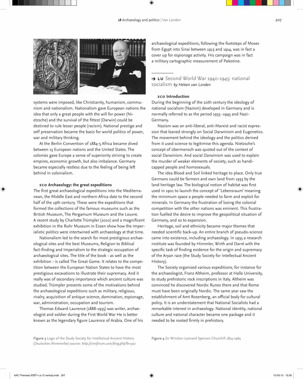
20718 Archaeology and politics | Van Londen
archaeological expeditions, following the footsteps of Moses from Egypt into Sinai between 1913 and 1914, was in fact a cover up for espionage activity. His campaign was in fact a military cartographic measurement of Palestine.
––––––––––Y lu Second World War 1940-1945: national socialism by Heleen van Londen
sco IntroductionDuring the beginning of the 20th century the ideology of national socialism (Nazism) developed in Germany and is normally referred to as the period 1933 -1945 and Nazi-Germany. Nazism was an anti-liberal, anti-Marxist and racist expres-sion that leaned strongly on Social Darwinism and Eugenetics. The movement behind the ideology and the politics derived from it used science to legitimise this agenda. Nietzsche’s concept of übermensch was quoted out of the context of social Darwinism. And social Darwinism was used to explain the murder of weaker elements of society, such as handi-capped people and homosexuals. The idea Blood and Soil linked heritage to place. Only true Germans could be farmers and own land from 1933 by the land heritage law. The biological notion of habitat was first used in 1901 to launch the concept of ‘Lebensraum’ meaning the minimum space a people needed to farm and exploit for minerals. In Germany the frustration of losing the colonial competition with the other nations was eminent. This frustra-tion fuelled the desire to improve the geopolitical situation of Germany, and so to expansion. Heritage, soil and ethnicity became major themes that needed scientific back-up. An entire branch of pseudo-science came into existence, including archaeology. In 1935 a research institute was founded by Himmler, Wirth and Darré with the specific task of finding evidence for the origin and supremacy of the Aryan race (the Study Society for Intellectual Ancient History). The Society organised various expeditions, for instance for the archaeologist, Franz Altheim, professor at Halle University, to study prehistoric rock inscriptions in Italy. Altheim was convinced he discovered Nordic Runes there and that Rome must have been originally Nordic. The same year saw the establishment of Amt Rosenberg, an official body for cultural policy. It is an understatement that National Socialists had a remarkable interest in archaeology. National identity, national culture and national character became one package and it needed to be rooted firmly in prehistory.
systems were imposed, like Christianity, humanism, commu-nism and nationalism. Nationalism gave European nations the idea that only a great people with the will for power (Ni-etzsche) and the survival of the fittest (Darwin) could be destined to rule lesser people (racism). National prestige and self preservation became the basis for world politics of power, war and military thinking. At the Berlin Convention of 1884-5 Africa became dived between 15 European nations and the United States. The colonies gave Europe a sense of superiority striving to create empires, economic growth, but also imbalance. Germany became especially restless due to the feeling of being left behind in colonialism.
sco Archaeology: the great expeditionsThe first great archaeological expeditions into the Mediterra-nean, the Middle East and northern Africa date to the second half of the 19th century. These were the expeditions that formed the collections of the famous museums such as the British Museum, The Pergamum Museum and the Louvre.A recent study by Charlotte Trümpler (2010) and a magnificent exhibition in the Ruhr Museum in Essen show how the imper-ialistic politics were intertwined with archaeology at that time. Nationalism led to the search for most prestigious archae-ological sites and the best Museums, Religion to Biblical fact-finding and Imperialism to the strategic occupation of archaeological sites. The title of the book - as well as the exhibition - is called The Great Game. It relates to the compe-tition between the European Nation States to have the most prestigious excavations to illustrate their supremacy. And it really was of secondary importance which ancient culture was studied. Trümpler presents some of the motivations behind the archaeological expeditions such as military, religious, rivalry, acquisition of antique science, domination, espionage, war, administration, occupation and tourism. Thomas Edward Laurence (1888-1935) was writer, archae-ologist and soldier during the First World War He is better known as the legendary figure Laurence of Arabia. One of his
Figure 3 Logo of the Study Society for Intellectual Ancient History (Deutsches Ahnenerbe) source: http://vnnforum.com/blog.php?b=502
Figure 4 Sir Winston Leonard Spencer-Churchill 1874-1965
AAC-Themata 5DEF-v.a.12 verloop.indd 207 12-03-13 15:29

208 part 2
not new, a wave of nationalism and populism swept over Europe (see Rosenmuller’s tv documentary on populism in Europe http://www.ikonrtv.nl/uitzendingDyn.aspx?lIntType=41).
sco Perceived societal problems and heritageNational cohesion - or lack thereof- is a substantial theme on the political agenda in Western Europe. Western leaders speak of a crisis in national identity. One of the main causes pointed at is a general lack of historical understanding. This feeling of loss dominates the integration debate. Newcomers need to learn about the nation’s history, language and core values.The Dutch government for instance asks of the cultural sector and education to communicate a clear national narrative. Recently, Dutch history was studied with the purpose of creating a Canon for school education. This Canon is now put down in law and each teacher must use this selection of important windows into Dutch history (look for the interactive content at http://www.entoen.nu in English). In 2007 the French president Sarkozy appointed a minister of Immigration, Integration, National Identity and Co-devel-opment. Identity quickly became a hot topic in politics, journalism as well as research. The role of governments interfering with peoples’ identity is part of a general discourse. Of course, the debate must be placed in a context of increased European influence and globalisation. Several people now forecast a true United States of Europe as was presented by Churchill in 1946. There is a strong emphasis on a shared European identity with a common European heritage as is stressed by several European heritage conventions such as the Valletta Conven-tion 1992 (archaeology), Florence Convention 2000 (landscape) and the Faro Convention 2005 (heritage tangible and intangi-ble). Also regional identities are sought and developed through history or archaeology. The biography of landscape is an example of a narrative on regional history and character alike (see the course on the biography of landscape). In reference to the historical canon, more than a few (small) cities developed local archaeological canons, such as the archaeological canon of Cuijk (see http://www.cuijksecanon.nl/press) or the city of Oss (see: http://www.ossecanon.nl). A complete map of regional Canons in the Netherlands is to be found at http://www.regiocanons.nl/. All contain some archaeology. Regional identity has become a communication format for the public.
sco Prehistory and the quest for originsThe Dutch archaeologist and prehistorian F.C. Bursch was a convinced national socialist. In a lecture in 1941 he empha-sised the importance of archaeology as a source of knowledge for the origins of ethnic people making special emphasis on how lucky it was that the Dutch and Germans were ethnically bound. A special book publisher, called Hammer, was founded in the Netherlands in 1940 for SS propaganda. Its main purpose was to stimulate the idea of a great Germanic cultural com-munity. Bursch published his book here on the earliest history of The Netherlands in 1944. A series of studies were financed that looked into the origins of Germanic culture. Between 1940 and 1944 they produced one book a month and were in fact the largest national socialist publisher.
––––––––––Y lu European Integration and globalization: 1945-present by Heleen van Londen
sco IntroductionAfter the Second World War large parts of Europe were devastated by extreme nationalism. Winston Churchill pre-sented the idea of a United States of Europe on September 19th 1946 at the University of Zürich to be formed as an independent development alongside the creation of the United Nations [read the speech http://www.zeit.de/reden/die_historische_rede/200115_hr_churchill1_englisch].The idea was to create a broader sense of citizenship. In 1949 The Council of Europe was created and its greatest achievement became the European Convention of Human Rights in 1950. The conventions of the Council of Europe aim at greater legal integration. Member states are invited to sign a convention after which the content needs to be integrated into national law. To prevent further war between France and Germany, France proposed a six nation organisation to form a common market for coal and steel, the European Coal and Steel Com-munity. It was the first supranational community consisting of Germany, France, Italy, Belgium, The Netherlands and Luxembourg (Treaty of Paris 1951). These countries formed the European Economic Community (eec) after the treaty of Rome in 1958 that laid the foundation for the European Union in 1992 (Treaty of Maastricht). Europe's union is primarily an economic one and it lacks political unity as is illustrated by the problems surrounding the Euro today. The present debate focuses on the increase of political central power, where nation states give away part of their sovereignty to prevent economic imbalance. In reaction, although the thought was
AAC-Themata 5DEF-v.a.12 verloop.indd 208 12-03-13 15:29

209
links• http://www.bible-archaeology.info/bible_city_jericho.htm• http://www.zeit.de/reden/die_historische_rede/200115_hr_churchill1_englisch• http://ec.europa.eu/publications/booklets/eu_documentation/04/txt07_en.htm#declaration
> sco Exercises
––––––––––Y lu Archaeology and politics by Heleen van Londen
sco Further ReadingGraves-Brown, P, S. Jones, C. Gamble, 1996, identity and archaeology: the construction of European communities, LondonKohl, Ph.L., and C. P. Fawcett, 1995, Nationalism, politics, and the practice of archaeology, Cambridge University PressShanks, M., 2004, Archaeology and politics, in: J. Bintliff (ed). A compan-ion to Archaeology, 490-509 - Wiley Online Library
sco ReferencesAnonymous, 1967, Sesam Atlas bij de Wereldgeschiedenis deel 2 van de Franse revolutie tot heden, Van Walraven bv, ApeldoornAnderson, B., 1983 Imagined Communities: Reflections on the Origin and Spread of Nationalism, New YorkEickhof, M., 2007, De oorsprong van het eigene, AmsterdamGrever, M., K. Ribbens, 2007, Nationale identiteit en meervoudig verleden, WRR, Amsterdam University Press, Den Haag, AmsterdamGroeneveld, G., 2001, Zwaard van de geest, het bruine boek in Neder-land 1921-1945. Uitgeverij Vantilt, NijmegenMoorhead, S., 2010, Leonard Woolley, Thomas E. Lawrence und die Vermessung der Wildnis von Zin, in Ch. Trümpler (ed.), Dass grosse Spiel. Archäologie und Politiek (1860-1940), Essen, 420-430Nora, P., Les lieux de memoires, (7 volumes) Gallimard 1984-1992Pringle, H., 2006, The Master Plan: Himmler's Scholars and the Holo-caust. HyperionRooy, P., de, 2002, Republiek van rivaliteiten. Nederland sinds 1813, Metz & Schilt, Amsterdam Toebosch, T., 2003, Grondwerk, 200 Jaar archeologie in Nederland, Uitgeverij Sun, AmsterdamTrümpler, Ch., 2010, Dass grosse Spiel. Archäologie und Politiek (1860-1940), Dumont, EssenSen, A., 2006, Identity and Violence. The illusion of destiny, London
pdfs Valletta treaty 1992Florence treaty 2000Faro treaty 2005
18 Archaeology and politics | Van Londen
AAC-Themata 5DEF-v.a.12 verloop.indd 209 12-03-13 15:29
210 part 2
stewardship. Increasingly, archaeologists even consider it to be their ethical responsibility to interpret research in a way that it is understandable for the public. It is their conviction that the past cannot be owned by archaeologists but should be made accessible to a wider audience.
sco Definitions> Animation
Usually, the engagement of the archaeological discipline with the public is referred to as ‘public archaeology’. There is however not just one agreed definition of ‘public archae-ology’. It depends on how one interprets ‘public’.It can mean:> on behalf of the public: the public’s interest is represent-ed by the State through regulation (and by archaeologists working on behalf of the public);> for the public: the public’s interest is taken into account by giving them the narratives the result from research;> by the public: the public’s interest is taken into account by acknowledging its right to have a say in the study and interpretation of their ‘own’ past and by opening-up in order for them to bring it into practice (indigenous groups).The way one applies and defines Public Archaeology can also depend on the aims one has. Broadly, two main approaches are being distinguished and debated in the literature:> the educational model (or deficit model) The goal is informing the public in order to gain support (and to account for public funds). By engaging with the public, people will get more interested (and perhaps more understanding of the difficulties), and consequently supportive for the work of archaeologists and the (public) funding that is involved (and confidence in the approach). This is primarily being done for archaeology’s sake.> the democratic model (or multiple perspective model)Its goal is to meet the public’s needs of identity, enrich-ment and enjoyment. By getting involved the public will enhance its real-life experiences of the archaeological herit-age. The public is encouraged to have its own encounters with archaeology, and to follow their own social, cultural or even educational preferences and agendas, even in inter-pretation. This is being done for the sake of the public.
sco Levels of engagementMost interactions with the public have an educational charac-ter. However, there are many ways to engage with the public, leading to various degrees in which the public is allowed to become involved:
19Public archaeology by Monique
van den Dries
––––––––––Y lu Public archaeology – Introduction by Monique van den Dries
sco IntroductionIn this module we will look into the concept of Public Archae-ology, or rather the concepts, as there are various approaches. We are not going to look at it from a practical point of view, by highlighting all the different means to engage with the public, or by showing good practices. Instead, we will look into the developments that started and stimulated the engagement with the public in various parts of the world and into some of the many challenges Public Archaeology faces today.
sco Archaeology and the publicArchaeology always has had a close relation with the public. The discipline originally emerged from the interest and fascination of individuals with the remains of the past that started with the systematic collection of antiquities (16th and 17th century). Also the first ‘show cases’ were set up by merchants. Even the first systematic approaches towards the recording of excavations and the first attempts at preservation in situ were often private initiatives. Furthermore, a large (or perhaps the largest) part of the sites that are known today have been discovered (and saved) by avocational archaeo-logists. The public’s fascination never vanished, but its interference and influence gradually decreased when the State took over responsibility in the 19th and 20th centuries on behalf of the public. The right to interpret the archaeological heritage was reserved for communities of professionals. For a long time these professionals primarily served academic interests, as was expected from them. When the archaeological resources started to diminish quickly and became endangered due to rapid economic development in the 20th century, the archaeo-logical discipline had to look for public support (and funding) for its efforts to preserve the resources. In contemporary heritage management public engagement and a public interpretation of archaeological sites has come to be recognised as an essential component in the conservation and protection of cultural resources and in fostering public
AAC-Themata 5DEF-v.a.12 verloop.indd 210 12-03-13 15:29

211
that both parties develop the plans together. The relation becomes a partnership of equally important partners. The former is often conducted in situations where indig-enous people are involved and their consent with the research is asked.
Decides> for a fourth group of archaeologists, which probably represents a minority, Public Archaeology means that the public is not only involved in the development of outreach activities, but also in the development of archaeological research programs. They may even be considered the most important stakeholder which decides what happens also regarding the archaeological research. It is ‘archaeology from below’ and aims at empowering communities. It is also referred to as community-based archaeology, or community archaeology. Often professional archaeologists are included, but this is not by definition the case.
sco InstrumentsGiven that there are various aims and levels to engage with the public, there are also numerous ways and means to conduct it. All over the world archaeologists have experiment-ed with all kinds of traditional or more innovative ways to work with audiences and have reported on their experiences. Increasingly archaeologists partner with specialists in educa-tion, entertainment, design and marketing to enlarge their range of communication instruments and products and to improve their communication skills. To name a few options: school projects, school-oriented workbooks, museum displays and exhibits, theme parks, open
> AnimationPresenting> probably the largest group of archaeologists that engages with the public does so by presenting archaeologi-cal findings (finds and interpretations). This can also be called public outreach.It implies sharing and distributing archaeological knowl-edge specifically to the community. The community itself plays a passive role, they are consumers only. Some archaeologists consider public outreach a specialism and establish partnerships with professionals in practicing education and public interpretation.
Involve> for a second and probably smaller number of archae-ologists, Public Archaeology implies that they involve the public - for instance by inviting them to participate in excavations or training excavations, in hands-on learning in archaeological techniques and in experiments (for instance in archaeological open air museums). The effect is that the audience becomes more active instead of a passive spectator. It may also include Participatory action research.
Consulting> for a third group of archaeologists engaging with the public also implies consulting the public or local commu-nity in order to gather their ideas and wishes regarding the partnership. This can either have a reactive character or an interactive character. The first means that the archaeologist provides proposals and the audience is allowed to negoti-ate the proposals and to add comments. The latter implies
Figure 1 Society is generally fascinated by archaeology but in the case of spectacular discoveries, the public consumes it massively(photo: M. van den Dries)
Figure 2 Public interaction still has an educational aim and character, although the combination with entertainment is growing (edutainment) (photo: M. van den Dries)
AAC-Themata 5DEF-v.a.12 verloop.indd 211 12-03-13 15:29

212 part 2
Holtorf, C., 2006, Archaeology is a brand! The meaning of archaeology in contemporary popular culture. Oxford: Archaeopress.Skeates, R., C. McDavid, and J. Carman, 2011, The Oxford Handbook of Public Archaeology. Oxford: Oxford University Press.
––––––––––Y lu History and Developments by Monique van den Dries
sco IntroductionThe emergence and development of what today is called ‘Public Archaeology’ is closely connected to what happened in the discipline as a whole, especially when it developed from a purely academic endeavour towards cultural resource man-agement and cultural heritage management. The focus and character of the attention for the public developed however differently in various parts of the world. Roughly two schools can be distinguished, the ‘American’ and the ‘European’. In the us the relation with the public is characterised by a focus on education and it is primarily initiated by the authorities (top-down). In Europe (i.e. the uk) it is more directed towards social inclusion and organised through private initiatives (bottom-up). In order to understand why PA has these various dimensions, we have to look at the developments that influ-enced engagement with the public in the different regions.
sco Developments in the United States> Animation
In the 1960s it became clear that archaeological resources were in danger from massive building and development activities and that it needed more structural protection, cultural resource management (crm), rather than just rescue archaeology. Also the vastness of the archaeological resource that was in danger led to the realisation that the help of the public was needed to protect it. This inspired McGimsey in 1972 to publish his book called ‘Public Archaeology’, by which he introduced the term in the archaeological literature. In this book he expressed his worries concerning the massive destruction of the archaeo-logical record by construction activities and by looting and he noted the lack of provision by both the State and Federal governments of legislative protection for sites and antiquities. He not only made a strong plea for adequate legal protection, he also advocated more public involve-ment in the past. The people would stimulate that the past would be preserved for future generations if they better understood its significance and value. Consequently, he believed public education was the key to engage the public with its past.So as crm relied on public support it became known as ‘Public Archaeology’. It both refers to archaeology regu-
days on excavations, children’s books, comic books, films, film festivals, websites, reconstructions, public lectures, radio programmes, television shows and news coverage, artistic and literary creations, dramatic re-enactments, living history, experimental programmes, video games, leaflets, brochures, photo books, magazines, guided tours, participation action, workshops etc. To summarize: there are no standard models or approach-es to engage with the public. What instruments suit a particu-lar situation depends on many factors, such as the aims of the engagement, the character of the public, the character of the archaeology, the financial means, etc. Various audiences and community groups may attach various types of values to a site and to its preservation too, and not everybody wants to be involved in the same way. So, in partnering with the community one should adapt to the individual situation and options. Moreover, it is advisable to allow different ways of participation: entertainment for the passive audience; education for those who want to be informed and want to learn; active participation opportunities for those who want to be engaged in the various processes and, finally, facilities to consult and negotiate with the local community.
> sco Exercise
sco ReferencesFaulkner, N., 2000, Archaeology from below, Public Archaeology 1(1), 21-33.McManamon, F.P., 2000, Archaeological messages and messengers. Public Archaeology 1(1), 5-20.Merriman, N. (ed.), 2004, Public Archaeology. London: Routledge. Skeates, R., 2000, Debating the Archaeological Heritage. London: Duckworth.Holtorf, C., 2007, Can You Hear Me At the Back? Archaeology, Commu-nication and Society. European Journal of Archaeology 10, 149-165.Greer, S., R. Harrison and S. McIntyre-Tamwoy, 2002, Community-based archaeology in Australia, World Archaeology 34(2), 265-287.
Websiteswww.yorkshiremuseum.org.ukwww.ace-archaeology.eu
––––––––––Y lu Public archaeology – Introductionby Monique van den Dries
sco Further readingPublic Archaeology JournalHoltorf, C., 2005, From Stonehenge to Las Vegas: archaeology as popular culture. Altamira: Walnut Creek CA.
AAC-Themata 5DEF-v.a.12 verloop.indd 212 12-03-13 15:29

213
interests, led to concerns for inclusiveness and a sensitivity to heritage values of other ‘stakeholders’ of the cultural heritage. When evaluating the significance of sites, archaeologists and heritage managers increasingly took other peoples’ interests into consideration. Gradually the archaeological remains were no longer seen as a research resource only, but as cultural heritage. So crm transformed into cultural heritage manage-ment (chm). Towards the turn of the millennium, it was generally acknowledged that the archaeological profession had to share the archaeological heritage with the public. Especially govern-ment programmes took the lead in promoting education and outreach. At the federal level, the National Park Service (nps), the u.s. federal agency that manages all national parks (58), national monuments and other historical properties, played a major role in this. Throughout the country the regional departments developed numerous educational programmes. It was also realised that professional communication and dissemination is a specialised field of operation, and that professionalisation was needed. Professional organisations, such as the Society for American Archaeology (saa) took up this challenge. For instance, they produced handbooks for best practices in outreach and education and the saa Principles of Archaeological Ethics encouraged all archaeologists to under-take public education and outreach. Moreover, archaeologists looked for collaboration with museum curators, exhibit designers and publishers etc to devise new strategies, to improve their abilities and to apply new communication technologies to unlock the past. Inspired by the icomos-Ename Charter on the Interpretation and Presentation of Cultural Heritage Sites (2008), the nps started to develop standards for education. Today in the u.s. all archaeology is considered public archaeology. It includes everything that relates to the wider society: antiquities laws, cultural resource preservation and management, monument restoration etc. As most of the work is done with public money, it is believed that archaeologists should always try to produce popular accounts and interpreta-tions of what they have found. These accounts consist of educational programmes, avocational archaeology, popular media presentations, communication with communities and individuals affected by archaeology etc. Public Archaeology is even an integral part of academic archaeological education.
sco Developments in EuropeIn contrast to the governmental initiatives of the us, in Europe the movement towards more public involvement came much more from within the discipline. It relied mainly on private initiatives rather than on State imposed actions. In this, the uk
lated by the state, and archaeology of the public and for the public.Ironically, ‘Public Archaeology’ at first caused a relative decline of public participation. After the Archaeological and Historic Preservation Act (ahpa) was signed in 1974, not only the salvage of endangered archaeological remains improved, also competitive contracting for archaeological work began. As a result, standards for archaeological contracting were developed, leading to a professionalisa-tion of the discipline. Consequently, archaeologists got further in a position to control and direct developments in the public sphere and the ‘public’ element transformed into archaeologists managing cultural sources on behalf of the public.This only changed in the late 1980s when the standards also stressed public education and outreach as a recom-mended outcome of mitigation activities. Then archaeo-logical outreach efforts (through lectures, exhibits, books, tours, films etc) increased hugely.
sco nagpraBut there were also external factors that stimulated the return of the attention for the public. One of these was the emer-gence of interest for indigenous cultures and other minority groups. They wanted to have a say in the study and interpreta-tion of their past. In the us this led in November 1990 to a federal law, the Native American Graves Protection and Repatriation Act (nagpra), which stated that federal agencies and institutions that receive federal funding have to return Native American cultural items and human remains to their respective peoples. It was of major importance as it juridically recognised that the archaeological heritage may have other values besides a scientific one and that there are other people besides archaeologists that have an interest in the archaeo-logical heritage. As of that moment the values of these ‘stakeholders’ had to be considered.
sco Growing awareness of stakeholdersSimultaneously the global movement of post-colonialism took place which brought a new sense of pride to (descendant) communities. In this context the theoretical archaeological debates moved, as in the eighties, from processualism to post-processualism.This implied a shift from absolutism to relativism, with more space for alternative views. Consequent-ly, archaeologists experienced that engaging with (local) communities was not only ethically and politically correct, but could be enriching as well. The development of resource protection legislation and crm strategies together with the notion of indigenous
19 Public archaeology | Van den Dries
AAC-Themata 5DEF-v.a.12 verloop.indd 213 12-03-13 15:29

214 part 2
standing the past and of the threats to this heritage; ii) to promote public access to important elements of its archaeo-logical heritage, especially sites, and encourage the display to the public of suitable selections of archaeological objects.The convention however does not specify how this should be done. So throughout Europe it is being done differently. Some national governments strongly stimulate public outreach and heritage participation through public funding; others leave it to private initiatives and private funding. It can in any case be seen that archaeologists are doing their utmost to engage with the public. All kinds of (creative) activities are carried out, ranging from the dissemination of results through books, displays, and films to community-based excavations. A second and more recent development is the Council of Europe’s Faro Convention, that only entered into force in June 2011, when it was signed by a tenth country. It encourages everyone in society to become involved in the process of defining and managing cultural heritage. As such it has the potential of strengthening the public’s involvement in heritage management even further.
– – – – – – – –sco Case study: Dutch situation
In The Netherlands, the public has always been very interested in and involved with archaeology. From the 19th century onwards, there has been a strong tradition of highly organised and active amateur historians, collectors, voluntary archaeolo-gists etc. They initiated for instance high quality journals and always collaborated with the professional world. Also they were often involved in field work. The National Archaeological Service, then rob, employed many amateurs after wwii in order to cope with the vast number of rescue excavations. However, when during the last decades the profession further professionalised, especially since the restructuring of the archaeological heritage management system after the signing of the Malta-Convention, the opportunities for local volunteers diminished. Amateur groups were no longer allowed to conduct excavations independently and due to the legally obliged quality assurance measurements, their involve-ment in commercial archaeological projects decreased as well.To the disillusionment of many, article 9 of the Malta-Conven-tion was unlike the other principles, not integrated in the national law. This means that there is no formal obligation to engage with the public. Nonetheless, there is a lot of interac-tion and engagement with the public. First of all archaeolo-gists need to negotiate with developers, policymakers and local authorities on funding. As there is also a growing
has played an important initiating role. One of the main initiators of public involvement was the late Peter Ucko (1938-2007). Ucko was a British archaeologist who witnessed in Australia the exclusiveness and the birth of the Burra Charter (1979). He took these experiences with him when he returned to the uk in 1981, where he succeeded Colin Renfrew as professor of archaeology at the University of Southampton. His motto was that archaeology is at least as much about the living as about the dead, and that it is at least as much about the present as about the past. So Ucko made an attempt to open up archaeology to a wider audience. In Southampton, he organised the first World Archaeological Congress (wac) in 1986. One of the implicit aims of wac was to encourage an open approach to the study of the past, in which consumers and users as well as ‘produc-ers’ were given equal weight. In 1997 Ucko also started a university graduate degree on Public Archaeology at University College London. His aim was to encourage archaeologists to consider the wider implications of their academic work and to introduce them to issues like nationalism, ethnicity, politics, media, illicit antiquities, education and globalisation of the past. This broad approach towards Public Archaeology is also reflected by the journal on Public Archaeology (2000) that Ucko initiated next. According to Neal Ascherson, the first editor of the journal, Public Archaeology ‘is about the prob-lems which arise when archaeology moves into the real world of economic conflict and political struggle. In other words, Public Archaeology is about ethics.’ Therefore, according to the Journal’s preface its purpose is ‘to analyse and report on archaeological and heritage issues which relate to the wider world of politics, ethics, government, social questions, educa-tion, management, economics and philosophy.’ Also on the continent some important developments took place that stimulated the engagement with the public. One is the signing of the Council of Europe’s Convention of the protection of the Archaeological Heritage (revised version) in 1992 by 20 countries. As it transferred archaeology from the margin to the centre of environmental planning processes, it brought along an increased interaction with the public, together with developers, policymakers of municipal councils and other stakeholders. Moreover, as it also obliges those that disturb archaeological remains to pay for archaeological research, it also stimulated research results in return. Of special importance in this context is Article 9 of the conven-tion, which states that:each party undertakes: i) to conduct educational actions with a view to rousing and developing an awareness in public opinion of the value of the archaeological heritage for under-
AAC-Themata 5DEF-v.a.12 verloop.indd 214 12-03-13 15:29

215
century, 2000, Washington D.C.: Society for American Archaeology.Dries, M.H. van den and S.J. van der Linde, in press (2012), Twenty years after Malta: archaeological heritage as a source of collective memory and scientific study anno 2012, Analecta Praehistorica Leidensia 43.Jameson Jr., J.H., 2004, Public Archaeology in the United States, in: N. Merriman (ed.), Public Archaeology. London: Routledge, 21-58.Jameson Jr., J.H. and S. Baugher (eds.), 2008, Past meets present, Archaeologists partnering with museum curators, teachers and commu-nity groups. New York: Springer.McGimsey, C.R., 1972. Public Archaeology. New York: McGraw Hill.McManamon, F.P., 2006, The foundation for American public archaeol-ogy. In: D. Harmon, F.P. McManamon and D.T. Pitcaithley (eds.), The Antiquities Act: A Century of American Archaeology, Historic Preserva-tion, and Nature Conservation. Tucson: The Arizona Board of Regents, Arizona University Press, 154-175.Merriman, N., 2004, Introduction: diversity and dissonance in public archaeology. In: N. Merriman (ed.) Public Archaeology. Routledge, London, 1-18.Ucko, P.J., 1987, Academic Freedom and Apartheid: The story of the World Archaeological Congress. London: Gerald Duckworth & Co Ltd.Willems, W.J.H., H. Kars and D.P. Hallewas (eds.), 1997, Archaeological Heritage Management in the Netherlands. Fifty Years State Service for Archeological Investigations. Amersfoort: Van Gorcum.
http://www.nps.gov/index.htm/http://www.nps.gov/archeology/tools/Laws/ahpa.htmhttp://www.cr.nps.gov/local-law/FHPL_ArchHistPres.pdfhttp://www.saa.org/http://www.worldarchaeologicalcongress.org/http://www.ucl.ac.uk/archaeology/http://www.rug.nl/let/nieuws/LetArchief/archief/archief2010/promoties_oraties/13_OratieGroenendijkhttp://www.erfgoednederland.nl/http://ace-archaeology.eu/http://archaeology.leiden.edu/research/archaeological-heritage-manage-ment/education/internships.html
––––––––––Y lu Relevant charters and conventions by Monique van den Dries
sco IntroductionIn various international charters and conventions the interest of the public has been recognised and acknowledged. This has influenced the present and future role of the public. Not only did it bring more awareness to archaeologists and heritage managers regarding their responsibilities towards the public, it also stimulated the public and local communities to play a more influential role in heritage management.> Animation
Burra CharterThe 1979 Burra Charter for the Conservation of Places of
tendency that representatives of the general public want to became involved in research objectives too, archaeologists increasingly need to negotiate on content. Municipalities develop for instance their own archaeological policies and local research agendas. Secondly, it is expected more than ever that research results are disseminated to the public. As a result masses of public books, brochures, leaflets, websites, exhibitions, cd-roms, bicycle-routes, guided tours on excavations, school programs, are being produced. Furthermore, there are numerous museums, several open air museums and theme parks, reconstructions, visualisations, information panels on monuments etc. It has become a business in its own: there are around 20 companies which specialise in public outreach. Also during the last ten years public outreach and heritage participation was highly stimulated by the government. Funding was provided for special participation programmes and for ngos that stimulate outreach and participation (such as regional heritage centres and private sector institutes like Erfgoed Nederland). Due to the economic crisis and a shift in the political arena, these organisations were confronted with heavy reductions of expenditure and closed funding programmes. Despite these difficulties and the lack of legal support for public involvement, the benefit of the Valletta Convention for society is that the archaeological community now acknowl-edges that the local public should be able to participate in heritage projects and that our interest in the past cannot not overrule the desire of others to participate in their heritage. This is also apparent in the university training. There is much more attention for public engagement as communication and public outreach is now included in many bachelor and master programmes. Since September 2009 there is even a chair for community archaeology, at Groningen University. In his inaugural lecture professor Henny Groenendijk stated that the aim of this chair is to build a bridge between the univer-sity, the state and the public by facilitating that local volun-teers, farmers and developers are informed and involved in the archaeological agenda and have a voice in the decision-making process.
> sco Exercises
sco ReferencesAscherson, N., 2000, Editorial. Public Archaeology 1(1): 1-4.Band, A.P. van den, and E.H.P. Cordfunke (eds.), 2001, Archeologie in veelvoud. Vijftig jaar Archeologische Werkgemeenschap voor Nederland. Utrecht: Matrijs.Bender, S. and G.S. Smith (eds.), Teaching archaeology in the twenty-first
19 Public archaeology | Van den Dries
AAC-Themata 5DEF-v.a.12 verloop.indd 215 12-03-13 15:29

216 part 2
idea that knowledge and use of heritage form part of the citizen’s right to participate in cultural life as defined in the Universal Declaration of Human Rights. The conven-tion therefore recognises the need to involve everyone in society in the ongoing process of defining and managing cultural heritage.The Faro-Convention presents heritage both as a resource for human development, the enhancement of cultural diversity and the promotion of intercultural dialogue, and as part of an economic development model based on the principles of sustainable resource use. It therefore aims to change heritage from being treated as a limited number of assets to be kept from harm, to being something universal and ubiquitous to exploit as a resource for society as a whole. This is about the use of the past in the present and its renewal into the future, to turn it into living heritage.It calls upon public authorities to encourage, for instance, reflection on the ethics and methods of presentation of the cultural heritage, to raise awareness and utilise the eco-nomic potential of the cultural heritage, and to stimulate everyone to participate in the process of identification, study, interpretation, protection, conservation and presen-tation of the cultural heritage.As in February 2011 Georgia was the tenth State Party that signed this convention, it entered into force as of June 2011.
Ename CharterIn 2008 the General Assembly of icomos ratified the Charter for the Interpretation and Presentation of Cultural Heritage Sites (known as the ‘Ename Charter’). It acknowl-edges that interpretation and presentation are part of the overall process of cultural heritage conservation and management, and seeks therefore to establish (seven) cardinal principles, upon which interpretation and presen-tation – in whatever form or medium is deemed appropri-ate in specific circumstances - should be based.
These principles are:> facilitate understanding and appreciation of cultural heritage sites and foster public awareness of the need for their protection and conservation;> communicate the meaning of cultural heritage sites through careful, documented recognition of their signifi-cance, through accepted scientific and scholarly methods as well as from living cultural traditions;> safeguard the tangible and intangible values of cultural heritage sites in their natural and cultural settings and
Cultural Significance, developed by icomos-Australia was the first that made the role of cultural significance in heritage conservation explicit. It defines cultural signifi-cance as the ‘aesthetic, historic, scientific or social value for past, present and future generations.’It provides a philosophy for the care of the Australian (indigenous) heritage and has been adopted as standard guidelines for heritage conservation practice in many parts of the world.
The principles set out in the Charter are:> heritage places are worth keeping because they enrich our lives – by helping us understand the past, contributing to the richness of the present environment and because they will be of value to future generations;> the cultural significance of a place is embodied in its: fabric, setting, contents, use, associated documents and meaning to people through their use and associations with it;> the cultural significance of a place are best understood by a process of collecting and analysing information before making decisions;> keeping accurate records about decisions and changes to the place helps in its care, management and interpreta-tion.The aims of the Burra Charter are to ensure that people are involved in the conservation of heritage places. This implies that decisions on the future of a heritage place are based on an understanding of the place, its cultural significance and its meaning to people and that communi-ties associated with the place are included in any decision concerning its preservation and use.
Valletta ConventionFor Europe, the Council of Europe’s Convention on the Protection of the Archaeological Heritage, signed in Valletta (Malta) in 1992 has been very important. Mainly because of its article 9, it has had a major effect on the volume of public involvement in archaeology.
Faro ConventionAnother and more recent development is the Council of Europe Framework Convention on the Value of Cultural Heritage for Society, from 2005. It is also known as the ‘Faro-Convention’. While the other international heritage conventions focus on how to protect and conserve cultural goods, the Faro Convention poses the question why and for whom the heritage is transmitted. It is based on the
AAC-Themata 5DEF-v.a.12 verloop.indd 216 12-03-13 15:29

217
In general, four target groups are distinguished when talking about ‘the community’:> people who live locally, either on or close to a site (that includes for instance stakeholders like landowners);> local descendant groups: those ancestrally linked to a site and which still live locally;> non-local descendant communities: they are linked to a site, but live in another location (maybe even hundreds or thousands kilometres away);> anybody who is interested and wants to participate.
sco How can one conduct community archaeology?The thousands of projects that happen all over the world show that there are many ways to engage with the local community and not all projects are conducted in the same way. The basic idea is that there is substantial community involvement and that ideally at least partial control remains with the commu-nity. A well-developed example is the Community Archaeology Project at Quseir, Egypt of the University of Southampton. Here a coherent methodology for community involvement was applied which consisted of seven components, including: communication with local organisations and collaboration in interpretation; employment and training of local people; public presentations; interviews of elders to retrieve local oral history; developing educational resources; building a photo-graphic and video archive; and community controlled mer-chandising. Not all community archaeology includes however the activities that were carried out in Quseir, not even in the uk. In 2010 the Council for British Archaeology published a study on the state of community archaeology (and voluntary action) in the United Kingdom. It was found that over 2000 voluntary groups and 215,000 individuals are active in archaeology. Only 41% of their activities involved excavations, in other cases they were active in photographic recording, field walking, finds analysis and post-excavation work like conservation, archive management, dissemination of findings (like web design, publication and exhibiting). Some focussed on lobbying for heritage management in the political arena. The form community archaeology has taken in the uk cannot exist in many other countries. Differences in laws across countries also dictate and limit the possibilities in various states. It may for instance be illegal for volunteers to handle archaeological artefacts without a permit and/or supervision. This is often indulged in the context of prevent-ing looting and illicit trade.
sco Importance
social context;> respect the authenticity of cultural heritage sites, by communicating the significance of their historic fabric and cultural values and protecting them from the adverse impact of intrusive interpretive infrastructure;> contribute to the sustainable conservation of cultural heritage sites, through promoting public understanding of ongoing conservation efforts and ensuring long-term maintenance and updating of the interpretive infrastruc-ture;> encourage inclusiveness in the interpretation of cultural heritage sites, by facilitating the involvement of stakehold-ers and associated communities in the development and implementation of interpretive programmes;> develop technical and professional standards for heritage interpretation and presentation, including tech-nologies, research, and training. These standards must be appropriate and sustainable in their social contexts.
> sco Exercise
sco Referenceshttp://australia.icomos.org/http://www.coe.int/http://conventions.coe.int/Treaty/en/Treaties/Html/143.htm (Valletta)https://wcd.coe.int/wcd/ViewDoc.jsp?id=975977 (Faro)http://www.enamecharter.org/
––––––––––Y lu Community Archaeology by Monique van den Dries
sco IntroductionCommunity archaeology or community-based archaeology is a relatively new development, which has boomed in the last two decades. Community archaeology is archaeology for the people and by the people. Its most important characteristic is to give – at least partial - control of a project to the local community. It may consist of projects run exclusively by the communities themselves or in collaboration with profession-als. It is taking place all over the world, but it appears to be more explicitly articulated as a specific practice in Australia, New Zealand and the United Kingdom. In these countries there is more agreement as to what community archaeology consists of than elsewhere in the world, but still there is no common view as to the aims, strategies, approaches and effects.
‘The community’
19 Public archaeology | Van den Dries
AAC-Themata 5DEF-v.a.12 verloop.indd 217 12-03-13 15:29

218 part 2
gical analysis.
– – – – – – – –sco Case study: working with the community in Palestine
In collaboration with unesco, the Palestinian Department of Antiquities and Cultural Heritage of the Palestinian Ministry of Tourism and Antiquities and Leiden University started in 2010 a joint project to turn the neglected Bronze Age site of Tell Balata (near Nablus) at the West Bank into an archaeologi-cal park for the local community. This site, historically known as Shechem (or Sjechem), is one of the archaeological crown jewels of the Palestinian territory and as part of the historic environment of Nablus it is a potential World Heritage site. It contains the remains of a fortified settlement of the Middle and Late Bronze Age, which already in the 14th century bc had an important position, because it was at the crossroads of trade routes. For a long time it has however been barely recognisable as an interesting place. Due to a lack of knowl-edge and resources and due to the general political context there has been a lack of preservation and conservation meas-ures and the site turned into a dump area. Until 2012 a large group of local and Dutch archaeologists and students from both countries will work on the site. The exposed foundations will be cleaned and the site will be prepared for visitors. The project combines a social and a scientific goal, as conservation and archaeological research alone are considered insufficient. Awareness by the community of the historical values of the site and of its social and economic potential is also needed. On the West Bank there is still little concern for heritage with the public. It has a low priority due to the political and economic situation. In formal education there is also little attention to the importance of historical remains, simply because the knowledge and the necessary educational materials are lacking. That is why all involved parties want to help evolving this awareness. The idea is that the Dutch support is given in a sustainable way, by investing in the heritage education of the local youth and by building the capacity of the other members of the local community. In this way the first step will be taken towards durable maintenance that is mainly conducted by the local community itself. To achieve this, multiple activities are undertaken, in which both the local archaeologists, students and inhabitants play the leading role. Together, they work on a visitor centre, visitor facilities, a tourism strategy, merchandising local products,
Today, many archaeological communities consider community archaeology important for the future of archaeology. They feel it is the only way that indigenous people, descendant commu-nities and other local interest groups will be able to own the past that archaeologists are employed to create. In reverse, many of the major issues in community archaeology are considered applicable to descendant communities and the collaborations essential for archaeologists to understand the social context of their work. Some even believe it enriches the discipline. For instance, it illustrates that there are different ways to construct and use ‘heritage’. Moreover, it encourages archaeologists to ask questions of the past they would not otherwise consider, to see archaeological remains in a new light and to think in new ways about how the past may inform the present. Nonetheless, there are also archaeologists that consider it to be a threat to the archaeological (academic) discipline. It may in any case cause tensions between archaeological and non-archaeological communities over the construction, interpretation and use of the past and, therefore, requires negotiation and compromises. It may certainly stress the skills of archaeologists.
sco FutureLike the broader concept of Public Archaeology, at first community archaeology seemed of little relevance for aca-demic research. By most academics, it was mainly considered a heritage management issue. It is only in the last decade that it also has become a significant field of scientific study. In particular there is a growing interest in the theoretical aspects of ‘heritage’, and subsequently of values and stakeholders, like how communities construct and use a sense of heritage and what the social, political and cultural implications of heritage can be. Increasingly students on archaeological heritage manage-ment are taught to critically evaluate the various ways in which archaeologists reach out to the public and to study the results.There is also an urge for research on community archaeology. In many countries funding for heritage is under increasing pressure, for instance as a consequence of the global financial crisis. In order to keep archaeology on the political agenda, it must provide the public service it is expected to provide. Thus, it must be proven that community archaeology does what it claims to do and a disjuncture between the ideal and the real world should be prevented from developing. It has therefore been suggested in the literature that projects need to be evaluated, either through self-reflexivity or ethno-archaeolo-
AAC-Themata 5DEF-v.a.12 verloop.indd 218 12-03-13 15:29

219
Community Archaeology Project at Quseir, Egypt, World Archaeology 34(2), 220-248.Simpson, F. and H.M.R. Williams, 2008, Evaluating community archaeol-ogy in the uk, Public Archaeology 7(2), 69-90.Available at: http://works.bepress.com/howard_williams/5.Smith, L. and E. Waterton, 2009, Heritage, Communities and Archaeol-ogy. London: Duckworth. Tell Balata Archaeological Park Project, Stories about Tell Balata. Nablus: Tell Balata Archaeological Park Project.Thomas, S., 2010, Community Archaeology in the uk: Recent Findings. York: Council for British Archaeology.Tully, G., 2007, Community archaeology: general methods and standards of practice. Public Archaeology 6(3), 155-187.
Websiteshttp://www.britarch.ac.ukhttp://www.publicarchaeology.eu/http://archaeology.leiden.edu/research/neareast-egypt/news/tell-balata-archaeological-park-kooij.htmlhttp://www.tellbalata.com
––––––––––Y lu Further reading on various aspects of presenting to the public by Monique van den Dries
sco Further reading on various aspects of presenting to the publicJameson Jr., J.H. (ed.), 1997, Presenting Archaeology to the public: Digging for Truths. Walnut Creek: Altamira Press. Jameson Jr., J.H. and S. Baugher (eds.), 2008, Past meets Present. Archae-ologists Partnering with Museum Curators, Teachers, and Community Groups. New York: Springer.Little, B.J., 2002, Public benefits of archaeology. Gainesville: University Press of Florida.Merriman, N., 1991, Beyond the glass case: the past, the heritage and the public in Britain. Leicester: Leicester University Press. Smardz, K. and S.J. Smith (eds.), 2000,The Archaeology Education Handbook: Sharing the Past with Kids. Altamira Press, New York. (Society for American Archaeology)Swain, H., 2007, An Introduction to Museum Archaeology. Cambridge University Press.Shackel, P.A. and E. Chambers (eds.), 2004, Places in Mind: Public Archaeology as Applied Anthropology. New York: Routledge.
and many other things. Also the oral history of the site is being documented and presented to the local community This is an important vehicle to get in touch with the residents, to cultivate their curiosity, to win their engagement and to appeal to their interests. Another important element is the production of a teacher’s handbook. All the knowledge on the site that was gained through excavations by Germans and Americans in the previous century was only available in English scientific publications. It is therefore not accessible to the Arabic speaking population. Through the development of a teacher’s handbook, this knowledge will be made available for the local community. An additional objective is to inspire teachers to use the site for their lessons. A third objective is to make (elementary school) students (approx. 8-12 years) aware that historical remnants of the past are valuable, useful and fun.It is a big challenge however to actually gain the attention and trust of the community. Given the tense and difficult political and economic situation they have lots of things on their mind which have higher priorities than heritage management. That is why it is important that close relationships with intermedi-ates like the local community centre are established. During two campaigns, educational material (in Arabic) has been developed for primary school pupils (about 50 children) and a number of lessons about the tell have been developed. This pilot has been evaluated positively by all concerned and led to interactions with the local community and school authorities to shape the final implementation.
> sco Exercises
sco ReferencesGreer, S., R. Harrison and S. McIntyre-Tamwoy, 2002, Community-based archaeology in Australia, World Archaeology 34(2), 256-287.Marshall, Y., 2002, What is community archaeology?, World Archaeology 34(2), 211-219. Moser, S., D. Glazier, J. Philips, L. N. El Nemer, M.S. Mousa, R. N. Aiesh, S. Richardson, A. Conner and M. Seymour, 2002, Transforming archaeol-ogy through practice: strategies for collaborative archaeology and the
19 Public archaeology | Van den Dries
AAC-Themata 5DEF-v.a.12 verloop.indd 219 12-03-13 15:29

220 part 2
Winchester (England), Bergen (Norway) and London (England). In the two latter cases the effects of archaeologi-cal works were crowned with the foundation of two archaeological museums:> The Bryggens Museum – opened in 1976Asbjørn Herteig was the director of archaeological works in Bergen for many years. This scholar is considered as the actual founder of modern urban archaeology as a field based on open-area examinations and measurement discipline.> The Museum of London – opened in 1978Edward C. Harris (Winchester) is considered as the founder of rudiments of examination methods. The fullest descrip-tion of excavation proceedings was offered by Philip Barker.The specifity of urban archaeology, resulting from different chronology, conservation status, or local specifity (topogra-phy, type of architecture), causes the fact that each country has a different history of the development of this branch of science. Local traditions are the main basis for research models and rules of administrative procedure. This in turn influences not only the value of such research, but also the research and conservation politics of the city.
sco Peculiarity of reseachUrban archaeology is the area of specialisation of enormous difficulty. The main reason for this complicatedness is the fact that research work is being done in the direct vicinity of the living urban infrastructure. Furthermore, in a vast majority of cases the history of examined places is recorded in thousands of layers. In most cases these layers form deposits with a total thickness of several metres. They are related to numerous levels of constructions, of various form, nature and function. Such constructions were built using various techniques and various materials. This diversity of forms and functions originated as a result of processes of stratification. On the other hand, a precise analysis carried out by archaeologists in Oslo has proved that it is (or was) numerous (continuous) levellings that are the essence of the sequence of layers as recorded by the archaeologist. The same research has proved that in most cases an archaeological site within a town of medieval origin is represented by layers with a total age of sedimentation being less than a half of the history of the examined location. The rest has disappeared in result of repeated topographic regulations. The stratigraphy of urban sites (as well as other multi-layer sites) is not the result of the process of continuous accumulation. It results from dynamic topographic changes. Historic continuity is usually notable in constructions discovered in the course of research.
20Urban archaeology by Andrzej
Gołembnik
msco General information> Animation
Scholars dealing with urban archaeology are to a consider-able degree unanimous with regard to the description and the definition of the subject of their interest. One of few controversies is the very name of the area of specialisation. Some researchers call it archaeology of historic towns while other scholars use the term urban archaeology.It seems that both of these terms may function in parallel; there is, however, a certain difference in their contents. The first term refers to research on structures of historic towns while the other one concerns any research within bounda-ries of historic towns, including locations of different origin and of various nature. The choice will therefore depend on the way of understanding the historic space of a town and on what we consider as a constituent of its history.At present, it seems that the only reason why both terms are in use is a different way of managing the historic space. This applies both to research institutions as well as to heritage protection services which safeguard the historic space. In most opinions a historic urban space is one vast archaeological site. In many towns there are internal diversities which separate spaces with other functional classifications. In most cases, however, such diversities result from traditional divisions.
––––––––––Y lu Basic problems and definitions by Andrzej Gołembnik
sco A short history of urban archaeologyThe history of urban archaeology> Animation
The history of urban archaeology can be traced back to the amateur searches for the ancient ruins of Heraculaneum and Pompeii. Systematic research was undertaken only right after wwi, by sir John Marschall in Mohenjo-daro and Harappa. Rudiments of modern urban archaeology were laid almost at the same time in three European cities:
AAC-Themata 5DEF-v.a.12 verloop.indd 220 12-03-13 15:29
221
a nearby building. A large amount of sandy fractions and clay, with a significant distribution of organic debris, allows to state that the accumulation process was slow. The researched area was hence a small courtyard of the prop-erty adjacent to the street.The ceiling of layer 32 was taken off (cut 37). It is possible that alongside with ceiling 32, other layers were removed at the same time. In total 50 years ‘dissapeared’. After making this levelling, a clay layer was exposed (30). Above it, levelling sediment was found, made up of something similar to 30 thin clay layers, divided by lenses of organic remains. Apparently, the levelling process was slower (29). At a certain point, it was almost entirely suspended, as it is suggested by layer 28. At that time, the decision about stopping the levelling works was made and focusing on making a deep dig in (31), filled with deposit 29. After that, the previously started levelling was carried on (27). The ceiling of the levelling, as well as the wooden construction beneath it, was removed (cut 26). This decision was caused by the unstable ground (loose structure of filling 29).The sequence of layers above is the proof of quick accumu-lation, connected to the functioning of a nearby building. The irregular surface of the ceiling layer is still caused by the deposition of filling 29. This is yet a further argument in favour of the quick accumulation of layers 25 and 24. They formed a part of the levelling prepared to restructure the place, in which another utility building and the accom-panying layer 22 appeared. Its ceiling was cut (20). Above it, there was another levelling layer (19). Its ceiling, along with the above layers, was cut (17). A new utility building emerged, which was accompanied with a slow accumula-tion process in the courtyard (bulk 15).The construction element (16) is a small pillar, placed in the ceiling layer of the final phase of building use. The ceiling of the layer was levelled as a result of the decision to widen the street (cut 14) and arranging a stone pavement on sandy ballast (deposit 13). The period of functioning of this pavement ends with the works carried out to build an aqueduct (cut 8, deposit 9), which was covered with layer 7. Above it, there emerged another level of the street (4), which after several years, was removed again (cut 2).Depositional history registered on a profile of the small trenchThe division into phasesThe division into phases and the proportional share of the layers in the stratigraphy (filled with colour) and levels (constructions) removed as a result of urban development. This scheme seems to prove the rule mentioned in the text, which considers ‘stratigraphical gaps’ as the basis of
Urban archaeology is therefore a field which encompasses not only historical, archaeological and urbanist knowledge, but also a broad knowledge of natural sciences. Urban archaeol-ogy is thus a truly interdisciplinary field. Due to a complexity of its research subject it has become a motive power of methods of archaeological research in the last half-century. It is enough to mention the merits of two key personages in urban archaeology:> Esbjorn Hertaig; Field strategy,> Edward Harris: Field methods and theoretical solutions, > Harris’s laws of archaeological stratigraphy.
sco Examples of simple stratigraphy and its analysis> Animation
Find the corresponding elements in the photo and figure. Add adequate numbers on the figure.The profile of an excavation site situated on the roadside (Płock – Central Poland)The profile represents a history of 650 years of the city under study. The total time of functioning of the levels, visible in the profile is 215 years. The sandy ballast stone pavement (4, 13, 46) functioned for the longest period of time (200 years). In each of the three cases, the pavement did not survive (2, 12, 44). The other units are the witnesses of short-term episodes, except for ‘layers’ 50, 32, 22, 15, 7 and 1. The ceiling was cut (71) in order to construct a free-stand-ing oven. The entire sequence is representing 75 years of the city history. The fact that the oven was used is known thanks to the sediment 70, formed from sequential lenses of coals of wood and ash.The next sediment is unit 69, being witness to cleaning the furnace chamber. Deposit 68 is made up of a ruined oven, which, most probably, functioned only for a couple of years. The unit, exposing the destruction of the oven, was covered with a clay deposit (66). This was a levelling that was to prepare the surface for the building of a small utility building. Connected with its functioning is bulk 50 – a layer made up of organic remains accumulated in a short period of time. The primary structure of the layer was obliterated due to intense postdeposit processes, taking place beneath the sandy ballast 46 (access of oxygen and rainwater). The building functioned for around 20 years.Layer 50 represents a similar time period. Its celing was cut (49) before restructuring the space and deciding to create a small, paved courtyard (ballast 46), which functioned for around 25 years. After removing the pavement (44) the area was left open. This state prevailed for around 5 years. On the ceiling, there formed a layer (bulk 32), accompanying
AAC-Themata 5DEF-v.a.12 verloop.indd 221 12-03-13 15:29
222 part 2
A major obstacle for the archaeologist who carries out research within a historic town is not only a need to organise the examinations in the direct neighbourhood of the living urban infrastructure but also to carry out the exploration on a broad surface and to a considerable depth. While mentioning a necessity of conforming to health and safety issues in the course of research, I need to remind the reader that archaeologists who carry out research near electrical, gas, waterworks and sewage installations, near functioning traffic routes, and in the direct vicinity of buildings, are obliged to conform to relevant legal regula-tions of particular European countries. It must also be remembered that participants in excavations must be immunised against tetanus.
sco TerminologyUrban archaeology is effectively opposing the introduction of rigid research norms. One of the signs of this is the existing lack of a standardised terminology and different conceptuali-zation of the used terms. This applies e.g. to the term ‘layer’. Some people find this state embarrassing, while others see it to be the strength of urben archaeology. Nevertheless, the dominating position of the English school in the last twenty years of the 20th century caused the fact that most terms were defined and many urban archaeologists use them to this day. This is especially important considering the modern techno-logical revolution. Using new documenting technologies in archaeology, such as close range photogrammetry, laser scans and computer systems of gathering and classyfying data, will force archaeologists to change the research strategy. This will include the need to standardize research methods and terminology.> Animation
Far-reaching freedom during research and the later analysis of its outcomes should not mean that archaeolo-gists are not obliged to report their work in detail, includ-ing an explanation of used terms. Despite the fact that the meaning of terms such as stratigraphy, stratification, unit, layer, structure, object, construction, element, cut, inter-face, horizon, phase, settlement level, and others is widely known, it is useful for the researcher to define such concepts each time. This would allow hindering the dangerous situation, where from the same urban setting; a couple of studies emerge using the same concepts in different ways.From the discussion about the meaning of basic terms in archaeology, it is useful to stop for a while when defining the term ‘layer’. Despite the fact that in many studies this
stratighaphic analysis in urban surroundings (multi-layer).Modern urban archaeology differs from the pioneer works of the two scientists mentioned above. It is difficult to find archaeologists keen to research with enthusiasm and in accordance with the canons set by Harris and Baker. Archaeologists are busy with many difficult tasks, mainly being a part of planned investments. Hence, they are subject to a certain timeframe and cost estimates, in which their research has to be finalised. Research strategy is therefore chosen to suit the conditions imposed on archaeologists. In the past decade, a model of research has been introduced, in which the organizational efficiency of researchers is more important than the quality of research. This is true for urban archaeology in almost all countries. Rare exceptions only prove this rule. This study is based on the works of classics, but it is also possible to realize it in reality.
sco Legal frameworkTheoretically, a legal framework for archaeological fieldwork, including historic spaces, is provided by the European Con-vention on the Protection of Archaeological Heritage (the Maltese Convention) of 16 January 1992, as well as national laws which usually refer to it. The Convention was ratified by 35 states. However, in practice, it are the internal legal regula-tions of each country that form the basis for all administrative and program decisions, despite often being in contradiction with European laws. The Convention says:Art. 3 of the European Convention: ‘To preserve the archaeo-logical heritage and guarantee the scientific significance of archaeological research work, each Party undertakes: I. to apply procedures for the authorisation and supervision of excavation and other archaeological activities in such a way as: a. to prevent any illicit excavation or removal of elements of the archaeological heritage; b. to ensure that archaeological excavations and prospecting are undertaken in a scientific manner (…); II. to ensure that excavations and other poten-tially destructive techniques are carried out only by qualified, specially authorised persons; III. to subject to specific prior authorisation, whenever foreseen by the domestic law of the State, the use of metal detectors and any other detection equipment or process for archaeological investigation.
sco Health and safetyThink about the risks that an archaeologist can face while carrying out research in an urban surrounding.> Animation> Exercise
AAC-Themata 5DEF-v.a.12 verloop.indd 222 12-03-13 15:29

223
A spatially defined unit with homogeneous or mixed composition. The unit is distinguished by its stratigraphical context, physical features and cultural contents. It origins in result of an activity or occurence of homogeneous nature.SedimentA continuous sequence of identifiable deposits. These deposits resulted from repetitive activities or series of subsequent activities which took place in the same spatially defined place and which were conditioned with a similar cause. A separation of a sediment results therefore from an interpretive process by which two or more connected deposits are grouped together into a single cultural unit. In order to distinguish between types of sediments, it is worth introducing three types of sediments into archaeo-logical records, depending on the legibility of their struc-ture:> Evident (clear, laminar structure)> Certain (disturbed structure)> Unclear (unified structure, e.g., fills of latrines)
BulkA spatially defined unit which is distinguished by its stratigraphical context, its physical features and its cultural contents. Its original nature is impossible to define.Non-layer (object) unitsObjectA feature which origins in result of a planned human activity and which is supposed to fulfil a given function. It consists of at least two units of different nature (e.g., layer unit + interface).ElementA unit which is distinguished by its structure and material, and located in a constructional position. It is part of a spatially defined system and it constitutes integral part of a construction.Set of elementsA group of elements which is spatially defined and which is distinguished by its context and material. The elements are mutually dependant in a direct, constructional and func-tional way.ConstructionA group of elements or sets which is spatially defined and distinguished by its context and material. The elements are mutually dependant in a direct, constructional and func-tional way and the construction forms a functionally closed entirety.
word has been replaced by the term ‘unit’ (which I find to be a considerable achievement), it is useful to introduce the proposals for stratigraphic analysis based on Polish-Norwegian experiences.
sco Basic definitionsConnect the keywords with their definitions.> Animation
Urban archaeologyResearch specialisation which makes use of archaeological methods for the purpose of examining the history of towns and urbanised spaces, as well as identifying urbanisation processes in their entire chronological dimension.Multi-layer archaeological sitesSpaces with a defined extent. The stratigraphy of these spaces consists of a sequence of archaeological layers of diverse chronology and defined context.StratificationA process of origin of the layer composition of a site, consisting of a sequence of units of diverse origin.StratigraphyAn existent system of spatially defined units, which is recorded by the archaeologist. The units are divided into layer units, non-layer units (objects and constructions) and interfaces/cuts.Archaeological layer (based on the definition by M. B. Schiffer)A defined and dynamic system which undergoes periodical processes of change. The system has two points of crea-tion: a quantitative growth of components and the point of final growth. The latter closes the process of layer forma-tion. The system then becomes a relic form and at the same time it is excluded from the set of elements of the living social-cultural system.
sco Stratification unitsFill in the diagram and check the correctness of the answer.> Animation
Stratification unitsLayer UnitsAn introductory analysis of the contents and the structure of a given layer unit is to be done in the course of explora-tion in a multi-layer site. This analysis should result in a decision on to which of the three types the examined unit belongs. Thanks to the use of types of layers it is possible to eliminate the ambiguous term ‘layer’ from the descrip-tion of stratification processes.Deposits
20 Urban archaeology | Gołembnik
AAC-Themata 5DEF-v.a.12 verloop.indd 223 12-03-13 15:29

224 part 2
sco Analysis of the sample sectionThe basic step in a proper recognition of the nature of strati-graphic unit is by analysis of the sample section. It is only by looking at its texture, the archaeologist is in a position to recognize and document its laminar structure, internal composition and integration of elements making up the layer. There is a number of simple procedures making possible to define the pace and character of accumulation, themselves characterizing deposition and pos-depositonal processes.
> Exercise: Connect the photos with their definitions
sco Characteristics of stratigraphy of urban sitesThe main reason for a considerable complexity of stratigraphy of most urban sites and a considerable dynamics of their stratification processes were constant changes in the build-ings’ structure and in the pace of growth of layers (chiefly waste layers). In many cases, especially in cities distant in the time of their existence, such changes were connected to a full restructuring of the urban surroundings, a change in the style and manner of using urban spaces. All this influences the fact that the thickness of archaeological layers, in multiple cases exceeds many meters. This process of stratification created multi-layered, culturally diverse archaeological sites. In the case of middle ages cities, the rapid growth in the quantity of waste and the impossibility of their current utilisation had two main consequences. It was due to this process that a vast majority of areas within historic towns (usually of medieval origin) are multi-layer sites. Furthermore, in most cases these layers are filled with organic material. This is because the pace of accumulation and the resulting permanent humid environ-ment created anaerobic conditions. These preserved the contents of layer units in an almost unchanged condition, including items of everyday use and construction elements of buildings. Furthermore, one must bear in mind frequent restructur-ing of urban buildings, both at a local scale and within the entire town, which resulted from modernisation, local fires or conflagrations of entire towns, planned changes in the spatial layout of a town, fortification works or similar activities. Due to these, layers which make up historic contents of the examined site are often found in secondary deposits. They therefore render the interpretation of archaeological discover-ies additionally difficult. This should be taken into considera-tion when creating proper working conditions for archaeolo-gists, as it is accuracy that should be the essence of archaeological research in towns. This is due to the fact that researchers working in towns usually examine structures
sco Units of stratigraphical analysisConnect the keywords with their definitions.> Animation
UnitEach unit (layer unit or object unit) which was separated by the archaeologist and which was provided with an indi-vidual identification number.HorizonA defined unit of stratification or a set of chronologically convergent units which are in a direct stratigraphical relation or which are spatially dependent on one another. This unit or set corresponds to defined stratigraphical events.Settlement levelA horizon or a set of horizons which are directly related to other units in the site in stratigraphical and chronological terms. This relation, however, is not necessarily of func-tional nature.PhaseA unit or a series of stratigraphical units being a testimony to a planned, carried out and completed idea of organisa-tion and functioning of a given space. This idea had its beginning and the resulting organisation and functioning lasted until a given activity was stopped or was subject to destruction. The latter implied a need for structural and spatial changes within the new space.The problem with terminology that is used when writing down the outcomes of excavation works is open and constantly evolving. It is enough to compare the content of publications of the leading theoreticians of excavation methodology in the past several years. From the most commonly used ‘layer’, through ‘stratuum’, ‘unit’, ‘feature’, recently, the term ‘context’ is increasingly popular. In each of these cases, the terminology was strictly connected to the concrete research methods and documenting strategies. Currently, the expression advocated by British scientists is the ‘single layer context’ rule. The set of terms I presented is not to undermine the legitimacy of existing arrangements. It is to provoke discussion and prepare ground for new terminology, which, sooner or later, will change the existing fieldwork methods and systems of documentation. It is hence important to inform those dealing with the same problems, that both research methods and the used terminology should be a creative process. At the same time, it is crucial to maintain a precise description of the techniques used during excavations and the ways of transcribing its outcomes.
AAC-Themata 5DEF-v.a.12 verloop.indd 224 12-03-13 15:29

225
the site, while analysing the drawn sample (micro-explora-tion). The second method is especially useful for research on organic layers. Thanks to such in-depth observations, it is possible to state if the researched layer is a primary deposit, or a translocated unit. This information is funda-mental for the analysis of the stratification process. It allows deciding on the time-schedule of the works (since primary deposits require different methods of exploration). It is also a way of preparing a defined, broad-context plan of the findings, which is especially important when using documenting methods such as photogrammetry and laser scans. Such methods enable a time-saving and effective way of conducting research. Moreover, a detailed descrip-tion of the physical characteristics of the layers proves to be the best method for the later monitoring of the layers being in close proximity to the excavation site. The best example for this are the works carried out by archaeologists in Bergen.
> sco Exercise> sco Exercise
––––––––––Y lu Selected elements of research strategyby Andrzej Gołembnik
sco Research strategyArchaeological research within living towns usually takes place as rescue excavation. This term refers to a scholarly procedure where not everything depends on the researcher’s will. Three key issues remain outside his or her decision: the selection of place, the duration of examinations and the financial frame-work of research. It is the form of research that forces the archaeologist to decide on a strategy which would match imposed conditions. In many cases it leads to improvisation or simplifications, with both of them being detrimental in archaeology. Another form of urban archaeology, which is far more dangerous, is a so-called watching brief. This is an attempt at limiting the participation of the archaeologist and reducing his or her role to a mere observer of ground works being carried out. Such activities drastically reduce cognitive opportunities. They are deprived of scholarly features and in consequence they reduce the value of offered conclusions. Such methods should be used in emergency only and for works in small areas. It must be underlined, however, that this recently widespread form of participation of the archaeologist in ground works in historic towns is contrary to the rules of the Maltese Convention.
whose history is known in broad terms. It most cases it must be completed with detailed information.> Animation
The ‘truth’ about each archaeological layer can be found from its content and structure. The complementation of this information is the context, in which it was found. The basic task of an archaeologist during excavations is hence recording all possible physical characteristics of the unit under study. The outcome of the analysis is the only way to identify the character and define the layer (deposit, stratum, bulk), as well as exposing its role in the process of stratification (establishing the category: continuity, distur-bance and destruction). The next phases of analysis com-plement each other, showing forms of dependency typical for the processes (depositional and postdepositional) of the layer types. This complex, but based on simple tests and steps, process, becomes a part of the scientific descrip-tion of each of the researched layers. It is crucial for a full understanding of the dynamics and details accompanying stratification processes. It is the quintessence of urban archaeology sites and it provides a descriptive complemen-tation of the archaeological ‘single layer context’ rule. Eliminating or limitating the scope of detailed analysis and description of all layers, just as making intuitive selections of units is a threat to the vaule of the excavation works.Modern urban archaeology is usually realized in the form of rescue research, based mainly on evaluating the rela-tions of space and context. The latter relates to the rela-tions between layer units and objects (between a group of dynamic units, layers and static – constructions). It is important to mention that an experienced researcher, with a sensible budget, allowing the possibility of developing interdisciplinary studies, is able to maintain research precision based on general arrangements, basing on spatial analyses of the site. It is therefore up to the archae-ologist (and his responsibility) to choose the appropriate research methods. We must keep in mind that the essence of detailed research is the evaluation of the dynamics of the processes taking place in each settlement horizon. In the case of rescue research, the archaeologist is forced to shift these evaluations into a more general level, concern-ing settlement levels and phases.New terminology, especially that distinguishing between layer types, forces the archaeologist to analyze each of them in detail during the excavations. For some, these are simple and quick steps, while for others they are compli-cated and time-consuming. This process can take place on the excavation site, during the explorations, or outside of
20 Urban archaeology | Gołembnik
AAC-Themata 5DEF-v.a.12 verloop.indd 225 12-03-13 15:29

226 part 2
safety regulations, the investment organisors usually fence the excavation site. In many cases however, this is not the only reason for the existence of such fences. Common causes for closing the excavation site are the conditions, in which the research is being conducted. This is not a healthy practice.NoProperly conducted research should have its scientific and social dimensions. The best way of making research public is opening it to a wider audience. In many cases, the excavation site is opened for visitors only in a set period of time. This is a sensible way of approaching the role that the archaeologist has, and the best way of making scientific research more popular in an educational way. It would therefore be good, if this became commonplace.
sco Localisation of examined places and measurement worksThe easiest way to describe a localisation of a place of exami-nations is a system based on an arbitrary division of the urban space. Lines of the land survey grid are the basis for the localisation of trenches. These lines make up squares (marked with symbols) within which the examined space is recorded. Apart from the symbols of squares and land survey coordi-nates, the name of the examined place is defined by its catalogue number and its postal address. This method sets up a complex, two-stage localisation of the examined place: a per-manent one (based on the grid) and a temporary one, based on the current postal address. The added individual catalogue number of the place (indispensable for archivisation purpos-es), becomes the main determinant of the research activity.The main element of the research strategy is to adopt one of two ways of managing the space under examinations. Basically, two ways may be chosen: the open-area one, which encompasses the entire examined surface at the same time (most common, preferred by English researchers), and the sectional one, when the examined space is divided into smaller sections by the archaeologist (popular in Scandinavia). The choice of one of these two ways depends on numerous factors. The most important ones are: personal preferences and character of the archaeologists, who draws (or not) conclusions based on series of internal sections, working conditions and the degree of complexity of the stratigraphy of the site. It is important to mention that archaeologists value the freedom to choose their own research methods and ways of documenting their findings. This is because their main objective should be the reliability of their research, not the spatial organisation of the excavations.
sco Pre-excavation research Pre-excavation researchAn efficient completion of archaeological research in a town requires a consistency in activities and a strict observance of procedures. The first duty of the archeologist is to gather knowledge about the place where excavations will be carried out. On the one hand, conditions of excavation works and the required extent of future research are defined in the adminis-trative decision of the Conservator who gives a permit to carry out the research. On the other hand, an efficient completion of future works depends to a great degree on the archaeolo-gist’s own activity. It is his or her duty to gather a possibly comprehensive knowledge on the history of the place of future research. All acquired information should help decide on the research strategy and support the efficient completion of research, including a preparation of a project cost estimate. Tasks of the research director include: to make (acquire) a land survey plan of the examined area with the present urban underground infrastructure; to examine historical sources and to analyse existing maps; to identify the state of research on the area where the excavations will be carried out; to check its geological and hydro-geological conditions; to identify the structure of layers and the compactness of soil; to examine the state of preservation of archaeological contents and the depth of their deposition. They also include introducing the basis of the proposed research strategy and describing the used terminology
Non-invasive examinationsNon-invasive examinations are of secondary importance in urban spaces. They may help in deciding on a proper strategy while examining broad surfaces which are not built-up. In such cases these examinations may chiefly consist of test drills and geophysical survey. Among the latter, resistivity survey and ground-penetrating radar survey are still most commonly used in open urban spaces. Both methods bear a risk of error, chiefly due to the presence of rubble layers and underground urban infrastructure. In the cases of dense urban building network aerial prospection may be of equally minor impor-tance. Analogously to field surveys, it can be successfully applied only for examinations of building-free areas of towns.
sco To fence or not to fence?Try to answer the following question: Is it useful to fence the excavation site in urban surroundings?> Animation
YesArchaeological research, carried out in cities, is visible to the eyes of almost all of its inhabitants. Due to health and
AAC-Themata 5DEF-v.a.12 verloop.indd 226 12-03-13 15:29

227
and compare, as well as facilitates further activities when attempting at changing the strategy.Multi-stage examinations with an internal divisionIn the case of the lack of experience or the presence of particularly complex systems it is acceptable to divide the area of examinations into smaller sectors and to explore it, e.g., within a chessboard system. In this case the spectacu-lar way of recording the open area gives way to the accu-racy of research. The opportunity to immediately verify the research results is an advantage of this way; furthermore,it is considerably easy to correct errors, chiefly due to the network of sections. The lack of opportunity of global thinking deprives the field documentation of the element of introductory synthesis. This, however, can be successfully done after the entire documentation is put together. This way of examinations proves useful in an open area with a complex stratigraphy. It is the least popular research method in urban archaeology. It is useful to its detailed nature, but difficult in putting to life in modern conditions.Role of sections A system of internal sections has always been important in archaeological study and is highly recommended for research on complex issues. These may be standing sections (used, e.g., in the ‘chessboard’ method), or tempo-rary cumulative sections. The latter are mainly used in the cases of excavations based on the horizontal excavation principle. One may therefore create a network of sections along the lines of the grid system in the area of the examined site. The sections may also be created ad hoc, in order to decide on a current issue. Sections are especially recommended for objects of complex multi-layer stratigra-phy, where the cross sections method is particularly useful. Sections are set up depending on interpretation needs. The presence of sections enables one to exercise full control over the course of recording and interpreting of stratifica-tion processes. On the other hand, their presence in the examined area renders a spatial analysis of discoveries difficult; furthermore, it disturbs their spectacular view. Therefore, should this method be used in modern urban archaeology? This decision lies with the archaeologist himself. The presence of sections should result from a sound compromise, with the principle of scholarly accuracy being in the forefront. It is not true that only a proper horizontal excavation secures a proper identification of complexities of stratification processes. It cannot be held for true, either, that a section records all the possible relations between identified units.Principles of using the measurement gridLines of a measurement grid in an archaeological site have,
> AnimationOpen-area examinationsOpen-area examinations consist of opening and exploring the entire space, which is available for archaeologists at the same time. This type of examinations is the most popular way to manage urban excavations. This particularly con-cerns areas with dense historic building. It allows a global perspective, which tackles the problems of spatial planning, the relations between open complexes, controlling the context, and defining its character and function. It will nevertheless be recalled that the lack of internal divisions which facilitate the interpretation of local stratigraphical complexities, bears the risk of interpretation simplifica-tions. The main advantage of the open-area method with no internal divisions is a spectacular image of excavation works. This method eases organization problems, mainly when it comes to moving around the site, carrying out measurements, simplyfing earth disposal, and the possibil-ity of making visual documentation (overhead photogra-phy). It must be admitted that examinations which are efficiently done in this way, provide the researchers with a unique opportunity of global thinking. This it why this method is recommended for experienced archaeologists.It is a method mainly used in England; however it is becoming increasingly popular in other countries as well.Open-area examinations with an internal divisionBased on practical experience of numerous archaeologists carrying out their excavations in broad surface complex urban sites, it can be said that an internal division of the site is indispensable to secure control over the course of works. This method, widely used in Scandinavia in the past century, is still very useful. The basis of this method is dividing the excavation space with a measuring grid. It is also possible to divide the space according to the spatial arrangement of buildings on the site. In both cases, the aim is to gain additional sections and enable efficient organisation, by establishing a couple of cooperating groups of researchers. Providing the participants in the open-area examinations with a division of the area into permanent measumement and recording units forces them to adapt a disciplined way of work. On the one hand, an established surface (e.g., a half of the are) is large enough to secure an opportunity to make valuable schol-arly observations. On the other hand, it is small enough to enable the excavation director to control the progress of work. In practical terms, it not only means a division into sections but also a competence division within the team. This supports the internal organisation of works. The internal division of the site enables one to control, verify
20 Urban archaeology | Gołembnik
AAC-Themata 5DEF-v.a.12 verloop.indd 227 12-03-13 15:29

228 part 2
and the mechanical equipment is part of today’s reality, every effort must be made to ensure its fully controlled use in the area of archaeological examinations. This problem has not been solved so far and it must be said that the mechanical equipment may be used only to remove present-day soil overburden and modern period rubble.Organisation of research disciplineA crucial element of the strategy of field examination is to define and to rigorously observe rules of carrying out excavation works. This concerns both general organisation affairs and particular solutions concerning exploration, the way of preparing documentation and collecting finds. All this should be put together into a transparent organisation scheme of works. An expedition should have several copies of such an instruction, which is a collection of principles to be observed in the course of works. This instruction should contain information on: the principles of the internal division of the site, a valid measurement system together with the coordinates of the main lines, as well as the location and the elevation of the benchmark. It should also include a set of definitions of basic terms used to describe and interpret the processes of stratification and to analyse the stratigraphy of the examined site; a template and an explanation of principles of preparing descriptive docu-mentation; a template and an explanation of principles of preparing drawing documentation. Furthermore, a system of collecting, storing and labelling of finds must be included.
> sco Exercise> sco Exercise
––––––––––Y lu Research procedures by Andrzej Gołembnik
sco Exploration> Animation
Stratigraphical explorationExploration is the main research activity undertaken in the course of excavation works. This term includes a set of mechanical activities related to: the examination of the extent, the composition and the nature of examined units of stratification; the collection of finds; taking of necessary samples; physical removing of all these outside the exam-ined area. After a many years’ discussion, started at the beginning of the last quarter of the 20th c. by the English archaeologist E. C. Harris, it was concluded that the method of stratigraphical exploration should be mandatory in multi-layer sites. This method consists in removing all the layer units of stratification and part of object units in
until recently, been the basis for all documentation works. Sir Mortimer Wheeler and Kathleen Kenyon are considered to be the inventors of the grid square system. As a rule, these lines should be a detailed development of the localisation grid and, as in the case of the latter, they should be based on land survey coordinates. It is recom-mended to use the grid lines which are referred to with full coordinate values. A grid which is set up this way should be stabilised outside the edges of research trenches. A local grid with no land survey coordinates should not be used in urban archaeology. The role of documentation measure-ment networks has presently been reduced by the more and more widespread use of total stations.Elevation measurementsElevation measurements should be done in reference to a level value of a state benchmark. The benchmark should be situated in a safe place, outside the area of excavation works. Its position and its absolute value should be marked on a situation plan of the site. Temporary benchmarks are used in the course of examinations. Their values must be recorded in the excavation journal.
sco Remaining elements of strategy research> Animation
Selection of specialists from other fieldsIt is at almost every occasion that theoreticians of urban archaeology underline the manifoldness of conducted research. In their opinion the research develops in two basic directions: a spatial and a social one. Due to the complexity of research issues, this situates urban archae-ology at the touch point of many branches of scholarship. A recommendation for interdisciplinary cooperation already at the introductory stage is commonly stressed. A requirement of field cooperation and a need to confront the results of excavations with opinions of specialists from other fields at the stage of conclusions must also be stressed. If understood this way, this necessity requires everyone to undertake particular organisation effort; to enforce high standards of excavation works; and to ensure high qualifications of archaeologists. Furthermore, it demands considerable financial expenses and necessary time for research.Mechanical equipment in archaeological sitesThere is no doubt that the pace of work resulting from the pressure put by developers is a problem for archaeology. In result of this, the presence of mechanical equipment in archaeological sites is more and more widespread. The presence of mechanical excavators in urban sites has been a common feature in Europe. As this misfortune occurred
AAC-Themata 5DEF-v.a.12 verloop.indd 228 12-03-13 15:29

229
This must be borne in mind in order to eliminate the factor of subjectivism (which accompanies the method) and a natural reflex to deal with the problem as soon as possible. The latter is particularly important in the circumstances of pressure, which is so often put on archaeologists.In order to secure a proper documentation order, each identified unit must be provided with an individual symbol (number). It is recommended to use an ongoing inventory, with a distinction between layer and object units (cf. defi-tions: deposit, sediment, stratum, interface/cut, object, construction element, construction set, construction).
Principles of separation of layer unitsControlling the work of explorators is the duty of the archaeologist who supervises the progress of works in the archaeological trench. If the examination is done properly, a decision on the extent of layer units is a resultant of data acquired during mechanical exploration activity and of the knowledge of the person responsible for recording the sequence of units, including the context and all topograph-ic conditions which accompany stratification processes. Practically, this two- or often three-stage system of making decisions increases their credibility.Another important task of the archaeologist who makes final decisions is to determine the detailedness of separa-tions being done. One of rudimental features of stratigra-phy of urban sites are traces of recurrence of occurrences and activities which make up a process of ‘layer’ making. This fact is a reason for a separation of three types of layer units. This provides the archaeologist with an opportunity to combine deposits into a unit with a compound (usually laminar) structure. This means that the process of separat-ing layer units must be done in parallel with activities aimed at preparing their comprehensive characteristics.Principle of analysis and recording of the contents of layer unitsDefining a full extent of each examined unit of stratifica-tion (both horizontally and vertically) and attempting at offering its comprehensive description and definition are part of proper exploration. With regard to that, the archae-ologist’s duties include: to determine the material contents of a unit; to identify and define its physical properties; to identify the mechanisms of accumulation; and finally to specify mechanical and natural factors responsible for post-deposition processes. These analyses should result in a decision of assigning the examined unit to one of three categories of layer units (as described above). The last stage of the analysis is to determine the original nature and characteristics of the unit.
the reverse order from their chronological sequence. In other words, this method relies on the principle of remov-ing the stratification units from the latest to the earliest one. This method is presently considered as the most appropriate way of examination of multi-layer sites. Its application raises the rank of exploration, thus making it scholarly activity. The search for the extent of separated units and attempts at defining their context secure a basis for more in-depth analyses of topographic changes. These analyses are the main component of spatial reconstruc-tions of the examined site done by archaeologists. The principle of stratigraphical exploration has profoundly changed not only research strategies and forms of pre-pared documentation but also the way of summarising the research results.Exploration using arbitrary layersThis is a traditional way of doing excavation works. It corresponds to the previous research strategy, which was based on simplified forms of documentation. In present-day urban archaeology this method is acceptable only for a conscious division of such layers whose thickness and structure render another division impossible. A decision to use this method of exploration may result from practical reasons only. At the present stage of development of methods of urban archaeology this method is not consid-ered scholarly.
sco Separation of stratigraphical units> Animation
Separation of stratigraphical unitsOne of the main tasks of archaeologists who carry out excavations using the stratigraphical exploration method is to separate stratigraphical units. The effort of archaeolo-gists aims at plastically preparing the top of a unit and defining the boundaries of its extent. This task requires knowledge on basic physical properties of explored layer units. Furthermore, experience is necessary in order to draw proper conclusions on the ongoing basis. It must be remembered that an improper use of the stratigraphical method can inflict damage which is difficult to redress. A proper final result is also influenced by an appropriate choice of work tools and by the pace of work which is imposed on archaeologists. The repertoire of ‘digging’ techniques comprises numerous ways of controlling the process of exploration. These depend on the competence and personal preferences of archaeologists. Least skilled archaeologists are recommended to use local vertical cuts. Detailed observations must be accompanied with a topo-graphic reflection and a full understanding of the context.
20 Urban archaeology | Gołembnik
AAC-Themata 5DEF-v.a.12 verloop.indd 229 12-03-13 15:29
230 part 2
standing of the stratification process and for a proper evaluation of finds discovered during the exploration. This state consists in putting together and analysing all the acquired features. The following rudimentary features are the most useful for identifying the category of layer units: the topography of the layer’s top (a degree of intermingling of the top and the bottom of neighbouring units), the degree of lamination, the position, the state of preserva-tion and the degree of overlapping of components which make up their contents. Each identified feature of a unit is nevertheless significant for the value of conclusions. This is because a decisive role in their final list may be played by a potentially least important one. A preparation of such a list is anyway a complex task.
Attempt at identifying the original nature of a layer unitA complete identification of features of a layer unit, that is, an attempt at identifying its original nature is a resultantof all the physical features (as detemined in the course of examination of physical features), their cultural contents and the results of all intermediate analyses. An appropriate identification of the contents (including relations between layer units and object units) no doubts supports the archaeologist in his or her attempts at reconstructing the stratification process. It is a good habit to secure the cooperation of an architect (when attempting at identifying relations between layer units and object units) and a botanist (when describing and analysing the contents and the nature of layer units).
sco Role of cuts/interfaces in the stratigraphical analysisThe notion of cuts/interfaces was introduced into archaeology by E. C. Harris. At present it is difficult to imagine any serious archaeological excavation without using this category of stratification units. While attempting at discussing the ques-tion of cuts/interfaces and their role in the stratigraphical analysis it is worth stressing again that only part of originally deposed layers survived in historic towns. This is obviously due to stratification processes. The principal task of the strati-graphical analysis is therefore to first identify places where an interruption or a disturbance of continuity of the stratification process occurred. An identification of such a place (let us call it a ‘stratigraphical gap’) is a confirmation of a past occurrence which resulted in a formation of a final stratification system. It is the trace of such an activity, which is notable only as a touch line (or plan) between units, that must be provided with an individual number in the course of work and must be consid-
Principles of identifying the contents of layer unitsIdentifying the contents of a stratification unit seems to be the easiest task. Analogously to all remarkable features of ‘layers,’ the degree of identification depends on their state of preservation. Basic data on this are also acquired during the exploration and simple supplementary tests (e.g., sieving on geological sieves). The contents of a layer unit may be homogeneous or heterogeneous and they may consist of various combinations of organic and mineral components as well as relics. Sieving a sample of a layer and dividing its contents into groups (depending on their size) enables the researcher to identify considerable part of them and to approximately assess their proportion. It also provides one with an opportunity to determine the degree of humification of organic remains.
Identification of physical features of layer unitsAs a routine, the colour is one of remarkable features of layers that should be identified (it is done in a descriptive manner or using a catalogue code, e.g., according to A.H. Munsell’s classification). At this occasion, many researchers attempt at identifying the degree of the colour change. This is a good test for chemical reactiveness of a unit. The most important task, however, is to determine its other physical features, the degree of compactness and cohesion of its components as well as its structure. Elastic-ity is another feature which is worth identifying and which helps in determining the pace of accumulation. This feature, analogously to the previous ones, is easy to identify provided that exploration is done carefully and that simple tests on taken samples are applied. Such tests may include, e.g., breaking, crushing, squeezing, twisting, rolling, etc. These may be supplemented with results of chemical analyses using simple pedological sets. The identification of physical features already at the stage of field examina-tions provides the archaeologist with a basis for a trustwor-thy identification of the type of the examined stratification unit (a deposit, a sediment, a stratum – compare with the chapter on definitions).
Identifications of categories of layer unitsThe next aim of analyses being carried out during field examinations is to assign examined units to one of three stratification categories: continuity, disturbance or destruc-tion. As a consequence, this enables the archaeologist to divide units into these in situ and those which were in a secondary deposit. This stage of the stratigraphical analysis is no doubt useful, e.g., for a more comprehensive under-
AAC-Themata 5DEF-v.a.12 verloop.indd 230 12-03-13 15:29

231
> Animation
> List of building units> Object> Sonstruction element> Set of elements> Construction
sco Wooden architecture in urban sites> Animation
Open-area examinationOne of the most difficult methodical problems of urban archaeology is the way of examination of settlement levels which contain remains of wooden constructions. Although the same principles of exploration are valid, this stage of research is usually one of the most difficult ones. This is because of manifoldness of analyses which are carried out in the trench. This usually concerns earlier levels, that is, levels which are usually least known. A remarkable feature of the stratigraphy of such levels is the dynamics of stratification processes. It is related not only to the rapid process of layer accumulation, but also to frequent recon-structions of wooden architecture. Frequent changes of the spatial organisations were in most cases related to profound topographic regulations. In their course parts of layers were removed, and other ones were relocated. Yet other ones originated as by-products of building processes, and the remaining ones were intentionally placed for the purpose of construction. This dynamic beginning evolved into static duration of erected constructions. Processes of rapid layer accumulation and frequent levelling took place around them. The main task of the archaeologist who is responsible for examination of these processes is first of all to determine the nature of such layers (a complete analysis of contents and structure). One then defines relations between layer units and elements of constructions (and entire constructions). Eventually, one undertakes a com-plete analysis of the examined construction
Open-area examination with an internal divisionA latrine (often being an old well) is a typical usage con-struction that is discovered in most urban sites. In most cases it is a wooden construction, which often originally fulfilled a function of a well. Archaeologists consider the exploration of such objects to be important, due to the contents and properties of fills. An opportunity to explore the interior of a latrine is a fascinating task. It both yields finds in excellent condition of preservation and a great bulk of material for further analyses. The problem is,
ered as an essential element of reconstructed history. In this system, an interface is rather understood as the term ‘cut,’ or a proof for a conscious, dynamic activity. This activity results in a change of the original sequence of units. In the case of layer units these may be horizontal lines (testimonies to levelling) and vertical lines (testimonies to digging in). All the afore-mentioned remarks concern relations be-tween object units. An interface is a trace of an interference in the original structure of a construction. This interference results in disassemblage or rebuilding of the construction and as such it must be subject to the same rigorous documen-tation procedures.
sco Identification of object units of stratificationAccording to definitions used in this paper, the list of object units comprises: an object, a construction element, a set of elements and a construction. They are all subject to the same principle of being provided with individual numbers and being situated in a proper location in the stratification process (and in the inventory of units). It must be remembered that a compound construction (as in the case of each ‘layer’) has its internal stratigraphy. In this case, however, it is possible to identify almost each element of such a construction (as opposed to ‘layers’). This poses a dilemma for the archaeolo-gist (or an architect) concerning how to determine the number of elements which must be recorded. No-one will provide, e.g., each brick in a wall with a unit number. The archaeologist who analyses the structure of a wall consciously puts elements into groups. In this way, he or she defines sets of elements and provides them with a common construction or functional feature. Based on this, such a set is given one identification number. On the other hand, such an individual number may also be given to a single element. This occurs in cases consid-ered relevant for the process of building, provided that a position (or a feature) of this element played a significant and definiable role in the construction process. This means, however, that constructions (as opposed to ‘layers’) may be divided into several individual numbers and then they may be grouped again into units. Such units are provided with one number which refers to the entire construction. This is why such a construction becomes an independent and permanent being. In most cases it undergoes a separate (architectural) analysis. This permanence and usually a considerable cubic capacity render a construction an important element of history of the examined site. It must also be remembered that the marvel of archaeology consists in the fact that in numerous cases it is a narrow layer or a small single find that become the most important discoveries of examinations. Such discoveries change hitherto ideas of historians.
20 Urban archaeology | Gołembnik
AAC-Themata 5DEF-v.a.12 verloop.indd 231 12-03-13 15:29

232 part 2
they also pose difficulties. Particular care is necessary while working with wooden paddings. This is mainly due to departures from the law of superposition
Principles of using the measurement gridArchaeological excavations are by nature destructive examinations. Conservation issues therefore become the main dilemma in the course of excavation examinations and are difficult to cope with. This particularly refers to exposed wooden constructions. Wood which is in most cases moist, looses its properties within a few hours after the exposure. Rapid evaporation irreversibly destroys its original structure. Although there are procedures which can slow down the pace of destruction, they are unable to stop it completely. This remark concerns all the species of wood, although to a various degree. This is why in most cases exposed elements of wooden constructions are subject to destruction. It is only few and best preserved objects which are most valuable for research that undergo conservation. Is this good practice? No. There is, regretta-bly, no other choice, due to the number of exposed construction elements, potential conservation costs and difficulties with finding proper storage space. What remains to be done by archaeologists is to prepare ex-haustive documentation of exposed objects. New photo-grammetrical technologies and an opportunity to make 3d models of exposed structures can prove useful here.
sco Research on masonry architecture> Animation
Masonry architectureResearch on masonry architectureA presence of large-scale masonry architecture in the archaeological trench has decisive impact on the way of doing research. A network of foundations or cellar rooms naturally limits an opportunity of arbitrary divisions and imposes a division system which results from positions of particular constructions. For this kind of research, a system of open-area examinations can be fully used. If complex constructions are discovered, it is a good habit to invite an architect to cooperate.
SeparationSeparation of stratification unitsEach construction, be it wooden or masonry, has its own internal ‘stratigraphy.’ In other words, each element of the
however, that this task is both dangerous and methodically complex. Namely, a latrine fill is a sediment which cannot be explored in a stratigraphical manner. Removal of the fill can therefore be done in a ‘freestyle’ manner, with an observation of strict safety rules. The location of found items should be recorded either individually or within arbitrary layers. At this occasion it must be remembered that latrines were objects which were frequently emptied. It was part of the executioner’s duties in medieval towns.
Multi-stage examinations with an internal divisionNumerous wooden constructions are exposed in the course of excavation examinations of the earliest settle-ment levels (in most European towns). In most cases these constructions are remains of buildings of various kind. In the course of time, masonry houses appeared in the front parts of plots in most towns. Wooden constructions, which fulfilled household functions, were usually built in the backyards. In result of both dynamics of stratification processes and profound topographical changes only bottom parts of such constructions survived. It is in few cases only that walls survived higher than the lintel board. Constructions of walls with surviving full-size door open-ings are unique discoveries.Examinations of wooden constructions and their strati-graphical contexts are among the most interesting stages of field examinations. This is due to their broad research spectrum, which usually consists of a legible spatial layout, supplemented (in most cases) with well-preserved contents of organic layers. It is because of the amount of available information, manifoldness of finds and even particular colour and smell of examined constructions and layers that there is no other specialisation in archaeology where a researcher would be so close to the past inhabitants. It is therefore no surprise that examinations of this part of urban stratigraphy trigger most inventiveness.Settlement levels with wooden constructions yield the most numerous and diversified assemblages of artefacts. Furthermore, most samples are taken and the number of separated stratification units is usually the highest there.
Role of sectionsAnother type of problems is encountered while exposing open-area surface constructions, such as pavements or paddings. Archaeologists usually enjoy their presence in the trench. Such constructs bring order into the examined area and they offer a chance of referring various sections of examined space to a common level. On the other hand,
AAC-Themata 5DEF-v.a.12 verloop.indd 232 12-03-13 15:29

233
Conservation issuesAs opposed to wooden constructions, buildings and associated objects which are made of bricks or stone receive more conservation care, although these are usually later and more common. This results, however, not from their historic value, but from practical reasons. Decisive arguments are the following: durability of material, lower costs of conservation and later maintenance as well as the opportunity to use historic walls in new architecture. This does not mean that all masonry constructions that are exposed by archaeologists are subject to strict protection. Practically, considerable part of them, especially those of later origin and minor historical value, are removed from the area of excavation with the consent of heritage protec-tion services.
sco Urban archaeology – ‘step by step’ of the archaeological reserch> Animation> sco Exercises
––––––––––Y lu Principles of gathering of relics by Andrzej Gołembnik
sco Monuments and properties> Animation
Labelling and listing of artifactsTens of thousands of tiny items are being found during urban excavations. Each find which belongs to a given unit must be provided with a label. The label must state the location and the time of extraction of an assembly (or a single find) and its nearest context. This procedure is indispensable for this part of the team who simultaneously wash, catalogue and record finds in the inventory. These procedures seem to be necessary, due to a considerable number of finds and a necessity of ongoing tracing of stratigraphical complexities. They provide excavation directors with an chance for an introductory assessment of discovered artefacts. When the listing is complete and the introductory assessment is done, assemblages of finds should be packed and stored in storage spaces.
Conservation issuesAlmost every archaeologist enjoys great numbers of acquired finds. This, however, is not shared by museum employees who are responsible for storage of discovered items. Assemblages of artefacts from urban excavations are
construction appeared in its body in a certain sequence. In theory, this sequence is possible to define. This does not make much sense in the case of masonry constructions. Researchers therefore concentrate on identifying sets of elements, which constitute a ‘phase’ of a building. The phase is provided with an individual number, analogously to an object interface, which marks the line of division between subsequent phases. It depends on the researcher’s experience and research preferences how many individual numbers will be assigned to the examined construction.It is recommended to assign as many as possible.
DefiningDefining a rudimentary stratigraphical relationAs opposed to wooden constructions, remains of masonry structures (chiefly foundations and cellars) survive for much longer in the urban space. These are accompanied with numerous layers, which origin in the vicinity of a building at various stages of its history. It depends on the experience of the researchers and the conditions of work whether all of them are assigned to proper episodes. The main task of the archaeologist is to find and properly document the moment of the beginning of building works. In most cases it is a fairly easy task and it is usually limited to identification of the level from which the foundation ditch was dug out. The next step is to assign numbers to the boundary of the ditch (i.e., the cut) and its fill and to place them in the stratigraphical scheme of the examined site.
DeterminationDetermination of relation between layer units and the constructionDetermination of stratigraphical relations between layer units and the construction is done in two research spaces: inside and outside the construction. As a rule, especially in the case of examination of cellar rooms, layers with the same chronology can be found on different levels. This obvious impediment opens another field of complex stratigraphical correlations for the archaeologist. As a rule, it is the layer sequence of the interior that is more impor-tant for examinations of the construction’s history. In order to secure proper research accuracy and documentation it is recommended to set up control sections. Outside, pad-dings and pavements are the most important units with a direct contact.
Conservation issues
20 Urban archaeology | Gołembnik
AAC-Themata 5DEF-v.a.12 verloop.indd 233 12-03-13 15:29

234 part 2
gather and sort data acquired in the course of research.
Documentation strategyWell-chosen strategy is a key to success in archaeological research in extreme conditions of urban archaeology. The archaeologist who decides on rules to be enforced in the course of works should establish a system which would successfully combine exploration, documentation and parallel desk-based works (listing and ongoing control of prepared documentation) into a sequence of mutually completing activities. Success depends on the efficient flow of informa-tion.
sco Descriptive documentation> Animation
Excavation journalAn excavation journal, being a peculiar chronicle of works, is a basic document. This traditional form of recording observations has been subject to modifications in the course of time. It assumed the shape of a diary which includes all the information concerning the course of works.
Documentation inventoriesInventories are the main document which helps secure order in the field documentation. A register of identified stratification units is the principal one. It consists of a list of numbers of identified units, including basic informa-tion, such as daily date, location, short description, strati-graphical position (definition of context) and references to other types of prepared documentation. These should also be listed as inventories (drawing documentation and photographic documentation inventories).
Interpretive descriptionsHaste which often accompanies urban archaeology often extorts departures from classical excavation methods, including the way of documentation. Exploration exposes surfaces where the examined unit is being recorded, together with its context of several (or more) units. After the drawing or photogrammetrical recording, such a plan should be provided with an interpretive description. It should include a set of information which explain the registered system of units. Such a description should be provided with the Harris matrix (a graphical and schematic way of presentation of stratigraphical relations between examined units). This type of descriptive documentation accompanies the more and more popular form of photo-
on the one hand tons of pottery and animal bones. On the other hand, there is a considerable amount of unique finds. Some of these are made of organic material, which requires complex conservation treatment. Mass presence of movable finds is a perennial component of urban research. It is also a perennial problem – what can one do with thousands of tiny leather scraps, gathered from a single ‘layer’ only? There is no decisive answer to this in archaeology. In theory, each discovered item should be listed. On the other hand, there are groups of finds which will never undergo individual assessment, such as the afore-mentioned thousands of tiny leather scraps. What to do with these? Archaeology knows cases when such finds were counted, conclusions were noted and then the finds were buried again in a marked place.
SamplingTaking samples for specialist examinations should not pose a problem. A specialist who cooperates with the archaeolo-gist should be responsible for selecting the location, the number and the size of samples. The only problem which may be difficult to solve by the archaeologist is to secure a research budget which would be high enough to enable such analyses. Despite the fact that the list of specialisa-tions useful for archaeological analyses is getting longer and longer, it is obvious that they are very important for the final outcome of the research process. There are three types of such analyses: those enhancing the precision of dating the findings, those complementing environmental knowledge, and those allowing a better understanding of various technological processes. It is up to the archaeolo-gist to cooperate with the specialists in the field and keeping a detailed description of these efforts in the inventory.
sco Documentation and interpretation of discoveriesThe next duty of the archaeologist who carries out the research is to prepare comprehensive documendation of discoveries. To a great degree, its quality is a derivative of well-chosen strategy and accuracy of exploration. In other words, the accuracy which is indispensable for preparing subsequent plans and sections yields profits in accuracy and detailedness of recording. Properly prepared documendation offers all facts recorded in the course of work in a descriptive, drawing (photogrammetrical) and photographic form. It also classifies such facts, with a precise distiction between facts and intepre-tations. An essential change in this field was caused by new computer software, including user-friendly databases. These
AAC-Themata 5DEF-v.a.12 verloop.indd 234 12-03-13 15:29

235
this type of documentation of archaeological discoveries. The pace of work imposed on archaeologists is not favour-able for the accuracy of exploration and it thus renders preparation of appropriate documentation even more difficult.
Digital processing of photographsWidespread use of digital cameras introduced another stage into documentation works. What is meant is digital processing of photographs. This offers opportunities of processing images using software which is sold together with digital cameras, joining photographs and providing them with graphical interpretations (vectorial or descriptive ones). This results in photographic documentation being more and more often replaced with imprecise pseudo-photogrammetrical images. This is no doubt a dangerous phenomenon in present-day urban archaeology.
Digital photogrammetryDigital photogrammetry is the newest way of recording discoveries and a chance for present day archaeology, not only urban one. Its strengths are both photographic fidelity of images and accuracy. It is done using a calibrated digital camera and special software, which enables one to prepare an ortophotoplan. The greatest advantage of this type of documentation is the easiness of relating the image to the measurement base of the site and placing the image within a defined space, which is determined by land survey coordinates. This method of registration is not fully accepted, mainly because of the groundless allegation about its lack of an interpretative layer. There is nothing more misleading. The interpretation of the registered surface is done during the exploration and while preparing the documentation. Visual interpretation is done not only on paper, but also on the registered surface. This makes the exploration process more scientific in character, raises its standards. It has recently become possible to do close range photogrammetry. It is not difficult to guess that this technique will dominate archaeological documentation, not only in towns.
Laser scanningAnother innovation is the possibility of laser-scanning the findings. This completely new method is especially useful for urban archaeology. Its main advantage is precision and the possibility of faithfully documenting the context of the findings. This type of documentation forms a reliable, 3d model of the registered surface in 1:1 scale. This is very
grammetrical recordings. The latter are based on the principle of documentation of horizons identified in the course of exploration.
New techniques of documentationModern archaeology bases on a written interpretation of the findings, registered in the increasingly popular cad and gis systems. Haste which often accompanies urban archaeology often extorts departures from classical excava-tion methods, including the way of documentation. Exploration exposes surfaces where the examined unit is being recorded, together with its context of several (or more) units. The characteristics of findings are described in sheets that are the basis of documentary discipline. Near future will show if the Museum of London and Bryggens Museum will experience a renaissance. Theoretically, this is what should happen, since the ability to directly write down the characteristics of units and their context and illustra-tions, using computers, is an amazing opportunity to compose multithreaded comparisons.
sco Drawing documentation> Animation
Drawing documentationThis type of documentation is the other element of tradi-tional methods of archaeology. It has undergone numer-ous modifications in the course of the last century, mainly due to changes in excavation techniques. It encompasses nearly ‘artistic’ drawings with no clear boundaries of examined units and colour drawings, and in the last quarter of the last century it became a schematic mono-chrome drawing. Such a drawing only depicts the extent of particular units with their main components. This type of drawing documentation, introduced by English archae-ologists, is a derivative of the technique of stratigraphical exploration. An obligation of giving numbers assigned to identified units is part of this type of recording.
Photographic documentationAt present, this is the most popular type of field recording. It owes its popularity to the development of techniques of digital recording of images. Digital cameras are easily available, easy to use and they offer an opportunity to make almost infinite numbers of photos. Due to this, photogra-phy assumed a ‘coverage’ form in the course of time, instead of required statical recording. This is no question detrimental for archaeology. More and more severe conditions of excavation works also negatively influence
20 Urban archaeology | Gołembnik
AAC-Themata 5DEF-v.a.12 verloop.indd 235 12-03-13 15:29
236 part 2
of ongoing summary of results of excavation works. The Harris matrix is the most popular form of such a scheme. At present, it is possible use specialist software in order to prepare this no doubt the most perfect form of presenta-tion of stratigraphy. The next step of the stratigraphical analysis and the schematic presentation of research results is to complete the matrix with additional data. Based on these data, units which were separated and situated within a schematic sequence can be assigned to defined horizons, phases and settlement levels. In the course of further analysis, the latter may be divided or grouped according to other criteria selected by the archaeologists. Such criteria are, e.g., nature, function and dating.
ReportA report which summarises the research results is an indispensable element of each excavation. In urban archaeology, where numerous examinations are carried out within one site (i.e., the town itself ) by researchers with various habits and different research tempers, it should be mandatory to conclude the research results with a compre-hensive report. If such a rule, however, is to make any practical sense, such reports should be prepared according to principles worked out individually for earch town. One of such principles which is worth suggesting is an obliga-tion to define all the terms to be used in the course of research. Such definitions should be offered already in the introduction to such a report. The following elements of the report should be the most important: a complete list of all the documentation, together with other inventories; a summary of the research strategy and the course of works; a schematic presentation of recorded stratigraphy – this should be calibrated and situated within a general plan with land survey coordinates; a presentation of all the graphical records with their interpretation; an identifica-tion and dating of units of stratigraphy with their complete characteristics; conservation recommendations, i.e., a summary of information on the examined issues and suggestions for neighbouring areas which will perhaps also attract research interest in future.
Administration archive
important, especially when it comes to the destruction of most of the studied structures. Such new methods will require the introduction of many methodological changes in near future.
sco Archivisation and preparation of research resultsA rapid process of change in forms of preparation and archivi-sation of research results takes place in present day urban archaeology. This is due to modern measuring equipment and widespread access to software which enables one to combine popular archaeological databases with image recordings, situated within the land survey space (the cad system). This type of recording has recently begun to give way to the gis system. The latter provides an opportunity to combine the image with active database recording, apart from gathering images which are situated within the land survey space. There is no doubt that the number of users of this system will increase in the course of time. This is due to the fact that the structure of this system combines almost all the perennial expectations of archaeologists. Furthermore, the system gives historic town authorities a chance to exercise full control over historic space.> Animation
Preparation of research results and archivisation within a sitePresent day urban archaeology is able to create a systema-tised achive almost in parallel to the fieldwork being carried out. This is based on: the afore-mentioned system of recording; proper principles of stratigraphical explora-tion; standardised way of recording observations; accurate measurements done with the use of total stations and recorded using the cad/gis system; and digital photo-grammetrical image recording, completed with interpre-tive descriptions. The amount and value of records within this archive depends on the archaeologist and on condi-tions which are created for him or her.
Correlation and phasingA graphical manner of demonstration of stratigraphical relations between examined units is a significant element
AAC-Themata 5DEF-v.a.12 verloop.indd 236 12-03-13 15:29
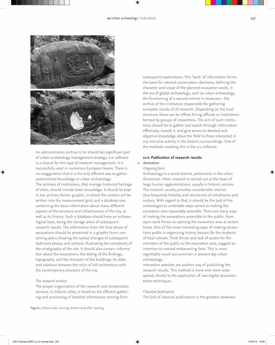
237
subsequent explorations. This ‘bank’ of information forms the basis for rational conservation decisions, defining the character and scope of the planned excavation works. It the era of global archaeology, such as urban archaeology, the functioning of a second archive is necessary – the archive of the institution responsible for gathering complete results of all research. Depending on the local structure, these can be offices hiring officials or institutions formed by groups of researchers. The aim of such institu-tions should be to gather and search through information effectively, classify it, and give access to detailed and objective knowledge about the field to those interested in any intrusive activity in the historic surroundings. One of the methods enabling this is the gis software.
sco Publication of research results> Animation
Ongoing formArchaeology is a social science, particularly in the urban dimension. Here, research is carried out at the heart of large human agglomerations, usually in historic centres. The research usually provokes considerable interest (less frequently hostility and reluctance) of inhabitants and visitors. With regard to that, it should be the task of the archeologist to undertake steps aimed at making the excavation area reasonably acessible. There are many ways of making the excavations accessible to the public, from open-work fences to opening the excavation area at certain times. One of the most interesting ways of making excava-tions public is organizing history lessons for the students of local schools. Thick fences and lack of access for the members of the public to the excavation area, suggest an intention to conceal embarassing facts. This is most regrettably much too common in present day urban archaeology.Interactive websites are another way of publishing the research results. This method is more and more wide-spread, thanks to the application of new digital documen-tation techniques.
Classical publicationThe lack of classical publications is the greatest weakness
An administration archive is (or should be) significant part of urban archaeology management strategy. gis software is a chance for this type of research management. It is successfully used in numerous European towns. There is no exaggeration that it is the only efficient way to gather systematised knowledge in urban archaeology.The archives of institutions, that manage historical heritage of cities, should include basic knowledge. It should be kept in two primary forms: graphic, in which the content will be written into the measurement grid, and a database one, containing the basic information about many different aspects of the structure and infrastructure of the city, as well as its history. Such a database should have an archaeo-logical layer, being the storage place of subsequent research results. The information from the final phase of excavations should be presented in a graphic form: con-taining plans showing the spatial changes of subsequent sediment phases and sections illustrating the complexity of the stratigraphy of the site. It should also contain informa-tion about the excavations: the dating of the findings, topography, and the character of the buildings, its state, and relations between the relics of old architecture with the contemporary structure of the city.
The research archiveThe proper organisation of the research and conservation services, in historic cities, is based on the efficient gather-ing and processing of detailed information coming from
Figure 1 Stone with carvings before and after looting
20 Urban archaeology | Gołembnik
AAC-Themata 5DEF-v.a.12 verloop.indd 237 12-03-13 15:29

238 part 2
of urban archaeology. The main reason for this is an intensive system of works, the scale of discoveries and the amount of gathered information and found relics. The fact that works are frequently undertaken again is also of considerable significance. This forces local archaeologists to undertake new research before the results of previous examinations are summarised. This is perhaps the most ardent issue of present day urban archaeology. This problem can be solved with administrative means only.
Museum displaysAnother form of publishing the results of urban excava-tions is to organise museum exhibitions. It seems that a traditional form of a museum is not attractive any more. Exhibitions organised in the sites of discoveries become therefore more and more popular. It must be underlined that museums organised in this way are usually one of more prominent attractions of historic towns (e.g., the frequently mentioned Museum of London, the Bryggens Museum, Yorkvik, Gdansk with the former Dominican friary). The extent of ground works in towns and cities, and thus the number of spectacular finds, seem to support such initiatives.
> sco Exercises> sco Exercises
msco References
AAC-Themata 5DEF-v.a.12 verloop.indd 238 12-03-13 15:29
239
motivates the looter and the collector and tries to put looting and collecting into a broader societal context of local and global power relations. Finally, it examines some of the cultural heritage professionals’ responsibilities in relation to the ongoing trade. In this part it will first give some examples of how museums and scholars have been involved in activities which has served to legitimise the trade in unprovenanced archaeological objects. Secondly, it will discuss how cultural heritage professionals in a more general way may support the trade through their participation in the social construction of such concepts as ‘art’ and ‘heritage’. It will be argued that the contemporary mainstream social production of these (seemingly innocent) concepts serves to endorse a privileged perspective and creates amnesia about past – and also contemporary – social inequality and exploitation. Hopefully, the text will lead to reflection, not only on the responsibilities of the cultural heritage professional concern-ing looting and the trade in loot as such, but also on broader issues relating to how a cultural heritage professional’s own (privileged) position within society affects the knowledge about the past – and the present – which she or he produces. Thus the text wants to contribute to the debate about the relationship between the social construction of the cultural heritage professional and the social construction of cultural heritage.
sco Introduction – What this module is not aboutThinking of perspectives and silences it is perhaps necessary to say something about how this module is focused and mention at least one of the many aspects which is not high-lighted here. The point of departure in the module is that – from an archaeological perspective – the problem with looting is the irreversible loss of archaeological data which could have been retrieved through controlled archaeological excavations. Thus for the archaeologist the main concern is the loss of ‘knowledge’ caused by looting. The text deals less with the many problems inherent in archaeological knowledge produc-tion itself, but it should not be forgotten that this knowledge production does not occur in a vacuum. On the contrary, the archaeological discipline has been, and is still, intrinsically linked to various national and colonial/neo-colonial practices. The knowledge produced by archaeologists is not necessarily beneficial to all members of mankind. It has been argued that archaeologists’ concern to protect the ‘archaeological record’ has led to the point of them endorsing military aggression and have become insensitive to the suffering of human beings (Hamilakis 2007, cf. Matsuda 1998). Indeed, this aspect is espe-cially relevant in relation to looting considering that – at least one – archaeologist has recommending killing looters to
21Perspectives on looting, illicit antiquities trade,art and heritage by Staffan Lundén
––––––––––Y lu Illicit trade, background and scale by Staffan Lundén
sco IntroductionToday, all over the world, looters are pillaging archaeological sites at an alarming rate in search for objects which can be sold for money. The objects they find is sold as ‘art’ on the antiquities market and end up in private and public collections where they bestow social prestige on the new owners. Given the scale of looting and the large output of unprovenanced objects on the market there can be little doubt that many, presumably the majority, of these objects have been recently looted, or recently manufactured. Thus, unprovenanced archaeological objects on the market must be considered to be loot (or fakes) until proven otherwise (Renfrew 2000: 11, 90; Muscarella 2000: 17). Looting (and the production of fakes) is ultimately generated by market demand – that is, by the dealers and collectors who buy and sell while turning a blind eye towards how the objects have come on the market and who deny that their willingness to continue purchasing these objects provides the incentive for the further destruction of the archaeological record. Poor and war-torn countries are especially badly affected by this looting. The market for the loot is mainly located in the more affluent parts of the world. Thus, the flow of objects is from South to North, from East to West, from the poor to the wealthy, from the powerless to the powerful. The trade may, in this respect, be seen as a continu-um of a centuries-old Western tradition of building up museum collection from ‘distant’ and ‘foreign’ peoples and lands.
sco Introduction – General outline and aim of the moduleThis module about looting and the consumption of loot proceeds as follows. It begins with a presentation of a rough sketch of looting and the linked trade to give an indication of the pace of the destruction of archaeological sites generated by market demand. It then briefly attempts to discuss what
AAC-Themata 5DEF-v.a.12 verloop.indd 239 12-03-13 15:29

240 part 2
Gilgan 2001, Nørskov 2002: 251-292, Davis 2006). A look what some of the major auction houses puts up for sale each year gives shows that large quantities of objects are sold for vast sums of money. At the twice-yearly antiquities sales at Bon-ham’s (London), Christie’s (London and New York) and Sothe-by’s (New York) around 10,000 objects are sold each year (Watson & Todeschini 2006: 94). The annual turnover at Sotheby’s and Christie’s auctions in New York is in the range of usd 20-30 million (Gill 2010). Despite the difficulties of quantifying both site looting and the trade in loot there can be little doubt that there is a general correspondence between looting and market availabil-ity. In each of these cases presented above, the data on looting and thefts in various countries – Mali, Pakistan, Afghanistan etc – may be compared to the output of objects originating from these regions on the antiquities market. Further confir-mation – if any such be needed – for the connection between the looting and the marketplace is gained through rare glimpses behind the facades of the trade. Internal documents leaked by a former employee at Sotheby’s London have revealed that Sotheby’s staff cannot have been unaware of that they were auctioning looted archaeological object. Sotheby’s staff were also personally involved in smuggling objects. As a result of this scandal Sotheby’s closed down their antiquities sales in London, but continue their sales in New York (Watson 1998). Until fairly recently the majority of the objects sold at auction house sales lacked information on their provenance (Brodie, Doole, & Watson 2000: 26; Watson & Todeschini 2006: 330). Probably as a result of heightened awareness surrounding these issues, the objects in more recent sales are accompanied with provenance information, which stretches their ownership history a couple of decades back in time (and sometimes even longer). This creates the impression that these major auction houses now have become reluctant to sell recently looted objects. However, the information provided is generally of such a nature that it is cannot be verified, and in some cases there is evidence to suggest that it is bogus (Gill 2011a).It is not only the well-known international auction houseslike Sotheby’s and Christie’s which have been selling unprov-enanced archaeological material on a regular basis. The Swedish major auction houses have been selling Chinese terracotta figurines for years and there is strong circumstantial evidence to suggest that these come from recent illegal excavations in China and have been smuggled out of the country. In 1999 I asked representatives of these three auction houses if it was possible to consign objects which had recently smuggled out from China to their auctions. At both Stock-
protect archaeological sites (see discussion in Walker Tubb 2006: 296). Despite the importance of the ‘archaeological record’ (and the possibilities of creating more nuances and less romantic representations of the past through this ‘record’ than through the display of decontextualised loot) it is impor-tant to stress that the past produced through this ‘record’ is not necessarily only a force for societal good and that preserv-ing it cannot have precedence over the protection of human lives.
> sco Exercise
sco The scale of the destruction and the trade – Looting and theftsDue to its illicit and clandestine nature it is extremely difficult to quantify the scale of the looting. Yet the few surveys which have been undertaken where physical evidence of looting on archaeological sites and monuments has been systematically recorded give an indication of the seriousness of the situation. In Mali, for example, systematic survey work undertaken in 1989 and 1991 revealed that 45% of sites had been damaged by looting, 17% badly. Survey work in a district in northern Pakistan has shown that nearly half of the Buddhist shrines, stupas and monasteries had been damaged or destroyed by looting (Brodie and Renfrew 2005: 346). A survey in Western Turkey inventorising 397 tumuli from the Lydian and Persian period showed that 357, or 90%, of these tumuli had been damaged by looting. A total of 72, or 18%, of the tumuli had been completely destroyed (Roosevelt and Luke 2006). Looting also takes a heavy toll on the archaeological record in the wealthy parts of the world. A survey conducted in Sweden of 25 sites where objects of precious metal had been found revealed that the majority of these sites had been looted by metal detectorists. The limited number of sites which had not been looted were the ones which had been given an erroneous location in archaeological publications and Fornminnesregistret (the register of archaeological sites) which shows that looters use these sources to locate promis-ing sites (Lundén 2004: 215, cf. Hennius 2008).
sco The scale of the destruction and the trade – The market: auction housesJust as it is difficult to quantify looting it is also difficult to quantify the volume of the trade both in the amount of objects being traded, the turn-over in monetary terms and long term market trends (for example fluctuations in availability of objects from particular regions). Yet, for such studies a very useful source of information is provided by the catalogues published by auction houses (see the studies by Elia 2001,
AAC-Themata 5DEF-v.a.12 verloop.indd 240 12-03-13 15:29

241
ties in Leiden which in 1997 purchased a piece of armour allegedly looted in Apulia. (Nørskov 2002: 291, van Beurden 2006, Scholten 2008). Moreover, Apulian tombs also contain large number of other objects including, for example Daunian ware pottery. Daunian ware does not appeal to the modern collector’s eye and is thus less expensive than the Apulian Red figure pottery (Graepler 1993: 16, 23-30). Daunian ware is also rare at auctions. This reminds us that there are also objects in even lower price ranges which are sold in the market through less exclusive venues (internet sites etc). The evidence which has been forthcoming from police investigations corroborates the conclusion that the majority of the loot is not sold by the auction houses. Raids by the Italian police against warehouses belonging to the two Italian dealers Gianfranco Becchina and Giacamo Medici revealed that these two men were in possession of about 5,000 and 4,000 objects respectively. A separate police investigation against the dealer Robin Symes has showed that he had about 17,000 objects in 27 different warehouses. The total market value of all these objects may be 500 million dollars (Watson & Todeschini 2006: 259, 316).
sco The scale of the destruction and the trade – From tombs to museumsThrough these investigations it has also been possible to map out the objects’ routes from looters to museum show cases and to show that those involved in the trade, including museum curators, cannot have been ignorant of the fact that they were dealing in loot. In the raids against Becchina and Medici the police found thousands of photographs of objects that these dealers had sold. Many of the objects were shown covered in dirt and incrustations and had presumably been taking shortly after they had been dug out by the looters. Medici’s photographic archive also included pictures of Pompeii-style wall painting in situ before their removal. Other photographs showed the wall-paintings in their sorry state after they had been detached. With the help of these photos, and other documents, a number of objects have been located in the possession of various museums, private collectors as well as in the cata-logues of various dealers and auction houses. The museums where, so far, such objects have discovered include the Paul Getty Museum in Malibu, the Metropolitan Museum in New York, the Museum of Fine Arts in Boston, the Cleveland Museum of Art, the Toledo Museum of Art, the Minneapolis Institute of Arts, the Princeton University Art Museum, the Ny Carlsberg Glyptotek in Copenhagen, the Antikensammlung (Collection of Classical Antiquities) in Berlin, the Miho Museum in Japan and the National Museum of Archaeology
holm’s Aktionsverk and Göteborg’s Auktionsverk the answer was yes. The representative at Bukowski’s said she preferred objects with a long provenance but explained that this was not because of any moral concerns about selling smuggled objects, but that she was worried about well-made fakes which recently had come on the market (Lundén 2004: 202-203). Also the major Danish auction houses Bruun Rasmussen, Ellekilde and Lauritz.com sell unprovenanced archaeological material. In 2007 I asked these auction houses the same question which I had earlier asked at the Swedish auction houses: if I could consign Chinese archaeological objects which had left China illegally to their auction. All three auction houses replied that that they had no restrictions against selling recently smuggled objects (Aagard & Kaarsholm 2007).
sco The scale of the destruction and the trade – A look at the invisible tradeThe glossy pages of auction catalogues provide worrying evidence of the destruction of the world’s archaeological heritage. However, auction house sales probably only reveal a small fraction of the total trade and devastation. The majority of the objects pass through the hands of various dealers and thus never come out on the open market. It also seems that it is mainly objects in the lower price range which are sold through the major auction houses. Comparisons between the relative proportions of different categories of objects originat-ing from the looted sites and the relative proportions of these objects in auction house sales reveals that much of the trade goes on outside the sales rooms of the auction houses. The rampant looting of Etruscan tombs yields both Attic black figure pottery and red figure pottery (which was imported to Etruria from Attica in Classical Antiquity), yet in the auction sales the black figure pottery outnumbers the red figure pottery. This discrepancy finds its explanation in the price difference between Attic black figure and red figure pottery. Amongst collectors red figure pottery is generally considered to be aesthetically superior to black figure pottery and there-fore red figure pottery commands higher prices. It is sold on to various private and institutional collectors in a more ‘private’ manner rather than passing through public auctions (Nørskov 2002: 270). Likewise, a comparison between the content of tombs in Apulia in Southern Italy and the market output of Apulian objects reveals a similar picture: these tombs contain metal armour and Apulian red figure pottery. However, while Apulian pottery (which occupies a lower price range than Attic red figure pottery) has been a staple at the auction houses, the more expensive armour is much more rarely seen there. The armour is sold directly to private and institutional collectors, like the National Museum of Antiqui-
21 Perspectives on looting, illicit antiquities trade, art and heritage | Lundén
AAC-Themata 5DEF-v.a.12 verloop.indd 241 12-03-13 15:29

242 part 2
Brodie, Neil; Doole, Jenny & Watson, Peter (2000). Stealing history. The illicit Trade in Cultural Material. Cambridge: McDonald Institute for Archaeological Research 2000. http://www.mcdonald.cam.ac.uk/projects/iarc/links/reading.htmBrodie, Neil & Renfrew, Colin (2005) ‘Looting and the world’s archaeo-logical heritage. The inadequate response’. Annual Review of Anthropol-ogy 34, 2005, pp. 343-361.Bäckström, Mattias (2003). ‘Kyrkostölderna en illegal miljonindustri’. Sundsvalls Tidning, 11 November 2003.Bäckström, Mattias (2006). ‘Övervakning, säkerhet och Munchs omåt-tlighet. Kyrkstölderna i Norrland och kuppen mot Munchmuseet i Oslo’. In: Kärnfelt, Johan (ed.) I skuggan av samtiden: en vänbok till Sven-Eric Liedman och Amanda Peralta. Arachne 20. Institutionen för idéhistoria och vetenskapsteori, Göteborgs universitet 2006, pp. 51-70.Davis, Terressa (2006). ‘Supply and demand. A glimpse into the traffic of illicit Khmer antiquities’. Culture without Context Issue 18, Spring 2006.http://www.mcdonald.cam.ac.uk/projects/iarc/culturewithoutcontext/issue18/davis.htmElia, Ricardo (2001). ‘Analysis of the looting, selling and collecting of Apulian red-figure vases: a quantitative approach’. In: Brodie, Neil; Doole, Jenny & Renfrew Colin (eds.) Trade in Illicit Antiquities: The Destruction of the World’s Archaeological Heritage. Cambridge: McDonald Institute for Archaeological Research 2001, pp. 145-53.Gilgan, Elizabeth (2001). ‘Looting and the market for Maya objects. A Belizean perspective’. In: Brodie, Neil; Doole, Jenny & Renfrew, Colin (eds.) Trade in Illicit Antiquities: The Destruction of the World’s Archaeo-logical Heritage. Cambridge: McDonald Institute for Archaeological Research 2001, pp. 73-87.Gill, David (2010). ‘New York market: update’.http://lootingmatters.blogspot.com/2010/12/new-york-market-update.htmlGill, David (2011a). ‘Raising eyebrow over Apulian fishplate’.http://lootingmatters.blogspot.com/2011/04/raising-eyebrow-over-apulian-fishplate.htmlGill, David (2011b). ‘Polaroids and unresolved issues’.http://lootingmatters.blogspot.com/2011/04/polaroids-and-unresolved-issues.htmlGill, David & Chippindale, Christopher (2007). ‘From Malibu to Rome. Further developments in the return of antiquities’. International Journal of Cultural Property 14, 2007, pp. 205-240.Graepler, Daniel & Mazzei, Marina (1993). Fundort: unbekannt. Raub-grabungen zerstören das archäologische Erbe. München: Walter Biering.Hamilakis, Yannis (2007). ‘From ethics to politics’. In: Hamilakis, Yannis & Duke, Philip (eds.) Archaeology and Capitalism. From Ethics to Politics. Walnut Creek: Left Coast Press 2007, pp. 15-40.Hennius, Andreas (2008). ‘Plundring av fornlämningar. Händer sånt i Sverige?’ Fornvännen 103, 2008, pp 29-32. http://fornvannen.se/pdf/2000talet/2008_029.pdfKrieken-Pieters, Juliette van (2006). ‘Afghanistan’s cultural heritage. An exceptional case?’ In: Brodie, Neil; Kersel, Morag; Luke, Christina & Walker Tubb, Kathryn (eds.) Archaeology, Cultural Heritage and the Antiquities Trade. Gainesville: University Press of Florida, pp. 227-235.Lundén, Staffan (2004). ‘The scholar and the market. Swedish scholarly contributions to the destruction of the world’s archaeological heritage’. In: Karlsson, Håkan (ed.) Swedish Archaeologists on Ethics. Lindome: Bricoleur Press 2004. pp. 197-247.
in Madrid. Embarrassed by the situation several us American museums have agreed to return about 130 objects to Italy and Greece (Gill & Chippindale 2007, Gill 2011b). Document found during police raids. On the paper is a chart of how the trade in organized from looters in Italy, via dealers to museums and collectors. The name of several well-known dealars including Giacomo Medici, Gianfranco Becchina and Robert Hecht appear on the chart. Investigations like this give a unique inside view into the trade, how it operates and the amount of destruction it generates. Part of the reason why this evidence is forthcoming about the trade in objects looted from Italian soil is that Italy, being a G8 country, has the resources to carry out this kind of huge police investigations which involves a wide range of expertise (legal, archaeological etc) and which take several years. There is no reason to think that similar organised networks of looters, smugglers and dealers do not operate in other heavily looted countries like Afghanistan, Cambodia, China, Colombia, Egypt, India, Iran, Iraq, Pakistan, Peru, Syria, and Turkey etc. On the contrary, the glimpses we get from various cases suggest that the destruction and trade occursin many places on a similar, if not larger, scale (cf. Watson & Todeschini 2006: 318). The Italian investigations might con-tribute to make the purchase of objects which are suspected, or known, to originate from Italy less attractive, but it might well be that dealers and collectors will instead turn their attention to objects originating from other countries with less capacity to investigate the looting and smuggling of archaeo-logical objects and thus less capacity to take the purchasers of the loot to court.
> sco Exercise
sco The scale of the destruction and the trade – ReferencesAagaard, Charlotte & Kaarsholm, Lotte (2007). ‘Man kan jo ikke se på tingene, hvor de kommer fra...’ Information 25 July 2007. http://www.information.dk/125436 Beurden, Jos van (2006). ‘A disputed cuirass: Italy versus the Netherland’s National Museum of Antiquities in Leiden. Culture without Context Issue 18, Spring 2006.
http://www.mcdonald.cam.ac.uk/projects/iarc/culturewithoutcontext/issue18/van_beurden.htmBogdanos, Matthew (2005). ‘The casualties of war. The truth about the Iraq Museum’. American Journal of Archaeology 109, 2005, pp. 477-526.Brodie, Neil (2006a). ‘Introduction’. In: Brodie, Neil; Kersel, Morag; Luke, Christina & Walker Tubb, Kathryn (eds.) Archaeology, Cultural Heritage and the Antiquities Trade. Gainesville: University Press of Florida, pp. 1-24.Brodie, Neil; Doole, Jenny & Renfrew, Colin (eds.) (2001) Trade in Illicit Antiquities: The Destruction of the World’s Archaeological Heritage. Cambridge: McDonald Institute for Archaeological Research 2001.
AAC-Themata 5DEF-v.a.12 verloop.indd 242 12-03-13 15:29

243
––––––––––Y lu The social context of looting and consumption of loot by Staffan Lundén
sco Looters and collectorsWhy do some people collect looted archaeological objects and why do some people loot? Both the collecting and looting of archaeological objects are complex social phenomena which reside in larger local, national and global contexts. In some cases there is clear evidence that looting is carried out by professional criminals who gain a substantial part of their income from selling the objects they discover through ran-sacking archaeological sites. In other cases – and this is especially the case in the richer parts of the world – looting, for example through metal detecting, may be a leisure activity, a thrilling pastime veiled in romantic notions of finding buried treasures. In the poor parts of the world looting – or subsistence digging – may be one of the few means available for survival, or for raising one’s incomes slightly above a very meagre standard of living (Matsuda 1998, Rose & Burke 2004, Kimbra 2005).
sco Looting and povertyLarge scale looting of archaeological sites and poverty are intrinsically connected. By and large, it is the countries where large strata of the population live in poverty which have the least resources available to protect archaeological sites – through physical supervision of sites and through educa-tional and awareness raising campaigns etc. This combination of poverty and lack of resources for site protection may give rise to looting of endemic proportions. Here it is important to note that poverty on both regional and national levels is linked to external factors. This is especially clear in cases when economic deprivation and breakdown of civil society is or has been a consequence of warfare. For example, in Iraq the looting of archaeological sites was comparatively rare until the 1980s and few objects of likely Iraqi origin turned up on the antiquities market. The situation changed when economic sanctions were imposed on Iraq after the 1991 war. The sanctions led to economic hardship both for the population in general and cutbacks in the budgets for the authorities responsible for site protection. Large scale looting of archaeo-logical sites and a surge of loot on the Western antiquities market followed. It is both ironic and tragic that the sanctions which forbade trade with Iraq created a booming market for loot from Iraq. The supervision of sites in Iraq improved somewhat in the late 1990s, but when Iraq was invaded in 2003 the National Museum was plundered and the looting of archaeological sites again gained pace. What could, and
http://www.etikkom.no/Documents/pdf/stefanart.pdfMatsuda, David (1998). ‘The ethics of archaeology. Subsistence digging, and artefact looting in Latin America. Point, Muted Counterpoint’. International Journal of Cultural Property 7. 1998, pp. 87-97.Muscarella, Oscar (2000). The Lie Became Great. The Forgery of Ancient Near Eastern Cultures. Groningen: Styx Publications 2000.Nørskov, Vinnie (2002). Greek Vases in New Contexts. The Collecting and Trading of Greek Vases. An Aspect of the Modern Reception of Antiquity. Aarhus & Oxford: Aarhus University Press 2002.Renfrew, Colin (2000). Loot, Legitimacy and Ownership. The Ethical Crisis in Archaeology. London: Duckworth 2000.Roosevelt, Christopher & Luke, Christina (2006). ‘Looting Lydia. The destruction of an archaeological landscape in Western Turkey’. In: Brodie, Neil; Kersel, Morag; Luke, Christina & Walker Tubb, Kathryn (eds.) Archaeology, Cultural Heritage and the Antiquities Trade, Gainesville: University Press of Florida. pp. 173-187.Scholten, Steph (2008). ‘An ethical dilemma. A disputed cuirass in Leiden’s National Museum of Antiquities’. Minerva January/February 2008, p. 54.Walker Tubb, Kathryn (2006). ‘Artifacts and emotion’. In: Brodie, Neil; Kersel, Morag; Luke, Christine &Walker Tubb, Kathryn (eds.) Archaeology, Cultural Heritage and the Antiquities Trade. Gainesville: University Press of Florida, pp. 284-302.Watson, Peter (1998). Sotheby’s. The Inside Story. London: Bloomsbury 1998 (First ed. 1997).Watson, Peter & Todeschini, Cecilia (2006). The Medici Conspiracy. The Illicit Journey of looted Antiquities from Italy’s Tomb Raiders to the World’s Greatest Museums. New York: Public Affairs 2006.
––––––––––Y lu Illicit trade, background and scale by Staffan Lundén
sco Further ReadingAtwood, Roger (2004). Stealing History. Tomb raiders, Smugglers and the Looting of the Ancient World. New York: St Martin’s Press 2004.Frammolino, Ralph & Felch, Jason (2011). Chasing Aphrodite. The Hunt for Looted Antiquities at the World’s Richest Museum. Boston & New York: Houghton Mifflin Harcourt.Davis Terressa (2006). ‘Supply and demand. A glimpse into the traffic of illicit Khmer antiquities’. Culture without Context Issue 18, Spring 2006.http://www.mcdonald.cam.ac.uk/projects/iarc/culturewithoutcontext/issue18/davis.htm
Useful information is available at these web sites/mailing lists:Heritage Watch: http://www.heritagewatchinternational.org/Illicit Antiquities Research Centre: http://www.mcdonald.cam.ac.uk/projects/iarc/home.htmLooting matters: http://lootingmatters.blogspot.com/Museum Security Network: http://www.museum-security.org/safe Saving Antiquities for Everyone: http://www.savingantiquities.org/
21 Perspectives on looting, illicit antiquities trade, art and heritage | Lundén
AAC-Themata 5DEF-v.a.12 verloop.indd 243 12-03-13 15:29

244 part 2
these objects range from persons who buy small inexpensive pieces – pottery, oil lamps and coins – at eBay auctions or perhaps from street vendors or at the local bazaars while on vacation (Kersel 2006: 194) to those major private and institu-tional players who purchase objects worth thousands or millions of dollars on Fifth Avenue in New York. The motives for wanting to possess archaeological objects may also vary – from the wish to have a souvenir from a vacation to ideas about being brought into communion with the past through the tactile sensation of holding a piece of the past in the hands. Archaeological objects may also be purchased for investment purposes. While advertising their merchandise antiquities dealers often highlight that antiquities are a good source of investment (see for example the home page of Royal-Athena Galleries http://www.royalathena.com/pages/intropages/ancientartasaninvestment.html and Graepler & Mazzei 1993: 70, 72). Sometimes this is made in a fashion which more or less explicitly admits that the objects have an illegal origin. In a news letter from AntikWest, Sweden’s leading dealer in Chinese archaeological object, where ‘invest-ment packages’ in the price range of 50-100 000 sek are offered, together with deposition in a bank safe, it is pointed out that the prices of Chinese artefacts will probably rise because, among other factors, in China ‘the excavation sites are becoming better controlled’ (Unikt och Antikt 1992: 3, 30). Apart from financial value it is often the – perceived – aesthetic qualities of the objects which motivate the collector, who purchase the objects to decorate her or his body or home. Advertisements for antiquities dealers sometimes describe finger rings, necklaces and other pieces of ancient jewellery as ‘wearable’ and point out that archaeological objects are suitable for interior decoration (Walker Tubb and Brodie 2001: 102-105). Interior design magazines – where the homes of the wealthy are shown as examples of good and refined taste for the lay readership – give some insights into how archaeologi-cal objects may be used for such purposes. In, for example, an article in Architectural Digest the International Magazine for Interior Design a ‘young dynamic family’ in San Francisco express their ‘the adventurous taste’ through displaying an Apulian red figure volute crater in the bedchamber and a Han dynasty vessel in their entrance hall (Leigh Brown 2005).
sco The role of museumsThe collectors may also be motivated by the feeling that by purchasing the object she or he (most often a he given how the distribution of wealth in the contemporary world is structured according to gender) has saved the object from destruction. Such feelings are enhanced when the collector donates objects to a museum and the museum in exchange
should, have been done by the us forces (apart from invading Iraq in the first place) to prevent the looting of the National Museum has been debated (Brodie 2006b: 209-210, on Iraq cf. Hamilakis 2003, Hamilakis 2007: 30-32). Yet, the fact remains that, ultimately, the looting of the museum must be seen in the context of the already existing Western market for Iraqi antiquities, which had maintained a well-established looting industry and smuggling routes out of the country. Also in other cases the causes for poverty in a country or region may be sought in a wider geopolitical context. In Northern Peru, for example, the cultivation of cane sugar is an important source of income. During the 1980s and 1990s the price for cane sugar dropped rapidly – largely as a result of the deregulation of the world market prices for cane sugar – and looting of archaeological sites became an alternative source of income for many people. The destruction of archaeological sites through looting may be a consequence of poverty. The preservation of archae-ological sites may be a way of reducing poverty. To continue the example of the situation in Northern Peru, the site of Sipán, is a good example of how an archaeological site may provide a long-term source of income. Here, in 1987, looters discovered a rich burial with spectacular gold objects from the Moche period, but the looting was stopped and a rescue excavation started. Now, the neighbouring town where the finds from Sipán are on display attracts a steady stream of tourists who bring larger incomes to the regional economy than would have been gained by looting, although it must acknowledged that the local population at the Sipán site benefits little from this money (Brodie 2006a: 3-4, cf. Kimbra 2005: 153-154). The situation may be compared to the site in La Mina, also in Northern Peru, where a tomb, probably as rich as the oneat Sipán, was thoroughly looted in 1988-1989. (Lundén 2004: 208-209). All what remains at the site is the empty tomb, which, needless to say, is not a major tourist attraction. When the objects from La Mina turn up on the auction sales in Den-mark and Sweden they do not only provide a reminder of a lost opportunity to gain knowledge of the ancient Moche society, they are also evidence of a lost chance to gain a sustainable source of income in a part in the world where it is desperately needed. The winners in this trade are the auction houses which gain a percentage from the sale of these objects. The losers are the population at La Mina. Looting is not only a consequence of poverty. In the long run, looting is also a cause of poverty.
sco Collecting and wealthWho then buys the loot? The collectors and end consumers of
AAC-Themata 5DEF-v.a.12 verloop.indd 244 12-03-13 15:29

245
Brodie, Neil (2006b). ‘Iraq’s archaeological heritage and the London antiquities trade’. In: Brodie, Neil; Kersel, Morag; Luke, Christine & Walker Tubb, Kathryn (eds.) Archaeology, Cultural Heritage and the Antiquities Trade, Gainesville: University Press of Florida, pp. 206-226.Cuno, James (2008). Whose owns Antiquity? Museums and the Battle over Our Ancient Heritage. Princeton: Princeton University Press 2008.Cuno, James (ed.) (2009). Whose Culture? The Promise of Museums and the Debate over Antiquities. Princeton: Princeton University Press 2009.Duncan, Carol (1995). Civilizing Rituals. Inside Public Art Museums. London: Routledge 1995.Fitz Gibbon, Kate (ed.) (2005). Who owns the Past? Cultural Policy, Cultural Property and the Law. New Brunswick: Rutgers University Press 2005.Graepler, Daniel & Mazzei, Marina (1993). Fundort: unbekannt. Raub-grabungen zerstören das archäologische Erbe. München: Walter Biering.Hamilakis, Yannis (2003). ‘Iraq, stewardship and ‘the record’. An ethical crisis for archaeology’. Public Archaeology 3, 2003, pp. 104-111.Hamilakis, Yannis (2007). ‘From ethics to politics’. In: Hamilakis, Yannis & Duke, Philip (eds.) Archaeology and Capitalism. From Ethics to Politics. Walnut Creek: Left Coast Press 2007, pp. 15-40.Kersel, Morag (2006). ‘From the ground to the buyer. A market analysis of the trade in illegal antiquities’. In: Brodie, Neil; Kersel, Morag; Luke, Christina & Walker Tubb, Kathryn (eds.) Archaeology, Cultural Heritage and the Antiquities Trade. Gainesville: University Press of Florida, pp. 188-205.Leigh Brown, Patricia (2005). ‘Romance on Russian hill’. Architectural Digest. The International Magazine for Interior Design. February 2005, pp. 180-185, 249.Lundén, Staffan (2004). ‘The scholar and the market. Swedish scholarly contributions to the destruction of the world’s archaeological heritage’. In: Karlsson, Håkan (ed.) Swedish Archaeologists on Ethics. Lindome: Bricoleur Press 2004. pp. 197-247. http://www.etikkom.no/Documents/pdf/stefanart.pdfMatsuda, David (1998). ‘The ethics of archaeology. Subsistence digging, and artifact looting in Latin America. Point, Muted Counterpoint’. International Journal of Cultural Property 7. 1998, pp. 87-97.Rose, Jerome & Burke, Dolores, ‘Making money from buried treasure’. Culture without Context Issue 14, Spring 2004, pp. 4-8.http://www.mcdonald.cam.ac.uk/projects/iarc/culturewithoutcontext/issue14/rose-burke.htmWalker Tubb, Kathryn & Brodie, Neil (2001). ‘From museum to mantel-piece. The antiquities trade in the United Kingdom’. In: Layton, Robert; Stone, Peter & Thomas, Julian (eds.) Destruction and Conservation of Cultural Property. London: Routledge 2001, pp. 102-116.
Unikt och Antikt. Nyhetsbrev från AntikWest 10:1, 1992.
––––––––––Y lu Looters and consumers by Staffan Lundén
sco Further readingSmith, Kimbra (2005). ‘Looting and the politics of archaeological knowledge in Northern Peru’. Ethnos. Journal of Anthroplogy 70, 2005,
pp. 149-170.
expresses its gratitude through naming the donor in the text label accompanying the object or – in case of large donations – by naming a room, a gallery or the entire museum after the donor. Through these donor memorials, when the name of the donor is inscribed in golden letters above the doorway of an exhibition hall or on the facade of the museum, money is exchanged for social status, or, to put it in Bourdieuan terms, economic capital is transformed into social and cultural capital. The generation of vast fortunes are made possible by certain societal rules and structures. When museums celebrate the benevolence and taste of wealthy donors this does not only function to maintain and further the donors’ position within this class hierarchy. The message proclaimed – that society as a whole benefits from the acquisition of wealth in the hands of a plutocracy – also serves to uphold and legiti-mise the class structure of society (Duncan 1995). This may be said to be a function of all art donations by the rich and wealthy – whether the donation comprises Impres-sionist paintings or looted Peruvian gold – but when it comes to the collection and donation of looted archaeological material the notion that society owes gratitude to the those individuals – often labelled ‘philanthropists’ – who put money into the looting business becomes especially paradoxical. Also, when archaeological objects from all over the world – but mainly from third world countries – are gathered together and put on display in Western museums with the implicit, or sometimes explicit, message that these objects would have been neglected, lost or destroyed in their countries of origin, but have now been saved for posterity by the museum where they can be seen and appreciated by ‘everyone’ (which in practice means those parts of the population of planet Earth which have the opportunity and financial resources to go to these Western museums) this subtly serves to reinforce notions of the West as being more developed, peaceful and civilised than the rest of the world. The displays confirm a sense of Western superiority and naturalises the global power structures which makes the accumulation of loot in Western public and private collections possible (for the argument that the trade in unprovenanced archaeological objects is beneficial to mankind and that the world’s self-declared ‘universal’ museums have the right and duty to continue acquire such objects, see Gibbon 2005, Cuno 2008, Cuno 2009).
> sco Exercise
sco ReferencesBrodie, Neil (2006a). ‘Introduction’. In: Brodie, Neil; Kersel, Morag; Luke, Christina & Walker Tubb, Kathryn (eds.) Archaeology, Cultural Heritage and the Antiquities Trade. Gainesville: University Press of Florida, pp. 1-24.
21 Perspectives on looting, illicit antiquities trade, art and heritage | Lundén
AAC-Themata 5DEF-v.a.12 verloop.indd 245 12-03-13 15:29

246 part 2
other countries and therefore do not run the risk of support-ing the trade through their own acquisitions in this way. Yet, museums may also lend their institutional credibility to the trade in other, more circumvented, ways. Therefore the icom Code of Ethics does not only regulate the museum’s own acquisition. The Code also has a general provision which stipulates that museum professionals ‘should not support the illicit traffic or market in natural and cultural property, directly or indirectly.’ (8.5). The activities of Nordiska museet (the Nordic Museum) in Stockholm may be considered in the light of this paragraph. Nordiska Museet is one of Sweden’s largest museums, dedicated to the preservation of and representation of Swed-ish cultural heritage. The museum is also responsible for the upkeep of the Swedish export regulation on furniture and other cultural objects. Since 2002 the museum has rented out its premises to the biannual antiquities fair ‘Grand Antiques’. Among the dealers present at the fair were the previously mentioned gallery AntikWest which has a large assortment of unprovenanced archaeological objects from China and whose newsletter recommend such objects for investment purposes because the archaeological sites are becoming ‘better control-led’. It is a remarkable, regrettable and paradoxical fact that the Nordiska Museet provides space on its premises for a dealer selling artefacts which may be assumed to have been looted and smuggled out of in China. Clearly, the museum gives the general public the impression that it is not opposed to a trade which causes the destruction of cultural heritage abroad. Examples such as this, where museums give indirect authorisation of the trade may be multiplied. The Armému-seem (the Army museum), another major Stockholm museum has had a showcase from a dealer selling archaeological objects from around Europe. The British Museum has – in a laudable way – criticised internet sites for selling unprov-enanced ‘British’ archaeological objects, yet, the museum’s own magazine contains advertisements for dealers selling unprovenanced archaeological objects from all over the world.
sco Publishing lootAnother way scholars may become involved in legitimising the trade is when they carry out research and publish on recently surfaced unprovenanced archaeological objects. For this reason the American Journal of Archaeology do not accept arti-cles which are the initial scholarly publication of objects whose known ownership history does not reach back beyond 1973, unless the article in question is aimed at discussing the illicit trade and loss of archaeological information caused by looting. The rationale for this prohibition is that scholarly
––––––––––Y lu The cultural heritage professional and the illicit trade by Staffan Lundén
sco Professional collusionWhat are then the roles and responsibilities of culture heritage professionals in relation to the looting and collecting of loot? What could, and should, the culture heritage professional do – and refrain from doing – to put restraints on the illicit antiquities trade and the looting it causes? Unfortunately, academics and museum professionals have been involved in activities which have served to support the trade. As mentioned above, a number of prominent museums have been implicated in the acquisition of unprovenanced archaeological material. The problematic nature of such behaviour is especially clear when a museum purchases unprovenanced objects and thus injects money into the illicit trade and rewards dealers financially for dealing in objects of questionable origin. But also when accepting donations of unprovenanced objects the museum signals acceptance of dealing in and collecting loot. In such cases, the museum often, as mentioned earlier, also rewards the donor socially. Furthermore, museum acquisitions may function to increase the market value of particular categories of objects, because an acquisition by a museum highlights the importance of this type of material amongst collectors. In the trade the term ‘museum quality’ is reserved for the ‘best’ (that is, the most expensive) pieces and dealers often point out when objects similar to the ones they have for sale are represented in museum collections (or have been on temporary loan to museums). Thus, to encourage museums to acquire may be a deliberate market strategy (Lundén 2006: 7).
sco Museum ethicsThe acquisition of unprovenanced objects is in violation of the icom Code of Ethics, which stipulates that museums should not acquire – by purchase, gift, loan or bequest – an object if the object has been illegally exported from its country of origin, or if there is reasonable cause to believe that the recovery of the object ‘involved the unauthorized, unscientific or intentional damage of monuments, archaeological or geological sites’ (2.4). The only exception the Code makes from this role is for material which originates from the territory over which the museums has lawful responsibility (2.11) (http://icom.museum/who-we-are/the-vision/code-of-ethics.html) although, obviously such acquisitions are not unproblematic from an ethical perspective as they may also encourage looting. Most museums do not acquire archaeological objects from
AAC-Themata 5DEF-v.a.12 verloop.indd 246 12-03-13 15:29

247
sco Further readingBrodie, Neil; Doole, Jenny & Watson, Peter (2000). Stealing history. The illicit Trade in Cultural Material. Cambridge: McDonald Institute for Archaeological Research 2000. esp. 46-47. http://www.mcdonald.cam.ac.uk/projects/iarc/links/reading.htm
––––––––––Y lu Archaeological objects, art and heritageby Staffan Lundén
sco From ethics to politicsThe previous section tried to show how culture heritage professionals – regardless of their own motives for undertak-ing certain actions (or refraining from taking action) – may serve to legitimise the trade. In the cases presented, culture heritage professionals had acted in ways which, more or less clearly, contravened established codes for professional con-duct. However, it is important to acknowledge that culture heritage professionals contribute to creating notions of the past and its material remains in ways which play into the hands of the market in a much more indirect manner, without necessarily breaking any codes of ethics. Hamilakis (2007) has noted that there is reason to discuss not only ethics (limited to professional responsibility in a strict sense) put also politics, that is, the larger contemporary societal impact of ‘the past’ created by cultural heritage professionals. Following this line of thought this section will examine how the construction of ‘art’ and ‘heritage’ is linked to, and serves to naturalise, the illicit trade but also contributes to the reproduction of inequality as such.
sco What is an objectCentral to the conflict between those who wants to put restraints on the trade in unprovenanced archaeological objects and those who support it is diverging opinions on what these objects ‘are’ and what constitutes their main ‘value’. Cultural objects are interpreted within different regimes of value (Appadurai 1986: 15). From the archaeological perspective the value of an object resides in what information it may provide about the society in which it was produced. Hence, the object is only a part of a larger web of interlinked evidence which is provided by an archaeological excavation. For dealers and collectors, in contrast, the main value of an object resides its aesthetic qualities. Seen from this perspective it matters little whether the object’s original find spot is known or not. The absence or presence of such knowledge does not affect the object’s beauty (Gill and Chippindale 1993: 601-602, Lundén 2004: 236-241). Yet, despite the fundamental difference in the basic outlook upon the concept of an ‘object’ between culture
publications of unprovenanced objects serves to give an air of respectability both to the particular object (a presumably looted object) and its owner (who possess a presumably looted object) as well as the means by which the object has come on the market (looting) and the means by which its current owner has gained possession of it (purchase of a presumably looted object). The scholarly consent with the trade which such publications signal is enhanced through the euphemisms and laudatory vocabulary typical for this genre of publications. Academic articles and monographs of unprovenanced archae-ological objects often contain prefaces where the scholar express her or his ‘joy’ of receiving the news that a particular objects has ‘come to light’ in the hands of a collector who through her or his ‘passion’ or ‘love’ has ‘saved’ and given an ‘orphaned’ object a ‘home’ (Lundén 2004, p. 233). This direct or indirect praise of the buying and selling of unprovenanced archaeological objects is almost always accompanied by a notably silence on the fact that the objects in question have been retrieved by means which have entailed the destruction of other objects (which may have been less valuable in mon-etary terms but perhaps equally valuable from a scientific standpoint) as well as the obliteration of a wealth of contextual information. Such silences may be linked to the idea that the scholar – through being granted the permission to study and publish the object by its ‘owner’ – has become indebted to and dependent on the goodwill of the owner and thus would have difficulties in criticising the trade in unprovenanced antiqui-ties in general or the acquisition activities of the owner of the particular object. The alliances which are being forged between collectors and scholars in this way has also led to those scholars in the public debate on the illicit trade becom-ing in effect the spokespersons for the collectors ‘right’ to purchase and possess loot (Lundén 2006).
> sco Exercise
sco ReferencesLundén, Staffan (2004). ‘The scholar and the market. Swedish scholarly contributions to the destruction of the world’s archaeological heritage’. In: Karlsson, Håkan (ed.) Swedish Archaeologists on Ethics. Lindome: Bricoleur Press 2004. pp. 197-247. http://www.etikkom.no/Documents/pdf/stefanart.pdfLundén, Staffan (2006). ‘Skriftsamlaren (The Manuscript collector)’. Culture Without Context Issue 16 Spring 2006, pp. 3-11. http://www.mcdonald.cam.ac.uk/projects/iarc/culturewithoutcontext/issue16/lunden.htm
––––––––––Y lu The cultural heritage professional and the illicit trade by Staffan Lundén
21 Perspectives on looting, illicit antiquities trade, art and heritage | Lundén
AAC-Themata 5DEF-v.a.12 verloop.indd 247 12-03-13 15:29

248 part 2
looted silver treasure and marble statues (for example the fifteen-piece silver set looted at Morgantina, Sicily and pur-chased by the Metropolitan Museum in 1981-82 for usd 2.7 million and the marble Aphrodite statue also looted at Mor-gantina and purchased by the Paul Getty Museum in 1988 for usd 18 million) it is possible to speak of a certain degree of similarity between ancient and modern expenditure patterns in regards to silver sets and marble statues. These objects were, and are, part of elite consumption.
sco Pots versus vases and the representation of the pastYet, in other cases there is little or no correspondence between modern and ancient pricing of artefacts and patterns of con-sumption. The Attic black and red figure pottery have since the 18th century been regarded as ‘high art’ – Winckelmann stated that the figures drawn on ancient pots were worthy of a place in a drawing by Rafael – and considerable sums have been paid for these objects (Nørskov 2002: 5) with, as was noted above, a somewhat higher price level for the red figure pottery. Tellingly, when the Metropolitan Museum in 1972 paid 1 million us dollars for an Attic red figure pot looted in Italy, the pot was compared to and the price equalled that of a Monet painting the museum had recently bought (Watson 2006: x). The price paid was at the time the highest sum paid for any antiquity. Since then, similar, and larger sums, have been paid for Attic pottery. Interestingly, modern scholars have assumed that in ancient times black and red pottery was also held in high esteem, that the makers of these pots (today often referred to as ‘artists’ or ‘masters’) had a high social position in their societies and that pottery trade was an important part of the ancient economy. This ceramocentric assumption may be seen as a consequence of, and has contributed, to the modern aesthetic judgment and pricing of these pots (usually referred to as ‘vases’ by those championing their importance in ancient society). However, the prices inscribed on these pots suggest that they did cost very little money in ancient times. The average price for a pot has been estimated to 5 obols, which was less than a day’s wage. Not even the pots painted by those who today have been judged as the most accomplished ancient artists commanded higher prices. In fact, there seem to be no price difference between decorated and plain pottery. Thus, the evidence available suggest that in ancient Athenian society these pots were not prestigious goods that were acquired as part of elite expenditure, but rather that they were circulated lower down in the social hierarchy. When this type of pottery was deposited in Etruscan tombs this was probably because these pots were expendable, not because they were extremely valuable. In these societies, the people who occupied the top
heritage professionals on the one hand and the dealers and collectors on the other, it is noteworthy that when represent-ing the past culture heritage professionals tend to present objects – verbally and visually – in ways which emphasise these objects’ aesthetic qualities. When archaeological objects are exhibited in permanent or temporary exhibitions in (art) museums under labels such (‘The art of…’ or ‘Treasures from..’) through display techniques where dramatic spotlight lighting enhance the objects’ visual impact this suggests certain readings and interpretations of these objects’ – past and present – meaning(s) and value(s). Such representations imply a universal aesthetic which conveys the notion that these objects which are labelled ‘art’ today were also seen as art in the societies in which they were once produced and consumed, and that present-day aesthetic appreciation of these objects is, by and large, similar to ancient aesthetic appreciation of these objects (Gill and Chippindale 1993: 632-636).
sco Past and present ways of viewing and valuing objectsHowever, a high degree of correspondence between past and present ways of seeing and valuing objects should not be assumed a priori. There is reason to give some consideration to the differences and similarities between past and present ways of accrediting aesthetic and pecuniary value to object as it gives useful insights into the present-day social construction of esteem for ancient objects. Clearly, certain categories of ancient objects which today are valued highly (aesthetically and financially) were also cherished and treasured objects in the societies in which they were once created. Objects made of gold or silver would be one such category. The amount of labour needed for the production of, for example, a gold or a silver bowl (where the extraction of the silver or gold ore may have been the most labour intensive part) strongly indicates that such objects were very costly and mainly the prerogative of the wealthier strata in any ancient society. Also, part of their appeal in ancient times was through the daunting visual effect these objects had – although ancient silver was presumably often kept and appreciated in its black, tarnished state (Gill and Vickers 1995: 237-238). Likewise, in ancient Greek and Roman society, life size marble statues, were very costly and only affordable by very few people. As to these statues – today emblematic symbols of Classical Antiquity and an almost com-pulsory component of any contemporary representation of Greco-Roman society – it is clear that ancient and modern ways of viewing them differ. Modern aesthetic appreciation has celebrated the whiteness of the statues. Yet, in ancient times they were painted in bright colours. Considering the prices which have been paid recently for
AAC-Themata 5DEF-v.a.12 verloop.indd 248 12-03-13 15:29

249
remains of the past which, from the dominant ideological perspective of today, are considered aesthetically pleasing, grand or monumental. These remains from the past are most often presented in ways which stress reading them and, by implication, the societies in which they came into being, in unifying and idealising ways, at the expense of alternative readings which could have stressed dissonance and conflict. Yet, as Walter Benjamin has so poignantly remarked, there is reason to look at what we regard as ‘cultural treasures’ with less positive feelings even horror, because ‘cultural treasures owe their existence not only to the efforts of the great minds and talents who have created them, but also to the anony-mous toil of their contemporaries.’ Thus ‘there is no document of civilisation which is not at the same time a document of barbarism’. Benjamin also observed that the manner by which these ‘cultural treasures’ are transmitted from owner to owner is also tainted with barbarism (Löwy 2005:46-57). What Benjamin points out is that many of the expressions of ‘high culture’ have been, and still are, the possessions of a privileged few, which have come into being through hierarchi-cal and exploitative power relations, and that in many cases the current owners of these treasures have gained possession of them through exploiting these asymmetrical power rela-tions to their advantage. Benjamin’s ‘cultural treasures’ – the bits and pieces of the past which are usually regarded as constituting society’s ‘heritage’ – contain many different stories and narratives. Thus, heritage has no essence but rather acquires significance depending on which perspective it is seen from. It takes on different meaning(s) depending on whether it is looked upon from the viewpoint of those who are placed at the upper reaches of the hierarchy and who benefits from this hierarchy or from the viewpoint of those who are placed at its bottom and who are the subjects of exploitation and domination. Yet, when ‘heritage’ is created today by cultural heritage institu-tions it is generally seen as through the lens of the privileged. This means that the darker sides of ‘our heritage’ or ‘our history’ contained in objects and monuments are generally passed over in silence. The ‘collective memory’ of society is thus a very selective one and not representative of all its members. For example, most exhibitions of ethnographical or archaeological objects originating from non-European countries fail to put the collecting of these objects into the larger context of Western expansion and colonial domination which made the gathering together of these objects possible. Thus, the displays not only mute a less glorious side of the objects’ past, they also silence a darker aspect of the nation’s past (Vem tillhör museernas samlingar? 2008: 22). Likewise, a display of 17th century silver coffee pots and sugar boxes
of the social hierarchy used vessels in gold and silver, and it seem likely that the black glaze on the clay pots mimicked the tarnished black silver. Black and red figure pottery was not an independent artistic genre of ‘high art’ but one which had a set place in an ancient hierarchy of social, economic and artistic value, and in this hierarchy, pottery was placed far away from the top (Gill & Vickers 1995, Brodie & Luke 2006: 309-310, Gill & Chippindale 2007: 214-216, for an alternative view, see Boardman 2001: 156-162). It is as trivial as it is important to note that modern West-ern museums display object according to modern Western taxonomic categories and systems for judging aesthetic quality but present these taxonomic categories and hierarchies of artistic value as universal and eternal. Contemporary art museums display what is today considered to be ‘art’. The kind of ‘artworks’ typically exhibited in the major art museums include Renaissance and Impressionist paintings, Greek and Roman marble statues as well as ancient black and red figure pottery. In the galleries devoted to Greek and Roman art the pots and marble statues are as a rule displayed together with no hint that according to ancient ways of seeing, marble statues and clay vases were miles apart on the social and financial scale. One of the consequences of this mode of display – where the ancient price differences between clay pots and marble statues are glossed over – is not only that it misses an excel-lent opportunity to problematise the relationship between contemporary and ancient modes of viewing ‘art’ and to discuss the past (and present) social function of ‘art’, it also, most importantly, fails to recognise that the societies in which these ‘art works’ were made were highly stratified with vast differences in the living conditions between those who occupied the top and the base of the social pyramid. As such, the exhibition galleries provide a homogenising and idealising image of ‘Classical Antiquity’ – an epoch which traditionally has been, and in some circles still is, considered as being the foundation of Western civilisation.
sco ‘Our’ sanitized heritageNow, this example, of how old clay pots through their trans-formation into highly esteemed art works have been incorpo-rated into – and become an essential element in – a highly selective narrative about past societies (with certain implica-tions for contemporary Western self-understanding) is per-haps extreme in some of its peculiar details, yet not radically different from how ‘heritage’ is generally constructed and used in the present. Broadly speaking, what is designated as ‘heritage’ in contemporary society are often those tangible (or intangible)
21 Perspectives on looting, illicit antiquities trade, art and heritage | Lundén
AAC-Themata 5DEF-v.a.12 verloop.indd 249 12-03-13 15:29

250 part 2
ised heritage discourse (Smith 2006) which has been, and still is, produced by those who occupy a dominant position in society but also to that the individual heritage professional by virtue of her or his profession has come to occupy a privileged position within society.
sco De-sanitizing art and making pluralized representations of the pastThis is not to say that the heritage discourse cannot be mobilised to resist authority (cf. Hamilakis & Yalouri 1996, Hamilakis 2002). Nor is it to say that attempts to destabilise traditional notions of art and heritage and give voice to alternative interpretations of the material remains of the past are entirely lacking. Such initiatives have been made, yet – notably – often by individuals who, by virtue of their (ethnic etc.) identity are positioned on the margins of mainstream society. One interesting and inspiring example is the exhibi-tion/art installation Mining the Museum, created by Fred Wilson, an artist of African-American descent. The aim of the exhibition was to give voice to (some of ) the silenced histories embedded in museum collections (Corrin 1994, Wilson 2002: 122-124). Among the exhibits were a museum showcase containing silver vessels in ‘Baltimore repoussé style’ and slave shackles, also made in Baltimore. The showcase was labelled ‘Metal work 1793-1880’. Museums traditionally separate ‘art objects’ from ‘utilitarian objects’ and rarely display objects from these seemingly distinctly separated spheres of human creativity together. In this installation the taxonomic distinc-tion between ‘art’ and ‘non-art’ was blurred and showed that, in this case, refined ‘high culture’ and its material manifesta-tions (silver vessels) cannot be detached from cruelty and violence and its material manifestations (slave shackles). (For a likely influence by Fred Wilson in a museum text, see the following text on a sugar box in the Museum of Fine Arts, Boston: http://www.mfa.org/collections/object/sugar-box-38487). Another example, which has direct relevance to the topic of illicit trade and looting, is the exhibition Spelet om Maya (The Maya Game) shown at Historiska Museet in Stockholm (Museum of National Antiquities) in 2006-2008. This exhibi-tion was produced by white museum curators but explicitly from a post-colonial perspective (Frambäck 2006, Svanberg & Wahlgren 2007: 84, 90-92). In this exhibition, which was formed around a temporary loan of excavation material from Guatemala, an archaeological site and the objects discovered at this site were presented from different perspectives. The visitor to the exhibition saw the site and the artefacts from the viewpoint of a number of fictitious characters occupying various positions in interlinked local, national and global
would typically place these objects in an art-historical context and perhaps mention the name of the silversmiths who made the objects and the names of their past owners (including the name of the donor of the object to the museum), without a hint that the raw material for these precious objects was provided through slave labour in mines in South America, and that the sugar and coffee contained in the silverware was also produced by slaves. In a similar manner, when castles, man-sions and other dwelling places of the elite are made into heritage sites, the interpretative material provided at these sites (guidebooks, audio guides etc) usually only tell the story of those members of the elite for whom these houses were built. The story of those who actually built these houses and all those who maintained them and served the house-owners (with tasks which included pouring coffee from the silver coffee pots) is rarely told (cf. Smith 2006: 115-165).
sco Representation and privilegeHow does all this relate to the illicit antiquities trade? The trade cannot be seen outside the context of vastly unequal global (and local) power relations. This realisation might give rise to a feeling of despair among culture heritage profession-als. Changing the global structure might be beyond the reach and responsibility of the profession. Yet, the culture heritage professional has responsibility for and influence over how ‘heritage’ and ‘the past’ is represented. Representations of the past, made from the perspective of the privileged, without acknowledgement that the perspective adopted is particular one, but which pretends that the past is revealed in a neutral and objective way and where this past is portrayed as ‘good’, ‘glorious’, ‘harmonious’ and ‘beautiful’ while its darker and exploitative sides are glossed over only serve to legitimise this privileged perspective and therefore also inequality and ex-ploitation as such. By contrast, meaningful discussions about present-day injustices and social realities may be stimulated by representations of past which point to exploitation and power struggles in the past, and which also highlight that the past is understood today from a multitude of perspectives which reside in various present discursive contexts and power struggles. When making representations of more recent pasts and its less glorious aspects it is important to acknowledge connections and continuances between the past and present. As the Haitian historian Michel-Rolph Trouillot, writing about the legacy of slavery, reminds us: ‘the Past often diverts us from the present injustices for which previous generations only set the foundations’ (1995: 150). That culture heritage professionals rarely engage in endeavours to present less sanitised versions of the past is related both to the fact that the individual heritage professional is caught up in an author-
AAC-Themata 5DEF-v.a.12 verloop.indd 250 12-03-13 15:29

251
Christina & Walker Tubb, Kathryn (eds.) Archaeology, Cultural Heritage and the Antiquities Trade. Gainesville: University Press of Florida, pp. 303-319.Corrin, Lisa, (ed.) (1994). Mining the Museum. An Installation by Fred Wilson. Baltimore & New York: The Contemporary & New Press 1994.Frambäck, Tove (2006). Spelet om Maya. En utställning om arkeologiska berättelser. Stockholm: Historiska Museet 2006.Gill, David & Chippindale, Christopher (1993). ‘Material and intellectual consequences of esteem for Cycladic figures’. American Journal of Archaeology 97, 1993, pp. 601-59.Gill, David & Chippindale, Christopher (2007). ‘From Malibu to Rome. Further developments in the return of antiquities’. International Journal of Cultural Property 14, 2007, pp. 205-240.Gill, David & Vickers Michael (1995). ‘They were expendable. Greek vases in the Etruscan tomb’. Revue des etudes anciennes 97, 1995, pp. 225-249.Hamilakis, Yannis (2002). ‘The other Parthenon. Antiquity and national memory at Makronisos’. Journal of Modern Greek Studies 20, 2002, pp. 307-338.Hamilakis, Yannis (2007). ‘From ethics to politics’. In: Hamilakis, Yannis & Duke, Philip (eds.) Archaeology and Capitalism. From Ethics to Politics. Walnut Creek: Left Coast Press 2007, pp. 15-40.Hamilakis, Yannis & Yalouri, Eleana (1996). ‘Antiquities as symbolic capital in modern Greek society’. Antiquity 1996, pp. 117-129.Lundén, Staffan (2004). ‘The scholar and the market. Swedish scholarly contributions to the destruction of the world’s archaeological heritage’. In: Karlsson, Håkan (ed.) Swedish Archaeologists on Ethics. Lindome: Bricoleur Press 2004. pp. 197-247. http://www.etikkom.no/Documents/pdf/stefanart.pdfLöwy, Michael (2005). Fire Alarm. Reading Walter Benjamin’s ‘On the Concept of History’. London & New York: Verso 2005.Nørskov, Vinnie (2002). Greek Vases in New Contexts. The Collecting and Trading of Greek Vases. An Aspect of the Modern Reception of Antiquity. Aarhus & Oxford: Aarhus University Press 2002.Smith, Laurajane (2006). Uses of Heritage. New York: Routledge 2006.Svanberg, Fredrik & Wahlgren, Katty (2007). Publik arkeologi. Stockholm & Lund: Historiska Museet & Nordic Academic Press 2007.Troillot, Michel-Rolph (1995). Silencing the Past. Power and the Produc-tion of History. Boston: Beacon Press.Vem tillhör museernas samlingar? (2008). Svenska Unescorådets skriftserie 3, 2008.Watson, Peter & Todeschini, Cecilia (2006). The Medici Conspiracy. The Illicit Journey of looted Antiquities from Italy’s Tomb Raiders to the World’s Greatest Museums. New York: Public Affairs 2006.Wilson, Fred (2002). ‘Mining the museum’. In: Ågren, Per-Uno (ed.) Museum 2000. Confirmation or Challenge?. Stockholm: Riksutställnin-gar, pp. 121-126.
hierarchies of class, ethnicity and gender. The characters included a middle-aged male Swedish archaeologist, a young female Guatemalan/Mayan archaeologist, a young female Swedish backpacker and new-ager, a middle-aged female Guatemalan-Swedish photographer, a middle-aged male Guatemalan/Mayan fruit seller and looter, and a middle-aged female Swedish antiquities dealer. By showing the various interpretations these individuals made of the site and the different kinds of value (scientific, political, symbolic, econom-ic, aesthetic etc) they attached to the objects discovered there, the exhibition pointed to how the past – in this case the ‘Mayan culture’ – is created for various purposes in the present and how conflicts over the ownership and interpretation of archaeological objects are part of a larger context of struggles over resources and power between various parties. Hopefully such exhibitions will not only raise awareness about the illicit antiquities trade and archaeological site looting – and hence discourage the purchase of loot – but also encourage wider reflections on the global and local unfair distribution of power and resources and the role of history and heritage in maintaining or perhaps – through alternative readings – challenging these structures of domination.To sum up, it is important to remember that there is no neutral way of presenting ‘art’ or ‘heritage’ (or anything else). This insight should not lead to relativism nor to the conclu-sion that any representation of the past is as good or valid as the other. On the contrary, given the almost infinite numbers of possible pasts, it is especially important to scrutinise why certain pasts predominate and are seen as neutral and factual representations of a (singular) past. In this context it should be pointed out that attempts to make unbiased and objective rep-resentations of this past run the risk of conforming to, and confirming, the dominant societal discourse. Heritage is inherently political. In that sense, the heritage professional does not choose between political and non-political perspec-tives when producing statements and silences about the pasts. Ultimately, she or he chooses between which political perspective(s) to promote (cf. Hamilakis 2007: 24, 32-37).
> sco Exercises
sco ReferencesAppadurai, Arjun (1986). ‘Introduction: commodities and the politics of value’. In: Appadurai, Arjun (ed.) The Social Life of Things. Commodities in Cultural Perspective. Cambridge: Cambridge University Press, pp. 3-63.Boardman, John (2001). The History of Greek Vases. Potters, Painters and Pictures. London: Thames & Hudson 2001.Brodie, Neil & Luke, Christina (2006). ‘Conclusion. The social and cultural contexts of collecting’. In: Brodie, Neil; Kersel, Morag; Luke,
21 Perspectives on looting, illicit antiquities trade, art and heritage | Lundén
AAC-Themata 5DEF-v.a.12 verloop.indd 251 12-03-13 15:29

252 part 2
Of course, the theme of problematic cultural heritage can be discussed and presented from a number of directions but here we have chosen to present the issue under the headings of fearsome- and neglected cultural heritage. However, we raise no claims whatsoever of covering all aspects of this issue. Rather the text shall be seen as a presentation of some themes, issues and dimensions that can help the reader to find more information as well as to reflect critically around his or her own situation as a cultural heritage manager irrespec-tive of which European country he or she is active in. Before approaching the issues of problematic cultural heritage in the forms of fearsome- and neglected cultural heritage we start out with a brief background concerning the issues of collective memories and cultural heritage as well as the relationship between politics and cultural heritage.
sco Memories and cultural heritageInitially it can be concluded that every single individual has individual memories and that all societies has collective memories. Our individual memories are stretched backwards in time and are aided in their construction by material things such as photo-albums, souvenirs, furniture etc., but also by immaterial things such as family traditions, anecdotes, narratives etc. These things and phenomena are ordered within the framework of our cognitive memory and our cognitive construction in accordance with how we want to be remembered in the future. Thus, these things and phenomena – but also the meaning created by the ordering – can be said to constitute our individual cultural heritage (cf. Lowenthal 1985; Middleton & Edwards eds. 1990; Fentres & Wickham 1992; Halbwachs 1992; Kwint et al. 1999; Burström 2001; Shackel 2002; Van Dyke & Alcock eds. 2003; Jones 2007; Mills & Walker eds. 2008; Boric, ed. 2010). On the societal level these individual methods of ordering the memories are moved to higher levels in the form of collective memories – collective memories that in their materialised forms are highlighted at museums, stored in archives or that can be found as monuments, buildings, landscapes etc. at various places in the society. Thus, these collective memories can be in the material form of artefacts as well as large areas of landscape, but they can also have the immaterial form of narratives, myths etc. On a general level these things and phenomena – but also the meaning created by the ordering – can be said to constitute the society’s common cultural heritage (ibid.). It is thus interesting to underline that the individual memories (and individual forgetfulness) are organ-ised and constructed by ourselves within the framework of a continuous process. That this is the same process when it takes place on a societal level – that influences how the society
22Problematic heritage by Anders Gustafsson & Håkan Karlsson
––––––––––Y lu Problematic cultural heritage in memory processes and politics – basic concepts by Anders Gustafsson & Håkan Karlsson
sco IntroductionWhen filling the concept of cultural heritage with content and meaning one is confronted with of a number of questions – for instance: what kind of common culture constitutes a part of cultural heritage, a cultural heritage that is worth remem-bering in the future? Which parts of our common past shall be constricted and forgotten? Is cultural heritage something that is fixed once and for all – a cannoned agenda of things, monuments and narratives that we shall take care of and deliver untouched to the generations to come, or is cultural heritage never fixed, and instead something that is connected to complex, open, dynamic, and always continuing cultural and political processes – processes wherein the collective memory is materialised and constructed, and which therefore affects the whole of society? Present and continuous processes wherein contents and meanings of cultural heritage are constantly renewed and reconstructed since meanings, values, opinions and claims are directed – from different horizons – towards material and immaterial phenomena? Personally we lean towards the later interpretation and in this module we will approach and discuss the issue of prob-lematic cultural heritage - the material and immaterial remains and memories of the past, or of the near present, that by various reasons have either been hard to handle since they remind us of fearful, painful and/or shameful episodes of our history, or that have been neglected and forgotten since they are not considered as being worth remembering in the future. Often, but far from always, these two categories, fearsome- and neglected cultural heritage are also intertwined. The problematic cultural heritage forces us as cultural heritage managers to reflect twice since: the fearsome cultural heritage is often connected to feelings of fear and anxiety as well as in political agendas, and the neglected cultural heritage force us to discuss and decide which material and immaterial forms there are in our contemporary society that ought to be a part of the future’s cultural heritage.
AAC-Themata 5DEF-v.a.12 verloop.indd 252 12-03-13 15:29

253
(let us in a simplified manner label them flexible and tradi-tional) follows – needless to say – different views of the present societal and political role of the cultural heritage. Let us also state that with the concepts of heritage management, and the heritage management sector we refer to museums, county-boards, county antiquarians, and national heritage boards etc. that are responsible for the handling of the cultural heritage and that are financed by the taxpayers. Let us now turn to the connection between cultural heritage and politics.
sco ReferencesAnderson, B. 1983. Imagined communities. Reflections on the origin and spread of nationalism. London, Verso.Atkinson, J.A., Banks, J. & O’Sullivan, J. eds. 1996. Nationalism and archaeology. Glasgow, Cruithne Press.Boric, D. ed. 2010. Archaeology and memory. Oxford, Oxbow Books.Burström, M. 2001. Cultural heritage and antiquarian attitude. Current Swedish archaeology 2001/9. pp. 39-44.Díaz-Andreu, M. & Champion, T. eds. 1996. Nationalism and archaeology in Europe. London, UCL Press.Fentress, J. & Wickham, C. 1992 Social Memory. Oxford, Blackwell.Gellner, E. 1983. Nations and nationalism. Oxford, Blackwell.Halbwachs, M. 1992. On Collective Memory. Chicago and London, University of Chicago Press.Jones. A. 2007. Memory and material culture. Cambridge, Cambridge University Press.Kohl, P.L., Kozelsky, M. & Ben-Yehuda, N. eds. 2007. Selective remem-brances. Archaeology in the construction, commemoration, and consecration of national pasts. Chicago, University of Chicago Press.Lowenthal, D. 1985. The Past is a Foreign Country. Cambridge, Cam-bridge University Press.Middleton, D. & Edwards, D. eds. 1990. Collective remembering. London, Sage.Mills, B.J. & Walker, W.H. eds. 2008. Memory Work. Archaeologies of Material Practices. Santa Fe, NM: School of American Research Press.Kwint, M., Breward, C. & Aynsley, J. eds. 1999. Material memories. Design and evocation. Oxford, Berg.Shackel, P. A. 2002. Archaeology and created memory. Public history in a national park. New York, Kluwer Academic/Plenum Publishers.Shackel, P.A. & Chambers, E.J. ed. 2004. Places in mind. Public archaeol-ogy as applied anthropology. London, Routledge.Shore, B. 1996. Culture in mind. Cognition, culture, and the problem of meaning. New York, Oxford Univ. Press.Skeates, R. 2000. Debating the Archaeological Heritage. London, Duckworth.Smith, L. 2004. Archaeological theory and the politics of cultural heritage. London, Routledge.Ucko, P.J. & Layton, R. eds. 1999. The archaeology and anthropology of landscape. Shaping your landscape. London, Routledge. Van Dyke, R.M. & Alcock, S.E. eds. 2003. Archaeologies of Memory. Oxford, Blackwell.
wants to be remembered by the future –creates some prob-lematic dimensions. Not least because the society’s memories and the writing of its history are intimately connected and intertwined with present political and ideological decisions and dimensions. This means, amongst other things, that the past has created and neglected identities and that cultural heritage can be viewed as a society’s common collective (material and immaterial) identity-creating memory (cf. Layton & Ucko 1999; Gellner 1983; Anderson 1983; Atkinson, Banks & O’Sullivan (eds) 1996; Diaz-Andreu & Champion (eds) 1996; Skeates 2000; Smith 2004; Kohl, Kozelsky & Ben-Yehuda eds. 2007). When filling collective memories, i.e. cultural heritage, with content and meaning one is confronted by a number of questions, for instance: what kind of common culture consti-tutes a cultural heritage, a cultural heritage that is worth remembering in the future? Which parts of our common past shall be constricted and forgotten? Is cultural heritage some-thing that is fixed once and for all – a cannoned agenda of things, monuments and narratives that we shall take care of and deliver untouched to the generations to come, or is cultural heritage never fixed, and instead something that is connected to complex, open, dynamic, and always continuing cultural processes – processes wherein the collective memory is materialised and constructed, and which therefore affects the whole of society? Present and continuous processes wherein contents and meanings of cultural heritage are con-stantly renewed and reconstructed since meanings, values, opinions and claims are directed, from different perspectives, towards material and immaterial phenomena? (cf. Shore 1996; Lowenthal 1997; Burström 2001; Smith 2004, 2006). Not surprisingly, there are a number of ways to answer these questions since there are various – and sometimes contras-ting – meanings concerning the content of the concept of ‘cultural heritage’, meanings that differ according to the temporal/historical, geographical and social context of the interpreter. It can be stressed that the meaning inherent in the concept of ‘cultural heritage’ is always ambiguous, flexible and contextual dependent and there is no single interpretation of the content of the concept that can be pinned down once and for ever. However, this – flexible and partly construc-tivist – view of cultural heritage is not embraced by everyone and still there exists heritage management milieus where the content of the concept is viewed as quite unproblematic. In this perspective, since the cultural heritage is viewed as a number of cannoned – and pinned down – objects, monu-ments, buildings, landscapes etc. that in a simple way can be identified with older traditions and a number of current juridical documents. From the positions presented above
AAC-Themata 5DEF-v.a.12 verloop.indd 253 12-03-13 15:29

254 part 2
profound political (and economical) support to disciplines and activities that handle the past and cultural heritage solely exists in situations where political forces strive for a control over the interpretations of the past for various political agendas. Most often this reason implies a situation where a constructed identity or community is wanted in a certain society. This community can be constructed on local, regional or (most often at) national levels to implement a ‘we’ and a ‘them’ and it can, for instance, be used for gathering, and in the end to force, people to act towards an imagined inner or outer societal threat, i.e. constructed and/or imagined threats that can consist either of other nations or of ethnical groups or classes within the own society (cf. Anderson 1983; Gellner 1983). In short, this means that times of prosperity for archae-ology are synonymous with times of unpleasant, xenophobic and/or nationalistic, societal and political conditions. The list of examples of this circumstance from different times, political agendas and places around the world is long. In this context it is perhaps interesting to note that the most profound ‘all time high’ for archaeology (at least when it comes to political and economical support) existed in Nazi Germany. Here past cultural remains, historical greatness and the present Ger-mans and their culture were connected in uncomplicated and simplified manners that led to the construction of an imag-ined national identity/community where culture and ethnicity (i.e. race) became both the link to the past and the cultural heritage as well as the evidence for arguments concerning territory and racial superiority (cf. Arnold 1990; Härke ed. 2002). The German example and the political use of the past and archaeology in Nazi propaganda are also interesting from another point of view, namely its influences on the handling of the question of archaeology and politics after wwii. The theoretical and methodological development that took place in Anglo-American archaeology between the 1950s and the 1970s can at least partly be ascribed to a search for politically neutral scientific procedures that could secure that the idealistic abuse of the past and archaeology could never again be repeated (cf. Binford 1987, 1989). Thus, one reason for the scientific orientation, on behalf of the traditional cultural historical approach, as well as the rigorous methodological procedures within the processualism of the New Archaeology was – at least partly – a constructive way trying to handle the relationship between archaeology and politics (ibid.). Of course, this orientation, its interpretations and its production of knowledge was in itself political (and from a political standpoint) and it soon became evident that it had some undesired scientific as well as political implications. One of the trajectories of criticism that was/is directed towards
––––––––––Y lu Problematic cultural heritage in memory processes and politics – basic concepts by Anders Gustafsson & Håkan Karlsson
sco Further readingLowenthal, D. 1997. The Heritage Crusade and the Spoils of History. London, Viking.Shackel, P.A. & Chambers, E.J. ed. 2004. Places in mind. Public archaeol-ogy as applied anthropology. London, Routledge.Graves-Brown, P., Jones, S. & Gamble, C. eds. 1996. Cultural identity and archaeology. The construction of European communities. London, Routledge.Smith, L. 2006. Uses of heritage. New York, Routledge.Smith, L. & Waterton, E. 2009. Heritage, communities and archaeology.
London, Duckworth.
––––––––––Y lu Politics and cultural heritage by Anders Gustafsson & Håkan Karlsson
sco IntroductionDespite whether one views cultural heritage as fixed or as a process it is necessary to approach the fact that cultural heritage and the construction of collective memories always are connected to various forms of political agendas. This is the case for the traditional forms of cultural heritage as well as for various types of problematic (fearsome- and neglected) cultural heritage. The connection between archaeology, cultural heritage and politics seems to be a never ending story. During recent decades archaeological research, not at least the field of history of archaeology, has shown that antiquarianism, the discipline of archaeology, and cultural heritage manage-ment always have been influenced by, and influenced, politics in one way or another. This connection is so strong that the question is if the discipline of archaeology and its activities should have been born, developed and existing until today if it was not for this strong bond (cf. Trigger 1989; Atkinson, Banks & O’Sullivan eds. 1996; Díaz-Andreu 2007; Murray & Evans 2008; Diaz-Andreu & Champion eds. 1996; Skeates 2000; Smith 2004; Kohl, Kozelsky & Ben-Yehuda eds. 2007). It is easy to accept the connection between archaeology and politics when examining the history of the discipline and its activities but it is not always as easy to be aware of, and accept its existence, in ones present situation. However, on a general level the bond is always there! During history it has taken on a variety of forms and sometimes; for instance, in Nazi-Germany it is easy to trace the connection (cf. Arnold 1990) while in other contexts, such as in Sweden until the last election, it is more complicated. However, if approaching this bond in retrospect one can easily conclude that a more
AAC-Themata 5DEF-v.a.12 verloop.indd 254 12-03-13 15:29

255
Following this brief introduction let us move on to our two main categories of problematic cultural heritage, i.e. fearsome heritage and neglected heritage.
> sco Self test
sco ReferencesAnderson, B. 1983. Imagined communities. Reflections on the origin and spread of nationalism. London, Verso.Arnold, B. 1990. 1990 The past as propaganda: totalitarian archaeology in Nazi Germany. Antiquity 64(244):464-478.Atkinson, J.A., Banks, J. & O’Sullivan, J. eds. 1996. Nationalism and archaeology. Glasgow, Cruithne Press.Binford, L. 1987. Data, Relativism and Archaeological Science. Man (N.S.) 22. pp. 391-404.Binford, L. 1989. The New Archaeology, Then and Now. In: Binford, L. (ed) Debating Archaeology. San Diego, Academic Press. pp. 12-23.Díaz-Andreu, M. & Champion, T. eds. 1996. Nationalism and archaeology in Europe. London, UCL Press.Diaz-Andreu, M. 2007. A world history of nineteenth-century archaeol-ogy. Nationalism, colonialism, and the past. Oxford, Oxford University Press.Gellner, E. 1983. Nations and nationalism. Oxford, Blackwell.Härke, H. ed. 2002. Archaeology, ideology and society. The German experience. Frankfurt am Main, Lang.Murray, T. & Evans, C. eds. 2008. Histories of archaeology. A reader in the history of archaeology. Oxford, Oxford University Press.raä (Riksantikvarieämbetet). 2004a. Agenda kulturarv. Slutrapport, Stock-holm. raä (Riksantikvarieämbetet). 2004b. Människan i centrum. Agenda kulturarvs programförklaring, Stockholm.raä (Riksantikvarieämbetet). 2004c. Kulturarv är mångfald. Fördjupad omvärldsanalys för kulturmiljöområdet 2004. Stockholm, Riksantikvar-ieämbetet.raä (Riksantikvarieämbetet). 2005. Kulturarv ger livskraft. Fördjupad omvärldsanalys för kulturmiljöområdet 2005. Stockholm, Riksantikvar-ieämbetet.Shanks, M. & Tilley, C. 1987a. Social Theory and Archaeology. Cambridge, Polity Press.Shanks, M. & Tilley, C. 1987b. Re-Constructing Archaeology. Theory and Practice. London, Routledge.Skeates, R. 2000. Debating the Archaeological Heritage. London, Duckworth.Smith, L. 2004. Archaeological theory and the politics of cultural heritage. London, Routledge.Trigger, b.c. 1989. A history of archaeological thought. Cambridge, Cambridge Univ. Press.
––––––––––Y lu Politics and cultural heritage by Anders Gustafsson & Håkan Karlsson
sco Further readingGraves-Brown, P., Jones, S. & Gamble, C. eds. 1996. Cultural identity and
processualism from the mid-1970s until today, from critical Marxists and post-structuralist researchers, is that the wish for, and search for, an apolitical archaeology that through its scientific methods can produce neutral and objective knowl-edge is an impossibility (cf. Shanks & Tilley 1987a-b). From these standpoints it was/is instead argued that it is better to accept that archaeology always is political in its nature and to act thereafter, i.e. clearly declare why the past is interpreted and understood in one way and not in another and to accept the political implications of different interpretations. This means that the political bond is unavoidable and that archae-ology – as all science – always is a form of politics and that we must decide which kind of politics we want to support (ibid.).During recent decades European archaeology and cultural heritage management have been influenced by these different theoretical discussions in various ways and to various degrees. Even if the traditional cultural historical approach has contin-ued to be dominant in all sectors of European archaeology, academic research and education have at the same time been influenced by various theoretical and methodological perspec-tives. From a Swedish horizon it can be stressed that within the rescue-excavation activities, for instance, as carried out by the National Heritage Board and various county museums, the methodological ideas within processualism had, in a ‘soft’ version a rather rapid impact from the beginning of the 1970s and onwards since these ideas went hand-in-hand with the development of the technical and instrumental part of the excavation activities. Within the framework of cultural heritage management traditional ideas mainly continued to reign until the 1990s when various ideas concerning the interpretative dimensions inherent in the understanding of cultural heritage were developed, and from the beginning of the 21st century this field has seen the search for a clear political standpoint concerning the use of cultural heritage in the service of democracy and multiculturalism (raä 2004a-c, 2005). In short then, this implies that during the last four decades there has been a reawakened interest in, and awareness of, the political dimensions of archaeology and cultural heritage manage-ment. Today nobody working within these fields can be unaware of the political and constructivist dimensions inher-ent in the interpretation and understanding of the past. At this point it shall just be concluded that there seems to be a general acceptance of the connection between archaeology and politics within Swedish archaeology but there are, as we shall see below profound differences between the standpoints when it comes to questions concerning whether this connec-tion is unavoidable or not, if archaeology and the cultural heritage shall be used to support specific political ideas in contemporary society, and, if so, what kind of ideas?
22 Problematic heritage | Gustafsson & Karlsson
AAC-Themata 5DEF-v.a.12 verloop.indd 255 12-03-13 15:29

256 part 2
despite differences in ethnicity, religion etc. it was decided that the site should be preserved (Nuttall & Coetzee eds. 1998). Another political theme can be seen in cases where the fearsome cultural heritage is preserved as warnings of the potential we as humans have for inhumane actions towards one another and as a remainder and a statement that specific happenings should never be admitted to happen again. Examples of this use of the fearsome heritage are for instance, Holocaust sites such as Auschwitz, the Hiroshima Atomic Bomb dome and the remains of Club Atlético in Buenos Aires that was used as a torture-central during Argentina’s ‘dirty war’ 1976-1983. However, it is also necessary to realise that at the same time that the examples mentioned above are function-ing in this political way on the general level they are also at the same time important places for people and/or relatives, that once experienced the barbarism taking place at them and that use them in various therapeutic manners. To visit the places functions as a way to remember and existentially handle the past events. This at the same time as other people that have experienced the same events are more interested in forgetting them and thus also are not interested in preservation of the sites. This presents us as heritage managers with problematic questions when taking decisions regarding the preservation of these kinds of sites as well as deciding, if they are to be preserved, how they shall be presented. The examples men-tioned above are a part of a fearsome heritage that contains strong feelings but that have been conserved and that are used in the present for various aims, which may be political or personal. However, at the other end we also have the fearsome heritage that is neglected since it contains no strong feelings and/or they have been considered to have no political use on the national level. Examples of this are remains from the cold war in the form of bunkers, missile installations, radar stations etc. (Schofield & Cocroft 2007). Here we will look closer at one such site, namely the former Soviet nuclear missile site at Santa Cruz de los Pinos, Cuba.
> sco Self test
sco ReferencesAshworth, G.J. & Hartmann, R. 2005. Horror and Human Tragedy Revisited. The management of sites of atrocities for tourism. New York, Cognizant Communication.Calveiro, P. 1998. Poder y desaparición. Los campos de concentración en Argentina. Buenos Aires, Colihue.Graham, B. Ashworth, G.J. & Tunbridge, J. 2000. A Geography of Heritage, Power, Culture and Economy. London, Arnold.Lennon, J. & Foley, M. 2000. Dark tourism. London, Continuum.Logan, W.S. & Keir, R. eds. 2009. Places of pain and shame. Dealing with ‘difficult heritage’. Abingdon, Routledge.
archaeology. The construction of European communities. London, Routledge.Smith, L. 2006. Uses of heritage. New York, Routledge.Smith, L. & Waterton, E. 2009. Heritage, communities and archaeology. London, Duckworth.
––––––––––Y lu Fearsome cultural heritage by Anders Gustafsson & Håkan Karlsson
sco IntroductionThe history of our so called ‘civilisation’ is partly a dark one, full of cruelty and destruction. Thus there exist a number of sites and memories that represent fearful, painful and/or shameful episodes in local, regional or national history. This at the same time as governmental agencies, cultural heritage managers and the communities seek to remember commem-orate and conserve these sites and/or memories – or, con-versely, choose to forget them. These sites can for instance consist of concentration-camps and other genocide sites, slave-trade stations, Cold War installations, battlefields, mental asylums, political prisons etc. (cf. Calveiro 1998; Logan & Reeves ed. 2008; Lennon & Foley 2000; Ashworth & Hart-mann 2005; Schmidt & von Preuschen eds. 2005; Schofield & Cocroft 2007; MacDonald 2008). The material and immaterial remains from these and similar happenings have at least three things in common: Firstly, they are part of a problematic cultural heritage and the question is if sites, material remains and memories of these episodes shall be remembered or forgotten, and why? Secondly, they do not represent the traditional type of cultural heritage, such as the monuments, castles and cathedrals that remind us of the greatness and splendour of the past since instead they remind us of the opposite. Thirdly, they connect the present society, or specific groups, with its or their roots in the past. Thus, with all other forms of cultural heritage the fearsome heritage contains a political dimension in the present. They have political functions and can be used or abused in line with various political agendas in the present (cf. Graham et al 2000). This means that in some cases fearsome cultural heritage is adopted in the service of tradi-tional chauvinistic nationalism as well as in postcolonial situations where the creation of a national identity is necessary for the creation of political and cultural cohesion. One exam-ple of the later is the case of Robben Island in South Africa,the site of Nelson Mandela’s imprisonment. After profound discussions in post-Apartheid South Africa whether this shameful place should be destroyed since it memorialised Apartheid oppression or if it should be preserved as a symbol for a new South Africa where people could live together
AAC-Themata 5DEF-v.a.12 verloop.indd 256 12-03-13 15:29

257
nation where he announced the establishment of a naval blockade against Cuba.This meant that the world was now on the threshold to the unthinkable – full-scale nuclear war (Kahn, 1962). All over the world people anxiously awaited news about the devel-opment of the crisis. On 28 October Khrushchev accepted an offer from Kennedy, including a secret promise to withdraw us nuclear missiles from Turkey, and he ordered the dismantling and return of all offensive weapons back to the ussr. After 13 days ‘when the world stood still’ (Kennedy, 1969) the crisis finally came to an end.
The Missile Crisis can be considered to have had a happy ending; there was no Armageddon. But the solution of the crisis created great political tension in the relationship be-tween Cuba and the Soviet Union. The reason was that all the important negotiations during the crisis had taken place directly between Washington and Moscow, without involving Havana. As a consequence, in Cuba the Missile Crisis is considered to be something of a national disgrace. Although they were the epicentre of the conflict, they had no say in the matter. The national humiliation felt by the Cuban leadership has led to the Missile Crisis being an under-communicated part of Cuban history. So, while it is one of the most well-known episodes in modern Cuban history to most people outside Cuba, it is given paradoxically little attention in Cuba. The exhibition at the Museum of the Revolution in Havana is a good example of this. Although the museum contains a seemingly endless number of exhibition cases, there is only one that briefly touches on the Missile Crisis.We approached the former Soviet missile sites with the following questions:> What remains today, in the ground and in people’s minds, of the missile sites that were once a focus of world inter- est?> Can digging in the ground be a way to uncover memories and generate conversations about a silenced past?> What kind of memories do people have of the missile sites?
The purpose of our archaeological fieldwork at Santa Cruz de los Pinos was not only to search for material remains. We also wanted to create an arena where we could meet with local people and arouse their interest to talk about their experiences of the former Soviet base in particular and their memories of the Missile Crisis in general. Their stories are of a different kind than those dominating ‘big history’. Thus, within the project we have discussed how a site that once stood at the
MacDonald, S. 2008. Difficult Heritage. Negotiating the Nazi Past in Nuremburg and Beyond. London, Taylor & Francis.Nuttall, S. & Coetzee, C. eds. 1998. Negotiating the Past. The making of memory in South Africa. Cape Town, Oxford University Press.Schofield, J. & Cocroft, W. eds. 2007. A fearsome heritage. Diverse legacies of the Cold War. Walnut Creek, Left Coast Press.Schmidt, L. & von Preuschen, H. eds. 2005. On Both Sides of the Wall. Preserving Monuments and Sites of the Cold War. Berlin, Westkreuz-Verlag.
– – – – – – – –Y lu Case study: the former soviet missile bases on Cuba by Anders Gustafsson & Håkan Karlsson
sco IntroductionThe 1962 Missile Crisis is a well-known episode of the Cold War and 20th century history. It is well documented in a rich variety of sources, and has been the subject of extensive historical research. This is dominated by the political motives behind the development at large, the military strategy, the leaders of the two superpowers and their personalities, and the top-level diplomacy that took place in order to resolve the crisis (Blight, 1990; Blight and Welch, 1989; Dobbs, 2008; Fursenko and Naftali, 1997). So what about other perspectives on the Missile Crisis? In an attempt to find and give voice to stories other than those dominating ‘big history’ we have studied the crisis from an archaeological perspective. We want to find out what material remains the Missile Crisis generated and explore whether archaeology can be used to begin a remembering process and attract interest to a past that otherwise would not be discussed. Our point of departure is one of the former Soviet nuclear missile bases in Cuba. Our results strongly suggest that doing archaeology is in many ways as important, if not more important, than what actually emerges from the ground. The project is a co-operation between a group of Swedish archaeologists and Cuban anthropologists, archaeologists, and historians.> Animation
On 14 October 1962, us air reconnaissance discovered what the following day were interpreted as Soviet launching sites for nuclear missiles. This was the immediate trigger of the Missile Crisis.The us military was eager to launch an immediate and direct attack on Cuba with the aim of getting rid of the missiles as well as overthrowing the revolutionary govern-ment (Allison, 1994; May and Zelikow, 1997; Acosta 2002, 2008). However, President John F. Kennedy excluded this solution and a week later he gave his famous speech to the
22 Problematic heritage | Gustafsson & Karlsson
AAC-Themata 5DEF-v.a.12 verloop.indd 257 12-03-13 15:29

258 part 2
this new interest in the site is the inauguration of a commem-orative plaque, which took place in October 2007 on the 45th anniversary of the Missile Crisis. The plaque is placed at the site of one of the launch pads. Our archaeological interest in the former Soviet nuclear missile site initially aroused some surprise and scepticism among academic colleagues and local people in Santa Cruz de los Pinos. However, to excavate in the intense heat is hard work and this actually helped us to con-vince people of the sincerity of our interest in how the Missile Crisis was experienced from a local perspective. As a result of our digging in the ground, stories of a silenced past have begun to surface. These stories are, of course, influenced by the present context and we may very well have created an interest that was not there before (ibid.). Undoubtedly, more material remains need to be uncovered and more voices need to be heard in order to get a more fully down-to-earth per-spective on the Missile Crisis.> Animation
But let us summarise the most important results we have achieved so far:New knowledge has been produced about the precise locations of various structures of the missile base in Santa Cruz de los Pinos and the reuse of material remains.Using archaeological fieldwork as an arena for dialogue with local people has, together with the material remains found, triggered memories and stories about how the Missile Crisis was experienced from a local perspective. These histories from below give a new and human dimen-sion to the history of the crisis. It has also generated important discussions about the writing of history in general.The former Soviet nuclear missile bases in Cuba are now beginning to be recognized as sites of historical impor-tance both locally and nationally.A local project is underway to take care of and develop the former missile site in Santa Cruz de los Pinos as a heritage site.
In the above case-study we have meet with remains of a fearful cultural heritage that has been forgotten since it contains strong feelings and/or it has been considered to have no political use on the national level. We will now turn towards the other type of problematic heritage, namely the neglected cultural heritage.
centre of the world’s attention has left memories in the form of material remains and in the minds of people living adjacent to it. In the history of the recent past, well-documented large-scale happenings and meta-narratives dominate over small-scale and more specific histories (Burström et al 2009). This means that something is lost, since the latter histories are usually more tangible and give a human dimension to the past. In this case we have chosen to draw attention and give voice to narratives and memories that are usually left out from ‘big history’. We have also explored how archaeology can initiate a remembering process. It is obvious that material remains from the missile site – both the ones found during excavation and the ones that are being reused in different ways at farmsteads and other places – bring forth memories. To dig in the ground is also to dig in the memories of the recent past. Working together with local inhabitants creates new thoughts, focusing the specific historical happening and its aftermath as well as general questions concerning the writing of history. In this context, archaeology is as much an arena for dialogue and reflection as it is a search for material remains. This also means that the rather low number of artefacts found at the site that can be directly associated with the Missile Crisis is not a problem. It is the low-voiced, from-below histories that are called forth, and the human dimension these give to the history of the Missile Crisis, that are most important. When we started our fieldwork in Santa Cruz de los Pinos there was no local interest in the missile site as an historical place. This was well in line with the Missile Crisis being a kind of under-communicated part of Cuban history. This has now changed and the former Soviet base is locally recognized as a resource of historical interest as well as a place of economic potential. The local museum has been renovated and was re-opened in May 2008 with the history of the missile site as an important part of the exhibition. A collec-tion of material about the site has begun; one example is photographs showing Cubans on a picnic at the deserted base in 1963. Since Cubans were not allowed to visit the base when it was in use they were curious to see what the site looked like when the Russians had left. Later, the site was gradually forgotten as people were busy coping with everyday life. The local government has now discovered the economic potential of the missile site. It lies within range for a one-day visit from Havana and could therefore be of interest to tourists. People all over the world have memories of the Missile Crisis and may want to see one of the sites that they remember from back then. The old missile site could very well become a World Heritage Site. The authorities have started to educate some of the small farmers living closest to the site in how to guide visitors and keep watch over the area. Another expression of
AAC-Themata 5DEF-v.a.12 verloop.indd 258 12-03-13 15:29

259
practiced everywhere and with a minimum of equipment, is probably the most widespread sport with 200,000,000 registered practitioners worldwide (www.fifa.com). It is a global sport that is huge not just when it comes to the number of practitioners but also when it comes to the profound levels of public interest. For example a simple search on Google for the Spanish club FC Barcelona on the 28th of February 2011 gave 31,900,000 hits. In some places this sport has dimensions that come close to religious ones since it constructs and carries on social norms and values at the same time as it creates identities as well as social and existential security (cf. Prebish 1993; Kuper 1994; Duke & Crolley 1996; Dunning 1999; Bramham & Wagg 2009).
There is much to be said, for instance, about the social, psychological, economical and political dimensions of football but this is not the right place. Let us instead conclude that football has existed in its present form since the beginning of the 1860s and that it has left a number of immaterial and material cultural heritages of various natures. Concerning immaterial remains it is, for instance, a question about stories, anecdotes and cognitive memories and when it comes to material remains these can be found in the forms of: protocols and annual reports from associations, game-sheets, awards, player-equipment, photos etc., and not at least the physical remains of football arenas. At a general level it can be con-cluded that the formal juridical responsibility to handle the cultural heritage of sports falls on the traditional cultural heritage management sector but that the heritage of football – as well as the heritage of other sports – (regardless of whether the cultural heritage is immaterial or material in its nature) with few exceptions have been neglected and forgotten since it has not been considered as worth remembering in the future by the cultural heritage management. This means, for instance, that we do not find this cultural heritage at cultural-historical directed museums. In some countries, for instance Sweden, there exists local sport-historical museums but these are driven on low-budgets with a minimum of personnel and are often placed outside city centres. Their situations shall be compared with the (economical) conditions for the traditional cultural-historical museums that present the regional or national meta-narration. Beside these sport-historical muse-ums (that does not exist in all countries in Europe) it is primarily various forms of sport-historical associations, as well as the clubs themselves, that ideally stand for the primary handling and preservation of this cultural heritage. When it comes to the handling of the cultural heritage of sports in the form of places, these associations and clubs do not have the opportunity to take action since it falls outside their (economic
sco ReferencesAcosta, T. 2002. October 1962. The ‘Missile’ Crisis as Seen from Cuba. New York: Pathfinder.Acosta, T. 2008. Octubre de 1962. A un paso de holocaust. La Habana, Editora Política.Allison, G.T. 1994. The Secret Cuban Missile Crisis Documents. Washing-ton, cia/Brassey’s.Blight, J.G. 1990. The Shattered Crystal Ball: Fear and Learning in the Cuban Missile Crisis. Savage, Rowman & Littlefield.Blight, J.G. & Welch, D.A. eds. 1989. On the Brink: Americans and Soviets Reexamine the Cuban Missile Crisis. New York, Hill & Wang.Burström, M, Diez Acosta, T., González Noriega, E., Gustafsson, A., Hernández, I., Kartlsson, H., Pajón, J. M., Robaina Jaramillo, J. R., & Westergaard, B. 2009. Memories of a World Crisis. The archaeology of a former Soviet nuclear missile site in Cuba. Journal of Social Archaeology. pp.295-318.Dobbs, M. 2008. One Minute to Midnight. Kennedy, Khrushchev, and Castro on the Brink of Nuclear War. New York, Knopf.Fursenko, A. & Naftali, T. 1997. One Hell of a Gamble. Khrushchev, Castro, and Kennedy 1958–1964. New York, W.W. Norton.Kahn, H. 1962. Thinking about the Unthinkable. London: Weidenfeld & Nicolson.Kennedy, R.F. 1969. Thirteen Days. A Memoir of the Cuban Missile Crisis. New York, The New American Library.May, E.R. & Zelikow, P.D. eds. 1997. The Kennedy Tapes: Inside the White House During the Cuban Missile Crisis. New York, W.W. Norton.
––––––––––Y lu Neglected cultural heritage by Anders Gustafsson & Håkan Karlsson
The neglected cultural heritage can consist of fearsome heritage but it is most commonly neglected and forgotten since it is not considered to be worth remembering in the future by cultural heritage management. This kind of heritage takes on a number of forms such as, for instance, the remains of sport activities. Here we will concentrate on remains of the heritage of sports and especially football.> Animation
Without the aid of any scientific methods it can be con-cluded that sport in its various forms engages many people around the world, whether they themselves are practicing it or if they follow the athletes in arenas or in front of the tv set. This understatement has a universal character even if it ought to be stressed that which sport activities that engage most people in different parts of the world are determined by history, context and culture. There are sports that are limited to specific areas and contexts such as, for instance, horse-polo or curling. However, at the same time there are sports that transcend all borders and therefore are interesting to, and also practiced by, people all around the world. Football (soccer), which can be
22 Problematic heritage | Gustafsson & Karlsson
AAC-Themata 5DEF-v.a.12 verloop.indd 259 12-03-13 15:29

260 part 2
C. Arkeologiska skrifter No 33. Göteborg, Institutionen för arkeologi, Göteborgs universitet.Grundberg Jonas. 2004. Historiebruk, Globalisering och Kulturarvsför-valtning. Utveckling eller konflikt. Gotarc Series B. Gothenburg Archaeo-logical Theses, No 28. Göteborg, Institutionen för arkeologi, Göteborgs universitet.Gustafsson Anders & Karlsson Håkan. 2004. Plats på scen. Kring beskrivning och förmedling av Bohusläns fasta fornlämningar genom tiderna. Bohusläns museum, Uddevalla.Hems, A. & Blockley, M. eds. 2006. Heritage Interpretation. Routledge, London. Holtorf, C. 2005. From Stonehenge to Las Vegas. Archaeology as popular culture. Lanham, Altamira Press.Jameson, J. H. eds. 1997. Presenting Archaeology to the Public. Digging For Truths. Walnut Creek, Altamira Press. Jones, S. 2006. They made it a living thing didn’t they. The growth of things and the fossilisation of heritage. I: Layton, R, Shennan, S. & Stone, P G. (red.). A future for archaeology: the past in the present. Walnut Creek, Left Coast Press.Jones, S. 2005. That stone was born here and that’s where it belongs. Hilton of Cadboll and the negotiation of identity, ownership and belonging, I: Foster, Sally M. & Cross, Morag (red.). Able minds and practised hands: Scotland’s early medieval sculpture in the 21st century. Leeds, Maney. Karlsson, H. 2004. Försummat kulturarv. Det närliggande förflutna och fotbollens platser. Lindome, Bricoleur.Karlsson, H. 2008. Mellan kanon dialog och fotboll. Kulturarvets demokratiska potential. I Jönsson, L-E., Wallette, A. & Wienberg, J. (red.), Kanon och kulturarv. Historia och samtid i Danmark och Sverige. Centrum för Danmarksstudier 19, Stockholm, Makadam förlag. Merriman, N. (ed.). 2004. Public Archaeology. London, Routledge.Pettersson Richard. 2004. Den svenska kulturmiljövårdens värdegrunder. En idéhistorisk bakgrund och analys. Skrifter från forskningsprojektet ‘Landskapet som arena’ No 7, Umeå.Riksantikvarieämbetet. 2004. Agenda kulturarv. Slutrapport, Stockholm. Riksantikvarieämbetet. 2004. Människan i centrum. Agenda kulturarvs programförklaring, Stockholm.Skeates, R. 2000. Debating the Archaeological Heritage. London, Duckworth.Smith, L. 2004. Archaeological theory and the politics of cultural heritage. London, Routledge.Smith, L. 2006. Uses of heritage. New York, Routledge.
– – – – – – – –lu Case study the three negleced former football arenas in Gothenburg, Valletta and Poznan by Anders Gustafsson & Håkan Karlsson
> AnimationCarlsrofältet, Gothenburg, SwedenThe football arena Carlsrofältet, Gothenburg, Sweden, was constructed in 1904 and it was the first home-ground for the club ifk Göteborg (uefa-Cup winners in 1982 and 1987,
and juridical) possibilities. Thus, the neglect of the cultural heritage of sports is a question of a situation where this heritage has not been considered to be worth remembering in the future due to decisions and practices within cultural heritage management. It is worth reflecting for a moment upon this situation since the cultural heritage of sports probably, for the majority of people in the European societies, is considered to be more interesting and important than the cultural heritage traditionally handled by cultural heritage management. Here we come close to the question of who is taking the decisions concerning which cultural heritage shall be preserved and handled and which shall be forgotten and how the content of the collective memories are constructed? (see further reading below). Here we will look closer at a case study consisting of three abandoned football arenas from different parts of Europe that have been neglected by heritage managements and that are left to their fates.
> sco Self test
sco ReferencesBramham, P. & Wagg, S. eds. 2009. Sport, leisure and culture in the postmodern city. Farnham, Ashgate.Duke, V. & Crolley, L. 1996. Football, nationality and the state. New York, Longman.Dunning, E. 1999. Sport Matters. Sociological studies of sport, violence and civilization. London, Routledge.Kuper, S. 1994. Football Against the Enemy. London, Orion. Prebish, C.S. 1993. Religion and Sport. The meeting of sacred and profane. Connecticut, Greenwood Press.www.fifa.com
––––––––––Y lu Neglected cultural heritage by Anders Gustafsson & Håkan Karlsson
sco Further readingAlzén, A. & Aronsson, P. (red.) 2006. Demokratiskt kulturarv? Nationella institutioner, universilla värden, lokala praktiker. Norrköping, Tema Kultur och samhälle, Linköpings universitet.Aronsson Peter 2004. Historiebruk. Att använda det förflutna. Lund, Studentlitteratur.Burström Mats. 1997. ‘Disciplinating the Past. The Antiquarian Striving for Interpretative Supremacy’. Current Swedish Archaeology Vol 5, pp. 41-47.Burström Mats. 2007. Samtidsarkeologi. Introduktion till ett forsknings-fält, Lund, Studentlitteratur.Carman, J. 2005. Against Cultural Property. Archaeology, heritage and ownership. London, Duckworth.Grundberg Jonas. 2000. Kulturarvsförvaltningens samhällsuppdrag. En introduktion till kulturarvsförvaltningens teori och praktik. Gotarc Serie
AAC-Themata 5DEF-v.a.12 verloop.indd 260 12-03-13 15:29

261
Through the examples above derived from the cultural heritage of sports we can conclude that the neglect of the cultural heritage of sports is a question of a situation where this heritage has not been considered to be worth remember-ing in the future due to decisions and practices within cultural heritage management.
Problematic cultural heritage in memory processes and politics – Concluding remarks (Anders Gustafsson & Håkan Karlsson)
sco ConclusionIn this module we have approached and discussed the issue of problematic cultural heritage – the material and immaterial remains and memories of the past, or of the near present – that for various reasons have been either hard to handle since they remind us of fearful, painful and/or shameful episodes of our history, or that have been neglected and forgotten since they are not considered to be worth remembering in the future. However, we raise no claims whatsoever of having covered all aspects of this issue. Rather, the module has presented some themes, issues and dimensions that can help the reader to find more information as well as to reflect critically around his or her own situation as a cultural heritage manager irrespective of which European country he or she is active in.
and on 18 occasions Swedish league winners). The arena never had galleries but the spectators could stand in the slopes surrounding the northern and western parts of the pitch.During the 21st century the area of the arena shrank due to the construction of infrastructure in the form of roads etc. but it is interesting to note that it was used for its original purpose until 2002 when its use changed to parking. Today it is used as an overgrown fringe area for people living in the nearby area and the future for the place is insecure. Despite this it can be concluded that the arena is part of a central cultural heritage not just for the actual club but also for Swedish football, as well as Swedish cultural-history in general.
> AnimationGzira stadium, Valletta, MaltaThe football arena Gzira was a multi-purpose stadium in Gzira, Malta constructed in 1922. It was used mostly for football matches and hosted the home matches of the Maltese national football team, including the very first international match for Malta in 1957 against Austria. In addition, it also hosted the final of the Maltese Cup. The arena was able to hold 30,000 spectators and originally opened in 1922. It was notorious for its sandy pitch.The stadium hosted its final game in 1981. Today the arena is in a state of total decay, it is overgrown with weeds and the future of the place is uncertain. Undoubtedly the arena is central part of the cultural heritage of Maltese football and for Maltese cultural-history in general.
> AnimationStadium im. Edmunda Szyca, Poznan, PolandThe football arena Stadium im. Edmunda Szyca was a multi-purpose stadium in Poznan, Poland constructed in 1929. It was used mostly for football matches and hosted the home matches of Lech Poznan and Warta Poznan. At two occasions the Polish cup final was played at the stadium and at 10 occasions it also hosted home matches of the Polish national team. The arena was able to hold 60,000 spectators and this was the case on the 25th of June 1972 when Lech Poznan played Zawisza Bydgoszcz.Today the arena is in a state of total decay and its future is uncertain. Undoubtedly the arena is central to the cultural heritage of Polish football and for Polish cultural-history in general. This arena also holds dark memories since during the Nazi-German occupation it was used as a place for the execution of Jews.
22 Problematic heritage | Gustafsson & Karlsson
AAC-Themata 5DEF-v.a.12 verloop.indd 261 12-03-13 15:29

262 part 2
culture; nevertheless it is crucial to be aware of the fact, that such analyses are only meaningful when contextualized more broadly. After all, maritime history does not consist only of the evolution of simple boats into more complex ones.
sco Keith Muckelroy – maritime, nautical and underwater archaeologyThe basis for a more in-depth approach to the problem of the scope and definition of maritime archeology was Keith Muckelroy’s pioneer work Maritime Archaeology (1978). Apart from his achievements in the field of improving and populat-ing underwater and maritime archaeology, he saw the need to strengthen and develop the theoretical and methodological framework of this new branch of archaeology. Such reflections are just as important now as they were in the 70s of the 20th century; especially that maritime archaeology, with its under-water excavations in particular, is viewed as a ‘treasure hunt-ing’, both by academic circles and the public opinion. Muckelroy’s work has become the basis for the further development of theoretical and methodological frameworks in maritime archaeology and allowed defining the relationship between this discipline and other branches in archaeology as well as with other sciences. Since the time when his work was published, maritime archaeology has ‘come out from under-water’ to a much bigger extent than anticipated even by Muckelroy himself. Vessels and boatbuilding have become only one amongst many of maritime archaeology spheres of interest. Contemporary maritime archaeology encompasses issues such as the society, economy and culture of past communities, also those not directly reflected in archeological findings (as exchange, trade, social structures, beliefs etc.).> Animation showing diagram and following text
In the above diagram, Muckelroy defined the relationship between three branches of archaeology: maritime, nautical and underwater. It is important to point out that the researcher understood nautical archaeology as the study of vessels and ships. Maritime archaeology, the main interest of Muchelroy, is marked on the diagram with a double circle. The field in the oval is nautical archaeology, which includes categories A, B and D. According to the author, the consecutive fields are:A nautical heritage (vessels and their equipment) found outside of the nautical context (e.g. vessels found in graves), deliberately placed there;B nautical heritage not found in water (e.g. ones left on beaches);C other monuments related to maritime (but not nautical) archaeology, found outside of the marine environment (e.g. on drained areas);
23Maritime archaeology by Andrzej Pydyn
––––––––––Y lu Maritime archaeology – Introduction by Andrzej Pydyn
sco IntroductionMaritime archaeology is a thriving branch of archaeology, despite not being clearly delineated in its scope and definition. The most commonly found definition considers maritime archaeology to be a science that focuses mainly on the rela-tionship between the individual/society and the sea, or as one researching all aspects of human activity in relation to the sea and coastal line. This definition encompasses issues connected with the Pleistocene exploitation of the marine environment, as well as evidencing and preserving ship-wrecks from World War ii. Even the archaeology of lakes and rivers is understood to be ‘maritime’ according to this definition. Prehistoric and medieval seaside settlements can also be of interest to mari-time archaeologists, even though these issues are more closely tied to settlement and wetland archaeology.
sco Maritime archaeology and underwater archaeologyA considerable number of human activity remains in the maritime zone, can be found under the water surface; hence maritime archaeology is often equated with underwater archaeology. It is however important to remember that the term ‘underwater archaeology’ is merely the name of a concrete research method. As such, it can be tied to multiple issues such as the submerged Mesolithic Ertebølle-culture settlements, traces of Native American activity found in flooded Yucatan caves, Neolithic, Bronze and Iron Age seaside settlements, Medieval bridges, submerged ports and cities, as well as ship-wrecks from different time periods. For many researchers, maritime archaeology is mainly the archaeology of vessels and ships. This was the opinion of Seán McGrail (1987), reflected in his research and publications. It has also influenced the above diagram, which is often used as the starting point for debates on the definition and scope of maritime archaeology. For McGrail, studying rafts, boats, ships and other related to them topics is the basis of maritime archaeology. I do not intend to undermine the importance of such studies for researching maritime aspects of the past
AAC-Themata 5DEF-v.a.12 verloop.indd 262 12-03-13 15:29

263
ing and it is predicted that it will considerably increase our knowledge in this field.
sco The maritime cultural landscapeThe submerged archaeological sites cannot be analyzed without looking at a broader archaeological context. This is also due to the fact that the traces of human activity found in the marine environment are often caused by the develop-ment and use of the coastal zone. That is why an important element of cultural heritage is the so-called maritime cultural landscape. Such landscape was formed by prehistoric, medi-eval and even modern societies. Learning about and preserv-ing maritime cultural landscapes, constitutes one of the most important aspects of maritime archaeology.> Animation showing the following text
As mentioned above, boats, vessels, ships or their remains are usually associated with maritime cultural heritage. This is not surprising knowing that the Vasa museum in Stockholm, just as the Mary Rose museum in Great Britain, are amongst the most frequently visited museums in their countries. The same applies to almost all maritime archae-ology museums. The archaeology of late-Medieval and Modern boats and ships is often closely tied to the national history of many countries, hence its popularity. Unfortu-nately, many exploration expeditions in the 16th, 17th and 18th centuries were fuelled not by scientific interests, but by wanting to gain access to the cargo.Very rich sources of information are ship-wrecks from an earlier time period than late-Medieval times and moder-nity. Finding the wrecks of Gelidony and Uluburun have significantly changed our understanding of the Bronze Age in the Mediterranean. Theoretical assumptions about trade, exchange and long-distance contact have been proved reasonable thanks to the cargo found on these ships. Apart from 10 ton of copper and 1 ton of tin, the Uluburun wreck concealed many objects from geographically distant areas, such as Baltic amber and African ebony.A large amount of Roman ship-wrecks were found in the Mediterranean. Hence, maritime archaeology should not only focus on excavating and describing the found cargo. Archaeology understood that way would quickly fill all the empty museum storerooms. Just as important, or even more so, is the reconstruction of potential trade routes and an in-depth interpretation of all aspects connected to marine activities of the society in question.Valuable ship-wrecks, from the point of view of cultural heritage, are found not only in Northern Europe and the Mediterranean. This is best illustrated on the example
D marine construction and technology (especially boat-building) researched using underwater archaeology; E other aspects of maritime archaeology researched under water, not being a part of nautical archaeology;F underwater archaeology in a non-marine environment (mainly sites being under water as a result of a change in water levels).
> sco Exercise> sco Exercise> sco Exercise
––––––––––Y lu Types of maritime heritage by Andrzej Pydyn
sco Submerged Prehistoric Archaeology and Landscapes of the Continental ShelfGenerally speaking, when people hear of marine cultural herit-age, historic ship-wrecks are the first thing that comes to their. It is however important to be aware of the fact that there exist many types of this kind of heritage. When it come to research potential, almost the whole continental shelf should be considered archaeologically interesting. Almost 90% of the Pleistocene and early Holocene coastline is currently under water, the regressions and transgressions of waters in this period of time have reached more than 100 km. This meant that many shallow water reservoirs completely changed their shape or even ceased to exist, the coastline kept shifting, while islands disappeared and reappeared again. Submerged sites from the Stone Age can be found in Turkey, Israel, Cyprus, France, Denmark, Germany and Sweden. Without the research carried out in the Tybrind Vig site and many others in Den-mark and Northern Germany, our knowledge about the Mesolithic would have been considerably poorer. A great number of valuable organic monuments that have been found there, proved to be very helpful in interpreting the Stone Age. The eu research project – Submerged Prehistoric Archaeology and Landscapes of the Continental Shelf – looks very promis-
Figure 1 Divers about to go down
AAC-Themata 5DEF-v.a.12 verloop.indd 263 12-03-13 15:29

264 part 2
the flooding of these regions, which are currently available only to the scrutiny of maritime archaeologists.A completely different set of information is provided by the submerged city of Port Royal, Jamaica. This place has been the headquarters of pirates, smugglers and fugitives, until it was destroyed in 1692 as a result of an earthquake and tsunami wave. Archaeological excavations led there since the 80s of the 20th century, resulted in obtaining many monuments, amongst them organic objects, which enabled understanding many aspects of 16th and 17th century British-colony life. Works carried out on this site also allowed the reconstruction of the way that the submerged city looked like.One of the most interesting contemporary marine excava-tion sites is Yenikapi in Istanbul, where the remains of Theodosius i’s trading port were unearthed. This port functioned between the 5th and 15th centuries ad. During the railway-building works under the Bosphorus strait, 34 shipwrecks dated for the 6th and 11th century were found. Most of the wrecks found are remains of trade-ships. One of the most interesting finds is a type of a row-boat, which is probably the first archaeological example of a Byzantine galley.
sco TreasuresMany of the monuments found in the marine and generally water environment are ones that can be named ‘treasures’. These are usually objects deliberately placed under water. It seems highly probable that a large amount of such deposits was symbolic in character and represented a form of a pot-latch. Treasures of this type were deposited in late prehistory, in the Bronze Age and early Iron Age. Most of these finds come from lakes and rivers, not from the marine environment per se. The widespread understanding of ‘treasures’ considers them to be rich deposits made from precious metals, found in submerged ship-wrecks. Unfortunately, such a conceptuali-zation suggests some controversial methods of acquiring such treasures. One of such findings is the ship-wreck Black Swan. It has been found in 2007 in the Atlantic Ocean and was filled with around 17 ton of silver coins, hundreds of gold coins and other precious-metal objects. The value of the findings was estimated to be around 500 thousand million dollars. The wreck was discovered by the firm Odyssey Marine Exploration, which looks for treasures commercially. Before informing anyone about the findings, the ‘treasures’ were transported to the us, which made it difficult for the Spanish government to claim it. Spain stated that the Black Swan is the Nuestra Senora de las Mercedes, which sank in 1804. This unit was equipped in
of one of the most important contemporary discoveries – the ship-wreck of the Chinese Tang dynasty. This Arabic-descent unit was transporting everyday use pottery, as well as beautiful gold objects. It sank over 1100 years ago near the Indonesian island of Belitung. This ship-wreck is irrefutable evidence that the marine silk-route existed for many centuries before the appearance of the Portuguese in this region.
sco Ports and harbor-citiesFor centuries, ports and harbor-cities were windows to the world for past societies. Their remains are now ‘windows into the past’ for maritime archaeologists. Such excavation sites that are located not only inland, but also under water, consti-tute a valuable part of cultural heritage. The submerged remains of ports and harbor-cities have ended up under water as a result of a change in sea level, geological subsidence of the coastline or earthquakes. Usually, all of these factors influenced the sinking of ports. As a result, under water, there are many sites from different time periods, providing archae-ologists with varied information. In many regions of the world there exist many submerged and abandoned remains of ports and harbor-cities. They come from different time periods, but can provide us with important information about the everyday life of people, their trade contacts, shipping lanes, boatbuilding and other aspects of marine culture.> Animation showing the following text and words have to be placed in the right position
One of the most well-known ancient ports is port Pireus. ‘The place over the passage’, as you can translate its name, was settled already as early as 3 thousand years bc, its ‘golden era’, however, was the late 6th century bc. That was when all three of the port deep-basins were used. After the fortification works of the first half of the 5th century bc, Pireus became the main naval port of Athens and the place where its power was built. As a result of multiple conflicts, the fortifications of Pireus were often demolished and rebuilt again. Nevertheless, the damages done by Sulla in the year 86 bc, were big enough for the port to diminish in meaning. Since 2002 two deep-basins of Zea and Mounich are of interest to archaeologists studying them both on land and under water.Important ancient port cities are also Alexandria and Heraklion, as well as Canopus in the region of the Aboukir gulf. Not only many monuments and ship-wrecks were found there, but also whole regions of cities dated back to the Pharaoh, Hellenic and Roman times. It is believed that a series of earthquakes and tsunami waves contributed to
AAC-Themata 5DEF-v.a.12 verloop.indd 264 12-03-13 15:29

265
various methods.> Animation showing following text
The easiest one is using divers to penetrate the area of interest. This method is similar to the ones used on land, such as for field walking. The most difficult in such explora-tions is managing the area under study. This requires establishing methods, thanks to which controlling the area of interest and deciding if there is a need for further work in the same place or not. In comparison to excavations in the open air, working under water is more difficult due to water transparency or clarity. In small water basins, divers can carry out their search by moving parallel to the coast-line and keeping a constant depth. In order to maintain an equal distance between individuals, a string, held by all of the participants, is used. In underwa-ter prospecting, the so-called corridor or circle method is used.More detailed searches require using the research axis or incandescent grid. The major limitation of the above methods is the fact that they are time-consuming and possible to implement only on a small area. A partial answer to these problems is using underwater scooters or pulling the diver with a swimming unit, moving at a low speed.Increasingly, metal detectors are being used in underwater searches. They are particularly useful when penetrating areas with a big layer of sedimentation, which conceals archaeological remains. Such technology aids in precise localization of metal objects covered with concretions. It is important to remember that this is only one of the tools used by underwater archaeologists. All findings gained this way require detailed documentation, which takes into consideration not only the object itself, but also the site where it comes from.Searches carried out in large areas require using different methods, which allow gaining information about the site without having to dive under water. Modern technology equips us with many useful tools that enable this. Geo-physical methods have been used in archaeology since the 1960s. They are useful not only in finding sites, but also in making their blueprints and uncovering the site-formation processes. This in turn helps in the more efficient manage-ment of underwater archaeological heritage and their better conservation. Geophysical research allows not only enlarging the scope of the excavation, but also carrying it out in deep-water basins, which are difficult to reach by divers. It also provides researchers with information about objects fully hidden beneath the seabed.Generally speaking, two types of geophysical tools can be
36 cannons and sank near Portugal during a sea battle with the British naval force. According to the international law, all military units indefinitely remain under the jurisdiction of the countries, which they served. It is important to mention that transporting the treasures found in the Black Swan to the us, raises many legal and scientific reservations.
> sco Exercise––––––––––Y lu Archaeological maritime techniques by Andrzej Pydyn
sco Research of archiveBoth systematic exploration and searching for underwater sites should be preceded by an archive query if possible. This is relevant especially when it comes to sites from well-docu-mented historical periods. Archives, libraries, records from parish books, transport companies, lighthouses etc. can be a valuable source of information about sunken ships. Monu-ments and tombstones can in turn tell us a lot about past sea tragedies. Contemporary and archival maps show the existing navigation obstacles. Models and drawings can help in visually reconstructing the units under study. Shallow water basins can be analyzed using aerial photographs. Names of towns and villages can cast a shadow at past events, while oral stories tend to be kept alive for centuries by the local communities. Very important sources of information are fishermen whose nets get tangled up in ship-wrecks. Especially sponge fisher-men tend to have a broad knowledge about the whereabouts of wrecks. An in-depth analysis of the available information about the site is the key to a successful expedition.
sco Invasive and non-invasive archaeological researchArchaeological research carried out under water, just as inland, can be divided into invasive and non-invasive. The latter is made up of works that lead to finding potential sites and those, which aim at documenting them. At the same time, it is important to mention that many documenting methods will be used not only during the excavations, but also before they actually take place. Despite the fact that many underwater sites are found by accident or during large hydro-engineering investments, increasingly often systematic explorations are carried out, which aim at finding new sites. They are also helpful in documenting findings that are under water. Such work is the basis for a well-planned research strategy and helps in the professional management of cultural marine heritage.Depending on the size, depth and other characteristics of the water basin in question, research can be carried out using
23 Maritime archaeology | Pydyn
AAC-Themata 5DEF-v.a.12 verloop.indd 265 12-03-13 15:29

266 part 2
realized by Marek Jasinski from the Norwegian University of Science and Technology in Trondheim. He studied ship-wrecks found in the Northern Sea during the building of gas and oil pipes, as well as searched for submerged wrecks in the region of Ithaca in collaboration with Greek archaeologists.The primary step for archaeological works is determining the geographical coordinates and level of elevation of the site. This is relevant also when it comes to underwater excavations. Unfortunately, defining this under water is a very difficult and complex task, hence it is usually per-formed from the water surface. In order to determine the geographical position, one can use fixed reference points found in the surrounding landscape. Such points are also useful when it comes to the later drawing of the area in question.The more detailed horizontal sextant angles can be found using the theodolite. Archaeological works are also facili-tated by tools such as gps and total stations, which allow localizing chosen points in three dimensions. The relative difference in height can also be measured from underwater markers, research axes and grids. The leveler proves to be very useful in works carried out in shallow water-basins. With a stable water level and small waves, height measure-ments can be exchanged for depth measurements.
Since the Mary Rose excavations in 1972, underwater archaeol-ogy uses the acoustic positioning system (aps). This tool uses ultrasonic waves to locate divers or rovs, which helps in making blueprints of large areas. The main drawback for using this method is its high cost.
sco Correct documentation, digital photography and filming> Animation
Showing the following textThe most time-consuming and labor intensive element of underwater excavations is their correct documentation. Even during the first stages of the excavation process, various sketches and drawings, even if they are vague, are very useful. A more detailed image-documentation is mainly made up of plans and, if possible, profiles. In order to document the site, one needs permanent checkpoints, from which all measurements will be taken. It is also a good idea to use research axis that define the directions and sometimes even the level. They are sometimes re-placed by frames or measuring grids. Larger sites require incandescent grids, which should be tied to a geographic grid.
distinguished, which are used in maritime archaeology. The first category consists of tools using the acoustic method. This includes echo-sounders, multibeam swath systems, sidescan sonars, sub-bottom profilers, bottom classification systems. The second types of tools are magnetometers measuring disturbances in the magnetic field. They allow finding large metal objects, as well as furnaces and ceramics clusters.
sco Using the Appropriate toolUsing the appropriate tool will depend on many factors. The most important ones are: the type of the seabed, the size of the area of interest, the amount of detail needed in the research process (both in qualitative and quantitative re-search), type, size and location of the objects. Contemporarily, so-called integrated surveys are being carried out increasingly often. They use two or more of the tools mentioned above and the data acquired that way is analyzed together to get a fuller picture of the situation.> Animation showing the following text
An example of an integrated system is also rov (remotely operated vehicles) and auv (autonomous underwater vehicles). These tools gather large amounts of acoustic and photographic data, show a current image of the seabed and can perform certain tasks, which earlier had to be done by divers. At the same time they are not limited by time and depth. Initially, they could operate at a depth of 300 m, but their modern version works at a depth up to 6000 m. It was using rov that Robert Balard found the Titanic, but from an archaeological point of view more valuable are his projects realized in the Black Sea, near to the city of Sinop. A couple of ancient shipwrecks were found there at a depth of 100 m. The most spectacular find is Sinop D, located at a depth of 320 m, in anaerobic waters – a perfect conserva-tion environment. This ship-wreck is dated back to the turn of the 5th century ad and has a well-preserved hull, cargo, deck and even the mast. Such projects have also been
Figure 2 A shipwreck partly covered by sand
AAC-Themata 5DEF-v.a.12 verloop.indd 266 12-03-13 15:29

267
––––––––––Y lu Monitoring, protection and management of maritime heritage by Andrzej Pydyn
sco Monitoring of maritime heritageThe monitoring of underwater archeological sites is closely linked with the management of maritime heritage and thus has to cooperate with the rules that this kind of heritage is subjected to by local and national institutions. The monitoring can be either long- or short term, depending on the character-istics of the site and the aim of the research. Whilst monitor-ing the underwater sites one should attempt to learn about the processes which have formed and influenced the heritage. This knowledge will be helpful during the management of not only these site but also during the work with other similar sites.> Animation showing the following text
Careful monitoring should allow one to observe changes concerning the site as well as its surrounding. Such changes can be natural and very gentle or they can be rapid and occur as a result of human interference or due to changes in the natural environment.The results of the monitoring should allow one to evaluate the risk of destroying the site and thus one can undertake certain steps to protect it sufficiently through the work of a conservator (by the means of documentary work, conserva-tory actions or rescue excavations).Even though monitoring seems to be an obvious action, not all sites are systematically looked at. The choice of sites which will be monitored will be dependent upon many factors such as the historical and national value, the risk of damage and the available means.Single monuments, sites or groups of them or certain aquatic landscapes can be monitored. An interesting project concerning the supervision of chosen monuments has been undertaken by the nas (Nautical Archeological Society) in the Great Britain. It was called ‘Adopt a Wreck’ and it encouraged local diving clubs to supervise certain wrecks. Of course the project also involved a necessary archaeological training.The range of tasks realized while monitoring the underwa-ter sites can vary depending on the aim of the project and available sources. One of the most common actions undertaken during such projects is analyzing whether the aquatic environment suffers from human interference through for example treasure hunt or by typical recreation-al divers. Also hydro – engineering work (such as pipes) or other digging activities can have an influence on the
The development of digital photography and filming made documenting excavations considerably easier. Photographs are an important addition to drawings. They are also very helpful in making plans. Also monuments are documented by photographing them after they are taken out of water. When taking photos in water, it is important to remember that it requires special equipment and lighting.
sco Invasive methods in underwater archaeologyArchaeology also uses invasive methods. The full history of most sites can be uncovered only after exploring them as wholes.> Animation showing the following text
The most characteristic tools used in underwater archaeol-ogy are ejectors, which work like vacuum cleaners, taking in all of the sand, dirt and other sediments. This tool works as a result of pressure difference that arises in a narrow tube during the flow of water or air. Depending on the needs, ejectors can be used both in small-scale and large excavations. Water ejectors are most often used in excava-tions carried out in shallow water-basins because air ejectors would not create the necessary under pressure.On some of the sites, exploration works are carried out by probing, which allows determining their lower density and size. Probing can be realized by using a scaled rod or a water or air pump. This method is mainly used to deter-mine the scope of submerged structures or ports. It is important to point out that probing is dangerous for unseen objects, which are beneath the seabed.Most tools used in underwater archaeology are ones known from ordinary excavations: trowels, brushes and dental tools. Another difficulty is safely transporting the found objects to the surface. This requires using special containers that provide the objects with the necessary conditions and stability. Large objects are pulled out of the water by special flotation balloons.Another of the invasive methods used by underwater archaeology is collecting all types of samples in the under-water sites. Natural sciences are sometimes the key informants when it comes to providing information about the objects under study. For this reason, collecting all types of samples, be they dendrochronological, palynological, botanical or C14, is the basic procedure in all excavations. Underwater sites are also characterized by a low access to oxygen, which preserves the found objects in good shape.
> sco Exercise
23 Maritime archaeology | Pydyn
AAC-Themata 5DEF-v.a.12 verloop.indd 267 12-03-13 15:29

268 part 2
clearly stated, it should be adjusted to the present econom-ic situation, so that it could be enforced.An important element in maritime heritage management is education. This would ease the protection of those monuments. Also the maritime heritage can be a stimulat-ing factor in the sustainable development of a region.It is also important to remember that maritime heritage is not only wrecks and drowned archeological sites, but also archival documents, lighthouses, the docks, harbour cities, local sailing traditions, the specific fauna and flora as well as legends.
It is also important to put a lot of effort in combining the protection of the heritage with sharing it among people. This should be an element of long lasting and well designed policy.
––––––––––Y lu Legal framework in maritime archaeologyby Andrzej Pydyn
sco Five different areas in the World’s aquifersThe legal system created to protect maritime heritage is not consistent or easy to understand. What is more, it differs depending on the country, only in Greece, France and Holland are there specific regulations concerning this kind of archeo-logical heritage. In most cases the maritime archeological heritage undergoes the same regulations as wrecks and other estate present underwater, those regulations are called the Salvage Law. Also the general regulations concerning heritage applies to underwater monuments. The situation is even more complicated, as the type of the water that the site is located is to change the legal regulations. The United Nations Convention on the Law of the Sea (unclos) from 1982 has delimited a couple of zones in the world’s aquifers. In those times the protection of the maritime heritage was not a priority as thus the rules are not very specific and do not concern it directly. There are five different areas in the World’s aquifers:> Animation showing the following text
Deep sea-bed and the high seas is an area which is not under the jurisdiction of national laws. Nevertheless the 149th article of the convention is as follows: ‘all objects of
aquatic environment. In order to notice the changes, the sites must be monitored regularly.An important feature of the monitoring of archeological aquatic sites is the standardized archiving of the data, which enables one to easily conclude about the history of the site. Such data systems should be organized by nation-al institutions which deal with archeological heritage.
sco Protection of maritime heritageAs a result of monitoring, one can conclude that a specific site requests actions which would prevent it from further degrada-tion. In this case the in situ protection, which is reasonably new for maritime archeology, must be used. The need to protect archeological monument placed under water appears when they are subjected to many unfavorable conditions. Many objects, such as big wreck pieces, are too big to be excavated and must be left underwater. Of course the decision concerning the excavation must be made by a heritage officer and depends on available resources.
> Exercise
sco Management of maritime heritageIn the last a couple of years, the terms ‘archeological manage-ment’ of ‘heritage management’ have become very popular. The way and contexts in which they are used is not very consistent.> Animation showing the following text: words need to be filled in
When it comes to maritime heritage management, the most important change which took place over the last a couple of years was changing the approach to the area – oriented approach, from a big emphasis on excavations.Now, the maritime heritage management is focused on research, archiving, monitoring, protection, conservatory work, and dissemination the maritime heritage on the regional and national level.A conscious archeological heritage management should additionally consider work on the regulations and adjust-ing them to the present situation. On a national level the law concerning maritime heritage management should be
AAC-Themata 5DEF-v.a.12 verloop.indd 268 12-03-13 15:29

269
which the countries themselves have the right to constitute the laws concerning the aquamarine heritage. In this case, the regulations differ among the countries.
It is also important to remember that citizens of a given country have to obey their own countries law, now mater on which territory they are present.
sco The Salvage Law and National regulations concerning maritime heritageAs mentioned earlier, maritime heritage is a subject to regula-tions concerning saving and excavating properties from the sea and the ways of proceeding with wrecks (The Salvage Law). National regulations have been partially unified in the conven-tion form 1910, and also supplemented in 1989 (Salvage Convention). The Salvage Law does not control the issues of the ownership of the excavated items of the way in which the wreck should be brought to land. This right also guarantees an enumeration for people who undertake such actions. Some countries like France or Spain have excluded themselves from the regulations of the Salvage Law concerning the maritime heritage. National regulations concerning maritime heritage are constructed in a very diverse way. In some countries, those regulations are unified with the ones concerning land archeol-ogy. Specific countries have other regulations about what items placed under water are considered to be a heritage. In the us and the uk only wrecks placed on a specific lists are protected. In other countries, the age of the wrecks is an indicator of protection. For example in South Africa, the border is 50 years, whereas in Australia it is 75 and in Ireland 100. In Poland, like in many other countries, objects which have an historical or archeological value are placed under protection. The biggest drawback of this method is the problem with the execution of the protection, which is very clearly seen when it comes to maritime heritage.
sco Convention for the Protection of the Underwater Cultural Heritage (unesco)At present, the most spectacular destruction of maritime heritage takes place on the international waters, which hap-pens due to insufficient regulations. An effort to deal with this
an archaeological and historical nature found in the Area shall be preserved or disposed of for the benefit of man-kind as a whole, particular regard being paid to the prefer-ential rights of the state or country of origin, or the state of cultural origin, or the state of archaeological and historical origin’. It is clear that this article is far too general to be easily enforced.The continental shelf is an area which is located between shallow territorial water and the deep oceanic waters. Countries located near the shelf are subjected to the right of exploiting the natural resources on the area 350 water miles from the coast or 100 water miles from the isobaths 2500. Even though the heritage is not defined as a natural resource, the 303rd article of unclos states that a country has ‘to protect objects of archaeological and historical nature found at sea and shall co-operate for this purpose’. This statement also is not very specific, but some countries such as Ireland, Norway, Spain, Portugal, the Cyprus, Australia and China have expanded the law for it to directly concern aquamarine heritage located on the continental shelf.Exclusive economic zone is an area of maximum 200 water miles belonging to the coastal countries, which are given right to exploit the water resources. Still, other countries have the right to fly over, sail through, put cables on the seabed and also perform maritime scientific research on this territory. In these regulations maritime archeology is not clearly stated to be a scientific endeavor, which can cause many complications. Countries like Morocco and Jamaica have expanded this law so that it concerns cultural heritage.Contiguous zone is an aquifer which borders with territo-rial waters and thus countries are allowed to enforce their own customs, fiscal, sanitary and emigration regulations. The maximum range of this aquifer is 24 water miles from the coast. The already mentioned 303 article of unclos allows monuments to be treated as if they were located on the territorial waters not in the contiguous zone. Many countries (like the us from 1999) have therefore expanded these regulations to cover maritime heritage to 24 water miles from the coast.Territorial sea is a zone of maximum 12 water miles, in
23 Maritime archaeology | Pydyn
AAC-Themata 5DEF-v.a.12 verloop.indd 269 12-03-13 15:29

270 part 2
demand for contract archeology. Such archeologists always work before or while building new harbours, performing technological changes in the harbours, laying new pipes of cables at the bottom of the sea, building new water dams or excavating materials form the bottom of the see. The develop-ment of ‘maritime heritage management’ as well as an integrated approach to the aquatic cultural environment has caused an increase in demand for contract archeologists. What differs contract maritime archeology from the typical archeology? When it comes to big projects it is the very small competition on the national level. In some countries this competition is limited by law and other conservation regula-tions. For example, in Poland the Central Maritime Museum is privileged over other institutions while conducting investiga-tions in the central part of the Polish coast. Also the very high costs of specialized archaeological equipment limits the competition on the market. As the demand for such equipped archaeological groups is still relatively low, not many institu-tions purchase such apparatus. In some cases, this situation has been used by scientific or strictly archaeological institu-tions, which from their own resources purchase a part of the expensive equipment, as for them the results of such investi-gations are most important. Even in Great Britain, where the contract archaeology exists for a long time and thus has a long tradition, most of the orders are received by Wessex Archaeology, which is a special-ized firm and has the necessary human and material resourc-es. English Heritage supports the competition on the market and thus encourages other firms to apply for various maritime archaeological projects. Nonetheless in most cases they are not experienced enough to obtain such a job.
> sco Exercises
drawback has been made by creating in 2001 the unesco Convention for the Protection of the Underwater Cultural Heritage, which concerns the protection of maritime heritage on international waters. The main regulations were as follows:> Animation
Showing the following textCountries, which signed this act are obliged to protect cultural heritage as an benefit for the humanity. They are also obliged to be active in issues concerning the protec-tion; maritime heritage will be protected from commercial exploration, the economic market and speculations; the preferred form of protection is the form in situ.
The convention has been implemented in 2009 after being signed by 20 countries. Sadly, many Western countries, which benefit from commercial sailing, still have not signed the convention.
sco The European Convention on the Protectin of the Archaeological HeritageIn Europe, an important regulation is the European Conven-tion on the Protection of the Archaeological Heritage from 1992. It was adopted in Malta and is thus called the ‘Valletta Convention’. This convention is signed by the majority of European countries. The benefit of this convention is that it is very specific when it comes to defining the archeological maritime and land heritage. Nevertheless it does not take into consideration peculiarities of the aquatic life. Still, the coun-tries which have signed it are obliged to protect their own archeological heritage.
sco Contract work in maritime archaeologyContract archeology is an issue which causes many controver-sies not only among archeologists but also among other people. The rules and principles present in this type of arche-ology have caused many open-ended discussions. For many years maritime archeologists, who worked in cooperation with other institutions, have received contracts and were told to check for obstacles which would cause the destruction of fishing nets or would interfere with cruises. The intensification of exploitation of the coastal area as well as a ascend in knowl-edge concerning maritime heritage has caused an increase in
AAC-Themata 5DEF-v.a.12 verloop.indd 270 12-03-13 15:29