Embed Size (px)
Citation preview

The Wreck Pond Citizen Science Monitoring
Program Handbook
Prepared By: Zack Royle and Jenna Krug
Reviewed By: Capt. Alek Modjeski
American Littoral Society
18 Hartshorne Drive
Highlands, NJ 07732
In partnership with:
US Fish and Wildlife Service
Galloway, NJ

i
Contents I. Introduction ......................................................................................................................................... 1
II. Background Information ..................................................................................................................... 1
III. Citizen Science Monitoring Program ................................................................................................... 2
III.A. Water Monitoring ..................................................................................................................... 3
III.B. Bird Monitoring ......................................................................................................................... 9
IV. What To Do With Your Data Sheets .................................................................................................. 13
V. Contact Information .......................................................................................................................... 13
VI. Additional Resources ......................................................................................................................... 13
List of Figures Figure 1. Location of Water Monitoring Sites. .............................................................................................. 4 Figure 2. Diagram demonstrating accuracy and precision. .......................................................................... 5 Figure 3. Diagram of Salinity Refractometer. ............................................................................................... 6 Figure 4. Internal field of view of refractometer. ......................................................................................... 7 Figure 5. Diagram of a mercury thermometer. ............................................................................................. 8 Figure 6. Red Knot in breeding plumage. ...................................................................................................... 9 Figure 7. Red Knot non‐breeding plumage. ................................................................................................ 10 Figure 8. Piping Plover in breeding plumage. ............................................................................................. 11 Figure 9. Piping Plover in non‐breeding plumage. ...................................................................................... 11 Figure 10. State endangered Least Tern. .................................................................................................... 12
List of Tables Table 1. Sampling frequency. ........................................................................................................................ 5 Table 2. Bird monitoring time periods. ...................................................................................................... 13
List of Appendices Appendix A – Wreck Pond Citizen Science Monitoring Program Health and Safety Plan Appendix B – Water Monitoring Data Sheet Appendix C – Shorebird Monitoring Data Sheet

1
I. Introduction This handbook serves as a guide to those participating in the American Littoral Society’s (“Society”) Wreck Pond Citizen Science Monitoring Program. Monitoring is important because it enables practitioners to identify the effects of a restoration project on the environment or community or both, and ultimately, gauge project outcomes that assist in identifying adaptive management strategies. This is particularly valuable in restoration work, where a project often has multiple environmental and socioeconomic effects that may be different in the short‐term versus the long‐term. Because of this, it is best to monitor a restoration project frequently and for a long period of time. However, the resources required for this type of comprehensive monitoring often exceed what is available to the organizations doing the work. Citizen science provides a solution to this problem by employing and engaging members of the general public to assist in scientific monitoring. In this way, organizations are able to collect more data leading to better monitoring, better project management, and, in the long run, better project success; while members of the public gain ownership of the restoration and benefit through the training and experience provided by scientific monitoring. The following handbook provides an overview of the Wreck Pond Citizen Science Monitoring Program, and is meant to serve as a reference for those engaged in the program.
Within this document you will find background information on the project, descriptions of the
monitoring protocols, information on what to do with your data after you have collected it, and who to
contact if you have questions or comments. A Health and Safety Plan is included as Appendix A. We
thank you for being a part of this program. Your efforts will help us better manage and assess the effects
of our restoration efforts in the Wreck Pond Brook Watershed, and provide us with valuable information
on its ecological resources and improved health moving forward.
II. Background Information Wreck Pond is a 73‐acre coastal pond located at the border of the Boroughs of Spring Lake and Sea Girt,
Monmouth County, NJ. It serves as the eastern end of the Wreck Pond Brook Watershed, which
encompasses over 12 square miles of important habitat for birds, fish, and other wildlife. Wreck Pond is
fed by three main tributaries – Wreck Pond Brook, Hannabrand Brook, and Black Creek – that together
with smaller creeks and streams, drain the boroughs of Sea Girt, Spring Lake, Spring Lake Heights, and
Wall Township.
Historically, Wreck Pond had a natural inlet; however, in the 1930’s the inlet was filled in and a 500‐foot
long, 84‐inch diameter pipe (extended to 800‐feet in 2006) was installed to connect the lake to the
ocean. Over time, the restricted tidal flow caused by the pipe, coupled with impacts from increased
development, led to a number of environmental issues within the watershed. Among them: erosion,
impaired water quality, flooding, and reduced fish populations.
Since the early 2000’s, a diverse group of partners has been working together to address these issues
and help restore the ecological health of Wreck Pond and the larger watershed. The extension of the
existing outfall pipe in 2006, dredging of excess sediment, sewer infrastructure repair, the installation of
14 stormwater manufactured treatment devices (MTDs), property owner education, and numerous
monitoring studies including fish surveys, microbial source tracking, and water quality and stormwater
sampling (visit http://www.nj.gov/dep/wreckpond/index.htm for a complete list of downloadable

2
monitoring reports and management plans) and has resulted in improvements to the overall health of
Wreck Pond and provided a better understanding of the dynamics of Wreck Pond and the Wreck Pond
Brook Watershed. It has also shown that further improvements are needed.
In 2014, following Hurricane Sandy, the Society, in partnership with the US Fish and Wildlife Service
(USFWS), received a US Department of the Interior (DOI) Coastal Resiliency Grant to improve the aquatic
connectivity of Wreck Pond. More specifically, the grant funded the construction and installation of a
5.5’ x 8’ x 600’ secondary concrete box culvert just north of and adjacent to the existing pipe. The
culvert was specifically designed to improve fish passage for river herring (collectively, alewife, Alosa
pseudoharengus, and blueback herring, Alosa aestivalis) and American eel (Anguilla rostrata), as well as
improve water quality through increased tidal flushing and reduce flood risk for the surrounding
community.
Anadromous fishes, such as river herring and salmon, begin their lives in freshwater, migrate out to the
ocean where they spend time growing and maturing before migrating back to freshwater to spawn.
Where possible, river herring typically return to their natal (place of birth) stream to spawn again.
Catadromous fishes, such as the American eel, are the opposite: they are born in the ocean but migrate
to freshwater where they spend their adult lives before migrating back to the ocean, specifically the
Sargasso Sea, to spawn. Collectively, anadromous and catadromous species are referred to as
diadromous.
River herring once supported one of the largest commercial and recreational fisheries along the Atlantic
coast. However, the increase of impediments within streams and rivers causing blockage to spawning
habitat, along with general habitat degradation and overfishing, has led to severely diminished
populations. The blockage of streams and rivers has also negatively affected American eel, the only
species of freshwater eel in North America.
Additional funding received for the project included a Community Development Block Grant – Disaster
Recovery (CDBG‐DR) issued through the New Jersey Department of Environmental Protection (NJDEP)
Office of Flood Hazard Risk Reduction Measures and funded by US Department of Housing and Urban
Development (HUD), and funding from the Borough of Spring Lake and NJDEP Corporate Business Tax
Grant Program.
Besides the Society and USFWS, additional project partners include the Boroughs of Spring Lake and Sea
Girt, the Army Corps of Engineers, NJDEP, Monmouth County, Monmouth University, Rutgers
Cooperative Extension, Leon S. Avakian, Inc., and Najarian Associates.
III. Citizen Science Monitoring Program The Wreck Pond Citizen Science Monitoring Program consists of two types of monitoring: 1) Water
Monitoring and 2) Shorebird Monitoring. Citizen scientists may take part in both types of monitoring, or
they may choose to participate in one or the other, and likewise they may choose to monitor one or
more sites.

3
III.A. Water Monitoring
The goals of this type of monitoring are to collect information on water level, water salinity, water
temperature, and general site conditions at various locations throughout the lower Wreck Pond Brook
Watershed. This information will help characterize the water body before and after the installation of
the new culvert.
At each site citizen scientists will engage in four main tasks:
1) Water level monitoring
2) Water salinity monitoring
3) Water temperature monitoring
4) General observations and site conditions survey
Monitoring Locations There are a total of five sites located within the lower Wreck Pond Brook Watershed that will be
monitored in this program. Each citizen scientist taking part in this monitoring will be assigned to one (or
more) of the following sites (see Fig. 1):
Site 1 ‐ Pond side of culvert
Site 2 ‐ Pond side of Black Creek weir
Site 3 ‐ Shore Road
Site 4 ‐ Route 71 Bridge
Site 5 ‐ Old Mill Dam

4
Figure 1. Location of Water Monitoring Sites.
Monitoring Frequency The collection and analysis of long‐term datasets is useful for identifying ecological trends, whereas the
collection and analysis of pre‐ and post‐project data is useful for assessing project outcomes. For this
particular project, we have collected several years of pre‐project (i.e. baseline) data and we are hoping
to gather a minimum of 5 years of consistent post‐project data to assess the outcomes of the current
restoration efforts. Citizen scientists are encouraged to visit their sites as often as possible, however, in
the interim, we ask a minimum commitment of one site visit every two weeks through December 2016.
This initial monitoring frequency will allow us to consistently collect important data before the
completion of the culvert and determine the periodicity of long‐term monitoring. Post‐project
monitoring will begin in March 2017 (monitoring will not be required in January or February 2017 due to
potentially inclement weather). From March 2017 through December 2018, citizen scientists will need to
visit their sites at least once every two weeks. Frequency may change based on assessment of pre‐
project data. After December 2018, we anticipate visits can be reduced to at least once a month until
the end of the program (currently December 2021). You do not have to commit to the entire length of
the program in order to take part in the monitoring. While we hope that many of you will be able to

5
monitor your sites until the program end, we realize that this is a long‐term commitment and may not
be possible given other obligations and interests.
Table 1. Sampling frequency (subject to change).
Time Period Sampling Frequency
Program Start – December 2016 Once Every Two Weeks
January – February 2017 Monitoring Not Required
March 2017 – December 2018 Once Every Two Weeks
January 2019 – December 2021 Once a Month
Precision and Accuracy Data Quality Assurance (QA) is the overall process that ensures that data is of the highest applicable standards based on the protocols used to collect that data. Quality Control (QC) ensures that data being collected is precise and accurate. Littoral Society biologists will implement a QA/QC process and will work with you throughout the program to ensure data quality objectives are met and that we have usable data.
Figure 2. Diagram demonstrating accuracy and precision.
Monitoring Protocols
1) Water Level Monitoring
One of the goals of installing the secondary box culvert at the inlet of Wreck Pond is to improve tidal
flushing throughout the lower Pond, which will, in turn, improve water quality and habitat for aquatic
wildlife. In order to determine whether the project achieves this goal, water level at various points in the
watershed will be measured. Prior to the start of this program, Society biologists installed a water level
gauge at each of the five monitoring sites (Figure 1).
Water level can be documented by taking the following steps:
Step 1 – Locate water depth gauge at your site(s).
Step 2 – Record water level on the Water Monitoring Data Sheet (Appendix B).
Step 3 – Take a picture of the water level gauge with your phone or camera (if possible), to be uploaded
and saved as a jpeg file, named as “site_date.jpg” and emailed to the Littoral Society along with the
completed data sheet.

6
2) Water Salinity Monitoring
Salinity measures the amounts of salts dissolved in a liquid. It is typically measured in parts per thousand
(ppt). The salinity of the ocean is typically between about 32‐35 ppt whereas the average salinity of river
water is around 0‐0.5 ppt. In healthy, well connected estuaries and coastal ponds, there is typically a
gradient in the salinity such that deeper waters have a higher salinity and surface waters have a lower
salinity. This is because the freshwater flowing down from the rivers is less dense than the saltwater
coming in from the ocean, and thus the saltwater sinks to the bottom causing a wedge‐like gradient. The
water in the area where freshwater mixes with saltwater is called brackish water (0.5 to 32 ppt).
In order to further assess the extent of tidal flushing within Wreck Pond, the salinity of water at each
site will be measured. Salinity will be measured using a handheld refractometer. When light strikes
saltwater it bends at a different angle than when it strikes freshwater. By measuring this angle of
refraction, a refractometer is able to determine the amount of salt in a water sample.
Figure 3 illustrates the basic components of a refractometer. To use the device, hold the refractometer
roughly parallel to the ground, lift the cover, and place one to two drops of sample water on the sample
window. Gently replace the cover. The sample solution should make a thin film over the entire surface
of the sample window. It is important to make sure there are no air bubbles on the surface of the
window. Next, put your eye up to the eyepiece and turn the focus ring until your field of vision clears
and you can clearly see the numbers on the internal graduated lens.
Figure 3. Diagram of Salinity Refractometer.

7
Figure 4. Internal field of view of refractometer.
Figure 4 shows the internal field of view of a handheld refractometer. The left scale measures specific
gravity in kilograms per cubic meter (kg/m3), while the right scale measures salinity in parts per
thousand (ppt). The upper field of view appears blue, while the lower field of view will be white. The
reading is taken at the line where the blue and white fields meet. In the example above, the salinity
reading is 27 ppt.
To complete the water salinity monitoring component, follow these steps:
Step 1 – Use a dropper to collect a small water sample from the water surface. If the pond cannot be
reached directly, use a dip sampler to first collect some water from the pond, and then take your water
sample from the dip sampler. Make sure the dip sampler is clean and wiped dry prior to sampling.
Step 2 – Hold the refractometer parallel to the ground, lift the cover, and place one to two drops of
water on the sample window. Gently replace the cover and ensure that the entire sample window is
covered by a thin film of water. It is important to make sure there are no air bubbles on the surface of
the window. If there are air bubbles, repeat this step.
Step 3 – Hold the refractometer up to your eye, turn the focus knob until the scales are clear and record
the salinity level in ppt on the Water Monitoring Data Sheet (Appendix B). This is indicated on the scale
on the right side by the point where the upper blue field meets the lower white field.
Step 4 – Wipe off the refractometer with a tissue and store it in its case.

8
3) Water Temperature Monitoring
Water temperature is a function of depth, season, flow and other factors. It is typically directly related
to dissolved oxygen (the amount of oxygen dissolved in water) such that when temperatures increase,
dissolved oxygen levels decrease which can cause stress for aquatic wildlife. We will not be measuring
dissolved oxygen levels as the equipment required to do so is fairly expensive, but we will be monitoring
water temperatures and with this information will be able to make some assumptions about dissolved
oxygen levels and the general conditions and quality of water in the lower watershed.
Water temperature will be monitored using a mercury thermometer. It will be recorded in degrees
Celsius.
To measure water temperature, complete the following steps:
Step 1 – Carefully place the thermometer into the water as soon as you arrive on site. If the Pond cannot
be reached directly, use a dip sampler to first obtain a smaller sample of water, and place the
thermometer in that sample. Make sure the dip sampler is clean and wiped dry prior to sampling.
Step 2 – Wait until the liquid has stopped moving or after completing the rest of the data sheet. Record
the temperature on your data sheet. Figure 5 shows a mercury thermometer with a temperature of 36.6
°C.
Figure 5. Diagram of a mercury thermometer.
4) General Observations and Site Conditions Survey
While not specifically targeted, other information at a site can be important in helping us document the
state of the watershed and assess any further effects of the culvert. Such information can include the
presence of garbage (number and types) or other signs of pollution (e.g., surface oil sheen),
observations of birds and other animals or signs of their presence (e.g., tracks and/or scat), the presence
of invasive plant or aquatic species, and observations of plant health.
To obtain this information, follow this protocol:
Step 1 – Spend five to ten minutes documenting the state of your site. Write down any observations of
the things listed above, or anything else you find noteworthy. Try to remain still and quiet while to
increase your chances of observing wildlife.

9
III.B. Shorebird Monitoring
Shorebird monitoring is an additional monitoring component. Citizen scientists have the option of
conducting shorebird monitoring in addition to water monitoring or to focusing solely on one or the
other. Shorebird monitoring will take place on the beach near the culvert and outfall, and is focused on
two species: the federally threatened Red Knot (Calidris canutus rufa) and the federally endangered
Piping Plover (Charadrius melodus). The area east of the culvert and existing pipe is seasonally fenced off
to protect Piping Plover and seabeach amaranth (Amaranthus pumilus) and during this time birders
should view birds from outside of the fenced off area.
Red Knots (Calidris canutus rufa)
The Red Knot is a medium sized shorebird (approximately nine to ten inches long) with a short black bill
and dark brown to black legs. During the breeding season, it displays a reddish color breast and belly
(Figure 6). When not breeding, both sexes look alike with plain gray backs and dirty white bellies (Figure
7).
Figure 6. Red Knot in breeding plumage. www.wikipedia.org

10
Figure 7. Red Knot non‐breeding plumage. https://mexicobev.files.wordpress.com/2014/12/image2.jpg
Red Knots are famous for their long migration. Each year they travel over 9,000 miles (14,000 km) from
their wintering and foraging grounds in South America to their breeding grounds in the Artic. During
their spring migration, the rufa subspecies travels along the Eastern US coast, stopping in New Jersey
and the Delaware Bay to refuel by feeding primarily on horseshoe crab (Limulus polyphemus) eggs. Red
Knots may also be seen in New Jersey during their return fall migration. Red Knots are affected by
habitat loss, sea level rise, and coastal development. They are particularly vulnerable to factors that
affect horseshoe crab populations, as horseshoe crab eggs make up such an important component of
their diet during their spring stopover in New Jersey. The rufa subspecies was listed in 2015 as
Threatened under the United States Endangered Species Act. The American Littoral Society and its
partners have restored 9 beaches in Delaware Bay since Hurricane Sandy that are used by the horseshoe
crab and red knot and continue to monitor and restore both populations.
Piping Plovers (Charadrius melodus)
Piping plovers are small shorebirds (approximately seven inches in height as an adult) that nest and
breed along coastal beaches in North America. An adult displays a light beige back and crown (top part
of the head) with white underparts. In the summer, breeding adults have a single black breast band and
a black bar across the forehead, as well as orange legs, and an orange bill with a black tip (Figure 8). In
the winter, the birds lose their breast bands, and their legs fade to yellow (Figure 9). Their bill also fades
to yellow and loses the black tip.

11
Figure 8. Piping Plover in breeding plumage. www.audobon.com
Figure 9. Piping Plover in non‐breeding plumage. www.fws.gov

12
Piping plovers nest on beaches above the high tide line, where they also forage for marine invertebrates including worms, crustaceans, and beetles. Habitat loss, human disturbance of nesting birds, and predation have led to drastic population declines. The Atlantic coast breeding population (Northeast Region, Region 5) was listed as Threatened under the US Endangered Species Act in 1985. Piping Plovers have been observed and documented along the eastern part of Wreck Pond. While focused on these two species, citizen scientists are encouraged to record observations of other
bird species. Least Terns (Sternula antillarum) are another listed species that have been observed at
Wreck Pond (Figure 10). Least Terns are listed as state endangered in New Jersey. They are the smallest
of the North American terns (adults are about 9 in. long). Although common in New Jersey through most
of the 19th century, egg collecting and hunting for the millinery (plume) trade decimated populations by
the early 20th century. Protection by the Migratory Bird Treaty Act of 1918 and changing fashion trends
enabled populations to rebound until the late 1940s when coastal development and human influence on
breeding and foraging grounds began another decline. The population is currently declining due
primarily to losses by predation and coastal flooding.
Figure 10. State endangered Least Tern. http://www.iowaagriculture.gov/
Other species commonly observed around Wreck Pond include American Oystercatcher (Haematopus
palliatus), Laughing Gulls (Leucophaeus atricilla), Great Black‐backed Gulls (Larus marinus), Herring Gulls
(Larus argentatus), Pigeons (aka rock doves; Columba livia), Sanderlings (Calidris alba), and Common
Terns (Sterna hirundo). Your observations will assist in compiling a more comprehensive list of shorebird
species observed at and around Wreck Pond.
Monitoring Frequency As with the water monitoring, we ask that our shorebird monitors, at a minimum, conduct one survey every other week during the monitoring periods. We do encourage more frequent surveys if possible. The monitoring periods encompass the times when each species is most likely to be observed on NJ coastal beaches. The first monitoring period will take place from the beginning of March to the end of August. This corresponds with piping plover breeding season (March 15 ‐ August 31), as well as the

13
stopover of Red Knots in NJ during their spring migration (May through June). The second monitoring period will take place from the beginning of August to the end of October and corresponds to the fall migration of Red Knots. Citizen scientists are free to survey outside of these monitoring periods as well, if they so choose.
Table 2. Bird monitoring time periods.
Monitoring Period 1 Monitoring Period 2
March 1st ‐ August 31st August 1st ‐ October 31st
Bird Monitoring Protocol To complete the Bird Monitoring Data Sheet, complete the following steps:
Step 1 – Spend 20 to 30 minutes walking the beach in the vicinity of the culvert and pipe, as well as the
area of Wreck Pond from the culvert to the 1st Avenue Bridge. Record any observations of birds on your
Bird Monitoring Data Sheet (Appendix C). Please note the species, number seen, and what they were
doing (foraging, flying, standing, etc.). Additionally make note of their general location.
Step 2 – Record the wind as per the Beaufort Wind Scale. Information on the scale is included on your
data sheet.
IV. What To Do With Your Data Sheets You have collected your data. Now what? Within several days following your monitoring event, we ask
that you email your scanned data sheets to [email protected] or [email protected]. If you
do not have access to a scanner, but have access to a camera or smartphone, please take pictures of
your data sheets and email the pictures to us. If neither of those options are available, please mail us
your data sheets directly. If you are using this option, you may want to wait until you have collected
several events worth of data before mailing them to us, to cut down on envelope and stamp costs,
however it is preferred and recommended that you submit your first data sheet immediately so that we
can ensure that it has been completed properly. You also have the option of dropping off your data
sheets to us at our Sandy Hook Office: American Littoral Society, Wreck Pond Citizen Science, 18
Hartshorne Drive, Highlands, New Jersey 07732.
V. Contact Information If you have any questions or comments feel free to contact Zack Royle at [email protected] or
Jenna Krug at [email protected]. We can also be reached by phone at 732‐291‐0055.
VI. Additional Resources www.WreckPond.org – more information about project included updates on the culvert
construction, other monitoring opportunities and education outreach
iNaturalist – community of users that can assist with identification. Good way to get involved
with other interested in documenting wildlife. Contains online reference materials

14
Beaufort Wind Scale Developed in 1805 by Sir Francis Beaufort, U.K. Royal Navy
Force Wind
(Knots) WMO
Classification
Appearance of Wind Effects
On the Water On Land
0 Less than 1
Calm Sea surface smooth and mirror-like
Calm, smoke rises vertically
1 1-3 Light Air Scaly ripples, no foam crests Smoke drift indicates wind direction, still wind vanes
2 4-6 Light Breeze Small wavelets, crests glassy, no breaking
Wind felt on face, leaves rustle, vanes begin to move
3 7-10 Gentle Breeze Large wavelets, crests begin to break, scattered whitecaps
Leaves and small twigs constantly moving, light flags extended
4 11-16 Moderate Breeze
Small waves 1-4 ft. becoming longer, numerous whitecaps
Dust, leaves, and loose paper lifted, small tree branches move
5 17-21 Fresh Breeze Moderate waves 4-8 ft taking longer form, many whitecaps, some spray
Small trees in leaf begin to sway
6 22-27 Strong Breeze Larger waves 8-13 ft, whitecaps common, more spray
Larger tree branches moving, whistling in wires
7 28-33 Near Gale Sea heaps up, waves 13-19 ft, white foam streaks off breakers
Whole trees moving, resistance felt walking against wind
8 34-40 Gale
Moderately high (18-25 ft) waves of greater length, edges ofcrests begin to break into spindrift, foam blown in streaks
Twigs breaking off trees, generally impedes progress
9 41-47 Strong Gale
High waves (23-32 ft), sea begins to roll, dense streaks of foam, spray may reduce visibility
Slight structural damage occurs, slate blows off roofs
10 48-55 Storm
Very high waves (29-41 ft) with overhanging crests, sea white with densely blown foam, heavy rolling, lowered visibility
Seldom experienced on land, trees broken or uprooted, "considerable structural damage"
11 56-63 Violent Storm Exceptionally high (37-52 ft) waves, foam patches cover sea, visibility more reduced
12 64+ Hurricane Air filled with foam, waves over 45 ft, sea completely white with driving spray, visibility greatly reduced

Prepared for: US Fish and Wildlife Service Galloway, New Jersey 08205 and NJDEP Bureau of Marine Water Monitoring Leeds Point, New Jersey 08220
Wreck Pond Citizen Science Monitoring
− Health and Safety Plan (HASP)
Wreck Pond, Spring Lake and Sea Girt, Monmouth County, New Jersey
October 2016
American Littoral Society October 2016 USFWS Cooperative Agreement #: F14AC00250

October 2016 i
CONTENTS
1.0 INTRODUCTION ........................................................................................................................................ 1-1
1.1 HASP Applicability ........................................................................................................................... 1-1
1.2 Organization/Responsibility ............................................................................................................ 1-1 1.2.1 THE SOCIETY Project Manager ....................................................................................... 1-1 1.2.2 THE SOCIETY Habitat Restoration Program Director ..................................................... 1-2 1.2.3 THE SOCIETY Site Safety Officer .................................................................................... 1-2 1.2.4 THE SOCIETY Field Staff ................................................................................................. 1-3 1.2.5 Volunteers and Sub-contractors ........................................................................................ 1-3
1.3 Management of Change/Modification of the HASP ....................................................................... 1-3 1.3.1 Management ...................................................................................................................... 1-3 1.3.2 HASP Modification ............................................................................................................. 1-4
2.0 Site Description and History ................................................................................................................... 2-1
3.0 Scope of Work .......................................................................................................................................... 3-1
3.1 Purpose of Investigation .................................................................................................................. 3-1
4.0 Chemical Hazard Assessment and Control .......................................................................................... 4-2
4.1 Chemical Contaminants of Concern ............................................................................................... 4-2
5.0 Physical Hazards and Controls .............................................................................................................. 5-1
5.1 Back Safety...................................................................................................................................... 5-1
5.2 Thermal Stress ................................................................................................................................ 5-1 5.2.1 Cold Stress......................................................................................................................... 5-1 5.2.2 Heat Stress ........................................................................................................................ 5-2
5.3 Insects and Spiders ......................................................................................................................... 5-4
5.4 Water Safety .................................................................................................................................... 5-4
6.0 Air Monitoring ........................................................................................................................................... 6-1
6.1 Personal Air Sampling ..................................................................................................................... 6-1
7.0 Personal Protective Equipment ............................................................................................................. 7-1
7.1 Protective Clothing .......................................................................................................................... 7-1
7.2 Other Safety Equipment .................................................................................................................. 7-1
8.0 Site Control/Decontamination ................................................................................................................ 8-1
8.1 General Site Safety Practices ......................................................................................................... 8-1

October 2016 ii
9.0 Decontamination ...................................................................................................................................... 9-1
9.1 Personal Decontamination .............................................................................................................. 9-1
10.0 Emergency Response ......................................................................................................................... 10-1
10.1 Staff Training ................................................................................................................................. 10-1
10.2 Alarm System/Emergency Signthe Society .................................................................................. 10-1
10.3 Escape Routes and Procedures ................................................................................................... 10-1
10.4 Rescue and Medical Duty Assignments ....................................................................................... 10-2
10.5 Designation of responsible parties ................................................................................................ 10-2
10.6 Employee Accounting Method ...................................................................................................... 10-2
10.7 Accident Reporting and Investigation ........................................................................................... 10-2
Attachment A – HASP Acknowledgement and Acceptance Form
Attachment B – Updated Task Hazard Analysis Form
Attachment C – Pre-Entry Briefing Attendance Sheet
Attachment D – Accident Investigation Report Form

October 2016 1-1
1.0 INTRODUCTION
1.1 HASP Applicability
The American Littoral Society (“Society”) developed this Health and Safety Plan (HASP) specifically for the Citizen Science Monitoring Program in October 2016. This HASP establishes the health and safety procedures required to minimize potential risk to Society staff and volunteers involved with the Wreck Pond Citizen Science Monitoring Program, located within the Wreck Pond Brook Watershed, Monmouth County, New Jersey.
The provisions of this plan apply to Society staff, grantor/funding partner, volunteers, and Society sub-contractor personnel who may potentially be exposed to safety and/or health hazards related to activities described in Section 3.0 of this document.
This HASP has been written to comply with the requirements of OSHA’s Hazardous Waste Operations and Emergency Response Standard (29 CFR 1910.120). All activities covered by this HASP must be conducted in complete compliance with this HASP and with all applicable federal, state, and local health and safety regulations. Personnel covered by this HASP who cannot or will not comply will be excluded from site activities.
This plan will be distributed to each staff member, volunteer, or sub-contractor involved with the proposed investigative survey activities at the site and each must sign a copy of the attached health and safety plan sign-off sheet (see Attachment A) prior to starting work.
This HASP only pertains to the tasks that are listed in Section 3.0. A task specific HASP, site-specific task hazard analysis (THA), or addendum to this HASP will be developed as needed for any other subsequent investigative activities at the site.
1.2 Organization/Responsibility
The implementation of health and safety at this project location will be the shared responsibility of the Society’s Project Manager (PM), Habitat Restoration Program Director (HRPD), Site Safety Officer (SSO), Staff Biologists, and all other personnel implementing the proposed scope of work.
1.2.1 American Littoral Society Project Manager
The Society’s PM is the individual who has the primary responsibility for ensuring the overall health and safety of this project. As such, the PM is responsible for ensuring that the requirements of this HASP are implemented. Some of the PM's specific responsibilities include:
• Assuring that all personnel to whom this HASP applies, including Society volunteers and sub-contractors, have received a copy of it;
• Updating information regarding conditions at the site and the scope of site work;
• Providing adequate authority and resources to on-site staff, volunteers, and sub-contractors to allow for the successful implementation of all necessary safety procedures;
• Maintaining regular communications with the project team, the Society’s SSO, and HRPD, and;
• Coordinating the activities of the project team to ensure that they are aware of the pertinent health and safety requirements for this project.

October 2016 1-2
1.2.2 American Littoral Society Habitat Restoration Program Director
The Society’s Habitat Restoration Program Director (HRPD) is the individual responsible for the preparation, interpretation and modification of this HASP. Modifications to this HASP which may result in less stringent precautions cannot be undertaken by the PM without the approval of the HRPD. Specific duties of the HRPD include:
• Writing, approving and amending the HASP for this project;
• Advising the PM and SSO on matters relating to health and safety on this site;
• Recommending appropriate personal protective equipment (PPE) to protect personnel from potential site hazards;
• Conducting accident investigations; and,
• Maintaining regular contact with the PM and SSO to evaluate site conditions and new information which might require modifications to the HASP.
1.2.3 American Littoral Society Site Safety Officer
All members of the Project Team are responsible for implementing the safety requirements specified in this HASP. However, one field staff will serve as the SSO. The SSO will be appointed by the PM. The SSO will be on-site during all activities covered by this HASP. The SSO is responsible for enforcing the requirements of this HASP once work begins. The SSO has the authority to immediately correct all situations where noncompliance with this HASP is noted and to immediately stop work in cases where an immediate danger is perceived. Some of the SSO's specific responsibilities include:
• Assuring that all personnel to whom this HASP applies, including all subcontractors, have submitted a completed copy of the HASP receipt and acceptance form;
• Assuring that all personnel to whom this HASP applies have attended a pre-entry briefing and any subsequent safety meetings that are conducted during the implementation of the program;
• Maintaining a high level of health and safety consciousness among employees implementing the proposed investigative activities;
• Procuring and distributing the necessary Personal Protective Equipment (PPE) and safety equipment needed for this project;
• Verifying that all PPE and health and safety equipment used by Society staff is in good working order;
• Verifying that volunteers and sub-contractors are prepared with the PPE and safety equipment required for this program;
• Notifying the PM of all noncompliance situations and stopping work in the event that an immediate danger situation is perceived;
• Monitoring and controlling the safety performance of all personnel within the established restricted areas to ensure that required safety and health procedures are being followed;
• Conducting accident/incident investigations and preparing accident/incident investigation reports;
• Conducting the pre-entry briefing prior to beginning work and subsequent safety meetings as necessary; and,
• Initiating emergency response procedures in accordance with Section 11.0 of this HASP.

October 2016 1-3
1.2.4 American Littoral Society Staff Biologists
All staff biologists covered by this HASP are responsible for following the health and safety procedures specified in this HASP and for performing their work in a safe and responsible manner. Some of the specific responsibilities of the field staff are as follows:
• Reading the HASP in its entirety prior to the start of on-site work;
• Submitting a completed HASP Acceptance Form to the Society’s SSO prior to the start of work;
• Attending the required pre-entry briefing prior to beginning on-site work and any subsequent safety meetings that are conducted during the implementation of the program;
• Bringing forth any questions or concerns regarding the content of the HASP to the PM or the SSO prior to the start of work;
• Reporting all accidents, injuries and illnesses, regardless of their severity, to the SSO; and,
• Complying with the requirements of this HASP and the requests of the SSO.
1.2.5 Volunteers and Sub-contractors
Additionally, volunteers and contractors hired by the Society are responsible for:
• Reading the HASP in its entirety prior to the start of on-site work;
• Attending the required pre-entry briefing prior to beginning on-site work and any subsequent safety meetings that are conducted during the implementation of the program;
• Ensuring, via daily inspections, that their equipment is in good working order;
• Operating their equipment in a safe manner;
• Appointing an on-site safety coordinator to interface with the Society’s SSO;
• Providing the Society with copies of material safety data sheets (MSDS) for all hazardous materials brought on-site; and,
• Providing all the required PPE, respiratory equipment and safety supplies to their employees.
1.3 Management of Change/Modification of the HASP
1.3.1 Management
Every effort has been made to address the chemical hazards that may be encountered during the implementation of the proposed Monitoring. Similarly, this document discusses the physical hazards associated with the proposed activities. However, unanticipated site-specific conditions or situations may occur during the implementation of this project. The Society and/or the sub-contractors may elect to perform certain tasks in a manner that is different from what was originally intended due to a change in field conditions. As such, this HASP must be considered a working document that is subject to change to meet the needs of this dynamic project.
Society staff, volunteers, and/or the Society’s sub-contractors will complete a Task Hazard Assessment (THA) when new tasks or different investigative techniques not addressed in this HASP are proposed. The use of new techniques will be reviewed and if new hazards are associated with the proposed changes, they will be documented on the THA form. An effective control measure must be identified for each new hazard. THA forms will be reviewed by the SSO and HRPD prior to being implemented. Once approved, the completed forms will be reviewed with all field staff during the daily safety meeting. A completed THA form is presented as Attachment B.

October 2016 1-4
1.3.2 HASP Modification
Should significant information become available regarding potential on-site hazards, it may be necessary to modify this HASP. All proposed modifications to this HASP must be reviewed and approved by the HRPD before such modifications are implemented. Any significant modifications must be incorporated into the written document as addenda and the HASP must be reissued. The PM will ensure that all personnel covered by this HASP receive copies of all issued addenda. Sign-off forms will accompany each addendum and must be signed by all personnel covered by the addendum. Sign-off forms will be submitted to the Society’s PM. The HASP addenda should be distributed during the daily safety meeting so that they can be reviewed and discussed. Attendance forms will be collected during the meeting.

October 2016 2-1
2.0 Site Description and History
Wreck Pond is a 73 acre coastal lake that bisects the Boroughs of Sea Girt and Spring Lake, New Jersey and is located perpendicular to recreational beaches along the Atlantic Ocean. The Wreck Pond Brook Watershed drains approximately 12.8 square miles containing a mix of wooded areas, agricultural areas, low to medium density residential areas, and mixed use areas. Wreck Pond drains three main tributaries: Wreck Pond Brook, Hannabrand Brook and Black Creek from four municipalities: Wall Township, Spring Lake Heights, and the Boroughs of Spring Lake and Sea Girt. In addition to tributary streams, Wreck Pond receives direct stormwater flows through outfall structures from surrounding residential areas. Potential sources of contamination include stormwater flow into the Pond, waterfowl use, pet waste, and residential fertilizer use. The area near where Wreck Pond interacts with nearshore waters is classified as Prohibited for shellfish harvest and ensures a safety zone. To improve the overall water quality of the Wreck Pond Brook Watershed and reduce closures of the adjacent beach areas, the New Jersey Department of Environmental Protection (NJDEP) Bureau of Coastal Engineering was granted permits to extend the existing 84” diameter outfall structure and dredge various sections of the waterbody in 2005. The Wreck Pond dredging and outfall extension project included the extension of the original outfall structure by an additional three hundred feet (300’) offshore and hydraulically dredging portions of the waterbody in two phases. Phase I included the dredging of two sections of Wreck Pond located east and directly west of First Avenue. Phase II of the dredging project will consist of dredging the remaining areas of Wreck Pond. In addition to the extension and Phase I dredging, fourteen (14) existing outfalls were upgraded and retrofitted with manufactured stormwater treatment devices (MTDs) in 2013. In 2014, new sluice gates were installed to the existing tide gate structure. Wreck Pond has been identified and documented as a spawning ground for anadromous alewife (Alosa pseudoharengus) and blueback herring (Alosa aestivalis), species of special concern. As a condition to the permit, monitoring of the outfall structure was required from 2006 through 2008 to determine if the extension of the outfall deterred migration/emigration of adult and juvenile herring. Results of these studies would determine if further mitigation was necessary. Further studies have been initiated with the on-set of the current project to install a secondary 5.5’ x 8’ x 600’ box culvert just north and adjacent to the 800’ pipe. Monitoring as part of this project has occurred since 2014 in both spring and fall for juvenile herring.

October 2016 3-1
3.0 Scope of Work
3.1 Purpose of Investigation
The United States Fish and Wildlife Service (USFWS) was awarded a grant in October 2013 through the Department of Interior (DOI) to reestablish fish passage for anadromous fish to Wreck Pond while also improving water quality through increased tidal flushing and reducing flooding risk for the surrounding community. Currently, the only connection between the Atlantic Ocean and Wreck Pond is an 800 foot, 84-inch diameter pipe.
As part of the USFWS Wreck Pond Fish Passage and Dune Reconstruction Project (“Project”), a secondary corridor consisting of a 5.5’ x 8’ x 600’ bypass box culvert is being installed alongside the existing pipe from the Wreck Pond spillway into the Atlantic Ocean. The completed Project would provide improved aquatic connectivity for fish passage for migratory fishes including alewife (Alosa pseudoharengus), blueback herring (Alosa aestivalis), and American eel (Anguilla rostrata) and would be designed to maximize access into and out of Wreck Pond and its tributaries during spring migration and fall emigration. The Service would also advise on the potential reconstruction of the dune and berm system impacted by Sandy to minimize impact to nesting habitat for the federally-listed threatened Piping Plover (Charadrius melodus) and the state-listed Least Tern (Sterna antillarum). Construction of the box culvert began in mid-December 2015 and should be completed by December 2016.
Several studies have been conducted to monitor fish populations within Wreck Pond and specifically the presence and abundance of the aforementioned migratory species. Work has also been done to document the pre-Project conditions of the Pond in terms of water quality and flow. Once the Project is completed, it will be important to gather consistent and long-term data on wildlife populations, water level, and water quality, among other things, to determine the outcome of the Project and to help make decisions about adaptive management.
The Wreck Pond Citizen Science Monitoring Program will assist Project biologists with collecting long-term data on water level, temperature and salinity, as well as on the presence and behavior of shorebirds.

October 2016 4-2
4.0 Chemical Hazard Assessment and Control
4.1 Chemical Contaminants of Concern
There are no anticipated chemicals of concern associated with this project.

October 2016 5-1
5.0 Physical Hazards and Controls
5.1 Back Safety
While there is limited use of heavy equipment and lifting for this Program, anytime the need arises using the proper techniques to lift and move heavy pieces of equipment is important to reduce the potential for back injury. The following precautions should be implemented when lifting or moving heavy objects:
• Use mechanical devices to move objects that are too heavy to be moved manually
• If mechanical devices are not available, ask another person to assist you.
• Bend at the knees, not the waist. Let your legs do the lifting.
• Do not twist while lifting
• Bring the load as close to you as possible before lifting
• Be sure the path you are taking while carrying a heavy object is free of obstructions and
• Slip, trip and fall hazards.
5.2 Thermal Stress
There is potential for thermal stress due to the time of year of monitoring, however monitoring will not be required during the coldest months of the year (January and February) to limit exposure to extreme cold air and water temperatures.
5.2.1 Cold Stress
Type of Cold Stress
Cold injury is classified as either localized, as in frostbite, frostnip or chilblain; or generalized, as in hypothermia. The main factors contributing to cold injury are exposure to humidity and high winds, contact with wetness and inadequate clothing.
The likelihood of developing frostbite occurs when the face or extremities are exposed to a cold wind in addition to cold temperatures. The freezing point of the skin is about 30o F. When fluids around the cells of the body tissue freeze, skin turns white. This freezing is due to exposure to extremely low temperatures. As wind velocity increases, heat loss is greater and frostbite will occur more rapidly.
Symptoms of Cold Stress
The first symptom of frostbite is usually an uncomfortable sensation of coldness, followed by numbness. There may be a tingling, stinging or aching feeling in the effected area. The most vulnerable parts of the body are the nose, cheeks, ears, fingers and toes.
Symptoms of hypothermia, a condition of abnormally low body temperature, include uncontrollable shivering and sensations of cold. The heartbeat slows and may become irregular, the pulse weakens and the blood pressure changes. Pain in the extremities and severe shivering can be the first warning of dangerous exposure to cold.
Maximum severe shivering develops when the body temperature has fallen to 95° F. Productive physical and mental work is limited when severe shivering occurs. Shivering is a serious sign of danger. Immediately remove any person who is shivering from the cold.

October 2016 5-2
Methods to Prevent Cold Stress
When the ambient temperature, or a wind chill equivalent, falls to below 40°F (American Conference of Governmental Industrial Hygienists recommendation), site personnel who must remain outdoors should wear insulated coveralls, insulated boot liners, hard hat helmet liners and insulated hand protection. Wool mittens are more efficient insulators than gloves. Keeping the head covered is very important, since 40% of body heat can be lost when the head is exposed. If it is not necessary to wear a hard hat, a wool knit cap provides the best head protection. A facemask may also be worn.
Persons should dress in several layers rather than one single heavy outer garment. The outer piece of clothing should ideally be wind and waterproof. Clothing made of thin cotton fabric or synthetic fabrics such as polypropylene is ideal since it helps to evaporate sweat. Polypropylene is best at wicking away moisture while still retaining its insulating properties. Loosely fitting clothing also aids in sweat evaporation. Denim is not a good protective fabric. It is loosely woven which allows moisture to penetrate. Socks with high wool content are best. If two pairs of socks are worn, the inner sock should be smaller and made of cotton, polypropylene or similar types of synthetic material that wick away moisture. If clothing becomes wet, it should be taken off immediately and a dry set of clothing put on.
If wind conditions become severe, it may become necessary to shield the work area temporarily. The SSO and the PM will determine if this type of action is necessary. Heated break trailers or a designated area that is heated should be available if work is performed continuously in the cold at temperatures, or equivalent wind chill temperatures, of 20° F.
Dehydration occurs in the cold environment and may increase the susceptibility of the worker to cold injury due to significant change in blood flow to the extremities. Drink plenty of fluids, but limit the intake of caffeine.
5.2.2 Heat Stress
Types of Heat Stress
Heat related problems include heat rash, fainting, heat cramps, heat exhaustion and heat stroke. Heat rash can occur when sweat isn't allowed to evaporate; leaving the skin wet most of the time and making it subject to irritation. Fainting may occur when blood pools to lower parts of the body and as a result, does not return to the heart to be pumped to the brain. Heat related fainting often occurs during activities that require standing erect and immobile in the heat for long periods of time. Heat cramps are painful spasms of the muscles due to excessive salt loss associated with profuse sweating.
Heat exhaustion results from the loss of large amounts of fluid and excessive loss of salt from profuse sweating. The skin will be clammy and moist and the affected individual may exhibit giddiness, nausea and headache.
Heat stroke occurs when the body's temperature regulatory system has failed. The skin is hot, dry, red and spotted. The affected person may be mentally confused and delirious. Convulsions could occur. EARLY RECOGNITION AND TREATMENT OF HEAT STROKE ARE THE ONLY MEANS OF PREVENTING BRAIN DAMAGE OR DEATH. A person exhibiting signs of heat stroke should be removed from the work area to a shaded area. The person should be soaked with water to promote evaporation. Fan the person's body to increase cooling.
Increased body temperature and physical discomfort also promote irritability and a decreased attention to the performance of hazardous tasks.

October 2016 5-3
Early Symptoms of Heat-Related Health Problems:
• Decline in task performance
• Excessive fatigue
• Uncoordination
• Reduced vigilance
• Decline in alertness
• Muscle cramps
• Unsteady walk
• Dizziness
Susceptibility to Heat Stress Increases due to:
• Lack of physical fitness
• Obesity
• Lack of acclimatization
• Drug or alcohol use
• Increased age
• Sunburn
• Dehydration
• Infection
People unaccustomed to heat are particularly susceptible to heat fatigue. First timers in PPE need to gradually adjust to the heat.
The Effect of Personal Protective Equipment
Sweating normally cools the body as moisture is removed from the skin by evaporation. However, the wearing of certain personal protective equipment (PPE), particularly chemical protective coveralls (e.g., Tyvek), reduces the body's ability to evaporate sweat and thereby regulate heat buildup. The body's efforts to maintain an acceptable temperature can therefore become significantly impaired by the wearing of PPE.
Measures to Avoid Heat Stress:
The following guidelines should be adhered to when working in hot environments:
• Establish work-rest cycles (short and frequent are more beneficial than long and seldom).
• Identify a shaded, cool rest area.
• Rotate personnel, alternative job functions.
• Water intake should be equal to the sweat produced. Most workers exposed to hot conditions drink fewer fluids than needed because of an insufficient thirst. DO NOT DEPEND ON THIRST TO SIGNAL WHEN AND HOW MUCH TO DRINK. Consume enough liquid to force urination every two hours. In humid climates ice water or ice should be consumed to help maintain normal body temperature since evaporation does not provide an efficient mechanism for heat removal.
• Eat lightly salted foods or drink salted drinks such as Gatorade to replace lost salt.

October 2016 5-4
• Save most strenuous tasks for non-peak heat hours such as the early morning or at night.
• Avoid alcohol during prolonged periods of heat. Alcohol will cause additional dehydration.
• Avoid double shifts and/or overtime.
The implementation and enforcement of the above mentioned measures will be the joint responsibility of the Project Manager and health and the Site Safety Officer. Potable water and fruit juices should be made available each day for the field team.
Heat Stress Monitoring Techniques
Site personnel should regularly monitor their heart rate as an indicator of heat strain by the following method:
Radial pulse rates should be checked by using fore-and middle fingers and applying light pressure top the pulse in the wrist for one minute at the beginning of each rest cycle. If the pulse rate exceeds 110 beats/minute, the next work cycle will be shortened by one-third and the rest period will be kept the same. If, after the next rest period, the pulse rate still exceeds 110 beats/minute, the work cycle will be shortened again by one-third.
5.3 Insects and Spiders
Being that work will be completed outdoors in nature, the potential for interactions with spiders and insects is high. Spiders and wasps may be found in derelict buildings, sheltered areas, and even on open ground. Exercise care when collecting samples and avoid reaching into areas where visibility is limited. If stung by a wasp or bee, or bitten by a spider, notify a co-worker or someone who can help if you should have an allergic reaction. Stay calm and treat the area with ice or cold water. Seek medical attention if you have any reactions to the sting such as developing a rash, excessive swelling or pain at the site of the bite or sting or any swelling or numbness beyond the site of the bite or sting.
Studies have determined that repellants containing DEET as a main ingredient are most effective against spiders, mosquitoes, and other insects. DEET can be directly applied to the exposed skin of adults and/or clothing. Permanone® is another repellent however; it can only be directly applied to clothing.
5.4 Water Safety
Water safety is a concern since work will be completed near a waterbody. The Society staff and Citizen Science Monitors will not enter standing or flowing water (either by wading or in a boat) deeper than three feet (or higher than chest) unless they are tethered to a stationary object located at lest ten feet from the edge of the water. In all cases employees entering water greater than three to four feet deep will wear personal flotation devices and a second person will be stationed on the shore to assist during emergencies. Do not enter water unless you know the maximum depth in the area you are working.

October 2016 6-1
6.0 Air Monitoring
6.1 Personal Air Sampling
Personal air sampling is not necessary and will not be conducted during the activities covered by this HASP.

October 2016 7-1
7.0 Personal Protective Equipment
Personal protective equipment (PPE) will be worn during these activities to prevent on-site personnel from being injured by the safety hazards posed by the site and/or the activities being performed. In addition, chemical protective clothing will be worn to prevent direct dermal contact with the site’s chemical contaminants. The following table describes the PPE and chemical protective clothing to be worn for general site activities and for certain specific tasks.
7.1 Protective Clothing
None will be required for this monitoring program.
7.2 Other Safety Equipment
The following additional safety items should be available at the site:
• Portable (cell) phones

October 2016 8-1
8.0 Site Control/Decontamination
8.1 General Site Safety Practices
The following measures are designed to augment the specific health and safety guidelines provided in this plan.
• Look for and avoid any potential site hazards prior to beginning your survey.
• Hands and face must be thoroughly washed before eating, drinking or any other activities.
• The use of alcohol or illicit drugs is prohibited during the conduct of field operations.
• All equipment must be rinsed, dried and properly stored after each site visit.

October 2016 9-1
9.0 Decontamination
9.1 Personal Decontamination
Field members should always wash their face and hands with soap and water before eating, smoking or drinking.

October 2016 10-1
10.0 Emergency Response
OSHA defines emergency response as any "response effort by employees from outside the immediate release area or by other designated responders (i.e., mutual-aid groups, local fire departments, etc.) to an occurrence which results, or is likely to result in an uncontrolled release of a hazardous substance”. Society personnel shall not participate in any emergency response where there are potential safety or health hazards (i.e., fire, explosion, or chemical exposure). Society response actions will be limited to evacuation and medical/first aid as described within this section below. As such this section is written to comply with the requirements of 29 CFR 1910.38 (a).
The basic elements of an emergency evacuation plan include:
• Employee training,
• Alarm systems,
• Escape routes,
• Escape procedures,
• Critical operations or equipment,
• Rescue and medical duty assignments,
• Designation of responsible parties,
• Emergency reporting procedures, and
• Methods to account for all employees after evacuation.
10.1 Staff Training
Staff must be instructed in the site-specific aspects of emergency evacuation. On-site refresher or update training is required anytime escape routes or procedures are modified or personnel assignments are changed.
10.2 Alarm System/Emergency Signals
An emergency communication system must be in effect at all sites. The most simple and effective emergency communication system in many situations will be direct verbal communications. Each site must be assessed at the time of initial site activity and periodically as the work progresses. Verbal communications must be supplemented anytime voices cannot be clearly perceived above ambient noise levels (i.e., noise from heavy equipment; drilling rigs, backhoes, etc.) and anytime a clear line-of-sight can not be easily maintained amongst all personnel because of distance, terrain or other obstructions.
Verbal communications will be adequate to warn employees of hazards associated with the immediate work area. When on-site, Society staff will bring a cell phone to the site to ensure that communications with local emergency responders is maintained, when necessary. It is highly recommended that volunteers bring a cell phone to the site during each site visit as well.
10.3 Escape Routes and Procedures
During an on-site emergency, the Society will leave the site by the straightest, quickest, and safest route. All staff on site are responsible for knowing the escape route from the site and where to assemble after evacuation.

October 2016 10-2
10.4 Rescue and Medical Duty Assignments
The phone numbers of the police and fire departments, ambulance service, local hospital, and Society representatives are provided in the emergency reference sheet. This sheet will be distributed to all volunteers during training sessions prior to starting work.
In the event an injury or illness requires more than first aid treatment, the SSO will accompany the injured person to the medical facility and will remain with the person until release or admittance is determined. The escort will relay all appropriate medical information to the on-site project manager and the HRPD.
If the injured employee can be moved from the accident area, he or she will be brought to a safe area where their PPE will be removed. If the person is suffering from a back or neck injury the person will not be moved and the requirements for decontamination do not apply. The SSO must familiarize the responding emergency personnel about the nature of the site and the injury. If the responder feels that the PPE can be cut away from the injured person's body, this will be done on-site. If this not feasible, decontamination will be performed after the injured person has been stabilized.
10.5 Designation of responsible parties
The SSO is responsible for initiating emergency response. In the event the SSO can not fulfill this duty, the alternate SSO will take charge. Additionally, each volunteer is responsible for his or her own
10.6 Employee Accounting Method
The SSO is responsible for identifying all personnel on-site at all times. On small, short duration projects this can be done informally as long as accurate accounting is possible.
10.7 Accident Reporting and Investigation
Any incident (other than minor first aid treatment) resulting in injury, illness or property damage requires an accident investigation and report. The investigation should be conducted as soon as emergency conditions are under control. The purpose of the investigation is not to attribute blame but to determine the pertinent facts so that repeat or similar occurrences can be avoided. The injured staff’s PM and the HRPD should be notified immediately of the injury.
If a subcontractor employee is injured, they are required to notify the Society SSO. Once the incident is under control, the subcontractor will submit a copy of their company's accident investigation report to the Society SSO.

October 2016 10-3
EMERGENCY REFERENCES
Ambulance: 911
Fire: 911
Police: 911
Medical Services: (732) 755-5500 Jersey Shore Medical Center 1945 State Road 33 - Neptune
On Site Telephone: Bring portable communications.
THE SOCIETY Project Representatives:
American Littoral Society/Highlands, NJ (732) 291-0055
Al Modjeski (PM/HRPD) (732) 589-5116

October 2016 10-4
Map from Wreck Pond to Jersey Shore Medical Center
1. Start out going EAST on BROWN AVE toward CR-49 / 1ST AVE. 0.1 miles
2. BROWN AVE becomes CR-18 / OCEAN AVE. 2.8 miles
3. Turn LEFT onto 8TH AVE. 0.7 miles
4. Turn RIGHT onto RIVER RD / NJ-35 N. Continue to follow NJ-35 N. 1.1 miles
5. Turn SLIGHT LEFT onto CR-17 / W SYLVANIA AVE. 0.9 miles
6. Turn RIGHT onto OXFORD WAY. 0.2 miles
7 Turn RIGHT onto CORLIES AVE / NJ-33. 0.1 miles
8: End at Jersey Shore Medical Ctr. 1945 State Route 33, Neptune, NJ 07753, US

October 2016 10-1
Attachment A
Health and Safety Plan Receipt and Acceptance Form

October 2016 10-1
Health and Safety Plan Receipt and Acceptance Form
Wreck Pond Citizen Science Monitoring Program Wreck Pond
Monmouth County Boroughs of Spring Lake and Sea Girt, New Jersey
I have received a copy of the Health and Safety Plan prepared for the above-referenced site and activities. I have read and understood its contents and I agree that I will abide by its requirements.
Name:
Signature:
Date:
Representing:

October 2016 10-1
Attachment B
Example Task Hazard Assessment Form
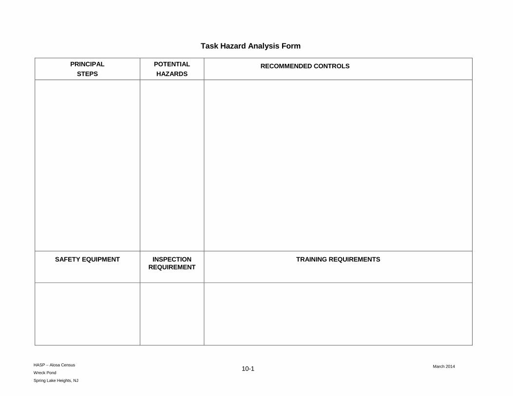
March 2014 10-1
HASP – Alosa Census
Wreck Pond
Spring Lake Heights, NJ
Task Hazard Analysis Form
PRINCIPAL
STEPS
POTENTIAL
HAZARDS RECOMMENDED CONTROLS
SAFETY EQUIPMENT INSPECTION REQUIREMENT
TRAINING REQUIREMENTS

May 2014
Attachment C
Health and Safety Plan Pre-Entry Briefing Attendance Form

May 2014
Health and Safety Plan Pre-Entry Briefing Attendance Form
Wreck Pond Citizen Science Monitoring Program Wreck Pond
Monmouth County Boroughs of Spring Lake and Sea Girt New Jersey
Conducted by:
Date Performed:
Topics Discussed:
1. Review of the content of the HASP (Required)
2.
3.
4.
Printed Name Signature Representing

May 2014
Attachment D
Supervisor’s Accident Investigation Report Form
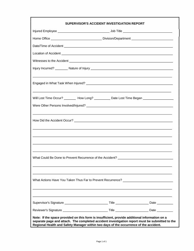
Page 1 of 1
SUPERVISOR'S ACCIDENT INVESTIGATION REPORT
Injured Employee Job Title
Home Office Division/Department
Date/Time of Accident
Location of Accident
Witnesses to the Accident
Injury Incurred? Nature of Injury
Engaged in What Task When Injured?
Will Lost Time Occur? How Long? Date Lost Time Began
Were Other Persons Involved/Injured?
How Did the Accident Occur?
What Could Be Done to Prevent Recurrence of the Accident?
What Actions Have You Taken Thus Far to Prevent Recurrence?
Supervisor's Signature Title Date
Reviewer's Signature Title Date
Note: If the space provided on this form is insufficient, provide additional information on a separate page and attach. The completed accident investigation report must be submitted to the Regional Health and Safety Manager within two days of the occurrence of the accident.

Task Hazard Safety Assessment
Project: Wreck Pond Citizen Science Monitoring New Revised Date: 10/07/2016
Work Activity: Water Monitoring
Personal Protective Equipment (PPE): none
Project Team Position/Title Reviewed By Position/Title Date
Capt. Al Modjeski Program Director Tim Dillingham Executive Director Jenna Krug Project Coordinator Pim Van Hemmen Assistant Director Zack Royle Project Technician
Job Steps1 Potential Hazards2 Control Measures 3
Stop Work Criteria
Surveying water level, temperature and salinity
• Slip/Trip/Fall • Heat Stress/Sun Exposure • Falling into Water • Drowning • Cold Stress/Hypothermia • Weather/Lightning • Wildlife
• Remove all hazards from survey area
• Drink fluids, take breaks, monitor pulse rate
• Wear SPF, hat to protect face
• Walk carefully and deliberately
• Stay away from the pond-side entrance to the pipe/culvert
• Dress properly • Monitor weather, 30/30 rule • Keep safe distance from
dangerous wildlife
• Trip hazards cannot be removed
• No water or insufficient supply
• Pulse rate over 130 beats/minute
• No sunscreen • Insufficient attire
Walking to/from the survey site
• Slip/Trip/Fall • Heat Stress/Sun Exposure • Falling into Water • Drowning • Cold Stress/Hypothermia • Weather/Lightning • Wildlife
• Remove all hazards from survey area
• Drink fluids, take breaks, monitor pulse rate
• Wear SPF, hat to protect face
• Walk carefully and deliberately
• Stay away from the pond-side entrance to the pipe/culvert
• Dress properly • Monitor weather, 30/30 rule • Keep safe distance from
dangerous wildlife
• Trip hazards cannot be removed
• No water or insufficient supply
• Pulse rate over 130 beats/minute
• No sunscreen • Insufficient attire

Task Hazard Safety Assessment
Project: Wreck Pond Citizen Science Monitoring New Revised Date: 10/07/2016
Work Activity: Shorebird Monitoring
Personal Protective Equipment (PPE): none
Project Team Position/Title Reviewed By Position/Title Date
Capt. Al Modjeski Program Director Tim Dillingham Executive Director Jenna Krug Project Coordinator Pim Van Hemmen Assistant Director Zack Royle Project Technician
Job Steps1 Potential Hazards2 Control Measures 3
Stop Work Criteria
Surveying birds on beach and near outfall
• Slip/Trip/Fall • Heat Stress/Sun Exposure • Falling into Water • Drowning • Cold Stress/Hypothermia • Weather/Lightning • Wildlife
• Remove all hazards from survey area
• Drink fluids, take breaks, monitor pulse rate
• Wear SPF, hat to protect face
• Avoid getting too close to the ocean and/or pond
• Stay away from the pond-side entrance to the pipe/culvert
• Dress properly • Monitor weather, 30/30 rule • Keep safe distance from
dangerous wildlife
• Trip hazards can not be removed
• No water or insufficient supply
• Pulse rate over 130 beats/minute
• No sunscreen • Insufficient attire

Wreck Pond Citizen Science Monitoring Program Page ___ of ___
American Littoral Society 18 Hartshorne Dr. Suite 1 Highlands, NJ 07732 (732) 291‐0055
WATER MONITORING DATA SHEET
Instructions: Fill in top portion completely to the best of your ability. In table below, record number
and species of birds observed, general location of observation and behavior/notes (optional).
Monitor Name: ______________________________ Date: ________________ Time: ________AM/PM
Location (circle one; see map below):
Site 1 ‐ Pond side of culvert
Site 2 ‐ Pond side of Black Creek weir
Site 3 ‐ Shore Road
Site 4 ‐ Route 71 Bridge
Site 5 ‐ Old Mill Dam
WATER LEVEL, SALINITY, TEMPERATURE
Water Level: _______________ Salinity: _________________ Temperature: ____________________
Photograph taken? (Y/N): ________ Notes: _______________________________________________
GENERAL OBSERVATIONS AND SITE CONDITIONS
Weather (circle one): Sunny Partly Sunny Cloudy Rain Thunderstorm Snow
Beaufort Wind Scale (0‐12): _________ Rainfall last 24 hrs? (Y/N): ________ Amount: __________
Tide stage (in/out, high/low): ______________________ Cloud cover (0 none‐ 8 total): ____________
Water flow (0 none‐ 4 strong): __________ Water clarity: ____________ Water color: _____________
Water odor: ______________Dominant substrate (silt, sand, gravel, cobble, boulder): _____________
Oil present? ____________ Foam present? ___________ Algae visual percent cover: ______________
Trash present? __________ # pieces: _______ Types: ________________________________________
Natural debris present? ____________ Types: ______________________________________________
Notes:

Wreck Pond Citizen Science Monitoring Program DATA SHEET Page ___ of ___
American Littoral Society 18 Hartshorne Dr. Suite 1 Highlands, NJ 07732 (732) 291‐0055
SHOREBIRD MONITORING
Instructions: Fill in top portion completely to the best of your ability. In table below, record number
and species of birds observed, general location of observation and behavior/notes (optional).
Monitor Name: ______________________________ Date: _____________ Start time: _______AM/PM
Weather (circle one): Sunny Partly Sunny Cloudy Rain Thunderstorm Snow
Beaufort Wind Scale (0‐12): _________ Rainfall last 24 hrs? (Y/N): _______ Amount (in.): _________
Locations surveyed (circle all that apply; see map): SGB SLB OC PI SGD SLD WP BR
Bird species / Description Number Location* Behavior/Notes
*Locations: SLB, SGB, WP, SLD, SGD, BR, PI, OC. See map.
NOTES (other critters observed and general observations):

Wreck Pond Citizen Science Monitoring Program DATA SHEET
American Littoral Society 18 Hartshorne Dr. Suite 1 Highlands, NJ 07732 (732) 291‐0055
Wreck Pond Shorebird Monitoring Locations Map