Embed Size (px)
Citation preview
The World Area Forecast System (WAFS) Internet File
Service (WIFS) Users Guide
By
WAFC Washington
Version 4.1
March 28, 2011

WIFS Users Guide WAFC Washington Page ii
Document Change History
Date Version Description1
24‐Feb‐10 1.0 Initial draft release.
26‐Mar‐10 1.1 Incorporated user feedback including: new document change history section, correction to Table 2 GRIB/GRIB2 description, additional descriptions where necessary, section heading changes, and more.
30‐Mar‐10 1.2 Based on feedback from reviewers, made some changes to the User Authentication fields.
5‐Apr‐10 1.2 Based on feedback from reviewers, added “WAFC Washington” wording to title, footer, and the Introduction.
26‐Apr‐10 1.2 Based on feedback from reviewers: (1) section 2 was renamed “Service Overview and Responsibilities of U.S. Government Agencies”, (2) section 3 was renamed “Data Retrieval Process”, (3) backup information was added to section 4, (4) section 7 “Responsibilities of U.S. Government Agencies” was renamed “WIFS Customer Support” and is now section 8, and (5) more information was added to the WIFS Customer Support section including information on a trouble ticket system.
20‐May‐10 1.3 Based on technical interchange with customers, the GRIB data is now being served in a concatenated file format. The description of the file formats in Section 6 reflects this change. Based on feedback from reviewers: (1) Appendix A was added to describe the Gnu Wget utility, (2) Section 3 was modified to include a reference for Appendix, (3) minor changes were made in Section 4 to clarify back‐up roles and responsibilities, and (4) Section 4.2 title was modified.
15‐Jul‐10 2.0 Folded in the contents of the WIFS Interface Control Document; added Appendix B, Reference Documents; expanded the Gnu Wget description in Appendix A; updated Section 3 Data Retrieval Process; added Appendix C WIFS Registration; changed link to software providers in Section 3; reorganized Section 4 based on reviewer comments; added new Section 4.3 Suspension of Access; added note to Section 5 that mentions potential harmonization of directory structures.
26‐Aug‐10 2.1 Changed WIFS help desk phone number.
1‐Nov‐10 3.0 Completed Draft Interim Version:
Added introductory information
Reorder sections for logical flow
Added Chapter 2, WIFS Products and Data
4‐Jan‐11 3.1 Added verbiage on authorization criteria. Updated document after review of v3.0
14‐Jan‐11 4.0 Document baselined after final reviews
28‐Mar‐11 4.1 Modified Section 5 Data Retrieval Process to make it clearer and easier to interpret; this includes removing the site‐specific URLs. Added reference to SADIS User Guide Annexes 1 and 4.
1 Minor corrections and cosmetic changes are not recorded.
WIFS Users Guide WAFC Washington Page iii
TableofContents
1 INTRODUCTION .............................................................................................................. 5 1.1 Reference Documents ....................................................................................................6 1.1.1 International Standards ........................................................................................................... 6 1.1.2 U.S. Government Standards .................................................................................................... 6 1.1.3 Industry Standards ................................................................................................................... 6 1.1.4 WAFC London Documents ....................................................................................................... 6
2 SERVICE OVERVIEW AND RESPONSIBILITIES OF U.S. GOVERNMENT AGENCIES .............. 8 3 PRODUCTS AND DATA AVAILABLE ON WIFS ................................................................... 9 3.1 Overview of Initial Service ..............................................................................................9 3.2 Grid Point Data ...............................................................................................................9 3.2.1 GRIB1 Data ............................................................................................................................... 9 3.2.2 GRIB2 Data ............................................................................................................................... 10
3.3 Significant Weather PNG Charts .....................................................................................11 3.4 Significant Weather BUFR Files ......................................................................................11 3.5 OPMET Data ...................................................................................................................12 3.6 Administrative Messages ...............................................................................................12 3.7 Annexes to the User Guide .............................................................................................12
4 USER AUTHORIZATION ................................................................................................... 14 4.1 WIFS Registration ...........................................................................................................14 4.2 WIFS Password Policy .....................................................................................................14 4.3 Access to Alternate WAFC Operations ...........................................................................16 4.4 Suspension of Access ......................................................................................................16
5 DATA RETRIEVAL PROCESS ............................................................................................. 17 6 WIFS DIRECTORY STRUCTURE AND FILE FORMATS ......................................................... 18 6.1 BUFR Files .......................................................................................................................19 6.1.1 Format of BUFR Files ............................................................................................................... 19
6.2 GRIB1 and GRIB2 ............................................................................................................20 6.2.1 Format of GRIB Files ................................................................................................................ 21
6.3 OPMET Data Files ...........................................................................................................22 6.3.1 OPMET‐HOURLY ...................................................................................................................... 22 6.3.2 OPMET‐MINUTE ...................................................................................................................... 23 6.3.3 OPMET‐ROLLING ...................................................................................................................... 24 6.3.4 Format of OPMET Files ............................................................................................................ 24
6.4 PNG .................................................................................................................................25 6.4.1 Format of PNG Files ................................................................................................................. 26
6.5 ADMIN_MSGS .................................................................................................................27 6.5.1 Format of Administrative Message Files ................................................................................. 27
7 WIFS SUPPORT WEB SITE ............................................................................................... 28 8 WIFS CUSTOMER SUPPORT ............................................................................................ 29 9 USER TROUBLESHOOTING GUIDELINES .......................................................................... 30 APPENDIX A. GNU WGET ................................................................................................. 31
WIFS Users Guide WAFC Washington Page iv
ListofTables
Table 3‐1 Administrative Message Types ....................................................................................12 Table 6‐1 Significant Weather PNG Files .....................................................................................25 Table 9‐1 Troubleshooting Guidelines .........................................................................................30
ListofFigures
Figure 4‐1 WIFS Online Registration Form ..................................................................................15 Figure 4‐2 WIFS Registration Confirmation Screen .....................................................................15 Figure 6‐1 WIFS Directory Structure ............................................................................................18 Figure 6‐2 Snapshot of the BUFR folder ......................................................................................19 Figure 6‐3 Snapshot of GRIB folder ..............................................................................................20 Figure 6‐4 Snapshot of the GRIB2 folder .....................................................................................21 Figure 6‐5 Snapshot of the OPMET‐Hourly Folder ......................................................................22 Figure 6‐6 Snapshot of the OPMET‐MINUTE folder ....................................................................23 Figure 6‐7 Snapshot of the OPMET‐ROLLING folder ....................................................................24 Figure 6‐8 Snapshot of the PNG folder ........................................................................................25 Figure 6‐9 Snapshot of the ADMIN_MSGS folder ........................................................................27
WIFS Users Guide WAFC Washington Page 5
1 Introduction
Established in 1982, the objective of the World Area Forecast System (WAFS) system is to
supply meteorological authorities and other users with forecasts of en‐route meteorological
conditions in digital form. This objective is achieved through a comprehensive, integrated
worldwide, and, as far as is practicable, uniform system and in a cost‐effective manner, taking
advantage of evolving technologies. One result of evolving technology is the implementation of
the WAFS Internet File Service (WIFS) which replaces the International Satellite Communication
System (ISCS).
WIFS is provided by the Washington World Area Forecast Center (WAFC). The Washington
WAFC is operated by the United States National Weather Service (NWS) and WIFS is an integral
part of the NWS’s Consolidated Aviation Web Services (CAWS) system, used for the purpose of
providing WAFS products and related services as defined by the International Civil Aviation
Organization (ICAO) Annex 3.
WIFS is in compliance with ICAO Document 9855 Guidelines on the Use of the Public Internet
for Aeronautical Applications, and the associated Federal Aviation Administration (FAA)
Advisory Circular 00‐62 Internet Communications of Aviation Weather and Notices to Airmen
(NOTAMs) dated November 1, 2002 that enables WIFS to support the dissemination of WAFS
and related products via the Internet in accordance with ICAO Annex 10.
WIFS supplies the same meteorological products as those currently broadcast by ISCS. Such
products include upper wind, upper‐air temperature, upper‐air humidity, direction, speed and
height of maximum wind, tropopause height and temperature, and forecast significant weather
phenomena.

WIFS Users Guide WAFC Washington Page 6
1.1 Reference Documents
1.1.1 International Standards
International Standard ISO 8802‐2: 1998 Part 2: Logical Link Control
WMO Publication 306 Manual on Codes
WMO Publication 386 Manual on the Global Telecommunications System
WMO Publication FM92 GRIB Edition 1
WMO Publication FM92 GRIB Edition 2
WMO Publication FM94 BUFR
ISO/IEC 15444‐1:2004, JPEG 2000 Compression
Annex 3 to the Convention on International Civil Aviation, Meteorological Services for
International Navigation.
Annex 10 to the Convention on International Civil Aviation , Aeronautical
Telecommunications
International Civil Aviation Organization Document 9855 Guidelines on the Use of the
Public Internet for Aeronautical Applications
1.1.2 U.S. Government Standards
Federal Aviation Administration Advisory Circular 00‐62 Internet Communications of
Aviation Weather and NOTAMS, November 1, 2002
1.1.3 Industry Standards
Institute of Electrical and Electronics Engineers (IEEE) 802.3: Ethernet Local Area
Network Specification
GNU Free Documentation License
(http://www.gnu.org/software/wget/manual/wget.html#GNU‐Free‐Documentation‐
License)
GNU Wget 1.12 Manual (http://www.gnu.org/software/wget/manual/wget.html)
RFC 791: Internet Protocol (IP)
RFC 793: Transmission Control Protocol (TCP)
W3C Portable Network Graphics (PNG) Specification (Second Edition)
1.1.4 WAFC London Documents
Satellite Distribution System (SADIS) User Guide Fourth Edition Annex 1
(http://www2.icao.int/en/anb/met‐
aim/met/sadisopsg/SADIS%20User%20Guide/SADIS%20User%20Guide%20‐
%20Fourth%20Edition/Annex%201.pdf)

WIFS Users Guide WAFC Washington Page 7
Satellite Distribution System (SADIS) User Guide Fourth Edition Annex 4
(http://www2.icao.int/en/anb/met‐
aim/met/sadisopsg/SADIS%20User%20Guide/SADIS%20User%20Guide%20‐
%20Fourth%20Edition/Annex%204.pdf)

WIFS Users Guide WAFC Washington Page 8
2 ServiceOverviewandResponsibilitiesofU.S.GovernmentAgencies
WIFS is a real‐time data repository integrated within the CAWS system and accessible via the
Internet to authorized users. For the purposes of adhering to the guidelines in ICAO Document
9855 Guidelines on the Use of the Public Internet for Aeronautical Applications and FAA
Advisory Circular 00‐62 requirements, the system is certified as a Qualified Internet
Communications Provider (QICP)
The FAA, as the U.S. Meteorological Authority, identifies requirements for the products and
services provided by the Washington WAFC. The National Oceanic and Atmospheric
Administration (NOAA) NWS is the service provider of WAFS products and has responsibility for
the management and operation of WIFS.
WIFS Users Guide WAFC Washington Page 9
3 ProductsandDataAvailableonWIFS
3.1 Overview of Initial Service
WIFS provides access to WAFS data and products that are currently broadcast over ISCS.
Information hosted on WIFS as defined in ICAO Annex 3, Meteorological Service for
International Air Navigation, Chapter 3. These products are provided in the following divided
into two groups:
Grid Point information in gridded binary (GRIB1 and GRIB2) formats
Significant Weather (SIGWX) in BUFR and PNG formats
Alphanumeric OPMET information required for pre‐flight planning
The required areas, flight levels, and forecast times for aeronautical meteorological products
are defined in Regional Air Navigation agreements, and listed in the applicable regional ICAO Air
Navigation Plan.
3.2 Grid Point Data
WIFS provides upper‐air gridded forecasts in two formats, GRIB1 and GRIB2. GRIB1 is the
format that has been used for many years. Due to a need to expand the data sets and increase
the resolution, ICAO approved the use of GRIB2 for encoding WAFS data sets. GRIB2 offers
significant advantages over GRIB1 including increased self‐description, flexibility, and
expandability. In addition, GRIB2 supports more compression schemes, including JPEG 2000
which is the scheme used by NCEP and used in the GRIB2 products on WIFS.
Note that GRIB1 data is scheduled to be terminated in 2013 in accordance with the long term
plan of the World Area Forecast System Operations Group (WAFSOPSG). Users are encouraged
to periodically check the WAFSOPSG bulletin board for changes in operations and policy.
Users receiving this data must have a data processing system, such as the WAFS workstation,
which can read, decode, and manipulate data for the user’s specific purpose. WAFS products
prepared in GRIB1 and GRIB2 format are transmitted as a series of bulletins. Each bulletin
contains a grid point field of one parameter at a single level. The individual bulletins are
concatenated together according to the valid forecast hour before being made available on
WIFS. Section 6.2 describes the naming convention for these concatenated data files.
3.2.1 GRIB1 Data
GRIB1 data is prepared by WAFC Washington and coded in the WAFS thinned GRIB format. The
globe is divided into eight octants, four each in the Northern and Southern Hemispheres. Each
segment is 90° in length, starting either side of the 30° W meridian, covering the Equator to
each Pole. Decoding software available from WAFC Washington enables the information to be
interpolated and presented on a regular latitude/longitude grid.

WIFS Users Guide WAFC Washington Page 10
Gridded forecasts are prepared four times daily, valid at 6, 12, 18, 24, 30 and 36 hours after
synoptic data time (0000, 0600, 1200, and 1800 UTC). Forecasts are made available for
transmission as soon as technically feasible, but no later than six (6) hours after the standard
time of observation.
3.2.2 GRIB2 Data
The same data sets are available in GRIB2 as are in GRIB1 (e.g., wind, temperature, humidity,
etc). In addition, Cumulonimbus (CB) Clouds, Turbulence, and Icing forecasts, are also available
on a trial basis and only reside on WIFS. To obtain more information users should refer to the
final report of the Fifth Meeting of the WAFS Operations Group (WAFSOPSG):
http://www2.icao.int/en/anb/met‐aim/met/wafsopsg/Pages/default.aspx
Notable GRIB2 Characteristics:
GRIB 2 grid will be regular 1.25 x 1.25 degree (unthinned).
New vertical levels at 350 hPa (~FL270), 275 hPa (~FL320) and 225 hPa (~FL360),
applicable to wind, temperature and geopotential height fields.
New vertical levels in the trial forecasts at 800 hPa (~FL060) for Icing; and 350 hPa
(~FL270) for Clear Air Turbulence (CAT).
CAT files have turbulence (%) for levels 150‐400 hPa in 50 hPa increments.
The Icing files have icing (%) from 300‐800 hPa in 100 hPa increments.
Eliminates use of octants and issues GRIB 2 data as a global field of data for each
element.
In Cloud Turbulence (ICT) is combined layer cloud and convective cloud turbulence
ICT files have turbulence (%) from 300‐700 hPa in 100 hPa increments.
Tropopause Height limit of FL530 in UK GRIB1 to be changed to FL600 in GRIB2.
Reference levels to tropopause height for GRIB1 and GRIB2 for WAFC Washington are
different. Users should refer to the WAFS Change Notice Board for further information.
Issuance times:
4 issues per day, with DT 00, 06, 12 and 18 UTC.
11 time steps at 3 hourly intervals T+6 to T+36.
Data Points:
27,576 GRIB 1 global data points with thinned “quasi‐regular” grid (i.e. 3447 data
points per octant).
41,760 GRIB 2 global data points with regular (unthinned) 1.25 x 1.25 degree grid
Approximately a 50% increase in the number of global data points over present
thinned GRIB 1 (27,576 increases to 41,760).

WIFS Users Guide WAFC Washington Page 11
Bulletins:
GRIB 1 bulletin is ~4 KB per octant, to 1st approximation (i.e. 2352 bulletins
totals, for forecast hours from 00 – 72, ~38 MB)
GRIB 2 bulletin is approximately 6 KB per octant (roughly a 50% increase).
GRIB 2 bulletins range from 20 KB ‐ 70 KB in size containing global field of data.
1078 GRIB 2 bulletins (671 standard bulletins and 405 trial bulletins) per run
containing global field of data.
Data volume
Data volume is ~35 MB per run before compression (671 bulletins ~25 MB and
407 bulletins ~10 MB).
Although there are more data points and higher resolution of GRIB2 over GRIB1,
the data volume is roughly the same due to better compression algorithms used
for GRIB2.
Detailed information concerning upper‐air gridded forecasts can be found in ICAO Annex 3,
Appendix 2.
3.3 Significant Weather PNG Charts
SIGWX forecasts supplied in a Portable Network Graphics (PNG) format are issued four (4) times
daily, and are valid at 0000, 0600, 1200, and 1800 UTC for the areas of coverage. The SIGWX
forecasts include the elements listed in Annex 3, Appendix 2, 1.3.3.
3.4 Significant Weather BUFR Files
SIGWX forecasts are issued using Binary Universal Form for the Representation of
meteorological data (BUFR) code form follow the specifications included in WMO Publication
No. 306, Manual on Codes, Volume I.2, Part B – Binary Codes. Forecasts of SIGWX prepared by
WAFC Washington are issued four times daily, valid at 0000, 0600, 1200, and 1800 UTC. BUFR is
a standard binary format approved by the WMO for efficient storage of meteorological
features. To produce a BUFR file, two elements are needed: a raw data file and a set of tables
containing descriptors. When raw data is encoded, each data value is attached to a descriptor
defining what the data represents. The decoding process reads the BUFR file, looks up the
descriptor in the relevant table, and writes out the information in the proper format. Binary
BUFR files contain a set of tables with descriptors. Descriptors must be decoded from a set of
common tables on the local machine in order to understand what the values represent. To this
end, BUFR messages are very small and machine independent. They can be understood and
decoded by any BUFR decoder having the latest tables available.

WIFS Users Guide WAFC Washington Page 12
SIGWX data in BUFR format is independent of the background or projection. Only the
information describing the feature is encoded. For example, a CLOUD area is a list of points
with the height of bases and tops, and cloud type and amount attributes attached. There are no
rules on how the cloud area should be drawn, or how the attributes are displayed. On SIGWX
charts this is shown as a box, sometimes with an arrow to the area, but this information is
determined by the graphical display program.
BUFR does not provide information on how to visually represent data. However, the WAFCs
have written guidance on representation, which can be found on the WAFS Operations Group
web page link:
http://www2.icao.int/en/anb/met‐aim/met/wafsopsg/Pages/GuidanceMaterial.aspx
3.5 OPMET Data
OPMET information includes Routine Aviation Weather Reports (METAR), Special Routine
Aviation Weather Reports (SPECI), Terminal Aerodrome Forecasts (TAF), Significant
Meteorological Information (SIGMET) and special Air‐reports (AIREPs). Volcanic Ash Advisory
(VAA) and Tropical Cyclone Advisory (TCA) messages are also available on WIFS.
3.6 Administrative Messages
WIFS maintains a folder for the following types of administrative messages:
Table 3-1 Administrative Message Types
WMO Header Description
NOUS42 KWNO An NWS administrative message that discusses any major impacts to NWS communications and provides relevant info on numeric models that could affect the WAFC.
FXUS65 KWBC and FXUK65 EGGR These are used by the WAFCs to alert users to corrections to the WAFC charts
NOXX10 KWBC Used for ISCS administrative messages until June 2012
NOXX10 KKCI A new WMO ID for WIFS administrative messages
3.7 Annexes to the User Guide
OPMET, forecasts and data products that are available to users on WIFS can be found in the
SADIS User Guide Annexes 1 and 4.
Annex 1 — FASID Table MET 2A — OPMET information (METAR, SPECI and TAF)
available on WIFS servers
Annex 4 — WAFS forecasts available on WIFS servers
All of these Annexes can be accessed under the Guidance Materials section of the SADIS
Operations Group web‐site:
http://www2.icao.int/en/anb/met‐aim/met/sadisopsg/Pages/default.aspx
WIFS Users Guide WAFC Washington Page 13
If an OPMET product is listed as being available under Annex 1 but cannot be found within the
OPMET data files in WIFS, send an email to [email protected] to report the issue.
WIFS Users Guide WAFC Washington Page 14
4 UserAuthorization
WIFS is not an open system and requires all users to be authorized for access. Authorization is
granted (or denied) as part of the WIFS Registration process by the Washington WAFC Provider
State’s Meteorological Authority, the FAA.
The main criteria for approval is that there is some type of understanding that the company or
person requesting access is providing direct support to an operator in support of flight planning
for international operations, and that they should fall into one of the following categories:
An existing ISCS user
WAFS Vendor
State MET Authority
State National Meteorological & Hydrologic Service Provider
International Operator and U.S. Flag carriers (domestic and international)
Vendor listed as Enhanced Weather Information Systems (EWINS)
Any Vendor identified in OPS SPEC in support of meteorological services for an airline
4.1 WIFS Registration
Users must complete and submit a form online at http://www.aviationweather.gov/wifs. Once
the WIFS approving official authorizes access, the Washington WAFC will issue a user name and
password which will be required to access the data.
For those States that deploy multiple WIFS workstation it is strongly recommended that each
be registered separately. Figure 4‐1 shows a snapshot of the current WIFS Registration Form
available on the WIFS home page. The form should be completed and submitted online. Figure
4‐2 shows a snapshot of the screen that will be seen upon successful form submission.
4.2 WIFS Password Policy
The current password policy is that the password does not expire. Users may request a
password change by submitting an updated Registration request, and adding an applicable
comment in the Comments (Other Information) field.
It should be noted, however, that the U.S. Department of Commerce may require NOAA/NWS
to change this password policy such that WIFS users will be required to change their password
periodically. If such a policy comes into effect, users will be provided with an automated
mechanism to renew their password, and this document will be updated accordingly.

WIFS Users Guide WAFC Washington Page 15
Figure 4-1 WIFS Online Registration Form
Figure 4-2 WIFS Registration Confirmation Screen
WIFS Users Guide WAFC Washington Page 16
4.3 Access to Alternate WAFC Operations
WIFS users can request access to SADIS FTP services as a back‐up means to obtain WAFS
products as a contingency plan in the unlikely event of a catastrophic WIFS outage. However,
SADIS FTP services are not available as a primary means of obtaining WAFS data to WIFS users,
or future users whose primary WAFS provider is designated as Washington WAFC. Unless there
is a major WIFS outage, SADIS FTP will not provide 'continuous', 'high volume' data supply to
those WIFS users who are using SADIS FTP as a backup/contingency.
Similarly, SADIS (2G or FTP) users can request access to WIFS as a back‐up means to obtain
WAFS products, as a contingency plan in the unlikely event of a catastrophic SADIS outage.
However, WIFS is not available as a primary means of obtaining WAFS data to SADIS users, or
future users whose primary WAFS provider is designated as London WAFC. Unless there is a
major SADIS outage, WIFS will not provide 'continuous', 'high volume' data supply to those
SADIS users who are using WIFS as a backup/contingency.
SADIS users can request access to WIFS by filling out the online registration form as called out
in Section 4.1 above.
WIFS users who wish to arrange a contingency account on SADIS FTP should contact the SADIS
Manager (Chris Tyson) at the UK Met Office directly ([email protected]).
4.4 Suspension of Access
WIFS access may be suspended by the WIFS approving authority for unauthorized use of WIFS.
Access to SADIS and WIFS as back‐up services may be suspended by the WIFS and SADIS
approving authorities if user’s primary WIFS or SADIS accounts are suspended.

WIFS Users Guide WAFC Washington Page 17
5 DataRetrievalProcess
WIFS hosts WAFS and OPMET products on file servers located within multiple web farms. WIFS
does not deliver (“push”) data to the user but requires the user to collect (“pull”) data off the
file servers. User access to the WIFS files servers is by a Secure Hypertext Transfer Protocol
(HTTPS) session over the Internet. Files can then be downloaded across this secure connection
using browser or script‐based tools. Users are encouraged to use the Gnu Wget designed to
retrieve content from web‐based file servers. More information about Gnu Wget can be found
in Appendix A.
The minimum recommended Internet connection speed is 64 kbps, bursting to 512 kbps. Once
the data is retrieved from WIFS, users will need software that is capable of processing and
displaying WAFS data. A list of WAFS software providers can be found on the Vendors page at
http://www.aviationweather.gov/wifs. Users should contact specific providers for cost and
availability.
WIFS users access the WIFS file servers using the https://www.aviationweather.gov/wifs/data
URL. This is a globally load‐balanced URL that CAWS provides to evenly distribute the load
amongst multiple web farms. Note that the previously published site‐specific URLs are being
taken out of service and, while they will still be temporarily available, users must begin the
transition to using the load balanced URL as soon as possible. Check the Advisories page at
http://www.aviationweather.gov/wifs for updates on this issue as they become available.

WIFS Users Guide WAFC Washington Page 18
6 WIFSDirectoryStructureandFileFormats
Figure 6‐1 depicts the WIFS directory structure and the names of the individual folders, with
respect to the base URL (e.g., https://www.aviationweather.gov/wifs/data).
Note: At the time of this writing the directory structure is under review by the FAA and the NWS as there
is a possibility of further harmonization of products between WIFS and SADIS.
Figure 6-1 WIFS Directory Structure

WIFS Users Guide WAFC Washington Page 19
6.1 BUFR Files
The BUFR files are generated every 6 hours and the WIFS BUFR folder contains the past 36
hours of SIGWX forecasts in BUFR format. Figure 6‐2 is an example of the files that can be found
in this folder.
Figure 6-2 Snapshot of the BUFR folder
The file naming convention for these files is:
YYYYMMDD_HH00_TTAAii_CCCC.bufr where
YYYY = 4‐digit year MM = 2‐digit month DD = 2‐digit day HH = 2‐digit hour of forecast package valid time 00 = Fixed characters
TTAAii_CCCC = WMO header and site identifier .bufr = File extension
6.1.1 Format of BUFR Files
For details on the format of the BUFR products see WMO Publication FM94 BUFR.
WIFS Users Guide WAFC Washington Page 20
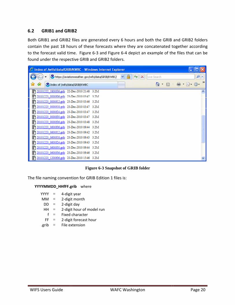
6.2 GRIB1 and GRIB2
Both GRIB1 and GRIB2 files are generated every 6 hours and both the GRIB and GRIB2 folders
contain the past 18 hours of these forecasts where they are concatenated together according
to the forecast valid time. Figure 6‐3 and Figure 6‐4 depict an example of the files that can be
found under the respective GRIB and GRIB2 folders.
Figure 6-3 Snapshot of GRIB folder
The file naming convention for GRIB Edition 1 files is:
YYYYMMDD_HHfFF.grib where
YYYY = 4‐digit year MM = 2‐digit month DD = 2‐digit day HH = 2‐digit hour of model run f = Fixed character
FF = 2‐digit forecast hour .grib = File extension
WIFS Users Guide WAFC Washington Page 21
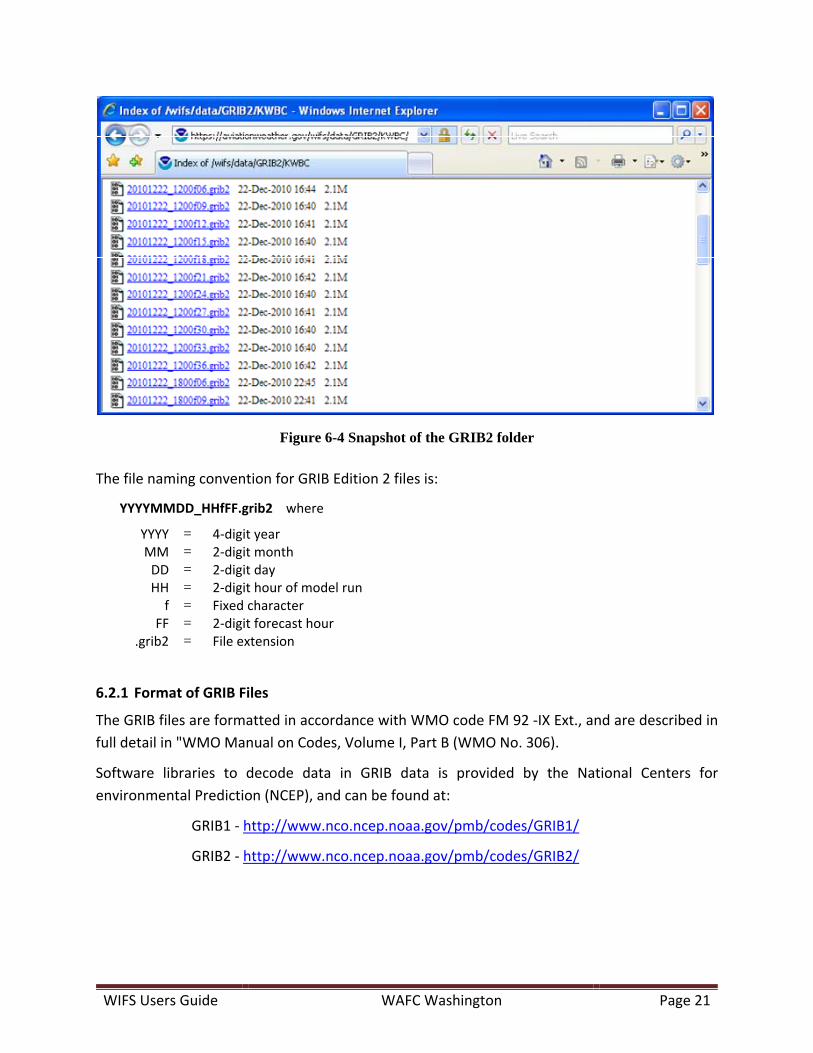
Figure 6-4 Snapshot of the GRIB2 folder
The file naming convention for GRIB Edition 2 files is:
YYYYMMDD_HHfFF.grib2 where
YYYY = 4‐digit year MM = 2‐digit month DD = 2‐digit day HH = 2‐digit hour of model run f = Fixed character
FF = 2‐digit forecast hour .grib2 = File extension
6.2.1 Format of GRIB Files
The GRIB files are formatted in accordance with WMO code FM 92 ‐IX Ext., and are described in
full detail in "WMO Manual on Codes, Volume I, Part B (WMO No. 306).
Software libraries to decode data in GRIB data is provided by the National Centers for
environmental Prediction (NCEP), and can be found at:
GRIB1 ‐ http://www.nco.ncep.noaa.gov/pmb/codes/GRIB1/
GRIB2 ‐ http://www.nco.ncep.noaa.gov/pmb/codes/GRIB2/
WIFS Users Guide WAFC Washington Page 22
6.3 OPMET Data Files
The WIFS servers provide OPMET data (METARs/SPECIs, TAFs, SIGMETs, Advisories, Air Reports,
NOTAMs, ASHTAMs) in character‐oriented format, and this data is made available based on the
following criteria:
By the Hour
By the Minute
Rolling timeframes of the last 5, 30 and 60 minutes
6.3.1 OPMET‐HOURLY
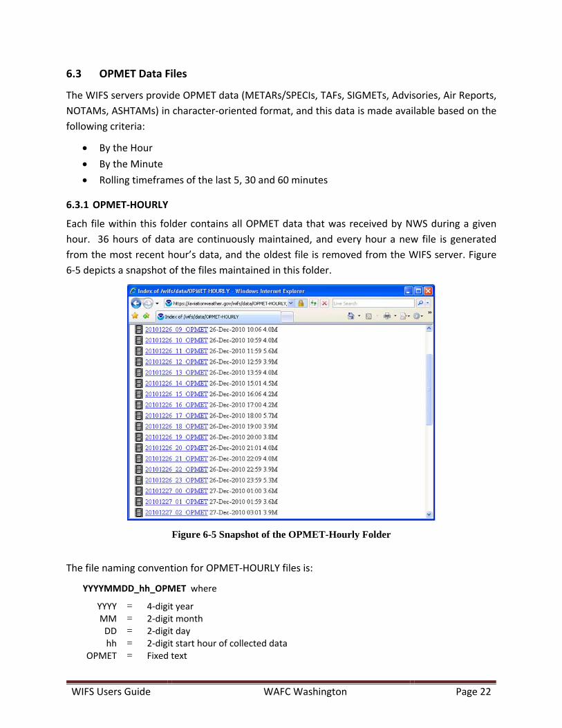
Each file within this folder contains all OPMET data that was received by NWS during a given
hour. 36 hours of data are continuously maintained, and every hour a new file is generated
from the most recent hour’s data, and the oldest file is removed from the WIFS server. Figure
6‐5 depicts a snapshot of the files maintained in this folder.
Figure 6-5 Snapshot of the OPMET-Hourly Folder
The file naming convention for OPMET‐HOURLY files is:
YYYYMMDD_hh_OPMET where
YYYY = 4‐digit year MM = 2‐digit month DD = 2‐digit day hh = 2‐digit start hour of collected data
OPMET = Fixed text
WIFS Users Guide WAFC Washington Page 23
6.3.2 OPMET‐MINUTE
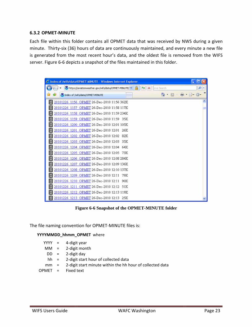
Each file within this folder contains all OPMET data that was received by NWS during a given
minute. Thirty‐six (36) hours of data are continuously maintained, and every minute a new file
is generated from the most recent hour’s data, and the oldest file is removed from the WIFS
server. Figure 6‐6 depicts a snapshot of the files maintained in this folder.
Figure 6-6 Snapshot of the OPMET-MINUTE folder
The file naming convention for OPMET‐MINUTE files is:
YYYYMMDD_hhmm_OPMET where
YYYY = 4‐digit year MM = 2‐digit month DD = 2‐digit day hh = 2‐digit start hour of collected data
mm = 2‐digit start minute within the hh hour of collected data OPMET = Fixed text
WIFS Users Guide WAFC Washington Page 24
6.3.3 OPMET‐ROLLING
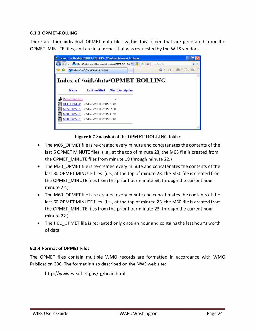
There are four individual OPMET data files within this folder that are generated from the
OPMET_MINUTE files, and are in a format that was requested by the WIFS vendors.
Figure 6-7 Snapshot of the OPMET-ROLLING folder
The M05_OPMET file is re‐created every minute and concatenates the contents of the
last 5 OPMET MINUTE files. (i.e., at the top of minute 23, the M05 file is created from
the OPMET_MINUTE files from minute 18 through minute 22.)
The M30_OPMET file is re‐created every minute and concatenates the contents of the
last 30 OPMET MINUTE files. (i.e., at the top of minute 23, the M30 file is created from
the OPMET_MINUTE files from the prior hour minute 53, through the current hour
minute 22.)
The M60_OPMET file is re‐created every minute and concatenates the contents of the
last 60 OPMET MINUTE files. (i.e., at the top of minute 23, the M60 file is created from
the OPMET_MINUTE files from the prior hour minute 23, through the current hour
minute 22.)
The H01_OPMET file is recreated only once an hour and contains the last hour’s worth
of data
6.3.4 Format of OPMET Files
The OPMET files contain multiple WMO records are formatted in accordance with WMO
Publication 386. The format is also described on the NWS web site:
http://www.weather.gov/tg/head.html.
WIFS Users Guide WAFC Washington Page 25
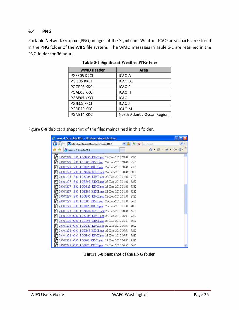
6.4 PNG
Portable Network Graphic (PNG) images of the Significant Weather ICAO area charts are stored
in the PNG folder of the WIFS file system. The WMO messages in Table 6‐1 are retained in the
PNG folder for 36 hours.
Table 6-1 Significant Weather PNG Files
WMO Header Area
PGEE05 KKCI ICAO A
PGIE05 KKCI ICAO B1
PGGE05 KKCI ICAO F
PGAE05 KKCI ICAO H
PGBE05 KKCI ICAO I
PGJE05 KKCI ICAO J
PGDE29 KKCI ICAO M
PGNE14 KKCI North Atlantic Ocean Region
Figure 6‐8 depicts a snapshot of the files maintained in this folder.
Figure 6-8 Snapshot of the PNG folder

WIFS Users Guide WAFC Washington Page 26
The file naming convention for these files is:
YYYYMMDD_HH00_TTAAii_CCCC.png where
YYYY = 4‐digit year MM = 2‐digit month DD = 2‐digit day HH = 2‐digit hour of forecast package valid time 00 = Fixed characters
TTAAii_CCCC = WMO header and site identifier .png = File extension
6.4.1 Format of PNG Files
For detailed information on the PNG format, see the W3C Portable Network Graphics (PNG)
Specification (Second Edition) (http://www.w3.org/TR/PNG).

WIFS Users Guide WAFC Washington Page 27
6.5 ADMIN_MSGS
Administrative messages are retained on WIFS for 36 hours. Each file contains a single message.
Figure 6‐9 is a snapshot of the administrative messages found on the WIFS servers.
Figure 6-9 Snapshot of the ADMIN_MSGS folder
The file naming convention for these files is:
YYYYMMDD_hhmm_NOUSii_CCCC.adm where
YYYY = 4‐digit year MM = 2‐digit month DD = 2‐digit day hh = 2‐digit hour of message issuance time
mm = 2‐digit minute of message issuance time 00 = Fixed characters
NOUSii_CCCC = WMO header and site identifier .adm = File extension
6.5.1 Format of Administrative Message Files
The Administrative message files contain a single WMO record formatted in accordance with
WMO Publication 386. The format is also described on the NWS web site:
http://www.weather.gov/tg/head.html.
WIFS Users Guide WAFC Washington Page 28
7 WIFSSupportWebSite
WIFS also has its own support web‐site, which can be accessed by opening the following link in
a web browser: http://www.aviationweather.gov/wifs.
The intent of this web site is to provide all the necessary information in support of WIFS. It
provides additional information about the products not contained in this user’s guide, such as
the list of available products which may change of time.
The web site has the following key capabilities:
Provides the user the ability to register for WIFS
The latest version of this users guide can be found under the Documentation page
The Products page provides details on the type of available products on WIFS along with
the list of specific products by WMO header
Contact information and troubleshooting tips can be found under the Support page
A link to the current set of vendors that can provide support to WIFS users is found
under the Vendors page
The Advisories page provides the latest operational status about the WIFS service its self

WIFS Users Guide WAFC Washington Page 29
8 WIFSCustomerSupport
The WIFS Customer Support Desk is available to address issues Monday through Friday
between the hours of 7am to 3pm US Central Time. To contact the WIFS Customer Support:
E‐mail: [email protected]
Phone: +1 (877) 280‐2811
If a user experiences operational issues outside of normal WIFS Customer Support Desk hours,
they can generally expect a response within 3 hours after the Customer Support Desk re‐opens.
For each operational issue identified, a service ticket will be generated and users will be sent an
e‐mail with the service ticket number. Users should refer to this ticket number in all follow‐up
correspondence with the WIFS Customer Support Desk.
If users require immediate help outside of normal business hours they should contact the NWS
Telecommunications Operations Center Help Desk at +1 (301) 713‐0902.
WIFS Users Guide WAFC Washington Page 30
9 UserTroubleshootingGuidelines
Table 9‐1 provides an initial set of troubleshooting guidelines to help users with possible issues.
This information can also be found on the WIFS Support web‐site which may be updated with
more troubleshooting guidelines.
Table 9-1 Troubleshooting Guidelines
Symptom Probable Cause Actions to Take
Data out of date, cannot be retrieved, or is not being properly displayed on the missing on the workstation
WAFS data retrieve process failed
Test the internet connection1
Check the data retrieve log file for errors2
Contact the WAFS workstation support team
Data on WIFS is out of date
Test the internet connection1
Browse to the WIFS online file list and check to see if data is up to date3
If data is out of date send an email to [email protected] and contact the NWSTG to report the problem.4
There is a WIFS data ingest problem
Check the Advisories page for new advisories pertaining to data outages.
If data is out of date send an email to [email protected] and contact the NWSTG to report the problem.4
Notes:
1. To test your internet connection, try to “ping” the WIFS URL (i.e., “ping
http://www.aviationweather.gov/wifs”). If the ping is successful you have a working
internet connection. If it is not, contact your system administrator or your Internet
Service Provider for assistance.
2. If you don’t know where this file is or how to access it, contact the WAFS Workstation
Support Team.
3. In your browser type in the WIFS URL (i.e., http://www.aviationweather.gov/wifs).
Click on the appropriate category and find the data you are looking for. Take note of
the file name with the latest date/time.
4. The National Weather Service Telecommunications Gateway (NWSTG) Helpdesk phone
number is (301) 713‐0902.

WIFS Users Guide WAFC Washington Page 31
AppendixA. GnuWget
GNU Wget is a free software package for retrieving files using HTTP, HTTPS and FTP, the most
widely‐used Internet protocols. It is a non‐interactive command‐line tool that can be executed
from programs, scripts, and cron jobs. GNU Wget has many features to make retrieving large
files easy, including:
Can resume aborted downloads, using REST and RANGE
Can use filename wild cards and recursively mirror directories
NLS‐based message files for many different languages
Optionally converts absolute links in downloaded documents to relative, so that
downloaded documents may link to each other locally
Runs on most UNIX‐like operating systems as well as Microsoft Windows
Supports HTTP proxies
Supports HTTP cookies
Supports persistent HTTP connections
Unattended / background operation
Uses local file timestamps to determine whether documents need to be re‐downloaded
when mirroring
GNU Wget is distributed under the GNU General Public License.
To download Wget, navigate to http://ftp.gnu.org/gnu/wget/.
GNU Wget documentation can be found at http://www.gnu.org/software/wget/manual/
For other manuals, please see http://www.gnu.org/manual/.
The structure of the command including only the required arguments is described below. The
Wget utility is powerful and includes the capability of performing recursion, statistics, logging,
and much more.
wget --user=<user> --password=<password> --no-check-certificate <URL>
whereuser = your WIFS login name password = your WIFS password no-check-certificate = required argument
WIFS Users Guide WAFC Washington Page 32
A.1 UseCase
Below is a use‐case scenario for how a fictitious user (John Smith) might identify a file he wants,
and uses wget to download the file from WIFS. In this case John knows he wants a Significant
Weather PNG chart.
1. John identifies the file he wants (20100715_0600_PGEE05_KKCI.png). He does this in
one of two ways:
A. Using his browser
He navigates to http://www.aviationweather.gov/wifs/data He enters his WIFS user ID and password He clicks on the PNG folder He locates the file of interest in the listing
B. Using a Wget file listing
John issues the following command:
wget ‐‐user=johnsmith ‐‐password=wxdude ‐‐no‐check‐certificate https://www.aviationweather.gov/wifs/data/PNG/
The “index.html” file for the PNG data folder will be downloaded to the
current working folder on John’s computer. John can then open this file
in his browser to see the directory listing.
The following directories can be listed:
o BUFR o GRIB o GRIB2 o ADMIN_MSGS o OPMET‐HOURLY o OPMET‐MINUTE o OPMET‐ROLLING o PNG
2. John downloads the file using Wget
A. On the command line from his computer, John types the following command:
wget ‐‐user=johnsmith ‐‐password=wxdude ‐‐no‐check‐certificate
https://www.aviationweather.gov/wifs/data/PNG/20100715_0600_PGEE05_KKC
I.png
B. John’s file will be downloaded to the current working directory on his computer.