Embed Size (px)
Citation preview
The Travels of Mendes Pinto.A *positivist approach.
1.Travel literature2. Precendents to transoceanic navigation
3. Fernão Mendes Pinto and The Travels of Mendes Pinto
4. Main geographical areas5. Place name identification
6. Conclusions* Positivist: "observable through empirical evidence”
1. Travel literatureTypology and examples after Cristóvão (1999, pp. 38-52)
PilgrimagesCommercial
Expansion: political, religious, and scientificErudite and artistic
Fictional
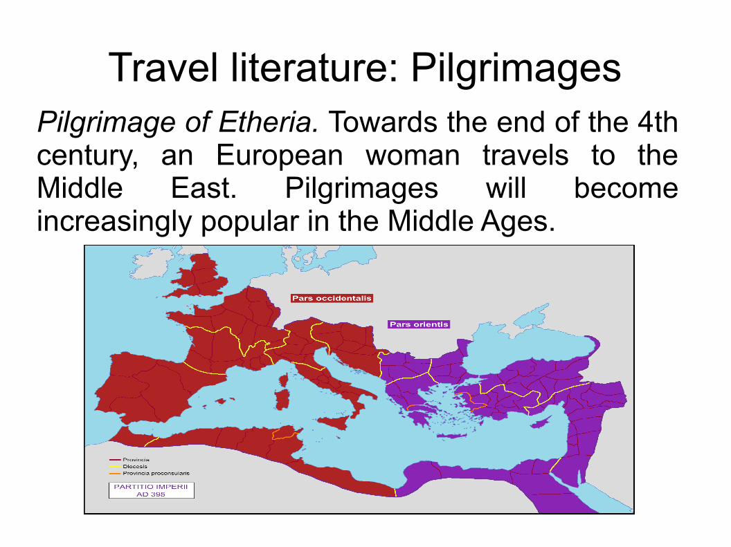
Travel literature: PilgrimagesPilgrimage of Etheria. Towards the end of the 4th century, an European woman travels to the Middle East. Pilgrimages will become increasingly popular in the Middle Ages.
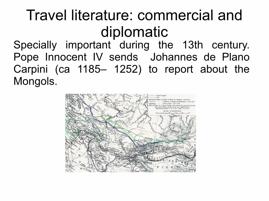
Travel literature: commercial and diplomatic
Specially important during the 13th century. Pope Innocent IV sends Johannes de Plano Carpini (ca 1185– 1252) to report about the Mongols.
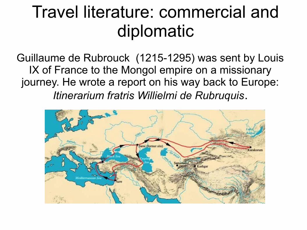
Travel literature: commercial and diplomatic
Guillaume de Rubrouck (1215-1295) was sent by Louis IX of France to the Mongol empire on a missionary
journey. He wrote a report on his way back to Europe: Itinerarium fratris Willielmi de Rubruquis.
http://commons.wikimedia.org/wiki/File:Route_rubrouck_1253_55.JPG?uselang=fr
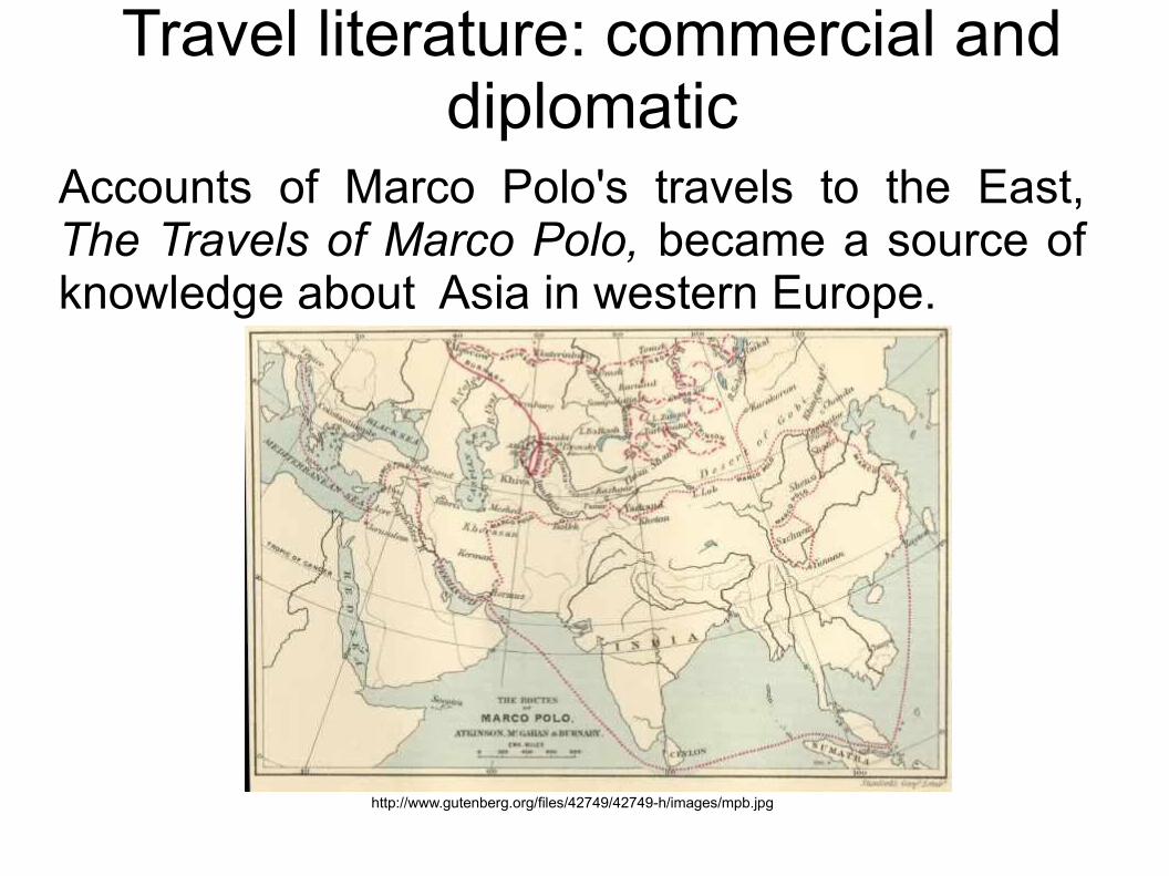
Travel literature: commercial and diplomatic
Accounts of Marco Polo's travels to the East, The Travels of Marco Polo, became a source of knowledge about Asia in western Europe.
http://www.gutenberg.org/files/42749/42749-h/images/mpb.jpg
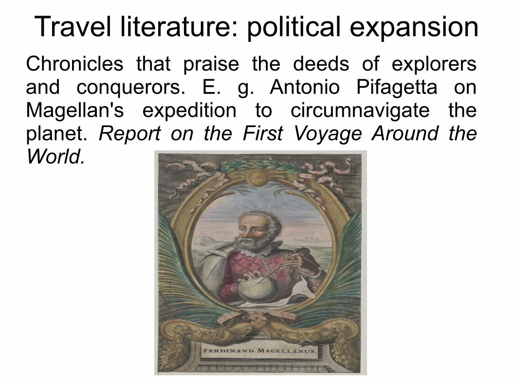
Travel literature: political expansionChronicles that praise the deeds of explorers and conquerors. E. g. Antonio Pifagetta on Magellan's expedition to circumnavigate the planet. Report on the First Voyage Around the World.
Travel literature: religion
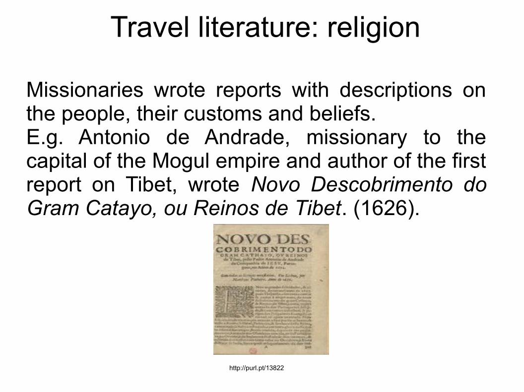
Missionaries wrote reports with descriptions on the people, their customs and beliefs. E.g. Antonio de Andrade, missionary to the capital of the Mogul empire and author of the first report on Tibet, wrote Novo Descobrimento do Gram Catayo, ou Reinos de Tibet. (1626).
http://purl.pt/13822
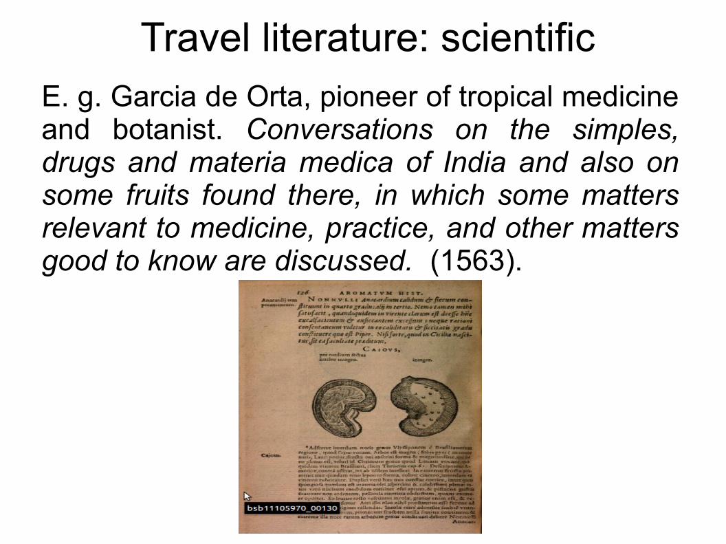
Travel literature: scientificE. g. Garcia de Orta, pioneer of tropical medicine and botanist. Conversations on the simples, drugs and materia medica of India and also on some fruits found there, in which some matters relevant to medicine, practice, and other matters good to know are discussed. (1563).
Travel literature: scientific
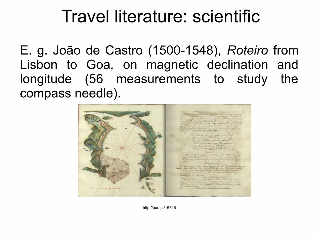
E. g. João de Castro (1500-1548), Roteiro from Lisbon to Goa, on magnetic declination and longitude (56 measurements to study the compass needle).
http://purl.pt/16746
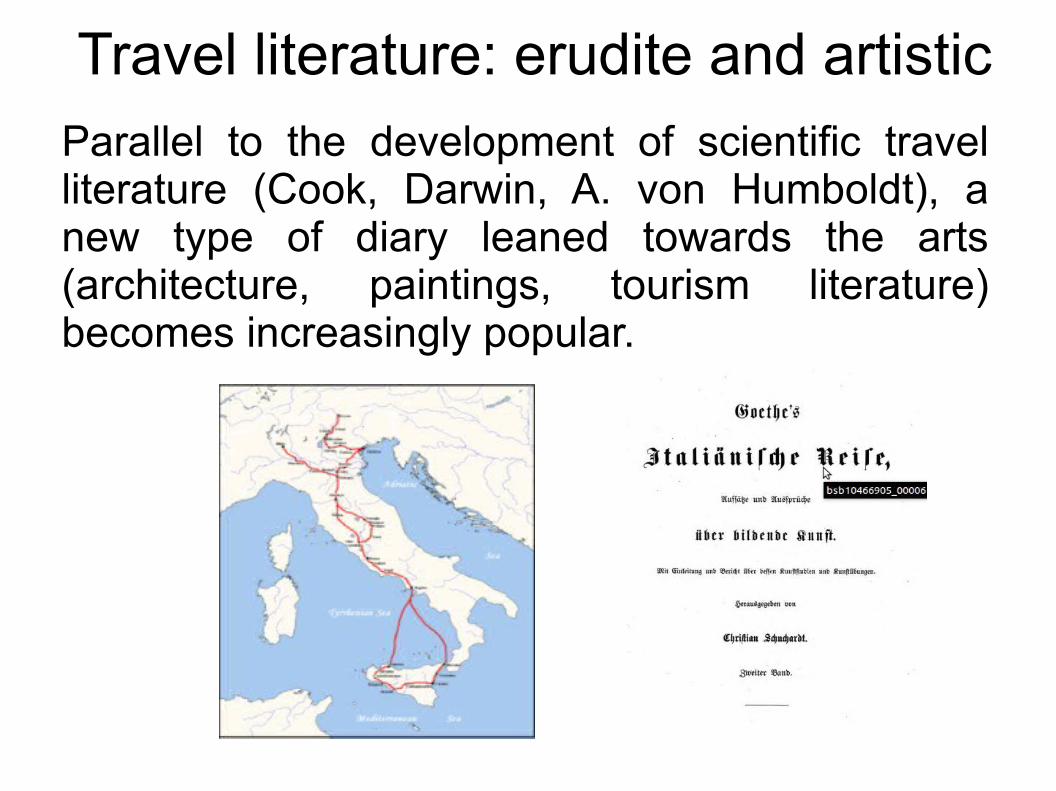
Travel literature: erudite and artisticParallel to the development of scientific travel literature (Cook, Darwin, A. von Humboldt), a new type of diary leaned towards the arts (architecture, paintings, tourism literature) becomes increasingly popular.
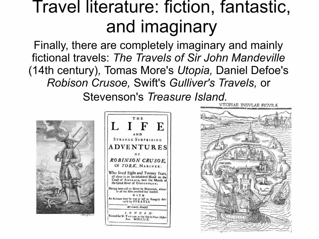
Travel literature: fiction, fantastic, and imaginary
Finally, there are completely imaginary and mainly fictional travels: The Travels of Sir John Mandeville
(14th century), Tomas More's Utopia, Daniel Defoe's Robison Crusoe, Swift's Gulliver's Travels, or
Stevenson's Treasure Island.
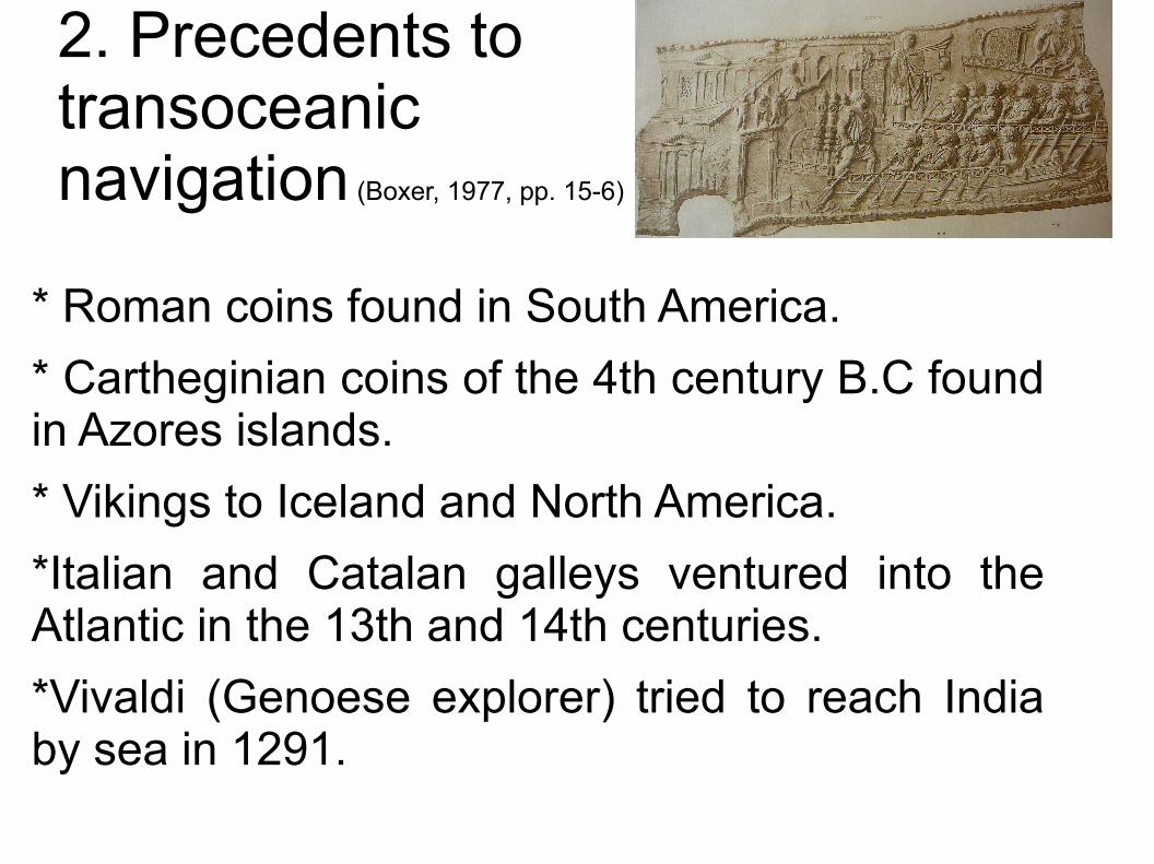
2. Precedents to transoceanic navigation (Boxer, 1977, pp. 15-6)
* Roman coins found in South America.
* Cartheginian coins of the 4th century B.C found in Azores islands.
* Vikings to Iceland and North America.
*Italian and Catalan galleys ventured into the Atlantic in the 13th and 14th centuries.
*Vivaldi (Genoese explorer) tried to reach India by sea in 1291.
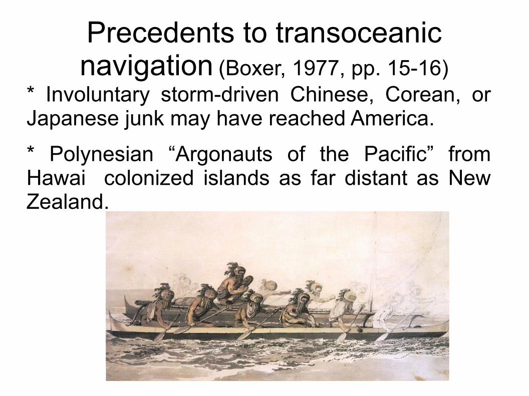
Precedents to transoceanic navigation (Boxer, 1977, pp. 15-16)
* Involuntary storm-driven Chinese, Corean, or Japanese junk may have reached America.
* Polynesian “Argonauts of the Pacific” from Hawai colonized islands as far distant as New Zealand.
3. Fernão Mendes Pinto
Fernão Mendes Pinto(c. 1510-1583)
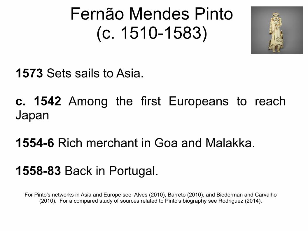
1573 Sets sails to Asia.
c. 1542 Among the first Europeans to reach Japan
1554-6 Rich merchant in Goa and Malakka.
1558-83 Back in Portugal.
For Pinto's networks in Asia and Europe see Alves (2010), Barreto (2010), and Biederman and Carvalho (2010). For a compared study of sources related to Pinto's biography see Rodriguez (2014).
Fernão Mendes Pinto(c. 1510-1583)
Pinto was frequently consulted on issues related to the geography of Asia.
E.g. João de Barros, chief historian of the Portuguese crown. Barros was also working on cartography.
E. g. Florentine ambassador in Portugal (following instructions from mathematician and cosmographer Ignatio Danti who was building a terrestrial globe by that time).
Fernão Mendes Pinto(c. 1510-1583)
We know that Pinto had access to the highest personalities of this time. The very same regent queen met Pinto when he came back to Lisbon. Filipe I, perhaps the man with the highest empire in the world at this time, also met Mendes Pinto.
Intellectuals and diplomats travelled to Pinto's retreat in Almada to meet him, showing a high interest in his report and documents.
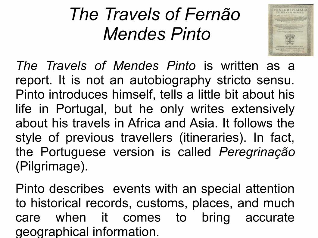
The Travels of Fernão Mendes Pinto
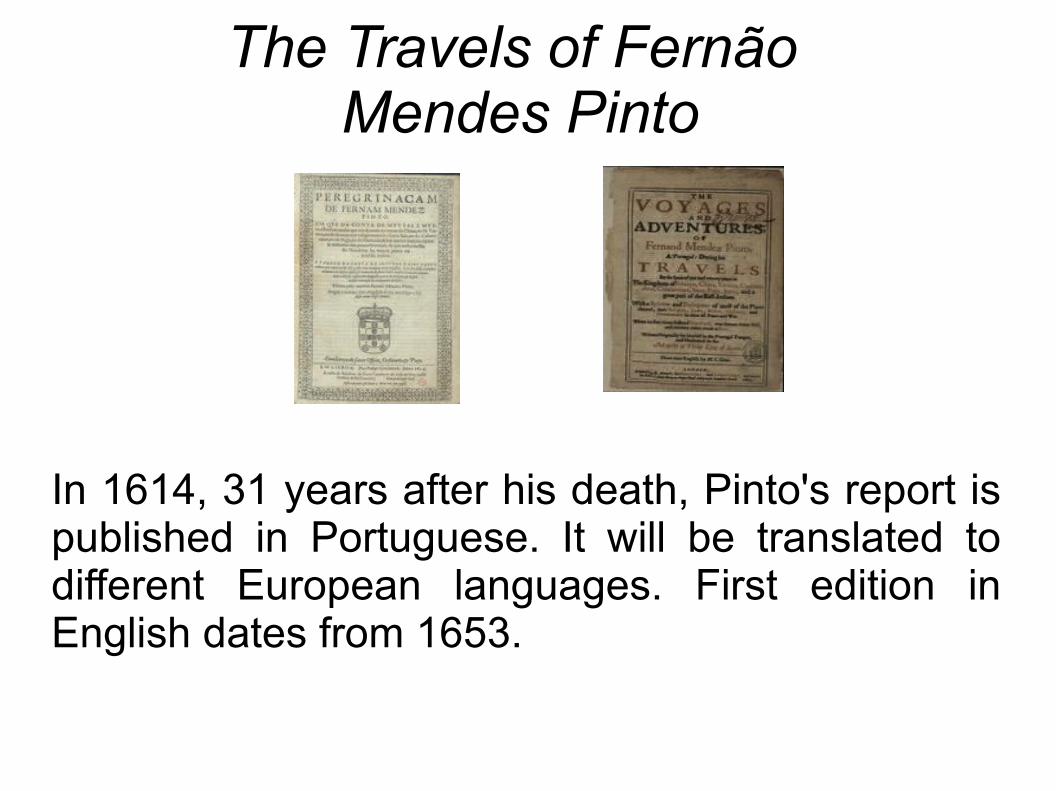
In 1614, 31 years after his death, Pinto's report is published in Portuguese. It will be translated to different European languages. First edition in English dates from 1653.
The Travels of Fernão Mendes Pinto
The Travels of Mendes Pinto is written as a report. It is not an autobiography stricto sensu. Pinto introduces himself, tells a little bit about his life in Portugal, but he only writes extensively about his travels in Africa and Asia. It follows the style of previous travellers (itineraries). In fact, the Portuguese version is called Peregrinação (Pilgrimage).
Pinto describes events with an special attention to historical records, customs, places, and much care when it comes to bring accurate geographical information.
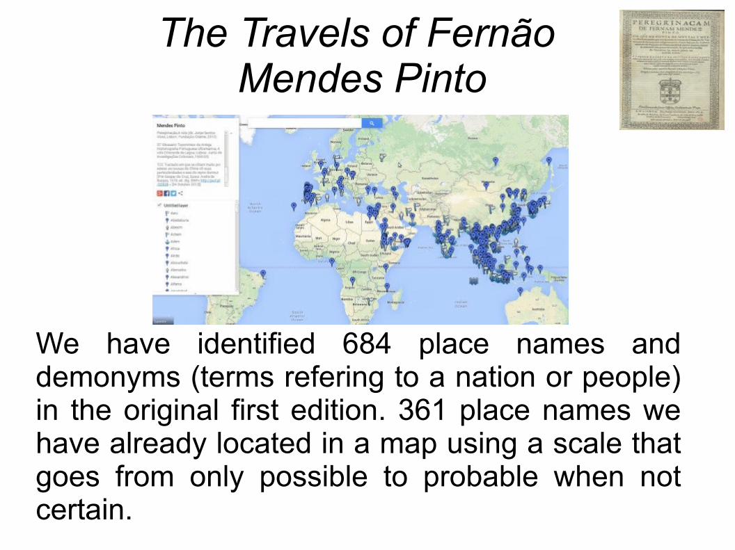
The Travels of Fernão Mendes Pinto
We have identified 684 place names and demonyms (terms refering to a nation or people) in the original first edition. 361 place names we have already located in a map using a scale that goes from only possible to probable when not certain.

4. Main geographical areas
We can find three main areas to locate most of the place names.
1. West Indian Ocean2. East Indian Ocean
3. East Asia
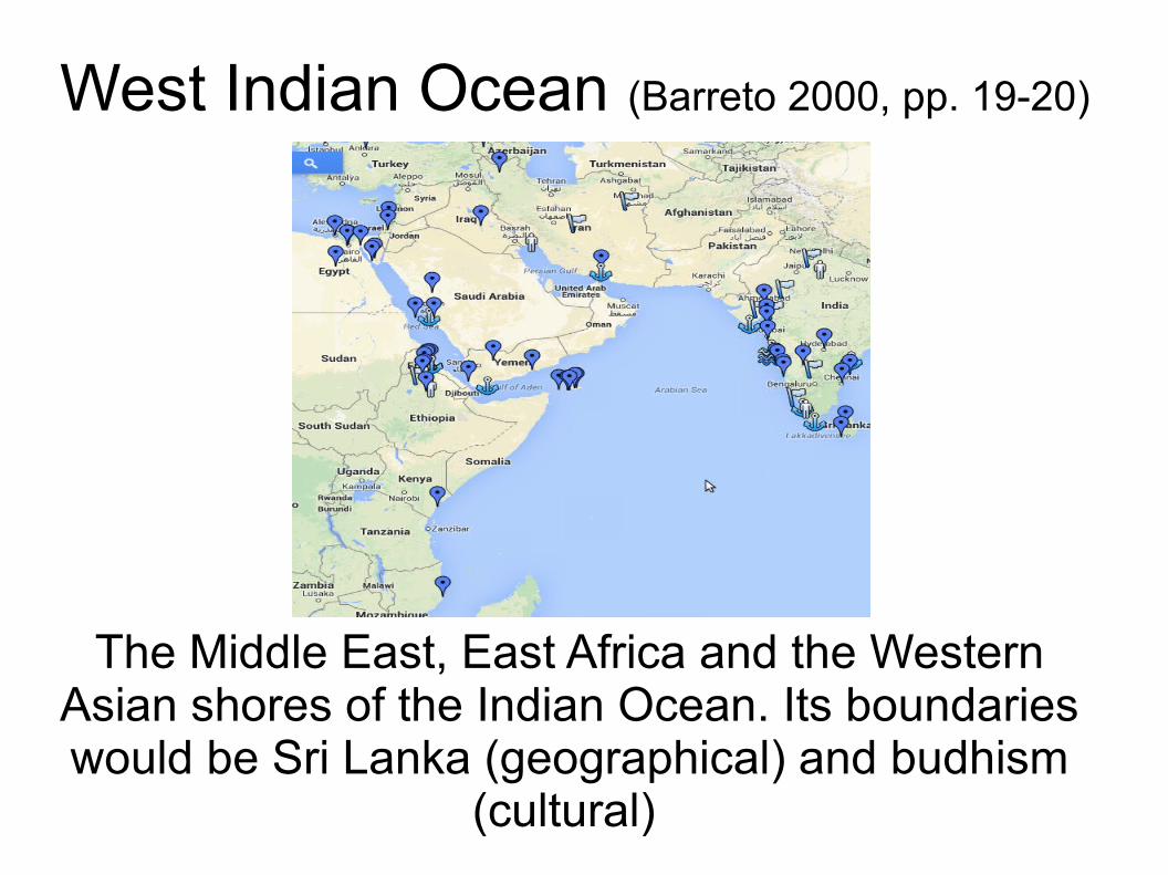
West Indian Ocean (Barreto 2000, pp. 19-20)
The Middle East, East Africa and the Western Asian shores of the Indian Ocean. Its boundaries would be Sri Lanka (geographical) and budhism
(cultural)
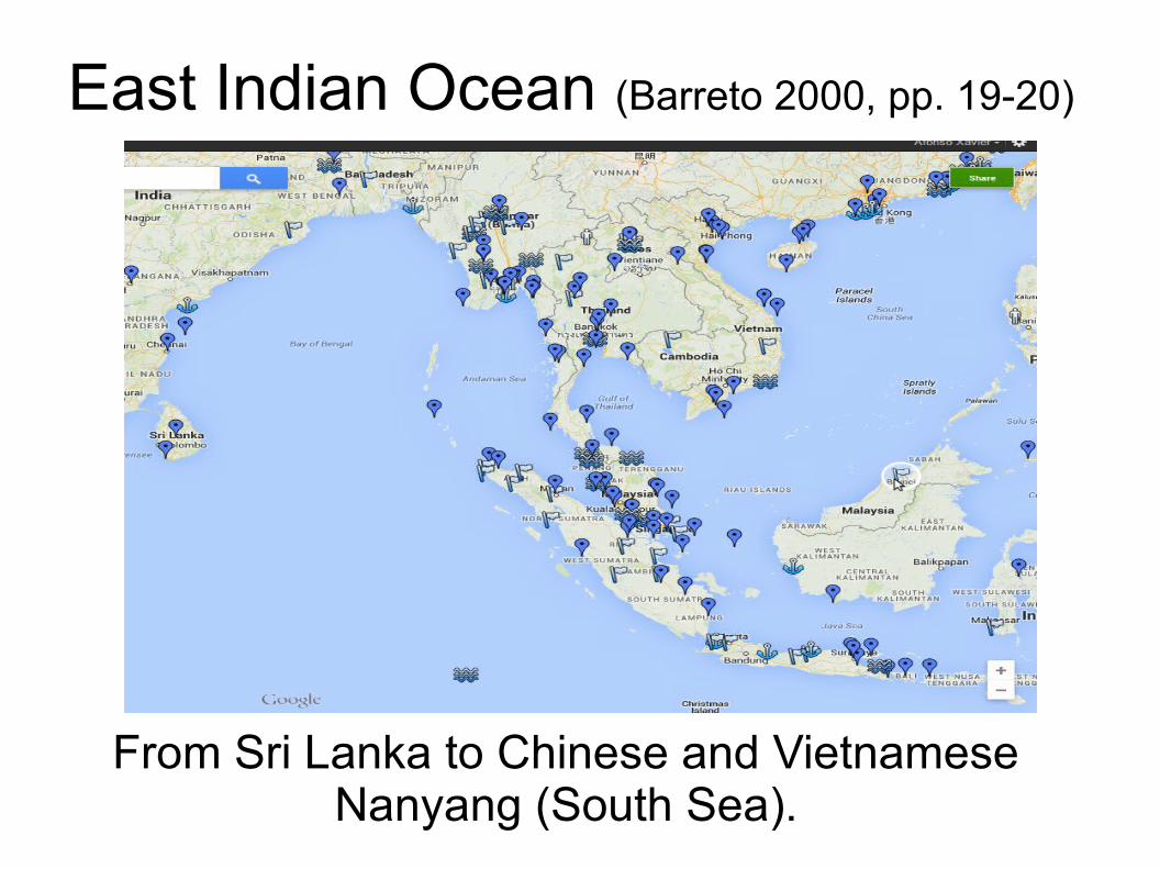
East Indian Ocean (Barreto 2000, pp. 19-20)
From Sri Lanka to Chinese and Vietnamese Nanyang (South Sea).
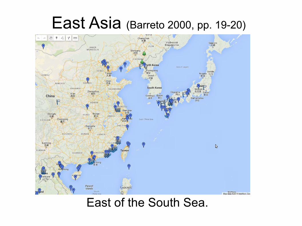
East Asia (Barreto 2000, pp. 19-20)
East of the South Sea.
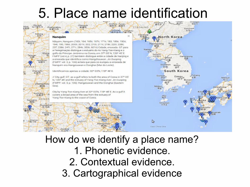
5. Place name identification
How do we identify a place name?1. Phonetic evidence.
2. Contextual evidence.3. Cartographical evidence
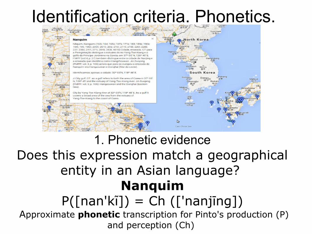
Identification criteria. Phonetics.
1. Phonetic evidenceDoes this expression match a geographical
entity in an Asian language? Nanquim
P([nan'kĩ]) = Ch (['nanjīng]) Approximate phonetic transcription for Pinto's production (P)
and perception (Ch)
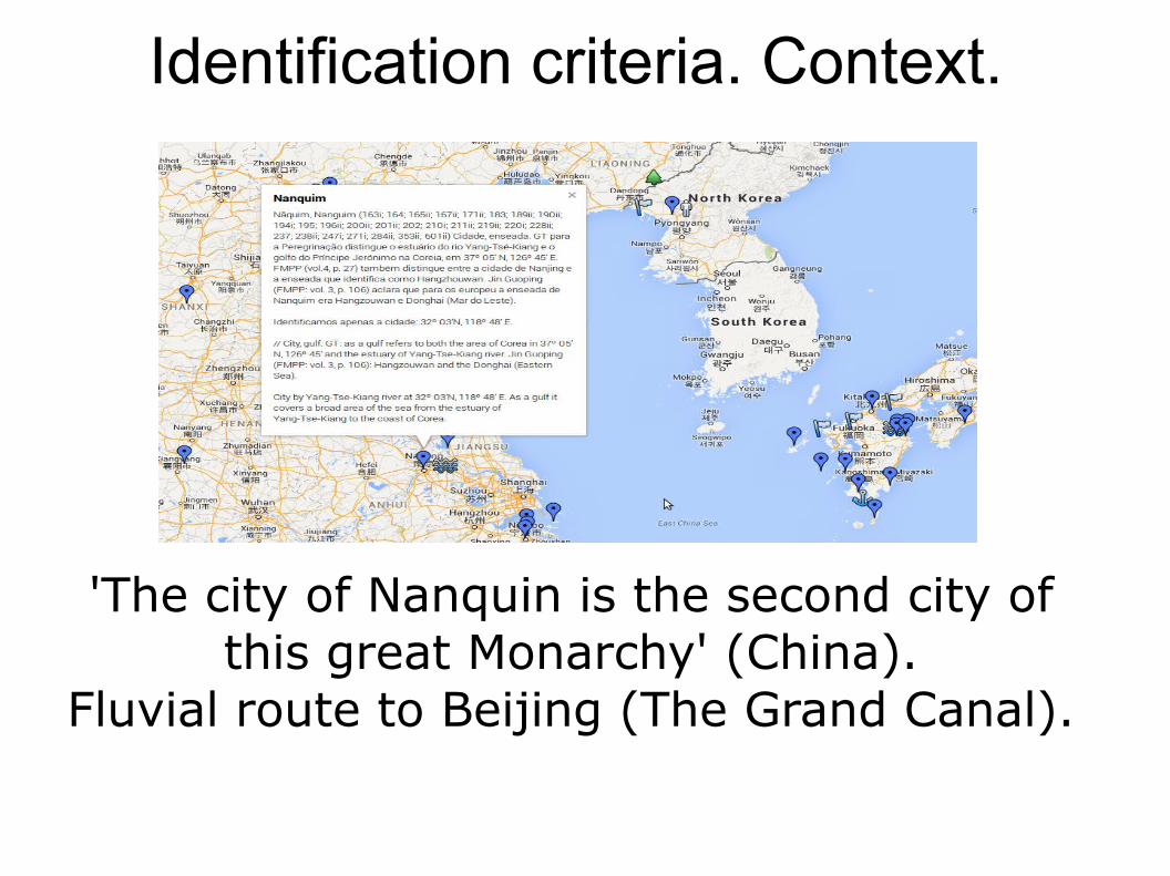
Identification criteria. Context.
'The city of Nanquin is the second city of this great Monarchy' (China).
Fluvial route to Beijing (The Grand Canal).
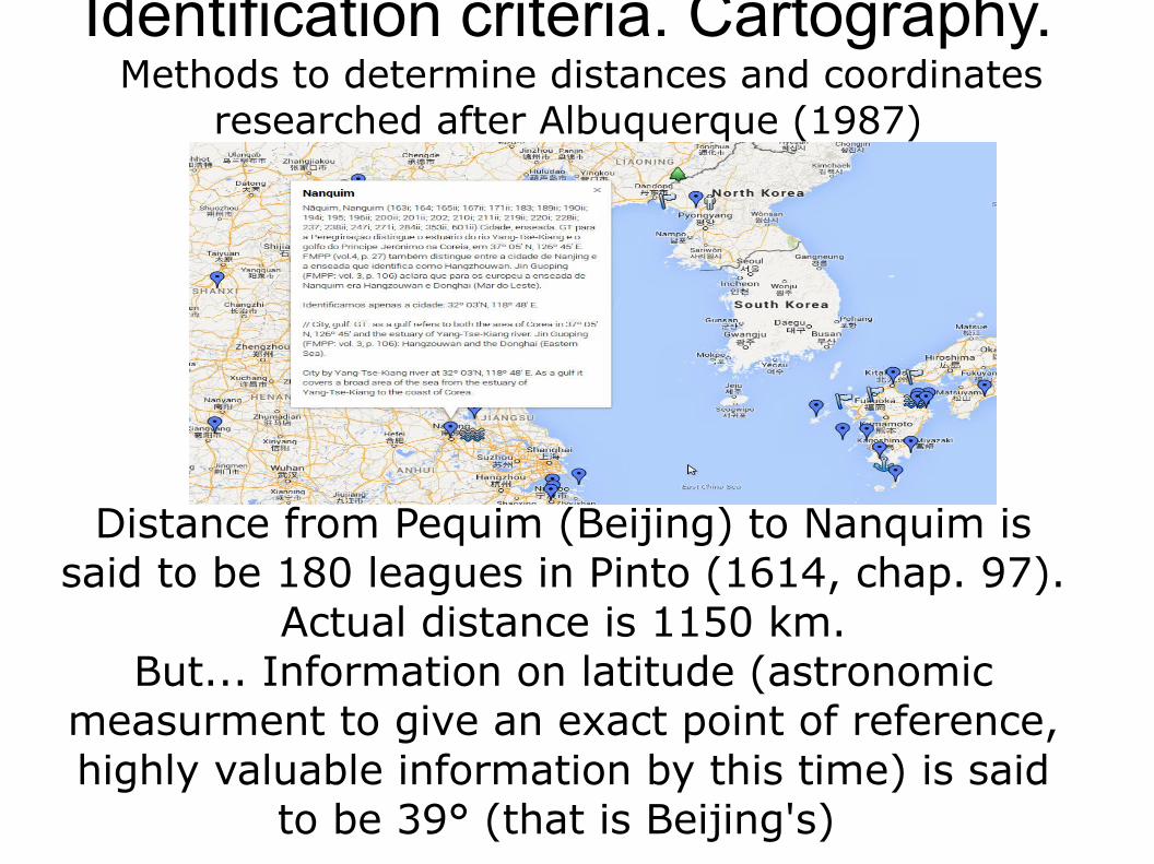
Identification criteria. Cartography. Methods to determine distances and coordinates
researched after Albuquerque (1987)
Distance from Pequim (Beijing) to Nanquim is said to be 180 leagues in Pinto (1614, chap. 97).
Actual distance is 1150 km.But... Information on latitude (astronomic
measurment to give an exact point of reference, highly valuable information by this time) is said
to be 39° (that is Beijing's)
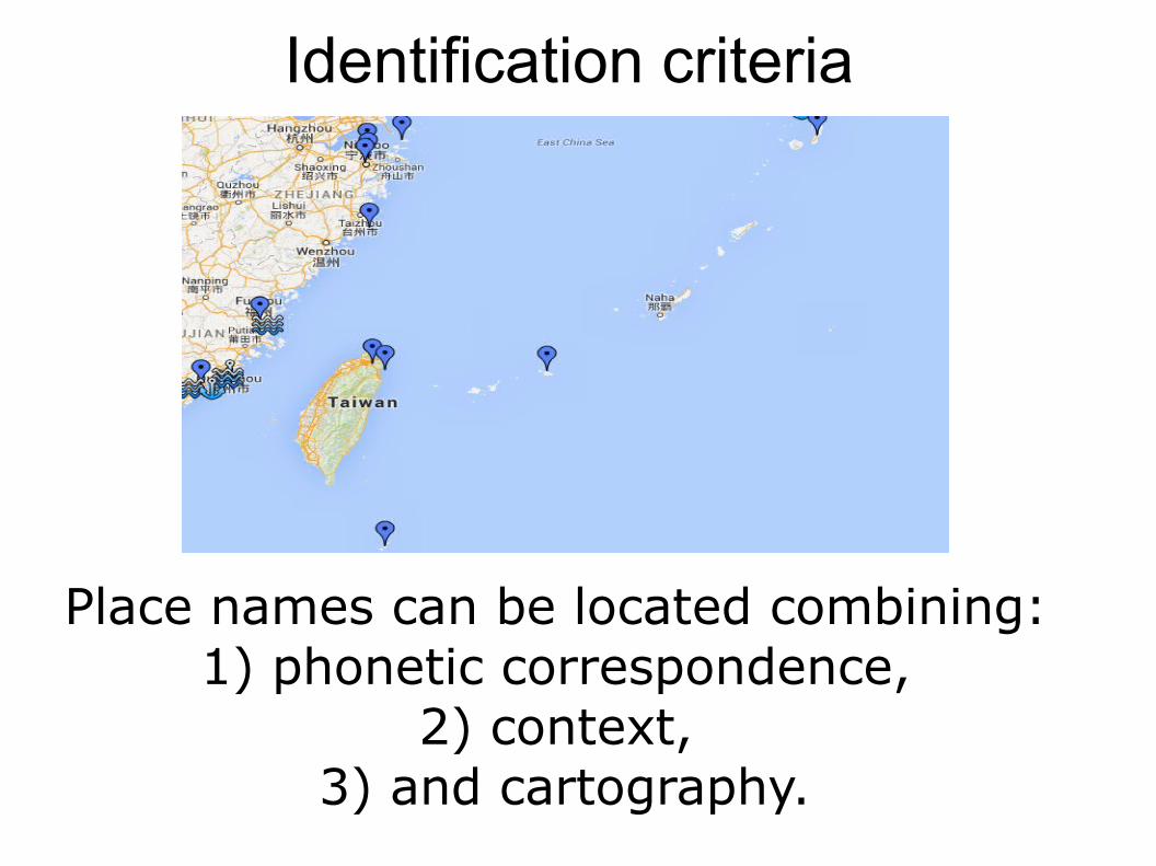
Identification criteria
Place names can be located combining: 1) phonetic correspondence,
2) context, 3) and cartography.
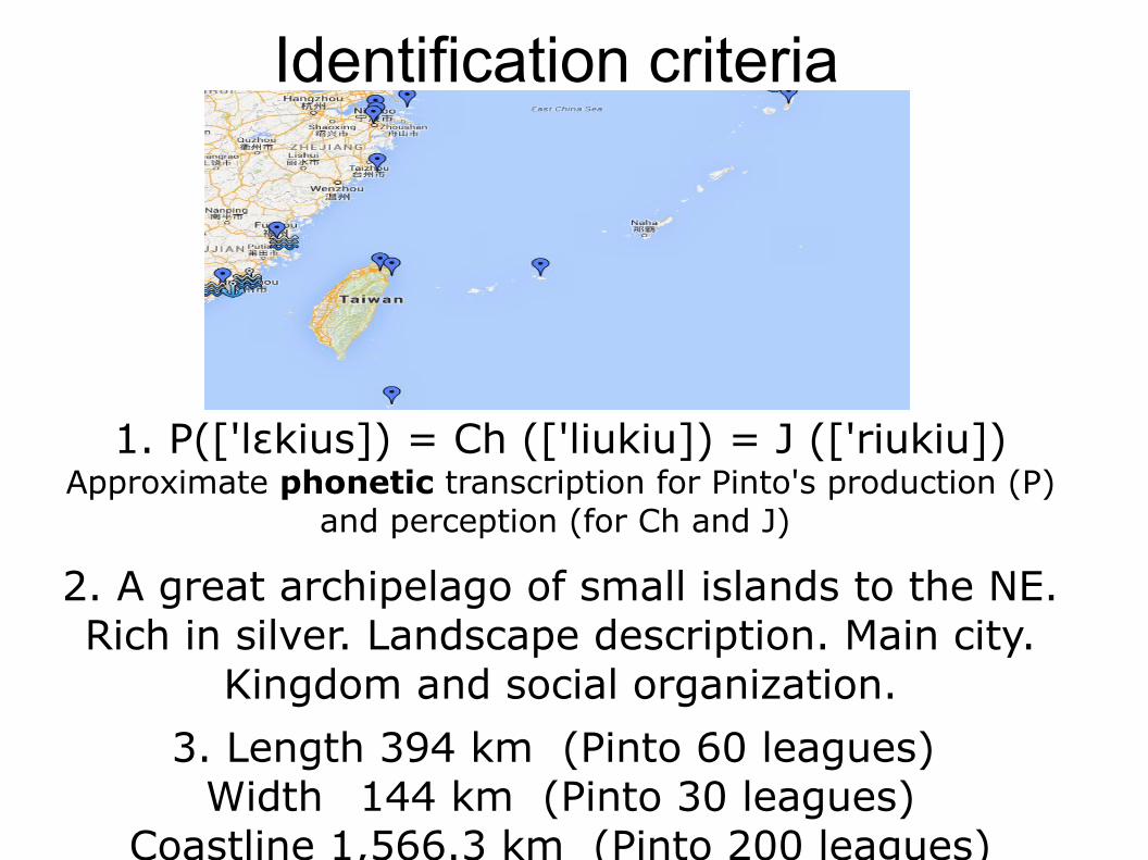
Identification criteria
1. P(['l kius]) = Ch (['liukiu]) = J (['riukiu])ɛApproximate phonetic transcription for Pinto's production (P)
and perception (for Ch and J)
2. A great archipelago of small islands to the NE. Rich in silver. Landscape description. Main city.
Kingdom and social organization.
3. Length 394 km (Pinto 60 leagues) Width 144 km (Pinto 30 leagues)
Coastline 1,566.3 km (Pinto 200 leagues)
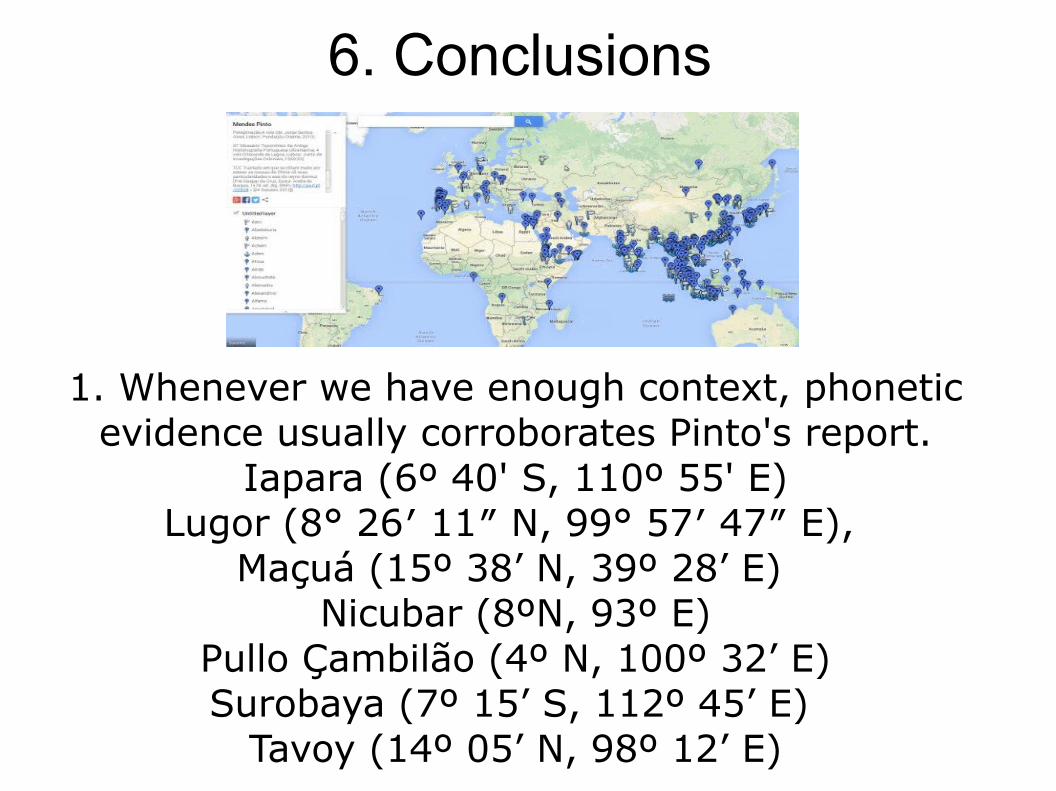
6. Conclusions
1. Whenever we have enough context, phonetic evidence usually corroborates Pinto's report.
Iapara (6º 40' S, 110º 55' E)Lugor (8° 26′ 11″ N, 99° 57′ 47″ E),
Maçuá (15º 38’ N, 39º 28’ E) Nicubar (8ºN, 93º E)
Pullo Çambilão (4º N, 100º 32’ E)Surobaya (7º 15’ S, 112º 45’ E)
Tavoy (14º 05’ N, 98º 12’ E)
Conclusions
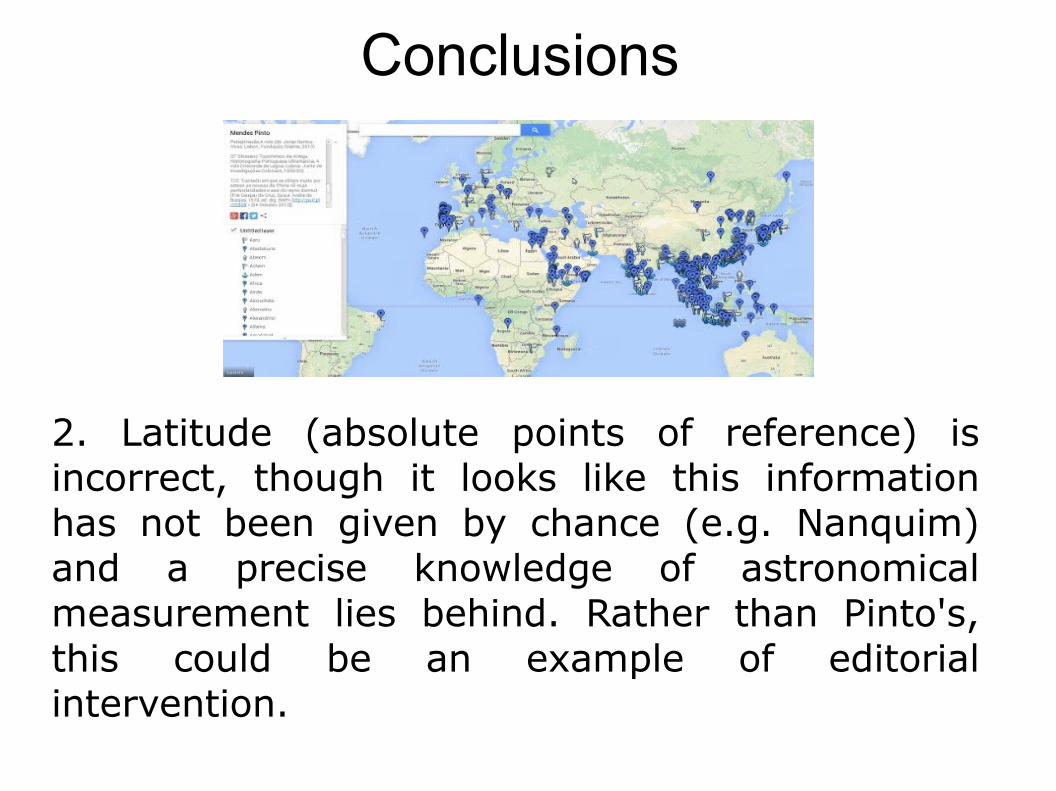
2. Latitude (absolute points of reference) is incorrect, though it looks like this information has not been given by chance (e.g. Nanquim) and a precise knowledge of astronomical measurement lies behind. Rather than Pinto's, this could be an example of editorial intervention.
Conclusions
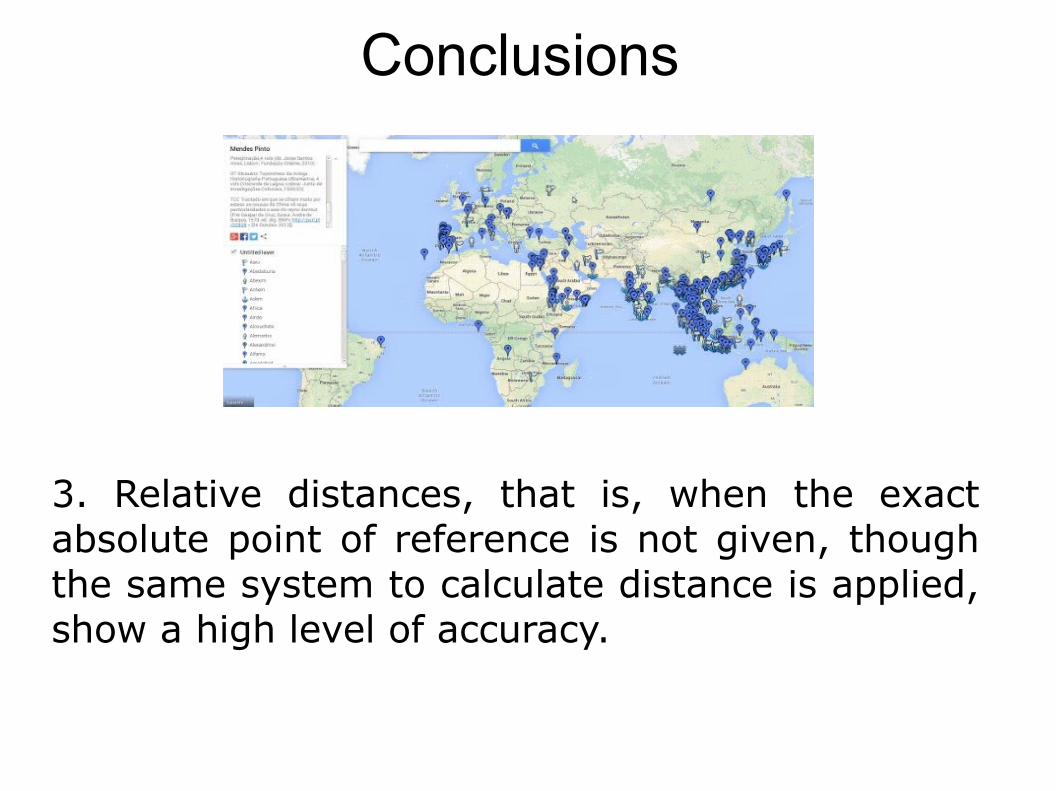
3. Relative distances, that is, when the exact absolute point of reference is not given, though the same system to calculate distance is applied, show a high level of accuracy.
CreditsP. 1 Image 1 (left)First edition of Mendes Pinto's Peregrinaçam (cover)Biblioteca Nacional de Portugal. http://purl.pt/82
Image 2 (right)A map to the travels of Mendes Pinto. http://goo.gl/iqc3P
P. 3 Map of the Roman Empire at the death of Theodosius, divided in two parts.https://commons.wikimedia.org/wiki/File%3APartition_of_the_Roman_Empire_in_395_AD.pBy Mandrak (Own work) [Public domain], via Wikimedia Commons
P. 4 Mediaeval trade routes in central Asia. Modified map based on Sheherd Mediaeval Commerce (1923/first edition 1911)http://commons.wikimedia.org/wiki/File:Central_Asian_trade_routes_V2.jpg
P. 5 Guillaume de Rubrouck's route (1253-55).University of Washington (Feb 2006) http://commons.wikimedia.org/wiki/File:Route_rubrouck_1253_55.JPG?uselang=fr
CreditsP. 6The Project Gutenberg eBook, Some Heroes of Travel, by W. H. DavenportAdamshttp://www.gutenberg.org/files/42749/42749-h/images/mpb.jpg
P. 7Magalhaes, Fernao de.Europeana / Osterreichische Nationalbibliothekhttp://www.europeana.eu/resolve/record/92062/BibliographicResource_1000126190747
P. 8Andrade, António de, S.J. 1580-1634, Novo Descobrimento do Gram Catayo, ou Reinos de Tibet. Biblioteca Nacional de Portugal. http://purl.pt/13822
P. 9 Orta, Garcia de. Aromatum et medicamentorum in Orientali India …Europeana / Bavarian State Libraryhttp://www.europeana.eu/resolve/record/03486/BibliographicResource_3000093850330
P. 10Castro, João de. Roteiro da costa do norte de Goa, ate Dio...Biblioteca Nacional de Portugal. http://purl.pt/16746
CreditsP. 11 Image 1 (left)Goethe's Italian Journey between September 1786 and May 1788By Zello. http://commons.wikimedia.org/wiki/File:Goethe%27s_Italian_Journey.png
Image 2 (right)Goethe's Italiänische Reise, Aufsätze und Aussprüche über bildende KunstEuropeana /Bavarian State Libraryhttp://www.europeana.eu/resolve/record/03486/BibliographicResource_1000128837053
P. 12 Image 1 (left)Daniel DeFoe, Robinson Crusoe [1st edition] (London: W. Taylor, 1719). http://commons.wikimedia.org/wiki/File:Robinson_Cruose_1719_1st_edition.jpg
Image 2 (right)Incisione del titolo per L'Utopia di Tommaso Moro.http://commons.wikimedia.org/wiki/File:Isola_di_Utopia_Moro.jpg
P. 13The Reliefs of Trajan's Column by Conrad Cichorius. Plate number LVIII: Trajan’s voyage (Scene LXXIX). Conrad Cichorius: "Die Reliefs der Traianssäule", Zweiter Tafelband: "Die Reliefs des Zweiten Dakischen Krieges", Tafeln 58-113, Verlag von Georg Reimer, Berlin 1900http://commons.wikimedia.org/wiki/File:058_Conrad_Cichorius,_Die_Reliefs_der_Traianss%C3%A4ule,_Tafel_LVIII.jpg
CreditsP. 14 Image 1 (left)Goethe's Italian Journey between September 1786 and May 1788By Zello. http://commons.wikimedia.org/wiki/File:Goethe%27s_Italian_Journey.png
Image 2 (right)Goethe's Italiänische Reise, Aufsätze und Aussprüche über bildende KunstEuropeana /Bavarian State Libraryhttp://www.europeana.eu/resolve/record/03486/BibliographicResource_1000128837053
P. 15 Image 1 (left)Daniel DeFoe, Robinson Crusoe [1st edition] (London: W. Taylor, 1719). http://commons.wikimedia.org/wiki/File:Robinson_Cruose_1719_1st_edition.jpg
Image 2 (right)Incisione del titolo per L'Utopia di Tommaso Moro.http://commons.wikimedia.org/wiki/File:Isola_di_Utopia_Moro.jpg
P. 16Image 1 (left)First edition of Mendes Pinto's Peregrinaçam (1614).Biblioteca Nacional de Portugal. http://purl.pt/82
Image2 (right)The voyages and adventures, of Fernand Mendez Pinto (1653).Biblioteca Nacional de Portugal. http://purl.pt/16425
CreditsPp. 22-34A map to the travels of Mendes Pinto. http://goo.gl/iqc3P
ReferencesAlbuquerque, L. (1987). As navegações e a sua projecção na ciência e na cultura. Lisboa: Gradiva.
Alves, J. S. (2010). Fernão Mendes Pinto and the Portuguese Commercial Networks in Maritime Sea (1530-1550). In J. Alves (ed.), Fernão Mendes Pinto and the Peregrinação (vol. I, pp. 89-119). Lisbon: Fundação Oriente.
Barreto, L. F. (2000). Lavrar o Mar. Os Portugueses e a Ásia. C. 1480- C. 1630. Lisboa: Comissão Nacional para as Comemorações dos Descobrimentos Portugueses.
Biedermann, Z., & Carvalho, A. Martins de . (2010). Home Sweet Home: The Social Networks of Mendes Pinto in Portugal. In J. Alves (ed.), Fernão Mendes Pinto and the Peregrinação (vol. I, pp. 29-53). Lisbon: Fundação Oriente.
Boxer, C. R. (1977/1969). The Portuguese Seaborne Empire 1415 - 1825. London: Hutchinson.
Cristóvão, F. (1999). Introdução. Para uma teoria da literatura de viagens. In Cristóvão, F. (ed.), Condicionantes Culturais da Literatura de Viagens (pp. 13-52). Lisboa: Edições Cosmos / Centro de Literaturas de Expressão Portuguesa da Universidade de Lisboa.
Rodriguez, A. X. C. (2014). Notas biográficas e estudo das referências documentais de Fernão Mendes Pinto. Veredas, 20, 9-34.